|
TYT-PCT-JMT
Lake Tahoe to Mount Whitney
Getting Started
INTRODUCTION
to
High Sierra Backpacking
Let's Get Oriented
Welcome
to
Tahoe to Whitney
Orientation
at the
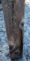
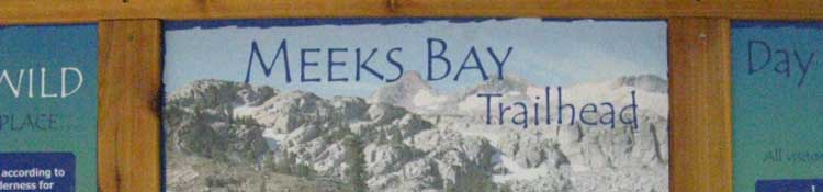
Meeks Bay Trailhead
INDEX
INTRODUCTION to the TAHOE to WHITNEY
BACKPACKING TRIP
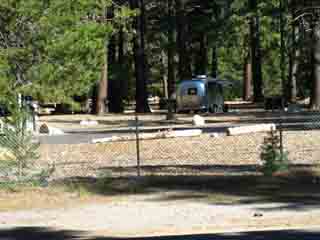
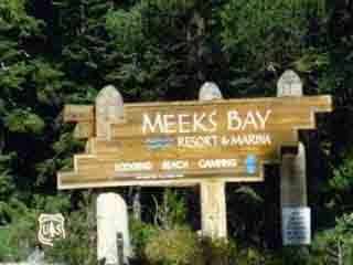
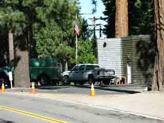
We are at Meeks Bay Trailhead to begin a forty day backpacking trip down the length of the Sierra Crestline to the Whitney Portal. Tahoe to Whitney begins with finding our way to the Tahoe to Yosemite Trailhead at Meeks Bay on the West Shore of Lake Tahoe. Our long hike ends when we step through the Whitney Portal marking the South end of the John Muir Trail.
(TYT History)
(overall miles below) (specific miles)
We're going to explore the routes of the classic trails decorating the Sierra Crestline from Lake Tahoe hiking South to the top of Mount Whitney. These are the Tahoe to Yosemite, Pacific Crest, and John Muir Trails.
Finding our way to the Meeks Bay Trailhead involves much more than just getting here, though we do that too. It is most important that we get to the trailhead prepared physically, psychologically, with sufficient experience, and properly geared to succeed.
(directions below & road map below)-(trail-road interface map)
(fitness)-(trail skills)-(gear list)
This introduction addresses proper preparation.
Backpacking Information
Proper preparation requires information. Lots of information. Collecting information begins with understanding our long distance backpacking route options and establishing which combinations of these options are best suited for us. Route selection is the first bit of information setting the bookends of our trip. Route selection is only our first step towards figuring-out exactly what will be required of us to complete our trip.
Our basic route options are either the Tahoe to Yosemite or Pacific Crest Trail across the North Sierra, and the John Muir Trail down the length of the South Sierra. We can craft hybrid routes combining elements of both the TYT and PCT down the length of the North Sierra Crest.
Though the PCT and JMT share the majoritiy of their route down the South Sierra, we will find many alternative routes to explore South of Yosemite to the Whitney Portal.
We'll either weave our route options into our own custom route down the length of the Sierra Crest, or we'll follow the routes of the classic trails down to the Portal. I say. "start with the classics and weave in everything else over time."
The Long View
My long-term plan has been to hike the classic routes of the TYT-PCT-JMT between Tahoe and Whitney as many times as I can. This averages out to once every two years. TW trips are followed-up, supplemented, and complimented by creating custom routes along shorter, more leisurely backpacking trips stringing together whatever I feel called to explore.
We can pursue the obscure or revisit favorite pieces of trail and favorite places. We can take the time to check out alternative routes, stop to watch trail crews working in the field, take more time visiting with the backpackers we encounter, and linger for a while at our resupply spots to catch-up with the resupply folk happenings at the edge of the wilderness.
First Steps
Our first route will predominantly be determined by our capabilities. Subsequent routes over time will evolve as our fitness, preferences, and imagination grow with our growing experience. Successfully hiking from Tahoe to Whitney strengthens all of our assets and opens increasing possibilities.
Wide Range of the Daily Demand
Determining the final line of our route from Tahoe to Whitney now needs a "pace" added so we can figure out how to get our supporting logistics properly calculated and timed to be at our line of resupply spots for our arrival. The timing and even size of our resupply package mailings will be determined by our pace along the length of our selected route.
Even more importantly, the emerging outlines of route selection against pace begins to lay out the final contours of our hiking plan.
Determining our route, deriving each section's, and our total mileage, begins establishing our pace across each section of trail. All these factors come together to predict/dictate exactly how many daily miles we have to hike each day across every section of trail between our selected resupply spots.
After figuring our route and daily mileage we overlay this "abstract" outline of our hiking plan on the maps to match it with "reality." This will reveal each day's biggest climbing challenges, our best potential break, view, water, and lunch spots, and guides our locating the best spots for our nightly campsites.
Physical Consequences
Our route selection and our daily mileage requirements have real consequences. Our plans create a physical reality that boils down to exactly how we are going to feel while doing it. Our subjective state, how our trip plan makes us feel while executing it will be the key factor defining the subjective character of every step, of every day, of every segment of trail, and will establish the overall tone of our whole Tahoe to Whitney backpacking trip.
It's very important our capacities match our plans, that we feel good.
The Final Plan
Figuring out the daily sequence of "details" along our route and adjusting our schedule to enjoy them all finalizes establishing our daily hiking miles between our nightly campsites across each section of trail between resupply points.
For instance, the location of campsites at a beautiful lake may be a couple of miles further, or a couple of miles less, than our standard daily miles. We may be running a series of "long and short" mileage days to keep our nightly campsites lined up with the most scenic spots along the trail.
I have an end-point, an objective, for each day's hike.
These last bit of planning "customization" finalize the specific requirements of each day's hike, which allows us to precisely predict each day's labors across each section of our route between our succession of resupply points.
Done correctly, our good planning gives us an accurate conception of the length, difficulty, and duration of every day crossing each section of trail between our resupply spots.
Our hiking plans accurately lay out the physical character and physical requirements of every aspect of our hike, when we add everything up.
This is It
Figuring out the final details of our schedule finally establishes the number of hiking days it will take to cross each section of trail. Now we need to figure-out how many extra nights we will spend along the trail, and then add the number of nights we will spend at each resupply spot.
Adding our days-off along the trail to our off-days at the resupply spots to our calculated hiking days across each section of trail gives us the final total of days from starting to finishing our Tahoe to Whitney backpacking trip.
Finalizing our basic daily mileage requirements against the length of each section of trail represents much more than the compilation and balancing of sterile physical facts and logistical figures.
Feelings
During this part of the planning stage our projected daily miles merely gives us a numerical value, an abstraction representing the physical and logistical demands we are designing for ourselves. Our plan has real physical and psychological consequences. Our plan requires specific levels of continuous work output capable of producing significant physical and psychological stresses, in an environment with objective terrain dangers, capable of causing exhaustion, injury, and death, or all three in succession, if you really screw-up.
Our abstract numbers and plans also represents the "state of being" induced by hiking these miles every day. What will this state be for you? Will it be pain and stress? Will we be able to enjoy it?
Our projected daily miles invites us, no it demands that we take a close and honest look at exactly how high we need to set the bar for properly training ourselves to deal with these seemingly harmless "abstract" numbers. And, not just physically. Our physical training also begins preparing us psychologically to endure the levels of pain and stress potentially induced by our daily hiking requirements.
Testing
Our planning stage should lead smoothly and seamlessly to our training stage.
We've got to begin testing ourselves over our planned daily distance under a comparable load to understand the actual implications of our hiking plan. We will add elevation and pack weight, or their training equivalents, to our training program until we have reasonable confidence we can handle the mileage and pack weight specifications our trip plan calls into being without us suffering too much on the trail.
We'd be wise to do as much of our suffering before hitting the trail as possible. Pre-suffering!
Fully Informed
"Getting to the trailhead,"
means much more than just generating all the sterile information necessary for us to be fully-informed of the specific external physical challenges the length and difficulty our trip plan bring into being. We've got to apply this information physically to the environment. We've got to know if we can do it, and how we will feel doing it.
Application is where our clean principals of planning get messy.
After deriving our external challenge the next most important component of our planning is identifying and dealing with our internal challenges. Internal challenges are how we deal with these physical and psychological realities, with the intense pressures, with all the environmental strains and internal pains our trip plan calls into being and puts on us when we step through the Meeks Bay Trailhead.
This is where "feelings" come searing into play.
This is a Test
We aim to use the demands created by our trip plan as the standard to set up test trips. Trips designed to ascertain our current internal physical capacities against our plan's external demands in a reasonably-controlled environment. We need to test our long-distance backpacking plan's assumptions in situations where the realities of our trip's external demands are tested against our internal capacities near easy escape and/or rescue facilities.
Feeling Good
Our goal is to hike our required daily miles "feeling" great while remaining well-within our capacity to recover from each day's hiking strains and pains with good food, warmth, and overnight rest. Our goal is to rise each morning, "good as new!" We need to take concrete steps to assure this outcome is within reach of our capabilities.
We need to be sure our internal physical capabilities and our expectations are balanced against the environmental realities our trip plan is creating for ourselves. We need to make sure we or our teammates will not be suffering too badly.
We are wise to test our happy expectations about the quality of our fitness and skills against the actual stresses the environment is going to put on us long before hitting the Long Trail. Engaging in a couple of training trips and actually training before hitting the trail goes a long ways towards mitigating the stark physical realities High Sierra trail conditions can put on us.
Man, do I sound grim?
top of page |
I Want Skittles!
I don't mean to be grim. Hiking from Tahoe to Whitney is joyous in so many ways, composed of rainbows, butterflies, bambi, and "skittles," so to speak.
"Unicorns Pooping Skittles" is a common facetious expression of unreasonable optimism.
Hiking the High Sierra Nevada does possess the potential to generate sublime states of emotional and aesthetic euphoria. It's so good our metaphorical unicorns are doing Olympic-quality (TM) summersaults while in full spiral-skittle production!
BUT...
Watch Out for the Dark Side
The High Sierra can be as brutal as beautiful. The profound environmental energies that make this place so freeking beautiful make it as dangerous as beautiful.
Great powers are unleashed when Natural Forces are in transition, or are "stirred up" here.
Let's review some of the hazards.
The High Sierra's winds can come at us carrying the unleashed power of a derailed freight train snapping trees like toothpicks.
Its roiling thunderclouds chase us with lightening bolts every now and again.
Its surging rivers emit the surreal sounds of massive submerged boulders grinding one against the other rolling downstream under the surging flows, resounding with terrifying power during heavy Spring Thaws. They produce a sound we can feel.
The power of the High Sierra unleashed gives one goose-bumps just standing, watching from a safe distance, without even thinking about engaging. Hunkering-down is a wise strategy in many High Sierra situations...
Oh My!
"Lions and Tigers and Bears... Oh My!"
Well, Mountain Lions and Bears.
It goes on...
On a more personal basis, the High Sierra can wring all of our energy out of us out as easily as we wring warm water from a washcloth. The Sierra can wield heat capable of evaporating our strength and cold freezing us to the bone. On the same day! During Summer and Winter!
The harsh requirements of its environments can easily pull our shoulders out of their sockets, strip the skin from our feet, rub our ass cheeks red as roses. It's rock can cut us like razor blades. Its solar intensity can fry us. Its rivers can drown us.
Its "agents" can steal our food and starve us! The Sierra can "get to" any and every aspect of our physical and mental being.
The Sierra Nevada is a double-edged sword that cuts deeply across pain and pleasure.
It is cool refreshing waters and deep thirst.
We were designed to operate across all these environments.
The Range
of
Backpacking Experiences
Mountain Safety Forum
High Sierra Trails
Definitions and Difficulty Ratings
LEGAL DISCLAIMER
(YOU CAN DIE)
FACTS
How we approach the Sierra Nevada greatly influences how we experience it.
Trial, Tribulation, Terror, and Triumph are not at all mutually exclusive on the Long Trails.
They are strangely complimentary.
It is up to each of us to be aware of, and ready for the wide range of "challengingly-rewarding" experiences Nature creates.
top of page |
Getting Started
Introducing Our Trail Guide Logic
The page below introduces us to the basic character elements of High Sierra Trails and the wide-ranging demands they can put on every aspect of our existence. We're going to explore various approaches to identifying and confronting these wide-ranging demands through comprehensive planning, training, setting up, gearing up, and finally backpacking
the Sierra Nevada from Tahoe to Whitney.
I'd prefer if we don't injure or kill ourselves doing this.
Much of the "external" information we need is straight-forward, being guide information, maps, and mileage and elevation data. Where this gets messy is when we "apply" humans.
Quest for Self-Knowledge
That's why we really begin this trail guide personally, by first looking into ourselves to find, understand, then balance our capacity for work and exposure against our personal recovery trajectory against the difficulties of our objective.
The seriousness of potential dangers confronting us in the High Sierra demands we carefully cultivate the required levels of fitness, skill, and gear through training and prep trips while giving ourselves a "safety margin." This comes down to preserving a reserve of energy beyond what is minimally necessary to complete our journey.
We must maintain a "personal reserve"
of energy sufficient to comfortably accommodate unexpected cold snaps, downpours, injuries to ourselves and others, or other "unexpected" events.
We not only need to understand our personal capacities and potentials, but we need to protect them against the even greater capacities and potentials of Nature! The seriousness of the threats demand we realistically match our expectations to our capacities to our plans.
Once we have an understanding of our own personal capacities within the context of the potentials of the ever-changing demands of the Sierra Environment we can use the information on the following guide to design the perfect long-distance High Sierra backpacking trips for us.
This begins by figuring-out our specific route and its mileage, and establishing excellent rest and resupply plans as detailed above. Then we train. Planning and training are complimented by figuring out how to get our permits from Lake Tahoe Basin Management Unit to make it happen. For those traveling to Lake Tahoe find information about local resources around the Meeks Bay Trailhead and in nearby South Lake Tahoe.
LTBMU
Permitting Note
Obtaining short-distance permits for hiking trips starting through Desolation Wilderness and subsequently remaining within the Tahoe Basin requires navigating the Desolation Wilderness reservation system. This system requires reservations six-month in advance for all busy Summer holiday dates. Well, the system allows reservations. The very busy status of Desolation Wilderness makes reservations necessary.
For my complex and custom Tahoe to Yosemite Trail and Tahoe to Whitney backpacking permits I contact the LTBMU staff personally. They generally write-out custom long-distance permits for Tahoe to Yosemite and/or Tahoe to Whitney backpacking trips beginning out of any LTBMU trailheads, including those starting into Desolation Wilderness.
2016 Permit Conspiracy
Yosemite is insisting National Forests stop writing long distance backpacking permits.
This "secret policy" has made it difficult for long distance backpackers to obtain permits.
More |
Route
Analysis and Comparison
The third page launching this trail guide is the Introduction to the North Sierra. Here we look at and compare the specific miles of each section of the TYT and PCT across the length of the North Sierra down to Tuolumne Meadows.
Then we put together the perfect backpacking plan customized to fit our skills, fitness, personal capacity, and reasonable goals.
Hiking Plan Based on Self-Knowledge
Below we focus on, and harp on and on about generating specific personal information about our comfortable capacities on the trail through short-distance practice trips and training at home. These training experiences are vital. They allow each of us to specifically experience how our daily hiking miles and the logistics of our
TYT Hiking Plan
are really going to feel.
Best Laid Plans...
The personal information we generate about how many miles a day we are capable of comfortably hiking during our test trips will be the key information we use to plan our long distance backpacking trip. It's important to get it right.
Our test trips give us a model, a template for exploring and balancing the contradictions of speed, time, distance, and weight always confronting us on the trail. This classic dilemma of trip planning will always be confronting us to greater and lesser degrees across every section of trail down to the Whitney Portal.
Though differently balanced for each trip, these are the same contradictions we face across the length of any long-distance backpacking trip. We've got to get to know it, and where we stand in the balance of contradictions to properly plan our trips.
Juggling Fools
An inherent challenge of long-distance backpacking is to accurately measure, skillfully juggle, and finally balance our fitness and skills within the sometimes overwhelming demands of the environment and the almost-unreasonable daily distance demands of our long-distance objectives.
Good thing we can juggle all the factors to some degree.
Other times it appears they are juggling us!
Our goal is to remain aware of, and in as much control of these evolving factors as possible.
top of page |
Prep Trips
are the
Mother of Information
As our training and planning for our Tahoe to Whitney backpacking trip evolves we must set up communication between our training and planning information. This communication establishes the standards for our hiking plans. The daily miles we design into our trip plans is going to be based on us feeling excellent while hiking the number of miles during our training and prep trips, but over a period of weeks and even months.
Ideally, we are going to execute a series of preparatory backpacking trips that both establish and test our backpacking plan's basic assumptions about our daily mileage, if we live near the Sierra.
If we cannot hike prep trips in the High Sierra we will use the specifications of High Sierra trails and the fitness levels described on this guide to inform our prep trips and gage our training, even those trips and training performed far from the High Sierra. |
Trail Difficulty
Foundational Information
Our Capacity
We have most of the information we need to establish our High Sierra hiking plan when we figure out how many daily backpacking miles we can comfortably sustain over a day, exactly how many days we can sustain that number of miles before requiring days off, and how much food we need to maintain that pace between rest periods.
Once we have generated this information all's we need to do is
apply it to a classic section of High Sierra Trails.
Trip Requirements
To properly apply our known capacity to the High Sierra we first derive the miles for each section of our selected route between resupply spots, and the total distance of all of our selected sections from start to finish.
The Trip Plan Emerges
With reliable information about our personal daily mileage capacity and reliable mileage figures for each of our trail sections we can figure out how many days hiking at our daily miles per day it will take us to cross each section.
This tells us how many days of food we need to cross each section of the trail between our selected resupply points. Once we have a good general outline of the distance and food parameters of our trip we can work on perfecting the final, specific details of our food, rest, resupply, and exploration plans.
Knowing our miles capacity and food needs allows us to figure out our pack weight at the beginning of each section of trail between resupply spots.
Logistics Emerge
The fundamental pieces composing our approach to logistics, "miles, fitness, and the food to do it," are as simple as they are important. Maintaining our daily mileage capacity is dependent on fitness and meeting our food requirements determines the weight of our food, which translates into exactly how much weight we will be carrying across each section of trail.
An accurate outline of our plan is just the beginning. Next, we've got to know we actually have the strength do it, and finally, we have to fill-in the specifics of our menu by accurately determining our daily calorie and nutrition needs, purchasing our food, breaking it down, and getting it perfectly posted in a timely fashion.
Hiking from Tahoe to Whitney requires we get together and mail out between 40 to 50 days of food to as many as 7 resupply spots. This is when we want good organization skills... it behooves us to get our food perfect. Not enough food seriously sucks. Carrying the weight of too much food pains us unnecessarily.
Our food needs and the vital importance of meeting them become crystal-clear rather quickly on the trail. Our calorie intake affects the character and rate of our acclimation to altitude, resist cold, and work. We may experience a temporary decrease in appetite during acclimation.
All this nitty-gritty about food is important. Food and the fuel to cook it are the biggest variables affecting the otherwise "standard" weight of our pack. Although food delivers great pleasure and utility on the trail, carrying its weight is still a drag. A necessary drag, but a drag nonetheless.
Five Day Food Supply
Pack Weight
Working out the final details of our food plan allows us to almost, if not exactly predict how much our pack will weigh starting our trip out of the Meeks Bay Trailhead, and after resupplying at each of our subsequent resupply points on our way down to the Portal.
This would be the standard base weight of our pack plus the weight of each section's food resupply.
Predictability Ensues
Well, we can predict pack weight once we work out our final gear list. We will work out our final gear setup during the same prep trips we used to work out our mileage capacities and food requirements.
Once we figure out our basic food and gear needs we can predict pack weight at the start of our trip and after resupplying at each resupply point. We can also predict the decline in our pack's weight between resupply spots as we eat each day's food.
This is a Test...
We can now use the information we generate about how much our pack will weigh, about how many miles we expect to carry it up and down how many feet of elevation each day, and about the altitude changes along our daily hike as our own personal "performance metric" guiding our local backpacking training trips in our local wilderness areas.
Our goal at home is to replicate and successfully deal with the required weight, distances and difficulty-level our Sierra backpacking trip plan brings into being before Backpacking the Sierra.
We can figure-out what percentage of the High Sierra's degree of difficulty our prep trips represent, and measure exactly how we feel doing these test trips. These prep trips will give us a glimpse, an insightful perspective showing us a percentage of how we will really feel being under full load on the higher, harder, and much longer High Sierra Trails. The question: Does it work for you?
Three Choices
Test trips leave us facing one of three possible scenarios. The first and second outcomes are that our personal capacities either work as planned, or not. If yes, good! If not, we must improve our personal capacities.
Our final option is that we must change our plan if we cannot improve our capacity. Only test trips will provide the critical information required to set-up and confirm we really have the all the elements of a successful long distance backpacking trip plan in place.
Simply stated, these are the levels of fitness, gear, and skills demanded by our plan.
Surprise!
Backpackers arriving at the Sierra from around the country are routinely surprised by the strains and pains induced by the angles of ascent, pack weight, and the stresses of high altitude.
This makes the ability to "suffer well" a distinct asset. "Suffering well," takes a dash of character and lots of practice... haha.
These are the obstacles we must,
"Break on through, to (get to) the other side."
(Doors-1967)
The main obstacle is mostly us.
The Scraper
Be nice. Don't be a jerk.
Nonetheless, the approach to High Sierra backpacking described here aims to reduce your surprise at the degree of difficulty hiking the High Sierra, reduce your suffering engaging this range, and assure all your stresses while experiencing the difficulties of hiking the high, long trails are necessary and productive.
I hope this information finally works to inspire you to the preparation required to reduce suffering while increasing safety, comfort, access, and success.
top of page |
Trail Rating Difficulty Standards
TRDS
So far, we've aimed to reduce the physical and emotional shock such a harsh workload puts on first-time High Sierra hikers through training and prep trips. Now it's time to quantify the challenge. To more precisely ascertain our status we employ a system of Trail Rating Difficulty Standards. This innovative system calibrates High Sierra trail difficulty ratings against a backpacker's fitness level.
Though a trail's objective physical difficulty is static and established by the trail itself, each hiker's subjective experience on that trail is a variable determined by their personal degree of fitness. Each of the rating system's three objective degrees of trail difficulty are contrasted against three objective levels of backpacker fitness.
Predictability of subjective outcomes ensues.
This allows backpackers to get a basic idea of what their subjective experience will be at each level of High Sierra trail difficulty based on their current level of fitness. The fitness we bring with us to the Sierra is broadly predictive of our performance and of our subjective experience on any given trail.
Will we be suffering or prospering? That is the question.
Because of the relationship between fitness, terrain difficulty, and perceived subjective experience, the TRDS trail rating standard allows hikers from places with very different geographies than the Sierra, such as Florida and North Dakota, to get an idea of the degree of difficulty they will experience on classic High Sierra Trails.
The fact is backpackers bring a wide range of aerobic and "structural," (muscular and skeletal) fitness with them to the Sierra. The level of fitness we bring either chains us down or sets us free. It is important we know which applies to us before hitting the long trails.
Read 'Em & Weep.
The School of Pack is a Harsh Mistress. But, the rewards of the Principal of The School of Pack, Nature, are evolving your own perspective on both the harsh and fine fabrics from which reality and all its Natural and human legends are cut and woven.
It is time to kiss the hem of Mother Nature, with humility, and realize that we may have to wear the hair shirt of suffering before enjoying the satisfaction of silk.
Nature is a Harsh Mistress, though Its rewards are Divine.
It is amazing something so beautiful is so brutal.
top of page |
Be
Trail-Ready
BEFORE
Hitting the Trail
I cannot emphasize this point enough. My wish is that every suffering backpacker I've ever met, and will ever meet knew, "It don't have to be that painful." The fact is that virtually all of us are going to have to do some work on something before hitting the long trails. It's best we get that work done gradually, and before hitting the long trail.
I would have told all the suffering backpackers I've met over the years that much pain could have been avoided if we had just test-run ourselves on a couple of backpacking trip a couple of months before we started the big trip.
That approach would have found and given us the time to fix our problems before hitting the long trail. This is far preferable to suffering through soreness, exhaustion, or a big blister's brutal trajectory while hiking the Sierra, none of which are fun. We could and should have looked for, found, and fixed up all of our potential physical, attitudinal, and hiking problems long before hitting the long trail.
For parents this includes "breaking-in" the kids before subjecting them to trail rigors.
Trail Testing Suggested
The wisdom of being trail-tested and ready before hitting the trailhead is valid for shorter trips such as the TYT, JMT, and TWT, but is even more important for longer trips like the AT and PCT. The relentless mileage demands required to finish either the PCT or AT over one Summer makes it very difficult to recover from injury or exhaustion caused, or not caught by, our lack of preparation.
top of page |
A Hiker and Their Gear
What does it Take?
It is as important we come to an understanding of our own personal physical capacities and cold resistance as it is to understand our personal requirements for food, water, rest, and recovery before we hit the long trail, at the very least. All of our capacities require gear to express.
Personal Standards of Nutrition and Comfort
Our cold capacity is reflected in our selection of insulation and shell layers, as well as our sleeping bag rating and quality of our tent. Our rest and recovery will be impeded if we are running cold or wet at night.
Our food requirements (5 day supply) are critical in determining our pack weight. Too much food drains our energy by carrying a too-heavy pack, too little food drains our energy by depriving us of vital calories.
Water; Some of the water filter pumps are like working an exercise machine, which means we are pumping up exasperation along with our water.
Improper gear selection, deployment, and use in the field pose significant problems for hikers. Our short prep trips reveal critical weaknesses in our gear selection and use for our particular degree of cold sensitivity. Our prep trips give us critical practice deploying our gear in wind and rain while exhausted before hitting the long trails.
A few short prep trips give us the space to test out all aspects of our approach to backpacking and bring them all up to the standards required by our trip plan and the wide range of High Sierra trail conditions we will encounter, if not now, eventually. Us and our gear either work as planned on our test trips or we improve our personal capacities, change gear, or change our plan.
Only test trips will generate the critical experiences required to generate the information we need about every aspect of ourselves to craft a successful long distance backpacking trip plan. We are not just exploring Nature, but conducting an internal exploration of our own assets and perceptions against the measure of Natural Reality.
|
The Integrated Backpacker
We need
to work out our food and gear needs, get our feet hardened up, our boots broken-in, and our fitness up to par. We've got to figure out how many miles a day we can sustain for how many days before rest is required. We need to know how much insulation we need to stay warm on the trail, in camp at night, and for us to sleep comfortably overnight.
We're going to develop and bring all this information together properly by designing a few backpacking trips testing our gear and fitness assumptions. It is critical we make sure our assumptions are accurate and evolved enough to define us as reasonably safe backpackers before hitting the long trails.
If we are already ready to hit the trail
We can cut to the chase, skip these introductory discussions continuing below, bypass our discussion of hiking plans and trail miles on the subsequent page, and hike through the Meeks Bay trailhead directly onto the Southbound Tahoe to Yosemite Trail
HERE.
But that may not be such a good idea. Besides discussing route and trail options below, we also explore understanding navigation, time and direction without a compass or clock. We explore the unique geology and geography of the High Sierra, and the timeless beauty of the dark night skies from the Sierra Crest. We look for the grand context of the Sierra Experience across all of its expressions. It is Big!
Hiking the Sierra Crest with basic physical comfort allows our perception to rise above the shackles of struggle and self-preservation on a rising tide of our growing internal strengths to deeply engage the external beauties we've worked so hard to access.
Reaching our "goal" is as much about developing our own internal capacities as it is reaching a particular external spot on the map. Ultimately, "success" is a particular state of mind and body. Our goal is a state of mind and body engaged in moving balance with the ever-changing realities and demands of our Natural Environment.
Most times our goal is reached backpacking to our planned destination. Other times Nature demands we exhibit great flexibility in our plans. It can reroute us with unpassable fords, avalanches, and fires, to name just a few. We can even sometimes find ourselves injured, exhausted, or otherwise into a situation demanding we change plans, if not having to execute a dire Self-Rescue.
Hiker Down!
I don't see these alternative outcomes as big problems, as our true goal has always been engagement. "Unexpected" circumstances are the expected "wild cards" we know are going to pop up on a regular basis as we are personally engaging powerful, unpredictable, and sometimes-rapidly changing Natural Forces.
top of page |
Tahoe to Whitney Trails
INTRODUCTION
Our Goal is Simple
Scope
We're backpacking the high altitude Sierra Crest trails South from Tahoe to Whitney. This trail guide starts here at the Tahoe to Yosemite Trailhead at Meeks Bay, and ends far to our South after hiking over Mount Whitney and out through the Whitney Portal at the South end of the John Muir Trail.
This guide covers the TYT, PCT, and JMT between Tahoe and Whitney.
Tahoe to Whitney covers vast majority of the high altitude Sierra Nevada, even if your definition of the High Sierra pushes a bit further North of Lake Tahoe and South of the Whitney Portal than mine.
Our alternative goals are to get ready for this monster hike by getting out backpacking the perfect length, duration, and difficulty of High Sierra trips and trails between Tahoe and Whitney for our evolving capabilities, skills, and tastes.
I say "evolving" because every trip is training for the next. Our goal is simple.
The Trail of Life
All our trips are getting us ready to hike the long trails from Tahoe to Whitney. But our efforts are more than a one-shot deal. As we hike over longer distances and spend more time backpacking over the mountains, through the forests and down into the great river valleys between, we will find ourselves gradually pushing our capacities through our seasonal, as well as our time and distance limits.
We'll venture earlier into Spring's decaying snow conditions, and as our "warm" Spring snow skills evolve, we'll push deeper into Fall's declining temperatures and intensifying storms.
As we hike longer and deeper into the Sierra we will find expanding experience ultimately leads us to both Edges of Winter, to late Fall and early Spring. We will be looking to very carefully push our mountaineering skills and gear kit to the standards demanded by the depths of Winter in the High Sierra.
Never Ending Trail
My goal is to point you to find your own trail through a lifetime of 4-season of High Sierra backpacking as we hike from Tahoe to Whitney. In the grand scale of "things," the Sierra Nevada Mountain Range is, and has been a continuous presence, an experience in time and space sitting here (more or less) for a very, very long time. The processes driving it are even older. Tahoe to Whitney aims to help folks to see and be as big a part of that reality, this vast Engine of Life, for as long and far as possible.
To facilitate that quest this guide also serves as a training and planning tool for developing our backpacking skills to the highest degree possible. You may not live near the Sierra, or even near mountains with sub-Alpine altitudes. But, you live in Nature. You can evolve your inherent skills and fitness by applying these principals and practices to identifying and engaging the Natural challenges your local environment offers.
The Whole Enchilada
I've got plans to see you as a long-distance four-season High Sierra backpacker. Put another way, I see a four-season long-distance High Sierra backpacker in every human. In either case I want to see you develop your internal capacities to observe, anticipate, analyze and make the best decisions in the moment, the impending moment, and the long term from within the most challenging circumstances the cycle of Sierra seasons can throw down. To find your natural potential.
Backpacker's World
Our observation and analysis requirements span from the esoteric to the mundane. We must practice practical metabolic management, fording, and lightening safety. We must know how to properly take a shit in the woods to protect the terrain, preserve sanitation, and prevent rashes. We must be observing evolving weather conditions anticipating the signs of unexpected cold, snow, heat, dew, or precipitation during any season. Finally, the quality, depth, and character of our observations and analysis are the foundations of the deep aesthetic and spiritual rewards the High Sierra offers every well-prepped backpacker.
The Sierra Nevada also tortures a significant percentage of its less-prepared backpacking visitors, and even kills a few almost every year. Lightening and fording are the major causes of death.
Warning
Mountain Safety Forum
Take the First Steps
TRAINING
To reach our long-term goal of being a competent four-season long-distance Sierra backpacker (A basic eco-configured Human?) we must first make ourselves capable, competent and safe for High Sierra Summertime travel between Tahoe and Whitney. Many of these challenges are physical, some psychological. I believe you can do about anything if you can backpack from Tahoe to Whitney in safety, with strength and confidence, during Summer.
Furthermore, I know that almost anyone can hike from Tahoe to Whitney. Both genders, all races, every variety of culture, and folks of all physical types and stripes all have the natural capacity within them necessary to deal with the natural challenges around them.
This specifically includes dealing with all the fundamental physical and perceptive challenges required to backpack from Lake Tahoe to Mount Whitney. Recovering these capacities may require a "recovery" or training program specifically tailored to wake these slumbering skills and capacities resident in each of us.
top of page |
Up to Speed
If we have previous backpacking experience we will polish up our fitness through training and our skills by putting together a short trip or two before hitting the long trails. If we have not yet developed (or recovered) our backpacking skills, gear, and fitness we will evolve them through a series of at first short, but increasingly longer and more difficulty training trips prior to beginning the Tahoe to Whitney, the PCT, JMT, or any other substantial hike.
This "approach through training" is optimal for all hikers who are planning on hiking the PCT, AT, JMT, and/or the TYT. You will also want to modify your current training to emphasize backpacking-friendly applications if you already have a training program.
Our exercises optimally emphasize building the capacity to easily endure on foot while constantly climbing and descending under heavy load.
First Step
Our physical evolution begins from scratch with simple walking and stretching if we are recovering from injury or a long bout of bad fitness. Our training optimally ends with our final preparatory backpacking trip equalling the time, distance, and difficulty of the longest section of our proposed Tahoe to Whitney hike, which is 110 miles.
This may not be practical. Most of us will not hike the Tahoe to Whitney during our lives, and will be lucky if we can even find the time and money to hike the whole TYT or JMT at some point in time. But we can still explore the local wilderness areas around us, to grow those spaces within ourselves. We can still develop or maintain our backpacking and natural engagement skills, even if we can't get to the Sierra or spend well over a month hiking it.
We get out and explore wherever we are.
The principals of observation and practices of engagement deployed in the High Sierra work everywhere, when adjusted for the specific character, climate, and potentials of your local terrain.
Something for Everyone
The High Sierra is as good for developing new hikers and rehabilitating old hikers as it is for exercising expert backpackers. There are High Sierra terrain and trails perfect to challenge every reasonable level of skill and fitness while fully entertaining every type, spirit, and character of backpacker.
We've just got to pick the best trails matching up with our current capacities and tastes. Test trips are designed to move us towards finding both.
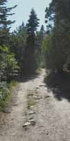
Meeks Bay Trailhead
Desolation Wilderness Permit Information
Long or Short Trips?
Meeks Bay offers an excellent trailhead to begin, or continue pursuing High Sierra backpacking to your next level. Entering Desolation through Meeks Bay is as good place to begin a series of short beginner and warm-up backpacking trips as it is to begin the long hike South to Mount Whitney.
The first miles beyond the Meeks Bay Trailhead are a fairly gradual lead-in to the stresses and strains High Sierra backpacking can induce, which we must take as seriously during our short prep trips as our long-distance hikes.
top of page |
Tahoe to Whitney
Why Tahoe?
The Tahoe Basin is special for many reasons, most good. The beauty of Tahoe has the undesirable effect of having drawn overdevelopment, overcrowding, and traffic threatening the very beauty attracting folks in the first place. That's bad.
We are hiking South from Tahoe because the mountains surrounding the Tahoe Basin are the beautiful Northern bookend of the High Elevation portion of the legendary "High" Sierra Nevada Mountain Range. At Meeks Bay we are near the top of the range, standing on its Northern End pointed South into its heart.
North of the Tahoe Basin the Sierra Nevada Mountains geological composition changes, its age advances considerably, and the range loses even more altitude. A different generation of the range, a distinct and much older part of the Sierra Nevada Mountains runs North from the Tahoe Basin. The Sierra North of Tahoe is akin to an older "Great Uncle's" relationship to the vibrancy of the very much younger range we are hiking South from Tahoe to Whitney.
Start Points
We can very easily start our hike to Tuolumne Meadows from trailheads South of the Tahoe Basin. Carson Pass, Ebbetts Pass, and Sonora Pass all offer successively shorter backpacking trips down to Tuolumne Meadows than starting out of Meeks Bay. I find "section hiking" perfectly acceptable, except for the fact that we miss the sparkling beauty of the Tahoe Basin!
Make sure the Tahoe Basin is one of your sections!
Why Whitney?
The Summit of Mount Whitney is a fitting crescendo to the series of natural wonders we experience hiking from Tahoe to Whitney. Hitting the highest point in the Continental United States is a properly climatic, a fitting end for the scale of grandure we observe along the length of this most remarkable hike.
TahoetoWhitney
We hike the terrain between Lake Tahoe and Mount Whitney because it is nothing short of majestic. North of Tahoe the Sierra breaks down into an older range. South of Mount Whitney the Sierra gradually descends and melts into the Southern Deserts. A zone of Unmitigated High Altitude Majesty spans the distance between Tahoe and Whitney.
Why the High Sierra?
Two Answers
Because we can stretch-out the length of continuous primitive trails along the sub-alpine High Sierra Nevada Crest and its highest altitude flanks to well over 400 miles. Though crossed by highways and touched by outposts of civilization, we have a very special run of a strip of continuous high altitude wilderness conditions hundreds of miles long spanning all the high altitude National Forests, Parks, and Wilderness Areas from Tahoe to Whitney. This remarkable span of terrain works as a bit of a remnant, an island or "throwback" zone large enough to maintain a substantial piece of its ancient web and energy of life displaced elsewhere.
And, because it's the High Hard One.
Two, because standing on the North end of the Sierra looking South to Mount Whitney in top physical condition with a well-equipped backpack, good logistics, and a well-considered hiking plan is one of the best feelings in life. The rest of the best are found while hiking it. Hiking South out of the Tahoe Basin marks the beginning of an amazing experience that can only be had in the High Sierra, but inversely, anyone can have this profound experience, just by doing it.
I suggest doing it right.
You are the Key
Hiking the High Sierra is a real adventure story that your plans write the script of, your feet speak the lines, and your subjective experience plays the role of "critic." How well you prepared for your role, how well you meet the challenges of the trail determines if your story is an outright horror story, a tale of painful endurance, or an account of transcendental inspiration. Likely a good mixture of all three, over the fullness of time!
Your personal backpacking "story" will likely have its own unique "chapters" divided into pains and pleasures balanced and given meaning by your evolving perspective, goals, and experience. Your hiking story will have its own unique "story line development," and trajectory reflecting your unique experiences engaging Nature and your own deep resources.
It is important we each know that the foundation of our "stories" all begin with our level of fitness, our preparation, and the skills each of us brings with us to the trailhead. Our combined assets compose a sort-of physical "lens" thorough which each of us are going to experience our slice of reality.
Your "lens" should be properly formed and polished a bit before hitting the trail.
What Time
IT IS
IS it time for you to lace up your hiking boots and hit the trail? At least your trainers? Time to dust off your "lens" for looking into Nature;
You?
IT IS!
It is Later than you Think.
top of page |
It's a Big Country
IF It is time for you to get re-engaged with Nature and yourself through hiking, we backpackers need to begin honing our fitness and backpacking skills wherever we are, using our local wilderness areas prior to hiking Sierra Trails or other difficult terrain.
We need to find hills and mountains near us for training trips to best prep us for the rigors of the High Sierra's altitude and steepness. We will walk stadium stairs as part of our training program if we live in flat states.
Note that our feet and boots have not been broken-in until they have been broken-in carrying the final weight of the loaded backpack. Only the final pack weight finally fully loads the feet into the boots. This fact explains why folks who thought they broke in their boots still get blisters when they strap-on the pack.
Getting Ready
Here in Northern California we have excellent "training grounds" for High Sierra Backpacking. The Coast Range Mountains near Santa Cruz (Wiki) running North up to and through Lost Coast* provides rigorous training terrain that readies backpackers for Sierra hiking.
Use the state and federal parks near you to hone your hiking skills.
*(The Sinkyone State Park administers the South Lost Coast and BLM the North end of Lost Coast.)
Seasonal Variation
The Coast Range in California and the Olympic National Rainforest in Washington typically draw my attention during transitions from Spring to Summer trail conditions in the High Sierra.
There is a period during the evolution of the Spring Thaw in the Sierra Nevada when the snow surface turns real sloppy, our post-hole depth is to the jewels, and the surging rivers are running boulders through the fords.
Those are the moments my attention shifts to the Coastal Range running North from Santa Cruz to the Olympics in Washington, and even beyond. One year I made it all the way up to the Canadian border above Haynes Alaska, before turning back to my home range.
The utility of this information will be apparent to everyone who planned Summer backpacking trips in the High Sierra, only to have an unexpected Spring snow pack, or the bulk of the Spring Thaw Surge pushing down mountain during their planned hiking dates.
Hiking the Coast Range or the Olympics will keep us busy until the snow and thaw clear off the Sierra Crest and Flanks. The Cascades and Rockies will likely be as packed with snow as the Sierra.
top of page |
Our Range of Route Options
Route Options
HIKING THE SIERRA CREST
The classic routes of the Tahoe to Yosemite, Pacific Crest, and John Muir Trails are our main trail options running North and South along the length of the Sierra Crestline from Tahoe to Whitney.
NORTH SIERRA
Physically, the PCT and the TYT share the beginning and ends of their routes across the North Sierra. The PCT and TYT share their routes across the Tahoe Basin and through North Yosemite. The PCT and TYT parallel each other from opposite flanks of the Sierra for a substantial length of the North Sierra between the Tahoe Basin and the Northernmost Yosemite boundary. The parallel tracks of the TYT and PCT are roughly are each about 75 miles long. (77.76 & 74.71 miles respectively.)
This "double-tracking" of the TYT and PCT across a significant span of the North Sierra really opens up many tasty hiking route options across the Carson Iceberg and Emigrant Wilderness Areas.
SOUTH SIERRA
South of Tuolumne Meadows the JMT and PCT share the vast majority of their routes along the South Sierra Crestline. At least down to Crabtree Meadow, where we follow the JMT turning East off the PCT to hike over Mount Whitney. The single-track of the combined JMT-PCT down most of the length of the South Sierra restricts our South Sierra route options to some degree. More on that below.
SELECTION PROCESS
Our concern is which route, or combination of our possible route options are best suited for our fitness and skill levels across the length of the High Sierra. Note that the Tahoe to Yosemite route's unmaintained segments across the North Sierra offers extra challenges. These cross-country segments of trail deter some hikers while attracting others.
Our route selection across the North Sierra will be informed by these unmaintained segments along the Tahoe to Yosemite Trail. We will either want to navigate through or around them. Our route selections across the South Sierra are a bit circumscribed, but we do have a fine series of alternative routes and unique side-trips across parts of the South Sierra as alternatives to the "standard" route of the "combined" JMT-PCT to select from.
Resupply
&
Local Evolutions
Next, we will be looking at breaking-down the long trails along the Sierra Crestline's Natural and administrative divisions with an eye for finding the best approach to dividing-up our Tahoe to Whitney trip for rest and resupply. Cutting-up our trip into sections between rest and resupply points helps us focus in laying-out our route and examining our options along either trail.
The section hiker's approach to the High Sierra is conducive to identifying shorter backpacking trips and longer local loops remaining within the various High Sierra Wilderness Areas.
Section hiking may best suite our current fitness and time constraints as we evolve our skills and fitness to the point they are sufficient, when we can finally put together the time, money, and "social space," to finally hike the whole Tahoe to Whitney in one long shot.
The index of the Tahoe to Whitney trail guide below breaks the High Sierra Crestline Trails downinto their logical resupply sections.
Indexing
the
North and South
Sierra
Trail Guide
Information
by
Sections
Resupply
Physical and Cultural
Awareness
Our goal is not just physically hiking the Tahoe to Whitney. We are going to explore as many of the side-trails, route options, broader wilderness areas, and the various trailheads on, along, and leading to the Sierra Crest Trails as we possibly can while hiking repeatedly from Tahoe to Whitney.
This does not begin to cover the enormity of the Sierra Nevada Mountain Range's physical scope, which is itself dwarfed by the vastness of the experiences of the webs of the Range supports.
The physical High Sierra is longer than lifetimes, the "experiencial space" its webs of life create are both within and beyond the scope of individual experience, if not the grasp of cultures.
"Seeing it all" is not really an option either "physically" or "experientially," yet not pursuing as great an understanding of the scope of the range is not an option.
The Trails Forums we designed to look at it through as many perspectives as possible.
Your
Awareness
The vast scope of the Sierra makes your perspective vital. Each of our views of the Sierra is limited by the scope of each of our perspectives. I am doomed to come up far short of complete coverage, even spanning as much physical and conceptual territory as I possibly can.
Our ability to share experiences breaks the boundary of individual experience. The capacity of the internet to store and organize huge amounts of information has forever changed the nature and scope of trail guides.
The digital tech has revolutionized the traditional role of trail guide. Trail guides can now offer comprehensive guide materials and information impossible during the paper-guide days
Trail guides can now present every aspect of "the subject" in greater detail than ever before. Vast amounts of map, miles, elevations, and images can now be organized and presented far beyond the limited scope of traditional printed guides. The inclusion of video add a whole new dimension to "scouting the terrain." More important than all these advances is the fact that backpacker's can now participate in the guide.
Trail guides can now include the experiences of all backpackers.
Digital technology allows the guide
Backpacking
Trails and Topics
FORUMS
Every step of the trail guide is paired with a forum page for backpacker input. I know it takes a lot of eyes and feet to get a truly comprehensive view of any one aspect of the Sierra, let alone a comprehensive perspective on the beauty and rigors of the trails down the length of the Crest Trails from Tahoe to Whitney.
Individuals can see it, but it takes a tribe to properly describe, monitor, and have any understanding of the vast scale and scope of the relationship between the "physical" High Sierra and the things living in it, and what those things are "doing." I have a pretty good idea of what it's "doing."
BIG
Engine of Life
I refer to confluence points of the forces of Nature as "Engines of Life." The High Sierra is one of these sacred confluence points of water, heat, and mineral energy from which Life draws energy directly from the seasonal transitions of our material, physical world as It simultaneously draws energy from the web of biological life through death.
For Example...
The insects begin eating the grasses, and each other, as soon as Spring's rising heat first melts snow into watering the first shoots first growth.
This feeding frenzy continues apace, with lizards and birds eating the insects until we have all the birds, bees, bears and beasts all engaging in a growing mutual feeding and fucking frenzy as the heat energy and waters of Spring are transformed into vast releases of biological energy through the Web of Life.
It's quite a show.
We can clearly see that Life absorbs heat and water (chemical) energy directly from Nature through these structures I call "Engines of Life." The Life existing along the "front-line"interface of absorbing energy from Nature is soon consumed, and the eater becomes the eaten in the sophisticated many-stepped construction of vast interelated webs of life creating the High Altitude Eden we see blooming around us every wet Spring.
Despite the beauty and blossoming of Life around us, we see, no, we even feel the nature of the feeding frenzy around us.
Life eats itself to Survive.
The fertility produced by "Engines of Life" are the products of complex physical and biological structures operating over large scales of time, space, ocean, atmosphere, and terrain. They are as much interfaces where life draws physical energy from the confluence of the forces of Nature themselves, as they are Engines of Consciousness and Perception.
The force driving the formation and increasing sophistication of Engines of Life is exactly the same force responsible for Mankind's capacity for "abstract thought." Engines of life are nothing more than the nature of reality's self-created foundations, more like "fountains" of energy it uses to build successively more complex physical expressions of itself, each of which adds the next layer of sophistication necessary to move the web of life closer to abstract, reflective consciouness.
The goal of this grand engine of life on this planet is to build abstract reflections of itself, as the ultimate force of Nature.
We are, and we are not what we think we are, at exactly the same time.
Each of us engaging and observing this "thing," this grand engine of life called the Sierra Nevada, creates a new reality within its ancient reality. We could call it an "update." Our observations, our engagements, and each of our perspectives on life moving through the ever-changing physical environment was once a vital and necessary part of our survival. Communication with Nature was our first and most fundamental "job," our first role in Life as Humans.
We by design reflect and pass along our experiences through culture, and all our potentials genitically. We were made to engage and reflect through time and space.
My view is humans' unique position and skills in the Web of Life requires we ultimately answer one basic question:
Are we to crown, balance, and give meaning to Life's
"Life eats itself to Survive"
method of growing and feeding webs of life?
Or, are we to seize it, supercharge it, and use it so humans can eat it all?
Our greed will consume everything and itself, if we allow it. Unless we decide otherwise.
Contemporary "social" values within "social life" encourage us to cultivate personal greed and personally consume everything possible. Industrial-scale human consumption is to Natural Balance as a porno movie is to Romeo and Juliet.
Nature's "life easts itself to survive" method of creating and perpetuating complex life wastes nothing. Nature only takes what it needs, and what it leaves behind is fertilizer to grow more. We leave a trail of toxic destruction and expanding death.
We've got to stop doing that...
Our power of conscious abstraction has allowed us the choice to either supercharge our abiltiy to eat to obesity, or choose to balance our appetites before they consume the Engines of Life themselves. Humanity currently resembles a cat with half of a bird sticking out of its mouth, about to swallow the other half.
Long distance backpacking clearly demonstrates that "Social Life" and "Llife" are quite different arenas of human operation, that they operate under completely different sets of rules, and that each generates completely different experiences and realities.
The key difference lays in the fact that one is created by humans over very short periods of time while the other is not created and is eternal, both establishing and reflecting the very rules of time and space we operate within.
How we, as individuals and as a society, engage and balance these contradictions between the social and natural worlds defines our scope, rank, and pay-grade in both Life and social life.
How we engage Nature and each other defines who we are, independent of what we say or how we look.
The vast arena and wide range of Natural and Human activity, experience, and adventure between Tahoe and Whitney makes it ridiculous not to rely on hiker input, not to seek out your experiences, considerations, and observations to help keep the guide well and properly grounded, up-to-date, and covering as much High Sierra experience as possible.
What about this "tribe" I spoke of?
top of page |
Social Awareness
WE ARE TRAIL CULTURE
Our hike is going to maximize engagement with all the various types of folks on and along the trail each year, what I call Trail Culture.
Trail Culture
Trail Culture is the combined "social presence," re-flated annually, consisting of you, me, all the backpackers, hikers, hunters, and horsepackers on the trail, including the unique characters at the various resupply spots, the High Sierra Camp staffs, the ranchers, wilderness rangers, horsefolk and cowboys, fisherfolk, especially the Trail Crews, and even the scientists.
We ARE Trail Culture.
Backpackers
There are predictable, reliable, and historical social groups composing High Sierra Trail Culture forming up along the Sierra Crest each season. Though these "historic" groupings are all substantial, the vast majority of two of the biggest backpacking sub-groups, the PCT and JMT hikers, are composed of different folks each season. Backpacker trail culture is the specific tribe of which I speak.
I myself am a member of the long-distance solo-hiker "sub-clan" of the Backpacker's Tribe.
Trail Culture Forum
Notes on
Yosemite Climbing Culture
Observe it All
We of the culture "trail" monitor the activities of the LE Rangers and Forest Managers, survey the residents of the "small towns" of car campers that pop-up in trailside campgrounds each year, and we even enjoy mingling with the hordes and herds of auto-tourists encountered where "popularity" and trans-Sierra Highways penetrate and intersect with the wilderness, mostly at our resupply stops.
We're going to do our best to observe, engage, and survey the health, composition, and character of every aspect of each season's trail culture at the places we find people coming into contact with Nature.
Unity of Purpose
Diversity of Approach
We are all here because we love Nature, though each "trail culture" group and sub-group loves it their own way. I say the variety of perspectives across our groups provides greater vision and understanding than any one group's single perspective.
Because our diversity is linked by our mutual adherence to a Core Value.
Without a Core Value, diversity is worthless. Oh, and greed is not a value. Greed is an emotion motivating and binding together flawed spirits.
That's because diversity of trail culture is rooted in a common, shared reliance on, and value for Nature. Each of our trail culture groups are only different expressions of the same shared Core Value.
Backpackers are kind of like how Americans used to be...
Before the Diversity anchored by Greed took over from Diversity anchored by Values.
Observation
Points and People
I have a network of "excellent observers," of long time High Sierra "engagers" from a range of Trail Culture groups. These folks occupy a wide range of vantage points overlooking various aspects of, and key "choke points" where high-altitude, High Sierra Trail Culture congregates. Especially us backpackers.
"Humans watching humans engaging Nature," will be a regular feature of the High Sierra Backpacking Magazine, when that finally gets off the ground. We've noticed that the various resupply and recreation locations along our trails have quite unique characters and cultures deeply interwoven with various aspects of the High Sierra's history and historical uses.
These places, unique themselves, also draw some interesting visitors through the universal appeal of their natural beauty.
Trail Culture is very interesting. Do tell us what you see!
From Tiny Acorns...
The forum part of this trail guide effort, actually the trails and topics forums themselves, are the little seed of what will eventually grow into the High Sierra Backpacking Magazine. The magazine will cover contemporary events, conditions, science, news, and experiences in and affecting the High Sierra Nevada Mountain Range and its winged, legged, and finned denizens.
The High Sierra Backpacking Magazine will cover the character of the High Sierra, being loosely-centered on the changes driven by the annual cycle of seasons, which is Nature's way of timing the rhythm and speed of life in the High Sierra.
The magazine will eventually cover and keep us up to date on both the more rapidly-moving contemporary physical, cultural, and climate changes in the Sierra driven by humans, society, and the weather. Monitoring the sources of these damages requires we observe the Social and Political structures of man. Gaging the transmission of these damages requires we keep an eye on the increasing series of disruptions and distortions in Nature's character and rhythms shaping our Sierra Experience.
We'll also use the magazine to track and learn about the advance of scientific knowledge as science dispassionatley and belatedly traces-out our rapidly deteriorating relationship with Nature. The High Sierra Backpacker's Forum currently tracks the progress of the various physical and natural sciences, cultural histories covering the Sierra, its current status, and the potential future trajectories of the physical and biological Sierra.
The trail guide will remain the anchor of these efforts, staying focused on accurately describing the basic physical aspects of, and personal requirements for, hiking the Sierra from Tahoe to Whitney.
Compared to the topical nature of the magazine, the guide will be a relatively static reference-resource of the physical layout of Sierra trails. It will be enhanced, updated and changed with the rate of change of the trails, terrain. The guide will change as conditions change for backpackers, and as backpackers post continuing information and updates through the forum.
Magazine Future
These "seed" forums are being carefully "watered" with work, structuring, restructuring, and lots of information. Sponsorship money and eventually a couple of hired guns will be required to finish 'em properly into an informative, entertaining, and fancy magazine format. A fancy High Sierra Backpacking Magazine of a character previously unseen in mainstream publishing will ultimately emerge atop these forums. Backpackers will change the world.
A Truly Independent Voice for, and reflection of, Nature on its own Terms is Emerging.
There's a huge fabric of rich physical and cultural reality in the Sierra for us to, "try on," to experience, become part of, add-to, and reflect between Tahoe and Whitney. This guide is designed as a resource and reference to support your efforts to personally engage Nature and each other.
The Magazine
The High Sierra Backpacking Magazine will eventually be focused on the more transitory nature of human experience in rapidly changing Sierra weather and terrain conditions.
Human experience in the High Sierra can change as rapidly as its weather and affect us as deeply as hiking from valley to peak.
The Trail Guide
The trail guide covers the more stable physical composition of the Sierra, which mostly moves at fairly predictable rates. The High Sierra Backpacking Magazine (currently the forum) reports on the more transitory nature of human experience, weather, terrain, and the ever-shifting pattern created by their movements and alignments.
The Backpacker
We are going to position ourselves to observe, soak in, and reflect as much of this interplay between culture, weather, trails, and terrain, and the High Sierra Engines of Life as possible.
top of page |
Two-Way Communication
Talk to Me
The backpacking Trails and Topics Forums offer extensive supplemental information about every backpacking trail covered by the guide and every relevant topic we must deal with to backpack them.
These forums are for backpacker's feedback, supplemental information, experiences, insights, if not updates on anything and everything affecting backpackers, their gear selections, trail conditions, and how to deal with all.
You are invited to both request & post information across the wide spectrum of backpacking trails and backpacking topics covered.
Vortex of Knowledge and Experience
When I say "we" are going to explore the Sierra, this means that you and I are going to be able to share and update all aspects of our knowledge and experiences through the
Backpacking Trails and Topics Forums.
Your Call
Or not. It is up to you if you want to hike across the Sierra during Summer, Winter, both, neither, or everything in-between, let alone share your insights and experiences. Part of our goal here is to provide an accurate look at the "nuts and bolts" of engaging Natural Experience for folks who can't get out into the wilderness, as well as those who can, but especially for those who should.
?
There are a lot of folks who need Nature, if they know it or not. A lot of folks with otherwise full lives know they are "missing" something in their lives, but don't quite know, can't put a finger on exactly what it is they are lacking. Engagement with Nature may be the missing piece in their lives.
Bottom Line
At the very least I suggest we evolve our backpacking skills sufficiently, as individuals and as a culture, to give ourselves and our kids the best chances to accurately observe, effectively analyze, and successfully engage the requirements of any Natural, and all the social circumstances we find ourselves in during the course of our lives.
Reaching the goal of being able to safely engage our natural environment requires we have a sufficient amount of backpacking experience. |
North and South
Sierra Nevada Mountain Range
Access, Resupply, Section Hiking
The Big Picture
Our comprehensive approach to experiencing the Sierra Nevada is most effective when matched with an understanding of how the Sierra is divided up by its access points and broken down into its federal administrative units.
Access points onto and along our selected route are important. The "main" access points to crestline trails reflect the natural and human administrative organization of the local terrain, the location of our resupply points, and provide opportunities to break these long trails down into nice section-hikes between our access/resupply points.
First Step
Mountain Passes, their Highways, and Forest Boundaries
Therefore, our first step is to break the Sierra Trails between Tahoe and Whitney into their most logical major natural divisions between access points into sections of trail.
Looking closely at the North Sierra hiking maps we see the boundaries between North Sierra National Forests and their Wilderness Areas are centered on the great river systems running down from historic mountain passes cracking the North Sierra Crestline.
These forest and wilderness boundaries run East-West roughly along the lines of the trans-Sierra Highways 50, 88, 4, and 108 up to the Crestline of the North Sierra and each road's particular mountain pass. An interesting pattern emerges from taking this "bird's-eye" perspective of the High Sierra Range.
Range of Activity
Remote and Isolated
We first note that five trans-Sierra Highways cross the North Sierra, while none cross the South Sierra. (South Sierra hiking maps) The South Sierra has no trans-Sierra Highways South of Highway 120, the Tioga Road crossing the high heart of Yosemite in Tuolumne Meadows.
We find access to the furthest South Sierra Crestline trails through a series of sometimes rough, sometimes isolated roads out to remote trailside resorts and trailheads located along the East and West Flanks of the South Sierra. Highway 168 out to Vermilion Valley and Florence Lake to access Muir Ranch is just such a road.
We also observe that the line of the Sierra Crestline itself running roughly North-South marks the boundary-line between the National Forests administering the East and West flanks of the Sierra.
The Crestline boundary also splits some of the Wilderness Areas draped across the Sierra Crest between their East and West Sierra Administrations. This is true of the Mokelumne and Carson Iceberg Wilderness in the North Sierra, and the Ansel Adams and John Muir Wilderness Areas in the South Sierra.
High Sierra
Forest
and
Wilderness Boundaries
Administration Map
Accessible and Busy
Other East Flank Trailheads can be quite busy. Trailheads such as in the Hoover Wilderness at Twin Lakes and the trailheads accessing Hoover/Hall Wilderness North of Tioga Pass are often very busy. South of Tioga Pass we find June Lake, Mammoth Lakes and Reds Meadow, and even Bishop Pass all can have almost overwhelming Summertime backpacker and tourist traffic.
Heavy use patterns are manifestations of the same forces of over-population that have brought permit-restrictions and the Minaret Vista road closure. Too many people destroy Nature. Mega-cities and mega-populations are bad for man and Nature everywhere, but especially bad for our last remaining wild areas, through both direct and indirect effects of way, way too many people.
North Sierra Access and Resupply
We see that the wilderness boundaries dividing the North Sierra Wilderness Areas all roughly correspond to the East-West lines of the trans-Sierra Highways crossing the North Sierra. We examine these trans-Sierra Highways more closely in the next section below.
South Sierra Access and Resupply
The lines of the forest and wilderness boundaries (map) dividing the South Sierra also roughly correspond to the locations of our resupply points and the access/fire roads out to them. But unlike the North Sierra, these access roads terminate at or near our resupply spots and trailheads, rather than crossing the Sierra.
These roads are well-represented on the West Flank by the long, rough road out to our two most Southernmost Sierra resupply spots, Vermilion Valley and Florence Lake. From Vermilion Valley we access the John Muir Trail, and from Florence Lake we hike out to Muir Ranch on our way to the JMT.
Alternative Approaches
The patterns of access emerging from a close inspection of the Sierra Nevada suggests a number of approaches other than hiking the whole Tahoe to Whitney in one shot. This is not so much of a problem in the North Sierra, where our trans-Sierra Highway offers easy access points breaking the trail down into manageable sections between easily-accessible resupply spots. The South Sierra is different.
Feast and Famine
Our South Sierra hike faces an abundance of resupply spots South of Tuolumne Meadows. At first. After a rapid succession of four resupply points from Tuolumne Meadows to Muir Ranch we face the very long, very difficult final unresupplied section of trail down to the Whitney Portal.
Last Resupply Spots
All of our resupply spots from Lake Tahoe down to Reds Meadow are accessible from main highways. Our two Southernmost resupply spots are not. Vermilion Valley Resort and Muir Ranch are only accessible at the ends of two remote West Flank roads off the end of remote Highway 168 at Shaver Lake.
VVR & Muir Ranch
From Fresno we drive East on 168 to Shaver Lake. From Shaver Lake backpackers seeking Vermilion Valley and its nearby trailheads leading to the JMT will follow the Kaiser Pass Road to the Edison Lake Road from Shaver Lake. Those hikers pointing themselves to Muir Ranch will continue on Kaiser Pass Road to its end at Florence Lake, where their hike to Muir Ranch and the John Muir Trail begins.
(Road Map Series)
South Sierra
Access & Resupply Sections
Starts with Slack
We find that the South Sierra resupply spots, being Reds Meadow, Vermillion Valley, and Muir Ranch come in a rapid-fire, closely-spaced succession hiking South from Tuolumne Meadows down to Muir Ranch. It is a series of easy two-day hikes from each to our next resupply spot from Tuolumne Meadows South to Muir Ranch.
This close-spaced line of resupply spots South of Yosemite to Muir Ranch allows us to easily carry a couple of extra day's food for scrambling, exploration, fishing, for whatever we want to do between each resupply spot. I take advantage of this "slack" between each set of resupply spots in different ways each time through. Each section of trail has a range has an extended set of features we can explore each time we hike it. We just have to make sure we don't over-burden ourselves.
The Hard Part
The concentration of South Sierra resupply spots South of Reds Meadow to Muir Ranch leaves the Southernmost section of our trail from Muir Ranch to the Whitney Portal as the longest and the most physically challenging section of trail between resupply points along our whole hike from Tahoe to Whitney.
The lack of "furthest" South Sierra resupply points affects not just our resupply plans, but tests and even potentially taxes our carrying capacity. This section's length and difficulty requires we approach planning and training very carefully. This long and difficult section induces some backpackers to weave-in an extra Resupply "solution" into this last long section of the South Sierra.
Bishop Pass to Resupply
I have never added an extra Resupply between Muir Ranch and the Portal, but I have encountered a lot of JMT backpackers who have. No problem. I have also regularly encountered backpackers who've hired horsepackers out of Bishop to run them a resupply out to the JMT, those who hike out to Bishop themselves, and those who have friends hike over Bishop Pass. I've seen all these techniques applied to obtaining resupply in the middle of this longest section of the John Muir Trail.
Bottom Line
The reality is that our ability to access the Sierra Crest Trails, their section hiking opportunities, and our resupply options are all organized along the lines of the trans-Sierra Highways across the North Sierra.
Our South Sierra
access is restricted to roads out to edge-of-the-trail backcountry resorts and pack stations South of Tuolumne Meadows down to Muir Ranch. Once we hike South of Muir Ranch our access to the Crestline Trail is limited to remote trailheads serviced by equally remote roads.
Our two Southernmost resupply spots along the line of the JMT-PCT, Vermilion Valley and Muir Ranch, are both "edge of the wilderness" resorts thinly but effectively serviced by remote roads and ferry to four-wheelers up the West flank of the Sierra, respectively.
The bottom line is that the distances and character of the terrain between our resupply points establishes the framework of our Sierra Crest section's backpacking challenges. The 110 mile length and high degree of difficulty of our last section of trail from Muir Ranch to the Whitney Portal presents a significant physical challenge.
Sections & Resupply
RECAP
North Sierra
The North Sierra resupply spots along the tran-Sierra Highways are frequent and closely-spaced from Lake Tahoe to Highway 108. Most long-distance backpackers do not use all the North Sierra resupply points.
The Southernmost 75 mile long section of trail from Highway 108 at Sonora Pass to Hwy 120 across Tuolumne Meadows is the longest and most difficult section of maintained trail across the North Sierra. The South Sierra follows a similar pattern.
South Sierra
Though the South Sierra begins with an abundance of resupply spots South of Tuolumne Meadows, we find the length and difficulty of our last 110 mile trail section from Muir Ranch to the Whitney Portal to be exceptionally challenging.
The last, Southernmost section of the TYT-PCT is the longest and hardest section in the North Sierra, while the Southernmost section of the JMT is the longest and hardest of all the trail sections between Lake Tahoe and Mount Whitney.
The Two Hardest Sections
The two sections of trail composed of the Muir Ranch to Whitney Portal section along the JMT and the Sonora Pass to Tuolumne Meadows section along the TYT are the two hardest sections of trail between Tahoe and Whitney.
The
Hardest Single Segment of Trail
I rate the Five Canyons of the North Yosemite Backcountry as the most difficult single segment of trail between Tahoe and Whitney. This segment of trail South from the top of Jack Main Canyon to Glen Aulin (map) is the hardest extended segment of trail along the Sierra Crest. This segment of trail will work anyone and everyone hard.
Honorable Mention
After that, the Golden Staircase's segment of trail climbing to Palisade Lakes (map) gets Honorable Mention for extreme difficulty. The difference between the Golden Staircase and the Five Canyons is the Five Canyons are a series of repeated steep climbs in immediate succession over the span of days it takes us to get through the Five Canyons.
We only have to do the Golden Staircase once, as part of a series of long climbs spaced at wide intervals. Miles and miles separate Selden from Muir to Mather Passes hiking South down the South Sierra Crest. Yards separate each in the series of brutal climbs across the Five Canyons of the North Yosemite Backcountry.
top of page
|
Trans-Sierra Highways
North Sierra Resupply Points
Five trans-Sierra Highways effectively split the North end of the Sierra Nevada Mountain Range into short sections of stunning Sierra Crest trails. These are Highways 50, 88, 4, 108, and 120. Highway 120 across Tuolumne Meadows also defines the center of the High Sierra mountain range for backpackers.
North Sierra
Google Road Map
Scroll
North and South
Below we're identifying highway and road access points, trailheads, available services and trans-Sierra highway resupply options, and their relationships with the Crest Trails along each trans-Sierra highway's corridor.
We'll also explore the historical outlines of each of these routes as they were initially probed by early Western trappers, explorers, and eventually miners and "settlers" looking for a way West, all essentially to unlock different aspects of the vast untapped resources of California.
Our North Sierra resupply points (resupply index page) are located along these trans-Sierra Highways. Highways 4, 108, and 120 have resupply facilities along their routes. Highways 50 and 88 only offer hitch-hiking access to resupply resources at South Lake Tahoe, having no resupply facilities at either Echo Summit or Carson Pass themselves.
Highway 50
Echo Summit
Trail Guide
Echo Summit Trailhead
The Echo Lake Chalet is located two miles North of where Eastbound Highway 50 crosses Echo Summit to make its magnificant entrance into the Tahoe Basin after climbing the heigth of the Western Sierra Flank.
Westbound drivers on Highway 50 crossing Echo Summit are rewarded with a grand view of the South end of Lake Tahoe in its unique basin as they cross the edge of its bowl.
Until recently Echo Chalet has been an important resupply point
along the Pacific Crest and Tahoe to Yosemite Trails.
NOVEMBER 2015 UPDATE
NO RESUPPLY FACILITY AT ECHO CHALET
Though terminating resupply services, Echo Chalet maintains its deli and small store.
The Utility
of
South Lake Tahoe
Even when Echo Chalet did offer resupply-package service a significant percentage of PCT hikers have traditionally hitch-hiked East from Echo Summit down Highway 50 into the South end of the Tahoe Basin where we find everything we need for a comprehensive rest, recharge, and resupply session in South Lake Tahoe. This percentage will increase to near 100 percent during 2016 and beyond.
South Lake Tahoe on the South end of the Tahoe Basin will be an even more popular resupply spot for PCT hikers now that Echo Chalet's no longer offering resupply services.
The explanation lays in the fact that the depth of services in South Lake Tahoe allow long-distance backpackers the luxury to enjoy a couple of days of baths, showers, fresh meals, each day followed by a night in a real bed.
Echo Chalet's termination of resupply services will negatively affect those PCT hikers who did not want or need to stop. All hikers who's chances of finishing the PCT over the course of a single Summer are diminished by the time lost being diverted off-trail to resupply will find the loss of Echo Chalet's on-trail resupply adding complexity to their planning.
Other PCT hikers will find that stopping and resting actually improves their performance. We must remember that rest and recovery are vital elements in the process of fitness. Rest and recovery allow us to heal and consolidate our strengths, making us stronger in the long run.
Proper rest and recovery makes us stronger and faster over long-distance trails. Consider the wisdom of the epic race between Rabbit and Turtle, between intensity and balance. (Wiki)
The remainder of long-distance hikers passing through the Tahoe Basin who are not resupplying in South Lake Tahoe will likely stop and resupply at Tahoe City along the North Shore of Lake Tahoe.
Late 2015 Update
Echo Chalet
No Longer Offers Resupply Package Services.
We are approaching water, garbage, bathrooms, and food at Echo Chalet, though no longer offering package resupply service.
Highways 50 & 89
Road Maps
CAL-TRANS
ROAD CONDITIONS
All
High Sierra
&
Mountain Road Conditions
High Sierra History
Pony Express through Echo Summit
Additional Notes
There's not much in the way of good free car camping along Highway 50, especially over Echo Summit.
Driving West up Highway 50 from where Ice House Reservoir Road breaks off the highway we find a series of Forest Service fire and service roads running up to the Western boundary of Desolation Wilderness.
Ice House Road and the rest of these fire roads up to the crest offer good hunting to find lots of nice places to car camp up there. These spots are a ways down the West Flank of the Sierra Crest, and a short ways North off the main route of Highway 50. But, they are good to know about.
We can trace them out on the maps below.
Free National Forest Car Camping Forum
Highway 88
Carson Pass
Trail Guide
Carson Pass Trailhead
Carson Pass has no Resupply Facilities. Carson Pass does have North and South trailhead parking lots, pit toilets, garbage cans, and ENFIA's rustic cabin manned by volunteers issuing permits for local backpacking into the nearby Carson Pass Management Area or points further South along the Sierra Crestline.
Hiking North from Carson Pass brings us directly into Meiss Country Roadless Area in the South end of the Lake Tahoe Basin. Meiss Country technically requires no backpacking permits for trips remaining within Meiss Country, but fire permits are required.
Highway 88 Region and Road Maps
Highway 88 Road Conditions
NO RESUPPLY FACILITY AT CARSON PASS
Bathrooms and garbage cans only.
NO WATER AT CARSON PASS
Fresh Water available at Woods Lake Car Campground
If you are really hurting for water the volunteers at the Carson Cabin will likely share some
of what they brought to cover their shifts.
High Sierra History
Carson Pass is named for Kit Carson expeditions exploring routes to California, which are detailed and discussed in the History of the Toiyabe National Forest, compiled by the Forest Service.
Additional Notes
Excellent free car camping along Highway 88 near Woods Lake and offset from Blue Lakes.
Free
National Forest Car Camping
Forum
Highways 4 & 108
Ebbetts and Sonora Passes
Highways
4 & 108
Road Maps
West Flank
North Sierra Highway Conditions
All
Sierra Highway Conditions
Highway 4
Ebbetts Pass & Silver Valley
TYT
Trail Guide
LAKE ALPINE INDEX
The Lake Alpine Lodge is located near where the TYT crosses Highway 4. Hikers on the PCT face a fifteen mile hitch-hike West from Ebbetts Pass to resupply at Lake Alpine.
No bathrooms, garbage cans or water at Ebbetts Pass along PCT.
Bathrooms, garbage cans, and water all available along the TYT's route around the East Shore of Lake Alpine. Full resupply services at Lake Alpine Lodge.
Lake Alpine Lodge Resupply
Additional Notes
Excellent free car camping along Highway 4.
Free National Forest Car Camping Forum
Highway 108
Sonora and Saint Marys Passes
Trail Guide
Kennedy Meadows Trailhead
The same is true of Kennedy Meadows Pack Station.
KM is also offset from the Sierra Crestline by about ten miles. Kennedy Meadows is ten miles down the West Flank of the Sierra from the Sonora Pass and nine from Saint Marys Pass trailhead.
Bathrooms only at Sonora Pass, no garbage can.
Kennedy Meadows Pack Station
Resources & Resupply
TYT-PCT
Sonora Pass Area Hiking Map
High Sierra History
Additional Notes
Excellent free car camping along Highway 108.
Free National Forest Car Camping Forum
Highways 120
Tuolumne Meadows
Trail Guide
Tuolumne Meadows Trailhead
I really enjoy Tuolumne Meadows. I have always considered it as my own little "Disneyland" for backpackers. I meet backpackers from around the world, the country, and California at TM every year. Plus, I do enjoy many of the tourists and even the drunken car campers who are enjoying the beauty as much as I am. We can share that even from our very different perspectives.
If Yosemite Valley becomes a city of car campers, tourists, climbers, and hikers each Summer, Tuolumne Meadows becomes Yosemite's small town.
Tuolumne Meadows Resupply Information
Tuolumne Meadows is an important resupply for us Southbound backpackers not so much because of our next, upcoming section of trail, but because our last section has worked us hard across its long 75 mile stretch of trail from Kennedy Meadows to Tuolumne Meadows, and we generally arrive hungry and ready to eat!
Tuolumne Meadows Road Map
All Road Access and Road Conditions Information
Tuolumne Meadows Hiking Map
Yosemite History
Yosemite, the Park and its Resources
Additional Notes
There is absolutely NO free car camping in National Parklands along Highway 120.
Below we are going to further discuss and explore our section hiking and resupply options first across the North Sierra, then the South Sierra.
top of page
|
Section Hiking
the
North Sierra
The "section hikes" we can put together in the North Sierra along either the PCT or TYT are nothing more than the individual sections of trail between our trans-Sierra Highway access/resupply points. This is our state of affairs hiking from Meeks Bay Trailhead to Tuolumne Meadows along the Sierra Crest.
Each section of trail between our resupply points between Tahoe and Whitney is a potential
"section" hike.
Classic Sections
All of our North Sierra resupply spots sit on the trans-Sierra Highways. The East-West lines of the trans-Sierra Highways also give us a rough idea of the locations of the boundaries dividing the North Sierra Wilderness Areas and National Forests one from the other.
A boundary line running North-South along the Sierra Crest divides the Toiyabe National Forest's administration of the East Flank of the Sierra from Tahoe to the Tioga Road from the National Forests administering the West Flank. Check out the Forest, Park, and Wilderness Map.
Permit Information
Expanding
North Sierra
Section Hiking Options
The North Sierra wilderness areas are Desolation, Meiss Country Roadless, Mokelumne, Carson Iceberg, Emigrant, and North Yosemite. Desolation and Meiss are in the Lake Tahoe Basin Management Unit, the Mokelumne is split between the Toiyabe on the East and the El Dorado National Forest to the West. The Carson Iceberg Wilderness is shared between Stanislaus and Toiyabe National Forests, while Emigrant Wilderness is exclusively within the Stanislaus National Forest.
Check out this list of
Wilderness Areas and their administrations.
Each of these wilderness areas can be hiked as an individual "section," from trans-Sierra Highway to trans-Sierra Highway. Each of these section hikes can also be expanded into grand backpacking loops around each of the North Sierra wilderness areas.
-- Long Focus -- Local Context --
--
Integrated Hiking--
This guide breaks down the TYT and PCT trails across the North Sierra into their constituent sections between the trans-Sierra Highways. Then we take a good, deep look at each of the local wilderness areas sitting between the parallel tracks of our two famous trails. We are looking to tie the parallel routes of the PCT and TYT together into grand backpacking loops around the North Sierra Wilderness Areas they run parallel routes across.
Our goal is to explore the classic Sierra hiking trails, find alternative routes along the crest, and find great backpacking loops exploring all the North Sierra wilderness areas.
Standard and Alternative Routes
NORTH SIERRA BACPACKING
Section and Local Loops
Looking at the TYT and PCT as they relate to each other across each section of the North Sierra reveals a wide range of potential alternative routes that can significantly lengthen or shorten that section's distance while increasing or decreasing its difficulty.
We can significantly diverge from the standard routes of either the TYT or PCT through the middle sections of the North Sierra.
Lost Loops
A lot of backpackers may overlook the unheralded potential of the long-distance backpacking loops that are possible around the Mokelumne, Carson Iceberg, and Emigrant Wilderness Areas in favor of linear trips down the John Muir Trail, the Tahoe to Yosemite Trail, or the various classic South Sierra backpacking loop trips.
That would be a mistake of omission with consequences affecting the character of our trip, depending on our expectations. Big backpacking loops around the Mokelumne, Carson Iceberg, and Emigrant Wilderness Areas in the North Sierra actually offer the difficulty and isolation many hikers on the "named" South Sierra trails and loops are seeking. The North Sierra Wilderness Areas offer a very different type of "classic" High Sierra terrain and experience that has been highly neglected in comparison to the overuse of the "classic trails," being the John Muir Trail and the trails in Yosemite, let's say.
I am not saying the classic routes are not magnificent. They are. I've hiked the JMT five times as of 2016. I am saying the High Sierra is much larger and deeper than any one trail. Each time I've hiked the John Muir Trail as the bottom-end of backpacking from Tahoe to Whitney.
Isolate Thyself
I can honesty say that the isolated beauties of hiking remote loops around the North Sierra Wilderness Areas compliment, if not exceed the shared beauties on the crowded trails in Yosemite and along the JMT down the South Sierra Crestline.
Indexed & Organized
The trail guide index we link to above breaks-down the North end of the Tahoe to Whitney hike into sections divided by the trans-Sierra Highways. The routes of the trans-Sierra Highways roughly corresponding to the boundaries between the High Sierra wilderness areas. There is a bit of "overlap" between administrative boundaries and the trans-Sierra Highways here and there.
Scope of Information
The North Sierra Trail Section Index lists guide pages, maps, permit information, resupply and miles and elevations information for each section of the TYT and PCT along the Sierra Crest between each set of the trans-Sierra highways and their attendant resupply spots. Resupply points along trans-Sierra Highways are typically located on each wilderness area's Northern and Southern boundaries, as we saw represented by the divisions of the "sections" link bar above.
This is the background information from which great backpacking trips are crafted.
top of page |
North Sierra Crest Trails
Wilderness Area Backpacking
MAP LINKS
Our basic TYT-PCT route options are traced-out across the North Sierra on the maps below.
Each 30 minute map operates as a graphical index for the trail guide information we have covering each Wilderness Area depicted.
Click the black-dotted trail routes on the 30 minute maps below for detailed maps, and click the red dots on all TW maps for that location's trail guide entry. The miles and elevations tables covering each Wilderness Area are linked-to from the link bar above each map.
North Yosemite Backcountry
Each map has labels linking to alternative maps, detailed maps, and adjacent maps.
top of page |
FORUM
Share your Knowledge and Experiences
High Sierra Backpacker's Forums
You are invited to help describe this wide selection of alternative routes and trail options we find across each section of the North Sierra. Every page of this guide following below is designed for us to share our experiences, add updates, our unique routes, and highlight the guide with our favorite things about each bit of trail in the Trails Forums. Or ask questions about issues of concern.
One good question can end the uncertainty of many backpackers pondering exactly the same backpacking trail, planning, and execution issues.
The Tahoe to Whitney Trails Forum is the place to post up your reports about experiences along Sierra Crest Trails and how you weave them together into innovative loops around North Sierra Wilderness Areas.
Your experiences, information and insights expand the scope and enhance the depth of the guide, keeps it current, and adds your voice to us encouraging folks to get out and explore the miracles of Nature within and around them.
I'll try to push you out there, and you respond with what you see out there and inside yourself. The backpacker experience is transformative. It does not create anything.
Backpacking the Sierra Nevada merely redirects and transforms social blindness into clarity by engaging ancient physical skills and assets within you, even uncovering fundamental tools of perception long neglected, abandoned or redirected to dubious social pursuits.
Nature built the perfect forum for the expression of the full range of Nature's characteristics in Human Reflective Capabilities. We responded by building great cities that now frustrate or misdirect most of our capabilities and their expressions. We can solve the problems we create.
Sadly, it is not as easy to solve problems as it is to create them.
It is time to clean and repair the tools of Nature within us through training and engagement, and around us through a little bit of self-restraint.
We must restrain ourselves from consume everything...
Long distance backpacking offers awareness of a different framework of reality as an optional, extra destination to the physical end of our trail. The longer we stay on the trail the deeper into that reality we go.
top of page |
Long Distance High Sierra Backpacking
The Unknown Contradiction
I experience backpacking as a "dynamic" process, where all aspects of experience are gradually drawn together and engaged in motion. The basis of this process is physical, but the end result is expanding observations and engagement with the environment. An imperative driving this process is the "living," and very real relationship within each of us between the known and the unknown.
The known beauties of the Sierra draw us back to soak-in their inherent beauty, while the unknowns call us to convert mystery into understanding, to fill in the "blanks," to enter, engage, and put together a line of understanding through missing pieces of beauty yet unseen. This is also the crux of the relationship between our long and short distance backpacking trips.
Long-Distance Backpacking Liability
Although long-distance backpacking
gives us a grand context on the character and beauty of the High Sierra, the daily hiking time and distance demands of the long distance backpacker give us little time to deeply soak in the details of any particular segment of trail.
We can address this to a greater or lesser extent by hiking alternative routes along our long-distance backpacking trips, to cover and see more terrain. We can pack an extra day's food to have the extra time to slow down, scramble, and explore the most interesting places in each section.
These alternative routes, as with my suggestions to carry extra food, are designed give us long distance backpackers chances to take a closer look at beauties within each wilderness area along our way while remaining within the parameters of good long-distance planning.
We can significantly extend our route hiking across the Emigrant and Carson Iceberg Wilderness Areas using alternative routes made possible by the parallel tracking of the TYT and PCT.
The parallel tracking of the TYT and PCT also make it possible for us to return to hike grand loops of detailed explorations around each North Sierra Wilderness Area that were impossible within the constraints of our classic long distance backpacking trips.
Finding Balance
This depth of detail contained in High Sierra terrain and its resounding beauty are complimented by the large number of route options through it. All make us measure our desire to continue hiking rapidly South down the trail on our long distance backpacking trip, albeit exploring new sights with each step, against tarrying to more deeply explore the local beauty we've currently hiked ourselves into.
Hiking the Sierra rapidly on long distance backpacking trips constantly makes us feel the timeless conflict between, "Long vs. Deep," backpacking trips in the High Sierra. We must press on, but oh, do we want to stay, to tarry a bit to plumb the depths of the local beauties!
Long and Deep
Balance
These are the moments when the logic of a more relaxed follow-up backpacking loop around each wilderness area we are rushing across becomes crystal-clear. Or maybe a warm-up loop, prior to beginning our Tahoe to Whitney Trip. Maybe a follow-up, after our trip shows us so many beauties needing further exploration.
Push on to Return
I find that telling myself I will come back to the special places I briefly encounter on long-distance trips for further careful exploration allows me to more easily push-on out of them.
Balance is a Long Game
My acknowledgment of the insufficiency of the encounter mitigates my long-distance backpacker's inherent frustration at being forced to depart one ill-explored beautiful place for another with all speed necessary to stay on our long-distance backpacking plan.
So, we will come back and hike a nice relaxed section or loop to more deeply soak it in, later.
More on this below.
top of page |
South Sierra
&
South Sierra Section Hiking
The idea of section hiking from Tahoe to Whitney works well in the North Sierra between the trans-Sierra highways. Section hiking does not work as well in the South Sierra. There are no trans-Sierra highways conveniently breaking the South Sierra into bite-sized chunks.
SOUTH SIERRA
South of Tuolumne Meadows the JMT and PCT share the vast majority of their routes along the Sierra Crestline down to Crabtree Meadow. Crabtree Meadow (map) is where the JMT splits East off the PCT to hike over Mount Whitney.
The single-track of the combined JMT-PCT down most of the length of the South Sierra, along with the above-mentioned lack of trans-Sierra highways, restricts our South Sierra route options to some degree.
There are no trans-Sierra Highways South of Highway 120 crossing Tuolumne Meadows until we have hiked far South of Mount Whitney down to Highway 178 crossing the South end of the Sierra via Lake Isabella. (map) Lake Isabella is near the very furthest Southern bitter end of the low-altitude Southern Sierra Foothills.
A Different Approach
Because of this lack of trans-Sierra highways South of Tuolumne Meadows, or a whole lot of other points of "civilization" along the trail South of Muir Ranch, we have to take a different approach to section hiking the JMT across the far South Sierra, especially below Muir Ranch, than the highway-to-highway section hikes possible along the North Sierra Crestline.
Ironically, our first miles hiking South out of Tuolumne Meadows present a series of South Sierra resupply spots in rapid succession. Reds Meadow, Vermilion Valley Resort, and Muir Ranch come closely-spaced together in rapid succession. This "bounty" of resupply spots is followed by the brutal 110 miles with no resupply South from Muir Ranch through the Whitney Portal.
The South Sierra is a "resupply arena" of first feast, then famine.
South Sierra Backpacker Resupply Options
Trip Plans
Completing the last, longest, most difficult section of the John Muir Trail from Muir Ranch to the Whitney Portal is a fitting end expressing the evolution of our skills and capacities as we've hiked South from the Lake Tahoe Basin.
If we are strong we will roll through this 113 mile section of trail from Muir Ranch to the Portal with extra food to support our scrambling plans. For me this will be ten days of total food including the two extra days of food to support explorations. This approach roughly translates into eight days at 14 miles a day, while taking two days off at pre-designated spots to bag peaks or explore cross-country and scrambling options.
This requires carrying a very heavy backpack hiking South out of Muir Ranch.
Bad Plans Happen
Ha-ha, honestly, that was my approach for my second through fifth times hiking the TWT. The first time I had misread the miles for Muir Ranch to the Portal from the 1932 Starr's Guide, which appears fairly accurate in 1998. I misread Starr's miles as 105 from VVR. I was two days' food short the first time I hiked from Muir Ranch to the Portal, which made for a very interesting hike.
I ran diminishing rations each day South from Palisades Lakes (I was already at 1500 calories a day at Palisades) down to the Portal. I crossed the Portal having had zero calories in the pack for a full day. That day I hiked to the top, and over Mount Whitney to the Portal with no food from my campsite located a bit West of Guitar Lake to the Portal.
PERFECTION
On perfect trips I finish the last of my snacks descending the East Flank of Whitney. Passing through the Portal with no food and no deficit of calories is perfect.
Next Stop; Doug's Burger and Fries!
I ate the last of my food and drained my last drops of water approaching the Portal last time, which allowed me to weigh my "gear only" pack exiting the Portal at 35 Lbs.
Trip Planning Guide
The Real Challenge is Personal
The rigors of hiking the trail South from Tahoe to Muir Ranch had already prepped me for the ordeal by hunger that followed. Never after my terrible mis-measurement of miles/food has the South Sierra seemed too difficult.
I have found lots of real challenges across my Tahoe to Whitney trips, and each has always been ultimately centered within my perceptions and misperceptions.
I find that the Sierra Nevada is a merciless "ruler," a scale upon which the balance between reality and our expectations can be precisely measured. It is our clarity, capacity, expectations, and even our spirits themselves that are being measured-up against Nature's unrelenting timeless standards.
The personal costs of inappropriate expectations influencing any gear, miles, food, or fitness mis-calculations can be severe when measured against Nature's Ruler.
Our misperceptions, miscalculations, and mistaken expectations are measured out as
pain on the trail.
The Spiraling Staircase
Our skills and fitness are increasing, decreasing, or remaining stable as we hike. Which way things go depends on the level of skills and fitness we initially brought to the trailhead. We are dealing with three factors. Time, distance, and energy. We must be precisely aware if the amount of energy we can marshall is sufficient to cross the specified distance in the required time. If so, all is "hunkey-dorey." Hike on! If it is not, we will be degrading day by day. We must modify our plans or bail-out.
Vortex of Doom
Our backpacking maps of the South Sierra from Muir Ranch to Bishop Pass and on down to the Whitney Portal show us the Southern End of Sierra has no easy resupply or "bail out" options South of Bishop Pass.
The Sectional Solution
Our proposed section hikes across the Southernmost section of the JMT-PCT South of Bishop Pass are typically from one in a series of very remote trailheads off Highway 395 to intersect with the John Muir Trail, then hiking South to our junction leading off the JMT to another equally remote trailhead in this series of trailheads, all located to the West of Highway 395 at the base of the East Flank of the Sierra. The map below precisely lays out this reality.
Bishop Pass to the Whitney Portal
30 minute Backpacking Map
All
South Sierra Maps
Bishop Pass is typically where folks who need to resupply while crossing the 110 miles separating Muir Ranch from the Whitney Portal either hike out to take advantage of the paved road up to South Lake, to hitch-hike out to resupply in the town of Bishop.
Another option I've seen is friends and/or family of JMT hikers backpacking-in resupply provisions to their hiker on the JMT through Bishop Pass. The extreme length and difficulty of the JMT-PCT from Muir Ranch to the Whitney Portal can make an "extra" resupply desired for some hikers and necessary for others.
I pack two extra days' food out of Muir Ranch for an unresupplied hike to Whitney capable of supporting some extra exploration. This may be beyond the reach of some hikers.
Unless we train-up to carry a day or two's extra food!
It is imperative that we have a clear understanding of the outlines of a
Logical Hiking Plan
through this difficult section of trail.
Section Hiking the South Sierra
Basic Structure of the South Sierra Trails
The kind of loops and alternative routes tying together the TYT and PCT across the North Sierra are not possible in the South Sierra hiking the JMT and PCT.
The JMT and PCT in the South Sierra do not parallel each other as do the TYT and PCT across the North Sierra (exception: 1000 Island Lake to Reds, where we actually have three parallel trails), but share the same route for the overwhelming majority of their shared length.
The shared route of the JMT-PCT is the sole continuous trail route from Tuolumne Meadows South to the Whitney Portal, including the Roper Route. The Roper Route is more of a "hybrid" set of cross-country segments interwoven into the route of the JMT.
Tahoe to Whitney does not currently cover the Roper Route, but we will highlight it's variations from positions along the JMT-PCT where the our route down the JMT and our various scrambles cross or coincide with its route. For more information, consult
OnTheTrail.org
Sierra High (Roper) Route Topo Map Series
Many of the scrambles and alternative routes off the JMT on this guide probe into segments of the Roper Route. I've come to believe that weaving elements of the Roper Route into the route of the John Muir Trail is a logical evolution for hikers making repeated trips down the John Muir Trail.
Despite the JMT and PCT sharing the vast majority of the trail across the South Sierra we still have a few significant lengths of "alternative" trails paralleling the standard route of the JMT/PCT. There are also a series of classic medium-distance backpacking loops utilizing lengths of the JMT that we can hike around the South Sierra Wilderness Areas.
South Sierra Backpacking Loops
I like the stretch of trail through Fish Valley that parallels the JMT-PCT route beginning just South of Reds Meadow that runs an alternative route South to, and over, the Silver Divide. Further South the North-South Lakes Loop and the Rae Lakes Loops round-out a nice selection of classic loops around the South Sierra.
Classic
South Sierra Backpacking Loops
Maps
South Sierra Backpacking
"Sections"
Though we have loops around nice parts of the South Sierra, we still do not have much in the way of "sections" of trail. Hiking the furthest Southern Sierra Trails South of Bishop Pass by "sections" generally requires we hike West to the route of the JMT-PCT from a remote East Sierra Trailhead off of Highway 395 out of Owens Valley. Highway 395 runs North and South along the entire base of the East Flank of the Sierra Nevada Mountains, North and South.
Far to our North Highway 395 runs around the East Flank of the Carson Range around Lake Tahoe before resuming its path along the Eastern Flank of the furthest North Sierra above Tahoe to terminate in Susanville. The South end of Highway 395 continues across the Mohave Desert with the termination of the South Sierra to end near Hesperia.
East Flank Trailheads
For our purposes Highway 395 runs North and South along the base of the East Flank of the South Sierra where it parallels the precipitous abrupt rise of the sheer East Sierra Flank from Mono Lake South through the town of Lone Pine sitting in the shadow of Mount Whitney.
Driving Highway 395 South from Lake Tahoe to Lee Vining to Lone Pine is a splendidly scenic trip offering access to a string of amazing trailheads directly accessing the Sierra Crest from the East.
Here we are concerned with gaining access to the furthest Southern segments of the South Sierra to put together section hikes along the South end of the JMT.
Highway 395 South from Bishop enters the top of Owens Valley running down to Lone Pine. Owens Valley is wedged between the Sierra to our West and the White Mountains to our East, until we reach the carcass of Owens Lake's sacrifice to the unquenchable greed of Lost Angeles, and begin approaching the top of the Mojave Desert with the dust of Owens Valley in our mouths.
I would rather have a lush Owens Valley than Los Angeles full of people.
The route of the JMT-PCT is West of Highway 395 running through Owens Valley, over on the other, Western Flank of this highest run of the Sierra Crestline. The line of the JMT-PCT is cut along the Western Flank of the South Sierra Crest, once we hike South of Reds Meadow. We will not return to the East Flank until we cross Trail Crest and turn down-mountain towards the Whitney Portal.
Reciprocally, if we hike to our East off the route of the JMT from anywhere South of Reds Meadow down to Mount Whitney we will first climb over the Sierra Crest then descend down its sheer Eastern Flank to what will generally be remote trailheads at the ends of remote roads climbing West into the Sierra off of Highway 395.
Utility
We can use the remote and the popular East Flank trailheads into the Sierra to break-down the length of the JMT-PCT along the furthest South Sierra into smaller, more manageable JMT-PCT trail "sections," stretching from one remote Highway 395 trailhead to another.
We can use this series of remote South Sierra Trailheads along Highway 395 to cut out "section hiking"-sized pieces of the JMT despite the lack of trans-Sierra highways South of Yosemite.
West Flank Trailheads
From the West Flank we have access to the South Sierra Crest Trails through Vermilion Valley, Muir Ranch, Roads End (Kanawyers), Cedar Grove, and Mineral King. (VVR and Muir Ranch road access)
Once we hike South of Muir Ranch the Western Sierra Trailheads of Roads End, Cedar Grove, and Mineral King are significantly offset down the Western Flank from the route of the combined JMT-PCT along the Sierra Crest. (Access Sequoia-Kings Canyon)
Access to the JMT below Muir Ranch is much more direct from the Eastern trailheads off of Highway 395 that access through the Western Flank Trailheads in Sequoia-Kings Canyon.
South of Bishop Pass
The closely-spaced series of resupply spots South from Tuolumne Meadows down to Muir Ranch makes it unnecessary for most backpackers to use all of them. On the other hand, the long distance separating Muir Ranch from the Whitney Portal makes it necessary for some backpackers to seek an extra off-trail resupply across this section.
Bishop Pass is the best option for an off-trail resupply between Muir Ranch and the Whitney Portal, as mentioned above. There are also the series of Sierra Crest Passes South of Bishop Pass and North of Mount Whitney that we can use as start and end points for South Sierra "section" hikes, as off-trail resupply options, or even as bailout points for exhausted backpackers.
I have seen them used all three ways.
Five South Sierra Passes
These remote mountain passes South of Bishop Pass and North of Mount Whitney crossing the highest section of the whole Sierra Crest are located in the White Mountain and Mount Whitney Ranger Districts of the Inyo National Forest.
They are Taboose Pass (permits), Sawmill Pass (permits), Baxter Pass (permits), Kersage Pass (permits), and Shepherd Pass (permits). We can trace them out on the map below.
Bishop Pass to the Whitney Portal Backpacking Map
30 minute USGS Backpacking Map
Inyo National Forest
Self-Designed
South Sierra
JMT "Sections"
Unlike the North Sierra, where the trans-Sierra Highways conveniently break the TYT and PCT into a range of hike-able sections of trail, we've got to design our own South Sierra Sections.
Our Southern Sierra Sections begin from and end through our self-selected starting and ending trailheads sequenced along Highway 395 paralleling the South end of the Sierra.
South Sierra section hikers hike West from our selected East Flank trailheads off Highway 395 to join up with the JMT-PCT. Reaching the JMT, we'll hike our pre-determined length of JMT "section" down to the trail junction we've decided to turn East, and back over the Sierra Crest out to the trailhead we designated as the end point of our self-designed South Sierra trail section.
We have a long series of East Flank trailheads accessing the JMT-PCT stretching South from all the way from June Lake (map) down to Shepherds Pass. (map) We can break the furthest-South Sierra (South of Muir Ranch) into a nice series of reasonably-sized backpacking sections, though we have to hike in and out over the precipitous South Sierra Crestline on sometimes degraded trails.
Strategy for Medium Distance Backpackers
These High Sierra Passes and their East Flank trailheads South of Bishop Pass access remote segments of the JMT across the furthest South Sierra. These passes make it possible to hike medium-distance trailhead to trailhead "sections" along the Southern end of the John Muir Trail, or hike in from a remote East Sierra Trailhead down to and through the Whitney Portal.
A section-hiking strategy
can cut this long unresupplied length of the JMT-PCT into more manageable medium-distance backpacking trips. But don't underestimate the difficulty of these shorter trips. Besides crossing the highest sections of the Sierra Crest twice, these remote mountain passes can be poorly maintained, while their East Flank Trailheads are desolate, and can often experience long periods of infrequent use.
Backpackers hitch-hiking to and from these remote trailheads (like me) may find themselves walking to and from Highway 395 and their selected East Flank Trailheads. I have met some of the most interesting folks in these desolate "interface zones," as I'm making my way on foot between civilization's lonely South Sierra highway and wilderness trailheads.
The East Flank of the South Sierra is stark, rises abruptly and precipitously, and rises out of the quite desolate conditions of a 5000 foot elevation arena of high desert-like conditions of poor pillaged Owens Valley along the Highway 395 corridor wedged between these grand mountain ranges.
Eastern Sierra Starkness creates a sense of timeless beauty we can access during our fleeting passage through it.
South Sierra Backpacking Loops
Let's take a closer look at the South Sierra's challenging backpacking loop opportunities on these maps from our South Sierra map series, below.
Note that these maps are part of an interlinked series of maps covering the JMT and PCT across the South Sierra at the two scales commonly deployed by the USGS.
I am prepping these maps and the full South Sierra Map Series to begin organizing the South end of the guide's structure prior to formally beginning guide construction.
Classic
South Sierra Crest Backpacking Loops
Wilderness Area Backpacking
Maps
Bishop Pass
to
Whitney Portal
South of Mammoth Lakes
&
North of Bishop Pass
EASTERN ACCESS
Mono Pass & Piute Canyon Access
Hiking South through the web of trails South from Mammoth Lakes and long before we come to the South Lake Trail (permits) over Bishop Pass we find two main routes accessing the John Muir Trail from the East, off of Highway 395.
Mono Pass (permits) and Piute Canyon (permits) are the two main terrain features offering routes directly accessing the JMT-PCT from the East South of Mammoth Lakes and North of Bishop Pass.
Note that the South Sierra trails are much busier North of Bishop Pass than South of Bishop Pass.
Reds Meadow, Mammoth Lakes, and Bishop (the town along Highway 395 accessing Bishop Pass) are hives of South Sierra backpacking activity. The trails out of Mammoth Lakes and Reds Meadow down to Bishop Pass, and Bishop Pass itself draws lots of local Summertime backpackers out of L.A., as well as the standard heavy traffic of each year's crops of JMT and PCT hikers.
There are many less backpackers once we get South of Bishop Pass. Once we get South of Bishop Pass we find trail traffic winnows down to the steady, yet still considerable flow of the annual Southbound JMT hikers against the predominantly Northbound PCT hikers.
This "flow pattern" remains true until we get down to Crabtree Meadow, where we encounter local hikers at Crabtree Meadow.
It turn out that Crabtree Meadow is used as the Westernmost camp of many Whitney Climbers who include venturing West over the mountain down to Crabtree Meadow as part of climbing Whitney.
Climbing Whitney Eastbound to end our hike we encounter the endless line of Whitney Climbers making their way from Portal to Peak and back again when we hit the Trail Crest Junction. From this point the majority of the line of Whitney Climbers appears to flow out of L.A.
The line is an interesting thing.
Though there are many hikers from around California, the Country, and the World, the majority of hikers we encounter South of Reds Meadow seem to hail from "The Southland," AKA, L.A.
"Lost Angeles."
Mono Pass and Piute Canyon
Backpacking
Map
What a Long, Strange Trip it's Been
Though this trail guide is dedicated to hiking from Tahoe to Whitney in one big, long, forty-day (+) shot, what we see and learn on our long backpacking trips demands to be followed-up by deeper trips, trips returning to more deeply explore the amazing places we find hiking the length of the Sierra.
The grand experience of hiking from Tahoe to Whitney uncovers lifetimes of amazing Sierra Nevada backpacking opportunities demanding we return with the time and energy necessary to deeply investigate each and every one of them, to our full measure.
Our present experiences are based on our past experience or information we collected about the High Sierra. Sadly, we cannot see too far back into the past. What we can see of the footsteps of our ancestors receding into the shadows of the Sierra's ancient past end abruptly at the beginning of the age of industrialism and mass culture.
We peer as far into the degrading future of Sierra weather as we dare.
Our actions in the present have shrouded the past and the future in deepening darkness.
For Now, let's do something quite different. Let's create the biggest bubble of clarity about the nature and value of Natural experience in the High Sierra during our time of responsibility, during our time,
"On Watch."
The Tahoe to Whitney backpacking trip is the mother of all High Sierra scouting trips. It's during our shorter follow-up trips we can delve much more deeply into the wide range of the High Sierra's characters that our long trips revealed.
Hike Long
&
Hike Deep
Our long backpacking trips help us to find and put each unique sequence of High Sierra terrain within the greater context and logic of the wider range. Reciprocally, our long trips build the physical energy and capacity while providing the information and experience necessary for us to find where, plan how, and direct our return trips to more deeply submerge ourselves in this stunning beauty.
Our TWT hikes
give us the overview necessary to design exceptional local and even local long-distance backpacking trips returning to specific spots and wilderness areas we identified on our long trips.
We're going to fill-in the grand long-distance context we gained on our long trips with deep detailed explorations of the finest local examples of unique terrain and the local beauties we found and were forced to race past while meeting the demands of hiking the long trail.
This is true up and down the length of the South Sierra Nevada Mountain Range. We are going to see, and move quickly past, many things demanding our further attention.
ARRRG!
These short-term contradictions, the frustrations generated by the demands of our long-distance backpacking can only be drawn to a complimentary balance over time. That's why I have a Lifetime Hiking Plan.
The LHP is simple; we long-distance backpack the Sierra over the span of our lives, over as wide a variety of routes as possible. We use our long trips as scouting to direct our return trips for detailed explorations.
Our short-tem frustrations at what we do or don't see at any particular time are dissipated across the fullness of time.
Hike Long and Hike Deep!
top of page
|
South Sierra Section Hiking
SCHOOL OF PACK
Endurance
The series of South Sierra mountain passes named above (Taboose Pass, Sawmill Pass, Baxter Pass, Kersage Pass, and Sheperd Pass) give us the ability to break down the long length of the unresupplied section of the JMT-PCT South of Bishop Pass into more manageable distances.
A Measure of Capacity
Though it is possible to use these passes over the Sierra Crest to break the lower end of the JMT into smaller segments, I don't suggest it for long distance backpackers. Break this section up if you must, if it is required or desired, but mastering this 110 mile long section of trail between Muir Ranch and the Whitney Portal without resupply is a fine measure of capacity and fitness.
Reaching the physical capacity to operate comfortably while carrying heavy weight at high altitudes over the very long and very difficult 110 mile distance between Muir Ranch and the Whitney Portal at the end of our Tahoe to Whitney backpacking trip demonstrates the evolution of our capacity.
This capacity gives us the ability
to craft amazing shorter trips through these remote trailheads when we come back to more deeply explore the South Sierra. Attaining this level of capacity opens many doors to many different physical pursuits.
Perspective
I promote hiking the South Sierra in one shot as a backpacker arriving at Muir Ranch after having thirty days hiking 300+ miles of difficult high altitude High Sierra trails under my belt. I am ready. The perspective of a hiker arriving from zero elevation with zero miles under their belt facing this difficult length of the South Sierra will be completely different.
The symmetry between our long and short backpacking trips is complete when our long distance capacity down this very long stretch of the JMT separating Muir Ranch from the Whitney Portal is used on local trips carrying that same ten days of food for a trip half the length, with lots of days off for exploration, climbing, and scrambling!
That is how our long and short trips feed and compliment each other. Our long distance capacities open up amazing short trip possibilities.
Conclusions
We've explored some of our local South Sierra backpacking options and we're going to encounter a good sample of the people that hike, supply, and maintain them as we continue South. One cannot help but conclude that these local South Sierra backpacking options open up fantastic backpacking loops and trailhead to trailhead hikes for advanced backpackers. The South Sierra is a difficult venue, and will strain or break unfit or poorly-prepped backpackers.
Character of the South Sierra
These are long, hard trails into isolated locations, even when we use the East Flank trailheads to put together shorter trips than hiking the entire length of the JMT from Muir Ranch, or even Bishop Pass, down to the Whitney Portal.
Explorama
Nonetheless, we are going to explore our various local backpacking options along both the
North and South Sierra as we hike South from Tahoe to Whitney. The nature of our hiking options change with the changing character of the range as we proceed South. The great loops we can hike around North Sierra backpacking areas turn into long runs between remote Highway 395 Trailheads down the furthest Southern Sierra Crestline.
This is not a problem. We are going to put our long and local backpacking into a productive relationship wherever we find our feet planted, be it exploring great loops around the North Sierra Crest wilderness areas, or great lengths of trail between remote trailheads along the South Sierra Crest.
Inspect the North Sierra
Ironically, the North Sierra trails are much less traveled than the JMT and PCT are across the South Sierra, but are much more accessible, and are much more amenable to great backpacking loops than the South Sierra. All of the above are good things.
There are lots of North Sierra Trails with virtually no one hiking most of them during the height of Summer. I say this to intentionally deflect at least a few hikers planning South Sierra and very overcrowded John Muir Trail hikes to explore the North Sierra trails from Lake Tahoe to Tuolumne Meadows.
The PCT and TYT provide two distinct routes across the North Sierra while the PCT and JMT provide a singular route across the South Sierra. There are side routes in the South Sierra that provide some exceptional alternative less-traveled trail routes and loops, which we will explore as we hike South. But North Sierra trails are generally less traveled than those of the South, and many are across terrain naturally designed to accommodate big backpacking loops.
Next School of Pack:
Bringing out Potential
top of page |
Why Section Hike?
Longer, Deeper Sections
"Sometimes we've got to slow down to speed up"
Approaching the Tahoe to Whitney hike as a series of section hikes potentially allows us to slow down enough to take in much more of each section's wilderness area surrounding the Sierra Crestline than we ever could hiking rapidly across them as part of a longer, more demanding backpacking trip.
Depth vs. Length
If this is a journey of exploration for you, then take your time and explore!
Hike long, deep, extended alternative routes and great sweeps up, down, and around both flanks of each section of the Sierra Crestline as you push South on the Crest Trails.
If this is a journey of great endurance over many miles, then push on and endure!
Some folks believe 25 miles per day is the only way!
Circumstantial
Evidence Carries the Day
Me? I believe circumstances will require each approach in its turn, over the duration of our hike.
Thus it is our duty to
have the ability to both hike great distances, and be able to slow ourselves down, take our time, and even go "deep," with still observation.
Which approach we employ will be the one "required," demanded by the nature of the circumstances. We will form ourselves and our behavior as required to be the "key" to fit into the "lock" created by the demands of the situation.
We will run if required, rest if necessary, or take a series of stops or side trips to soak in a series of unique, beautiful views.
Shifting Priorities
We'll experience both the thrill of exploration and the rigors of endurance as we hike South to Mount Whitney as the parameters of our journey change with our changing circumstances.
We will have times to tarry, and we will face situations demanding we push hard to stay within our schedule and food supply requirements.
Lots of situations are going to rise up, evolve, and pass as we hike South from Tahoe to Whitney.
Some situations will be internal and some external. We are going to prepare ourselves as best we can to deal with them all. |
We can exchange some of the time and speed requirements demanded by a one-shot Tahoe to Whitney trip for a more relaxed, in-depth section-by-section exploration of each High Sierra wilderness area.
We can significantly stretch out the time we spend and the overall miles if we hike around each section, rather than straight through, if our time and goal-centered mileage requirements relax a bit.
Getting the correct balance between the quality and quantity of our daily mileage is very important.
From Section to Loop
Section hikes allow us to take more time to enjoy hiking shorter spans of trail than demanded by through-hikes. We can take the time to give ourselves the luxury to push out to explore and scramble, even adding lines of trail to convert our linear section-hikes into grand backpacking loops.
If we look closely at the maps of each North Sierra section we can see the parallel routes of the TYT and PCT are inviting us to tie them together into a series of great backpacking loops around the North Sierra Wilderness Areas, to our great advantage.
We can use connector trails to tie the parallel tracks of the TYT and the PCT routes into grand backpacking loops around each of the
North Sierra wilderness areas.
This means that we can section hike the North Sierra one big backpacking loop at a time!
At the very least we can hike grand loops around the Tahoe Basin (Map), the Carson Iceberg (Map) and the Emigrant Wilderness Areas (Map). The geography of the Mokelumne Wilderness (Map) makes loops there a bit more difficult.
We have to extend Mokelumne backpacking loops South into the North end of the Carson-Iceberg to connect the PCT and TYT around the South end of that particular loop.
The vast canyon and rough terrain of the upper portions of the North Mokelumne River well divides the routes of the TYT and PCT on the South end of the Mokelumne Wilderness. We have to hike South into the Carson Iceberg to push our way up to and around the North Mokelumne's headwaters via Highland Creek to complete a Mokelumne Wilderness backpacking loop.
Nonetheless, we can tie the PCT and TYT routes together to make lots of backpacking loops around North Sierra Wilderness areas because the TYT and PCT routes run roughly parallel to each other down most of the length of the North Sierra Crestline.
Parallel PCT & TYT trails stretch from where they split up exiting the South end of the Tahoe Basin (Map) to where they reunite entering the Northwest Corner of Yosemite National Park (Map).
North Yosemite Backcountry Loops
The North Yosemite Backcountry is a gold mine of backpacking loops. The course of the Tuolumne River runs parallel to the line of the TYT-PCT and is tied to the PCT-TYT through a series of trails through amazing canyons from Glen Aulin to Hetch Hetchy.
The parallel track of the Grand Canyon of the Tuolumne with the PCT-TYT route running under the West Flank of the Sierra Crestline gives us a huge network of trails to explore the North Yosemite Backcountry.
A network of very, very difficult trails. We can also drop down into the North Yosemite Backcountry out of Twin Lakes in the Hoover Wilderness. Amazing loops of great difficulty ensue...
(Bensen Lake Loop Map)
Tahoe Basin Loops
Tying trails together around Lake Tahoe is not necessary.
The classic looping route (TRT map) of the Tahoe Rim Trail's tour around the Tahoe Basin is defined by the natural oval racetrack shape of the Tahoe Basin.
Our backpacking loops around the other North Sierra wilderness areas are going to be bisected by the Sierra Crestline, while that of the Tahoe Rim Trail runs the crestlines of both the Sierra and Carson Ranges composing the two ranges wrapping around Lake Tahoe.
North Sierra Sections and Loops
Our backpacking routes hiking South of the Tahoe Basin are only limited by how much time we have, our imagination, and the suitability of the fitness, gear, and skills we own.
This trail guide covers these Sierra Crestline Trails, and also organizes the subordinate trails and trailheads accessing and connecting them.
Our goal is to provide resources for putting together great long-distance backpacking trips along the classic Sierra Crest trails while exploring the alternative routes and fantastic backpacking loop opportunities around the wilderness areas bisecting the North Sierra Crestline.
Another important set of resources we are going to thoroughly explore are our weather status and forecast tools. Weather along the Sierra Crest and the gear to deal with it are vitally important. |
A Changing Environment
WEATHER REPORTS & FORECASTS
The Range of Sierra Weather
As a simple matter of fact I'd bet dollars against dimes that we will experience as wide a range of weather conditions as the wide variety of the hiking conditions we will encounter over the course of our forty day Tahoe to Whitney backpacking trip.
Earth and Sky
The character of the terrain and weather will change as we hike.
We can experience a wide range of weather conditions across the span of a single High Sierra Summer day.
Our odds of encountering bits of extreme weather over the duration of a forty day High Sierra hike are very high.
Range of Weather
We will certainly have at least a few cold rainy days, (walking in the rain video) and maybe even a few with bits of hail and some Summer Snow.
We will wake up to frost repeatedly, and we will certainly experience super-hot days. Temperatures will increase as we make our grand sweeps down into lower elevations along the West Flank of the Sierra hiking the Tahoe to Yosemite Trail.
It is likely we will watch at least a few "local" thunderstorms form out of the San Joaquin Valley as heat waves
down there form and fuel vast cells of superheated moisture that transform into rising thunderheads feeding torrential-style downpours crackling with fierce lightening as the cells climb to the Sierra Crest.
We very well may see tropical thunderstorms spun off from Southern tropical storms in the of the Sea of Cortez, the Gulf of Mexico, or out of the Southeast Pacific. Especially during El Nino seasons.
And we will certainly experience cool, clear, ideal backpacking conditions too. The longer we are out there, the wider the range of weather conditions we are likely to experience.
Odds Are...
This fact, that the length of time we spend on the trail is proportional to the range of weather we will experience assures us that we will hike across a very wide range of High Sierra weather conditions during our forty days on the trail between launch and landing on the Tahoe to Whitney Trails.
Factors Influencing Odds
The date we begin our trip and the overall character of each particular season's weather trajectory will affect the distribution of weather we will experience over the duration of any particular long distance backpacking trip.
Tahoe to Whitney has developed comprehensive resources for ascertaining the status, character, and trajectory of High Sierra Weather Conditions:
High Sierra
Backpacking Weather Forecast
and
Prediction Tools
Local Tahoe Basin Weather Resources
The Full Range of Everything
in the
Range of Light
Everything
The longer the span of time we are out in the Sierra Nevada, the wider the variety of weather conditions we can and will experience. I figure we need three things to get ourselves ready.
Full Information Required
We need knowledge of current conditions and future forecasts. The current conditions and future forecasts are further informed by the weather history and current trends of our hiking location.
The past and present predict the future, when properly interpreted.
Therefore we need excellent information about current conditions, the averages of the past, and the forecasts for the future. We need context.
The Question
With accurate weather information we can suss out if our gear, fitness, and skills are sufficient for the range of conditions we will most likely encounter. Let's take a look at some of the weather resources we can employ.
Weather Tools
RECENT PAST
This fine precipitation tool shows national precipitation over the last few days up to the last hour. It is kind of finicky, so tinker around with it a bit...
Past Storms and Precip
I found a tool that allows us to look at the US Radar for any day back to January 1, 1995. Click the link and scroll down to historic radar. Below the historical radar we can find a set of historical precipitation estimates. Check your trip dates.
Weather Tools
CURRENT CONDITIONS
The Mesowest network of real time reporting stations is the best way to gage real-time current temperature and snow depth readings from a network of sensors deployed across a wide swath of the Sierra.
Weather Tools
FUTURE
RAIN
This is the NOAA seven-day National Precipitation Forecast by days. Note there's also an animation version breaking the next seven days into 28 six-hour rain/snow forecast periods.
Also helpful for Winter Backpackers and Travelers is the
SEVEN DAY
Snowfall Probability Forecast Map
Future
EVERYTHING
Run the five day Rain, Snow, and a wide variety of forecast models at the
Storm Prediction Center's Short Range Ensemble Forecast (SREF) Products page.
Future
GENERAL FORECAST
The High Sierra Zonal Forecasts,
and especially its very nice graphical interface,
lay out a wide range of the upcoming week's forecasts across a tidy interface.
The graphical interface depicts a wide range of predictions, including temps, precip, cloud cover, dew points, and wind.
Future
TRENDS
The expected seasonal trends are laid out by the
Climate Prediction Center.
Past and Present
We may also find the date-adjustable
High Sierra Snow Pack Analysis helpful.
This snow pack tool allow us to review current overall High Sierra snow conditions and some recent history of our chosen early-season hiking dates. We can review the snow pack for the last twelve years.
I find this tool is particularly helpful for tracking the decay of Winter snow pack into Spring and its Fall to Winter buildup. This will show us when High Sierra trails could finally open in Spring for Summer conditions, and when they close in Fall.
WHY?
Context. We can and should probe various weather tools on the High Sierra Weather Page for both contemporary and historical weather information to figure out the future. We can put our current trends and future predictions into context of historical trends to see what's possible as well as probable for our time on the trail.
Weather is a worthy topic of study, idle conversation, and has always draws much speculation and analysis.
Pursuing all these approaches to weather has motivated me to draw together the most powerful array of weather analysis and predictions tools for backpackers I can find, all in one place:
High Sierra
Backpacking Weather Information
High Sierra backpackers spend significant time and energy tracking the evolution of each year's warming of Winter into Spring and Summer conditions on the TW forum site.
We carefully observe the specific evolution and timing of the annual transformation of snow-covered mountains into the open trails of Summer.
The timing, character, and evolution of each year's Winter to Spring, and Spring to Summer transitions establish each Summer's character.
The nature of this transition determines when the trails will finally melt out into Summer form, and later in the season it sets the table for the cooling of Summer through Fall into Winter.
It is this particular seasonal transition, from Winter to Spring to Summer, that determines the validity of many PCT hiker and other long-distance backpacker's start dates. Only the evolution of the season is going to prove if your start date is valid.
Start dates may have to be significantly adjusted due to the vagaries of the Winter snow pack and the Spring Thaw.
The timing and character of every seasonal transition is unique, interesting, and beautiful. It is also vitally important. The seasonal transitions in the High Sierra are vital for our health and safety.
These transitions are also vital to understand the system that provides resources to vast networks of human and natural life.
Here, our observations ultimately provide information of highest utility to backpackers while probing its critical implications for all living things on the trail, or living on, in, or around the range.
We keep a real close eye on the weather. The weather is one of Nature's most important indications of its status and "sets the table" for our backpacking experiences. |
SCHOOL OF PACK
PROJECT SIERRA
Mind, Body, Spirit,
and the
High Sierra
YOU
&
THE BIG PICTURE
I believe the best approach to hiking the Sierra Nevada is two-pronged. Most important is that we get as broad a feeling for the scope, scale, and nature of the range as quickly as possible. Obtaining this "big picture" view will guide and put all of our subsequent explorations into the overall context and logic of the broader range. Backpacking from Tahoe to Whitney gives us this grand, overall context.
Consolidating our knowledge of the High Sierra by hiking its length also pushes us quickly to a high degree of fitness.
Access Tool
YOU
That's why I urge new and beginning backpackers to quickly build their skills and fitness through a series of prep trips. Our goal is to rapidly achieve the capacity to fully scout the Sierra Nevada on a Tahoe to Whitney scale backpacking trip. The goal is not just to develop and consolidate fitness and skills, but to provide ourselves with a reliable, "mobile observation platform," which is us, complimented by our capacity to comfortably endure.
"Scratching the surface" of the whole High Sierra by backpacking the Tahoe to Whitney will not just thoroughly consolidate our backpacking skills and fitness, but clearly shows us a range of such dimensions that generations of backpacker's experiences have disappeared into it without nary more than a ripple.
Human significance and insignificance appear perfectly balanced on the Sierra Crest.
Self-Created Balance Point
Let the fitness, skills, and experience of backpacking through the grandeur of Nature be an anchor of balance and meaning in your life. Your understanding the fundamental experience of Man in Nature may provide no material wealth, but prove its ultimate value by imparting meaning and context to the material world. Natural context provides a unique perspective on the social pursuits of material wealth, power, and prestige. Finding your own perspective unmitigated by social distortions is the source of the meaning of life. At least your own meaning in your own life.
This is the place to find your values, if you have them inside, or forge them if you don't.
Less Than Zero
The pursuit of wealth, power, and prestige are less than worthless, but ultimately prove destructive when unsubordinated to a worthy value system.
This then is a question of context affecting values and meaning. Which of the very different social and Natural realities, "contexts," around us do you see as being significant, which are insignificant, and where do you put their balance point?
My job is to introduce the process for you to answer your own questions. No one has these answers but you.
Nature: Source Material
In the first instance I insist the value of "Natural Reality" is intrinsic. Maintaining a healthy Natural World with humans engaged in Natural Reality is vital for both the material and "spiritual" health of humans. Nature, wild Nature, must be preserved to preserve material wealth and spiritual validity themselves.
In terms of our Social Reality I argue that many of mankind's social goals are faddish, superficial, and transitory, though these trends appear enduring. Many social "organizations" are no more than human "garbage disposals,"defining existence as nothing more than "consuming" everything in their reach. That is disgusting.
Natural Reality offers the fundamental patterns of a more consistent, stable, and productive balanced approach to life for the people on this planet than the chaotic Social Reality has offered for quite some time.
The by-product of Death in Nature is more Life.
The by-product of Death by the hand of man is more Death.
We still have not figured-out that most simple magic trick of Nature:
"Life eats itself to Survive."
My recommendation is that understanding these facts, that Nature and Natural engagement are vital for human mental and physical health, have made it even more important that individuals personally balance their social and natural engagements so each enhances the other. This is vitally important nowadays, as our social institutions have lost, and grow even further away from Natural balance.
You've got to find meaning and values yourself.
Our institutions are morally and spiritually bankrupt.
No Worries. Nature is full of Life, even as we pound on it.
New Vistas
I believe fully engaging the Natural reality through long distance backpacking creates a timeless context that at least reveals your own relationship to the social reality we've created. At most it reveals your relationship to, and position in, the greater Natural Reality.
And there you are, between the two.
Extended exposure to Nature can produce an "objective space" in the human mind. This space is created when enough time, distance, and Natural experience are put between the hiker and their society that the perceptive relationship between the hiker and Nature exceeds the hiker's social-interpretive framework.
Changing our context from modern urban life to raw wilderness engagement draws into being a distinct, unique perspective. I experience this "social" version of "perspective acclimation" after the first three to five solo days on the trail.
Long distance backpacking, especially solo long backpacking, works effectively to break down our social-interpretive framework. Our Natural-interpretive framework fills the void as our corporate-consumer "socialized" interpretations of reality, of pain and pleasure, recedes with increasing time on the trail, and our transition from social to Natural environments and standards becomes complete.
This is a very, very good feeling.
YOU
If I am correct, then it is important for all humans to have a relationship with Nature unmitigated by any social forces, that is undisturbed by other people's perceptive frameworks, that is composed only of their own physical, intellectual, and spiritual engagements with Nature.
The point of this whole process is to dig down to reveal your fundamental character and values unmitigated by anything but Nature itself. Just you and the Natural Mirror of Reality.
These new wild perspectives require some basic training to achieve, continued practice of the backpacking arts to reinforce and grow, and a long-term approach to maintain.
Call it Mobile Meditation.
Long-Term Patterns
My ideal approach to every third backpacking year has been to hike my normal Winter into Spring snow scouting trips, hike a Tahoe to Whitney when the trails open, then come back to explore interesting places more closely on shorter trips during Fall.
I averaged a Tahoe to Whitney hike once every three years for fifteen years, until a
string of injuries ended this run in 2015.
The Cycle of Hike
Scouting trips into Fall snows prepares us for our Winter hikes. Winter hikes into Spring explore the trajectory of each year's Winter, and its subsequent thaw. Your personal "snow survey." How the snow thaws through Spring lays out important aspects of the character and timing of each Summer's trajectory, such as the timing of high trail openings, the bursting forth of the wildflowers, birds, bees, and of course the profile of the bugs, especially the rise and fall of vast mosquito populations.
The nature of the Summer pattern becomes clear as we observe the trends and trajectory of the Spring Thaw. The Thaw was conditioned by the Winter snow pack, and the profiles of the rising temperatures and storm activity out the back-end of Winter.
Prospective PCT and other long distance backpackers depending on an early start in the upcoming season should watch these Winter through Spring into Summer transitions closely to note their character to project their trajectory.
The validity of a PCT hiker's start date is decided by the trail conditions they encounter climbing into the South Sierra. Arriving to any snow stops about 50% of the PCT pack, while 8 feet of snow will halt 90% of PCT hikers.
Changing Environment
Over the past forty years Fall has been characterized by its ever-lengthening dry "Indian Summers," which have been pushing right up to the December doorstep of Winter over the past ten years.
The Spring Thaw has been arriving earlier and earlier over the last twenty five years, at the same time as Fall has been pushing into Winter.
During the past few years something remarkable has happened. The long term trend of the expanding dryness of Fall has finally reached across the shortened, dry Winter months to begin the Spring Thaw without any significant snowfall or snow pack forming.
The Winters of 2014 and 2015 have been effectively terminated in the Sierra.
The failure of significant snow packs to form over the past couple of Winters have triggered the earliest High Sierra Spring Thaws ever seen in human history from 2012-2015, marking the deepest drought ever recorded by humans in terms of temperatures and rainfall.
New Pattern
The long term pattern of steady Sierra drying started long before the current (2012-15) drought. The profound changes in the long term North Pacific Weather Patterns driving the extinction of High Sierra Winters have only deepened with the drought.
Judging from the long term changes in the weather patterns before the "drought" hit, I seriously doubt our classic weather pattern will return if the drought ever fully "lifts."
Northern California and the Sierra Nevada had already moved out of its classic, historical weather patterns into a whole new and much drier set of environmental conditions before the drought.
These new patterns and the new environment they are ushering in had already clearly manifest themselves before deepening into drought.
This drought will end with a whimper as our new regional weather patterns emerging out the end of the drought are going to be much closer to current drought conditions than to our traditional wet North Pacific weather patterns.
Those classic Winter conditions will be very rare events from here to eternity.
Our Job
I figure our job is to carefully observe these changes, note their genesis, development, and consequences so we can make good decisions to mitigate them within the constraints of our characters and personal value systems.
mosquito activity
top of page |
Evolutionary Options
Come Ready
I strongly suggest getting skills, fitness and experience well-established before
attempting cross-country and self-navigated routes, such as the TYT across the North Sierra and the Roper Route across the South Sierra.
Evolve
You are in the right place. Tahoe to Whitney offers the information and framework necessary to assess and evolve your backpacking skills logically and safely from sedentary couch-potato status to that of an experienced backpacker, to an experienced High Sierra backpacker, and finally evolving to exercise route-finding and cross-country levels of performance as you approach Winter travel standards.
We will evolve your backpacking skills and fitness one step at a time, from nothing to everything, and back again, over and over until this long, strange, backpacking trip through life finally draws to a close.
"When I get to the bottom I go back to the top of the slide
Where I stop and I turn and I go for a ride
Till I get to the bottom and I see you again
Yeah yeah yeah hey"
"Helter Skelter," The Beatles.
top of page |
Tahoe Basin Trailheads
MANY OPTIONS
We describe three potential starting trailheads out of the Tahoe Basin on this trail guide.
There are many more excellent trailheads than those, but these three are somewhat representative of our options starting our Tahoe To Whitney hike out of the Tahoe Basin.
The East wing of the Tahoe Basin is composed of the Carson Range wrapping around the East Shore of the Lake Tahoe. The spines of the Carson and Sierra Nevada Ranges split around the East and West Shores of Lake Tahoe like the prongs of a giant wishbone joined at the Carson Gap on the furthest South end of the Tahoe Basin.
We have trailhead options lengthening our trip to Whitney ringing the Tahoe Basin. We can go the other way, and shorten our Southbound journey by starting our trip South from outside the Tahoe Basin.
We can hike South out of trailheads topping the trans-Sierra Highways South of the Tahoe Basin. We can start hiking South for Tuolumne or Whitney out of the trailheads at Carson Pass on Highways 88, Ebbetts Pass on 4, or Sonora Pass on 108. Each trailhead to the South further shortens our Southbound hike.
North Limit of Guide
The Northernmost trailhead described on this trail guide is this classic Meeks Bay Trailhead of the Tahoe to Yosemite Trail located a bit South of the center of the Western Shore of Lake Tahoe, a stone's throw from the lake.
This is the introduction for long distance backpackers hiking the whole length of the Sierra Nevada from Meeks Bay to Mount Whitney. We explore both the TYT and PCT routes down to Tuolumne Meadows. Or Not. You can do it your way!
Roll Your Own
We can begin our own custom Tahoe to Whitney route out of our own favorite Lake Tahoe Trailhead. We can even begin hiking out of Tahoe Rim Trailheads in the Carson Range. The North edge of Desolation Wilderness is the effective Northern boundary of this guide. The Mount Whitney Portal is its Southern End. You can tie-together your favorite trailheads and trails between here and there...
Though we only list three starting trailheads out of the Tahoe Basin, and our guide only covers Desolation and Meiss in the Tahoe Basin, you can start your unique Tahoe to Whitney trip from anywhere in the Tahoe Basin or the North Sierra.
We really are a Tabula Rasa, a blank slate. Our impression is in our own hands. The design of our trip determines the nature of our experience, and that experience will be good if it is designed to reasonably reflect our capacities and tastes.
Alternative Trailhead Information
Folks who have input and insights about alternative trailheads and the route of the TRT & PCT through Granite Chief Wilderness up to Donner Summit on Highway 80 can post up in the Northwest Tahoe Basin Forum. This information would be a fine addition to the guide and forum.
My View
I believe the TYT Trailhead is the classic starting point for backpacking trips out of the Tahoe Basin to Tuolumne and/or the Whitney Portal. The Echo Summit and the South Upper Truckee Trailheads cited on this guide are good alternative trailheads if you want to avoid the crowds of Desolation Wilderness, or have problems getting permits through Desolation.
Each of these trailheads have a forum for your input and updates.
Recap
There are many excellent trailheads all around the Tahoe Basin where we can begin our backpacking trips South to Tuolumne and Whitney. I mostly stick to the West and Southwestern Shore Trailheads, as you can see through this guide.
You can craft your own custom Tahoe to Whitney backpacking trip. You can start out of your favorite trailhead, select your own unique route down to the Whitney Portal, and do it all your way, creating your own customized, unique Tahoe to Whitney experience.
Hiker History
Bruce and his son have walked a whole series of Tahoe to Whitney backpacking trips (five?) out of trailheads near Squaw Valley and up to Highway 80 in the furthest Northwest corner of the Tahoe Basin.
Great hiking dudes.
Bruce & Son show that there are a range of sweet trailheads to begin our Tahoe to Whitney backpacking trips to suit a wide range of hiking goals and preferences. Pick your favorite. |
The Big Picture
Mountain-centric
The beauty of a long trip like the Tahoe to Whitney is that it allows us to take a long perspective on how each unique segment of trail we hike along the Sierra Crest fits perfectly into this complex range of environments, terrains, characters, and experiences the Sierra is.
Our extended time on the trail also puts us into a completely different mental,
as well as physical world.
The first few times I hiked from Tahoe to Whitney I was a bit overwhelmed in mind and body, as much by the physical difficulty and challenges as the revelation of completely different aspects of life. Then the understanding kicked in that my observations were supporting the classic contention that,
"The more I see the greater my understanding of my own ignorance."
The Main Focus
Not just ignorance of fact, but of the whole context within the natural world operates. The context within which humans are only one small particular part of, rather than the all-consuming center.
Neutralizing our social ego and physical expectations are necessary for clear observation of Nature. That's why our training is so important. We need to take a different perspective on feelings we may be unnecessarily characterizing as, "unpleasant."
We will never enjoy the true rewards of the hike if we cannot get past our own exhaustion and 'break-in" pains.
That's why this guide is not really organized by the order of National Forests, wilderness areas, and National Parks it crosses. It is not organized by trail, or focused on any particular route, although I fully understand that "routes and permits and forests and trails" are all very important bits of information, and they are properly ordered and accounted for!
Putting and Keeping You There
The main focus and the center of this guide's attention is the nature of human experience along the Sierra Crestline, and within the alpine terrain along its flanks from Lake Tahoe to Mount Whitney. All the rest of the information here are what's necessary and required to safely put and keep ourselves into this ancient reality, this sacred space.
Subjectively, High Sierra experience spans from real enduring pain to real enduring ecstasy. Objectively, High Sierra experience puts these pains in context.
Preserving wild physical spaces in Nature to preserve Its spiritual space in Nature also preserves its "contexting" service for humans. This "tune-up service" for humans is a most fundamental and almost forgotten reason why Wilderness Areas are Good.
Our goal is the Sierra Crest, and reflecting the experience of hiking it for as long as possible. Thus my attempts to condition you for the experience.
Vortex of Beauty
The mountains and its forests, the trails, the birds, the bees, the flowers, the geology, and the weather raining on and blowing down the trees described on this guide are all organized around their relationship to the Sierra Crest.
We typically look for the dynamics drawing both us and these forces and bits of Nature into existence, then at how they capture and integrate the energy fueling their mutual survival, and that of their web of life across the top of the mountain range.
Next, we look inside ourselves for what it takes for us get us to there to see them. Finally, we need to know what it's going to take to keep us moving down the Sierra Crest for as long and far as we are capable.
From Lake Tahoe to Mount Whitney, hopefully over and over again. I suggest you see it eventually,
if not now. You gotta see this! You gotta BE this!
Everything on this guide pursues these goals of getting and keeping us in the reality of backpacking the Sierra Crest. Once you get there Nature will start, or finish adjusting you itself, if you yourself have not already begin the process at home with some training and prep trips.
Enough hippy shit. Time to sweat.
Our elevated perspective comes at the physical price extracted by climbing to that elevation.
Everything we achieve in the High Sierra is based on our hard work and physical engagement with raw natural forces and their hardcore material expressions.
top of page |
A General Outline
of
Time, Distance, and Difficulty
Standard and Alternative Approaches
Hiking the High Sierra
This hike involves lots of Time, Distance, and Difficulty. A lot of hard work and engagement are required.
Let's Start with Distance
STANDARD METRICS
ROUTE
Here at the Meeks Bay trailhead of the classic Tahoe to Yosemite Trail we are beginning a roughly 390 mile backpacking trip South down the Sierra Crest to the Whitney Portal, if we take the most direct route down the Sierra Crest.
We can push the distance from Tahoe to Whitney up to more than 460 miles if we take the most indirect routes possible, and over 500 miles if we add-in the alternative routes, extensive scrambling, and peak bagging I have planned for us as we're hiking South, some of which I cite below.
Approaching the Perfect Trip Plan
The difference between a 390 and a 500 mile Tahoe to Whitney route may clearly seem to be distance, but it is not. The other clear difference between the two distances is time. But that's not the main difference either, but starts pointing towards it. The real difference is our goal. Let's examine this more closely.
PCT PACE
I estimate the average strong PCT hiker, a member of what I call the "main body" of PCT hikers will cross this 390 miles in roughly 20 days averaging 20 miles a day, not including days off for rest and resupply. Their goal is maximum speed to reach the Canadian Border before the trail is buried under snow. Speed is very important.
TWT PACE
My "bottom-line" forty nights on the trail hiking from Tahoe to Whitney (with days off) approaches this same distance taking almost twice the time of a respectable PCT hiker. My goal is to have the time to understand the logic of the terrain I cross, and get a feel for the nature of the environment the terrain's specific configurations create. That takes a little more time.
I figure forty days gives us the time to soak it in, and we are still cooking with gas. AT this forty-day pace we have to decide, once we have reached the level of competence to have this decision, what the true goal of our trip is, and within what external limits we must hike it. Such as time limits.
Forty days is still a brisk pace. Should we slow it down, maintain it, or speed it up?
The PCT Pace Applied
If we are truly going for a trip of maximum energy output and endurance we are going to approach the Tahoe to Whitney Trail just like a Pacific Crest Trail hiker would. We will push for maximal (20+) daily miles per day, minimal days off along the trail, and be pulling "hit and runs" at our resupply spots. We will shoot for the twenty day passage of the High Sierra. My forty-day TWT turns this approach down a notch or two.
The TWT Pace Applied
My standard forty-day Tahoe to Whitney hike actually depends on a 15 mile per day pace. Fifteen a day are required to support the extra day of scrambling and exploring made possible by bringing an extra day's food across each trail section of trail. I tarry at the resupply spots to enjoy the culture. We've gotta ultimately pull a lot of fifteens and twenties, especially on the bottom-end of the trail, to make the forty-day mark.
THE BOTTOM LINE
Our pack weight starts significantly increasing if our daily mileage drops below fifteen miles per day. Look at days on the trail, our speed, and pack weight like this: The less miles we hike per day the more weight we carry for more days. The more miles we hike each day, the less we carry. Both too fast of a pace and too heavy a pack translate into obscured observations. The former blurred by speed, the latter by pain.
We are looking to perfectly balance the weight-time-speed contradiction for optimal observations, experiences, and trail efficiency suited to our specific capacities and our goal.
Fundamental Contradictions of Trip Planning
Time creates Speed creates Weight
15 mpd
The weight of the food necessary to cross one hundred miles of trail hiking fifteen miles per day equals six and a half days of hiking multiplied by our daily food weight of two pounds per day, let's say, equaling 13 pounds of food.
13 pounds of food covers a hundred miles over six and a half days at two pounds of food a day. Add 13 to my normally heavy 35 lb Summer pack for a total starting weight of 48 pounds.
10 mpd
At ten miles per day we take ten days, which requires 20 pounds of food.
20 pounds of food covers a hundred miles over ten days at two pounds of food a day. Add 20 to my normally heavy 35 lb Summer pack for a total starting weight of 55 pounds.
Double-Edged Sword
Above we describe dueling situations of diminishing returns; on one hand, taking too much time significantly increases our food weight. Weight can translate into pain, which seriously and ironically detracts from enjoying the extended length of a painful experience.
On the other hand, though rushing through too quickly lightens our pack, but it also robs us of the time to properly soak-in, understand, and enjoy the fullness of the environment.
A lack of supplies forces us to move too quickly, an overabundance of supplies bogs us down.
WHY?
I've come to consciously see that every good trip plan balances the speed-time-weight contradiction to reflect the hiker's specific imperative. Good plans reflect the motivation and capacity of each hiker.
A good plan incorporates and practically applies our motivation seamlessly over the course of our trip. This means that we must understand our motivations. Are we an aggressive hiker? Are we more laid-back?
Make the plan that reflects your desires, practically applied through your level of fitness.
We must know the limits of our physical capacity to carry-out our desires, our need for days off and proper rest, and adjust our plan accordingly to stay within our ability to recover.
For your first trips I would suggest an imperative of maximal engagement, rather than maximal endurance. By "maximal engagement," I mean that I would set my goal as an attempt to "do it all," to see and cover as much of the mountain range as comfortably possible.
Our other approach would be to rush through on maximal endurance mode, pushing the most direct line at the highest speed possible.
Those are the bookends of our trip planning: Maximal Endurance Vs. Maximal Engagement.
We address the specific process of squeezing high miles over long High Sierra Summer days out of ourselves in the Planning Section. I approach it as a science.
Mr. Max Engagement
Because of the wide variety of trail condition and terrain we are going to encounter between Tahoe and Whitney a relaxed approach translates into stretching-out each sweet section between resupply spots to the least amount of daily hiking miles possible, the most days on the trail, and the greatest route variety we can manage across each wilderness area without overburdening ourselves with a too-heavy pack.
Our ability to go slow and explore will be limited by our comfortable carrying capacity, in the scenario above. This explains the upper-body weight training aspect of our fitness program.
Getting a broad view of the North Sierra requires seeing both the TYT and PCT routes across the Carson Iceberg and Emigrant Wilderness Areas. We can do this by zigzagging between routes along one trip, or vary our routes over time, hiking it many times.
I prefer a combination of both approaches!
One year we can drop down off the PCT route to hike the unmaintained segment of the TYT through the Headwaters of the Clarks Fork, the next year we will remain high-up on the PCT through the grand isolated sheer granites lining the East Carson River.
Once we hike both routes one time we can begin to craft some stellar hybrid routes by tying together our favorite segments of each trail, and weaving in new segments each time through the North Sierra.
Mr. Max Endurance
Our other option is to post the highest daily miles possible for the least amount of days between resupply spots along the most direct routes possible.
top of page |
The North Sierra
Alternative
ROUTES
The North Sierra starts off with two distinctly different routes between Tahoe and Yosemite, both measuring out to roughly 175 miles. The proximity of the TYT and PCT to each other offers us the ability to create many alternative routes significantly extending our hike across the North Sierra.
My favorite Tahoe to Whitney route starts TYT, switches TYT to PCT, and then back again across the Carson Iceberg Wilderness.
The link below brings us to a comparison of mileages between our North Sierra TYT and PCT route sections. Thought the miles of these two routes are close to each other, inspecting the maps and guide shows us that the character of each route's miles can present radically different challenges. The maps also clarify our options for weaving pieces of the TYT and PCT together into unique routes across the North Sierra.
Weaving bits of the TYT and PCT together can significantly extend the miles and widen the scope of our journey across the North Sierra.
Specific
TYT-PCT
Section Distances
to
Tuolumne Meadows
SELF-REGULATED TIME
The duration of our hike really depends on the route we've chosen, and our pace relies on how our training is going. We are going to have to figure out how our route selection and training are going to establish our pace, the number of miles that we are comfortable hiking each day for a series of days.
Our number of days on the trail will be less if we can hike high miles each day, more if we cannot. This is not a problem, as long as our pace and fitness are well-balanced in our plan.
The South Sierra
Alternative
ROUTES
I look at the South Sierra as having "two" mileages, even though we don't have two distinct routes as we do across the North Sierra.
First, we have the miles walking the "standard" length of the JMT route across the South Sierra from Tuolumne Meadows to the Whitney Portal. Then we have the miles of our modified route, which includes our selected alternative routes, scrambling and climbing expeditions, and side trips.
Below we explore the series of alternative routes along the standard route of the John Muir Trail from Yosemite Valley to the Whitney Portal.
North Sierra to South Sierra
TRANSITIONS
The Golden Triangle
Hiking South into Tuolumne Meadows marks the end of our hike on the Tahoe to Yosemite Trail, and is where we're picking up the John Muir Trail climbing into Tuolumne Meadows from the Happy Isles Trailhead in Yosemite Valley. Our "standard" route would be to transition from the end of the Tahoe to Yosemite Trail onto the Southbound John Muir Trail.
But this "direct" TYT to JMT transition completely misses the whole "heart" of Yosemite, which I consider as the terrain down to and back from Yosemite Valley along two distinct in-and-out routes.
This omission bugged me as I hiked the Sierra Crest across Yosemite along the Sierra Crestline. I always felt as if I was really missing something by not swinging down the JMT to the Valley on the way to Whitney. So I added an extra section to our Tahoe to Whitney hike to fix this terrible omission, which I call, "The Golden Triangle."
Golden Triangle Trail Guide Index
Our Golden Triangle route hikes backwards down the JMT to Yosemite Valley from Tuolumne Meadows. We are going to kick back to resupply and check out The Valley. Then we hike back through Happy Isles through Little Yosemite and up Merced River to Merced Lake and over Vogelsang to rejoin the JMT in Lyell Canyon. We return to the Southbound John Muir Trail a couple of miles South of where we turned down to The Valley from Tuolumne Meadows. We miss very little of the trail along the Crest while exploring a wide swath of Yosemite down to and back out of its stunning Valley.
Standard Route
Vs.
Golden Triangle
The Golden Triangle
Detouring though Yosemite Valley adds at least 40 miles to the total mileage of our
Tahoe to Whitney hike. Here's the way I do it:
The"The Golden Triangle" really is a fun and beautiful addition to our Tahoe to Whitney backpacking trip. And, I have come to believe dropping down to The Valley is the only proper way to finish the Tahoe to Yosemite Trail, if that's your hike.
There really is nothing like hiking down into Yosemite Valley after a couple of weeks hiking along the Sierra Crest! Our views dropping into the Valley are a very stunning reward for our having hiked about, "half-way" to Whitney.
And we don't miss the huge climb back up to the Sierra Crest out of Yosemite Valley.
It's a climb of classic dimensions...
Banner Peak
Departing the South end of Yosemite National Park brings sooo many peaks and scrambling opportunities! Ritter, and the endless scrambling around on both flanks of Donohue Pass are just the start. Once we cross Island Pass Banner Peak's extensive scrambling approaches wrapping around Thousand Island Lake come into view.
I always bring at least one extra day's food here, to at least scramble up to Lake Catherine on backside of Banner, if not to probe all around the scattering of exquisite rock and lakes laid out between Island Pass to Thousand Island Lake and Banner.
This is remarkable scrambling terrain.
I have packed up to two days of extra food to scramble this area as extensively as possible while hiking through.
Iva Bell Hot Springs
The Hilton Hotel of High Sierra Hot Springs
South of Reds Meadow we break off the JMT to hike down into Fish Valley to visit Iva Bell Hot Springs on our unique approach to the Silver Divide. Iva Bell Hot Springs is the finest High Sierra Hot Springs I've encountered. Departing Iva Bell we add at least another 20+ mile addition to the standard length of the JMT by walking alt routes into and out of Vermilion Valley Resort.
From Iva Bell we cross Goodale Pass and descend to Vermilion Valley Resort.
Bear Creek
Departing VVR we will hike up Bear Creek to the JMT (map), rather than taking the ferry across
Lake Thomas Edison from VVR. That adds maybe 12 miles.
Vermilion Valley and the trailheads leading to and from the JMT around Lake Thomas Edison (or the ferry) and up Bear Creek are accessible from the West by driving. We drive Northeast out of Fresno on Highway 168 to Shaver Lake to Kaiser Pass Road to Lake Thomas Edison.
Darwin's Stuff...
Hiking South of Muir Ranch we are going to dedicate as much time as we can afford (food!) to exploring the fantasmal beauties found in Darwin Canyon, Darwin Bench & the surrounding terrain. We are also going to take a look into the Ionian Basin from the very top of Darwin Canyon. (map)
Visiting each of these amazing places (Darwin Bench & Ionian Basin) adds up to ten miles apiece, and these "scrambles" are only "scratching the surface" of Darwin Canyon's beauty and mystery.
Darwin Canyon is surrounded by peaks enticing us to try to climb them, with easy to climb domes scattered about, and great stretches of exposed granite formations inviting us to scramble around and explore. I can easily spend two nights here and still feel like my explorations were truncated.
Lots of the domes and peaks surrounding Evolution Basin have summit registers on them.
North-South Lakes Loop
Hiking off the South edge of Muir Pass we drop into a moonscape of an environment that gradually moderates into classic fly fishing riverine terrain across the "wide" meadows below Bishop Pass.
Piute Canyon & Bishop Pass
North and South Ends of North-South Lake Loop along JMT
Piute Canyon is the Northern access to the John Muir Trail from South Lake, which is the Northernmost extent of the North-South Lakes Loop. Bishop Pass is the loop's Southernmost access to the JMT. The South end of the loop route reaches across Dusy Basin from South Lake down to the JMT. The North end of the loop route reaches across Humphries Basin from North Lake through Piute Canyon down to the JMT. (Map)
Hiking Southbound on the JMT we reach the trail junction up Piute Canyon, which is the North end of the North-South Lake Loop, at the bridge over Piute Creek marking our entrance into Kings Canyon National Park.
The North-South Lakes Loop is a classic route incorporating fantastic terrain along and above the John Muir Trail. Bishop Pass marking the South end of the Loop also offers long distance backpackers the chance to hike out to a popular trailhead to hitchhike to the excellent town of Bishop along Highway 395 for emergency resupply.
Rae Lakes and Center Basin are Amazing
Exploring the Rae Lakes area (map) and hiking up to take a look at Center Basin (map) on our way up to Forrester Pass both add notable extra miles. Center Basin is about our last off-trail exploration on the bottom-end of the John Muir Trail. We are going to hike up to the top of Mount Whitney on our way over the Sierra Crest to the Portal, but I consider that little "diversion" a standard element of our Tahoe to Whitney route. Of course we are going to the top of Whitney!
We could defer the crest of Whitney if we are injured or exhausted.
I always carry my pack to the top, and never leave it at Trail Crest.
Food + 1 Policy
There is absolutely no way we can run our side trips and scrambles, let alone our alternative routes without carrying extra food. Sometimes considerable extra food.
My policy is taking at least an extra day's food for every section of trail between resupply points, and two for the long section from Muir to Whitney. Extra food is what gives us the time for exploratory scrambles along each section of trail. Carrying extra food gives us the "slack," or extra time necessary to hike a longer alternative route, to take a full day & night off for rest, or to execute a major side trip or scramble.
I instituted this policy after endless frustrations of wanting to stop and explore something, but being driven onward by food constraints. Eventually I just started carrying an extra day's food for the flexibility to follow my curiosity, rather than stifle it!
Routes & Time
Hiking South out of Meeks Bay this trail guide explores the TYT, PCT, JMT, and all the on-trail alternative routes to these classic trails I can find all the way down the Sierra Crestline, over Mount Whitney, and out the Portal.
TM/MPD=HD +(DX)+(DR)
The specific route selections we make will determine the exact mileage of our trip. Our route's overall miles divided by our planned daily mileage tell us how many hiking days we will be on the trail. The size of our extra food supply between each set of resupply points establishes the scope of our side trips, scrambles, or the days off we can take along each section of our trail.
Planning Outline
formula
Trip Miles (TM) divided by Miles Per Day (MPD) equals total Hiking Days (HD)--plus (DX), extra day's food --plus (DR) days at resupply spots.
Those are the basic parameters of our trip.
Time Vs. Distance
I've backpacked the Tahoe to Whitney in forty days three times, and fifty days twice. My experiences lead me to suggest that you take at least 50 days to fully absorb and enjoy this remarkable experience. More is better. I have come to the conclusion that more miles we hike through stunningly beautiful terrain, the more time we should take to hike these miles.
This time gives us the chance to absorb a wider range of experiences than when we rapidly rush through these beautiful places. Taking a little extra time can allow us to slow down just enough that our really tough hike through a spinning kaleidoscope of beauty can deepen into a really rewarding experience.
Take the above advice according to your own standards.*
I am not saying "slow down," or "go slow." I am saying have the time and energy to be able to slow down, stop, observe, and even go off-trail to explore when the situation invites it. I am suggesting having the greatest degree of flexibility possible.
Potential is Personal
The real key here is to make ourselves fundamentally trail-ready and begin bringing ourselves towards our potential through training, then carry that progression onto the trail for a Natural Finish.
Nothing will work you to a fine physical finish like Nature!
Elements of Potential
Part of our potential is physical, involving our solid material assets, such as strength, endurance, and acclimation. Another aspect of our potential is much less material, involving our "abstract" self. Your abstract self-reflective capacities are ideally composed of and expressed by your abstract character and spirit. Call those your, "values."
Balanced Abstractions
This abstract side of us also has an emotional, visceral aspect, where emotions and feelings are experienced, where pain and pleasure live. It is important we have at least a taste of how we are going to actually "feel," while operating under load in sustained adverse environments. Both sides of this visceral aspect of our mind, both pain and pleasure, are going to be fully engaged by High Sierra backpacking.
I am not worried about the pleasure. The beauty of the Sierra takes care of that. I am worried about the pain. I am worried that when almost unbelievable depths of pain are magnified by failed expectations this quickly drives folks from finding their potentials through backpacking by driving them straight out of backpacking. That's a shame, and we should avoid this scenario at all costs.
Employ proper preparation.
Preparatory backpacking trips and training give us a glimpse of how we are going to actually "feel," while operating in an adverse environment, verses how we expected to feel. Expectations. The trail can brutalize expectations in a sea of strains and pains. Prep trips allow us to find, measure, and close our gap between our expectations and reality before the difference go critical in the backcountry.
Slow
Expectation-Reality
Closure
One approach to the long trails through Nature is to plan and execute a classic, well-thought-out training program that includes a fairly painless evolution of increasing-difficulty backpacking trips gradually bringing our fitness and skills to high levels.
Our gradual evolution of fitness, hard feet, and a strong back will remove much of the pain associated with training, control the strains and pains induced by backpacking, and make each of our increasing-difficulty backpacking trips a logical and most enjoyable step in our development.
The gradual approach to long-distance backpacking will soon be exercising superior skills and fitness under minimal pain while directly confronting Natural Realities.
Easy-Peasy!
Rapid
Expectation-Reality
Closure
On the other hand, when our preparations and training are insufficient, when our plans are ill-conceived, when our poor planning breaks-down, or it just goes haywire, balance and clarity can still emerge, but it will emerge painfully, being forged out of the crucible of pain and struggle that our improperly addressing Nature brings into being.
This "trail by fire" approach is stark: it produces great pain independent of success or failure. Putting ourselves into a situation where we either meet the challenge or break is unwise in any circumstances, but borders on the insane in High Sierra Wilderness Areas.
Both the "gradual" and "by fire" methods of acclimating to the rigors of the long trails work. The "gradual" method approaches changing our capacities and expectations gradually and gently until they are not offended by huge amounts of work, while the latter transforms them swiftly and harshly.
I strongly recommend the gradual, evolutionary approach, to developing backpacking skills and fitness. This encourages all to avoid mismatching expectations and reality by testing both.
Knowledge is Power
PCT Hikers
The typical PCT hiker with a shot of finishing the PCT will roll Northbound through the Sierra Nevada between Whitney and Tahoe in a little over 20 days hiking an average of 20 miles per day.
The goal of this guide for those PCT hikers is to offer information about the depth and context of the terrain they are racing through prior to starting. Call it a "study guide" for PCT hikers to gain some familiarity with the High Sierra beyond the scope of their "strip-maps."
I figure getting a broader look at the context and layout of the Sierra before departing allows PCTers to absorb the best understanding and insight possible during the rapidity of their passage.
The rapidity of the PCT hiker's Sierra passage should be their greatest encouragement drawing them back to take in this deep beauty on a much more leisurely forty, if not fifty day hike. I really do believe the Tahoe to Whitney backpacking trip is the perfect last-step prep trip to finish working our fitness and skills up for the PCT or AT.
Environmental Factors
It is very important to understand that the whole distance from Tahoe to Whitney is hiked at high elevation up and down steep, sometimes degraded trails over extended distances carrying a heavy load while getting dusted, fried, frozen, baked, and soaked by whatever weather blows in. Oh, and sucked dry by mosquitoes. We cannot forget the mosquitoes! These can be very hard, but incredibly rewarding miles.
The rewards and the challenges are both great. We must be ready for all that can happen.
Fitness is Necessary
Assets and Skills
The nature and scope of the Tahoe to Whitney backpacking trip is such that it demands a good degree of fitness, a very reasonable selection of gear, good quality trail maps, excellent plans, and most importantly, the ability to observe, analyze, and respond appropriately to various environmental and internal situations as they arise on the trail.
We are trying to get you matched with the proper gear for your tolerances, suggest approaches to fitness, and encourage short backpacking trips to develop your observation and analytical skills.
These prep trips will bind your fitness and gear skills together, show you how many miles you can hike repeatedly over days, how much food and rest you need to cover those miles, and the gear to keep you warm and dry while doing it, all tailored to your personal requirements.
Prep trips generating this information will ready us to perfectly plan and execute the perfect Tahoe to Whitney for our capacities, or about any other backpacking trips we desire. Evolving this self-knowledge and these skills is a process. It behooves us to find where we are "in the process," to properly begin training and planning optimal trips for our position in the process, remembering that...
Backpacker stew is best cooked slow!
top of page |
Vortex
of
Backpacker Knowledge
High Sierra Backpacker Forum
I expect evolving and experienced backpackers to chip-in to share their unique solutions to the matrix of issues that we all face on the trail.
Tahoe to Whitney has a comprehensive set of forums to collect, sort, and offer backpackers the option to add to, or access information in a repository of backcountry trails and topics information and knowledge, dare I hope wisdom?
Post up your delightful and dreadful experiences, trip & trail reports, your great ideas and insightful observations in the Tahoe to Whitney Backpacking Trails and Topics Forums.
What do you think is the most important bit of knowledge for new or aspiring long distance backpackers?
Comments, Questions, Experiences
Solicited
The comments links scattered everywhere on this trail guide each feed the specific Trail or Topic Forum that applies to that page's subject.
We solicit experiences, questions, answers, issues, and problems from all hikers, especially trail updates and reports for the Trail Forum for each segment of trail.
Your backpacking experiences supplement, give freshness, life, and depth to the guide.
Guide & Forum
These backpacker forums are deeply interlinked with the trail guide. The forums allow each of us to both contribute to, and access supplemental information about these Sierra Crestline Trails from a wide range of hiker perspectives, in additions to the guide. Each of us have different capacities which induce different strategies to get and stay on the trail. I want to hear yours.
Here's why and how to be a member of Tahoe to Whitney. |
At the Meeks Bay Trailhead
Recap
We should be at the starting trailhead of our Tahoe to Whitney trip with the basic physical and experiential requirements necessary for a successful Tahoe to Whitney hike already "in hand." We cannot expect to build skills and fitness safely on the trail, but only to suffer from their deficit.
For me, this
translates into having already developed the practical expressions of my prep work: "hard" feet in broken-in boots. Legs and knees that have already been put through thousands of steps under load, shoulders/back/hips that I know can carry that load, and a metabolism that I know can endure the weeks of hard physical output ahead without breaking down.
This degree of assurance only comes from training.
We need to do some prep work for the TYT, let alone the TWT. Training must start long before we arrive at the trailhead for the maximal possibility of success.
It is time to rehab and fix yourself if you are injured. It is time to train yourself if you are untrained.
It is time to build skills and gear on short backpacking trips if you are already fit.
If you are fit, trained, geared, and skilled it is time to plan and execute
your first prep trips of the year, weather permitting.
top of page |
Bringing out Potential
Pain anchors Pleasure
THE SCHOOL OF PACK
The assets and skills required to successfully hike the Tahoe to Whitney are resident within each and every one of us. It's just a harder trail to access those skills for some than others.
It does not matter if we are big or small, short or tall, a guy or a gal, young or old. The most common problem I see is that our inherent skills might not be currently active. And you might not even know these skills lay within you. They do.
You may know these powers lay within you, but are confused about how to access them. Let's clarify the situation:
Each of us has within us the natural assets required to effectively observe, analyze, make rapid decisions, communicate, and engage all aspects of our natural environment while walking, climbing, crawling, or running across all types of difficult natural terrains existing on this planet.
We can do so while fully loaded, through all types of weather conditions while communicating in complex groups while being pursued or in pursuit.
While having a blast doing it.
We are quite amazing in our original natural habitats.
From Fundamentals of Fitness |
Got that?
Clarification requires we begin to slowly activate, coordinate, and evolve our inherent physical and psychological assets through the practical approach of stretching, aerobic, and strength training our perspective before hitting the trail, depending on how deeply your ass is buried in the couch/desk/car seat.
Though we may see our internal assets, it takes work to actually access them.
We will convert our inherent physical assets into reliably expressed backpacking skills and strengths by developing them through a series of increasingly difficult preparatory backpacking trips prior to launching ourselves into this very demanding Tahoe to Whitney backpacking trip. Or the PCT, JMT, AT, or any other major backpacking trip that demands significant preparation.
Training and prep trips will build skills and confidence. With confidence crowning our physical training and development of our camp and trail skills comes the possibility of psychological and physical pleasures on the trail unimaginable in "civilization." True joy. Joy as the cutting edge of the focused reflection-point of the local spirit of Nature we hike through.
Thus we may be here at the Meeks Bay Trailhead to hike the 30 miles South across the length of Desolation Wilderness to Lower Echo Lake, rather than the 360 miles down to Mount Whitney. We may be getting ourselves ready to hike the long trails, or actually beginning our trek to Mount Whitney.
In either case, prep trips are good.
True Clarification
Preparatory backpacking trips clarify just how important it is to get past the blisters, ass rash, joint pain, and exhaustion that hard backpacking can bring down on us. A set of well thought out preparatory trips and training allows us to work our gear, camp, and physical problems into fitness, skills, hard feet, and experiences sufficient to deal with the adverse situations that always arise.
Our plan assumes that good planning and on-trail decisions based on our level of skills and fitness will keep us comfortably within our personal safety limits, if not those of comfort and joy, during our long hard hike South.
Clarity Ensues
Backpacking Tahoe to Whitney is made fantastic by its challenges as much as by its rewarding beauty. These mountains will sharpen the very senses we use to view them.
You CAN Do It
Though backpacking the High Sierra Crest trails is very hard work the average human can easily manage it. We must logically and gradually ascertain and bring our physical assets up to speed through training, while simultaneously developing practical backcountry skills and experience planning and executing short backpacking trips. No problem. We humans were designed and made to operate effectively in Nature, by Nature, as said above.
Give Nature a chance, and it will take you back. You will have to thrash yourself a bit,
and learn to like it. Once you do, the Natural World is your oyster.
The Sierra clarifies things. Backpacking the Sierra gives us as much context on ourselves as on the mountains around us. Once we come to terms with our external context we may find our internal context changing as well. Our notions of just what pleasure, pain, and comfort are composed of can dramatically readjust themselves.
Handling the physical challenges sets our attitude free from its slavery as a mere mental reflection of our socialized expectations of "pleasure." Physical comfort in adverse environments is necessary for full observation of, and engagement with the Sierra Nevada Mountains.
Not only does High Sierra backpacking push us towards our physical potential, but also sets our minds free by shifting our framework of expectations. Urban expectations from the perspective of a spoon-fed, pleasure-loving, sedentary-passive consumer can be almost magically transformed into an engaged accurate observer, a confident, conscious participant within the ever-changing and yet still stable magnificence of Nature.
My Start Point
I am an "average Joe," never been an "athlete," and I'm always taking one kind of injury or another. I have found that the basic "recipe" of a human is quite remarkable. You, and every other human have within you physical, perceptive, psychological, and spiritual assets that are nothing short of mind-blowing.
If one puts a little work into developing these physical and perceptive assets, and points them into amazing natural places, say the trails between Tahoe to Whitney, the ensuing physical, perceptive, psychological, and spiritual rewards can be profound.
Reciprocally, the same systems that bring pleasure also bring pain. Thus my constant suggestions for a balanced approach through evolving training and skills.
What makes life meaningful can end life.
You tell me.
That's why the forum exists.
top of page |
Assets and Skills II
The Payoff
Creatures of sky, land, and water live, hunt, and play under our watchful eye in the geological and arboreal wonderlands that we were created to observe, engage, and reflect.
Once we master, or at least get these physically demanding fundamentals of movement and camp-environmental protection under some degree of comfortable control, our attention will shift from self-perpetuation to self-discovery.
Getting the fundamentals under control allows us to turn our attention from our internal pains and strains outward to truly enjoy being surrounded by a veritable open treasure-chest of life"s most natural delights on the Long Trails down the Sierra Nevada Crestline.
Wooo-Hooo!
We can only get a clear look around us after we get past the internal physical challenges dealing with the workload, the external challenges presented by the difficult terrain and harsh weather, and most importantly, beyond the interpretive limitations of our own assumptios, expectations, and preconceptions.
Once body and mind are freed from their socialized assumptions and finally get past the demanding work and pain of the trail, it is then that the reality of being fully engaged with Nature turns the metaphorical key in the lock of perception, and our self-reflective capacity reveals the fundamental power of life surging through all things natural.
Landscapes once seen as barren becomes rich, and cities once though rich now appear
devoid of the power of life.
ROCK
The rock alone in the Sierra is overwhelming. The grandeur and beauty of the glacial cut granite canyons are amazing on their own. But they are not alone.
Much of the granite crestline of the North Sierra from Lake Tahoe South through Mammoth Lakes is decorated, surrounded, or topped by the ancient remnants of great and small volcanic flows.
Today these massive volcanic caps are rapidly eroding away. The soft volcanic caps on hard granite mountains are being slowly scoured off the reemerging granite buried underneath, a rocky rebirth taking place over eons as time pushes at the fringes of my ability to fully absorb.
But we can read the rock.
Our human "civilization" was born about the last time these great granite canyons
were filling with volcanic debris, around 10,000 years ago.
Monitoring Volcanoes in the Eastern Sierra
Huge sheets of ice first cut these incredible granite valleys deep into this pristine rock, which were certainly disturbed by the widespread outbreak of volcanic eruptions at the end of the ice age. Rock does not lie.
These eruptions
brought massive flows of volcanic debris on biblical scale that swept the ice away and filled many vast granite canyons with what must have been lahars of incredible size. Tidal Waves.
These flows covered great lengths of the Sierra Crest North of Mammoth Lakes.
These almost unimaginably long and sometimes incredibly violent and powerful geological processes are the physical framework
of the life we see in the High Sierra today. This is the violently unpredictable box that life comes in.
Good thing it has long periods of quiet between its inevitable tantrums.
GEOGRAPHY of LIFE
We look down from our perch on the Sierra Crest at fingers of life, thin lines of lodgepole pines climbing steep mountain gullies out of tiny meadows along the narrow bottoms of these glacial-cut valleys, reaching up into barren rock. Where the lodgepoles fail, the hearty little whitebark pushes the faint line up to find and test the treeline. Nice.
The geological history of the Sierra Nevada provides the physical framework of the beginning of the range and points to its end. More importantly, Natural History sets the table for, and explains the contemporary conditions we are now experiencing. These are young mountains, at about ten million years of age, cut only once by an ice age.
In contrast, the 450 million years of the Appalachian Mountain Range, born with the birth of North America itself, have been cut by at least 11 major glacial events over its much longer life.
The Sierra was at the cutting edge of our growing continent until the subduction ended, yet the mountains themselves still appear to be rising.
Big Wheels Keep on Turning
The height and shape of the Sierra Range in relation to North Pacific weather patterns controls its own local weather by establishing the distribution of rain by just how its shape wrings the moisture out of Pacific storms forced up and over the Western flank of the range.
The distribution of precipitation created by the shape of the mountains lays the framework for the distribution of life on its flanks. The intensity and character of the Pacific Ocean weather breaking on the range and getting its moisture drained climbing the Western Flank establishes both the timing of the seasons, the rates of plant growth and erosion on the mountain, and creates the desert conditions under its vast rain shadow stretching East of the range across Nevada and Utah.
The Speed of Life
Precipitation is the key to the fundamentally linked powers of construction and destruction operating in lockstep in the Sierra Nevada. The rate, reliability, and character of Sierra Storms hitting the Western Flank drives the pace of physical change by controlling both the speed of life and rate of erosion in the Sierra.
These two great interlinked forces of change in the Sierra, life and erosion, speed up when precipitation is plentiful, and slow down when it is not.
References
A Sierra Club naturalist's guide to the Sierra Nevada is a most excellent preliminary general reference text that gives all High Sierra backpackers deep insight into what we are seeing in the Natural World
around us.
I believe the theories underlying its analysis of High Sierra Geological History are becoming dated. See the Geological History section of the Backpacker's Links page.
We will seek out more Natural Reference Materials as we become more curious about the grand geological processes sculpting these mountains, its complex interactions with webs of life on the mountain and far distant, and how they all operate, each integrated into the system at its own level.
The delights in the Sierra are not just terrestrial and meteorological.
It's time to get celestial, for all us Space Cowboys!
top of page |
Night and Sky
Of Earth and Sky, the backpacker concentrates on Earth. Of Night and Day, most backpackers move during the day. Though Earth and Day are the backpacker's main venues, the Night Skies are equally as important for backpackers, and equally, if not more beautiful in their diurnal turn.
It is my practice to use astronomical principals to keep track of time, space, and my direction across the Sierra Nevada during the day. This requires some reference materials and fundamental understanding of our "context."
I have a set of astronomical and navigational references, as well as a bunch of cool information that puts this vast thing into some kind of grand context we can read precisely, much more accurately than with a conventional compass or clock. These same principals apply at night.
The Divergent Centers
of the
Social and Natural
Universes
With our astronomical information we can read Nature's compass points during day and night to determine direction and tell time on the long trail.
Moving from "technical" to natural time and space references to keep time and direction are significant elements of a long-term reorientation of our perspective from social to natural dependencies.
There's no need to look down into a device when the information is the face of Nature around us.
I see way too many folks organizing the reality of their backpacking trip with the goal of enhancing social prestige or attaining an egotistic high based on some "personal conquest" of Nature, rather than the much more humble goal of accessing natural beauty and experiencing its reality.
One of my major goals on the long trails is to make the physical and psychological transition from both engaging and looking at life from a social perspective to a natural perspective unmitigated by society, it's technology, and in my case, even hiking partners.
Except you. You're always invited to hike along... |
Being oriented celestially with the night sky is as important to me as being oriented geographically during day. As well it might, as they are different aspects of the same relationships. The basic orientation we are dealing with is the Earth's relationship to the Sun in the solar system.
During the day we are pointed at the Sun, and away from it during Night.
During Summertime the Sun is furthest North, and days are the longest.
During Wintertime the Sun is furthest South, and days are the shortest.
The specifics of exactly where we are in our annual cycle around the Sun not only times and locates all of our daily reference points, but also determines which part of the visible universe we observe at night.
Interestingly enough, all of these celestial and terrestrial relationships are oriented from your specific position and perspective on this planet.
Measuring Time
At the Center of the Universe
A Clock - A Compass - A Perspective
What time it is, what we see in the night sky, and when and where the sun rises and sets are all specifically dependent upon our position on the planet. Everything is measured from the perspective of the observer.
(This is not an accident)
Seeing the precision and beauty of the relationships between time, celestial alignments, and us highlights the linkage between our very practical Earth-bound backpacker's terrestrial navigation needs and understanding the universal relationships between us, time, space, and motion.
I believe that self-reflective humans are fundamentally designed to see, understand, and make plans within the parameters of these relationships. In fact, I believe our design parameters create a need in humans to "Navigate," meaning we must engage our observational, analytical, and the resulting decision-making skills to reach our inherent potentials. Or be fundamentally unfulfilled.
As these skills were forged navigating the mountains, deserts, tundra, and savannahs of Nature, they must be returned to their environment to be repaired and re-forged in the environment that created them.
We are the self-reflective element of huge web of life. Our abstract observations and the sophistication of our most basic engagement with the Natural Environment describes a fundamental role and purpose of humans in life. We organize things.
To what purpose do we point this great power? The eternal forum of Nature is a very good place to clarify your position and role in the Social and Natural Worlds.
The trail can bring us to understand that nature itself is our clock and compass during the day, and the darkness of the night skies in the Sierra is our portal looking out across all time and space. Well, at least the slice of eternity that we can see every night. It takes about a year to see it all...
The Bottom Line
The bugs, birds, bears, bees, even the bacteria and the fungus on the trees are all tuned to and balanced within the harsh beauty of the pristine parameters of the geological and meteorological frameworks of this almost timeless environment. Though it is a powerful place, its power only exists within sets of delicate balances.
See it Now
The geological processes pushing the Sierra Nevada Mountains so high into the sky interacts with the seasonal global weather pattern to create a rhythm of storms pacing a specialized biological evolution which man long ago smashed the surface of, but only recently has shaken to its very foundations.
The weather is rapidly changing. I say this looking back through a solid forty years of clear observation. You must see the High Sierra now, while it is still holding something near its classic timing and distribution of weather, moisture, and especially the timing of life that has characterized it since the end of the last ice age. Or you will miss it. I will.
These "rapid"changes we've observed over the last fifty years are dispelling the ancient patterns that distributes, times, and fuels the balance between life and death in the Sierra Nevada Mountains, their foothills, and the whole Western United States and Northeast Pacific Ocean.
We've sucked a lot of life out of Nature, now the direction of influence is changing.
Big weather patterns are dramatically changing over the North Pacific Ocean and Western United States. The Sierra Nevada Mountain Range is a critical piece in a huge regional weather and water system upon which a vast natural ecosystem and vast human populations depend.
And it is broken. |
Backpacking Forums
Various Perspectives
on
Backpacking
Trails and Topics
Each of our perspectives on, and the experiences we have hiking across exactly the same trails are different. Each of us experiences the same situation differently, and each of us will see and feel very different things on the same trip. Each of us draws on different resources to understand and interpret experience, let alone reality.
That would be an expression of the perceptive "circle of life."
One Trail-Two Different Experiences
Two different women contacted me about hiking the TYT approaching the 2012 hiking season. I told them both everything I know, answered all their questions, and pointed them to the guide's map, miles, video, and imagery resources.
They both independently hiked the TYT in 2012. One told me it was harder than I described, the other told me it was easier.
The one who told me it was harder was a bit accusatory, so I reminded her that my guide discussion says that "you can die." I don't know of a firmer warning. The lady that said it was harder than I described never submitted a report. I actually met her on the TYT in the North Yosemite Backcountry on the way to Tuolumne Meadows.
But, her and her new husband did hike the whole TYT on their honeymoon! I ran into them at Stubblefield Canyon in the North Yosemite Backcountry. How about that! I could see that the lack of trails through Summit City Canyon to Camp Irene had given them a harder time than they expected. The other lady rolled right through!
These very different experiences testify to the utility of having a backpacking trails forum where potential backpackers can read about the range of possible experiences on a particular trail, and figure out where they sit on the specturm of experiences. They can then submit a trail report to update us on conditions, and add another perspective, theirs, to our library of backpacker experiences.
Range of Experience
The Backpacking Trails Forum is designed to capture and record your unique perspective on the trails covered by the trail guide. The goal is to offer backpackers as wide a range of supplemental references, perspectives, and experiences reporting on every trail covered on this guide, and on the classic backpacking routes, as possible.
I see a lot! I miss a lot! Thus we need your unique perspective, resources, and understanding incorporated into the forum to cover as much of the range of backpacker experiences possible.
Especially if the trail gives you a harder time than you expected.
That's why each part of this whole trail guide is paralleled by a Trail Forum for questions, comments, and to quickly and easily record and share your experiences. I want you to help supplement and update the information for every trail covered by the guide.
The forum adds extra dimensions to the guide: Yours, hopefully.
The Trails Forum is perfect for trail conditions updates and information, your hiking plans and subsequent trip reports, and to share your favorite trails, trips, campsites, local scrambles, and peaks bagged, or to be bagged. Whatever you deem important or noteworthy.
And of course, your unique perspective on the High Sierra reality and experience itself.
MY FAVORITE THINGS
Forum-Wise
UNMAINTAINED TRAILS FORUM
One of my favorite and most valuable Trails Forums is the Unmaintained TYT Segments Updates. This is where backpackers who have consulted this guide to hike the TYT this year post updates about their experiences for subsequent TYT backpackers. This allows us to track and record the status of the unmaintained and un-trailed segments of the Tahoe to Yosemite Trail over the seasons and years, and monitor the nature of the experiences of the folks who hike it.
I'd like to have a continuous record of the evolution and devolution of this cool route over the long term. Chip in with your experiences. Let's build some informative chains of knowledge and experience.
This trail guide covers the trails, and the Tahoe to Whitney Backpacker Trails Forum covers the experiences and commentary of the backpackers hiking these trails. The forum seeks out your perspective, comments, updates, experiences, and questions to help fill in information-blanks, widen our perspective, and keep us informed. Though these Trails Forums are good, this organization still leaves many aspects of High Sierra Backpacking unaddressed. This need gave birth to the Backpacking Topics Forums.
It's Not Just About the Trails
TOPICS FORUM
The trail guide and trail forum describe the trail, but much of the fundamental beauty and logic of the High Sierra are better understood as products of its natural history. Our access to the beauty and logic of the Sierra Nevada is a function of our gear needs and our level of fitness and skills.
These topical needs draws us to seek out a wider a range of knowledge and draw on a wider range of resources and information beyond the simple trails--maps--navigation--miles--permits information required to execute the backpacking trip.
THIS PLACE IS FRIGGING ALIVE.
Topics of Interest to Backpackers
The vast number of topics backpacker's must master for safe trips are the reason the Backpacking Topics Forum exists. Backpacking Topics deal with the most fundamental to the most esoteric issues affecting backpackers.
Gear, food, weather, resupply, living things, and trail culture are all addressed in the Backpacking Topics Forum. Your observations, analysis, and conclusions are welcome.
A small amount of understanding of the complex geological, biological, meteorological, astronomical, cultural, and historical forces that condition our experience backpacking the Sierra from
Lake Tahoe to Mount Whitney deeply enhances the experience.
The more we know about the Sierra Nevada Mountains, the more we are blown away by it.
top of page |
Planning, Preparation, and Resupplying
On the page above we have introduced our general approach to the Tahoe to Whitney Trails.
On the page below we provide directions getting to the Meeks Bay Trailhead on a road map and with written directions.
On the next page we explore the meager local resources near Meeks Bay. We also have a HIgh Sierra backpacker resupply page linking to our page describing rest, resupply, and assorted backpacker resources in South Lake Tahoe, as well as an page about Echo Chalet backpacker resupply services located on the South edge of Desolation Wilderness.
Post up your best and worse experiences with South Lake Tahoe resources there.
Finally, on the third page, before we finally launch our Tahoe to Yosemite backpacking trip out of the Meeks Bay Trailhead, we discuss the basic principals of planning and resupplying long distance backpacking trips using our TYT trip planning as a template for our whole Tahoe to Whitney hike.
Putting together our TYT trip plan across the North Sierra involves comparing the miles from Meeks Bay to Tuolumne Meadows on both the Tahoe to Yosemite and Pacific Crest Trails to craft the specifics of our route across the North Sierra.
Then we hit the trail.
Wooo-Hooo! |
|
The Highway 89 Corridor
along the
West Shore of Lake Tahoe
From the North
I figure it's 26 miles driving South down Highway 89 from Highway 80 to the Meeks Bay Trailhead. The turnoff Highway 80 to Southbound Highway 89 is well-marked. (Highway 89 Wiki)
About half of this distance, 12.4 miles, is driving South to Tahoe City from Highway 80. The other half, about 13.6 miles, is from Tahoe City to Meeks Bay
along the West Shore of Lake Tahoe.
From the South
Meeks Bay Trailhead is about 11 miles North on Highway 89 along the West Shore of Lake Tahoe from the intersection of
Highways 50 and 89, the intersection called "the Tahoe Y," in South Lake Tahoe.
Highway 89
along the
West Shore of Lake Tahoe
Highway 80 approaches its high point crossing the Sierra Range just outside the North end of the Tahoe Basin. There are 37 (or so) total miles on Highway 89 from Highway 80 Southbound down to Highway 50 in South Lake Tahoe. Highway 50 wraps around the actual South Shore of Lake Tahoe.
Highway 89 links the Highways 80 and 50 along the West Shore of Lake Tahoe.
(Highway Conditions Information)
Two
Lake Tahoe Roadmaps
Highway 89's
narrow two-lane highway twists, turns, rises, and falls tracing out the complex contours within the strip of East-Flank Sierra forests and granite pinched between the Sierra Crest and the West Shore of Lake Tahoe.
Highway 89 a slow road. It drives like it's 50+ miles long.
This convoluted little road is a wonderful scenic route to drive slow on, but this will be very problematic during fires, and it is overwhelmed during busy ski season snowstorms. Heck, now-a-days Highway 89 even has daily commute traffic-jams approaching Tahoe City and South Lake Tahoe.
Nature is drowning in people and their by-products.
Alpha and Omega
The trail maps linked to below reflect the relationship between our main two highway options shown on the road maps above for getting into the Tahoe Basin to the Meeks Bay Trailhead and their relationship to the subsequent line of our trail South. Which road we choose will likely depend on where we are coming from, but we could start our trip from trailhead North or South of Meeks Bay.
We find Highway 80 running East-West across the Sierra Crest outside the North end of the Tahoe Basin. Highway 50 runs around the South Shore of the lake itself.
Highway 89 ties Highways 80 and 50 together through its North and South route along the West Shore of Lake Tahoe. Though the
Meeks Bay Trailhead sits roughly mid-way between Tahoe City and South Lake Tahoe along the West Shore of Lake Tahoe, Meeks Bay is positioned about two-thirds of the distance South from Highway 80 to Highway 50.
Highway Vs. Freeway
50 Vs.
80
The main differences between these two trans-Sierra Roads running up to the North and South ends of the Tahoe Basin is that Highway 80 is a major four lane divided freeway, while 50 is a minor two lane highway.
Lotsa Local Options
Notice that we also have sets of trailheads located both North and South of Meeks Bay along Highways 89, 80, and 50 suitable for alternative trailheads to begin our Tahoe to Whitney trip, or to begin and end local backpacking trips remaining within the Tahoe Basin having one end through Meeks Bay.
Other Routes into the Tahoe Basin
Kingsbury Grade
There are other ways into the Tahoe Basin. Highways 80 and 50 are just the main routes. We can drive West on Nevada 207 into the Tahoe Basin over Kingsbury Grade from Highway 395 running through Minden/Gardnerville out of the South end of the Carson Valley South of Carson City.
Highway 89 out of
Driving East on Highway 89 from its start point on the Eastern Base of the Sierra Crest brings us into the South end of the Tahoe Basin to the South Shore of Lake Tahoe. Highway 89 begins its climb into the Sierra out of the North end of Antelope Valley, a couple of miles South of Topaz Lake along Highway 395. This is maybe 15 miles below the South end of the Carson Valley.
To our South Highway 88 crosses the Sierra Crest over Carson Pass just outside the South end of the Tahoe Basin, giving us access
into South Lake Tahoe from 88 via Highway 89 crossing Luther Pass. Highway 89 runs with 88 before turning North to cross Luther Pass on its way into the Southernmost end of the Lake Tahoe Basin.
Though we can approach the Tahoe Basin from all directions, we will find its main access points run East and West along Highways 50 and 80.
Road Map Approaching Tahoe Basin Trailheads
Mappage
Road and Trail
The Desolation Wilderness maps and miles information linked to below are a good place to start planning our Tahoe to Whitney backpacking trip, a TYT trip South to Yosemite, or even local backpacking trips loops around Desolation Wilderness.
The road maps above directs us to the Meeks Bay Trailhead from all compass points...
Tahoe to Whitney Hiking Maps
Let's Get Started
Click-Click
Note the links embedded on the maps.
The black-dotted trail routes on the 30 minute large-scale maps are linked to the detailed 15 minute maps of each area, while the red dots on all the maps link to the trail guide entries for the selected position. The black-dotted routes only link to detailed maps from the large-scale maps.
Thus the links embedded in each large-scale map allow those maps to be used as de facto "graphical indexes" for the underlying trail guide and detailed maps of the area covered.
Therefore, click the maps! Especially the large-scale maps.
Indexing each section can also work using the linked entries of every location noted on the Miles and Elevations pages.
Each entry in the miles and elevations tables are linked to the trail guide citation for that location.
Click-Click!!
Click the labels on the maps pointing to the adjacent maps to the North, South, East and West, as applicable to the direction of the Sierra Crest and our trails South along it.
top of page comments
|
Starting
The Tahoe to Yosemite Trail
On its Own
or as part of
The Tahoe to Whitney Trail
Finding our way to the Trailhead
Whether beginning the Tahoe to Yosemite Trail and/or hiking down to Mount Whitney from the Meeks Bay Trailhead, we are beginning a significant backpacking trip.
We are 175 miles North of Tuolumne Meadows and at least 360 miles North of the Whitney Portal, depending on the specifics of our route.
I'm hiking South the long way.
Actually getting here to hit the trail has been a trip in itself. To get to the trailhead we've built up the necessary gear, broken our feet into a good set of boots, and put in the training time necessary to succeed.
We've built gear, fitness, and experience. Or maybe we are hitting the Meeks Bay Trailhead for a short trip to build up our assets.
We paralleled getting our gear and fitness up to the challenges by planning out our itinerary and logistical needs through experience.
Our preliminary training trips determined how many miles a day we could reasonably sustain down the trail, and also established our daily food consumption, from which we calculated our subsequent Resupply package needs.
The information we gathered on our prep trips guided
all aspects of our planning.
The Tahoe to Yosemite Trail
Vs.
the Pacific Crest Trail
11.5 miles South out of our Meeks Bay Trailhead our Tahoe to Yosemite Trail route intersects with the Pacific Crest Trail just a bit North of Velma Lakes.
From that point this trail guide follows the unified routes of both the Tahoe to Yosemite and Pacific Crest Trails South for 30 miles to the Carson Gap.
The PCT and TYT split-up exiting the Lake Tahoe Basin through the Carson Gap.
The TYT and PCT have very different routes with very
different characters South of the Lake Tahoe Basin.
The main difference between the Tahoe to Yosemite and Pacific Crest Trails South of the Lake Tahoe Basin is that the Pacific Crest Trail stays up on the mostly volcanic terrain capping the Sierra Crest, or ventures a bit down its Eastern flank, while the Tahoe to Yosemite Trail takes two great sweeps down the West flank of the Sierra through great granite canyons.
These great sweeps down the Western flank make the TYT
a very different trail than the PCT.
Exiting the Tahoe Basin the Tahoe to Yosemite Trail is approaching the first of its two great swings down the Western flank. We have to decide which route is most suited for our skills and fitness. The following guide can help with that, by showing us the details and demands of each route.
First, let's talk about it for a while:
TYT Unmaintained Segment
South of Carson Pass Management Area
Yosemite Valley too...
Hiking South from Tuolumne Meadows we will pick up the John Muir Trail. The Southbound Pacific Crest and John Muir Trails share most of the trail bed from Tuolumne Meadows to the Crabtree trail junction, where our JMT turns East to crest Whitney and end our trip through The Portal.
There are a few notable exceptions, alternative routes, and side trips off the JMT and PCT routes we will check out as we hike South.
The only real difference between the PCT and JMT routes are the nine miles from Thousand Island Lake to Reds Meadow. Other than that they are the same.
The Golden Triangle
At Tuolumne Meadows we are going to consider our option of following the John Muir Trail backwards down to Yosemite Valley, then returning to the Southbound JMT 5.6 miles South of Tuolumne Meadows in Lyell Canyon via a route up the Merced River and over Voglesang. That's my druthers.
After following the JMT down to Yosemite Valley from Tuolumne Meadows we will take a different route back to the Southbound JMT.
Departing Yosemite Valley after a trippy visit, we re-trace the JMT South back up the Merced River to Little Yosemite Valley, but continue up the Merced past where the JMT turns for its climb up to Tuolumne Meadows.
Trippy, because the Valley is strangely beautiful.
Instead of following the JMT back up to Tuolumne Meadows we hike up the Merced River to the far end of Merced Lake,
where we find the trails up to Vogelsang Pass and the
Vogelsang
High Sierra Camp.
We cross Vogelsang Pass (or the nearby trail paralleling it) on our way to rejoin the Southbound JMT 5.6 miles South of Tuolumne Meadows in Lyell Canyon.
We also have the option of hiking through Tuolumne Pass directly to Tuolumne Meadows from Voglesang HSC, and doing the Golden Triangle as a fine stand-alone backpacking trip exploring what I call "Yosemite Central," or The Golden Triangle around the Heart of Yosemite.
Yosemite Valley Map Index
The Golden Triangle is a fine addition to our Tahoe to Whitney backpacking trip, but may entail some permit hassles.
I've read that Yosemite wants you to get another permit if you exit the JMT through Happy Isles, spend two nights at Camp 4 and party like a rock star, then hike back through Happy Isles to resume our "Golden Triangle" extension to our hike South from Tahoe to Whitney.
Well, I've done it on a single permit issued by the LTBMU twice, and not had any problems with the Yosemite Rangers. But, I'm a proven "lucky," hiker, so far. Yosemite Rangers have looked at my permit, said, "Wow, have fun," and sent me on my way down the trail.
I am not trying to "get over" on anybody, I am just swinging through the stunning Yosemite Valley as a part of my continuous hike from Lake Tahoe to Mount Whitney. The Valley is a heck of a resupply spot.
Plan of Attack
We have three pages here dedicated to getting us on the trail through this
Meeks Bay Trailhead to begin either
the Tahoe to Yosemite or Tahoe to Whitney hike.
This is the end of the first such page, which concerned itself with introducing the broader context of our Tahoe to Whitney backpacking trip and the trail guide itself, then finding the Meeks Bay Trailhead, and getting ourselves properly orientated and ready for our TYT-TWT hike.
Most of the orientation I speak to above happens long before setting out for the trailhead, but the trailhead is where we pull all these factors together.
The next page deals with the thin resources near Meeks Bay
and trailhead information.
Despite the lack of resources near the Meeks Bay Trail Head, Tahoe City to the North and especially South Lake Tahoe to our South give us ample opportunities to pick up last minute supplies and/or gear bits, take a last meal, and wrap up any activities that require "civilization" to complete.
The third page jumps off on our backpacking trip itself after determining that our internal and external preparations, our Hiking Plan, and the time we allot to hike the distances between resupply points are sufficient for the task at hand.
Then we hit the trail.
top of page |
|
Meeks Bay
Weather Information |
|
Knowing the current weather trends and the range of historical storm and temperature possibilities is vital for all backpackers.
Especially during this current drought "era," as early Spring and Summer conditions have been drawing significant numbers of backpackers out very early in the hiking season.
Weather information is especially important for backpackers hoping to put in Fall backpacking trips, hikers looking to get an early season start on the Spring backpacking season, and of course, especially important for Winter backpackers.
The Tahoe to Whitney High Sierra Backpacking Weather Page is designed and determined to provide year-round tracking of all aspects of the weather approaching and crossing the whole length of the High Sierra Mountain Range.
Every trail guide page is equipped with a collection of local weather resources, as below. Refer to Tahoe to Whitney High Sierra Backpacking Weather Resources to find the latest data from local reporting stations and the most focused sets of local and long range reporting and forecasting resources available.
Earlier Summer Trail Openings
For Summer Backpackers good information is necessary to determine when the low elevation trails, then the high trails through the mountain passes will open.
Each year's seasonal evolution is different.
The fact is that the High Sierra trail's average opening dates have been moving earlier and earlier in the Spring season for well over twenty years now. "Indian Summers" are now regularly pushing into late November and even early December. Fantastic weeks of Summer conditions are now happening in Jan and Feb...
We will come to see these new weather patterns as a curse if we ever
come back to our senses.
Below find the weather information necessary to determine the status and evolution of snow conditions and runoff levels indicative of trail conditions along the West shore of Lake Tahoe.
All backpackers should check nighttime lows and daytime highs of the remote weather stations near our routes before any trip to determine proper layering and gear needs.
Summer Threats
Also keep an eye on weather forecasts and even look beyond them at the Pacific Ocean for approaching freak Summertime storms, as well as keeping an eye on building heat conditions in the San Joaquin Valley to determine thunderstorm potential. |
Find
the
Meeks Bay Trailhead
Meeks Bay
Trail Head
MILES NOTE
Meeks Bay trail head is the start point for the Classic 175 mile Tahoe to Yosemite Trail.
Well, it is 184 if you make the dangerous 9 mile hike down Highway 108 from Saint Marys Pass to Kennedy Meadows.
I hitch from Saint Marys Pass to Kennedy Meadows Pack Station.
TRAILHEAD
Meeks Bay Trailhead is located on Highway 89 along the West shore of Lake Tahoe about half-way between the North and South shores of Lake Tahoe.
Meeks Bay Location
Meeks Bay is located 11 miles South of Tahoe City and 13.6 miles North of the Tahoe Y in South Lake Tahoe along Highway 89.
The "Tahoe Y" is the intersection of Highways 89 and 50 in South Lake Tahoe.
Local Color
There is a resort / Marina about a hundred yards North of the trailhead with sodas, chips and candy bars.
Subsequent trail guide pages track our progress South down the Tahoe to Yosemite trail into the heart of the Desolation Wilderness with links to maps, mileages, elevations, and your fine commentary.
Road Map |
LANDMARK
Meeks Bay Resort

The Meeks Bay Resort and Marina sit a hundred yards N of the Meeks Bay Trailhead. |
Tahoe to Yosemite Trail
The Tahoe to Yosemite trail ends 184 miles South of Meeks Bay at Tuolumne Meadows in Yosemite.
We also have the option of following the Pacific Crest Trail route to Tuolumne Meadows.
The PCT route measures out at a tad above 173 miles.
PCT-TYT
Miles to Tuolumne Meadows
We can considerably extend the length of the trail by tying together elements of the TYT and PCT across the Carson Iceberg and Emigrant Wilderness.
This trail guide follows both routes South to Tuolumne Meadows.
See the Desolation Trail page for more information.
LTBMU SITE
Meeks Bay Trailhead
top of page |
| |
Coming
from the
North
Highway 80
to
Highway 89
Tahoe City
South on 89
11 miles of twisting roads lined with deep forest along Highway 89 separate Tahoe City to the North from the Meeks Bay trail head.
Full backpacker rest, resupply, and repair resources are available in Tahoe City, so get what you need there before heading South to the Meeks Bay trail head.
Tahoe City is 13.6 miles South on Highway 89 from Highway 80. Highway 80 is the main East-West route over Donner Summit between San Francisco and Reno.
Therefore 24.6 miles is the total distance from Highway 80 to Meeks Bay Southbound on Highway 89.
Comments? top of page |
Directions
Driving to Meeks Bay
THE GOAL
Our first destination out of the Meeks Bay Trail Head is Lake Genevieve, 4.39 miles out of Meeks Bay, shown here at sunset
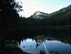
|
Coming
from the
South
Highway 50
to
Highway 89
South Lake Tahoe
North on 89
The Meeks Bay Trailhead sits 16.2 miles North of Highway 89's junction with Highway 50 at the "Tahoe Y" in South Lake Tahoe.
No backpacker rest, resupply, or repair resources are available at Meeks Bay, so make sure you have everything you need before you depart South Lake Tahoe.
Highway 50, the old route of the Lincoln Highway and the Pony Express before that, is the main road from San Francisco into South Lake Tahoe.
Highway 80 connects North Lake Tahoe with the world through 4 lanes of divided highway.
Highway 50, on the other hand, is a two lane undivided road connecting The Valley and the Bay Area to South Lake Tahoe over Echo Summit. |
| |
Landmarks
around the
Meeks Bay Trailhead
Navigating
this
Trail Guide's
Assets
PAGE AND TOPIC
INTERLINKAGE
Each trail guide pages is linked to the pages North and South down Tahoe to Yosemite, Pacific Crest, and John Muir Trails.
Every trail guide page is deeply interlinked with the related miles and elevations pages, and the detailed maps covering that specific area, and to the area/region maps presenting broad context.
Each page links
to the indexes for all the miles and maps for that section of trail, and
the rest of the guide.
MAP LINKS
The red dots marked on all the maps link to that location's entry on the trail guide.
The black dots on the 30 minute maps link to the detailed 15 minute map for
that segment of trail.
MILES AND ELEVATIONS
Each of the locations cited on the miles and elevations pages link to
that location's entry
in the trail guide.
WEBS OF INTERLINKED INFORMATION
All map, miles, and trail guide pages are linked within their sequence of pages running
North and South, and to that section's index.
Each segment of trail is covered by a series of video observations.
RAPID PERUSAL
This indexed sequence of maps, miles, and trail guide pages allow us to run North and South through the trail guide's information rapidly from Tahoe to Whitney. This organization offers a good balance between quick access to deep detail about specific trail locations and the ability to quickly more North and South through the guide.
As we inspect the trails to the South the Maps and Miles indexes allow us to easily review the key overall information about each section of the trails as well as inspect specific locations on the guide pages while quickly moving from trail section to section and key point to key point down the trail.
Employ these features on the 15 minute map covering the Meeks Bay Trailhead, the 30 minute Desolation Wilderness Map, and the Meeks Bay to Echo Summit Miles and Elevations pages:
Meeks Bay to Echo Summit
Backpacking Miles and Elevations
THE POINT
We can move quickly from section to section of the trails
across
different types of interrelated information:
Context and Understanding.
top of page |
Local or Long Distance Backpacking
Meeks Bay
Short Trips
Meeks Bay is more than just the trail head for the Classic Tahoe to Yosemite backpacking trip.
It stands on its own as a excellent trailhead into the remarkable beauties of the Desolation Wilderness.
Meeks Bay is an excellent trail head for short day hikes and short backpacking trips and loops into Desolation Wilderness.
It is also the Northernmost Desolation Wilderness Trailhead.
An excellent longer trip option from Meeks Bay would carry us through the 30.71 mile length of the Heart of the Desolation Wilderness from its North end down and out of its Southern end via Lower Echo Lake.
Check out the Desolation Wilderness miles & elevations page for more information on hiking this beautiful section of the Tahoe to Yosemite Trail across the heart of the Desolation Wilderness.
Wrap your route around the heart of the Desolation Wilderness.
Along Highway 89 between Meeks Bay and Lower Echo Lake are a series of trailheads along the West Shore of Lake Tahoe, all pointing trails West onto the main Tahoe to Yosemite-Pacific Crest Trail route across the Heart of Desolation Wilderness.
We can use this series of trailheads to craft short to medium distance hiking and backpacking loops around the North, Central, and Southern Desolation Wilderness.
Check out the full list of maps covering the trails from Meeks Bay to Echo Lake for more ideas for trips, as well as a clear view of the main trails across Desolation Wilderness. |
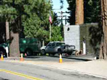 The National Forest Fire Station 75 yards North of the Meeks Bay Trailhead. The National Forest Fire Station 75 yards North of the Meeks Bay Trailhead.
|
Tahoe to Yosemite Trail
What Lays Ahead
We will join with the already unified routes of the Pacific Crest and the Tahoe Rim Trails 11.5 miles South of Meeks Bay just a bit North of the Velma Lakes.
From that point all three of these trails run South together across the length of the Desolation Wilderness to cross Highway 50 together into the Meiss Country Roadless Area.
At Meiss Cabin the Tahoe Rim Trail turns Northeast get itself onto the Carson Range wrapping around Lake Tahoe's Eastern Shore, while the Pacific Crest and Tahoe to Yosemite Trails continue South to exit the Tahoe Basin through the Carson Gap.
At the Carson Gap we find the first chance of three to break off the Pacific Crest Trail onto the Western Flank route of the Tahoe to Yosemite.
We can either follow the Pacific Crest Trail to the Southeast, or the Tahoe to
Yosemite Trail to the Southwest.
It is notable that significant segments of the TYT are unmaintained across the heart of the Mokelumne Wilderness, and hiking out the South end of the Carson Iceberg Wilderness.
Trail Ratings
2016 Update:
The route South of the North Fork of the Stanislaus River has degraded into unmaintained status as of 2016.
Updates and Reports
Read-Report
Unmaintained Trails Updates
Mokelumne Wilderness
Carson Iceberg Wilderness
Discussion on Routes
Route Discussion II,
Comments |
What to look for
The Meeks Bay Trail head into Desolation Wilderness
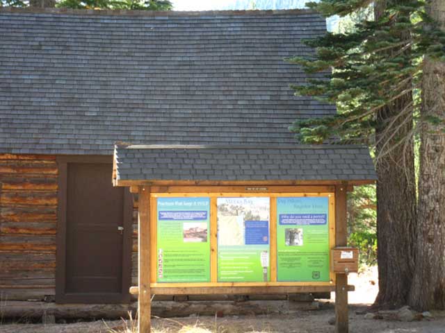 |
The Meek Bay trail head is to the right of the Seasonal permit cabin and the information board.
The exact address on a tree in front of the trailhead along Highway 89 is "498 Log Cabin Road." I figure this is the address of the house just yards North of the trailhead. |
Meeks Bay Trail Head
Desolation Wilderness (permit info) is one of the most popular Wilderness areas in the United States, if not currently the most popular. It attracts more visitors than Yosemite most years.
Thus obtaining permits early is very important. If you show up at the seasonal permit cabin on a mid-Summer weekend, the chances are you will be in a line waiting to not get the permit you desire.
Permit reservations start six months before the desired hiking date.
Check out the Backpacking Calendar to keep track of advanced reservation dates.
Desolation has strict restrictions on the number of permits issued, and of visitors in its various "zones."
Therefore it is important that you use this link to the Lake Tahoe Basin Management Unit so that you can get all the information necessary to easily reserve your Desolation Wilderness backpacking permits long before your trip date.
How I get TYT Long Distance permits.
top of page |
 498 Log Cabin Road marks the location of the Meeks Bay Trail Head 498 Log Cabin Road marks the location of the Meeks Bay Trail Head |
Tahoe to Yosemite Trail Permits
Permits for the Tahoe to Yosemite Trail are obtained from the
Lake Tahoe Basin Management Unit.
It should be no problem getting a permit for the Tahoe to Yosemite Trail.
Sandy_Nevada, a killer backpacking friend of mine in Nevada City, researched the issue in February of 2011 for an upcoming movie she is planning about hiking the Tahoe to Yosemite Trail.
Sandy was told by the LTBMU that they issue less than 10 Tahoe to Yosemite permits a season.
Cool! Thanks Sandy!
Though there were not a lot of permits for the whole thing, I know that a lot of hikers are hiking sections of the TYT every year.
But, many segments along the TYT are very quiet trails.
Restrictions getting into Desolation caused by too many backpackers may delay the start of your Tahoe to Yosemite hike at the trailhead if you do not reserve your Tahoe to Yosemite Trail permit early. |
Meeks Bay Trailhead
Location
The Meeks Bay Trailhead is the Northernmost trailhead into the Desolation Wilderness.
Meeks Bay is located on the Western Shore of Lake Tahoe along Highway 89 close to the Northern boundary of the Desolation Wilderness.
Meeks Bay trailhead is about halfway between Tahoe City and Highway 50 at South Lake Tahoe.
See the
Big regional topo map
(run your cursor along the trail route and click for underlying detailed hiking maps)
The Desolation Trail follows the blocked off Road 14n42 out of the Meeks Bay trail head to the first trail junction. |
Topographic Hiking Maps
Desolation Wilderness
Topo Hiking Map
top of page comments |
Video
Find the Meeks Bay trail head
Video above: Meeks Bay trail head into Desolation Wilderness, Wednesday, September 16, '09. Duration 2:21.
The
Lake Tahoe to Yosemite Trail
more on the
Tahoe to Yosemite Trail
The Meeks Bay trailhead is the start point in the Northern end of Desolation Wilderness on the West Shore of Lake Tahoe for the classic 184 mile Lake Tahoe to Yosemite Trail route described in Thomas Winnett's 1970 book of the same name.
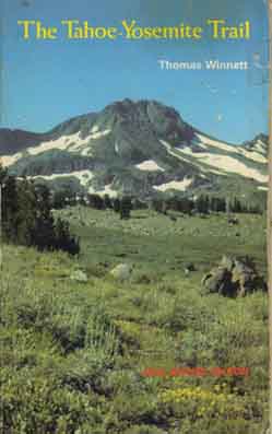 |
This Guide updates the status of the
Tahoe to Yosemite Trail.
Winnett scouted and assembled trails into the
Tahoe to Yosemite Trail
Though describing a great route through the Sierras, the real gift of this book is that it continues to stimulate backpackers to explore the many alternative routes to the main Pacific Crest Trail route that bisects the Sierras. |
I believe that the Tahoe-Yosemite Trail is as challenging a route today as when it was
designed and introduced by Thomas Winnett in 1970.
The reason is the continual degradation of the unmaintained segments of the trail. The Tahoe-Yosemite trail's unmaintained section of trail between its junction with Summit City Creek to Camp Irene on the North Fork of the Mokelumne River underwent extensive flood damage in 1998. This left parts of the route in very degraded condition, much more than what would be expected from "normal" deterioration of the unmaintained segments of trail.
Southern Unmaintained Section
As of July 2009 even the "maintained" segment of trail South from the Summit City Creek trail junction (below 4th of July Lake) down to Horse Canyon had fallen into very unmaintained status. This part of the trail from the junction to Horse Canyon is cited as being maintained on the maps, but had fallen into unmaintained status, and deteriorated significantly.
The traditionally unmaintained trail South to Camp Irene from the Horse Canyon trail junction was and had been unmaintained for
many, many years, with fallen trees and moderate obstacles.
Traditionally there has been a decent but subtle trail bed to follow that is almost, but not quite continuous from Summit City Canyon to the top of Mount Reba, if your observation and route finding skills are fairly developed, and you can stay on it.
Where the real fun begins depends on your skill level. Technically, the unmaintained route begins at Horse Canyon and ends at Camp Irene. Unmaintained segments of trail can reach from the Summit City Canyon junction below Fourth of July Lake all the way South to the top of Mount Reba.
After climbing out of the lower ford of Summit City Creek we will come to the untracked and untrailed portion of our route through what I call "The Enchanted Forest." There is no trail through this delightful little segment of trail. I consider all these challenging segments of Tahoe to Yosemite Trail to be quite enjoyable. This is hard, but amazing fun.
There is no finding like route finding.
The Expected and The Unexpected
Unexpected stretches of faint trails can pop up along the TYT route even South of Camp Irene, while climbing Mount Reba, and even hiking further South of Lake Alpine we encountered some thin trails on the way to Spicer Meadow Reservoir.
The trails South of Camp Irene are supposed to be maintained all the way down to our next unmaintained segment of trail at the top of the Clarks Fork. But they may not be. We may find faint segments of trail in unexpected places.
Unmaintained Trail Updates
Therefore we have created Forums dedicated to covering the changing challenges along these Unmaintained segments of the TYT through the Mokelumne and Carson Iceberg Wilderness Areas. All's I ask is that you contribute your experiences after using them. Add to our evolving understanding of these evolving routes.
Southern Unmaintained Section
Clarks Fork of the Stanislaus over Saint Marys Pass
The most challenging segment of the Tahoe to Yosemite Trail is the difficult climb up the unmaintained segment of trail from the Eureka Valley trail junction along the Clarks Fork of the Stanislaus River to the sweet overlook at the edge of Clarks Meadow, and the subsequent untrailed route up through Saint Mary's Pass.
From Clarks Meadow there is no trail bringing us up to and through the Clarks Fork Headwaters Bowl for the climb over Saint Marys Pass. There is a route.
This challenging segment of trail from the end of maintained trail to its resumption near
Saint Marys Pass requires good route-finding skills and fitness.
Very Interesting...
(While twirling moustache)
These interesting sections of the Tahoe to Yosemite trail should not disqualify Meeks Bay as the start point for your backpacking trip to Mount Whitney, independent of if you swing through the unmaintained segments of the Tahoe-Yosemite Trail, remain on the Pacific Crest Trail, or craft your own unique route across the Northern Sierras to Yosemite. All are possible.
Follow along with me down both the PCT and the TYT to Yosemite on the trail guide below, then you can decide for yourself which route, or combination of routes are best suited for your current skills and fitness levels.
Meeks Bay Trailhead
There are two distinct advantages to starting our backpacking trip out of
Meeks Bay into Desolation Wilderness that are striking.
First, Meeks Bay offers a gently rising entry into High Sierra backpacking over a gentle four mile rise in elevation to the first set of lakes, along which we can experience a fairly gentle acclimation. The two subsequent mountain passes and subsequent long descent across the Southern Desolation Wilderness make our start out of Meeks Bay a moderate introduction and fairly gentle transition to continuous high altitude backpacking.
A Definition of Wisdom
Taking a fairly gentle entry into the rigors of long distance high altitude backpacking reduces the shock put on our body of being draped with a heavy backpack with a metabolism unaccustomed to altitude, while hiking uphill. This fairly gentle transition to the rigors of the trail moderates the strains and pains of the first few days of our trip.
A Definition of Beauty
The Second Advantage to Meeks Bay is that it starts our trip into the North end of Desolation Wilderness, a most beautiful place, despite the heavy overuse its beauty and popularity have drawn to itself, as we will see over the next pages of the trail guide.
more on the
Tahoe Yosemite trail
2015 UPDATE
The TYT route South from the Summit City Canyon trail junction down to the Horse Canyon trail junction has been maintained and opened up. Some small bit of work has been done South of Horse Canyon to to the Upper Ford.
We have seen a Period of Growing Unmaintained Trail give way to an Era of Maintenance and Attention.
Summit City Canyon Trail Guide
Unmaintained Trail Updates
more on finding
Meeks Bay
top of page comments |
next page
The Meeks Bay Trailhead #2:
Meeks Bay Resources
back to Section One trails index
Discussion
Desolation Trail in Desolation Wilderness |
Hiking
The Tahoe to Yosemite Trail
out of
Meeks Bay
First Steps
The trailhead at Meeks Bay begins our backpacking trip onto the Desolation Trail, which follows an old sandy dirt road up the North side of a wide meadow flanked by ridge arms reaching down towards Lake Tahoe for a fairly flat and sandy mile and a third hiking West up to the Desolation Trail Junction.
Arriving at this well-marked junction we bend right towards the Desolation Wilderness Boundary.
The trail surface following the road to the trail junction is sandy, adding a degree of difficulty to this exposed section of trail along a sloppy forest-fringe meadow interface, before we enter the forest.
The terrain tilts very slightly upward to the first trail junction from the trailhead. The angle of climb increases from this first junction from road to trail.
The Terrain
The ecology is a meadow-side forest fringe, composed of invading Lodgepole Pine. The trail skirts the North side of the meadow along its diffuse interface with the base of the forested ridge arm. Though parts of the trail are shaded by the forest, the road to the first junction is neither forest or meadow, but runs along the boundary between the two.
We're exposed to the Sun until we enter the forest beyond this upcoming first trail junction.
The Subjectivity of Pain and Pleasure
The difficulty level is Easy, though this rating is subjectively dependent on your pack weight, your level of conditioning, and how you respond to your first day of hiking. The first day can be tough, combining a heavy pack with rising elevation and thin air.
Pack weight
Pack weight can vary widely, depending on the length of our trip and our resupply plans. For long-distance backpackers heading towards Yosemite or Mount Whitney, this bit of "Easy" trail can can be extremely difficult, depending on what combination of stops we are planning to use for resupply. Our pack could be real heavy or real light.
The less resupply stops we plan on making, the heavier our starting pack weight, and the harder our objective and subjective experience will be.
The Tradeoff
Pack weight is vital while hiking. A heavy pack hurts. Each thing that is weighing down our packs becomes vital in its own turn. Food is vital at mealtimes, our tent when it is raining or the mosquitoes are thick, and proper insulation when it gets cold.
The comforts of a light pack on the trail do not make up for missing food or gear when
we need them each in their turn.
Balance Point
Thus we should avoid carrying unnecessary or overly-heavy gear as assiduously as we strive to bring all the gear necessary to safely cross the terrain and weather we could potentially encounter.
Not too much, nor too little. "Just perfect" gear is our goal, with just a little bit extra food and insulation to provide a
safety margin for cold and hungry nights.
Resupply Recap
Our resupply options hiking down the Tahoe to Yosemite Trail are Echo Chalet, Lake Alpine and Kennedy Meadows. We also have the option of "none of the above," and packing a full load to carry our whole food supply all the way down to Tuolumne Meadows, Yosemite.
That makes for a tough start even on this easy opening trail.
On Sept. 15, '09 I started towards Yosemite with a 75 lb+ pack containing 37 lbs of food, enough food that I did not resupply between Lake Tahoe and Tuolumne Meadows. I did pass through Lake Alpine/Bear Valley and Kennedy Meadows, and I ate like a pig at each, but I did not resupply!
The heavy initial pack made me thankful that the Meeks Bay trailhead, the Desolation Trail, and much of the Desolation Wilderness are of Easy to Moderate degrees of difficulty.
next page
The Meeks Bay trailhead #2
Trailhead Resources
Miles and Elevations
comments top of page |
Backpacker Forums
Have a great Sierra Nevada trip or story to relate?
A fine piece of gear? Or gear that failed?
Post it on
TahoetoWhitney.Org
The Backpacker's Forum.
Above we link to the Front Page of the High Backpacking Trails and Topics Forums. Below we break the forums down into categories:
Anyone can post text comments in the existing forums, but only members can post up new topics, along with images, maps, and formatting.
Become a Member
If you have experiences, comments, questions, trip reports, trail conditions updates or pictures and videos of the Tahoe to Yosemite/Pacific Crest Trail from Meeks Bay to Echo Summit, post up here as an unknown hiker or as a member:
|
next page
The Meeks Bay trailhead
#2:
Local Resources
Need the personal touch?
I'm always happy to correspond with you!
Contact
Alex Wierbinski
top of page
|