The Trails
Guide
Maps
Miles/Ele
Permits
Resupply
Forum
Current Weather Conditions
Weather Notes
Northern High Sierras
Central High Sierras
Southern High Sierras
Gear
Gear List
Gettin Started
Layering
Discussion
Testing yourself and your gear
Gear Reviews
Backpacking
Kennedy Meadows Pack Station
to
Relief Reservoir Campsites
Backpacking Emigrant Wilderness
Hiking
Tahoe to Yosemite Trail South
Backpacking
Emigrant Wilderness from Kennedy Meadows to Tuolumne Meadows
Languages
Languages
Trail Arts
The art of walking
Physical Preperation
Trail Skills
The trail
Off the trail
Scrambling
Maps
Navigation
Camp skills
Food
Resupply
Food
Other
Photo Catagories
Trail Stories
Trail Culture
News and Science
Links
Groups
Books
Terms and Conditions of Use
Trail Guide |
Guide |
Guide |
7.5 Topo |
30 min 108 to Bensen Lake |
Kennedy |
TOPO |
Resupply South |
National Forest PERMITS Toiyabe & Stanislaus |
all maps index |
Kennedy Meadows Pack Station
Hiking South
on the
Tahoe to Yosemite Trail
Kennedy Meadows Pack Station
Resupply and Backpacker Resources
Information
Kennedy Meadows Pack Station
The Longest Street-Crossing Offset Continuing South on the TYT takes more that a simple walk across Highway 108 from the Saint Marys Pass Trailhead, as does the PCT across Sonora Pass. Do it My Way KM In addition to being a vital stop on our Tahoe to Yosemite Trail route South, Kennedy Meadows Pack Station (full TW webpage) is one of the four best trailheads for short and long backpacking trips South into the highest elevation sections of the Emigrant Wilderness. Schematic Trail Map of Emigrant Wilderness (below) Great Utility Tie it All Up
Backpacking Sonora Pass has no services. Kennedy Meadows has excellent services. Effective and Enjoyable
Our previous challenges along the Tahoe to Yosemite Trail have been both physical and navigational. Our navigational skills will no longer be required following the TYT out of Kennedy Meadows Pack Station. Our challenge now shifts more to strength and endurance over this long and very physically demanding section of trail. The North Yosemite Backcountry is legendary for its degree of difficulty combined with length. Our TYT route intersects with the PCT coming South from Sonora Pass just inside Yosemites' far Northwestern corner. These two trails, along with the web of trails covering the High Emigrant Basin between them, allows us to craft many, many excellent long and short backpacking loops around Emigrant Wilderness. We can put ourselves pretty far "out there" in the Emigrant Wilderness. Local Loops As we hike South along the Tahoe to Yosemite Trail we observe a web of trails conducive to local loops and trailhead to trailhead hikes are laid out on our route across the high elevation section of the Emigrant Wilderness. These are the Kennedy Canyon (guide) and Grizzly Peak (guide) trail junctions. Adjust your boots and secure your food, 'cause we're going to rock the Emigrant Wilderness. I mean walk the Emigrant Wilderness. If you believe that walk'n is rock'n we are going to have a real good time together. Studio of the Mind Music draws the ears, then the mind, and finally the soul far out of the fullness and bounty of Nature's own Reality, and ITS Soundtrack. (Jeeze. No GPS. No headphones. No fires. Is this guy crazy?) Nope, just not within, "The Cone of Stupid." Accurate Observers have all senses engaged. Our ears listen to the music of the gods, AKA, "Nature's Soundtrack," to the beat of our own two feet. Trip Options The following trail guide pages (INDEX) , the information on the associated maps (INDEX) , miles and elevation pages are all designed to reveal our short, medium, and long distance hiking options in and around and around Emigrant Wilderness as well as exploring the classic Tahoe to Yosemite and Pacific Crest Trail routes across their slices of the Emigrant Wilderness. Love Me Two Times This plan works very well to get a good look at the web of trails interconnecting the Emigrant Wilderness. Then we can follow-up by putting together endless combinations of short, medium, & very long distance backpacking trips staying within the exceptional beauty of Emigrant Wilderness. We will touch the Northern corner of Yosemite and a sliver of the Toiyabe, but we will remain predominantly within the Emigrant Wilderness. These long trips around the high elevation areas of Emigrant Wilderness are well-made by tying together the lengths of these two classic trails into unique configurations exploring Emigrant Wilderness. Every now and then we will end these Emigrant Wilderness trips through Yosemite by hiking South to Tuolumne Meadows or Hetch Hetchy. Other times we will end our hikes through Leavitt Meadow on the Eastern Flank of the Sierra, when we don't bend our route into a loop back to Kennedy Meadows Pack Station or over Leavitt Peak to Sonora Pass. We have lots of beautiful hiking options in the Emigrant Wilderness. 2016 Trails and Trail Culture Review: The Other Way The roughly parallel routes of the diverging Northbound TYT and PCT tracking North into the Carson Iceberg Wilderness are also tied together by a series of longer and longer trails linking them across their expanding divergence. These "connector trails" in the Carson Iceberg Wilderness are shaped more like a "ladder," than the "web" design of trails across Emigrant Wilderness. Nonetheless, this "ladder" of rungs connecting the TYT & PCT across the Carson Iceberg Wilderness opens up scads of short and medium distance backpacking loop trips out of the Saint Marys Pass Trailhead or the series of trailheads along the Clarks Fork Road. What did you Say? What did you See? Your experiences here are important. Your input enriches the trail guide, independent of if you provide trail reports, add some random contemporary or historical information, and especially your questions, updates, and experiences. Add your two-cents worth about your participation in, or curiosity about, the Emigrant Wilderness Experience to the |
Kennedy Meadows Turnoff
from
Highway 108
 |
Kennedy Meadows Pack Station turnoff from Highway 108. The location of the Kennedy Meadows turnoff is seven miles East of Clarks Fork Road (sign-resupply page) and nine miles West of Sonora Pass. The roadmap below pinpoints the locations of all these local landmarks. |
North Sierra Highway Access
to
Tahoe to Yosemite and Pacific Crest Trails
This Page
Kennedy Meadows Pack Station |
||||||||||||||||||||||||||||||||||||||||
| 2.46 Hard Hot miles Climbing 720 feet from the KM Gate up to Kennedy Lake Trail Junction |
2.96 Hard Hot miles Climbing 880 feet from the KM Gate up to OVERLOOK Relief Reservoir |
4.03 miles Climbing 826 feet from the KM Gate to the Fine Campsites on Southeast shore of Relief Reservoir |
TYT
Miles & Elevations
Down the Trail
| 5.37 miles Climbing 1320 feet from the KM Gate to the Trail Junction off the Southeast shore of Relief Reservoir |
| 8.23 miles Climbing 2400 feet from the KM Gate to Sheep Camp |
10.92 miles Climbing 3360 feet from the KM Gate to Brown Bear Pass |
| 16.04 miles from the KM Gate to Bond Pass |
72.43 miles from the KM Gate to Tuolumne Meadows on the Tahoe to Yosemite Trail |
Trail MAP Miles and Elevations Road MAP
Hiking South Highway 108 down the "paved" road driving (?) to Kennedy Meadows Pack Station gate: 1 mile. The gate on the South end of KM walking (!) down the dirt road to the actual federal trailhead: 1 mile. Kennedy Meadows Pack Station gate hiking South on the TYT to the Trail junction on the SE side of Relief Reservoir: 5.37 miles. ZERO POINT The first trail junction along our hike to Relief Reservoir leads East to Kennedy Lake and the PCT beyond. Scope Hiking North The Northbound Tahoe to Yosemite Trail is located nine miles East of Kennedy Meadows along Highway 108 on the West flank of the Sierra just below Sonora Pass. The TYT continues North through the Saint Marys Pass Trailhead. |
Backpacking Kennedy Meadows Index |
||||||||||||||||||||||
Kennedy Meadows Introduction Kennedy Meadows
Kennedy Meadows to Relief Reservoir: INDEX
3 TRAILHEADS
Kennedy Meadows Pack Station
Camping at KM
Video Intro
Video I
Video II
Related Video
Trailhead II
Kennedy Meadows Water District
Into the Southern Kennedy Meadows
Local Color
2010 -2012
Upper Kennedy Meadow
OFFICIAL TRAILHEAD Kennedy Meadows National Forest Trailhead
Sandy Trail up to Wilderness/Bridge
Emigrant Wilderness
Kennedy Creek
Trail through Carved Rock
Kennedy Creek
Video
Upper Footbridge
Two Routes above |
Emigrant Wilderness Weather Below find
Satellite and Radar Imagery
Check
All
All
|
Summit Creek
PGE
TRAIL JUNCTION Kennedy Lake
PGE Relief Reservoir Tender's Cabin
Backpackers at Kennedy Lake
View into beginning of Middle Fork
Stanislaus NF CCC Backcountry Trail Crew
TRAIL JUNCTION
Video
TRAIL
FORDING
Upper Grouse Creek Ford along TYT
TRAIL JUNCTION
Main Upper Relief Reservoir Campsite
Overview of Relief Reservoir Campsites
Back to the Tahoe to Yosemite Trail
|
||||||||||||||||||||
| > Forum < | ||||||||||||||||||||||
Trails Forum
for our
Comments & Questions
EXPERIENCE
Input-Output
All backpackers can post text comments about the section covered by this guide page below through the comments links on this, and all the trail guide pages.
Registered Members can post up text, images, maps and videos in the Trails Forum that supplements and updates this page's coverage of Jack Main Canyon.
Check out the Tahoe to Whitney .org
Backpacking Trails and Topics
FORUMS
| Driving to Sonora Pass-Clarks Fork Road |
Kennedy Meadows and Relief Reservoir |
 |
The signs marking the location of the parking lot for the Kennedy Meadows Trailhead across from Deadman Campground. These signs say the trailhead is located near Highway 108. OK, but... |
 |
Kennedy Meadows Kennedy Meadows Trailheads? You could say there are three Kennedy Meadows trail heads. This causes some confusion. Let's clarify the situation. A very short ways South down the old paved road to Kennedy Meadows Pack Station off Highway 108 we see the signs pictured above pointing to our Left to the first Kennedy Meadow Trailhead and Trailhead Parking. Though this location is signed as the Kennedy Meadow trail head, this is not the location of the Kennedy Meadows Trailhead. This is the free parking for the next two trailheads further down the road. Let's head down the road to Kennedy Meadows Pack Station to check out the second trail head. Driving about three eights of a mile from the first signed trailhead parking (above) down to the South end of Kennedy Meadows Pack Station we find the second trail head, consisting of the stock gate across the dirt road continuing South into Kennedy Meadows proper past the pack station. Here auto traffic ends, except for PGE workers. This is the second trailhead. The actual official Federal Kennedy Meadow Trail head is another mile' walk past the gate down this dirt road through the series of Kennedy Meadows to their far South end where the actual National Forest Trailhead into the Emigrant Wilderness is located. In total the actual Kennedy Meadow Trailhead is a mile and three eighths South of the location of the trailhead parking up near Highway 108 across from the Deadman Campground. What? The marked trailhead and parking is the first of three Kennedy Meadows trail heads. The second trailhead is the Southern gate at the pack station, where we begin hiking, and the third and final trailhead is the actual trailhead at the South end of the southernmost of the series of Kennedy Meadows a mile beyond the stock gate. PG & E own the land from the stock gate to the trailhead as we will see on our hike South. The Effective Trailhead Does this make sense now? To recap, the location across from Deadman Campground is the parking lot for the Kennedy Meadow Trail head, though the official trailhead is actually a mile and 3/8ths to the South of the trail head parking. Drop Your Load If you have a group of backpackers bring them and their packs down to the parking lot by the stock gate at the South end of Kennedy Meadows Pack Station before driving your car back to park at the "trailhead" parking lot across from Deadman Campground. Then walk down to Kennedy Meadow's gate where you dropped your people and pack. Kennedy Meadows Position Kennedy Meadows Pack Station offers excellent access to the high elevation portions of Emigrant Wilderness for short and medium distance backpackers as well as long hikers. TYT This section of the Tahoe to Yosemite Trail hikes a segment of trail along the Sierra Crest where the Pacific Crest Trail detours around the Sierra Crest. TYT + PCT Their sole remaining divergence is the TYT's short loop around Tilden Lake where the PCT swings around Wilmer Lake. Big Loops Great Backpacking loops around the Emigrant Wilderness of various distances can be started from Kennedy Meadows hiking South on the TYT. We can control the length of our loop by turning our route back to Kennedy Meadows through trail junctions situated at various distances South of Kennedy Meadows. Bond Pass is our furthest turnaround point. Check out the maps and following trail guide pages for more information. Looking for the best Emigrant Wilderness Backpacking trip ideas?
We can also begin and end great Emigrant Wilderness backpacking loops from Sonora Pass, Leavitt Lake, and Leavitt Meadow that circle around to Kennedy Meadows Pack Station, and visa-versa. Emigrant WildernessFurther Down the Western Flank Articles
|
The The video below runs us quickly through Kennedy Meadows Pack Station. For more on the location and about the resources at Kennedy Meadows Pack Station and Resort see the |
An introduction to, and a brief tour of Kennedy Meadows Pack Station. 2:31 I love this place... Emigrant Wilderness Backpacking Videos
|
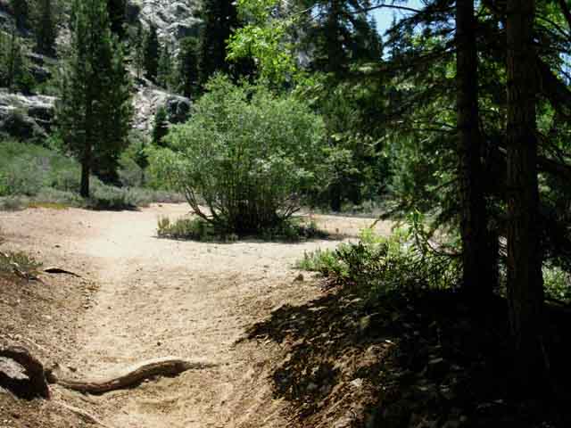
South From the stock gate at the South side of Kennedy Meadows Pack Station we follow a dirt road for about a mile South over a low hill and around to the East side of the Southernmost of the series of riverside meadows composing Kennedy Meadows. This mile long dirt road separate the stock gate on the South side of Kennedy Meadows Pack Station from the actual Kennedy Meadows Trailhead at the far South end of this extended set of meadows. Parking for the trailhead is 3/8 of a mile North up the paved road towards Highway 108 from this stock gate at Kennedy Meadows Pack Station. The trailhead parking is located across from the Deadman Campground. Check the map for the location of the free trailhead parking near the Deadman Campground. You cannot park at the pack station. Well, you can park at the pack station but it will cost you. It's easier and cheaper to park at the free trailhead parking down by Deadman Campground. Procedure |
Tahoe to Yosemite Trail
South
The Gate on the South Side of Kennedy Meadows Pack Station and Resort
 |
|||
| Tahoe to Yosemite Trail Southbound through the gate at Kennedy Meadows Pack Station. This is the end of the line for auto traffic.
2016 The position of gate has been moved about a hundred yards North, towards our position, from the location pictured above. The hinge end of the gate has been attached to the end of the low wall dividing the mule-loading and rider mounting area, to our Left, from the parking area behind us. This change has no substantial effect on the route of the TYT. It has given horse and mule traffic a gate between them and the parking lot. It's different than it was in 2015. |
Kennedy Meadows Pack Station Resupply Spot Kennedy Meadow Pack Station Resupply Resupply Strategy Timing The common problem I see confronting PCT and TYT hikers is how to fit a resupply stop into our hiking plans. This really comes down to what you want from your resupply spot. Are you doing a "Hit and Run," stopping for only enough time to stuff new food into the pack and hit the trail? Or are you planning on a day(s) of rest and recovery? How your body feels, how drained or properly maintained you feel, should be the concern guiding how you use each of your resupply stops. How you feelin'? My I'm looking to pick up my resupply, recharge myself with plenty of good food, rest for one full day, and hang out with the cowboys, horsepackers, locals and whatever hikers are hanging around. And horsemen and fisherfolk and hunters and tourists, and so on... Approach and Exit For every type of resupply stop finding the best approach to the resupply spot for your purpose is very important. This issue generally resolves itself into three simple questions: where to camp before, during, and when departing the resupply spot. Campsite selection approaching your resupply determines when you arrive at your resupply spot, and your campsite after you leave determine exactly when you must depart your resupply "vacation" to get there before dark. I've already decided I'm going to spend two nights at Kennedy Meadows. The real question is, "what are the best places to stage up to easily get off and then back on the trail?" Where we stage up before and after our resupply determines how efficient our resupply stop is and if it keeps us on our schedule while recharging and restoring our packs, our minds, and our bodies. I want all three topped-off with one simple resupply... PCT Solution We can get closer to Sonora Pass than Hunter's Camp on the North side of Sonora Pass, but I will not camp near Wolf Creek Lake until late in the Summer when it has dried out completely. Mosquitoes. Many, many mosquitoes. Hunters Camp is a superior campsite in every respect. If you can find it... There is not a better location than Latopie Lake for staging up a Northbound hiker resupplying out of Kennedy Meadows. Being 3.07 miles North of Sonora Pass allows us to sleep in and still hike to Sonora Pass early enough to pick up the first "traffic" with the coming of the first light of day. TYT I very well may set up an additional campsite in the upper bowl above Clarks Meadow to support some extended local explorations. I had a hot time the last time I set up camp in the uppermost part of the headwaters bowl. TYT Considerations Kennedy Meadows Backpacker Resources If you work hard to push up to Sonora Pass late in the evening to catch a ride down to Kennedy Meadows you may have wasted some of your time and energy. The sparse traffic on Highway 108 ends quickly at dark and does not even begin to hit 3 cars an hour until after 8 am, though I wake up at first light. And there is no water at Sonora Pass. Rushing around to reach Sonora Pass may well slow you down. Therefore we should carefully time our arrival at Highway 108, be we hiking North or South on either the TYT or PCT, to coincide with the beginning of daily traffic and the opening times of the restaurant and store at Kennedy Meadows. That's always the logic of my plan: spending the least energy for the most experience. Staging for resupply is not as much of a problem for Southbound hikers on the Tahoe to Yosemite Trail. The TYT route passes by Kennedy Meadows' front door, and unlike Sonora Pass, the Saint Marys Pass trailhead on Highway 108 has a nearby creek, which allows Southbound TYT hikers to camp there. There are water sources and legal campsites about a half-mile West down Highway 108 from Sonora Pass. There There My resupply plan is to get in easy, take it easy, and get out easy. Many hikers show up at resupply spots on the edge of civilization looking like a fish out of water. They hit the highway access after dark, after traffic has declined. If they get a ride down to Kennedy Meadows after dark, they generally arrive after the store and restaurant have closed. Then they worry about where to camp. A little pre-planning will smooth your entry and exit from all of your resupply spots. Most long-distance hikers have no idea about the camping policies and practices at the resupply spots or the availability and location of places backpackers seeking rest can camp. Trust me, there are free backpacker campsites near all the resupply spots. Not knowing the situation makes backpackers uncertain about how to proceed, which means our time at the resupply spot is not resting and recharging us as much as it should. Let's dispel that uncertainty with solid planning to make sure we get well-recharged at Kennedy Meadows Pack Station, and every resupply spot we visit. Kennedy Meadows Pack Station First thing the long-distance backpacker arriving at Kennedy Meadows Pack Station has to do, if you are kicking it, is to secure a quiet and restful campsite. I see four options for kicking back at Kennedy Meadows Pack Station. Matt has a bunkhouse in the main building where backpackers can rent a bunk. It's 35 bucks a bunk and the bunkhouse rooms hold five people. If you've got five hikers who all want to chip in you can rent one of the bunkhouse rooms for your group. If not, you will share with other long distance backpackers. Each bunk comes with use of the shower and laundry. Take a shower, do your laundry, eat a great meal, take a nap in a bed, and pet Matt's friendly damn mules. Matt also has cabins backpackers can rent, but they are mostly pre-reserved during the Summer season, and they sleep six... If you are planning a long hiking trip and you know when you will pass through Kennedy Meadows you can try to reserve a cabin for those dates. But it is hard to keep on schedule on the long trails and it is even harder to reserve a cabin at Kennedy Meadows during the high Summer vacation season. But if you are sure of your dates, and it's mid-week away from a major holiday, you may be able to reserve a cabin. Kennedy Meadow Pack Station Backpacker Resupply Page Pirates There are fine campsites a mile South down the TYT past the gate scattered all around the National Forest Kennedy Meadows Trailhead, but that's a bit too far away for me to camp at a resupply spot. These are perfect sites for camping the night after a long drive and before hitting the trail. I've also got a couple of secret self-stash places very close to Kennedy Meadows Pack Station, but hey, I've got to have a few secrets... (hint: log crossing...) If you are not a pain in the ass and you camp about near Kennedy Meadows nobody gripes... but if you trash the area or are disruptive you are out of there. The Party Line "There are campsites in the federal Deadman Campground 3/8ths of a mile North (All Highway 108 Federal Car Camping) Official Policy Not Happening If the beach does not look good, and the car campground sounds as bad to you as it does to me, then hike South towards the gate and look at the river making its ribbon-like bend on the South side of the Pack Station. You will see a rather large tree bridging this bend in the river. It will be swept away sometime in the future by a massive Spring thaw, but it's still there as of 2016. Hike down and cross the river on the tree. You are now in a kind of wasteland under dense forest created by the overflow of the river every Spring. Look around for a flat soft sandy spot you can shape-up into a place for your sleeping pad, and kick back. This is a no fire at all zone. Ok, you've made your camp, assured that your resupply bucket is in the store, and eaten a big meal. What now? Nap-time! Back to the campsite to watch the day pass by on its own as the shifting shadows of the sun through the forest mark the passage of time, to put the feet up, and to soak up experiences from a non-moving perspective. Our moving meditation has now become delightfully stationary. Locals work at Kennedy Meadows and at all the pack stations and other resupply points up and down the High Sierra Crest. They have local knowledge, as do the local trail crews. Striking up friendly conversations and picking their brains about the upcoming trails, terrain, and fishing is always a good idea. |
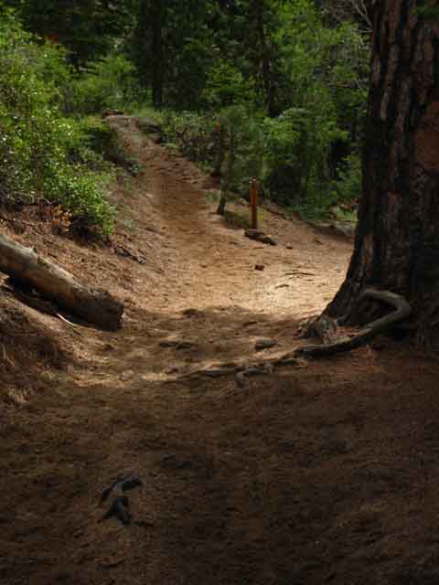
Time to Hike Kennedy Meadows Pack Station to the lowest Footbridge |
Kennedy Meadows Pack Station Gate to the Lower Bridge over Summit Creek. 1.30 miles rising 80 feet of elevation. Duration: 8:40 Videos
|
Through
the
Kennedy Meadows Gate
and
Up the Hill
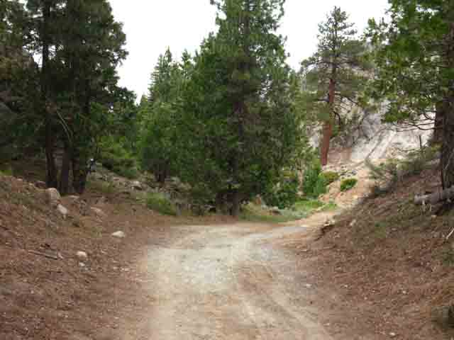 |
Passing South through the gate we climb a small hill before re-entering the continuing series of Kennedy Meadows, which end where the federal trailhead on the South end of Kennedy Meadows marks the beginning of Emigrant Wilderness. |
Private
Campsites on South End of Kennedy Meadows Pack Station
 |
|||
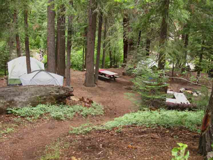
Above: As we hike South past the Kennedy Meadows Gate over the hill we look back over our Right shoulder, Northwest, to see the improved campsite on the South end of Kennedy Meadows Pack Station. As I stay two nights at Kennedy Meadows Pack Station I like to find a nice place to set up camp very unobtrusively. Kennedy Meadows does not have actual backpacker camping. The ladies in the office will tell you to hike down three-quarters of a mile to the Deadman Federal Campsite and pay 18 bucks a night to stay there. Nope. That is not a good option for me. I want to remain near Kennedy Meadow's excellent restaurant, store, bar, and folks. On the Beach There is another option. Walk South to and through the gate on the South side of Kennedy Meadows. Look off to your Right and you will see paths leading down to the fine improved campsite pictured above. If there is nobody in there, that's where I camp. I don't mess with the established camp there, just set up my own. If the folks who set up this site are there, I just hop on the big log across the Stanislaus here to set up in the chaos on the other side of the river. In recent years Matt's kid has been running a Summer Horse Camp for Kids. I think she is camping the horse camp there in the tent camping spot pictured above. If so, we will be limited to the sites on the beach or the sites across the log. Well, there are not any formal sites on the other side of the river due to seasonal flooding over there. But there are lots of places we can set up a little camp. So, our pirate camping options at Kennedy Meadows are on the beach, the improved site on the South end of Kennedy Meadows Pack Station, and various throwdown spots on the other side of the river across from the improved campsite. We also have very nice campsites a mile South of the Kennedy Meadows Gate at the federal trailhead on the far South end of Kennedy Meadows meadows, and the federal car camping sites to our North at the Deadman Campground mentioned above.
|
Kennedy Meadows Pack Station
Water Works
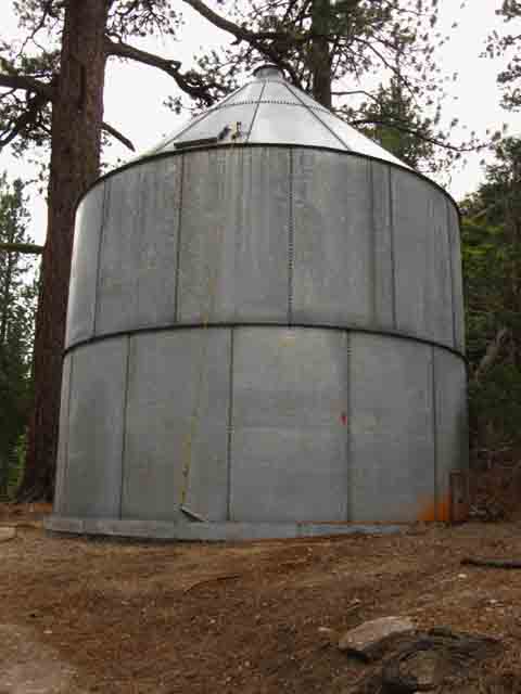 |
Kennedy Meadows Pack Station has its own infrastructure. Water, electricity, fire dept., and sewage are all independently maintained by and for the Pack Station. "About Kennedy Meadows" |
South over the Hill Down into Kennedy Meadows
 |
Dropping down the South side of the hill shortly brings us into the next of the series of Kennedy Meadows. |
View South
from the
North End of Kennedy Meadows
 |
|||
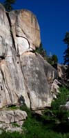
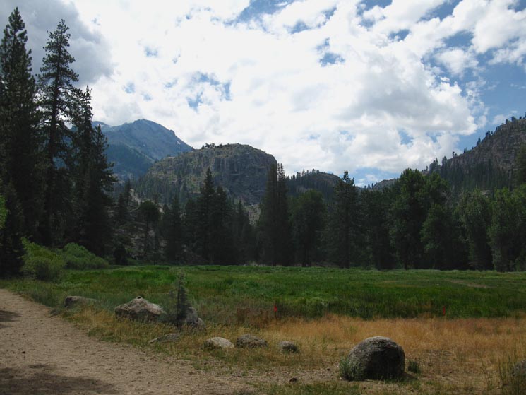
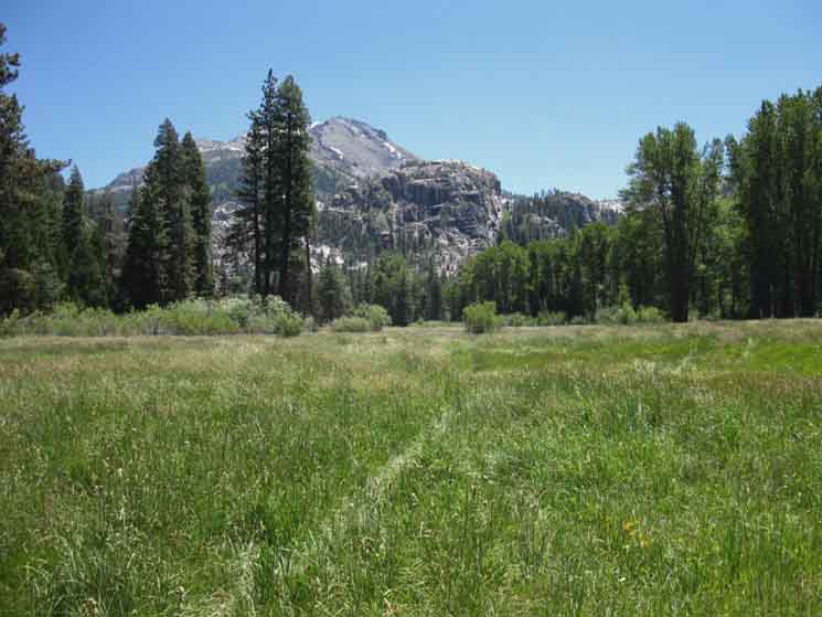
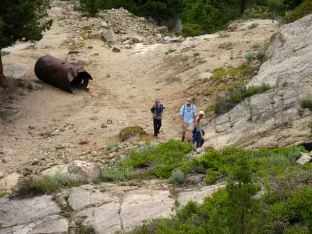
We've hiked South over the hill dividing the first and smallest of Kennedy Meadows where the pack station is located from the next upriver segment of Kennedy Meadows. The dirt road is twisting to our Left around to the East side of this segment of Kennedy Meadows to make its way to the trailhead and Emigrant Wilderness boundary by going around the edge of the meadow. Our third and final trailhead is located at the end of the third nub of Kennedy Meadows just beyond the trees on the far side of the meadow. Roads and trails always go the long way around areas flooded during Spring, typified by the trail around this segment of Kennedy Meadows in front of us. Here we get some good visual references for our upcoming route options. Peak 10530 beyond the South end of Kennedy Meadows Therefore we can "see" the basic outlines of our two potential routes up to the Sierra Crest from here. Closer to us we can also see a giant granite plug rising out of the middle-foreground of the image, just beyond the end of Kennedy Meadows. Past the upcoming Emigrant Wilderness Trailhead our route hikes up along Summit Creek into the canyon to the Left, or carved into a spiral wrapping up and around the Eastern base of that granite plug formation. That's where Summit Creek comes down the mountain, where Kennedy Creek comes out of its canyon from Kennedy Lake into Summit Creek, and around which we will follow the Tahoe to Yosemite Trail climbing towards either Kennedy Lake (junction below) or Relief Reservoir (below). We can see and visit both on the properly planned Emigrant Wilderness Backpacking loop. Emigrant Wilderness Schematic Trail Map The old trail route, the route indicated on the USGS map, passes to the Right of the big plug rock, between it and the smaller rock feature to the lower-Right of the plug. The old route is no longer maintained or used. Check out the map and notice the route I marked South of the trailhead is different from the old route marked on the map. Lots of Trout fishing (KM, stocked) going on along here. Check in at the Kennedy Meadows office for fishing reports, all you fisherfolk. I fish (and hunt) with my camera. Unless I'm hungry and desperate. Then it's on. I was real surprised how observable (forum) trout are. About 20 years ago I was quietly approaching a deep pool in the South Sierra. I mis-stepped and made a "thumping" sound, which alerted all the fish I was coming. But they did something unexpected. They all poked their heads out from their rocky lairs to see what made the sound, and I located them all, all at once. I understood then that trout are curious creatures, and I could use that curiosity to my observational advantage. "Ha! Gotcha fish cold," said I. I had never understood just how carefully trout observe activity out of the water until then. They mostly listen, tracking the "vibes," but trout also watch things that come close to the water. Since then I have been sneaking up to streams and pools, and if no fish are out "fishing" for insects I make that same odd, hollow thumping sound, (like a heavy mis-step) three times, to use the trout's own curiosity to draw them out. "What was that?" feels the trout... This approach of using "mystery" sounds (or vibrations) to lure out the local wildlife works well with lots of critters, if you see, or anticipate their presence first. If they see you first they mostly make the decision to hide or take off. IN any case, triggering motion with sound can reveal a targets's position. And your own. That's why we get "weird" to draw them out. Earlier in my hiking life I would just sit there (stillness) and watch trout fish. Fish either hang out with their buddies, rest, or hunt (real "fishing"). Therefore, most of my observations are of trout fishing for insects. Now I take their pictures, film them, and keep an eye on the lives of fish. My observations indicate fish are a lot smarter and more engaged with the environment around them than most people ever give them credit for, even most fisher-folk. Trout even have simple emotions. They fear, are curious, and I've even seen an angry trout. Seriously. That fish was pissed-off... at me! And I'm not even a fisherman with a pole. Again, my camera... Trout are mostly, "tough customers," character-wise. Keep your eyes open when you engage your feet. They will carry you to many amazing sights and tasty delights. Though I don't eat fish, I do see many happy fisherfolk in the Emigrant Wilderness.
|
Back to the Trail Crossing over the little hill South of the gate we enter the Southern of Kennedy Meadows and see some activity on the trail ahead. |
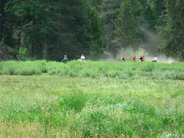 |
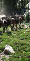
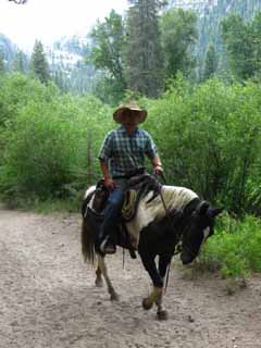
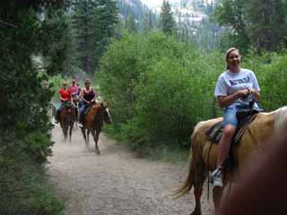
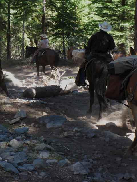
Horse party approaching through Kennedy Meadows. I always put myself on the windward side of approaching horses and mules to avoid getting dusted, if possible. |
Activities in Kennedy Meadow
| Lead rider and cowboy guide from Kennedy Meadows Pack Station. | Hourly or trip group riders out of Kennedy Meadows Pack Station follow the guide. | |||
 |
 |
|||
The kids love the horse rides. Everyone looked real happy. |
||||
| Nice pony. | Top of Page |
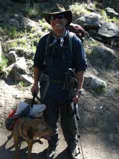 |
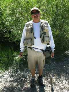
Hiker and Fisherman encounters Along the trail in the Southern Kennedy Meadow. This beautiful place has something that makes everyone smile. |
 |
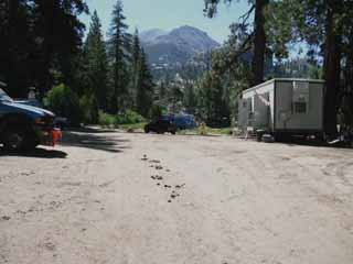 |
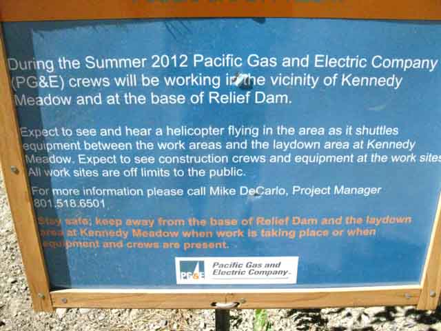
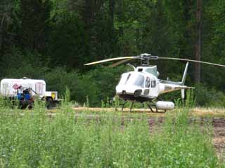
| Camp PGE in Kennedy Meadow 2012. This is the staging area for work on Relief Reservoir. |
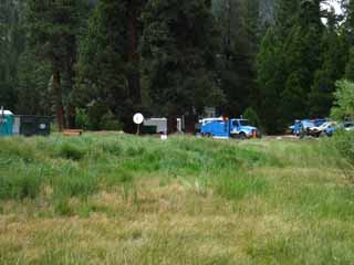 |
PG & E trucks and copter in the Southern Kennedy Meadow |
 |
 |
Camp PGE after removing the temp offices and equipment after 2012 work on Relief Reservoir was completed. The surface was compressed. |
View North
down the
Middle Fork of the Stanislaus River
Beginning
on the
South End of Kennedy Meadows
 |
|||
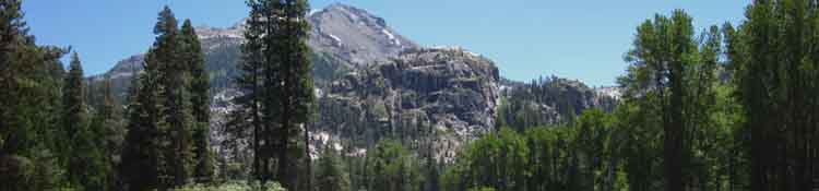
Sweet Look Downriver Kennedy Meadows is a narrow wedge of tranquility carved in at the base of the steepest descent of the Western Flank below the Sierra Crestline. This cut in the mountains continues below Kennedy Meadows for nine miles all the way down to the Clarks Fork Road, where this cut in the mountains joins the even larger canyon of the Clarks Fork coming down from Saint Marys Pass. The beauty and bounty of this run along the Middle Stanislaus was likely well-used before Western intervention (history), explains early Western use, and is why it remains popular today. It is a long sweet spot. A series of Federal Car Campgrounds (index) listed as the "Brightman Recreation Campgrounds," refers to these specific campgrounds along this tranquil run down the nine mile run of uppermost Middle Fork of the Stanislaus River before its confluence with the Clarks Fork. We can see most of this valley and its campgrounds along Highway 108 across the bottom of the Carson Iceberg Wilderness Trail Map. It's a sweet spot, this run of canyon from the top of Kennedy Meadows to the Clarks Fork.
|
Stock |
 |
|||
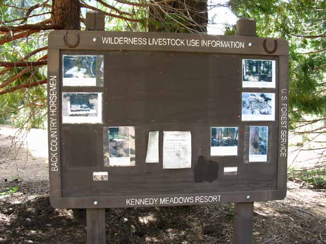
Backcountry horseman and livestock public service information board that Kennedy Meadows Pack Station put up. The point of this board is to encourage minimal impact camping by horse parties. "Be Good, don't trash Nature" The point is to encourage the mounted traveling public to leave no trace.
|
Kennedy Meadows Trailhead A bit South of the Stock and Backpacker Information board. The final, last of the three trailheads we've counted since the sign at the trailhead parking lot across from Deadman Camp and the gate at Kennedy Meadows. |
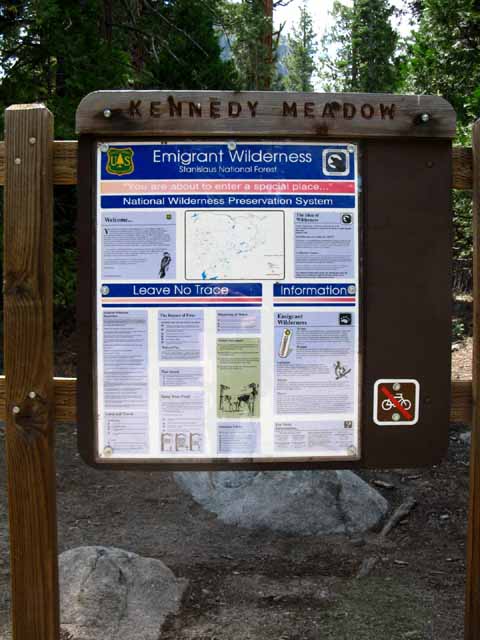 |
This is the actual Kennedy Meadow Trailhead for Backpackers into Emigrant Wilderness. Trey Trailhead Review 6400 1.01 miles 3.16 miles To Relief Reservoir Kennedy Meadows to Relief Reservoir |
Trail
above
Kennedy Meadows Trailhead
Sandy Chute up to the Lower Bridge over Summit Creek
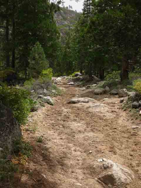 |
Short chute of sandy trail from trailhead to the bridge. Moist and compressed after a rain shower. Kennedy Meadows to Relief Reservoir |
Summit Creek
| Summit Creek | Approaching lower footbridge. | |||||
 |
 |
|||||
| Above Kennedy Meadows the running water is Summit Creek. Once it hits Kennedy Meadows it has become the Middle Fork of the Stanislaus River. |
Top of Page |
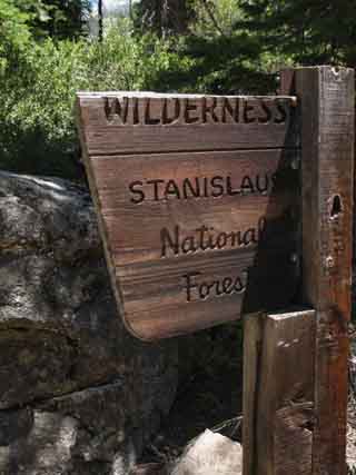
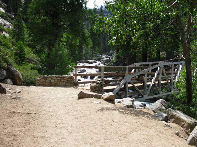
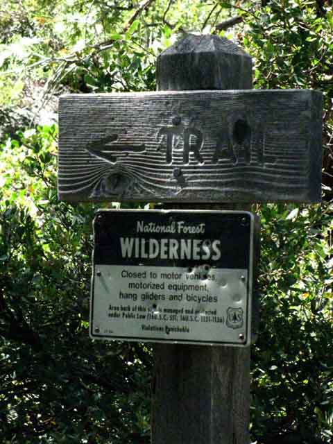
Emigrant Wilderness Boundary
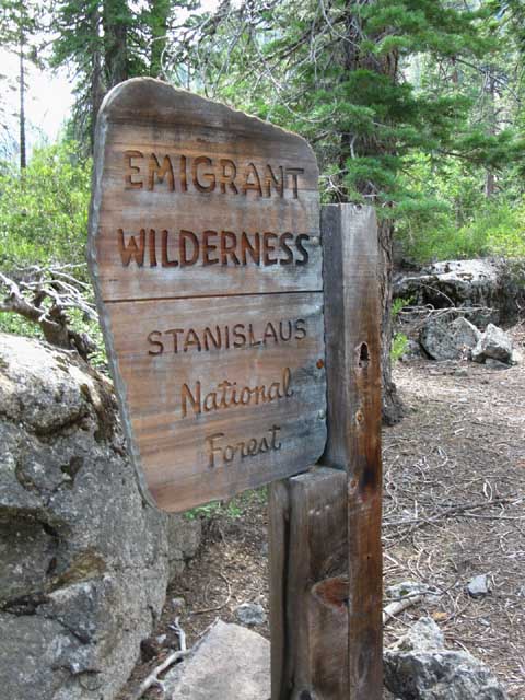 |
We enter Emigrant Wilderness South of Kennedy Meadows Pack Station crossing Summit Creek. Broken in July of 2016. Kennedy Meadows to Relief Reservoir |
Lower Footbridge up to Relief Reservoir
 |
|||
Lower footbridge over Summit Creek. Entering Emigrant Wilderness about a third of a mile South of the trailhead.
|
First & Lowest
of
Two
Footbridges
over
Summit Creek
 |
The cool flow of air running downstream with the creek is always nice on a hot day. Crossing this bridge marks the beginning of our climb through the lower run of the upcoming narrow rocky canyon. The run of canyon ahead acts as a reflector-oven and heat collector during fine Summer weather. I like to get through here early in the morning when it's cool, if possible. Especially if we are carrying the heavy pack necessary to get ourselves down to Tuolumne Meadows. |
Video
Lower Footbridge South
to
Trail Junction
off the
Southeast Shore
of
Relief Reservoir
| Hiking from the Lower Footbridge to the Brown Bear Pass & Relief Valley trail junction off the Southeast shore of Relief Reservoir |
||||||
Duration 12:41. Videos
|
View up Summit Creek
So Relaxing
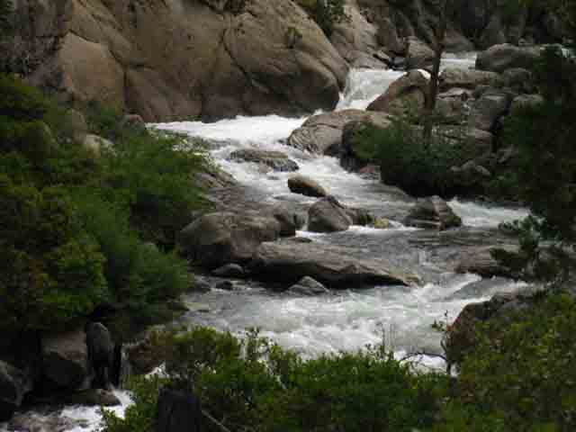 |
Crossing the lower Summit Creek Bridge gives up a quick glimpse up Summit Creek in its rock vault before we climb far above the Creek up onto the trail carved into its Western Canyon wall. |
USGS The following section between the lower and upper footbridges has bothered me for a long time. The map and the reality on the ground are different. That always drives me crazy. When I sat down to work on the maps for this section it became clear that I would have to collect more information, which meant another trip to inspect this section with map in hand and eyes wide open. I knew the USGS map is wrong, but I could not define the correct trail route... back to the trail... Significant Divergence The Dardanelle Map of 1979 indicates that the trail continues West above the lower footbridge to climb the dry canyon West of Summit Creek on the West flank of the plug up to the second footbridge. The trail in fact climbs up to the second footbridge above the Western bank of Summit Creek. I have marked the TW topo map for this section to indicate the current route of the Tahoe to Yosemite Trail as carved into the hard rock cliff following Summit Creek to the Upper bridge. |
The Trail bends Left
following
Summit Creek South
of the
Lower Footbridge
 |
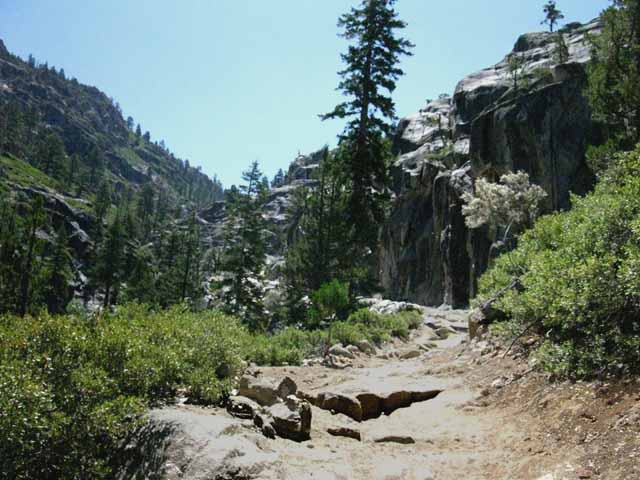
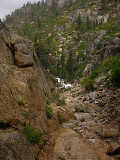
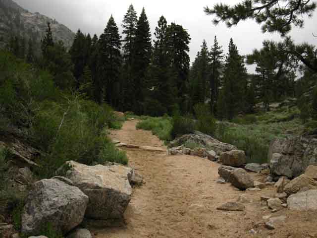
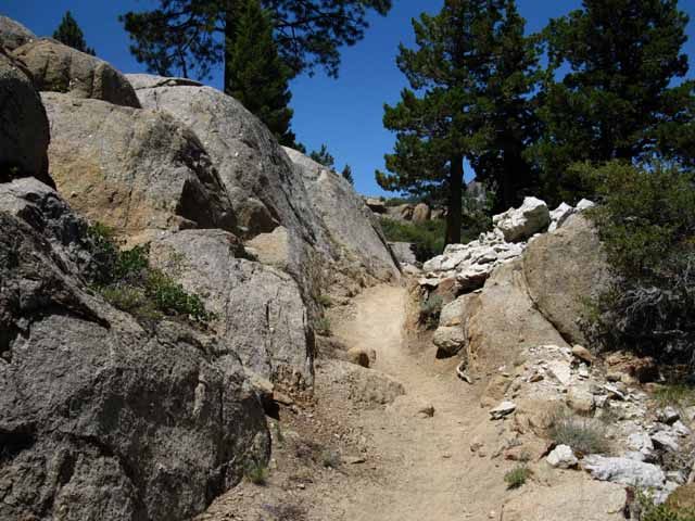
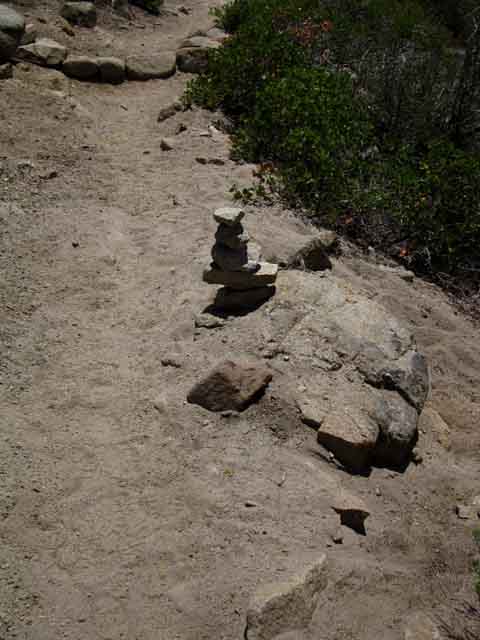
Trail sign just a few steps South of lower Summit Creek footbridge. This sign looks to be situated where the old route continued West marking where the current route turns South along Summit Creek through a channel cut through the hard rock of the plug's lower Eastern flank. Marty, a very experienced horsepacker out of Kennedy Meadows, said of the old trail route, "It's a jumble back there." Matt, Marty, and Corky represent a lot of backcountry knowledge riding out of Kennedy Meadows Pack Station. Note how the Map depicts the old abandoned trail as the main route. I have corrected our map with the current route between the lower and upper footbridges. From above the lower bridge hard granite knobs, slabs, and runs of granite rise up out of this sandy trail, giving us a either a series of tripping points or firm footing in this sea of sandy trail. If we have the strength to go, "top to top," from each ascending granite knob to the next, we are fine. If not, we are slogging along in the sand. But, be careful! Sand on granite makes for some slippery stepping. Remember, when on sandy trail or sandy rock surfaces keep your body upright and shorten your steps. Shortening our steps will decrease our tendency to slip when taking steps forward as well as when pushing off against our back foot. This technic generally helps keep us stable across slippery terrain, be it slick granite, sandy granite, or hard snow and ice. |
Up
Summit Creek Canyon
 |
|||
Past the lower footbridge the Tahoe to Yosemite Trail route is carved into the solid granite wall above the West Shore of Summit Creek. This is an impressive segment of trail. It is also an exposed section of trail with no tree cover surrounded by reflective granite. The tendency of this canyon to hold heat combined with the solar intensity focused here proves the necessity of a good hat and sunscreen.
|
Beautiful Sierra Trail
 |
| Sculpted Art Tahoe to Yosemite Trail carved out of the solid rock of the canyon wall. |
Summit Creek views Open
as we
climb higher above the creek
We parallel and begin climbing higher up the West side of the canyon wall above Summit Creek, moving up and to our Right on a route cut into the rock above Summit Creek from the viewpoint below.
The trail climbs in anticipation of getting around the wishbone cuts of Summit Creek canyon where the branch of canyon bringing Kennedy Creek down from Kennedy Lake cuts into the canyon carrying Summit Creek. |
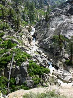
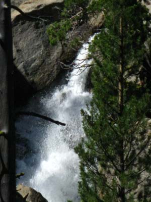
Hiking a bit further South and higher up we come to Kennedy Creek rushing into Summit Creek. Below we see where Kennedy Creek cascades down into Summit Creek. It is almost like a series of stacked waterfalls. We're looking up the canyon Kennedy Creek is flowing down. We were enjoying the cool air blowing down the canyon, but now that we are climbing higher up the canyon wall from the creek things begin to heat up. |
|||||
 |
 |
|||||
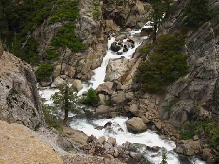
View up Summit Creek. Take a look down at this terrain from the Note that the end of the trail EAST to Kennedy Lake intersects with the That trail junction makes big hiking loops around the High Entertainment Wilderness back to our position here in Summit Creek possible. |
Plus, the reflective rock and our lack of tree cover is adding heat to the situation as well. This is a hot hike during bright days. A quick look over at Kennedy Creek flowing down from Kennedy Lake cools our thoughts but not our bodies.
|
Kennedy Creek Waterfall
coming down to
feed Summit Creek,
a
detail
from the
image above Right
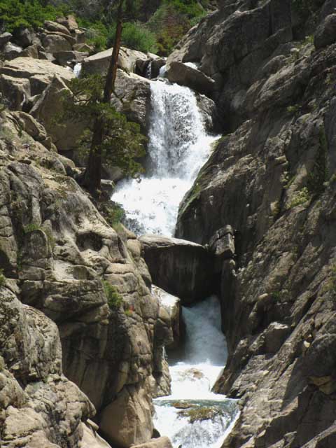 |
Past the lower footbridge we have followed the trail up through a narrow rocky channel cut into the side of the plug feature (above) rising above the West shore of Summit Creek. Approaching the upper footbridge we take note of a substantial creek flowing out of its own rocky gorge down into a segment of Summit Creek Canyon's steepest, deepest, and narrowest runs. Above we see the top of Kennedy Creek's final run pouring out of its narrow channel beginning its last cascade into Summit Creek to end its Westward flow down from Kennedy Lake (trail guide). The Kennedy Configuration Eastern Flank Got that? Between the trails running up and down these two canyons the Kennedy Canyon trail junction offers a way to connect the routes of the PCT & TYT on the Sierra Crestline. Kennedy Meadows to Relief Reservoir |
Kennedy Creek
at
Summit Creek
 |
The end of Kennedy Creek flowing into Summit Creek. |
Video
Kennedy Creek
into
Summit Creek
| Kennedy Creek Flows into Summit Creek North of and a bit below the Upper Footbridge. | ||||||
1:13 All Backpacking Videos
|
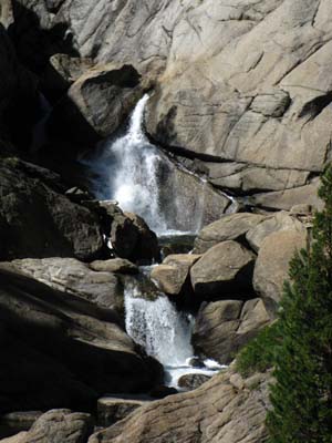
Kennedy Creek Falls
and
Cascades down into Summit Creek
 |
Kennedy Creek flows through a solid rock channel into Summit Creek along the Tahoe to Yosemite Trail. Map: East up to |
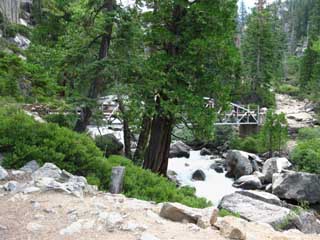
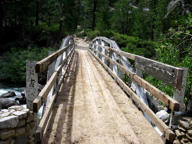
Upper Summit Creek Footbridge
 |
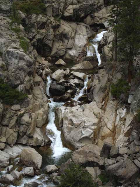
Upper footbridge up to Relief Reservoir. South of the unique and romanesque upper footbridge the route up to Relief Reservoir splits into two trails. Both trail options rejoin on the narrow flat where we get our last look at Summit Creek before turning away for the ascent to the top of the ridge arm wrapping around the Northeast Shore of Relief Reservoir. After climbing to the top of that ridgearm we'll get our next look at Summit Creek when we climb into the canyon above Relief Reservoir running East up to Brown Bear Pass. Say goodbye to Summit Creek for now. Trail Specs 7040 2.46 miles. Elevation: (KM = 6400) Trail:
NEXT We will encounter the Kennedy Lake trail junction just above where this short split rejoins the main trail, after climbing to the flat, then up to the junction. .21 mile 1.57 miles
Kennedy Meadows to Relief Reservoir |
Above, Down to, and just North
of the
Upper Footbridge Down the Eastern trail
| Coming down steep rocky chute/gully above the Upper Footbridge. | ||||||
Dropping down the Chute to the Upper Bridge over Summit Creek Location Climbing This particular film was shot returning to Kennedy Meadows Pack Station at the end of a big circle backpacking trip around the High Emigrant Wilderness, thus we are hiking North down to the upper bridge, rather than up to it... 3:33 minutes. Trail Videos
|
 |
View from the upper footbridge. The sound is really nice. Kennedy Meadows to Relief Reservoir |
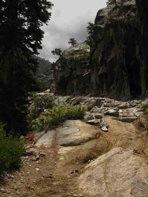
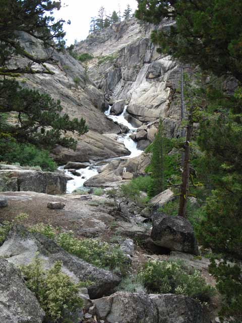
Summit Creek's Chaotic Canyon
above the
Upper Footbridge
 |
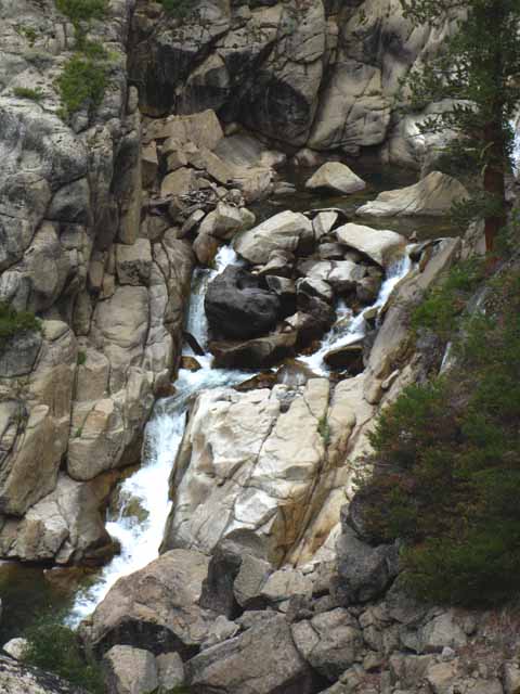
View from the Upper Footbridge Looking into the rough canyon Summit Creek flows down descending from the Southwest above the Upper Footbridge. Above the upper footbridge the trail splits into two routes for a short distance before rejoining on the flat about 3/8's of a mile further South. The Western trail goes through this sheer gulch while the Eastern trail follows a steep rocky chute South of the upper footbridge. We can see the V-of the location of the canyon on the Left side of the ridgeline. Note the Western trail's route moving through the lower section of the image to bend into this section of canyon. These Western and Eastern trails rejoin on the flat at the top of the rocky chute to the South of the upper footbridge. The USGS map does not depict this side trail. It's there, and its nice. Kennedy Meadows to Relief Reservoir |
Summit Creek
 |
View from the Upper Footbridge Summit Creek surging through its narrow jumbled canyon just above the upper footbridge. |
Second Map Anomaly The USGS 7.5 minute Dardanelle, Calif, Topographic Map of 1979's description of the trail and the actual trail route differ between the upper footbridge and the Kennedy Lake trail junction, misrepresenting the trail route's position in relation to the site of the old PG & E Relief Cabin. The USGS map shows the Tahoe to Yosemite Trail junction intersection with the Eastbound trail to Kennedy Lake being situated South of the PG&E Cabin while the trail junction is presently North of the old PG&E Dam Tender Cabin site. I say "site" because the cabin was removed during the Summer of 2011. So that removal is another map correction, too. Hiking South up the steep chute running East above upper footbridge brings us to a short flat where we get clear views of Summit Creek surging down its steep canyon below Relief Reservoir before we again submerge into the terrain for the short hike up to the Kennedy Lake trail junction. The old site of the PG & E cabin is just a few steps South, and within sight of the location of the Kennedy Lake trail junction. In any case, our trail to Relief Reservoir first encounters the trail junction to Kennedy Lake North of the flat where the Relief Dam Tender's was located, though the USGS map indicates our trail junction to Kennedy Lake is South of the site of the cabin. Hummm. I have altered the USGS map used on this site to reflect the reality on the ground as well as I am capable. Kennedy Meadows to Relief Reservoir |
Looking North
at the
Upper Footbridge of Summit Creek
&
the
Small bit of Shade under its Tree
 |
|||
Sweet footbridge. Viewed from the Eastern trail above the footbridge. That tree is the only thin shade between the lower and upper bridges, if the angle of the Sun on the canyon is direct. Cool mornings before the Sun rises too high is the best time to climb this canyon.
|
Same Footbridge
from the
Western Trail
above the
Footbridge
 |
Footbridge viewed from the Western spur trail. As I mentioned above, the trail splits for a short distance just South of the Upper Footbridge before rejoining at the flat section of trail above the climb South of the Upper Footbridge. This is the view from the Western trail. |
Hiking
around the
Western spur trail
 |
Deep pool at the bottom of the narrow rock channel Summit Creek flows through below the Western spur trail. The Western spur trail navigates along the edge of the narrow rocky channel Summit Creek passes through above the upper footbridge. The Eastern "chute" trail bypasses this section of the creek by climbing up a steep rocky channel/chute East of the course of Summit Creek. Kennedy Meadows to Relief Reservoir |
Following the Eastern Trail up the Chute
Looking Back, North down the trail towards Kennedy Meadows
 |
Down the Chute At the bottom of this channel we will find the upper bridge. Here we can see Summit Creek running below the upper bridge. At the top of this rock channel (behind us) the trail spur running West from the upper bridge rejoins our route. |
Falls
where the
East and West
Spur Trails Rejoin
below the
Kennedy Lake Trail Junction
 |
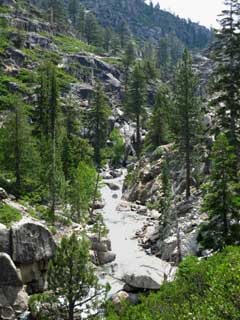
As we come around to the top of either the Western or Eastern spur trail above the Upper Footbridge we find a flat perfectly situated for us to observe the dramatic falls located where the two spur trails rejoin. |
 |
Summit Creek
below
Relief Reservoir
above
The Upper Footbridge
 |
View from the Flat The East and Western spur trails joined together on the North side of this flat section, to our Right, where we hiked South into this sweet view of the gorge, Summit Creek, and its various surges, cascades, and falls. |
Another climb follows the brief flat
with the
Stunning view of Summit Creek
Early equipment to build and maintain the Relief Reservoir Dam made this climb steam powered:
Steam driven cable winch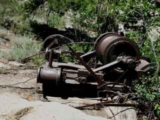 |
 |
|
| Steam winch below Kennedy Lake trail junction. | Example of "portable" industrial age steam power in the Sierra Nevada. |
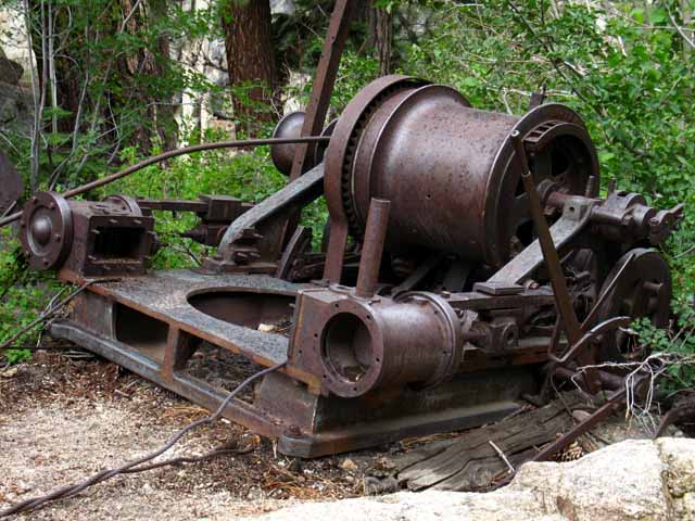 |
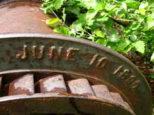
Detail of steam winch below Relief Reservoir on Tahoe to Yosemite Trail. Note the raindrops decorating the winch. Always be ready for weather. From the Sonora Pass Road History we learn that, This indicates private interests were looking for stable water sources here in 1861. The historical marker in Sugar Pine notes that part of Sonora Road built as early as 1852 by the Tuolumne County Water Company." The huge increase in population first brought by the gold rush and sustained by the silver boom had driven the expansion in agriculture and ranching that drove the search for reliable water to the Sierra. "In 1906, the contract for the Relief Dam on the Middle Fork of the Stanislaus River resulted in improving the road between Sonora and Kennedy Meadows so heavy equipment could be moved on this route." I see the June 10, 1880 and Oct. 24, 1899 dates we find cast-into the portable steam winch below comporting with the date of Relief Reservoir's construction, if not earlier operations. |
 |
 |
 |
| Looking South up the hill this winch pulled equipment up. |
Looking down the hill at the Winch
 |
Looking back down at the winch. See it down there on the upper Right of the image? |
Approaching the Kennedy Lake Trail Junction
 |
|||
The Kennedy Lake trail junction. The trail to Kennedy Lake tracks East, left at the upcoming Y.
|
Relief Reservoir Work 2010-2012
 |
2010 sign approaching Kennedy Lake trail junction and the Relief Reservoir Tender's Cabin just beyond. PG&E Says: "Upgrades to the Relief Dam at an elevation of 7,000 feet in the High Sierra, which, with a new automated system, will allow PG&E to better control the year-round stream flows from a remote location." The cabin and the sign were removed in 2011. Post up any, "work notices," fire warnings, or other bits of information you encounter on the trail. |
Kennedy Lake Trail Junction
East
 |
|||||||||||||||||||||||||||||||||||||||||||||||||||||||||||||||||||||||||||||||||||||||||||
The junction for the trail leading East up Kennedy Creek to Kennedy Lake. Hiking East West End of Kennedy Lake
Trail Specifications 7120 feet
SOUTH
Kennedy Lake Trail Junction
Trail We saw Kennedy Creek entering Lower Summit Creek Canyon lower down the canyon, just below the upper bridge. The steepness of climbing into the mouth of the canyon moderates once we climb up to Kennedy Creek and we can see it turning North into its gorge for its final run down to Summit Creek. Once we get to the top of the switchbacks the course of Kennedy Creek and our route along it both moderate. Climbing along Kennedy Creek moderates further reaching the big central meadow holding Kennedy Lake. Continuing East beyond Kennedy Lake kicks the climbing back up to the highest of the moderate degrees of difficulty. Physical difficulty is enhanced by the significant segments of trail composed of gravel and/or loose rock, and the other segments lost through erosion, under use, and lack of maintenance. No big deal. Follow Kennedy Creek all the way up to its headwaters flowing out a fold in the Big Sam Massif under the Northeast Flank of Big Sam. Well, we can follow it up except for the couple of times we have to hike further North to get around steep runs of the creek coming down the center of the upper canyon. We have to go wide in some places. Unmaintained Trail Bloom and his horsemen ride through there, so it is not bad enough to prohibit horses. But, conditions change rapidly in the Sierra. We may find a range of different conditions here over time ranging from OK to bad. Use at your own risk. Expect the best, be ready for the rest. More Information PCT Route Kennedy Canyon Trail Junction It is a magnificent place, full of hiking potential. VIDEO TYT
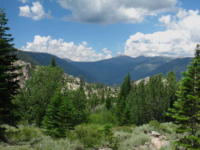
LONG and LOOPY This elongation of my long distance trips (chasing the beauty within Emigrant Wilderness) on my way South has caused me to return repeatedly to hike nice loops with more leisure to explore and scramble than possible on long backpacking trips. Below I look at the how the terrain and trails across Emigrant Wilderness, and the associated "proto" Hoover Wilderness Area in the Toiyabe NF to our East, and the Northwest corner of Yosemite bracketed by Bond and Dorothy Lake Passes all work together creating a fine web of trails that makes exploring the Emigrant Wilderness a real joy, something akin to prying open every part of Nature's Treasure Chest one step at a time. |
|||||||||||||||||||||||||||||||||||||||||||||||||||||||||||||||||||||||||||||||||||||||||||
Kennedy Lake
Kennedy Lake Trail Junction Hiking Route Possibilities
Loops and Trailhead to Trailhead EAST Hiking Options Kennedy Lake is situated on an expansive meadowed flat (image from above on Big Sam) wedged high up into the West flank of the Sierra between the Pacific Crest and Tahoe to Yosemite Trails. Kennedy Lake sits about three miles West of, and 1879 feet below the Kennedy Canyon Trail Junction on the Pacific Crest Trail. That trail junction is located 7.97 miles South of Sonora Pass along the route of the PCT. TYT to PCT TOPO MAP A few hundred yards before linking up with the PCT our trail East up from Kennedy Lake intersects with the Southbound shortcut trail up to the Tungsten Road (guide info) over Big Sam into the Emigrant Basin. Kennedy Canyon Trail Junction This pattern of interconnected trails laid out over the Emigrant Wilderness gives us some interesting backpacking route options from the Kennedy Canyon (guide page) trail junction on the PCT: Sonora Pass Trailhead Leavitt Meadow Trailhead Continuing South... Grizzly Peak Trail Junction NEXT JUNCTION SOUTH We can continue South to turn our loop back around via Snow Lake, or push on to our furthest potential Emigrant Loop turnaround point by "threading the needle" through the Northwest corner of Yosemite, changing the direction of our loop by hiking through both Bond and Dorothy Lake Passes. We really can "tune" the length of our Emigrant Wilderness backpacking loops by selecting various combinations of trails through the Kennedy Canyon and Grizzly Peak trail junctions, independent of which trailhead we started out of, or which we plan to finish through. Check out the maps for this section, which lay out these trails. Our Present Location MAPPAGE High Emigrant Wilderness Potential My map above cites this as a 31.06 mile hike, beginning and ending at Kennedy Meadows. We can easily push this distance up by extending the diameter of our loop. We can "double-down" continuing South into Yosemite to Hetch Hetchy (guide) or Tuolumne Meadows. Or we can hike out to Relief Reservoir, camp for a couple of nights, and hike back. Many Emigrant Wilderness Or we can turn Right from the West West Walker Bridge continuing Southbound along the PCT route into the top of Jack Main Canyon. A short ways down Jack Main Canyon we find the long-way option to loop back to Kennedy Meadows Pack Station hiking the Tahoe to Yosemite Trail route through Bond Pass Northwest across the High Emigrant Basin. Do It Check out this Map to trace out our potential routes past Kennedy Lake, and the maps below to explore all our Highway 108 Corridor access points bracketing the Sierra Crestline. HIGH
As you can see there are many big and small loop trips possible around and across the amazingly beautiful terrain of the High Elevation portions of Emigrant Wilderness (the "High Emigrant Wilderness") once we hike up to the trail junction on the PCT between Kennedy Canyon and Kennedy Lake. Where we turn from there determines the nature and length of our trip. I've found it easy to craft big backpacking loops around the Emigrant Wilderness. Trailhead to Trailhead Big Loops. Little Loops, Long trail sections, and many cool trailhead to trailhead backpacking trips are possible out of Kennedy Meadows Pack Station, Sonora Pass, Leavitt Lake and Leavitt Meadow. Hiking South into the Emigrant Wilderness or Toiyabe National Forest on either flank of the High Sierra South of Highway 108 opens up dozens of miles of beautiful trails that stay within the Emigrant Wilderness on the Western flank and that little tab of the Toiyabe National Forest wedged-in on the Eastern flank between the Hoover and Emigrant Wilderness Areas. NOTE Full Wilderness Region Region TOPO MAP |
Continuing
SOUTH ON THE TYT
PG & E
Relief Dam Tender's Cabin
Removed during the Summer of 2011
 |
|||
A few feet through a roller-coaster twist in the trail South of the Kennedy Lake trail junction on the way towards Relief Reservoir we encounter the empty flat that once held the Dam Tender's Cabin. PG&E Apparently the latest upgrades allow for remote control of both the flood gates as well as the collection of data necessary to tune the system. These upgrades negated any need for a dam tender or cabin to house them, and the cabin was removed during 2011.
|
Relief Dam Tender's Cabin Site
 |
The empty site of the old Relief Reservoir Dam Tender's Cabin. Removed during the Summer of 2011. |
Backpackers
Matt and Nick
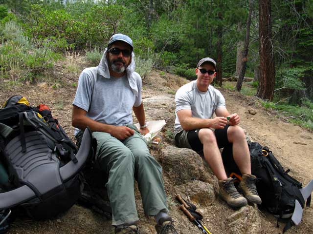 |
Matt and Nick having a snack with the trail to Kennedy Lake behind them. July 26 2010. I Also met Matt on the trail at Tuolumne Meadows during 2009. |
Hiking South
above the
Kennedy Lake junction
 |
|
Heavy Wasp Activity during late August
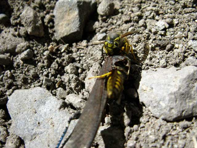 |
Furious Wasps I've noticed the wasps get more intense as Fall deepens. High Sierra Flying Insect Forum |
Kennedy Meadows Horsepackers
 |
Kennedy Meadows Pack Station horse packers. 2012. |
Last Climb
to
Above the Northeastern Shore
of
Relief Reservoir
 |
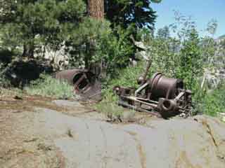
Trail climbing above old boiler. We are coming to the end of this section of climbing. At the very top of this climb we reach and cross over the top of this ridge-arm onto the Northeast flank of the valley constraining Relief Reservoir. From the top of the ridge we begin the gradual traverse down to the Southeastern corner of Relief Reservoir. Immediately ahead we are coming to a flat decorated by an old boiler featuring the main trail to the Relief Reservoir Dam on the North end of the reservoir. Before we get there we come to a small segment where the trail spreads across a rocky eroded surface. We find our options funneling to a low gap rising to the boiler flat. |
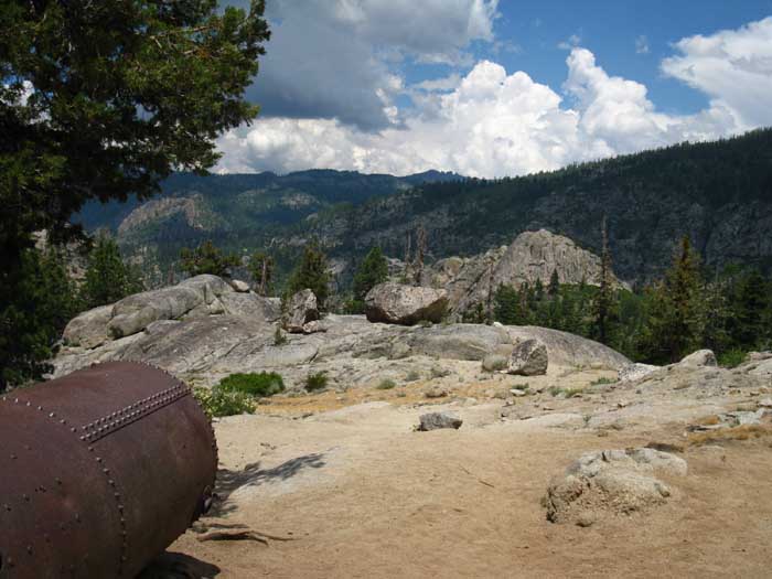
High Pressure Cast Iron Cylinder
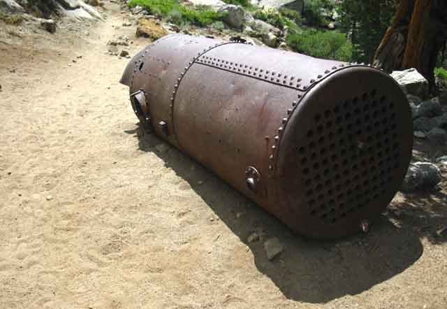 |
Old Industrial Remnant Again, I figure that this is the "portable" field-version power plant of its era. Did it come East and down into the San Joaquin Valley by rail, or was the plate cast and formed in California? Wagons took over transportation where rails ended, bringing to mind thoughts of the roads, wagons, horses and men of the late 19th century who ferried these bits of industrial history to a place too expensive to haul them out and melt them down at the ends of their useful lives. Thus this lost boiler survived through isolation and obscurity. I figure this is the boiler that powered the steam pump tasked with dragging heavy gear up the slope past the steel frame bridge. If so, there should be some signs of the high pressure steam pipes connecting the system together somewhere around here. Unless everything but the heaviest bits were hauled out as they became superfluous. |
Heavy Metal
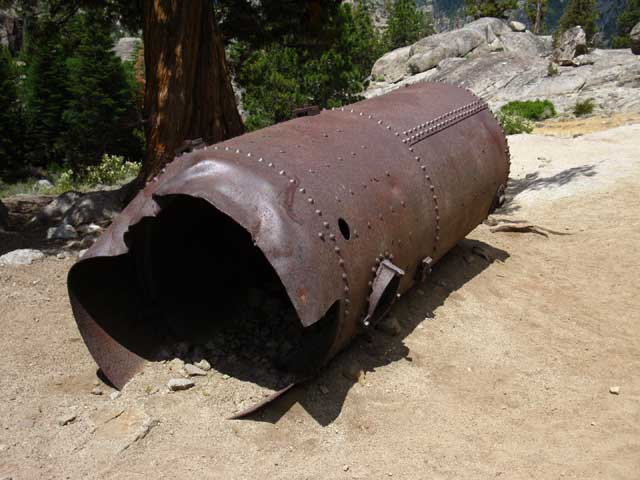 |
This may be the chamber where small diameter water pipes were heated to produce steam power. If so this was that day's version of a portable generator, as long as fuel was available. The size tells me it was not fueled by wood, but by a fuel capable of generating heat much more "compactly," such as a fuel oil. Using fuel oil allowed them to get away with a much smaller fire box for their boiler than wood allowed. In other words, this open bottom-end likely had some kind of fuel-oil powered burners that fit in there. The top end had long tubes bent into a long U with water entering one end and exiting as steam through the other. That steam was then metered and piped to the various engines in operation, such as the steam winch we saw further down the mountain. So, that's likely why that cylinder is so skinny. It's portable! Who wodda thunk it? Post up any information you have in the High Sierra History Forum or the Sonora Pass Road History page, depending on the type and nature of your information. Trail Notes and Reports |
View Down Summit Creek
 |
|||
Looking Northwest down Summit Creek. The canyon cutting in from the distant Right is Deadman Creek running down from Sonora Pass to join the Middle Fork of the Stanislaus River at Kennedy Meadows Pack Station.
|
Long View North-Northwest
 |
Climbing higher up Summit Creek's drainage brings us above the treetops and terrain obstructions to get an overall view of the terrain, specifically looking North out the bottom of the canyon Summit Canyon flows down where it become the Middle Stanislaus River flowing into Kennedy Meadows. The Ground Game Then we have crest of the the distant ridge running up to the Sierra Crest. The Crestline Bald and Red Peaks are at the top of the massive ridge dividing the Clarks fork of the Stanislaus River on its far side from the Middle Fork of the Stanislaus running down the valley below us. Since everything North of Highway 108 is in the Carson Iceberg Wilderness we will consult that map to locate Bald and Red Peaks. Carson Iceberg Wilderness Trail and Terrain Map,... and especially the Sonora Pass Region Hiking Map as well. As I mentioned above, the sun-splashed V-cut canyon entering the East side of valley wall at our feet, the Right side a few miles below our position locates Deadman Creek flowing into the Middle Fork of the Stanislaus just North of Kennedy Meadow Pack Station. The Clarks Fork on the Far side of that massive distant ridge and the Deadman Creek on this side define our main hiking lines of access up to the Sierra Crest on both sides of the massive mountain ridge capped by Bald and Red Peaks. Each of these river canyons has been used as the "main" route over the Sierra Crest, as was as Emigrant Pass to our South. Emigrant Pass is speculated to be the first Western route, Sonora-Saint Marys Passes the second, and Deadman Creek the third and current route. Clarks and Middle Forks Highway 108 Car Camping the High Sierra The Middle Forks of the Stanislaus River converges with the Clarks at the South end of this delightful valley. Highway 108 runs West through this narrow valley along the Middle Fork for about 8.82 miles West of the Kennedy Meadows Pack Station. This nifty run of river, road and forest ends where the Middle Fork enters the much larger canyon of the Clarks Fork at the Clarks Fork Road junction. From that point our route West on Highway 108 is along the flank of the massive canyon of the Middle Forks of the Stanislaus. Though the Clarks Forks Canyon is much bigger than that of the Middle Fork, and that this vast canyon running down from Saint Marys Pass was cut by the Clarks Fork of the Stanislaus, the river and its canyon from where the Middle Fork enters the Clarks Fork Canyon takes the name of the Middle Fork of the Stanislaus. The Clarks Fork Road (map) offers deep access into the Tahoe to Yosemite Trail route passing through the Carson Iceberg Wilderness North of Highway 108. |
Heavy Trail
to the
Relief Reservoir Dam
 |
|||
Reality Check Other times the fine details, colors and contrasts of the exact same location come out as the Sun drops lower in the Southern Skies, or a bit of atmospheric moisture diffuses the overwhelming power of the Sun. The many faces of Nature are the ever-changing icing on the cake of life.
|
Day hikers
out of
Kennedy Meadows
 |
Day Hiker Heaven This is a popular hike for a wide range of folks. We find a good number of day hikers making the 4 mile one-way hike out to Relief Reservoir during morning, enjoying a day exploring the camping area, fishing, and kicking back, then hiking back down to Kennedy Meadows in the afternoon. The intrepid car-camper/day hiker has a lot of day hiking options in the Highway 108 corridor and its immediate East and West flanks. The trails accessing Emigrant Wilderness through Leavitt Meadow and Leavitt Lake trail heads on the East flank are well complimented by the network of trails running off the Clarks Fork Road and through Kennedy Meadows on the West Flank. Leavitt Peak lays South of Sonora Pass along the Sierra Crest while Stanislaus Peak, Sonora Peak, and Wolf Creek Lake all lay just North of Sonora Pass along the Sierra Crest. The areas North and South of the 108 corridor contains a vast amount of fine terrain. Whichever way you begin scouting out the Highway 108 corridor, day hiking or backpacking, make sure you bring plenty of food, water, a good shell, DEET, suntan lotion, and a hat. Camping out for a few nights here is always a good idea, even if we are stationary, based out of one of the nice free National Forest car camping sites up along the Sierra Crest. Car Camping the High Sierra: |
To the Top
of the
Ridge Above Relief Reservoir
 |
|||
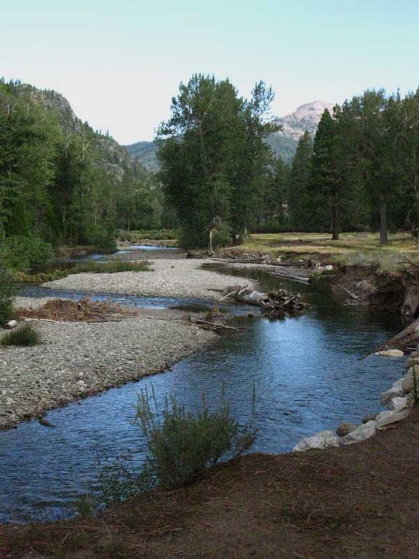
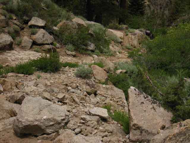
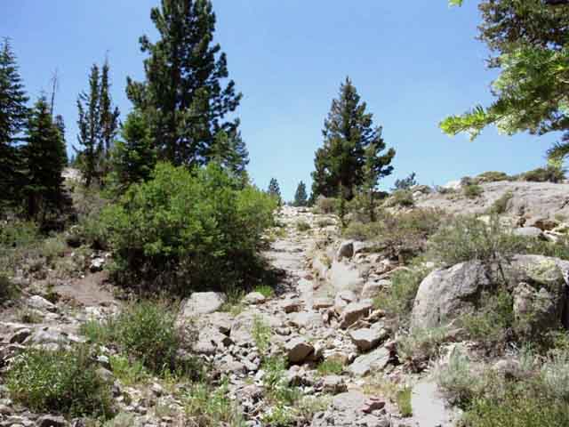
After passing the trail off to our Right to the Relief Reservoir Dam we continue climbing up and around a rocky turn out into the expanse of brushy dry meadow above, where we can see the top of the 7440 foot ridge that is both separating us from, and overlooking Relief Reservoir. Relief Reservoir's 7226 foot surface fills the bottom of the canyon on the other side of that low ridge ahead. The low ridge running across the middle of the image above is what divides us from Relief Reservoir. The rising mountain flank on the far Left we can see beyond the ridge makes up the Eastern wall of the canyon holding Relief Reservoir at its foot. This ridge arm ahead is what wraps around the Northeast end of the reservoir to pinch the bottom end of the canyon to make damming-up Relief Reservoir practical. Our trail is pointing to the junction between the low granite mound on the Right and the descending mountainside on the Left. That is where the trail gets onto the flank of that descending mountain and begins traversing down that mountain's flank, down to the cool tab of granite and forest sticking out on Southeast shore of Relief Reservoir. That's where the Relief Reservoir campsites are located. We'll get a better look at the upcoming trail from the top.
|
North shore
of
Relief Reservoir
 |
Reaching the top of the ridge arm we get our first view of Relief Reservoir. Though we climb up higher than the level of Relief Reservoir we do not get sight of the reservoir through the lay of the land and forest cover until we have hiked well South of the dam, up over the ridge and out from under the forest cover. |
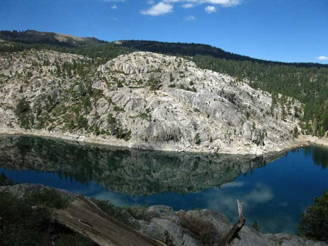
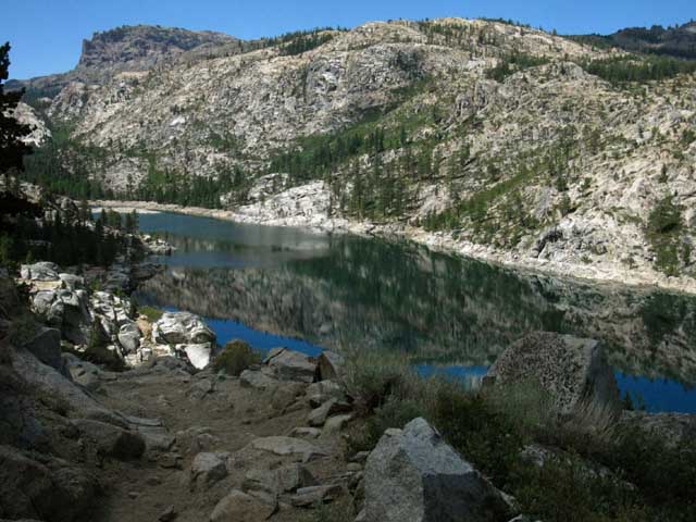
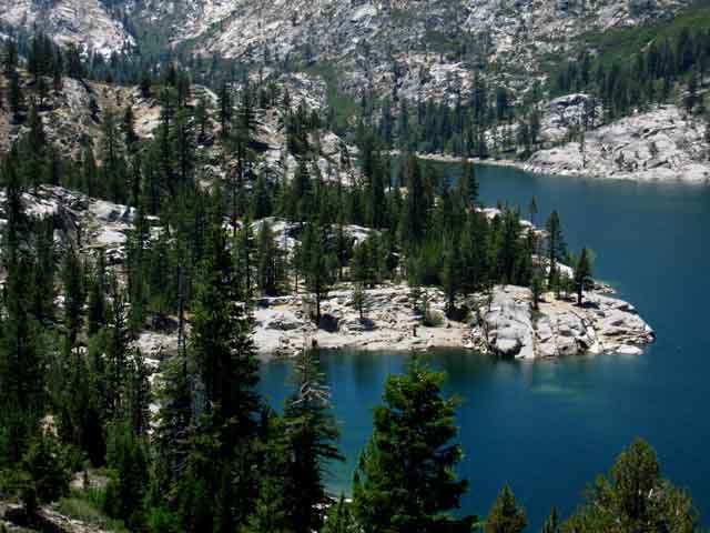
Relief Reservoir
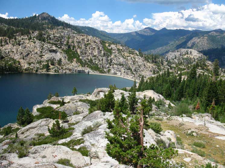 |
|||
Reaching the top of the Ridge. We can see how this descending ridge pinches off the canyon making an ideal location for the dam. We've hiked to the top of the ridge arm making up the Southeastern shore of Relief Reservoir to our first good view of its North shore and dam. In the middle-Right we can see the forest cover that blocked our view of Relief Reservoir as we climbed higher up the ridge, even after we had hiked South past the dam. Above that the terrain masked our view up to our present position. We've another fine view of Deadman Creek's canyon dropping into that of the Middle Fork of the Stanislaus, and a good look down that canyon too. 7440 3.3 miles .87 of a mile 7.62 miles
|
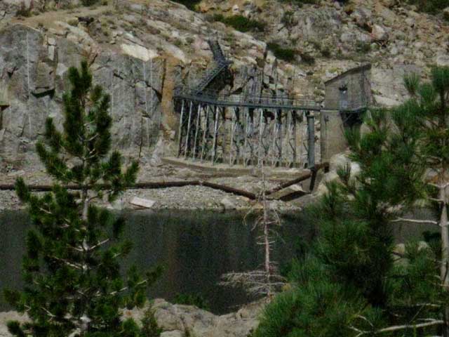
Relief Reservoir Dam
and
Floodgate
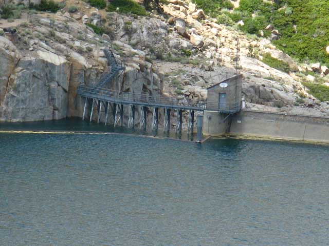 |
Relief Reservoir Dam and Floodgate. It appears to me there is an interesting history of dam operators and operations here beyond, or below the grand picture of infrastructural expansion. An "individual" history. The Relief Reservoir Cabin appears to have had live-in dam operators for a long period of its history. The Dam Tender's Cabin was removed in 2011. It was automated to a high degree prior to removal, and run by an operator prior to that. It may be that dam operations and operators have a similar history to that of telegraph operators and stagecoach drivers, of lighthouse keepers and Longshoremen, of being rendered useless by technology. And truck drivers next? I'm thinking about inventing the, "AutoHiker X," a robot that replaces the need for humans to hike... oh wait... Does the robot exist if it can't hear a tree fall in the forest? Does the human? |
Very Low Water
during
August of 2012
 |
|||
The Winter of 2011-2012 brought very little snow to the Sierra, leading to early opening of the trails, early termination of the thaw, early drying out of meadows, and low water levels in creeks and lakes up and down the Sierra Crest. Weather Page Drought Information
|
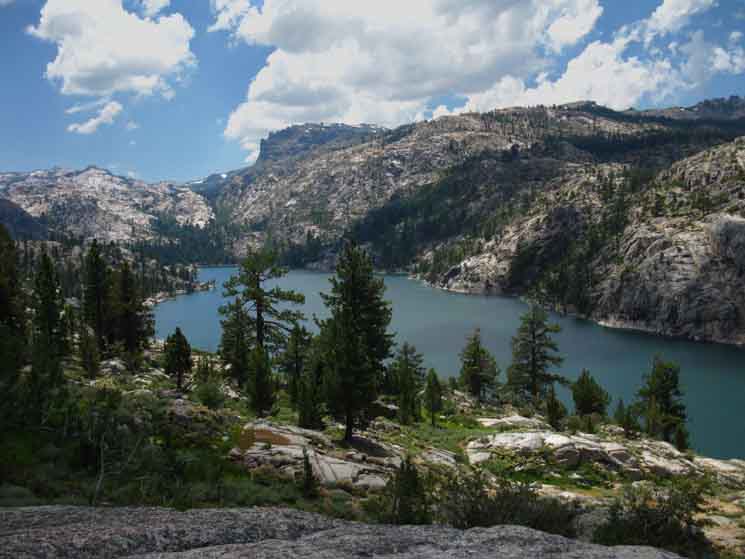
Relief Reservoir
 |
The dam is located on the far-Right, the Northern end of the shoreline. Reaching Relief Reservoir begins bringing the grand granite features into view that will highlight our Emigrant Wilderness backpacking trip. |
Relief Reservoir
Southwest behind the Dam
 |
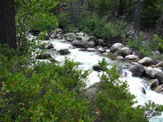
Our trail descending above the East Shore traverses down towards the point extending out into the reservoir on the upper Left shore of Relief Reservoir in the image above. The trail is mostly exposed across sandy soil on and between sweet granite outcroppings. Beyond the South end of Relief Reservoir the trail South climbing over into Lower Relief Valley passes around the Left, or East side of the pointy low granite rise on the Left side of the image. East Flange Rock is the great feature rising on the distant Right, to the more-distant Southwest. We'll be turning East, Left at the far end of Relief Reservoir to follow Summit Creek up to Brown Bear Pass following the Southbound Tahoe to Yosemite Trail. Kennedy Meadows to Relief Reservoir |
West and South Shores
of
Relief Reservoir
 |
Looking to our Southwest |
The
Stanislaus National Forest
Backcountry Trail Crew
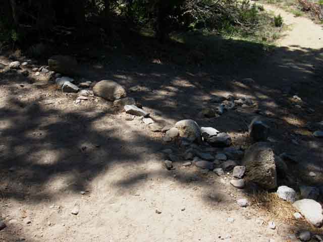
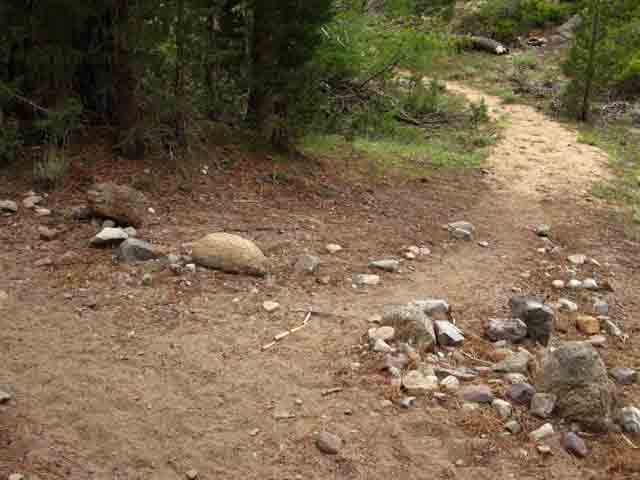
Hiking across the broken-down sandy trail through the exposed terrain paralleling the East shore of Relief Reservoir makes for hard hiking even though the descent is fairly easy. The alternating sandy and slippery granite surfaces themselves suck extra energy out of us with every step. These sandy sections break down quickly during Spring Thaw's raging runoff. Without some shovel-love these sandy sections of trail wash away in a few short years. The Stanislaus National Forest Backcountry Trail Crew is on it. "Stanislaus Trails" are sometimes supplemented by crews from other organizations. Below as we see a California Conservation Corps backcountry crew working the trails in Emigrant Wilderness during 2010. California Conservation Corps Backcountry Trails Program Every Summer the CCC typically has crews working in the High Sierra backcountry, One is generally somewhere in Northern California between Tahoe and Yosemite, another in Yosemite, and a third down in Sequoia Kings Canyon. Tahoe to Whitney hikers appreciate the work of the federal forest and park trail crews, as well as the other public and private sponsored crews. Thanks! Support You Local Trail Crew California Conservation Corps Post up your sightings of Trail Crew in their Natural Habitat: |
Trail Work
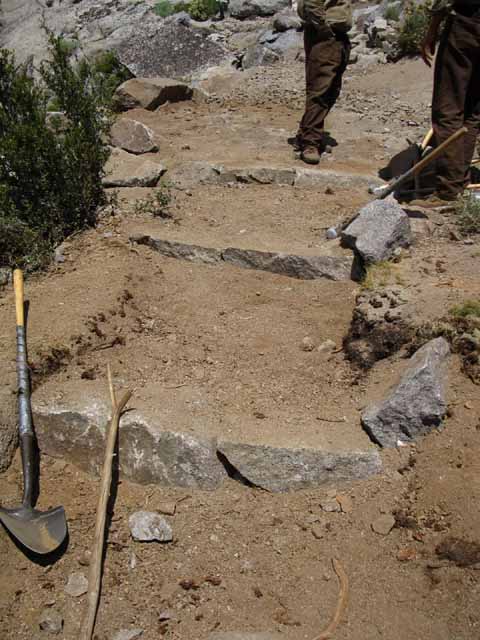 |
The CCC trail crew is stabilizing a section of sandy trail across and down a sandy spot along the traverse above Relief Reservoir by boxing it in with custom-carved interlocking granite blocks. |
| Stanislaus CCC backcountry Trail Crew Dimes, Heather and Zack |
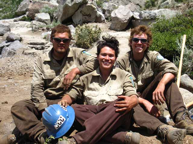 |
July 26, 2010. Experienced trail crew are easily among the strongest hikers on High Sierra trails. CCC is typically the first step into the world of trail crew. Successful participants in a Summer of CCC "fun" can typically get recommendations onto National Forest and sometimes even National Park Crews for the next season. Trail Culture Forum Official |
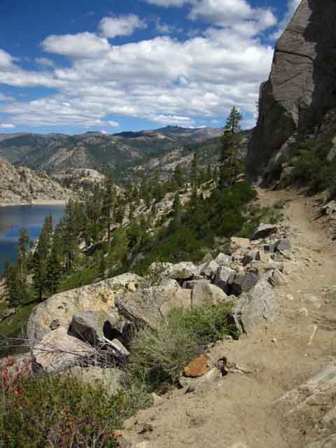
Trail Traversing East Shore
of
Relief Reservoir
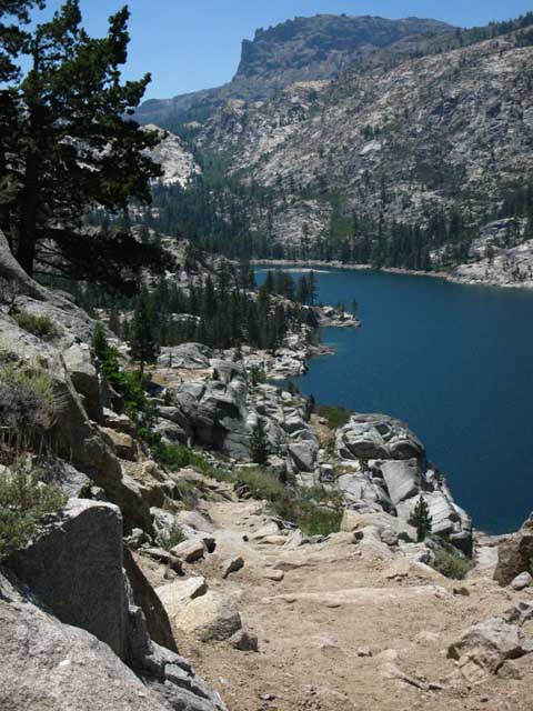 |
Rock & Sand Let's take a closer look below. Kennedy Meadows to Relief Reservoir |
Spur of Granite and Forest
on the
Southeast Shore of Relief Reservoir
 |
||
A closer look at the location of a matrix of many excellent trails to campsites along the Southeast-most shore of Relief Reservoir. That point is covered with a web of old trails linking bunches of campsites to lots of fishing spots. Scrambleland Granite Dome and the associated Black Hawk Mountain are premium terrain for cross country backpackers and scramblers. The Emigrant Wilderness Map from Wilderness Press that was published with their Emigrant Wilderness Hiking guide below depicts cross-country routes into Granite Dome and Black Hawk Mountain.
The Wilderness Press Yosemite and Vicinity Map contains an "inset" attaching the PCT route across Emigrant Wilderness from Sonora Pass to the main body of the map covering Yosemite, but it does not include the majority of our TYT route across Emigrant into Yosemite. Check out our Paper and Digital Map Solutions page. As the trail descends towards Relief Reservoir we will begin to intersect with, sometimes, a number of trails funneling down to the main line of the informal shortcut trail down to the campsites area on the Southeast shore of Relief Reservoir. |
The Main Shortcut Down
to the
Relief Reservoir Campsites
 |
Ducks mark the shortcut trail down through some manzanita to campsites along Southeast shore of Relief Reservoir. 7520 4.03 miles .14 of a miles South to Grouse Creek Ford/trail to Just past the double Grouse Creek ford just up ahead of us on the trail we will find another faint trail, the main trail down to the campsites along the Southeastern Shore of Relief Reservoir. Along the position of the duck above there are sometimes a series of little trails breaking through manzanita that mostly funnel together into the route down to a little jumble of fallen timber in heavy undergrowth where we ford Grouse Creek right before it empties into Relief Reservoir. A bunch of timber was swept into Grouse Creek a number of years ago, and seems to be working its way slowly down to the reservoir. This location makes this the worse fording point early in the season during high runoff. In that case we appreciate the way Grouse Creek is broken into two branches where the formal route of the trail fords. |
Looking Back, North,
at the
Trail along Southeast Shore of Relief Reservoir
 |
KEY VIEW In the image above we can see the canyons of both the Middle Fork of the Stanislaus running down from our position and the very bottom of Deadman Creek's Canyon, which Highway 108 followed down from Sonora Pass. Above the dam, and the dome rising just beyond the dam, the great feature we see is the Deadman Creek Canyon descending from the Right, the East, down into the Canyon of the Middle Fork of the Mokelumne River, which runs out the Left edge of the image. The top of the dome just beyond the dam almost exactly marks the location where these two canyons meet, and the great exposed triangular shape rising above the dome is the canyon wall marking their junction point. That's freeking huge. The route of Highway 108 runs through both canyons on its way climbing over the second highest pass of Sierra Nevada Mountain Range. Middle This section of the Middle Fork between Deadman Creek and the Clarks Fork is a real sweet section of this river. Not as nice as the uppermost segment of the Middle Fork where it breaks off Highway 108 to run up to its inception point entering Kennedy Meadows, but much nicer than after it joins the massive canyon the Clarks Fork carves on its way down the mountain. Run of Car Campgrounds Fed Status Deadman Car Campground (fed status) is located a short ways down the road to Kennedy Meadows off Highway 108. Here's all the That Cool Canyon It Climbs Fiercely Junction with History Further Back The upper Clarks Fork is unstable. Hard Rock Route The route up the Clarks Fork through Saint Marys Pass is through very soft terrain that is in motion. North & South Everything to the South of that line, which also roughly follows the route Highway 108, is in the Emigrant Wilderness. Both wilderness areas are administered by the |
VIDEO
Down to the Campsites
on the
Southeast Corner of Relief Reservoir
Relief Reservoir Campsites 9:06 Hiking down to the campsites along the Southeast side of Relief Reservoir, checking out the various campsites and trails down there. After walking around the campsites from the top-down on one trip we hike in via the shortcut and check it out from the bottom-up on another trip. After checking out the Relief Reservoir campsites we'll hike back out to the Tahoe to Yosemite Trail along the main trail from the campsites to the TYT just a bit South of Grouse Creek.
Our rules At the end of our visit we hike out the "main" trail back to the TYT and continue South on the Tahoe to Yosemite Trail up Summit Creek to Brown Bear Pass on our way to Yosemite. Videos
|
Relief Reservoir Campsites Below we are standing along the shore of Relief Reservoir looking Northeast at the terrain we hiked to get here from Kennedy Meadows Pack Station. We can make out the faint angled but straight line of the Tahoe to Yosemite Trail cutting a line traversing through the manzanita along the mountainside. We hiked down to the campsites from the ducked shortcut trail (pictured above) through the Manzanita pictured on the far Right side of image below, which is still North of the Grouse Creek ford. That route pushes down through some manzanita into a loose wash leading down to a point above the little inlet where Grouse Creek finally flows into Relief Reservoir.
Just above the lower Right corner and a bit down the shoreline of the image above we see the small triangular inlet where Grouse Creek flows into Relief Reservoir. Let's take a closer look. Grouse Creek Flowing into Relief Reservoir The shortcut route down to the campsites North of the Grouse Creek fords brings us down a steep exposed manzanita mountainside through a jumble of brush into a dark stand of forest where we ford Grouse Creek just a few dozen yards above where it flows into Relief Reservoir. |
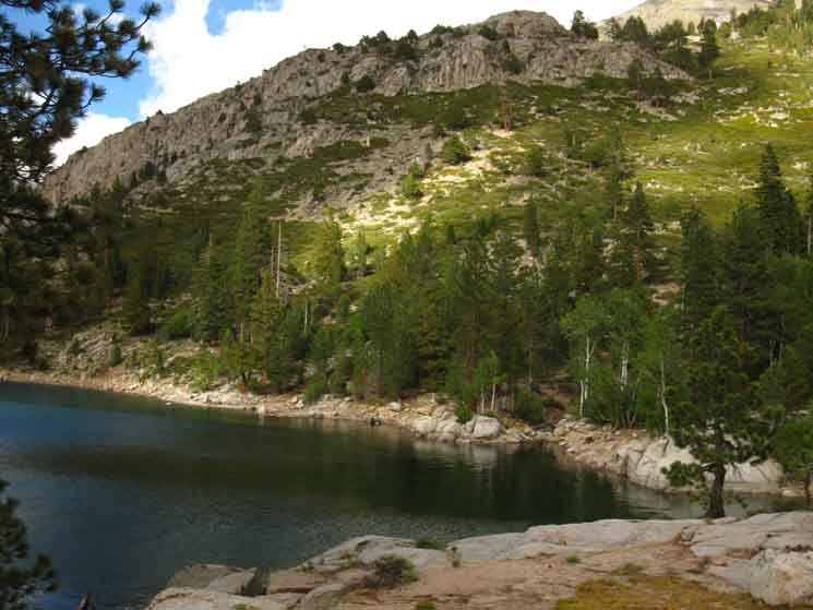
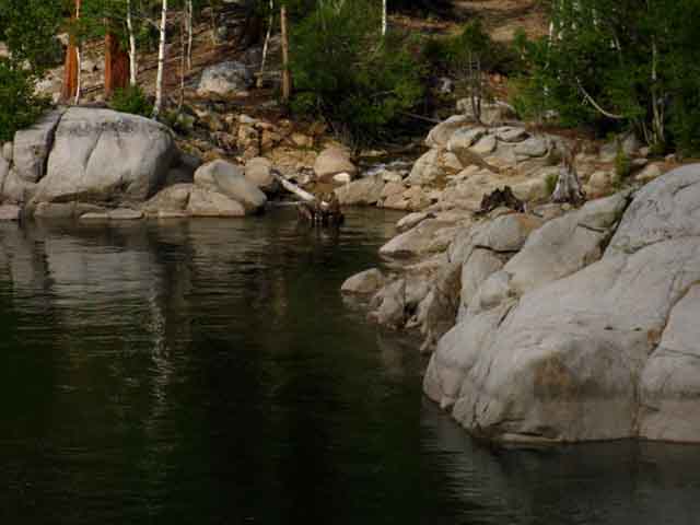
The Lower Grouse Creek Fords There are two fords of Grouse Creek. One is along the Tahoe to Yosemite Trail while the other is below it, where the faint shortcut trail North of the ford along the TYT drops us directly down to the Relief Reservoir campsites. If we continue South past the typically ducked shortcut trail, staying on the Southbound TYT, we reach Grouse Creek. I call this ford along the main trail the upper ford. Braiding of Grouse Creek has split this upper ford into two segments, nicely dividing up the flow into two easy fords. Well, maybe one and a half easy fords. The Northern of which has had fallen trees crossing it for as long as I can remember, while a reduced flow through the Southern branch does not typically demand a log crossing. This changes seasonally, of course. Every ford can be dangerous, but there are times during Spring of heavy snowfall years when virtually no ford is safe. If we hike down to the Relief Reservoir campsites on the shortcut North of the upper ford we will still have to ford Grouse Creek, but we will ford it just yards above where it flows into Relief Reservoir. I call this the lower ford. General Rule Fording Grouse Creek and continuing maybe forty yards further South down the Tahoe to Yosemite Trail, (though now we have begun to gently climb after crossing Grouse Creek), we come to the "main" Relief Reservoir Trail branching off West to Relief Reservoir's campsites. I've noticed this trail can be faint at its junction with the TYT, so look for it when you are around forty yards South of the Grouse Creek Ford. The trail down to Relief Reservoir "fattens Up" a few yards down the trail and is typically easy to follow. |
Made It !
View North towards the Dam
from the
Campsites along the Granite Flat
on the
Southeast shore of Relief Reservoir
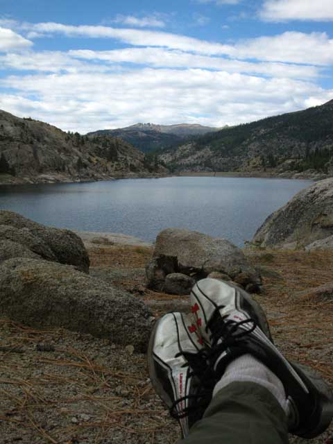 |
Relaxing with a long view North across Relief Reservoir. Using my feet as a different form of viewfinder... stationary mode... |
Relief Reservoir
and
Dam
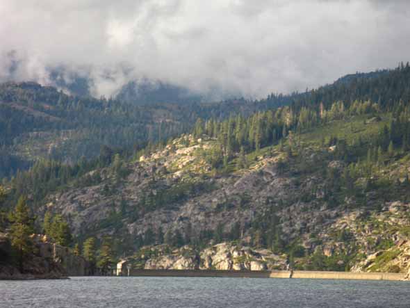 |
|||
Approaching sunset lights up the Southwest faces of the dam. The canyon leading up to Kennedy Lake is visible in the Left back.
|
Relief Reservoir Dam
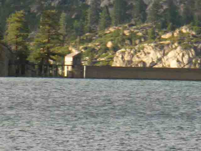 |
Last rays of the days sun light up the operations building above Relief Reservoir's dam gates. |
"Drop Campers"
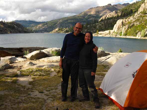 |
Wandering about the fine mixture of granite and forest holding the campsites on the Southwest shore of Relief Reservoir, I met these nice backpackers from Santa Cruz. They had each hauled in two big loads, so they could "drop camp" for 11 days here at Relief Reservoir. The plan was to bring in all the supplies to support an extensive stay of day hikes and scrambles from their well-appointed base camp. That's long enough to change your perspective. Two Legged Support Samples of Emigrant Wilderness Backpackers 2013 High Sierra Trail & Culture Report: Relief Reservoir & Beyond 2016 High Sierra Trail & Culture Report: Relief Reservoir & Beyond Four Legged Support |
Lodgepole Chipmunk
| Chipmunk visit at Relief Reservoir. | Chipmunk seemed concerned when I did not respond to his cuteness with food. | |||||
 |
 |
|||||
Judging by his approach to me this little bugger has convinced backpackers to give him food in the past. Not this time. I appreciate cuteness, but I never pay for it. |
Why aren't you feeding me? Because I never feed the wildlife, specifically to keep it wild. Feel lucky that the hawks and coyotes skirt my position, offering a nearby prey a momentary refuge in the shadow of my protection. |
Sunset Approaching Relief Reservoir
Nightcap Peak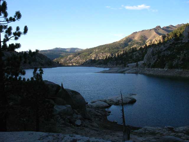 |
|||
Long shadows stretch over Relief Reservoir as twilight approaches. On the Right we can see Nightcap Peak atop the end of the ridge making up the North wall of the canyon holding Kennedy Lake at the base of its Southern-facing flank. On the furthest horizon beyond Nightcap Peak we see shadow and twilight along the top of the main ridge running up to Saint Marys Pass. That is the top of the massive ridge dividing the drainage between the Middle Fork's Canyon on this side from the Canyon holding the Clarks Fork on the other. The Deadman Route following Highway 108 up to Sonora Pass is located on this side of the low ridge between Nightcap Peak's ridge and the furthest ridge on the horizon. These two maps encompasses this whole view North out of the Emigrant Wilderness from Relief Reservoir into the Carson Iceberg Wilderness: Carson Iceberg Wilderness Hiking Map These maps cover our up to hike here and on toBrown Bear Pass, along with the miles and elevations:
Relief Reservoir to Brown Bear Pass |
Nightcap Peak Northeast of Relief Reservoir
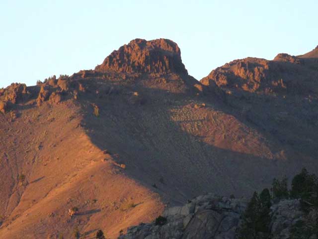 |
Nightcap Peak. Kennedy Meadows to Relief Reservoir |
Upper Grouse Creek Ford Below we come South on the Tahoe to Yosemite Trail to Grouse Creek where it runs across our route as if we had not cut off to our Right through the shortcut to Relief Reservoir's shoreline campsites. 7360 feet of elevation 4.17 miles 1.58 miles 4.06 |
Grouse Creek
Double Upper Ford
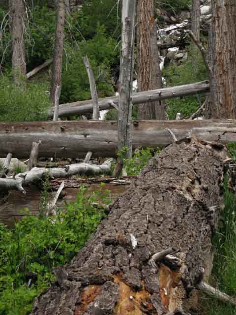
Over a fallen tree along a jumble swept down Grouse Creek.
Grouse Creek Ford
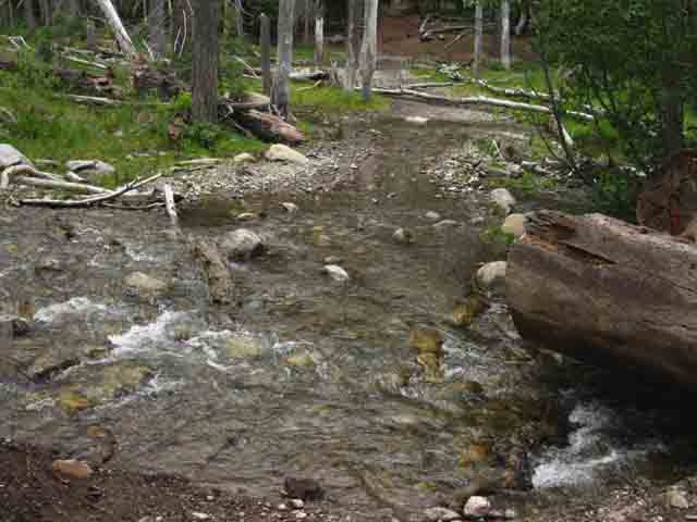
Grouse Creek braids out into streams, sheets, and flowing channels depending on the time of year
and the character of the seasons.
 |
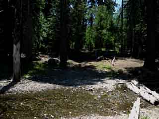 |
|
Looking East, to our Left, up the treefall swept down with Grouse Creek as we cross the first of the two braided streams of Grouse Creek. |
Grouse Creek splits off a little side stream around and South of the debris piled up around the fording spot. Thus we have two fords over Grouse Creek. |
The Faint Main Trail
to
Relief Reservoir
Campsites
Maybe forty yards South of the Grouse Creek Ford
View West towards Relief Reservoir
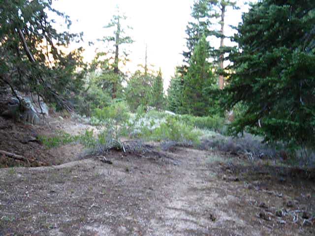 |
|||
Hiking about forty yards South of the Upper Grouse Creek ford we see the faint trail above tracking to the West, our Southbound Right. We are standing on the Tahoe to Yosemite Trail looking West, to the Southbound hiker's Right, at the unmarked faint trail leading out to the campsites on the Southeast shore of Relief Reservoir. This is the second, last, and the "main" trail to Relief Reservoir's campsites that Southbound hikers encounter. Just South of Grouse Creek we Southbound backpackers find this faint unmarked but high quality trail tracking off to our Right, leading down to terminate into the main campsite under the big Juniper Tree, with a series of trails beyond to the wide range of campsites scattered over this wedge of terrain on the Southeast shore of Relief Reservoir. This trail is where mounted parties head to the Relief Reservoir campsites.
|
Here's Where the Trail from above Grouse Creek Leads
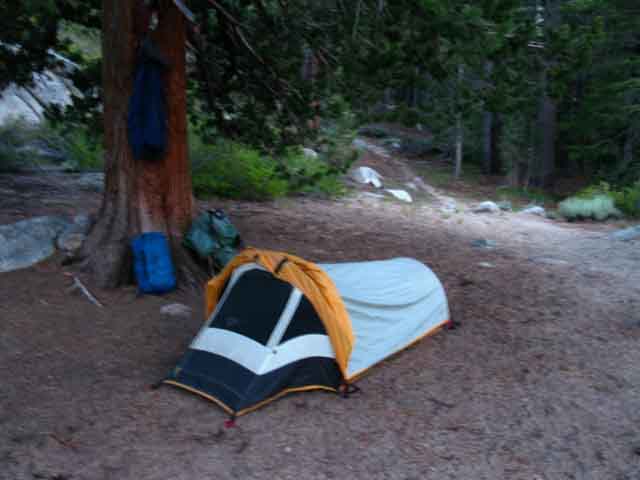
Overview of Lower Main Campsite from the Upper Main Campsite
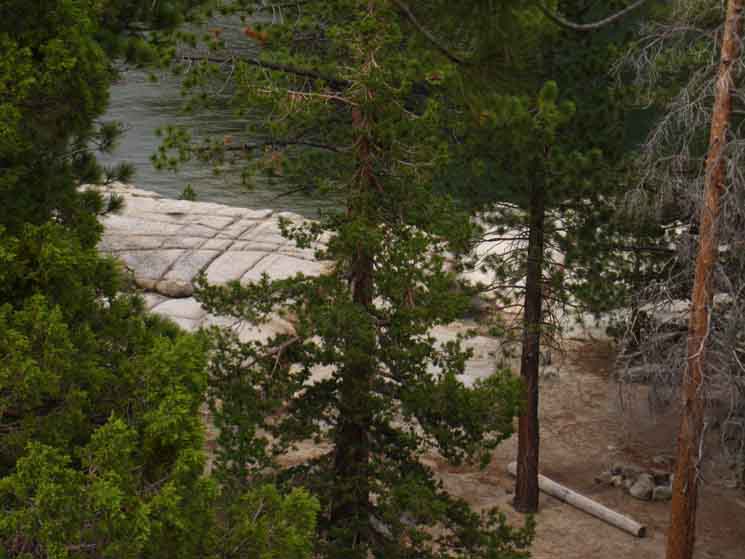 |
View down at the main campsite roughly in the center of the crescent of campsites wedged in along the rough granite shelf wrapping this part of the Southeast shore of Relief Reservoir. There are a bunch of sites in the rock wrapping around this central site. Hiking down to the Relief Reservoir Campsites via the shortcut trail brings us to the campsites down there, to the shore of Relief Reservoir wrapping around the main campsite area shown in the image above. Hiking to the Relief Reservoir Campsites via the main trail South of Grouse Creek brings us to the overlook from the Juniper Tree site, which is our observation point above. There are more large group-style campsites directly to the Right of the fire ring we see down there. There is another large site off to the Right, out of the view of the image above. Other campsites are located off the Left of the fire ring. In fact, the flat we are looking down into sports the main campsite/fire ring pictured above, and at least five other exceptional sites in nifty flats wedged into the surrounding granite slabs. Also note the big almost-flat granite slab we have down there to run around on. This place is idea for "scrambling-walks." This is a nifty place to kick back for a couple of nights. Relief Reservoir |
13 Backpackers
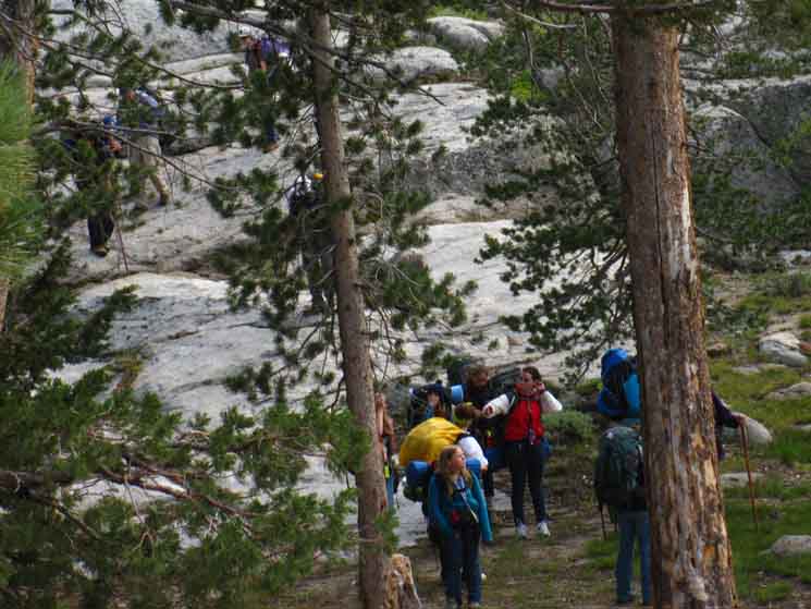 |
Can you see the 13 backpackers in the picture? Relief Reservoir Campsites are pretty busy. I was almost alone here when 13 backpackers of a group of unknown size hiked in from the upper ford. I figure there were "laggars" who would come in after this main body of hikers. They got off the route that leads to the juniper site South of the upper ford, or deflected off of that route down after seeing that I was in the high site. Or they wanted to camp on the lower site. Or they lost the faint trail down, and picked their way through the rock formations down to the lower sites. The biggest group sites are located at the lower sites, so it makes sense for a large group to camp down there, independent of how they finally found their way down. Anyway, I was sitting on a well situated rock for observing all visible terrain when they hiked in. The group never became aware of my presence, though I observed and listened to them. Two things here: there are generally a lot of folks out here during mid Summer weekends, though not many during the week. Even during mid Summer. Second, this place attracts clubs and recreational groups. The group above was some kind of club or employee group. Maybe even a church. Third: can you find all thirteen hikers in the image above? |
Three Views
of
Grouse Creek
As we scramble about exploring the various routes and views we get from between the upper and lower campsites, and all around the Relief Reservoir campsites, we note the steady sound of water falling is the auditory backdrop of this whole place. Our ears direct our eyes to the source of the sound from positions East of the upper site. See it there? The slash of whitewater in the rock, forest, and meadowed mountainside?
The view of Grouse Creek we get hiking South along the Tahoe to Yosemite Trail to the upper ford is a restrained view. We really can not see its course. The meadow along the top of the cascade
Kennedy Meadows to Relief Reservoir Soundtrack This is the source of the beautiful background music reverberating off all the granite faces we hear while camping at the campsites along the Southeast shore of Relief Reservoir. How loud the music is dependent on the power of, and what part of the season we arrive. |
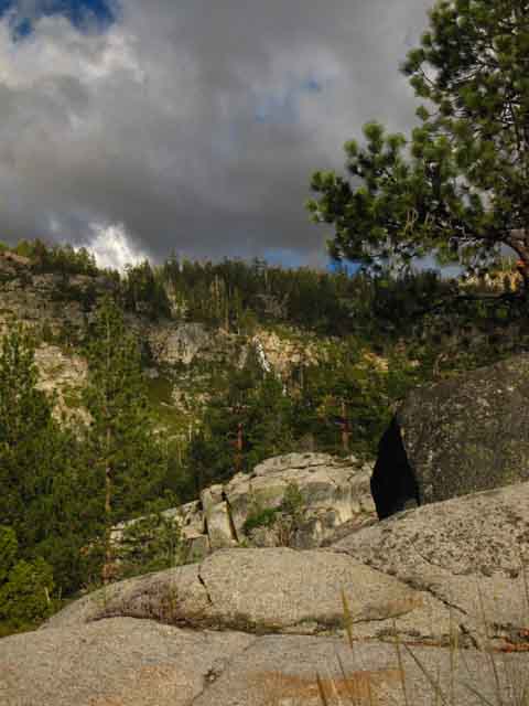
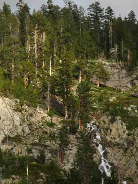
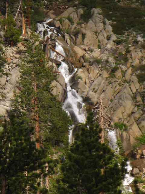
Far South End
of
Relief Reservoir
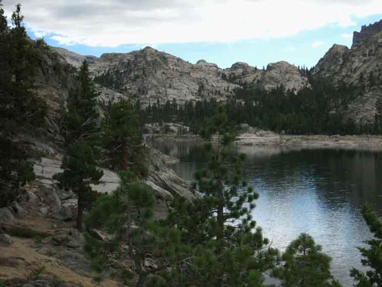 |
Look at the line of granite knobs running out in the distance. Raindrops decorate the surface of Relief Reservoir as we drop down from the upper campsite approaching its shore. From here we get views of the fishing trails down to the Left, down to the Southwest end of Relief Reservoir. Kennedy Meadows to Relief Reservoir To our Right we bend around through complex shoreline terrain of forest and rock to the main lower campsite, and all the campsites nestled in flats between arms of rock and forest. The next morning we watch the last wisps of this storm's clouds disappear into rolling currents of air heating in the piercing rays of the rising sun.
Above is the very last wisp of a moderate-strength Pacific Storm that swept across the High Sierra for the last couple of days during late June of 2013. Fairly rare, but not surprising. Most weather coming across the Sierra during Summer are local weather created by air coming across and that being evaporated out of the San Joaquin Valley. This ride across the valley during hot temps creates vast moist cells of superheated air that subsequently has its rain and electricity squeezed violently out by rapid cooling during its swift passage up and over the Sierra Crest. Local Thunderstorms The violent contraction of these superheated cells of air and moisture cooling rapidly appears to spin a vapor dynamo within these cells capable of generating vast amounts of both rainfall and electricity, when conditions are perfectly aligned.
Summertime Pacific Storms Summertime Tropical Storms |
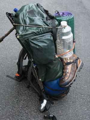
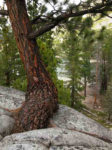
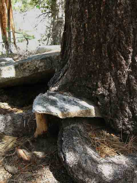
Back
to the
Upper Main Campsite
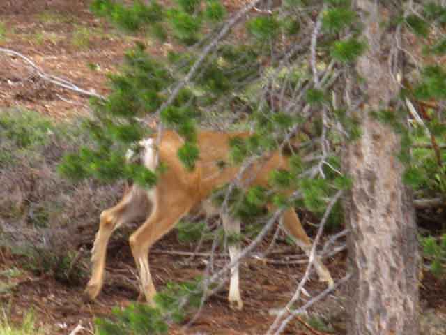
Departing
the
Upper Main Campsite
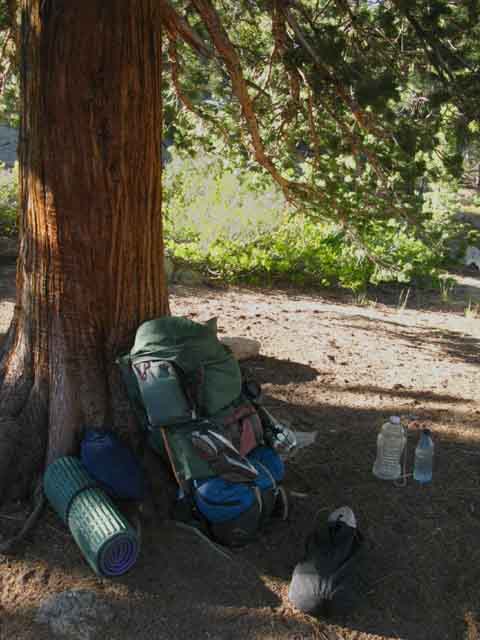
South
on the
Tahoe to Yosemite Trail
Hiking South Back to the Trail We could use the shortcut trail if we were returning to Kennedy Meadows. This next segment of our trail South is characterized by our climb from Relief Reservoir to Sheep Camp, on our way to Brown Bear Pass. The first part of this segment is the climb up and into the middle segment of Summit Creek's canyon. We just completed the first segment of this trip, the hike through the unique lower canyon up to Relief Reservoir. Trip Segments I measure the second segment of our hike from Sheep Camp to Relief Reservoir. First Segment Second Segment Top Segment This upper segment is also bracketed by volcanic material to our North and granite to our South. Changing Terrain These segments of our trail to Brown Bear Pass present quite an "evolution" of terrains which tell a number of stories. Upcoming Landmarks We have the final climb to Brown Bear Pass beyond the Mosquito Pass trail junction. Our miles and elevations page lists these upcoming locations of note in order, cites their mileage along the Tahoe to Yosemite Trail, their elevation, and links to each location's trail guide entry. Fire Ice Time Life Our lower climb has been through granite. Though we cannot yet see it during most of our hike up to Relief Reservoir, above the granite terrain to our East is a huge volcanic ridge covering the granite. Hiking above Relief Reservoir we are bending our route Southeast to get up and off the West flanking base of this great ridge running up to the Sierra Crest. Our route is getting around the Southwestern-most corner of this ridge and into the valley below its Southwestern facing flank. The Big Picture Here at Relief Reservoir we are beyond the Western reach of these ancient volcanic flows capping the ridge to our East. Yet we can see indications that this granite wrapping around the East shore of Relief Reservoir is protruding out from under a massive volcanic topping. Hiking Southeast up into Summit Creek's middle segment of canyon above Relief Reservoir we begin to see that we are hiking out of this lower elevation granite terrain into higher elevations under the coverage of these ancient volcanic flows. The terrain to our North-Northeast is transforming as we climb to the Southeast. Looking closely around our trail climbing along the base of the Southwestern-facing flank of this canyon we can see that this great ancient volcanic feature capped by Relief Peak is covering even older granite features we see sticking out beyond the furthest reaches of the volcanic flows here and there as we climb up into the volcanic zone. In other locations we can see that the harder once-covered granites have actually eroded out from under the coverage of these soft over-covering ancient volcanic flows. Epic Vistas are Opening... Despite all of this volcanic activity sufficient to cover the massive ridge making up the North flank of the upper canyon, the limit of its flows still allowed the South side of this beautifully bifurcated canyon to remain clear of volcanic debris, surviving to eventually be named Granite Dome. Red & White In the Meantime... Oh Yeah. Have A Nice Trip |
Back
to the
Tahoe to Yosemite Trail
Faint Junction at Relief Reservoir
 |
Looking West across the Tahoe to Yosemite Trail at the faint trail to the Relief Reservoir Campsites. It appears as a sandy, washed-out bit of faint deer trail. Forty Yards South of Grouse Creek 7360 4.17 miles 6.75 miles Note the deeply grooved bed of the North-South route of the Tahoe to Yosemite Trail across the bottom of the image compared to the faint crease of trail angled off to the Northwest, to Relief Reservoir at the top Right of the image. Now we continue hiking South deeper into Emigrant Wilderness, to our Left in the image above, along the Tahoe to Yosemite Trail up through Brown Bear Pass and into Emigrant Meadow. Kennedy Meadows to Relief Reservoir |
Sunrise Departing Relief Reservoir
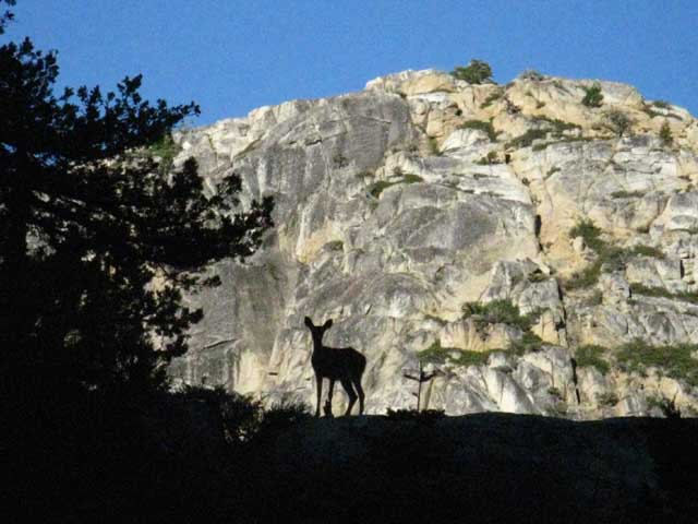 |
Deer pointing ears at us along ridge line between Tahoe to Yosemite Trail and Relief Reservoir, hiking South from the Upper Ford trail junction towards the Lower Relief Valley junction. |
South End
of
Relief Reservoir
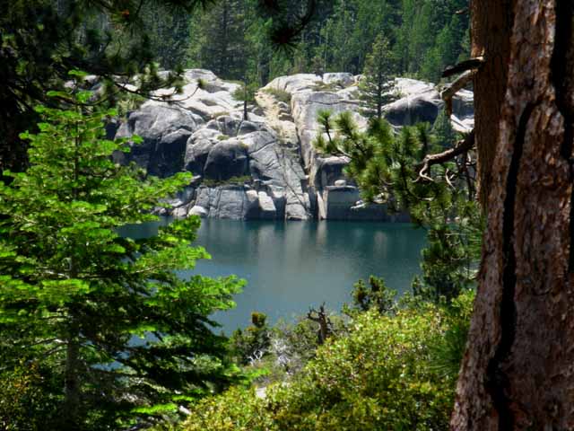 |
As the trail begins bending Southeast to bring us up into the awesome canyon holding Summit Creek we get fleeting views back through breaks in the forest cover, when we turn around, of the South end of Relief Reservoir. Dig the granite. Kennedy Meadows to Relief Reservoir |
Trail Climbing South
above
Relief Reservoir
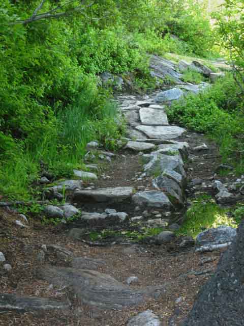
Enter the Canyon
Southeast climbing up under the outstretched lower Western Flank's
Granite Arm
of the
Summit Creek Canyon
towards
Brown Bear Pass
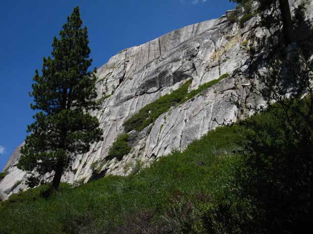 |
|||
Granite wall towering above as the trail begins bending Southeast from the South end of Relief Reservoir, bending up towards the canyon cut halfway through solid granite and halfway through pure volcanic debris that brings Summit Creek down the Western flank of the Sierra. Far above this granite foundation this mountain is topped by volcanic terrain. As we climb into the valley we will see that the granite is solid on the South side of the valley, but that the granite on the North side of the valley has been drowned by ancient lava flows. The granite terrain only emerges from its volcanic jacketing in selected lower elevation locations, such as the lower Western flank of this ridge wrapping around the East Shore of Relief Reservoir. Such as the great slab pictured above, beyond the furthest reaches of the volcanic flows. As we climb higher we will see the center of the valley precisely divides the granite to the South from the lava to the North. Along the flanks of the Northern canyon wall we will see great granite features eroding our of their ancient volcanic jacket. This trail gets better and better as we climb higher and higher. This is just the beginning of a great show with many acts.
|
| NEXT We begin the climb Southeast up into the middle segment of canyon bringing Summit Creek down from Brown Bear Pass. |
North: Sonora Pass Trailheads East: Kennedy Lake South TYT: Relief Reservoir to Brown Bear Pass
Kennedy Meadows |
Tahoe to Yosemite Trail This page begins the Emigrant Wilderness section of our Tahoe to Yosemite Trail backpacking trip through Kennedy Meadows Pack Station. The Tahoe to Yosemite route across Emigrant Wilderness is a good start for exploring the backpacking possibilities both across and within the High Emigrant Wilderness. The following trail guide pages and their associated maps point towards some grand backpacking loops around the Emigrant Wilderness as well as a guide to the Tahoe to Yosemite and Pacific Crest Trails across Emigrant Wilderness into the Northern Yosemite Backcountry. The 70+ mile hike from HIghway 108 to Tuolumne Meadows is a classic, whichever trailhead you begin through, or whichever final route you select. However you approach the Emigrant Wilderness, as a long distance backpacker, a weekend warrior, or with a grand nine-day loop around the Wilderness, you will find this an intriguing and beautiful place that offers us as much depth of experience as time we can put in. Though this guide is fairly detailed, it merely scratches the surface of the Emigrant Wilderness. The High Emigrant Wilderness is a scrambler's paradise. Once you figure out the routes of the trails and the basic layout of the Emigrant Wilderness terrain along the Sierra Crest and its Upper Flanks you will see miles and miles of trails, routes, and cross-country scrambles open up before you. Whoo-hooo! MAPS 7.5 Map 30 min Map Trail South |
Scroll up to view TYT North to Kennedy Meadows
Backpacking Trail Guide TYT |
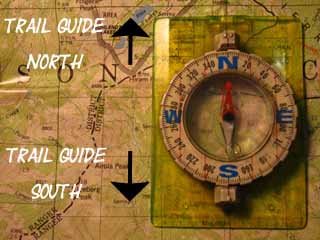 |
Backpacking Trail Guide TYT Relief Reservoir East |
Backpacker ForumsHave a great Sierra Nevada trip or story to relate? A fine piece of gear? Or gear that failed?Post it onTahoetoWhitney.Org If you have experiences, comments, questions, or pictures and videos of the Tahoe to Yosemite Trail between Kennedy Meadows to Tuolumne Meadows, Post 'em up here:Forum Section
|
North (108 Corridor): Sonora Pass Trailheads East to PCT: Kennedy Lake South TYT: Relief Reservoir to Brown Bear Pass
Trailhead
Contact
Alex Wierbinski
Backpacking Lake Tahoe to Mount Whitney
Your Guide to the High Sierra Crest, including the Tahoe to Yosemite, Pacific Crest, and John Muir Trails