


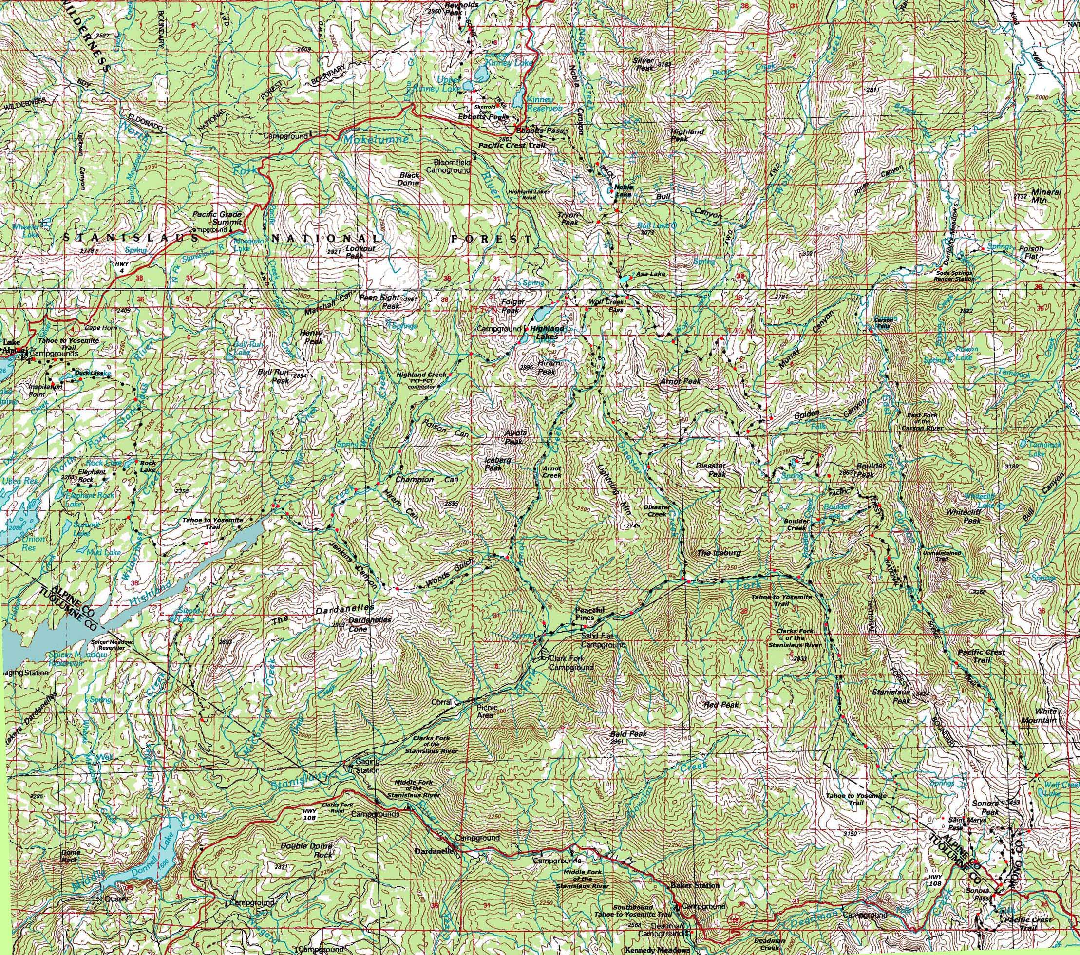
Carson Iceberg Wilderness Topo Hiking Map
Backpacking
The Pacific Crest Trail and The Tahoe to Yosemite Trail
across the
Carson Iceberg Wilderness
Two 30 minute USGS Topographic Backpacking Maps

Maps |
Trail Guide Index |
Map |
Map |
Trail Guide |
30 min |
Miles and Elevations |
Permits |
Weather |
This map brings you there:
| Click BLACK DOTS for Detailed Maps |
Click RED DOTS for Trail Guide Information |
North map: Mokelumne Wilderness Topo Map Click Red Dots South map: Emigrant Wilderness Topo Map
|
North map: Mokelumne Wilderness Topo Map South map: Emigrant Wilderness Topo Map
Mapology |
||||
MAP NOTE What's important for our general reference purpose is that each side of a square is 1000 meters, or a Kilometer. From my point of view that is 1093.6 yards or .62 of a mile. Diagonal: 1414.22 meters, if my trig is correct. That converts the diagonal distance into 4,639.8 feet or .88 of a mile.
|
HIGHWAY 4 CORRIDOR ROAD MAP Ebbetts Pass (PCT) and Lake Alpine (TYT) This is a road map for highway access to the trailheads on the North end of the trail map above. Centered On
|
HIGHWAY 108 CORRIDOR ROAD MAP Sonora Pass (PCT) and Clarks Fork Road and Saint Marys Pass (TYT) This is a road map for highway access to the trailheads on the South end of the trail map above. Centered On
|
North map: Mokelumne Wilderness Topo Map South map: Emigrant Wilderness Topo Map
| Elevations | More Information | ||
Lake Tahoe: feet Meeks Bay Trail head: feet elevation rise: meters, or feet |
|||
Map Credit |
U.S. Geological Survey, Department of the Interior The Move the Map to the Sierras. Select size of Maps you wish to locate. Click "Mark Point" on map to see the USGS map grid of the selected map scale. |
Trailhead
Comments? Questions?Pick your Place:
Carson Iceberg Wilderness Backpacker's
Forum
| West Flank TYT |
East Flank PCT |