

Desolation Wilderness Topo Hiking Map
The Tahoe to Yosemite, Pacific Crest, and Tahoe Rim Trails
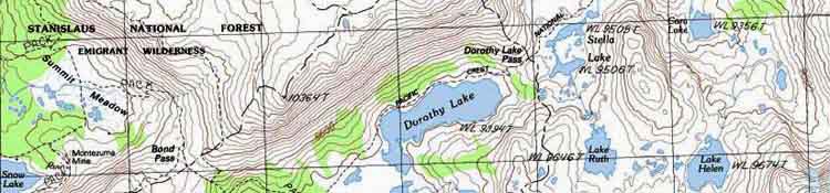
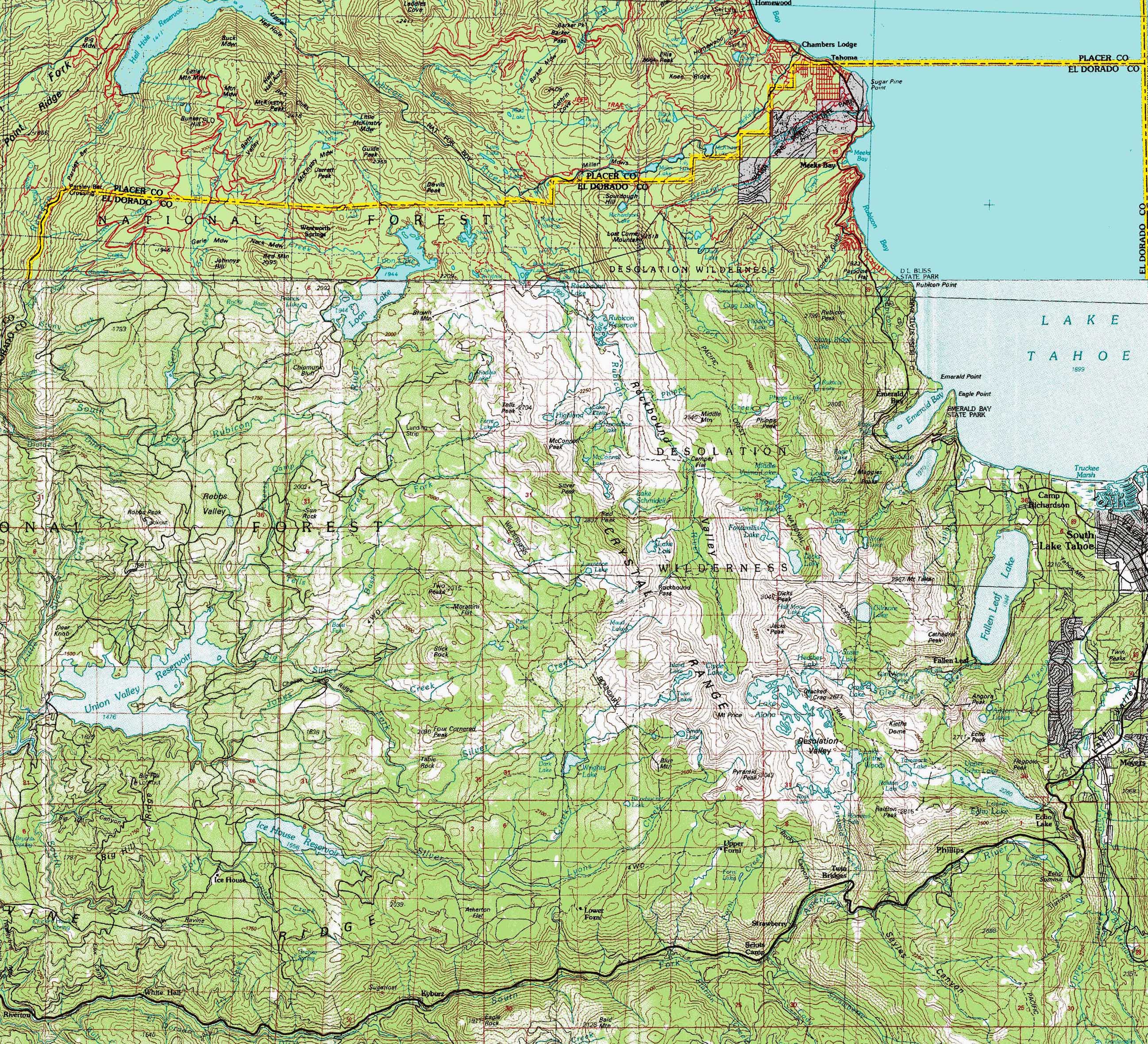
Two USGS 30 minute backpacking topo maps of Desolation Wilderness
| Meeks Bay to Echo Summit MAPS INDEX |
7.5 min maps |
next 7.5 min map: | full Echo Lake 7.5 Map |
30 min MAP Desolation Wilderness with trail routes marked |
30 min MAP SOUTH MEISS COUNTRY ROADLESS AREA |
Trail Guide |
all maps | all pages | Miles and Elevations |
Desolation Wilderness Topo Backpacking Map
| Click MAP for Detailed Maps |
Western Approaches and Eastern Limits
| North Desolation Trail Map | 30 min MAP SOUTH MEISS COUNTRY ROADLESS AREA |
|
| North Desolation | South Desolation | 30 min MAP SOUTH MEISS COUNTRY ROADLESS AREA |
Location |
|||||
Main Features This map covers the whole area of Desolation Wilderness, including its Western Approaches, and not just the central zone of Desolation Wilderness through with the TYT, PCT, and TRT pass. Scroll over the Right side of the map above to find that the North, Central, and Southern portions of the map above are linked to the detailed maps for each of those areas, just as the bottom-Right of the map is linked to the detailed map of Meiss Country Roadless Area South of Highway 50. Those subordinate detailed maps are marked up with our main TYT-PCT routes. I decided to leave this map "plain," not marked up with the main trail routes so that we could get a better idea of the terrain and contours without distraction. The rest of the 30 and 7.5 minute maps are marked up with specific trail route and location links.
|
| Road and Trailhead access to South Lake Tahoe |
||||
| Three Excellent Representative Trailheads Highways 50 and 89 Meeks Bay, Echo Summit and South Upper Truckee Trailheads |
South Lake Tahoe Resources Highways 50 & 89 |
|||
More
|
||||
Mapping Information |
|
Permits Western Desolation Trailhead Permits Desolation Wilderness
Mileages
|
Topo Maps Upper Map Lower Map Compass Offset
scale Contours
Backpacking permitting authority
|
| North Desolation | South Desolation | 30 min MAP SOUTH MEISS COUNTRY ROADLESS AREA |
| Elevations | More Information | ||
Lake Tahoe Meeks Bay Trail head elevation rise |
Trail Guide, Section Trail Guide, Segment Google Map |
||
Map Credit |
U.S. Geological Survey, Department of the Interior: The Use search term "Meeks Bay," and "Address," as search type to locate this USGS map. USGS Topographic |