High Sierra
Backpacking
Trail Guide
Forums
Sierra
Weather
WeatherNotes Northern
Sierra Weather
Gear
The Tahoe to Yosemite Trail
Backpacking or Day Hiking to
Lake Genevieve out of Meeks Bay
Backpacking Desolation Wilderness on the The Tahoe to Yosemite Trail
Languages
Trail Skills
Mountain
Safety
Food
Planning
Trail Arts
More
Information
Social
| Trail Guide Section INDEX |
North |
South |
Topo Map Meeks Bay to Dicks Lake |
Miles & Elevations |
Miles and Elevations INDEX |
Lake Tahoe Basin Management Unit PERMITS |
All |
All |
Hiking
Lake Genevieve
Backpacking Desolation Wilderness
Last Steps to Lake Genevieve
We are 4.39 miles South of the Meeks Bay Trailhead.
More campsites around this end of Lake Genevieve are available by continuing South down the TYT trail for just a few more steps while watching carefully off to our Left, where we will see some campsites up and off to our Left. The Next 2.23 Miles:
Lake Genevieve is followed immediately by Crag Lake and then Shadow Lake after a short climb, with Hidden Lake offset, "hidden" in a crinkle of terrain between Crag and Shadow Lakes. Each lake has its set of campsites stashed around it. The narrowing line of the surrounding ridges pinch-in towards the top of the valley, running right up to the Southern Shore of Stony Ridge Lake, leaving a narrow track for our trail between water and a steepening rock for our hike down to the South end of Stony Ridge Lake.
Marsh at the Head of this Valley It looks like a favored hangout for ducks, though.
High Sierra Mosquito Information Skeeter Instructional & Informative
High Sierra Weather Information Local Temp and Snow Reporting Stations
Lake Tahoe Basin 7-Day Weather Forecast
|
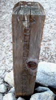
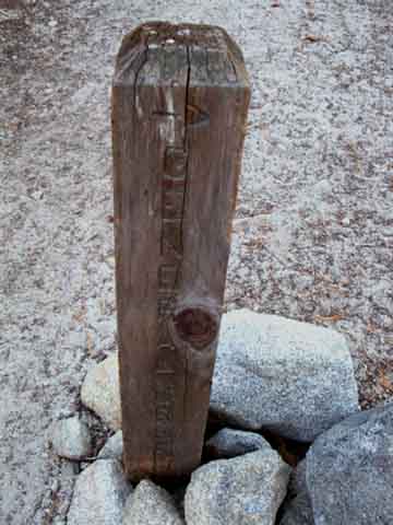
General Creek Trail Junction
Lake Genevieve
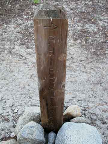
Trail Post at Lake Genevieve. GENERAL CREEK |
Same Post-Different Side: PHIPPS PASS |
|||||
 |
 |
|||||
Right to General Creek This unmaintained route finds the top of the General Creek Trail by hiking Northeast to make our way around the nose of the ridge on the NW side of Lake Genevieve to follow the upper stretch of Meek Creek along an unmaintained route to where it overlooks General Creek and its trail. The 30 minute maps depict the trail from Lake Genevieve to General Creek as a trail route, but it is currently an unmaintained route, rather than a maintained trail. |
Veering Left with the TYT
Phipps Pass is 4.49 miles South of Lake Genevieve. The TYT-PCT junction is 7.11 miles
The route of the TYT South is well marked, well maintained, and easy to follow.
|
The Numbers
Lake Genevieve
7400 Feet
Mileage
4.49 miles North of Phipps Pass.
Maps, Miles and Elevations
|
Lake Genevieve General Creek trail junction above: General Creek
Northbound hikers can veer Right around the North shore of Lake Genevieve to find their way West to General Creek to trace out the cross country route along the top of the Western Upper Branch of Meeks Creek around the nose of the ridge to find General Creek and its shortcut to the Pacific Crest Trail North of our where our TYT route intersects with the PCT.
SOUTHBOUND TYT Us Southbound TYT hikers veer Left past the General Creek junction on the nose of Lake Genevieve to continue following the well-grooved route of the Tahoe to Yosemite Trail on our way South up this valley to hike over Phipps Pass to our intersection with the Pacific Crest and Tahoe Rim Trails, a bit South of where the General Creek route hooks up with it..
11.5 miles Our destination along this first segment of the Tahoe to Yosemite Trail starting out of Meeks Bay Trailhead is the trail junction where the TYT Tees-Out into the line of the Pacific Crest and Tahoe Rim Trails 11.5 miles South of Meeks Bay Trailhead. This junction is located just .82 of a mile North of fine campsites around Middle Velma Lake.
From that point our combined TYT-PCT-TRT trail will take us South through the heart of Desolation Wilderness, and most of the rest of the Southwestern quadrant of the Tahoe Basin.
General Creek Northbound hikers can veer Right to trace out the cross country route along the top of the Western Upper Branch of Meeks Creek around the end of the ridge wrapping around Lake Genevieve, to find General Creek and its shortcut to the Pacific Crest Trail North of our TYT route.
Local Loopers The General Creek trail to the PCT is a well worn cross country route. This status is a function of the popularity of Desolation Wilderness. Wear Factor The burnishing of the stone terrain and the compression of soils by the long application of feet is observable. Save the Web Consumers consume. Too many consumers consume too much. Trails cutting like wounds in the terrain are a sign of too many consuming too much. The weight our our existence should not damage the planet.
End all Demographic Growth in the USA!
|
High Sierra Video
Lake Genevieve Desolation Wilderness Afternoon. |
||
Video: Lake Genevieve, Desolation Wilderness, afternoon. Duration 1:04. |
Camp Notes:
|
| Astronomical Navigation Information |
Astronomical Links |
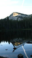
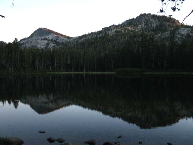
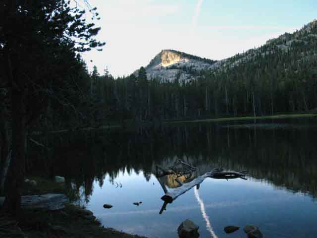
Sunset in the Desolation Wilderness behind Lake Genevieve
 |
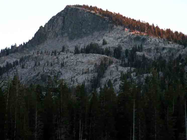
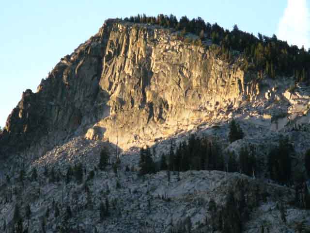
| Peaks 9054 (Left) and 8721 behind Lake Genevieve. |
Detail of Peak 9054, Sunset in the Desolation Wilderness, behind Lake Genevieve
 |
Sunset over the Northern Desolation Wilderness. Majesty is relaxing. But nature can be disquieting to folks used to the security of walls. Folks who are a bit nervous about sleeping outside in nature only have to follow some basic practices of food and consumable storage to give themselves a reasonable assurance of safety. If this is not enough, then the knowledge that backpacking in Desolation Wilderness puts you into one of the most heavily-used wilderness areas in the country, likely with many neighbors, and plenty of human contact. Just as with adjusting to physical work of backpacking by degree is a wise approach, so too can a gradual approach to psychologically adjusting to isolation in the Natural Environment be wise. Lots of Company
|
Views of Lake Genevieve
Desolation Wilderness
Sunset
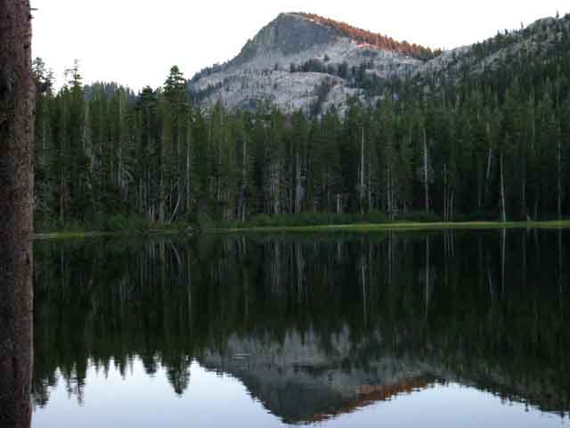
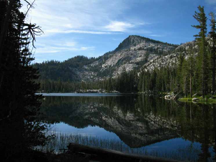
Peak 7820 (Above) sits behind Lake Genevieve with Peak 9054 (Below) the next peak increasing in height to the South of Lake Genevieve.
Lake Genevieve, Desolation Wilderness
morning
| Lake Genevieve | ||
Video
|
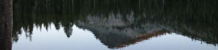
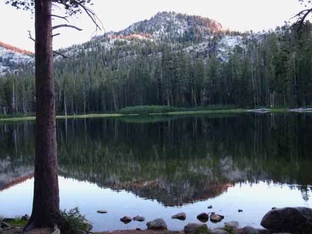
The Value of Reflective Water There are sometimes unique moments of early morning stillness
in the mountains. Stillness Ensues. A Profound Quiet and Calm envelopes reality. The beauty surrounding us rapidly multiplies itself during these fleeting seconds when air and water become momentarily balanced. Critical Mass is attained when this external beauty
Through the Looking Glass Other times the lightest of breezes drive shimmering waves reflecting a chaotic world of sparkling lights dancing on the lake's surface, sometimes shimmering whirlwinds. Merced Lake Shimmering Sunset video Both states are nice. Let Nature Feed your Soul These beauties act as a trigger, tapping into deep internal reservoirs of experiences, skills, resources, and feelings that nature equipped each of us with, but only come out when called back to natural engagement. "They" say that "humans only use 10% of their brains." I say that humans have lost 99% of their physical and spiritual assets, having forgotten that engagement with nature is not just the key to the meaning of life, but to a meaningful life as well. There is a physical, natural basis and context below all experience from which we can measure all human gratifications. Most human gratifications are meaningless exercises of meaningless consumption. Reflecting lakes are the sparkle in Nature's eyes, and the eyes are portals to the soul, as "they" say... Beautiful reflective lakes act as a spiritual/psychological key, one of the Natural contexts that create meaning for humans. The psychological effect of this great beauty justifies the hard work required to view it. Nature has other uses for our lost observation and engagement skills. But it first has to break them loose from their social captivity. The stillness of reflective lakes are portals linking the spirit of Nature to the souls of men. These are the times and situations that draw out and reward our engagement. The work required to engage nature and its beauties does not just deepen the beauty, but becomes a vital part of the beauty itself. The Journey Begins This new feeling is the knowledge that the deep joy of engagement with Nature does not just open up and draw out hidden skills and potentials within ourselves that are normally locked down by the spiritual wasteland of urban life, but that these natural interactions introduce alternative definitions of the nature and the meaning of life than the passive consumer gratifications popular today. Life to be lived, not consumed. We've only just begun to scratch the surface. Let the backpacking begin! We're falling into the real looking glass now... |
Sunrise
Peak 9054 (Above) is the second peak to the North of Phipps Pass, and it dominates the terrain as we hike through this valley and its series of fine lakes. We are viewing it across Lake Genevieve above and across Crag Lake in the image below.
The image below is Peak 9054 seen above Crag Lake, which is the next lake in the series above Lake Genevieve. the image above Right is looking at Peak 9054 across Crag Lake, the next lake in the series of lakes in this sweet valley.
First Light
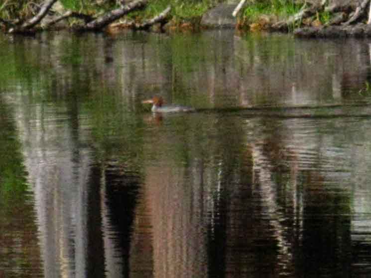
Sunrise's first light strikes above Lake Genevieve on Peak 9054 drawing a Merganser out for breakfast, starting the daily cycle of life in the Desolation Wilderness.
Our daily cycle involves hiking through and observing as much of the local activity as possible.
Merganser on Lake Genevieve
 |
| Merganser soon puts the head down, and begins trolling on Lake Genevieve. |
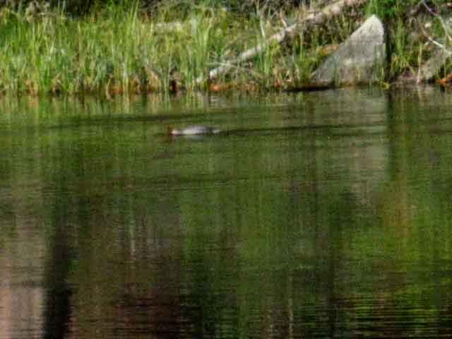
Locating Breakfast
 |
Something below has drawn the Duck's full attention, stopping to get some focus on what has been found. |
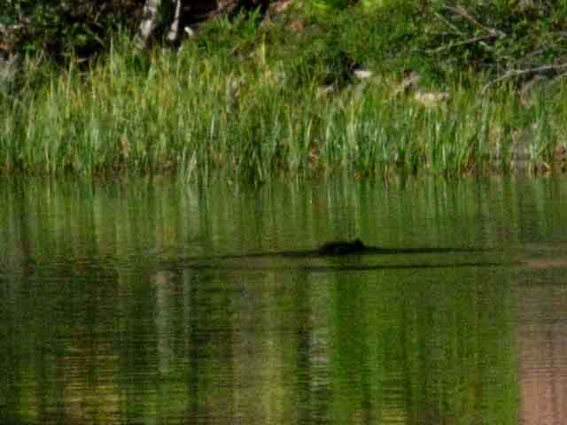
Rippling Waters
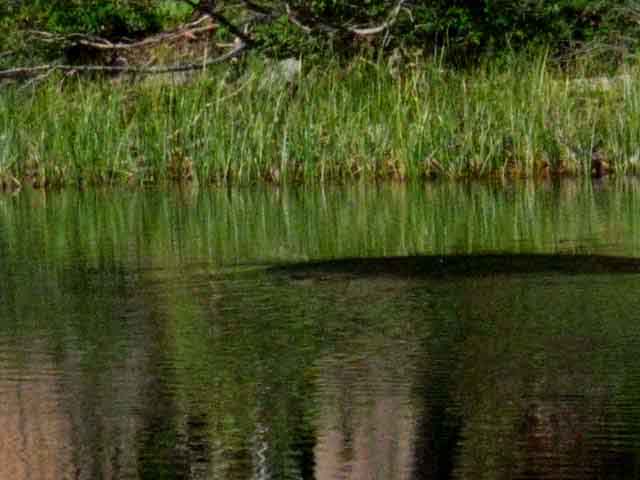 |
| A little underwater flying to get breakfast. |
Lay of the Land At Lake Genevieve we have climbed up to the mouth this narrow canyon to hike past a popular chain of lakes wedged along the 2.23 mile span of this gradually rising canyon from Lake Genevieve up to the soggy South end of Stony Ridge Lake. We're going to hike out of the soggy end of this gentle valley onto the steepest part of our hike so far, the climb up to Phipps Pass beginning from the boggy meadows on South of the South shore of Stony Ridge Lake. A Heavy Weight These subtle signs of very heavy use tell us two things. First, that there are going to be lots of campsites nestled around each and every one of the lakes leading up to Phipps Pass (and in all of Desolation Wilderness), and Second, that we are going to meet lots of backpackers here during the peak of the Summer backpacking season. Desolation Wilderness is quiet in Spring and quiets down in Fall. In fact, the heavy use of the totality of the Desolation Wilderness indicates that every place you look at and say to yourself, "That looks like a nice place to camp" is likely to contain a campsite. I feel a vexing contradiction between the beauty of Desolation Wilderness and its overuse as the population of California and Tahoe irresponsibly exploded. My inadequate personal solution is to avoid high-traffic areas like Desolation Wilderness and Yosemite Valley during the Summer, restricting my visits to these kinds of high traffic area to Fall when the crowds have thinned, and Spring before they begin to build up in earnest. We can see the physical justifications for the Lake Tahoe Basin Management Unit's quotas and permit restrictions in the deeply cut trails and highly compressed soils around the aprons of these sweet lakes. The Forests and Parks have been getting weird and deceptive in their imposing permit restrictions. Though Desolation Wilderness is busy and shows signs of overuse, one of the unexpected pleasures of backpacking the Desolation Wilderness is meeting the vast community of backpackers hiking its trails. Desolation Wilderness appears to be the number one Summer weekend destination for beginner to intermediate backpackers, family backpackers, and day hikers from all over Northern California and Northern Nevada. The good thing about this is that backpackers are generally great folks. It's always a pleasure to meet us on the trails. |
Video
Lake Genevieve in the Morning I
| Lake Genevieve | ||
Video: Lake Genevieve, Desolation Wilderness, in the morning. Duration 1:04. |
Chain of Lakes Lake Genevieve is the first in a series of five lakes we encounter entering the mouth of this gently rising valley. We pass these lakes while hiking within the two and a quarter mile length of this gentle rising valley. Enjoy it now. Genevieve, Crag, Hidden, Shadow, and Stony Ridge are the series of lakes we will encounter. Let's take a look at them on the map and miles pages:
These lakes give us lots of camping options along the length of this valley fitting between the fourth and sixth miles of our hike South out of Meeks Bay. Rubicon Lake is not one of our options along this little chain of lakes. Rubicon Lake is nestled into rocky folds buried under dense forest above the head of this valley, about 400 feet higher and a mile further South past the South Shore of Stony Ridge Lake, which is the last lake in this little series of valley lakes. Note Stony Ridge lake's position on the map. The narrow strip of flat terrain the TYT runs through between Stony Ridge Lake's NE shoreline and the rising terrain is too narrow for legal camps, though there are campsites halfway down the length of the lake. The terrain off the South Shore of Stony Ridge Lake is too marshy for good camping. Shadow and Hidden Lakes have nice aprons for camping around parts of their shorelines. It is nice here, in this sweet little valley. A Doubly Protected Space Not only is this a wilderness area that is preserved against development, but it also must be afforded higher protections against the fundamental overuse by our much too large population. I don't like quotas, but they have only become necessary because we cannot control our growth. Thus we are forced to protect nature once, then again. Kidriffic This is a good place for rookie backpackers of all ages! First, the distances and elevation increase out of Meeks Bay to this chain of lakes are not too bad for parents splitting a kid's gear, nor too difficult for many growing kid hikers. Second, the terrain is stunningly beautiful, and subsequent trips can be extended deeper into the Desolation Wilderness over the years as the kids grow and their capacities increase. Rookie adults will appreciate this expandability as well. Third, this valley is full of fun things to explore at our leisure. Once we hike in and camp there are plenty of activities to keep the kids of all ages engaged in a lifetime of rewarding experiences. |
Desolation WildernessMeeks Bay
|
Camping Notes Sunrise Temp before Sunrise Camp Status Overall Weather Time, Space, Direction, and You This handy information allows us to use the Sun as a compass and a clock. We now know both the exact time and precise compass points at sunrise, sunset, and the "city time" of when the Sun crosses the North-South line, AKA, High Noon. FACT: It is Noon when the Sun crosses the North-South line in the sky from our position, NO MATTER WHAT your watch says. One is "city time," the other is your own personal "astronomical time." Yes my dear, all time and space does rotate around you. The last bit of astronomical information I am bringing is either The backpacking links page has a wide selection of different types of nature, instructional, and trail guides, maps for use on the trail, and even a selection of free utilities and technical resources helpful for backpackers. I've now got up a star chart and digital sky wheel for nigh sky orientation. We'll use this information to ascertain the Sun rise and set compass points and timing on the horizon without using a compass, and know the "civil" time when the Sun crosses the celestial meridian. We will literally and accurately measure the distance of the Sun's daily travel across the sky to both estimate and precisely determine both "city" and "astronomical" time, as necessary for our situation. Our planet spinning around our Solar System is literally our But unlike most watches, I'd argue that ours is actually wearing us, Who's in who's pocket? Is each of us no more than a little "second hand," running around and around on the face of the master clock of life? The "times" mentioned above, being the Sunrise and set times when I take my daily temperature measurements reflects the time of Sunrise and set during late September, which was the start day of a particular trip. This brings up two important facts. First, the time and location of Sunrise and set are in constant motion over the course of a year,
even if we retain a fixed position. I have brought together a number of astronomical tools and information resources that describe and explain the rhythms of celestial and terrestrial motion and how this relates to navigation, and us keeping our bearings.
Everything is Moving That's why the astronomical data we need is derived by entering a location as well as a date in the database. Exactly where and when the Sun rises and sets is dependent on our location and the date. Short Backpacking Trips A Regular Rate of Change We can figure it out by noting the change in timing and location of Sunrise and set from a single position over the duration of our trip. This rate of change will be a reliably consistent correction factor to reasonably correct our Sunrise and set figures. Long Backpacking Trips The Tahoe to Whitney This information will not just keep us "in time," but also establishes a fundamental context structuring the terrain we cross by keeping us aware of and engaged with the physical relationships between time, space and terrain. Time, direction, terrain and our position within it are different, changing, and related aspects of dealing with these grand mountains who's crestline we are hiking. We're going to keep our bearings and time squared-away as we hike South. Our ability to organize and correlate time and space information adds extra dimensions to our engagement and understanding of the logical and physical relationships holding the the High Sierra together. |
Trail Junction |
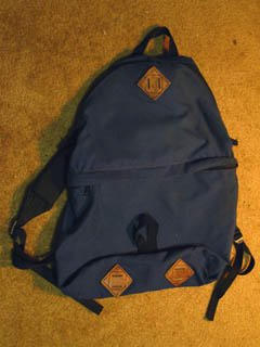
Short Cross-Country Route The General Creek trail junction is a shortcut to the Pacific Crest Trail that only makes sense for Northbound Hikers. The trail post for the General Creek Trail sits on the North shore of Genevieve Lake. The 30 min map (1977) shows a trail, but the 7.5 min (1992) map does not. It is typical to see that trails marked as maintained on older maps like the 30 minute map, are either unmaintained or omitted on newer maps. This is a good way to find unmaintained and abandoned trails that make great cross-country routes. Compare the older and newer maps, and note the omission of trails on the newer maps. These are potential cross country trips. I observed a backpacker doing a day hike cutting up the General Creek trail, but he got past me before I could catch him. (I was taking a crap.) I wanted to ask him about the General Creek route to the PCT. A short while later I had a snack with the very same dude on Phipps Pass. After hiking by me at Lake Genevieve he followed the cross country route to and across the General Creek Trail to the PCT, then hiked South on the PCT to the TYT trail junction for the hike North on the TYT back to his Crag Lake campsite. In the meantime I had hiked from Lake Genevieve to Phipps Pass Southbound along the TYT. Excellent Short Backpacking Trip His day hiking trip consisted of backpacking up to Crag Lake from Meeks Bay, dropping his pack, then day hiking the General Creek loop to the Pacific Crest Trail, then hooking left at the trail junction above Middle Velma Lake to follow the Desolation Trail back to Crag Lake. Nice work. His trip was an example of how you can make a short backpacking trip exciting. He only carried his heavy pack a very short distance to a fine campsite on Craig Lake, avoiding the pain of long distance backpacking. Leaving his pack in camp allowed him to explore the cross country routes in the area while only carrying day hiking weights. He reported the General Trail as rough cross country, but easily do-able. I do exactly the same thing. But I do it by carrying an extra day's food between my resupply points. Then I can throw down the pack, pull out the day pack, and take a lightweight day of scrambling. Here's the old-school day pack I bring on my Lake Tahoe to Mount Whitney trips for day hiking. The Day Pack I stuff this pack at the bottom of my external frame pack's upper compartment, where it only comes out for "day-off" scrambles and explorations, which you will see described down up and down the trail guide. I use it between 5 and 7 times for scrambling during a Tahoe to Whitney hike. It is also very convenient to have during resupply stops. It fits water, food, and an extra layer of insulation comfortably for scrambling. I once used this pack for a one-night, two day 46 mile round trip to bring supplies to a trail crew. I carried an insulation and rain layer in the mini pack with a sleeping bag lashed to the bottom. The trail crew provided a great party, dinner and breakfast. You've never partied until you've partied with trail crew at elevation during the end of the season. Note the leather strap loops on this fine old pack. Note the metal buckles. They don't make them like this anymore. You can really gear up this late-'70s vintage Kelty for "lightening" trips by externally strapping on your sleeping bag, pad, and shell, while packing it with your insulation layer and food enough for a day or two. I can see how carrying two packs will drive Pacific Crest Trail hikers crazy. Though an extra pack is extra weight to carry over the long hauls between resupply points, without this pack I would not be able to do aggressive scrambles between the resupply points. Thus the difference between Tahoe to Whitney and Pacific Crest Trail hikers. Though both must push long distances, the lack of a seasonal time constraint allows the Tahoe to Whitney backpacker the time to pack an extra day's food between resupply points, to scramble without worrying about being caught-out by early season snow a couple of months later while crossing the Cascades up in Washington. Few Pacific Crest Trailers can, or will, pack extra food, or take a day off to scramble. Section Hikers do. Check out the Gear Section The Gear Forum Too Post up about your favorite Day Pack |
North: Desolation Trail Junction top of page South: Crag Lake
Lake Genevieve Check Dam
| Degraded state of Genevieve's Check Dam. |
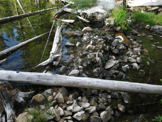 |
It appears that locals have worked to maintain the Check Dam. Somebody has been throwing rocks onto the pile. |
High Sierra Check DamsCheck dams occasionally cause great controversy in the Sierras. High Sierra Check Dams all seem to have a shared history. The first Western settlers, mostly herders and ranchers, put up check dams in likely locations to provide water for stock driven into the High Sierra every Summer to graze its lush meadows. This early damming was supplemented by local and state dams as the population of California skyrocketed. Local dams such as that at Beardsley Lake on Highway 108 supply valley agriculture with water. Relief Reservoir on Highway 108 and the Blue Lakes are examples of originally state-subsidized and regulated public utility operations, which are now privately owned. Elements of trail culture divide up, and fight for the removal or retention of the early check dams, the bigger local dams, and no one can honestly explain why the hell PGE "owns" huge amounts of our water and our Sierra terrain. Well, I can, but I defer on this platform. This is about the mountains. Man's folly is secondary. I can't help it: I guess that's the only way "our" politicians of both parties pay off their bribers... I vote for retention of the historical check dams, strict regulation of the local and private dams, and complete public ownership of our public lands and resources. Here's a little note on check dams, and a partial list of our favorite lakes along our route that exist because of the historic check dams:
High Sierra Check Dams
I support retention of existing check dams. As work continues South on the Guide more will be added. Feel free to add your favorite check-damed lake. |
North: Desolation Trail Junction South: Crag Lake
Discussion |
||
Night #1: Lake GenevieveFirst, the miles!Meeks Bay trail head to the end of the dirt road/ Desolation trail junction: 1.35 miles Dirt road/trail junction to Lake Genevieve: 3.36 Total Meeks Bay to Lower Echo Lake Trailhead This Map: Meeks to Phipps Pass Next Map: Genevieve to Phipps Pass
The Trail to Lake Genevieve
|
Morning One |
|||||
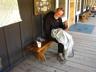
Morning One Granola, powdered milk, and dried fruit were rapidly brought to life with a little heat under the roar of my old-school MSR white gas stove, and I was shortly fed, packed, and ready to saddle-up. Time to take off the insulation and freeze a bit before the pack and the trail warm me up. I tried to unzip my REI fleece jacket, and everything went to shit. The zipper is one of those fancy "clasping" zippers, the type that lock. The fabric pull and its ring broke off the zipper, locking the clasping zipper in place, zipped up around my neck. With no pull strap there was no way to unzip the fleece jacket, and claustrophobia set in, and I was soon bouncing/hopping about in circles trying to get the damn thing unzipped from high around my neck. I looked like I was fighting off the attack of the fleece shirt. Finally, I used the flat end of the can-opener on my Swiss Army Knife to pry up the edge of the spring-loaded locking clasp on the back of the zipper assembly, and was finally able to unzip my fleece jacket in fits and starts, before the clasp slipped in the locked position again. I was tempted to use the knife's blade to cut the coat off. I was not happy with the fancy clasp when I bought the shirt. Relax Al, Chillaxation required... take a couple of deep breaths. As soon as I got the shirt off I promptly removed the locking mechanism from the zipper, (a zipper-ectomy) and everything was all cool again. The jacket still zipped-up, but I had to grasp the zipper on both sides to make it work, as the pull tab had broken off. But my gear was falling apart. This was not unexpected. I had already put 750 long-distance backpacking miles on the gear this Spring and Summer (2009) alone, and my gear was showing it. My boots, pants, and socks were all starting to wear thin. The harness of my pack was worn, and all grommets were distorting. I was monitoring the degradation of all key gear components. I was packing a bigger spare parts kit than normal. I am facing a maintenance cycle with my clothing, pack, boots, and most of the gear elements that wear out. Clone me a new frk'n body too, while we are at it... I'm going to re-harness my pack frame, replace or repair my worn-out clothing, and new boots have been necessary for awhile. Where are you in the "Gear Cycle?" Everyone has one. Some are slow, some quick. Keep tabs on how your gear is wearing, and check your harnesses, stitching, clasps, and eyelets often during your long trips, and an inspection before every trip. Inspect the stove and water filtration device, and clean each as necessary. I visually inspect my harness before each time I saddle up my pack. Keep a list of upcoming gear problems and repairs that will be necessary at home that is updated after each trip, and check the list before the next trip. Pack the replacement parts you may need, or replace degrading parts prior to departure. Broken and fixed
Be Ready!
Check out the |
|||||
 |
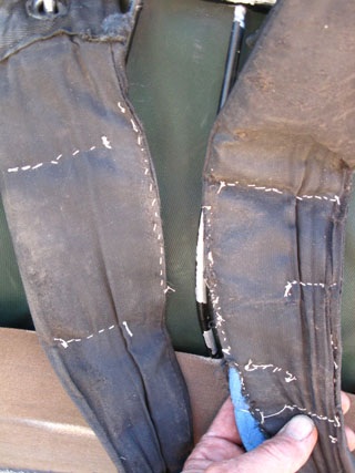
A frk'n gopher ran a hole up to the surface under my backpack, which was laid flat on the ground with rocks on top to protect its salted straps from just such a varmint attack... Sometimes we just can't win... |
||||
Wilderness gear Repair at Kennedy Meadows Pack Station, earlier in the 2009 backpacking season. Pants in hand, fleece pants deployed during the day! I love They loaned me the needle, and gave me the thread to keep my ass in my pants, and my straps on my shoulders. The cowboys offered me the use of their saddle shop, but I didn't need to go nuclear!
|
|||||
Topo Map South South Desolation Wilderness
South |
|||||
Hiking North |
Hiking South |
Backpacker Forums Post it on Welcome to Tahoe to Whitney
Anyone can post text comments in the existing forums, but only members can post up new topics, along with images, maps, and formatting. If you have experiences, comments, questions, trip reports, trail conditions updates or pictures and videos of the Tahoe to Yosemite Trail from Meeks Bay to Lake Genevieve, post up your images and notes here as an unknown hiker or as a member: Section
|
North: Desolation Trail Junction South: Crag Lake
Trailhead
Contact
Alex Wierbinski

Backpacking Lake Tahoe to Mount Whitney
Your guide to the High Sierra Crest, including the Tahoe to Yosemite, Pacific Crest, and John Muir Trails
