The Trails
Guide
Maps
Miles/Ele
Permits
Resupply
Forum
Current Weather Conditions
Weather Notes
Northern High Sierras
Central High Sierras
Southern High Sierras
Gear
Gear List
Gettin Started
Layering
Discussion
Testing yourself and your gear
Gear Reviews
Backpacking
Lake Alpine
Stanislaus National Forest
Hiking
The Tahoe to Yosemite Trail from Lake Alpine to Saint Marys Pass
Languages
Languages
Trail Arts
The art of walking
Physical Preperation
Trail Skills
The trail
Off the trail
Scrambling
Maps
Navigation
Camp skills
Food
Resupply
Food
Other
Photo Catagories
Trail Stories
Trail Culture
News and Science
Links
Groups
Books
Terms and Conditions of Use
| Trail Guide INDEX Highway 4 to Highway 108 |
Guide North TYT Mount Reba to Lake Alpine |
Guide South TYT Lake Alpine to Rock Lake |
7.5 Topo Hiking Map Lake Alpine Area |
Regional |
Lake Alpine to Saint Marys Pass MILES AND ELEVATIONS |
ALL TOPO MAPS Lake Alpine to Saint Marys Pass |
Resupply Here Lake Alpine Resupply South Kennedy Meadows |
National Forest Stanislaus |
all maps index |
Lake Alpine
Highway 4,
Calavaras Ranger District,
Stanislaus National Forest
MAPS
MILES and ELEVATIONS
TRAIL GUIDE PAGES
CIVILIZATION
All Weather and Fire Information All High Sierra Lake Alpine Hiking Information
The Pacific Crest Trail crosses Ebbetts Pass on Highway 4 fourteen miles East of Lake Alpine. |
|||||||||||||||||||||||||||||||||||||||||||||||||||||||||
North TYT: Mount Reba to Lake Alpine South TYT: Lake Alpine to Rock Lake
Hiking South
into the
Carson Iceberg Wilderness
on the
Tahoe to Yosemite Trail
Lake AlpineElevation So Far Southbound on the Tahoe to Yosemite Trail Miles We have hiked a total of 68 miles South from our starting point at Meeks Bay on the North side of Desolation Wilderness to Lake Alpine. We have a bit less than 120 miles remaining through the next two sections of our hike down to Tuolumne Meadows. Wilderness & National Forests Our hike down from Meeks Bay has passed through a variety of administrative units. We have hiked through the Desolation Wilderness and Meiss Roadless Area sections of The Lake Tahoe Basin Management Unit, The Mokelumne Wilderness in the El Dorado National Forest, and we entered The Stanislaus National Forest when we crossed the North fork of the Mokelumne River at Camp Irene. Coming Attractions South of Highway 108 we will remain within the Stanislaus National Forest after departing the Carson Iceberg Wilderness to enter the Emigrant Wilderness on the South side of Highway 108 continuing our hike South on the Tahoe to Yosemite Trail. We will finally exit the Stanislaus National Forest when we enter Yosemite National Park through Bond Pass. Click on the red dots along the hiking maps linked to above for that particular location's trail guide page. The trail routes on the 30 min maps are linked to detailed maps.
|
The Big Picture
Where Lake Alpine Miles and Elevations segments for the Trail Sections of the Tahoe to Yosemite Trail are divided by the natural re supply points cut through the Sierra Nevada Mountains by the trans-Sierra highways. These highways also delineate many of the boundaries of the various North Sierra Nevada Wilderness Areas and National Forests that we cross, and are also where the main resupply points are located. The list goes down as far as I've constructed trail guide...so far.
(Trail Guide ASAP: I can't wait to put up the Southern Sierra Trail Guide Pages...) Note: The locations listed on the miles and elevations pages are linked to the trail guide page for each location. Each of the above sections of the Tahoe to Yosemite and Pacific Crest Trail can be hiked as individual backpacking trips one section at a time, or modified into nice hiking loops and in-and-outs using local trails and trailheads to supplement, or even tie together sections of the Tahoe to Yosemite and Pacific Crest Trails. |
Lake Alpine
on a
Roadmap
| Road Map showing Lake Alpine, our trail heads and nearby backpacker resources. | ||
Lake Alpine is a gateway South into the Carson Iceberg Wilderness, and North into the Mokelumne Wilderness. |
The Local Lake Alpine Picture
Topo Hiking Maps
Guide, Maps,
Click the Red Dots on all the maps for related trail guide pages, black dots on the big maps for detailed maps. |
The Big Picture
Topo Hiking Maps
Backpacking Topo Maps Planning Maps To plan our trips North or South from Lake Alpine I should refer to the free downloadable USGS topo map series. The 1 x 2, 30 minute, and 7.5 series topo maps are free to download. We can open and use them with the also-free Adobe Reader, which is linked to from the USGS page. One stop shopping for all your US map needs... We can top-off all this information by downloading the free Terrago Toolbar for Adobe from the USGS page, which gives us limited trail measurement capabilities. Hopefully Terrago will improve their flawed product to improve mileage accuracy. It's free, so I can't complain too much. A terrago "upgrade" made it impossible to accurately measure distance with their tool. I made a valiant effort to inform terrago about the terrible mistake they made during their "upgrade," but it was like beating my head against a corporate brick wall. Adobe has improved the map handling capabilities of its Reader. We can obtain good measurements and locations with the built-in tools. The USGS Store site will provide us with the proper maps to plan any backpacking trip in the US. For Lake Alpine, navigate the map to Stockton Ca, and follow Highway 4 up to Lake Alpine. Check the "mark points" selection, click the desired quadrangles and select the map sizes you want to download, then download them. Unzip the file and open it with Adobe. We can refer to the Topo Hiking Map Information on each of my Map Pages to determine which maps you may want to download. I have set myself up with a well-organized collection of USGS maps covering all my main routes and side trips from Lake Tahoe to Mount Whitney in various scales. I find these maps real helpful to properly plan trips. Use these detailed USGS topo maps, and the maps, mileages, and trail guide pages laid out here on Tahoe to Whitney to plan the details of your backpacking trips starting at, or hiking through Lake Alpine. Go long, go short, but just go backpacking! Hiking Maps For trail use I prefer to carry the USDA National Forest Wilderness Maps when hiking either the Mokelumne (North of Lake Alpine) or Carson-Iceberg Wilderness (South of Lake Alpine). These maps are a fine balance between size and detail. Each well covers its respective wilderness area. The new 2009 plastic maps are better in field conditions, but the color, labeling, contrast, and accuracy of the new maps leaves a lot to be desired compared to the older 1988 paper map. But the paper maps fall apart at the seams and disintegrate in moisture. One step forward, two steps backwards... Familiarity gained studying the detailed USGS maps during our planning stage will make better sense of our trail maps during our trip. Where to Obtain your Topo Trail Hiking Maps for Lake Alpine North: USDA Forest Service Mokelumne Wilderness, ENFIA. South: USDA Forest Service Carson-Iceberg Wilderness, Toiyabe National Forest. They offer a plastic version of the old 1988 map. I've got to get one of these before they disappear... Map Think Unlike topo hiking maps that only display a "sliver" of the terrain, these wilderness-sized topo maps allow us to situate and saturate ourselves in the terrain. Good Long-Distance Backpacker Practice Maps are too expensive to throw away. |
Hiking Into
and
Out Of Lake Alpine
on the
Tahoe to Yosemite Trail
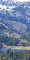
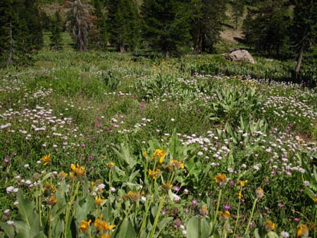
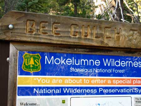
Exactly Where We Are at Lake Alpine Hiking Southbound into Lake Alpine down from the top of Mount Reba we exit the Mokelumne Wilderness into a vast field of Mule Ears. Continuing down across Mount Reba's Southwestern flank we turn into Bee Gulch's rich down-mountain meadow (pictured below, and yes, it was full of friendly bees.) to drop down to Highway 4 through the Bee Gulch trailhead. It's now break time at Lake Alpine!
The Bee Gulch Trailhead is nestled in on the North side of Highway 4 across from the Northwestern Corner of Lake Alpine. We've hiked 8.38 miles South from Camp Irene to Bee Gulch Trailhead on Highway 4. Miles from Meeks Bay & Points North and South. Bee Gulch Trailhead Just past the trailhead we will enter the Carson Iceberg Wilderness. The Bee Gulch trailhead is nestled into a cramped roadside alcove in the dense forest along the North side of narrow Highway 4.
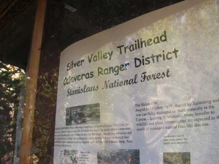
Above: Though hard to see from the road, the Bee Gulch Trail head sits almost directly across from the well-marked entrance and paved road to the Pine Martin and Silver Valley car campgrounds, as well as our Silver Valley Trailhead.
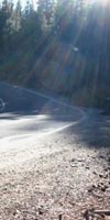
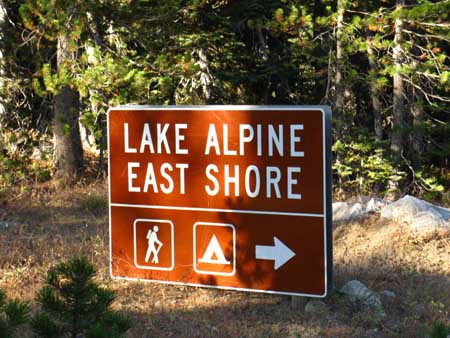
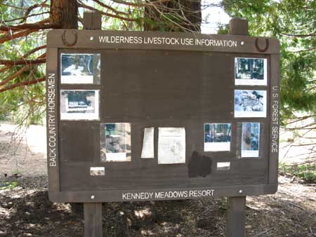
Above: The Tahoe to Yosemite Trail exits Bee Gulch and continues South along the paved road this sign points to, for about a half-mile until we encounter the Silver Valley trailhead, pictured below. Here the Tahoe to Yosemite trail resumes trail Southbound towards Saint Marys Pass through the Carson Iceberg Wilderness.
Local Resources You will see the Silver Valley Trailhead where the road turns Southwest (Right) to enter the Silver Valley car campground. Southbound backpackers continue straight through the Silver Valley Trailhead. Let's Roll But First... |
Short, Medium,
and
Long Distance Backpacking Trips
through the
Carson Iceberg Wilderness
This Next From Lake Alpine we have a 34.64 mile hike on the Tahoe to Yosemite Trail South to Saint Marys Pass on Highway 108. From there we will easily hitch 8 miles West down Highway 108 to access our next resupply package at the Kennedy Meadows Pack Station. I'm looking forward to my KM stop already... Kennedy Meadows has an excellent restaurant that serves three squares a day, a store, a bar, laundry facilities, and excellent showers. Best of all I like the people who work there, and the family who owns the operation. But your trip South into the Carson Iceberg Wilderness doesn't have to go all the way down to Saint Marys Pass from Lake Alpine. Carson Iceberg Wilderness Backpacking Longer Local Backpacking Trips We have multiple ways up to the PCT, from where we can hike North to Ebbetts Pass or South to Sonora Pass. Refer to the maps and continue down the trail guide to check out these and more hiking options. Long Distance Backpackers At Lake Alpine: The Lake Alpine Lodge will hold your resupply package for free if you send it to them via UPS. The Lake Alpine Lodge has a fancy restaurant that serves three squares a day, but it is rather pricey for poor backpacking bums like me. The store is set up more for car campers and fishermen than backpackers, with little fuel or dried food supplies that suit backpackers. The bar is top notch, and the bar menu is more reasonable than the restaurant. The laundry and shower facilities are good. The real star of the Lake Alpine Lodge is the staff who makes it go. Great people. Hang out and have a beer and conversation with them on the deck in front of the bar. Support locals who cater to Long Distance Backpackers My theory about the Lake Alpine Lodge restaurant is that I will try to eat a meal there for each day I spend at Lake Alpine. Though expensive, I will do what I can to support places like the Lake Alpine Lodge who offer Tahoe to Yosemite Trail hikers free resupply package service and a good deal of hospitality. Thanks! For more information see the Lake Alpine Lodge-Bear Valley-Arnold resupply page. Explore the Carson Iceberg Wilderness Long, Short, and Medium distance backpacking trips within the Carson Iceberg After walking the Tahoe to Yosemite and Pacific Crest Trail routes across the Carson Iceberg a few times, I began to put together alternative routes across the wilderness. There are many fine trailheads circling the Carson Iceberg, and these are backed up by a web of trails that deeply link-up the PCT and TYT as they cross between Highway 4 and Highway 108. Heading East off of the Tahoe to Yosemite Trail Route South of Lake Alpine allows you to substantially lengthen this section of the TYT by hiking up to the PCT. East of Spicer Meadow Reservoir you can hike up through Highland Creek to join the Pacific Crest Trail at Wolf Creek Pass. This route alteration splits your hiking distance across the Carson Iceberg Wilderness between the Tahoe to Yosemite and Pacific Crest Trails, giving you what I consider to be the best of both trails. Following this plan you exit the Carson Iceberg Wilderness through Sonora Pass, rather than Saint Marys Pass. Or you can shorten this section by hiking up to the PCT from Lake Alpine to end your trip at Highland Lakes, or a bit further Northeast at Ebbetts Pass. You have lots of good hiking options out of Lake Alpine. Heading West off of the Tahoe to Yosemite Trail South of Lake Alpine there are a bunch of beautiful short loops you can craft around Elephant Rock via Rock and Summit Lakes out of and back to the Silver Valley Trailhead. There are lots of nice trails and trips in the Carson Iceberg Wilderness other than the TYT and PCT routes that I focus on. But the TYT and PCT trail sections you incorporate into your shorter trips will be the high point of that backpacking trip, both literally and aesthetically. Plan a Big Exploration of the Carson Iceberg I've laid out a trip report about a long Carson-Iceberg loop you might find interesting, and informative about the loops you can hike around the Carson Iceberg. This loop was planned as a 79 mile loop around the Carson-Iceberg Wilderness weaving together elements of the Tahoe to Yosemite and Pacific Crest Trails using the handy trails that connect these two routes. This trip finally ended up as a shorter 4 night 51 mile loop, but it was a great trip nonetheless. Long and medium distance loop trips around the Carson Iceberg Wilderness are fairly unique because of the fact that the Tahoe to Yosemite Trail roughly parallels the route of the Pacific Crest Trail down the whole length of the Carson-Iceberg Wilderness. On Highway 4 the trail heads for the Tahoe to Yosemite and Pacific Crest Trails at Lake Alpine and Ebbetts Pass are separated by 14 miles. It gets better as we hike South. Hiking South these two classic trails are connected by four trails between Highway 4 and Highway 108. Each of these connector trails gets shorter as you hike further South, as the Pacific Crest and Tahoe to Yosemite Trails draw closer and closer together as their respective routes converge approaching Highway 108. Though these trails are separated by 14 miles up North on Highway 4, their respective trailheads are only one mile apart on Highway 108. This means that you can craft a wide range of short to long distance backpacking loops around the Carson-Iceberg incorporating sections of the Pacific Crest Trail in one direction, then crossing over to the Tahoe to Yosemite for the return leg. Or visa-versa... and this place is frkn beautiful. Check out these potential routes on this map of the Carson Iceberg Wilderness I'm working on. Soon all the red dots on the trail routes will lead to the trail guide page for that exact location. The Highland Creek, Arnot Creek, Disaster Creek, and the Boulder Creek trails connect the Pacific Crest Trail to the Tahoe to Yosemite Trail across the Carson Iceberg Wilderness. Starting at Lake Alpine on the TYT (or from Ebbetts Pass on the PCT) you can use any of these trails to link the PCT and TYT to craft big or small loops back around to your starting trailhead. Or you can craft a grand circle route around the Carson Iceberg Wilderness by hiking the TYT down to Saint Marys Pass, then returning to Lake Alpine via the and PCT and your selected connector trail. You have lots of great hiking options in the Carson Iceberg Wilderness. The Carson-Iceberg Wilderness offers a remarkable range of experiences for all levels of backpackers, from exciting short trips for the checked-out novice to isolated cross-country routes perfect for the grizzled old expert backpacker. As we head South on this trail guide I will point out the Murray and Golden Canyon trails down to the East Carson River, which points you towards a potential Eastern entry into the Carson Iceberg Wilderness through the Corral Valley Trailhead at Rodriguez Flat off of Highway 395. The Carson-Iceberg is completely awesome. It contains classic sections of both the Pacific Crest and Tahoe to Yosemite Trails which can be hiked as parts of their greater routes, hiked as sections, or you can weave together sections of both trails into substantial backpacking trips that remain within the Carson-Iceberg Wilderness. The Carson-Iceberg Wilderness? It's real good. |
The Past Conditions the Future:
Resupply Notes at Lake Alpine
Big Picture: Analysis of the last trail section will inform your planning and resupply decisions for the next trail section. How do you feel after finishing the 25 miles hiking down to Lake Alpine from Carson Pass? How did your food and daily mileage plans work out? How does this affect your calculations of mileage and food for the next section of trail? What adjustments to your plans and supplies are necessary?
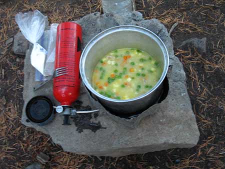
Tasty Treats on the Trail: Mountain House... Resupply spots are your opportunity to make adjustments to your hiking plan and food supply for the upcoming trail section, and add or subtract whatever is required. Ask yourself how the daily mileage plan worked out. How about the menu? Are you using more fuel than you expected? Less? ...
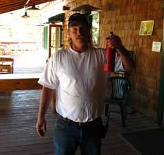
Steve found the fuel I needed... Thanks Steve! ... or are the blisters acting up? Need new socks? Break a buckle on your backpack? Now is the time to make repairs to your gear and adjustments to your supplies and hiking plan to suit the reality you are experiencing on the ground. Every hike is different. Reflect on the tendencies of this trip and tune your resupplies and overall trip plan to suite your status and needs. Below: I needed more medical tape...
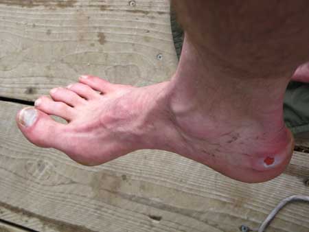
Heel and Toe: Heel losing skin, toe losing nail. Win some-lose some. It was still a fine 100 mile trip, despite the pain... ...and a little pain relief may be in order.
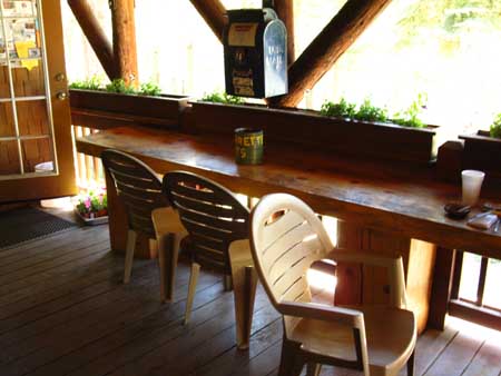
Debbie behind the Lake Alpine Lodge's Bar. Onward! The next trail section South on the Tahoe to Yosemite Trail stretches from Lake Alpine to Saint Marys Pass. This section is longer than our last, measuring out at 34.64 miles across the Western side of the Carson-Iceberg Wilderness. But there are no unmaintained trails through this next section South, though the trail does get a bit thin in places. The next trail section South of the Carson Iceberg Wilderness, from Kennedy Meadows to Tuolumne Meadows, is the final section of the Tahoe to Yosemite Trail. The KM to TM section will also be our longest section of trail yet, measuring out at around 75 miles.
"I am my own horse, and my own mule, you lazy &^%$" cowboys " (Rash words spoken to the Cowboys at the KM Cowboy Bar-resulting in great laughter and back-slapping. They thought I was hilarious...) Above: South on the Tahoe to Yosemite Trail out of Kennedy Meadows. Since starting the Tahoe to Yosemite Trail at Meeks Bay we have been hiking longer trail sections between resupply points, and getting more trail time and miles under our belts. Good thing. The 75 mile section of trail between Kennedy Meadows and Tuolumne Meadows is known as the hardest stretch of trail on the whole Pacific Crest Trail. We have the next two resupply spots at Lake Alpine and Kennedy Meadows to adjust our hiking plan and supplies for the increasing length and difficulty of each of the subsequent trail sections between our current position at Lake Alpine and our final TYT goal of Tuolumne Meadows. |

Break time
My Take on Lake Alpine I take Lake Alpine as a break spot. I depart Camp Irene very early in the morning and make Lake Alpine by early afternoon. I make a campsite at my traditional pirate camping spot on the East side of Lake Alpine, and walk down to the lake Alpine Lodge for a beer and some fresh food, and to assure my resupply bucket is there.
I just may take a full day off the trail the next day to rest my body, do laundry, take a nice shower, and leisurely pack my resupply. I might hitch down to the store and deli in Bear Valley. Lake Alpine Backpacker Re supply Resources |
Lake Alpine
|
North: Mount Reba to Lake Alpine South: Lake Alpine to Rock Lake
The Tahoe to Yosemite Trail |
Lake Alpine to Saint Marys Pass Highway 4, Calavaras Ranger District, Stanislaus National Forest. Mokelumne Wilderness to the North, Carson Iceberg Wilderness to the South. 7.5 min Hiking Topo Map 30 min Hiking Topo Map Next page South |
Backpacking Trail Guide North on the TYT |
 |
Backpacking Trail Guide South on the TYT |
Backpacker ForumsHave a great Sierra Nevada trip or story to relate? A fine piece of gear? Or gear that failed?Post it on
|
North: Mount Reba to Lake Alpine South: Lake Alpine to Rock Lake
Trailhead
Contact
Alex Wierbinski

Backpacking Lake Tahoe to Mount Whitney
Your Guide to the High Sierra Crest, including the Tahoe to Yosemite, Pacific Crest, and John Muir Trails
