The Trails
Guide
Maps
Miles/Ele
Permits
Resupply
Forum
Current Weather Conditions
Weather Notes
Northern High Sierras
Central High Sierras
Southern High Sierras
Gear
Gear List
Gettin Started
Layering
Discussion
Testing yourself and your gear
Gear Reviews
Backpacking
Sonora Pass & Saint Marys Pass
Trailheads
Our Gateways
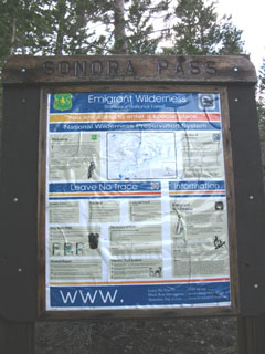
South into Emigrant Wilderness
and
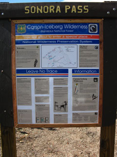
North into Carson Iceberg Wilderness
&
East into Toiyabe NF
Hiking
The Tahoe to Yosemite Trail and The Pacific Crest Trail across Highway 108
Languages
Languages
Trail Arts
The art of walking
Physical Preperation
Trail Skills
The trail
Off the trail
Scrambling
Maps
Navigation
Camp skills
Food
Resupply
Food
Other
Photo Catagories
Trail Stories
Trail Culture
News and Science
Links
Groups
Books
Terms and Conditions of Use
Trail Guide Index |
Trail Guide Index |
Guide North |
Guide South |
Topo |
Local |
MILES North - - South |
Resupply North |
Resupply HWY |
Resupply South |
National Forests |
All |
Trail Information
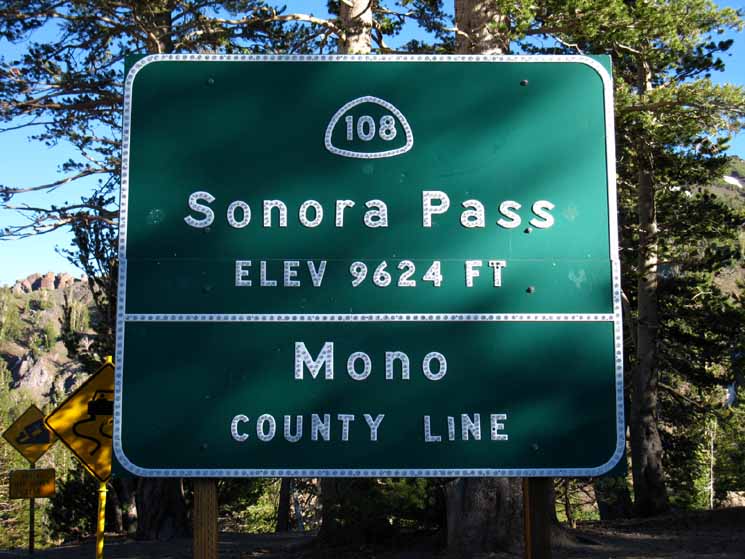
Sonora and Saint Marys Pass
Trailheads
ATOP
Highway 108
What Backpackers Need to Know
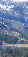
Sonora Pass Trailheads Introduction Physical, Administrative, and Historical Physically, Sonora Pass is a low point along the North-South orientation of the Sierra Crestline where Highway 108 links the Eastern and Western flanks of the Sierra Nevada Mountains. Road Map. The high point to the South of Sonora Pass is Leavitt Peak sitting upon the massive bulk of the Leavitt Massif surrounded by subordinate peaks. Administratively, Sonora Pass is the point along the North and South alignment of the Sierra Crestline that intersects with the East-West route of Highway 108. Highway 108 and the Sierra Crestline itself are the boundary lines crossing to divide the various administrative authorities that intersect at Sonora Pass. Stanislaus National Forest Toiyabe National Forest The history of these administrative units and Sonora Pass itself are based on the Western expansion of the United States in the second quarter of the 19th century.
National Forests Wilderness Both the Toiyabe and Stanislaus National Forests run North & South of Highway 108, but only the Stanislaus administers the Emigrant Wilderness, which is located on the West flank of the Sierra crestline South of Highway 108. Topo Hiking Maps Carson Iceberg Wilderness Carson Iceberg and Emigrant Emigrant Wilderness Sonora Pass for Long Distance Backpackers The next standard resupply spot North of Sonora Pass is 69 miles North at Echo Summit above South Lake Tahoe (Resupply at Echo Chalet or a hitch down to South Lake Tahoe), though PCT hikers can also resupply between Sonora Pass and Echo Summit by hitching 15 miles West down to the Lake Alpine Lodge from Ebbetts Pass along Highway 4. Lake Alpine accepts and holds resupply packages free for long distance backpackers. PCT TYT Sonora Pass for Local Backpackers For Southbound hikers Sonora Pass's 9643 foot altitude offers high altitude access to Leavitt Peak and the Emigrant Wilderness of the Stanislaus National Forest beyond. Though hiking Southbound from Sonora Pass begins along the Pacific Crest Trail soon many trails into the Emigrant Wilderness fan out into a web of trails that we can use to create a wide variety of excellent loop and trailhead to trailhead backpacking trips beginning from Sonora Pass. The following Southbound trail guide pages explore these options as we hike South, and so should you. Though this guide does follows the PCT South to Tuolumne Meadows in Yosemite it also links up with the Tahoe to Yosemite Trail North of Relief Reservoir via Kennedy Lake and at Grizzly Peak South via the trail over Big Sam. These trails can be used to link up the PCT and TYT route's divergent paths around Emigrant Wilderness to create long backpacking loops that mostly stay inside Emigrant Wilderness. Similar hiking options are available for Northbound hikers out of Sonora Pass. The PCT and TYT routes North of Sonora Pass are also connected by a series of trails that allow hikers to craft great loops around the Carson Iceberg wilderness. These are good warm-up trips if you don't quite feel ready to hike 74 miles all the way down to Tuolumne Meadows from Sonora Pass. Build the length and duration of your first short backpacking trips one step at a time. As you develop skills, fitness and experience expand the scope of your trips until you can easily hike the long trail South down to Tuolumne in Yosemite or North up to Lake Tahoe. Soon you will be hiking long trails like the Tahoe to Yosemite Trail, the John Muir Trail, and the whole length of the Sierra Nevada between Lake Tahoe and Mount Whitney. See it before its gone! |
Pacific Crest Trail Highway 108 North and South |
PCT Section Sonora Pass 29.44 miles Into
Carson Iceberg Wilderness Hiking Map Permits |
PCT Section Sonora Pass 73.8 miles Into
Sonora Pass Region Backpacking Map Permits |
Tahoe to Yosemite Trail Highway 108
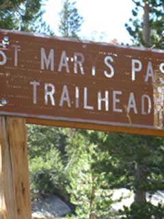
The Northbound TYT Trailhead is located along Highway 108 about a half-mile West of Sonora Pass. The Southbound TYT Trailhead is offset about nine miles down the West Flank of of the Sierra along Highway 108, then a mile West down a rustic semi-paved road to where we find the gate on the South end of Kennedy meadows Pack Station. |
TYT Tahoe to Yosemite Trail Saint Marys Pass 34.57 miles The Southern Carson Iceberg Wilderness
Carson Iceberg Wilderness Permits |
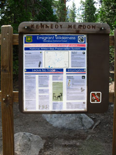
TYT Tahoe to Yosemite Trail Kennedy Meadows Pack Station 71.76 miles Located Nine Miles down the West Flank along Highway 108 to the Kennedy Meadows Road, then one mile South. Across the Heart of the Emigrant Wilderness into the North Yosemite Backcountry
Sonora Pass Region
|
Highway 108 Corridor Resupply |
Video
Walking into Sonora Pass Southbound on the PCT
Video
Saint Marys Pass Trailhead and Trail on the TYT
Video
Highway 108 Road Map with Nearby Trailheads
| Trailheads along Highways 88, 4, and 108 | ||
Road access to the Tahoe to Yosemite and Pacific Crest Trailheads in the Northern High Sierra. Clarks Fork Road to Arnot Creek (TYT), Disaster Creek, and Clarks Fork (TYT) trailheads. Highway 108 trailheads include Kennedy Meadows Pack Station (TYT South), Saint Marys Pass (TYT North), and Sonora Pass (PCT North and South). |
For Local and Long Distance Backpackers The Tahoe to Yosemite and the Pacific Crest Trails have trailheads in proximity to each other at Sonora Pass. The Pacific Crest Trail has both North and Southbound trailheads crossing Sonora Pass itself. The Tahoe to Yosemite Trail does not. Only the Northbound Tahoe to Yosemite Trailhead is near Sonora Pass, at Saint Marys Pass. The Tahoe to Yosemite Trail's Northbound trailhead is the Saint Marys Pass Trailhead located a mile West of Sonora Pass along Highway 108. The Tahoe to Yosemite's Southbound trailhead is located about 9 miles West then a couple of miles Southeast off of Highway 108 through Kennedy Meadows Pack Station. There are no unmaintained trails along the TYT between Kennedy Meadows Pack Station South to Tuolumne Meadows. TYT NORTHBOUND NOTE: Southbound backpackers arriving at the Saint Marys Pass Trailhead are marking the end of the unmaintained sections of trail along the Tahoe to Yosemite Trail route. Let's Eat Sonora Pass is the traditional resupply point for both Northbound Pacific Crest Trail hikers and Southbound Tahoe to Yosemite Trail hikers. Almost everyone stops at Kennedy Meadows Pack Station to pick up a pre-sent resupply bucket and eat fresh food, drink cold beer, and do a little R&R, depending on their personal schedules and goals. Resupply at Kennedy Meadows Pack Station requires a 9 mile hitch-hike West down to Kennedy Meadows from Sonora or Saint Marys Pass. We also have the option of resupplying at Bridgeport, 29 miles to the Southeast. I suggest and prefer Kennedy Meadows, but Bridgeport does have its drawing points, which I isolate as more food choices. If I hitch East off Sonora Pass out of the Sierra Nevada Mountains, I head North to visit friends in the town of Walker. Walker lays 14 miles North of the junction between Highways 108 and 395 12 miles West of Sonora Pass. Whichever way you go on Highway 395, North or South, the valleys spaced out like pearls on a necklace along the length of the base of the Eastern flank of the Sierra Nevada Mountains are stunningly beautiful, and generally inhabited by good folks. Local Backpacking Four excellent sets of local trip options await local and section hikers out of each of the trailheads at Sonora Pass. Each of these trailheads offers an excellent range of short, medium, and long distance backpacking trip options. Each offers unique terrains and backpacking experiences. Each trailhead can be used to hike the whole section of that particular trail to the next Highway North or South. Each trailhead can be used to craft unique 20 to 90 mile hiking loops around the Carson Iceberg Wilderness to the North, and the Emigrant Wilderness to the South. Along the Highway 108 corridor we have two distinct routes North to Highway 4, and two distinct routes South to Tuolumne Meadows in Yosemite. The distances vary from between 29 miles North to Ebbetts Pass along the PCT, up to 75 miles South to Tuolumne Meadows following the TYT route. Each of the trailheads at Sonora Pass offers a wide range of excellent local loops and trips to other nearby trailheads. Semi-circle and potential loop routes link the trails out of the TYT trailheads to the PCT trails to both the North and South of Highway 108. Check out the road map below to also locate other nearby trailheads located on the Clarks Fork Road West of Kennedy Meadows Pack Station on Highway 108, and trailheads out of Leavitt Lake to the East of Sonora Pass on Highway 108. Take the time to explore your basic backpacking options out of Sonora Pass, and your explorations will be richly rewarding. |
Sonora Pass Historical Monuments Trail Guide Read Backpacker's Forum High Sierra Historical Monuments |
THIS PAGE IS UNDER CONSTRUCTION: STAY TUNED FOR MUCH MORE! Highway 108 Sonora Pass Drive-By May 31 2010 On the way to the East Carson River via Highway 395
COME ON BACK NOW, 'YA HEAR? |
North: South:
Tahoe to Yosemite |
|
North TYT TYT 30 min Map North North TYT PCT PCT 30 min Map North North PCT |
South TYT TYT 30 min Map South South TYT PCT PCT 30 min Map South South PCT |
| Carson Iceberg Wilderness Hiking Map 30 minute USGS topo map |
|
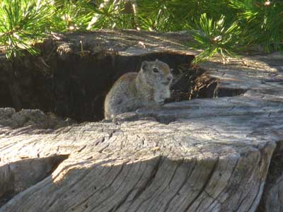
Local Color: Sonora Pass Picnic Area Squirrel
Backpacker ForumsHave a great Sierra Nevada trip or story to relate? A fine piece of gear? Or gear that failed?Post it onTahoetoWhitney.Org Become a MemberIf you have experiences, comments, questions, or pictures and videos of the Pacific Crest Trail and Tahoe to Yosemite from Highway 4 across Sonora Pass to Tuolumne Meadows down in Yosemite, Post up here:North Forum Section
|
Trailhead
Contact
Alex Wierbinski

Backpacking Lake Tahoe to Mount Whitney
Your Guide to the High Sierra Crest, including the Tahoe to Yosemite, Pacific Crest, and John Muir Trails
