
The Trails
Guide
Maps
Miles/Ele
Permits
Resupply
Forum
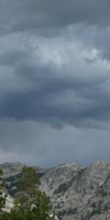
Current Weather Conditions
Weather Notes
Northern High Sierras
Central High Sierras
Southern High Sierras
Gear
Gear List
Gettin Started
Layering
Discussion
Testing yourself and your gear
Gear Reviews
Hiking
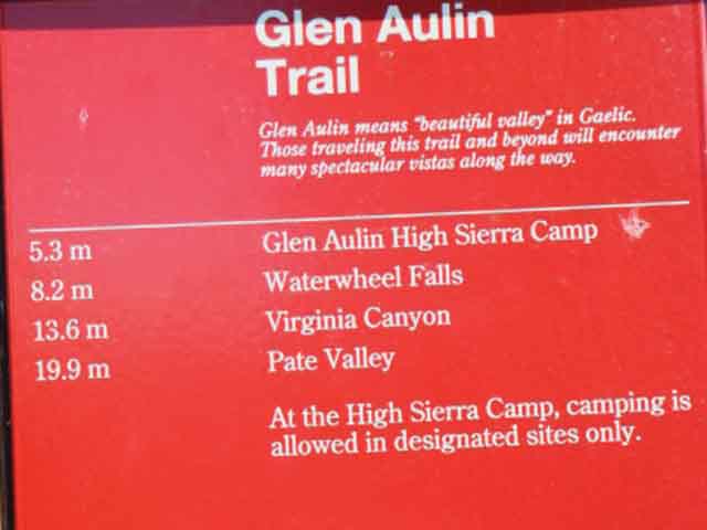
Glen Aulin
to
Tuolumne Meadows
Backpacking
North Yosemite National Park Backcountry
Hiking Section
The Pacific Crest Trail and Tahoe to Yosemite Trail from Sonora Pass to Tuolumne Meadows
Languages
Languages
Trail Arts
The art of walking
Physical Preperation
Trail Skills
The trail
Off the trail
Scrambling
Maps
Navigation
Camp skills
Food
Resupply
Food
Other
Photo Catagories
Trail Stories
Trail Culture
News and Science
Links
Groups
Books
Terms and Conditions of Use
| Trail Guide INDEX Highway 108 to Highway 120 |
North PCT-TYT Miller Lake to Glen Aulin |
JMT South Donohue Pass JMT South The Valley |
7.5 min Map Tuolumne Meadows Region Hiking Map |
30 min Map Cold Canyon to Tuolumne Meadows |
Sonora Pass to Tuolumne Meadows MILES and ELEVATIONS |
TOPO MAP INDEX SONORA PASS to TUOLUMNE MEADOWS |
Resupply North Kennedy Meadows South Tuolumne Meadows |
National |
all maps index |
Yosemite National Park
Tahoe to Yosemite and Pacific Crest Trail
Routes
South from Glen Aulin
GUIDE PAGE INDEX
| Video Glen Aulin to Tuolumne Meadows |
||||
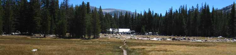
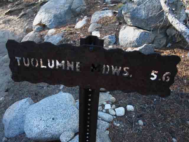
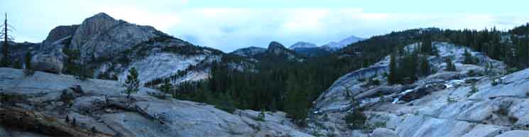
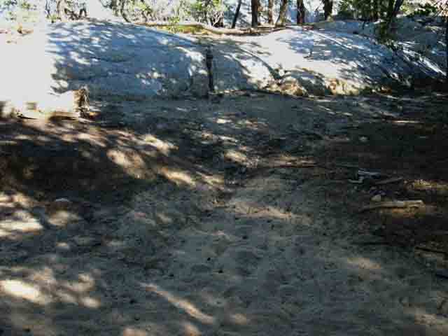
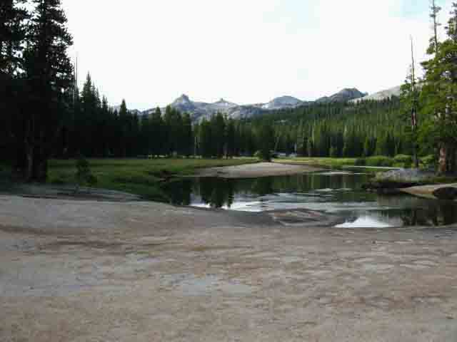
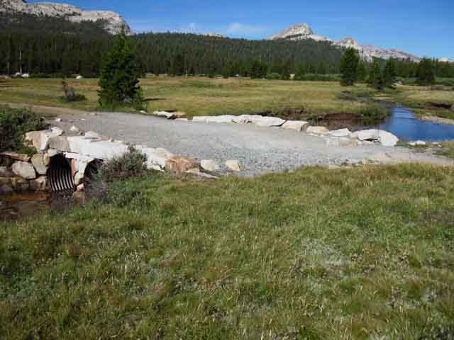
This Trail Guide Page We still climb for 3/4th's of a mile above the bridge to get over the last granite dome and into the lowest of the Tuolumne Meadows.
|
Approaching Glen Aulin
Southbound
on the
Tahoe to Yosemite & Pacific Crest Trails
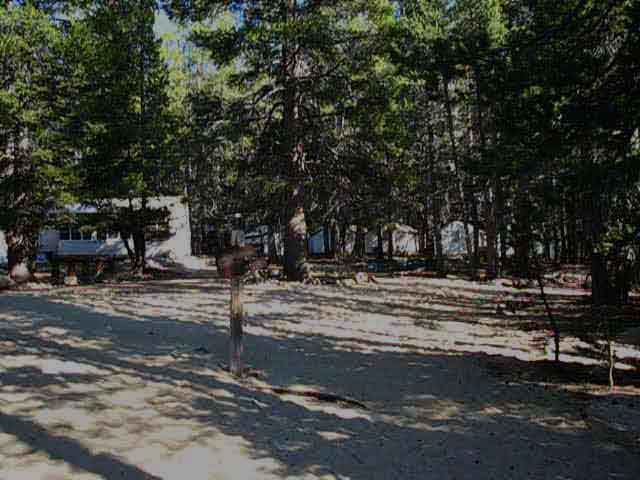
Final Hike down to Glen Aulin High Sierra Camp These are local backpackers who hiked to the backpackers camp in Glen Aulin, through it, and then continued a bit North beyond the backpackers camp along the ridge. If we don't see folks up there, we'll see their nice campsites. End of the Great Descent High point on trail South of Miller Lake 9560 feet of elevation. We've lost 1640 feet of elevation over the last 11.9 miles from the high point on the ridge South of Miller Lake hiking South down to Glen Aulin. We've descended a bit more than that if we consider the elevation we gained hiking South out of Virginia Canyon into the top of Cold Canyon. Northbound hikers on the PCT-TYT at Glen Aulin have a long, hard climb to Miller Lake ahead. Glen Aulin to Tuolumne Meadows The Climbing Begins Again Granite and Ducks This is not to say that all trails are not "As-Is," so to speak. They are. How you find them is what you get. There could have been an avalanche yesterday, and a tree-fall today. This is a very different situation than Trails Rangers and Crews find themselves in at National Forests and Wilderness Areas that are much less well-funded than Yosemite. It can be many years between trail crew sweeps down the trails, especially the more remote trails, in these less-funded units. Glen Aulin Marks the "Circle of Busy." TYT Hikers There is no-one on the unmaintained segment through the South end of the Carson Iceberg Wilderness to Saint Marys Pass. No people, no trail, no distractions at all! Emigrant Wilderness brings a little higher backpacker density until we get away from the trailheads on either the TYT or PCT, and it is very quiet once we got into the interior of the wilderness. Entering Yosemite and rejoining the main route of the PCT dramatically increases backpacker traffic, and that traffic increases approaching the main trailheads around Tuolumne Meadows. Tuolumne Meadows 8591 feet of elevation. Glen Aulin to Tuolumne Meadows Visitor Center 5.8 miles climbing 741 feet. Glen Aulin to Tuolumne Meadows Resupply Facilities 5.1 miles climbing 741 feet. Backpacking South from Glen Aulin |
 |
Hiking South along the Pacific Crest Trail to the Glen Aulin Bridge over Conness Creek. Will we stay or will we go? |
We encounter Trail Signs approaching the Bridge to Glen Aulin
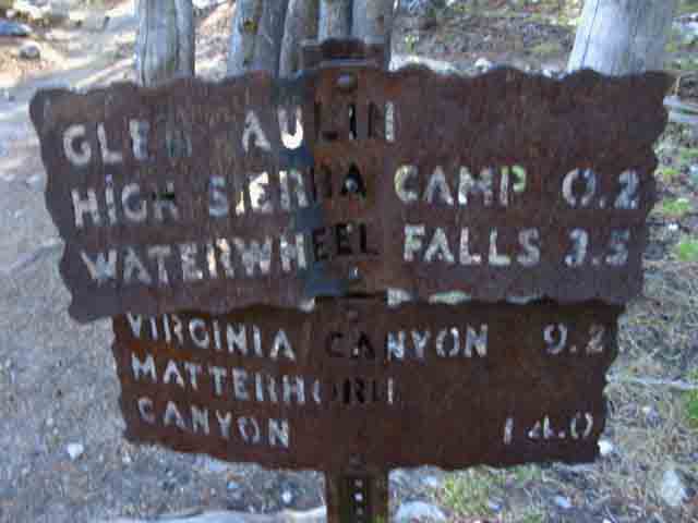
Glen Aulin Trail Junctions
Trails North, South and West from Glen Aulin
North
Up Cold Canyon
Back the way we came...
 |
||||||
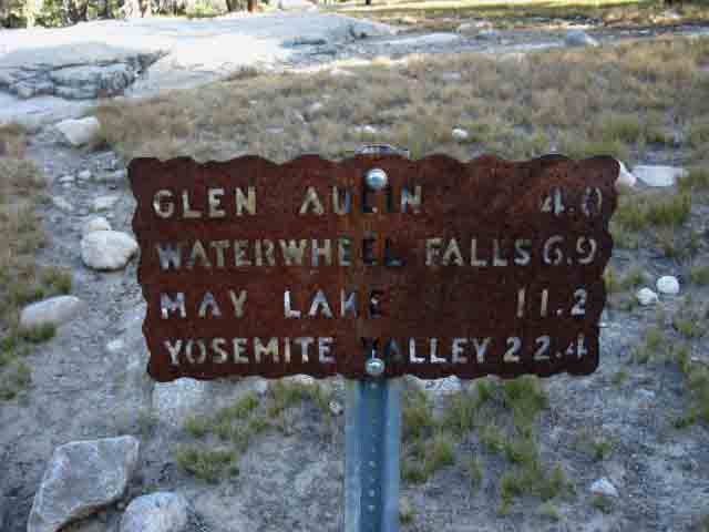
The trail North from Glen Aulin. Personally, I prefer the TYT route. Which trailhead the Northbound hiker passes through depends on what they do at the top of Jack Main Canyon. We are hiking towards Kennedy Meadows if we turn Northwest through Bond Pass at the top of Jack Main Canyon, or towards Sonora Pass if we continue Northeast through Dorothy Lake Pass at the top of the canyon. Check out the PCT mileage South from Sonora Pass on Highway 108 to Tuolumne Meadows on the Left below, and the miles if we start South out of Kennedy Meadows on the Tahoe to Yosemite Trail on the Right.
This map shows the divergent routes of the TYT and PCT across Emigrant Wilderness to the top of Jack Main Canyon. Sonora Pass Region Hiking Map Northbound In from the East Hiking North to the top of Virginia Canyon offers access (over the Sierra Crest) to two Hoover Wilderness Trailheads. We can hike out the top of Virginia Canyon to either the Green Lakes and Green Creek Road or turn South at Summit Lake for the climb over to Virginia Lakes. The Green Creek Road runs down to Highway 395 just a bit South of the Highway 270 road out to Bodie. The Virginia Lakes Road runs down to Conway Summit. South of Bridgeport we have Twin Lakes, Green Creek, and Virginia Lakes trailheads that all give us access into the North Yosemite Backcountry. Continuing North on the TYT-PCT from Virginia Canyon into Matterhorn Canyon, or even further North into Kerrick Canyon puts us in position to exit the East Sierra through Twin Lakes. Twin Lakes is located just a bit to the Southwest of Bridgeport. Check out the Road Map on our Sonora Pass Region Map. Inspect Highway 395 from Sonora Pass Junction down to Mono Lake to find access to these East Sierra Trailheads. Amazing North Yosemite Backcountry Backpacking Trips All the trips mentioned above begin from Tuolumne Meadows in Yosemite and exit through the Hoover or Emigrant Wilderness. The Hoover Wilderness wraps around most of the Northeastern boundary of Yosemite National Park. The Emigrant wraps around the Northwestern boundary of Yosemite. Summertime hikers wishing to backpack Yosemite during the most popular Summer months will find it a lot easier to get permits hiking into Yosemite from the Hoover Wilderness, and easier yet from Emigrant Wilderness, than getting permits from Yosemite. Not having Yosemite Backpacking Reservations may require days of waiting at the permit station for a permit to become available through popular Yosemite Trailheads. So make your reservations early, or hike in through the Hoover or Emigrant Wilderness. Hoover Wilderness also has a reservation system, so make sure you get your Hoover reservations early too! Scope and Scale The North Yosemite Backcountry is the area most neglected by Yosemite backpackers because it is the most physically difficult are to access, and require trips of substantial length and duration. There is a lot of hard terrain between the trailheads surrounding the North Yosemite Backcountry. A high degree of overall fitness is required.
|
West
Down the Tuolumne River
 |
||
Down the Grand Canyon of the Tuolumne. One Way Out I estimate it's around thirty miles hiking downriver along the Tuolumne River from Tuolumne Meadows to the trailhead on the O'Shaughnessy Dam. I've been meaning to hike it, and it's still on the list... UNLESS... The TYT and PCT give us access to Trailheads in the Emigrant Wilderness, the Toiyabe National Forest, and the Hoover Wilderness, all wrapping around the North Yosemite Backcountry. This means that we can craft a series of great loops around the North Yosemite Backcountry using Hetch Hetchy in the bottom of the Grand Canyon of the Tuolumne as our Southwestern trailhead, the Sonora Pass Trailhead of the PCT and the Kennedy Meadows Trailhead of the TYT as our North and Northwestern entrances, and the trailheads along the Eastern Flank of the Sierra through the Toiyabe Forest and the Hoover Wilderness as our Northeastern entrances into the North Yosemite Backcountry. Tuolumne Meadows is our Southeastern access/egress point, depending on how we hike it. We have a ring of trailheads that will set our hair on fire. Well, this is tough terrain, so hiking it will at least get our legs and lungs burning, and it is so beautiful that it will explode your head if it does not set your hair on fire... Once within the North Yosemite Backcountry through any of the above trailheads we can use the trails through Jack Main, TilTill, Pate, and Pleasant Valleys (including Kerrick and Virginia Canyons!) and the main route of the TYT-PCT to connect the trailheads around the perimeter of the North Yosemite backcountry. We can turn loops of varying degrees of very long and very difficult backpacking trips back to our starting trailhead. These loops can be started out of Kennedy Meadows, Hetch Hetchy or Tuolumne Meadows on the West Flank, from Sonora Pass along the Sierra Crest, or out of Leavitt Meadow, Twin Lakes, and from the Green and Virginia Lakes Trailheads on the East Flank. This is very difficult terrain, and all of these loops and trailhead to trailhead backpacking trips require extended hard work, excellent food planning and protection, and a good knowledge of basic backpacking skills and gear use.
|
Our Route
South
South down the Tahoe to Yosemite and Pacific Crest Trail Routes
from
Glen Aulin High Sierra Camp
 |
||||
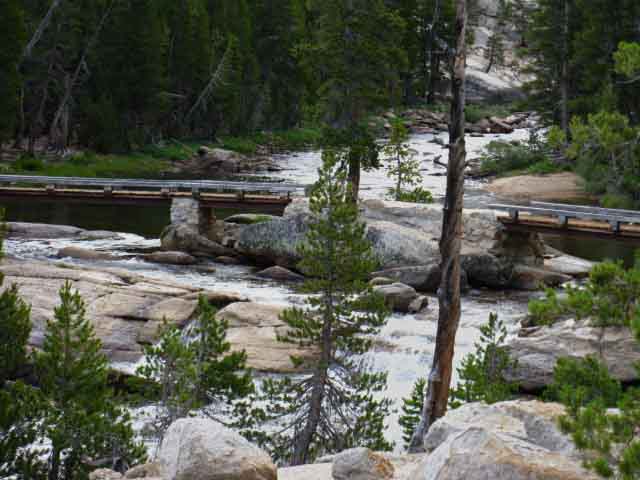
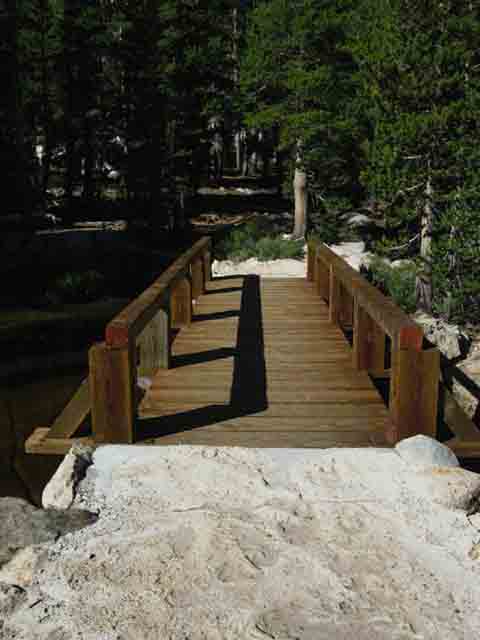
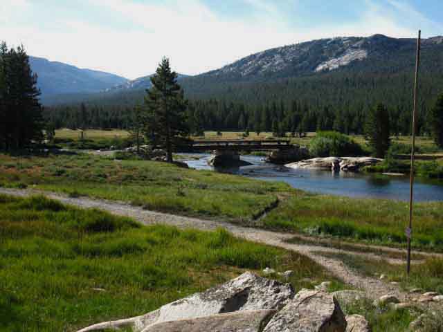
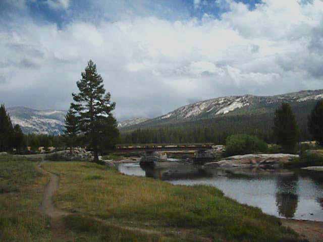
The footbridge East to Glen Aulin High Sierra Camp is located to our Left as we look over the trail sign pointing us South down the PCT-TYT route to the second bridge we encounter at Glen Aulin, the bridge over the Tuolumne River. We'll continue our Southbound hike over that bridge along the Tahoe to Yosemite and Pacific Crest Trail route to begin hiking our final 5.8 miles of our Tahoe to Yosemite Trail backpacking trip to Tuolumne Meadows. Tomorrow. Tonight we stay at Glen Aulin High Sierra Camp. It's still quite early and we can poke around Glen Aulin, talk to the employees, "guests," and backpackers. We will cross the bridge off to our Left over Conness Creek to Glen Aulin and find a campsite in the Glen Aulin High Sierra Camp backpacker's camp.
Maps North
|
Glen Aulin High Sierra Camp
Looking East Over the Bridge into Glen Aulin High Sierra Camp
 |
Entering Glen Aulin High Sierra Camp I suggest staying at Glen Aulin for an evening. The beauty and roar of the White Cascade filling the pool and a fairly mosquito-free environment is what drew the High Sierra Camp to this location from its original location and namesake, Glen Aulin. The sunset spot overlooking Glen Aulin and the majesty of sunset over the Grand Canyon of the Tuolumne River beyond is not just delightful, but overlooks the actual site of Glen Aulin, which marks the very top of the Grand Canyon of the Tuolumne River. On the previous page we explored Glen Aulin High Sierra Camp. Below: Entering Glen Aulin after crossing the bridge. We'll do a quick review of Glen Aulin below before we continue South on the combined Tahoe to Yosemite and Pacific Crest Trail to Tuolumne Meadows. DNC |
Glen Aulin High Sierra Camp I enjoy Glen Aulin High Sierra Backpacker's Camp because it is a wonderfully beautiful place, and it allows me to get an early start and early arrival at Tuolumne Meadows the next day. It takes a long time to get back to "civilization" from Tuolumne Meadows, so getting there early in the day can be a big head-start.
Glen Aulin to Tuolumne Meadows All of the same priorities are served if I am resupplying to continue backpacking South to Mount Whitney or down into Yosemite Valley. I would prefer to have whole days off to relax and enjoy the unique culture and hospitality offered at each resupply spot between Tahoe and Whitney, especially when hiking through Tuolumne Meadows. Tuolumne Meadows is backpacker-centric. TM is also roughly the halfway point of our Lake Tahoe to Mount Whitney backpacking trip. Glen Aulin is almost a resupply spot. It offers dinners to passing backpackers if they have an open place at the dinner table. It has an informal store with snacks, such as candy bars. It has "guests." High Sierra Camp Backpacker's Camps have a very different feel than our typical backcountry campsites. They have assigned campsites, a big solar outhouse, and purified water taps. The proximity of Glen Aulin High Sierra Camp to popular trailheads makes it a busy place. It is typically accessed from either Tuolumne Meadows or the trailhead at Tenaya Lake.
Thus Glen Aulin High Sierra Camp is a good transition point between the relative seclusion of backcountry trails and the bustle and activity at Tuolumne Meadows. I've likely gone for 3 to 5 days in total silence (depending on the season and trail traffic) so Glen Aulin offers a nice transition to talking again. It's not uncommon to see no one out here at all during September and October. |
South
to
Tuolumne Meadows
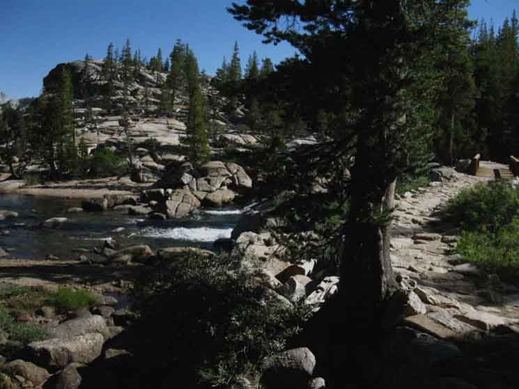
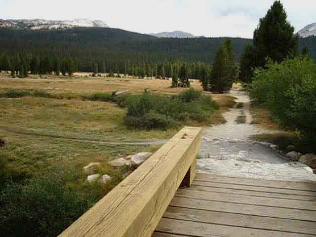
On the remainder of the page below we continue hiking the 5.8 miles South from Glen Aulin to Tuolumne Meadows along the last segment of the unified Pacific Crest and Tahoe to Yosemite Trails. We have 741 feet of climbing between Glen Aulin and Tuolumne Meadows, and most of this elevation is gained during the first 1.8 miles of hiking South of Glen Aulin. On the previous page to our North we explored the 11.9 mile hike South from Check that link to the previous page if you want to see more of Glen Aulin High Sierra Camp. Note that there is an alternative route to the Tahoe to Yosemite/Pacific Crest Trail maintained route to Tuolumne Meadows. There is a cross country route from Glen Aulin High Sierra Camp up to the double bridge above the North bank of the Tuolumne River. |
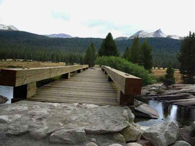
Crossing the TYT-PCT Bridge
Southbound
over the
Tuolumne River at Glen Aulin High Sierra Camp
 |
Hiking South to the bridge crossing the Tuolumne River below the White Cascade and its pool at Glen Aulin. |
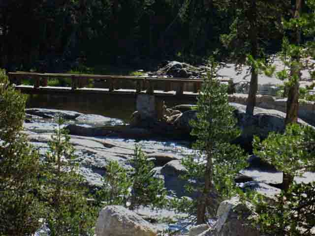
Bridge over the Tuolumne River at Glen Aulin High Sierra Camp
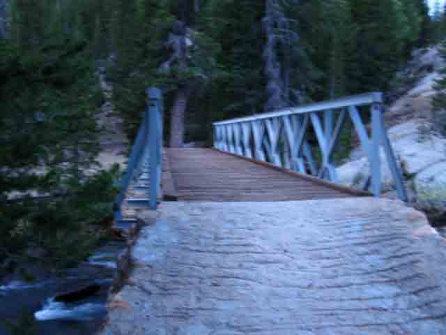 |
Stepping Southbound onto the bridge over the Tuolumne River. The Sun's up, but no direct light has hit Glen Aulin yet, and we're on our way to Tuolumne Meadows! I'm always pretty excited about finishing the Tahoe to Yosemite section of my trip, finishing the hike down across the North Sierra, so I always push this little segment of trail hard, and get to Tuolumne Meadows very quickly. I am thinking about food, a ham and eggs breakfast at the cafe, yogurt, cottage cheese, and bananas in the store, and my resupply in the Post Office. Oh Boy! Let's Roll! |
View West into the top of the Grand Canyon of the Tuolumne River
 |
View West illuminated by brilliant early morning light while crossing the Tuolumne River Bridge at Glen Aulin. Peak 8886 rises on the Right. Crossing the bridge South towards Tuolumne Meadows from Glen Aulin High Sierra Camp gives us a view over the treetops of the forest down in Glen Aulin at a good indication of why the section of trail following the Tuolumne River down to Hetch Hetchy is called The Grand Canyon of the Tuolumne. Let's Make a Deal Sadly, our political leadership has been long captured by and represents the organized forces of greed, corruption, and wealth, not our citizens or their general welfare. Subsequently our natural environment, our wealth, and our rights have long been sacrificed on the alter of greed. I would much rather deplete our overabundance of greedy people and irresponsibly gotten wealth than our rapidly diminishing natural resources. The map of Cold Canyon to Glen Aulin shows Glen Aulin Meadow and the great rock walls of its surrounding canyon. Cold Canyon The Southwest corner of the map above gives us a look down at the top of the Grand Canyon of the Tuolumne River. |
Glen Aulin
|
||||||||||||||||||||||||||||||||||
| Tuolumne Meadows Hiking Map 15 minute topo hiking map |
Virginia Canyon to Tuolumne Meadows N Yosemite 30 minute Backpacking Map |
Map North and Miles
| Cold Canyon 15 min Topo Backpacking Map |
North Yosemite Miles and Elevations |
Backpacker Resources and Hiker Information
| The Last Segment of the Tahoe to Yosemite Trail into Tuolumne Meadows |
Backpacking Trail Information Glen Aulin to Tuolumne Meadows Index |
||||||||||||||||||||||
Video
Southbound TYT: Approaching Glen Aulin
Glen Aulin Trail Junction
Into Glen Aulin High Sierra Camp
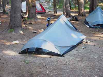
Glen Aulin High Sierra Backpacker's Camp
Bridge over Tuolumne River at Glen Aulin High Sierra Camp
View down Tuolumne River from Glen Aulin Bridge
INDEX
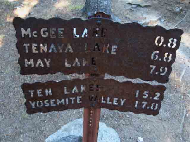
McGee-Tenaya Lakes trail junction South of Glen Aulin
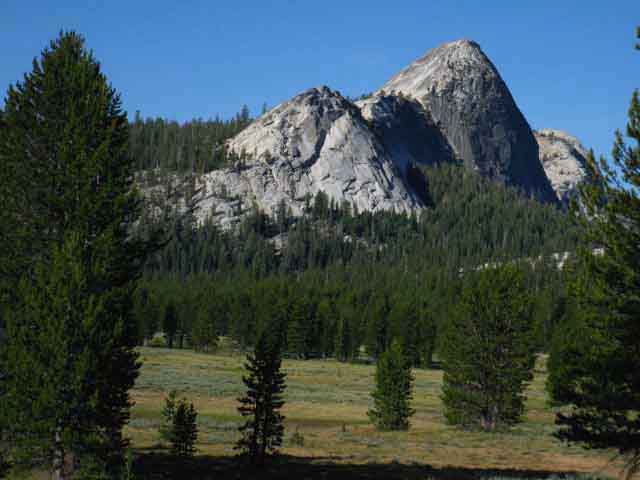
Peak 8886 below Glen Aulin High Sierra Camp
Tuolumne River to Tuolumne Falls
Trail Crew
Double Bridge above Tuolumne Falls
Alternative route from Glen Aulin rejoins main trail
View down Tuolumne River from above White Cascade
Rocky Bend above the Upper Bridge
|
North Yosemite Backcountry Weather and Road Information
Below find the closest Ground Stations, Point and Regional Forecasts near Glen Aulin. Satellite and Radar Imagery provides Long Range and Regional overviews. Check out the Ground Reporting Stations for real-time current snow and temp data.
Check this Out |
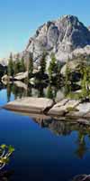
Fairview Dome and Cathedral Peak
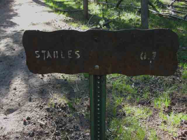
Tuolumne Stables-Lembert Dome Parking Lot Junction
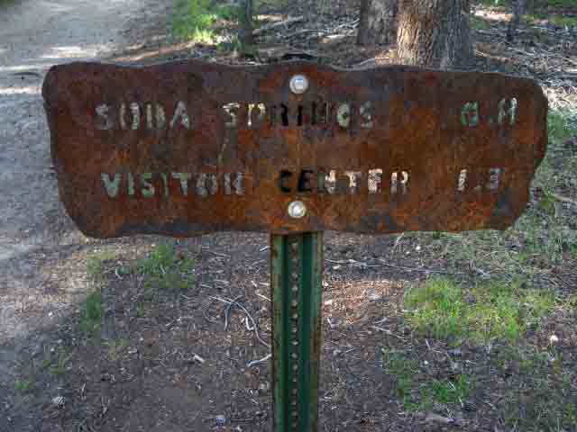
Approach to Soda Springs and Parsons Cabin
Tuolumne River Bridge at Parsons Cabin
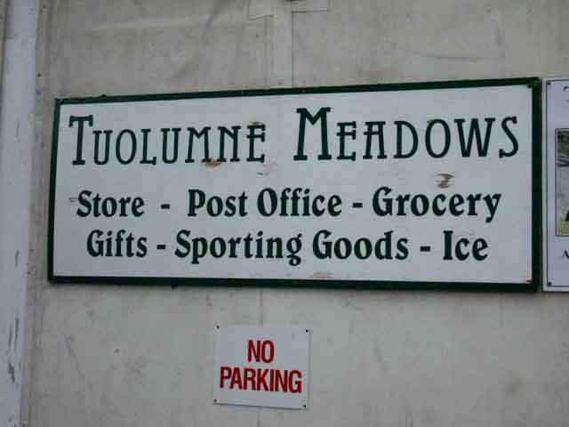
Trail directly to Tuolumne Meadows Store
End RESUPPLY
Tuolumne Meadows Store and Grill have great folks
Video
TM Culture
|
||||||||||||||||||||
| > Forum < | ||||||||||||||||||||||
All backpackers can post text comments, questions, or add information and share their knowledge and experiences on this segment of trail from Glen Aulin to Tuolumne Meadows through the comments links on this page.
Every comment link on every trail guide page goes into the forum for its particular segment of trail.
Your experiences become part of the guide. Your questions inform other hikers. Your experiences too.
Registered Members can post text, images, maps and videos on their own pages in the Trails Forum to supplement this section of the Trail Guide. Unidentified hikers can post up comments.
Check out the Tahoe to Whitney .org Backpacking Trails and Topics forums.
The Backpacking Trails Forums cover the main High Sierra Trails from Lake Tahoe to Mount Whitney paralleling trail guide construction.
The Backpacking Topics Forum covers about every topical issue any long distance backpacker would face in high elevation mountains. The Topics Forum is also being constructed in conjunction with the trail guide.
As I slowly move South completing the trail guide so too the Trails and Topics Forums evolve. I hope to complete all three simultaneously. Make sure to post up your bits of wisdom and experience in this compendium of High Sierra Backpacker information, knowledge and experiences.
Joy, Pain, Wisdom and informative experiences emanate from experts and rookies alike. Your experiences across this terrain, as well as you questions, are part of its great tapestry of experience.
Share them.
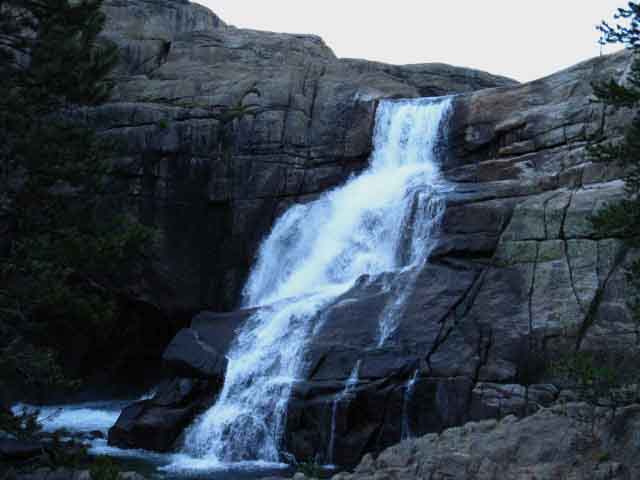
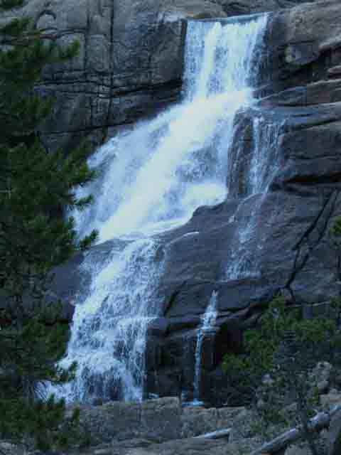
White Cascade on the Tuolumne River
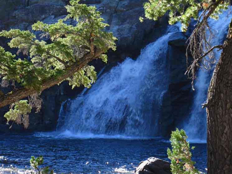 |
View at the White Cascade from the Southwest, across the pool from Glen Aulin High Sierra Camp. |
Trail Junction .11 of a mile South of the Tuolumne River Bridge at Glen Aulin
Southwest
to
Highway 120
at
Tenaya Lake
 |
||
.11 of a mile South of the bridge over the Tuolumne River at Glen Aulin we come to the trail junction on the South side of Glen Aulin High Sierra Camp. This trail leads Southwest to Highway 120 at Tenaya Lake via McGee Lake, with access to the trail into the back way of May Lake too. We'd turn Northwest approaching May Lake to hike out to the remote Ten Lakes Basin. Alternative Routes into Yosemite Valley Shortcut to Highway 120 As I have not hiked this particular shortcut, I cannot remark on its difficulty or routing. But I know it is there for hikers who need to bail out of the wilderness ASAP, cross-country, and day hikers. If you need to use this shortcut route ask around with the crew at Glen Aulin. They will tell you about it if you ask nice and are polite...
|
South
along the
Combined TYT-PCT route
to
Tuolumne Meadows
 |
Our trail continuing South along the Tuolumne River. |
North
 |
||
Trail North on the Pacific Crest Trail from the trail junction on the South side of the Glen Aulin Bridge over Tuolumne River. We continue South towards Tuolumne Meadows, which requires we begin the climb to get around the White Cascade, the waterfall at Glen Aulin.
|
Climbing Around and Above the White Cascade
to a
View Northwest
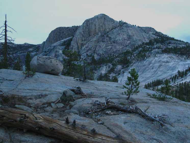 |
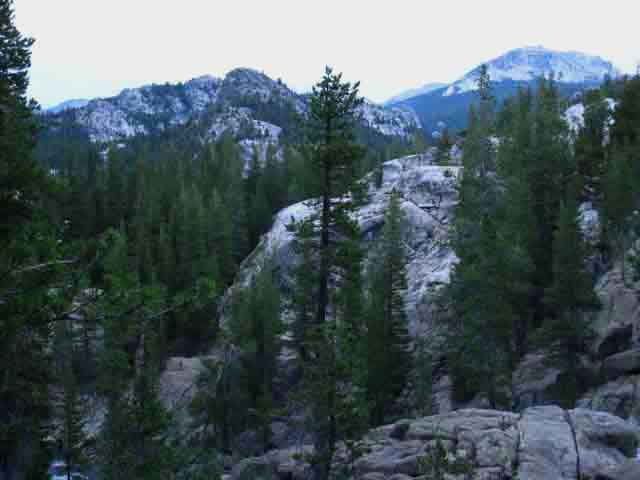
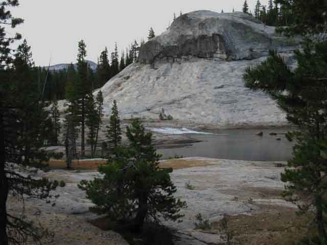
Looking Northwest Faint traces of rusty red streak the terrain near and far. The color is different, but similar, to the granite coloration up in Emigrant Wilderness. This is one Huge slab of Granite Once we get South of the Carson Iceberg Wilderness into the Emigrant we notice that a vast granite slab runs much further down the West flank of the Sierra than up North in either the Carson Iceberg or Mokelumne Wilderness. This magnificent slab continues South across the wilderness boundary into Yosemite. Information for Backpackers Plants, animals, rocks, trail skills, mountain safety, and trail culture are just the bottom end. The Night Skies open up the evening, and the timing and location of the Sun across the daytime sky make astronomy a 24 hour pursuit. Every aspect of art and science comes into play in the wilderness. Continuing South This is the same wall we viewed approaching Glen Aulin from the North and crossing the bridge hiking South from Glen Aulin. Above we see Peak 8886 in a longer context of the terrain down river from Glen Aulin High Sierra Camp, which also makes up the North wall of the canyon wall rising above the actual location of the Glen Aulin. The actual location of Glen Aulin is downstream from the current location of the Glen Aulin High Sierra Camp. Glen Aulin is marked in the lower-Left end of the Cold Canyon backpacking map. Upcoming Rest and Resupply That would be two full days and two nights off "sleeping in," in the Tuolumne Meadows Backpacker's Camp. Eating, drinking, and letting the system soak up massive calories and decompress from these intense impacts and endurance activities. Well, not two full days. We are hiking this 5.8 miles of easy money hiking up to Tuolumne Meadows during our first "day off." We have gained the ability to choose how we pace our engagement. We can now run easy or hard at will. Peak 8886 is one of the great terrain features we observe, heck, we're overwhelmed by, from the sunset overlook spot on the far West side of the Glen Aulin High Sierra Camp. The Glen Aulin observation spot is located just out of the Right side of the middle of the image above, to the Right of the great slab of granite of curving granite in the middle-distant Right of the image. Virginia Canyon to Tuolumne Meadows |
View North
across
The Tuolumne River at Glen Aulin water intake and Mount Conness beyond
 |
View North across Tuolumne River from the trail above the White Cascade. The water intake for Glen Aulin is located in a small building in the stand of trees on the other side of the Tuolumne River. Mount Conness can be seen in the upper left corner. Virginia Canyon to Tuolumne Meadows |
Glen Aulin & North Sierra Beyond
 |
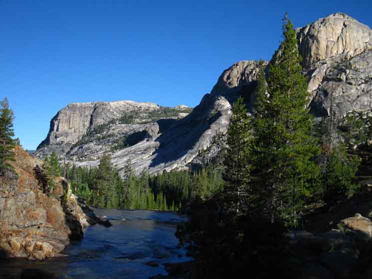
Let Us get some Context In the image above we have climbed above the South side of the White Cascade South from Glen Aulin. Glen Aulin High Sierra Camp is located in the forest directly below us in the center foreground of the image. The Tuolumne River is plunging into the White Cascade waterfall, coming down from the far-Right to the middle of the image. Peak 8886 rises on the far upper Left. In the distance the PCT-TYT runs up between Peak 8886 on the Left and the Granite Horn rising in the middle of the image. Conness Creek runs past that horn too, below its Right side, the Eastern Flank of that Granite Horn. We can see the gap in the distance to the Left of the Granite Horn through which the Northbound PCT-TYT continues its climb to upper Cold Canyon. That's where we hiked down to Glen Aulin. Peak 8886 rises to guard the very top of the Grand Canyon of the Tuolumne on the upper Left of the image above. We can almost see the Glen Aulin sunset overlook spot along the edge of the forest fringe in the distant middle Left of the image above. Now we turn to our Right to continue our climb up along the Tuolumne River to our Tuolumne Meadows rest and resupply stop. Frick. I am ready for a break... Tuolumne Meadows is coming right in time! Kennedy Meadows Pack Station is a "Disneyland" for horse-folk, cowboys, Clampers, and random bikers... Yeah, the cowboys party there.... Tuolumne Meadows is the backpacker's "Disneyland." I meet my backpacking bros from around the world and from across the US of A here every year. Tuolumne Meadows is where backpacker culture forms up like a standing cloud on a cold mountain every year. Nice. Virginia Canyon to Tuolumne Meadows |
Better View of the Glen Aulin water intake building
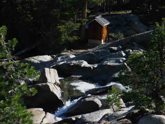 |
The water intake for Glen Aulin High Sierra Camp above the White Cascade. |
Southeast View above White Cascade
Upstream to Tuolumne Falls
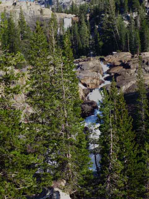 |
Looking Southeast upriver from our position above the White Cascade. We can see the serious granite terrain the Tuolumne River falls through. Seriously beautiful. Note the location of Tuolumne Falls in the upper middle Left hand corner of the image above. Once we climb above the White Cascade this represents our next segment of trail. |
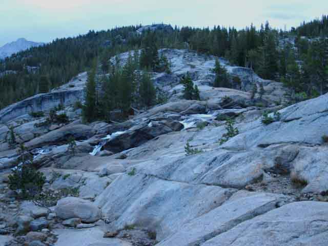
Tuolumne Falls
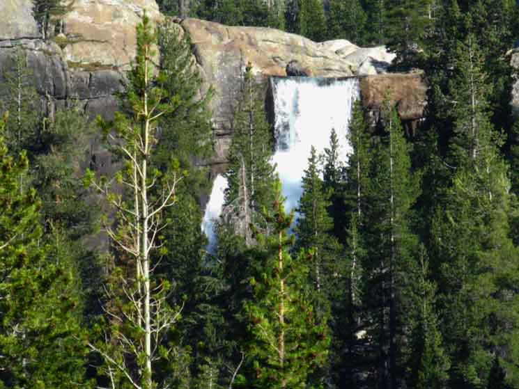 |
Tuolumne Falls from our position above White Cascade. |
Tuolumne Falls
 |
| After climbing up and around the forest and granite we come up to Tuolumne Falls. |
Tuolumne Falls
 |
Rock and Water. |
Climbing South of the Tuolumne Falls
 |
View a bit East of North Another look at the Granite Horn. Notice the Granite Horn emerging out of the forest on the Left side of the image. We followed the TYT-PCT route down Cold Canyon through the gap below the Left flank of the Granite Horn in the upper-Left of the image, as we observed above. We've seen this terrain around Tuolumne Falls before. The last time we looked at our current position here approaching Tuolumne Falls was from above and behind that Granite Horn pictured above as we dropped down past the Left (West) side of that Granite Horn formation hiking down to Glen Aulin out of Cold Canyon. Our perspective looking back up there from here is much different than looking down here from there. Virginia Canyon to Tuolumne Meadows |
Above Tuolumne Falls
 |
We've gotten above Tuolumne Falls, down river behind us, to our Left from this perspective. Tuolumne River flows of the edge of this massive expanse of almost horizontal granite above the falls. Above is the view looking to our Southbound Left, to the North-northeast to see the top of Ragged Peak to the South of Mount Conness, sticking up over the terrain. We are hiking Southeast, to our Right, upstream against the course of the Tuolumne River flowing in the foreground, while looking over to our Left to take in this sweet view. Double Bridges Approaching Tuolumne Meadows Last Climb into the Bottom of Tuolumne Meadows Above the bridge we'll make our way through a bit of almost flat forest before we begin our final bit of climbing up a finger of forest to cross a nifty gap in the great granite formation dividing the fall of Tuolumne River below from the flat meadow terrain above. As this well-used trail bends South around the base of this high "nose" our view of the Tuolumne River flowing out of the Tuolumne Meadows opens up. We can see that we are stepping out of the last bit of the steep climb up from Glen Aulin into an incline more suitable for meadows. Though we are not done with climbing, nor with granite terrain, climbing over and off this last great granite feature marks our entrance into the lowest of Tuolumne Meadows. After climbing over this last feature we cross a candy-stripped terrain. We drop down into a succession of alternating strips of forest divided by great flat sheets of almost unjointed granite. We'll be staying on the North bank of the Tuolumne River, then skirt the North edge of Tuolumne Meadows as we approach the main meadow. In Tuolumne Meadows we will cross our last bridge of this segment of our trail. This is the bridge bringing us over to the South bank of the Tuolumne River just below Soda Springs and the Sierra Club's Parsons Cabin. That's a nice bridge. Well, there is one more bridge after that. There is a culvert bridge over Unicorn Creek between the Parsons Cabin bridge and Tuolumne Meadows Visitors Center. End of A Fine Trail All of those are great things, after our first 200 miles on the trail. Everything tastes better. Well, our specific mileage hiking down to Tuolumne Meadows depends on where exactly in the Tahoe Basin we started, and what kind of route we put together across the North Sierra. Some folks start in Squaw Valley up North in the Tahoe Basin. Other folks tie together various lengths of the TYT and PCT to craft unique longer routes than either the PCT or TYT alone. I don't know about you, but I've taken the longest and hardest combination of the TYT and PCT down to this point as possible at least once. My routes keep changing! And now we draw near to the halfway point. Tuolumne Meadows. I am excited! |
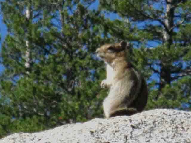
Yosemite Wildlife
Squirrel
 |
||
Golden-mantled ground squirrel.
|
Fawn
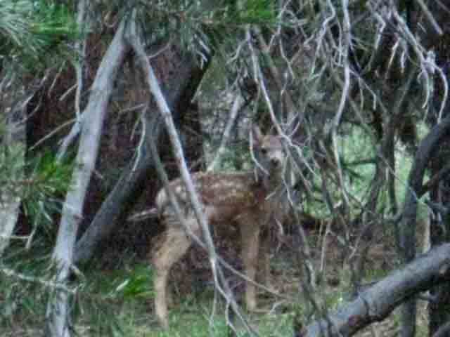 |
My eyes were drawn to the fawn by the delicate crunch of light twigs breaking in the underbrush. |
Doe
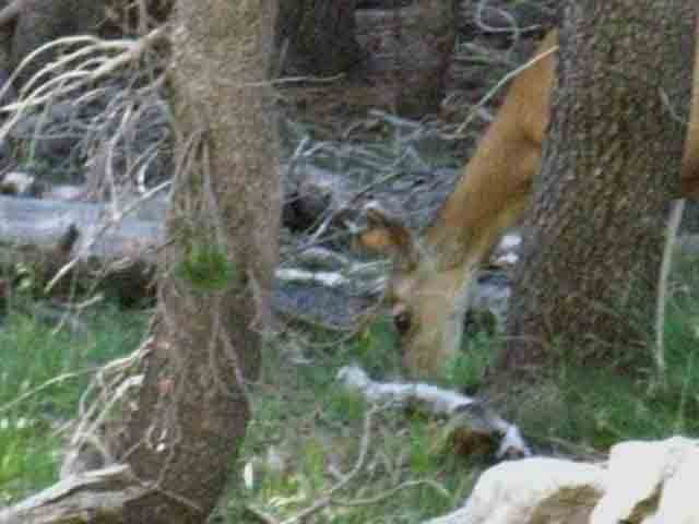 |
Tuolumne Meadows is full of life. |
Yosemite National Park Trails
 |
Trail along Tuolumne River between Glen Aulin and upper bridge. Over the decades the heavy use of Yosemite has carved deep channels across thin meadow soils and trenches across forest floors. On one hand the Park instituted permits, then restricted the numbers of permits, and on the other hand trail crews work to mitigate human damage as well as keep trails open against the ravages of a violent environment. The result is that there have been up to a hundred seasons of enduring hard rock trail crew work from a bit North of Sonora Pass down to Mount Whitney. Generations and generations of Trail Crew. Yosemite National Park is the center of High Sierra Trail Work, and where the most work has been done over the last hundred years, by my observations. But is by no means the only place where generations of Trail Crew have left their mark on the mountains, and will remain for who knows how long? I'm guessing that lots of High Sierra trail work will survive the test of time, and not be damaged until the next ice age or age of volcanoes sweeps it all away. Trail Crew Comments Trail Crew Forum |
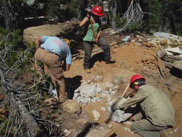
Erin Anders Working the Trail
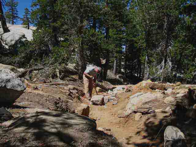 |
Erin Anders 2010 crew worked the trails around Tuolumne Meadows. These are great examples of the guys and gals who work hard creating the practical art that is the trail we tread. The observation and understanding of the practical forces of nature in motion across the terrain over time under great environmental pressures is the first step in setting rock that withstands the foot of man, the hooves of fully laden mules, and the annual force of water down all the mountains as the Spring Thaw melts the Winter snowpack. The Yosemite National Park Trail Crews are among the most accomplished, experienced, and professional masters of High Sierra terrain I have had the pleasure of meeting. |
Yosemite National Park Trail Crew
 |
Shaping rock to contain part of the trail subject to washing out during Fall and Spring. This is part of the trail that swings away from the Tuolumne River below the double bridge and above Tuolumne Falls. |
Erin Anders 2010 Trail Crew
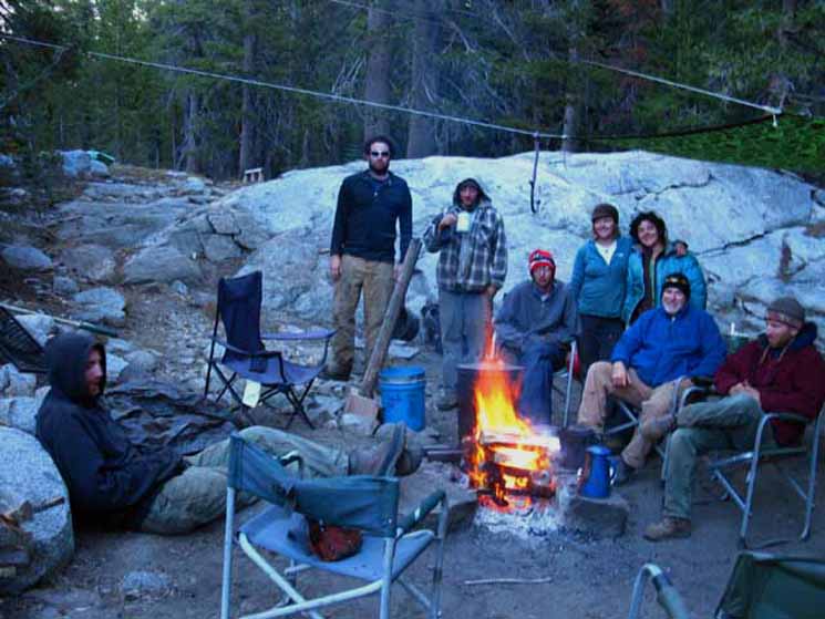 |
LIfe in Camp I'm looking for pictures of High Sierra Trail Crew. |
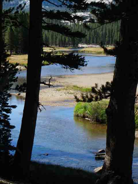
Tuolumne River
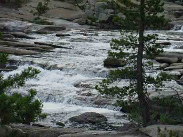 |
Tuolumne River flows over section of stepped flats of granite between Tuolumne Falls and the double bridge. |
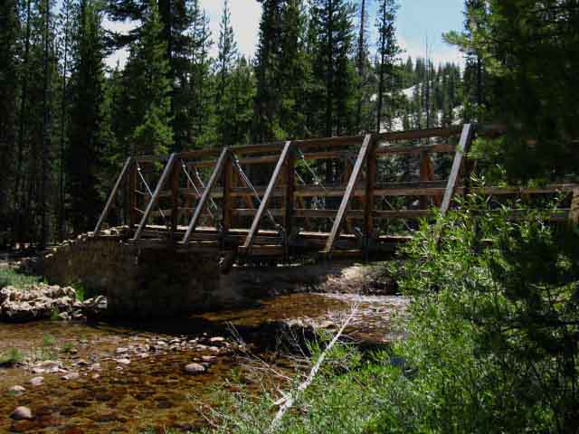
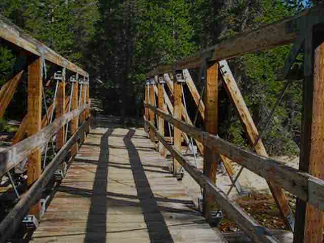
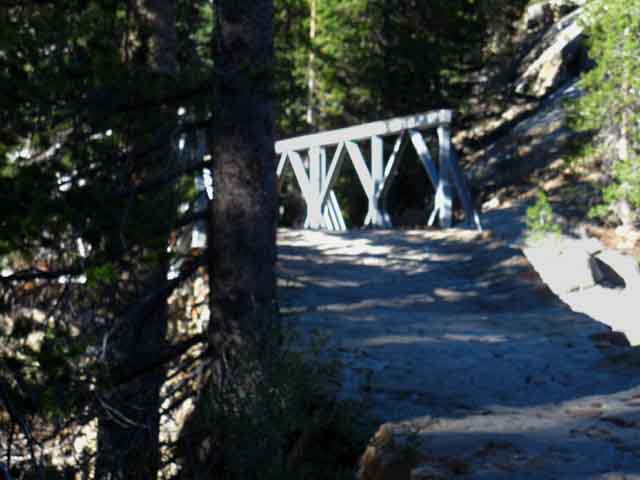
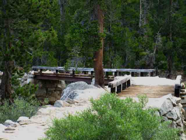
Double Bridge
 |
||
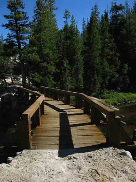
The double bridge above the falls-cascade section of the Tuolumne River. One more short section climbing around a rocky turn in the Tuolumne River above the bridge will bring us to the lower of Tuolumne Meadows. In the distance beyond the bridge to the Left we can see the forested segment we hike through to climb up onto the rock feature in the far distance.
|
North Span of Double Bridge
 |
Approaching the double bridge we observe the Northern of two segments of bridge tied together on a granite formation rising from the Tuolumne River. |
View North across Double Bridge
 |
Looking across Tuolumne River where the upper bridge above the Tuolumne Falls crosses to the North shore. The bridge is lined up like a gun sight on the far-Right of the image. The cross-country trail up from Glen Aulin rejoins our trail on the other side of the river at the foot of the bridge, on its North-Westernmost anchorage. |
Double Bridge above Tuolumne Falls
 |
Southbound hiking approach to the Double Bridge. |
Across the Upper Tuolumne River Bridge
 |
Looking South across the South length of the double bridge over Tuolumne River.
|
Down River
from the
Double Bridge
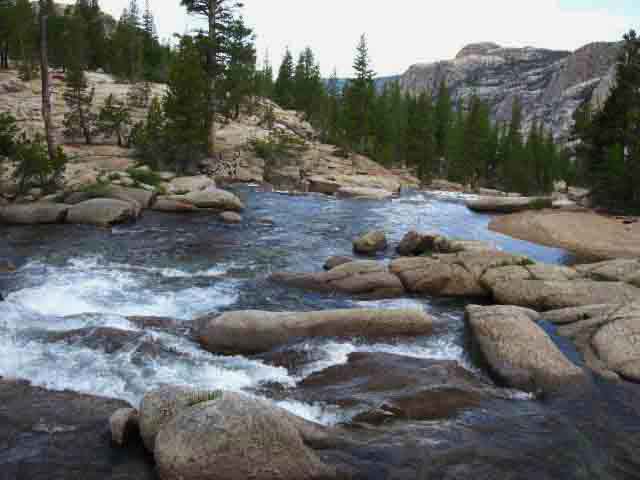 |
View down Tuolumne River from the Upper Bridge. The Tuolumne River runs down across, through, and around a set of granite waves down to Glen Aulin. We cam see the steep angle the river flows down below the double bridge. We can see the North wall of the Grand Canyon of the Tuolumne River in the distance, both above and beyond Glen Aulin. Virginia Canyon to Tuolumne Meadows |
Wildcat Fire
in the
Grand Canyon of the Tuolumne River
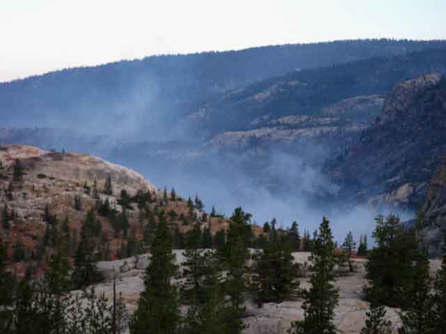 |
Wildcat Fire 2009. Since 2009 the area around Hetch Hetch and the entirety of the Southwestern Yosemite Wilderness was scoured by the massive 2013 Rim Fire. The changes that have already transpired in the character of the seasons has already doomed us to a future of changing forests. I don't argue about "global warming." The direction the winds blow out of during the Winter changed 15 years ago. These changes have grown and consolidated into a whole new weather pattern who's seasons have different beginning and end dates, different prevailing wind and storm patterns, different humidity levels, and almost different completely characters. The web of life is freaking out at these catastrophic changes. "Normal" weather patterns are now rare events. Rare weather patterns are now "normal." As the natural seasons have changed in timing and character so too has man's "fire season." The implications of our "evolving" weather patterns are quite clear. If the trends dominating our weather pattern over the Northeastern Pacific keeps evolving for the next thirty years as they have over the past thirty, then everything that we have not already clear-cut, damned, drained, drilled or developed will burn. The energy pushing these changes is not petrochemical, it is not physical at all. What pushes these changes we are seeing in Nature comes straight out of the hearts and minds of man, a product of our human perspectives, motivations, and goals. Nature does not care about any of that. It measures and cuts a precision pattern in the fabric of life reflecting the reality of life's capacity to capture and transfer energy. We'd call it "fertility." We are degrading the physical and chemical underpinnings of the web of life, not to mention shitting up the spiritual aspects of life, sufficient to degrade them to the point the interface where life draws energy from Nature, "the engines of life," will no longer be sufficient to create or support the web of life, which, at its end sustains the very same obscene human populations that are destroying it. The fertility of Nature is withdrawing from the material world, from human support. As humanity long ago abandoned its role as the conscious mirror of the spirit of life, the spirit of life is retreating from us. Our imbalance is well balanced. It is shared equally across all aspects of human experience. The alpha and omega are out of balance: both individuals and their societies are imbalanced. Classes, economies, and whole nations are out of balance. This serious disconnect between our policies, practices, and our looming catastrophic outcomes drives these changes forward. Until we actually end the policies of irresponsible growth driving the mass production and consumption of worthless crap by greater and greater populations that have already changed the seasons, these changes will continue to accelerate. Well, that's one way of solving this "problem." I would not be adverse to this solution if we only took ourselves out. The kicker is that we are riding Nature into the ground as our collectively recognized motivation of humans, "greed," takes us out of the picture too. The last victim of this tidal wave of human-generated extinctions will be humans. Comments on Changing Forests? |
South Segment of Double Bridge
 |
Hiking South on the Trail over to the North Bank of Tuolumne River. Taking a Left-turn at the end of the bridge is the beginning of the cross-country route down to Glen Aulin. Following the trail South, to our Right, points us towards the bottom-most of the Tuolumne Meadows, and the final bit of our climb to the facilities along Highway 120 in Tuolumne Meadows. If this is a bit confusing it is because we are hiking South on the TYT-PCT which crosses the Tuolumne River from South to North across the double bridge. |
Sandy Trail
on
North Side of Bridge
 |
Sandy conditions on the North side of the bridge. We are walking across a sand box as soon as we step off the South end (by trail direction) of the double bridge, bending to our Right (East by compass) to cross an elevated segment of trail across a small patch of wet meadow. |
Trail
and
Deer
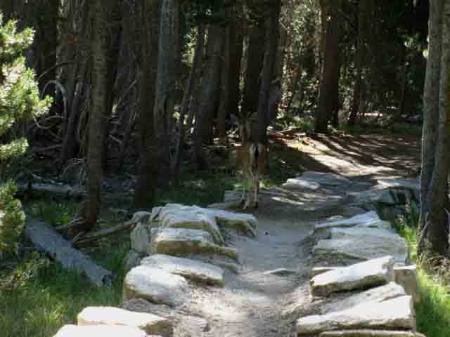 |
Deer walking slowly off sandy section of elevated trail above wet meadow into the forest as we approach. We can see in the 9th image above how the forest on the South side of the bridge follows the river up climb over a great granite feature. Above we follow sandy trail bending to our Right through fine forest to where we climb up through a very pretty low rocky gap fronting a bend in the Tuolumne River at the bottom of the Tuolumne Meadows proper. |
Out of the Forest into the Granite
Rocky Path along Bending River
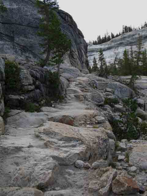 |
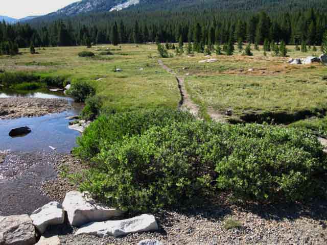
Climbing through the romantic low gap we bend to our Left (East) and are now hiking around the base of the granite nose to our Left and a wide expanse of granite running off to our Right to a sheer cliff forcing the Tuolumne River through a narrow segment between the granite features on each bank that opens out just above the double bridge. We are passing through a fantastic stretch of granite between Peaks 9083 and 8924 that marks the bottom of Tuolumne Meadows and the transition of the Tuolumne River's mostly mellow meadow flows above from its cascade through granite below. Our trail South is carved high up on the North flank of this wide granite slab under Peak 8924 over to where the Tuolumne River pools below a bend in the river. This is the point where the Tuolumne River passes out of the bottom of Tuolumne Meadows, narrowing down the wide bends of its twisting flow through meadow terrain to pool up before flowing over and through this great granite gap to begin its cascading flow down to Glen Aulin. This is a fun little section. |
The Gap between Meadow Flows and Rapids
 |
Above we are looking South across the river at the very bottom of the ridge arm running out to the Northeast of Peak 9083, which marks the bottom of Tuolumne Meadows. The Tuolumne River flattens out and moderates its flow considerably above this point of pooling and focuses into rapids and waterfalls below. I'd call this place a calm granite transition zone between the even quieter meadow flows above and the turmoil of the cascading rapids below. This place marks the beginning of Tuolumne River's series of cascades and waterfalls along it's precipitous drop to Glen Aulin for Northbound backpackers and our entrance into the bottom of the Tuolumne Meadows for us Southbound backpackers. |
Entering Lower Tuolumne Meadows
 |
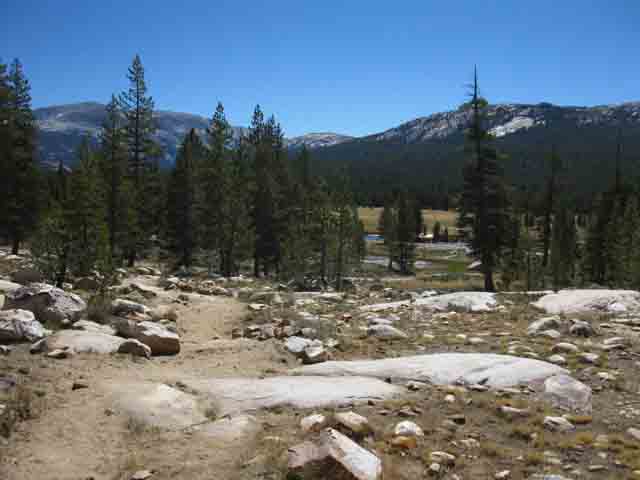
The first of two great granite slabs we cross. Hiking through/across the great granite apron wrapping around the bottom of Tuolumne Meadows. This is the first of the two granite slabs our trail crosses as we bend around the granite and forest wedged in between the North bank of the Tuolumne River and Peak 8924 marking the bottom of Tuolumne Meadows. We're crossing the first of two great granite slabs under Peak 8924 entering the bottom of Tuolumne Meadows. To our North, Left in the Southeast- facing image above, Peak 8924 rises as the North horn of this great granite gap at the bottom of Tuolumne Meadows, and to our South Peak 9083 finishes the pair. These fine huge rock slabs greet our entry into lower Tuolumne Meadows. |
Cathedral Range from the
bottom
of
Tuolumne Meadows
 |
Now that we've climbed up along the Tuolumne River out of the top of its run through, across, and over this beautifully sculpted granite descent down to Glen Aulin, we again get views of the Cathedral Range rising above Tuolumne Meadows. Unicorn and Coxcomb Peaks from Left to Right, then the rounded crest of Peak 11168. We can see a bit of Echo Peaks and Cathedral Peak jumbled together, all rising beyond these serene meadows wrapping around fine granite slabs suitable for the floor of this temple of nature as the Tuolumne River flows past. I do find it sad that the waters of this temple of Nature are destined for the toilets and bathtubs of San Franciscans. |
Wildlife Abounds
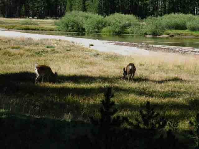 |
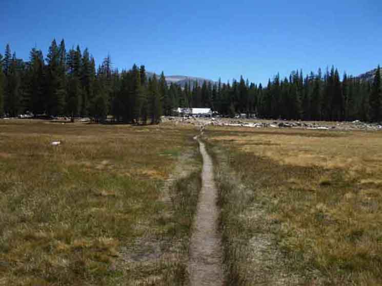
Deer grazing in the lower Tuolumne Meadows. This is the big oval meadow section below the main body of Tuolumne Meadows. As soon as we hike around the North perimeter of this great oval meadow we've got a a 600 yard climb up a low forested gully that brings us up to a moderately steep rock ramp. Off to our Right the Tuolumne River runs through a low rocky section between the upper and the lower meadow shown above. We could easily wander to our South, off the trail, if we wanted to follow the river up to the upper Tuolumne Meadows, if were were scrambling about or dayhiking. While following the river we could turn North to return to this PCT-TYT. Following the trail South we'll look to the Right side of that granite ramp, about 6oo yards ahead, to find the ducks leading us up its Right side. At the top of our scramble up the rock ramp we have another three hundred yards, about a quarter mile, under dry forest until we emerge to a treeless segment of trail approaching the Young Lake Trails. |
Trail Crew and High Sierra Camp Resupply on the Way
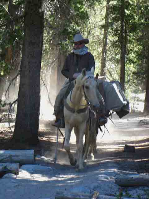 |
Nope. Upon closer inspection this is a private horsepacker riding North out of Tuolumne Meadows. Good looking horse. |
A Sweet Melody of Meadow, Forest, and Rock
The Lowest of the Tuolumne Meadows
 |
The river, meadows, forest, and trail meander through lower Tuolumne Meadows. |
View South:
Cathedral Range
across
The Lowest of the Tuolumne Meadows
 |
||||
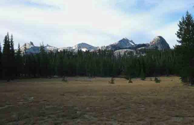
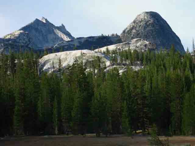
Cathedral Range comes into view again as we hike around the North end of the lower Tuolumne Meadows. Unicorn and Coxcomb Peaks from Left to Right, then the rounded crest of Peak 11168, AKA the Echo Crest, followed by the star-shaped crown of Cathedral Peak, and then Fairview Dome rising on the far Right of the image, though much closer to us than the rest of the peaks. OK, here's where things get interesting: We are seeing the Western spire of Echo Peak along the crestline of Cathedral Peak from this perspective. Well, I think that explains some of the interesting profiles of Cathedral Peak we've observed while hiking down the changing perspectives of Cold Canyon and the descent to Glen Aulin. The Matthes Crest runs South down the far flank of Peak 11168, which is also known as Echo Ridge. We hike South past the West flank of Matthes Crest after hiking through Cathedral Pass, if we are following the John Muir Trail down to Yosemite Valley. Also See
The Maps
Virginia Canyon to Tuolumne Meadows
|
View South
Cathedral Range
Cockscomb, Unicorn Peak, and Peak 11168
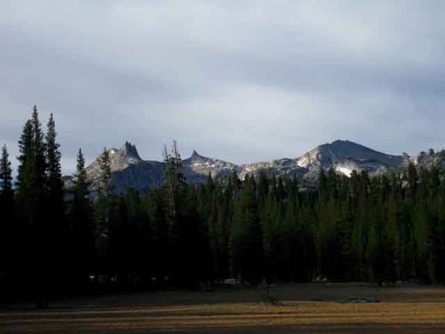 |
Last time we saw the Cathedral Range was at the upper end of Cold Canyon's meadows before we hiked over the low ridge to descend into the lower canyon bringing us down to Glen Aulin High Sierra Camp. Now, climbing into these lowest of the string of Tuolumne Meadows out of Glen Aulin, we once again get on the same line of perspective to view the Cathedral Range as we had way back at the bottom of Cold Canyon's meadows. Except now we are much closer... |
View South
Cathedral Peak
and
Fairview Dome
across
The Lowest of the Tuolumne Meadows
 |
Cathedral Peak and Fairview Dome on a clear Summer morning. We Southbound hikers begin about a mile of moderate climbing, the hardest degree of easy hiking from the top of this lowest of the Tuolumne Meadows up to the bottom of the main body of the Tuolumne Meadows. We've got about a mile of the hardest degree of easy hiking climbing from the top of this lowest of the Tuolumne Meadows up to the bottom of the main body of the Tuolumne Meadows when we pass by the Young Lake trail. Thus our route takes us around the North perimeter of the meadows until we reach the point it crosses the meadow. We continue hiking on our line to the Southeast from the Young Lake trail junction around the North perimeter of Tuolumne Meadows though some lightly forested terrain until we come upon the quagmire conditions around our Delaney Creek Ford. Beyond Delaney Creek we have our last little bit of climbing, a gentle climb up a forested channel of granite. This is because the upper Tuolumne Meadows are shaped like a backwards "L," or an "n." We gain about 70 feet of elevation over 500 yards of distance to where we begin our final descent down about 700 yards (about four tenths of a mile) into Tuolumne Meadows through the Soda Springs/Parsons Cabin trailhead.
that cuts a straight line between the bending arc of Tuolumne Meadows, which is sitting to our South off our Right shoulder. Check out the line of our route between Delaney Creek to Soda Springs on the USGS backpacking map: Tuolumne Meadows Hiking Map We still have a mile long hike from the Young Lakes junction to where we cross the wilderness boundary into Tuolumne Meadows proper at Soda Springs. But I'd say we've been hiking along the North end of the Tuolumne Meadows since at least the lowest of the meadows, once we got onto the massive flat granite slabs on the North end of the lowest meadow after climbing over the granite gap above the double bridge. If not walking along the edge of the lower Tuolumne Meadows we've been paralleling the route of the Tuolumne River as it runs over the low granite sheet dividing the upper from the lower meadows. This Line of Meadows is Long If we are continuing our backpacking trip South on the combined PCT-TYT past the Tuolumne Meadows Store and Post Office we will see that this great chain of meadows, of which Tuolumne Meadows is bottom and most expansive of this whole line, actually stretches all the way up into the top of Lyell Canyon along the Tuolumne River from our present position. Our brutal hike up to Donohue Pass out of the end of Lyell Canyon is broken up by three sweet levels of meadow with stunningly beautiful little Sierra lakes in them. It's a steep hike between these three meadowed flats on our way up to Donohue Pass from the end of Lyell Canyon. Tuolumne Meadows Hiking Map A fantastic chain of meadows spill down Lyell Canyon massing in Tuolumne Meadows and dripping down along the Tuolumne River until the emergent granite terrain just above the double bridge assures the transition to rapids. Here the meadows end where the Tuolumne River begins its cascading and water-falling run down to Glen Aulin, an ample preparation for its entrance into the magnificence of the Grand Canyon of the Tuolumne. Above and below are images looking South across the lower meadow at the Cathedral Range and the granite features backdropping Tuolumne Meadows. |
Cathedral Peak and Fairview Dome
Later in the Season
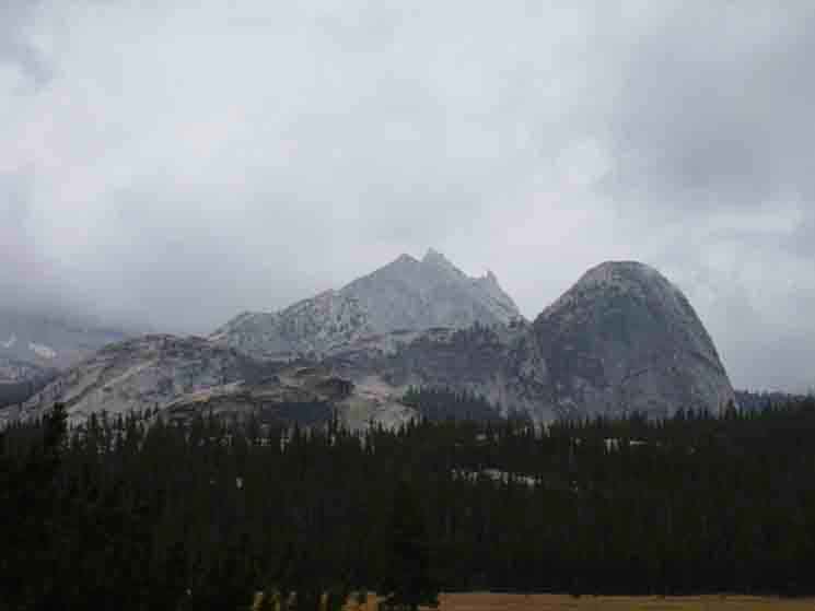 |
Cathedral Peak and Fairview Dome shrouded under the unsettled weather of Fall. Hiking the Tahoe to Yosemite Trail during early October brings threatening weather on every cold breeze crossing the Sierra Crest. |
Rotating Around Fairview Dome
View of the Northeastern End of Fairview Dome
 |
Finishing the climb up the rapids from Glen Auln brought us first to cross the first great slab of granite, where the lowest great sweep of Tuolumne Meadows lays. From there Fairview Dome looks "conventional." It takes on a different aspect after we cross the rock and forest dividing the upper from the lower Tuolumne Meadows. Perspective Rotated This aspect shows a unique profile. Beyond we can see light on the Northeastern face of Mendlicott Dome beyond the shadowed main Western face of Fairview. The very nature of our perceived reality dances on our constantly changing perspectives. These changes are fully capable of transforming the whole, "look and feel," the whole character of the environment we are hiking through, not to mention significant changes in perspective brought by atmospheric changes. Out here we can see that sometimes our perception itself is capable of adjusting, of dancing on the ever changing juxtipositions of perspective, light, temperature, and moisture that Nature endows itself with to obtain and maintain context, if not full engagement. Out here the Nature of Reality can wear new "clothes" every day. It is our job to learn from the tailor, to enjoy these heavenly displays of light, weather, and perspective, and finally, to anticipate the evolution of Nature's Styles with the evolution of its seasons. |
View South
Top of Fairview Dome
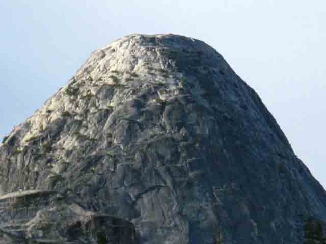 |
Detail of Fairview Dome. |
View South
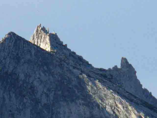
Crest of Cathedral Peak
 |
Detail of delicate rock spires of the unique star-shaped crest of Cathedral Peak. View of Cathedral Range from Cold Canyon |
View South
Cockscomb Peak
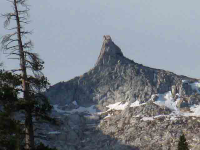 |
Cockscomb Peak is most distinctive among the distinctive peaks of the Cathedral Range. |
North
By the Compass
Young Lake Trail Junction
Towards
Mount Conness
 |
||
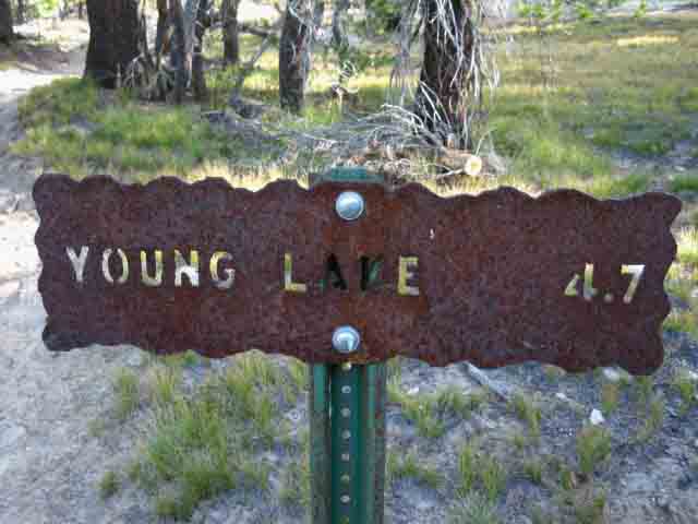
Young Lake trail junction North by the compass off our TYT & PCT route.
Over to our Right is the bottom of the Western Leg of the n-shaped (or backward "L") Tuolumne Meadows. We will continue almost directly East for our next low climb, which will bring us up and over this last low granite flat over to the Eastern Leg of these n-shaped Tuolumne Meadows, and down to Soda Springs and Parsons Lodge. Though we are plainly crossing an elevated segment of glacial cut granite, it is well forests and reasonably shaded, if dry. |
North
By trail direction
Young Lake Junction
on the
PCT-TYT
 |
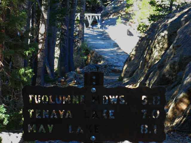
The trail North along the PCT-TYT route from the Young Lake trail junction. This would be back the way we came to Glen Aulin and points North. This would also be the way for a nice backpacking arc from Tuolumne Meadows to Tenaya Lake via Glen Aulin and May Lake, or even a tour down the Grand Canyon of the Tuolumne River to the Hetch Hetchy Reservoir Trailhead via Waterwheel Falls. |
South
from
Young Lake Junction
on the
PCT-TYT
 |
Southbound to the End of the Tahoe to Yosemite Trail at Tuolumne Meadows. Tuolumne Meadows, meaning the Visitor Center, is 2.2 miles from the Young Lake trail junction. It's a little less, 1.91 miles, if we turn towards the Post Office, store, and cafe on the path on the South side of the Parsons Cabin Bridge. |
Last Ford
between
Tahoe and Tuolumne Meadows
Delaney Creek
 |
Delaney Creek. Delaney Creek breaks down into a quagmire where its waters are ground into the perimeter of the soft meadow soils under the hard hooves and heavy boots of the heavy hiker and rider traffic on the trails around Tuolumne Meadows. |
Trail Spit
to
Lembert Dome Parking Lot
and
Tuolumne Meadows Stables
 |
A Trail Y Junction to the Tuolumne Meadows Stables veers to the Left at this trail Y. The stables are located next to the Lembert Dome parking lot. This would be the direction we finish the trip if we have a car parked in Tuolumne Meadows at Lembert Dome. If we are ending our Tahoe to Yosemite Trail and have no car here, we will point ourselves to the Right through this trail Y towards the direct trails to the Tuolumne Meadows Store and Cafe. That's where we through-hikers want to be. At the Tuolumne Meadows Store we will be able to get some refreshments and food while we plan our YARTS transportation out of Yosemite if we have finished the Tahoe to Yosemite Trail, or find other backpackers/climbers who will give us a ride towards home. Or hitch hike. I have had a great run of rides out of Tuolumne Meadows over the past few years. I had a run of three rides in a row that brought me from Tuolumne Meadows in Yosemite right to my doorstep in Berkeley. That's good hitch-hiking! |
Our Final Segment
of the
Tahoe to Yosemite Trail
to
Tuolumne Meadows
 |
||
We veer to the Left at this trail-Y to hike towards the Lembert Dome parking lot and the Tuolumne Meadows Stables, or to the Right for Soda Springs on our the way across Tuolumne Meadows to the Visitor Center along Highway 120. I veer Right to Soda Springs, then turn towards the Tuolumne Meadows Store and Grill on the South side of the bridge at Parson Cabin just past Soda Springs. I'd hike to the Visitor Center if it served food and was holding my resupply. But, the visitor center is not holding food. There are nice Ranger-Folk working at the Visitor Center, though. The Tuolumne Meadows Cafe and Post Office are doing both: serving food and holding my resupply, so I'll hike there.
|
Down Into the Main Meadow
 |
We've climbed from the Young Lake junction to the top of the low granite rise dividing the East from the West "wings" of Tuolumne Meadows. Above we hike down where Soda Springs and Parsons Cabin along the edge of the main body of the Tuolumne Meadows. Above we are approaching our exit from the North Yosemite Wilderness through the Soda Springs Trailhead and into Tuolumne Meadows proper. Tuolumne Meadows is cut-out from the Yosemite Wilderness Area. PCT TYT We are getting very close to resources. Woooooo---Hooooooo! The Yosemite wilderness boundary at Soda Springs is only .59 of a mile from the Tuolumne Meadows Store, Post office, and Cafe. I repeat, Woooooo---Hooooooo! |
Glen Aulin Wilderness Trailhead
 |
Wilderness boundary at Soda Springs trailhead to Glen Aulin. |
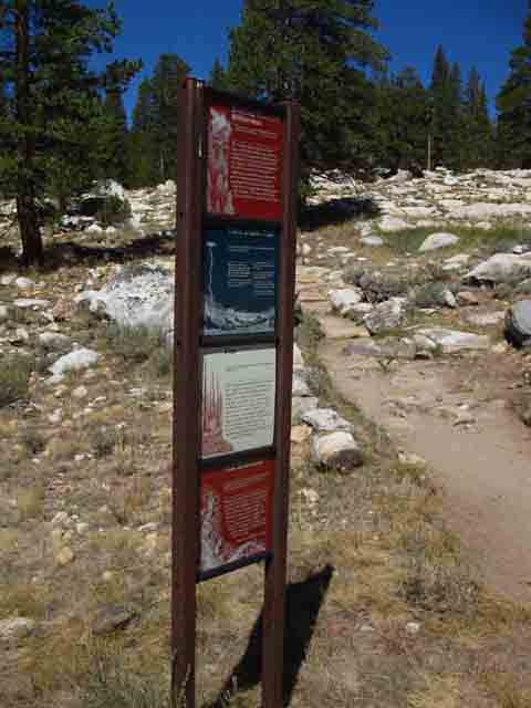
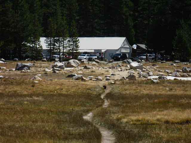
Trail Information Sign
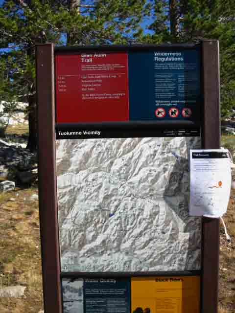 |
This is not encouraging. The presentation of maps, regulations, and warnings indicates to me that the Park believes many folks are showing up at the trailhead without good information. I find that is true, especially at places like Yosemite that draw large numbers of tourists. Tourists hit the trail and get lost, tired, or broken. At least a few tourists are killed every year in the High Sierra. |
The Trail to Glen Aulin
 |
||
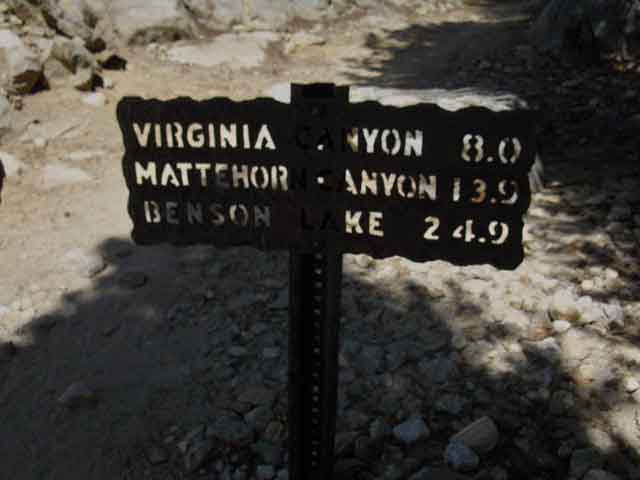
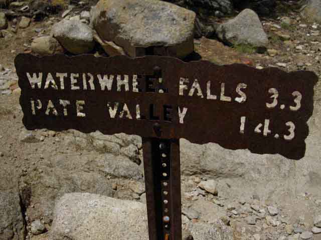
The Wonderful Trail North to Glen Aulin Waterwheel Falls is further West down the Tuolumne River from Glen Aulin, while the trail to Virginia Canyon is Northbound along the Pacific Crest-Tahoe to Yosemite Trails from Glen Aulin. Pate Valley is further down the Grand Canyon of the Tuolumne River than Waterwheel Falls, maybe on your way West-Southwest to Hetch Hetchy? We discuss various route options across the North Yosemite Backcountry here, and routes around it here. We are leaving great terrain behind, but will find rising grandeur ahead. For the next day or so we will hang out on this interface between nature and civilization at Tuolumne Meadows.
|
At the Glen Aulin Trailhead
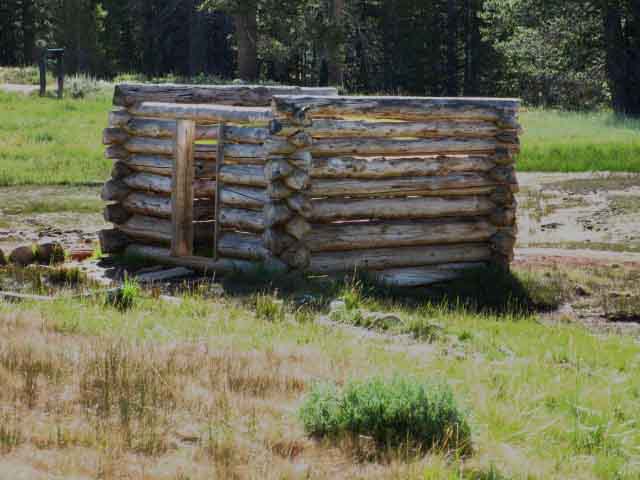
Soda Springs and Parsons Cabin
 |
||
Soda Springs "Cabin." It's thought that this cabin was constructed to preserve the quality of the spring water by protecting it from cattle grazing in Tuolumne Meadows. The hooves and weight of the cattle would destroy the spring if not protected. I've always thought that building a protective fence would have been easier than building a cabin. That makes me ask, "why?" Why would a cabin be built when a fence would do better, quicker, and cheaper? Thinking Out Loud...
|
Soda Springs Information Sign
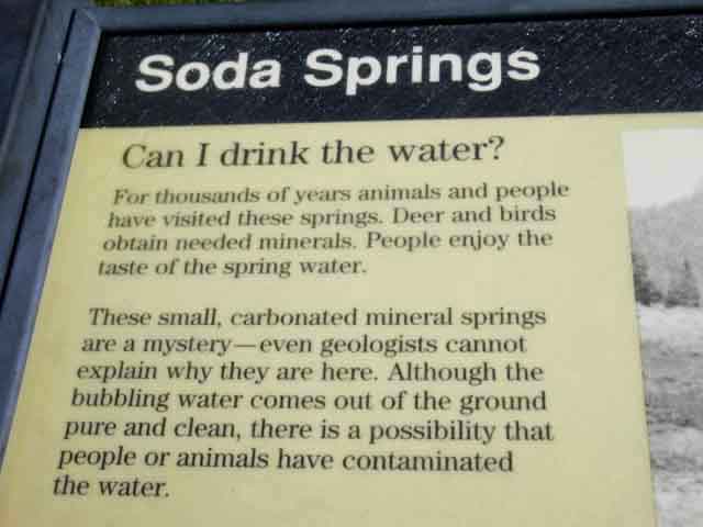 |
Soda Springs water comes with the same warnings as all the water in the High Sierra Mountains: It's clean unless it's not. |
Parsons Lodge
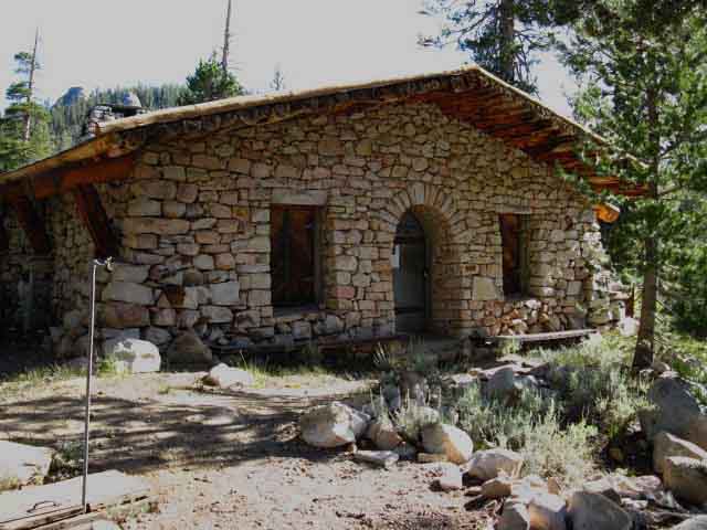 |
||
Parsons Lodge. Parsons Lodge is a few dozen yards from Soda Springs, and the McCauley Cabin a few dozen yards distant from the Parsons Lodge. The Tuolumne River flows by a hundred yards to the South of Parsons Cabin. All are in close proximity to the Northbound PCT Trailhead, actually the wilderness boundary a few feet to our North, and all are close to the substantial bridge over to the South bank of the Tuolumne River just a few feet upriver. Folks starting backpacking trips here will start out of the Lembert Dome parking lot. Check out the Yosemite Backpacking Permits Page for more information on starting trips out of Tuolumne Meadows. Tourists walk out here from the Visitor Center along Highway 120 after being encouraged and suggested by the Rangers there to hike around. The bridge is followed by a heavy jeep road type trail to the Visitor Center. Most important to us Southbound backpackers is the trail cutting Southeast, to our Left, from the South end of the bridge. This trail cuts across Tuolumne Meadows and brings us by the most direct route to the Tuolumne Meadows Store, Post Office and Cafe facilities.
NPS Programs |
McCauley Cabin
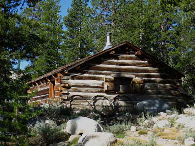 |
McCauley Cabin. Now a residence of National Park Service Rangers, if my information is correct. History of the McCauley Cabin |
Parsons Lodge Information Sign
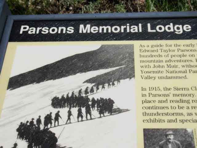 |
||
Parsons Lodge Information.
|
Mileage to Highway 120
 |
||
End of the Line The Visitor Center is about .85 of a mile West down Highway 120 from the Tuolumne Meadows tent cabin facilities where we seek food, drink, communication with loved ones off the trail, and the resupply necessary to continue down the trail. And don't forget resting the body in the Tuolumne Meadows Backpacker's Camp!! So we will cross the Tuolumne River here over the Parsons Cabin Bridge, then cut immediately Left on the South bank of the Tuolumne to follow the trail across Tuolumne Meadows to the tent cabin facilities.
|
Tuolumne Meadows Bridge
 |
Substantial bridge over the Tuolumne River at Parsons Cabin. Snow gage on the Right edge of the image. |
Final Approach to Tuolumne Meadows Facilities
 |
The trail South over Tuolumne River in Tuolumne Meadows. Far beyond the bridge we can see where our next section along the PCT and JMT routes South will bend South into Lyell Canyon for our hike out the South end of Yosemite National Park over Donohue Pass. |
Bridge over Tuolumne River at Parsons Cabin
 |
Crossing the Bridge South towards the resupply and food we seek at the Tuolumne Meadows Post Office and Store, and our fast food fix at the Cafe. Bacon Cheese Burgers and Piles of Fries, washed down with a frigging chocolate milkshake! The Cockscomb then Unicorn Peak rise on the far Right of the image. |
Three ways to Tuolumne Meadows Resources The most direct way is the path off the Left (East) corner of the South bank of the bridge over the Tuolumne River at Parsons Cabin. The second most direct way is to continue South towards the Visitor Center on Highway 120 but we cut Left at the trail on the other side of the culvert bridge over Unicorn Creek before we arrive at the Visitor Center. This is a bit longer. The longest way is to proceed to the Visitor Center on Highway 120 from Parsons Cabin, then walk East along Highway 120 (or in the campground) about .85 of a mile to the Tuolumne Meadows Store, Cafe, and Post Office. There is an even longer way... Hike to the Visitor Center then continue South to the "official" JMT route behind it. From there the JMT passes around the South side, the back side of the Tuolumne Meadows facilities. We would then cut North across the car campground to the Store, Cafe, and Post Office tent cabin complex. When hiking into Tuolumne Meadows I assume all backpacker's destination will be the Store, Cafe, and Post Office. Then at least a night at the Tuolumne Meadows Backpacker's Camp to rest up for the next leg of our hike South or our journey home. |
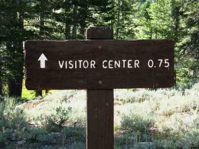
Trail to Visitor Center on Highway 120
 |
||
The trail pointing directly towards the Tuolumne Meadows Store breaks off to the Left from the main trail to the Visitors Center on the South end of Parsons Cabin Bridge. Right here the signs indicate we are about .75 of a mile from the Visitor Center on Highway 120. I have it at .54 of a mile to the Visitor Center from here. I have our distance at .55 of a mile from the Parsons Bridge to the front door of the Tuolumne Meadows Store by this most direct route.
|
Towards the Visitor Center
Unicorn Creek
View to the Southwest
 |
Continuing on the trail towards the Visitors Center we come to take a look to the Southwest across the culvert bridge over Unicorn Creek. Fairview dome in middle-Right distance. That big chunk of granite on the far Left edge of the image is the Northernmost end of the rock composing Cathedral Peak. You remember that we've been watching the position of Cathedral Peak rotate in our perspective has we've hiked towards Tuolumne Meadows since we first got into the bottom of the upper, meadowed section of Cold Canyon. This will be our last look at Mendicott Dome, unless and until we hike the JMT route backwards down into Yosemite Valley. In that case we will be hiking between the visible base of Cathedral Peak above and the South end of Fariview Dome approaching the Cathedral Lakes. Our trail down the JMT to Yosemite Valley goes between those granite formations. |
Trail to Post Office and Store from Unicorn Creek
 |
Trail off the Southeast side of the bridge over Unicorn Creek heading directly to Tuolumne Meadows Store and Post Office. We are a half mile from the Tuolumne Meadows Store from here. |
The End of the
TAHOE TO YOSEMITE TRAIL
 |
||
Arriving at Tuolumne Meadows Store, Cafe, and Post Office. This is the end of the trail from the bridge at Parsons Cabin. This is the End of the Tahoe to Yosemite Trail.
Check out a sample of the 2013 Crop of Pacific Crest and John Muir Trail hikers resupplying and carrying on at Tuolumne Meadows as well as a look at the fine crew working there. |
Tuolumne Meadows
 |
Tuolumne Meadows Tent Cabin Facilities Backpackers, day hikers, climbers, scramblers, boulderers, birders, flower people, runners and bicycle riders of all characters and types from all compass points of the planet are here, will be here, or have been here. Park Tourist Capitol |
Tuolumne Meadows Tent Cabin Services
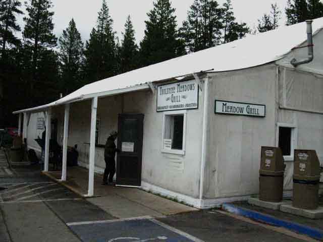 |
Tuolumne Meadows houses it's services, its Store, Post Office and the "Meadow Grill" in a seasonal tent cabin that can be substantially dismantled when the Winter snows close Highway 120. Open: July through late September (approximately). Historical Opening and Closing dates for Highway 120. |
Tuolumne Meadows Tent Cabin dismantled
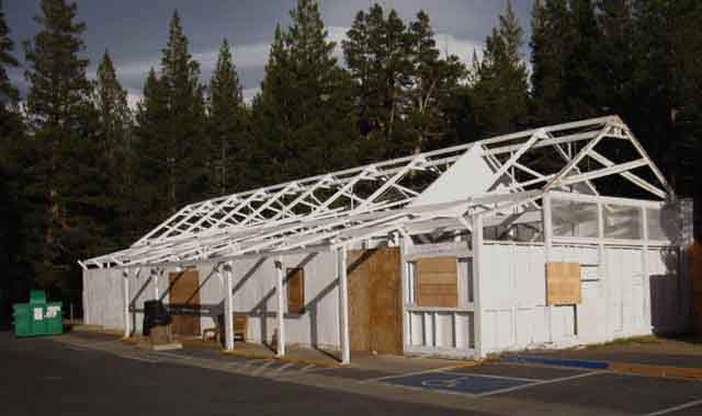 |
Canvass elements of the Tuolumne Meadows facilities disassembled for Wintertime. The closing date of the store changes from year to year with the changes in the transition to cold and potentially snowy weather. I figure on the facilities closing at the end of September. Tuolumne Meadows JMT-PCT Backpacker Resupply Information |
The Center of Resources in Tuolumne Meadows
 |
Tuolumne Meadows Services. The Post Office is where we pick up our resupply. We'll get fresh food and local beer brewed at Mammoth Lakes from the Store, and we'll eat a couple of burgers and breakfasts at the Grill. |
Two Landmarks of Tuolumne Meadows
The Center of Tuolumne Meadows
The Post Office
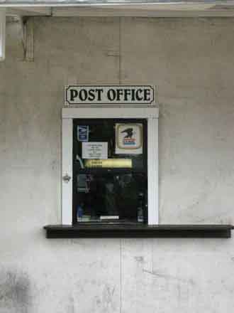 |
It looks like a small window, but it works like Alice's Rabbit-Hole... |
Tuolumne Meadows Post Office
Packed with
Backpacker's Resupply Packages
and
The Postmaster
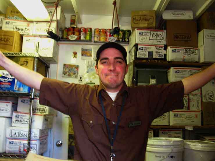 |
Michael Kochakji, the Postmaster and unofficial Mayor of Tuolumne Meadows. The Resupply Box Kingdom This dude will do anything in his power to make things right for you, so be a good backpacker to him. When he comes to the fore is when your resupply did not show up. When injured or fading backpackers wander into Tuolumne Meadows. When you stupidly sent your resupply package to the city of Tuolumne rather than Tuolumne Meadows. You are not helping anyone, especially yourself, if you are a demanding fool. Be an excellent representative of the backpacking community and you will find the staff of the Post Office, Store, and Grill can be a real addition to the cultural aspects of your Tahoe to Whitney Backpacking Trip. |
The Center of the Universe
is marked by a
Disco Ball
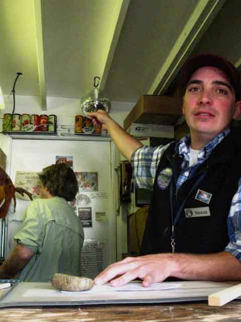 |
See... We Rock. It's not the disco ball, but the employees that make this place sparkle. I think the postmaster shines more than the disco ball... Awwww... |
Facilities
Tuolumne Meadows Store
The Store and Post Office |
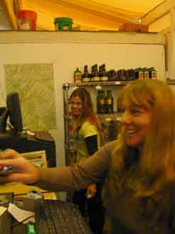 |
 |
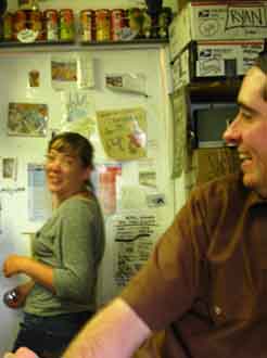 |
From Left to Right above: Dianne and Sarah on Left, and Jamie in the middle image, all working the Tuolumne Meadows Store. On the Right we have another Jamie in the Post Office with Michael on the far Right.
These delightful folk are just a representative sample of the fine folks who run and work the Store, Post Office and Cafe in Tuolumne Meadows. They are just the tip of the iceberg. As the seasons pass the regular employees will return each year, joined by a few new.
Be nice to them. They work hard to provide thousands of daily tourists and dozens of backpackers a wide range of services.
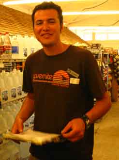
The Tuolumne Grill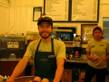 |
 |
These nice folks will help you find anything they have, and set you straight as to what they do not have.
Be nice to them.
Nothing like a cool backpacker and a fat tip to brighten up their day!
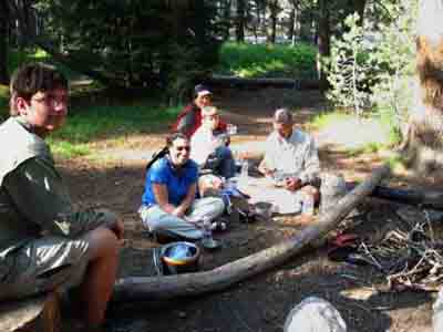
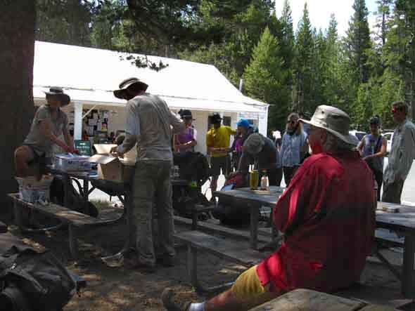
A Batch July 2013 A Representative View of Summer in Tuolumne Meadows See 2013 PCT Report As I walk South from Lake Tahoe along the Sierra Crestline every year I run into the first PCTers sometimes in early Spring, while doing annual Spring snow trips in the East Carson River's Canyon Northeast of Sonora Pass. He had two ice axes, crampons, and was traveling very light and very fast. Hell, it was March, if I remember correctly. Crazy little bastard climbed the steep section right below the Sonora Gap, coming South from Sonora Pass. Highway 108 was not yet open for the season. I climbed up to the Sonora Gap and looked down in wonder at what the little French dude had climbed. Brian Robinson walks PCT, CDT, and AT in one season. "Triple Crown" Information Later in the Spring come a few more hearty early-season PCT hikers, crossing the snow-filled mountain passes. A little later comes this season's sensible "body" of PCT hikers who have timed their arrival at the Southern Sierra with the depletion of snow from the high mountain passes, which is also indicative that the rivers have mellowed-out from their harrowing flows during the height of the Spring Thaw. Each year's timing of these seasonal transitions from Winter to Spring to Summer conditions is different, but the vast majority of PCT hikers are well advised to time their arrival in the Sierras with the tempering of both snow conditions and the Spring Thaw. We offer the best resources to track each season's progression. Unless snow covered mountains and raging rivers are what you are into and prepped for, like the amazing little French Dude, we must carefully observe each season's specific evolution from Winter to Spring into Summer conditions to find the conditions that suite our levels of fitness, skills, and gear. Well, the French Dude crossed the Sierra before the Spring Thaw even started... His plan was to get to the Continental Divide Trail for Spring, the the AT during mid-Summer. I wonder if he made it? Anyone have any information? PCT hikers will time their approach to the Sierra to coincide with approaching optimal conditions, and the law of averages will create a distribution of hikers strung along the trail. I, on the other hand, will try to figure out when and where the main body of Northbound PCT hikers will pass through a given location, then walk it Southbound to check out the year's PCTers. During 2013 I caught the leading edge of the main body hiking up Jack Main Canyon, and a rather large grouping moving through Tuolumne Meadows. Tuolumne Meadows marks around 920 miles of backpacking from the Mexican Border. Below is a sample of the folks and activity at Tuolumne Meadows during the height of the Pacific Crest and John Muir Trail season. The PCT crowd will pass through as early in the season as possible, then taper off into a constant flow of PCT "section hikers" as the season progresses. John Muir Trail hikers tend to be older, and with more backpacking experience than the PCT kids. Now don't get me wrong: there are lots of older PCT hikers and young hikers on the JMT. I am just talking about the averages of my observations over the last couple of decades. There are always exceptions, and there are always averages.
Above: Note the YARTS-Shuttle stop in foreground Left. YARTS spans from Mammoth Lakes to Merced via Tuolumne Meadows, Yosemite Valley, and a slew of stops down Highway 140 from the Yosemite Valley to Merced, including Mariposa on Highway 49. The Shuttle circles around Tuolumne Meadows points of interest.
Above and below: Rest and Resupply time on the PCT-JMT.
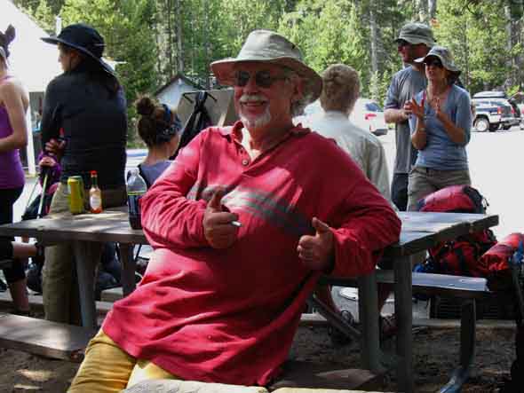
Above: Ansel, a moderator from HighSierraTopix and art teacher living in Mammoth wearing Red Shirt, observes and engages PCT and JMT hikers resupplying at Tuolumne Meadows.
Ansel is a hell of a nice guy. High Sierra Topix is a quality site. During 2016 we learn that Ansel is quite a talented artist Weather There were quite a few impressive downpours before the storm moderated after about 4 hours.
|
Tuolumne Meadows
Backpacker
Sample
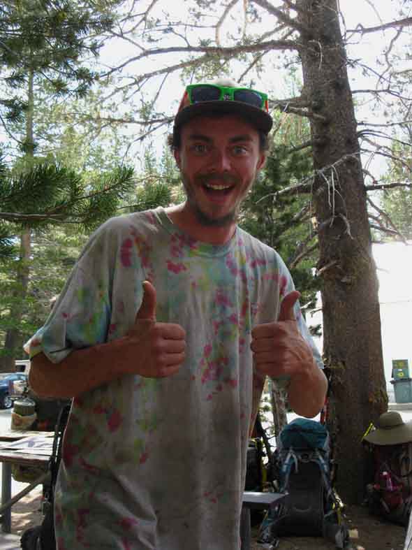
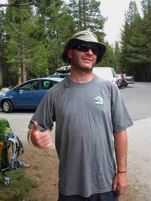
Thirty Pack
Highly animated. Look of the joy of trails, mountains, and life on his face. AT last season, PCT this. "Best days of my life doing AT last year and the PCT this year." |
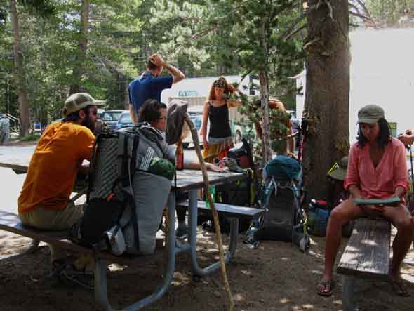
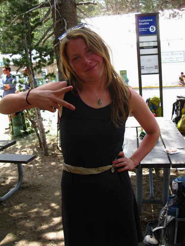
Alex
Hiking the Pacific Crest Trail. I really enjoyed hanging out with Alex for a brief time. She's just a great soul. |
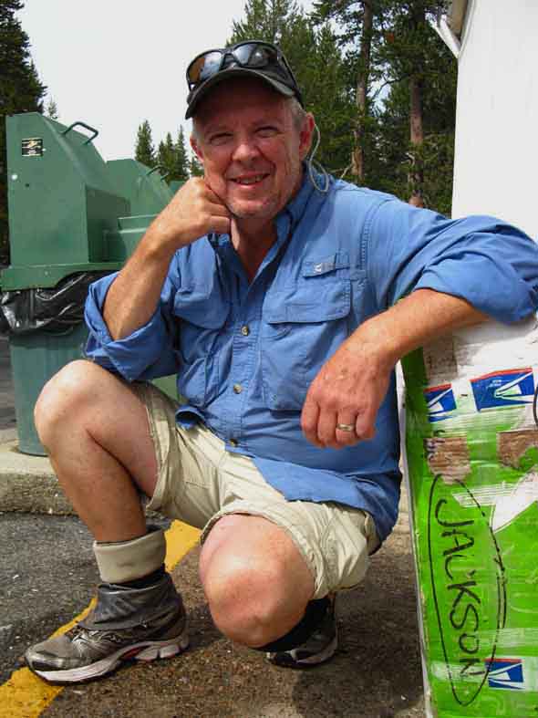
Brad
Out of Seattle. Considered Lake Wanda a spiritual place. I totally agree. |
Gary Jackson
JMT Hiking with his two sons and daughter. Facebook Page: Bluegrass Trekkers |
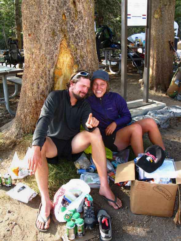
Team SmilesWry Smile on Jit' in Time's face on the Left and Crossover's big S-eating grin on the Right.
PCT Adventure: "Love it more than anything." These were two of the nicest folks you'd ever want to meet. July 18 UPDATE "We're in Truckee now." |
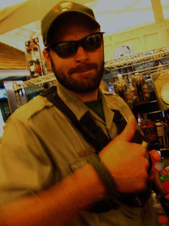
Bear Ranger
A Bear Ranger, as opposed to LE and Wilderness Rangers, at Tuolumne Meadows Store. "LE" is "Law Enforcement," as opposed to a "Real" Ranger, being a Wilderness, Trails, or Bear Ranger. Law enforcement Rangers are not "Rangers," they are cops. But no, in case you were wondering, the Ranger above is not a Ranger who looks like a bear, but a Ranger dedicated to training the campers not to attract bears in the first place, and who inevitably has to run the bears off when this car-camper training fails. The bears are not the problem. It's us, as campers and cops. But, to top it al off, "LE Rangers" are not Rangers, they are cops. That is a Big Difference. I remember when Nixon gave Rangers guns, and created "LE" Rangers. A sad day in "Ranger" history. That's when America had too many folks in it. That's when the Rangers became cops, when car camping became an urban, rather than a wilderness experience. "Now that we have cities in the wilderness, we must have cops in the wilderness." That's when the Rangers became cops, I think it was 1971. This only shows that in the 1970s we, as a society, had already grown much too large to preserve the classic identity of either Rangers or Campers. That was forty years ago. Then we, as a society, hit the gas. Pedal to the Metal. Massive Growth Ensued. Our population doubled. I say that the principal of growth has destroyed this nation and its principals, and certainly does not represent the principals that gave birth to this nation. Quite to the contrary, the principals of endless growth have drowned our original revolutionary principals that gave birth to the concept of the empowered individual supported by a mutually empowered society. We are a mockery of those principals, and their required practices, today. Except the Bear Ranger. I salute him. Great Bear Insight and Sights |
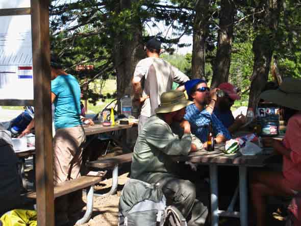
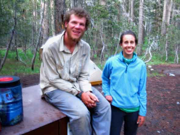
Rabbit and Happy Thought
PCT Nathan and Carolyn taking resupply break at Tuolumne Meadows Backpacker Camp. Nathan is out of Sonora, a town along the mountain road (Highway 108) to Sonora Pass on the Western Flank of the Sierra, while Carolyn hails from Western New York. I enjoyed a lively talk with these fine folks. |
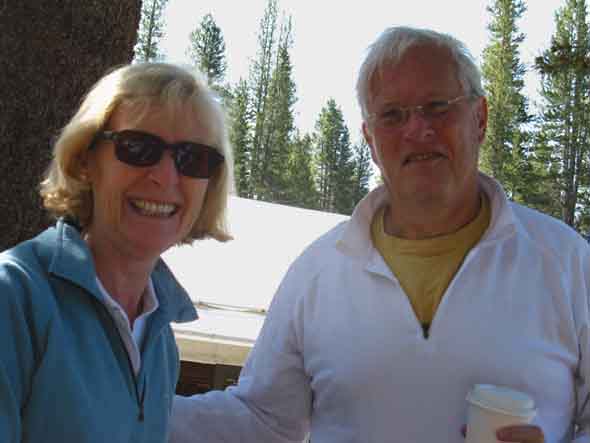
Tom and Wife
Great folks from Alabama visiting the Yosemite High Country. Go 'Bama... haha. Though they are not hiking, these fine folks represent the great people from around the world and the country visiting Yosemite that you should take the time to get to know when you hike around the wilderness. We shared one of the picnic tables and a great conversation over morning coffee. These folks were so sharply aware of the nature of the American Reality it restored my faith that there are still a few good Americans in every part of the country. |
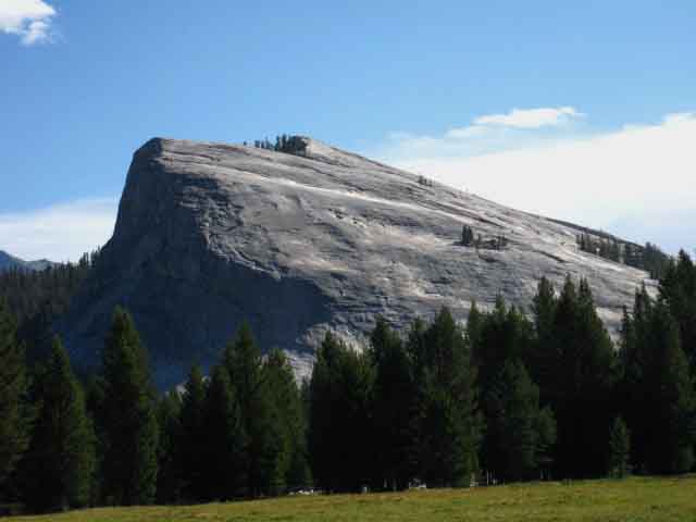
Lembert Dome
 |
||
Lembert Dome towers above Tuolumne Meadows. Lembert Dome ViewsTrail Guide Pages
|
The End A Milestone on the Trail I don't know how you've gotten here. Google, or another trail guide page? A map page? Or, you may have followed trail guide construction progress from Meeks Bay all the way down to Tuolumne Meadows. In any case, it is here: This page represents the completion of a comprehensive web-based Trail Guide of the Pacific Crest and Tahoe to Yosemite Trails from Lake Tahoe to Tuolumne Meadows on the TYT and PCT. This is a milestone for me. The last people to collect this much information wrote a book. Books. Now these trails are on the Web. Free. Trail Guide. On the Web... I hope you've been driven here by your deep personal interest in long distance High Sierra Backpacking, as I have to represent it. I started writing trail guide geographically at Meeks Bay, chronologically when I began pushing into the High Sierra during the early 1990s, all of which has finally gotten me down to Tuolumne Meadows (covering both the TYT and PCT routes) on this trail guide. In the Mokelumne Wilderness the PCT and TYT separate from each other like a Wishbone. No connector trails up there, as there are across the Carson Iceberg and Emigrant Wilderness to the South. The TYT across the Mokelumne Wilderness is a very remote and quiet place. We explored both the main trails and the webs of interesting trails tying the PCT and TYT together across the Carson Iceberg and Emigrant Wilderness! The Goal Long distance backpacking along the High Sierra Crest will draw physical and mental resources out of yourself that you never knew were in there. Without nature we are not. I am not religious. Still, "meaning" lives within and without each of us. Only you can determine what's inside and outside of you, what it means to you, and exactly how you can balance the internal and external. Nature provides that standard. You just have to go find it. This requires some preparation and consideration. I hope this guide points you in the correct direction. The goal of this guide is to prepare, gear, and train you up sufficiently to get you out into this ultimate external context, Deep Nature. Then it's up to you. This is where you make the physical and psychological adjustments necessary to see the movements of Nature around you to find the meaning within yourself. That's why I hike solo. There is nowhere better than the High Sierra to find It, yourself, your values, and the physical and spiritual beauties of the natural world. The cities tell us all about the folly, ego, vanity and greed clearly motivating mankind, and corruption being the form of greed's expression. Nature lays out the building blocks we constructed into Mordor while It still attempts to build Edens, as our folly rips the web of life on this planet asunder. Nonetheless, I trust that you in nature will produce a superior you, once you wring the physical and spiritual corruptions of "civilization" out of yourself, and are unencumbered by our social and political definitions of life as a contest of man against Nature and of man one against another. This will bring it out. My hope is that you will then bring these "reflective" values back into "civilization" with you as a counterweight to its programs of grasping greed run in an operating system of corruption. Ta-Da! From under my feet, into my heart and head, and finally out through my fingertips and onto the interweb. Now it spans from Tahoe to Tuolumne on the interwebs! Wow! Woooooo-Hoooooo! After a bunch of editing and trying to make the North Sierra as clear and concise as possible, we'll start the JMT-PCT down to Mount Whitney! Woooooo-Hoooooo! I'll tell you that I've found the part of trail guide writing that involves going repeatedly up and down the trails on my feet to be much more fun, easier, and quicker than the part of trail guide writing concerned with editing videos, constructing maps, and accurately ascertaining mileages and crafting trail guide descriptions through my fingertips. It has taken a long time and a lot of divergent types of work to reach this point. I feel like my next trail name should be, "Rubber Band Man" Writing the guide has pulled me away from the trails more than anything else, except injury. Getting wounded is a bitch. But, the deeper I go into the guide the harder it becomes to maintain the year-round backpacker lifestyle. I used to work to hike. Now I hike to write. I used to be the guy on the side of the road with the sign that says, "Send me Backpacking." What a fucking poser I've become. The fact remains that what takes seconds to view on the web has taken decades to create with feet and fingers. I hope every second of your journey will be as productive and rewarding as mine has been! Keep on Trucking |
North: Miller Lake to Glen Aulin South:
Glen Aulin High Sierra Camp |
End of the Tahoe to Yosemite Trail Arriving at Tuolumne Meadows marks the end of our long hike down the Tahoe to Yosemite Trail from Meeks Bay. Congratulations! That TYT was some trail, eh? NEXT This means that we have to decide exactly how to do that. Shall we hike backwards down the JMT to visit Yosemite Valley first, then climb out of the Valley to reconnect with the JMT in Lyell Canyon via Voglesang? Or shall we pick up the John Muir Trail here at Tuolumne Meadows, and begin our JMT hike South by following it down Lyell Canyon? Hummm... Your answer to this question could be dependent on how much time, money, and energy you have left. I'm figuring on 45 to 55 days to complete the whole Tahoe to Whitney hike just staying on the Sierra Crestline, and swinging down to Yosemite Valley can add up to six days to our total, pushing it up to 51 to 61 days on the trail. I'm taking my time, so you could likely keep it at 45 days for the whole thing, but I think you would be cheating yourself out of the extra time necessary to really soak-up the experience if you don't take enough time to enjoy it all. 7.5 Map 30 min Map |
Backpacking Trail Guide PCT & TYT North |
 |
Backpacking Trail Guide PCT & JMT South JMT SW |
Backpacker ForumsHave a great Sierra Nevada trip or story to relate? A fine piece of gear? Or gear that failed? Post it on Above we come to the Front Page of the High Backpacking Trails and Topics Forums. Below we break the forums down into categories:
Anyone can post text comments in the existing forums, but only members can post up new topics, along with images, maps, and formatting. If you have experiences, comments, questions, or pictures and videos of the Pacific Crest Trail between Sonora Pass and Tuolumne Meadows, post up here as an unknown hiker or as a member: Forum Section |
Trailhead
Contact
Alex Wierbinski

Backpacking Lake Tahoe to Mount Whitney
Your Guide to the High Sierra Crest, including the Tahoe to Yosemite, Pacific Crest, and John Muir Trails
