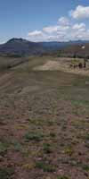
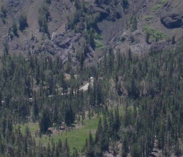
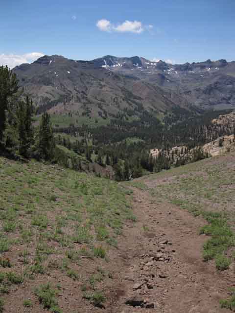
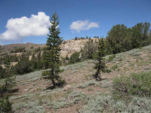
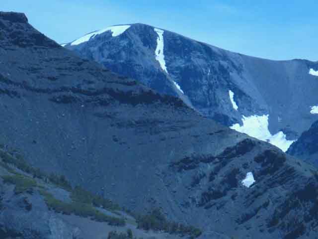
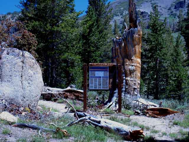
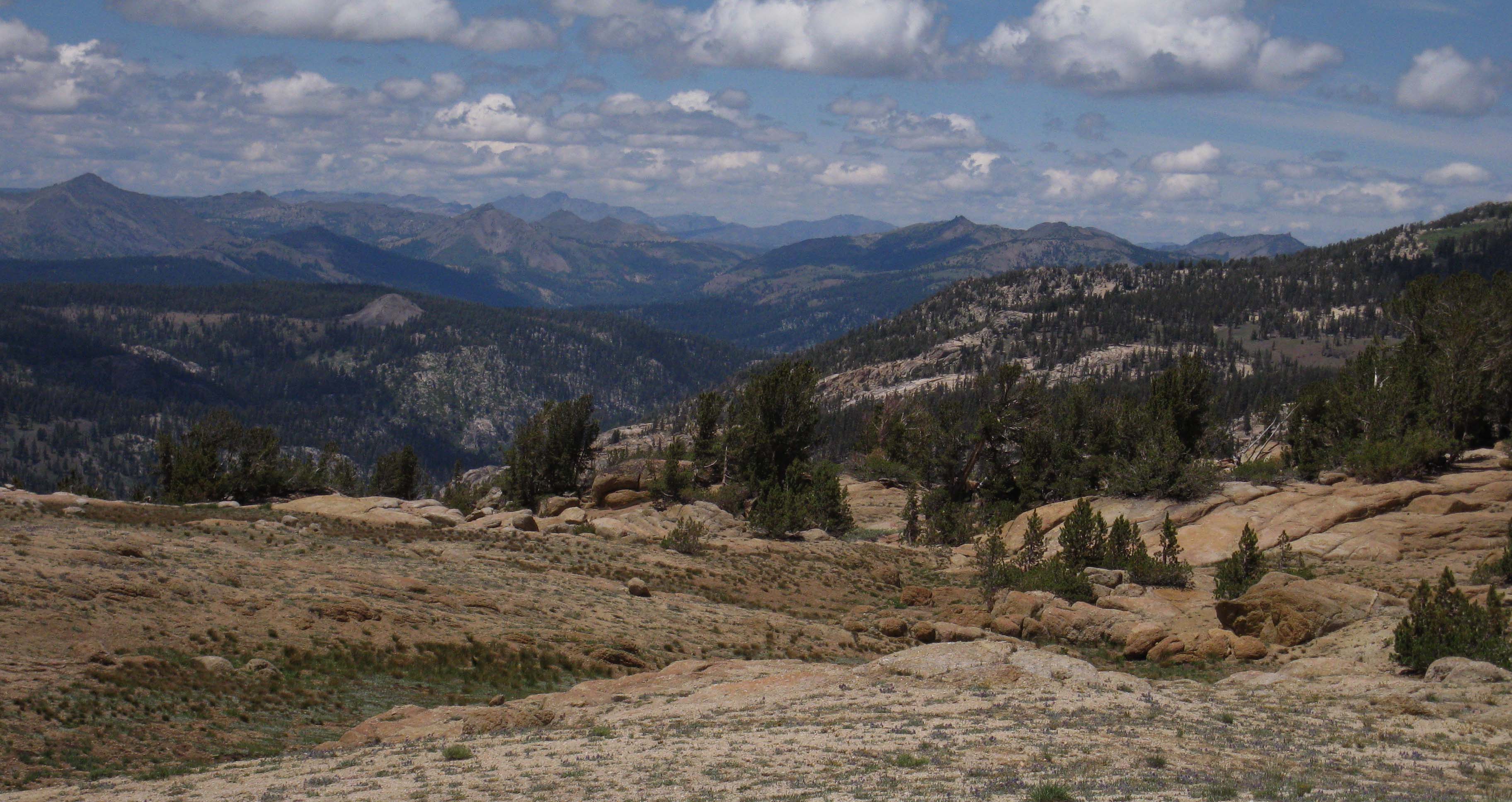
Looking West (Northbound on the TYT) across the Headwaters bowl down into Clarks Meadow from Saint Marys Pass.
The Trails
Guide
Maps
Miles/Ele
Permits
Resupply
Forum
Current Weather Conditions
Weather Notes
Northern High Sierras
Central High Sierras
Southern High Sierras
Gear
Gear List
Gettin Started
Layering
Discussion
Testing yourself and your gear
Gear Reviews
Backpacking From
The Slot
Exiting the Upper Headwaters Bowl
through
Saint Marys Pass
to
Highway 108
Hiking
The Tahoe to Yosemite Trail between Lake Alpine and Saint Marys Pass
BACKPACKING SOUTH CARSON ICEBERG WILDERNESS
Languages
Languages
Trail Arts
The art of walking
Physical Preperation
Trail Skills
The trail
Off the trail
Scrambling
Maps
Navigation
Camp skills
Food
Resupply
Food
Other
Photo Catagories
Trail Stories
Trail Culture
News and Science
Links
Groups
Books
Terms and Conditions of Use
| TRAIL GUIDE SECTION INDEX PCT-TYT Highway 4 to Highway 108 |
North |
South |
TYT DETAILED MAP Clarks Meadow & Clarks Fork Headwaters to Saint Marys Pass TH |
TYT-PCT REGION MAP Carson Iceberg Wilderness MAP |
TYT TOPO MAPS INDEX Lake Alpine to Saint Marys Pass |
RESUPPLY SOUTH |
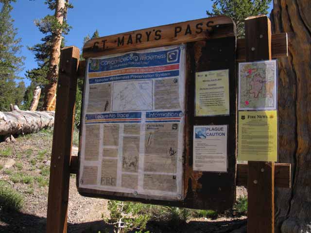
PERMITS
|
All |
TYT-PCT |
TYT Lake Alpine to Saint Marys Pass MILES and ELEVATIONS |
|||||||
| East
to PCT TRAIL GUIDE via Boulder LAKE |
||||||||
|
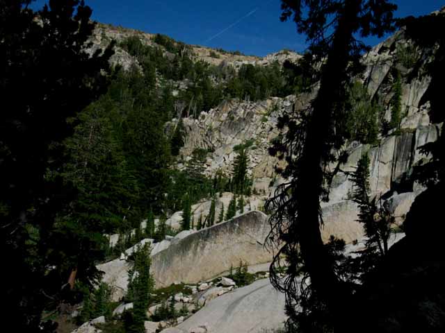
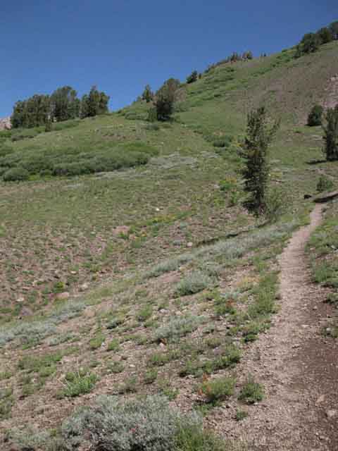
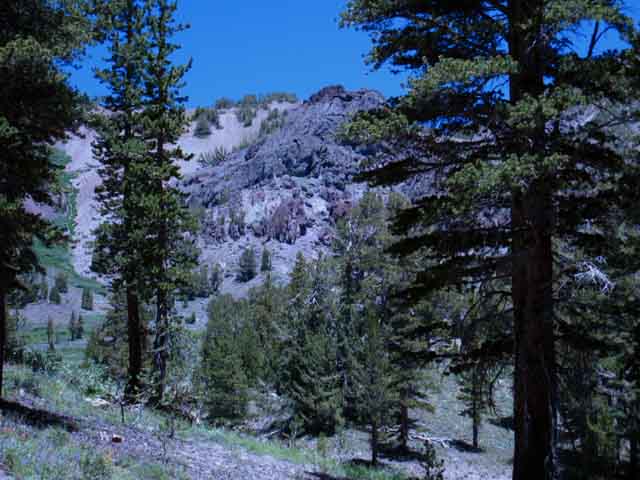
The Tahoe to Yosemite Trail Atop the headwaters bowl we look to find where the mainatained trail comes up from Highway 108 through the gap into the top of the headwaters bowl to the Northeast of Saint Marys Pass. Finding, then following the maintained trail South quickly brings us down to the end of this section of the Tahoe to Yosemite Trail across the Carson Iceberg Wilderness at the Saint Marys Pass Trailhead on Highway 108. The first thing we should do is look at this last bit of the route on the maps, review the miles, and have a good plan for dealing with rough terrain and faint route-finding conditions through the South end of the Carson Iceberg Wilderness.
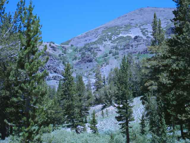
Changing Trail Environment
Also see the maps side by side, and lined up below the map we use to depict the current status of the route, for easier discovery and comparison of these historical clues to our "route options." This guide page below describes the route of the Tahoe to Yosemite Trail as depicted on the 1970 TYT map above, as do the maps accompanying this guide.
POST UP! My standard line is that, "All backpackers can post text comments about the segments of trail this guide page describes through the comments links on this, and all the trail guide pages. Registered Members can post up stand alone post about the trail with text, images, maps and videos in the Trails Forum that supplements this section of the Trail Guide." This is important. You have recent information about this nebulous "trail" route if you hiked it recently, or at all, and should share your experiences here. Independent of your experience, be they fantastic, good, bad, ugly, or heavenly. Independent of how much trouble you had getting through here, I will bet you diamonds to donuts that you thought the experience was tits after you got out, independent of how much you suffered along the way. I dragged a group of Cal Students through the rough unmaintained East Carson River a few years ago. They cried all the way through, but could not stop talking about how exciting it was after it was over. Hard segments of our trail through life are like that. Sometimes the greatest pleasures of experience come after the experience. Life is a funny thing. Share your take on it.
Hiker's Accounts through the Clarks Fork: |
||||||||||||||||||||||||||||||||||
|
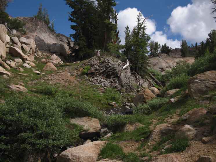
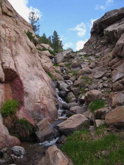
Bottom of the Slot Review Images and Guide Video video duration distance The first segment of our hike South up along the tributary creek to the base of the slot in the cliffs has a nice random selection of wild ducks assuring us we are indeed on the route leading us out of the headwaters bowl. But once we get up into the slot there is no trail, no wild ducks, but the way up is crystal clear once we get into the slot... That's because the slot is narrow, offering few route options. elevation change Difficulty After getting over the sand berm the steep angle of the route moderates into a "normally" difficult H1 climbing trail, still Cross-Country. At the top of the slot we are atop the ring of cliffs of the headwaters bowl just a bit Southwest of Saint Marys Pass. We will either hike through or across Saint Marys Pass on our way hiking around the perimeter of the headwaters bowl, depending on where we decide to intersect with the maintained trail coming up from the Saint Marys Pass Trailhead. More on that below. The Other Side of the Mountain Backpacking Map Highway 108 continues West past Kennedy Meadows along the Middle Stanislaus River for another nine miles until we come to the point where the Clarks Fork of the Stanislaus River is subsumed into the Middle Stanislaus River. That's the alpha and omega of the Clarks Fork of the Stanislaus River, its beginning and end. We are about to finish backpacking the highest point along it's length when we turn around and cross Saint Marys Pass out of the Clarks Fork's Watershed into the Middle Stanislaus Watershed via Deadman Creek. Trailheads at Both ends of this Segment of Trail It's at least 12 road miles East from the beginning of the rustic old Clarks Fork Road to its end at the Clarks Fork Trailhead. I make this road and trailhead information as clear as I can for backpackers who are looking to put together a plan to hike this short but very challenging segment of trail as a stand-alone trip from the Clarks Fork Trailhead at the end of Clarks Fork Road to the Saint Marys Pass Trailhead near the top of Highway 108. We also have a google road map covering Clarks Fork Road and Highway 108 up to Saint Marys Pass Trailhead accompanying our backpacking trail map of the Saint Marys Pass Trailhead. Check the "pins" around "Peaceful Pines," on the google road map, which are located along Clarks Fork Road. TWO ROUTES OUT Well, the trail through the gap brings us up to unnecessary altitude to reach the top of the headwaters bowl, while our other option, cutting cross-country through Saint Marys Pass itself, confronts us with the increased difficulties of hiking cross-country across rough terrain. Problems to the Left, Problems to the Right. Keep an eye on the sky! Finding the Line of our Cross Country Route The same process is necessary if we are hiking either direction through Saint Marys Pass. Note the 1987 Carson Iceberg Wilderness Map perfectly depicts the cross-country route I describe above, breaking off from the maintained trail to hike West through Saint Marys Pass. In 1987 this was the regular route. The only problem with this map is that the vast majority of the length of the route it depicts from the maintained trail East of Saint Marys Pass to the North edge of Clarks Fork Meadow are now all in cross-country route status, if even that. My observations indicate that there is no trail and very few if any indications of a route route East or West of Saint Marys Pass along the line of trail depicted on the 1987 map above. That line of the trail/route is not maintained, nor are their many, if any indications of its presence along this line to the East and West of Saint Marys Pass. To the East of the pass the only indications of a route lay in our ability to clearly see the maintained trail on the other side of the ravine below Saint Marys Pass, and our intentions to cross the ravine over to it. Winnett's 1970 map depictis the CURRENT route of the Tahoe to Yosemite Trail around the top of the headwaters bowl over to where it intersects with the maintained trail coming up through the gap from Saint Marys Pass Trailhead. The only problem with Winnett's map is that he mislabeled the "gap" as Saint Marys Pass. The 1987 Wilderness Map correctly labels the position of the low point in the Clarks Fork Headwaters Bowl as Saint Marys Pass. Typos and mistakes happen. You make sure to let me know if you find any here. Unless you are a quibbling troll with no experience or information and a big mouth. Unmaintained TYT Trail Reports
And, I'll be damned if I'll tolerate being used by scammers to host their damn ads. Maintained Trail to the Gap It is not too difficult. We will observe remnants of use trail wrapping around the perimeter of the headwaters bowl, its faded bits pretty much following the line laid out by Winnett. We also identify a nice landmark to lead Northbound hikers to the top of the slot. TWO ROUTES The maintained trail pointing North out of the Saint Marys Pass Trailhead is overwhelmingly used by day hikers targeting Stanislaus and Sonora Peaks. It is rarely used by Tahoe to Yosemite Trail backpackers. That's because TYT backpackers are so rare. That might be caused by the nature of the "trail" itself. The fact is that trail itself is rare from the end of maintained trail on the rim of the headwaters bowl down to its resumption 6.24 miles to our North at the Eureka Valley trail junction. These 6.24 miles are more route than trail. We are either beginning or ending a very difficult little segment of The Tahoe to Yosemite Trail, depending on our direction of travel. Grand Context But, our first consideration here is the lack of maintained trail along the whole South end of the Tahoe to Yosemite Trail across the Carson Iceberg Wilderness. The 6.24 miles of the Tahoe to Yosemite Trail North between the headwaters bowl down to the Eureka Valley trail junction are unmaintained trail or self-navigated route selections. This is challenging and stimulating terrain deserving of some special attention. Shorter Explorations Those of us without the time necessary to hike from Tahoe to Whitney or Yosemite can use this information for constructing amazing shorter local backpacking loops around the Southern Carson Iceberg and Northern Emigrant Wilderness Areas. Remember, click the Black Dots on the 30 minute maps for more detailed maps, Each 30 minute map acts as an index for all the guide pages, underlaying detailed maps, and
Unmaintained TYT Trail Reports
|
Video
Into The
Headwaters of the Clarks Fork of the Stanislaus River
The Plan Hiking through Saint Marys Pass is a novel approach. Most hike North from the Saint Marys Pass Trailhead all the way up the maintained trail through the gap onto the top of the headwaters bowl of the Clarks Fork. That route actually crosses Saint Marys Pass into the drainage of the Clarks Fork. After that we begin hiking clockwise searching around to the South end of the headwaters looking for the entrance into the top of the correct slot leading down to the floor of the headwaters bowl. The first one I explored was not the correct route down, forcing me to climb back out. The second one I explored proved fruitful, bringing me down to the Clarks Fork. It is a lot of fun exploring new, unknown, rarely hiked routes. 12:14 |
SOUTHBOUND HIKER
|
Hiking We are standing at the base of the slot, looking to climb to the top of the headwaters cliffs. From here we are hiking South up the Slot to the top of the Headwaters Bowl. At the base of the Southern Passage cutting its steep route South up through the rock channel to the top of the headwaters bowl we find this big wild duck. Though leading to no particular trail this duck marks our position standing below the granite channel, the "slot," and the beginning of the end of our Southbound hike climbing out, off the floor of the Clarks Fork Headwaters Bowl. |
 |
||
Wild Duck Heck, there's no, or not many ducks on the maintained portion of the trail down to the trailhead either. Nonetheless, this wild duck pictured above is the top and last duck for Southbound hikers below the slot climbing out of the base of the Clarks Fork of the Stanislaus River to the top of its headwaters bowl. Northbound hikers will find this duck is the first is a potential series of wild ducks leading down to the North end of Clarks Fork Meadow. I say potential because ducks, and especially wild ducks, can come and go each hiking season. Especially after a heavy Winter.
|
ENTERING the SLOT
Our
Very Distinctive Exit Point from the Floor of the Clarks Fork Headwaters Bowl
BLACK-STRIPPED OVERHANGING ROCK
LANDMARK ROCK
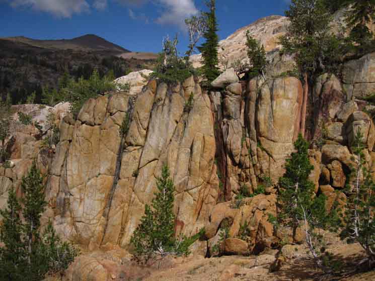
| The distinctive formal entrance to The Slot leading us up to the top of the Clarks Fork Headwaters Bowl. |
 |
This distinctive rock dispels all doubt about our position. The Black and White Stripping is Quite Striking. We are at the base of the correct slot leading us up and out. Now we just have to hope the last Spring Thaw did not re-carve the terrain to our great disadvantage. There is always a chance that conditions have changed radically for the worse since this account was written in August of 2015. Welcome to the uncertainty factor. Will the passage be open and passable? We will see. |
 |
||||
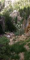
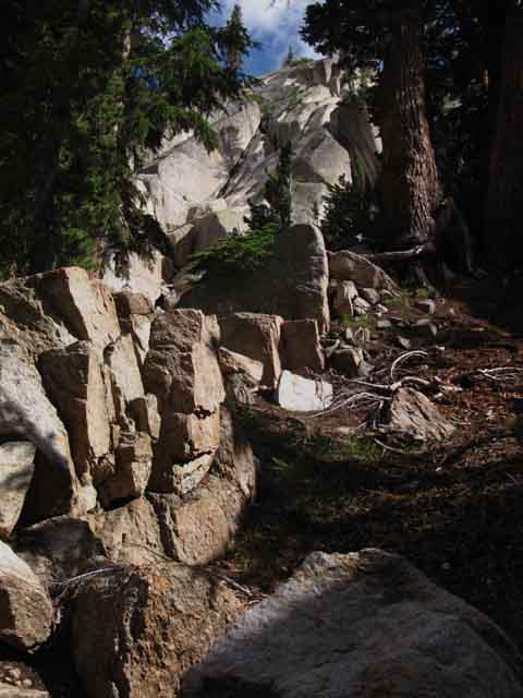
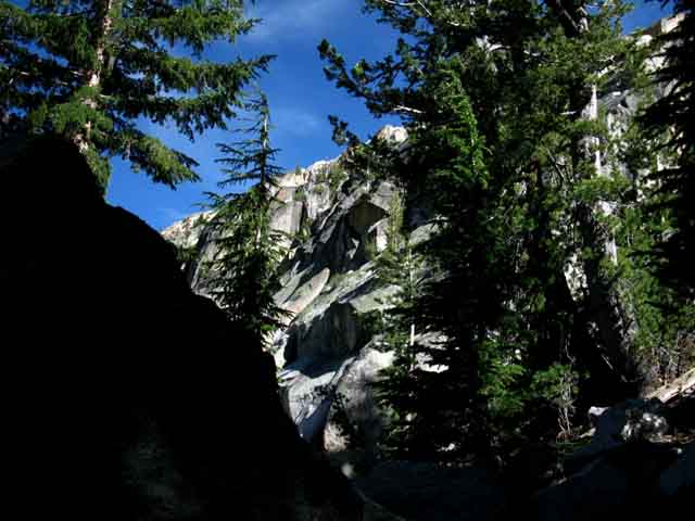
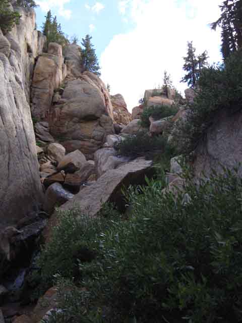
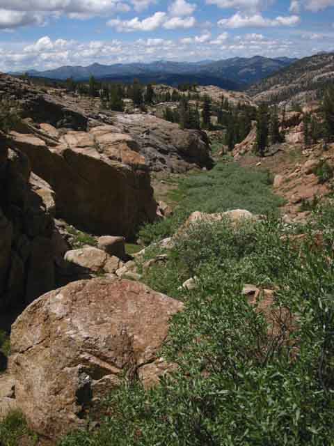
BOTTOM of the SLOT Let's take a look at our position from an overview point looking up into the headwaters bowl. As we see in the next image below our view of the surrounding headwaters bowl expands as we climb higer up into the slot, before the walls of the cliffs rising around the slot cut off most long views. On the far side of the forest in the image above we can see the bottom of the slope descending off the Southeast flank of the great citidel rock. This view indicates the narrowing of the headwaters bowl as the head of the canyon assumes its characteristic "horseshoe" shape. As we gain altitude following the tributary South up to the base of the slot our expanding view above the forest (before our view is eclipsed entering the slot) gives us some perspective on the location of our position exiting the upper headwaters bowl. It is very cozy in here, as you can see.
|
View East Climbing the lower slot between the top and the bottom of the headwaters bowl we get a couple of views East at the womb of the Clarks Fork of the Stanislaus River as we climb higher, and a sweet view Northeast opens up briefly before we are submerged deep between the cliff's walls. To our East-Northeast we see the top of the headwaters canyon where the initial tributaries run out feeding the central river, which continues to run up into the center of the headwaters bowl above the point we turned South into our exit/entrance tributary along the route of the TYT through the slot. The low point we see in the distance is atop the headwaters bowl located ALT ROUTES We may find ourselves facing the alternative routes. The TYT route is not easy to see, find, or stay on, so those who are charting their own route through here need all the information they can get, to find and stay on their preferred route, or find an alternative if unable to find the TYT. I'd advise finding the TYT route out of the upper headwaters, but for those looking for alternative routes I've put together this short "map history" of the Upper Clarks Fork and its known and unknown route options, back on the previous page of the guide: ALT ROUTES I have never found indications of such a route, even when I last hiked that route about 15 years ago. It was a tough self-selected route with few indications of humans, let along route or trail. Nor have I seen indications of a route branching Southeast out of the upper North flank of the headwaters bowl, though Johnny described making his way out the upper end of the South canyon during 2015. This is not to say that these routes cannot be hiked. I am sure they can. Johnny hiked out the Southeast flank. I am also sure that they require a superior level of fitness and route finding ability to pull off them off with a reasonable degree of safety. |
 |
||
Rough country looking East-Northeast across the South flank of the headwaters bowl at the head of the canyon. Unmaintained TYT Trail Reports
|
Coming through the Rocky Channel An adventure is composed of not knowing exactly what is going to happen next... and this section of the trail provides just that experience. Up we go! |
 |
||
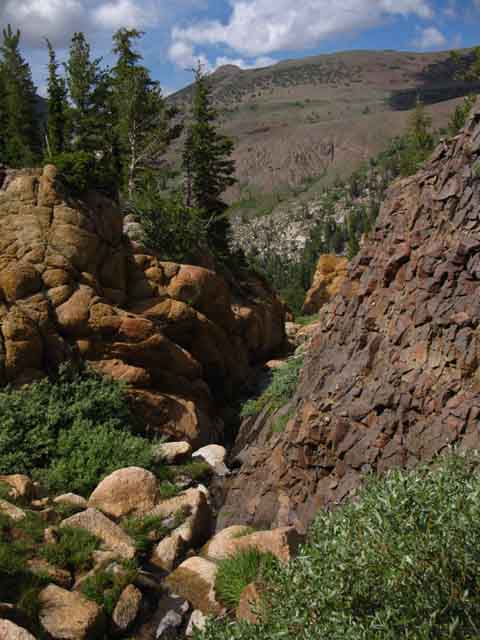
View East of the granite walls of the cliffs around the South flank of the headwaters bowl as we move up the rocky channel between the top of the headwaters bowl and Clarks Fork of the Stanislaus at the bottom.
|
 |
Looking East-Northeast up at the very top of the Headwaters Bowl of the Clarks Fork of the Stanislaus River. We are at the last location we can get a glimpse out of the slot until we climb out of the top. |
Climbing to a View of Stanislaus Peak
 |
View Northwest of Stanislaus Peak across the lower headwaters of the Clarks Fork while climbing South up the slot on the Tahoe to Yosemite Trail. |
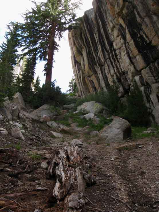
The Stripped Rock Wall
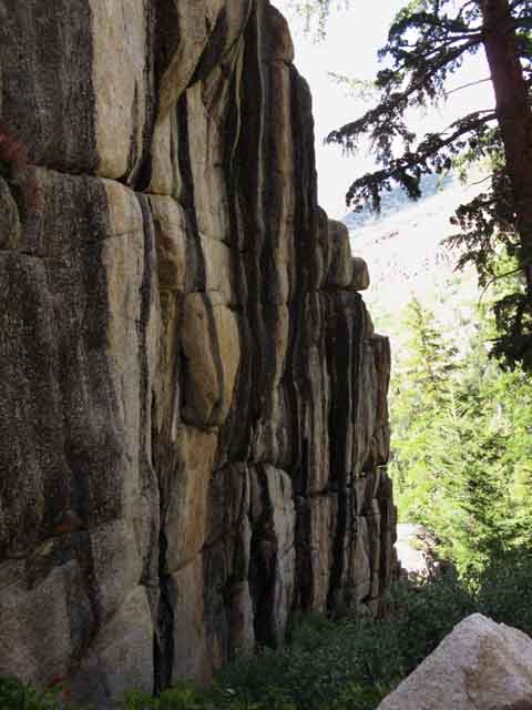 |
The distinctive stripped wall marking the entrance to the slot runs a straight and parallel wall up the slot for a considerable distance. |
Jumbled Terrain Above
 |
Up the Slot we can see where the course of the tributary flows down to our Left through a jumbled gorge while our route climbs a slightly less jumbled steep sandy wash to our Right. |
Nice Light and Color
 |
Sun breaking across the upper gorge brings out the rich earth tones in the rock. |
Jumbled Boulders down to the Canyon Floor
 |
Looking back we can see the steep boulder and brush-filled sandy slot we've climbed up from the floor of the Headwaters Bowl. |
Coming Up through the Rocky Channel Wall to Northeast as we climb up to our Right, Southeast. |
 |
||||
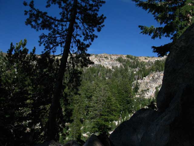
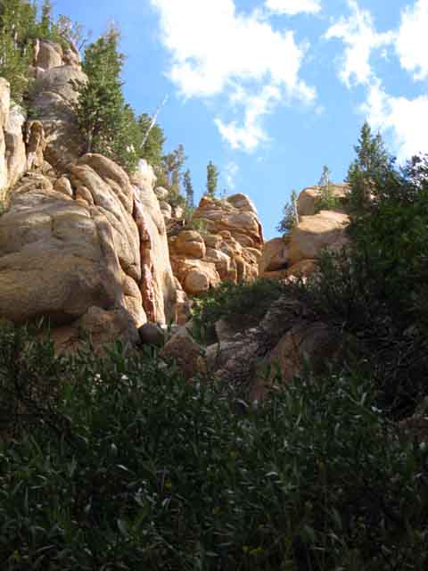
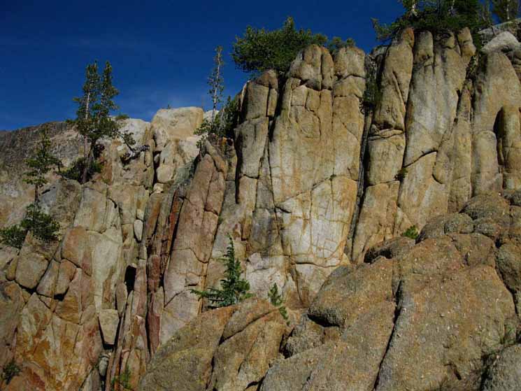
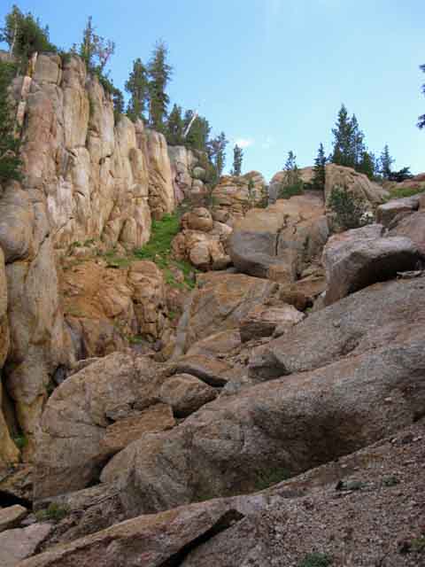
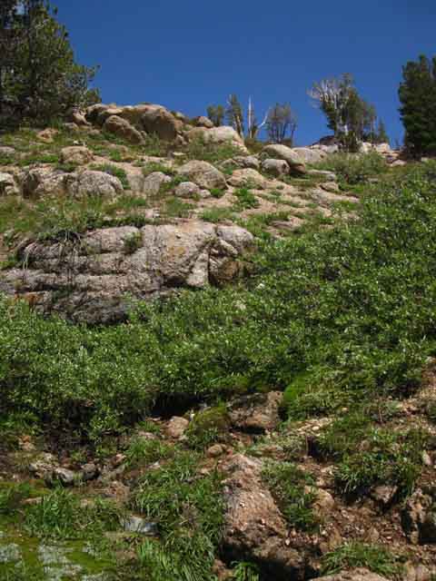
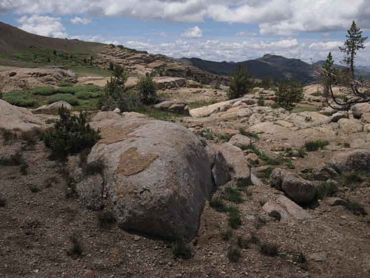
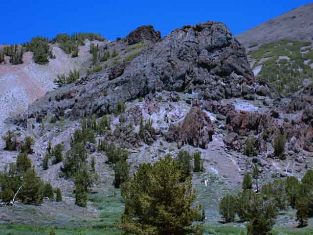
Sweet granite cliffs along our route up the slot from the floor of the upper Clarks Fork River's canyon up to the top of the its headwaters bowl. I was fascinated with the face above in 2012 when I shot the image above, but I prefer the image from 2015 below, in which I caught Sonora Peak off to the East-Northeast. We can also see a slice of how the steep funnel shape of the headwaters bowl wraps around the Northeastern quadrant of the upper canyon. This is an amazing little piece of our route. A creek runs down from the top of the headwaters bowl through a steep jumbled channel along the base of this wall. We can get some idea about its character from the picture below. We are looking at all of this standing on a berm of sand to the West of the jumbled channel at the base of the wall. I figure the course of the stream and position of the sandy berm are part of a alternating mechanism over time. I figure the channel of the creek shifts every few decades, when the creek cutting too deeply and the sand berm piling too high is followed by a great Winter and a fierce Spring Thaw. In my mind's eye I can see a powerful Spring Thaw collasping the sandy berm into the stream every few score years. I speculate that the power of these random but regular flood-thaw events work to sweep the accumulated sand and debris out of the congested slot every couple of decades as part of a catastrophic process that both cleans and cuts a new layout of stream, sand, and trail in this rocky channel. Maps of the Headwaters Bowl Along our way up the slot we find a series of sweet spots.
There are a few nice places one could camp in the slot, up near the top and at the top,
Unmaintained TYT Trail Reports
|
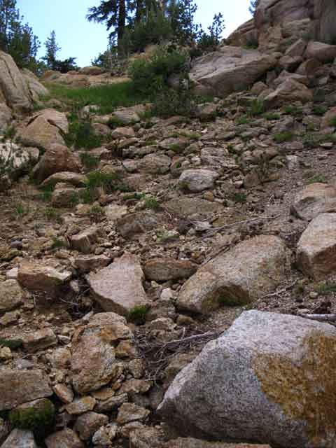
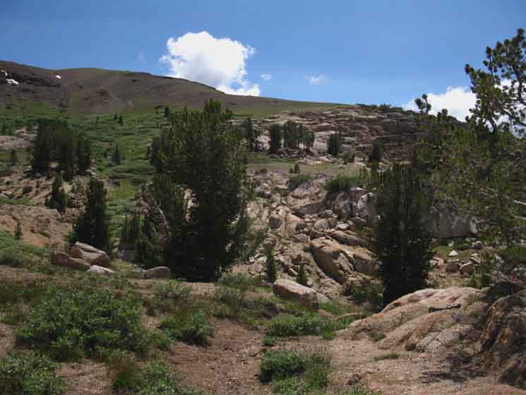
To the Top Sweet Relief Maps of the Headwaters Bowl At the Top Once we get out of the cut of the tributary exiting the slot we find wide-open terrain wrapping around the top of the horseshoe-shaped broad flat atop the cliffs of the Clarks Fork Headwaters Bowl really opens up. But first we have to ascend up a series of jumbled rocky slopes above the sandy bottom segment of the slot to bring us up there. |
 |
||
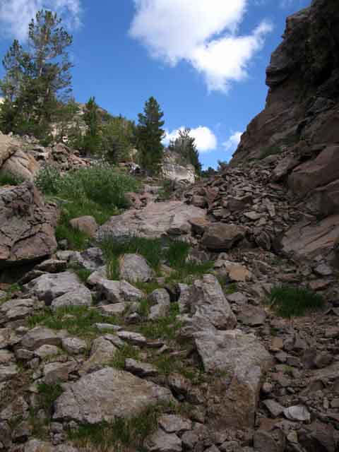
Above we are entering the final two-thirds of our hike after getting up above the steepest lower segment of the slot. Our route through the upper segments of this slot moderates once we get up to the top of this great steep berm of jumbled boulders, dense under brush, with gravity-drawn debris filling its lower end. We are approaching the end of this steep lower segment of the slot.
Below us we can make out features that help us locate the position of the slot in the South wall of the headwaters cliffs. |
View to the Floor of the Canyon
 |
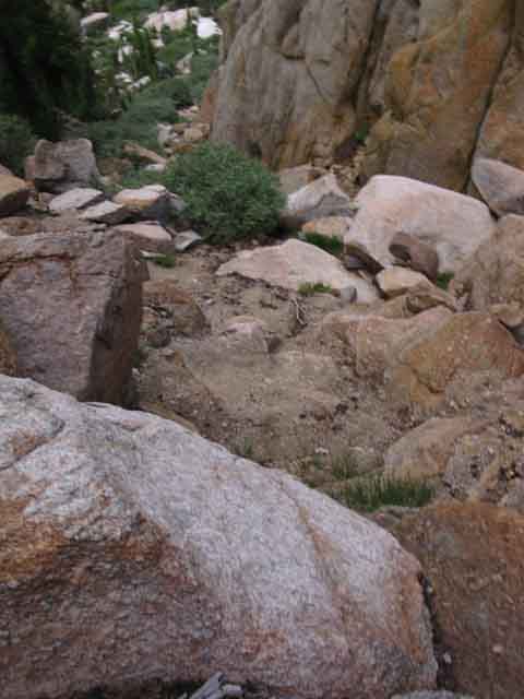
The image above is instructive for establishing the position of this slot in the cliffs up to the top of the headwaters bowl. Note the remnants of the great granite dome sitting on the floor of the canyon at the base of this slot. We can line up the location of the slot in the cliffs with the dome below it on images of the upper headwaters bowl and its surrounding cliffs. |
Our Ascent Moderates
 |
||
The angle of ascent of the lower slot we followed up through the cliffs moderates considerably once we climb above its very steep and chaotic lower section. Here we go around to the Left of the boulders in the line of the creek, to rejoin the line of the creek on the other side of the low rise. Maps of the Headwaters Bowl
|
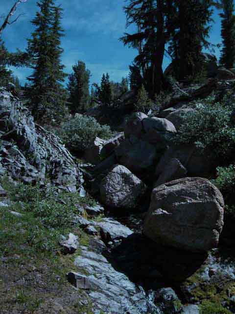 |
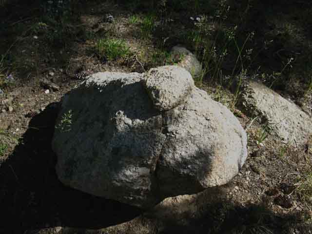
The two images above are of exactly the same boulder-choked segment of the tributary, but from different perspectives. Note the unique shape of the closest boulder. |
View Back to the North
Romantic Western Terrain
 |
We find many sweet perspectives across this beautiful terrain. The character of the slot induces good feelings when backpackers reflect the spirit of the terrain. |
Route Around Brush & Boulder-Filled Creek
 |
Faint indications of Use Trail at our feet. Though there is no real trail through here there is really not much room to get lost in this narrow crack in the cliffs. Here we are bending East to detour around a rocky jumbled segment along the creek. |
Ascending Channel
 |
| We follow the burbling creek up its rocky channel through a series of chutes linking small flats into a staircase of sorts. |
 |
The Stream running Down the Slot
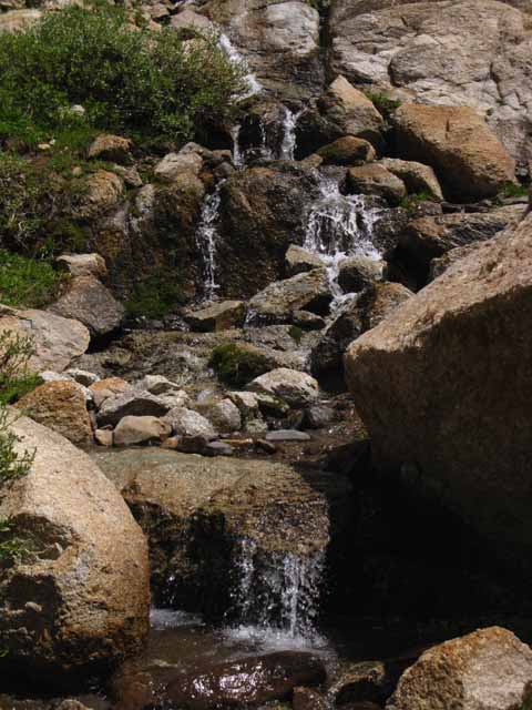 |
Pleasant details emerge out of the larger context of beauty around us. Here our eyes are drawn to the sloppy route of the creek down through the rocks by the tinkling song it makes tumbling over and rushing around the rocks. |
Chaotic Creek Approaches Top of Slot
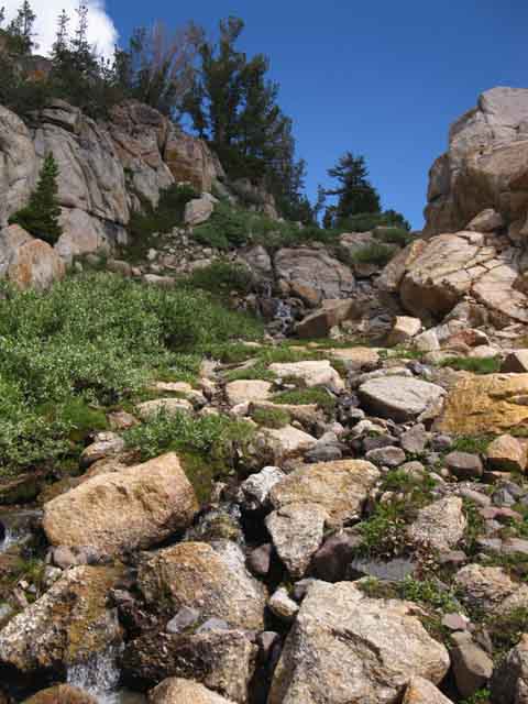 |
We can see the route ahead is moderating a bit more as our jumbled slot is finally moderating as it reaches up into the flattening top of its headwaters bowl. |
Looking Back, North, While Climbing Out
 |
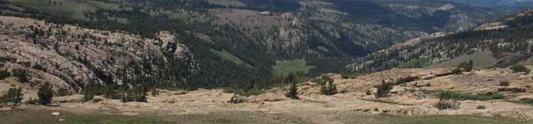
Great Panorama of the North Sierra A final look back across the upper length of the slot, then we climb out of its ravine to our Northeast away from the creek below, to find our way to Saint Marys Pass seeking signs of the maintained trail that will lead us down to its trailhead on Highway 108. Above, we can see the line of the creek running down into the slot below our view of an ocean of Sierra peaks running North along the Sierra Crest. Expansive views greet us as our view opens with the opening terrain as we approach the top of the slot. We inspect this North Sierra Panorama as we hike around the top of the headwaters bowl to Saint Marys Pass. Climbing Out of the Tributary Creekbed-Ravine |
 |
This is where I climb out of the vast widening cut (see the next image below) in the terrain that is growing above the top of the slot. This cut in the terrain is the "mini-headwaters" bowl of the tributary creek making a substantial cut in the soft volcanic terrain above the granite slot, feeding the tributary creek flowing down through to the Clarks Fork. The image below, and this one from a distance, show the size of the cut in the volcanic terrain above the slot in the cliffs. This cut also identifies the slot and guides Northbound hikers to it. |
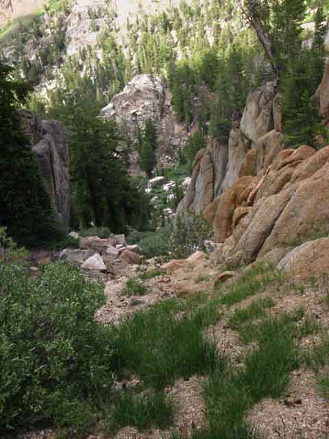
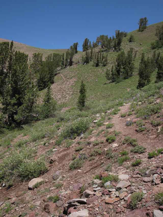
Segment Cross-Country Images and Guide Below we are looking back at the End of our Hike up the Slot. In the image below we are turning around to look West at the faint use trail at our feet we followed See that granite wearing out of the volcanic hillside along the face rising above the far Right side of the ravine? The lowest portion of that ridgline has a distinctive patch of exposed granite blocks that have eroded out from under their volcanic covering. It is a very distinctive feature. Northbound hikers can use that distinctive patch of granite blocks as a landmark to identify the otherwise invisible gully as we Northbound hikers move clockwise around the top of the headwaters bowl. Other than this landmark the ravine feeding the slot is hidden from Northbound backpackers' view as they approach via Saint Marys Pass. But we can see the granite above the slot, and use that to guide us into the correct route. That's the same granite we see emerging out of the same hillside in this image, looking around the Southwest end of the headwaters bowl from near Saint Marys Pass. Northbound backpackers can guide themselves to the top of the slot using that emerging granite as a landmark. Note this distinctive feature if you ever plan on hiking into the Clarks Fork from the North. We know that the creek down through the slot to the floor of the canyon sits between us and that granite, right below that granite, in fact. video duration route distances 1.14 miles of maintained trail to 2.35 miles total elevation change 10, 400 at the Gap to 9440 at Saint Marys Pass Trailhead Climbing out of the creek's ravine to reach the top of the Headwaters Bowl we find a maze of sweet low granite features decorating the terrain. We've got to hike counter-clockwise around its horseshoe shaped perimeter, which will bring us to the formal locations of Saint Marys Pass. At Saint Marys Pass we will look East across the drainage below the gap to see our trail running down the mountain flank to the Saint Marys Pass Trailhead on its far side. We have two ways to get over there. First, we will reach the top of that trail at the gap where that ravine begins if we continue counter-clockwise around the perimeter of the headwaters bowl across Saint Marys Pass. Or we can hike directly to the trail by scrambling across the drainage through Saint Marys Pass. Either approach rapidly brings us to the maintained trail coming up from Highway 108. We find a 1.14 mile length of well-maintained trail leading South down from the gap to the Saint Marys Pass Trailhead on Highway 108, which is just nine miles East of our next rest and resupply stop at the fantastic rest and resupply services offered up by Kennedy Meadows Pack Station. It's almost time to kick-back a spell. Rest, Recovery, Resupply Both of these facts, that we have excellent resources, and that they are located right along our TYT route, are both good news. We are going to need some rest after the challenges and difficulties of this segment of trail, and it's nice not to have to get off the line of our route to get some rest, eat some great food, and pick up our resupply for our final 75 mile section of trail hiking down to Tuolumne Meadows. CONTEXT Check out the Sonora Pass Region Map for an even broader perspective on the relationship between the PCT and TYT both North and South of Highway 108, and our options for tying bits of each trail together into unique routes for our long distance trips or as part of shorter, but expansive local backpacking loops. Remember, click the Black Dots on the 30 minute maps above for more detailed maps, and the Red Dots on all the maps for the associated trail guide information.
Unmaintained TYT Trail Reports
|
 |
Reaching the top of the headwaters bowl we begin looking East for our potential routes to Saint Marys Pass and the maintained trail beyond. We can see Sonora Peak peeking over the scene on the Left of the image. We can use the top of Sonora Peak to guide our path towards the gap because the gap lays almost directly between us and Sonora Peak, while Saint Marys Pass is bit to the East of that line. |
Video
Hiking Cross-Country from the maintained trail above Saint Marys Pass Trailhead West across the gully below the gap to and through Saint Marys Pass. 9:54 |
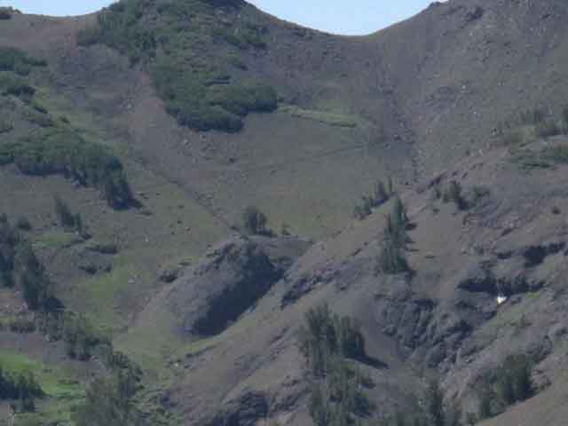
Exploring the Potential ways down to the Clarks Fork Working our way East around the South side of the upper rim of the Headwaters we look at a potential channel we explored before rejecting it as a route down on a previous trip. We'd need wings for this one. I took this shot after climbing back out of my exploratory probe down-mountain through the slot below.
|
 |
||
Above and Below: Two views of the wrong way down to the Clarks Fork! This is a bit East of the route down.
|
Around the Top of the Headwaters Bowl
 |
| Looking East-Northeast across the top of the headwaters bowl for the best route to Saint Marys Pass. |
|
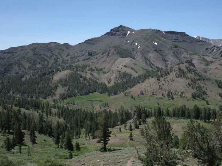
Stanislaus Peak tops the Northern ridgeline of the Sierra Crest above the Clarks Fork viewed looking West-Northwest from the rim at the top of the Headwaters Bowl of the Clarks Fork of the Stanislaus River. |
 |
||||
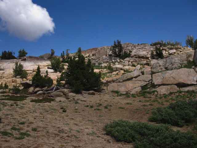
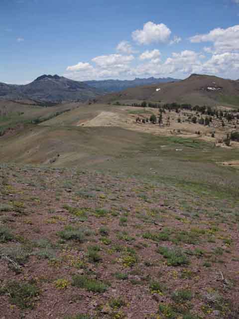
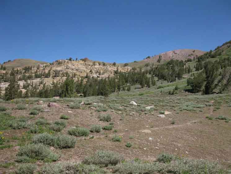
Stanislaus Peak from the Headwaters of the Clarks Fork of the Stanislaus River. Variations on a Theme Here, hiking around the top of the headwaters bowl we find great sections of golden sands, pebbles, and fields of boulders all sitting on glacially-sculpted sheets of granite, all being variations on the theme of the color, tone, and texture of the underlaying golden granite that was glacially carved, volcanically coated, and environmentally eroded. I like golden granites in all its forms.
|
View Southwest
 |
Looking Southwest at the South end of the headwaters bowl. Note the granite emerging out of the volcanic terrain on the exposed end of the ridge in the middle-distance. That's the landmark terrain we saw above the creek running down through the slot to the bottom of the headwaters bowl. Note that we cannot actually see the ravine in the terrain leading to the slot, or the creek that runs through it, while hiking across the top of the headwaters bowl. Norhtbound hikers will be right up on the ravine before seeing it. |
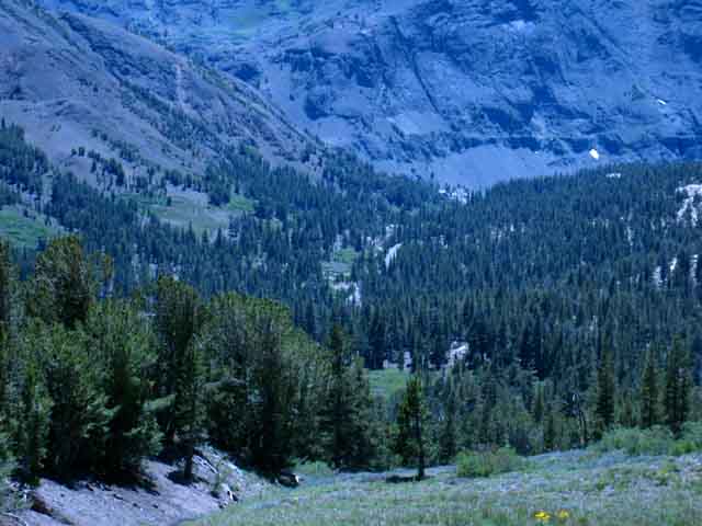
Long View Twisting path of Clarks Fork through the Western Flank of the Sierra Nevada Mountains from the top of the Headwaters Bowl. |
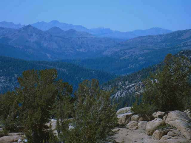 |
View a bit North of West down the valley of the Clarks Fork of the Stanislaus River. In a longer context we are looking Northwest at the Sierra Crestline all the way up to the frigging Tahoe Basin, over the near terrain of the whole length of the Carson Iceberg and Mokelumne Wilerness Areas. I can't see much of the Mokelumne Wilderness before the bulk of Round Top rises as the highest peak Left of center on the furthest ridgline. Off to the Right of Round Top we can see the Crystal Range in the fuzzy mists of this long distance view, with the vague form Red Lake Peak on the South Rim of the Tahoe Basin visible to the Right of the Crystal Range along the hazy horizon. I focused on the Round Top and Sisters Massif in the far Northern distance, the highest mountain South of the Tahoe Basin until we get all the way down here to Stanislaus and Sonora Peaks. Below we can see most of the North Sierra Crestline and its Western flank North to the West Shore of the Tahoe Basin from our position on the rim of the Clarks Forrk Headwaters Bowl. Let's try to take an even closer look at the North Sierra Crestline and its Flanks below. |
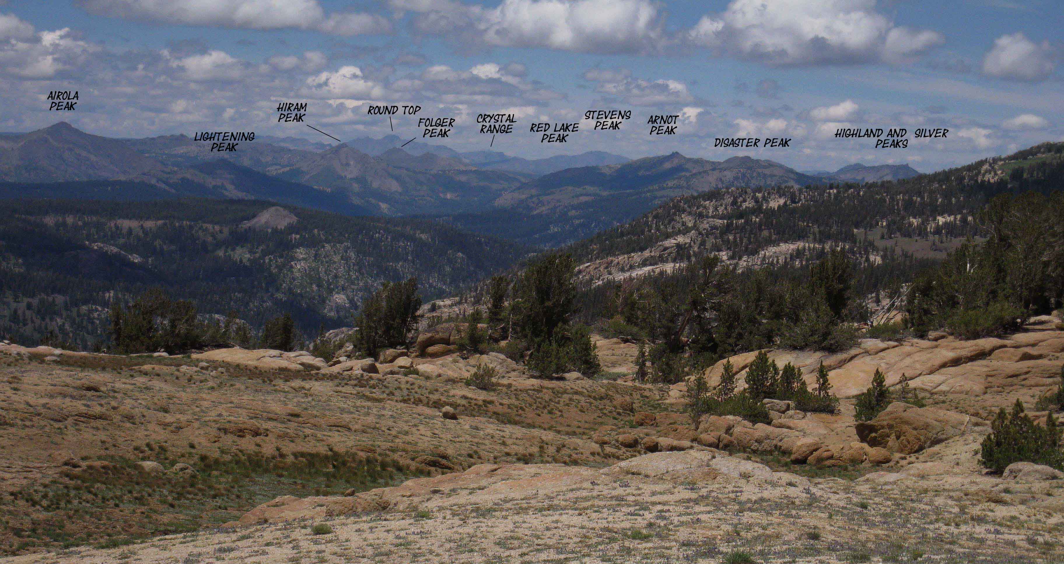
North Sierra Panorama
 |
|||||||
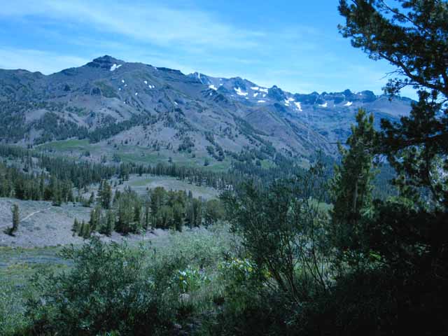
North Sierra Panorama from Saint Marys Pass. I'm thinking we are seeing the mountains way up to our North approaching and even around the Airola Peak is the highest peak on the far Left horizon, Lightening Mountain the shadowed peak to its lower-Right. Oh heck, let's forget calling out the individual names of the mountains, and just post up a large and a large-labeled version of the image above.
Yes, looking a bit West of North from Saint Marys Pass we can see the backsides of Round Top and the Sisters above Carson Pass, the Crystal Range along the West Shore of Lake Tahoe, Highland and Silver Peaks above Ebbetts Pass and even make out the lines of Red Lake and Stevens Peaks guarding our trail's Southern exit from the Lake Tahoe Basin. Well, I'm as certain as I can be of the peak identifications. Nonetheless, the peaks of the Carson Iceberg Wilderness are spread across the middle of the image. Let's check out the image above against the
I am pretty confident in my identifications of the peaks, but your input, corrections, and additions are welcome.
|
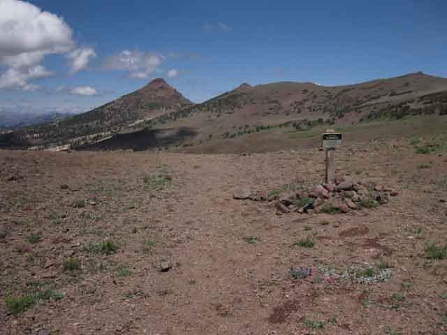
Segment Saint Marys Pass Trail Images and Guide Our Southbound Tahoe to Yosemite Trail route climbing out of the headwaters of the Clarks Fork connects up with the maintained trail coming up from the Saint Marys Pass Trailhead on Highway 108. Once we climb South up onto the top of the headwaters bowl and start moving counter-clockwise atop these headwaters cliffs, we begin to find bits of use trail approaching Saint Marys Pass, located on the low point of the perimeter of the bowl, then we encounter signs of a consolidating trail pointing Northeast, climbing from Saint Marys Pass with faint trail further consolidating along the upper edge of the headwaters bowl, pointing us Northeast over to the gap where thes faint bits of our TYT route forms up into a few feet of formal trail before intersecting with the heavily carved line of the maintained trail running between the Saint Marys Pass Trailhead to Stanislaus and Sonora Peaks. The faint route of the TYT consolidating as it reaches the maintained trail coming up from Saint Marys Pass Trailhead looks like the physical equalivant of a fading memory, if ancient terrain has a mind of its own.
The
All runoff running of the East side of this image flows down into Deadman Creek. Sonora Pass sits at the very top of the Deadman Creek drainage off to the Left, the East, at the top of the Sierra Crest. We are about 800 feet above Sonora Pass at 10 400 feet of elevation here looking at Saint Marys Pass. Everything flowing to the Right in the image above is flowing West into the Clarks Fork of the Stanislaus River. Interestingly, the drainage coming off both flanks of Saint Marys Pass flow West. Disappearing Trail North Saint Marys Pass Trailhead The trail up from the Saint Marys Pass Trailhead accesses the top of the Northeastern corner of the headwaters bowl through the gap at the top of the drainage gully where we find the Carson Iceberg wilderness boundary. We can see that the wilderness boundary runs Southwest around the perimeter of the top edge of the Clarks Fork Headwaters Bowl, passing through Saint Marys Pass. The boundary to our East Crosses the summit of Sonora Peak. Two Ways South on the Tahoe to Yosemite Trail Our other option walks us to and directly through Saint Marys Pass cutting directly East across the ravine to pick up the maintained trail well below where it comes through the gap. Film video duration Northbound Southbound route distance 10400 to 9440 feet
Unmaintained TYT Trail Reports
|
Again,
looking Southwest
Across
Saint Marys Pass
This is the very top of the Clarks Fork Headwaters Bowl.
Clarks Fork to our Right-West
Sonora Pass atop Deadman Creek Drainage to our Left-East
Saint Marys Pass whis is marked by the Wilderness Boundary
 |
Southbound on the Tahoe to Yosemite Trail At our feet we can watch our unmaintained route emerging and consolidating into a faded trail, then dissappearing again as it leads us over the red hill ahead to the gap on its far side where we will find the maintained trail running from the Saint Marys Pass Trailhead to Stanislaus Peak. Ahead to our Right we can see the wilderness boundary marker in Saint Marys Pass itself. The terrain to the Right of Saint Marys Pass, to the East, drops into a ravine running down from the gap where we meet the maintained trail. The maintained trail runs from the Saint Marys Pass Trailhead up the far Eastern flank of the ravine up to the gap. To the Saint Marys Pass Trailhead Gap Route Saint Marys Pass Route We will hike cross-country across this ravine to find the maintained trail on its Eastern flank if we turn East to hike through Saint Marys Pass. In the meantime, let's take a look at the rest of our amazing surroundings up here on the rim of the Clarks Fork Headwaters Bowl. We've got 360 degrees of amazing around us. |
Looking to our Left
(Southbound TYT Hiker)
View West
The Narrow Horseshoe Shape of the Headwaters Bowl of the Clarks Fork of the Stanislaus River
 |
Looking West into the far end of the upper canyon we can see the Clarks Fork Meadow down in the floor of the Headwaters Bowl of the Clarks Fork of the Stanislaus River. We were just down there. Hit this next link to take a view from down there, looking East towards our position here on the top of the headwaters bowl, a perspective looking East from the far Western edge of Clarks Fork Meadow. Check out the |
Looking to our Right
(Southbound TYT Hiker)
View Southeast
Leavitt Peak across Deadman Creek's Upper Canyon
 |
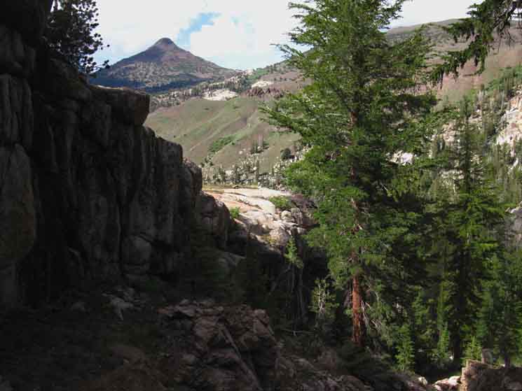
Leavitt Peak and Massif This is the Sierra Crestline South of Sonora Pass. The Pacific Crest Trail runs North and South threading its way around the series of mountain peaks capping the the Leavitt Massif's segment of the Sierra Crest line on the Left, the East side of the image above. Map of Leavitt Peak and the Southbound PCT Highway 108 runs East-West along the bottom of this valley between us and the Leavitt Massif. Highway 108 runs around the near perimeter of the expansive meadow decorating the bottom of this canyon between our position and the Leavitt Massif.
Let's take a closer look at that uppermost segment of the Sonora Pass Road: The peak on the far Left of the third image above is the Northern Peak 10 480 capping the Northern Flank of the Leavitt Massif. It is the only part of Leavitt massif shown in the second image above, which shows Highway 108 approaching Sonora Pass. Besides being able to see the The Pacific Crest Trail crossing Sonora Pass and Leavitt Peak back on its massif, we can also see where the PCT makes its big traverse South of Sonora Pass up the North-facing North face of the Northern Leavitt Massif peak. PCT SIGHTING FROM TYT We can see its faint line diagonally traversing across the middle of the image above. We carefully studied the route over Leavitt Peak as we approached it on the Southbound PCT. |
Continuing South on the TYT
Over the Top of the Red Hill
Approaching the Gap
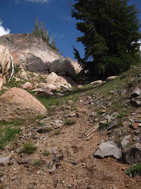
The total length of the nub of "maintained" trail extending North on the TYT from the gap
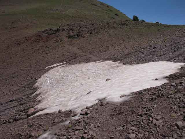 |
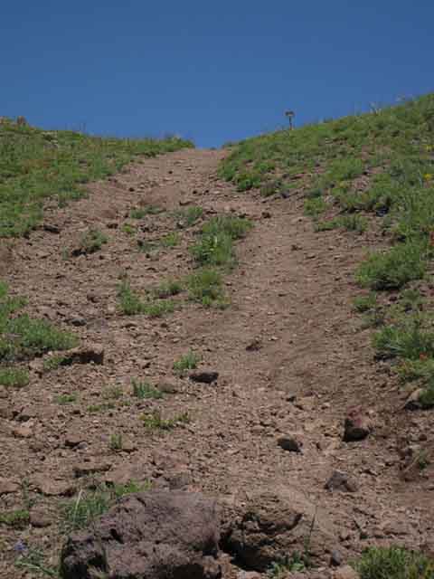
To Maintained Trail These last few feet of trail bring us across our final steps into the gap in the rim of the headwaters bowl (just over the low rise ahead) where we find the wilderness boundary and the trail junction with the maintained trail coming up from Saint Marys Pass Trailhead. The pattern of use on the trails makes it apparent we TYT hikers are joining in with the heavily-used trail from Highway 108 to Stanislaus Peak, and it is not the case that the trail to Stanislaus Peak is joining in with a heavily-used Tahoe to Yosemite Trail. The faintness of our TYT route turning off the deep grove of the trail to Stanislaus Peak proves that point. In the image above the position where the maintained trail crosses the gap into the drainage of the Clarks Fork of the Stanislaus River is just ahead. Our junction with the maintained trail is on the other side of the low patch of rough terrain just beyond the snow remnant. We are at the Northeastern corner of the top of the Clarks Fork Drainage, but we will shortly turn Right, South by the compass, to drop into the Deadman Creek Drainage as soon as we step over the crestline to our South. All runoff off the Right side of the image runs South into Deadman Creek. All runoff on the Left runs into the Clarks Fork. There is a wilderness boundary sign marking the junction of our unmaintained TYT route with maintained trail coming up from Saint Marys Pass hidden out of sight hidden behind the low rough patch, pictured below. |
Trail Junction in the Gap
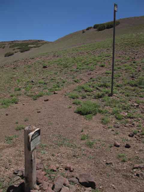 |
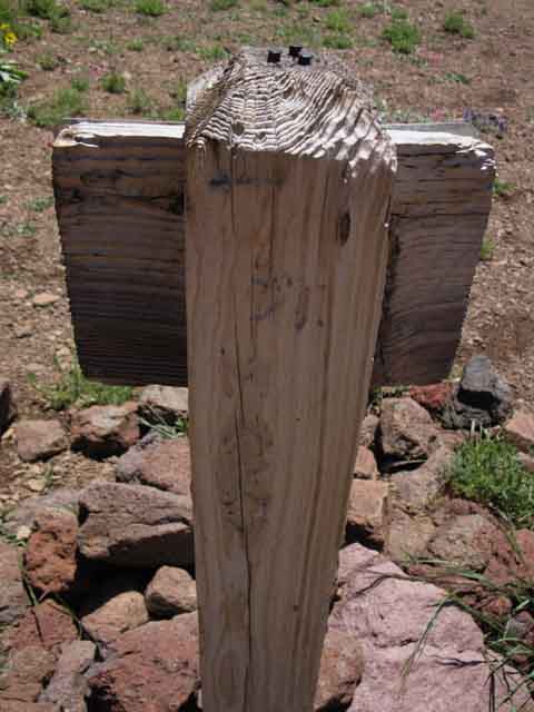
Wilderness Boundary Markers at the trail junction in the gap. We've picked up the last feet of a very short bit of trail leading us to the well-maintained trail running from Saint Marys Pass Trailhead to Stanislaus Peak. This is a faint four-way trail junction Southbound TYT Hiker To our Right is the Southbound TYT, now a maintained trail leading us down to the Saint Marys Pass Trailhead on Highway 108. To our Left is the trail leading Northwest out to Stanislaus Peak.
A look at the back of the wilderness area sign reveals an old faded carving of "Saint Marys Pass" and an arrow pointing us North back along our route around the headwaters bowl of the Clarks Fork towards Saint Marys Pass. Faint sign pointing Southwest There is a faint arrow pointing West along with the words, The carving is almost worn out to the limits of perception as is the trail it points to. The TYT "trail" North of this junction shortly melts into the terrain. The faint arrow pointing to Saint Marys Pass and the faded remnant of trail are the only formal indications that the Tahoe to Yosemite Trail, or any other trail, tracks West from this location in the gap intersecting with maintained trail. That's the only sign pointing West in any way indicative of the route North. |
DOWN THE GAP
View Southeast
MAINTAINED TRAIL
to
Saint Marys Pass Trailhead
 |
Leavitt Peak lined up in the Gunsight Gap Down Through the Gap This view South reveals the complexity of the Leavitt Massif, and even Leavitt Peak itself as we hike South down maintained trail through the gap to the Saint Marys Pass Trailhead on Highway 108. Map of Leavitt Peak and the Southbound PCT Before us is our last segment of the whole section of trail crossing the Much of the remainder of our route South on the Tahoe to Yosemite Trail is on some of the best maintained trail in the Sierra Nevada; We will intersect with, and rejoin the PCT following our hike across the Emigrant Wilderness where we enter Yosemite. In the meantime we are getting a good look at the route of the PCT across the Leavitt Massif from our position exiting the Carson Iceberg Wilderness along the route of the TYT. |
View Northwest
to
Stanislaus Peak
 |
Continuing Route of the Maintained Trail View North to Stanislaus Peak, topping the North wall of the Clarks Fork Canyon. We are looking Northwest across the top of the gap where the trail up from Saint Marys Pass reaches the top of the headwaters bowl. Remember the location of our campsite on the North edge of Clarks Fork Meadow was at the base of Stanislaus Peak's Southwestern flank? This shot gives us some perspective on the great volcanic cap covering/composing the Sierra Crestline between the granite lined valleys of the Clarks Fork and East Carson Rivers which are emerging out from under both flanks of the volcanic-capped crestline. |
Climbing North to the Gap
from
Saint Marys Pass Trailhead
 |
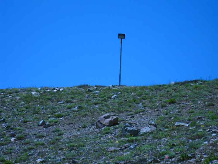
View North through the Gap The view of the gap climbing up from Saint Marys Pass Trailhead. We are in the throat of the narrowing ravine which begins its flow down the mountain to Deadman Creek from the narrowness of the gap. We can see the wilderness boundary line represented by the snow pole rising above us in the gap. The Historical Maps define the line of the Wilderness precisely. |
Alternative Route
Through Saint Marys Pass
Wilderness Boundary An Alternative Route Through, rather than Across Our view in the second image below is gazing West as we climb (Northbound on the TYT) making our own cross-country route that actually hikes Westbound through Saint Marys Pass into the Headwaters Bowl of the Clarks Fork of the Stanislaus. We do this by turning West off the Saint Marys Pass Trail as soon as we gained enough altitude to put ourselves above the granite feature, pictured below, on the West side of the drainage that is blocking our cross-country access to Saint Marys Pass from the Southeast. This image shows the granite feature below the Southeast side of Saint Marys Pass. "Standard" Route North
At our back is the Saint Marys Pass Trail which we exited. |
Looking West
View
from
THE EAST FLANK BELOW SAINT MARYS PASS
We are Cutting West to Hike Directly Through Saint Mary Pass
 |
||||
Carson Iceberg Wilderness Boundary runs across Saint Marys Pass around the perimeter of the Clarks Fork Headwaters bowl. One Route Through Saint Marys Pass One Route Across Saint Marys Pass Two Locations cited for Saint Marys Pass In real terms Winett names this gap as Saint Marys Pass, while the federal maps cite the low point along this ridgeline. I follow the federal definition for the location of Saint Marys Pass. Above we are looking West at the Carson Iceberg wilderness boundary marker in Saint Marys Pass. One day while hiking North from Saint Marys Pass Trailhead along the Northbound Tahoe to Yosemite Trail I decided to cut directly West over to, and through Saint Marys Pass into the headwaters bowl, rather than hiking up to the gap on the maintained trail, then circling clockwise on the unmaintained route around the headwaters bowl. I turned West as soon as I considered myself high enough, and began finding the easiest route over to Saint Marys Pass. I had hiked high enough on the maintained trail to get above the granite blocking the lower approaches to the pass, but the loose terrain and lack of trail makes this more direct route maybe a bit harder than the standard route up to the junction in the gap. Your comparisons are invited.
Unmaintained TYT Trail Reports
|
Below the Gap
To the Saint Marys Pass Trailhead
 |
| Final stretch of trail leading North from Saint Marys Pass Trailhead up to gap into Clarks Fork drainage. |
 |
Looking North at the descent from the gap down towards the Saint Marys Pass Trailhead for Southbound backpackers. Northbound hikers find a challenging climb. |
|
View West from above the Saint Marys Pass Trailhead Saint Marys Pass is the low gap making up the saddle on the far Right side of the ridge, to the Right of the pointy feature above upper section of the granite feature. My "alternative route" plan is to use the Saint Marys Pass Trail to put myself above the granite so I have a clear traverse from the trail West over to and through Saint Marys Pass. Otherwise we climb way above Saint Marys Pass to the gap, then descend across Saint Marys Pass. |
 |
||
Saint Marys Pass viewed from the East side, looking Northwest from a position where we've climbed above the trailhead and can identify the ravine leading up to the gap. Saint Marys Pass is the low point between the creme-colored granite formation blocking access to it from the Left, the Southeast, and the ruddy volcanic terrain rising on its Right, the Northeast. We can see a "sweet spot," a thin strip of green terrain approaching Saint Marys Pass from above the boulder-sheet and below the volcanic rise. Interestingly, the National Forest Map from 1987 shows the old trail threading through Saint Marys Pass connecting with the present line of the maintained trail far below the gap, while Winnett's Map has the route climbing through the gap (not Saint Marys Pass), while all the current USGS and National Forest maps show no through trails here at all, maintained or unmaintained, but only this trail at our feet servicing Stanislaus and Sonora Peaks. The trail we can see in the immediate foreground is the TYT tracking North. It positions itself on this side, the East flank of the upcoming ravine running to our Right up to the gap. The trail climbs the East flank of the ravine all the way up to where the two radically steepening flanks of the ravine converge at the gap crossing us into the drainage of the Clarks Fork of the Stanislaus River. Wooo Hooo! That gap is the highest point along this section of the perimeter of the Clarks Fork Headwaters Bowl, while Saint Marys Pass as identified above is the lowest point around the perimeter of the headwaters bowl. The latter is the definition of a pass. I would bet that back when the trail was laid out across the ravine it was wiped out by the Spring Thaw almost every year, until the trail was rerouted to stay up on the flank of the ravine to pass through the gap. That kept it from getting washed away every year. The route of the TYT as described on Winnett's Map follows the current route of the maintained trail running from the gap to Saint Marys Pass Trailhead. This is the only trail depicted on the current maps. The current maps depict this trail as the access point to Stanislaus and Sonora Peaks from the Saint Marys Pass Trailhead, and nothing else. Nothing. That's it. No current trails or routes are depicted through Saint Marys Pass or around the perimeter of the headwaters bowl. But they exist. That other route across Saint Marys Pass into the Clarks Fork drainage exists because I've hiked it. It might be easier or harder than following the trail higher up in elevation to the gap, but I believe the most important part of the route is West of Saint Marys Pass, not East.
|
Down from the Gap
to
Saint Marys Pass Trailhead
LEAVITT PEAK & MASSIF
 |
Our final run SOUTH down to the Saint Marys Pass Trailhead Or, looking at our last descent South to the Saint Marys Pass Trailhead on Highway 108. Looking South above we can see the very impressive North flank of the Leavitt Massif, and actually make out Leavitt Peak too. Leavitt Peak is the rounded peak with a little dash of snow peeking out behind the descending ridgline on the far Right side of the image. Yes, that is the actual Leavitt Peak back there. The peak in the center is Peak 10 480, which is the dominant peak of the North Flank of the Leavitt Massif. Because of its position rising above Sonora Pass and Highway 108 a lot of folks mistake peak 10 480 for Leavitt Peak, while it is actually one of its subordinate peaks on the quite substantial Leavitt Massif. Thus the above image presents a broad look at the North Face of Leavitt Massif and its almost hidden peak. |
 |
||
Camelback formation sitting at the base of the Southwest corner of Sonora Peak. This looks like something shot out of a volcano like a cannon shell, which subsequently has sat in place since landing, slowly but steadily dissolving into the surrounding terrain.
|
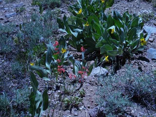 |
Flowers. From a distance this looks like barren terrain. Closer inspection shows a healthy carpet of colorful plant life across the terrain. Closer yet we find colors, shapes, and unique textures forged by the interactions of living things with radical weather and radical weather changes. These bits of blooming beauty are our rewards for the continued survival of the plants displaying them, as close to a "something for nothing" deal as we can come. Nature is amazing like that. |
|
I spotted a fast moving hiker coming down the trail. The Saint Marys Pass Trailhead access to both Sonora and Stanislaus Peaks makes this trailhead a favorite for serious dayhikers. Here's one now. |
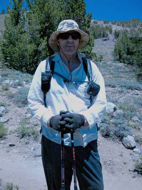 |
||
Gerry is a local day hiker dedicated to seeing the Sierra. Though there is excellent trail all the way to Stanislaus Peak, the last bit of the climb to the very top looks really hairy!
|
|
To our Southwest we can see the bottom of the headwaters meadow running West from Sonora Pass where Deadman Creek begins it Westward flow. The meadow is situated running down the Western Flank of the Sierra between Leavitt and Sonora Peaks. Below the bottom of the meadow is visible with Highway 108 winding its way along its edge towards the steep drop into the canyon below. |
 |
||||
Westbound Highway 108 turning into the Big V. This is the bottom of the meadow off the West flank from Sonora Pass where Deadman Creek begins its flow down to the Middle Fork of the Stanislaus River through Kennedy Meadows Pack Station. Our Saint Marys Pass Trailhead is located along the North edge of this meadow about a mile West of Sonora Pass.
|
|
We get great views of the Leavitt Massif to our South and note Leavitt Peak's position in the surrounding terrain. |
 |
||
Leavitt Massif to our South. Leavitt Peak is the peak to the Right down the ridgeline from the predominant peak, which is not Leavitt Peak but Peak 10 480. The peaks on the Left side of the image, including Peak 10 480 and Leavitt Peak are all along the Pacific Crest Trail's route over the massive bulk of the Leavitt Massif. That, my friends, is the Sierra Crestline South of Sonora Pass. The ridge descending to the Right of Leavitt Peak divides Deadman Creek's drainage on this side from Kennedy Creek's flow West on its South side. Views of Leavitt Massif and Peak
|
 |
||
View South I've climbed Leavitt Peak in Winter and Spring. The Winter climbs required ascending the snow-covered Eastern Flank from the end of the plowed road at the Marine Base up to Sonora Pass to start the climb in earnest. So do the Spring climbs, until evolving conditions open the Sonora Pass Road. That's when most folks take their shots at climbing Leavitt Peak in Winter conditions. Quite a time, however you do it. I suggest it as a goal for all High Sierra Backpackers. I mean a four day High Sierra Winter Mountain Climbing Expedition.
|
Southwest edge of Sonora Peak
 |
||
View North Camelback lava formation on the Southwest side of Sonora Peak.
|
|
Dominating the scene to our Northeast. The Saint Marys Pass Trail runs up the East side of the ravine desending off the Southwestern shoulder of Sonora Peak. We're looking up at where the trail runs up to the gap below the Southwestern corner of Sonora Peak. |
 |
||||
Sonora Peak to the Northeast. The volcanic formation on the far upper Right of the image above, below the top of Sonora Peak, marks the Western end of the PCT route across the South Flank of Sonora Peak. The route of our TYT is just off to the Left of that point, West, where we can see the line of the Clarks Fork Headwaters Bowl running into the Southwest corner of Sonora Peak. The Pacific Crest Trail route almost reaches the line of those volcanic formations on the far Southwestern flank of Sonora Peak as it traverses the South Flank of Sonora Peak, before turning Southeast down to Sonora Pass. Our TYT route comes through the gap above, on the Southwestern corner of Sonora Peak, before following the ravine down to the Saint Marys Pass Trailhead. We're at the point where the PCT and TYT come closest together since departing the Tahoe Basin (map) before they again reunite entering Yosemite. (map) The map below Right shows where the TYT and PCT swing close together on the Southwestern corner of Sonora Peak before beding away from each other descending to their respective Highway 108 Trailheads.
|
Local Color
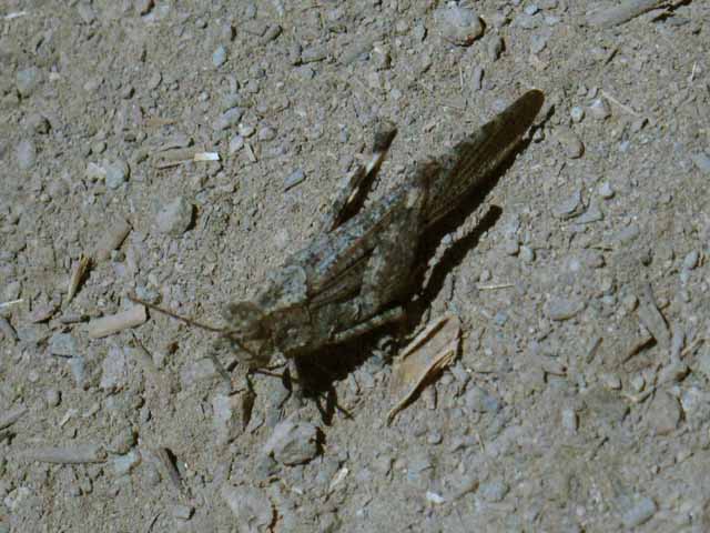 |
High Sierra grasshopper at 9500 feet. Living Things: |
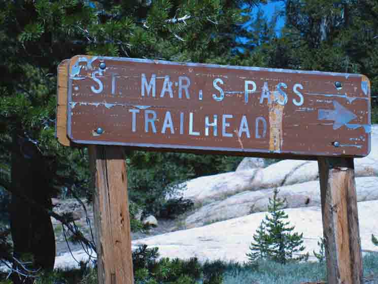
Saint Marys Pass Trailhead The beginning, the end, or another way point on our endless trail exploring Sierra Life. The Saint Marys Pass Trailhead is located just short of the top of the Western Slope of the Sierra Flank along Highway 108, the Sonora Pass Highway. Sonora Pass cuts through the Sierra Crestline about another three-quarters of a mile East of Saint Marys Pass. The Saint Marys Pass Trailhead is one of the unusual number of three trailheads here in proximity to the Sierra Crest. The other two trailheads are the PCT Trailheads pointing North and South from Sonora Pass. The Saint Marys Pass Trailhead has no matching Southbound TYT Trailhead along the Sierra Crest. TYT Trailhead Offset The actual National Forest Trailhead is about a mile beyond Kennedy Meadows Pack Station. The relative positions of the TYT and PCT Trailheads on the North and South sides of Highway 108 are laid out on this map: |
 |
||||
Saint Marys Pass Trailhead.
All good things to consider.
Transportation
|
North TYT: Lower Clarks Ford to Headwaters Bowl South TYT: Sonora Pass Trailheads
|
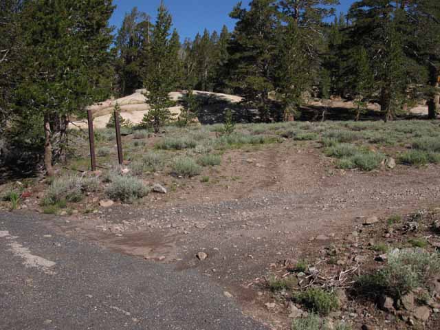
Northbound Hikers Dirt Road 2015 Update: The Saint Marys Pass trailhead itself is situated a short distance up a dirt road about one mile West of Sonora Pass on the North side of Highway 108, above the North perimeter of the great meadow feeding Deadman Creek. The trailhead is situated along along the spottily-wooded Northern perimeter of the large meadow that opens up below the Western flank of Sonora Pass's gap in the mountains. We saw that above, as we observed the terrain to our South while descending to Saint Marys Pass Trailhead. Deadman Creek The current route of Highway 108 follows Deadman Creek's Canyon from the Middle Fork of the Stanislaus up the Western flank to cross the Sierra Crestline at Sonora Pass. Saint Marys Pass was the second Trans-Sierra road used by Western settlers before the current route through Deadman Canyon was opened. The first was to the South of Sonora Pass, made by poorly-informed travelers who attempted to cross via the West Walker via Emigrant Pass. That route was abandoned in favor of the current route up the Eastern flank to Sonora Pass, but the second route did not follow the present course of Deadman Creek. Wagons first climbed to 9643 feet to cross the Sierra Crest at Sonora Pass, then made a second climb over the 10,400 feet of Saint Marys Pass to get into the top of the Clarks Fork, prior to opening the Deadman Route. Though a bigger and less-steep canyon than Deadman Creek's sheer canyon, the soft terrain of the Clarks Fork is terribly unsuited for a road and was difficult to maintain and keep open. Thus the current route was moved to Deadman Creek, where it could be carved into much more stable terrain along the side of the canyon than available along the Clarks Fork Route. Now you know. History of the Sonora Pass Road We will cross the bridge over Deadman Creek far down the mountain just above where it surges into the Middle Stanislaus River, as we are entering Kennedy Meadows Pack Station to continue South on the TYT. Top Regional Headwater The Clarks Fork transports much more water into the Middle Fork of the Stanislaus than the Middle Fork itself carries to their convergence point. The other major contributor to the Middle Fork, Summit Creek running up to Brown Bear Pass, is well designated. Summit Creek and its canyon are an order of magnitude smaller than the Clarks Fork River and Canyon. The Clarks Fork and its Canyon provide the majority of the water flowing down the Middle Fork of the Stanislaus from their convergence point. This map shows the convergence point of the Clarks Forks and Middle Stanislaus Rivers: The Canyon of the Clarks Fork marches all the way up to its magnificant 10 400 foot granite headwaters bowl. Or, if we have hiked South over Saint Marys Pass we have hiked into the watershed of the Middle Fork of the Stanislaus, which is nine miles below our position. The Middle Fork is fed from the crest by streams, while the Clarks Fork marches up to the crest and takes the runoff itself. The Middle Fork of the Stanislaus drains our next segment of our Southbound Tahoe to Yosemite Trail from Saint Marys Pass until we cross Brown Bear Pass into Emigrant Basin and enter the massive watershed of the Tuolumne River. The watershed of the Tuolumne River stretches from Emigrant Wilderness all the way across the whole length of the Yosemite High Country along the Western Sierra Crestline to our Southern exit from Yos over Donohue Pass. May all your water be cold and fresh. Starting Backpacking Trips This is where we enter the bottom of Deadman Creek's headwaters meadow. The Eastbound Sonora Pass Road begins bending a long arc to the Northeast tracing out the perimeter of this expansive high altitude meadow on our final approach to Sonora Pass. When the road bends enough to begin pointing us directly East we start looking to our Left for the Sign and faint dirt track to Saint Marys Pass Trailhead on the North side of the road. We will notice a rather exposed car-camping site sitting on the South side of Highway 108 just a few paces East of the Saint Marys Pass trailhead sign. Better car camping sites are located a short distance West, located off the short dirt roads running off the North side of Highway 108 a short ways towards the bottom of the meadow from the Saint Marys Pass Trailhead. Map with Car Camping sites noted near Sonora Pass Use of Saint Marys Pass Trailhead In fact, there are very few backpackers hiking this 11.25 mile segment of mostly unmarked and unmaintained trail from the end of the Clarks Fork Road to the trailhead at Saint Marys Pass. We become aware of this fact as the trail fades away due to lack of use as well as lack of maintenance. The same is true in the Southbound direction. Very few backpackers attempt this section of the Tahoe to Yosemite Trail hiking the TYT North or South. I have never seen anyone out here on the unmaintained segment above Boulder Creek, nor below the Headwaters Bowl. This is very remote country for our modern times. Lots 'O Dayhikers I have always encountered a day hiker or two here. Very nice folks. A Tough Hike Amenities at the Saint Marys Pass Trailhead Look West up the low rise at the left (South) side of the massive granite boulder for the sheltered little private site just West of the trailhead.
|
 |
||||||
Saint Marys Pass road sign from Highway 108. Sign Missing as of July 2015, which makes the narrow dirt road even more difficult to locate...
Kennedy Meadows is nine miles West down Highway 108, Sonora Pass a mile to our East, behind us.
Hiking South through the Saint Marys Pass Trailhead onto Highway 108 finishes the 34.57 mile long section of the Tahoe to Yosemite Trail from Lake Alpine to Saint Marys Pass. Good Work! South on the Tahoe to Yosemite Trail
Now we have to figure out how to cross the nine miles West down Highway 108 to our trailhead continuing South through Kennedy Meadows Pack Station. I discuss our rather limited options for local transportation up and down the Highway 108 corridor.
|
North TYT: Lower Clarks Ford to Headwaters Bowl South TYT: Sonora Pass Trailheads
Our progress down the |
|||||
Completed: TYT
TYT
TYT COMPLETED Next: Viva La Difference! This segment is worth the diversion off the Crestline. At the top of this great Sierra canyon
it feels like we are touching the sky hiking through the saddle of Brown Bear Pass looking at a big chunk of the Sierra Crestline across the high altitude heart of the Emigrant Wilderness. PCT DETOUR AROUND THE SIERRA CREST !! Oh My! O.K., the High Emigrant Basin is amazing. The PCT route bends around the High Emigrant Basin, effectively missing the unique beauties stashed up there in the heart of the Emigrant Wilderness. TYT = HEART OF EMIGRANT WILDERNESS The PCT is a higher route than the TYT South out of Kennedy Meadows, but lacks the complexity we find hiking the granite-volcanic interface up Summit Creek up from Kennedy Meadows, or the sub-alpine eden of the Emigrant and Grizzly Meadows. This is divine terrain. THANK YOU The section of this map below depicting the South side of Highway 108 shows all of our PCT & TYT options starting South from the Highway 108 corridor to Yosemite. And it shows the early season PCT detour route for hikers through Leavitt Meadow and the Marine Base up to the East Carson Gap for PCT hikers unable to get over Leavitt and Sonora Peaks when covered with early season snow. Sonora Pass Region Map Northbound Bond Pass to Brown Bear Pass Have some fun with it! The easiest way, but not the most scenic, is for Northbound PCT hikers to continue hiking West from the trail junction at the top of Kennedy Canyon on the South side of Leavitt Peak, rather than South over Leavitt Peak to Highway 108. This is a quick and easy route into Kennedy Meadows Pack Station from the PCT. Kennedy Canyon to Kennedy Creek and Lake The first route option above, from Bond to Brown Bear Passes, brings us through some of the most stunningly beautiful sections of the Emigrant Wilderness, rather than around them... The second option is not as scenic, but is the most effective/efficient way to hike directly into Kennedy Meadows off the PCT. The What goes down in the mountains always climbs again. These great sweeps of the Tahoe to Yosemite Trail down the Western flank are inevitably followed by long hard climbs back to high points along the Sierra Crest. Our descent to Camp Irene was followed by our big climb across the peak of 8720 foot Mount Reba. And so too here at Saint Marys Pass Trailhead we are at a high point along the Tahoe to Yosemite Trail about to head down to a deep low point. To our South we will now drop down to 6400 feet passing through Kennedy Meadows Pack Station before backpacking our way up the Western flank of the Sierra via Summit Creek through Brown Bear Pass into and across the splendors of the High Emigrant Basin over to Bond Pass's 9720 foot entry point into the Northwestern corner of the North Yosemite Backcountry. The flattened shelf of terrain along the Sierra Crestline between Brown Bear and Bond Passes is what I consider "The High Emigrant Basin." Such Sweetness In general, the Tahoe to Yosemite Trail veers much further away from the Sierra Crestline and dives deeper in elevation down the Western flank of the Sierra between returns to the crest than the Pacific Crest Trail as they follow their very divergent, but yet roughly parallel routes down the length of the North Sierra. These sweeps through divergent Sierra Terrain seems to impart a deeper understanding of the terrain. East and West Which route appeals to you depends on your particular definition of fun. I like 'em both, and long ago began to mix and match up various sections of each to make my own custom long distance backpacking routes from Tahoe to Yosemite and on down to Whitney. The same for Tahoe to Yosemite backpacking trips. My goal here is to open up this can of worms a bit for you, get you to peek inside, then watch you rip the lid off yourself. Very old-school fun that's always fresh. TYT-PCT Reunify in NW Corner of Yosemite And it's really different! After taking divergent routes around and across the Mokelumne, Carson Iceberg, and Emigrant Wilderness, the PCT and TYT rejoin in the North Yosemite Backcountry below Bond Pass at the top of Jack Main Canyon. Southbound TYT Trailhead on Highway 108 Where is it? Catch a Ride As I mentioned above, Dee was driving up the twisting upper sections of Highway 108 like Mario Andretti (wiki). I was not worried, as Dee was downshifting and braking properly as she entered cork-screwing decreasing radius corners, and pulling good acceleration out. Old Dee knew how to drive mountain roads. Lots of folks don't have that skill, which puts backpackers into the road kill zone hiking down Highway 108. Trails Rejoined I generally decide between the Wilmer or Tilden trail option based on the time of year. Early in Spring I choose the Tilden Lake Loop, as the terrain around Tilden dries out more quickly than the lower elevation Wilmer Lake, which will be living under a thicker cloud of mosquitoes early in the season. And later in the season as well, as Wilmer seems to be sitting atop a big granite bowl which holds great amounts of moisture late into the Summer Season, feeding and keeping Spring Mosquito conditions alive long after the heat of Summer dries out the surrounding terrain. Tilden drains better. Heck, Tilden gets a better breeze all Summer long, which blows the mosquitoes away. Tilden is also the route less traveled, which makes it quieter than the PCT around Wilmer Lake. Other than mosquito considerations, if I was you I would choose to hike the route I had not yet hiked. Do one. Do the other. Mix your favorite sections, and expand the length of your trips, skills, fitness, and knowledge simultaneously to weave yourself into greater challenges and rewards.
7.5 topo hiking Map 7.5 topo hiking Map 30 min topo hiking Map
Next page South |
|
|||||||||||||||
Backpacker Forums Have a great Sierra Nevada trip or story to relate? A fine piece of gear? Or gear that failed?Post it on If you have specific experiences, comments, questions, or pictures and videos of the Pacific Crest Trail between Lake Alpine and Saint Marys Pass, Post up here:Forum Section
|
North: Lower Clarks Ford to Headwaters Bowl South: Sonora Pass Trailheads
HELP THANKS! You can help support these efforts too. If you feel this guide has value to you, or that it's just good to support having a free, online High Sierra trail guide around for everyone to use, then you are invited to help my endless efforts here: This is the first full and free classic trail guide of and on the web. A True "Digital Book" written for the power of internet presentation. |
Trailhead
Contact
Alex Wierbinski

Backpacking Lake Tahoe to Mount Whitney
Your Guide to the High Sierra Crest, including the Tahoe to Yosemite, Pacific Crest, and John Muir Trails
