

The Trails
Guide
Maps
Miles/Ele
Permits
Resupply
Forum
Current Weather Conditions
Weather Notes
Northern High Sierras
Central High Sierras
Southern High Sierras
Gear
Gear List
Gettin Started
Layering
Discussion
Testing yourself and your gear
Gear Reviews
Backpacking
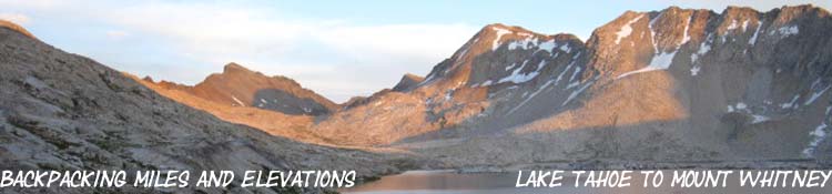
Lake Tahoe to Mount Whitney
Miles and Elevations
All
Miles and Elevations on the Tahoe to Yosemite, Pacific Crest, and John Muir Trails
Translate
Languages
Trail Arts
The art of walking
Physical Preparation
Trail Skills
The trail
Off the trail
Scrambling
Maps
Navigation
Camp skills
Food
Resupply
Food
Other
Photo Categories
Trail Stories
Trail Culture
News and Science
Links
Groups
Books
top of page
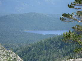
| Desolation Wilderness Backpacking Trail Miles & Elevations Meeks Bay to Echo LakeThe West Shore of the Tahoe Basin PCT and TYT
DISCUSSION |
|
 |
|
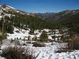
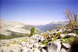
| Fallen Leaf Lake while approaching North Side of Phipps Pass, Desolation Wilderness, Tahoe to Yosemite Trail. | |
 |
Resupply #1
Important South Lake Tahoe Alternative Resupply Spot |
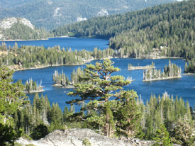
| Meiss Country Roadless Area Hiking Miles & Elevations Echo Lake to the Carson GapThe South End of the Tahoe Basin PCT and TYT
Alternative Routes |
|
 |
|
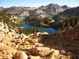
Both Echo Lakes viewed coming down from Lake Aloha. Desolation Wilderness, Pacific Crest and Tahoe to Yosemite Trails. Meiss Country visible in the valley beyond Lower Echo Lake. |
|
| Mokelumne Wilderness Backpacking Trail Miles The Carson Gap
West Mokelumne Wilderness TYT East Mokelumne Wilderness PCT |
|
 |
|
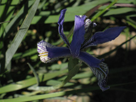
| Iris growing in the Carson Gap where we exit the Lake Tahoe Basin. | |
 |
|
| South around Raymond Peak on the Pacific Crest Trail Route between Carson and Ebbetts Passes. | |
Resupply #2 |
|
 |
|
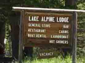
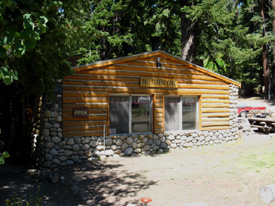
| Lake Alpine Lodge on the Western shore of Lake Alpine, along Highway 4. | |
Carson Iceberg Wilderness Backpacking Trail Miles Highway 4
|
|
 |
|
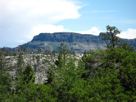
| The Dardanelles. The Dardanelle Cone is behind the tree and the interposing volcanic mass. The Tahoe to Yosemite Trail. | |
 |
|
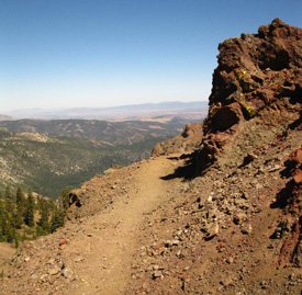
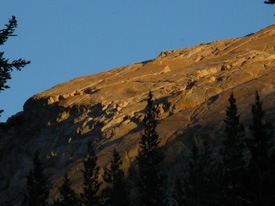
View Northwest down East Carson across East Carson Iceberg Wilderness towards Silver and Highland Peaks towering over Ebbetts Pass. Stanislaus Peak in upper left. |
|
Resupply #3 |
|
 |
|
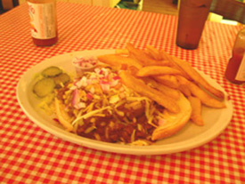
| The Chile Cheese Burger. The food at Kennedy Meadows Pack Station is the best on the trail. | |
Highway 108 to Tuolumne Meadows Across West Flank of Emigrant Wilderness to Sierra Crest TYT Western Toiyabe Boundary & Yosemite Wilderness PCT Alternative Route | |
 |
|
| Tahoe to Yosemite: Granite Dome in Emigrant Wilderness from Sheep Camp. South of Kennedy Meadows Pack Station. | |
 |
|
| Pacific Crest Trail: Leavitt Massif, two miles South of Sonora Pass, Pacific Crest Trail. | |
Resupply #4 |
|
 |
|
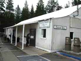
| The Tuolumne Meadows tent cabin. Post Office, Store, and Cafe. | |
UNDER CONSTRUCTION |
|
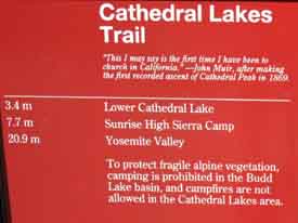 Trail sign behind the Tuolumne Meadows Visitor Center. |
Standard JMT-PCT Routes South Alternative JMT Route |
UNDER CONSTRUCTION |
|
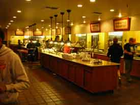 The plush Cafeteria in Yosemite Valley. Wow. Living BIG. |
Resupply #4a |
UNDER CONSTRUCTION |
|
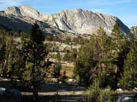 Looking South towards Voglesang High Sierra Camp from Lake Evelyn. |
Yosemite Valley Alternative Route to the JMT South Standard JMT Route |
UNDER CONSTRUCTION |
|
Down Lyell & Out of Yosemite
Standard JMT Route
|
|
 |
|
| Lyell Canyon from near the top of Donohue Pass. | |
UNDER CONSTRUCTION |
|
Resupply #5: |
|
 |
|
| Mule House Cafe at Reds Meadow Pack Station. | |
UNDER CONSTRUCTION |
|
John Muir Wilderness
Standard JMT-PCT Route
Alternative Route |
|
 |
|
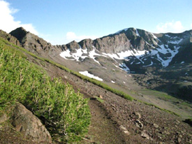
| Lake of the Lone Indian with the Silver Divide in the background. | |
UNDER CONSTRUCTION |
|
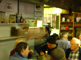 Vermilion Valley Breakfast. |
Resupply #6 |
UNDER CONSTRUCTION |
|
John Muir Wilderness
Standard JMT Route Alternative Route |
|
 |
|
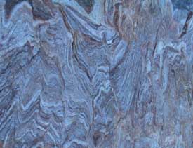
| Spirit in the Rock, South of Selden Pass, John Muir Trail. | |
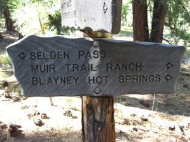 Southern Muir Ranch Trail junction. |
Resupply #7 |
Kings Canyon-Sequoia National Park
Standard JMT Route |
|
 |
|
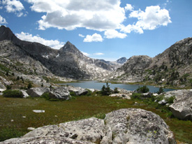
| Mount Spencer and Huxley in foreground behind and right of lower pools below Saphire Lake. Peak 12960 in far background. | |