The Trails
Guide
Maps
Miles/Ele
Permits
Resupply
Forum
Current Weather Conditions
Weather Notes
Northern High Sierras
Central High Sierras
Southern High Sierras
Gear
Gear List
Gettin Started
Layering
Discussion
Testing yourself and your gear
Gear Reviews
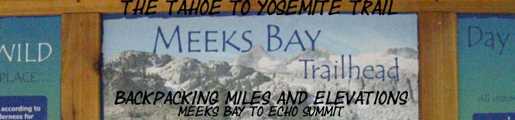
Meeks Bay to Echo Summit
Backpacking
Mileages and Elevations
Miles and Elevations through Desolation Wilderness on the Tahoe to Yosemite and Pacific Crest Trails
Languages
Translate
Trail Arts
The art of walking
Physical Preperation
Trail Skills
The trail
Off the trail
Scrambling
Maps
Navigation
Camp skills
Food
Resupply
Food
Other
Photo Catagories
Trail Stories
Trail Culture
News and Science
Links
Groups
Books
ALL |
MILES NONE Meeks |
MILES TYT-PCT |
REGIONAL TYT-PCT |
DESOLATION |
ALL |
TRAIL TYT-PCT |
ALL |
Miles & ElevationsStarting the
|
||||||||||||||||||||||||||||||||||||||||||||||||||||||||||||||||||||||||||||||||||||||||||||||||||||||||||||||||||||||||||||||||||||||||||||||||||||||||||||||||||||||||||||||||||||||||||||||||||||||||||||||||||||||||||||||||||||||||||||||||||||||||||||||||||||||||||||||||||||||||||||||||||||||||||||||||||||||||||||||||||||||||||||||||||||||||||||||||||||||||||||||||||||||||||||||||||||||||||||||||||||||||||||||||||||||||||||||||||||||||||||||||||||||||||
| MILES and ELEVATIONS SOUTH ECHO SUMMIT to CARSON PASS |
||||||||||||||||||||||||||||||||||||||||||||||||||||||||||||||||||||||||||||||||||||||||||||||||||||||||||||||||||||||||||||||||||||||||||||||||||||||||||||||||||||||||||||||||||||||||||||||||||||||||||||||||||||||||||||||||||||||||||||||||||||||||||||||||||||||||||||||||||||||||||||||||||||||||||||||||||||||||||||||||||||||||||||||||||||||||||||||||||||||||||||||||||||||||||||||||||||||||||||||||||||||||||||||||||||||||||||||||||||||||||||||||||||||||||
Backpacking
Backpacking Desolation Wilderness North Desolation Wilderness Topo Map Meeks Bay to Phipps Pass
Backpacking Desolation Wilderness North-Central Desolation Wilderness Topo Map Phipps Pass to Middle Velma Lake
Backpacking Desolation Wilderness Central Desolation Wilderness Topo Map Middle Velma Lake to Dicks Pass
Backpacking Desolation Wilderness Central Desolation Wilderness Topo Map Dicks Pass down to Susie Lake
Backpacking Desolation Wilderness Central Desolation Wilderness Topo Map
|
||||||||||||||||||||||||||||||||||||||||||||||||||||||||||||||||||||||||||||||||||||||||||||||||||||||||||||||||||||||||||||||||||||||||||||||||||||||||||||||||||||||||||||||||||||||||||||||||||||||||||||||||||||||||||||||||||||||||||||||||||||||||||||||||||||||||||||||||||||||||||||||||||||||||||||||||||||||||||||||||||||||||||||||||||||||||||||||||||||||||||||||||||||||||||||||||||||||||||||||||||||||||||||||||||||||||||||||||||||||||||||||||||||||||||
| Location | Elevation | Mileage | |||
| West Shore Susie Lake | 7800 | 19.76 | |||
| +120 | .56 | ||||
| West Shore Heather Lake | 7920 | 20.32 | |||
| +200 | .84 | ||||
| North Lake Aloha/Rubicon Jnct |
8120 | 21.16 | |||
|
|||||
Backpacking Desolation Wilderness
North Shore
of
Lake Aloha
to
Echo Summit
The South End
of the
Desolation Wilderness
| Region Map South Desolation Wilderness |
Detailed Map South Desolation Wilderness |
Lake Aloha to Echo Summit Trailhead
-706 feet, 9.55 miles
| Location | Elevation | Mileage | |||
| N. Lake Aloha/Rubicon Jnct |
8120 | 21.16 | |||
| +40 | 1.42 | ||||
| Lake of the Woods Jnct |
8160 | 22.58 | |||
| -80 | .59 | ||||
Lake Lucille/ Margery Jnct, (L) |
8080 | 23.17 | |||
| +240 | .41 | ||||
Lake Lucille/ Margery Jnct, |
8320 | 23.58 | |||
| -80 | .76 | ||||
| Triangle/Lilly Lakes Jnct |
8240 | 24.34 | |||
| -360 | .68 | ||||
| Tamarack Lake Jnct |
7880 | 25.02 | |||
| -80 | .46 | ||||
| Triangle/Lilly 2nd Jnct |
7800 | 25.48 | |||
| -280 | .61 | ||||
| Boat Taxi Dock | 7520 | 26.09 | |||
| -106 | 2.62 | ||||
| Lower Echo Lake Trailhead | 7414 | 28.71 | |||
| -37 | 2.00 | ||||
| Echo Summit Trail Head | 7377 | 30.71 | |||
|
|||||
Miles and Elevations
for the
Next
TYT & PCT
Section
SOUTH
Backpacking Meiss Country Roadless Area
Echo Summit to Carson Pass
Miles and Elevations
Note |
This trail guide, like the High Sierras, divides itself into ups and downs. Our miles are generally done either going up to the top of the mountain, or we are coming down from the mountaintop into the valley that separates us from the next mountain. Between Meeks Bay and Echo Summit in the Desolation Wilderness along the Tahoe to Yosemite Trail there are 32 miles and two major passes, Phipps Pass and Dicks Pass, measuring at 8800 and 9390 of feet of elevation, respectively. Once we cross Dicks Pass it is almost all down-mountain to the the South end of Desolation Wilderness at Lower Echo Lake and our first resupply at Echo Chalet. Remember this important rule: Every descending route holds many mini-ascents, and every ascent has many mini-descents within its length. Our mileage will very rarely just go up, or just go down. We are going endlessly up and down. It's a rock, river, and forest roller-coaster. |
Backpacker Forums Post it on Above we come to the Front Page of the High Backpacking Trails and Topics Forums. Below we break the forums down into categories:
Anyone can post text comments in the existing forums, but only members can post up new topics, along with images, maps, and formatting. If you have experiences, comments, questions, trip reports, trail conditions updates or pictures and videos of the Tahoe to Yosemite/Pacific Crest Trail from Meeks Bay to Echo Summit, post up here as an unknown hiker or as a member: Trail Segment
|
Miles South
Echo Summit to Carson Pass
Miles and Elevations
Trailhead
Contact
Alex Wierbinski

Backpacking Lake Tahoe to Mount Whitney
Your guide to the High Sierra Crest, including the Tahoe to Yosemite, Pacific Crest, and John Muir Trails