a
Tree, Poison Flat, Carson Iceberg Lake Tahoe to Mount Whitney: Your Backpacking Guide to the High Sierras Yellow Flower
On the way to Round Lake during Winter.

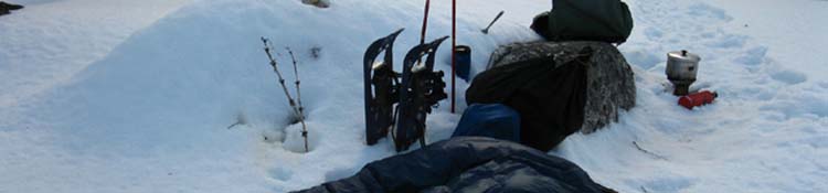
Good morning. Waking view snow camping site in the Lake Tahoe Basin. Path is to my craphole, made yesterday.

The Trails

Guide

Maps

Miles/Ele

Permits

Resupply

Forum


Current Weather Conditions

Weather Notes

Northern High Sierra

Central High Sierra

Southern High Sierra


Gear

Gear List

Gear Forum

Gettin Started

Layering

Testing yourself and your gear

Gear Reviews


top of page

High Sierra Nevada Backpacking Gear

Testing
You and Your Gear

Languages

Translate


Trail Arts

The art of walking


Physical Preperation


Trail Skills

The trail

Off the trail

Scrambling

Maps

Navigation

Camp skills


Food

Resupply Forum

Food

Food Forum


Other

Trail Stories


Trail Culture


News and Science


Links


Groups


Books


Terms and Conditions of Use


top of page

HOME PAGE GEAR LIST GETTING STARTED LAYERING BOOTS TRAIL SKILLS GEAR FORUM trail guide index all pages maps index
Hitting
the
Trail

Step by Step
Now that you've got your basic gear kit setup together, bought and broken in your boots, and have gotten yourself geared and trained sufficiently to take you and your gear out a series of logical test trips before hitting the High Sierra Trails. You may not live near the Sierra. Your environment may be completely different, with completely different requirements.

Note the character and demands of your locale, and gear-up accordingly.

Car Camping
TEST I
Once you've geared for the local requirements, I suggest starting the process of testing yourself and your gear by throwing your pack into the car and driving to, and finding a classic High Sierra car camping location to test all aspects of your gear set- up in a controlled environment in the field. A high elevation High Sierra car campsite seems about as effective a "test-bed" as possible.

Cook on your stove, and test your food plan for quantity, taste and satisfaction. Experience just how warm your layering plan keeps you at night. Practice setting-up your tent, and get a sense of how your degree of cold sensitivity is being served by your clothing and sleeping setup. How's the mosquito protection plan working out? Have you shit cleanly into a hole? If you live near high elevation (7000 feet +) car camping spots you will experience a crisp evening chill, as in the High Sierra.

Living at low elevations requires you must understand that what works during low elevation nighttime temps may well be insufficient for high elevation nighttime lows. The same is true for every aspect of life. Breathing itself can become strained. Walking on flat land will not prep you for hiking up steep high elevation Sierra flanks to the Sierra Crest. That's why you have to run your fat ass. Being trained offsets some degree of the initial altitude, weight, and climbing strains induced by Backpacking the Sierra. Especially if you are used to low-altitude warm environments, unladen hiking, and flatlands.

Oh-No!
Problems arise when you don't have the physical capacity required to keep moving in difficult conditions necessary to remain warm while carrying insufficient insulation to stay warm when not hiking. That would be called "screwing yourself." All of these problems are products of flawed expectations and bad assumptions. Testing our insulation and camping gear in the field under controlled conditions, especially at altitude, tests our assumptions and capacities.

Sierra conditions can shift from hot to cold and back six times during the span of a day. Your operating principal is to protect yourself by properly matching gear for the environment, to have the range of layers and depth of gear required the by the range of weather you will experience. To do that you must be informed and prepared.

Informed about your own particular level of sensitivity to cold, the status and capabilities of your level of fitness, and prepared with the correct gear and trip plan suited to both.

To figure out your capacities requires testing. To figure out weather conditions in the Sierra Nevada requires information. I've woven together extensive weather information and resources. These are centralized on the High Sierra Weather Page. This is our general backpacker's resource covering every aspect of High Sierra Weather.

Next, I've broken down weather resources regionally, so users of various sections of the guide can more easily access the latest weather information pertinent to their specific locations. Each page of the trail guide is linked to that region's weather page listing local weather assets, such as the nearest local real time ground reporting stations, local forecasts, local radar, and the regional satellite views.
These weather forecasts, predications, satellites and radar provide the best views of the potential range of weather conditions and temps you could experience through all the Sierra Nevada's seasons.

Wide Range of the Wild Side
You will be amazed at the range of environments you will experience. I base my planning on the belief that we will experience everything possible, if we spend enough time in the wilderness.

Engage Thyself
Your High Sierra trip requires, no, it demands that you understand both your internal capacities to endure cold measured against the potential power of High Sierra weather and its range of temperatures demanding your endurance.
You need to know the range of weather possible during the dates of the locations you are hiking through. You can take heart in the fact that as a human you are designed to evaluate and accommodate the range of environmental conditions Nature throws down. You were designed with the basic perceptive, conceptual, and physical tools necessary to percieve, understand, endure and survive. The trick is learning to properly employ these practices as a fundamental joy of engaging Life before their use becomes critical for preserving life or deeply enjoying a long-distance backpacking trip.

One is fun, the other is not. Well, not until it's over.

Endless CYA
The fact is our planning and perception skills must take over when our strength is insufficient, and our strength must see us through when our planning and perception fails us. Put another way, we must be both intelligent enough to see our own weaknesses, and strong enough to survive our own ignorance.

We each have weakness and ignorance along with strength and intelligence.

Little can stop us IF we can get beyond our own self-imposed limitations.

How we approach the process of dynamically identifying and balancing our strengths and weaknesses each against the others within the challenges of our ever-changing High Sierra environment defines a big chunck of who we really are as people, when all social bullshit is stripped away.

The Simple Life
Life in the High Sierra can be as simple as the weight of the pack we carry, the height we must elevate it while crossing the distance remaining to our destination, all measured against the level of energy remaining within us.

Car Camping
TEST II
Once we've verified our backpacking gear selection is, "good to go," during our car camping we will take our car camping trip up to the next level. We'll carry our fully-loaded backpack from our car campsite to the top of the Sierra Crestline and back.

If we are car camping along one of the trans-Sierra Highway we will locate the PCT or TYT and hike to the top of the Sierra Crestline with our fully-loaded "test" backpack. From Sonora Pass on Highway 108 that would be Leavitt Peak. From Ebbetts Pass on Highway 4 it's Tyron Peak, while Round Top and the Sisters overlooks Carson Pass on Highway 88. We'll plan a half-day "turnaround" hike. We'll hike up for the first half of the day before we turn around and hike back to camp during the second half.

My theory is that a couple of nights of car camping along the Sierra Crest complimented by carrying your fully-loaded pack to the crest a couple of times during those days will exactly ascertain what level of conditioning you support, how well your gear and logistics are keeping you warm and well fed, and exactly how you feel doing it.

These car camping "tests" of your gear and fitness will very effectively tie your assumptions and expectations to your actual capacities. This information will guide adjustmenting to your training, gear selection, and trip-planning to the actual realities of the trail before launching a long-distance High Sierra backpacking trip.

That's why I suggest the "safety-net" of car camping. Failure of mind, body, or gear sits next to a car's protection and means of escape. Your car camping trips will naturally evolve into launching-points for multi-night backpacking trips once you, the wife (GF?) and kids become familiar and comfortable with the environment and its demands.

You will pull in and camp for the evening, adjusting to altitude. The next morning you get an early start for your backpacking/day hiking day.

Car camping provides a natural and comfortable foundation to begin your transition from city, to trailside, to trail.

Once I became familiar and comfortable with High Sierra backpacking I evolved series of seasonal trips to explore as many of its aspects as possible. Each Winter I have a series of regular trips over the course of Winter anchored by what I call, "the Winter Circle."

THE WINTER CIRCLE
The Sierra & Co.
Death Valley is a stone's throw from the South end of the Sierra. I really enjoy sitting in a custom truck-campsite high in the White Mountains North of Death Valley looking West across Owens Valley at the incredible Eastern Sierra massif holding Mount Whitney.

These views come from a custom truck camping site I set up on a spur off an old mining road/track left behind from the silver rush days overlooking both mountain ranges on my way over the White Mountains and down into the North end of Death Valley ending a mid-Winter series of trips by dropping into this incredible sunken desert. In my opinion the only time for smart backpackers to visit Death Valley is during Wintertime. Well, once any snows have melted off the White Mountains, and we're pretty sure no more is coming...

Heading down to Death Valley is my favorite way to end a classic series of mid-Winter High Sierra backpacking trips.

Nice Adventure
This obscure dirt route (Big Pine Road Map) into the North end of Death Valley is South of the Black Mountains, driving East from Big Pine on 168 East to the Death Valley Road. The sign at the road junction a few miles East of Highway 395 warns you about the route that follows. Remember what I have said about always carrying shovel, rope or chain, come-along, water, gas, and a well stocked backpack as standard gear for dirt road travel in the mountains... A breakdown can kill the unprepared.

This route is the long "good" dirt road into Death Valley from the North. It can only be used during Winter, by my reckoning. I would not drive it once the heat begins in earnest, equipped with any gear at all. You can't get me near Death Valley during Summer. Winter, yes. Summer, NO.

There's a reason it's called Death Valley.

My Winter backpacking trifecta is composed of three trips in one. First, Meyers to Round Top & back. An excellent warm-up for serious Cold Weather Travel. After that I find my way down to the town of Walker on Hwy 395 along the Eastern escarpment of the Sierra. From there we hike to the East Carson River up to the snow covered PCT to take a look at Sonora Pass from above. I would hike down to Sonora Pass if the route down was safe, but it is not safe (for me) to descend during mid-Winter. I hike East down to and through the Marine base to exit the High Sierra. (Map) A few times I've made my way West up the snow-covered route of Highway 108 to climb Leavitt Peak, descending back to 108 to 395 via Leavitt Lake.

Finally, the third leg of the Winter Tour takes me down Highway 395 to Death Valley for a run up to the pass in the ridge South of Telescope Peak via Johnson Canyon by West Side Road. The radical 50 degree daily change in temps sometimes seen in Death Valley during Winter requires serious Fall/Spring gear, depending on weather trends.

20 degrees at night to 75 degrees during the day is a big swing.

Back to the Beginning
Our first goal is to properly evaluate our capacities and sensitivities against the expected range of temps and conditions through a series of car camping, hiking, and finally, backpacking trips.

Evolving car camping trips into short backpacking trips is when you will finish breaking in your boots and feet (neither are broken in without carrying weight), perfect your food selection and cooking, learn to properly shit in a hole, and gain the overall familiarity with your gear necessary to keep warm and dry (at least warm) under stressful and difficult conditions entering the High Sierra Nevada Mountain Range.


THIS PAGE IS
UNDER
CONSTRUCTION:

STAY TUNED FOR MUCH MORE
!

COME ON BACK NOW, 'YA HEAR?

Add your
two-cents
worth...

Gear Tech
LAYERING

Last page: GEAR LIST                                                                                         Next page: TRAIL SKILLS


Backpacker Forums

Have a great Sierra Nevada route or trip to relate?

Post it on
TahoetoWhitney.Org

The High Sierra Backpacker's Trail and Topics Forums


Experiences, comments, or pictures about GEAR?
POST HERE:
Gear Forum
Trailhead
Contact
Alex Wierbinski

top of page

Bird South of Donohue Pass on the John Muir Trail, 2009.

Backpacking Lake Tahoe to Mount Whitney

Your guide to the High Sierra Crest, including the Tahoe to Yosemite, Pacific Crest, and John Muir Trails

Poison Flat Bear, Toiyabe National Forest.
© Lake Tahoe to Mount Whitney: Crown Jewel of the Pacific Crest Trail