Tahoe to Whitney Trail Guide Banner.

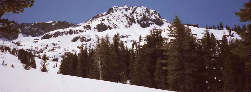
Approaching Round Top covered in May Snows.
Approaching Round Top (guide) covered in May Snows.


Current Weather
Sophisticated Tools

TAHOE to WHITNEY

A
MODERN, DIGITAL,
&
Classic

HIGH SIERRA NEVADA

TRAIL GUIDE


Basics
Trail Guide
INDEX


Tracking

Winter of 2020

Fires of 2019

Spring of 2019

Winter of 2019

Fires of 2018

Spring of 2018

Winter of 2018


Backpacker's Calendar
Backpacking Season Conditions
Almanac Calendar

May of 2020


LATEST
HIGH SIERRA
NEWS
LATEST
ENVIRONMENTAL
STRAINS


Backpacker Alerts
Sophisticated Analysis
T


General
Introduction

to
Backpacking
the
Tahoe to Whitney
Trails

TAHOE to WHITNEY


LETS EXPLORE

the
HIGH SIERRA NEVADA
MOUNTAIN RANGE


beginner?
Getting Started

Orientations

<<<<- - - -Introductions - - - ->>>>
to
TAHOE
to WHITNEY


THE NATURE
OF
LONG-DISTANCE
BACKPACKING

Introductory
TRAIL GUIDE
Topics

Getting Started

Gear List

Boots

Levels
of
Difficulty
Art
of
Walking

Navigation

Camp Skills


Introducing
The Tahoe to Yosemite Trail


Key
Maps--Miles--Elevations--Navigation--Nature--Permits

INFORMATION
Follows Below


Lake Tahoe Basin
TRAILHEAD - - TRAILHEADS


All
High Sierra Trailheads

TRAIL GUIDE INDEX


General
Introduction

to
Backpacking
the

Tahoe to Yosemite
Trail(s)


Who?


CURRENT & CLASSIC
HIGH SIERRA PERSPECTIVES
New
Tahoe to Whitney
(TESTING)
High Sierra Backpacker Magazine

(A Test Page)
Presenting

The Arts, Sciences, Physicality, Spirituality, Gear, Environment,
History, and
Cultures of High Altitude Living


Our
Avenues of Approach

-The-
TAHOE to WHITNEY
BACKPACKING
TRAILS
FORUMS
-The-
TAHOE to WHITNEY

BACKPACKING
TOPICS
FORUMS
-The-
TAHOE to WHITNEY
BACKPACKING

NEWS


2016
High Sierra Trails
and
Trail Culture Review


2013 --------- 2010


Why?

Tahoe to Whitney
is
Soliciting
Ethical
Sponsorships
 

Tahoe to Whitney
Best
Backpacking Trail Guide


Under Construction

77% completed
GUIDE: Meeks Bay to Yosemite Valley
MAPS: Tahoe to Whitney

 
Tahoe to Whitney
is
Soliciting
Quality
Advertisers
Top


The
High Sierra Trail Guide

Trail Guide Backpacking Maps Distances Administration
Best trail guide information along Sierra Crest to Mount Whitney. The best High Sierra backpacking trail maps. The best High Sierra backpacking trail miles and elevations information. The best High Sierra Backpacking Permits information.
Text, Images and Videos 30 and 15 min
USGS maps
TYT, PCT, and JMT (soon) High Sierra National Parks and Forests

Trail Guide

Detailed descriptions, maps, miles and elevations information along the Sierra Crest from Tahoe to Whitney helps us plan our trip and obtain our permit.


High Sierra
Trail Guide
Resources

Trail Support

Resupply information, trail skills, four season gear and food tips all help keep us healthy and happy down the Sierra Crestline Trails.

High Sierra Backpacker
Resupply
Tips for
Camp and Trail
Four Season
Gear List
Food Plan
(Forum )
The best High Sierra Backpacking Resupply information. The best source of Backpacking Skills and Knowledge. The best High Sierra Backpacking Gear List. The best High Sierra Backpacking Food information and insights.
How, Where, and When Campsite Comfort Be Ready Be Well Nourished


High Sierra
Backpacking Skills,
Information,
and
Fitness

Backpacker
Navigation
Backpacker
Nature Identification
Backpacker
Astronomy
Backpacker
Physical Prep
The best High Sierra Navigation information and resources. The best backpacking plant and animal identification information High Sierra Mountain Range. The best astronomical inforamtion and star charts for backpackers. The best backpacking training for backpacking.
Introduction:
Goals & Tools
Look Around!
Plants-Animals-Environment
Look Up!
Night Skies
Look Inside Yourself
School of Pack


High Sierra
Wilderness Backpacking
Maps
North Sierra

Dicks and
Fontanillis Lakes
Meiss Cabin Round Top Sunset Summit City Canyon
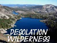
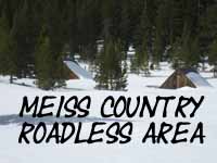
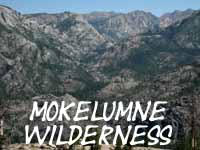
The best Desolation Wilderness backpacking trail map. The best Meiss Country Roadless Area backpacking trail  map. The best Carson Pass Management Area backpacking trail map. The best Map of Mokelumne Wilderness backpacking trails.
Desolation Wilderness
TYT, PCT,
& TRT
Meiss Country
TYT, PCT,
& TRT
Round Top and the Sisters
TYT
West Mokelumne Wilderness
TYT

East Carson River North Face
Leavitt Massif
High Emigrant
Basin
Mountains above
Glen Aulin
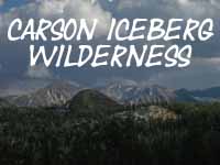
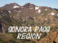
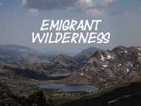
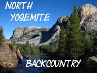
The best Carson Iceberg Wilderness backpacking trail map. The best trail map for Sonora Pass backpackers. The best Emigrant Wilderness backpacking maps. The best North Yosemite backpacking maps.
East Carson Iceberg Wilderness
PCT
Highway 108 Corridor
PCT or TYT
Across Emigrant into Yosemite
PCT or TYT
North Yosemite
PCT
& TYT

NORTH
High Sierra
at our
Fingertips

Black-Dotted trail routes on 30 minute maps of North Sierra click to detailed maps.

All Red Dots on the maps click to that location on the trail guide.


High Sierra
Wilderness Backpacking
Maps
Central
and South Sierra

Mount Florence Banner Peak Silver Divide Guitar Lake
The best backpacking trail maps covering Yosemite. The best backpacking map of the John Muir Trail from Tuolumne Meadows to Reds Meadow. Best hiking maps for alternative route through Fish Valley to John Muir Trail over Silver Divide. The best backpacking maps of the trails from Muir Ranch to Mount Whitney.

JMT or PCT
Yosemite Wilderness

across
Across Central Yosemite

JMT & PCT
Ansel Adams Wilderness

Tuolumne Meadows
to
Reds Meadow
JMT & PCT
John Muir Wilderness

Red Meadow
to
Vermilion Valley
JMT & PCT
Kings Canyon-Sequoia

Muir Ranch
to the
Whitney Portal

Central
and
South
High Sierra
Maps

These maps are
Under Construction

The Central and South ends of the Trail Guide are Under
Construction


High Sierra
Backpacking Forums
Trails and
Topics

Backpacking
Trails
and
Topics

Our trail guide is matched to comprehensive
Backpacking
Trails & Topics Forums.

Each High Sierra trail and every backpacking topic is open to wide interpretation.

Share your unique perspective and experiences!

No or little experience?
Good Questions educate everyone!

All Trails It's Alive! Gear is Life Warm and Dry
High Sierra Backpacking Trails Forum. Living things forum. Backpacking Gear Forum. Mountain Safety Forum.
Questions-
Comments-Info
Record of Encounters Share
life Experiences
Think!
Then Think Again!

Context
and
Meaning
Echos
of the
Past
Many Ways
to
Love The Sierra
Endless Reflections
of
Eternal Beauty
The best High Sierra Navigation information and resources. The best resource for High Sierra Nevada History information and resources. Insights into High Sierra Nevada trail culture forum. The best Art and High Sierra Nevada Arts and Letters resources.
Finding
Ourselves First
A Long Trail Enjoy them All Eye of the Beholder


HIGH SIERRA BACKPACKER
NEWS-EVENTS-STATUS
&
RESOURCES

of the
HIGH SIERRA:

HIGH SIERRA BACKPACKING MAGAZINE
THE BLOG FORMAT
STAY TUNED FOR EVOLUTION


A new Presentation Drawing Together and Supercharging our
Trail Guide Information with our Backpacking Trails and Topics Forums

Top


Trail Guide
&
High Sierra Backpacking
Trails and Topics
Status
Report


Progress of this Project


Here We Are!


see the
2020
High Sierra
Backpacking
Calendar


see the
2019
High Sierra
Backpacking
Calendar


see the
2018
High Sierra
Backpacking
Calendar


2017
High Sierra
Backpacking
Calendar


Compare

2016
High Sierra
Backpacking
Calendar


News
JMT PERMIT RESTRICTIONS
UPDATE

JMT-Yosemite
Donohue Pass
Exit Quota


Hoover Wilderness
to
JMT

No permits over
Donohue Pass


First
Opening:
High Sierra Road

2019

Highway 108, Sonora Pass,
Open as of
June 3

Highway 4, Ebbetts Pass,
Open as of
June 3

Highway 120, Tioga Road,
Limited Opening June 21


2018

Ebbetts
&
Sonora Passes
Open
1st week of May


Beginning
Summer
2017

May 8, 2017:

Highway 89
Monitor Pass


All
Trans Sierra Highway
&
Road News

April-May
2017


2017
SPRING
to
SUMMER

Notes
&
ALERTS
Highway
OPENINGS

All Trans-Sierra Highways
OPENED
by

JUNE 30 2017


WINTER CLOSURES

Still Closed

May 8 2017

Caltrans:

Highway 4
Ebbetts Pass


Highway 108
Sonora Pass


Highway 120
Tioga Pass


top of page


Backpacker Logic
SPRING 2017

Prospects

Latest Hazard-Alert Status


Latest Trail News
News Page

Progress of this 2017-2018
Fall & Winter Seasons


WINTER of 2018


May 25, 2017

Memorial Day
High Sierra Hazard Warning


Previous
BACKPACKER ALERTS

September 23, 2017


Previous
BACKPACKER ALERTS

Aug 25, 2017


2017
EPIC SPRING

Let this be a WARNING to ALL
SPRING of 2018 BACKPACKERS

Review evolving conditions as Spring Progresses!!

Previous
KEY-CRITICAL
BACKPACKER ALERT

April 1- Aug 22, 2017


Building the Massive Snow Pack

BACKPACKER ALERT
March 22, 2017

BACKPACKER ALERT
February 20, 2017


WEATHER RESOURCES

See the High Sierra Weather Page for the best fundamental resources for tracking factors forming and directing weather, for the most current High Sierra weather forecasts, resources, and information.


See the backpacking calendar for notes on tracking the specific progress of this year's seasons. Post up suggested calendar entries (observations) through the comments link below.

DIGGING OUT

Closing Down
First Fall
2017
Snow Closure

Sept 22


All Sierra
Trans-Sierra
Highways
CLOSED

Novermber 14,
2017

All
Trans Sierra Highway
&
Road News


All Road Info


2017
FALL
to

WINTER

Notes
&
ALERTS
Highway
Closures

All Trans-Sierra Highways
CLOSED

November 14, 2017 Road News


WINTER CLOSURES

November 14, 2017

Caltrans:

Highway 4
Ebbetts Pass


Highway 108
Sonora Pass


Highway 120
Tioga Pass

High Sierra Current Events
Climate News, El Nino and Drought, Science, Culture, Politics

Backpacker
News
Drought and El Nino
News
Corporate News
Liar, liar, pants on Fire!
Corporate Consequences
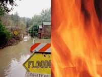
Drought, Fire, Flooding, and El Nino News for High Sierra Backpackers.

Liar, liar, Earth
on Fire!

NEXT
Massive Snow

All Snow Data

All River Reports

Latest
Drought and Flood Data

Fires first,
Floods next?
LATEST EL NINO INFO


ALL El Nino
Weather Reporting
and
Analyses
INFORMATION


NORTH
HIGH SIERRA BACKPACKING

Backpacking Trip Ideas

"SECTION HIKING"
the
North Sierra Nevada
on the
PCT
and/or TYT
&
Alternative Routes

BELOW


THE NORTH SIERRA

Two Routes
from
Lake Tahoe
to
Tuolumne Meadows


The Pacific Crest Trail
and

The Tahoe to Yosemite Trail
BY
SECTIONS

East Sierra Flank
The Pacific Crest Trail

1
Starting

TYT & PCT
West Lake Tahoe Basin


28.71 miles

Across
Desolation Wilderness

BIG
Desolation Wilderness
MAP

Meeks Bay
to

Echo Lake
+
(2 miles to Echo Summit)

PCT & TYT
UNIFIED

28.71 miles

Notes
Hike 11 miles SW to PCT from Meeks Bay to follow unified PCT-TYT trail South through the heart of Desolation Wilderness.


West Shore trailheads between Meeks, South to Fallen Leaf Lake, creates lots of short sweet backpacking trips out of either Meeks Bay or Echo Lakes.
Busiest Wilderness in America.

Highway 89 Trailhead to Highway 50.


3E
Pacific Crest Trail


27.88 miles

Backpacking
East
Mokelumne Wilderness

BIG
Mokelumne Wilderness
MAP

Carson Pass
to
Ebbetts Pass

PCT

Eastern
Mokelumne Wilderness

27.88 miles

Notes
At Carson Pass the PCT and TYT split, with the PCT following the East flank of the Sierra Nevada South.


We have one trail connecting the PCT and TYT South of the trail to Summit City Creek from Forestdale Divide (South of Carson Pass), South to Ebbetts Pass.

But the trail from Blue Lakes to Summit City Creek does not offer a substantially different route connecting the PCT to the TYT than the trail from Forestdale Divide.

Highway 88 Trailhead to Highway 4.


4E
Pacific Crest Trail

29.44 miles

Backpacking
East
Carson Iceberg Wilderness

BIG
Carson Iceberg Wilderness
MAP

Ebbetts Pass
to
Sonora Pass

PCT

Eastern
Carson Iceberg Wilderness

29.44 miles

Notes
The PCT remains (mostly) on the East flank, above or along the stunning terrain of the East Carson River for a significant length of this section.


The PCT and TYT routes are connected by four trails across the Carson Iceberg.

This creates optimal conditions for great hiking loops around the Carson Iceberg Wilderness.

Highway 4 Trailhead to Highway 108.


5E
Pacific Crest Trail


19.22 miles

Backpacking
East
Emigrant Wilderness

BIG
Emigrant Wilderness
MAP

Sonora Pass
to
South Bond Pass
Trail Junction

PCT

Eastern Boundary
of
Emigrant Wilderness

19.22 miles

Notes
Though we stay on the Eastern Sierra Flank, our trip options really open up in the High Emigrant Wilderness.

Highway 108


West Sierra Flank
The Tahoe to
Yosemite Trail

2
Backpacking
TYT & PCT
Southwest Lake Tahoe Basin

12 miles

Across
Meiss Country

Meiss Country Roadless Area

Echo Summit
to

Carson Pass

BIG
Meiss Country
MAP

PCT & TYT
UNIFIED

PCT & TYT
SPLIT AT CARSON GAP

12 miles

Notes
TYT and PCT remain unified across MCRA until we exit the Lake Tahoe Basin.


For local hikers, trailheads ring this small triangular area located in the SW corner of the Tahoe Basin.

Trailheads
on
Highways 50, 89, and 88.


3W
Tahoe
to Yosemite Trail

21.15 miles

Backpacking
West
Mokelumne Wilderness

Carson Gap
to
Lake Alpine

TYT

BIG
Mokelumne Wilderness
MAP

Western
Mokelumne Wilderness

21.15 miles

Notes
The TYT swings into the remote West Sierra Flank and across a lengthy section of unmaintained trail.

No optional trails run around this rough section of the TYT, short of hiking the PCT route.

No trails connect the PCT and TYT South of the Summit City Creek trail junction below Fourth of July Lake.

Crosses
Highway 88 W of Carson Pass
to Highway 4.


4W
Tahoe to Yosemite Trail

34.28 miles

Backpacking
West
Carson Iceberg Wilderness

Lake Alpine
to
Saint Marys Pass

TYT

BIG
Carson Iceberg Wilderness
MAP

Western
Carson Iceberg Wilderness

34.28 miles

Notes
The TYT traces its way across West flank canyons, climbing through another lengthy unmaintained section of trail approaching Saint Marys Pass.

We have many trail options bringing us up to the PCT to hike around this unmaintained section of the TYT.

Highway 4 Trailhead to Highway 108.


5W
Tahoe to Yosemite Trail

16.91 miles

Backpacking
West
Emigrant Wilderness

Kennedy Meadows
Pack Station

to the
South Bond Pass
Trail Junction

TYT

BIG
Emigrant Wilderness
MAP

Northwestern
Emigrant Wilderness

16.91 miles

Notes
Hiking up West Flank to hub of trails at Grizzly Peak opens up trails in all directions.

Yosemite to SE, great granite canyons of Emigrant rolling to our SW, KM back to the NW, Sonora Pass directly to our North, and the West Walker in the Toiyabe to our NE. Wow.

Highway 108


North Yosemite Backcountry

6
Backpacking
TYT & PCT

PCT & TYT
rejoin
in
Jack Main Canyon

North Yosemite Backcountry


South Bond Pass
Trail Junction
to
Tuolumne Meadows

The Last Leg

54.58 miles
to
Tuolumne Meadows

We get to the South Bond Pass trail junction either via the PCT or TYT South from Highway 108.

The PCT
19.22 miles, South from Sonora Pass. See above Right.

The TYT
16.91 miles, South from Kennedy Meadows Pack Station. See above-right, but not as far above.


Notes
The PCT finally crosses onto the Western Flank of the Sierra by crossing Dorothy Lake Pass into the top of Jack Main Canyon.
A short ways down-canyon it joins the TYT at the SOUTH BOND PASS TRAIL JUNCTION for the remainder of the hike to Tuolumne Meadows, with the short exception of the TYT route's last variation around Tilden Lake.

Our PCT route will stay on the West Flank of the Sierra down to and past where we join the JMT South of Tuolumne Meadows.

Our combined PCT-JMT route crosses over to the East Flank hiking Southbound out of the South end of Yosemite through Donohue Pass.

Highways 108, 395, and 120


Highway 108
to
Tuolumne Meadows
PCT and TYT

Note the complete distance hiking from Sonora Pass to Tuolumne Meadows along the PCT is
73.8 miles

Backpacking from Kennedy Meadows to Tuolumne Meadows along the TYT is
71.49 miles.

The real difference between these two trails is that the PCT route begins along the Sierra Crestline while the TYT route climbs up to the Sierra Crest from down-low on the Western Flank out of Kennedy Meadows Pack Station.

After following very different routes from Highway 108 both of our Southbound trails merge in the Top of Jack Main Canyon entering the North Yosemite Backcountry, independent of which trail we started South on.

Highways 108, 395, and 120


More information Coming Soon
As soon as I build more trail guide !!

Top

NOTE

We can hike individual sections of the TYT and PCT as defined above. We can "easily" tie these routes together into nice loops around the Tahoe Basin, the Carson Iceberg, Emigrant, and North Yosemite Wilderness Areas.

We can bust-out some long trips staying within a Wilderness Area.


High Sierra Backpacking
VIDEOS
VIDEO RESOURCES

for the
NORTH SIERRA

Videos Supplement the Trail Guide

Video Playlists
Meeks Bay to Pacific Crest Trail
Desolation Wilderness


Pacific Crest Trail to Echo Lake
PCT & TYT Desolation Wilderness


Echo Summit to Carson Gap
PCT & TYT Meiss Country Roadless Area


Carson Gap to Lake Alpine
TYT Mokelumne Wilderness


Carson Pass to Ebbetts Pass
PCT Mokelumne Wilderness


New!
Check out the Tahoe to Whitney

2020 High Sierra
Backpacking Calendar

2019 High Sierra
Backpacking Calendar

2018 High Sierra
Backpacking Calendar

2017 High Sierra
Backpacking Calendar

2016 High Sierra
Backpacking Calendar

2015
Calendar
2014
Calendar

See the complete collection of North Sierra videos through the link below.

Tahoe to Whitney
on
Youtube

I've hundreds of South Sierra Videos yet to come, after I finish editing the North Sierra guide. Then I'll begin building the guide South to Mount Whitney!

The videos are made to compliment the guide.

The first time I hiked South to the Whitney Portal was in 1998. I started shooting digital during 2009.

Honestly, I can't wait to begin the guide South from Tuolumne Meadows! I've shot hundreds of hours of film, and thousands of photos, and written endless notes and journals.


Video Playlists
Lake Alpine to Saint Marys Pass
TYT Carson Iceberg Wilderness


Ebbetts Pass to Sonora Pass
PCT Carson Iceberg Wilderness


Kennedy Meadows to Bond Pass
TYT Carson Iceberg Wilderness


Sonora Pass to Dorothy Lake Pass
PCT Carson Iceberg Wilderness


Jack Main Canyon to Tuolumne Meadows
TYT &PCT Carson Iceberg Wilderness

Top

Seasonal Notes


All Sierra Weather
Forecasts, Satellites, Radar, snowpack,
real-time temps.


December
2015

Planning

Looking for substantial gaps between projected storms.


Trans-Sierra Highways
ALERT
Winter Storm Conditions!

Yosemite Roads
Tioga and Glacier Point Roads
Tioga Closed-Glacier Closed

Yosemite Road Status

LAST YEAR
Highway 4 Ebbetts Pass
OPEN April 17 2015
Closed for Storm May 19.
CLOSED Dec 2015

Highway 108 Sonora Pass
Open April 17 2015
Closing with Storm Activity,
May 19.
CLOSED Dec 2015

CURRENT INFORMATION
Tahoe Basin Highways

Central Sierra Highways

2015
Questions and Answers
LOOK QUITE GRIM
EXTREME DROUGHT CONDITIONS


March 2015
Update

PERMIT RESTRICTIONS

YOSEMITE
DONOHUE PASS JMT EXIT QUOTAS

BRIDGEPORT RANGER DISTRICT
Hoover Wilderness

NO PERMITS ISSUED
OVER
DONOHUE PASS


2017

FIRE REPORTS

National Fire Outlook

CalFire Incidents

INCIWEB

Today huge chunks of forest and habitat used by nature and man are at risk and much already burned. Much econ damage to North Sierra folks who rely on Summer backpackers-visitors as well as threatening their homes and animals.


High Sierra Backpacking Forums

TahoetoWhitney.ORG

A Vortex of Backpacking Experience and Knowledge

Why Join?
To Share your Knowledge, Insight, and Love of the High Sierra Nevada Mountains

Members
Love you guys... Only Members can view Members Profiles and Post...

Information, Insight, Wilderness Delights, and Intelligence
Engaged with Nature and Man


Yesterday is Tomorrow
But it's you on the trail!

2016
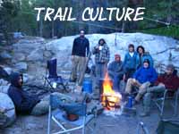
Trail Culture Sample

2013
Trail Culture
&
PCT Hiker Sample

(2010 report)

Tahoe to Yosemite
Trail Conditions
Summit City Creek

Saint Marys Pass


The Two Main
LATE 2015
Stories-Questions
ANSWERED
Dec 5

How will El Nino hit us? How much Winter Snow will pile onto the ample Fall base?

How will early-season weather and temp conditions progressing into Spring Conditions along the High Trails between Lake Tahoe and Mount Whitney evolve during early 2014?


ANSWER
We are Watching.

Second, and related to the above question, is "when can PCTers expect to depart Mexico to arrive at the South Sierra with open trails?"


ANSWER
Last season we had one of the earliest openings of High Sierra Trails ever.

I believe the highest percentage of PCT hikers ever had the chances complete it. I don't know the date, but average PCT hikers hit the South Sierra during mid May and expected to pass the South Sierra.
INCREDIBLE!

That is not looking even remotely possible during 2016.

As Spring progress we will monitor evolving weather conditions to answer these questions.


2015 ANSWER
Never have I seen such early and dry conditions.


2016
Spring and Summer
Water and High Sierra Trail Opening
Questions and Answers
LOOK QUITE GRIM in DECEMBER.

Looks like a heavy snow year is lining up. This will delay PCT hikers.


All Sierra Weather
Forecasts, Satellites, Radar, snowpack,
real-time temps.


2019
Fall to Winter

2018
Issues and Situation

Spring of 2019

2018
Issues and Situation

Spring of 2018

WINTER of 2018

Approaching the Winter of 2018


2017
Issues and Situation

Summer
Heat & Fire with Snow on the Crest

Winter
Biggest Snowpack in History?
Longest Persistant Summer Snow?


2016
Issues and Situation

Slightly Below Average Winter Snowpack


April 17 2015

-- Freak Weather, Freak Weather around the World --

We just experienced a drought Winter during the biggest El Nino in human memory, and it barely left an average snowpack on the Sierra.


2015
Issues and Situation

March 25 2015

-- Screaming Drought, Freak Weather, Freak Weather around the World --

Earliest opening of Sierra Crest Trails in human and geological history is forming up.
Having a "fire escape plan" for this year's High Sierra backpacking will be a wise forethought this year.


March 2015
We Need a New Environmentalism

"It is later than you think."

The Situation has gone too far to maintain the status-quo lies...

THE AGE OF CHEATERS

Impending Ecological Disaster of Historical Proportions
Current weather conditions, any reasonable observations, and new research indicates we on the West Coast of the US are facing expanding drought and fire conditions unprecedented in the human and natural historical records. Extreme weather is tormenting the whole country, and the whole world.

I am curious about what we are going to do with the vast population our "leaders" have so wisely stuffed/snuck into the Southwest-West Coast of the US, when we run out of water?

You have any ideas?

I know why it happened.

THE AGE OF CHEATERS

Environmentally, our greedy motivations created a program of endless irresponsible growth that has severely damaged the web of life in California, the US, and around the world.
Specifically, the rapid swelling of our population matched with spreading our irresponsible industrial growth program around the world ("globalism"-moving our dirty manufacturing to China) has transformed seasonal weather patterns in the North Pacific and around the whole world.

In our part of the world our trans-Pacific policy, our bad behavior, has dispelled the North Pacific weather pattern that traditionally fed the Sierra snow pack every Winter.
The weather pattern feeding the Sierra snow pack is gone. Our traditional Winter weather pattern out of the Northwest has slowly faded away over the last 40 years to be replaced by weaker Winter weather patterns out of the West and Southwest Pacific.
This is a serious problem.

California will not support its current very irresponsible level of population without the weather supporting the annual Sierra Snow Pack each Winter. Period.

I know how it happened.

Our corporate program of endless growth powered by endless greedy self-interest perpetuated through institutionalized political bribery and widespread cheating, of people putting themselves above our laws, has succeeded in sweeping away the political and social values necessary to maintain our democracy, our security, and our environment against greed and self-interest.
That's a mouthful.
We lost the battle between our mutual democratic rights and social liberties against the profits of the greedy and powerful, and the self-gratifications of power-seekers. We lost the battle between democratic ethics and the base desire to get rich, to dominate, to consume, and use that collected power to rule over other folks.
Some folks have stolen and cheated themselves to a "better life."

We are in the situation we are in because the cheaters have won, making greed and the lust for power the ascendant motivations tying the players in our polity together.

That's quite unexceptional...

We replaced our exceptional political values with greed, redefining the meaning of "exceptional" along the way.
The Desires of Consumerism have replaced the Ethics of Citizenship as our nation's qualification for citizenship, with greed becoming the operational, "value system," motivating and justifying the crimes of our political, economic, and social, "leaders," and their millions of, "followers."

The fates of man and nature are doomed as long as greed rules our hearts, minds, and politics. If we cannot clean up this central quagmire of corruption to make our democratic values operational we will not preserve the last remnants of our traditional ecology.

The greed-based political policies of endless irresponsible growth have stripped our country's social, human, and natural resources naked, pushing more wealth and political power to the smallest number of people at the very top of our society than any time in all of human history.

"Mission Accomplished," or "That's not Right?"

Personally, I am very angry about the corruptions and greed that have powered and allowed this massive irresponsible growth and associated transfer of wealth and power to continue. This "feeding frenzy" of greed will not end well environmentally, economically, or socially.

A recognizable set of corrupt behaviors have fueled a shift in power and wealth over the past forty years that have ravaged the social, political, and environmental infrastructures in the State of California, across our whole country, and around the world.

Allow me to clarify and contrast some basic principals of being an American against these behaviors.

END
THE AGE OF CHEATERS

Shared greed and corruption are not American Constitutional Principals, and they do not produce ethical bonds or practices between politicians and their bribers. They produce conspiracies between political criminals.

Bribery is not democracy.

Money is not free speech.

Breaking our laws and borders and putting yourself above the rule of our laws is not the basis of citizenship.

Imposing yourself and your values on others is not an American Right.

Cheating is wrong, no matter how well it serves your self-interest, or makes your "dreams" come true.

The dreams of cheaters are a nightmare for everyone else.


A NATION
OF
CHEATERS

Many claim the above behaviors are "American" rights!
Barry Bonds, Lance Armstrong, Mexicans, Bush, Obama, and their political parties come instantly to mind when considering those who's cheating has put themselves above our laws, rules, and political values as a matter of professional practice.

We have become a nation of cheaters, ruled by cheaters, fueled by cheaters, and this cheating must end to save our environment, let alone our democracy, and our country!

None of these corrupt practices are compatible with citizens running a self-regulating American democracy. They are compatible with American Corporate Fascism ruling over fat greedy "consumers."
Our current practices are antithetical to our Constitutional values or to creating or maintaining healthy social or natural environments to raise children in, let alone to maintain our democratic republic.

Unless you want fatter, stupider, greedier children...

How can your children not be cheaters, when raised in a society based on cheating?

We have in fact already lost our democratic republic and our Constitutional rights. We are now consumers in a corporate state, not citizens in a democratic republic. We live in, and serve a system of greed. And as a result we are losing the last remnants of our traditional weather patterns around the world.

"Si Se Puede?"

Really? You want to cheat to join an empire that's that you helped set on fire? Really?

Strange times, when the rats are jumping onto the burning ship of state...haha

Nonetheless, we can stop the cheaters at the top and at the bottom of society who've joined forces to rob our country of its political, economic, and environmental wealth.

GREED IS NOT GOOD.
Unless you are supporting the American legacy of irresponsible growth via cheating powered by greed that has driven the destruction of our democracy and our environment in the first place.

CORPORATE FASCISM
There are a lot of American Fascists and foreigners who put their own material wealth, their own self-interest, and imposing their own values on others before their duty to defend our shared political principals, practices, and process.

They ARE NOT Americans. It's that simple.

That would be the dark side of American history and the American personality. This genocidal force of mass greed must be subjugated to, and restrained by our "Higher Angels," our eternal mutual democratic values as specifically defined in our Constitution. It's that simple.

The Mantra of Death
Personally, I reject the mantra of endless greed, endless growth, and endless profits that our corporate fascist leaders have deluded and drained America with, and I reject those who pursue greed. I choose the Constitutional values of our democratic republic as the basis of our social and political relationship, not shared greed. I choose balance over growth.

I reject the Corporate Growth Machine of Death.

We the people are empowered to regulate wealth, political power, markets, and immigration,
not they regulating and abusing us citizens, as is happening today.

BACK to the FUTURE
If we want to save the last bits of our environmental and political legacies we've got to get back to our own honest standards, and cast these greedy cheaters and their corrupt practices aside.

If we don't stop the greed and corruption, if we don't stop the cheaters who have corrupted our government and driven this irresponsible growth and destruction, nature will. Nature is.

FASTER than SCIENCE
Nature is now undergoing powerful changes in direct response to our irresponsible growth of the last forty years that are moving more rapidly than science can track, to stop our corrupt practices in their tracks!

On a Biblical Scale.

Watch and Learn.

Karma is a bitch when you are bad, and we have been very bad, by our own Constitutional and ethical standards, let alone by any spiritual or secular interpretations of ethical behavior.

Nature is coming for us, and IT is not happy.

The need for a New "American" Environmentalism that actually recognizes the sources of these damages and addresses their true causes is profound.

We must
" un-do it."

Status-Quo
of
EVIL
The political status-quo of bribery, corruption, and cheating fueled by greed is insufficient for the scale of the ecological, economic, and political crisis we face.
Our favorite backpacking spots in the Sierra are being both slowly and quickly changed by the double-edged sword of massive population growth driving one blade of this sword, and the changing character of the seasons driving the other blade.

The remaining forests of California have suffered gradually under drying conditions sufficiently long to now assure their rapid transformation through fire. Drier species will fill the burned areas, rapidly transforming the character of the Sierra.
The disastrous trajectory we are on will not be altered unless we as a people take up a new vision of renewed political relationships, curb the greedy, and pull in the reins on endless growth that feeds their evil scam.

THE
WAY FORWARD
Wealth and power determines outcomes in government, not democracy. Thus effective environmentalism requires political bribery be outlawed, or at least be driven out of the center of politics. It demands a real democratic playing field be reinstated.

Restoring democracy is the only way to disempower our growth-based corporate-bribed political "leadership." Alternatives to their failed growth policies are doomed to fail within the current political processes dominated by corporate bribery and corruption.

The status-quo killed our goose, and continues to cook it.

The political corruptions of our past that brought us to our current disastrous situation and the cheaters who did it must be politically neutralized and harshly punished to preserve any future for our country, our planet, let along the fragile nature of the Sierra Nevada's unique sub-alpine environment.
We must "un-rig" politics to save the environment, and ourselves.

NO cheaters!

Edited
Dec 2, 2019

January 2015
ZERO RAINFALL
The critical issue is the serious persisting drought conditions. Nature is cooking us up a disastrous Spring and Summer for life on the West Coast.

Again, conditions are looking like they could again develop into historical early openings of the High Sierra roads and trails. I figure the Sierra will be burning by July, so watch the fire reports...

My personal situation is embroiled deep in injury recovery and editing up the completed North Sierra parts of the Tahoe to Whitney Guide.
I've got to bring the finished Lake Tahoe to Tuolumne Meadows part of the guide from draft to finished form.

So I'm turned mostly inward, even as our modern Rome burns ever so slowly around us.

I believe the seasonal reports from recent years are informative as to the hot and dry trajectory our future weather holds in store for us.


2015 High Sierra Snow Backpackers & Skiers:
You're Screwed --&-- No Snow in the Sierra

A little bit of High Sierra Backpacking Heaven on the Web

Top

HIGH SIERRA BACKPACKING
FEATURES

VIDEOS
of
Information

Tahoe to Whitney

Backpacking Videos

Currently there are 159 videos supplementing the trail guide arranged in 8 playlists covering each completed section of the trail guide.

Latest
Backpacking Video


North Yosemite Backcountry: Into Kerrick Canyon

Playlists

Tahoe to Whitney
trail sections
by Video

All Backpacking Videos


Seasonal Information

2013 Report


TRAIL
Logistics
Five Day Food Supply Trip Planning Considerations

High Sierra
Backpacker Resupply Spots

GALLERY
of
Inspiration

DAVID MAXIMTahoe to Whitney is proud to feature
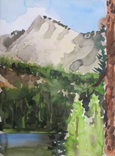
David Maxim High Sierra WatercolorsDinkey Lakes High Sierra Watercolor by David Maxim.David's works capture the both the spirit of the Sierra and its hikers.

David Maxim Backpacker                David Maxim Artist

GEAR
Innovation

Camp Comfort
Water System Innovation
TW Members George and Sue evolved the efficient jug water system into a new role as a fine camp shower. Backpacking water system with shower.
G & S have brought me to a new level of Sanitation and Luxury on the Trail.

Check out the Video

HIGH SIERRA BACKPACKING

FEATURES

Our Nature Loving Friends

Music to our Ears Tahoe to Whitney Backpacking Music Created, Performed and Produced
by
Steve Scheppers

Need some Fine Tunes to chill you out?Need some Sounds for your media work? I rely on Steve for both !

Steve Scheppers
on
Sound Cloud

and check out

Steve's
YouTube
Channel

Listen to Steve's
New Album
on Myspace

Analytical Survival

Analytical Survival

Building your capacity to be a self-contained individual across time and space is the point of this backpacking website. Analytical Survival takes this a step further, and demonstrates how to be a self-contained individual in control of time and space.

Analytical Survival's approach translates your backpacking gear and skills into an emergency setup within a framework of intelligent emergency planning and preparation.

Lake Tahoe to Mount Whitney

Your Guide to the Pacific Crest, Tahoe to Yosemite, and John Muir Trails across the High Sierra Nevada Mountains

Top