The Trails
Guide
Maps
Miles/Ele
Permits
Resupply
Forum
Current Weather Conditions
Weather Notes
Northern High Sierras
Central High Sierras
Southern High Sierras
Gear
Gear List
Gettin Started
Layering
Discussion
Testing yourself and your gear
Gear Reviews
Lake Tahoe Basin
Hiking and Backpacking
Three
Classic High Sierra Trailheads in the Tahoe Basin
Trail Arts
The art of walking
Physical Preperation
Trail Skills
The trail
Off the trail
Scrambling
Maps
Navigation
Camp skills
Food
Resupply
Food
Other
Photo Catagories
Trail Stories
Trail Culture
News and Science
Links
Groups
Books
| Lake Tahoe to Lake Alpine maps index |
Lake Tahoe to Lake Alpine trail guide index |
Tahoe to Whitney maps index |
Three Excellent Lake Tahoe Trailheads
(according to me)
Meeks Bay Trailhead Trail Guide Big Topo Map Detailed Add your Experiences |
Echo Summit Trailhead Trail Guide Big Top Map Detailed Add your Experiences |
Meyers Trailhead Trail Guide Big Top Map Detailed Add your Experiences |
| Also See Lake Tahoe Resources Road Map |
||
The
|
Local Trailheads-Long Trails Starting from any of these three, or your own favorite local trailhead makes little difference to the long distance backpacker. No matter where you start your Southbound long-distance backpacking trip from around Lake Tahoe your route will have to converge with both the Tahoe to Yosemite and Pacific Crest Trail routes before exiting the Tahoe Basin. Approaching Carson Pass the Tahoe Rim Trail turns Northeast into the Carson Range near Meiss Cabin. Hikers coming South from the Carson Range along the Eastern shore of Lake Tahoe will join up with the TYT-PCT routes South in Meiss Meadow to exit the Southern end of the Tahoe Basin. Turning South through Meiss Meadow to exit the South end of the Lake Tahoe Basin demands that we will very shortly decide which route we are going to hike South down to down Yosemite. This trail guide covers both the Tahoe to Yosemite and Pacific Crest Trail routes down to Tuolumne Meadows. I personally prefer the Tahoe to Yosemite Route South out of the Tahoe Basin. I've hiked the PCT route to Ebbetts Pass maybe four or five times, while I've hiked the TYT section more times than I can count on all my fingers and toes. So that's nineteen and a half. The Trailheads The classic Tahoe to Yosemite Trail begins in the Northern Desolation Wilderness at the Meeks Bay Trailhead. 11.5 miles South of Meeks Bay the TYT joins the Pacific Crest and Tahoe Rim Trails to hike 17.21 miles South down the middle of the Desolation Wilderness to Lower Echo Lake. This is a very pretty hike. Two miles South of Lower Echo Lake we pass through the Echo Summit Traihead, our second trailhead, being our gateway South into the Meiss Country Roadless Area. All three of these "named" trails, the TYT, PCT, and TRT are still sharing the same route South into the Meiss Country. A roadless area is not quite a wilderness, but exercises a higher degree of restrictions on use than typical National Forest Lands. Freeking bikes are allowed in the parts of the Roadless Area below the line of the TYT and PCT. This is the best map of the Meiss Country Roadless Area I've yet seen:
Our third trailhead is located at the top of the South Upper Truckee Road in Meyers, nestled in the Southwest corner of the Tahoe Basin. Like the Echo Summit Trailhead, the Meyers trailhead brings us into the Meiss Country Roadless Area, but from the Tahoe Basin rather than along the Tahoe Rim. This South Upper Truckee and the nearby Big Meadow Trailhead give us access to the main TYT-PCT route at Meiss Cabin. This is the route you will hike to hook up with the Southbound PCT-TYT if you are hiking South from trails along the Carson Range. |
The Range of this Trail Guide The reason that this trail guide backpacks South from Lake Tahoe is that Lake Tahoe is the Northern Bookend of the High Sierra Nevada Range. The High Sierra Mountain Range increases in altitude South of Lake Tahoe, and decreases in altitude North of Lake Tahoe. The Prime High Sierra Backpacking Zone begins in the Lake Tahoe Basin and continues South for over 400 miles of increasingly high elevation travel down to Mount Whitney, the highest mountain in the Continental United States. We are backpacking South along the classic High Sierra Backpacking Trails down to Mount Whitney, the Southern Bookend of the High Sierra Backpacker. This trail guide ends when we exit the Whitney Portal. Your Range But you do not have to bite off such a big chunk of the High Sierra Backpacking Trails all at once. There are many fine short-to-medium distance Southbound backpacking trips that you can craft from each of these 3 trailheads. Consider backpacking to the Carson Pass. If you start from the South Upper Truckee trailhead, the distance to the Carson Pass is 9 miles. If you begin from Echo Summit, the distance to the Carson Pass is 12 miles. If you start from Meeks Bay, the distance to the Carson Pass is 42.71 miles. It appears to me that a beginning backpacker can view these three trailheads as great classrooms where long distance backpacking skills and fitness can be developed over longer and longer backpacking trips deeper and higher into Sierra Nevada Mountain trails. |
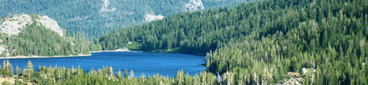
The Beauties of the Lake Tahoe Basin These three trailheads are my favorites because each reveals a specific character of the Tahoe Basin. The Meeks Bay trailhead is the beginning of the Classic Tahoe to Yosemite Trail. This route brings you though the granite beauties of Desolation Wilderness before depositing you at Echo Lake. Desolation offers excellent intermediate difficulty terrain, and also offers a fine selection of short backpacking trips and loops within the Wilderness itself. The drawback to the Desolation Wilderness is its lack of Desolation, especially during mid-Summer. This place is busy. The Echo Summit trail head is on the Pacific Crest Trail two miles South of Echo Lake on Highway 50. Here your Southbound backpacking trip begins in the chaotic terrain along the Southwestern edge of the Tahoe Basin, passing through forest and rock deeply carved by the steep drainages feeding the South Upper Truckee River. This is quite different terrain than the granites of Desolation Wilderness. You will work through a fine roller coaster ride through this rough terrain to Showers Lake. From Showers Lake the terrain moderates as you head South towards the Carson Gap. The Echo Summit Trail head offers easy access for autos, being situated right on Highway 50, which is the main route into South Lake Tahoe. The South Upper Truckee trail head is situated in the Tahoe Basin in the little town of Meyers. The trailhead is located where the South Upper Truckee River flattens out as comes out of the mountains. The trail follows a short but steep tributary of the South Upper Truckee River up through the deeply forested Christmas Valley to connect with the combined Tahoe to Yosemite and Pacific Crest Trails at the Meiss Cabin. This is the quietist trail head of all, as it is mostly used by locals. Its complimentary trailhead is the Big Meadow Trailhead located on Highway 89 just South of Meyers and North of Luther Pass. In recent year the South Upper Truckee Trail has become uber-popular with mountain bikers, resulting in damage to the trail serious enough to spark a major rerouting of the trail. |
The Big Picture is made up of all of these Small Bits combinedThe Meeks Bay trail head puts the backpacker a total of 181 miles from Tuolumne Meadows in Yosemite. The Echo Summit trailhead counts out at 150 miles to TM, while the South Upper Truckee trail head measures 147 miles to Tuolumne Meadows. Whichever trailhead you choose to explore, I suggest you make it "additive." If you are fit and strong, start with the 31 mile trip from Meeks Bay to Echo Summit. If you are less experienced or less prepared, the Southbound backpacking trip from Echo Summit to Showers Lake covers 6.8 miles. From Showers Lake you can either return to Echo Summit, continue 5.2 miles South to the Carson Pass, or chart a crafty loop: Echo Summit to Showers Lake for the first day, then South on the Pacific Crest Trail to the Round Lake junction in Meiss Meadow, where you turn left onto the Round Lake trail to spend a beautiful second night camped by Round Lake. From Round Lake you drop down to, and through, the South Upper Truckee Road. From the trail head you hike South for a few feet to the Hawley Grade trail head to climb that short but steep monster back up to the Echo Summit trailhead where you started. Nice. In any case, these three trailhead options are the best bets for experienced long-distance backpackers heading South from Lake Tahoe to Ebbetts Pass, to the Sonora Pass, to Yosemite or even all the way down to Mount Whitney. For less experienced backpackers, or backpackers with much less time on their hands, these trails offer the easiest access to High Sierra backpacking where you can consolidate and expand, or just exercise, your backcountry experience and strength. The map at the top of the page locates these trailheads' road access points |
Trail head MapsMeeks Bay trail head region Echo Summit trail head region |
Trail heads: Trail guideMeeks Bay trail head Echo Summit trail head South Upper Truckee Road trail head |
Lake Tahoe to Mount Whitney Maps Index Lake Tahoe to Mount Whitney Trail Guide Index |
Lake Tahoe to Mount Whitney
Your guide to the Sierra Crest, including the Tahoe to Yosemite Trail, the Pacific Crest Trail and the John Muir Trail