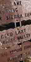

Trail junction and mileages at Yosemite trail junction. Lake Tahoe to Mount Whitney: Your Backpacking Guide to the High Sierras Unmaintained trail East over Sawmill Pass.
South Sierra Nevada Backpacking Maps Index banner.


The Trails

Guide
Maps
Miles/Ele
Permits
Resupply
Forum


Current Weather Conditions

Weather Notes
Northern High Sierras
Central High Sierras
Southern High Sierras
 

Gear

Gear List
Gettin Started
Layering
Discussion
 
Testing yourself and your gear
 
Gear Reviews

top of page

Reds Meadow to Vermilion Valley

Backpacking Maps Index

Pacific Crest Trail and John Muir Trail Backpacking Maps


Languages

Translate


Trail Arts

The art of walking
 
Physical Preperation


Trail Skills

The trail
Off the trail
Scrambling
Maps
Navigation
Camp skills
 

Food

Resupply
Food


Other

Photo Catagories
 
Trail Stories
 
Trail Culture
 
News and Science
 
Links
 
Groups
 
Books
 

top of page

MAP INDEX
NORTH

Tuolumne
Meadows
to
Reds
Meadow

MAP INDEX
SOUTH

Vermilion
Valley
to
Muir
Ranch

REGION
MAP

Ansel
Adams
into
John Muir
Wilderness

ALL
MAPS
INDEX

Tahoe
to
Whitney
MAPS

GUIDE
INDEX
NORTH

Tuolumne Meadows
to
Reds Meadow

GUIDE
INDEX

Reds
Meadow
to
Vermilion
Valley
Resort

GUIDE
INDEX
SOUTH

Vermilion
Valley
to
Muir
Ranch

ALL
GUIDE
INDEX

Lake
Tahoe
to
Whitney
Portal

MILES
ELEVATIONS
NORTH

Tuolumne
Meadows
to
Reds
Meadow

MILES
ELEVATIONS
SOUTH

Vermilion
Valley
to
Muir
Ranch

ALL
MILES
INDEX

Trail Section
Reds Meadow to Vermilion Valley Resort

The John Muir Trail

NOTE

Highway 120 to Highway 120
XX.XX miles

Topo Hiking Maps for
The John Muir Trail

Reds Meadow to Vermilion Valley

7.5 minute
backpacking maps

1:24 000


Donohue Pass to Reds Meadow


Reds Meadow to Vermilion Valley


30 minute
backpacking maps

1:100 000


Central Yosemite and North Ansel Adams Wilderness


Donohue Pass to Fish Valley


Reds Meadow to Vermilion Valley Resort

> Forum <

ROUTE OPTIONS NOTE

North Maps: Tuolumne Meadows to Reds Meadow                                    South Maps: Vermilion Valley to Muir Ranch

Backpacking Map
Assets


Backpacking Map Information and Instruction

USGS Map Information USGS Map Symbols

Online and Trail
Backpacking Maps
Decimal-Degree
Conversion Tool

USGS MAP LOCATOR
Free USGS Maps for Downloading

Navigation Page Astronomical Information

Navigation Videos Map Tools Tutorials
(excellent map tools too)


top of page


Backpacker Forums

TahoetoWhitney.Org

TW ORG has Backpacker's Trail Forums covering the Sections and Segments of the long distance High Sierra Trails between Lake Tahoe and Mount Whitney, what we will need to hike them.
This includes topics of interest to backpackers everywhere:

High Sierra Trails High Sierra Topics

Here's a few of my favoirite topics:

Gear

Living Things

What you Need to Know

Unidentified Hikers can post up comments in all the Trails and Topics Forums.

Registered Members can post up their own pages in the forums.

Become a Member

Add your experiences, comments, questions, and information about our High Sierra backpacking map.
Members can write up their own pages about their favorite maps, tips and tools here:

Trail Topic
High Sierra Backpacking Maps Forum

Trailhead

Contact
Alex Wierbinski

top of page

Backpacking Lake Tahoe to Mount Whitney

Your guide to the High Sierra Crest, including the Tahoe to Yosemite, Pacific Crest, and John Muir Trails

© Lake Tahoe to Mount Whitney: Crown Jewel of the Pacific Crest Trail