Snowplant, below Round Lake, Meiss Roadless Country Lake Tahoe to Mount Whitney: Your Backpacking Guide to the High Sierras Sprouting Paper Plant
Iris in Shadow in the Carson Gap between the Lake Tahoe Basin and Carson Pass.
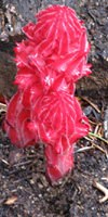
Snow plant
Iris in Sun and Shadow blooming in the Carson Gap between the Lake Tahoe Basin and Carson Pass.
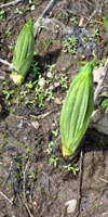
Paperplant


The Trails

Guide
Maps
Miles/Ele
Permits
Resupply
Forum


Current Weather Conditions

Weather Notes
Northern High Sierras
Central High Sierras
Southern High Sierras
 

Gear

Gear List
Gettin Started
Layering
Discussion
 
Testing yourself and your gear
 
Gear Reviews


top of page

Backpacking
through the
Carson Gap

Hiking South out of the Tahoe Basin through the Carson Gap on the Tahoe to Yosemite and Pacific Crest Trails


Languages

Languages


Trail Arts

The art of walking
Physical Preperation


Trail Skills

The trail
Off the trail
Scrambling
Maps
Navigation
Camp skills
 

Food

Resupply
Food


Other

Photo Catagories
Trail Stories
Trail Culture
News and Science
Links
Groups
Books


Terms and Conditions of Use

top of page

Trail Guide

INDEX
North
TYT-PCT

Carson Gap
Winter
South TYT

Trail
to
Woods
Lake
South
PCT


Carson Pass
Topo
Map

Meiss
Country
Topo Map
SOUTH


Carson
Pass
Region
Map

Maps Index
MILES
AND
ELEVATIONS
Miles
and
Elevations
INDEX
Lake Tahoe Basin Management Unit
PERMITS

Meiss
Country
PERMITS

High
Sierra
PERMITS

Local
Weather


All Sierra Weather
Tahoe
to
Whitney
on
YouTube

Approaching
Carson Gap from the North crossing Meiss Meadow
departing the
Lake Tahoe Basin

Meiss Meadow Getting Ready to BLOOM
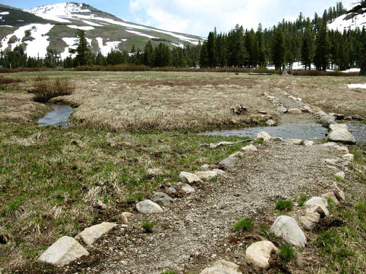
Approaching our Southbound exit from Meiss Meadow through the Carson Gap.

View Southeast
down the
Unified
Pacific Crest and Tahoe to Yosemite Trails

We're looking down the last bit of trail as we approach our Southbound exit from the Tahoe Basin through the Carson Gap. We're crossing Meiss Meadow with a length of the South Upper Truckee River at our feet. This high stream runs up the gully to the Carson Gap with our trail.

We're looking Southeast at the Southernmost point of the Lake Tahoe Basin.

Red Lake Peak rises in the Left, out of the frame of this view, but we can see its' subordinate Southwestern peak rising above the East side of the Carson Gap, the gap through which we will exit the Lake Tahoe Basin.

The final layers of Spring snow have finally melted into the meadow. The uncovered meadow first reveals the matted dead brown grasses of last year, crushed flat and turned brown under the heavy weight of the cold Winter snow.

The water and heat of the Spring Thaw first reveals the meadow, then begins surging subtle waves of muffled green hues through these vast fields of compressed dead grasses and barren brush.
The meadows and brush first respond to their freedom from snow with what appears as subtle green hues surging through the recently thawed landscape pictured above, to be shortly followed by a massive bursting forth of the power of life driven by the heat and moisture of the Spring Thaw. See the previous page for more images of the Power of Spring.

Hiking Map South
Meiss Country Roadless Area
Miles and Elevations
Echo Summit to Carson Pass

Comments-Questions

South
out of the
Lake Tahoe Basin

Which Way?
Passing South through the Carson Gap we Southbound hikers must decide between hiking The Pacific Crest Trail or the Tahoe to Yosemite Trail route on our way South to Tuolumne Meadows.

We can hike a Tahoe to Yosemite backpacking trip along the Pacific Crest or the Tahoe to Yosemite Trails down to Tuolumne Meadows, depending on our preferences and capabilities. But the TYT route stands alone as a unique hiking experience.

Just a few feet South through the Carson Gap we encounter the first and Northernmost of three possible routes to the Southwest up to Round Top Lake to get onto the Tahoe to Yosemite Trail route.

We find three trails up to Round Top Lake, but there's only one way down the South side of Round Top along the Tahoe to Yosemite Trail into Summit City Canyon.

We discuss the differences between the Tahoe to Yosemite and Pacific Crest trail routes below, and in the Trail Guide Index.

Northbound Backpackers
Coming through the Carson Gap Northbound Hikers once again find themselves hiking on a reunified Pacific Crest and Tahoe to Yosemite Trail route.
The PCT and TYT last split-up for Northbound backpackers at the top of Jack Main Canyon in Yosemite. There the TYT exited Yosemite to the Northwest through Bond Pass into Emigrant Wilderness, while the PCT route continued North into the Toiyabe National Forest through Dorothy Lake Pass.

Southbound Like Us
Southbound
hikers on the currently dividing PCT and TYT trail routes will again see these two trails rejoin at the top of Jack Main Canyon in Yosemite.

But, for roughly the next 75 miles the Tahoe to Yosemite and Pacific Crest Trails will take very different routes South down opposite sides of the Sierra Nevada until they do again rejoin entering the North Yosemite Backcountry at the top of Jack Main Canyon.

Hooray for the Difference
The basic difference between the TYT and PCT from the Carson Gap to Jack Main Canyon is that the PCT remains along the Sierra Crest and its East flank while the Southbound TYT makes two great sweeps down the Western flank of the Sierra, then back up to the Sierra Crest.

It gets even better.

TYT Challenges
The Tahoe to Yosemite route runs us through miles of challenging unmaintained trail route across difficult terrain across sections of both the Mokelumne and Carson Iceberg Wilderness.
We'll find ourselves following faint trailbed, then searching for ducks and blazes indicating the presence of the route, and finally encounter segments of the route with no sign of trail or blaze where we must rely on our basic route finding skills.
That's a darn cool trail, if we are ready for it.

PCT
The Pacific Crest Trail on the other hand, or more precisely, on the other side of the mountain, the PCT composes what can only be called The Superhighway of Trails, so well maintained, can we daresay heavily used, that it is observable by satellites orbiting the Earth from space, and glows bright enough in the dark during nighttime that flashlights only serve to dim our view of this magical Shining Path through and over these grand mountains.

The Other Route
These two routes have very different characters, each worthy of exploring on its own merits. The first time you hike from Carson Gap to the top of Jack Main Canyon take the route that interests or suits you the most, PCT or TYT. The second time you hike it, take the other route.

TYT+PCT=
Endless Backpacking Adventure
After hiking both routes we can start stitching together our favorite pieces of both trails, and exploring every side trail we can. At least across the Carson Iceberg and Emigrant Wilderness, where a web of trails interconnect the Tahoe to Yosemite and Pacific Crest Trail routes, unlike the upcoming Mokelumne Wilderness, where the TYT and PCT represent two distinctly separate routes.

Local and Long Distance
Once we've hiked either route through the three wilderness areas that lay between our position in the Carson Gap and our entrance into the Northwestern corner of Yosemite, we have gotten a pretty good view of half of each of these wilderness areas.

We can use the route we've explored across each of these subsequent wilderness as the basis of "grand tour" loops around each wilderness area.
If you hiked the TYT South across the Carson Iceberg Wilderness, its time to tie that Southbound TYT route up with the PCT route North across the Carson Iceberg, back to our starting trailhead, to create a massive backpacking loop around the Carson Iceberg Wilderness.
Check out the map. See what I'm saying about the many trails connecting the PCT and TYT routes?

Once we hike the long trails across the Sierra Nevada this is going to have shown us enough to get us back in for more.

Backpacking is addictive, if you approach it carefully.

Our long hike down the Sierra Nevada will reveal further routes to explore in each wilderness area, and bring us to so many places that are so beautiful we will be drawn back in for years of additional in-depth explorations.

INDEX
On this page

Directions


Miles and Elevations North & South: TYT and PCT


Video
Through the Carson Gap


Carson Gap Encounters

Trail Culture: Pepperoni and Harmony

Video
Bear & Idiot day Hiker


Carson Gap Iris


Carson Gap Pond


Video
Three ways to Round Top Lake


Butterflies


TYT Junctions

Upper Tahoe Yosemite Trail Junction

Lower Tahoe Yosemite Trail Junction


Carson Pass Weather Information

Point Forecast

NWS
Echo Summit
Point Forecast

NWS
Carson Pass
Point Forecast

Regional Forecasts

NWS Regional Forecast; Greater Lake Tahoe

NWS Regional Forecast: West Slope Sierra Tahoe to Yosemite

All South Lake Tahoe
Regional Weather Information

All Carson Pass
Regional Weather Information

All High Sierra Weather Resources

Real Time
Ground Reporting Stations

Lake Tahoe
Ground Stations

Carson Pass
Ground Stations

Carson Pass reporting station

Caples Lake Reporting Station

Schneiders reporting station

Forestdale Creek reporting station

Silver Lake Reporting Station

All Ground Reporting Stations

MesoWest N Calif Stations

Calif Snotel

Road Conditions

Caltrans Hwy 88

All Lake Tahoe Basin Highway Conditions

Big View
Radar

North California
Radar

Big View
Space

Western US-East Pacific
Satellite

All Weather
and
Fire Information

All High Sierra Weather Resources

Comprehensive High Sierra Fire and Smoke Information

Route South Options & Information

PCT vs TYT


TYT unmaintained trail section


Thoughts on the upcoming Trails

Backpacking is Dangerous


Next Resupply
Lake Alpine Lodge


South of Highway 4 Carson-Iceberg Wilderness


Sierra Nevada Administration and Permits


Short Trips: Carson Pass and Meiss Roadless Area

> Forum <

POST UP!

All backpackers can post text comments about the following segment of trail through the comments links on all the trail guide pages.

Registered Members can post up stand alone post about the trail with text, images, maps and videos in the Trails Forum that supplements this section of the Trail Guide.

Check out All the Tahoe to Whitney .org
Backpacking Trails and Topics forums.

comments

Views East
Hiking South
up to the
Carson Gap


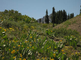
Paper Plant in full bloom heading up the North side of the Carson Gap.

Looking at Stevens Peak to the Northeast behind the stand of forest.

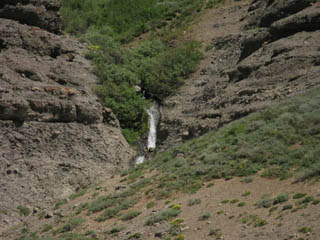
      Waterfall draining off the North side of Red Lake Peak in July, which bounds the Eastern Side of the Carson Gap. A high source of the South Upper Truckee River.  
  Young Paper Plants (ie, "Miner's Cabbage") Just listen to it in Fall!       Waterfall on the way to the Carson Gap  
Otherwise known as Mule Ears. The sound these plants make in Fall breezes sounds like rustling pager in an ancient library. Much of the Eastern Sierra is draped with, if not completely composed of, reddish-hued volcanic rock.  

The Carson Gap

The Carson Gap is the low gap (8800 ft) in the mountains ringing the Southernmost end of the Tahoe Basin. This gap is located at the low point along the Sierra Crestline between the West flank of Red Lake Peak and the ridgeline dropping off the Eastern side of the Little Round Top massif.

The Carson Gap is the lowest point between the peaks ringing Meiss Meadow. Meiss Meadow is the bottom of the South Upper Truckee River's headwaters bowl collecting water from the mountains wrapping around the Southern corner of the Tahoe Basin, and these mountains also mark out the Southern extent of the Tahoe Basin.
The South Upper Truckee drainage is large and complicated, beginning at Echo Pass and encompassing the totality of the Meiss Country Roadless Area all the way around the South end of the Tahoe Basin to the Big Meadow Trailhead on Highway 89.

On the South side of the Carson Gap the Eastern Sierra flank and its streams drain into the West Carson River while the Western Flank mountains channel their runoff into the Silver Fork of the American River.

Hiking Maps
South

Meiss Country Roadless Area

Carson Pass Hiking Map

In any case, the Carson Gap marks the Southbound backpackers departure from the Tahoe Basin and the uniquely beautiful variety of terrains that decorated our hike down the High Sierra mountains wrapping around the Western Shore of Lake Tahoe.

We will realize just how unique the Tahoe Basin is after we hike through a few more National Forests and Wilderness backpacking South. Though each is unique and beautiful, the Tahoe Basin puts together such a variety of physical and cultural terrains it stands out. Well, each area stands out on its own individual expression of beauty.

From the Carson Gap we exit the Tahoe Basin to continue our Southward trek along the Sierra Crest Line. The question is, South along which trail? The TYT or the PCT?

We must decide quickly. I hope you have already decided and planned and packed properly for your chosen route. Because a few yards down the South side of Carson Gap we will find the first of three trail junctions where the PCT and TYT routes part company near Carson Pass.

PCT vs TYT

From the Carson Gap the great Massif of Round Top and the Sisters dominates our Southern view. This piece of rock is also the dominant feature of our route decision. How we pass South of this feature determines our route.

PCT

The Pacific Crest Trail route turns Southeast hiking around the East side of Round Top to trace its Southbound route along the volcanic dominated Eastern flank of the High Sierra.

The Pacific Crest Trail route brings us 27 miles South of our position at the Carson Gap down to Ebbetts Pass on Highway 4.

See this topo hiking map which marks the location of the Carson Gap in relation to both the Tahoe to Yosemite and Pacific Crest Trails. Click the Colored dots along each route and be brought to the corresponding trail guide page for that location, where you can examine each location and both routes in detail.

TYT

Rather than hiking around Round Top the Tahoe to Yosemite Trail hikes up to Round Top Lake sitting nestled in a sweet flat just below The Sisters. Our TYT route rounds the Southwest flank of the Western Sister to set our general line of travel to the Southwest, towards Lake Alpine through the grand granite Western Flank of the Sierras. Lake Alpine is 26.28 trail miles South of our position here at the Carson Gap, situated about 15 road miles West of Ebbetts Pass down Highway 4.

Backpackers on the Tahoe to Yosemite route encounter the first of three possible trail junctions to the TY Trail just a few steps to the South of the Carson Gap. (see below) The second junction sits at the bottom of the South flank of the mountain below Carson Gap, (also below) while the third junction to the Tahoe to Yosemite Trail is through the Winnemucca Lake Junction a mile South of Carson Pass on the Pacific Crest Trail. Our first question is which of the three routes to the TYT should we hike?

The first two junctions to the TYT are unmarked trail junctions that lead us down well-trod trails to where they meet at the creek. From the creek below Carson Gap these trail join to lead us down to Highway 88 West of Carson Pass at an old trailhead.
We'll see a snow shed on the South side of Highway 88. and the dirt road that leading Southwest towards Woods Lake. Approaching Woods Lake we'll find the Central footbridge and Western Lost Cabin Mine Trails to Round Top Lake. The third trail junction is the well marked Winnemucca Lake trail junction located on the Pacific Crest Trail a mile South of Carson Pass. This route approaches Round Top from the East.

There are no trail junctions labeled "The Tahoe to Yosemite Trail" in the Carson Pass region, though there are three ways to get to the Western Flank of Round Top and The Sisters to follow the Tahoe to Yosemite route into the great granite valley holding Summit City Creek.

Carson Gap Forum Page

Comments-Questions

top of page


Exiting
the
Meiss Country Roadless Area
and the
Lake Tahoe Basin
Southbound
through the
Carson Gap

The Carson Gap

Elevation
8800 feet

North

1.52 Miles to Meiss Cabin.        3.4 miles to Showers Lake.         10.61 miles to Echo Summit

7.03 miles to South Upper Truckee Trailhead.       6.9 miles to Big Meadow Trailhead.

South

1.39 miles to Carson Pass PCT.         29.27 miles to Ebbetts Pass PCT.  

 3.9 miles to Round Top Lake TYT.          26.34 miles to Lake Alpine TYT.

Mileages North
Combined
PCT & TYT
Carson Pass to Echo Summit
12

Echo Summit to Meeks Bay

30.71

Total
Carson Pass to Meeks Bay
42.71

Note
South of the Carson Gap the PCT and TYT routes split-up until they rejoin below Bond Pass in the Yosemite Backcountry.
North of the Carson Gap the PCT and TYT again divide .82 of a mile North of Middle Velma Lake.

North of Middle Velma Lake the TYT cuts Northeast towards its Trailhead at Meeks Bay while the PCT continues North along the West Shore of Lake Tahoe towards Canada.

The TYT trailhead at Meeks Bay is the Northern limit of this guide for the Pacific Crest Trail. The Southern limit is Crabtree Meadow West of Mount Whitney.

Mileage South
Pacific Crest Trail
Carson Pass to Ebbetts Pass
27.1 miles

Ebbetts Pass to Sonora Pass
29.44 miles

Sonora Pass to Tuolumne Meadows
73.8 miles


PCT
Total
Meeks Bay
to
Tuolumne Meadows
173.05 miles


Southbound PCT
Information
To the Carson Pass
Trail Guide
Carson Pass
Region Topo Map
Carson Pass to Ebbetts Pass
Topo Hiking Maps
Miles and Elevations

Southbound Hikers

Southbound backpackers have a choice between continuing South on the Pacific Crest Trail or the Tahoe to Yosemite Trail.

These are very different trails providing very different experiences.

For information about the differences between your two route options South read the route discussion below, and find more information and links on the Carson Gap Forum Page, where you can also leave comments and questions.

Note that below and to the Left we have comparison miles for each trail's distinct route across the Mokelumne, Carson Iceberg, and Emigrant Wilderness Areas.

Backpackers who wish to hike the TYT but don't want to hike the segments of unmaintained trail can find side trails where we can get around the unmaintained section in the Southern Carson Iceberg Wilderness.

The upcoming unmaintained section through the Mokelumne Wilderness has no side trails around it. Either we take the TYT through the unmaintained section or we take the heavily used PCT route.
No middle ground here, as we will find further South when we hike across the Carson Iceberg Wilderness, where we can easily detour around the unmaintained segment at the South end of the wilderness.

Mileage South
Tahoe to Yosemite Trail

Carson Gap to Lake Alpine
24.81 miles

Lake Alpine to Saint Marys Pass
34.64 miles

Kennedy Meadows to Tuolumne Meadows
71.4 miles

TYT
Total
Meeks Bay
to
Tuolumne Meadows
172.17 miles
 
Southbound TYT
Information
To Round Top Lake
Trail Guide
Carson Pass
Region Topo Map
Carson Gap to Lake Alpine
Topo Hiking Maps
Miles and Elevations

Comments-Questions

top of page

Video
Backpacking through the Carson Gap
looking
South
at our
Tahoe to Yosemite and Pacific Crest Trail options

This video gives us a look at the Carson Gap, where the Southbound backpacker on the Tahoe to Yosemite trail departs the Pacific Crest Trail to hike to Lake Alpine on Highway 4 along the Western flank of the Sierras.
The PCT tracks along the Eastern flank of the Sierras and intersects with Highway 4 at Ebbetts Pass.

The videos, maps, miles and elevations, and all the trail guide information linked to these assets below give us a real good look at the aspects and character of both of these routes down to Highway 4.

Video Playlist
North

Echo Summit to Carson Gap

Video Playlists
South

Tahoe to Yosemite Trail
from
Carson Gap to Lake Alpine

Pacific Crest Trail
from
Carson Pass to Ebbetts Pass
Two Routes South
30 Minute Hiking Map
Mokelumne Wilderness
15 minute Hiking Map
Carson Pass Hiking Map
TYT & PCT
Miles and Elevations
to
Highway 4
TYT Miles and Elevations
Carson Gap to Lake Alpine
PCT Miles and Elevations
Carson Pass to Ebbetts Pass

Comments-Questions

top of page

Encounters at the Carson Gap

Cowgirls in the High Sierras

Trail Culture

Equestrian Pacific Crest Trailer

Janice "Pepperoni" Raddatz
and
Harmony
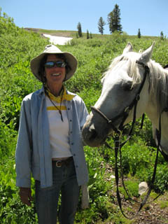
Half-way up to the Carson Gap I encountered Pepperoni and Harmony coming down.
They were both in good Cheer.

Pepperoni and Harmony

I encountered Pepperoni and Harmony on the North Side of the Carson Gap on July 16, 2009. They were heading North, and I South.

This horse carried Pepperoni Northbound across the Sierras during the early Spring when they were full of snow. This was a real accomplishment for both horse and rider. I find that the Sierras are very challenging in Spring Conditions for backpackers, and can only imagine these challenges on horseback. But, horses are amazing mountain climbers.
I have seen cowgirls riding up steep mountain trails that the misinformed would believe impossible for a horse. Not so. I've also seen a bear climb a granite rock face, but that's a different story, for later. But don't underestimate the climbing ability of horses or bears in the mountains.

The horse was wearing a few scrapes from hitting submerged objects in the snow, but was looking sharp and lively. A very well tuned creature, by my accounting. Some Young horses' skittishness is perfectly tuned to the environment.
Harmony was such a horse, apparently closely observing everything in the surrounding terrain. I was happy to share the trail with both, and was fortunate to meet this team before I cut off of the Pacific Crest Trail at the Carson Gap to follow the Tahoe to Yosemite South. That junction would mark the end of encounters with Pacific Crest Trailers until rejoining the PCT in the Northern Yosemite backcountry below Bond Pass.

I departed the trail through the Whitney Portal on August 28, finally returning home in early September. I looked up Pepperoni and found her to be Janice Raddatz, and checked her website. On her site I found a notice that she had a wreck up North, going over the edge of a trail with Harmony, pictured above, and another mount, and losing both. Hard luck. Harmony was a fine mount with a great character, by my momentary accounting.

Though the notice of the accident is no longer on Janice Raddatz's site, the site is up. Nope, that site is off-line as of Sept 2010, but the eques-trek site was still up at that time, and as of May 2014.

I don't support or condone organized religion...

Trail Comments-Questions

Horse Forum

Horse Comments

top of page

Video and Pictures of Bear Running North through Carson Gap, down to Meiss Meadow

Approaching the Gap on September 20, 2009

Bear running North
through
The Carson Gap

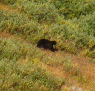
I was approaching the Carson Gap on my way from Meeks Bay to Yosemite on September 20, 2009, when I noticed something big and black coming fast down the drainage from the Gap. Must be a bear, I though.

Then I thought how glad I was that bear was using the drainage, rather than the trail, to race down from the gap. Bears use the trails too, but this bear was not on a leisurely walk, he was moving fast to get away from something. As bear was more concerned with fleeing something behind him than observing, bear did not see me in its haste.

After bear passed down into Meiss Meadow, I resumed my hike up to the Carson Gap. Since the only things that make bears run are humans or other bears, I was now looking out for the day hiker, backpacker, or bear that most likely spooked the bear I saw, causing it to run away down to Meiss Meadow.

Full Observation Powers ON!
Something's coming!

Comments-Questions

top of page

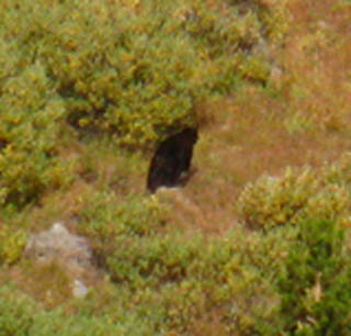
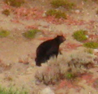
Running Bear on the North side of the Carson Gap

Bear in full retreat down from the Carson Gap. Slowing a bit behind the brush cover.  
Carson Gap Bear 1 Carson Gap Bear 2  
The bear must be doing 25 mph. But keeping a brisk pace away from the intruder. Bear had no idea I was observing.

Video of Bear and Comments on Two-legged Trail Denizens

Bear film shot below the Carson Gap

The rest was shot at the Carson Gap Pond.

The Point
Be Cool. Be Nice.

Video Playlist
Tahoe to Yosemite Trail
from
Carson Gap to Lake Alpine

top of page

More Bear

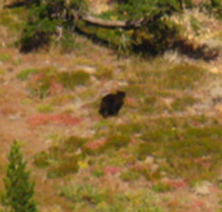
Bear fleeing into Meiss Meadow This bear would have shocked the shit out of any hikers coming up through Meiss Meadow...  
Carson Gap Bear 3 Carson Gap Bear 4  
Wild Bears run from people. But there was no one coming up behind me. Likely heading down to the unsecured garbage cans at the houses in Christmas Valley.

top of page

Reaching the Carson Gap
in
Spring and Early Summer
finds the

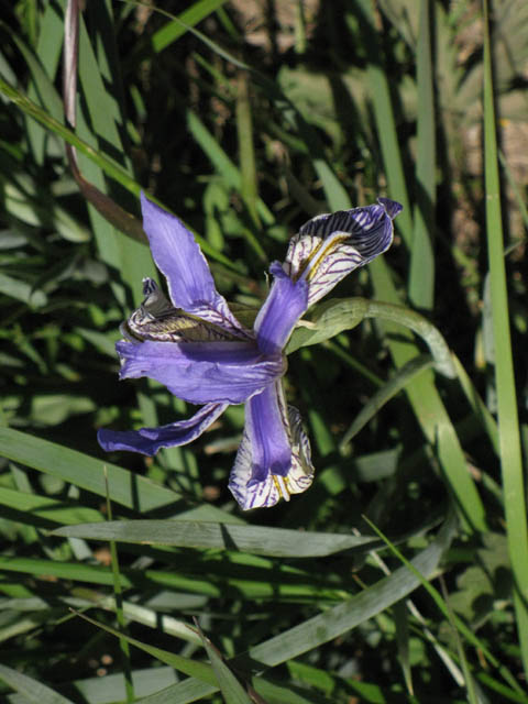
Iris Pads in full bloom
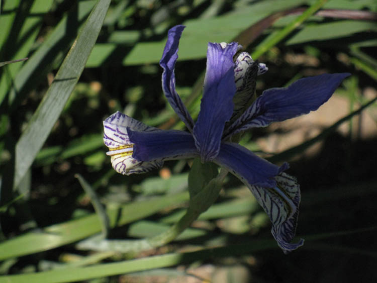
Iris in shadow

Another Iris at the Carson Gap  
Iris at the Carson Gap  

The Iris in the Gap is always a welcome sight in Spring.

top of page

North: Carson Gap                 South on the TYT: Trail to Woods Lake.                South on the PCT: Carson Pass.

The Carson Gap Pond
backed by
Round Top and The Sisters

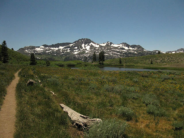
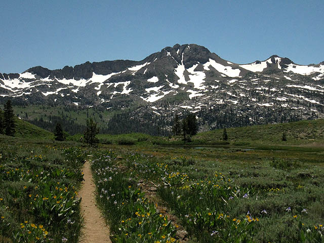
View South of the Round Top Massif through the Carson Gap.
Carson Gap Pond appears
Below: Round Top and The Eastern Sister dominates the Vista South of the Carson Gap.
Approaching Carson Gap. View! Carson Gap Pond!

The Carson Gap's Meadow was in full bloom.

top of page

Video
Three ways
from
Carson Gap to Round Top Lake

Three ways from Carson Gap to Round Top Lake.

Duration: 13:27

In the video above we hike from the Carson Gap through Carson Pass. Turning Southwest at the Winnemucca Lake trail junction towards Round Top Lake we observe the trail up from Woods Lake to Winnemucca Lake via the footbridge over Woods Creek, which I call the Center route.

The total distance of the Eastern Route from Carson Gap to Round Top Lake via Carson Pass is 4.57 miles, while the Center Route up from the footbridge is 3.90 miles.

Arriving at Round Top Lake we take note of the Lost Cabin Mine trail coming up from the campground near Woods Lake. This is the Western, and shortest route up to Round Top Lake.
The total distance from Carson Gap to Round Top Lake via the Lost Cabin Trail is 3.40 miles.

That completes our hike up the Eastern route to Round Top Lake from Carson Pass, except for checking out the wind on the lake.

Our next move is from Round Top Lake to Fourth of July Lake on our way down to the unmaintained section of Tahoe to Yosemite Trail along Summit City Creek.

Video Playlist
Tahoe to Yosemite Trail from Carson Gap to Lake Alpine

top of page


  North TYT-PCT: Carson Gap                  South TYT: Trail to Woods Lake.           South PCT: Carson Pass.

BUTTERFLIES!

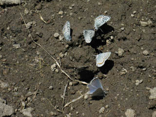
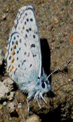
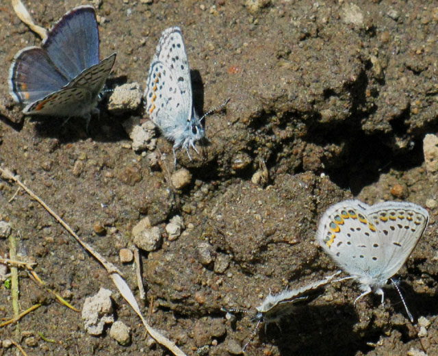
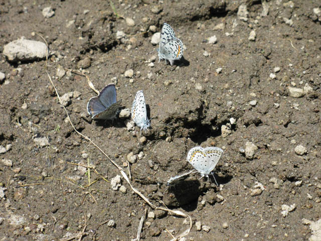
Puddling Butterflies sucking salt at the Carson Gap Pond

Butterflies are a regular, sometimes constant joy along our trail South to Mount Whitney.

We see them in meadows and forests, as well as high up on barren rocky mountainsides. Every now and again we run into great concentrations of butterfly beauty, sometimes by specific species, and sometimes in great congregations of every type, size and color.

I enjoy them all.

Thanks
to
Professor Arthur Shapiro
for
Identification and Behavior information
We've Got the Blues
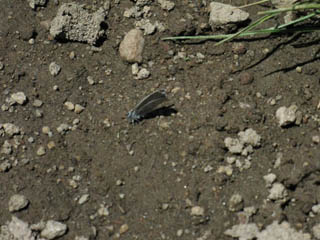
Small pale blue butterflies were feeding on the receding wet apron of the pond in the Carson Gap. They were fluttering on their own, when they were not holding on to keep the gusting breezes from pushing them over.  
Moth 1 Moths!  

So I sat down with the view of Round Top before me, and the fluttering butterflies below.

Between the breeze and their fluttering, they were a hard shot. Especially as this was my break!

Butterfly Forum


Little Blue Butterfly at the Carson Gap Pond

About the image above

Butterflies in the Sierras are beyond my ability to identify. I sought out the expertise of Professor Arthur Shapiro, who is quoted and credited for identifying the species on this page.

Professor Shapiro Says

"All easy, but you may be slightly discombobulated by the information about the little blue guys--identifying them is a skill that takes lots of practice.""The one in the smaller upper-left picture is undeterminable at this angle."

"In the smaller upper-right picture:

The 3 at the top are Euphilotes battoides.

The one at 3 o'clock is Lycaeides idas anna.

The one at 5 o'clock is almost certainly plebejus icarioides."

Butterflies in the Carson Gap

Above and Below
Blues
Puddling at the Carson Gap Pond

Beautiful pale blue with orange and black checkering
Moths having a Salt Party
Their fluttering wings were a relaxing sight.

Professor Shapiro

Distinguished Professor at UC Davis

Professor Shapiro is a Fellow of the American Association for the Advancement of Science, the California Academy of Sciences, the Royal Entomological Society of London, and the Explorers Club and has received the Academic Senate Distinguished Teaching Award and the Outstanding Adviser Award at Davis and has been a Fellow of the Davis Humanities Institute.

Professor Shapiro identifies the above group as a mixed-species "puddling" group, with interesting facts that have expanded my knowledge about the behavior of Butterflies.

Professor Shapiro Says:

"In the big puddling picture:

At 9 o'clock, two Plebejus lupini.

At 1 o'clock: E. battoides

At 5 o'clock: 2 L.i.anna."

"These are all males and all common. Many Blues look very much alike and their males -- only males -- puddle together, but forming single-species clusters when numerous! There are others in the mix too--just not in your pictures; I've seen six different Blues on one puddle."

For more on Butterflies, See the Butterfly Section of the Backpacker's Forum

top of page

For more butterflies,
or to
add your own experiences
see the
butterfly section
of the

High Sierra Backpacker's Forum

For an excellent source of Sierra Butterfly information, see

Art Shapiro's Butterfly Site

especially the

Butterfly Listing by Latin Name
page, for pictures of Sierra Butterflies.

and the Professor's recent work;

Compounded effects of climate change and habitat alteration shift patterns of butterfly diversity. (abstract)

To obtain a broad understanding of Sierra Butterflies, see;

Status of Butterflies, Arthur M. Shapiro, Center for Population Biology, University of California, Davis. (pdf)

On Professor Shapiro

Professor Shapiro has contributed valuable information to our understanding of the repercussions that our alterations to our climate and ecosystem have initiated.

My hope is that our society has the wisdom to understand and properly use the information Professor Shapiro has generated to guide our legal, political, and development policies to mitigate, if not restore, our crumbling natural infrastructure.

Many thanks to Professor Shapiro not just for identifying the Butterflies pictured above, but for his dedication to understanding the Natural World, as well as his contributions to making us all aware of the importance of our interrelationship with Nature.

And he's a really cool dude.

Butterfly Forum

Comments-Questions

Carson Gap Pond with snow apron

Early Spring with the Carson Gap Pond in the background.
Carson Gap Pond

A small ice apron still sits around the perimeter of the pond, as well.

top of page

Two Lake Tahoe to Yosemite Trail Junctions South of the Carson Gap

#1, At the top

The first unmarked junction is a Right Turn to the Southwest just below the South side of the Carson Gap. This unmarked trail brings us straight down to Highway 88, on our way up to Round Top, in the Background.
Unmarked trail junction towards Woods Lake from the Carson Gap.

Trail to Woods Lake
The Tahoe Yosemite Trail passes across the right side of the Round Top massif, pictured above, on its way down to Summit City Creek.

The two lesser peaks to the Right of Round Top are The Sisters. Our TYT route passes around the Right side of the third peak to the Right of Round Top.

Following The Pacific Crest Trail South from here keeps us on the main trail (Left) that leads us down to the Carson Pass.

South of Carson Pass the PCT route tracks East of Elephant Back dropping down to Forestdale Creek for the climb up to the Forestdale Divide. From the Forestdale Divide we get a glimpse down Summit City Creek and at the South flank of Round Top and The Sisters, to our West, before turning Southeast towards Ebbetts Pass.


  North TYT-PCT: Carson Gap                  South TYT: Trail to Woods Lake.           South PCT: Carson Pass.

top of page

#2 Tahoe to Yosemite Trail junction
at the
Base
of the trail up to the
Carson Gap

The second unmarked trail junction is at the base of the Southern descent from the Carson Gap.

Here the PCT turns Left, East to traverse Red Lake Peak's lower mountain flanks over to Carson Pass. This unmarked trail Southwest joins up with the TYT trail coming down from Carson Gap at a creek less than a quarter of a mile from the junction below.

 
The second unmarked trail junction to the TW trail heading South through the Carson Gap  

Trail to Woods Lake
The unmarked junction above brings us down to Highway 88. On the South side of Highway 88 we encounter a corrugated shack that appears to belong to CalTrans, where we encounter the dirt road leading down from Carson Pass to Woods Lake.

We'll follow this dirt track down the mountain to our Southbound Right, down to the paved road leading South to Woods Lake, and also to our two trail options up to Round Top Lake.

The unmarked trail junction pictured above is located near the head of the little creek that this unmarked trail follows down to Highway 88. We'll meet the unmarked trail coming down from the Carson Gap where it crosses this creek, which is where these first two trails to the TYT join to roughly follow the course of the creek down to Highway 88.

top of page

top of page

North: Carson Gap                              South on TY: Trail to Woods Lake.                    South on the PCT: Carson Pass.

Let's
do some
Strategic Thinking

Departing the Lake Tahoe Basin Southbound

The Tahoe to Yosemite Trail
or
The Pacific Crest Trail

South to Tuolumne Meadows?

Passing South through the Carson Gap marks our point of departure from the Lake Tahoe Basin.

Independent of where we started, be it 40 miles North at Meeks Bay, 10 miles North at Echo Summit, or 8 miles coming up from the South Upper Truckee Trailhead, the terrain outside of the Tahoe Basin is going to radically change.

But how it changes depends on which way we head South out of the Lake Tahoe Basin. We have two options.

The Tahoe to Yosemite
or
Pacific Crest Trail

South
from the
Carson Gap to Tuolumne Meadows?

We have a choice of trails when we head South from the Carson Gap. First, we can head around the Southwest side of Round Top to follow the Tahoe to Yosemite Trail along the Western flank of the Sierras to Lake Alpine.

Our second option is to follow the Pacific Crest Trail through the Carson Pass, passing around the Southeast side of Round Top and Elephant Back to follow along the Eastern Flank of the Sierras to Ebbetts Pass.

Both are excellent trail routes. I suggest you hike both, as possible.


The Tahoe to Yosemite
vs.
The Pacific Crest Trail

Time

If we follow the Tahoe to Yosemite Trail along the Western Flank of the Sierras South from the Carson Gap, we are going to be spending roughly 2 nights hiking to Lake Alpine. We will arrive at Lake Alpine early on the second morning coming out of the Carson Gap.

That's on a 15 miles per day schedule.

I also figure on spending the same amount of time, roughly two nights and a small bit of a third day, getting to Ebbetts Pass from the Carson Pass along the Pacific Crest Trail route.
We must add more or less time as necessary to suite our needs and capabilities.

The Numbers

26.28 miles from the Carson Gap to Lake Alpine via the Tahoe to Yosemite Trail.
Miles & Elevations. Maps.

27.88 miles from the Carson Pass to Ebbetts Pass on the Pacific Crest Trail.
Miles & Elevations. Maps.

Despite the mile and a half difference between the two routes, mileage is not the most important distinction between the Tahoe to Yosemite and Pacific Crest Trails.

Check out the mileages coming down from Meeks Bay

top of page

Physical Differences between Routes

Climate and Terrain

The Tahoe to Yosemite route between the Carson Gap and Lake Alpine on Highway 4 traverses the Western Flank of the Sierras. The Western flank of the Sierras is generally shadier, cooler, and wetter than the PCT's route along the Eastern flank.

Besides being more exposed, hotter, and drier, the Eastern flank of the Sierras between Carson Pass and Ebbetts Pass is physically quite different in geology and appearance than the Western Flank between Carson Gap and Lake Alpine. The vast majority of the Pacific Crest Trail along Eastern flank passes through the harsh and subtle, yet sublime beauties of barren volcanic terrain.

While the PCT crosses the arid volcanic terrain of Sierra's Eastern Flank with long views East, the Tahoe to Yosemite Trail submerges itself into two deeply forested granite gorges descending off into the moister Western flank of the Sierras. This extra moisture accounts for both the massive gorges as well as the denser forests on the Western Flank of the Sierras.

The moisture today drives forest growth in the Sierra. A few tens of thousands of years ago this moisture was driving massive glaciers through Summit City Creek and the North Fork of the Mokelumne.

Though both the PCT and TYT routes are "dry," meaning the Sierra Nevada is a dry place, the Western Flank's windward position facing the moist prevailing winds off the Pacific Ocean makes the Western flank noticeably greener and shadier than the Eastern. Having more tree cover gives the hiker more shade, making for a less exposed, if not a cooler hike.

Not a cooler hike because the TYT route drops much lower in elevation than the PCT, putting the TYT into some very hot lower elevation temps during Summer.

I've seen high 80s and low 90s as we descend to the 6000 foot range elevations towards Camp Irene. And the Sierra is getting hotter and hotter every year.

Psychological Difference
Much more isolated

The Tahoe to Yosemite Trail route is also much more remote and less traveled than the Pacific Crest Trail. It is not uncommon to pass through the whole section between Summit City Creek and Lake Alpine without meeting another backpacker.

This is because of the very difficult unmaintained trail conditions that characterize the Tahoe to Yosemite Trail between Summit City Creek down to Camp Irene on the banks of N fork of the Mokelumne River.

top of page

Unmaintained Trail Section
on the
Tahoe to Yosemite Trail

The reason for the low backpacker traffic on the Tahoe to Yosemite Trail route between Carson Pass and Lake Alpine is the rough terrain and difficult route-finding required by the 9.52 miles of unmaintained trail between the Summit City Creek trail junction below Fourth of July Lake, to the North Fork of the Mokelumne River at Camp Irene.

Basic Conditions on the Unmaintained Sections

POST/READ
Summit City Canyon Trail Conditions Updates
Trail Terms and Conditions

On an unmaintained section of trail we should expect that all signs of trail, trail bed, blazes, and ducks are absent for extended lengths. We should expect fallen trees, heavy overgrowths of brush, runoff gorges, and boulders to block our way. A wide variety of obstacles can be depended on block our route, and obscure all traces of the route we are following.

Crossing this type of terrain with a backpack is very hard work. This type of terrain demands physical conditioning and backcountry skills necessary to prevent injury while carrying a heavy pack across difficult and unstable terrain. You know you are in good enough shape when it is fun. For me this means I am running 7 miles every other day up 750 feet of elevation. Less training and preparation, less fun on the trail.

This terrain also demands the ability to find the best route in the proper direction without trail, trail markers, blazes, or ducks.
Again, you know you are good to go when you enjoy the experience. If our route finding skills are sufficient, we will find this a fun and exciting challenge. If they are not, we will find this section to be a little piece of hell.

During Lake 2013 I hiked this section after a bunch of physical injuries. Though my body was banged up and weak, my route finding and conservation of energy practices carried me right through. Slowly, but directly through...

This tells me more skills will allow less fitness through Summit City Canyon. If your skills are insufficient you better pray you are in good enough condition to fight your way through...

Vortex of Doom
If you are in poor condition with undeveloped route finding skills, your inability to find the easiest way through will seriously increase your workload. As your workload increases your fatigue, your ability to observe and make good decisions decreases.

This means your are entering the
"Vortex of Doom."

The "Vortex of Doom" is when poor decision making and poor fitness break down mental and physical capacity.

Time for some pain and fear!

In any case, projected or predicted times to make mileage on maintained trails is significantly altered by encountering unmaintained routes. It can easily take twice as long to cross a mile of an unmaintained route as it would to cross a mile of maintained trail.

Expectations must be adjusted accordingly, and the proper levels of skill and fitness must be applied to the situation to avoid the
"Vortex of Doom."

top of page

Warning

Backpacking is Dangerous

Backpacking is dangerous, and can generate significant amounts of physical and psychological stress. Injury and death are regular outcomes for backpackers.

Every year backpackers get lost, injured, struck by lightening, eaten by bears, drown while crossing rivers, shot by hunters, crushed by falling snags, swept away by avalanches, or frozen in unexpected blizzards. These are the things that can happen to well-prepared, smart backpackers.
I have not even begun to mention the things that unprepared stupid backpackers do to themselves through bad decision making.

(Classic Example of Stupidity: Use your food bag as a pillow. Get run-over while crossing a remote mountain pass...)

Nothing in this trail guide will protect you against yourself or the occasional Fury of Nature.

Backpacking unmaintained trails multiplies all of these dangers, puts us further from help and/or rescue, and generally increases all of the physical and psychological stresses and dangers of normal backpacking.

Super-Great Fun!!!

It is during these hard engagements with nature that I have my best experiences. Though most of us attempt to mitigate these dangers, there is always a reasonable chance that you will get lost, get injured, or get dead while having the time of your life.

Good times I hope.

The best way to minimize the ever-present chances of injury and death is to build our backpacking and backcountry skills and fitness in conjunction with increasing the difficulty of our backpacking trips. This way we reduce the chances of putting ourselves in situations we are not prepared for.

Don't do that!

Don't attempt the unmaintained section of the Tahoe to Yosemite trail unless you are an accomplished, experienced backpacker, in good physical shape, capable of reading maps, with good route finding skills and properly equipped with enough food to accommodate a longer crossing of this section than you anticipated.

Remember: Shit happens.

Our pace, carrying capacity, state of physical conditioning, and the particular route we choose may extend or shorten the duration of our trip through this section of the trail, and any of the trails described on this web site. Plan accordingly. Discretion is often the better part of valor.

Psychological Difference II
Much more isolated, and no maintained trails

This combination of isolation, no trails, and very hard hiking presents different obstacles and challenges than the typical long distance backpacking trip.
Pressing for miles is replaced by pressing to find a route through the terrain, if we cannot locate signs of the trailbed itself. This is a completely different type of stress than running down a maintained trail.

This type of travel requires careful observation, good decision making on observations, and the understanding and ability to backtrack to the point where we deviated from the best route so we can try again.
That means we have to know when you are off the Route...

How do you know what you don't know? The subtle signs of man and nature will tell you.

Cross country travel produces a certain psychological type of stress in addition to the normal stresses of backpacking. The normal stresses of backpacking are generally physical, caused by being constantly exposed to the environment, and the constant work staying in motion over the terrain demands.

Good gear mitigates the hots and colds of being constantly exposed to the elements, and constant work is offset by good eating, plenty of water, and proper rest. I find that the physical stress of normal backpacking is an excellent antidote for the crazy psychological and physical stresses of Urban Life. One is very good for you, the other is very bad.

Cross country travel puts all stresses other than finding the proper route into secondary positions. The things that bothered us most on the trail; hunger, overheating, and exhaustion can all become inconsequential when the thing we relied on the most for our most fundamental sense of security, the trail, disappears.

That loss of trail can be quite disquieting.

top of page

Take a Break

It is at just this moment, when our most basic assumption about backpacking, the trail itself, has disappeared from beneath our feet, is when we must not freak out, and we must rebalance our approach to backpacking.
Kick back and take a nice break. Have a snack and some water. Observe and Consider our situation. Food, Water, and rest are vital, and without them we will deprive ourself of our most fundamental skills.
These are the ability to observe, analyze, and make good decisions.

Stop, rehydrate, fill up our water bottle, and cook up a nice hot meal and some coffee. Restore our calm approach, and our clear vision and good decision making process will follow. Always maintain our water and food consumption as we struggle to find and follow any very difficult route.


Basic Details
of the
Unmaintained Section

between
The Summit City Creek trail junction
(below Fourth of July Lake)
to
Camp Irene

The Tahoe to Yosemite Trail's Unmaintained Section

(As of July 2009)
(2013 UPDATE REPORTS)

Between the Summit City Creek trail Junction and Telephone Gulch there is occasionally a followable trail bed, though the trail is very faint in some sections. The many downed trees require some climbing to follow the identifiable sections of the trailbed.

Conditions worsen as we hike South. I classify this type of terrain as a "route."

2013 update: Work has cleared trail pretty well down to Telephone Gulch.

(2013 UPDATE REPORTS)

From Horse Canyon to the first open rock section above Telephone Gulch the trail degrades into sections of route finding, though faint trailbed and too many ducks and blazes illuminate the route.

Don't over-duck or over-maintain this trail. The difficulty and route finding are what make it special.

South of Telephone Gulch above the upper ford the going gets really rough for a few segments of trail. We can only identify and follow the trail bed for very short sections, if at all, until it is obliterated by swaths of downed trees, completely covered and overgrown by great forests of ferns, or transformed by the Spring runoff from old trail remnants into tributaries feeding Summit City Creek.
We just have to put together the best route through here as we can. If we are "on" the lay of the land we will occasionally hit small indications of the previous existence of a trail through here on a regular basis.

Ducks

It was recently pointed out by SandyNevada that this route was very heavily, but not very well ducked by the time she traveled it during a late Summer hike.

Sigh. If you are not very well aware of the terrain, and not completely sure you are on the optimal route, don't try to duck the route.

Remember, it's the challenges that make this trail fun and special...

Even if you are sure of the optimal route ducking reduces the enjoyment and challenge for many of the backpackers who hike through this section just for the challenge of navigating the terrain.

This route will not remain a special experience if it is too opened up.

Sandy also noted that her research with the Tahoe Basin Rangers indicated that no more than 10 Tahoe to Yosemite permits are issued each year.
This is not the best measure of the use of this section of trail, as many backpackers who come through here are hiking short or medium distance trips out of The Carson Pass Management Area, or coming North out of Lake Alpine. These low figures underestimate the light backpacker traffic out here.

Continuing South
from
Telephone Gulch

After passing through this very rough section of highly obscured "trail," mostly composed of small bits of discrete remnants of trail bed South of Telephone Gulch, we will breathe a sigh of relief when we reach the first small section of exposed granite above the Upper Ford.
This section is easy to navigate, but it is brief, and we still have a small section of forest to get through before we reach the second section of open granite. The second section of open granite past Telephone Gulch continues South across some expansive sections of beautiful open rock all the way down to the upper ford of Summit City Creek.

The route through this open granite section was fairly well ducked (marked by occasional stacks of differently colored rocks) in July of 2009, and heavily ducked in 2013... The problem (or blessing?) is that Winter snows knock down the less secure ducks each year.
So, early season backpackers will not have many ducks to follow. But we should observe the knocked down piles of rocks that remain.

I find fewer ducks more stimulating than too many ducks.

Recap

To cross this section of the Tahoe to Yosemite Trail between Summit City Creek and Camp Irene we should be prepared to find our way without trail or trail signs through 9.52 +/- miles of dense forest, obstructing rock, and thick manzanita.

The conditions we may encounter through here demand that we have the physical fitness and route-finding skill to pick our way through this section over difficult terrain without trails.

If we don't entertain these skills I know that we will suffer and be endangered in proportion to our lack of skills.

...

South from the Upper Ford

After crossing Summit City Creek's upper ford, look to your right for the faint trail that climbs up the granite knoll sitting above the river. Don't try to continue straight up the drainage behind the ford, though it looks like the easiest way. Instead, the route turns right to roughly follow the course of the creek, but from high above Summit City Creek. The rocky turmoil of sheer terrain that Summit City Creek flows through here is forcing us to ford and climb up to the East, up around this rough section of Summit City Creek.

At the top of this granite knoll we find a small campsite with an even smaller fire ring. Continuing South we descend off the knoll, shortly entering a small maze of manzanita brush. Get used to it. Manzanita decorates much of the route down to the lower ford of Summit City Creek.

After navigating a series of creekside rises and falls our Southbound descent flattens out we again begin to approach Summit City Creek. Look West to the Creek for where it emerges from its rough section.

We will soon see access to water and a couple of very nice campsites where Summit City Creek flows over and through a beautiful and notable large granite flat. This granite flat location sits about a mile and a third South of the upper ford of Summit City Creek.

On the South end of this awesome granite flat we enter The Manzanita.

Continuing South to the end of this interesting granite flat along Summit City Creek, we plunge into the manzanita. We stay parallel with Summit City Creek for about a quarter mile until we come to an excellent campsite overlooking the end of Summit City Canyon's "hanging canyon" up on the wall of the massive canyon of the North fork of the Mokelumne River.

Continuing South out the end of Summit City Canyon we begin to bend East and gently up onto the dry manzanita covered mountainside, away from the creek. Summit City Creek is setting up for its steep drop down to its meeting with the North Fork of the Mokelumne River far below, and we are moving away from its gorge.

As we pass out of Summit City Canyon onto the manzanita covered mountainside for the descent to the North Mokelumne River we can now more clearly see that the Summit City Creek's massive canyon is little more than a magnificent, monster hanging canyon in the much larger gorge cut by the North Mokelumne River. Wow.

I far prefer views of this route over the PCT to our East. And, we work a lot harder for the views along the TYT than the PCT.

The manzanita and heat on this mountainside are indicative of the elevation.
At this point we have followed the Summit City Drainage down to 6120 feet from our 9630 foot high crossing over Round Top, losing this 3510 feet of elevation over 6.39 miles of rough hiking.

Of the 2.51 miles between the upper and lower fords on Summit City Creek, we will find that most of this distance is on an exposed Southern facing manzanita-covered mountainside.
These lower elevations mean that the majority of this section of trail is very hot with little cover. The heat, the exposure, and the full contact manzanita offers a multitude of route options. These factors all combine to make this a challenging descent.

The campsite on the granite flat that we are hiking past is about a mile and a quarter above the lower Summit City Creek Ford, and the overlook campsite another quarter-mile South. As mentioned, a good part of this remaining distance down to the lower ford is mostly covered with a massive maze of manzanita, which we will route-find our way through.

There are a couple of bits of forest, and the jumbled chute of forest and rock along the last section approaching the lower ford.

***

After the second, lower ford of Summit City Creek, a short ducked section of trail will bring us up to the entrance of a deep and dark un-blazed forest after passing a black pond. I call this dark forest the Enchanted Forest. I give everything a frigging name...

Making our way across this forest down into and across a unblazed forested bowl sitting on the North shore of the N Mokelumne River is pretty challenging. Unless you just scout out this little bit of Italy.
I mean "Italy" because the enchanted forest is shaped almost perfectly like a boot. Look again at the picture of Summit City Canyon linked to above, and at the map.
Both reflect the boot shape of the Enchanted Forest. The heel part of the boot is obscured by the intervening terrain in the picture, but the "L" or boot shape of the forest is apparent.
Once we figure out the outline of the Enchanted Forest we can make out the course of the North Mokelumne River along its Eastern Fringe, then we can see the channel of the river squeezing between the rock walls on its way to flow past Camp Irene.
It's that big chunk of rock squeezing the River through a narrow gorge that forces our route the long way around its backside, its Western side.
Once we find our way across the length of the Enchanted Forest we must find where the ducked trail climbing out of the Southwest side of the forested bowl to Camp Irene is located. This too is pretty challenging.
Here's my advice for entering the Enchanted Forest:

Turn left when we enter the forest past at the end of the apparent trail past the Black Pond. We'll know when we are there. A deep, dark trackless forest appears to our front and Left. No trail at all.
We'll turn a hard Left to make our way South and downward through this Eastern fringe of the upper section of the Enchanted Forest for less than a half-mile.

Rock ridges project out to our Left from the Eastern edge of the forest, but avoid following them out, for they are dead ends. They stretch out to overlook the North Mokelumne River in the narrowest and most majestic section of its gorge.
If we've got some time, ie, extra food, we'll stash our packs and go scout it out on the rocks to the East.
It's great scrambling out there to our East... just make sure we put the packs where we will find them, and remove the food containers and everything else bears like to eat, and especially moving our food canister to a position the bear can't roll it off a cliff...

After scouting out the rock we'll...

...continue South and down along the boundary between rock and forest to where the terrain begins to flatten out, and we begin to find and cross a series of Spring Thaw drainages running diagonally across our self-selected route from Right to left, down to the Southeast, down to the N Mokelumne River. The bottom drainages run across the bottom of the forested bowl we are seeking. Follow the lowest of these drainages down SE (Leftward)into the forest filled granite bowl wedged in alongside the N. Mokelumne River.

As we follow this final drainage down to the Southeast, we are entering a granite bowl surrounding a large flat that is densely forested. This is likely why I call the overall position in the terrain, "the bowl," and as the forest within it is quite enchanting, the Enchanted Forest. It only gets better...

If true, and we have made our way into "The Bowl," then the N Mokelumne is directly to our East, off our Left, and somewhere through the forest to our Southwest is the steep base of the granite ridge that makes up the Western Boundary of "The Bowl." The only way out of this densely forested bowl is located to Southwest, where at the "heel" of the boot we will again find an obvious trail at the crack in the bowl's perimeter wall where a small creek flows through on its way to the North Mokelumne. (2013 update: someone has kind of cleared a trail extending some way North into the Enchanted Forest from the Southern trail out of the bowl.

That's the toughest part of our Tahoe to Yosemite Trail route South to Camp Irene. From our Southbound exit from the Enchanted Forest the trail is fairly well marked out down to Camp Irene, though with a couple of exceptions, being spots where we have to observe well or scout around a bit to stay on the trail route.

But, before we find the trail to Camp Irene we are going to find our way to the North Mokelumne River. Here there are fine white sand beaches running right up to the shore, softly carpeting the floor of the dense forest that also marches right up to the river. This is one of the finest remote "campsites" in the Sierras that's not real far from a trailhead.

And it's not a campsite. There is one fire ring and campsite here, up at the Northern end where the white sand beaches begin, but I have a policy of not making any improvements in this pristine location. If you want a fire and a fine improved campsite, head North to the campsite at the top of the stretch of beach along the Enchanted Forest, or continue South to Camp Irene's first-rate campsites.

I strongly suggest anyone entering this section have expert backpacking, map reading, and cross-country route finding skills. The Tahoe to Yosemite Trail route between the Summit City Creek Upper Ford and Camp Irene is difficult expert terrain.

Once we find the trail leading out of the Southwest side of the bowl, we are relieved to see there is a fairly well-trod trail bed, if not a fully ducked trail the rest of the way to Camp Irene. Well, there are a couple of ambiguous positions between the Enchanted Forest and Camp Irene that require some keen observation.

Even when there are no ducks the trail bed itself should suffice to lead us to Camp Irene. The trail is actually burnished into sections of bare granite it crosses through this section of trail. A hundred and fifty years of even sparse traffic has left its mark on the rock.

I figure the burnished granite is the remnant of the Silver Boom of the late 1850s.

From Camp Irene a faint maintained trail brings us up to the crest of Mount Reba, which is the last obstacle sitting between Camp Irene and us having fresh food and picking up our resupply package at Lake Alpine, and the end of this trail section. We will pick up the resupply package we sent to our self at the Lake Alpine Lodge.

Once we've reached Camp Irene from the Summit City Creek we have finished passing through one of the two the toughest part of the Tahoe to Yosemite Trail. Congratulations!

We still have the other unmaintained trail section coming up. The South end of our hike across the Carson Iceberg Wilderness through the headwaters of the Clarks Fork of the Stanislaus River through Saint Marys Pass is along unmaintained trail passing into an untrailed section of route through Clarks Meadow to Saint Marys Pass.

Reaching the North fork of the Mokelumne River we have also passed through the end of the granite section of this part of the trail. After we cross the North Mokelumne River and begin to climb up the Northeast flanks of the Mount Reba massif, the granite terrain we've crossed since Summit City Creek is gradually submerged under volcanic terrain as we climb higher on Mount Reba.

OK, now continue to check out the Southbound TYT on the following trail guide pages!

Or the PCT. We cover both routes down to Tuolumne Meadows.

top of page

Below: Me, still looking for the trail out of the forested bowl along the Mokelumne River.

In the Bowl next to the N Mokelumne, just North of Camp Irene

top of page

Resupply

Two days South out of the Carson Gap on the Tahoe to Yosemite Trail will see us drop down the South side of Mount Reba to our first resupply point at the Lake Alpine lodge, located on Highway 104 on the West side of Lake Alpine.

Likewise, Pacific Crest Trail backpackers will generally hit Ebbetts Pass two days South out of the Carson Gap on the Pacific Crest Trail. Lake Alpine is a short 16 mile hitch hike to the West of Ebbetts Pass on Highway 4, where you can pick up your resupply package from Kim.

Bear Valley is three miles further West from the Lake Alpine Lodge down Highway 4.

Lake Alpine Lodge Backpacker Resupply

(including Bear Valley and Arnold)

Resupply

Highway 4, Lake Alpine Lodge and Ebbetts Pass

The Pacific Crest trail crosses Ebbetts Pass on Highway 4. Lake Alpine, where the Tahoe to Yosemite hits Highway 4, sits about 26 miles to the West of Ebbetts Pass, also on Highway 4.

I always pick up my first resupply at the Lake Alpine Lodge, even if I am hiking the Pacific Crest Trail. This necessitates hitching a ride down down mountain from Ebbetts Pass for hikers on the Pacific Crest Trail. Hikers on the Tahoe to Yosemite Trail hit Highway 4 at the East end of Lake Alpine, and will find it a pleasant 3/4 mile walk alone the beautiful shore of Lake Alpine to the Lake Alpine Lodge.

After finding my secret camp on the East side of Lake Alpine and stashing our food and gear properly, we will take a leisurely walk along the scenic North Shore of Lake Alpine down to the Lake Alpine Lodge.

Food! Beer! Good Company!

Highway 108, Saint Mary and Sonora Passes

The same basic resupply situation confronts backpackers hitting Highway 108 at the Sonora Pass as it did on Highway 4. Kennedy Meadows Pack Station is 9 miles West down the mountain from the Sonora Pass. I suggest hitching the 8 miles West, down to Kennedy Meadows to resupply.

We also have the option of hitching 13 miles East to the Highways 108 and 395 junction, then hitching about 25 miles South on Highway 395 to the fine little town of Bridgeport. I don't recommend heading to Bridgeport for resupply.

Kennedy Meadows Pack Station

Kennedy Meadows is the superior resupply option in every respect. But if you do hit Bridgeport to resupply, check out Rhino's Bar and Grill. Rhino's sports pool tables, a nice cafe with great food, and a bar. US Marines, random special forces, and other military personnel from Pickle Meadow mingle with locals, car campers, hunters, fishermen, and the occasional backpacker misguided enough to head to Bridgeport for resupply. Bridgeport also has a grocery store(since closed). Bridgeport is also the Gateway to Twin Lakes, a fine Eastern entry into Yosemite's Northern Backcountry.

Don't get me wrong, I like Bridgeport a lot, its fine residents, and especially the hot springs just South of town, but Kennedy Meadows is the Superior resupply option for backpackers crossing Highway 108.

The 395 Corridor

Personally, when I am in the 395 corridor near Highway 108, I always head North to the little town of Walker, which sits 14 miles North of the Highways 108 and 395 junction. Though it has few resources, I have friends there that have always made Walker a fine place to visit.

Lake Alpine, Bear Valley, and Arnold Resupply

Kennedy Meadows Pack Station and Resort Resupply

Full Resupply Discussion: Tahoe to Tuolumne Meadows

Read more about your route options on the Pacific Crest Trail or the Tahoe to Yosemite Trail between the Carson Gap and Highway 4 on the Trail Guide Index, on the Carson Gap Trail Guide page, in the maps section, and on the miles and elevations pages.

Inform Yourself!

top of page

More Information

Check the maps, mileages and elevations, and the trail guide pages for information on each route's specifics.

The route options through the Northern Sierras are approached from the perspective of resupply on the Echo Lake Chalet Resupply page. Check this page out for resupply information and options as they pertain to both the Tahoe to Yosemite and Pacific Crest Trail routes between Meeks Bay and Sonora Pass.


Also Check out the route discussion comparing the Tahoe to Yosemite and Pacific Crest Trail routes on the
Backpacker's Forum

Comments?

top of page

Maps

North
of the
Carson Gap

7.5 minute Topo hiking Map
Echo Summit and South Upper Truckee to Carson Pass

30 min Topo hiking Map
Echo Summit and South Upper Truckee to Carson Gap

Miles and Elevations


South
of the
Carson Gap

The Carson Pass Region Map

The Mokelumne Wilderness Map

Fourth of July Lake to Mount Reba Map

SOUTH PCT miles
Carson Pass to Ebbetts Pass

SOUTH TYT miles
Carson Gap to Lake Alpine

Trail Guide Pages

North: Carson Gap             South on TYT: Trail to Woods Lake.       South on the PCT: Carson Pass.

top of page

Short Trips
around
Carson Pass
&
The Administrative Units

Many fine short and medium length trips can be crafted between the Carson Pass on Highway 88 North to either Echo Summit on Highway 50, or South to either Lake Alpine or Ebbetts Pass on Highway 4.

Backpacking trips can be kept close to Carson Pass, or extended as far North or South as desire, capacity, and time allow.

For those backpackers maintaining serious long term responsibilities (kids, career, education) consider backpacking from Lake Tahoe to Mount Whitney over a number of years as a "Section Hiker:"
Start with the backpacking trip from Meeks Bay to Echo Summit as your first section. The next Summer hike from Echo Summit to Carson Pass and on down to Lake Alpine. And so on...
Work your way South from Meeks Bay to Mount Whitney one section at a time as the nature of your life permits.

Permits

The El Dorado, Toiyabe, and Stanislaus National Forests administer the regions South to Yosemite National ParkThe Lake Tahoe Basin Management Unit sits to the North of Carson Pass.
Which National Forest we will need to get our permit from is determined by where we begin our trip.

Generally, if we begin backpacking from anyplace to the East of the Sierra Crest we will get our permit from the Toiyabe National Forest. The Toiyabe manages everything on the East flank of the Sierra Crest from the Carson Range wrapping around the East shore of Lake Tahoe down to the Hoover Wilderness wrapping around the Northeast Yosemite Backcountry around to the Tioga Road, including the terrain to the North of Tioga Road up the East flank of the Sierra.

It's worth noting that all of the mountain pass trailheads located at the tops of the trans-Sierra highways, including Carson Pass, Ebbetts Pass, and Sonora Pass are administered by the Forests administering the Western flank of the Sierra.
I believe this is because the huge size of the Toiyabe National Forest induces surrounding national forests to administer all of their shared trailheads. They are "taking the load off" of the huge Toiyabe National Forest.

All of the trailheads along the Sierra Crest are shared between Forests. This is because the crest of the Sierra Nevada Mountains defines the boundary dividing the National Forests on the West flank from the Toiyabe's administration of the whole East flank of the North Sierra.

Practically, this means we will draw our permits for trips beginning at the mountain passes from the forest administering the Western Flank. This means we will draw most of our permits from the LTBMU, the El Dorado, and the Stanislaus Forests.

If we are traveling up to mountain pass trailheads from the East, the relevant Ranger District of the Toiyabe National Forest will gladly issue us our permit.

If we are entering the Sierra through Carson Pass we will need to contact the Amador Ranger District of the El Dorado NF for information.
If the Carson Pass is our trailhead, we will have to get a permit from the Carson Pass Cabin for all travel starting from or staying near the Carson Pass from the Carson Pass Management Area.

Since the Carson Pass Cabin is seasonal, check with the Amador Ranger District of the El Dorado National Forest for information on its status.

If our trip starts from anywhere East of Carson Pass, the Carson Ranger District of the Toiyabe National Forest is the administering authority. Each National Forest is divided into a number of Ranger Districts. Remember, we must order your permit from the Ranger district that administers the trailhead where we are starting our trip.

Below are the contacts to find the proper Ranger District in the pertinent National Forest to obtain the permits we need for backpacking trips beginning in the North Sierra Nevada from Lake Tahoe down to Yosemite National Park. Also see the permits page.

Once we get the North Sierra finished we will begin the South. Soon!

Southbound trips beginning in, but departing the Lake Tahoe Basin Management Unit through the Carson Gap for points further South, (Such as Echo Summit to Carson Pass, 12 miles, or Meeks Bay to Carson Pass, 42.71 miles) must be obtained from the Lake Tahoe Basin Administrative Unit.

Permits and Permits
Many backpacking trips in the LTBMU do not require backpacking permits, such as backpacking trips starting and remaining within the Meiss Roadless Area. Other areas in the LTBMU, such as Desolation Wilderness, don't just require permits, they severely limit the number of permits they issue to limit overuse and overcrowding. I always suggest calling ahead to find out if we need a permit for our particular trip, then ordering our permit over the phone, and having them send it to us well before the start of our long-distance backpacking trip.

The Rangers like us to pick up the permit at their station on our way to the trailhead, but that can be difficult when I'm taking public transportation and/or hitch hiking to the trailhead. The Rangers will generally send me the permit when I explain my situation to them.

If you are driving it's generally easy to pick up the permit at the Ranger Station.

If we are planning to begin our backpacking trip in one Administrative Unit or National Forest and are subsequently hiking into or through a series of different National Forest and Wilderness Areas beyond the one issuing our permit, we must make sure we get a permit, even if a permit is not required for our starting trailhead. A permit will be required for all the subsequent National Forests and Wilderness we travel through.
Permits must be drawn through the Administrative Unit of the trailhead we begin our trip.

We must make sure we name all of our campsite locations in the subsequent National Forests and administrative units on our permit.
This accuracy in planning can save us a lot of problems when our hike brings us through a large number of National Forests, Wilderness, and especially when we cross through special administrative or management units that experience heavy backpacker traffic.
We're going to cross Desolation Wilderness, Carson Pass Management Area, Yosemite, and the Mount Whitney Zone, all highly impacted locations that actively exercise enforcement.

If we listed campsites in special zones on our permit, the special zones are obliged to honor our permit.

In any case, I suggest calling the National Forest that your trip begins in to avoid confusion about permitting policies, trailhead permit boxes, and permits that cross multiple administrative units, all to make sure you can get the permit you need for your trip without hassle or undue delays at the trail head the day you want to depart.

If you are planning on getting trailhead permits during the mid-Summer high backpacking season at any of the places mentioned above you will be standing in a line.

Desolation Wilderness, Yosemite, and the Whitney Zone all have automated web-based, FAX, and mail reservation systems. For example, here's Desolation and Yosemite's systems:

Desolation          Yosemite

Here's the full information for both areas:

Desolation          Yosemite

Oh, and although the Meiss Country Roadless Area does not require backpacking permits they do require Fire Permits, even for camp stoves.

The change in the character of the seasons is quickly driving the National Forests towards a policy of banning all fires.

Beginning our backpacking trips from Desolation Wilderness or Yosemite National Park entails some planning and preparation for permits, while beginning out of Echo Summit or the South Upper Truckee Trailheads involves much less permit hassles.

That's a great reason to always hike into Desolation Wilderness or Yosemite National Park, rather than begin trips from either.

We can easily get permits to hike through areas where permits to begin backpacking trips are unavailable.

***

Exiting the Tahoe Basin South through the Carson Gap puts us into the Carson Pass Management Area of the El Dorado National Forest on both the Tahoe to Yosemite and the Pacific Crest Trail routes. The Mokelumne Wilderness also begins here, but many cut-outs make the Eastern edge of this wilderness boundary along the PCT route very complicated.
Starting Southbound trips into, or out of the Carson Pass Management Area requires we get our permit at the Carson Pass Cabin.

Tahoe to Yosemite South of Carson Pass

On the Tahoe to Yosemite Trail we exit the Carson Pass Management Area just past Fourth of July Lake on our Southbound hike down to Summit City Creek. From Fourth of July Lake we remain in the El Dorado National Forest administered section of the Mokelumne Wilderness until we cross the North Mokelumne River at Camp Irene. Crossing the North Mokelumne River at Camp Irene marks our passage into the sliver of the Mokelumne Wilderness administered by the Stanislaus National Forest.

Thus short-distance backpacking trips Southbound out of the Carson Pass to Lake Alpine or Ebbetts Pass will require permits from the El Dorado National Forest at the Carson Pass Cabin.
Northbound hikers out of Lake Alpine or Ebbetts Pass on Highway 4 will pick up their permits from the Calavaras Ranger District of the Stanislaus National Forest.

Pacific Crest Trail

South of Carson Pass we are in the El Dorado National Forest for a short distance, then the remainder of the trail to and through Ebbetts Pass down to Sonora Pass and South to Yosemite remains in the Toiyabe National Forest, though the Southbound trailhead from Sonora Pass is administered by the Stanislaus National Forest.

All Sierra Pass trailheads are administered by the Western National Forest.

Overall

Heading South from trailheads in the Tahoe Basin to and through Carson Pass on our way down either the Pacific Crest or Tahoe to Yosemite Trails requires that we obtain our permit from the Lake Tahoe Basin Management Unit.

If we start our Southbound trip from Carson Pass we obtain our permit at the Carson Pass Cabin or from the Amador Ranger District of the El Dorado National Forest if the Carson Pass Cabin is closed.

Comments-Questions

top of page

The Administrative Units

The Toiyabe National Forest extends down the Eastern flank of the Sierras from North of Lake Tahoe South down to where it wraps around the Northeastern boundary of the Yosemite National Park. The Toiyabe manages the East flank of the Carson Range around the East shore of Lake Tahoe, then the East flank of the Sierra from Carson Pass down to Highway 120.
The Toiyabe National Forest manages both the Mokelumne and Carson-Iceberg's Eastern sections between the Carson and Sonora Passes, as well the Hoover Wilderness wrapping around the Northeast boundary of Yosemite National Park.

The Toiyabe National Forest is huge.

The Western Flank of the Sierra between Tahoe to Yosemite is administered by a series of National Forests. The Lake Tahoe Basin Management Unit administers the whole Lake Tahoe Basin. South of the Tahoe Basin from Carson Pass to Camp Irene the El Dorado National Forest administers the Western Flank of the Mokelumne Wilderness, while the Eastern side of the Mokelumne Wilderness sits within the Toiyabe NF.

The Carson-Iceberg Wilderness spans both flanks of the Sierra Crest South of Highway 4 down to Highway 108. Again, the Eastern Flank is administered by the Toiyabe NF, while its Western Flank is part of the Stanislaus NF.

South of Highway 108 both the PCT and TY trails enter the Stanislaus NF Administered sections of the Emigrant Wilderness. The Southbound hiker on the Pacific Crest Trail will enter the Toiyabe NF for the short section from Kennedy Canyon to where they enter Yosemite through Dorothy Lake Pass.

The Tahoe to Yosemite Backpacker will be in the Emigrant Wilderness administered by the Stanislaus National Forest from Kennedy Meadows until they enter Yosemite through Bond Pass.

Climate and Terrain

The Eastern slope is noticeably drier than the Western flank of the Sierra Neavada Mountains. This is because most of the moisture of the wet Pacific Ocean air currents passing over the Western Slope is drawn out as it climbs up to and over the high altitude Crest of the Sierra Nevada Mountains.
This ride up and over the mountains drains the air of its moisture, leaving little for the Eastern Sierras, and virtually none for the mountains beyond.

Local Thunderstorms
This same process turns super-heated moisture-laden air blown West from the San Joaquin Valley on hot Summer Days into massive expanding thunderheads as they climb the Western flank of the Sierra Crest.
Be careful, and keep an eye out for afternoon thunderstorms forming along the Sierra Crest above all the trails during Summertime. These storms can be quite violent. Lightening presents a very serious danger to High Sierra backpackers during these storms, so be careful and watchful.

Don't get caught out on a high altitude exposed mountainside when one of these storms forms up. I have postponed crossing open meadows and exposed mountainsides during thunderstorm activity.

The volcanic terrain along the Sierra's Eastern Flank compliments its dryness. The PCT route along the Eastern Slope is dominated by starkly beautiful volcanic features, until we approach the East Fork of the Carson River, (South of Ebbetts Pass past Wolf Creek Pass, and 5 miles North of Sonora Pass.) which presents a beautiful interface zone between local pink-hued granites and the surrounding volcanic overlays bracketing the granite.

We will trace this interface from the East Fork of the Carson through Emigrant Wilderness, until we begin climbing to the Boundary of Yosemite National Park at Dorothy Pass. From there it's all granite, all the way to Tuolumne Meadows.

The volcanic/granite terrain interfaces that surround Yosemite, to both the North and South, fall away as we enter Yosemite.

Yosemite stands as a great granite island in the vast sea of mixed volcanic and granite terrain that surrounds it.

We've got lots of cool things to see, both about and around us.

top of page

Trips North
from
Highway 4 to Highway 88

If we are hiking North from Lake Alpine on the Tahoe to Yosemite Trail to the Carson Pass, we will need to obtain our permit from the Calavaras Ranger District of the Stanislaus National Forest. If we depart from Ebbetts Pass for the Carson Pass on the Pacific Crest Trail, we will have to contact the Carson Ranger district of the Toiyabe National Forest for our permit.
Well, not really. I've always been able to obtain permits for any of the trans-Sierra mountain pass trailheads from the Ranger District on my way up. If I'm driving in from the East, from the Toiyabe. If I'm driving in from the West, from the appropriate national forest.

It's really never been a problem when driving to the crest up either flank. The national forests seem to have a reciprocity agreement about issuing permits for the Sierra Crest Trailheads.

The Pacific Crest Trail South from Carson Pass

Southbound on the PCT we will hit Ebbetts Pass after two nights heading South from the Carson Gap, and Sonora Pass after roughly six nights on the trail, including a day off at Lake Alpine. Of course your specific timing depends on your plans, carrying capacity, and daily mileage. You must make your hiking plans to reasonably suit your particular needs, goals, and capacities.

Following the Pacific Crest Trail South out of the Carson Gap shortly brings us a couple of miles Southeastward down to Carson Pass. From here the Pacific Crest Trail continues South along the Eastern slope of the Sierra Crest to Ebbetts Pass on Highway 4.

Shortly after departing Carson Pass we will be entering the Toiyabe National Forest, within which we remain as we backpack across the Eastern Sections of the Mokelumne Wilderness to Ebbetts Pass, and further South on down to the Sonora Pass.

The Southbound Pacific Crest and Tahoe to Yosemite trails both depart the Mokelumne Wilderness at Highway 4, and both shortly enter the Carson-Iceberg Wilderness down to Highway 108.
South of Highway 108 hikers on both routes enter the Emigrant Wilderness of Stanislaus National Forest on their ways to their respective entry points into Yosemite.

The Pacific Crest Trail Hiker will enter Yosemite through Dorothy Lake Pass, while the backpacker on the Tahoe to Yosemite enters through Bond Pass, each close to where they join the other for the remainder of our hike down to Tuolumne Meadows.

One short variant between the routes remains: The Tahoe to Yosemite Trail tracks around Tilden Lake, while the Pacific Crest Trail swings lower down Jack Main Canyon to swing around Wilmer Lake.

They meet in the canyon containing Tilden Creek just beyond Bailey Ridge, before the final climb up and over into Stubblefield Canyon.

South of Highway 4
to
Yosemite
Yet More Route Options!

Tahoe to Yosemite Trail
The 34.64 miles Southbound on the Tahoe to Yosemite Trail that separates Lake Alpine from Saint Marys Pass also stays on the Western flank of the Sierra.
Saint Marys Pass is located a mile West of where the Pacific Crest Trail passes through Sonora Pass on Highway 108. Though the PCT and TYT take divergent routes through the Sierras North and South of Highway 4, they draw close together where their respective Southbound trails almost meet Highway 108.

Though the Southbound PCT trailhead is located across Highway 108 from the Northbound PCT trailhead at Sonora Pass, the North and Southbound TYT trailheads along Highway 108 are offset by about nine miles.

Though the Northbound TYT Saint Marys Pass Trailhead is located near Sonora Pass, the Southbound TYT trailhead is located nine miles West down Highway 108 on the South edge of the Kennedy Meadows Pack Station.

Check out this Big Map which highlights the differences between the Tahoe to Yosemite and Pacific Crest Trail routes approaching and departing their Highway 108 trailheads.

Click the black-dotted routes for detailed maps.

The Pacific Crest Trail

South of Ebbetts Pass on the Pacific Crest Trail the mountains seem to thicken. Rather than a quick drop off the Eastern flank of the Sierras with long views East, as was typical for much of the distance between Carson Pass and Ebbetts Pass, our 26.78 mile hike from Ebbetts Pass to Sonora Pass has more and larger ridges separating the Sierra Crest from the Eastern escarpment of the Sierra.
The long view East we enjoyed North of Ebbetts Pass are now regularly obscured by big mountain ridges and their intervening drainages. The nature of the terrain the Pacific Crest trail passes through South of Highway 4 also changes.

The raw harshness of the volcanic terrain that we experienced North of Ebbetts Pass coming across Raymond and around Reynolds Peaks on the Pacific Crest Trail continues to be moderated by thickening sections of forest.

As we hike South past Noble Lake and over the shoulder of Tyron Peak we are still crossing volcanic terrain. As we head South of Asa Lake the volcanic terrain is now occasionally being broken up by sections of fine metamorphic and granite rock formations. These formations rear up out of the Sierra crest line like great mountainous shark fins.

Sharkfin formation on the Pacific Crest Trail approaching Murray Canyon trail junction

Upon closer inspection, some of these formations are reminiscent of the hexagonal columns of of slow cooling metamorphic rock similar to that which produced Devils Postpile.

Metamorphic Rock shark fin similar in character to Devils Postpile

Continuing South from the junction with Murray Canyon, we begin crossing an interface zone between the fine granites lining the East Carson River, the metamorphic rock zone approaching Murray Creek and the volcanic crestline continuing South to and through Sonora Pass, represented by the great volcanic masses of Sonora, Stanislaus, and Disaster Peaks making up the Eastern flank of the Sierra Crest, rising up from the West shore of the East Carson River.
We can see that these great granite mountains were once buried by volcanic debris, and are now slowly emerging, being eroded out their volcanic encasements, rising from the East and West banks of the East Carson.

It sure looks like the long inextricable process of erosion has worked, and is working to expose these beautiful buried granite mountain flanks, while still capped and surrounded by massive ancient volcanic flows. This volcanic material is still flowing, albeit a lot slower than when it was running hot over the Sierra Nevada, but the long time span the flow of erosion travels across ultimately transfers more material.

The upper reaches of the East Carson River is quite a remarkable place.

At this point in time I have only completed the guide from the Tahoe Basin down to Tuolumne Meadows, and I really enjoyed adding the information about this amazing section of the trail. Check out the Carson Iceberg Wilderness section of the trail guide.

The Hybrid Routes

Because I want to pass through the various terrains that are situated along the Sierra Nevada Crest I prefer to mix up my route to cover the best, or stretch out to find bits of new trail and terrain between Highway 4 and Highway 108, by finding interesting ways to tie together lengths of trail of both the Pacific Crest and Tahoe to Yosemite Trails.

Though I prefer to follow the Tahoe to Yosemite Trail route South from the Carson Gap departing the Lake Tahoe Basin through Lake Alpine, I almost always switch over to the Pacific Crest Trail halfway somewhere between Highway 4 and Highway 108.

I follow the Tahoe to Yosemite Route South out of the Eastern side of Lake Alpine as normal for a Tahoe to Yosemite hiker, but my destination is not Saint Marys Pass Trailhead, where the Tahoe to Yosemite trailhead is located on Highway 108, but the Sonora Pass trailhead of the Pacific Crest Trail, which is located a mile East of Saint Marys Pass.

On the East Side of Spicer Reservoir I depart the Tahoe to Yosemite Trail to follow Highland Creek up to the Sierra Crest. After passing by Highland Lakes and crossing Gardiner Meadow I turn South on the PCT at Wolf Creek Pass. This will bring me through the beauties of the East Carson River on my way to Sonora Pass.

Recently I've been taking the Boulder Lake shortcut over to the PCT, or hiking over Saint Marys Pass to Highway 108. It seems that my preferred routes shift gradually over the years.

I've preferred developing hybrid routes to simply following the Tahoe to Yosemite Route from Lake Alpine to Saint Marys Pass or the Pacific Crest Trail from Ebbetts Pass to Sonora Pass.

Each time I hike these routes I see more and different terrain, as well as getting to know the standard routes better.

This way, on my Tahoe to Yosemite-Pacific Crest hybrid routes, I start on the TYT at Lake Alpine, then hike up to the Sierra Crestline to catch the PCT South to Sonora Pass, rather than continue along the Western Flank of the Sierra on the Tahoe to Yosemite Trail to Saint Marys Pass.
Though the great valleys along the Western flank of the Sierras to Saint Marys Pass are excellent backpacking terrain, I prefer my hybrid route over hiking straight through on one or the other routes between Highway 4 and Highway 108.

Variety is the Spice of Life!

At least until I start to miss the epic route over Saint Marys Pass. Then I maintain the TYT route rather than switching over to the PCT until I get my fill of that special place.

The Carson Iceberg Wilderness offers an amazing lattice work of trails from end to end. Imagine the PCT and TYT as the two uprights of a ladder, with a series of trails connecting them together, just like the steps on a ladder.
The Emigrant Wilderness to its South is set up more like a web of trails covering its beauties, than the "ladder" of connected trails across the Carson Iceberg.

Independent of the geometry of its trails, Each Wilderness offers a wide range of alternative routes off the standard routes of the PCT and TYT. The interconnectivity of the TYT and PCT across the Carson Iceberg and Emigrant Wilderness make each of them exceptional places to craft grand loops around these stunning wilderness areas.

We can easily plan 90 miles loops around either wilderness.

Review
Tahoe to Yosemite Route Options

The point of all of these words is to express that we have many route options between Lake Tahoe and Yosemite. I stitch together my favorite pieces of both the Pacific Crest and Tahoe to Yosemite trails hiking between Lake Tahoe and Tuolumne Meadows.

Your trail options begin in the Tahoe Basin, where you can pick your own starting trailhead to begin your own customized backpacking trip.

At the Carson Gap we will exit the Tahoe Basin, and have a choice between the Tahoe to Yosemite or Pacific Crest Trail route South to Highway 4.

It's pretty much PCT or TYT across the Mokelumne Wilderness.

Once we enter the Carson Iceberg and Emigrant Wilderness we find a web of trails connecting the TYT and PCT that allow an almost infinite range of unique route options.

As you can now see, we have a huge variety of route options on our hike South between Highway 4 and Highway 108, and our options South of Highway 108 multiply.

Woo-Hoo!

You a broken puppy, a damaged war vet, or sick and twisted by our sick and twisted anti-social society of greed?

The beauty and power of nature lays out the ultimate context for all of our experiences.

It can recontext and readjust senses, memory, and experience.

Nature can reset mind, body, and spirit.

We lose it every now and again, but it's out there.

East Carson Drainage

South from Highway 108
Excellent Trail Options

When we arrive at Highway 108, at either Saint Marys Pass or Sonora Pass trailheads, we will hitchhike 9 miles down to the Kennedy Meadows Pack Station, also on Highway 108, where our second (or third) resupply will be waiting for us with Cheryl. Tell her hi from Alex!

At both Lake Alpine on Highway 4 and the Kennedy Meadows Pack Station on Highway 108 we can rest up a bit, eat some good food, have a beer, hang out with the fishermen, locals, car campers, staff, hunters, and cowboys, and pick up our resupply for the next section of our run South to Tuolumne Meadows.

At Kennedy Meadows Pack Station we decide if we will continue South on the Tahoe to Yosemite Trail by hiking up Summit Creek out of Kennedy Meadows Pack Station to cross the Emigrant Wilderness into Yosemite, or to hitch-hike back up to Sonora Pass to continue South on the Pacific Crest Trail over Leavitt Peak, to follow the West Walker up to the Yosemite boundary.

Man, I like both routes a lot! Plus there are a couple of other ways to go that are really nice too! The TYT South from KM hikes up by Relief Reservoir past Granite Chief to cross the amazing Emigrant Basin to enter Yosemite through Bond Pass into the top of Jack Main Canyon. This is amazing terrain.

The Pacific Crest Trail, on the other hand, swings around the Emigrant Basin to follow the granite terrain of the West Walker River up past a series of stunning lakes to Dorothy Pass Lake, where we enter Yosemite at the top of Jack Main Canyon, just above where the Tahoe to Yosemite Trail enters the Canyon through Bond Pass.

The Pacific Crest Trail hiker can alter their route to pass through Emigrant Basin between Big Sam and Bond Pass, bypassing the West Walker River between Kennedy Canyon and Dorothy Pass Lake.

All of these routes from Highway 108 to Jack Main Canyon are awesome, and it has been interesting to hike each one many times. I learn and see new stuff every time through.

This is a basic description of our route options down to Yosemite. I'd do one main trail, then the other, then I'd repeat multiple times trying to fill in the information of the terrain between the trails.

Then we can start working on seeing it changing with the seasons.

Comments-Questions

top of page

Backpacking Trail Guide Pages from Carson Gap

North

Pacific Crest & Tahoe to Yosemite Trails

Carson Gap

South

Pacific Crest Trail


Carson Pass

South

Tahoe to Yosemite Trail

Trail to Woods Lake

Backpacker Forums

Have General Information about Backpacking to relate ?

Post 'em on
TahoetoWhitney.Org
The Backpacker's Forums.

High Sierra Backpacking
Trails
High Sierra Backpacking
Topics
Become a Member!

Post your comments and questions on the relevant Pages in this Forum, or Register to post your own pages about your trips and the trails through the Meiss Country Roadless Area in the Echo Summit to Carson Pass Forum.

Forum
Echo Summit to Carson Pass
Segment
The Carson Gap
Discuss
Tahoe to Yosemite or Pacific Crest Trail?

  North TYT-PCT: Carson Gap                  South TYT: Trail to Woods Lake.           South PCT: Carson Pass.

Trailhead
Contact
Alex Wierbinski

top of page

Frosted Backpack

Backpacking Lake Tahoe to Mount Whitney

Your guide to the High Sierra Crest, including the Tahoe to Yosemite, Pacific Crest, and John Muir Trails

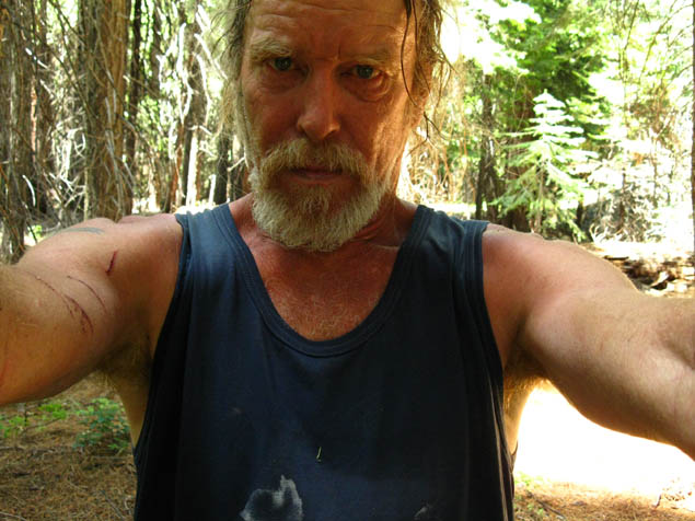
Snug tent after Snow Storm
© Lake Tahoe to Mount Whitney: Crown Jewel of the Pacific Crest Trail