

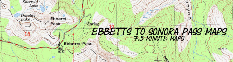

Backpacking map:
Ebbetts Pass
to
Wolf Creek Pass
via
Tyron Peak
Backpacking Topo Map of Northeast Carson Iceberg Wilderness
Hiking Topo Maps for
The Pacific Crest Trail between Ebbetts Pass and Sonora Pass

Topo maps |
PCT Map North Lower Sunset Lake to Ebbetts Pass |
PCT Map South Tyron Peak to Wolf Creek |
Ebbetts Pass to Sonora Pass Miles and Elevations |
30 min |
Click RED DOTS for links to Trail Guide Pages |
Trail Guide |
Ebbetts Pass Weather Forecast ALL SIERRA WEATHER Ebbetts Pass Weather Station |
all miles and elevations |
4.92 miles South from Ebbetts Pass
to
Tyron Peak on the Pacific Crest Trail in the Carson Iceberg Wilderness
| Map North PCT Lower Sunset Lake to Ebbetts Pass |
click Red Dots & Map Labels |
Map South PCT Asa Lake to the East Fork of the Carson River |
|
| Map North PCT Lower Sunset Lake to Ebbetts Pass |
click red dots click map labels |
Map South PCT Asa Lake to the East Fork of the Carson River |
Mapology |
||||
MAP NOTE What's important for our general reference purpose is that each side of a square is 1000 meters, or a Kilometer. From my point of view that is 1093.6 yards or .62 of a mile. Diagonal: 1414.22 meters, if my trig is correct. That converts the diagonal distance into 4,639.8 feet or .88 of a mile.
|
Entering |
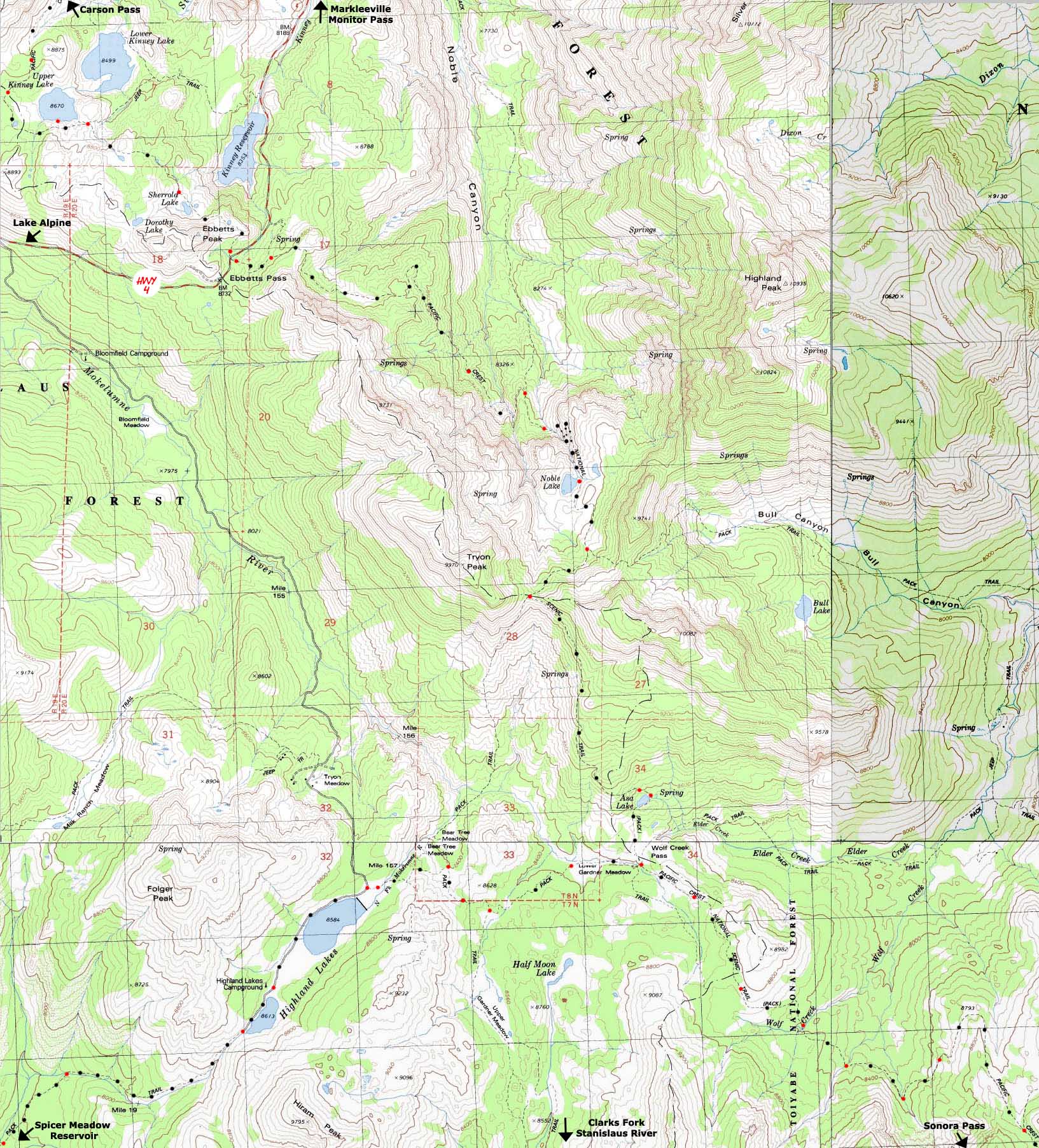
Main Features Ebbetts Pass is an excellent entry point into either the Carson-Iceberg Wilderness to the South and the Mokelumne Wilderness to the North. Here we are concerned with hiking South to cross the 29.44 mile length of the Carson-Iceberg Wilderness along the Pacific Crest Trail route. From Ebbetts Pass to Noble Lake we cross Noble Canyon and its attending headwaters bowl under the Northeast flank of Tyron Peak. From Ebbetts Pass we descend to a point where the trail crosses Noble Creek high up in the canyon. This is the low point of the trail between Ebbetts Pass and the high point on Tyron Peak. The trail from Noble Creek climbs in both directions. Southbound we traverse up across a great shoulder of treeless volcanic terrain to the switchbacks below Noble Lake. At Noble Lake we may find the water fouled by stock, and the camp / break spot littered with cow pies. Noble Lake needs some stock fencing to keep the cattle from accessing the whole lakeshore. From Noble Lake a gentle but steady climb brings up to the high point on Tyron Peak where the Pacific Crest Trail crosses from the Eastern to the Western Sierra. For a few moments... This topo hiking map depicts 4.92 miles of the Pacific Crest Trail South from the Ebbetts Pass Trail head to the high point of the PCT over the East shoulder of Tyron Peak. The links below and above will bring you to the maps heading North to Meeks Bay in the Lake Tahoe Basin and South to Tuolumne Meadows in Yosemite. (May 22 2012) Soon the maps miles, elevations, images, videos and trail guide will run through the Whitney Portal. Trail Guide Page |
Road Map
Topo Hiking Map North PCT: Lower Sunset Lake to Ebbetts Pass Topo Hiking Map South PCT: Tyron Peak to Wolf Creek
Topo Maps Miles Elevations |
|
Miles and Elevations
Location Elevation Mileage Ebbetts Pass 8732 0 Parking Junction 8760 .36Junction to Noble Canyon 8400 3.01Noble Lake 8880 3.96Bull Canyon Junction 9120 4.47 Tyron Peak High Point 9320 4.92
Ebbetts to Sonora Pass Topo maps
Ebbetts Pass
MAP NOTE What's important for our general reference purpose is that each side of a square is 1000 meters, or a Kilometer. |
USGS topo maps information Map Names SW NE SE Compass Offset scale Contours National Forest Contacts Backpacking permitting authority
Wilderness Area
|
Topographic Maps, Miles, Elevation Information |
|
Topo Hiking Map North PCT: Lower Sunset Lake to Ebbetts Pass Topo Hiking Map South PCT: Tyron Peak to Wolf Creek
| Elevations | More Information | ||
Ebbetts Pass Tyron Peak +588 feet |
Trail Guide, Section Trail Guide, Segment Google Map |
||
| MAP CREDIT | ||
U.S. Geological Survey, Department of the Interior The
|
||