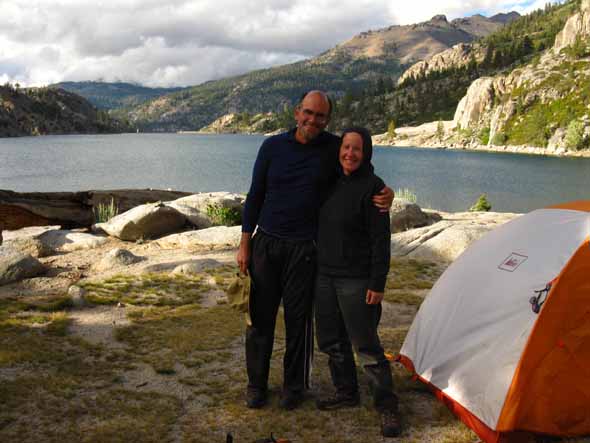
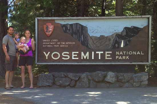
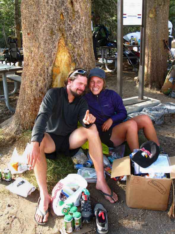
Just in Time and Crossover resupplying PCT trip at Tuolumne Meadows.
The Trails
Guide
Maps
Miles/Ele
Permits
Resupply
Forum
Current Weather Conditions
Weather Notes
Northern High Sierras
Central High Sierras
Southern High Sierras
Gear
Gear List
Gettin Started
Layering
Discussion
Testing yourself and your gear
Gear Reviews
High Sierra Trail Culture
2013 SAMPLE
of
High Sierra Trail Culture
Backpackers, Trail Angels, Horsepackers, Resupply Folks and Hikers
AND
A Day of Pacific Crest Trail Hikers in Jack Main Canyon and another at Tuolumne Meadows
Emigrant Wilderness and Yosemite National Park, June 24 to July 3
Languages
Languages
Trail Arts
The art of walking
Physical Preperation
Trail Skills
The trail
Off the trail
Scrambling
Maps
Navigation
Camp skills
Food
Resupply
Food
Other
Photo Catagories
Trail Stories
Trail Culture
News and Science
Links
Groups
Books
Terms and Conditions of Use
| Trail Guide Highway 108 to Highway 120 | North PCT Dorothy Lake Pass North TYT Bond Pass |
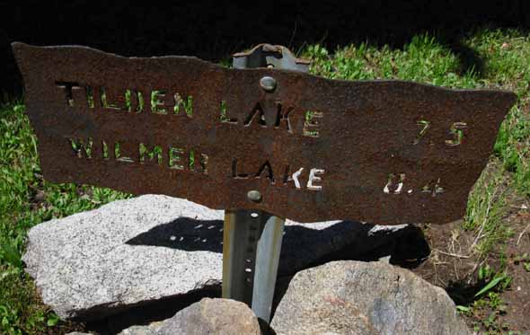
South PCT Wilmer Lake South TYT Tilden Lake |
7.5 Topo Map Jack Main Canyon, Tilden Lake and Wilmer Lake | This 30 min Map Sonora Pass to Bensen Lake | Sonora Pass to Tuolumne Meadows MILES AND ELEVATIONS | TOPO MAP INDEX SONORA PASS | Resupply North Kennedy Meadows. South Tuolumne Meadows | National Forests Toiyabe & Stanislaus | all maps index |
To the Mountains!
| 2010 Report | 2016 Report |
Mountain Madness June 24 to July 3 2013 Mountain Madness, a deep desire to run screaming from the clutches of "civilization" into the Sierra Nevada Mountains, was growing wildly in my soul as Summer began and the days since my last footsteps on a trail grew into distant echoes in my memory. And I had an excellent excuse: by my reckoning the lead pack of Pacific Crest Trail hikers should be moving into the North Yosemite Backcountry. A hike South along the Pacific Crest Trail from the Emigrant Wilderness into Yosemite should give me a fine sample of this year's crop of PCT hikers as they march North out of Yosemite. I was correct. After two days hiking up to the Sierra Crest on the Tahoe to Yosemite Trail route crossing the Emigrant Wilderness from Kennedy Meadows Pack Station on Highway 108 I crossed over Bond Pass into the far Northwestern corner of the North Yosemite backcountry and hiked down to the intersection between the Pacific Crest and Tahoe to Yosemite Trails just below Dorothy Lake and Dorothy Lake Pass at the top of Jack Main Canyon. It was not long, not long at all, before I ran into a series of fine folk hiking the Pacific Crest Trail. The next day I only encountered a few PCT hikers before I passed South of the Wilmer Lake trail junction, where the PCT-TYT turns towards Tuolumne Meadows and I continued down Jack Main Canyon, and a very few local backpackers, towards my exit from the backcountry over O'Shawnessey Dam at the head of Hetch Hetch Reservoir in the Grand Canyon of the Tuolumne. Hitching out of Hetch Hetchy brought me to Tuolumne Meadows, where I met a large group of Resupplying PCTers moving North as well as a good number of JMT hikers hiking South. Let's take a look at some of the fine folks hiking the Pacific Crest Trail during 2013, other long and short hikers we meet along the trail, and check out the backpacker resupply spots that bookend this trip.
|
Road and Trail Angels
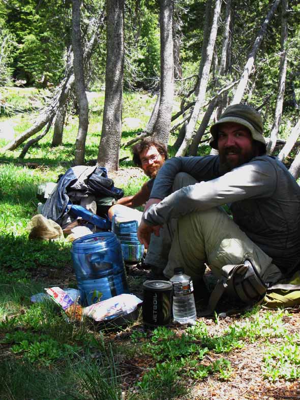
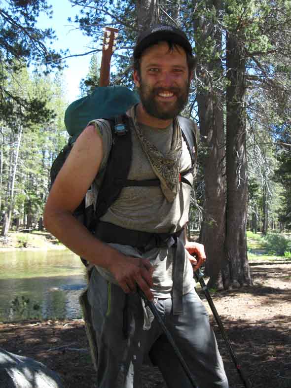
Getting there is Half the Fun I managed to get a ride across the Vast San Joaquin Valley to the Sierra Foothills at the Split between Highways 108 and 120. Here I would begin my nine hour 75 mile hitch up to Kennedy Meadows, and here is where I got hit with the first in a series of beautiful weather changes. The first change shifted from Fair Weather into mild rainstorm conditions spawned by a weak low pressure zone slowly rotating its way Westward from about a thousand miles North of Hawaii Eastward to cross Northern California on its way further East. For the next nine hours I was buffeted by mostly gentle rain from the sky and worse, supercharged spray from cars passing at 50 mph, broken up every now and then by meeting real nice locals who stopped and shuttled me a few more miles up Highway 108 towards Kennedy Meadows Pack Station. Nice folks up there in the Sierra Foothills. I got two rides that were both very interesting and delightful at the same time. The first was from Cindy and Adam, local residents from Twain Harte down on Highway 49, who's love of hiking the Sierra Nevada Mountains in their backyard provoked Cindy to set up This delightful site will fill you in on local social and community events along the Northwest Sierra flank in what's commonly called "Gold Country," as well as Hiking and Outdoor Activities. This site is as delightful and informative as I found Cindy and Adam to be. There's loads of "locals only" information in here that would take outsiders years to uncover on their own. Next Cindy and Adam dropped me off at the Summit Ranger District Station just West of Strawberry along Highway 108. This is where you will get your permits hiking North into the Carson Iceberg Wilderness or South into the Emigrant Wilderness. Hats off to the fine staff at Summit. They always take good care of backcountry travelers. Stop by and chat them up if you are passing by, or need permits for the Emigrant Wilderness. Then came a most entertaining ride from a band of three ex-PCT hikers who were on a mission of angels, to be more specific, a mission as trail angels. TRAIL ANGELS Curtis, Alec, and Kim had a big Toyota stuffed with BBQ treats, food, drink, and everything they would need to set up a remote feeding station along the PCT to treat the body of Pacific Crest Trail hikers that passed Sonora Pass and Kennedy Meadows during the next few days. The best ride is always the last after a long day of hitching, and Curtis, Alec, and Kim brought me directly to my final road destination at Kennedy Meadows, where travel would now shift to the trails, and I would begin hiking South. How delightful. Below: TUMBLEWEED, Kennedy Meadows Pack Station First PCT Hiker: Tumbleweed on far Right on June 24, 2013, with Alec, Kim, and Curtis at Kennedy Meadows. They gonna feed up that skinny boy!
They had invited Tumbleweed down to set up and camp in the Deadman Car Campground so they could feed him full of food and drink. Kennedy Meadows Pack Station Trail Map (TYT route) Sonora Pass Trail Map (PCT route) |
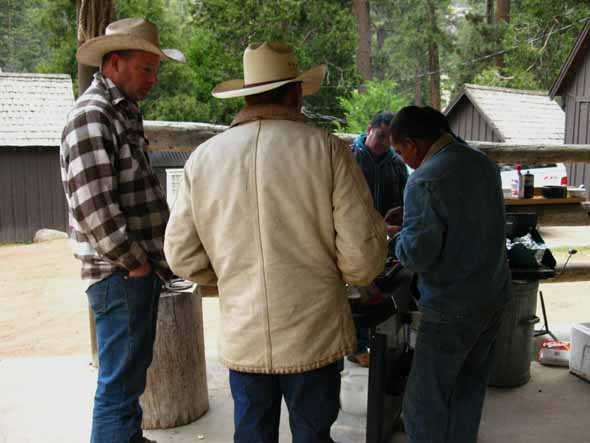
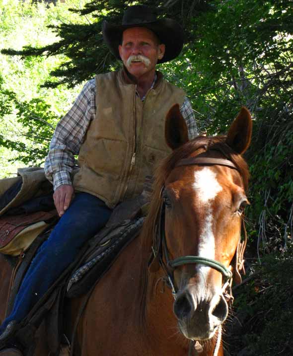
Fun with Cowboys
Kennedy Meadow Pack Station I arrived at Kennedy Meadows during one of the Horsepacker's little party-BBQs, which was a good thing. A cold beer and hot tacos warmed up wet bones chilled by a day beside the road.
Kennedy Meadows Cowboys and Crew having a time. Bloom always thinks up something to hit me with when I show up. One year it was his John Muir Stories. "You Know what John Muir was," asks Bloom, like a trapper looking at the critter he's setting a trap for. He thinks I'm a Berkeley hippy. That could be a mistaken perspective... I look Bloom straight in the eyes, and say, "A frkn Racist. You ever read anything he wrote about indians?" I kicked Bloom's verbal trap back at him. Matt takes no mind of any of what I say, moving forward with his argument at a good trot, saying, "Muir was a backpacking bum. He never carried any food, and followed the horse packers around to eat." I take an offended air, rhetorically asking Bloom, "You know I'm a backpacking bum? No self-respecting backpacking bum needs a cowboy. " Such is a sample of the conversation between me and my friend Matt. He has a horseman's respect for real backcountry backpackers, but with the horseman's disdain for two-footed mules like me offset by his steady good nature. But he's always waiting for me with something under his white hat. This time it was good. We're standing about eating tacos properly washed down with a few beers, playing with Matilda the Burro, watching Colin torture anyone stupid or crazy enough to pull his chain, when Matt turns and says, "You backpackers can't see the surrounding terrain with your eyes down on the trail. It takes a horseman to really observe the terrain." Now this is the kind of "watch everything" talk I reserve for people doing the "PCT shuffle" or rookie hikers who have yet to learn how to observe everything necessary and possible under all situations. I have studied The Art of Walking from the inside of my metabolism joined to the full extent of my perceptive capabilities, learning to both fully focus of my attentions on trail for high speed situations as well as vary the balance between trail, terrain, and body as the demands of the environment require different splits of perception. I have developed physical and mental technics to deeply observe and engage the environment as I hike through at optimal speed. And, I stood there mute, shagged, a soggy doggy wet all through and exhausted by the long hitch up the mountain through the storm. And now, a couple of weeks later, I am frustrated. I knew what to say, but I was too tired to say it: "The noise of a horse and rider scares everything off before it even gets into visual range. My light steps quietly down the trail let me sneak up on things riders scare off." I'll be back, to keep the damn cowboys in line, and safe for backpackers.
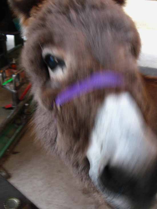
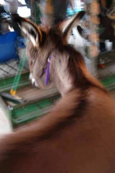
But what really warmed up my attitude, besides the cowboy hospitality, the hot tacos and cold beer at KM, was the new member of the Kennedy Meadows Pack Station family: Matilda the Burro
Ain't she the cutest thing you've ever seen? Well, maybe I should get out more... The thing about Matilda, besides being cute as hell and her delightful personality, is that she appears to believe she is a dog, rather than a burro. The Ruff Life. Matilda comes when called by name, and has a very interactive personality. The Pack Station dogs, on the other hand, think Matilda is an object of fun, to be messed around with. Matilda will have none of that. When the dogs approach to give her some guff, Matilda sets them straight with a few swift kicks, which the dogs expect and avoid, then she chases their asses off in a hurry. It appears that both Matilda and the dogs greatly enjoy their little game. Matilda takes no shit from the dogs, because she is convinced she's the alpha in that pack. And her size lends credibility to her belief, even if her self-identification as a dog is dead wrong. She's big enough now that I don't think any dog has the weight to convince her she's not the head dog, let along not a dog at all. If things keep going on as they are I would not be surprised if Matilda tries to herd the horses as the dogs attempt to do. I'm pretty sure the horses and mules will set her straight where the dogs are failing.
Matilda is a fine addition to the KM family and a unique addition to trail culture. We don't see many burros in the Sierra anymore. |
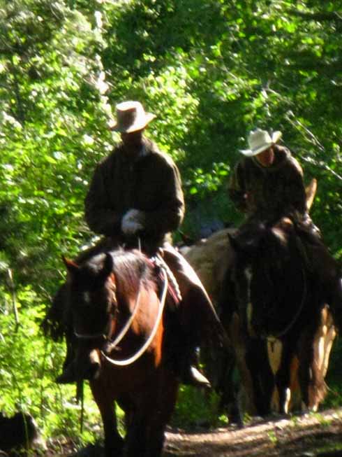
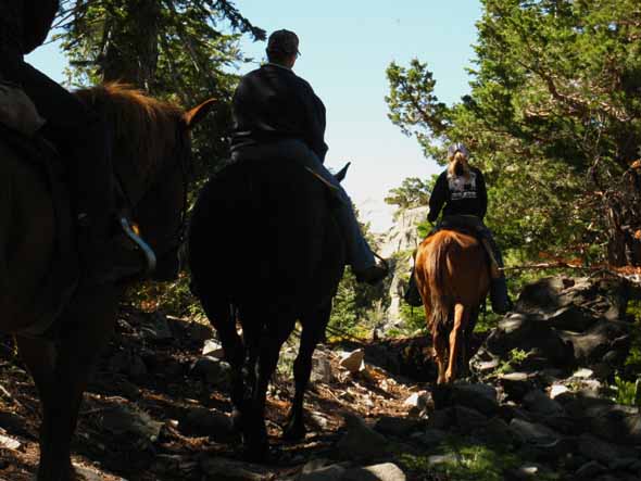
Kennedy Meadows Horse Packers Riding the Emigrant Wilderness
With a few fisherfolk and local backpackers in the Mix
June 25 2013
Kennedy Meadows to Brown Bear Pass Day Hikers and Fisherfolk along the Middle Fork of the Stanislaus River Backpackers at Relief Reservoir "Drop Campers"
Wandering about the fine mixture of granite and forest holding the campsites on the Southwest shore of Relief Reservoir, I met these nice backpackers from Santa Cruz. They had each hauled in two big loads, so they could "drop camp" for 11 days here at Relief Reservoir. The plan was to bring in all the supplies to support an extensive stay of day hikes and scrambles from their well-appointed base camp. A great idea. I've met bunches of Backpackers in the Emigrant Wilderness, and up and down the Sierra Crest, who've been resupplied by Horse Packers. Or, you can have Kennedy Meadows horsepackers ride in and drop a load at any point you specify, or to any point you are capable of hiking into and back from. Call and Talk to Matt about riding you and/or your supplies/pack deep into the Emigrant Wilderness. comments on horsepacker drop camping? comments on 2013 trail culture Trail Guide: Relief Reservoir Relief Reservoir Dam on the North side of the Reservoir
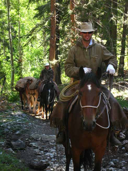
The last clouds from a weak Pacific Ocean storm are rising and beginning to break up. Kennedy Meadows Horsepackers above Relief Reservoir up Summit Creek June 26 2013 Colin and Pal
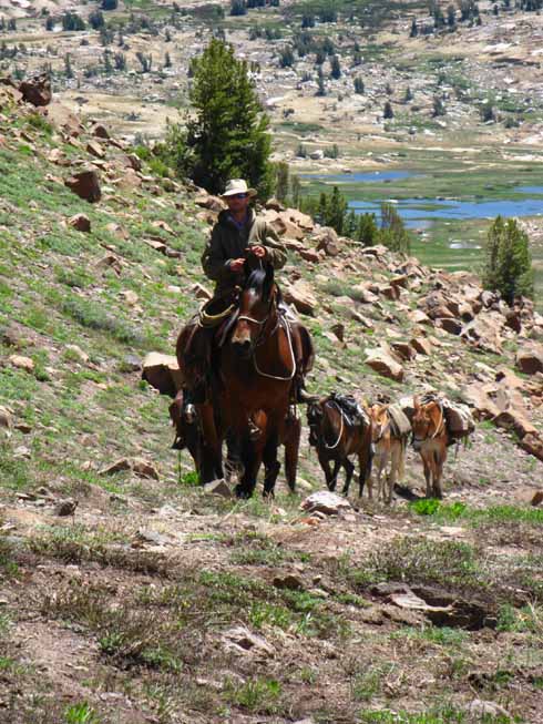
Riding through the Morning Glare Colin and another Kennedy Meadows Horsepacker ride out of the Morning Glare, on a long ride to move some Kennedy Meadows horse campers to another site, somewhere down near Twin Lakes in the Emigrant Wilderness. We will meet them riding back the next day as well.
I don't know if you can see it on his face, but Colin is always thinking about some way to have fun. Cowboy fun can be a bit rough, so keep your eyes on Colin! He's some unique piece of work! Call and Talk to Matt about riding you and your supplies/pack/ or a fine backcountry camp deep into the Emigrant Wilderness. These guys will set you up. Picture: Approaching the Lower Relief Valley trail junction. A few miles and a few hours later Corky rode by leading day riders deep into the Emigrant Wilderness out of Kennedy Meadows Pack Station. The Corkster is one hell of a guy. I'd ride or hike with him anytime, anywhere. Well, I don't think we'll see Corky hiking, unless thing go really wrong! Call and Talk to Matt about having Corky ride your ass around Emigrant Wilderness. He knows his way around those mountain trails up and down the Sierra Nevada.
Speaking of work, they broke the mold after they made Corky. Corky's horse is taking a deep look, listen, and scent of me. Neither Corky or his horse can understand why someone would not ride these beautiful trails. Good looking horse. Corky on the other hand... Location: climbing to Saucer Meadow
Above: Riders with Corky follow him up the trail towards Saucer Meadow. To the High Sierra Crest in Emigrant Wilderness Colin and Pal riding out of Emigrant Meadow up to cross Brown Bear Pass the next day. Emigrant Meadow Lake in Emigrant Meadow visible in background.
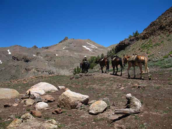
MAP: Brown Bear Pass to Bond Pass Riding North through Brown Bear Pass
After riding out to resupply and move a backcountry camp to a new location for the smart fishermen who hired them, Colin rides back to Kennedy Meadows Pack Station the next day. Now that's a job! Call and Talk to Matt or Marty (scroll down below the map) about riding you and your supplies/pack/ or a fine backcountry camp deep into the Emigrant Wilderness. Not only can you ride with these horsemen (and horsewomen, Matt employs Gina the Horsepacker as well as fine backcountry horsemen such as Corky, Marty, and Colin) but you can hire these folks to ride and camp you around a multi-day loop or ride the long ride down to Tuolumne Meadows across Emigrant Wilderness and the North Yosemite Backcountry. Colin had one mule "free ranging" it, following along off the rope. I understand. I have a couple of mules at KM that I really like. Fine Beasts with great characters. Colin mentioned he had two off the rope as he rode past. I only counted one. But that's likely a figment of Colin's wry sense of humor, to know I would then be scanning meadow, trail, and mountainside looking for the second mule, knowing I would take the rope, load my pack onto the mule, and keep walking South... Hahaha, I've got a sense of humor too... especially if I find an unloaded mule on the trail! That sucker is going to do some "light" work hiking South with me! Ha ha... Passing South through Brown Bear Pass we will now hike across Emigrant, Grizzly, and Summit Meadows over Bond Pass and Into Jack Main Canyon along the Tahoe to Yosemite Trail route. Our goal is to make contact with Pacific Crest Trail and its 2013 Hikers in the far Northwest corner of Yosemite National Park. |

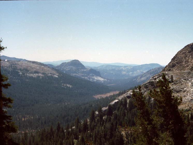
Grizzly Peak near, Tower Peak far, Emigrant Meadow in Foreground
Forsyth Peak on the far Right Corner, with Jack Main Canyon below its near flank
View Southeast from Brown Bear Pass across Emigrant Meadow at Grizzly, Tower and Forsyth Peaks
Grizzly Peak is the volcanic cone on the Left side of the image above. In the distance to the Right of Grizzly Peak we can see the two low ridges separating us from Jack Main Canyon in Yosemite. Tower Peak, in the distant Middle-Right of the image above, lays beyond Jack Main Canyon at the head of Tilden Canyon, holding Tilden Lake in Tilden Canyon.
If we hike North or South our view of Tower Peak will rotate with our changing position. It's an area landmark. It's an impressive monster from any angle.
MAP of Emigrant Wilderness with Grizzly Peak
MAP of Jack Main Canyon, Yosemite, with Tower and Forsyth Peaks
June 28
Bond PassTYT Route into Yosemite
On the upper Right hand side of the second image above the second dark ridgeline beyond Grizzly Peak descends downward out of the Right side of the frame, below the tip of Forsyth Peak at the Right edge of the frame. This second ridge descends down to the low point in that ridgeline called Bond Pass, marked by the sign above. We enter Yosemite National Park via the Tahoe to Yosemite Trail through Bond Pass to begin the brief descent down into Jack Main Canyon to meet the Pacific Crest Trail near the top of the canyon.
Mileage: Bond Pass is 16.04 miles from the Kennedy Meadows Pack Station. |

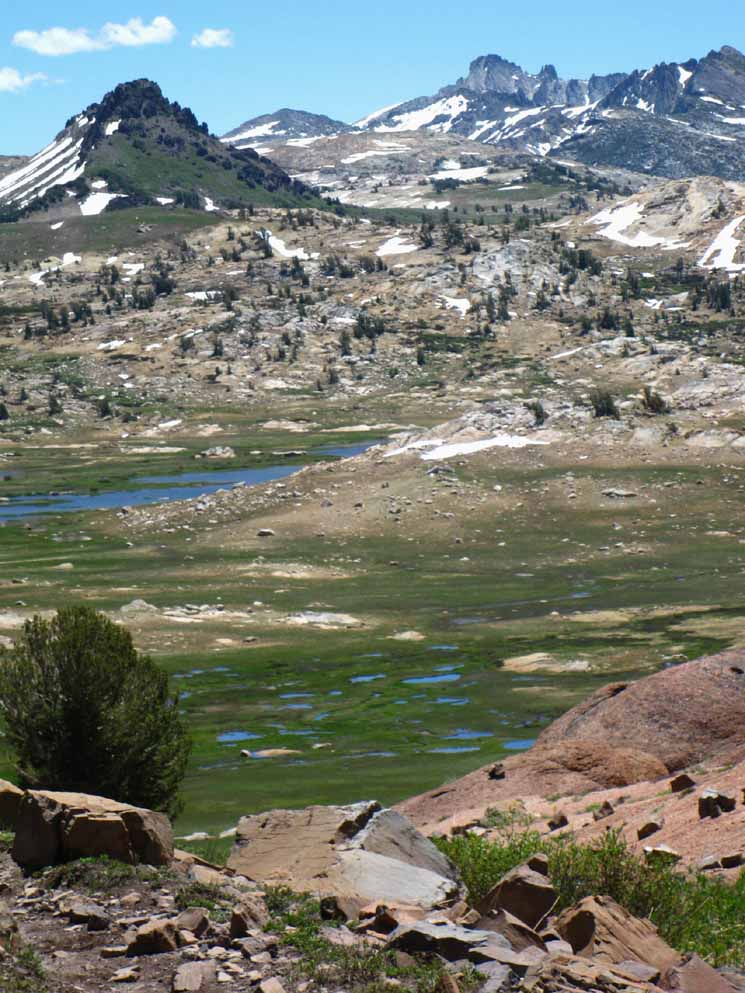
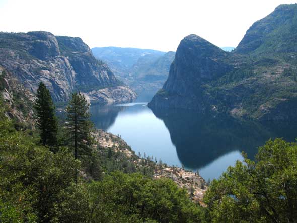
Bird's Eye View of Jack Main Canyon, Yosemite National Park
Looking down Jack Main Canyon at Grace Meadow and Chittenden Peak. Within this canyon is where we met the PCT hikers depicted below. MAP. BIG MAP. We are standing on the boundary line between Emigrant Wilderness and the North Yosemite Backcountry, above Bond Pass. I had a wild hair up my ass during one trip back in the late 1990s that caused me to climb to every high point to get the best views.
Nowadays the plan is to have an extra day's food for every section between resupply spots. This allows great flexibility. I can take a full day off to rest or explore, or two half days off for two half-day explorations of various intriguing areas I've spotted from the trails during previous hikes, or during map study.
Click anywhere along the black dotted trail routes on the BIG MAP for detailed maps of that area. The BIG MAP can be heavily magnified for greater detail as well. Clicking the RED DOTS on every Tahoe to Whitney map puts you on the Trail Guide in that location.
The BIG MAP highlights the differences between the PCT & TYT routes both North and South of Highway 108. The Big Map can be magnified for better detail, as I mentioned, or clicked through to the detailed maps depicting all the trails.
Tahoe to Yosemite Trail junction with the Pacific Crest Trail Jack Main Canyon, Yosemite This is the Southern of two junctions made by the TYT splitting off into North and Southern intersections with the PCT. This "trail triangle" is located near the top of Jack Main Canyon. Only the Southern junction is signed. Though the USGS map does not show this trail triangle, I've drawn it in. Here local hikers heading South out of any of the Highway 108 Trailheads can mark the far point of their great loop routes by turning North, back towards Highway 108. Or continue South towards Tuolumne Meadows. Here Northbound hikers have found the TYT route to Kennedy Meadows Pack Station. Mileage 16.91 miles South of Kennedy Meadows Pack Station along the Tahoe to Yosemite Trail 19.22 miles South of Sonora Pass along the Pacific Crest Trail 54.58 miles North of Tuolumne Meadows along the Pacific Crest Trail Note It's a couple of miles further hiking to TM along the TYT than PCT from this point because the TYT swings around Tilden, rather than Wilmer Lake on their otherwise shared routes South, though the overall miles of the PCT and TYT to TM from their respective trailheads off of Highway 108 are roughly equal. Check the Map for details of this final divergence of the TYT and PCT down to TM. Both routes are very beautiful, with the major difference is that each explores different aspects of Bailey and Macomb Ridges. |
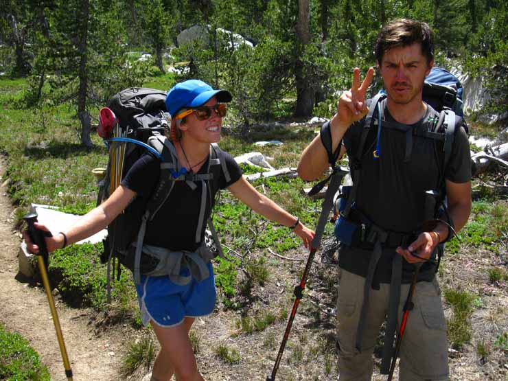
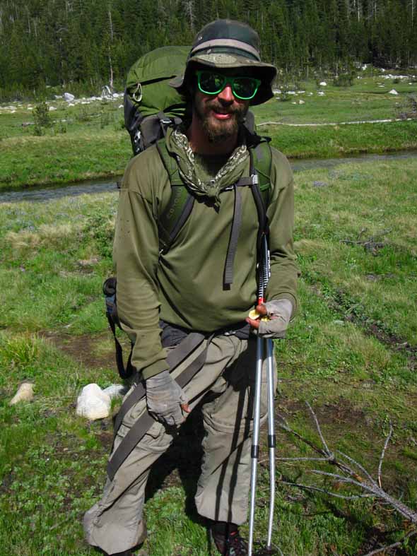
Intersecting with the Pacific Crest Trail If I had calculated correctly, hiking Southbound on the Pacific Crest Trail down Jack Main Canyon on June 29 and 30 would bring contact with a whole stream of Northbound Pacific Crest Trail hikers who would be up near the front of the series of hiker "packs" of PCTers strung out along the Sierra Crest, like a string of pearls. Why? Because 1000 divided by 60 = 16.6. This equation means that hikers who departed the Mexican Border sixty days ago (May 1) and have averaged 16.6 miles a day will be approaching the 1000 mile mark near Sonora Pass. Sampling the TrailJournals.com lists of 2013 hikers shows May 1 is a good average for the shotgun spread of PCT'ers start dates. Check ADZ and PCT Association for annual opening of the Sierra. Better yet, track the transition of seasonal weather trends across the High Sierra that determine when the High Sierra trails will become passable. I put day zero on May 1, and then put myself Southbound down the Pacific Crest Trail sixty days later at the end of June and first days of July to intercept and check out a good sample this year's crop of Pacific Crest Trail hikers. That worked out well. I saw 31 PCT hikers in Jack Main Canyon and talked to 25 of them on the latter half of June 29 and the earlier part of June 30. Three hikers passed by in the canyon with minimal acknowledgement of another backpacker. They were literally doing the "PCT shuffle" and their eyes were glued to the trail. One backpacker crossed Falls Creek, then stripped naked. I did not see what he did after that, as I focused on my lunch and the beauty of the rippling waters reflecting waves of light across the surrounding trees and rocks. I observed two more suspected PCTers hiking North past Wilmer Lake on their way to the Falls Creek ford as I proceeded off the PCT down Jack Main Canyon.
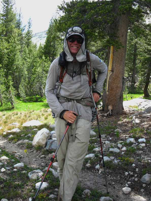
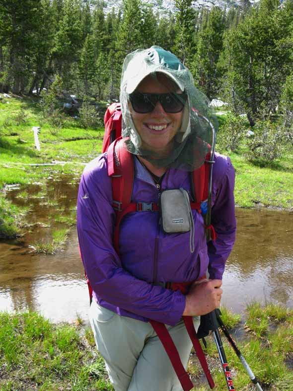
After exiting Jack Main Canyon via Hetch Hetchy I hitched to Tuolumne Meadows and observed and engaged some more of this year's Pacific Crest Trail hikers, and a few John Muir Trail hikers too. Following below is a sample of this year's PCT hikers and aspects of High Sierra Trail Culture. 2013 Pacific Crest Trail Hikers Observations This year's hikers looked really good, at least the sample I came into contact with. All hikers looked strong and fit, well fed, and uninjured. Two issues were bothering hikers, which was the building heat wave and high humidity, and the legions of mosquitoes plaguing the trail. The group I came into contact with crossed the Five Canyons, the "North Yosemite Washboard," at the tail of a weak Pacific Storm which then built into a real high elevation heat wave with Heat Advisories issued by the National Weather Service and by Yosemite even to high elevation hikers. Along with the heat the mosquitoes too were oppressive. I found that many hikers had little chemical or clothing protection against the mosquitoes. Those who had clothing sufficient to ward off the pests were faced with overheating issues. I recorded temps from 87 to 92 degrees at altitude, and my observations indicated it was even hotter than that. Only a few Pacific Crest Trail hikers carried 100% DEET, though many took up my offer to use mine, and take some with them if they had suitable containers. Most used the DEET, though none took any with them, except what they applied to themselves. The vast majority had DEET on their shopping list for Lake Tahoe. Most were planning to hike the 150 miles between Tuolumne Meadows and Lake Tahoe without resupplying, though a few were stopping at Kennedy Meadows Pack Station to resupply. No one needed any of the extra food I had brought along. |
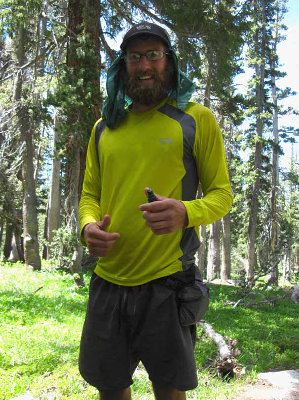
Caveman
Caveman, early start out of Kennedy Meadows Pack Station South. Out of 82nd Airborne and combat tours, all the way out on the PCT. Real cool guy, pleasure to talk with. Caveman loves the Sierra, really enjoying the rugged 5 canyons North of Tuolumne Meadows. |
Dinnertime
|
Dinnertime, Dingo and Mud
Dingo and Mud out of Ohio and Michigan, respectively. |
Keno
Reported doing 26 miles the previous day, and not slowing down for the five canyons of the North Yosemite Backcountry, which was typical of most PCT hikers. Most dropped down to 15 miles per day across this section from 20+ miles per day further South in the Sierra. This reduction is attributed to the closeness of the series of ridges in the Yosemite Backcountry. There is no distance between ascents and descents. |
Gone Slow
Out of Redding California, along with his hometown pal, Mountain Man. |
Gone Slow and Mountain Man
Gone Slow and Mountain Man really liked the "Squeeze Bag" water filters, and the filters themselves, but note that the integral water bags only last for 700 miles before the material splits. Mountain Man was getting tagged by the skeeters. His shoulders were one big bite.
|
UniCrock and Scat Tracker
Delightful folks from Michigan. Lots of hikers from Michigan. Very clean and tidy, had that look of mountain joy on their faces. |
Tom and Annette
Trip: Kennedy Meadows South to Crater Lake Time: Two months on the trail to reach Crater Lake. Averaging 17 miles per day, and having a blast doing it. |
Soul Catcher
He and his partner, below, hail out of New Zealand. "Amazing, spent night on Mt. Whitney, sun rise and set stunning." |
New Zealand
Delightful hiker out of New Zealand. A pleasure to speak to even as the skeeters tried to drain me. She was using full protection clothing to keep the smile on her face! |
Robin Hood
Out of North Dakota. Falls Creek in Grace Meadow. |
Cuttles and Emma
Very Clean. I did not think they were PCTers, due to their fine appearance. But I was wrong, people can keep really sano on the trail! Falls Creek and Grace Meadow with peak 9214 rising behind Grace Meadow. I've seen that Cuttles is a a professional cellist who is giving concerts hiking down the trail. Cuttles explains his approach thusly, "I wanted more time. I wanted my music to be part of the summer. I wanted to take things as they came with less of a hurry. And maybe just as important, i wanted to walk every step." If you live in the Great Northwest of the US and it's still the Summer of 2013 you still may have time to catch Cuttles' traveling concert series. Check out his tentative concert schedule along the Pacific Crest Trail route below. Cuttles' PCT Trail Journal |
Bandleader
Out of Bellingham Washington. |
Simon
Out of the UK, London specifically. One word for the PCT: "Awesome" |
Decon
Out of Penn. Reported all PCT fords in the Sierra were do-able. |
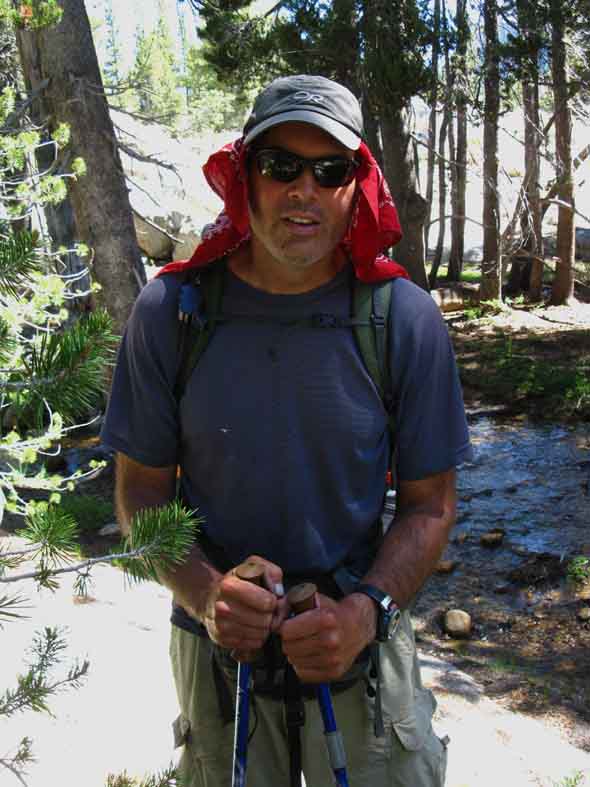
Anson
Anson is out of Park City, Utah. Caveman had mentioned his friend and hiking partner Anson would be hiking up soon. Caveman said their hiking motivations had varied, as Anson had become intrigued by the terrain, and wanted to slow and stop to engage it. Anson and Caveman were playing out the classic contradiction between the demanding physical engagement required to cover the necessary miles vs. the demands of the environment to check it out, carefully observe, consider, and engage it. This is the contradiction between depth of local understanding and familiarity vs. the distances required by long distance backpacking. Anson and I chatted about how the beauty and terrain of the Sierra demanded more from hikers than rushing through, and the possible ways hikers could balance the many miles and hard physical demands of the PCT against the demands of the environment to check it out. We agreed that the ability to go slow and stop to enjoy the trail was best complimented by the ability to go very fast. We agreed that the ability of a long distance backpacker to both stop and smell the roses as well as cover 25 mile days is the key to enjoying all aspects of the trail, of being able to meet the wide variety of demands life on the trail puts on backpackers. The more you can rush the more you can rest. Sometimes the trail demands you stop and soak it up, other times it demands that you push forward high mileage days. Only you can hear what the trail demands from you. Anson was listening carefully. |
RodKnee DangerTrail
RodKnee is out of Florida. Trip: "A dream, gorgeous." Reported a "Billy Goat" sighting. Billy Goat is a legendary PCT hiker. Never met him myself, but I've heard trail stories. Stories say Billy was a railroad employee who spent all his off times in the mountains. After retiring, he spent all his time in the mountains, with his wife (?) spending her time resupplying him at various trailheads. Billy Goat told RodKnee a walking ranger was at Bensen Lake. |
Songbird and Banana Ripper
Out of Cambridge Massachusetts. PCT: "Awesome." |
VeggieLast PCT hiker talked to
Out of Rhode Island. Hiked AT last Summer. The Falls Creek fording spot continuing South on the PCT to Wilmer Lake is behind Veggie.
At this point I continued down Jack Main Canyon rather than crossing Falls Creek to continue South along the Pacific Crest Trail route. |
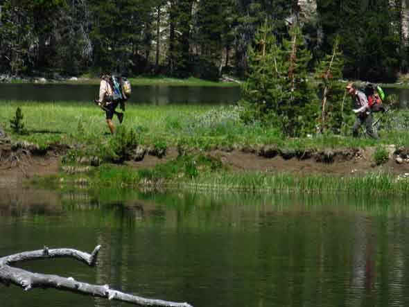
Unidentified, but likely PCT hikers
Spotted this crew as I continued to follow Falls Creek down Jack Main Canyon, past the PCT trail junction turning to Wilmer Lake. They did not see me. They were hiking on the thin neck of land between where Falls Creek pools up in the foreground with Wilmer Lake behind them. Trail Guide Page |
OFF the PCT From the Wilmer Lake trail junction I hiked South down Jack Main Canyon to exit the trail through Hetch Hetchy. A short set of hitch hiking rides soon brought me to Tuolumne Meadows, where I met a bunch of John Muir Trail hikers, as well as lots more Pacific Crest Trail hikers. |
Jack Main Canyon to Hetch Hetchy
July 1 2013
John and ReneeLower Jack Main Canyon
Out of North Carolina. And they really-really love the Sierra, and are just delightful folks. More Renee was really on it with trail information. She totally updated me about the location of water and distances between water spots. She informed me of running water not marked on the maps, located to our West after we finish the climb out of the bottom of Jack Main Canyon onto the top of Moraine Ridge. John and Renee, like the next folks I met (John and Anne at the trailhead) were serious religious folks.
Here's the deal in the lower section of Jack Main Canyon Plenty of water in and along the lower sections of Jack Main Canyon from the Wilmer Lake trail junction down to the climb up onto Moraine Ridge all season long. Water is not a problem in Jack Main Canyon. Near the top of the steady and sometimes very steep climb out of Jack Main Canyon to the top of Moraine Ridge a strong tributary of Falls Creek flows past, the one mentioned by Renee above. This will be our last reliable water until arriving at the well at The Beehive. There is one more seasonal possible source of water between the North end of Moraine Ridge and The Beehive. About halfway between the North end of Moraine Ridge and the Beehive the flow of a tributary of Frog Creek, flowing Southwest, swings near the trail. This creek was running on July 1 of 2013, a year with a very dry Winter and early Summer, but I do not expect it to be running late in the Summer most years. My apologies to the Northbound hiker above Hetch Hetchy who asked me about it in passing. I was pretty spaced out from the heat, which was running in the mid 90s. I did not realize what he was asking until we had some distance between us. August 8, 2013 update Renee sent me this update, which also points out the location of the creek between the North end of Moraine Ridge and The Beehive, and gives us a better description of its location: Renee's Update Half way across the ridge we will see a ravine with Aspen trees, and think we can hear the faintest tingling sounds of water flowing. At one point the trail passes about 300 feet from this ravine. So we went over to check it out. Sure enough a nice flowing stream with easy access, so we camped there. You asked me about water and my answer was totally not correct. This stream must come from a spring as there is no other water source. Not sure if it is seasonal. Hope this information can be of help to you, Renee. |
On Religion I'm not religious in any kind of conventional sense. But, contemporary organized religions bug me. Not necessarily all the people in them, but their centralized ethic and methods of operation. These involve training to absorb fundamental dogma, rather than to develop analytical or spiritual assets. These types of dogmatic beliefs and practices neutralize spirituality within the framework of our polity and economy. Compliance and compulsion in a system openly centered on the pursuit of material gain are not spiritual tools, do not reflect or respect the complexity of life, and are not the tools and methods of religion, but of empire. Religion in an Empire? Really? How's that working for religion, the empire, and society? Not too well, eh, if we count the percentages of people who are using anti-depressants and divorce, after drowning their spirit in material self-gratification fails. Our society's "Spiritual Health" is not doing very well if we measure the moral and ethical framework and foundation of the average "American" individual and our institutions. But I seem to get confused. Is religion a personal spiritual or public legal issue? Well, I guess it depends on how you look at spirituality, which is supposed to be the specialty of religion. The answer to this question depends on where you stand on the division between personal and public life, and how the rule of law balances this equation. The war on drugs perfectly displays this hypocrisy The founder of Western Religion "gave Caesar his," while our modern versions of religiosity claim Caesar's criminal powers of compulsion as their own, to enforce their moral perspective in the bedroom, in the doctor's office, and even down to what you put in your pipe. Interesting. Either Jesus or our modern religions of moral imposition are wrong. All these moral impositions into the personal life of people directly violate those, "cast the first stone," "turn the other cheek," bits of wisdom that christianity is supposed to be based on. Unless religion has been misused by turing it into a tool of public compulsion, as it is today. Let's figure this out: Religion in an empire is the religion of the empire, or else the empire will target and kill the members of the religion... Remember Jesus? Remember the Muslims in America? American Indians? Hell, we can even throw in the Mormons. Unpopular religions do not last long in, "The Land of the Free." Those are just a few in a long line of examples of what happens to religious figures who really seek justice, rather than wealth and power. They are killed, and usually brutally as a warning to all those who might be thinking about contesting the power of the status-quo. The worse examples of institutional and spiritual corruption in America, besides the political parties, can be found in the so-called "churches of prosperity." They do resemble our political parties. I know exactly what these religious sans political scammers are doing: stealing. They are quite amazing for a religion who's leader threw the money changers out of the temple and said, "The rich man will get to heaven like the camel through the eye of the needle." Churches of Prosperity? Religion of the Empire? Really? Any true religion defies institutions created by man's greed, corruption, and evil rather than replicates and services them. I don't see any religions in America identifying, let alone defying the institutional corruption that pervades our system. Of the last two popes the last was a nazi and the current quietly served a murderous criminal military dictatorship. Quite to the contrary, religions are vying against their institutional and individual "enemies" (such as "secularism") to impose their parochial "values" on everyone else. Religion in America has a very long history of associating with unethical but powerful business and political lobbies to use our political institutions to impose their beliefs by law. That's un-American and not religious. You are welcome to tend your own spiritual garden, but get the hell out of mine. Socially, religions have kept themselves busy by personally assuaging the emptiness and guilt of individual consumers, consumers who's anxieties originate from the coldness of life within a corporate empire, to believe and follow their religious values while attempting to punish those who disagree by law. In the meantime, the crimes of empire continue unabated, and the root causes of individual's spiritual malaise continues equally unabated. Religions are operating in the shadow of a much greater evil, pretending to be unaware that the deep shadow of this evil assures their work will ultimately be ineffective for manifesting the spirit individually, institutionally, or through our environment. There is a great evil at the heart of our system composed of the greedy desires of a large group of folks. Religions will not pit themselves against the source of individuals' moral, social, or economic dysfunction, the empire of greed and corruption itself, but ignore the empire in exchange for use of its criminal powers to impose their moral code with the power of law from positions of great luxury. Rather than helping folks find their own unique relationship within the miracle we live within, religions attempt to make every unique individual fit within their own narrow definitions of propriety to serve their prosperity. It's the old "throw the first stone" hypocrisy. Religious hypocrites can't stop throwing stones, judging others while they are living in the same glass empire as those they stone. This presents the whole world with the spectacle of those selling the line "don't judge others," punishing the victims of their judgments. Wow! These are the "good" people in our society, good people who are following bad religions in the US. Yet I have seen the power of the Spirit of Life move all things. The spirit is here. It just does not live in any of the boxes called "churches," nor does it endow empires with "justifications." Only the "churches" of men do that. I never find the spirit within the physical constructions of cities, though spirit holds on tenaciously in a very few of the folks who live in these vast cities. Most modern city folk are spiritual "zombies" full of themselves and their own greedy desires, which their "religions" justify. The spirit does flow through the mountains. You don't need religion to see that. All that aside, the religious folk I meet in the High Sierra are among the finest folk I meet anywhere. They see the spirit in the mountains, though we may disagree about what to call It. The Bottom Line I will fight for every citizen's fundamental right to describe their own religious framework with their words, beliefs, and most importantly, their actions. I will fight for the right of my fellow citizens to entertain their own religions and comport their own private lives by their own beliefs. I will fight against anyone who imposes their beliefs on another, or on the public. Let's get back to our mutual agreement to protect each other's rights, even when each of us uses that right differently. It's called being American Citizens. This would be the mutual basis of all our freedoms, if this ethic still existed in the hearts and minds of our people and within our institutions. It does not. Troubles will increase until we put our ethical and secular mutual agreement before our own personal greed, and the greed of those who thirst for wealth and power in social, economic, political and even religious terms. These are the dangerous people our mutual agreement was designed to control. It has failed on all fronts. No, our Constitution has not failed. It is us, us American who have failed to live up to our fundamental values, and allowed the greedy and corrupt to put our Constitution aside. Religion is as crazy as politics are evil, and the corporations have monopolized and organized a system of global greed to control it all. Unified by our mutual greed. I'd pray we can fix it, if I was religious, for the failure of our mutual agreement means everyone's religious, philosophical, and practical freedom are at risk, as well as our lives, the remnants of our shattered liberties, and what remains of our property. It is the time for all good Americans to fight for their country's very ethical soul.
Check Out |
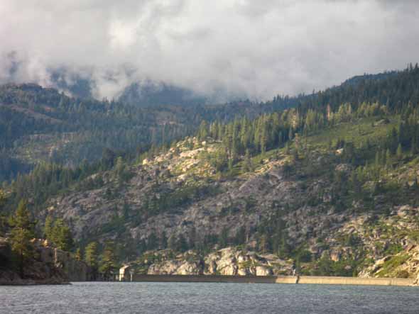
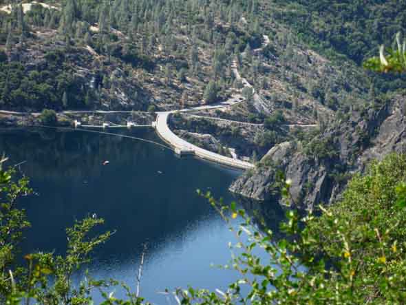
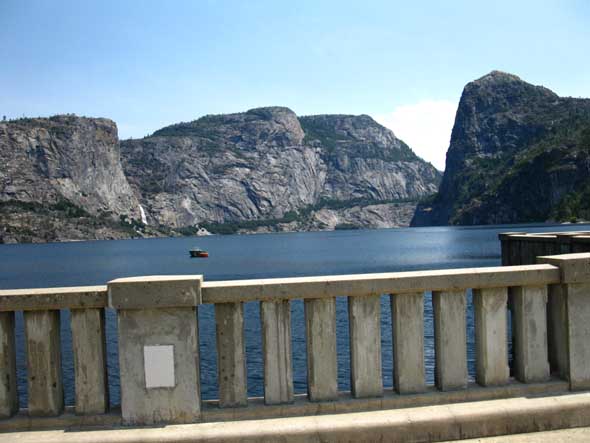
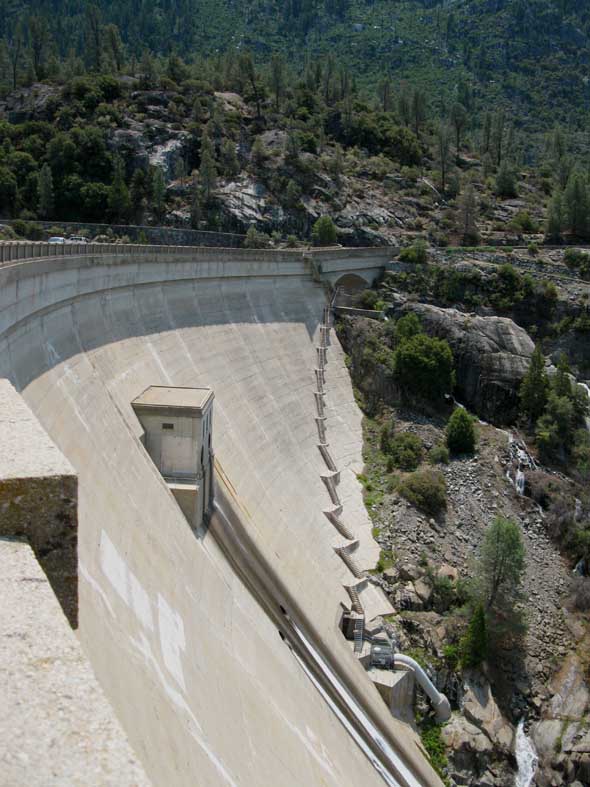
Hetch Hetchy Reservoir capped
|
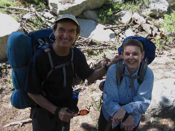
Jon and Anne with the Kids
Well this is Jon, anyway. I need a better picture of the whole family! Jon is a religious youth counselor at a religious university. He and Anne were really nice folks, typical of those who visit Yosemite in a variety of different styles. Their style of visiting is quite unique, as part of a cross country American Family Adventure. As Jon was changing jobs, he and his wife managed to take the kids on a cross country auto and camper adventure as they traveled everywhere possible during the time between jobs. Here's what Jon has to say about it, which is really worth hearing for you backpackers who have or are having children:
Though I'm a packer and they are driving, we were tied together by our love of the outdoors. The family was taking a long cross country trip across America, visiting beautiful places, seeing new things, and visiting friends and family along the way. My little adventure across the mountains had collided with a cross country adventure! Many thanks to this fine family for making room for one hot sweaty backpacker in their fully packed family truck. Jon made a backpacker-sized slot in the back that I fit perfectly into, then turned up the AC to cool me off. Jon could see that the Sun had baked me up pretty well, and I needed to cool off. Nice folks. |
Darcy from Santa CruzImage Needed Darcy was driving up to begin the JMT from Sunrise Lake, hike down to Sunrise High Sierra Camp, and begin her JMT South from there. This is one of Yosemite's solutions to having more John Muir Trail hikers than Trail: spread the "start point" for the JMT down the trail to avoid too much congestion out of Happy Isles in the Yosemite Valley. She was on her way to meet her two friends/hiking partners, to begin their John Muir Trail adventure the next day. Darcy was delightful company to share the stunning views of the drive up to Tuolumne Meadows from Crane Flat. Sadly, I did not get a picture of Darcy. What a fool I am. This is too bad on many fronts, as she was as beautiful physically as she was philosophically. |
Tuolumne MeadowsResupply Information
Though this little hole in the wall below lay wonders you sent yourself and things resident in Tuolumne:
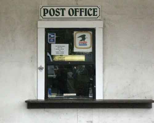
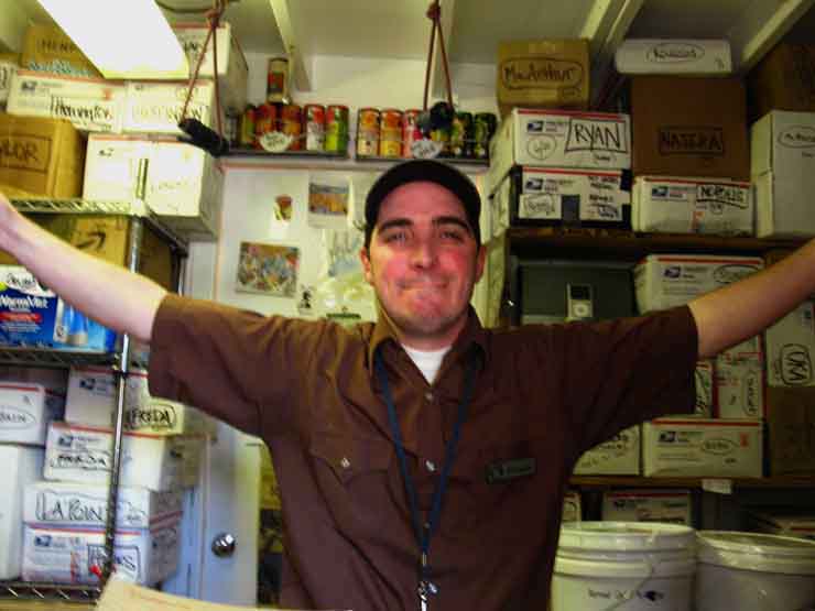
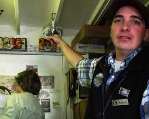
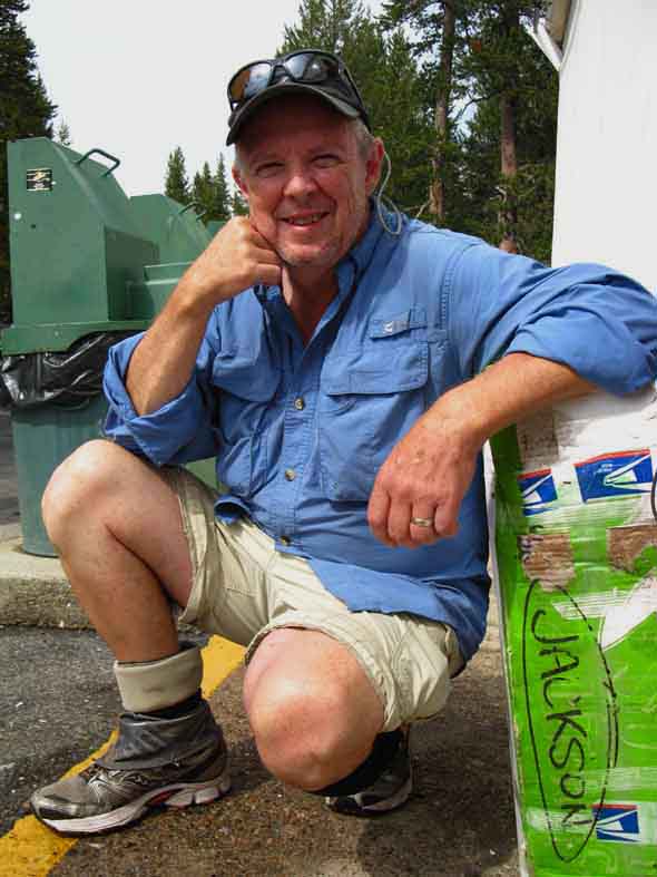
Through this portal you meet your Host, the Mayor of Tuolumne Meadows
Michael the Postmaster, 2013
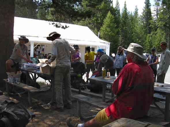
Michael Rocks. So proves the Disco Ball. 2009, since removed. Wat up wit Dat? Michael is the guy you will see to pick up your resupply package at the Tuolumne Meadows Post Office. Note the resupply packages stuffed into his tiny post office. He's a great guy, runs a real tight ship, and has answers, if not solutions, for any issues you may confront in Tuolumne Meadows. That's why they call him the mayor of TM. Michael keeps a backpackers box of food and supplies for those that have too much and too little. Resupply Information |
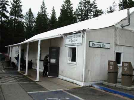
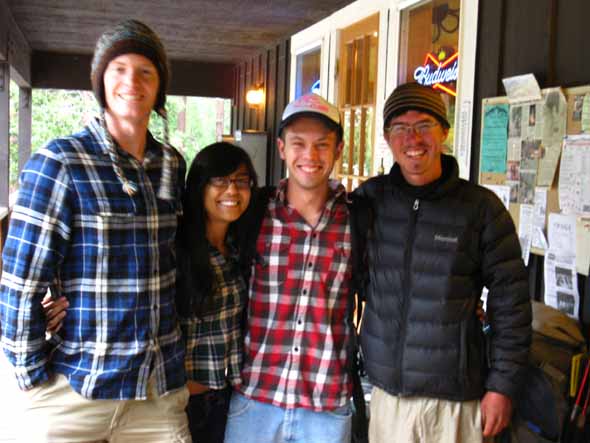
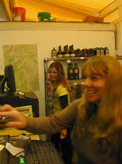
Tuolumne Store, Post Office, and Cafe
From Left to Right above: Dianne and Sarah on Left, and Jamie in the middle image, and Jamie in the Post Office with Michael on the far Right. These delightful folk are representatives of the fine folks who run the Store, Post Office and Cafe in Tuolumne Meadows. These nice folks will help you find anything they have, and set you straight as to what they do not have. Be nice to them. |
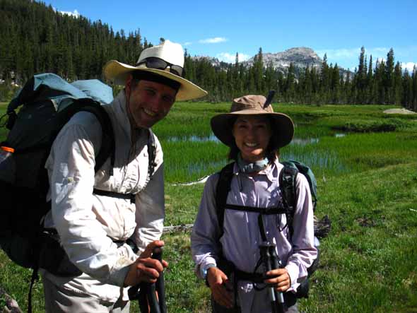
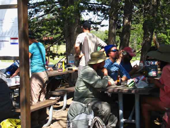
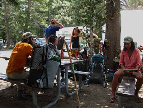
Backpackers Resupplying at Tuolumne Meadows
Above: Note the YARTS-Shuttle stop in foreground Left. YARTS spans from Mammoth Lakes to Merced via Tuolumne Meadows, Yosemite Valley, and a slew of stops down Highway 140 from the Yosemite Valley to Merced, including Mariposa on Highway 49.
Above and below: Rest and Resupply time.
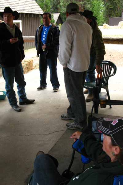
Above: Ansel, a moderator from HighSierraTopix and art teacher living in Mammoth wearing Red Shirt, observes and engages PCT and JMT hikers resupplying at Tuolumne Meadows.
Ansel is a hell of a nice guy. High Sierra Topix is a quality site. During 2016 we learn that Ansel is quite a talented artist A fine High Sierra Thunderstorm blew in on July 3 at 11am. That's pretty early in the day for a thunderstorm out of the San Joaquin Valley. There were quite a few impressive downpours before the storm moderated after about 4 hours. |
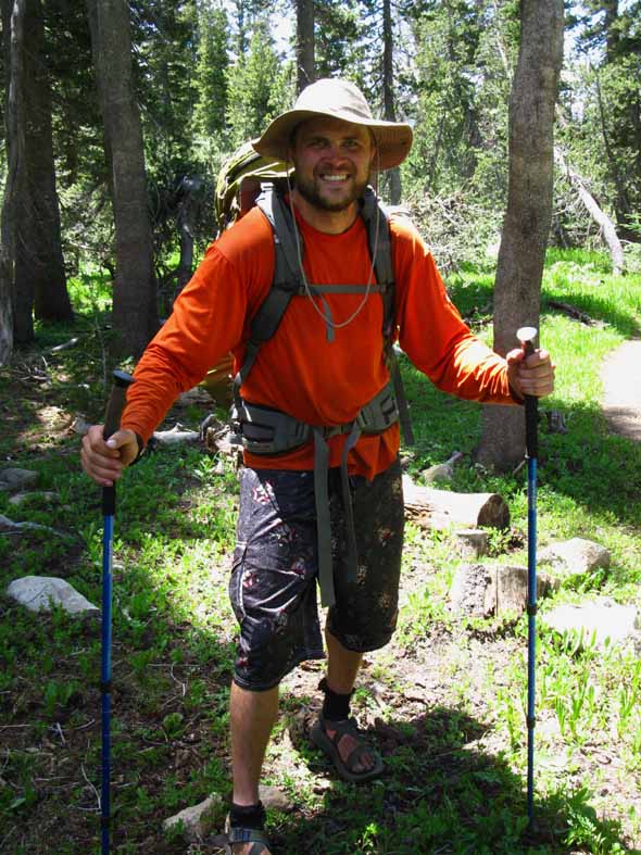
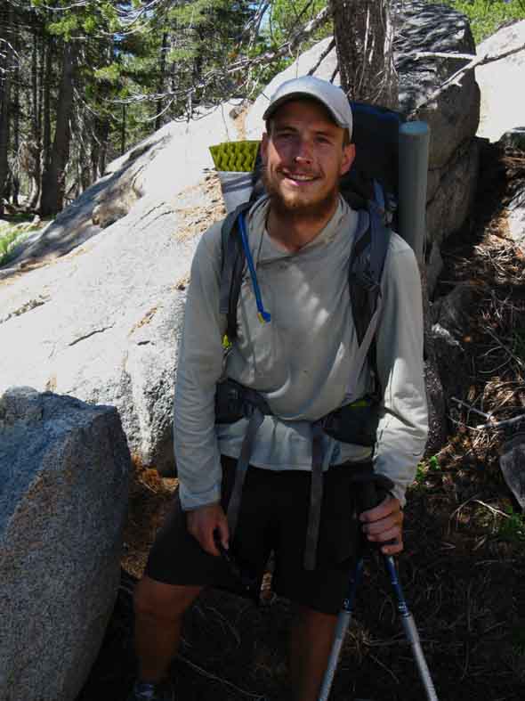
Thirty Pack
Highly animated. Look of the joy of trails, mountains, and life on his face. AT last season, PCT this. "Best days of my life doing AT last year and the PCT this year." |
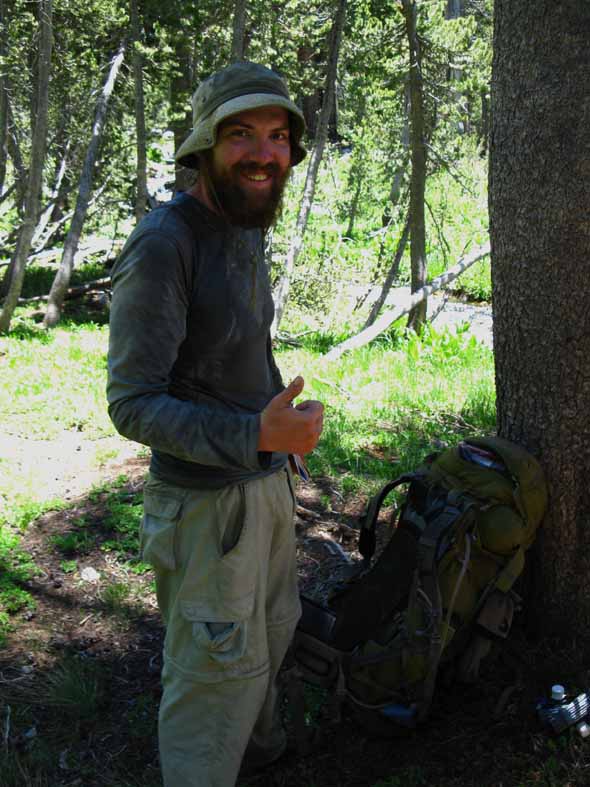
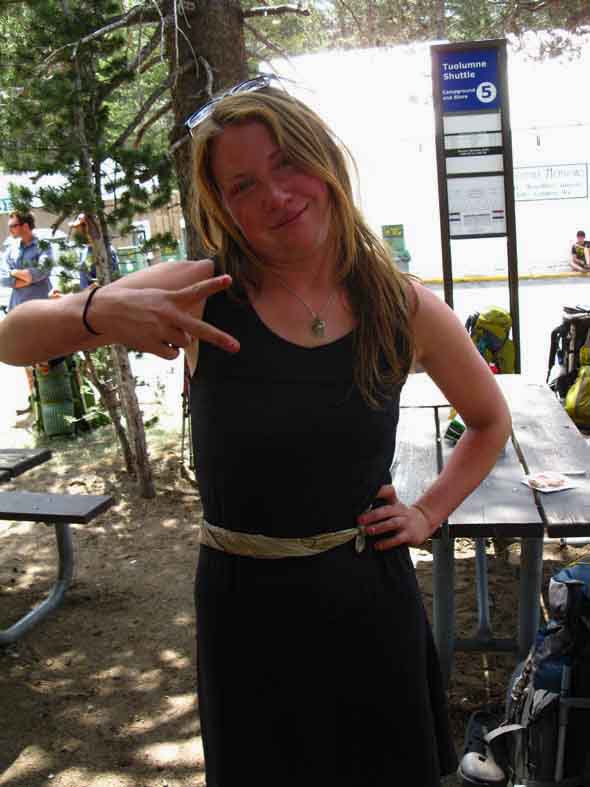
Alex
Hiking the Pacific Crest Trail. I really enjoyed hanging out with Alex for a brief time. She's just a great soul. |
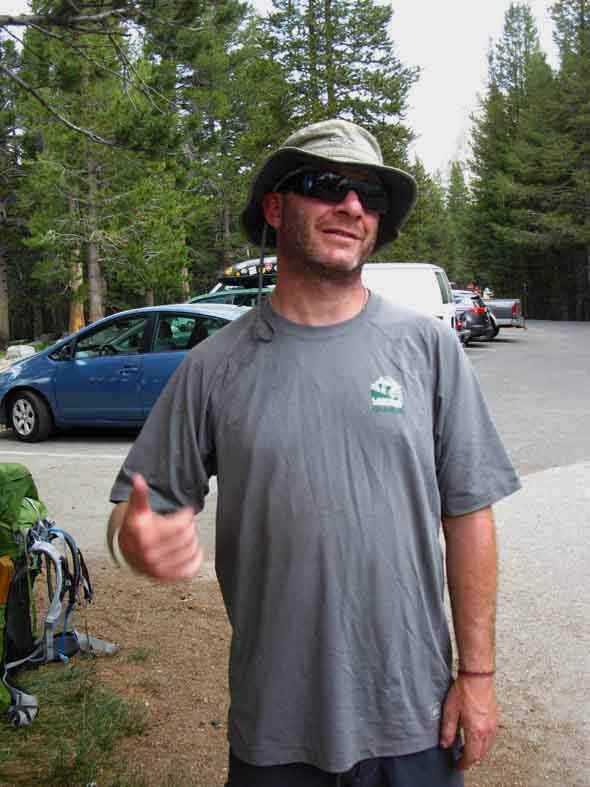
Brad
Out of Seattle. Considered Lake Wanda a spiritual place. I totally agree. |
Gary Jackson
JMT Hiking with his two sons and daughter. Facebook Page: Bluegrass Trekkers |
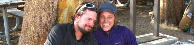
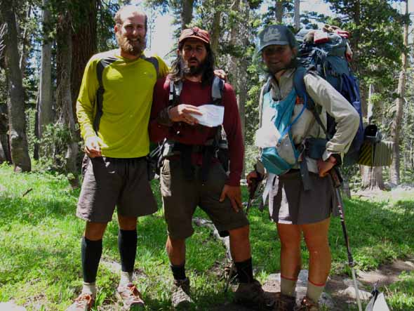
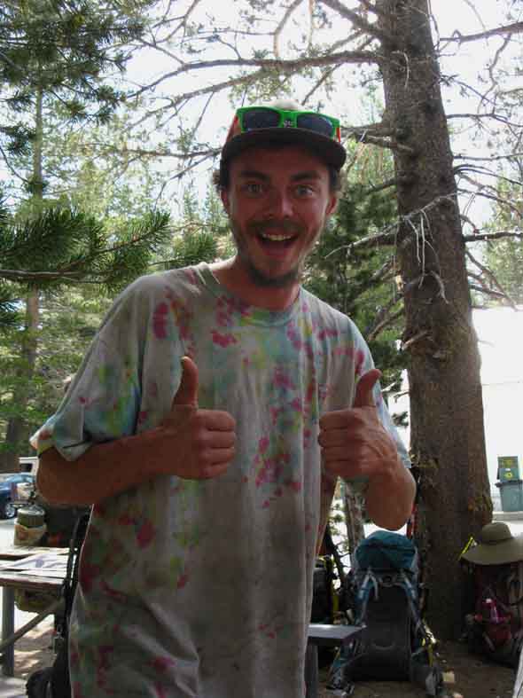
Team SmilesWry Smile on Jit' in Time's face on the Left and Crossover's big S-eating grin on the Right.
PCT Adventure: "Love it more than anything." These were two of the nicest folks you'd ever want to meet. July 18 UPDATE "We're in Truckee now." |
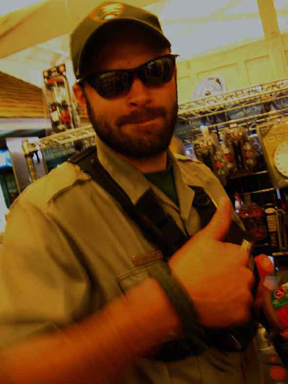
Bear Ranger
Bear Ranger (as opposed to LE and Wilderness) at Tuolumne Meadows Store. No, not a Ranger who looks like a bear, but a Ranger dedicated to training the campers not to attract bears in the first place, and inevitably run the bears off when this fails. The bears are not the problem.
Great Bear Insight and Sights |
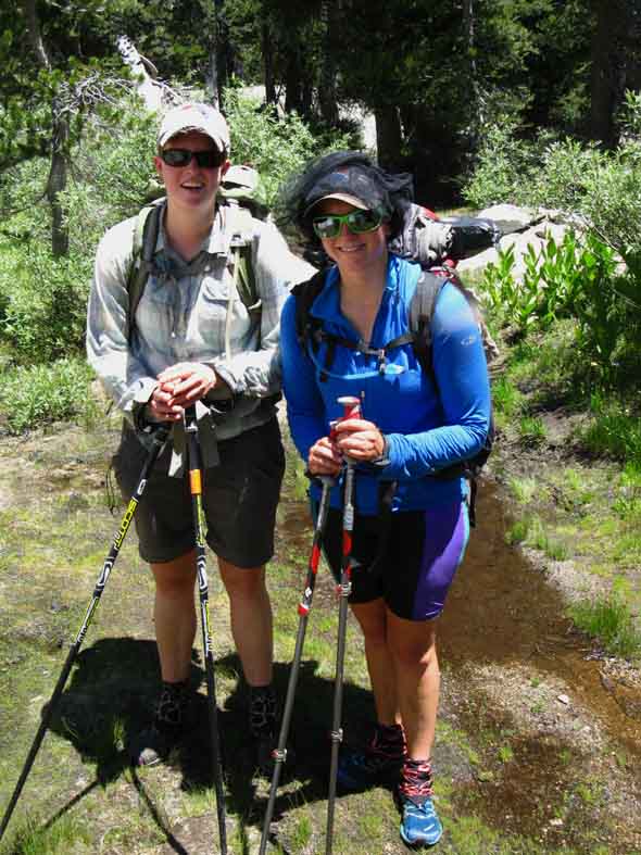
Rabbit and Happy Thought
PCT Nathan and Carolyn taking resupply break at Tuolumne Meadows Backpacker Camp. Nathan is out of Sonora, a town along the mountain road to Sonora Pass on the Western Flank of the Sierra, while Carolyn hails from Western New York. I enjoyed a lively talk with these fine folks. |
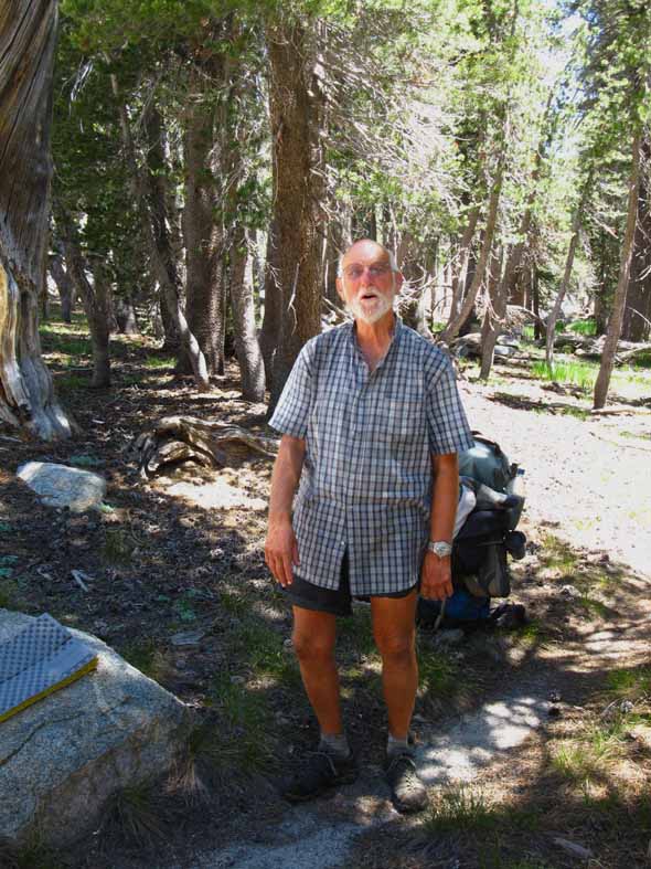
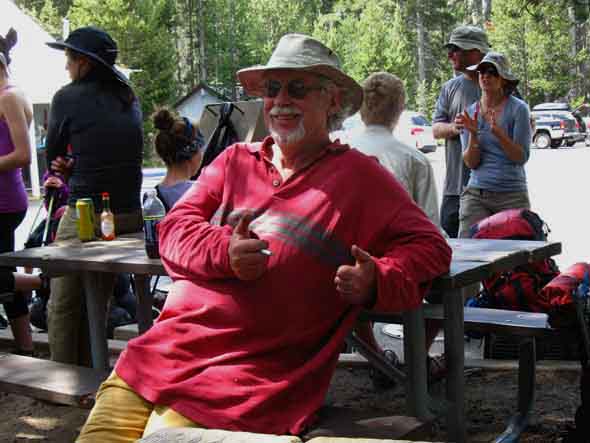
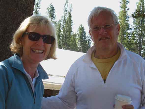
Tom and Wife
Great folks from Alabama visiting the Yosemite High Country. Though they are not hiking, these fine folks represent the great people from around the world and the country that you should take the time to get to know when you hike around the wilderness. These folks were so sharply aware of the nature of the American Reality it restored my faith that there are still a few good Americans in every part of the country. |
2013 Trail Culture Conclusions The PCT This year's crop of PCT hikers looks real good. Well, many of those having problems likely fell off the trail long before approaching the thousand mile mark near Sonora Pass. They looked strong, well fed, and fit. Mosquitoes and heat were the major issues confronting the PCT hikers in the Sierra that I observed on the section of trail I observed them. The mosquitoes were thick and intense, and the heat oppressive. My hiking dates happened to coincide with a significant heat wave and associated heat advisories, so I saw PCT hikers as they were contending with extra factors. Add these extra factors to the fact that the section of trail between Tuolumne Meadows and Sonora Pass is generally considered the hardest section of the trail, that means this year's hikers are looking really good. They were steaming up Jack Main Canyon showing good speed and strength approaching the end of this very difficult section. Trail difficulty moderates significantly about 7 miles North of Sonora Pass after climbing the switchbacks out of the East fork of the Carson River. North of that point the trail to Tahoe significantly moderates, and this batch of hikers looked like they would really start picking up speed as they approach and pass that point. I expect lots of folks to complete the PCT this year. Great food, great backpacker resupply services, store, and folks sitting on the edge of the Tahoe to Yosemite trailhead into Emigrant Wilderness. Unlike Kennedy Meadows, which is decidedly centered on a Western Cowboy Perspective, Tuolumne Meadows is a global crossroads and concentration of backpackers, climbers and "wilderness tourist" of every type and description. Unlike Kennedy Meadows, Tuolumne Meadows is lacking good hot food. Though the staff at the Tuolumne Meadows Cafe are excellent and do their best to make the best of what they have to work with, it is still an overpriced corporate fast food outlet in the Sierra. The wide variety of good and fresh foods at the Store somewhat offsets the Cafe's liabilities. Backpackers who seek good food will be amazed at the cafeteria at Curry Village in the Yosemite Valley. Alternative Route North or South The Yosemite Valley Those hiking North on the PCT may want to consider swinging through the Yosemite Valley on their way North. Hike over Voglesang out of Lyell Canyon over to the Merced River down to the Yosemite Valley. After a couple of nights exploring the Yosemite Valley hike the JMT route up to Tuolumne Meadows to rejoin the Northbound Pacific Crest Trail. This route takes you down into the Valley by one route from the East, and out on another to the Northeast, showing you a hell of a lot of Yosemite territory on your way through the Park, especially when you combine this with your hike into Yosemite over Donohue Pass, and out of Yosemite through the North Yosemite Backcountry. See it all. Then do it again. I call this particular route North or South through Yosemite the "Golden Triangle" because of the triangle shape of the route from Lyell to Tuolumne Meadows via the Valley brings us through Yosemite's Classic Vistas on a roughly triangular route. |
Last page: 2010 Trail Culture Report Next page: 2013 Trail Culture Report
High Sierra Trail Culture |
||||||
Kennedy Meadows Pack Station Backpacker Resupply Tuolumne Meadows Backpacker Resupply
Trip
7.5 Map 30 min Map
Next page? Up to YOU! Post in the
|
Backpacker ForumsHave a great Sierra Nevada route or trip to relate?Post it on
|
Home Page
Contact Alex Wierbinski

Backpacking Lake Tahoe to Mount Whitney
Your guide to the High Sierra Crest, including the Tahoe to Yosemite, Pacific Crest, and John Muir Trails
