Tree, Poison Flat, Carson Iceberg Lake Tahoe to Mount Whitney: Your Backpacking Guide to the High Sierras Yellow Flower
Leavit Peak in December with Snow Plume
Looking back at Leavitt Peak during a Winter Circle to Sonora Pass, over Leavitt, then back down to Highway 395.


High Sierra
Backpacking

Main
Trail Guide
TRAILHEAD

High Sierra
MAGAZINE

ALL BLOG


Trail Guide

Guide Index

Maps Index

Miles-Eleva

Permits

Resupply

 
Forums

All Blog

Trails Forum

Topics Forum


Sierra
Weather

ALL
High Sierra Weather

Weather
Notes

Northern
Sierra Weather

Central
Sierra Weather

Southern
Sierra Weather


Gear

Gear List

Gettin Started

Layering

Discussion

Testing yourself and gear

Member
Favorite Gear

Gear Reviews


top of page


High Sierra
Backpacking & Scrambling


Languages

Translate


Trail Skills

The trail

Navigation

Camp skills

Paper Maps

Off the trail

Scrambling


Mountain
Safety

Safety Topics

Safety
Incidents

Mosquito Info

Skeeter News


Food

Resupply
FORUM

Food


Planning

40 Days to Whitney

Introduction Tahoe to Whitney

Introduction Tahoe-Yosemite


Trail Arts

Art of walking

Physical
Preperation


More
Information

Links


News
and
Science


Books


Trail Stories


Photo
Catagories


Social

Trail Culture


Groups


Terms and Conditions of Use


top of page


HOME PAGE GEAR PAGE NAVIGATION NAVIGATION FORUM ASTRO LINKS TRAIL SKILLS PERMITS GUIDE
INDEX
MAPS


THIS PAGE IS UNDER CONSTRUCTION:

STAY TUNED FOR MUCH MORE!

Scrambling

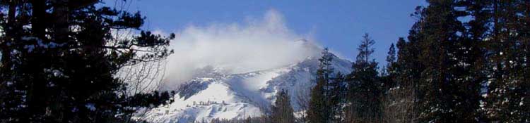
Scrambling is one of the great recreations of the Long Distance backpacker.

Once you handle the weight, high angle climbs, and the altitude, it is now time to consider packing an extra day's food for each section to climb a nearby mountain, explore some lakes in a hanging valley, climb up to a gap in the Sierra Crest Line to see what's on the other side, or just check out the full extent of the valley or mountain where you are camped.


We have put ourselves into some of the most wonderful terrain in the world.

We are going to be heavily taxed just getting through the trail If we are struggling and hurting. Others will find they have just begun to tap their internal resources as they approach these magnificant Natural Resources around them.

Our options are infinite.

The Tahoe to Yosemite Trail
Those of us hiking the Tahoe to Yosemite Trail route are going to find ourselves on substantial lengths of "cross-country backpacking," being travel with full pack through unmarked and unmaintained self-selected routes as standard parts of our trip.

DA PCT
PCT hikers, though hiking on the "superhighway of trails," are putting themselves through some of the finest scrambling terrain in the world, if they just give themselves some time to explore it.

Da Difference
Scrambling would be different from Cross-Country Travel as the former is done from an established campsite with no more than a day pack, while the latter is crossing unmaintained/unmarked terrain between our campsites with our full pack.

Da Point
We are going to cross a lot of trails leading a short distance to a nice lake, overview,or some other curiosity. I like to have my daypack and a plan set up to secure my main pack for when I take off on extra-cirricular scrambles.

I secure food, secure the pack, pull out the daypack, figure water, snacks, and necessary insulation, then take off!.

Classic Scrambles


Desolation Wilderness (MAP) is full of them.

Meiss Country Roadless Area (MAP)
Dense brush is a bitch other than during Winter.


West Mokelumne Wilderness (MAP), TYT:
It is a major cross-country section
Monty Wolf's Cabin

East Mokelumne Wilderness (MAP), PCT
Check out Blue Lakes


West Carson Iceberg Wilderness (MAP), TYT
It is a major cross-country section


East Carson Iceberg Wilderness (MAP), PCT
East Carson River


Emigrant Wilderness Backpacking (MAP), TYT
Granite Dome & the Whole High Emigrant Basin

Emigrant-Hoover Wilderness Areas (MAP), PCT
Tower Peak


North Yosemite (MAP)
PCT-TYT

--IT'S DEEP--


South Yosemite-Muir Wilderness
JMT-PCT

Lyell, Ritter, Banner, down to June Lake (MAP)


--MORE COMING--


THIS PAGE IS UNDER CONSTRUCTION: STAY TUNED FOR MUCH MORE!
COME ON BACK NOW, 'YA HEAR?


A basic approach to scrambling is included in the
INTRODUCTION TO NAVIGATION

Check Out or Post Up:
High Sierra Backpacking Navigation Forum

Next page:


Last page: Navigation                                                                                                       Next page: Trail Skills


Backpacker Forums

Have a great Sierra Nevada
SCRAMBLING
route or trip to relate?

Post it on
TahoetoWhitney.Org

Experiences, comments, or pictures about High Sierra Backpacker Scrambling?

Let it Rip HERE:
NAVIGATION FORUM


Trailhead
Contact
Alex Wierbinski

top of page

Frosted Backpack

Backpacking Lake Tahoe to Mount Whitney

Your guide to the High Sierra Crest, including the Tahoe to Yosemite, Pacific Crest, and John Muir Trails

Snug tent after Snow Storm
© Lake Tahoe to Mount Whitney: Crown Jewel of the Pacific Crest Trail