The Trails
Guide
Maps
Miles/Ele
Permits
Resupply
Forum
Current Weather Conditions
Weather Notes
Northern High Sierras
Central High Sierras
Southern High Sierras
Gear
Gear List
Gettin Started
Layering
Discussion
Testing yourself and your gear
Gear Reviews
Hiking
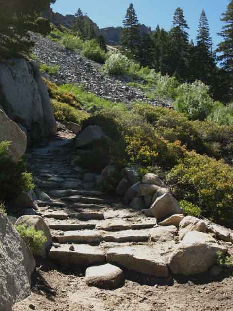
Relief Reservoir to Brown Bear Pass
Backpacking
Emigrant Wilderness in the Stanislaus National Forest
Hiking
The Tahoe to Yosemite Trail from Kennedy Meadows to Tuolumne Meadows
Languages
Languages
Trail Arts
The art of walking
Physical Preperation
Trail Skills
The trail
Off the trail
Scrambling
Maps
Navigation
Camp skills
Food
Resupply
Food
Other
Photo Catagories
Trail Stories
Trail Culture
News and Science
Links
Groups
Books
Terms and Conditions of Use
| Trail Guide INDEX Highway 108 to Highway 120 |
Guide |
Guide to Bond Pass |
7.5 Topo Map Relief Reservoir to Brown Bear Pass |
30 min Map Highway 108 to Jack Main Canyon |
Kennedy Meadows to Tuolumne Meadows MILES and ELEVATIONS |
TOPO MAP INDEX TYT Kennedy Meadows to Tuolumne Meadows |
Resupply North Kennedy Meadows South Tuolumne Meadows |
National Forest |
All maps index |
Backpacking to & from Relief Reservoir
Where We're At
GUIDE PAGE INDEX
Go to
Tahoe to Yosemite Trail
SOUTH FROM RELIEF RESERVOIR
 |
|||||||||
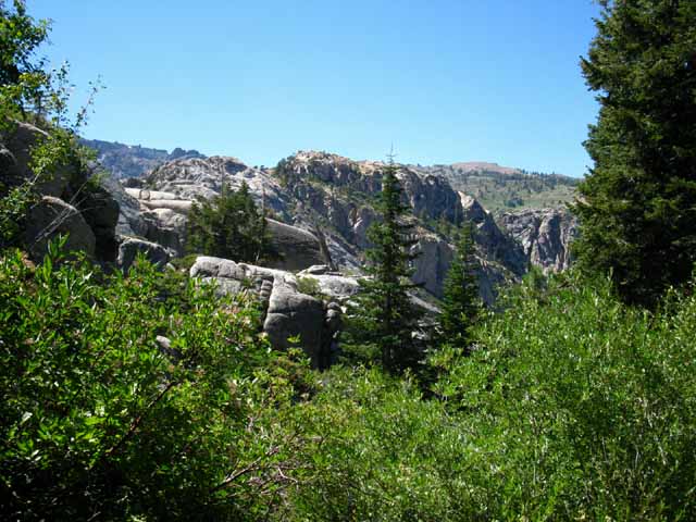
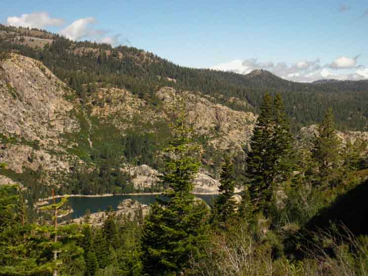
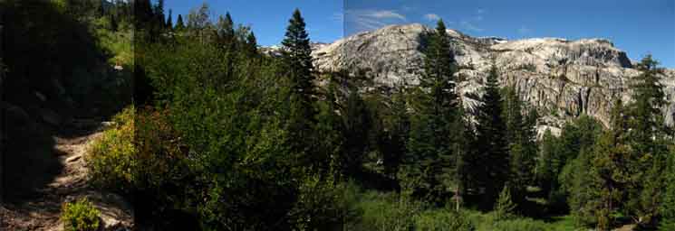
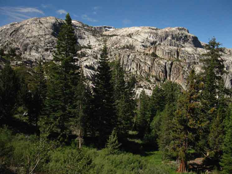
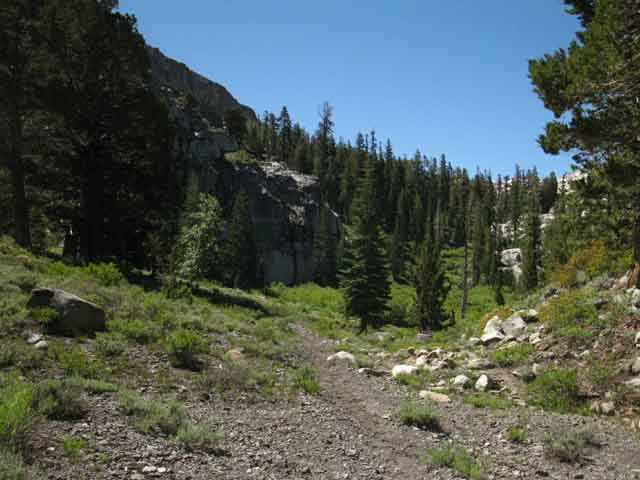
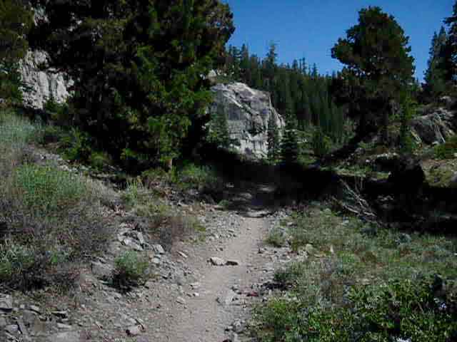
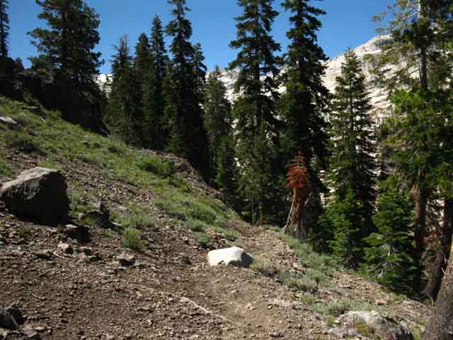
Looking Southwest across Relief Reservoir from the highpoint of the Orientation Location 3.3 miles .87 of a mile 7.62 miles This is our first long view of Relief Reservoir hiking Southbound out of Kennedy Meadows. We can't see Relief Reservoir until we get to this position above the reservoir. The shape and foresting of the ridgeline masking our view means we have to hike to the top of the ridge East and South of the dam and reservoir before we get a glimpse of the dam and the South end of the reservoir. It's worth the work. Our position above marks the end of our steep climb through the lower canyon to Relief Reservoir from Kennedy Meadows Pack Station. Now we will gradually descend to our Left, down the final remaining mile to the sweet campsites on the far Southeastern corner of the reservoir. Beyond Relief Reservoir, two miles South of our position here on the highest point of the ridge, our trail tees-out into a trail junction located above the far Southeastern corner of the reservoir. Us Southbound hikers on the Tahoe to Yosemite Trail make a Left turn (East) at this junction for the climb into Summit Creek's middle canyon towards Mosquito and/or Brown Bear Pass, depending on our backpacking goals. Our next climbing section into the middle and upper portions of Summit Creek's canyon begins when we depart the campsites on the Southeast corner of Relief Reservoir for the Sierra Crestline via Brown Bear Pass.
Miles South Western Nose In the image above we are traversing down the Western nose of this vast ridge. This ridge to our East running Southeast up to the Sierra Crest also divides the valley descending from the Sierra Crest under its North flank holding Kennedy Lake and Creek (behind us) from that holding Summit Creek ahead of us under its South flank. To the Sierra Crestline
Local Geological Another view of, and perspective on, this Vast Volcanic Ridge (previous Page) Main Trail Shortcut to Relief Reservoir Campsites Bypassing the shortcut trail(s) we find the faint unmarked main trail to the Relief Reservoir Campsites about 40 yards South of Grouse Creek. Just Me, but... We carry five days of food for the 75 miles of distance between Kennedy and Tuolumne Meadows. Do the math. 75 miles divided by five days is 15 miles a day. We can adjust the daily mileage requirement by adding food. Each day of food weighs from 2 to 3 pounds. Yet I have been pleased by all my visits to the Relief Reservoir campsites. Balance
START POINT Our next significant goal is the short walk up to the Lower Relief Valley trail junction where our long distance Tahoe to Yosemite Trail route turns Southeast, to the Southbound hiker's Left, climbing towards Brown Bear Pass. The other trail from this junction tracks Southwest up to Lower Relief Valley. Above this trail junction our climb into the upper canyon holding Summit Creek through its headwaters to Brown Bear Pass gets more serious.
|
| Introduction Relief Reservoir to Brown Bear Pass Start 7226 to 9760 feet 2534 feet of elevation
|
|||||||||||||||||||||||||||||||||||||||||||||||
| GEO LINKS | GEO FORUM |
Post up your geological experiences, information, & references.
Geo News:
Life at the Speed of Rock
top of page
Final Cut
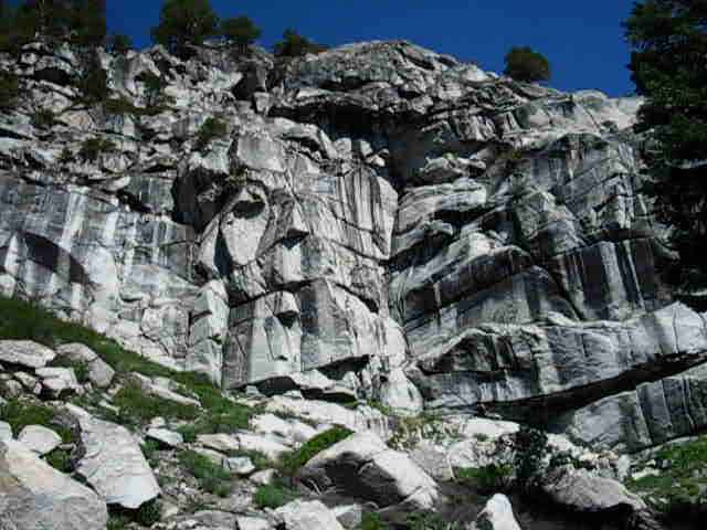
These ancient pre-Ice Age eruptions eventually subsided and cooled, leaving us with massive new layers of red volcanic terrain making up the NE side of this canyon, while the ancient majestic granite terrain of the canyon's SW wall, just feet to our South across Summit Creek, was left relatively untouched. Nothing a vast coating of glacial ice would not carve off...
Then came the Ice Age, cutting equally through the red and gray rocks independent of color, point of origin, composition, or age. It seems the last Ice Age went out with a bang in some locations, caused by fresh volcanic eruptions happening under the vast snow and ice depositions of the last ice age. This created lahars bigger than my imagination, sufficient to replace the ice filling vast river valleys with vast flows of steaming mud of various consistencies and compositions.
That's what appears to have happened here to some extent, though it appears these lava flows over the top of the Northern Emigrant and along the Sierra Crestline North into Carson Iceberg were of a much thicker consistency than those we saw up North.
In places like the South Upper Truckee (guide) and Noble Creek (guide) we've seen or will see evidence of vast watery-thin lahars flowing through, hardening, and being subsequently worn away by eons of erosion. Not so much evidence of those types of watery flows here, though there is some, it indicates thicker flows.
My take is fairly dense, rather than watery, volcanic flows covered this terrain,
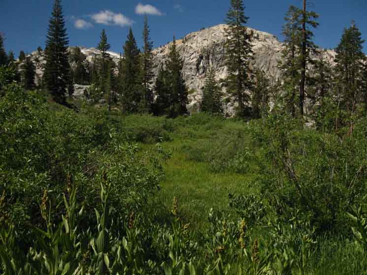
Here, climbing into the bottom of Lunch Meadow, we find Summit Creek running between Red and White Terrain almost perfectly splitting the distance between the Northern volcanic and Southern granite walls of this canyon.
This is a striking interface. Well, it is now, but grows as we get higher, and becomes striking when we finally get a good, long overview. Entering Lunch Meadow now puts us very close to that point. I'd say this "red and white" has been a very intriguing interface to observed it close up one step at a time as we hiked up through its contradictions lower down in the canyon.
Now we have gained the necessary elevation for a mini "birds eye view" of the middle section of our climb as we approached Sheep Camp. Now, crossing Lunch Meadow we finally get longer and longer overviews of the big picture of the size of the profound geological forces which created and shaped this amazing canyon. We got a great, but brief view of this dramatic terrain approaching the gap in the mountain to Sheep Camp, but our best views are still ahead. Our broadest and best views come while climbing above Lunch Meadow on our final approach to Brown Bear Pass.
Levels of Lunch Meadow
Lunch Meadow's gentle Southbound ascent is accentuated by its hour glass shape. A closer look (map) shows Lunch Meadow is broken into two discernable levels of meadow divided by a short ascent through a low band of quite nifty granite dividing the upper and lower shelves of meadow. This granite segment is noticeably steeper than the gradual ascent around either the upper or lower meadows themselves. The upper meadow is short, terminating in choppy terrain wedged between the two differently colored converging walls as this uppermost portion of the canyon is pinching closer together towards the distinct volcanic-granite convergence line precisely marking the location of Brown Bear Pass above upper Lunch Meadow.
Our trail finally splits the color gap dividing the walls of this canyon crossing Brown Bear Pass.
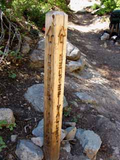
Mosquito Pass Trail Junction
At the top of the Upper Lunch Meadow we find the 9000 foot post marking the end of campfires. From that post we also find some nice campsites off the trail to our Southbound Right, the Southwest, and more lower down near where Summit Creek flows through its granite channel between the upper and lower sections of Lunch Meadow. There's an obvious upper campsite just a few dozen yards off the trail under a nice stand of trees, but I prefer the ones invisible from the trail down the hillside closer to Summit Creek.
A brief climb South from Upper Lunch Meadow brings us to overlook a T -junction with a trail leading South. Here this fine trail fords Summit Creek to hike South over a low gap in the granite ridge line to our South called Mosquito Pass (below). Emigrant Lake on North Cherry Creek is on the other side of Mosquito Pass at the base of a great granite wall. We continue South on the Tahoe to Yosemite Trail up to Brown Bear Pass.
Relief Reservoir to Brown Bear Pass
15 min USGS Backpacking
Map
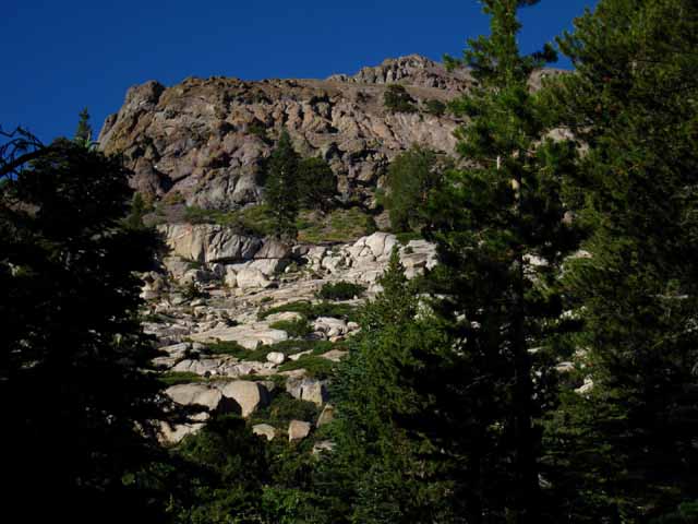
Last Climb to Brown Bear Pass
This begins our third and final "major" climb coming up from Relief Reservoir to Brown Bear Pass, composed of the short steep section of trail from the Mosquito Pass trail junction above the South end of Upper Lunch Meadow to Brown Bear Pass.
Brown Bear Pass perfectly divides and marks the interface between the volcanic terrain making up the North wall of the valley from the granite terrain making up its Southern walls.
Brown Bear Pass is quite striking for more than being a unique interface between divergent terrains. Approaching Brown Bear Pass from the North, as we do, we get longer and longer views to the North back down this valley of contrasting color as we get higher and closer to the pass. The sweet spot for views sits in the last small lonely grove of whitebark pines below the North flank of Brown Bear Pass. This will be our last bit of shade for quite some time. Our view North back down the valley is obscured from Brown Bear Pass itself. One would think it difficult for our view to improve, but it does when we get a look at the view North as we approach the stands of whitebarks under Brown Bear Pass's North flank.
Our best views from Brown Bear Pass (below) itself are to the Southeast.
Beyond the Brown Bear
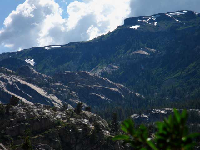
From Brown Bear Pass we get magnificent views of the other side of the mountain, to our Southeast. Looking over the South flank of Brown Bear Pass we see the line of peaks composing the Sierra Crestline running Southeast, wrapping around the North Yosemite Backcountry. This run of the Sierra Crest divides Emigrant Wilderness in our foreground on the Western flank from the Hoover Wilderness on the East flank in the distant background Left, from the North Yosemite Backcountry in the distant Right.
Will we cross this Southern terrain we are viewing as we continue down the long trails South to Tuolumne Meadows and hopefully on down to Mount Whitney. If not, we still have many trails we can use to circle around as much of the beauty of the Emigrant Wilderness terrain in the foreground of our Brown Bear Pass view as we possibly can, before being forced to turn back to Kennedy Meadows Pack Station.
Humm, better check my calendar...
Emigrant Wilderness Backpacking Loops
Mosquito Pass to Brown Bear Pass
Hikers considering loops back to Kennedy Meadows have lots of fantastic routes of varying distance back to the Tahoe to Yosemite Trail utilizing the Mosquito Pass trail junction. Each of them involves crossing Mosquito Pass (junction below) (guide: Mosquito Pass) then turning up at some point back to the Tahoe to Yosemite Trail, to turn North back to Brown Bear Pass on the way back to Kennedy Meadows Pack Station. How far we hike South before we turn our loop around determines the length of our Emigrant Wilderness loop. We can expand our loop's length in any direction through the upcoming Grizzly Peak trail junction located between Brown Bear and Bond Passes along the Tahoe to Yosemite Trail...
Emigrant Lake lays on the other side, the South side of Mosquito Pass. The quickest way back to Kennedy Meadows from Emigrant Lake is the short hike up North Cherry Creek past the scenic Blackbird, Middle Emigrant and Emigrant Meadow Lakes to the Tahoe to Yosemite Trail crossing Emigrant Meadow. The trail junction running off the TYT down to Emigrant Lake is located off the Northeast shore of Emigrant Meadow Lake within view of our position at Brown Bear Pass.
That's a nice hike.
| Big Picture Map | Detailed Map |
| Sonora Pass Hiking Map Scroll down to Emigrant Wilderness |
Central High Emigrant Wilderness Mosquito Pass Loop Map |
These Loops
Expand Like a Bubble
If we don't want to turn back towards civilization from Emigrant Lake, we find a trail tracking almost directly South from the far Northeastern shore of Emigrant Lake taking us past Bluebird Lake to Maxwell Lake. This pushes our next turnaround point down to Horse Meadow, further expanding our loop. Hiking past Horse Meadow to Snow Lake via Bigelow Lake pushes our turnaround point out to Twin Lakes below Summit Meadow. This route further expands our Emigrant Wilderness backpacking loops by pushing our turnaround point all the way out to just under the Eastern boundary of the Emigrant Wilderness with Yosemite National Park. The next-step threads our route through the Northwestern corner of Yosemite.
That involves crossing over Bond Pass into Yosemite. This marks the end of our Emigrant Wilderness hike for long distance backpackers continuing their hikes South, or marks the furthest turnaround point through the top of Jack Main Canyon for local loop hikers.
From the top of Jack Main Canyon we can turn back by hiking North on the PCT through Dorothy Lake Pass to the bottom of Kennedy Canyon. From the Kennedy Canyon trail junction at the top of Kennedy Canyon we can turn West to rejoin the Tahoe to Yosemite Trail via Kennedy Lake, rejoining the TYT 2.67 miles South of Kennedy Meadows at the Kennedy Lake trail junction.
Check the Emigrant Wilderness Schematic Trail map on the previous page.
This big 30 minute map below covers our most distant location at Twin Lakes along this grand loop around the high elevation portion of the Emigrant Wilderness:
These trail options could be part of a big loop from Kennedy Meadows back to Kennedy Meadows, or compose a significant lengthening of our Tahoe to Yosemite Trail route between Kennedy Meadows Pack Station down to Tuolumne Meadows. This depends on what we have the time and energy to successfully and pleasurably complete.
This huge map below-Left lays out most of the possible routes we can hike around the High Emigrant Wilderness by tying the TYT & PCT together. Clicking the red dots on the two maps below links to guide entries, the black dots to detailed maps, with more red dots.
| Sonora Pass Hiking Map Scroll down to Emigrant Wilderness |
Sonora Pass to Bensen Lake PCT-TYT Alternative Routes Emigrant Wilderness |
I am currently focusing on completing the main body of the trail guide along the Sierra Crest between Lake Tahoe and Mount Whitney before I add trail guide pages for these side trails feeding great loops across and around the high elevation areas of Emigrant Wilderness.
Sample images & descriptions:
Backpacking
Emigrant, Maxwell, Snow Lakes.
Emigrant Wilderness Loop Distances
I figure these loop backpacking trips around Emigrant Wilderness at between 50 to 90 miles, depending on how much of the High Emigrant Wilderness we want to see, if I'm not just planning on hiking the 70 miles (+/-, depending on route) from Hwy 108 to Tuolumne Meadows. Sometimes I start from the base of the Eastern Sierra at Walker Ca., hike to the PCT through the unmaintained trail North of Sonora Pass along the East Carson River (map) before switching over to the TYT South of Sonora Pass.
Point of Focus
My point is that you really can mix and match unique combinations of Emigrant Wilderness backpacking trails to suite your character, capacity, and curiosity. Enter Emigrant Wilderness through Leavitt Meadow or Leavitt Lake to expand our experiences into amazing East Sierra terrain. What ties all the trails on this website together are their relationships to the Sierra Crest. No matter where our backpacking trips begin or end every trail on this guide is organized by where it sits in relation to the Sierra Crest trails.
This Sonora Pass Region hiking map lays out a line of travel over Mosquito Pass that potentially reunites with our Southbound TYT route at various points. Though I've walked, photographed, and filmed these trails I cannot bring myself to write their guide pages or expand the maps into full coverage until I finish the main body of TYT, PCT, and JMT between Tahoe and Whitney. Sigh...
It's sad because I love the Emigrant Wilderness.
I have only laid out complete guide information for the Tahoe to Yosemite and Pacific Crest Trail routes across the Emigrant Wilderness, along with the main trails that connect them.
This information is almost sufficient to plan every loop and trailhead to trailhead trips possible around the high elevation zone of the Emigrant Wilderness. I will put up a new section with guide pages finishing these associated trails after finishing the main body of the Tahoe to Whitney guide. The backbone of the guide must be completed before adding ribs.
New 2016
Emigrant Wilderness Planning Guide
Continue South down this page to explore this section of the Tahoe to Yosemite Trail through Emigrant Wilderness from Relief Reservoir to Brown Bear Pass.
Relief Reservoir
to
Brown Bear Pass
7226 to 9760 feet
+2534
feet of elevation
over
7.96 miles of
"intermediate +"
difficulty
miles
Map |
Emigrant Wilderness Map Lists TYT PCT |
Map South Relief Reservoir to Brown Bear Pass 15 min USGS Backpacking Map |
TYT & PCT
Miles and Elevations
| Kennedy Meadows to Jack Main Canyon TYT Tahoe to Yosemite Miles and Elevations |
Sonora Pass to Tuolumne Meadows PCT Pacific Crest Trail Miles and Elevations |
Backpacking Relief Reservoir to Brown Bear Pass Index |
||||||||||||||||||||||
Relief Reservoir
Introduction
Guide Page Index
Video
Grouse Creek Junction to
Campsites
Stanislaus National Forest
Stanislaus National Forest
Trail Junction
Turning up
Video
Campsites
Video
Wedged Snag
Video
South from Last Saucer Meadow Campsite
|
Emigrant Wilderness
Weather
Below find
Satellite and Radar Imagery
Check
All
All
|
Goal
View
Campsites
Rock and Meadow
Campsite
Campsites
Video
Long view South up to the goal
View North across
Granite Feature between Upper and Lower Lunch Meadows
Upper Lunch Meadow, 9000 foot no fire marker
Campsites
Trail Junction
Trail Dog and Kennedy Meadows Pack Station Horsepacker
Unique shapes, colors, compositions, and decorations of
Circular approach to Brown Bear Pass
View of Lunch Meadow and Summit Creek from the top.
Last Steps to
Brown Bear Pass |
||||||||||||||||||||
| > Forum < | ||||||||||||||||||||||
This trail guide is made to be a source of information for, and subsequently updated by its readers/hikers through the comments and forum links on each trail guide page. Registered Members can post up stand alone posts about this section of the trail with images, maps and videos in the Trails Forum for this Kennedy Meadows to Tuolumne Meadows Pass section of the Trail Guide. Add updates, questions, comments, and additional information through the comments links. Check out this supplemental information through the forum links. Check out the Tahoe to Whitney .org Backpacking Trails and Topics forums |
||||||||||||||||||||||
| comments | top of page |
Video
Get Some Views| Relief Reservoir to Saucer Meadow. |
||||||||
10:29 High Sierra Backpacking Videos
|
Tahoe to Yosemite Trail
 |
||
Forty Yards South of Grouse Creek 7360 feet of elevation 4.17 miles 1.58 miles 4.06 miles 6.75 miles Looking West across the Tahoe to Yosemite Trail at the faint main trail to the Relief Reservoir Campsites. The North-South route of the Tahoe to Yosemite Trail is deeply grooved across the bottom of the image. The faint crease of trail angled off to the Northwest, to Relief Reservoir on the top Right of the image, is not as easily visible. Now we will continue South, to our Left in the image above, along the Tahoe to Yosemite Trail to Brown Bear Pass and Emigrant Meadow laid out below the South flank of Brown Bear pass. Kennedy Meadows to Relief Reservoir Hiking South we continue under dense forest cover into a moist zone of temperate terrain sporting moss and fern growth. Our trail tracks through what appears to be a run of spring-fed sogginess. We have a short run through a quagmire shored-up by some solid trail crew stonework.
|
Trail Climbing South above Relief Reservoir
Into a Temperate Zone
 |
Trail to Lunch Meadow-Lower Relief Valley trail junction. Moist areas create zones of temperate forest, and the image above shows us climbing into a temperate zone leading up to the trail junction T above the Southeast corner of Relief Reservoir. Hiking Left, to our Southeast from this junction leads us up through Lunch Meadow to Brown Bear and Mosquito Passes. Turning Right, to the Southwest from the upcoming T-junction leads Southwest to Lower Relief Valley. We can loop around the Southwest flank of Granite Dome via Lower Relief Valley to eventually reach Emigrant Lake, where we can turn back towards Kennedy Meadows through Mosquito Pass. I've never hiked that particular loop, but I have been told it is a substantial hike. Both substantially beautiful, and a long run all the way around the South flank of the Granite Dome-Black Hawk Peak Massif to Emigrant Lake and a potential turnaround point, if we intend to return to Kennedy Meadows Pack Station. Before arriving at the upcoming trail junction we run into a couple of classic manifestations of High Sierra Trail Culture: |
Stanislaus National Forest
Frog Counting Crew
 |
|||||
Stanislaus National Forest Frog Counting Team 2010. Quote Scientists are a regular part of High Sierra Trail Culture. And scientists are also a force that can affect policy and law concerning the Sierra Nevada. These including other counting teams, such as the one we encountered doing a general animal survey on Leavitt Peak. I make this distinction between science and culture because we regularly encounter scientists as "civilian" backpackers, hiking and climbing the Sierra Nevada because of a deep personal love of the Sierra Nevada, in addition to the scientists working in the field, as above. Living Things Forum Living Things Forum We regularly encounter scientists as parts of scientific expeditions encamped at established trail crew camps supplied by horsepackers deep in the Sierra, or, as in the case of the frog team above, performing regular monitoring of a species or ecosystem through multi day backpacking trips. Scientists perform in a wide range of roles in the High Sierra. I'd say scientists make up a larger percentage of High Sierra Backpackers than their overall percentage of the American population would indicate. The scientists on the trail for personal preferences are over-represented on High Sierra trails. I find scientists to be interesting in both of these roles in the High Sierra. If you do too, check out the Science in the High Sierra Forum. They are typically excellent observers of the finite, if not the infinite. Maybe the Sierra helps them bridge that deep gap. I know it helps me. Forum
|
The Yesterday, while hiking down the sandy trail to the East shore of Relief Reservoir North of Grouse Creek we encountered three CCC trail crew members working the trail. Today, we came across the main body of their Stanislaus CCC Backcountry Trail Crew, pictured below, working the trail South of Grouse Creek. Large Trail Crews often disperse smaller teams to perform various tasks. I always ask the small teams about the location and activities of the main work sites, the small crews dispersed on various tasks, the location of the main camp, and what they've seen and done so far this season. Dimes, Heather and Zack were working on the trail North of Grouse Creek, so I found out that I'd see the main body of the crew further down the trail. The trail was looking real good because of all their hard work. The Stanislaus National Forest Backcountry Trail Crew is on it. |
 |
|||||
Stanislaus National Forest backcountry trail crew July 26, 2010. Supplemented by a CCC Trail Crew. Note the different colored helmets. Yellows are training blues. A great bunch of top-notch kids, all. We will run into them under Grizzly Peak the next day, on July 27 as they took a day to shift their trail crew camp down to Horse Meadow, as the location of their work area shifted.
|
Quick Moving Trail Kids
 |
||
Trail crew are at the top of the heap of the strongest hikers in the High Sierra. It likely has something to do with living at high elevation while performing hard physical labor with heavy tools. What was once difficult becomes easy, That's what the CCC does for a lot of kids.
|
CCC Trail Crew
The
Elders
 |
|||
Steven, Stephanie, and Morgan. Creating an environment balancing kids and trail work. CCC is fairly strict, keeping a tight leash on the kids. This is because it is a training program that often contains folks with some degree of motivation or discipline issues they are trying to straighten out, as well as imparting skills. After these blue helmet kids pass the CCC training program they can work the pro National Forest yellow helmet and National Park red helmet crews (Anders-Yosemite). The professional crews and their camps are good folks living very well while working very hard in some of the very finest places on Earth.
|
Let's get technical
 |
||
Trail design and measurement. The CCC trail crew was finishing up rerouting a section of the trail to improve its drainage. We've seen some substantial lengths of soft, sandy soil on the way up here that is highly susceptible to Spring Thaw erosion. Both areas I observed the CCC working they were improving and protecting soft sections of the trail. They made careful measurements of the length of the new section of trail. New Route of a Thousand Small Changes Trail mileages are a moving target. Though we see that Trail Crew carefully notes distance changes caused by trail work, we can only find these new distances when they are eventually compiled and incorporated into map updates. Decades later... Miles and Mileages in the High Sierra Huge discrepancies between routes and distances depicted on USGS maps and the reality on the ground build up between map updates, and I've seen map updates which do not contain old route changes. Trail Culture Forum Official
|
Trail Junction
off the
Southeast Shore of Relief Reservoir
Southeast |
Southwest Southbound Hiker Right Right to Lower Relief Valley. |
|||||
 |
 |
|||||
| Kennedy Meadows is at our back, to the North. |
 |
|||||
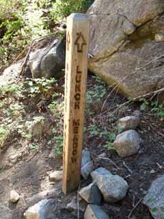
7680 feet 5.37 miles 5.55 miles Roughly halfway between Kennedy Meadows and Brown Bear Pass. A good time and cool location to take off the very heavy backpack and take a little break, though there is not good seating here. And, the moisture, shadow, and coolness we like also makes this area dense with mosquitoes. We are still in the moist temperate zone, and mosquito populations are always higher in wet zones. The visible arrow on the trail junction post is pointing us Southeast towards Lunch Meadow and Brown Bear Pass just beyond. Now the climb really begins.
|
 |
||
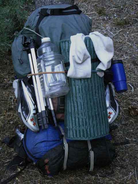
HOPP, the good old Harness Of Pain fully equipped and ready to make me sweat... Wait. I've got to modify my pack's name from HOP to HOPP. Harness of Pain AND Pleasure... yes, yes, that's even more accurate... Tripod, two cameras, lots of batteries and a solar charger pump up the weight. I have a lashing system that allows me to pack this sucker internally and externally. 14 day trip? No problem. We will lash and secure two external food bags to this bad boy. Backpack Water, Shower, and Gear Lashing System Unresupplied Tahoe to Yosemite Trail Extra/camp/river crossing shoes add comfort, the tent brings shelter against the violence of Nature and the mosquitoes, while my full first aid kit has brought clumsy me and under-equipped backpackers much relief over the decades. I've fixed up a lot of fucked up feet... a couple of bad knees, and more than a few sprains. Some scoff at the weight of my pack. Until I feed them, dress their wounds, and stock their pack with some bandages and tape after fixing them up so they can get those fkd up feet down the trail... Then they are happy that at least I carried what was necessary into the mountains.
|
Pack Lashing System
 |
This clip allows me to securely attach very heavy gear and/or lots of food to my pack. During Summertime this is typically used for huge amounts of food. During Wintertime it secures various bits of gear, including snowshoes, poles, crampons, and other bits of gear rendered unnecessary by changing terrain. Four Season High Sierra Fun Forum The two black lines each lead to a 15lb food sack each suitable for supplying five days of hard travel. The white cord ties to my water jug. There is also a Garcia in the lowest compartment of the pack holding five days' of food. Member's Favorites: The blue foam is my backpack strap tearing its insulation out from the stresses of overloading, but only after a gopher ate the salt out of the strap's seams. |
Harness
of
Pain and Pleasure
 |
||
High Sierra Backpack fully overloaded for 17 day trip. Each of these two very heavy external food sacks is attached to the frame clip and secured by the bungee. I make sure to set it up so none of my gear "bounces" as I walk. Having a rig that shifts when you walk is very-very bad. Don't let that happen. Bouncing-shifting gear bleeds calories/energy/pain out of you for no good reason... That bounce makes me think you might be stupid. Don't be stupid. Properly secure all gear. The setup above weights about 84 lbs. I walked the whole Tahoe to Yosemite Trail without resupply carrying this rig. Each of the external black sacks carries five days of food and weighs 15 pounds apiece. The Garcia in the pack is carrying a solid five days of food at 20 pounds of weight. That's fifty pounds of food & bear canister. Unresupplied Tahoe to Yosemite Trail I have cart-wheeled down mountains a couple of times and this setup has proven secure. My "clip and lines" system keeps everything from flying off and rolling down the mountain during a wreck. And, whenever I fall down I know I have a landing pad secured to my back... that would be my foam bedroll. That pad has cushioned a lot of falls. I affect my falls to land on it when possible. I've lost nothing but blood during my various falls. And I have the first aid kit to fix that right up within easy reach inside the pack. Here's my rule: Make sure you can "tape it and make it" out if you break it...
|
Southeast Shore Hiking Options through Lower Relief Valley Fire up the Here the trail makes a significant split for Southbound backpackers. The main Tahoe to Yosemite Trail route and all of us long-distance backpackers who are pointing ourselves Southeast up to the highest part of Emigrant Wilderness turn Left, Southeast towards the Sierra Crest here. Our hike continues tracking the unique beauties of Summit Creek Emigrant Wilderness hikers have other significant options at this trail junction Though the route to the Right through this trail junction brings us around the West and Southwest flanks of Granite Dome would take us far off our Sierra Crest route, these Emigrant Wilderness hiking options are worth discussing and checking out. Off the Crest Around Granite Dome and Blackhawk Mountain The trail Southwest, turning Right from the South end of Relief Reservoir through Lower Relief Valley passes around the South side of the Granite Dome Massif opening up the possibility of a big backpacking loop counterclockwise around Granite Dome (Deer Lake to Buck Lake to Emigrant Lake...), back to Kennedy Meadows Pack Station. But I believe there are better options. Fire up the Lower Emigrant Wilderness Roll Your Own Get to know the lay of the land and your own limits before pushing too far off trail. Scrambland For a "bird's eye view" of these hiking and scrambling options around Emigrant Wilderness, download the FREE USGS Bridgeport 30 minute hiking map. Matt Bloom and his horsepackers know the territory on the Southwest side of Granite Dome like the back of their hooves, I mean hands... haha... Talking to the folks at Kennedy Meadows Pack Stat ion can be real instructive. Be nice to the cowboys! Take You Higher And, here along Summit Creek we will examine the limit line of an ancient volcanic eruption's over even older granite terrain as we climb higher and higher up this amazing canyon. |
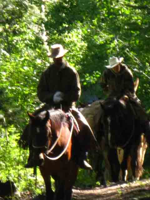
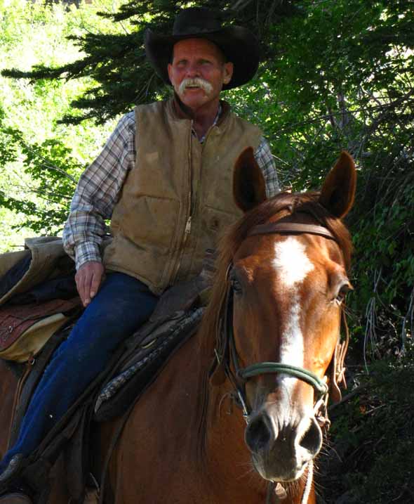
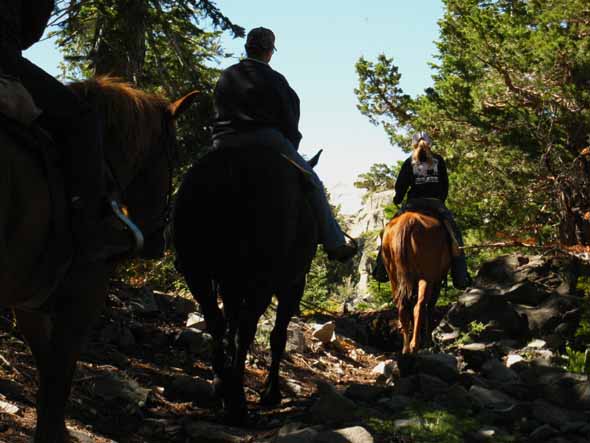
Cowboys riding
through
Shadow and Light
of a
High Sierra Sunrise
 |
||
Kicking back at the junction I first began to feel the deep thumping vibes of hooves reverbing through living Sierra Soils before I could hear the sound. I knew Horses and riders were approaching. Then the sound of cracking of leather harness on muscled beast, then their heavy, hollow breathing, then they physically broke through into the kaleidoscope of shadow and light. Colin and another rider breaking through light and shadow riding South out of Kennedy Meadows Pack Station early in the morning. Hey Colin, What's Up?
|
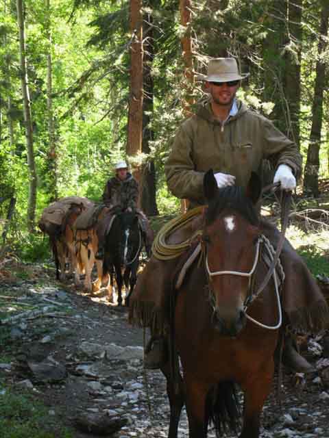 |
Colin is a damn crazy kid and a hell of a horse packer. Rock Solid Dude. When I compare the faces of horsepackers and their horses I find the horses generally more attentive... maybe even more intelligent... haha... I like horsepackers, but we've got to keep things in context. |
 |
Up the Valley Colin and his pal are running almost unladen mules. I heard something the previous day when I was passing through Kennedy Meadows about shifting a fishing party established at Huckleberry Lake to another premium fishing spot in the High Emigrant Wilderness. Thus the mules are unladen, except for what I figure is a food resupply. Matt will haul you and your pack out into the middle of Emigrant Wilderness and leave you there. Or he will set up a camp, and leave you there with pro cowboy cooks. The Kennedy Meadows horse packers will resupply and support your trips in any way you specify. |
Now we Climb East
up into the
Beauties of Summit Creek's Valley
between
Granite Dome and Relief Peak
 |
||
Above the trail junction our trail twists around great granite features, specifically winding its way around the base of this fine piece of rock. Let's step back in time and space to get the full view.
|
 |
||
Here this sweet rock face picks up the first direct light of the day. Same Rock, different time of day and different season. A different feel for each part of the day and each season of the year is a fundamental expression of the many faces of Nature.
|
View South across Canyon
| Entering the narrowing mouth of the gorge-valley of Summit Creek above and Southeast of Relief Reservoir... we look directly South through a gap in the brush and terrain over at Granite Dome. | ||
 |
||
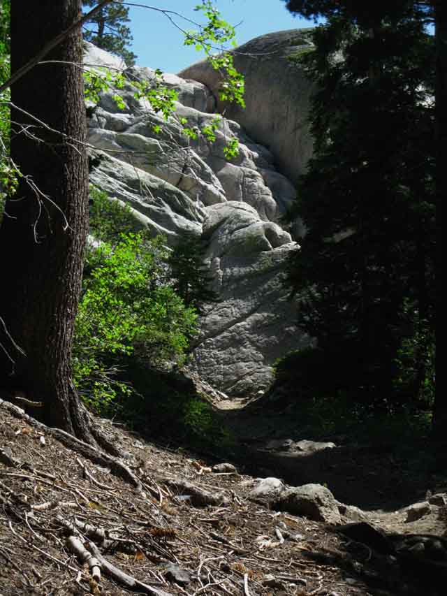
Great Granite formations on the Granite Dome Massif emerge as we climb out of the top of the surrounding forest. We are approaching the center of the canyon hiking up into an interface, like the layering of a cake, climbing between layers of red volcanic cake on top and granite layers on the bottom. We are now climbing up into, then above the line of this volcanic layering on our Northern flank of this fantastic valley. The other flank, the Southern flank, making up the Southern side of this narrowing mouth of this valley is composed of sparkling granite.
|
Rock Stars
 |
|||||
Looking to the Northeast, to our Left and Up while hiking Southbound. Hiking up into the mouth of the gorge Summit Creek flows down, above and South of Relief Reservoir. Above us we have great granite formations capped with hundreds of feet of volcanic material above them, up to the ridgetop. We find some fine granite below the encroaching volcanic cap. This canyon was once all granite, until an ancient flow covered the whole Northeast side of the canyon. Granite remnants sit in pockets and alcoves protected from, or beyond the reach of the ancient flows along the base of this otherwise volcanic ridge. I noticed a little glowing spot of red high up on the rock.
|
Life Everywhere
 |
||
Cool. Under an angled rock, that did not quite fall flat, a little splash of red pushes towards the sky, until the rock finally falls, and they die.
|
Leaving Relief Reservoir Behind
 |
||
We strain for our last glimpse of Relief Reservoir hiking Southeast climbing deeper up towards the mouth of the narrowing gorge-valley along the middle part of our hike along Summit Creek from Relief Reservoir to Brown Bear Pass on the TYT. As we climb towards Saucer Meadow the South end of Relief Reservoir blinks in and out of sight through trees and terrain until finally being blocked out by the terrain.
|
Beauty in all Directions
| View North by Northwest while climbing Southeast into the throat of Summit Creek's cool central gorge. | |||||
 |
|||||
West view beyond projecting granite formation towards volcanic ridge bounding West flank of Lower Relief Valley and the upper part of the ridge wrapping around the West shore of Relief Reservoir. We are looking back across the South Shore of Relief Reservoir, which is below our line of sight. The ridge composing the Western ridge above Relief Reservoir is visible in the furthest distance beyond the granite formations in the middle of the image.
|
Volcanic terrain on top, Granite Below
 |
||
View Northeast This picture is worth a thousand words describing the ancient geological history stacked up on this terrain. An amazing horizontal interface between stacked granite and volcanic terrain. As we climb higher up and gain grand views of this valley we will note how the natural limits of the ancient lava flows over the granite created the unique juxtapositions of terrain we enjoy in this valley.
|
Looking Southeast down the Tahoe to Yosemite Trail
Saucer Meadow's Campsites sit just within the slot of the Narrowing Granite Valley to our Southeast
 |
|||||
Ahead we see Summit Creek running through its narrow gap in the center of the valley below the North flank of the Granite Dome Massif. The Tahoe to Yosemite Trail bends to our Left working the mostly volcanic North side of this valley hiking up to Saucer Meadow. Once we get over there our steep climb moderates. Saucer Meadow Campsites Relief Reservoir to Brown Bear Pass Once we climb our way up to Saucer Meadow & into the center of the upcoming narrow section of the valley, the trail slightly descends to our Right to the flat with the big granite boulder campsite and access to Summit Creek's water source that are called the "Saucer Meadow" campsites for their proximity to Saucer Meadow. Saucer Meadow itself, though well vegetated, has no nearby flowing water. The campsites just South of Saucer Meadow are where we gain access to Summit Creek. Access to Granite Dome HIGHLY RESTRICTED CAMPING ZONE This first flat in the run of Saucer Meadow campsites is full up with three small hiking parties. No worries. From the Boulder Campsite hiking South we will see that this forested flat is extensive, maybe 3/8ths of a mile long, with a run of many fine campsites scattered along Summit Creek from the first boulder campsite above Saucer Meadow to the fallen tree camp marking the end of Saucer Meadow's run of campsites.
|
Relief Reservoir
 |
||
Looking Northwest back down the terrain we just climbed to get up here from Relief Reservoir, at the Southwestern Shore of Relief Reservoir.
|
Trail
 |
||
Hiking Southeast climbing up and towards the center of the valley, eventually, as we trace the wide mouth of the canyon narrowing down into its throat, being the center of the narrowing canyon in the images above.
|
View of the Terrain to the Southwest
South of Relief Reservoir
 |
|||||
Glimpse to the Southwest of the mountain to the Southwest of Relief Reservoir, East Flange Rock, located above Relief Valley. We are now seeing long and far to all compass points as we climb higher into great views, before we enter the throat of Summit Creek's narrowing canyon/gorge, and the terrain of the canyon becomes the sole object of our observations. We are hiking into a "box," in a manner of speaking. A box of very interesting design and construction. The feature above is the East Flange Rock above the West shore of Relief Creek South of Relief Reservoir. Though we are following the Southbound Tahoe to Yosemite Trail our route up Summit Creek's Canyon is pointing Southeast by the compass.
|
Southwest
the
Majestic Granites
rising to
Granite Dome appear
 |
|||
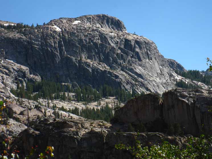
Majestic granite formations of the Northwest ridge and flank of the Granite Dome Massif. Peak 9113 on map below-Left.
|
Panorama
 |
||
I spliced together the three pictures above to indicate our trail's position in the funneling up into the narrowing mouth of the middle section of canyon. The granite on its South flank is pinching in to the North, while the volcanic terrain we are threading through is pinching South, though we can see great blocks of granite emerging from their ancient volcanic coverings above us to the North, our Southbound Left. Summit Creek flows down through where these two distinct terrains touch, and we are hiking there now.
|
Granite Dome and Black Hawk Mountain
Massif
featuring
Peaks
9752 and 9113
from
Left to Right
and
GRANITE DOME
 |
||||
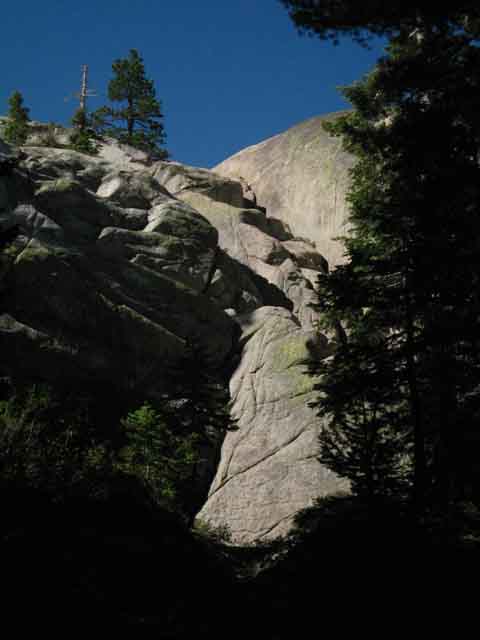
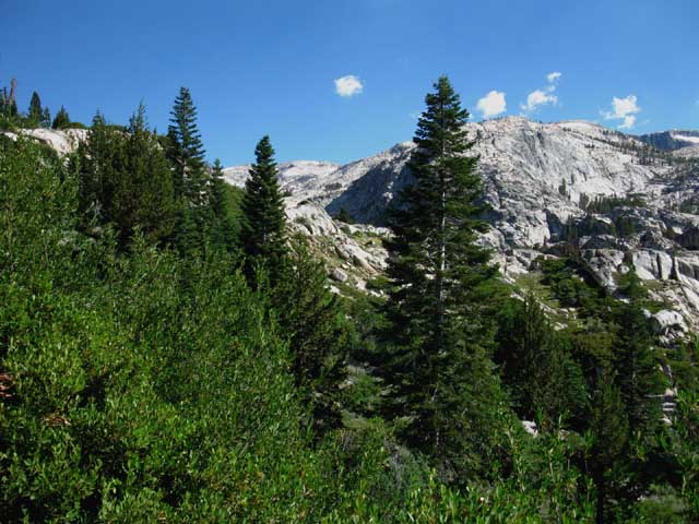
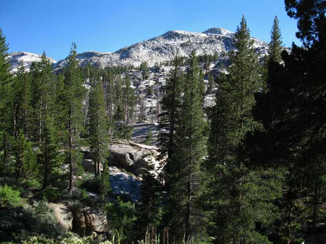
GRANITE DOME and its MASSIF The View The highpoint on the West side, the high point on the furthest Right crest of the Granite Dome Massif is Peak 9113. The high point of the rounded dome on the far Left is Peak 9752. Between the two is Granite Dome in the furthest distance. Continuing South Our position hiking along through granite terrain under the over-capping volcanic cap of Relief Peak is gradually changing has we hike higher up and deeper into the volcanic half of this canyon. Approaching Saucer Meadow We are seriously impressed by the grand beauty of the Granite Dome - Black Hawk Mountain Massif and its striking contrast with the great red volcanic ridge capped by Relief Peak. These features are striking on their own, but when sharing the different sides of the same canyon they create a startling beauty encompassing most of the processes that drove the creation of the range we hike today. Main Peaks Visible Above Relief Reservoir to Brown Bear Pass That's the bonus view in the image above. The very top of Granite Dome is visible sticking up over the low gap between Peaks 9113 and 9752. The full extent of the Granite Dome-Black Hawk Mountain Massif is one massively impressive piece of rock. It is also amazingly accessible for scrambling, cross-country backpacking, and all forms of sensible exploration.
|
Working our way South
around the
North Flank of the Narrowing and Rising Canyon
 |
We find examples of ancient granite beyond the reach of the volcanic flows that covered the ridge above our Northern, Left-hand shoulder. I felt something watching me. |
Easter Island Rock
 |
||
It was Climbing higher we reach a shelf of highly jointed granite, This shelf appears to sit both above and below volcanic terrain. A little island of granite sticking out of a frozen sea of volcanic terrain. Its existence is a function of the shape of the volcanic flows that engulfed the granite here, with this bit granite being "pushed out" far enough above and beyond the apparent main lines of the volcanic flows to survive. This peculiarity of terrain and luck put this run of amazing granite out of the path of the ancient lava flows. What Ifs.. If the eruptions had just been a bit different the character of the Sierra would me much different. Yet all things happen over the vast fullness of time. Mountains rising in gleaming granite glory. Capped and Cut by Ice. Fired and coated with volcanoes, and eventually all is worn away to reform and be reborn yet again. The range of experience between first rise and last fall is vast.
|
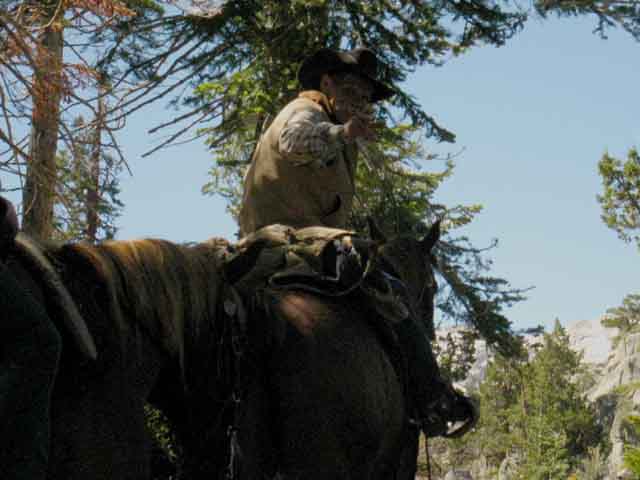
The Corkster
Corky the Horsepacker A few miles and a few hours later Corky rode by leading day riders deep into the Emigrant Wilderness out of Kennedy Meadows Pack Station. The Corkster is one hell of a guy. I'd ride or hike with him anytime, anywhere. Well, I don't think we'll see Corky hiking, unless things go really wrong! Corky is a life long High Sierra professional horse packer. He's won awards at Mule Days in Bishop, and rode to and through retirement as a Yosemite National Park horse packer. This man rides, not hikes. Corky is now riding out of Kennedy Meadows Pack Station. He's available for everything from day rides out to Lunch Meadow to major multi-day hunting and fishing expeditions. Or just observing Nature, and shooting it with our camera. Call and Talk to Matt about having Corky ride your ass around Emigrant Wilderness. He knows his way around the mountain trails up and down the Sierra Nevada Crest and Valleys. |
 |
Speaking of work, they broke the mold after they made Corky. Corky's horse is taking a deep look, listen, and scent of me. Neither Corky or his horse can understand why someone would not ride these beautiful trails. Good looking horse. Corky on the other hand... Location |
Corky's Riders
 |
||
Above: Riders with Corky follow him up the trail towards Saucer Meadow. Kennedy Meadows Pack station will bring you on extensive day rides If you want to get a deep look at this terrain without walking it.
|
Corky
 |
||
Corky rides down the trail. Later, Bro.
|
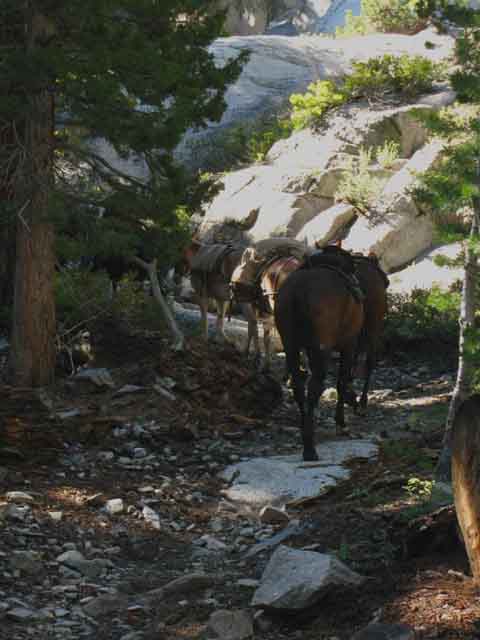
Complex Terrain up Summit Creek
The image below does not convey the majesty of the scene we are hiking into. We've funneled in, climbing towards the center of Summit Creek's middle canyon from the Northwest since departing Relief Reservoir. Now we are beginning to see the grand scale of the granite terrain funneling up to the center of the canyon on the other side, the South side of this bifurcated canyon. See, our hike up the North side of the "funnel" up to the center of the middle canyon is across mixed granite and volcanic terrain, while the South flank of the canyon is pure, clean, magnificent granite. The South flank of the middle and upper sections of our hike are composed of the massive granites of the Granite Dome on its Western end running up to Black Hawk Mountain on its East end. The North wall of our canyon is exposing itself as the North flank of the vast ridge of burnt-red volcanic materials capped by Relief Peak. Except the places below and beyond the furthest reach of the volcanic flows. These places include the lower Western-most parts of our climb East from Relief Reservoir, but diminish as we climb higher into the over-capping volcanic coverage as we hike Southeast. At our position in the image below we can make out the center of the funnel ahead, the center of the canyon where both sides of this grand two-tone funnel come together marking the beginning of the next segment of our hike through the middle segment of this canyon. At this point we realize (if we are observing and analyzing properly) we are coming to a fairly flat strip of forested terrain stuck between monumental granite to our South with epic volcanic terrain rising to our North. Wow. This is delightfully complex terrain. Saucer Meadow Campsites |
Granite Dome
 |
||||||||
Granite Dome approaching Saucer Meadow Saucer Meadows Campsites Saucer Meadow's campsites are South, further down the trail from the location of Saucer Meadow ahead of us, as shown on our customized backpacking MAP. In the image above we can see how the steep terrain we climbed from Relief Reservoir is further moderating into a nice flat ahead, where the convergence of lower canyon walls ends, and the run of the middle canyon from Saucer Meadow to the foot of the climb up to Sheep Camp begins. This is a moderate degree of difficulty segment of trail. The location of Saucer Meadow on the map is correct, but the trail does not come close to Summit Creek for about a half mile South of Saucer Meadow's marked location on the map. The campsites begin where the trail, deep pools along Summit Creek, and a nice forested flat along the creek come together nicely. A little piece of perfection.
Video Saucer
|
Approaching Saucer Meadow
 |
||
Coming over a low rise we begin dropping into the shallow bowl that captures the moisture sustaining Saucer Meadow.
|
VIDEO
Saucer Meadow South to its Associated Campsites
Camping under Granite Dome
Above Relief Reservoir Being on the North flank of the ascending canyon puts us on the volcanic side of the canyon, except that the volcanic terrain is only capping this end of the ridge. The end of abrupt horizontal transition lines between granite terrain sticking out from under the limits of the volcanic flows that poured over the granite from above show us the outlines of the furthest limits of this ancient lava flow over the even older granite it covered. Observing the terrain carefully tells us that this vast volcanic ridge to our North was created by volcanic flows over, and capping the granite ridge that at one time made up the North flank of this canyon. We can see this granite sticking out beyond the furthest extents of the lava flows. We can also see once fully-encased super hard granites eroding out of their soft volcanic jackets above the horizontal interface line dividing the volcanic material on top from the granite underneath. Everything is telling stories to the observant backpacker. Life never stops talking if we don't stop listening. To Saucer Meadow |
||||||||||||
South of Saucer Meadow: These are the Saucer Meadow Campsites. The first site we encounter off to our Right is characterized by a low wide granite rock feature in a nice flat above Summit Creek. I call it the big rock site. Looking around we see another flat upstream, but it's a restoration zone. I stop here to lean up against the cool boulder for lunch and a break, and to check out hikers. Unfortunately, too many campers find this small spot as handsome as we do. Well, it is a brilliant site... a pretty and peaceful place. The almost invisible lines of force circulating in the currents through great pool under the big rock are nice. This first cluster of campsites along this stretch of Summit Creek is mostly staked off-limits by Stanislaus National Forest as restoration zones. There are many more campsites than these, stretching for about 3/8ths of a mile upstream from these first Saucer Meadow campsites at the big rock site.
Access to Granite Dome Scrambles We've found scrambling access up to the series of lakes surrounding Granite Dome. Relief Reservoir to Brown Bear Pass
Observe and Explore Find your Perfect Spot If we give ourselves the time to scout out the locations we hike through and we will find many hidden treasures. Here we've found the key to the whole treasure chest, being scrambling access onto the Granite Dome Massif. This strip of flat forested terrain above Saucer Meadow offers fantastic access to Granite Dome up to the point where the trail climbs Southbound into the gravel washes. The beginning of this series of campsites along the trail South of Saucer Meadow is marked by the granite boulder campsite feature below, which we see off to our Right as we enter the first forested flat hiking South of Saucer Meadow. Once we get to these Saucer Meadow Campsites we should begin looking South across Summit Creek for campsites and access to scrambling on Granite Dome. Dedicated Emigrant Wilderness Scrambling Trips Hiking up to Saucer Meadow with the intention of scrambling into/onto Granite Dome for a couple of days is a great idea. Just be careful, don't get in over your head, and you will have the time of your life.
|
Saucer Meadow
 |
||
Hiking South into Saucer Meadow. Saucer Meadow opens up ahead and to our Right, the South-Southeast. The ridge to the Left, the Northeast, is the great volcanic ridgeline running East up to the Sierra Crest. To our West and Southwest we have the great granite mass of Granite Dome making up the South wall of the canyon down here, and Black Hawk Mountain caps the granite ridge as we approach the Sierra Crest. Note the granite on the Left of the image ahead. These bits of granite along the North flank escaped the flows that capped the rest of the North ridge.
|
Saucer Meadow
 |
Hiking Through Saucer Meadow Walking South down to Saucer Meadow. Here we note the massive granite feature that characterizes the North flank of this meadow, and marks its Northeastern extent. |
Saucer Meadow Granite
 |
||
View North Great granite feature making up the Northeastern wall of the canyon rising out of Saucer Meadow. Beyond this granite wall the top of the ridge rises and forms itself into Relief Peak's massive volcanic horn. The flows of the ancient eruptions that covered the ridge above were insufficient to reach over and all the way down to cover this amazing protruding nub of a granite feature. Thus we are seeing bits and pieces of a horizontal line of volcanic material running out to its Westernmost extent. Unsubmerged granite as seen above reminds us of the buried granite serving as the foundation for the vast volcanic ridge deposited on top of it. Rising out of its Grave Think of Noah's Flood, but with lava...
|
Saucer Meadow Blooming
 |
||||
Looking South across Saucer Meadow. Mid-June. Mosquitoes thick and aggressive.
Our trail is hiking South-Southeast by the compass out of the upper-Left edge of the image above. The perspective above is looking South across Saucer Meadow at the granite on the Granite Dome side of the canyon.
|
Composite Boulder
 |
||
Composite Boulder Garden Above is a composite boulder, one of a set making up what I call a composite boulder garden on South edge of Saucer Meadow. This may seem a bit strange and out of place, as we just passed the great wall of granite making up part of the North wall marking out the Northern extent of Saucer Meadow. We can see this composite boulder is the product of, and tumbled down from far above the horizontal interface marking out the the underlying granite terrain from the overlaying volcanic terrain. This is a part of that flow over the top of this canyon's North wall, when it was once granite far in the past, and then flowed down its South-facing flank, scooping up the encased granite debris we see breaking out today. These chunks of consolidated boulders making up this rock garden pictured above fell off the volcanic mountainside piled up above our granite wall. About ten thousand years ago a massive eruption along the Sierra Crest and its Eastern flank stretched from the Carson Range South to Mammoth Lakes. An eruption here, an eruption there, then one over here, and one over there, with this irregular pattern repeating itself over and over again for a few thousand very active years. All this intense volcanic activity happened at the end of the last ice age. New and The Sierra Club's Naturalist's Guide to the Sierra Nevada and Mineral Resources of
the Emigrant Basin
Primitive Area,
Imagine a volcano erupting along the Sierra Crest while buried under a few thousand feet of Ice Age ice. Imagine rivers of muck a thousand feet deep created by under-ice eruptions melting canyon-fulls of volcanic slurry sweeping down the Western flank. Imagine looking at a remaining "piece" of one of these ancient rivers of volcanic muck that's frozen in time and place, that's thousands of feet thick, and that's breaking off big chunks and tumbling them down its deteriorating flanks. That's how I see composite boulders, as one of the end stages of a very, very long process. This Earth is amazing. Here in the image above we can see a much thicker flow swept up and encased glacial debris in a very hard volcanic shell. The lava was almost as dense as the rocks it swept up within its flow, but it was not hot enough to melt these captured rocks. This is very different than the "soft," composite flows of even cooler materials we see in other volcanic valleys off the Sierra Crest, where the encasing volcanic material can be as soft as a weak mixture of cement. Also See Composite Boulders, South Upper Truckee
|
Looking North across Saucer Meadow
Back the way we Came
 |
||
The Fall Zone We can see the ridge in the distance dropping down toward Relief Reservoir. A gentle climb behind us brings us deeper into Summit Creek's middle canyon. After a short climb we begin a brief descent to the big rock campsite, the first in the series of, "Saucer Meadow Campsites."
|
Last Climb South
of
Saucer Meadow
before reaching
Campsites
 |
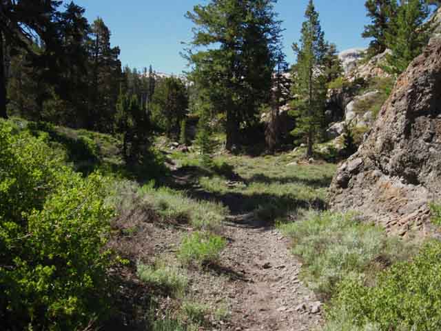
A gentle climb brings us out of Saucer Meadow. We've climbed up, and funneled into the narrowing middle segment of the canyon during the hike up from Relief Reservoir. Though we've entered the middle segment of the canyon, our trail is still climbing, but more gently. Our trail is still following the line of the still-narrowing canyon walls towards the center of the canyon, albeit on a much more gentle angle. |
Dropping down
to the
Saucer Meadow Camp Sites
 |
Entering last segment of trail approaching Saucer Meadow Campsites. Hiking to the lowest point ahead we come first to Summit Creek, then a series of campsites. |
Around the Berm into the Flat
 |
||
Here we begin a short descent to Summit Creek running through a nice series of deep pools in the center of the canyon under sheltering forest.
|
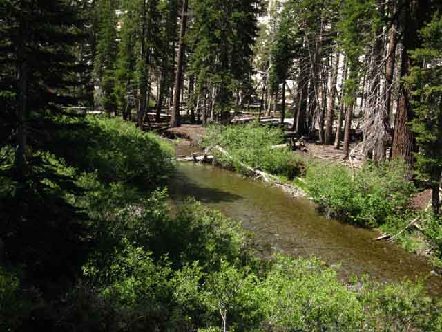
Summit Creek below Camp Sites
 |
||
Reaching Summit Creek-Approaching Campsite Zone We exit the berm to a flat above and along Summit Creek about wide enough for our trail. Across Summit Creek we see promising sites... but... We're still about a hundred yards North of the campsites. We can see campsites across the creek as we approach the main campsite area.
|
Main Saucer Meadow Campsite
 |
||||
Big Rock Campsite The most distant low granite feature is the big rock marking the location of the first of a series of campsites along our Tahoe to Yosemite Trail for the next 3/8ths of a mile. Our trail leads into this first nicely forested Saucer Meadow Campsites area, while the actual location Saucer Meadow is a bit behind us to the North. In any case this is not where the premium campsites at "Saucer Meadow" are located. We've got to continue South to find them. The campsites in the first forested flat above Saucer Meadow, which we are looking at above, would be the best places to camp, if the heavy use drawn to this spot's optimal location and beauty had not also drawn-in camping restrictions. The very suitability of this place for camping has drawn campsite restrictions here. Most of the potential campsites on this little upcoming flat are marked with "restoration area" posts, but not the key site at the big rock. The granite rock in the middle-distant Right is the main, and still legal campsite here during the 2016 season. This guide was designed to be updated through its Trails Forums. Post up your observations and analysis of camping opportunities here, and the current status of the restrictions:
Let's take a closer look...
|
Saucer Meadow Big Rock Campsites
 |
|||||
The Big Granite Rock Campsite of the Lower Saucer Meadow Campsites Above we see the distinctive boulder campsite marking the beginning of the series of campsites at, and running about a half mile South of this first campsite. Summit Creek flows past through a fine pool on the backside of this boulder. Though this little flat is pretty busy during Summer, there are not many campsites here. The site pictured above is the main campsite. But don't worry if you hike into here tired and sweaty only to see someone camped here! A series of campsites, and the best sites here at Saucer Meadow are only a short distance further South upriver along the trail. Over the years I've hiked through, and taken breaks here, I've always seen a party at this site during weekends during the height of the Summertime backpacking season. There will be another party camped here at the less optimal spot. No problem. I generally take a break here to refresh myself after the climb up from Relief Reservoir, and to enjoy the special beauty of this site, and the nice swirling pool along a bend of Summit Creek behind the big rock, even though I don't camp here. It's still a beautiful spot. My favorite spots are just a short ways further up the trail.
|
Video
Saucer Meadow Campsites
Video: Saucer Meadow Campsites. 5:26 High Sierra Backpacking Videos Emigrant Wilderness
|
Campsite at the Boulder at Saucer Meadow
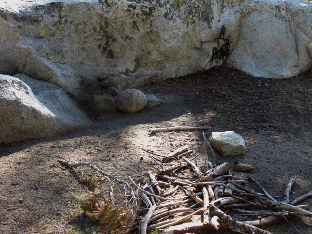 |
Fire ring and collected firewood at Saucer Meadow Boulder along TYT in Emigrant Wilderness July 2012. Too bad I don't make fires... nor stay overnight at this particular location. |
Flat Areas 30 yards South of the boulder
 |
|||||||
Site Restoration Much of this first Saucer Meadow camping flat is a restoration site, posted with no camping posts like the one above. Since this first flat is pretty small, these restoration site posts cover most of this area.
|
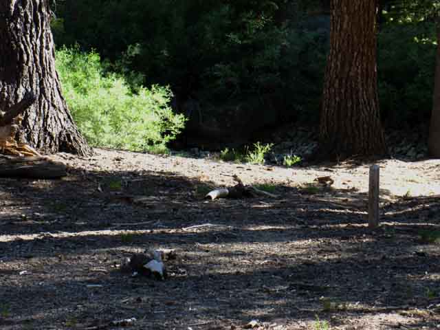
Site Restoration at Saucer Meadow
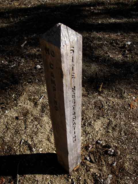 |
Saucer Meadow site restoration post. Stanislaus National Forest regulations tell us not to camp within one hundred feet of these restoration posts. |
Saucer Meadow Resident
 |
||
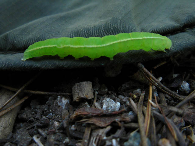
Saucer Meadow Caterpillar. I leaned back against the cool shaded rock of the main boulder campsite as I pulled my hot and sweaty hat off, tossing it onto the ground beside me. I was done with all the work of collecting trail guide information. Then I noticed a piece of fluorescent fury surging across the forest floor. My first thought, "food," was interrupted by the delight generated by the intense color and activity of this mini might. Most of the insect world seems to well-justify occupation of its position in the chain of life by how well it supports the increasing sophistication of the web of life, by both eating and being eaten. Food. Thus my "food" though. Don't get me wrong. Food is beautiful on so many levels. I cherish and respect food, as well as enjoy it. But this was more. Under examination each piece of the food chain is inherently beautiful. This little sucker needed no examination! It was beautiful "on the hoof." Hooves. Many of them. As it swept past in its furiously undulating beauty it evoked images in my mind of beautiful butterflies emerging from their chrysalis stage, of the beauty of the short and long cycles of evolution coming neatly together in one creature's radically changing life... ... and, the florescence of this little devil was pleasing on its own merits. Pretty Food ! I put my trail guide writer hat back on (after the creature exited my hat!) and chased this bug around a bit, despite being previously exhausted by all the chases on the hike up here... When the opportunity to reflect the beauty of nature arises, I rise as if from the dead to answer. The web of life draws out and expresses all aspects of existence in the execution of its design. This guy rewarded me with its unceasing energy expressed as undulating fluorescent beauty.
|
Trail South from First Flat
 |
||||
South from First Campsites Hiking South from the first campsites above Saucer Meadow (the boulder site) our trail follows this rocky trail to top a low rise where the next narrow flats suitable for camping are wedged in along Summit Creek. We have this low climb pictured above leading to the next two and a half flats. The first upcoming flat is the granite flat pictured below, then there's a forested flat beyond it a bit further South where the horses are pictured tied-off below. Lots of places to camp at both places. Best "Saucer Meadow" Campsites Access to Granite Dome We've got to cross over to the South shore of Summit Creek for access.
|
Granite Dome Massif
 |
||
Granite Dome from "Middle" Saucer Meadow Campsites We are looking over our Right shoulder at Granite Dome in the above image as we hike South. We have a view of the massive granite of Granite Dome to our South across a massive slab of granite. Our Southbound trail is taking us from the Right to Left, though we are traveling East by Southeast by compass heading. Hunting around over there on the South shore of Summit Creek will reveal nice campsites. Very nice. We also have campsites behind us at the big rock site, and ahead at the wedged snag site, before we begin seriously climbing to our next campsites at Sheep Camp. At our position in the picture above we are above and South of the first set of Saucer Meadow campsites, which are out of the Right edge from the picture's perspective, and we are walking towards the last set of Saucer Meadow campsites to our South, which are out of sight beyond the Left edge of the image above. Color Line This is not just a zone of camping along Summit Creek, but our access into the Granite Dome-Blackhawk Mountain Massif.
|
Second set of Campsites
 |
||||
Day Riders A big group of private day riders rode up to the second "Saucer Meadow" campsite flat pictured above, above the big rock site. They rode South past me as I lounged around in the big rock campsite, chased bugs around, got some water, and rested up a bit. Nice folks. We exchanged greetings and I said hello to their dogs who came over to check me out as the group rode past. Good dogs. The dogs were happy to see someone they could, "scout out," as they ran alongside the mounted riders with engaged joy. These were riders out of the Kennedy Meadows Trailhead, though not affiliated with Kennedy Meadows Pack Station's stock or riders, as far as I could tell. This is a great place for the horsefolks to exercise their riding and packing skills. It looks like these horsefolk day-riders even packed a mule to carry their lunch. Must've been a great lunch! That mule can pack 180 lbs of food! That means a cold beer with lunch! Backcountry Horsemen of California This is great riding country. Hell, this is great country for the human spirit, be it on foot or horseback. The spirit soars like an eagle here, be it launched from hoof or heel, the flight of the Spirit here is real. The dogs certainly were digging it. Moving On Past the second flat the trail takes a couple of kinked turns, rises a little, then makes an almost straight stretch South through what appears to be a jumbled, almost confused bit of forested terrain running right alongside Summit Creek. We'll make out a few sad campsites and restoration posts, until we reach the wedged snag. The key things to consider if we're planning on staying at Saucer Meadow Campsites is where they end, for we don't want to walk past the end of this strip of campsites. The next consideration is which is the best site for us.
|
Far Southern End of Saucer Meadow
Campsites
The Wedged Snag
 |
||
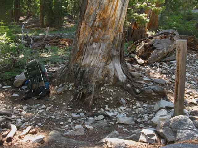
The Wedged Snag Above we are looking at the fallen snag landmark wedged between two standing trees from the custom campsite pictured below. This snag, easily visible from the trail, marks the location of the best sites and access to other sites at the very South end of the strip of Saucer Meadow campsites along this nice flat above Saucer Meadow. We hiked South past that snag, with the snag to our Left, and turned Left (North) off the trail into the fine campsite pictured below. The TYT route is off to the Left of this view above of the wedged snag. We're looking North back down the trail after making camp... Hiking South on the Tahoe to Yosemite Trail The wedged snag marks the point where we Southbound hikers will look for the little waterfall off to our Right, the premium campsite off to our Left, and Summit Creek flowing down towards us below its little waterfall, flowing through a series of beautiful sculpted granite pools. The sensuous shapes of these shoreline granite features were sculpted by the furious phase of thousands of cycles of Spring Thaw's surging waters along Summit Creek, that now, later in the season, provide us with deeply relaxing gallery of sculpted granite decorating a string of peaceful placid pools of relaxation. I love pools of relaxation and contemplation... We can cross Summit Creek here to find a series of sites along its far shore. There's a nice site above the waterfall on the South shore of Summit Creek. Now we are at the best sites above Saucer Meadow for camping in beautiful forested granite terrain with volcanic terrain stacked above it, above us on on the North wall of the canyon. To our South across Summit Creek we are blessed with stunning views of the great granites making up the South wall of our canyon, with access to amazing scrambling routes into the granite terrain of, and between Granite Dome and Black Hawk Mountain. A Series of Fine Campsites Very nice terrain around here... More Restoration Posts How to find it: Walking South on the TYT to the Wedged Snag we look 45 degrees to our Left off the line of the TYT (look Northeast), and we should see this fine site within ten steps further Southbound down the TYT. By the map we hike South of the wedged snag and look to our North-Northeast to find this campsite. This particular site has a great soft flat, rock and tree protection from the elements, a beautiful granite feature to lean comfortably against, easy access to look at, listen to, and drink water. That is, this site is within hearing of the gentle tinkling background melody of the waterfall and the sounds of Summit Creek flowing through priceless works of granite sculpture it is still carving and polishing. Make sure we don't hike past it! These last campsites are not obvious, and we must be observing the surrounding terrain carefully or we will hike right past them. Thus the fallen snag landmark tells us when we are near these fine sites. A few dozen yards South of the fallen wedged snag pictured above this segment of our trail South climbs a set of steps out of this line of Saucer Meadow Campsites. Beyond the wedged snag we are leaving behind the best and last of this series of nice camping flats strung out along the trail above Saucer Meadow's location on the maps. Next I have the distance from Saucer Meadow, meaning the actual meadow site named on the maps, to the last in the series of Saucer Meadow Campsites campsites at the wedged flat at three-eight's of a mile. That puts the Sheep Camp campsites 2.03 miles South of last of the Saucer Meadow campsites just yards South of the wedged snag. There are major differences between Saucer Meadow and Sheep Camp's characters. Sheep Camp also locates beautiful campsites. Both the Saucer Meadow and Sheep Camp campsites are beautiful spots located in unique terrain. Saucer Meadow has many more sites that Sheep Camp. This is because Saucer Meadow's sites are located along a narrow, but long run of flat terrain along Summit Creek. Sheep Camp is a discrete, single location. This makes for very different characters. Campsites at Sheep Camp are centralized in and around the edge of an expansive sandy open flat surrounded by encircling granite features, all under the main arm of ridgeline running Northeast off Black Hawk Peak. Though Saucer Meadow's sites are strung-out along an almost half-mile length of Summit Creek, they feel more close-in than Sheep Camps' site, in the sense that the forests are denser, the granite formations and canyon walls are closer by, and we have the feeling these Saucer Meadow Camps are "wedged in" along this line of forest and creek in a narrow canyon.
|
Backpacker
Physical Status
Our constant climbing and exposure to the burning Sun since departing Kennedy Meadows moderates significantly after we climbed past Saucer Meadow to enter this narrow flat of shaded terrain along Summit Creek. The North wall of this canyon rising above us is capped by a great volcanic mass rising up atop the granite it overwhelmed and drowned. Across Summit Creek the pure granite of the South wall of our canyon rises up to deserve its designation as Granite Dome. Once we encounter the Boulder campsite, the first campsite flat where this series of Saucer Meadow's campsites strung out to the South begins, we will note a series of nice little campsites stretching for about three eight's of a mile down the Southbound trail along this fairly flat strip of terrain with an endearing length of Summit Creek in close proximity under some nice tree cover. It gets better. Looking South across Summit Creek through the tree cover we find fantastic views of the Granite Dome-Black Hawk Massif and potential access points into this mass of majestic granite. Below we see our last view up Summit Creek before we enter the set of steps bringing us out of this forested run of sites alongside Summit Creek into a series of granite washes running above and around a great channel of Summit Creek approaching its cascading course down the steep canyon from Sheep Camp. |
Mini
Waterfall
at the
South End
of the
Saucer Meadow Campsites
 |
|||||
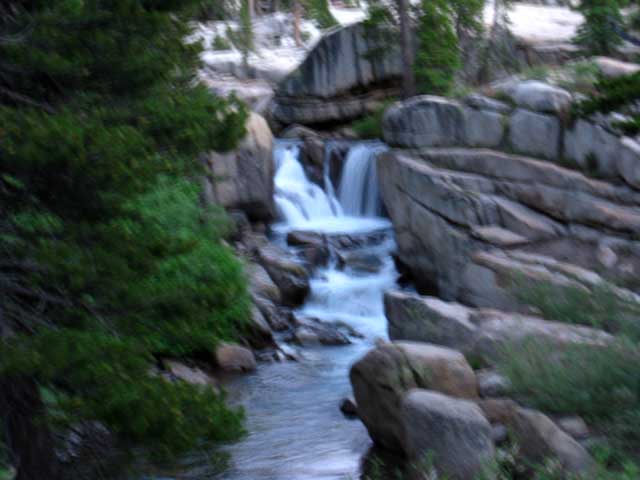
Summit Creek Waterfall There's a nice campsite above the falls on a flat to its upper Right, on the far side of the creek. We can just see this campsite location in the upper Right of the image above. There is also another campsite off to the middle-Right of the creek below the falls, out of view of this picture. I'm standing on the North shore of the Creek, and behind me is the nice campsite pictured below.
|
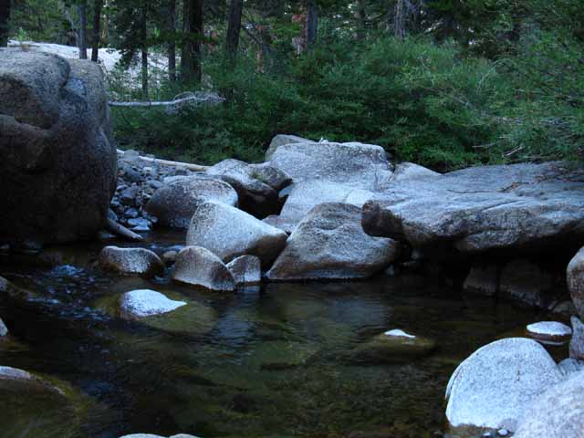
Cold Pools below twice sculpted granite
 |
||
The length of Summit Creek below this little waterfall flows through a delightful field of ice and then water sculpted granite. First the frozen water of great glaciers cut out the crude shapes of this canyon and its rock, now the liquid water of Summit Creek is oh so very gradually finish-shaping the rock along its course, especially during the Spring Thaw, into quite beautiful water sculptures.
|
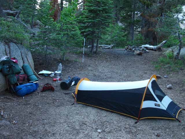
Main Campsite
along a run of
fine campsites stretching
about a
Half Mile South of the Saucer Meadow Boulder Site
 |
|||||||||
I like this Campsite This is the last site hiking South from Saucer Meadow on the North shore of Summit Creek. Just a few feet South of this site the trail climbs out of this nice flat, and makes its way into a series of gravel washes. This site above is a fine wind and sun protected campsite suitable for larger parties with a nice fire ring and seating we can see in the background. Well, the fire ring is now gone. And the only protection from mosquitoes is offered by my tent, pictured without its rain fly, as its only job during the fine weather of the trip pictured above was to provide me with mosquito-free sleeping. The rest of my hiking day mosquito protection is offered by clothing, DEET, and/or my mosquito net. Don't underestimate the mosquitoes, especially before the middle of August. To fully enjoy the beauty and experiences here we must fully protect ourselves from its hazards, of which the mosquitoes are a big one.
The big boulder campsite area has long been an area of "restoration" and restricted camping. These restoration zones have recently spread South along the whole length of the run of campsites strung out along Summit Creek in the forested flats above Saucer Meadow. I have never seen the main, and first site, the big boulder site, ever posted as being off-limits by a camping restriction post. The below pertains to the last flat of campsites above Saucer Meadow, the ones in proximity to the Wedged Snag: 2010: No restrictions in upper campsites 2012: Trail Crew has disassembled most of the fire rings and placed restoration markers in many of the more popular campsites. Restoration posts also in sites across Summit Creek, on its South bank. 2013: More restoration sites in these upper Saucer Meadow sites, on both sides of Summit Creek, but the site pictured above, my favorite, was still open in Fall of 2013. No worries. Many sites still open on both sides of creek. 2016: Extensive restrictions still in place, but the first and last sites, the Boulder Site and the Wedged Snag sites, respectively, are both still open for use. Post a Report Ring Backpackers typically love fires. The campfire is emblematic of camping, hiking and backpacking. The classic sign of a backpacker's camp is the fire ring surrounded by boulder and split-timber benches. The National Forest's mission of preserving wilderness motivates them to disassemble backpackers camps, hide the split timber benches, and roll the fire ring and our seating boulders away. I am of the opinion that the National Forest Service should not disassemble all of the fire rings, nor its surrounding seating, in any popular camping area. They should leave the main fire rings in the main sites. And the benches too... These fire rings and these site constructions are here because hiker traffic supports them. Hikers will inevitably restore the main fire rings and main campsite features. Why fight it? I fully agree with disassembling all the satellite site fire rings. And the overbuilt features in satellite sites. We hikers should not make extra fire rings or build benches & etc. outside of the fire rings and benches established at the main campsites in any location. Too many campsites is bad. No campsites will induce their construction. A Modest Proposal How about that for a "middle of the trail" proposal? This reasonable policy would allow us to intelligently deal with, and concentrate heavy use in specific campsites, while maintaining the overall natural character of popular camping areas. Maybe rotate the location of an area's "main site" as necessary. Both the National Forest Service and backpackers must modify their behavior to obtain a degree of balance and stability for highly used sites such as these. Personally, I never build camp chairs or benches. I don't make fires except during emergencies. Fires obscure our vision of the night, and focus our attention into a cone of light that we cannot see outside of. Darkness is our friend. Navigating out of Society's Cones of Stupid. Backpacker's Astronomical Tools and Information Forum The key is to be able to navigate through both darkness and light, without being too dependent on either, and comfortable in both.
Backpacking Trail Tips
|
VIEW from UPPER "SAUCER MEADOW" CAMPSITES
Northwest Flank of Granite Dome
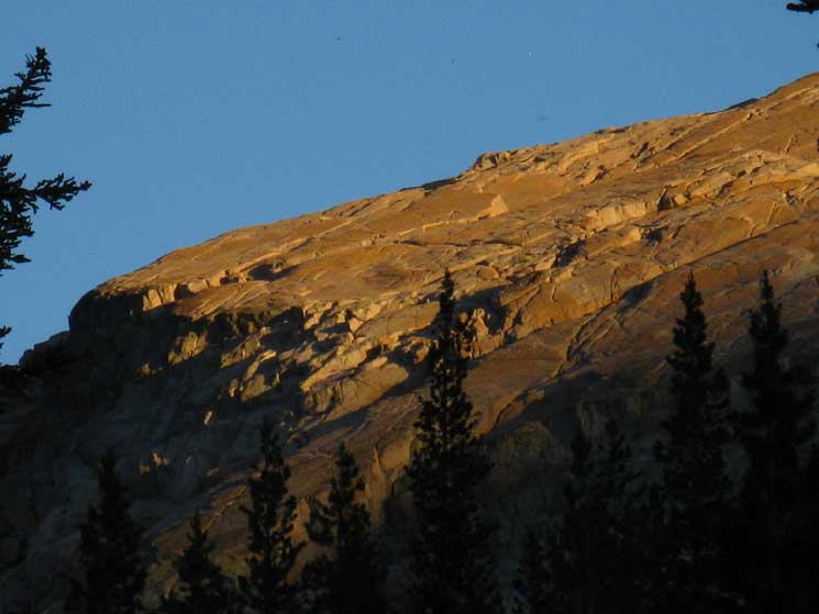 Detail on a magnificent scale dwarfing man. July 2010 |
||||||
| A Golden Mountain A view through the trees looking Southeast from the far South end of Saucer Meadow's strip of campsites at the Northeast flank of Granite Dome's Mountain Massif under the last direct rays of twilight. This flank of the great Granite Dome Massif rises above Lewis Lake, while the base of its North flank composes Summit Creek's upper canyon leading us all the way up to Brown Bear Pass. Between Above we can see the shadows of evening climbing out of the darkness along Summit Creek below. Deepening sunset is transmuting the fading light into the burnt colored range of the "sunset spectrum," pushing into deep reds, orange, and yellows before the climbing fingers of nightfall finally engulfs this massive chunk of rock in darkness. What a beautiful golden sunset that was. Below is a view of a straight no-refraction bright white sunlight sunset on the same frkn massive granite feature:
We won't see Black Hawk Mountain behind it, until we clear the North (Left) edge of that dome. Relief Reservoir to Brown Bear Pass We will be hiking up under the North flank of Black Hawk Mountain as we wrap around the North flank of the dome pictured above. Black Hawk Mountain is the peak topping the Eastern end of this vast granite ridge composing what I call the "Granite Dome Massif." This granite ridge to our South, above, is actually part of an epic outcropping of granite running East and West along the middle and upper segments of our hike up to Brown Bear Pass. From the perspective above Black Hawk Mountain is located about a mile and a half to the South by Southeast behind the Left edge of the dome above. This amazing dome is marked as Peak 9523 on the USGS 7.5 series Emigrant Lake map linked to above. Granite Dome's crestline is beyond the Western end (Right flank) of this great granite ridge, while Black Hawk Peak dominates its Eastern end, is also mostly obscured by this killer dome.
Emigrant Wilderness Getting the full potential of the views while camping at the last campsite in this string-of-pearls run of campsites strung out South from Saucer Meadow requires a bit of hiking around to clear obstructions from between us and the stunning views of the surrounding terrain. We can see bits and pieces of the surrounding granite mountains, domes, ridge tops and canyons all protruding through the forest cover to the South of our campsite. If we hike around just a wee little bit we will find expansive views of all these fine features. Well, I was done with the day's backpacking, and finished with the evening's "wee" bit of scouting, and very ready to lay about and only observe nearby forest, rock, the sounds of water and starlight from the sky from a stationary position. I was ready to reduce observation to watching only the things which come to me under their own power, when I noticed puffs of smoke shooting skyward out of the forest to the South by Southwest. A forest fire! The thinness of the forest and the predominance of rock terrain naturally limited the spread of this fire, but it puffed up some inspiring smoke signals until it began smoldering in the understory, and burned itself out. At our elevation with the timber cover so thin, this is not just a rare event, but a positive for the fertility of the forest affected. This is the second gentle forest fire I've encountered in the high elevation section of the Emigrant Wilderness. Both appeared to be productive of sustained and increased fertility, unlike the massive blazes which are consuming our low elevation Sierra flank forests, as if they are burning in a furnace. These high elevation blazes appear to be part of the natural process of slowly converting rock into soil. After vegetation and trees begin to exploit and expand cracks in the rock and grow for a few generations they gently catch on fire to better convert the previous generations of plant growth into productive soil for the subsequent gens. This invigorated soil seeps deeper into cracks in rock its own roots had previously pried a bit further apart, which will be followed by its ancestors roots expanding these cracks while continuing to break rock into soil by adding its own biomass. And a bit of fire. These high elevation fires are very different from the low elevation fires burning like furnaces consuming whole forests while sterilizing ancient soils. These fires up here are still expanding fertility, rather than destroying it. Tracking the Emergence of New Global Weather Patterns
|
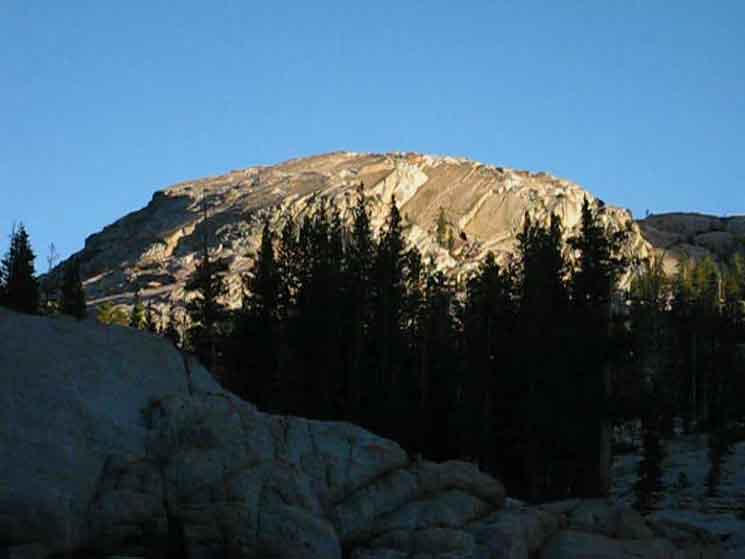
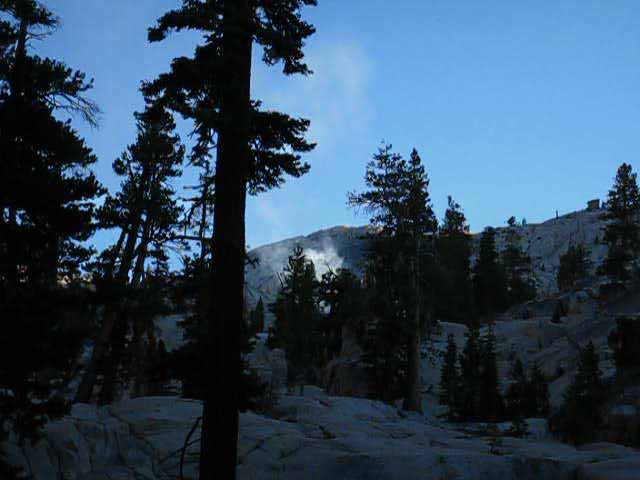
Video
Last Campsite North
of
Saucer Meadow
to
Campsite on North End of Lunch Meadow
Check out the terrain following Summit Creek's canyon up to Sheep Camp on our way into the bottom of Lunch Meadow. 16:17 Backpacking Videos Emigrant Wilderness!
|
Summit Creek Waterfall
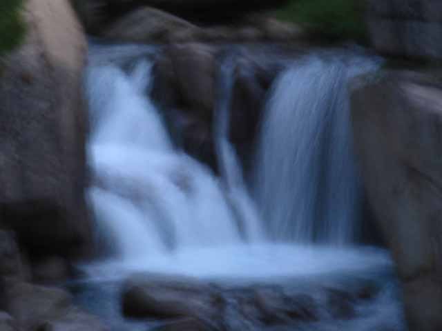 |
Pocket falls along Summit Creek. This little falls is inset at the bottom of its own granite channel. |
Summit Creek Waterfall
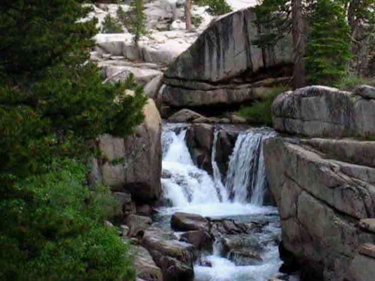 |
||
SUMMIT CREEK The trail beyond, South of this waterfall climbs out of the series of Saucer Meadow Campsites across a wet zone of temperate forest and brush into a series of dry gravel washes. Keep your eyes open for the waterfall above to the Right past the wedged snag. Directly behind us lays the premium campsite described above. Just a few feet hiking further South the trail begins climbing a set of steps to leave all of these fine sites behind, with no premium camping available until we arrive at Sheep Camp.
|
South
from
Saucer Meadow Campsites
All good things must end. At least change, as we mark the end of this almost half-mile long flat along Summit Creek peppered with campsites. The end of this fine flat forested stretch with campsites finishes with a series of really beautiful campsites along a section of creek with a waterfall followed by sweet pools flowing through water sculpted granite. Now we begin a moderate climb through a short wet zone into a series of gravel waves. Our Southbound trail is climbing up and around a section of Summit Creek flowing through a steep and narrow granite channel. This impassable section along the creek pushes the trail route up the mountain away from the creek to begin crossing over a series of undulating great gravel waves, washes really, composed of huge fields of fine gravel rocks that have been worn out of the composite volcanic material capping the cliffs rising to our North. This gravel has been eroded out and washed gradually down, season by season, towards Summit Creek by the tumultuous force of thousands of years of Spring Thaws. Huge energy is slowly eroding this ancient granite rock out of its volcanic captivity, then pushing and pulling these rivers of gravel down into Summit Creek. This next section of trail South, without campsites, begins where we see the almost-uprooted tree hanging on for dear life, below. I've been waiting for that sucker to slide off the edge for years! Between this point, located about a mile and a half North of Sheep Camp, there is not much in the way of camping until we arrive at Sheep Camp. When we look to our Right and see the little pocket waterfall pictured above (while hiking South) we are about to depart the strip of Saucer Meadow Campsites and begin that climb to Sheep Camp.
|
South
from the
Last Saucer Meadow Campsites
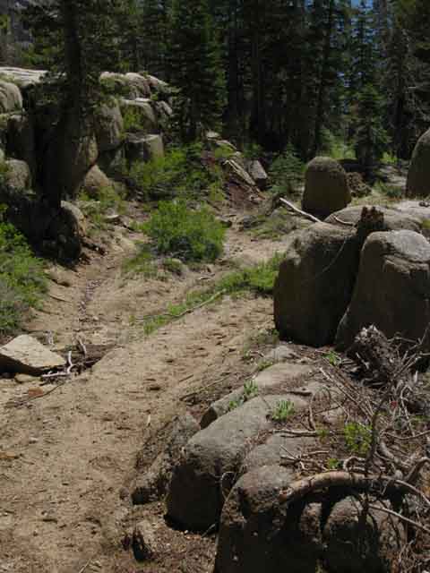 |
||
We turn up hiking South from the last of the string of Saucer Meadow Campsites strung along Summit Creek above Saucer Meadow proper.
|
Steps through Wetness
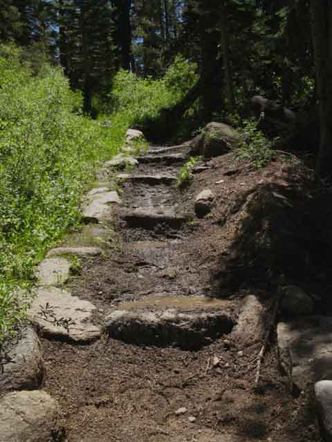 |
||
Hiking South our next destination is the sweet flat behind a gap in the granite mountain flank under Black Hawk Mountain called Sheep Camp. It is very picturesque terrain hiking the last half-mile up to Sheep Camp. Real special. Above we have an excellent example of how to maintain a trail through a wet section of terrain. I've always thought there is a spring located here. We are climbing up to the gravel section.
|
Into the Gravel Waves
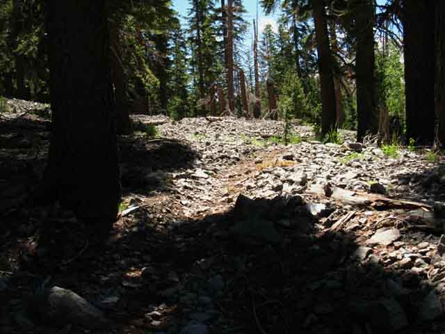 |
Gravel washes between Saucer Meadow and Sheep Camp. |
Lewis Lake Canyon
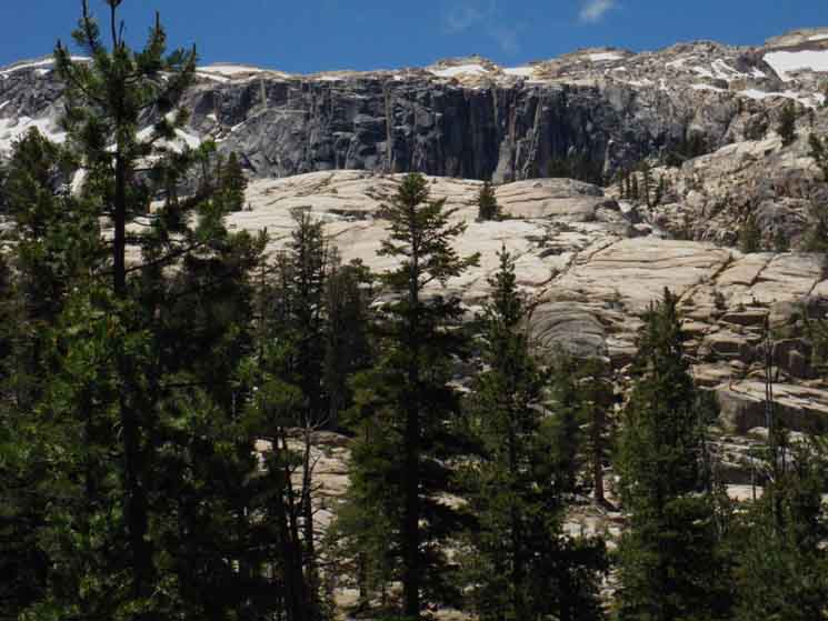 |
||||
View to the Southwest, to our Southbound Right, as we are walking South. I'm thinking we are getting a look at the canyon holding Lewis Lake, as its marked on the USGS maps. This is a fantastic example of the granite terrain around and between Black Hawk Mountain and Granite Dome.
|
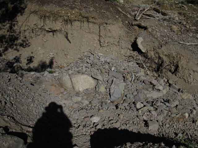 |
|||||
Serious Gravel Washes This section of serious gravel washes makes camping hard and hiking challenging for about a mile between the end of our long string of Saucer Meadow campsites to where we begin our final climb up to Sheep Camp.
|
Southeast view of Summit Creek in Morning Shadow and Brightness
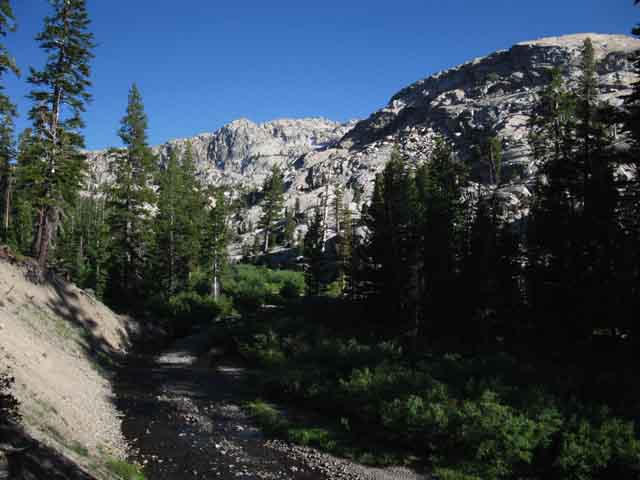 |
||||
Summit Creek North of Sheep Camp. Crossing the gravel washes we draw back towards the creek to get a great view upriver at a section of the North ridgeline of Black Hawk Mountain. That's it, Black Hawk Mountain, in the furthest distant upper-Right beyond the dome in the middle distance. We can see that distant ridge rising to the peak of Black Hawk Mountain. Sheep Camp sits at the base of the prominent dome along Black Hawk Mountain's descending Northeastern ridgeline. We will continue straight where Summit Creek bends Right, seeking the ledge up across the steep granite terrain bringing us to the top of this middle section of the valley, and to the base of that dome. At the top we will find a narrow gap in the ridgeline leading us through a narrow channel to Sheep Camp. That puts us at the bottom of the uppermost and final segment of this canyon's run across Lunch Meadow up to Brown Bear Pass. Sheep Camp lays at the foot of the dome on the ridgeline in the image above. We can see where we pass through the ridgline running across the base of that dome. Our passage through that crack in the ridgeline is just to the Left of the base of the Dome protruding above the ridgeline in the furthest distance. I call that dome Peak 9800 as depicted on the Northeast flank just below Black Hawk Mountain on the USGS Emigrant Lake 7.5 minute map. Relief Reservoir to Brown Bear Pass Closer to us we see a steeply eroding bank, which I figure is the mother of all the washes running across its surface. Our trail crosses the top of the bank, with the bend in Summit Creek eroding it back and away, revealing that this great bank is composed mostly of a whole lot of piled-up gravel.
|
Afternoon Shadows drawing over Summit Creek above Saucer Meadow
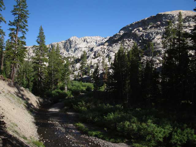 |
|||||
Turning Left, Northeast, where Summit Creek bends to the Southeast, we can begin to see our traversing route up to the gap in the mountains leading to Sheep Camp. Keep the sunscreen handy and the hat properly adjusted, because we will shortly need their protection.
|
Morning Light
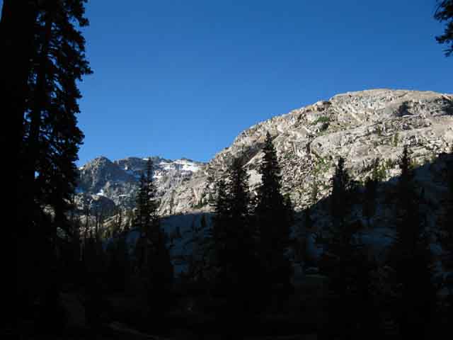 |
Cool cone below Black Hawk Mountain. Sheep Camp sits at the base of that cone. Black Hawk Mountain caps the top of the ridge. |
Detail
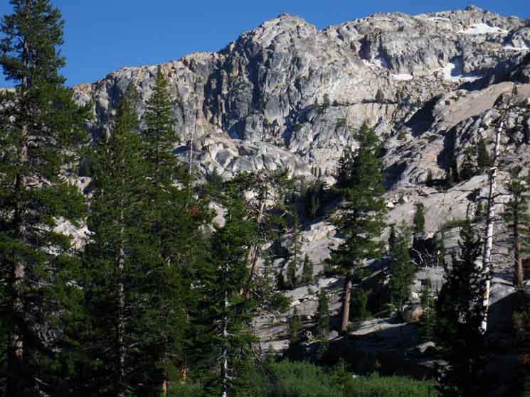 |
||||
Detail of dome on the North flank, running up to the peak of Black Hawk Mountain. We cut through a gap in the mountains into the flat of Sheep Camp at the base of this cone feature. Is that not cool?
|
Trail around Summit Creek Wash
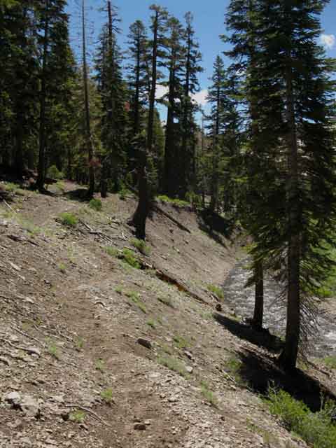 |
Trail around a section of Summit Creek driving the great gravel wash down the mountain and eventually into the Middle Fork of the Stanislaus River on its long trip to the Pacific Ocean. Well, I'll bet some small portion of this mass of gravel is passing out of the Golden Gate on every big outbound tide as sure as clockwork. |
Detail from Above Image:
Hanging in there
at the
Edge of Life.
 |
||
Tree ready to go from edge of the eroded creek bank South of Saucer Meadow. How many seasons until this tree comes by Kennedy Meadows on the high tide of a massive Spring Thaw?
|
South Brief Climb South from the Saucer Meadow Campsite pictured above brings panoramic views of a vast swath of Granite Dome's mighty massif through forest as we follow Summit Creek rotating around its Northern limits. |
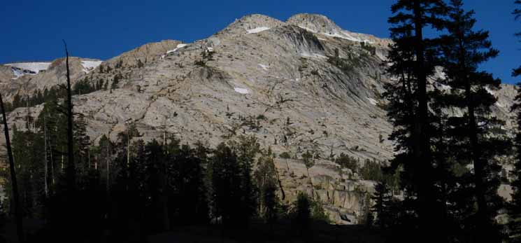 |
|||||
Looking to our Southwest at the vast expanses of open granite terrain across the Granite Dome Massif imparts the monumental scale of this massive sheet of granite terrain. This is part of a vast sheet of granite stretching out beyond the Northwestern boundary of Yosemite. This sheet of granite stretches and descends far South and Southwest beyond the South flank of Granite Dome. The sheet of granite below Granite Dome runs a series of valleys down to Pinecrest Lake off its Southwestern edge, and South all the way down to Cherry Lake. Our view of this mighty massif above is from the Northwestern-most edge of this great sheet of granite. We are going to cross the Northwestern edge of this great sheet of granite into the Northwestern corner of Yosemite. I figure this edge of this sheet of granite is the Northwestern-most edge of the great sheet that reaches all the way down to Yosemite Valley, eventually. This sheet of granite continues South along the Sierra Crest to Tioga Pass, and continues South through the Cathedral Range. I prefer to include a swing down to Yosemite Valley and back to the Crest in my Tahoe to Whitney hikes. But make no mistake, we are making a slow but profound transition out of this amazing interface zone of volcanic and granite grandeur here in Emigrant Wilderness, hiking across its edge, while pointing ourselves towards the center of the High Sierra's widest and deepest run of unadulterated granite. That would be the run from the Sierra Crest to Yosemite Valley and out the South end of Yosemite across this monumentally vast sheet of granite. In either case, this is one big sheet of granite we are looking at the edge of....
|
Daytime "over there"
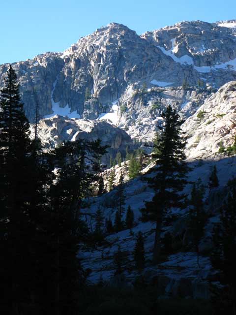 |
|||||
Sunrise sweeping away shadow and chill from the Great Granite dome decorating the Northeastern ridge arm descending off Black Hawk Mountain. The image above shows the terrain above and around the Southeast perimeter of Sheep Camp. We are looking to our Southeast. Summit Creek passes through the bright gap to the Right of the section of illuminated granite ridgeline below the dome. Our smaller gap is located to the Left, the NE, along that ridgeline. Once we pass through the gap into Sheep Camp we will understand that Sheep Camp sits just a short ways below the bottom of Lunch Meadow. Local This may be earlier than astronomical rise and set times. Our local position in the terrain finally determines exactly when we feel the first and last rays of each day.
|
Pocket of Forest North of Climb to Sheep Camp
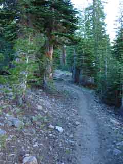 |
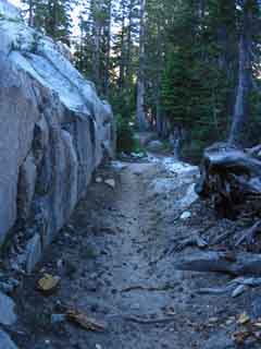 |
|
The very rocky terrain, our hike through a series of gravel washes is finally transitioning as we climb higher up the washes. The 100 percent gravel surface is now being contrasted by great granite blocks and the surface diluted with soil. This explains and justifies the forest thickening nicely as our trail continues climbing moderately to the Southeast (South on the Trail, almost East by the Compass) bringing us up to the head of this middle segment of Summit Creek's canyon. Above we can see we are gradually transitioning from gravel onto a surface with a higher percentage of soil, precluding us from calling the surface a "wash" any longer. It is an "ex" wash transitioning into stable forest. Generations of trees are depositing their bodies in an increasing bank of organic soil here, rather than into a gravel wash. The percentage of soil and forest grows as we climb closer to the top of this segment of the canyon. But the surface is still very very rocky. At the top of this segment of mixed, but changing terrain we pass out of gravel washes into thickening forest ending in a nice stand at the top of the canyon. The gradually changing composition of our gravel into soil surface transitions again at the head of this narrowing canyon, this time abruptly onto solid granite. Our hike through gravel washes, then transitioning surfaces and thickening forest now abruptly transitions again, but this time into exposed granite where we begin the final climb for the gap to Sheep Camp, and into the bottom of Lunch Meadow. The end of the stretch of Saucer Meadow campsites was marked the change in surface from soft soils to a very rocky soil, into terrain that can be characterized as one great section of gravel washes. These washes gave way to gravelly forests, then denser bits of forest, and now transitions again, this time into a stretch of solid granite.
Relief Reservoir to Brown Bear Pass |
||
Out of the Forest
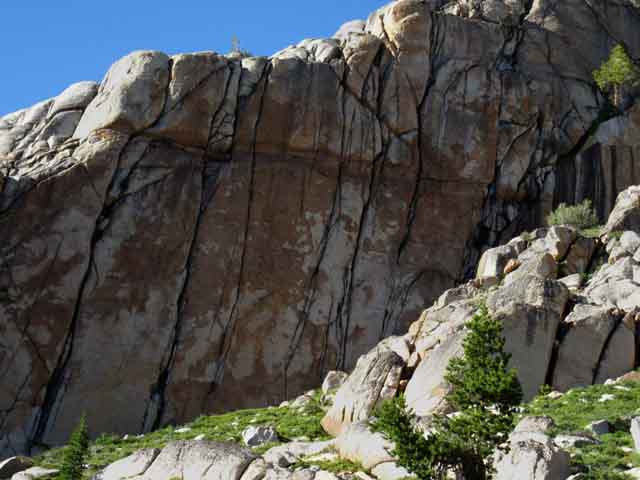 |
||||
The trail emerges from the forest-covered gravel washes into a final stand of forest. This last, uppermost stand of the forest is closely wrapped. The top of the forest is surrounded by rising walls of uniquely tinted and jointed granite narrowing down to wrap around the head of this gorge-like last segment of trail climbing us up to the gap to Sheep Camp. We find a ledge of trail switchbacking up to a traverse trail chipped into the top of this rocky canyon.
|
Looking North back down the canyon
 |
|||
Below Sheep Camp and above Saucer Meadow. Once we leave this last bit of forest cover we are not going to have a lot of sustained cover, if any at all for sustained lengths of trail, until we cross Bond Pass to drop into Jack Main Canyon. Time to keep a close eye on exposure and hydration.
|
Climbing to see the volcanic Terrain Stacked on the Granite
To the North |
||
Our view to the North-Northeast, at the top of the volcanic North canyon wall rising above this alcove of granite wedged into this narrow throat of the middle segment of canyon.
|
Southbound
View Left, Northeast
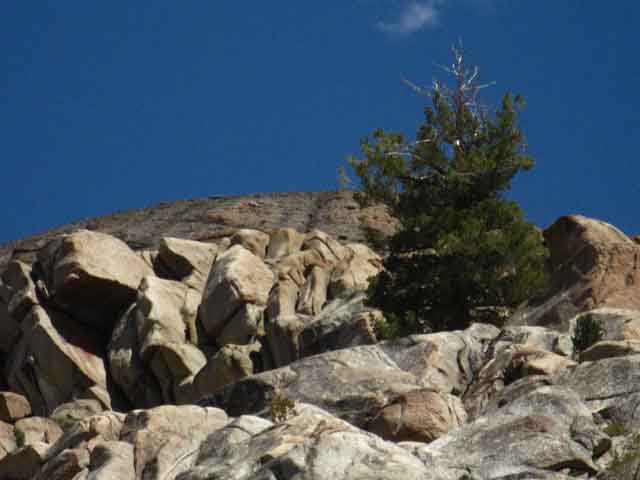 |
Dramatic example of volcanic-granite interface above us. This view gives us an idea of the scale of these ancient eruptions. The granite of the Sierra Nevada is substantial, yet we can see volcanic flows completely drowned great expanses of High Sierra Granite. |
Looking South up to Our Gap through the Top of the Canyon
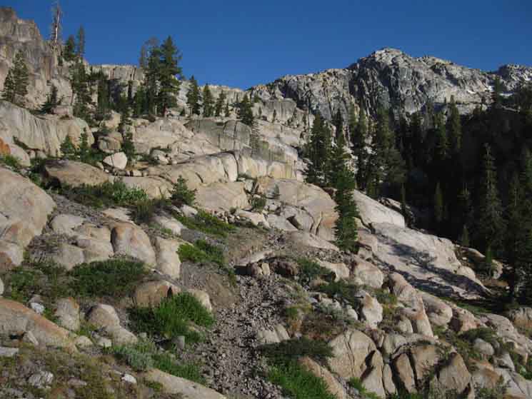 |
|||||||
We are approaching the narrow channel to Sheep Camp across nifty granite terrain. Note that there are two ridgelines sharing the horizon of the image above. Steel Gray Granite vs Oxide Soaked Granite We slip through a gap in the pinkish golden granite over to a flat, Sheep Camp, through the small space between the near and distant ridgelines, to come out under the steep ascending walls of steel gray rising to Black Hawk Mountain. Summit Creek again marks out a visible line between the mineral stained pink and golden granites in contact with the volcanic cap to its North from those only colored by their own internal mineral composition and their own unique processes of environmental staining to its South. I find this subtle interface of differently stained granites is deeply satisfying. Nature just makes me smile.
|
Switchbacks
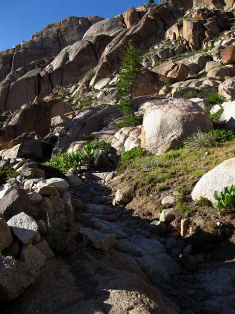 |
Switchback below Sheep Camp. Our rocky track begins to switchback up the broken granite flank. Relief Reservoir to Brown Bear Pass |
Trail across fine slabs
Favorite Slabs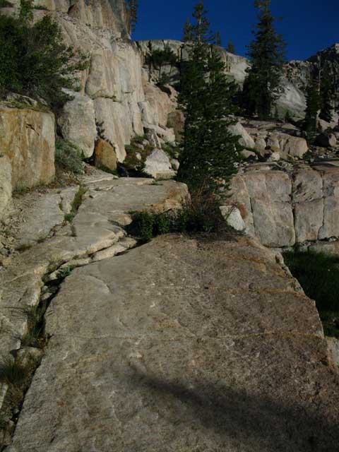 |
||||
The Tahoe to Yosemite Trail's last traverse up to the rocky gap starts across a sweet section of perfectly flat granite slabs. It's a natural causeway.
|
Flank & Trail
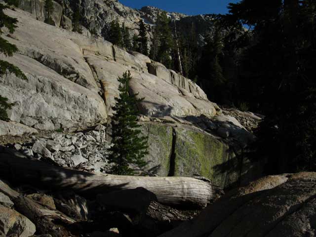 |
To the Head of this Segment of Canyon That's where we're going. |
Looking back
at
Granite & Volcanic
Terrain above our Trail's Route
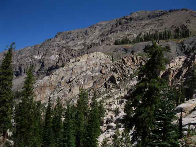 |
|||||||
Higher up our trail to the gap bends South, opening up fine views of the North ridge running down to Relief Reservoir. We can see how the granite terrain our trail threads through, and all the granite on the North shore of Summit Creek, emerge out from a volcanic encasement. We can see this in the image above. The top of the ridge these great granite features are protruding out of was capped by great volcanic flows. We can see the depth of erosion that has taken place by the heights of the volcanic spires just beyond the granite slabs. The question of how much of this granite was originally buried, and how much has eroded out since, comes to mind. As we climb higher up towards the headwaters of Summit Creek at the base of Brown Bear Pass we will be able to see this distinct boundary line dividing the massive ancient volcanic flows covering the granite on the North side of this great valley while leaving the granite on the South side exposed. Note the close up view of the Upper Left granite formation.
|
Same Flank, Different Light
Sunrise Highlights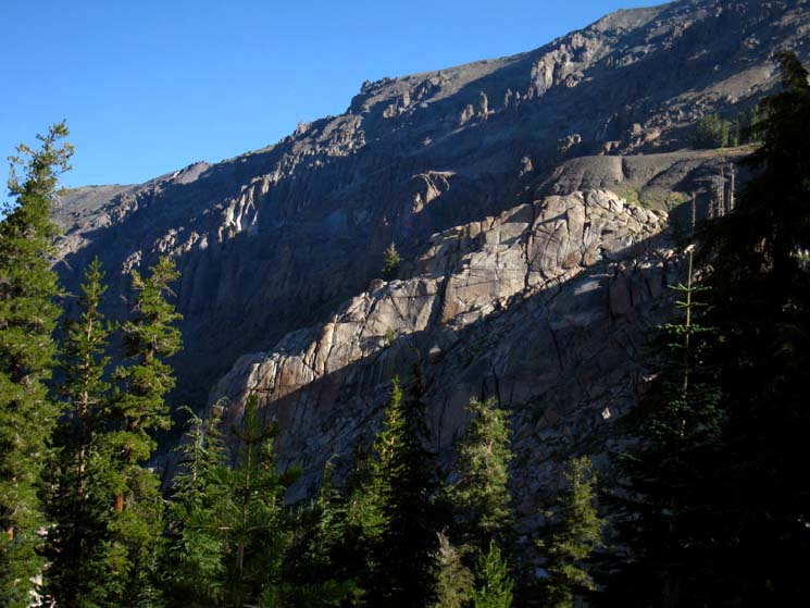 |
|||||||
A backward glance to the NW reveals first rays of sunlight breeching the shadowy depths of Summit Creek's middle canyon. We get a feeling for how volcanic material flowed over the underlying granite. I discuss how the volcanic material is eroding much faster than the underlying granite, resulting in a long slow reemergence of the granite terrain from under its volcanic mantle as we hiked through the high bits of East Carson River hiking South on the PCT. This is one very cool place on a very cool planet.
|
Southern Wall of this Gorge
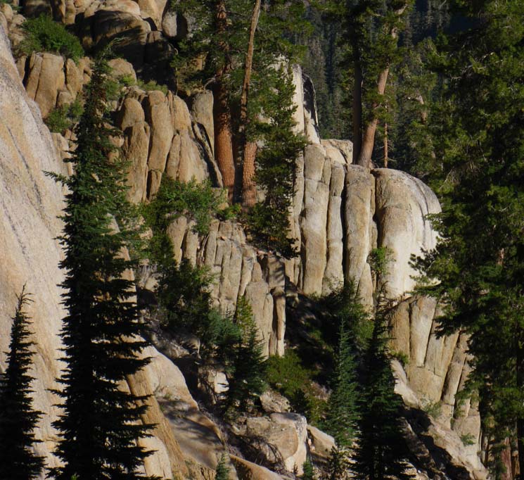 |
A range of rusts, burnt reds, golds, and browns pervades the granites of Emigrant Wilderness. The colors are rivaled by the shapes of the granites of Emigrant. They are shaped as pleasingly as they're colored, and the range of their unique combinations is unrivaled. Here color, shape, and the bright rays of the rising Sun all come into as we move higher up into free rock, granite emerging from its forest and lava jacketing all around. |
Two sides of the canyon's walls
pinch together behind us
and
open up below us
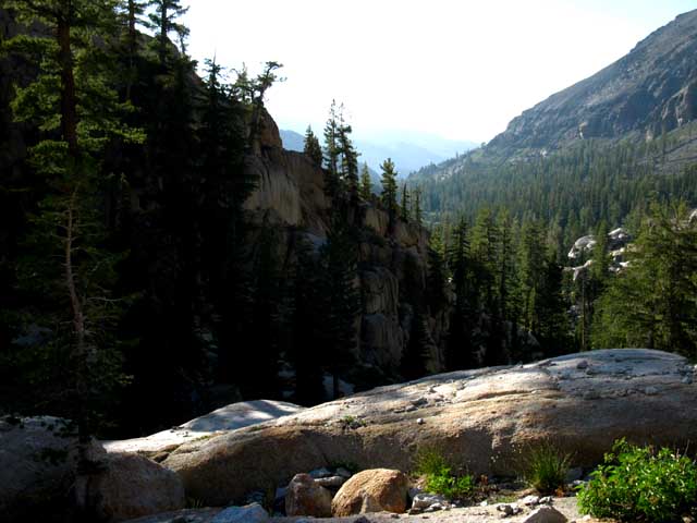 |
|||||||
We are just feet from passing to our South through the narrow defile composing the gap to Sheep Camp. Passing through this gap also marks the point of convergence, where the iron stained granite coming out from the Northern wall of the canyon reaches to the North bank of Summit Creek. where the steel gray granites making up the Southern wall of the canyon rise above its South bank. We're roughly crossing the line of these subtle contrasts as we pass through the gap. But first we turn around to take in the view North above, to review the big picture perspective of our route up here before leaving it behind.
Though the topo map depicts the narrowing gorge of the canyon running up to the gap to Sheep Camp, it does not convey subtle differences in granite staining, nor the unique compost ion of the layering of granite and volcanic terrain our visit reveals.
|
Let's get a better look at our View emerging from both forest cover and morning shadow
View of the Terrain from the Last Saucer Meadow Campsite South to the Gap below Sheep Camp
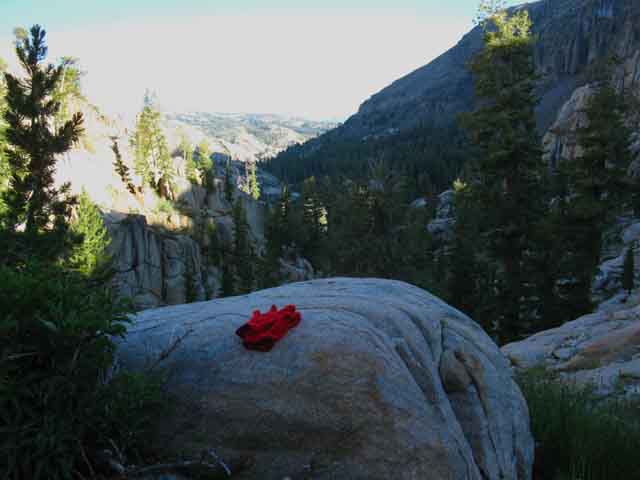 |
Looking back At our back (Southeast) is the gap South through the mountaintop to Sheep Camp The view above looking Northwest reveals the terrain of the length of the middle segment of our hike through the valley from the uppermost & last of the Saucer Meadow campsites to our current position. To our South, behind us, we are standing next to the gap to Sheep Camp. I figure we can roughly see where the the last of the Saucer Meadow campsites is located in the image above. The last site is located near where the bottom of the descending line of the distant shadowed Northern volcanic ridge arm crosses behind the bright granite of the interceding North canyon wall. This image above overlooks the majority of the terrain we cross from the last Saucer Meadow campsite to the gap to Sheep Camp. Though the image above is not the highest quality, it contains a lot of information. Note that the position of the granite dome on the far-right edge at the middle of the image above was offset just far enough Southwest from the volcanic flows that created the ridge rising behind it, to exist this day. That granite and its dome is actually on the North side of the canyon, but far enough offset, pushed out to the Southwest that the ancient flows that created the vast volcanic ridge behind it were not quite able to engulf it within its Pyroclastic flows. Thus we have the pleasure of observing this excellent section of granite trail under a vast volcanic ridge leading us up to Sheep Camp. Map Time The bend we see at the bottom of this segment of the valley (and the bend in the course of Summit Creek) in the furthest distance are all pivoting around Peak 9819 capping the top of that shadowed volcanic ridge arm in the image above. Peak 9819 is visible in the upper Right corner of the image above and on our Relief Reservoir to Brown Bear Pass Map. The base of that descending ridge arm where Summit Creek flows by is where the last campsites South of Saucer Meadow are located. Relief Reservoir to Brown Bear Pass Just South of those campsites down there, a bit closer to our position, are the gravel washes we hiked across. The washes are hidden under the thin forests at the far end of the shaded valley in the middle of the image above. The gravel washes give way to terrain composed of more solid soils about halfway between our position and the bend in the valley. Off to the middle-Right of the image we can see where we emerge from our forest covered trail onto the exposed granite terrain leading up to our current position. It's not a great image of a really cool location. |
Relaxing moments
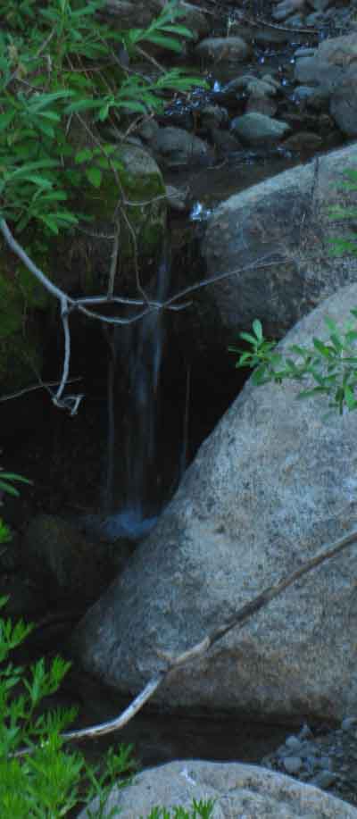 |
| Relaxing sounds of tinkling stream draws attention. There are a number of unmarked springs and streams between Saucer Meadow and Sheep Camp. I'd depend on none of them for reliable water, while enjoying the jingling melodic joy of each. |
Last steps up to the Gap to Sheep Camp.
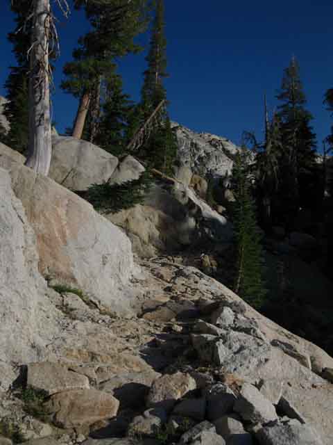 |
||
Hiking South up thinning trail. This is really cool terrain. The switchbacks gave way to a gently increasing traverse after getting us up high enough. Note the silver mountain in the background, contrasted by the rusty granite in the foreground. Sheep Camp lays through a gap over to a sweet protected sandy flat between these two different expressions of the local granite's wide range of characters.
|
Oh So Sweet Trails
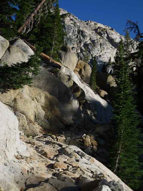 |
Check out that trail surface. Nice. Watch your footing. |
The Gap to Sheep Camp
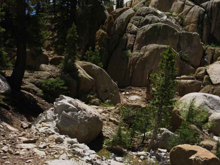 |
||||
The gap to Sheep Camp.
|
Through the gap to Sheep Camp
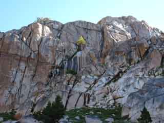 |
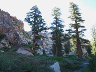 |
|
View from the Gap Northeast Above we walk through the gap North to South. Looking to our Left, North-Northeast at the top of the surrounding granite ridgeline as we hike through the gap to Sheep Camp. |
||
View Northeast entering Gap in Ridgeline to Sheep Camp
The Volcanic and the Granite pinch together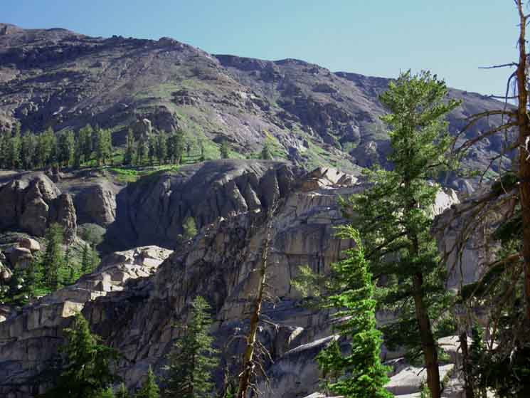 |
|||||
The Pinch Between Note the top of the near granite ridgeline in the foreground middle Right, bending down and around to the lower Left of the image. That is also the line of the trail we hiked up to our current position. We are essentially hiking into the bottom of the next level of this canyon by hiking up onto the bottom of a great flat reaching up through the Lunch Meadows towards Brown Bear Pass as we pass South through the gap into Sheep Camp. Sheep Camp and Lunch Meadow are like an exclamation mark. Sheep Camp represents the point, the dot below the (bent) exclamation slash of Lunch Meadow pointing to Brown Bear Pass. Relief Reservoir to Brown Bear Pass Our Southbound trail is pointing us through the gap behind us that through this ridgeline ending the middle segment of our hike from Relief Reservoir to Sheep Camp and beginning the last and uppermost part of our hike through the uppermost segment of Summit Creek's canyons up to Brown Bear Pass. In the image above we are turning around for one last look to our North, in this case a look Northeast across this narrow pinch-point that separates the middle from upper segments of our hike to Brown Bear Pass. Views like these, up here at the top of this unique section of Summit Creek's long valley, are why we must keep our eyes on the beauty and complexity of the surrounding terrain, as well as on the trail itself, as we hike through. We can't let one overwhelm the other. Keeping our eyes on the trail and the terrain splits our energy and attention. It's a cursed tradeoff: The faster we go the less we see. Entering Sheep Camp we will make a hard Left to begin hiking a curving line to the Southeast into the bottom of Lunch Meadow.
We turn around from the position this picture above was taken to hike South through the nifty narrow gap in the top of the crestline into Sheep Camp.
|
Southbound Entering Sheep Camp
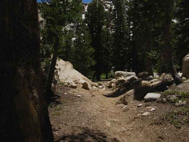 |
Last steps in the gap before entering Sheep Camp's cool campsite area. |
The details of the terrain around Sheep Camp are esthetically delicious, in a very physical way. Sheep Camp is a lightly forested sandy flat surrounded by arms of encircling, wind protective granite. Looking to the South we can see that Sheep Camp sits under the rising mass of a vast granite dome decorating the ridgeline running up to the top of Black Hawk Mountain. After entering Sheep Camp Southbound the Tahoe to Yosemite Trail bends sharply to our Left while the expansive granite-encircled sandy flat of Sheep Camp runs before us down to Summit Creek. Those wanting water will find Summit Creek winding around the South side of Sheep Camp. I figure that passing through this gap marks the top, and end of the middle section of canyon from Relief Reservoir to Sheep Camp. Turning a hard Left to our geographic East after passing through the gap into Sheep Camp's sandy flat keeps us pointed Southbound on the Tahoe to Yosemite Trail. We hike about fifty yards to exit Sheep Camp as we entered it, by passing through a narrow channel of uniquely shaped and colored rust-pinkish granite formations. The one we entered was pointed NW and SE, the one we Exit is pointed NE and SW. The Southbound TYT leads us into light forest in the center of the upper canyon as the line of our trail gradually bends Southeast while the terrain gradually opens up into the bottom of Lunch Meadow. Hiking a just feet South of Sheep Camp brings us out from under the shadow of this massive spur of granite ridge nestled in under Black Hawk Mountain. Our trail first brings us back into the center of the canyon from its granite Southern flank, and then back up under the volcanic Northern wall of the canyon for our final and uppermost segment of our hike around the North edge of Lunch Meadow to Brown Bear Pass. We're almost there. There are a few nice campsites on the South side of Sheep Camp near the Creek. |
Standing on the Northwest Edge of Sheep Camp Looking Southeast
We Just Hiked South into the NW Corner of Sheep Camp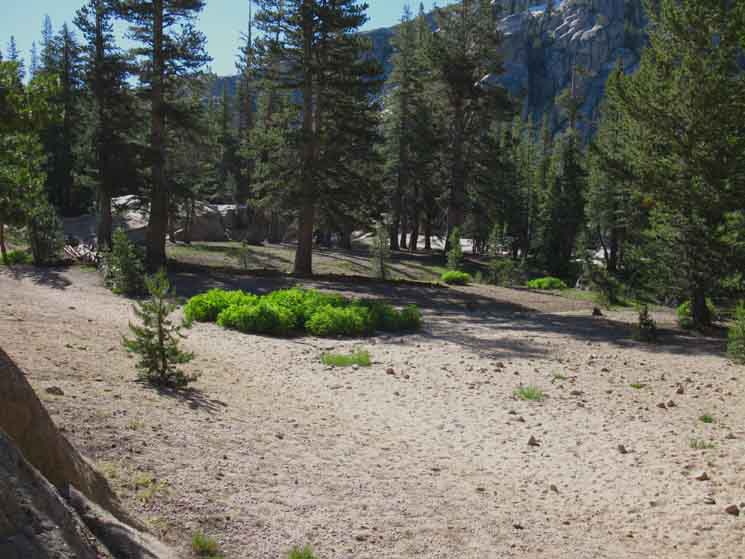 |
||||
View Hiking South into Sheep Camp. Sheep Camp sites directly ahead and to our Right, 8800 feet 8.23 miles 1 mile 2.69 miles 7.81 miles Note the trail moving Left. That's the route South to Lunch Meadow. Summit Creek is straight ahead, on the far side of Sheep Camp along with a couple of nice level campsites on the South end of Sheep Camp under the trees by the rock over in the middle-left of the image above. There's another big campsite out of the frame of the Right side of the image, the Northwest side of Sheep Camp.
|
Sheep Camp
Sitting in a Sheep Camp Campsite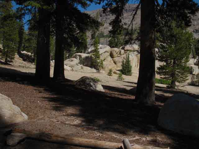 |
||||
Sitting in Sheep Camp having a nice lunch and water break. We're looking at the location we took the picture above, as that picture is looking to this position, one of the nice campsites in Sheep Camp. Our trail continuing South to Lunch Meadow is up by the granite rock beyond our campsite. We'll turn Right to Lunch Meadow. If we were hiking North back to Kennedy Meadows Pack Station we would follow the trail straight through the gap in that granite. So, North on the TYT is straight ahead from this perspective, while the Southbound TYT moves out the Right edge of the image up where we see the granite.
|
South from Sheep Camp
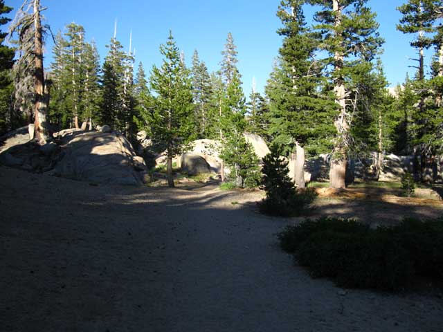 |
|||
Turning Left after passing through the gap to Sheep Camp we find a very sandy surface as we hike along Sheep Camp's Northern end to another gap in the granite encircling Sheep Camp. We find and cross some interesting granite formations to exit Sheep Camp. First, let's check out Sheep Camp more closely.
|
Sheep Camp
Sitting in Sheep Camp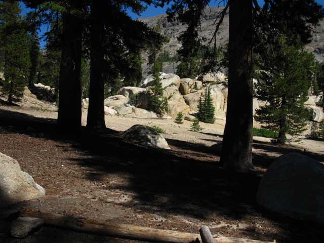 |
||
If we hike straight South across Sheep Camp towards Summit Creek instead of turning Left following the Southbound Tahoe to Yosemite Trail we encounter the campsites with fire rings in the central stand of trees, pictured above, in Sheep Camp. Kennedy Meadows to Jack Main Canyon
|
Sheep Camp Fire Ring
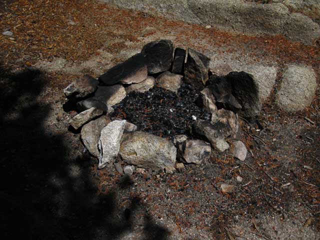 |
||
Sheep Camp fire ring.
|
Hiking South from Sheep Camp
After passing through the gap South into Sheep Camp hikers continuing South for Lunch Meadow turn 90 degrees Left. After hiking about fifty yards East across the sandy North edge of Sheep Camp we come to the unusual granite feature below. Note in the film that hikers have placed rocks making a 90 degree perimeter turn guiding the Southbound hiker South. Otherwise Southbound hikers coming through the gap can step into a large sandbox with no indication of the direction of the trail. I've seen it both ways over the years, marked and unmarked. Well, as Sheep Camp is a mini little "box canyon," the only other main route out is the one leading East to Lunch Meadow. If this turn happens to be unmarked, do what I do. Stop. Look and find the perimeter of the trackless area. Scan the perimeter for indications of resuming trail. If we cannot find trail sign we are going to hike in the direction of our best guess where the trail restarts, but we will carefully note exactly how to get back to our starting point if our potential route goes bust. That's just good practice, but a little overboard here. Here on the South side of the gap to Sheep Camp we turn 90 degrees to our Left to hike South across Sheep Camp's sandbox to hike through this unique granite channel pictured below into the forest leading us up into the bottom end, the North end of Lunch Meadow.
|
||||
Tahoe to Yosemite Trail South through granite slot into moderate forest cover. The course of Summit Creek is flowing off to our Right, to our South.
|
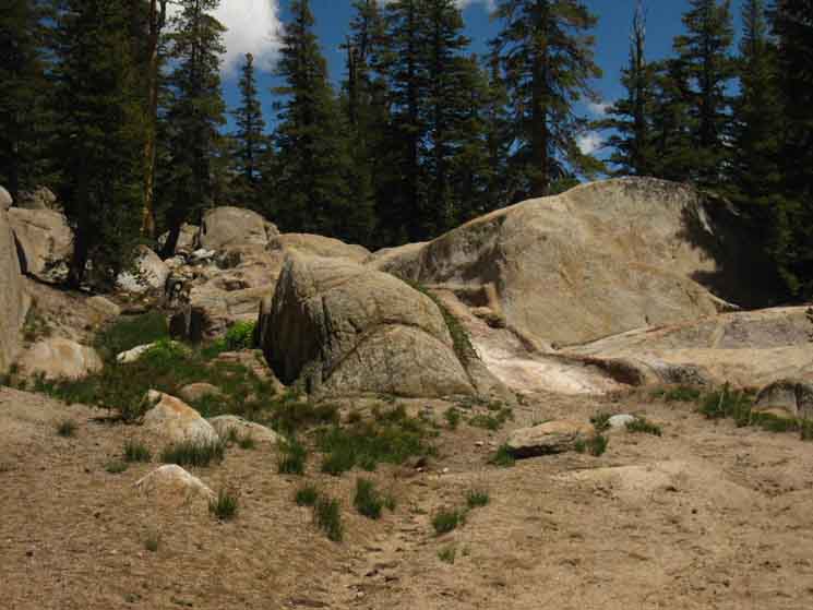
Nifty Granite Channel hiking South out of Sheep Camp
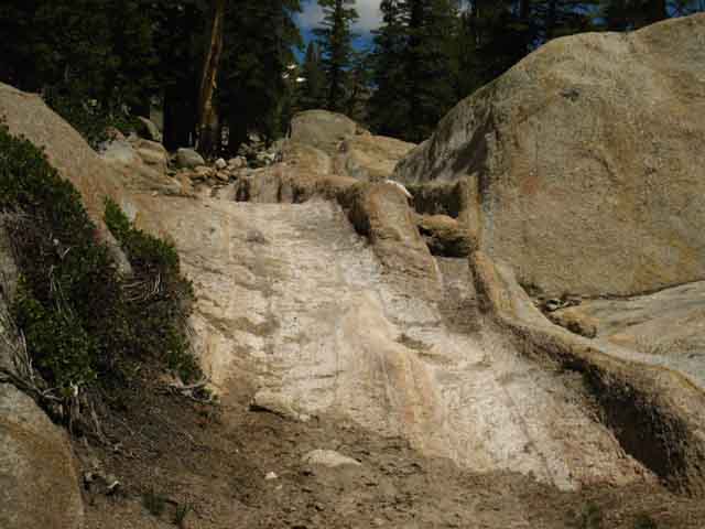 |
The trail crosses this set of unique granite channels hiking South out of Sheep Camp. |
Fine Rock Formations along our trail South
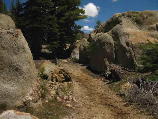 |
||||
Trail to Lunch Meadow.
|
Beautiful Golden Hued Granite Forms
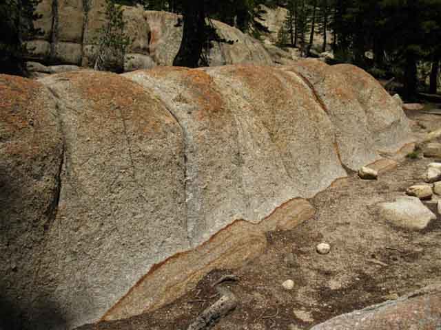 |
||
Pleasing terrain. Leeching iron oxides out of the volcanic soils.
|
Still A bit North of Lunch Meadow
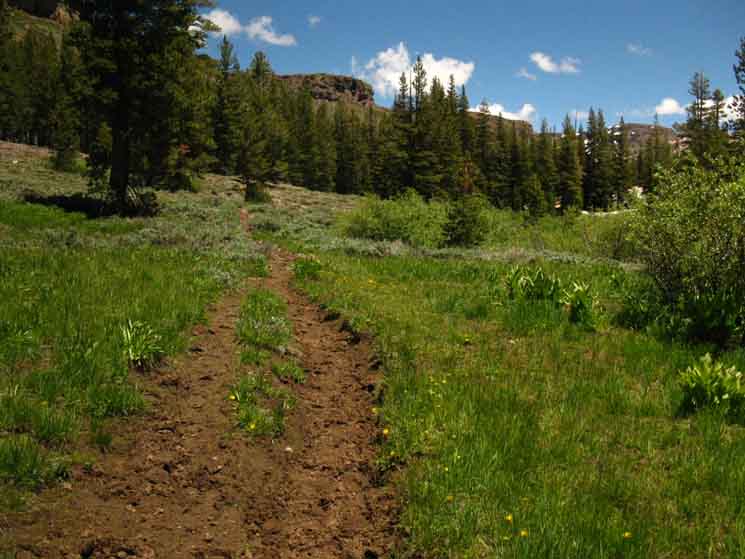 |
||
Still below, a bit North of Lunch Meadow we can spot Brown Bear Pass in the distant middle-Right of the image above. Brown Bear Pass is on the Right side of that red peak on the far distant Right of the image above, the one we can just see through the intervening trees, still spackled with a bit of snow. Brown Bear Pass is located in a low shoulder on the Right side of that peak that exactly marks the seam between the volcanic and granite terrain at the very top of this canyon. Note how we are passing through bits of forest and meadow while still well below Lunch Meadow. A large campsite sits in the next grove ahead, still a bit North of Lunch Meadow.
|
Large Campsite North of Lunch Meadow
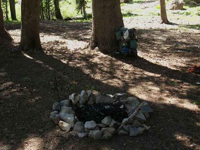 |
||
Large campsite North of Lunch Meadow, South of Sheep Camp.
|
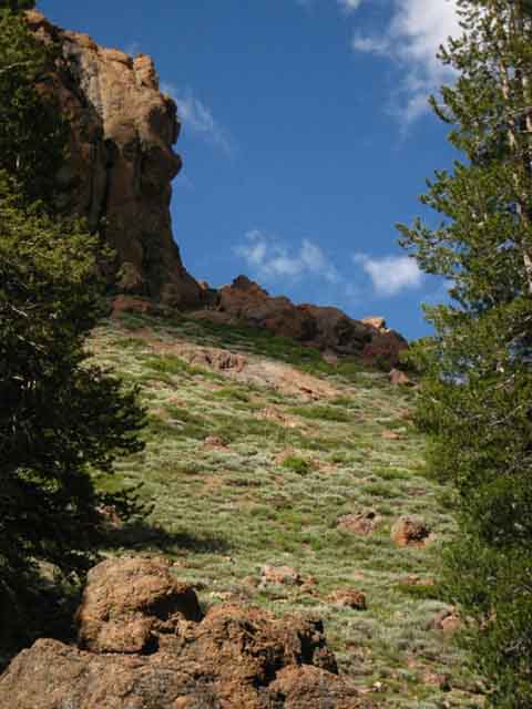 |
||
The volcanic North wall of our canyon is showing lots of color and detail as we approach Lunch Meadow.
|
Campsite on North End of Lunch Meadow
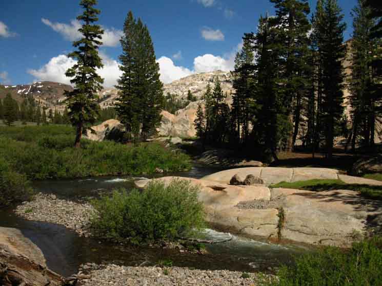 |
||||
Entering the North end of Lunch Meadow. This is the lowest end of Lunch Meadow. To our Right across Summit Creek we find nice soft campsites and forested shade. In the middle distance on the Left of the image we can see the low rise dividing the upper and lower sections of Lunch Meadow. Lunch Meadow has levels. In the distant Left we see the volcanic mountain marking the Southern extent of Summit Creek's headwaters, and the bulk of the peak that Brown Bear Pass cuts through. The final steps of our trail up to Brown Bear Pass traverses the visible flank of that brownish-red volcanic peak from Left to Right up to Brown Bear Pass, which is located just out of sight behind the tree... We can see how the final steps of our trail lead directly up to the seam dividing the volcanic terrain making up the North wall of this long valley from the granite making up the South. We're going to get some amazing views looking back down this bifurcated valley as we climb to its top. Nonetheless, we can see the end of this long climb up from Kennedy Meadows Pack Station up there on Brown Bear Pass. The Bottom of Lunch Meadow 8960 1.69 miles 9.23 miles
|
Lower Lunch Meadow Campsites
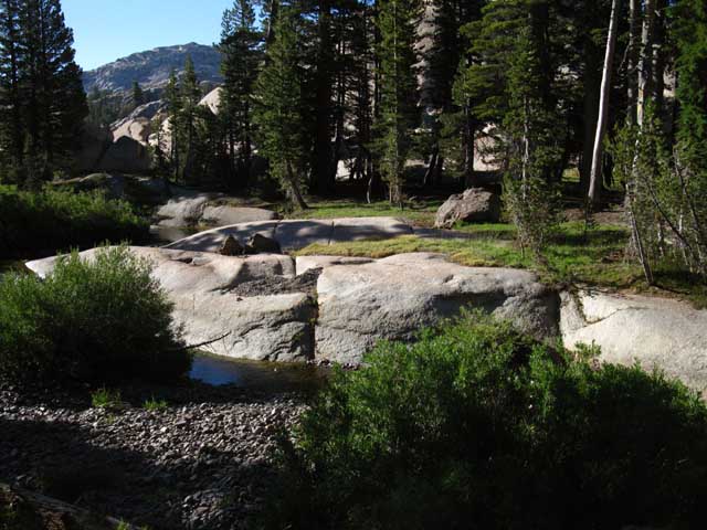 |
|||||||
A short hike South, first over some interesting granite then through bits of forest and meadow brings us to where we can see Summit Creek to our Right twisting around the granite rimmed flat marking our entrance into the North side of Lunch Meadow. Crossing Summit Creek we find this flat provides a pleasant campsite, though in 2012 I did find a "restoration site" post about 30 yards downstream on the other side of Summit Creek pictured above. That was a shock.
|
Video
Lunch Meadow to Brown Bear Pass
Hike along from the bottom of Lunch Meadow to Brown Bear Pass. Nothing fancy, we just take a look at the trail and surrounding terrain along the way. 11:27 Hiking Emigrant Wilderness
|
Looking South across Lunch Meadow at Brown Bear Pass in the Distance
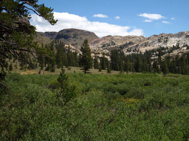 |
|||||
Brown Bear Pass lays on the Right side of the distant volcanic mass behind the top of the granite formation at the center-Right of the above image. Note that Lunch Meadow sits on two levels, divided by a granite rise, or maybe a belt of granite between its expansive lower and compact upper meadows. In the image above we are looking South while approaching the South end of the lower level of Lunch Meadow. Note the granite rise crossing Lunch Meadow in the middle distance ahead. That rise divides the upper level of Lunch Meadow from the lower. Hike up that rise we will encounter the 9000 foot marker at the top of the upper level of Lunch Meadow.
|
Looking North at the North End of Lunch Meadow
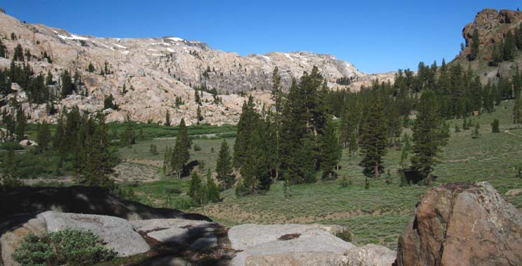 |
||
View North down towards the campsite on the North end of Lunch Meadow, We can get an idea of how Sheep Camp is nestled in under the ridge about a mile beyond the North end of Lunch Meadow. Also take note of the volcanic formation on the upper North flank of the valley against the contrast of the granite making up the South flank. These divergent flanks are pinching together around the top of the canyon above us.
|
Southbound Around Lunch Meadow
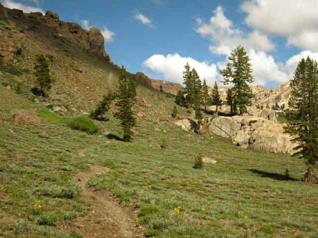 |
||
Note how the Southbound trail pushes up to higher and drier terrain by routing around the North edge of Lunch Meadow avoiding Spring soggy and boggy conditions. We're hiking up towards the upcoming granite formations. An amazing set of granite features divides the upper shelf of Lunch Meadow from the lower shelf.
|
Belt of Granite
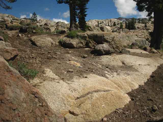 |
||
Up onto granite on the South end of lower Lunch Meadow.
|
View South across the Granite Belt
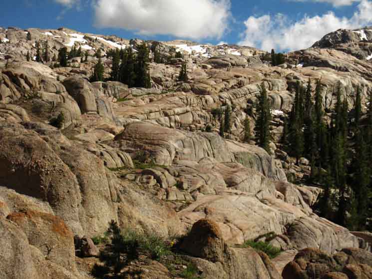 |
||
This line of sweet shaped and colored granite formations reaches across Lunch Meadow effectively dividing the meadow into upper and lower shelves.
|
The Trail South
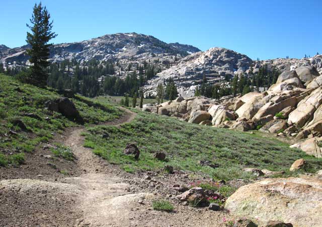 |
||
Upper Lunch Meadow and No Shade for A While Our trail up to and crossing Brown Bear Pass bringing us across High Emigrant Meadow, Grizzly Meadow, and Summit Meadow up to Bond Pass is all across exposed terrain. In fact, we've been crossing exposed terrain since coming out of the gravel washes above Saucer Meadow. Get out the sunscreen! I'm going to enjoy the last little bit of upcoming shade that we can see up ahead by taking a break there. The 9000 foot marker sits under those upcoming tress. To cover this line of trail we're going to check out our next map, the Emigrant Basin Backpacking Map
|
Uppermost South end of Lunch Meadow
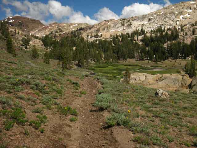 |
||
Coming off the South end of the granite formation cutting Lunch Meadow in half we see the little shelf Upper Lunch Meadow sits on laid out in front of us. It's a cute little shelf of meadow. The granite we can see hidden in a stand of trees ahead of us, in the upper-Left of the middle of the image above, is where the 9000 foot no fires post and a couple of nice campsites sit. In the furthest beyond the granite at the very upper end of Upper Lunch Meadow we see the iconic volcanic mountaintop which makes up the Left, the Northeast flank of Brown Bear Pass. We also notice that the vast bulk of the granite ridge to our Right (South by the compass) as well as the volcanic ridge to our North are both thinning out as they approach the Sierra Crest. These massive ridges are narrowing and no longer towering over us as we approach the 9000 foot mark and the 9760 feet of elevation passing through Brown Bear Pass. We're getting up to the elevation where the tops of the mountains are not as far away as they once were. We Walk the Line
|
Upper Lunch Meadow
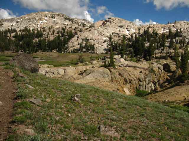 |
||
Hiking South into Upper Lunch Meadow. The very top of the Black Hawk Mountain-Granite Dome Massif (the granites to our Right) is taking on the unique shapes of carved granite typical of the formations decorating the perimeter of High Emigrant Basin. These are wedge-shaded blocks of granite. The shapes of those domes and ridges we see ahead are created and left behind by the vast pressure waves and subsequent motions of the overtopping ice sheet. This is what results when an ice sheet is cutting granite so hard that it was simultaneously being deflected away by the granite it was cutting. This ancient ice was deflected by the hardness of the granite into a series of pressure waves. The structure of these pressure waves flowing through great masses of ice acted as an unseen "hand" guiding the moving ice to sculpt these amazing shapes through this hard granite rock. These pressure waves settled down as the overcapping ice flowed down across the relatively unyielding, and now very smooth granites, of the Black Hawk-Granite Dome Massif. IT, being these raw forces of Nature are, was, is, and will ever be a machine of beauty and life, if we see its actions over the endless oceans of time and space It operates across, if we get just a glimpse of these present wonders, or see them not at all. Summit Creek runs North across Upper Lunch Meadow to be joined by a significant tributary at the bottom of this small shelf composing Upper Lunch Meadow. We can see this tributary flowing through its custom granite channel to our Right on the lower end of Upper Lunch Meadow. Brown Bear Pas draws near, seen beyond the upper meadow, below.
|
Brown Bear Pass We catch a glimpse of the line of the last steps of the Tahoe to Yosemite Trail up the North Side of Brown Bear Pass before reaching the 9000 foot marker in the upper section of Lunch Meadow. Always look around at the surrounding terrain. The things you see will amaze you. |
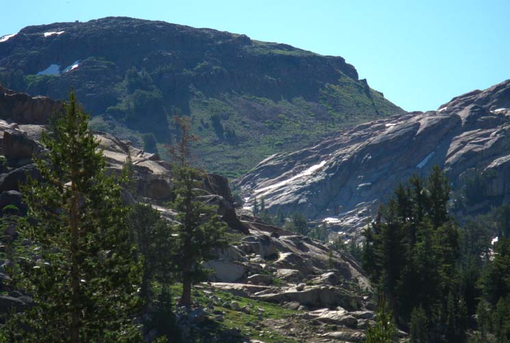 |
||
Top of the Canyon The faint line along the base of the dark volcanic mass ahead is the last bit of our Tahoe to Yosemite Trail up to Brown Bear Pass. We're close. Less than a mile and a half from here.
|
To the Top of Upper Lunch Meadow
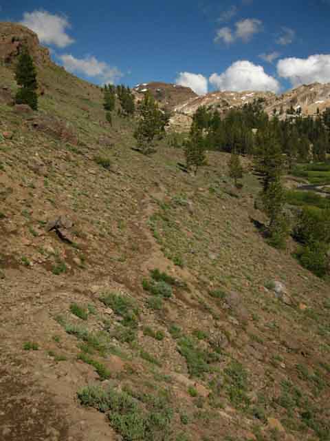 |
||
Along North edge of Upper Lunch Meadow. As with Lower Lunch Meadow, our trail to its upper shelf takes to the Northern volcanic flank to get around Upper Lunch Meadow. Brown Bear Pass itself is out of sight, masked by the descending granite. That granite obscuring Brown Bear Pass actually runs up to the pass to compose the South flank of Brown Bear Pass. From our perspective here it's obscuring the pass. But it is the pass!
|
To the 9000 Foot Marker
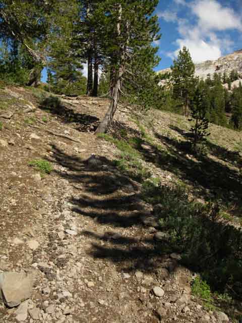 |
||||
Last feet South to the Upper Lunch Meadow elevation post, access to water, and two levels of campsites.
|
9000 Foot No Fire Marker
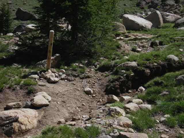 |
9000 foot no fire post in Upper Lunch Meadow. Fires permitted below 9000 feet, prohibited above. |
Break time in Lunch Meadow
| Lunch Meadow lunch in the shade at the 9000 foot no fires marker. | |||||||||
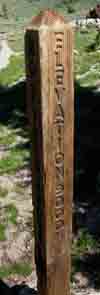 |
 |
||||||||
9000 foot elevation marker: No Fires! |
The little island of shifting shadow under a little stand of whitebarks at the elevation marker provided the shade to take in the surrounding terrain with some calories.
|
||||||||
Birds also Hanging About the little stand of Whitebarks
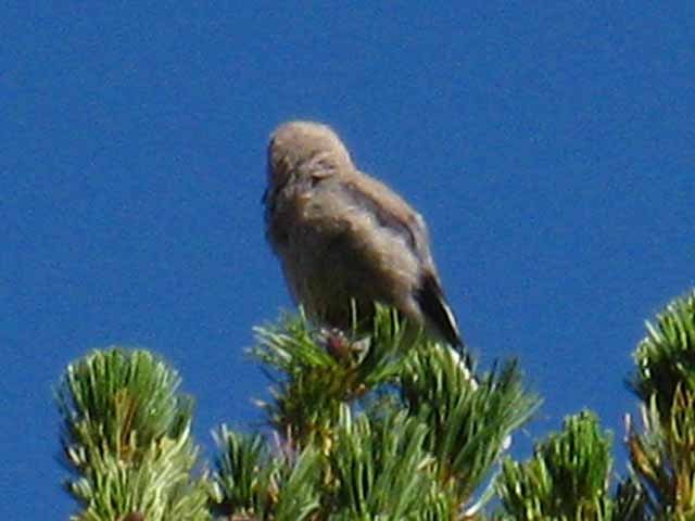 |
Crazy birds. |
Always Keep an Eye on the Humans
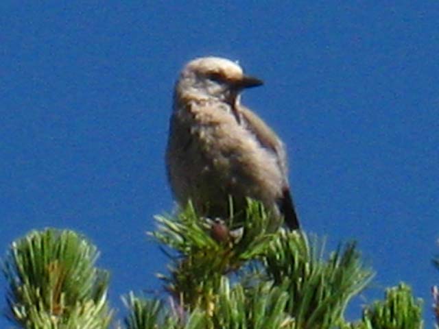 |
Bird in Lunch Meadow spots me. |
Upper Lunch Meadow Campsite
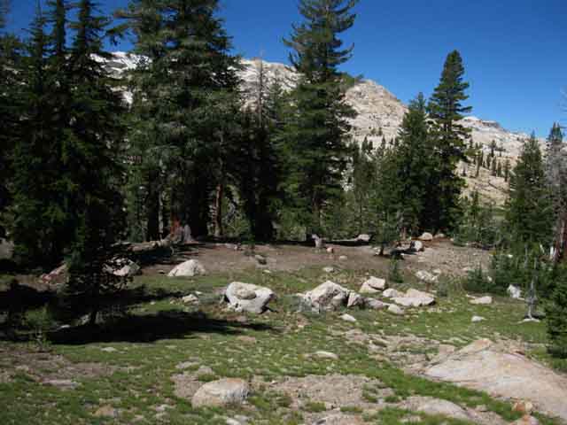 |
||||
Our view of the Upper Lunch Meadow Campsites from the 9000 foot no fires marker, which is just above the level of the campsites.
|
Upper Lunch Meadow Campsite
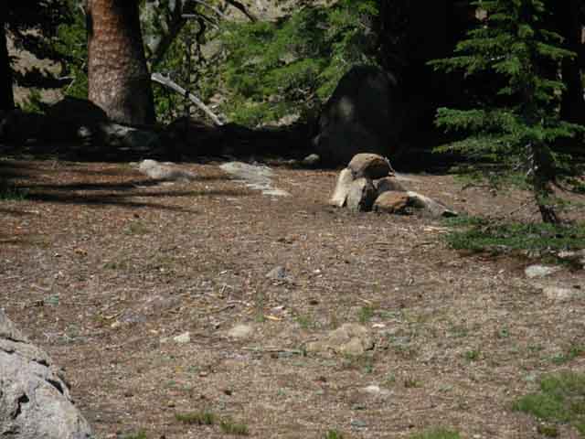 |
||
Fire ring at the Upper Lunch Meadow campsite.
|
Upper Lunch Meadow Twilight
From the sites below the elevation marker |
||||
View West across Upper Lunch Meadow during sunset. We've hiked down to Summit Creek below the campsites near the trail and the 9000 foot marker. There are a couple of nice campsites down here. Ahead Emigrant Lake sits at the base of a vast granite cliff along the North Fork of Cherry Creek. Continuing South on the TYT we will see Emigrant Meadow Lake in Emigrant Meadow once we get a view South from Brown Bear Pass. Emigrant Meadow and its Emigrant Meadow Lake are the headwaters of the North fork of Cherry Creek. That's some very scenic terrain. Emigrant Wilderness Hiking Map I have this image (guide) looking South from near the top of Big Sam, looking down across the route of the TYT running past the North Shore of Emigrant Meadow Lake. Beyond Emigrant Meadow Lake we can see Middle Emigrant Lake in the canyon running South on its way to Emigrant Lake. From Big Sam we can look a-ways South down into the amazing beauty of North Cherry Creek's canyon connecting Emigrant Meadow to Emigrant Lake. In any case, arriving at Upper Lunch Meadow leaves only the last bit our hike up to Brown Bear Pass ahead of us, if we bypass the trail leading South over Mosquito Pass. From Brown Bear Pass our view to the Southeast takes in the North Shore of Emigrant Meadow Lake. Unless we are turning South through Mosquito Pass for the hike to Emigrant Lake. Let's take a look at the Trail Schematic Map I made, with selected mileages.
|
Trail Schematic Map
BIG VERSION
Mosquito Pass
Emigrant Lake Trail Junction
 |
|||||||
Trail junction South over Mosquito Pass to Emigrant Lake from near the top of Summit Creek's upper canyon. 9040 feet 1.23 miles 9.69 miles This trail junction crossing Mosquito Pass offers an alternative route to get to Bond Pass or can open up routes visiting the series of lakes paralleling the route of the Tahoe to Yosemite Trail, but at a slightly lower elevation.
I've hiked over Mosquito Pass, and up and down all the trails and many routes I make up myself in Emigrant Wilderness. Most of these will not be on the trail guide until I get the PCT-TYT-JMT routes between Tahoe to Whitney laid out. Correction: In early 2014 Backpacker Magazine contacted me for information about an Emigrant Wilderness backpacking trip they were writing. I put up a page that depicts the terrain from here at the Mosquito Pass junction past Emigrant and Blackbird Lakes, Horse Meadow to Snow Lake. This section represents a "third level" of trails from Highway 108 into Yosemite. The first would be the Pacific Crest Trail, the second would be the Tahoe to Yosemite Trail, and the third would be this route to Emigrant, Blackbird, and Maxwell Lakes on our way to return to the Tahoe to Yosemite Trail via either Horse Meadow or over the unmaintained trail to Snow Lake via Black Bear and Bigelow Lakes. Again, check out the big regional map: Emigrant Wilderness Hiking Map Check out the page over Mosquito Pass as described above here.
TRAIL GUIDE SUPPLEMENT
|
Mosquito Pass
 |
||||
The Mosquito Pass trail junction is posted next to Summit Creek.
|
Trail to Mosquito Pass
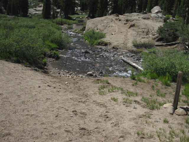 |
The trail up to Mosquito Pass fords Summit Creek here. |
South towards Brown Bear Pass
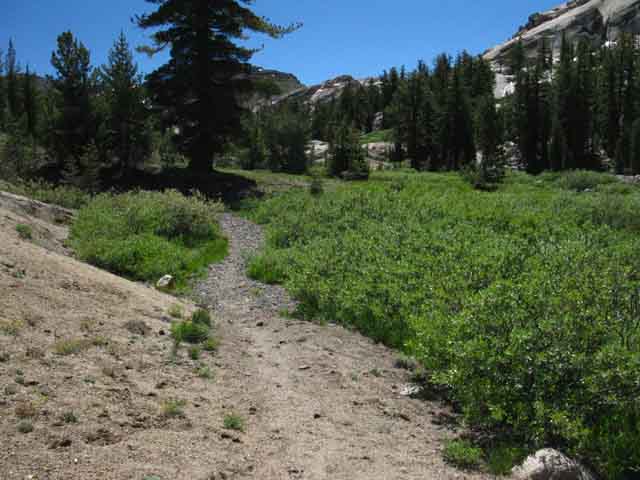 |
||
This last run of our trail South to Brown Bear Pass from the Mosquito Pass junction starts in a meadow, but soon bends to our Left through very jumbled terrain to set itself up for the climbing traverse up the great red mountain feature ahead. We are going to "buttonhook" a curving trail first straight, then taking a big-assed bending curve to the Left, which then begins bending a long arcing curve up and to the Right, arcing around from North to South as it brings us up to Brown Bear Pass. One of the joys of hiking is that we never know what will pop up along the long trail. How about a dog?
|
Riggs
Scouting the Terrain
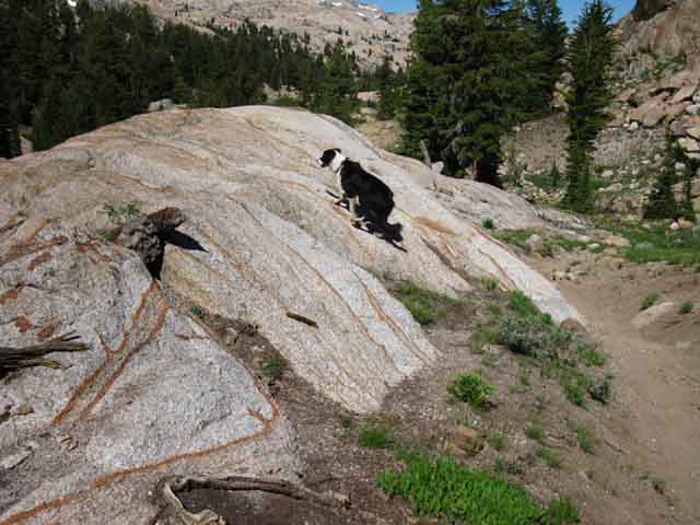 |
||||
A dog trotted up the trail, gave me a bored look and proceeded to scout the trail on the way up to Brown Bear Pass. I could read the dog's thoughts: "Yet another backpacker-Yawn." That would be Riggs, the dog of Gina, one of Matt Bloom's horsepackers out of Kennedy Meadows Pack Station. I said, "Hey Riggs," but Riggs had more important things on his mind. He was looking for potential trouble, and I was not a problem. The year these pictures were taken I believe Gina and Riggs were packing supplies out to the CCC Trail Crew pictured above on this page and on the next page at the Horse Meadow trail junction in Grizzly Meadow. Services Over the Edge of Civilization Dog was looking everything over before the following mule trail came by. Besides seeing dog coming by I could feel the vibes of the mule train as it approached. Sierra soils resonate. But I also knew it was a Horsepacker dog running point. Story
|
Sure Enough
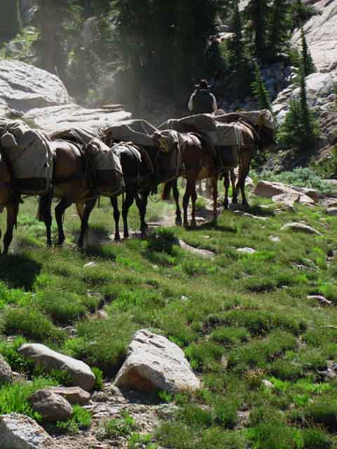 |
||||
Gina the horsepacker rides by quickly approaching Brown Bear Pass from Kennedy Meadows out of the North. The dog, Riggs, is out front scouting.
|
Emigrant Wilderness Granite: Patterns
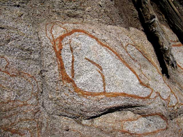 |
Emigrant Wilderness mineral staining rock patterns. |
Emigrant Wilderness Granite
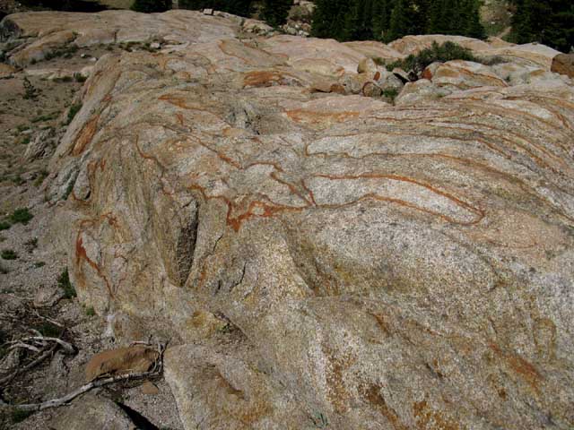 |
||
Emigrant Wilderness rock inscribed with unique decorations and cut into bizarre shapes.
|
Emigrant Wilderness Granite Color and Shape
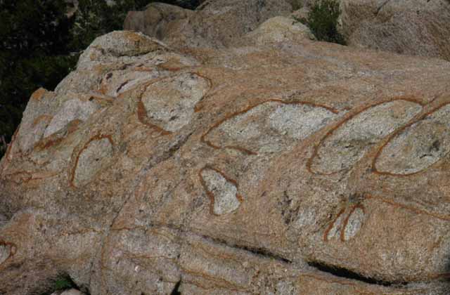 |
|||
Stains and shapes on Emigrant Wilderness granite are delightful. How does this happen?
|
Flowers grow up to Brown Bear Pass and Bees follow
 |
Purple High Sierra Flowers. I am thinking they are some kind of Flax... |
Bumble Bee
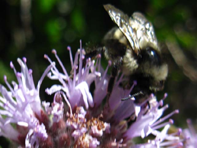 |
||
Bumblebee working the flowers on the North side of Brown Bear Pass. Sept 2, 2010. What a delightful aspect of nature to work within. These bees don't sting. The Buzz
|
Lovely Flower
 |
||
Wine purple-red flower spattered with pollen after a bumblebee visit. Sept 2, 2010. High Sierra Flower Identification Have any ideas about what type of flower this is? A Geranium? What do you think? Birdmom:
|
Ridgeline North of Brown Bear Pass
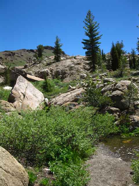 |
||
View Northeast Our trail is now bending to our Left, towards the Northeast, to swing around to begin climbing before we traverse traverse across the burnt red volcanic peak to Brown Bear Pass.
|
Final Approach to Brown Bear Pass
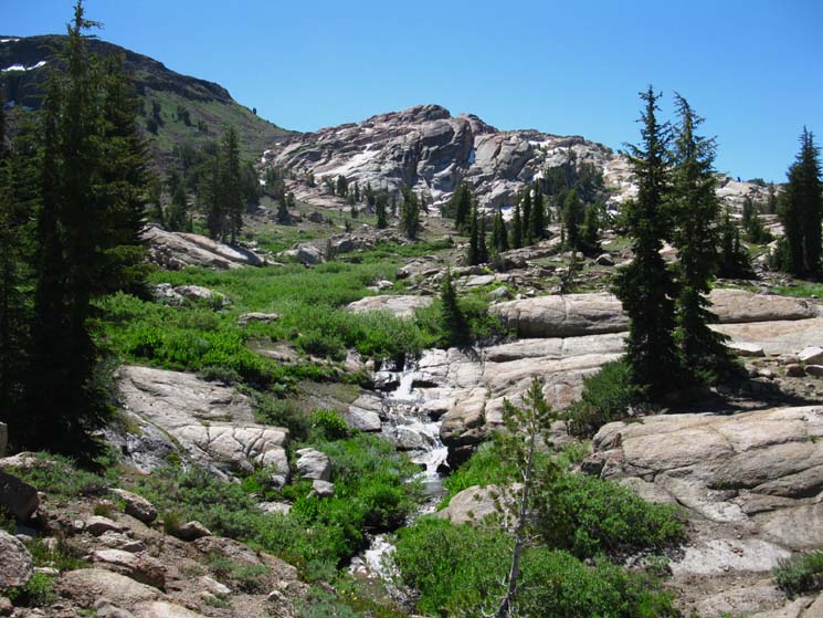 |
|||||
View Southeast
|
Emigrant Wilderness Granite Form and Color
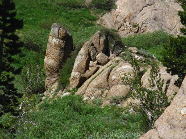 |
Emigrant Wilderness decorated rock formations. Sometimes in the Wilderness we feel as if we are walking through the grandest gallery of the finest art museum in the world. That's because we are... |
Looking West by Southwest across Upper Lunch Meadow
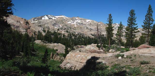 |
||
Black Hawk and Granite Dome Massif from the TYT just North of Brown Bear Pass.
|
Pussypaw
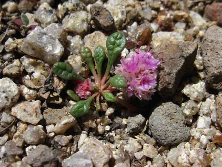 |
Tiny pussypaw made large with digital technology. High Sierra Flower Identification |
The Granite
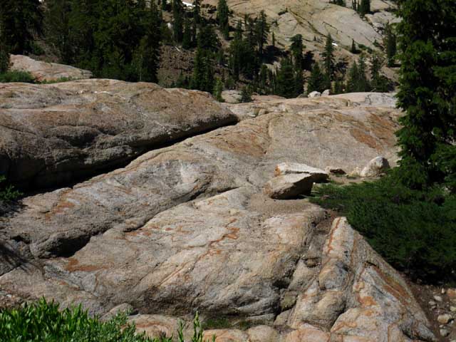 |
||
Emigrant Wilderness rock color and shape.
|
The Volcanic
Melting Volcanic Lion
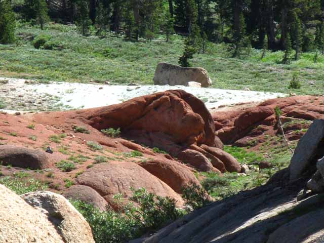 |
||
Red rust mineral exposed. Looks like the outline of the head of a female lion emerging from the red mineral mass at the center of the image.
|
Summit Creek's Final Run to Headwaters
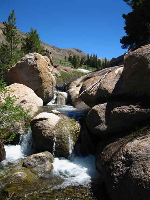 |
||
Summit Creek below Brown Bear Pass.
|
Last Trees-Shade below Brown Bear Pass
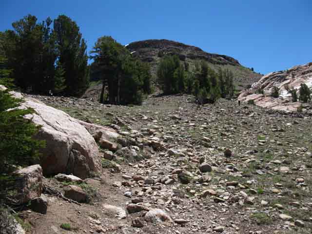 |
||
Last tree cover with best views below Brown Bear Pass.
|
Approaching Brown Bear Pass exposes the seam
between
volcanic and granite terrain composing Brown Bear Pass
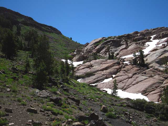 |
|||||
Granite on Southwest flank of Brown Bear Pass, Volcanic on Northeast. Ten thousand years ago this is where the flood tide of volcanic fury flowing over already ancient granite froze in place.
|
Granite Volcanic Interface at Brown Bear Pass
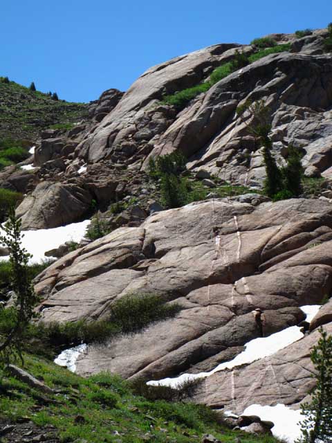 |
||
Detail of granite on Southwest flank of Brown Bear Pass.
|
Range of Granites
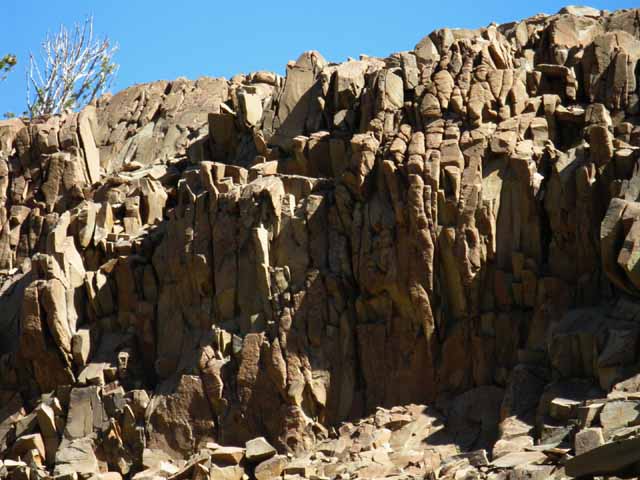 |
|||||||
Close jointed granite on Southwest flank of Brown Bear Pass contrasts the massive virtually unjointed slabs of smooth granite seen in the image above.
|
Lunch Meadow spreads out below us to the Northwest
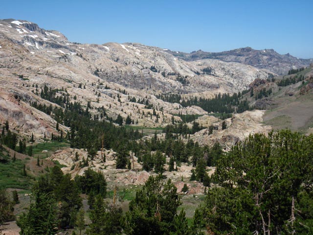 |
||
Looking West across the uppermost segment of the Summit Creek valley we just climbed. From here we can see the levels of Lunch Meadow. Also note the valley divides the terrain into granite on the Southwest side and volcanic on the Northeast. Our route has been tracing out the limit line of an ancient volcanic eruption.
|
Detail of Lunch Meadow and Valley below
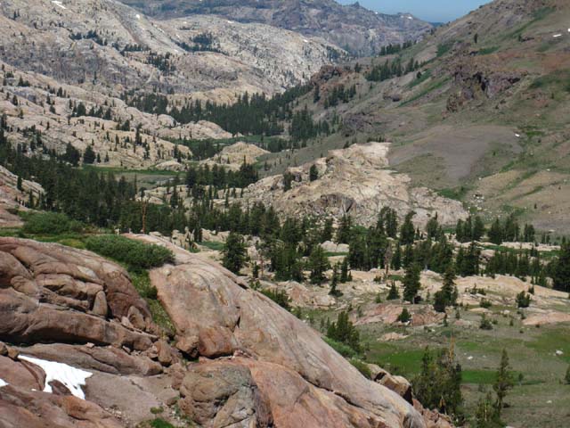 |
|||||||
Volcanic-granite terrain interface detail. Especially note how the isolated granite feature in the middle-Right of the image emerges from its surrounding volcanic jacket.
|
last longest view back the way we came
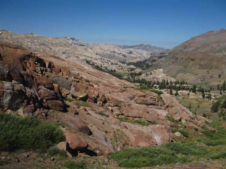 |
|||||||
Long view North down Summit Creek across Lunch Meadow before the terrain clips our view during final climb to Brown Bear Pass.
|
Last Length of Trail South up to Brown Bear Pass
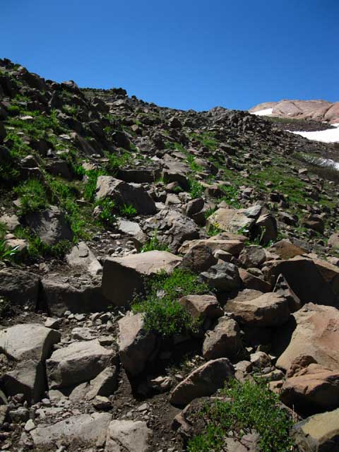 |
Last bit of shattered rock trail up the North flank of Brown Bear Pass. |
Shattered and Smooth Terrain
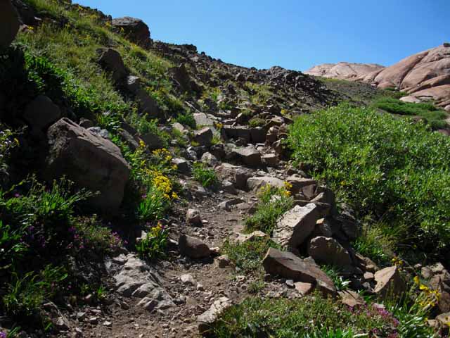 |
||||
Trials within Trails within Trails The seasonal snow and thaw will redistribute the rock on the trail, and each subsequent Summer horse, mule, and backpacker will kick some of them off their regular stepping spots. This means that there is a trail within the trail. The more clearly you see this the easier your hikes become. Every few years a trail crew will come by and fancy it all up.
|
Volcanic Burnt Red Terrain alongside Pink Granite
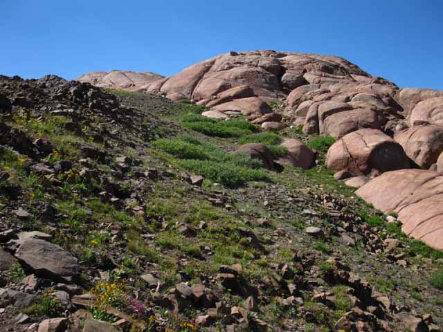 |
Trail across savagely broken volcanic terrain next to baby-butt smooth granite. We can see how the proximity to the minerals in the volcanic terrain have stained the granite a reddish-pink. A pinkish red? Pinko Red Pass? |
Final Approach to Brown Bear Pass
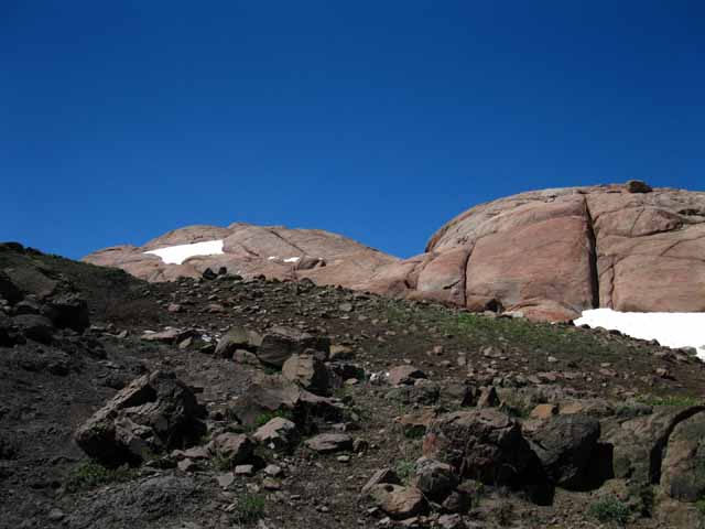 |
|||||||
Perspective shifts one step at a time providing thousands of fine views across a few short feet. At Brown Bear Pass I'll also take a break overlooking the Southbound Sierra Crestline, air out my feet, and switch my sweated socks with the dry socks sun-bleaching on my pack. I always have one pair of socks sun-bleaching on my pack as I am sweating up another. Switching pairs every few hours keeps both pairs very sanitary for up to three hiking days.
|
Brown Bear Pass Break
and
Foot Inspection
Time to Chill Out the Old Hooves...
Bottom Lines...| I stopped in Brown Bear Pass to inspect and air out the feet. Right and Left had a hard year, but were healing up well for the upcoming Winter... | |||||
 |
 |
||||
| September 2010 the feet had almost healed up. | 2010 was not a good year for the feet. | ||||
Aggressive trips during the Winter and early Spring tore up my feet, which had softened up during a period of injury. Problems persisted through the 2010 Summer hiking season. This required accommodating the problems with plenty of first aid gear and an excellent system to use it properly and effectively. Good first aid technics allow heavy hiking with heavy blisters. These Reports from Emigrant & Yosemite, filmed at about 3 and 25 miles South of our current position depicts the combination of traveling 70 miles through the High Sierra when it is in Massive Mosquito Attack Mode (for the whole trip) on a set of well-perforated feet. This situation may be considered typical of routine issues that pop up on the trail. We laugh at the mosquitoes and scoff at minor injury when we have the proper gear and know how to use it. Be Ready. Be Very Ready. Mosquitoes and Minor Injuries will torture you if your are improperly geared.
|
|||||
Sixteen things at once Hiking is sixteen things at once. Breathing, heart rate, food and water consumption are the important standard internal metrics for our mobil observation unit, our bodies, until something else goes wrong. Is a storm forming, is your stomach churning, is the river ford surging? Is your ankle turning, is your skin burning, are your allergies emerging? Are your knees creaking, are your fears tweaking, is your water leaking? Are your blisters bleeding, is your food feeding, is your map misleading? Is your motor running down, your gear too thin, your pack attacking your back? All of these things will pop up or be persistent backpacking companions at some point during your travels. You must be ready to deal with each way life can get hard. If you spend enough time on the trail everything that can happen will happen to you out there. Hell may seem a long distance away while sitting in heaven, but your subjective state can shift in the blink of an eye in the High Sierra. You must be able to protect yourself. This protection requires thinking, not shooting. You can't shoot stupid... I've hiked with him too long... and I hike solo. Have the ability to take a day off. Have bandages, proper food, clothing, shelter, bear protection, and most importantly have the proper expectations to properly define your needs for safe mountain travel. Having expectations which distinguish too much from too little gear, too long from too short of a trip, and too much from too little food are good places to start. I don't expect to get pounded on the trail, but I am not surprised when shit happens. Balancing, or more accurately juggling these internal and external factors before and during the trip brings clarity unavailable elsewhere. What's important becomes crystal clear on the long trails. |
View East-Southeast off the South Flank of Brown Bear Pass
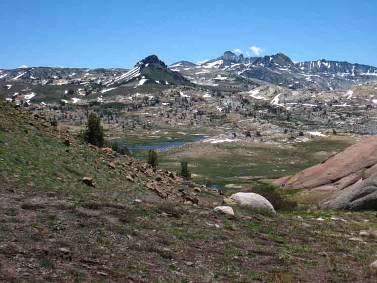 |
||||||||
Crossing over to South Flank of Brown Bear Pass overlooking Emigrant Meadow. 2013. Entering 9760 10.92 miles
|
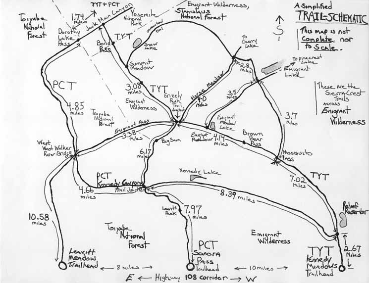
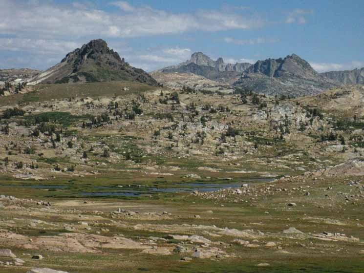 |
|||||||
Grizzly Peak in Left foreground, Tower Peak jutting up in the far middle distance, and Forsyth Peak rising above the PCT's entrance to the Northeast corner of Yosemite via Dorothy Lake Pass. We are seeing all of this looking East-Southeast across Emigrant Meadow Lake in Emigrant Meadow in the foreground. Check this out in Spring on the next guide page South.
Late Summer (Aug 23 2012) into early Fall tunes down the intensity of High Sierra greenery and transitions these vibrant greens into the golden tones of Fall.
|
Cool Pools Compose NW side of Emigrant Meadow Lake
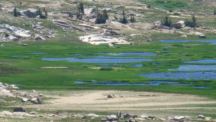 |
|||||
These beautiful pools are MLZ. Mosquito Launch Zones. The High Emigrant Basin is full of mosquitoes all Summer long. Those lush green grasses and expansive surface waters we see are indicative of massive populations of mosquitoes. These mosquitoes will rise from the grasses as we brush through them, or as they pick up our scent. Independent of how they zero-in on us, they will be going for our blood as we hike across the meadow. A headwind helps, but during Spring a brimmed hat with mosquito net to a collared long sleeve shit is nice protection to have. DEET for the face and the backs of the hands. The "drop dead" date for mosquitoes in the High Sierra is August 15 during a "typical" year, whatever that is. During years of average rainfall and a normal Spring the wet meadows generally dry out by August 15. Drier years this happens earlier and later during wet years. But Emigrant Meadow is special, and typical of many MLZ across the Sierra Nevada. What makes this place special for the mosquitoes is what we don't see. Emigrant Meadow is composed of eroded sediments from the surrounding peaks. These sediments are deposited on a rock foundation. Note the flattish shape of the granite plates on the far side of Middle Emigrant Lake. These great granite plates underlay Emigrant Meadow, trapping water, and keeping the meadow moist and full of mosquitoes long after surrounding terrain has dried out. Get out the DEET if you don't want to become a mosquito TREET.
High Sierra Mosquito Information
|
Brown Bear PassOne Gateway into the High Emigrant Basin Most people refer to the area on the Southeast flank of Brown Bear Pass as High Emigrant Meadow. I refer to the two meadows sitting on the big flat on South side of Brown Bear Pass as the High Emigrant Basin containing both Emigrant and Grizzly Meadows. The Basin drops down to the Southeast to include Summit Meadow on a subordinate shelf just below the High Sierra Crest line. High Emigrant Basin is essentially a shelf, or set of shelves nestled in just below the crestline running along the top of the Western flank of the Sierra Crestline stretching South from Brown Bear Pass marking its Northwestern corner, Big Sam its Northern extent with Bond Pass marking its Southernmost end. See this high elevation view of High Emigrant Basin from the North: This expansive high elevation flat containing both meadows is ringed with mountains around its North and Northwestern sides while to the Southwest the High Emigrant Basin drains through complex sets of granite valleys descending into deep forests that span from Hetch Hetchy to the Southeast to Pinecrest Lake to the Northwest. Emigrant Basin's Northeast shoulder composes the Western flank of the West Walker River watershed draining Northeast out of the Eastern Sierra through Leavitt Meadow below Sonora Pass. It is splendid. In any case the High Emigrant Basin we are now entering through Brown Bear Pass holds a hub of trails radiating to all the cardinal compass points. I have just two words to describe this: Woooo-Hoooo!! Let's do them all, then make up some of our own... 7.96 miles 10.92 miles |
North: Kennedy Meadows to Relief Reservoir South: Brown Bear Pass to Bond Pass
Relief Reservoir to Brown Bear Pass |
Tahoe to Yosemite Trail Hub of Trails Below Grizzly Peak To our Northwest: To our North: To our Northeast: To our South: Pacific Crest and Tahoe to Yosemite Trails both heading South towards Tuolumne Meadows in Yosemite. We can also run Jack Main Canyon all the way down to Hetch Hetchy. Recap This leg of the Tahoe to Yosemite Trail between Relief Reservoir and Brown Bear Pass is not just one segment of the longer TYT trail but also opens up many opportunities for a wide range of loops and trailhead to trailhead trips around and across Emigrant Wilderness. On the way up to Brown Bear Pass we passed both the trail into Relief Valley and the Mosquito Pass trail junction. Both of these trails offers access to a wide variety of loop routes around Emigrant Wilderness of various length.
Emigrant Wilderness Topo Hiking Maps 7.5 Map: 30 min Map: South: Brown Bear Pass to Bond Pass |
Backpacking Trail Guide TYT Kennedy Meadows North Kennedy Canyon |
 |
Backpacking Trail Guide TYT |
Backpacker ForumsHave a great Sierra Nevada trip or story to relate? A fine piece of gear? Or gear that failed?Post it onTahoetoWhitney.Org Become a MemberAll backpackers can comment.
|
North: Kennedy Meadows to Relief Reservoir South: Brown Bear Pass to Bond Pass
Trailhead
Contact
Alex Wierbinski
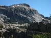
Backpacking Lake Tahoe to Mount Whitney
Your Guide to the High Sierra Crest, including the Tahoe to Yosemite, Pacific Crest, and John Muir Trails