The Trails
Guide
Maps
Miles/Ele
Permits
Resupply
Forum
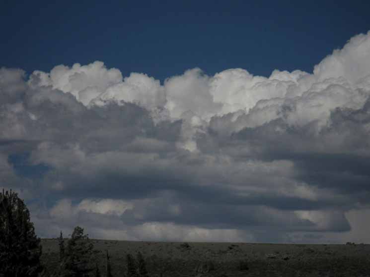
Current Weather Conditions
Weather Notes
Northern High Sierras
Central High Sierras
Southern High Sierras
Gear
Gear List
Gettin Started
Layering
Discussion
Testing yourself and your gear
Gear Reviews
Backpacking
Murray Canyon
to the
Boulder Lake Trail Junction
Approaching the
East Carson River
in the
Carson Iceberg Wilderness
Hiking
The Pacific Crest Trail from Ebbetts Pass to Sonora Pass
Languages
Languages
Trail Arts
The art of walking
Physical Preperation
Trail Skills
The trail
Off the trail
Scrambling
Maps
Navigation
Camp skills
Food
Resupply
Food
Other
Photo Catagories
Trail Stories
Trail Culture
News and Science
Links
Groups
Books
Terms and Conditions of Use
| Trail Guide INDEX Highway 4 to Highway 108 |
North PCT Tyron Peak to Murray Canyon |
South PCT Boulder Lake Junction to East Carson River |
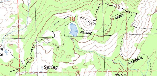
Topo Map Asa Lake to East Fork of Carson River |
30 min Map Ebbetts Pass to Sonora Pass |
Ebbetts Pass to Sonora Pass MILES AND ELEVATIONS |
ALL TOPO MAPS EBBETTS PASS TO SONORA PASS |
Resupply North Lake Alpine. South Kennedy Meadows |
National Forests Toiyabe & Stanislaus |
all |
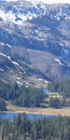
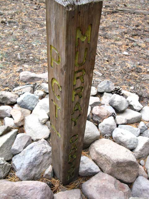
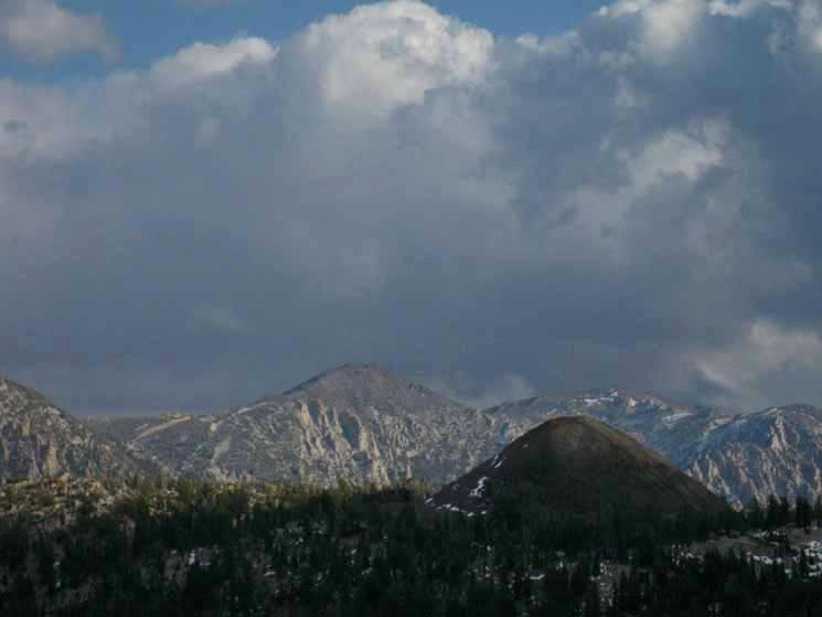
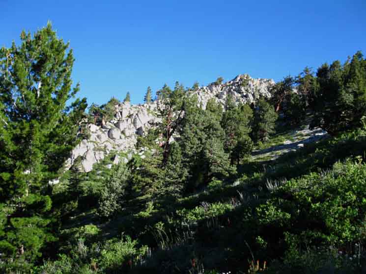
Murray Canyon
trail Junction in the
Carson-Iceberg Wilderness
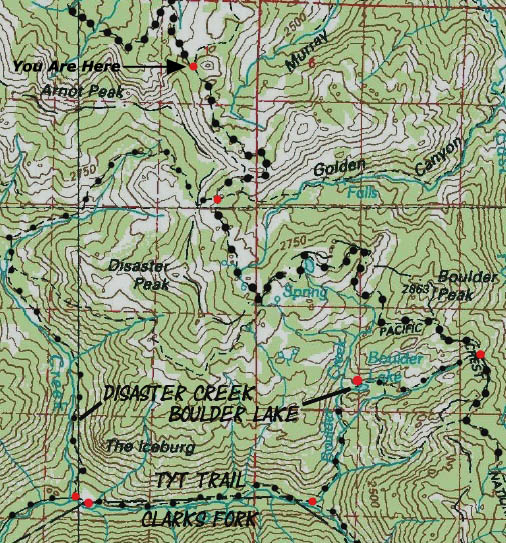
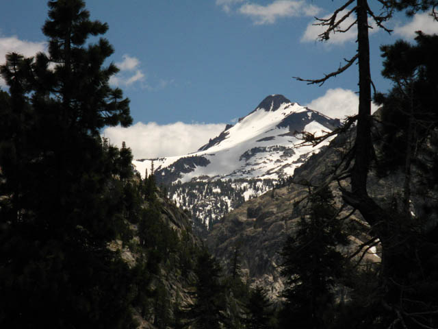
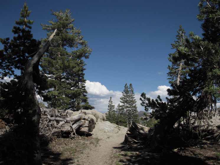
Murray Canyon Trail Junction along the Pacific Crest Trail. What's Up Here? |
 |
We're a bit more than a third of the way to Sonora Pass from Ebbetts Pass. Looking East I say lower because Falls Meadow sits below Carson Falls. Carson Falls is the balance point between the steep mountain terrain above from the flatter mid-elevation mountain & meadow terrain below. Above Carson Falls the classic challenges of a long-unmaintained trail follows the rough terrain along the East fork of the Carson River, upriver, to end where it finally brings us back to "civilization" with its intersection with the PCT. Check the Northeast corner of the Carson Iceberg Map below to see how this interesting bit of trail and terrain are situated. Carson Iceberg Wilderness Hiking Map Note that the trail across Poison Flat to the Northeast of Carson Falls leads East to the Corral Valley Trailhead on Rodriguez Flat. Corral Valley is a remote East Sierra trailhead accessed through Mill Canyon Road, a dirt road leading West off Highway 395 a bit North of the town of Walker, California (map). I've written up some notes about accessing the unmaintained trail up the East Carson River from Corral Valley Trailhead off of Highway 395, which I linked to above. We can craft some fun and very challenging routes across Rodriguez Flat that will approach this Murray Canyon trail junction from the East or North, depending on how we want to hike it, and what we want to see and experience. Southbound Finally, South of Boulder Peak we will pass around the backside of a massive granite feature I call "The Plug," which brings us past the sheer cliffs rising from the East Carson River onto terrain that permits a set of switchbacks to finally bring us down to river level. These switchbacks make North-bound PCTers sweat hard. Asa Lake to East Carson River Though we can't see it from the PCT, there's a fine campsite sitting along the East Carson River a short ways down the East Carson Trail from the PCT. A very nice place to camp. At this unmarked trail junction at the bottom of the switchbacks we have hiked 9.83 miles of the 18.57 miles South from the Murray Canyon trail junction to Sonora Pass. We're about two thirds of the way from Ebbetts to Sonora Passes. Ahead of us to our South, from the unmarked East Carson junction, we have a 4.65 mile climb up from this 8160 foot low point climbing up to and out of the 10, 240 foot headwaters bowl of the East Carson, followed by another 1.21 miles climbing another 296 feet to reach the 10,536 foot high point of our whole Ebbetts to Sonora Pass hike through the Sonora Gap. Boulder Lake to Sonora Pass At the Sonora Gap we are 2.88 miles North of, and 293 feet above Sonora Pass. |
IndexHiking the PCT South Murray Canyon is 10.87 miles South of Ebbetts Pass Murray Canyon is 18.57 miles North of Sonora Pass
Murray Canyon to Boulder Lake trail junction The Boulder Lake trail junction 11.73 miles North of Sonora Pass
Murray Canyon to East Carson River Trail Ebbetts Pass to Sonora Pass
Basic Facts Topo Hiking Maps Asa Lake to East Carson River
Miles and Elevations Miles and Elevations Murray Canyon to Boulder Lake trail junction The Boulder Lake trail junction 11.73 miles North of Sonora Pass
|
||||||||||||||||||||||||||||||
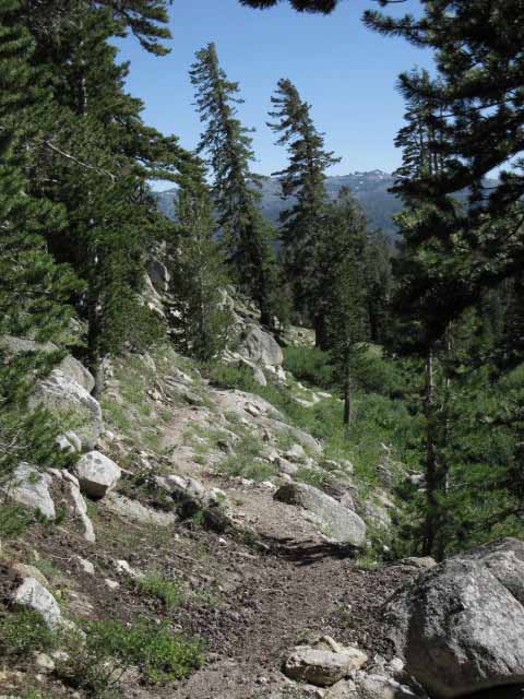
South into Murray Canyon
 |
||
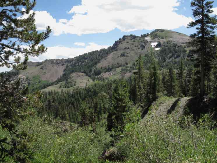
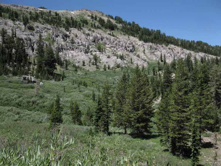
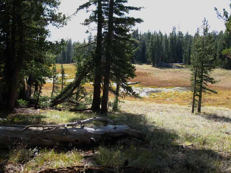
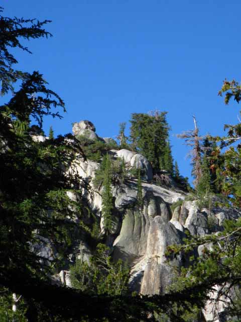
South past the Murray Canyon trail junction we hike South to cross the upper end of Murray Canyon. Our trail moves to our Right to wrap around the upper perimeter of Murray Canyon. Disaster Peak rises above the West ends of both Murray and Golden Canyons, though it is lined up behind Golden Canyon.
|
Murray Canyon Trail Options
Murray Canyon
|
| Carson Iceberg Wilderness 30 minute backpacking Map |
Asa Lake to East Carson River 15 minute backpacking MAP |
All Right, back to the Southbound Pacific Crest Trail at the Murray Canyon Trail junction.
VIDEO
Discussion
at
Murray Canyon Trail Junction
Campsites 1.5 miles further South.
| Murray Canyon Trail Junction Options | ||
Video Thinking about the hiking options at the Murray Canyon trail junction.
|
Hiking Loops
through
Murray and Golden Canyons
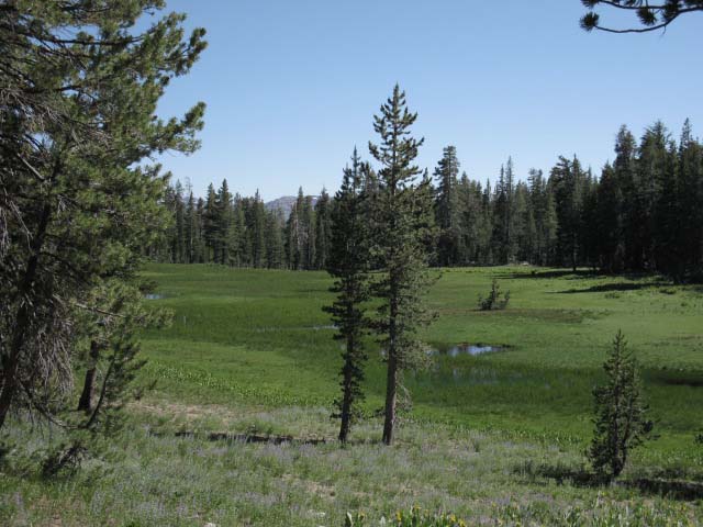
Backpacking Loops The Trail Route Options Big loops using the PCT and TYT through the Carson-Iceberg Wilderness At Golden Canyon we can hike 3.16 miles West over the Sierra Crest line down through Paradise Valley on the Western flank to connect with Disaster Creek. Disaster Creek runs North and South from the PCT at Wolf Creek Pass to the TYT at the top of the Clarks Fork Road. Carson Iceberg Wilderness From Disaster Creek we can head North towards road access at Highland Lakes through the Gardner Meadow Trailhead, or hike South to the Disaster Creek Trailhead along the Tahoe to Yosemite Trail at the very end of the paved road up the Clarks Fork of the Stanislaus River off of Highway 108. Disaster Creek is one of our four trail options for crafting grand loops of various lengths through the Carson-Iceberg Wilderness. Heading South down disaster Creek brings us to the Tahoe to Yosemite Trail along the Clarks Fork of the Stanislaus River. We have four trails along creeks that connect the PCT and TYT routes between Highways 4 and 108. Highland, Arnot, Disaster, and Boulder Creeks all offer connections from the Tahoe to Yosemite Trail to the Pacific Crest Trail down the length of the Carson-Iceberg Wilderness. The Southern Disaster Creek trailhead is located at the end of the old paved road tracing out the original pioneer wagon road that preceded the opening of Highway 108. This old road follows the Clarks Fork of the Stanislaus River up from Highway 108 to the Arnot, Disaster, and Clarks Fork trailheads along the Clarks Fork, as well as a trailhead leading over The Dardanelles to Sword and Lost Lakes near Spicer Meadow Reservoir. Using one of these four trails to hike up to the Pacific Crest Trail, and one of the other trails to hike back to the Tahoe to Yosemite Trail allows us to craft a great variety of backpacking loops that provide an excellent way to introduce yourself to the remote trails accessing the fine terrain of the Carson-Iceberg Wilderness. This big topo hiking map of the Carson Iceberg Wilderness I gussied-up marks these route options. Click the RED DOTS marking trailhead and trail junctions to see that location on the trail guide. Click the black-dotted trail routes for the underlying 15 minute detailed backpacking maps. Also check out this report of a 50 mile loop around the Carson Iceberg Wilderness using bits of both the PCT and TYT. On its Northern side the Disaster Creek Trail ends where it connects to the trail between Wolf Creek Pass on the Pacific Crest Trail and the Gardner Meadow trail head near Upper Highland Lake. Alas, I suspect most readers here are more interested in heading up and down the Pacific Crest Trail past the Murray Canyon trail junction than veering off into the lower reaches of the East Carson River or crafting a grand loop around the Carson-Iceberg Wilderness using Disaster Creek as a leg of the trip. But you can. Backpacking loops around the Carson Iceberg Wilderness are amazing fun. If you are looking for a beautifully remote and fairly easy backpacking experience in a most remote area of the Carson-Iceberg Wilderness, then approaching Carson Falls from the East, from Highway 395, is a trip for you. The hike West to Carson Falls along the East Carson River is delightful and easy. It only gets harder if you push past the falls up the East Carson. If you are looking for a challenging place to try out your expert route-finding skills, then by all means push into the segment of trail above Carson Falls up the East Carson River to its junction with the Pacific Crest Trail. Getting to Carson Falls from the East is fairly easy. Getting past it is a different story. More Information See |
Back to the Continuing our hike South along the Pacific Crest Trail for 9.83 miles from this Murray Canyon trail junction brings us to where the South end of the East Carson River trail's unmarked route joins with the Pacific Crest Trail route at an obvious, but unmarked junction. I'm the one who's been ducking this junction every Spring for many years until 2010. It's a plainly visible junction to anyone who keeps their eyes open. I'm generally in and out (and have reducked this junction) long before any Pacific Crest or local hikers get into this section of the Carson-Iceberg. Well, I was the one who ducked this junction during the past 20 years... An injury in early 2011 (jan, frostbite.) made my annual Spring Trip up the East Carson impossible during 2011 and 2012. Heart issues killed 2013, and a broken leg in early 2014 has not improved hiking prospects... Sigh. Well, I've more time to write the guide, rather than compile information and experience. The video below is a reprise of this discussion about the Murray Canyon Trail Junction in proximity to the East Carson River, and also notes the campsites about a mile and a half to the South of the junction. These sites are in proximity to an upper branch of Murray Creek reaching up across the Pacific Crest Trail. The creek will not reach up to the PCT during these times of dire drought and radical changes in the character of the seasons. There are also campsites ahead in Golden Canyon, a beautiful site along the upper reaches of Boulder Creek where we pass around the West flank of Boulder Peak, the expansive site at the PCT-East Carson River Trail, and Hunter's Camp high up in the East Carson River's headwaters bowl. We are going to check out all these sites as we continue hiking South. All of these sites are linked to from all the maps and the miles and elevations pages. Ebbetts Pass to Sonora Pass Murray Canyon is Murray Canyon is After I lay in the basic guide pages for the main PCT and TYT routes through the Carson-Iceberg Wilderness I will add guide pages for the Highland Creek, Boulder Creek, and East Carson River trails that connect up with the main routes. |
Continuing South
on the
Pacific Crest Trail from Murray Canyon
Murray Canyon Campsites
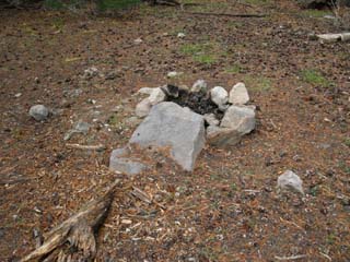
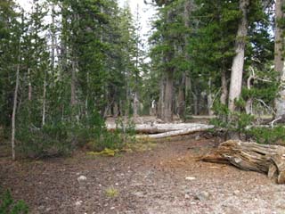
| Fire ring at campsites South of Murray Canyon trail junction. | Flat with many campsites on the South side of the unmarked stream up the center of Murray Canyon. | |||||
 |
 |
|||||
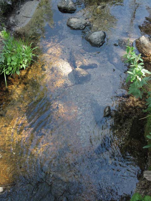
Keep your eyes open as you cross the center of Murray Canyon. Asa Lake to East Carson River |
This flat is on the East side of the PCT. |
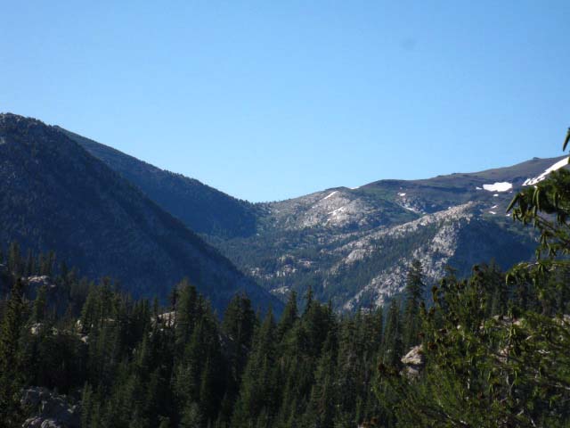
Looking North from a break in the spotty forest cover while crossing the upper reaches of Murray Canyon. We are looking back at the Northern Shark fin, Peak 9362, which marked our Southbound entrance into Murray Canyon. |
 |
Murray Canyon drains East, into the East Fork of the Carson River, to our Right. |
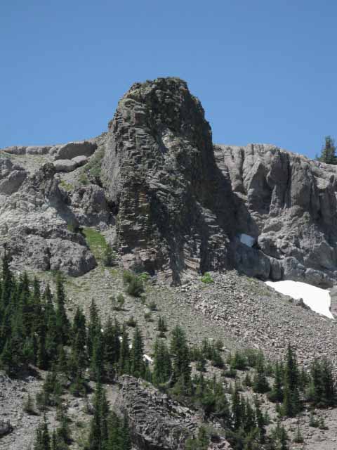
Peak 9362
 |
Looking North at Peak 9362 on the North edge of Murray Canyon. Asa Lake to East Carson River |
Detail of Peak 9362
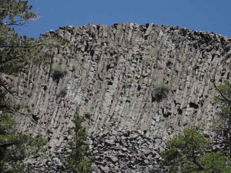 |
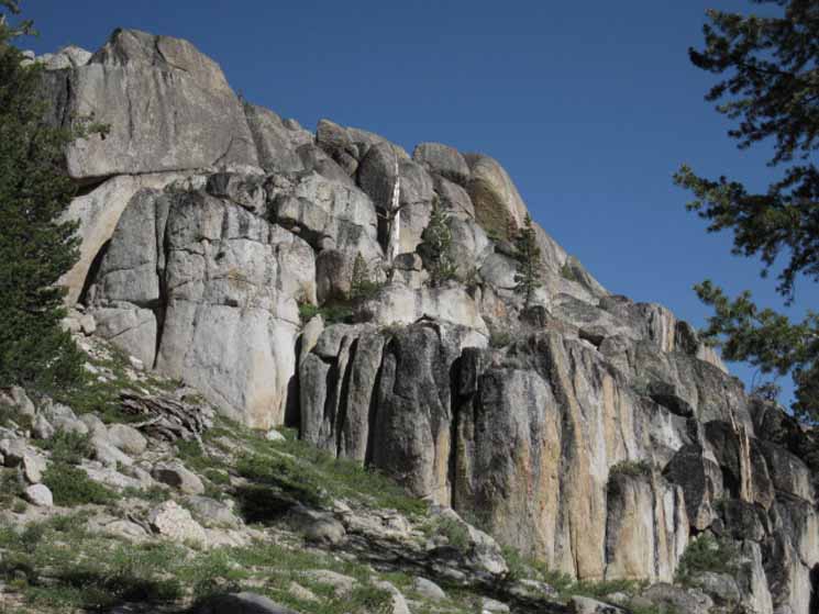
Detail of upper South Flank of Peak 9632. Indications of uniform cooling of large bodies of lava into columns first appeared hiking South from Wolf Creek Pass on and around Arnot Peak. The Northern and Southern Sharkfins marking the ends of the Murray and Golden Canyons are excellent examples of this type of lava deposition and cooling. This USGS article explains the mechanism: Devils Postpile National Park Geologic Story Though focused on Devils Postpile, this article explains certain elements of the terrain we've passed through. |
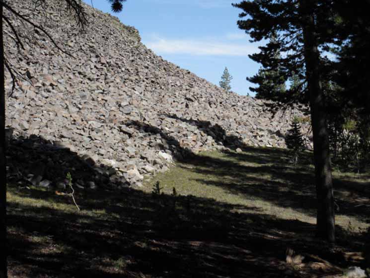
Murray Canyon Scenes
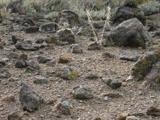
| Field of broken volcanic rocks. | Sunburst over the Sierra Crest. | |||||
 |
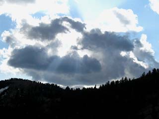 |
|||||
| A Martian-like scene frozen in time. This area has not changed much for decades, if not centuries! | Sunrays over Murray Canyon. You had to be there... but you get the idea. |
North along the Sierra Crest
 |
Northwest corner of Murray Canyon along the Sierra Crest. We've been wrapping around the upper end of Murray Canyon. Asa Lake to East Carson River |
Cone along Sierra Crest above Murray Canyon
 |
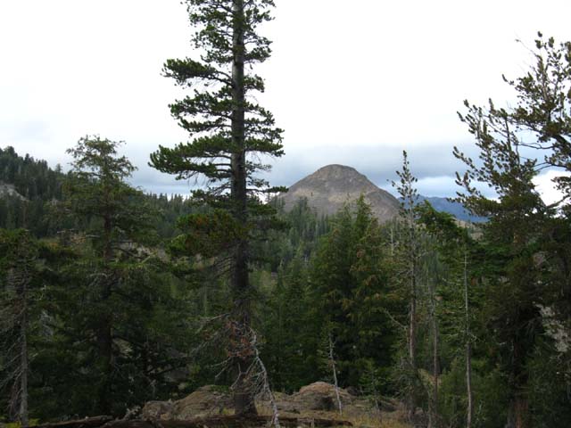
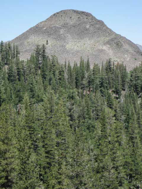
A great volcanic cone rises off the East flank of the Sierra Nevada above Murray Canyon. |
Flower, Purple, Murray Canyon
| Phlox? |
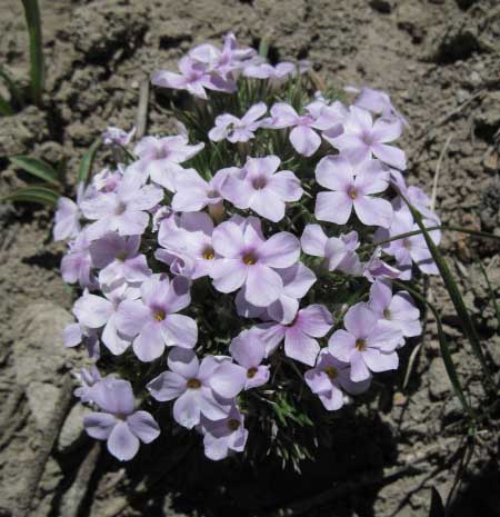 |
8960 feet, July 2009. Lovely color and shape. Comments-Precise Identification? Have any impressive images of High Sierra flora and fauna you'd like to share? That's why the Backpackers's Trail and Topics Forum has a |
Hiking South out of Murray Canyon
| Exiting the very top of Murray Canyon, Southbound. | ||
 |
||
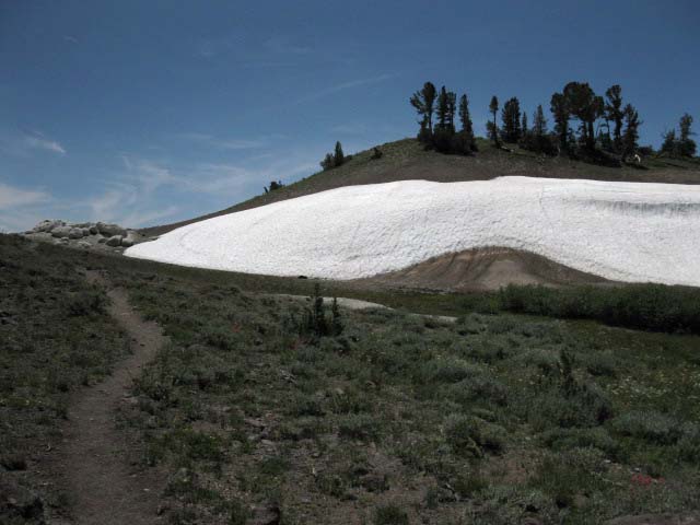
This is the snowberm during July of 2009. Note the heavy snow berm during October in the video from 2011. The picture above is within "normal" (whatever that is...) seasonal ranges, while the massive snowberm of October 2011 is indicative of the heavy snow pack that kept the high trails covered until mid August of 2011.
|
Video
Murray Canyon and Golden Canyon
BIG ERROR in Video
I call Stanislaus Peak "Disaster Peak"
That's what I get for walking myself stupid... and then Talking!
| Departing Murray Canyon Southbound, Trail Junction Options | ||
Video: Hiking Murray and Golden Canyons. 7:59 Note: Disaster Peak sits to the Southwest of our position hiking South into Murray Canyon, being located at the top of Golden Canyon.
|
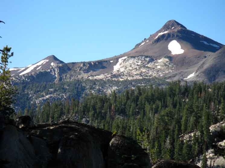
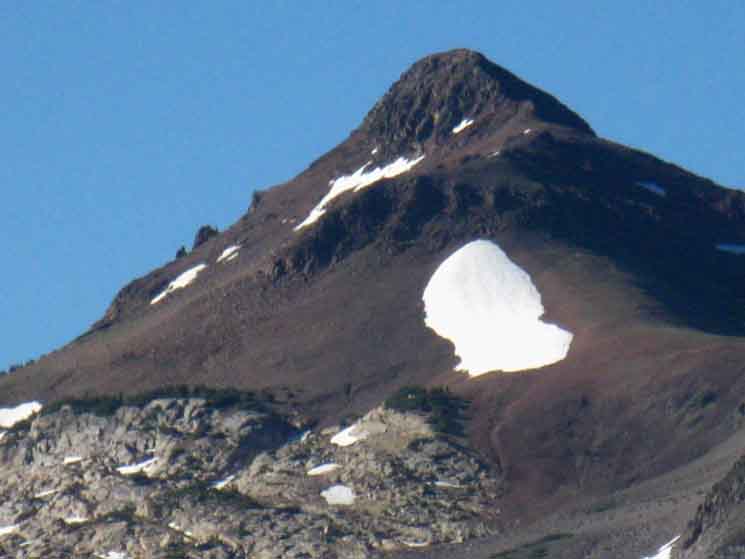
Stanislaus Peak
Ari Coming South through the Gap
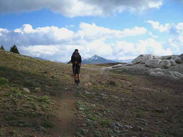 |
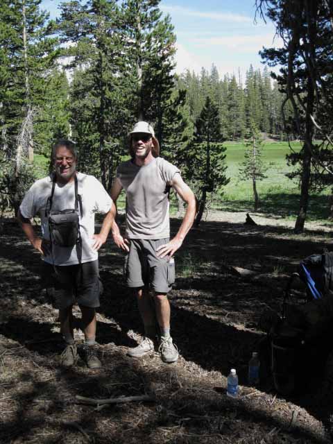
Ari hiking Northbound out of Golden Canyon into Murray Canyon. Tuesday October 25th, 2011. Clouds thickened and mini-snow flurries swept across the high points of the terrain before the clouds dissipated and clear cold skies brought nighttime temps way down. I generally hike alone, but am always glad to backpack with my pal Ari. This was my first hike after losing the tip of my toe during the first days of January of 2011. Well, it took months for the tip of the toe to rot off after the initial frostbite injury. Ari was good to have along on my first trip out. |
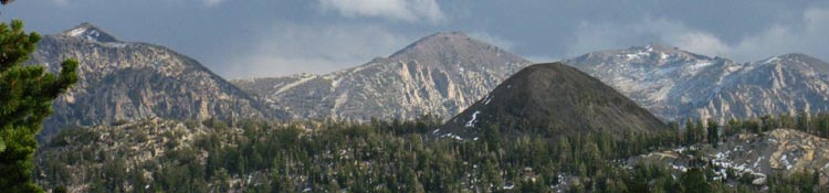
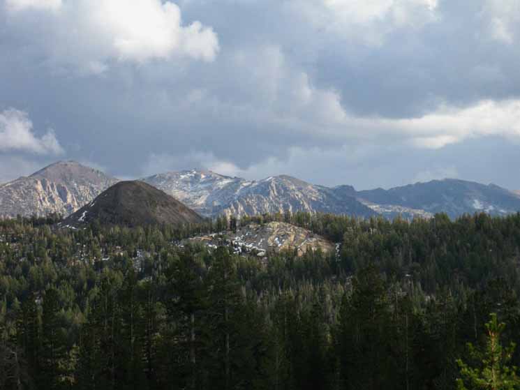
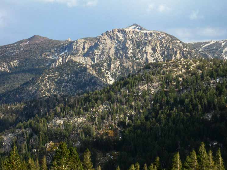
Stanislaus Peak
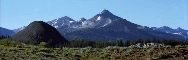
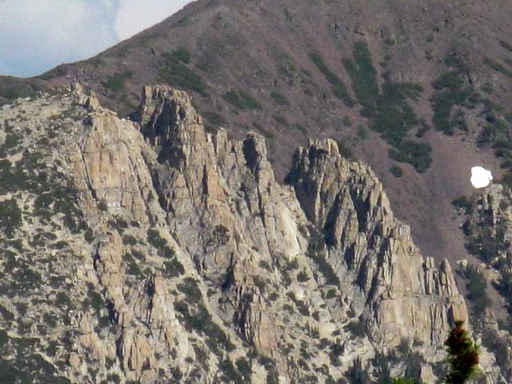
This is the correct identification: View South of Stanislaus Peak in central foreground and Sonora Peak in the Left background, looking South approaching the divide between Murray and Golden Canyons. The peak between Stanislaus and Sonora Peaks sits above what I call "The Prominence." The Prominence is a great rock face we will see as we hike up the East Carson River between Stanislaus and Sonora Peaks. The Prominence rises from the West side of the upper East Carson River's upper canyon. Disaster Peak is to our Right, out of sight at the head of Golden Canyon. The Southern Sharkfin, Peak 9501, rises in the Left foreground, marking the South edge of Golden Canyon and the location of the Swampy Lake.
|
||
Stanislaus Peak, Sonora Peak in far background Left 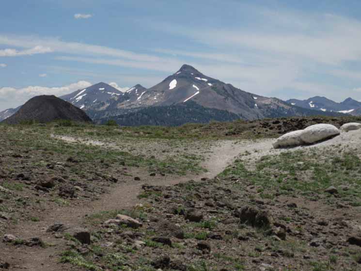 |
||
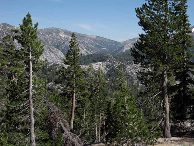
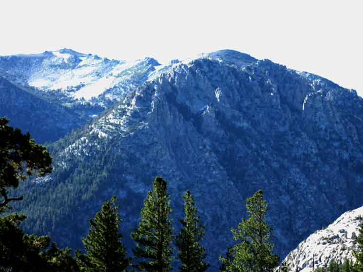
| TWO RIVERS The Stanislaus - Sonora Peak Massif ahead marks the convergence of the Pacific Crest and Tahoe to Yosemite Trails. The Tahoe to Yosemite Trail follows the Clarks Fork of the Stanislaus up the West flank of the Sierra to Saint Marys Pass wrapping around the Western base of Stanislaus Peak. The Clarks Fork flows West between Stanislaus Peak and the ridgeline we can see in the distance beyond its descending ridge arm. Our Pacific Crest Trail route up the East fork of the Carson River passes under the Eastern flank of Stanislaus Peak before we traverse the Eastern and Southern flanks of Sonora Peak. Our PCT wraps around the East flank of Sonora Peak to arrive at Sonora Pass, while the TYT wraps around its Western flank. The Saint Marys Trailhead is less than a mile West of Sonora Pass along Highway 108. The PCT and TYT almost converge on Highway 108. This line of Sierra Crest mountains divide the beginnings of two these two great North Sierra river systems, as it also brings together the lines of these two great trails together near Sonora Pass. Knowing this from the trail tells us that we are drawing much closer to our next resupply spot at Kennedy Meadows Pack Station. We're a little less than 20 miles North of the Sonora Pass trailhead on Highway 108 from our position here, hiking into the top of Murray Canyon. We are planning where the best campsite will be to stage up for an early arrival at Kennedy Meadows if we are standing on the North edge of Murray Canyon early in the morning, and we are holding a hiking pace of 15+ miles a day. If it's late in the afternoon I'll be thinking about making it to the Boulder Creek Campsite, and even down to the campsite at the East Carson trail junction if it's a bit earlier in the afternoon. If it is really late in the afternoon or early twilight, we'll likely be pushing hard to see if there's enough water in the tributaries reaching into the upper areas of Murray and Golden Canyons where our PCT route crosses to support a campsite. The point is to understand that our time at a location has significant meaning for scheduling our upcoming water and food breaks with local resources. We can see 12 miles to the North all the up to the East Carson Gap from the North end of Murray Canyon. It behooves us to look carefully at the upcoming terrain to consider how far we will get during the remaining daylight, and just where we will be when Sun hits the horizon. I'm going to be somewhere that brings me great joy, if at all possible... The nearby landmark of the Southern Sharkfin, Peak 9501, is seen marking the South end of Golden Canyon in the Left foreground of the image above.
Two Sharkfin formations and Two Canyons: |
Wide View South down the Pacific Crest Trail
 |
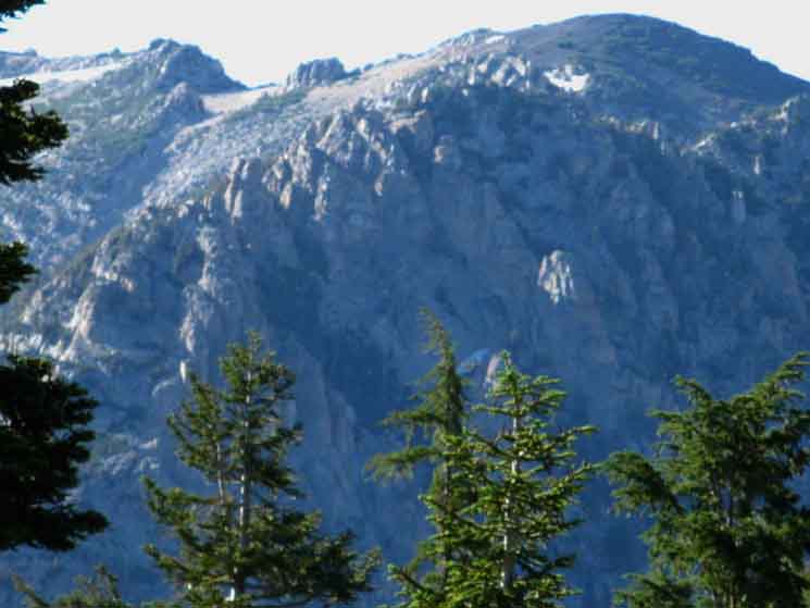
View South of East Carson Gap, The Southern Sharkfin, Sonora Peak, Stanislaus Peak, and the Clarks Fork, from Left to Right from the North edge of Murray Canyon. Our Upcoming Route South To the Right of the East Carson Gap we see Sonora Peak's great triangular bulk rising up to compose the most distant of the three great peaks filling the center of the image. Passing South through the East Carson Gap the PCT continues South, gradually climbing the East flank of Sonora Peak before turning West, to the Right, to traverse the South flank of Sonora Peak before finally turning Southeast to drop down to Sonora Pass and Highway 108. Lay of the Land Check out this massive map that tracks the TYT and PCT down to Highway 108 and South to the Yosemite Boundary: Sonora Pass Region Backpacking Map The black dotted trail routes link to detailed maps, the red dots link to trail guide information. The light brown rounded mass rising in the Left foreground is the Southern Sharkfin, Peak 9501. Looked at from most perspectives, the mass of the Southern Sharkfin resembles a sharkfin. The Southern Sharkfin marks our Southbound exit from the Golden Canyon, as the Northern Sharkfin marked our Southbound entrance into Murray Canyon. Both are valuable landmarks. Hiking South past the Southern Sharkfin we will turn West for a short detour around Boulder Peak onto the Western Flank of the Sierra and the Western drainage of Boulder Creek for a very short distance until we return to hiking along the edge of the top of the Western Wall overlooking the East Carson River's fantastic canyon. A short distance South past Boulder Peak we arrive at the Boulder Lake trail junction. A faded old trail leads West down to Boulder Lake, where a good trail descends to the Tahoe to Yosemite Trail along the Clarks Fork of the Stanislaus River. The Boulder Lake trail junction along the Tahoe to Yosemite Trail marks where the Southbound route up to Saint Marys Pass begins to degrade into unmaintained status, then into basic route-finding, and finally into a short length of cross country route finding over the final distance from Clarks Meadow to Saint Marys Pass. The upcoming Boulder Lake trail junction is perfect for us if we are thinking about trading in our difficult, but well-marked route up the East Carson River to Sonora Pass Trailhead on the PCT for the even more difficult, unmaintained and cross country route up the Clarks Fork on the TYT to Saint Marys Pass Trailhead. We have that option through the Boulder Lake trail junction. Here's a map from the TYT section of the guide laying out the route off the PCT down to the TYT for the Clarks Fork route over Saint Marys Pass: Arnot Creek to Boulder Lake Junction Map |
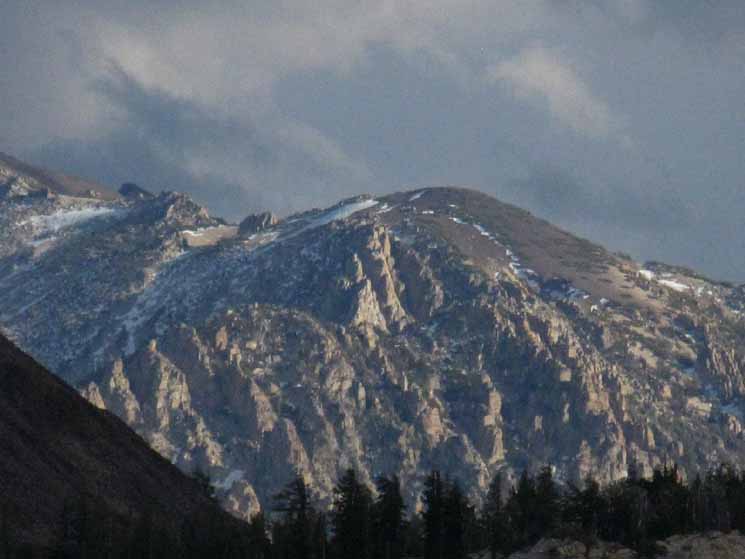
A Different Perspective on Stanislaus Peak
| Stanislaus Peak in Fall snow from the East. |
 |
Looking West across the East Carson River This perspective is looking West from the East shore of the East Fork of the Carson River through a gap in forest and mountain. I went in after a Fall storm laid a nice coat of snow onto the terrain. This USGS topo map shows the unmaintained route up the East Fork of the Carson River. Look for Carson Falls on the far Right or East side of the topo map. The unmaintained route stretches from Carson Falls South to its junction with the Pacific Crest Trail. My access point was from the East, off of Highway 395 between Walker and Coleville. Walker to Sonora Pass |
East Carson Gap
Our visible goal to the South across this section of trail is marked by the East Carson Gap. The Pacific Crest Trail crosses this 10,240 foot low point in the dead center of the East Carson headwaters bowl seen below. The East Carson Gap sits between the 11,459 feet of Sonora Peak rising to the West, right in the image below and White Peak's 11,324 feet rising to the East. The gap is just visible from our position between Murray and Golden Canyons in this long telephoto image. The PCT climbs up to the low point in the gap from the right... |
||
 |
||
Beyond the East Carson Gap pretty little Wolf Creek Lake sits on its little shelf nestled-in under the Eastern Flank of Sonora Peak. As soon as we cross the flat on the gap we will see it.
|
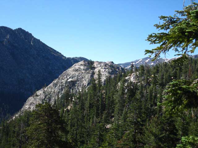
The North side of Golden Canyon to the Southern SharkfinThe Lay of the Land, Options... We encounter a volcanic "sharkfin" formation approaching Murray and Golden Canyons from either the North or the South. The video clips in the following film show the sharkfins located on the Northern side of Murray Canyon and the one that marks the Southern side of Golden Canyon. The Sharkfin on the Northern side of Murray Canyon is noted as Peak 9362 while the one on the Southern end of Golden Canyon is Peak 9501. Murray and Golden Canyons are located in quick succession between these landmarks. These sharkfin formations are identifiable as volcanic rock similar to the structure at Devils Post Pile. The difference is that these rock piles did not cool at the proper time and temp to produce the perfect octagonal hexagonal columns as the rock at the Postpile did. They are unique. These sharkfins are composed of uneven columns of rock that are falling apart, falling into the rough outline of sharkfins to the imaginative eye of the distant solo hiker. Added to the sharktooths formed along the Sierra crestline by erosion of the hard volcanic crestline to our North, I note this section of trail from Wolf Creek Pass to the South end of Golden Canyon "sharkfin and sharktooth territory." These unique features are quite distinctive landmarks. Check out the following video for a look at this section of the Pacific Crest Trail.
Ebbetts Pass to Sonora Pass |
Looking North into Golden Canyon
The deeply-cut PCT dropping into the North side of Golden Canyon. Such deeply cut sections of the trail are rare in the North Sierra. This particular example is as much a product of its location and role in the Spring Thaw as it is of backpacker traffic. A couple of block-rocks properly set will stop the Spring Thaw from continuing to cut a seasonal creek through this section of trail. This points out a different problem. Park Funding. We are hiking across the Carson Iceberg Wilderness in the Toiyabe National Forest. The Toiyabe is one of the biggest, and financially thinnest stretched, of all the Forests that administer the Tahoe to Whitney Trails. That's the real reason why the trail along Raymond Peak, the trail below, and the trail across the South flank of Sonora Peak are often in sketchy condition. We don't spend enough on our National Forest, our National Park, or our CCC trail crews. Don't blame the trail crew. They only expertly execute their instructions. |
||
 |
||
We can see Boulder Creek's Western drainage behind Golden Canyon's Southern limit. The PCT bends around to the Right, following the perimeter of Golden Canyon up high enough to keep it above the wetness of the Spring Thaw. During Summertime you will rightly question this long route around the canyon, while during Spring you will be happy it takes the high route around the floor of the canyon.
|
Disaster Peak
| Western Upper Golden Canyon topped by Disaster Peak. | ||
 |
||
The Pacific Crest Trail heads South tracing the long way around the upper rim of Golden Canyon, around to the Right. At the head of the canyon sits Disaster Peak. During Summertime it sometimes seems as if the trail takes the "long way" around rather than across features such as Golden Canyon. True That. One look at the quagmire conditions that come with the Spring Thaw will show you why the trail route stays high on the mountain around the center of both Murray and Golden Canyons. But the route that makes sense during Spring makes no sense during Summer. Until we wrap our mind around the seasonal cycle here. Then the trail makes perfect sense. Brush and dense undergrowth make the trail vital during Summer, but once the snows of Winter cover the terrain the best routes open up too. The trails are intentionally designed to loop around areas of early-season wetness. Trail routings that make no sense at all during Summertime are the height of Trail Route Logic during the Spring Thaw. Check the Trail Crew and Trail Work Forum.
|
Valley Heat
and
Moisture Surging
up the
Western Sierra Flank
DANGER COMING
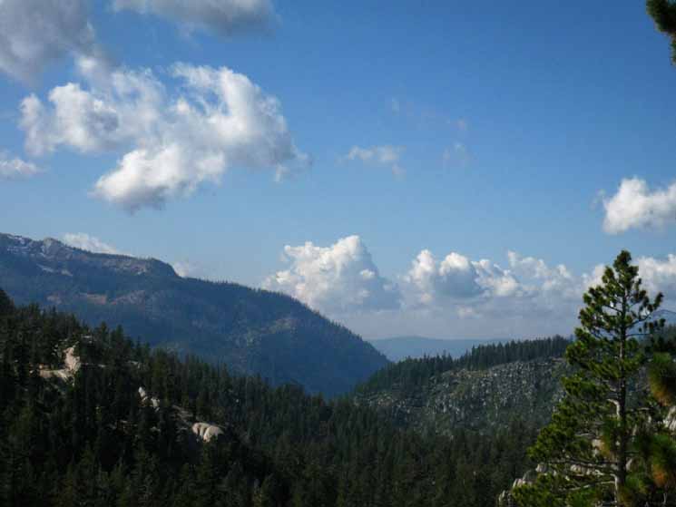
July, Noon: Summer heat carried in clouds of moisture exploding into action blowing up from the Valley over the Western flank of the Sierra. We are just below the Sierra Crest on the Eastern Flank of the Sierra looking West at the leading edge of a shock wave of heat and moisture concentrating into the potential for violent electrical storms and heavy downpours. |
 |
Watch these Bad Boys Carefully! IT IS ON "A freight train is a-coming, packing big heat, Heading South on the Pacific Crest Trail from Golden Canyon we will eventually hike to a long exposed crossing up, around, and down Sonora Peak to Sonora Pass. When we climb South out of the East Carson Headwaters we will be climbing out of the last fringes of protective forest onto an exposed traverse over 5 miles of high elevation across the barren flanks of Sonora Peak to reach Sonora Pass. Very dangerous under strengthening thunderstorms spitting lightening. Northbound long distance hikers face the exposed crossing of Tyron Peak, if lightening storms are developing. Other than those two sections we do have exposed crossings, but they are lower down in the terrain, short, and fairly safely passable with common sense. The key is to stay safe under the weather. When lightening fires up I follow the forest line around exposed meadows and other dangerous locations the route of the trail might cross when the lightening is striking. I follow the safest route when possible, and when a safe passage is not possible I hunker down and set up camp in a safe location until I can cross the exposed terrain in safety. Hiking over Sonora and Tyron Peaks during active storms is stupid; it leave our asses hanging out for lightening to strike. Crossing these exposed sections is highly unadvisable if these thunder clouds continue to mass up, deepen, and build strength as we approach our high exposed crossings. Timing is going to be our key to passage across exposed high elevation positions if active weather is brewing. My observations indicate these dangerous lightening conditions build passively until around 2 pm in the afternoon (different times on different days with differing conditions), when the massing clouds explode into violent thunderstorms packing heavy lightening and downpours, even light snow and hail. Hot temps (100+) in the Valley pushed up the Western flank of the Sierra by an onshore breeze can knock things off the hook. Especially since recent weather changes have moved much more humid masses of air further North. These conditions require that we continually calculate the time we expect to cross exposed terrain against our observation of the evolution of atmospheric conditions. If afternoon heat condensation storms are brewing up, we must recognize them early, and be able to time our exposed crossings to avoid them. If these clouds consolidate into a thunder and lightening storm we will make camp in a safe position rather than attempting an exposed crossing through these extremely dangerous lightening conditions. Anticipate, Observe, Analyze, Act, React. At the very least, Don't be a Dumbass. Drawing on our experience is one thing, putting it into a historical context is another. The top two historical causes of death for backcountry travelers are crossing rivers and lightening. Don't become a statistic. Keep your eyes on the skies and be river-wise. This means that stopping or turning around are always options. |
Golden Canyon & Paradise Valley trail junction on the Pacific Crest Trail
| Golden Canyon to the East. | Paradise Valley to the West. | |||||
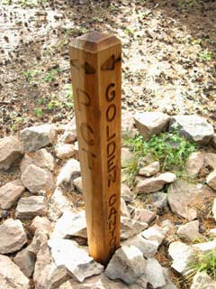 |
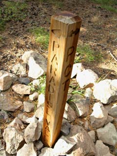 |
|||||
The PCT North and South. |
3.16 miles through Paradise Valley sits Disaster Creek.
|
Golden Canyon trail Junction Miles 3.76 miles East to the East Fork of the Carson River Trail.
Goldern Canyon is 12.73 miles South of Ebbetts Pass Goldern Canyon is 16.71 miles North of Sonora Pass Miles and Elevations |
Paradise Valley West Miles From the Disaster Creek Trailhead on the Clarks Fork Road to its Northern tee into the trail from Gardner Meadow to Wolf Creek Pass, the length of the Disaster Creek Trail is 7.02 miles. Hiking West from Golden Canyon around the North side of Disaster Peak through Paradise Valley down to Disaster Creek locates us 4.11 miles South of the trail T between Gardner Meadow and Wolf Creek Pass, and 2.91 miles North of the Disaster Creek Trailhead on Clarks Fork Road. This connector trail is one of four that makes great loops out of Highland Lakes or the Clark Fork Road between the PCT and TYT possible. Disaster Creek Trailhead to Lower Gardner Meadow 1st Junction, to PCT S of Boulder Peak 2.83 .08 2nd Junction, to PCT @ Golden Canyon 2.91 1.27 3rd Junction, spur trail 4.18 .75 Entering Arnot 4.93 .72 Arnot Creek ford 5.65 .52 Junction with Arnot Creek Trail / Upper Gardner Meadow 6.17 .85 Junction with Gardner Meadow Trail 7.02 For more information about backpacking loop trips around the Carson Iceberg Wilderness read the trail guide, especially the notes on the top of the Jenkins Canyon guide page and the Jenkins Canyon- Highland Creek Map. |
Golden Canyon CampsitesThe Lay of the Land Just South of the Golden Canyon-Paradise Valley trail junction on the Pacific Crest Trail sits a little city of campsites on a wide forested flat.
Miles and Elevations |
Campsites South of Golden Canyon trail junction
| Campsites South of Golden Canyon Trail Junction | ||
Video: Golden Canyon Campsites, 1:04. Check the Asa Lake to East Carson River
|
View to the Southeast hiking across the Center of Golden Canyon
East Carson River Canyon
| View Southeast: We are now getting grand views of the upper reaches of the East Carson River Valley. | ||
 |
||
Golden Canyon drops away to our Left in the foreground, the Southern Sharkin sits middle-left marking the Southern extent of Golden Canyon and the location of the swampy lake, and the great gorge of the East Carson beyond shows us our way South towards its headwaters bowl sitting under the Southwestern flank of White Mountain in the far distant Right of the image above. Peak 10990 rises in the distance above the top Left of the Southern Sharkfin and Whitecliff Peak is out of view just off the Left edge of the image.
Carson Iceberg Wilderness Hiking Map |
East Flank above East Carson River
| Darkening clouds brings out deep contrasts in the terrain. |
 |
I can't get enough of the East Fork of the Carson River... The great red peak is Peak 10990 just a bit South of Whitecliff Peak along the top of the Eastern wall of the East Carson River's Canyon. Carson Iceberg Wilderness Hiking Map |
| Until I've plainly gotten enough... | ||
 |
||
One beat Al, East Carson River Headwaters during a trip up through the East Carson, Winter of 1998. |
Ancient Rock Star: The Lahar
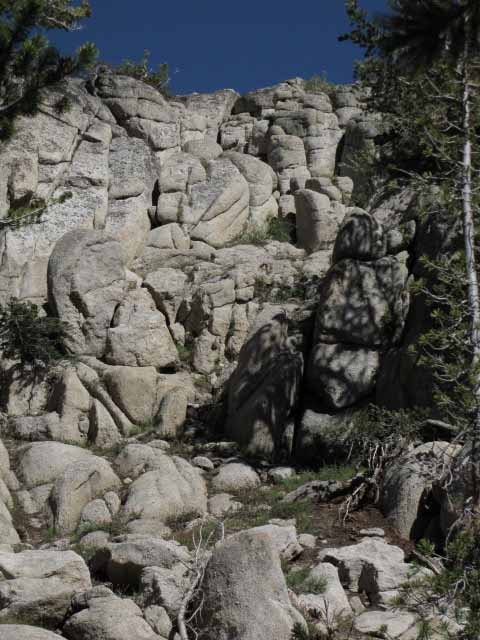
| Detail of great granite formations eroding out of their ancient volcanic jacketing. This "jacket" was applied by the ancient volcanic debris flooding of a massive lahar. |
 |
The hard granite terrain making up the East Fork of the Carson River was first deeply and steeply cut into a narrow North-South valley by glacial ice. The toughness of the rock and its tight jointing resisted the power of the ice, only allowing a narrow channel to be cut through the rock. The rock did not allow this channel to be cut Eastward, downward with the flow of gravity out of the Sierra, but forced the ice to flow North. The gorge and its surrounding terrain was subsequently flooded-drowned really-10,000 years ago by ancient flows of volcanic debris from a series of massive eruptions. These flows were thousands of feet deep. Super-Lahars, I would say. I think about the timing of the last massive volcanic eruptions that rocked the Sierra as I observe the remnants of the ancient ferocity of their Lahar flows. The remnants of these flows stretch down the Sierra Crestline from Lake Tahoe to South of Reds Meadow creating a convoluted interface between granite, volcanic, and metamorphic rock with small bits of Super-Ancient pre-Sierra uplift rock thrown in for good measure. I imagine massive volcanic eruptions from Lake Tahoe down to Mammoth Mountain exploding out from under and around deep granite valleys already buried under thousands of feet of glacial ice. What a mess that made. Judging by the scope of these ancient lahar flows, which were big enough to literally bury tall mountains and drown deep valleys under thousands of feet of flowing liquid volcanic debris, many of these granite valleys quickly transformed their massive loads of ice into massive lahar flows. For thousands of years since then some of the granite peaks of these submerged mountains stuck out through their surrounding ocean of volcanic debris. Runoff water cut rivers into the volcanic debris filling granite valleys buried below. For thousands of years granite islands were the only sign of the existence of the grand granite terrain buried far below. Today the ancient granites of the East Carson River are emerging from their volcanic grave. The terrain is losing its volcanic jacket. Thousands of years of water, ice, wind, tectonic uplift, and chemical breakdown have scoured some of the soft but persistent volcanic remnants off of the underlying granites along the East Fork of the Carson River, revealing the grandeur of the ancient granites below. The Pacific Crest Trail winds around and through many of these granite islands floating in this slowly diminishing high tide of volcanic debris as we hike through the East Carson River drainage. |
Whitecliff Peak to the East
Whitecliff Peak, peeking out over the top of the great rock formation in the foreground, which divides two great hanging valleys on the East side of the East Carson River gorge. In the foreground we are looking over the South end of Golden Canyon. |
 |
Each of these two successive hanging canyons along the West wall of the East Carson River Canyon has a major creek running out of it. I've long looked at both of these remote canyons as potential places to explore. I'll bet that both these valleys are full of bear, deer, and trout. I've hiked through Murray Canyon a couple of times during Spring, but it was so full of mosquitoes and soft terrain that I never tarried. Silver King Creek sits on the backside, the East side of Whitecliff Peak and its hanging canyons. It is incredibly quiet back there along the Silver King Creek. Carson Iceberg Wilderness Hiking Map |
View South-Southwest
| In the distant South we can see Leavitt Peak. | ||
 |
||
I'm always trying to figure out distant mountains to better understand where I am in the grand context of the Sierra. Long views Southwest begin to open up as we hike around the upper Western edge of Golden Canyon approaching Golden and Swampy Lakes. We are again getting a look across the Western flank of the Sierra Nevada, the first since hiking from Tyron Peak to Wolf Creek. We are looking across the upper reaches of the Clarks Fork of the Stanislaus at the high point of the great Sierra Massif rising to the South of Sonora Pass capped by Leavitt Peak. Leavitt Peak is the snow-stripped peak on the Left of the image.
|
Leavitt Peak to the South
| Same Range July 2009. |
 |
The upper image was taken in October of 2011 and reflects the snow cover that remained on the mountains through the shortened Summer backpacking season. |
Rock-Bound Creek on the South Side of Golden Canyon
| As we gently climb South out of Golden Canyon we encounter this rock-bound creek and feeble pool I have always identified as Golden Lake. Some of the rocks are granite, some volcanic... | ||
 |
||
No shade, but fresh cold water. A short ways South of here we exit Golden Canyon approaching the Swampy Lake and Sharkfin 9501. Neither Golden Lake or the Swampy Lake are great places to camp, though Golden Lake's active stream offers water. It's much harder to get water out of the Swampy Lake because there is no distinct shoreline, only a transition from soggy soil to deeper soggy soil. By the time we are far enough out to get water we are up to our ankles. Combined with the heavy mosquito population fed by the widespread moisture of the Swampy Lake, this is not a great place to camp.
|
South Sharkfin & The Swampy LakeThe Lay of the Land
Check your map USGS Disaster Peak 7.5 quadrangle against your hiking map. Your hiking map should depict this lake as swampy... If not, your map is wrong.
Wolf Creek to Swampy Lake Unmaintained Trail Section Note that there is a trail junction at the lowest left corner of the map. This unmarked and unmaintained trail runs down to Disaster Creek. I've never hiked down it, but tracks I've observed here indicate that this trail is used heavily by horses in Fall. I've always entertained an unspoken assumption that the cowboys who come up here for Fall Roundup have a campsite down there. That's what the tracks indicated during a couple of Fall trips through here, and it accounts for my observations. This area has long been under grazing leases. The cowboys are all over the mountains during late September and early October. They use these faint trails to chase their cows around when they round them up in October. This rough cross-country trail twists its way Northeast down to a junction on the Disaster Creek Trail 2.83 miles North of the Disaster Creek Trailhead at the top of the Clarks Ford Road. If we head North up Disaster Creek instead of South we will have a 4.19 mile hike up to the junction with the trail between Gardner Meadow and Wolf Creek Pass. I have a picture of this faint trail off of the Pacific Crest Trail, but I can't find it... |
Mole Casings on the Trail:
Unique for October on the Pacific Crest Trail
| Mole Casing decorating the center of the Pacific Crest Trail, October 2011. |
 |
See Fall Report: Carson-Iceberg Oct 2011 for a discussion of trail conditions and the message mole casings on the trail in October is sending. Both the Tahoe to Yosemite and Pacific Crest Trail routes were littered with mole casings during October of 2011, signs of the very short Summer of 2011. Mole casings are remnants of the moles cleaning out their underground passages when the surface is covered with many feet of snow. The moles make tunnels in the snow above the ground, which they fill with the soils they dig out of their underground burrows as they cut new tunnels and clean up the old. When the snow melts during Spring we begin to see these tubes of soil emerge from snowbanks, until the disappearance of the snow leaves long lines of tubular soil across the terrain and trail. During a normal hiking year these fragile tubes are quickly trodden into dust during early Spring. But we will still see these remnants of last Winter's underground activities when the snow sticks to the mountains deep into Summer. Summer snow discourages Summer backpackers, which leaves these mole casings undisturbed, and still visible in October. |
Team Opus at the Swampy Lake
 |
||
Dudes at Swampy Lake. These are two of the four members of Team Opus, who we also encounter to our North at Wolf Creek Pass. They were not real happy with Swampy Lake. Their planning assumed it was a reasonable campsite, but they had a hard time getting water out of the long interface between swampy shore and water deep enough to draw from.
|
The Swampy Lake
Sharkfin 9501
| The Pacific Crest Trail bends South around the the East shore of the Swampy Lake to pass between the lake and the breaking-down hulk of Peak 9501. | ||
 |
||
Peak 9501 is composed of a great mass of volcanic terrain that cooled into rough columns.
|
Base of the Southern Sharkfin
| Neat boundary between rock and grass. |
 |
The uniform nature of this volcanic rock's formation causes a uniform breakdown of the feature over time. Two Sharkfin formations and Two Canyons: |
Swampy Lake Browning Up
| Looking Southwest towards where the Swampy Lake and its accompanying marshy area drain into the Boulder Creek watershed. |
 |
Swampy Lake's wet meadow in Fall. |
Swampy Lake in Early Summer
| Swampy Lake displaying Spring Conditions during July. |
 |
Can you hear the mosquitoes buzzing? I can. |
Video
Sharkfin 9501 and the Swampy Lake
| South of Golden Canyon | |||
Video: South Sharkfin and Swampy Lake. 3:37
Two Sharkfin formations and Two Canyons: |
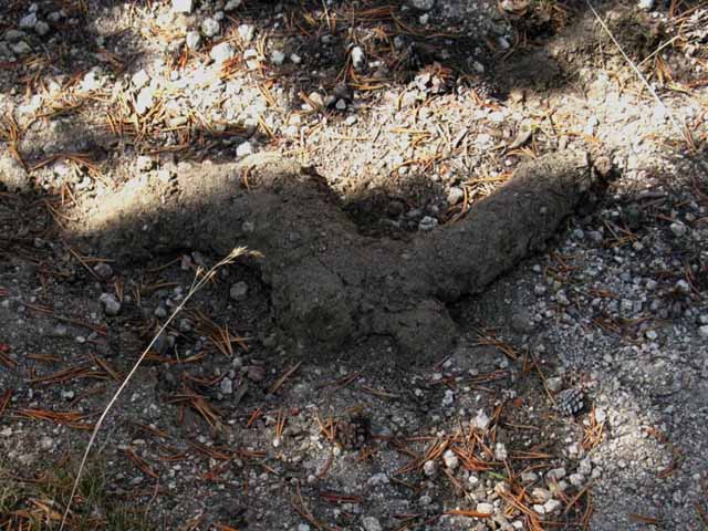
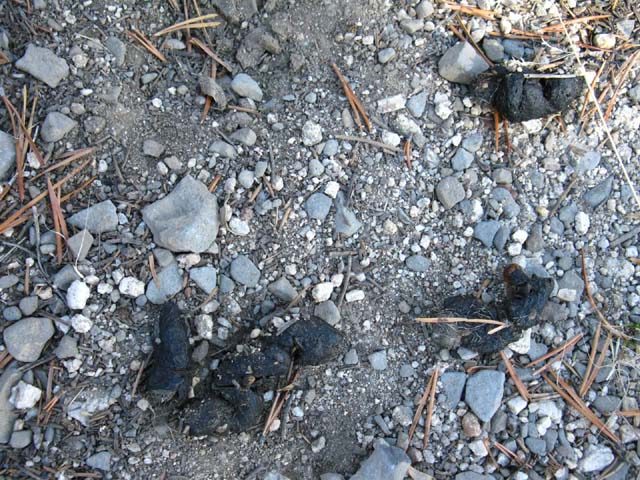
The bears are active-if unseen
| Old Bear Tracks near Swampy Lake. |
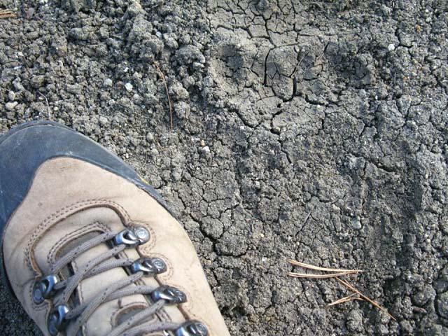 |
Note how the toe prints share footprints... the arc of the toes give it away. The upper bear print overlaps the lower, with the toes centering both. The last wet soil conditions here sufficient for these prints was 10 days prior. |
Bear Country This is Bear Country. Lots of bears have been prospering in these mountains for centuries. There is a big rectangle of terrain on the Southeast side of the Carson Iceberg Wilderness filled with remote untrailed mountains and valleys that has provided excellent almost-undisturbed bear habitat for a very very long time. These are not the human acclimated fat bears you see in Yosemite Valley, though there have been some disturbing behavior changes during the last decade. These bears still sleep at night, still fear people, and generally only tap humans for food in quick twilight "hit and runs," when they try to snatch up goodies as they bolt across your camp when you step out of camp. A fat, fully Human-acclimated Yosemite Bear sneers at such haste and discretion. Acclimated bears just walk right into camp with me standing right there, peruse my food defenses at their leisure, while I beat a retreat and commence bouncing rocks off bear's head. The bear says, "Ho-Hum, rocks are below my notice," and continues to nonchalantly scout out my resources. Partially acclimated bears are very nervous approaching humans. "Nervous" around humans is the status of the most aggressive bears along this section of the trail, by my observations. They're very nervous, and scare off easily. But, bears are also very hungry, and if they have been previously successful at obtaining food from humans their hunger will control their fear, and bear will try again. It is your job to reward the bear by making it regret ever approaching humans. Don't ever hurt the bear, but thankfully instilling fear does not require pain. Hurt the bear's feelings. The slow but sure trend of increasing bear contact through here is likely to decline. Bear hunting has started up earnestly in these mountains again, out of the Little Antelope Pack Station. This will certainly reverse the recent slow trend of bears becoming more aggressive in this area. Once they figure out that people are shooting them they will stay as far away from us humans as they can. Comments Trail Comments |
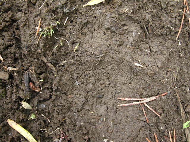
| Old bear turds by the old bear tracks. |
 |
I looked at these a long time before deciding, no, not coyote turds, These are hungry bear turds. Too big for coyote, though you may not pick up the scale from the image. |
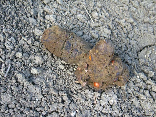
| Recent bear track, just a bit further South down the trail from the Swampy Lake. |
 |
I put the prints at 3 days +, though the nearby turds appeared older. |
| Near the track above: a more recent bear turd. |
 |
There's lots of bears in the East Carson River Valley and its associated remote Eastern drainages including the Silver King Creek and Fish Valley. The bears here have long been scared of humans, but during the last ten years they have been getting acclimated to people, and getting more "aggressive." Prior to this trend they were opportunistic. Little Antelope Pack Station has begun active operations again, which includes bear hunting. This appears to have put the fear of humans back into the bears of the East Carson River and its associated drainages. |
Swampy Lake
|
| Ebbetts Pass to Wolf Creek Pass 15 minute backpacking MAP |
Asa Lake to East Carson River 15 minute backpacking MAP |
Miles and Elevations
Ebbetts Pass to Sonora Pass
Pacific Crest Trail Miles and Elevations
We get our first full look at the grandeur of the East Carson River Canyon's amazing granite walls as the trail works its way South out of Golden Canyon. A grand view up the East Carson River opens up as we swing East to a fine overlook after passing South between the Sharkfin and the Swampy Lake.
Continuing South the trail executes a ninety-degree turn West to begin dropping down to cross the highest reach of Boulder Creek on the West side of Boulder Peak. After crossing tiny Boulder Creek the trail bends Southward to almost parallel the creek South. Fifty feet South of Boulder Creek there are fine camps on both sides of the trail.
After climbing South past the creek and the campsites the trail turns directly East to climb up through a beautiful granite and forest channel back up to the very edge of a cliff overlooking the East Carson River's gorge on the South side of Boulder Peak. Here again we get an excellent view of our upcoming terrain South, or back at the terrain we just crossed if we are hiking North. Always turn around!
Sometimes the best views are behind us!
Keep your head on a swivel.
We continue the moderate climb South that began when we crossed Boulder Creek, but now the trail South is tracing the arcing top edge of a steep tributary chute plunging down to the East Carson River far below. We work our way up and over a ridge arm descending off the Sierra crest down the Western Sierra flank. This ridge arm divides two of the Westward draining canyons that feed Boulder Lake and Creek. We just camped along the Northern drainage holding Boulder Creek, now we are crossing into the unnamed drainage running down to Boulder Creek, along with the trail down to the TYT via Boulder Lake and Creek.
Everything to our East of where we are standing drains into the East Carson River, and flows East into the desert. Everything West of where we are standing eventually drains into the Clarks Fork of the Stanislaus River, and ends up in the Pacific Ocean.
Or a faucet in L.A...
After topping this nicely forested Sierra ridgecrest we have a short walk down to the Boulder Lake Trail Junction.
The Boulder Lake Trail junction is 17.71 miles South of Ebbetts Pass.
The Boulder Lake Trail junction is 11.73 miles North of Sonora Pass.
To overlook the East Carson River
 |
The trail turns East from the Southern Sharkfin and Swampy Lake through the light forest behind Ari to a fantastic overlook of the great gorge of the East Fork of the Carson River. We can see the mountains on the East side of the East Carson River Canyon behind Ari to the Right. We're hiking South to overlook the upper section of the canyon. |
Hiking East to Overlook the East Carson River
 |
Hiking East to East Carson River overlook. |
The Upper reaches of the East Fork of the Carson River
| The final Southern extent of the East Carson River is visible from the Southside of Peak 9501. | ||
 |
||
Between Peak 9501 and the switchbacks down to (near) the East Carson River the PCT is constantly moving East and West and Up and Down following its convoluted route right along the actual crest line dividing the Eastern and Western drainages off of the Sierra Crest, while enjoying the amazing views in all directions this convoluted route provides through holes in the forest cover and high spots. This section does not look like much on the map, but it will work you hard for the views.
You should be ready for this difficult terrain by now. Pacific Crest Trail Hiker Note IF you are coming North through here on the Pacific Crest Trail you have just ended the very difficult 75 mile long "Five Canyons" section between Tuolumne Meadows and Sonora Pass. This current section of trail between Sonora and Ebbetts Pass will be a cakewalk compared to the previous section of the trail, but it is likely that you will underestimate the challenge that the Sonora to Ebbetts Pass section presents. You will pick up speed on this section, but not as much as you thought. I watch you guys every year. I watch the Spring Thaw carefully to inform you of its particulars, and I almost always plan a long trip South down the PCT at just the right time of Summer so I can get a good sample of the character of each year's crop of Pacific Crest Trail hikers. (2010 PCT & Hiker Sample-this guide contains all prior PCT hikers encountered and photographed...) And I report what I see. I've seen PCT hikers expect that crossing this section between Sonora and Ebbetts Passes would be easier than it is. Southbound Tahoe to Whitney Hikers Reaching Sonora Pass will put the Southbound hiker coming out of Meeks Bay at around a hundred miles of hiking, give or take a few odd miles. The PCT route South from Lake Tahoe gets gradually harder as you head further South through each section of the trail, and this section between Ebbetts and Sonora Passes is the most difficult yet. The next section between Sonora Pass and Tuolumne Meadows is harder, higher, and twice the distance. As with the Northbound PCT hiker, you too have gradually become hardened by your previous sections and should be ready for the toughest section yet. Or not. The section between Ebbetts and Sonora Pass is your first section of sustained high elevation travel. All Hikers You have to judge your physical condition and make good decisions as you proceed down the trail. If you need a day off or two to rest and feed up before crossing the Carson-Iceberg Southbound, then hitch down to Lake Alpine, set up a nice pirate campsite in the National Forest lands, head over to the Lake Alpine Lodge or Bear Valley, and kick back to eat and rest for a full day. The same opportunity exists at Kennedy Meadows on the South side of the Carson-Iceberg. Northbound hikers have just resupplied, rested, and fed up at Kennedy Meadows Pack Station and should be well fueled and rested for this, their last section of difficult high elevation trail. Trail difficulty moderates on each of the next two trail sections heading North into the Lake Tahoe Basin. |
Eastern Wall of the East Carson Canyon
| Detail of rock formations above Eastern side of the East Carson. Peak 10440 with Whitecliff Peak rising in the background. |
 |
This section is full of fine terrain that I strongly suggest you take the time to observe... Too many PCT hikers run through here with their eyes glued to the trail, seeing nothing of the environment they are passing through. |
Video
Along the Sierra Crest
| South Side of Sharkfin 9501 to the Boulder Lake Trail Junction | |||
Video: The PCT between Ebbetts Pass and Sonora Pass. 5:48
|
Around Boulder Peak
| Passing a jumble of exposed granite dropping down Southbound towards Boulder Creek. |
 |
Located between the Swampy Lake and Boulder Creek. |
Down the West Flank
 |
||
Looking West down Boulder Creek as we begin to follow it West around Boulder Peak.
|
Granite Features
 |
We're looking Southeast over our Left shoulder up at the Northwest flank of Boulder Peak as we walk Southwest, to our Right along Boulder Creek down around Boulder Peak into sweet quiet forest. |
Deer on Boulder Peak
| Winding South around granite and down through forest toward Boulder Creek this fawn and I noted each other's presence. |
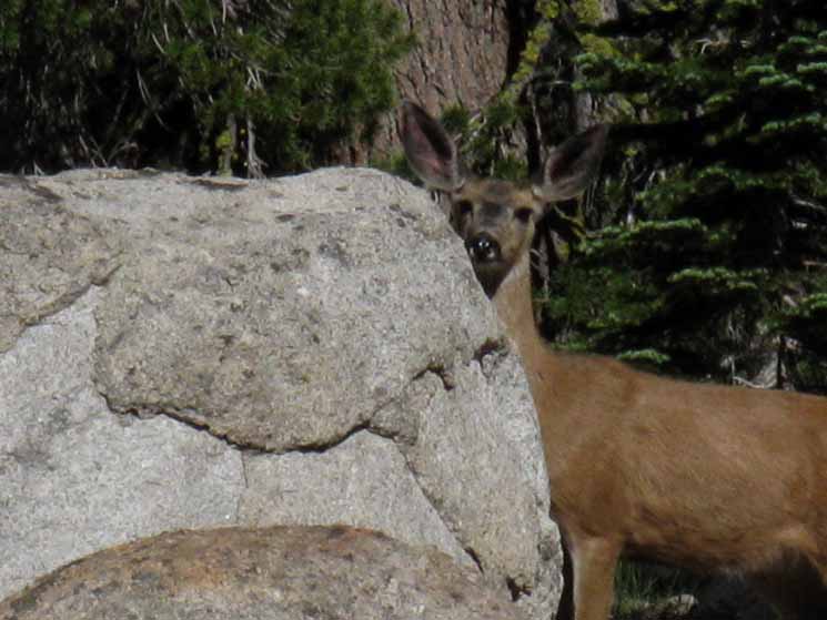 |
She was a bit skittish and inclined to split. |
| But a little sweet talking brought her out. |
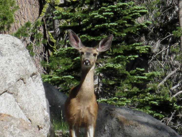 |
Hey Baby! How's Life? She was fat, strong, and looking sharp. She was thinner than the stout girl at Round Lake and certainly not as crazy as the deer running around Fourth of July Lake. |
Boulder Creek
| Up at the top of Boulder Creek in July. | ||
 |
||
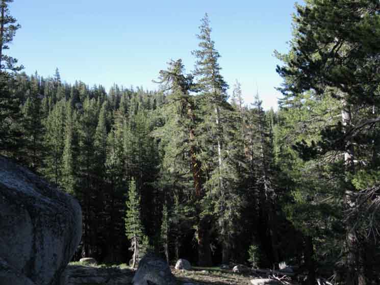
The quiet sound of tinkling water, the refreshing moist air in the little concentration of forest within the fold of the mountain here, and the relaxing forms of the granite made me look for the nice campsite I knew would be nearby.
Boulder Lake junction to Sonora Pass Map
|
Boulder Creek Campsite
| A few feet South of crossing Boulder Creek on the West side of Boulder Peak we find nice campsites on both sides of the trail. |
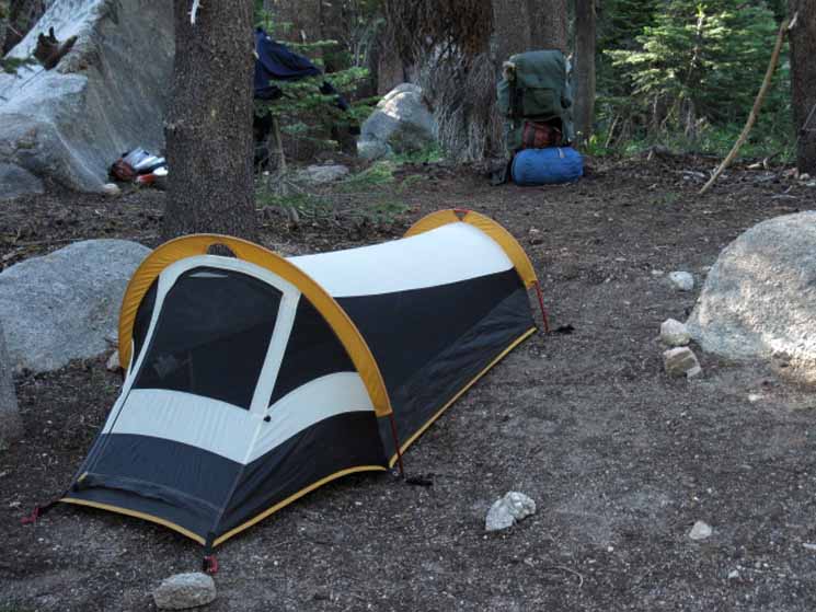 |
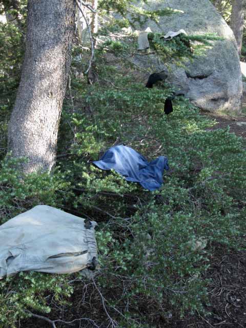
An early stop along the trail, fine weather, and easy access to water makes this laundry day. |
| Laundry Time. | ||
 |
||
The Dry Cycle. |
Hiking Down around Boulder Peak
 |
At the bottom of our Westward turn down Boulder Creek we turn East, bending up to our Left back up to the Sierra Crestline. |
Southwest Flank of Boulder Peak
 |
Looking Northeast up towards the crest of Boulder Peak while working our way around its Southwest flank. |
 |
Hollow. |
View North
 |
Southwest flank of Boulder Peak. |
View East Hiking East
 |
As we finish our loop around the West flank of Boulder Peak we climb East up a channel on the South flank of Boulder Peak up until we get a glimpse over the treetops across the gorge of the East Carson River at the mountain rising from its Eastern Shore. East Carson River from South flank of Boulder Peak. |
Trail and View Turn South
Stanislaus Peak
 |
Stanislaus Peak comes back into view, seeming to tower higer above us as we hike closer. |
Stanislaus Peak
 |
Note how Stanislaus Peak's volcanic bulk did not quite cover this exposed patch of granite on its Eastern Flank. This characterizes much of the charm of this area, where granite is bursting out of ancient volcanic encasements in a geological scale slow motion movie as the soft volcanic terrain melts away over time. |
East Wall of the East Carson River Canyon
 |
Looking across the East Carson River at the great canyon cut into the East flank of the East Carson River's Canyon. I've had aspirations to explore it, but have not yet found the oppertunity. Carson Iceberg Wilderness Hiking Map |
View to the Southwest
The Tahoe to Yosemite Trail
Boulder Creek Draining
into the
Clarks Fork of the Stanislaus
| Crisp late-October Morning: Looking SW from the Southern flank of Boulder Peak we can see the Boulder Creek drainage and its little canyon rising above the Clarks Fork of the Stanilus and the Tahoe to Yosemite Trail running alongside it. |
 |
The Clarks Fork of the Stanislaus River with the Tahoe to Yosemite Trail running alongside it are sitting at the base of the massive mountain mass dominating the center-left of the image above. The Boulder Lake Trail runs down the obvious angle below us in the image above, connecting the Pacific Crest Trail with the Tahoe to Yosemite Trail. |
East Carson River Headwaters Bowl
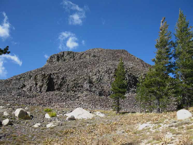
"The Plug"
Getting closer to the East Carson River Headwaters Bowl and the Gap over it. We have a clear view of the massive granite feature rising out of the West shore of the East Carson River ahead, the Right side, which I call "The Plug." The Plug is the pyramidal-shaped chunk of granite rock in the lower-middle of the far-right side of the image below. |
||
 |
||
Our Southbound trail goes around the backside of that feature. I call this huge granite dome feature "the plug," because of its role in affecting the route of the unmaintained trail coming up the East Carson River as well as our PCT route down to the East Carson. The Plug does the same thing to both Southbound trails; it forces them to go around it before being able to gain the Sierra Crest. For Northbound hikers on the PCT The Plug is what greets us after descending from the headwaters bowl to our lowest point in the canyon. From there we climb back up to the Sierra Crest on the South side of The Plug. Northbound hikers climb the switchbacks on the South side of The Plug to gain access to the Sierra Crestline. From our position in the picture above our Southbound PCT route circles around the backside of The Plug before switch-backing down to the East fork of the Carson River. The unmaintained trail coming up the East Carson River, along its Eastern shore far below us, has to get past the plug before fording the East Carson and joining up with the Pacific Crest Trail. The East Carson Trail junction with the Pacific Crest Trail is a short distance upriver from the base of The Plug. South of the plug our Pacific Crest Trail route parallels the East Carson River up to the headwaters. North of the plug the Pacific Crest Trail follows the Sierra crest line along the West Rim of the East Carson River Canyon.
|
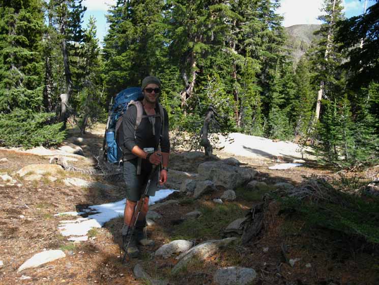
Cowboy Encounter
| Cowboy Steve. |
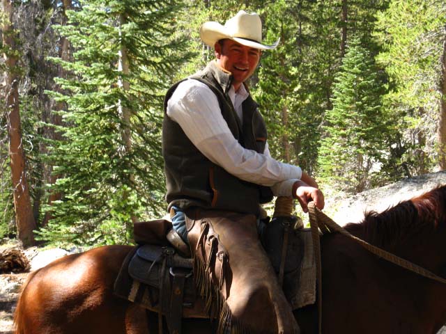 |
I met Steve's three stock-seeking dogs before I met Steve. Funny Story. I call it... The Great Al Roundup, or "I'm not a cow." The dogs thought I was a cow, and I thought the dogs were wild. When they came through the underbrush to "round me up" I was ready to do battle with dogs. Listening to three animals approaching and flanking me was disquieting. Bears do not travel in packs, neither do coyotes, so I guessed wild dogs were on my trail. They were intentionally tracking and flanking me. I charged the dog on the left as they broke through the underbrush in unison. I saw what I instantly thought were three crazy dogs who had somehow packed-up in the Carson-Iceberg Wilderness. The dogs instantly knew they had met a frkn crazy backpacker. As far as I was concerned it was on. The dogs would die and I would live. The dogs, on their part of the deal, were quite surprised that I was not a cow, and were even more shocked that someone was charging them with threats of mayhem, death and a big stick. The dogs made themselves scarce quick. I instantly noted their puzzled looks and the fear in their eyes sparked by my aggression. This instantly informed me that they were not lost or wild dogs. I said, "good dogs," and all three wagged their tails in unison from their safe observation spots, as I expected they were. They were a team of working dogs. Then I heard the mounted rider coming hard and fast up the mountain. Steve rode hard up the mountain when he heard my battle-cry, knowing his dogs had not found the cow they were tracking. Steve rode up apologizing profusely. I assured him that all was well that ended well. The dogs returned and we had a formal introduction. They were not getting anywhere near me until Steve called them in. Steve's dogs were tracking a stubborn stray up Boulder Creek's drainage. His dogs had the wind to their backs and picked me up with their ears, so their noses had not rejected me as a bovine target. The dogs came in and nosed my hand, and let me give them a quick pat, but they were more concerned with finding the cow they were chasing than hanging out with me. They were good working dogs who liked their job as much as Steve. Steve's family has had a stock lease up here for generations. They come out in late September and early October to start rounding up their grazing stock and comb the deep valleys for strays and stubborn cows. Steve was as nice a guy as his picture indicates. We spoke for a while and went on with our different tasks through the Carson-Iceberg Wilderness. Down the trail his dad and brother rode by fast a couple of times trying to box-in the stubborn stray. The stray was doing everything in his power to avoid capture. The cowboys were chasing the cow through the mountainside ravines, then cutting up to the PCT to ride fast and hard to get in front of the stray's maneuvers, then cut off the trail back down the mountain to force the stray back down the drainage. Just another day in the Sierra. Late Sept 2009.
|
Two Views from the South Side of Boulder Peak
Boulder Creek Drainage South West to the Clarks Fork of the Stanislaus River
| Looking down two of the drainages feeding Boulder Creek on its way down to the Clarks Fork via Boulder Lake. |
 |
On the Left of this image there is a low ridge of brighter green trees descending SW in front of the higher ridge behind. The larger second ridge is capped with a granite crown coming down from the far Left of the image. Out of view to our left between these two ridges is where the trail route down from the Pacific Crest Trail to Boulder Lake heads West off the Sierra Crest. Directly in front of us is another drainage down to Boulder Lake, though un-trailed. A spider-web of trails run down across the central flat holding Boulder Lake before joining Boulder Creek on its way down to the Clarks Fork of the Stanislaus River. The Clarks Fork of the Stanislaus runs Westward in front of the mountain mass in the middle-distant center of the image, which is exactly where Boulder Creek joins the Clarks Fork of the Stanislaus River at the bottom of this Boulder Creek-Boulder Lake drainage we are overlooking. Crossing the low ridge on the left, to our South, will bring us to the Boulder Lake trail junction on the other side. |
Southeastern View of "The Plug," Peak 8990
From the South Side of Boulder Peak we can view details of "The Plug," Peak 8990 to our South, while overlooking the steepening upper reaches of the East Fork of the Carson River's canyon. We will pass around the backside, the West or Right side of The Plug to the switchbacks down to the East Carson River beyond. |
 |
Above: "The Plug," a feature on the East Shore of the East Carson River. Note Sonora Peak in far distant right under tree branch. From our position here on the South side of Boulder Peak we have a brief climb before the PCT drops down to meet the Boulder Lake Trail. There is another set of two short climbs South of the Boulder Lake trail junction that bring us around the backside of "The Plug." The next ridgecrest we climb is visible to our South above the exposed rock we can see poking through the trees between our position and The Plug. Crossing over that ridge the Southbound trail then turns West to traverse down the ridge's far side to a black pond before climbing Southeast to pass behind "The Plug." The location of the Black Pond is where another unmaintained route comes up to the PCT from Boulder Lake. I can simplify this: From here hiking South we go up & down, then up & down again. Then up one more time to behind "The Plug." On the other side of The Plug we have a short walk to the switchbacks down to the East Carson River. Check the 7.5 USGS Topo Map |
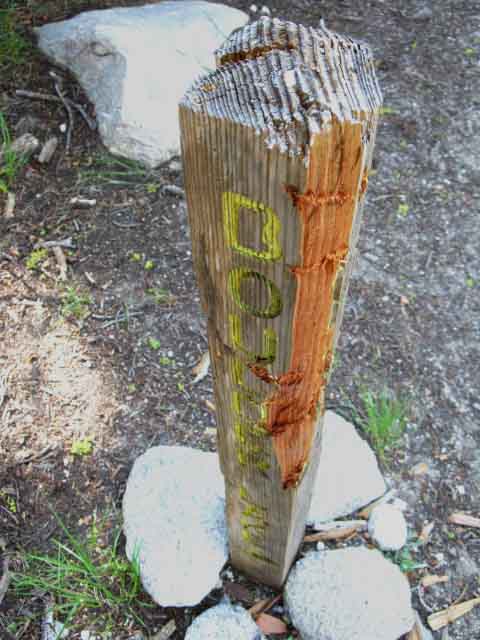
Boulder Lake Trail Junction
Hike
West to the TYT:
Boulder Lake Trail to the Tahoe to Yosemite Trail
along the
Clarks Fork of the Stanislaus
| 2011. Looking North, Boulder Lake to the West, our Left. |
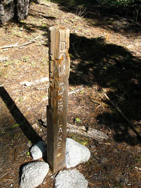 |
The Boulder Lake Trail Junction well decorated by the local bears. The trail from this junction heads almost directly West off our high position on the Sierra Crestline. Trail Guide Page: This trail connects our position on the Pacific Crest Trail with the Tahoe to Yosemite Trail via Boulder Lake. Map: Turing South from Boulder Lake junction on the South end of this trail follows the Clarks Fork of the Stanislaus River upstream on the TYT through some rough unmaintained trail and cross country hiking conditions to Saint Marys Pass. Saint Marys Pass is about a mile West of Sonora Pass along Highway 108. This connector trail can be used to craft great local loops around the Carson Iceberg Wilderness using both the PCT and TYT routes. This connector trail also offers a way for Southound hikers on the Tahoe to Yosemite Trail to bypass the difficult segment of unmaintained trail up the Clarks Fork over Saint Marys Pass by detouring around it on the PCT. |
| Boulder Lake trail junction freshly slashed in 2009. |
 |
| Hey. What's Up? I hope you are enjoying the trail as much as I. |
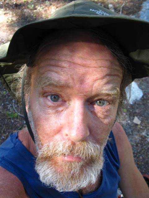 |
The 1000 yard Solo Hiker Stare. |
North: Tyron Peak to Murray Canyon West: Boulder Creek to the PCT South: Boulder Lake Junction to East Carson River
Hiking |
||||||
Ebbetts Pass to Sonora Pass on the Pacific Crest Trail.
7.5 Map North 7.5 Map South 30 min Map Next page South |
||||||
Backpacking Trail Guide North |
West Boulder Lake Trail |
Backpacking Trail Guide South |
Backpacker ForumsHave general experiences, trips, or stories about backpacking to relate? A fine piece of gear? Or gear that failed?Post it on
|
North: Tyron Peak to Murray Canyon West: Boulder Creek to the PCT South: Boulder Lake Junction to East Carson River
Trailhead
Contact
Alex Wierbinski

Backpacking Lake Tahoe to Mount Whitney:
Your Guide to the High Sierra Crest, including the Tahoe to Yosemite, Pacific Crest, and John Muir Trails
