Round Top Lake gion15 Lost Keys Lake
Killer Sunset at The Sisters near Carson Pass Lake Tahoe to Mount Whitney: Crown Jewel of the Pacific Crest Trail Need a Map? Lost Al near Lost Keys Lake
Topo Map Page Banner Image: Highway 108 to Highway 120 on the Tahoe to Yosemite and  Pacific Crest Trails.
Dicks Lake   Lake Aloha
Dicks, and Fontanillis Lakes from Dicks Pass

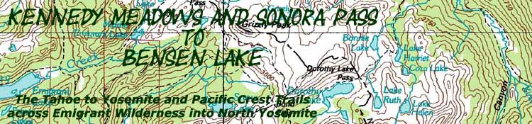
Kennedy Meadows and Sonora Pass to Bensen Lake

Tahoe to Yosemite and Pacific Crest Trail Routes across Emigrant Wilderness into Yosemite Backcountry

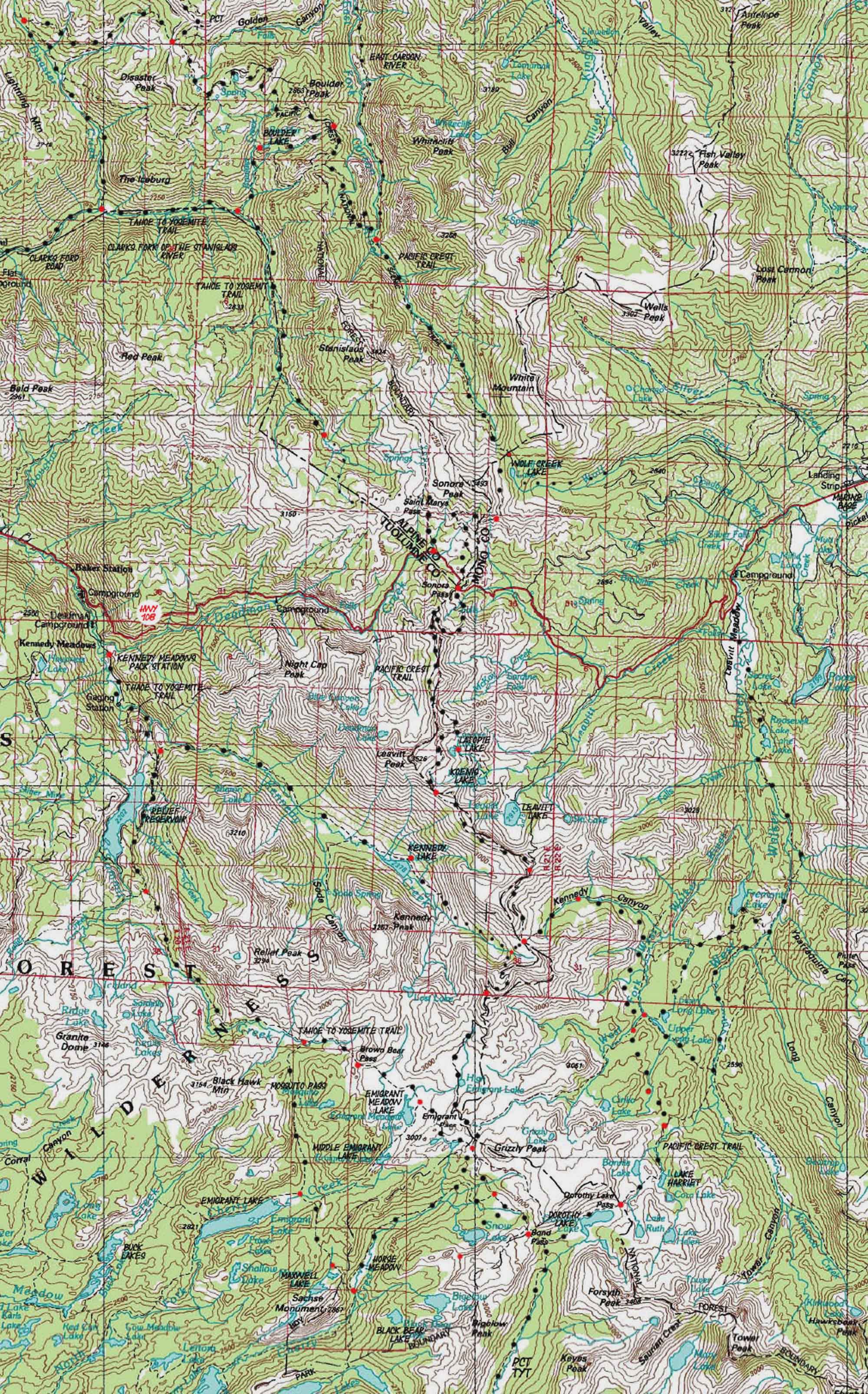
USGS 30 minute Backpacking Map

Aloha Lake under Pyramid Peak from Dicks Pass

Maps Index 

Highway 108
to
Highway 120

Trail Guide

Kennedy Meadows

Trail Guide

Sonora Pass

15 min map NORTH TYT

Lake Alpine to Saint Marys Pass

TYT 15 min map SOUTH

Kennedy Meadows to Relief Reservoir

PCT 30 min map SOUTH

Sonora Pass to Bensen Lake

TYT Miles and Elevations

Kennedy Meadows to Bond Pass

PCT Miles and Elevations

Sonora Pass to Tuolumne Meadows

Click map dots for links to Trail Guide Page

all maps   miles and elevations map information

Different routes of Tahoe to Yosemite and Pacific Crest Trails across Carson Iceberg Converge near Sonora Pass
The then split on Highway 108 Emigrant Wilderness converge in Yosemite's Jack Main Canyon

TYT SOUTH  Kennedy Meadows to Relief Reservoir                            Click Red & Black Dots                             PCT SOUTH: Sonora Pass to Bensen Lake

Sonora Pass area hiking map. next MAP page: Lake Genevieve to Middle Velma Lake

Location

Main Features

Highway 108 is where the divergent paths of the Tahoe to Yosemite and Pacific Crest Trails converge, and then diverge once again.

TYT
Southbound hikers on the Tahoe to Yosemite Trail Route Passing the unmarked Eureka Trail junction are following the Clarks fork of the Stanislaus River up past the Southern extent of maintained trail. Trail deteroriates as we progress up the canyon.

The trail from the lower ford to the climb over Saint Marys Pass is unmaintained route with long sections without trail, trailbed, ducks, or any indications of a trail. Figure on 6.24 miles of various degrees of unmaintained trail.

PCT

Mapping, Mileage, and National Forest Permit Information


Map Name
USGS Bridgeport, California & Nevada, 1985, 30x60 Topographic


Compass Offset
Magnetic North is 16 degrees East of True North


scale
1:100 000

Contours
50 meters


National Forest
Stanislaus

Wilderness Areas
Carson Iceberg
Emigrant

Physical location
Centered
on
Highway 108


next map:                              last map:

Elevations   More Information

Lake Tahoe: feet

Meeks Bay Trail head: feet

elevation rise: meters, or feet

Trail Guide, Section:

Trail Guide, Segment:

Google Map:


Map Credit

U.S. Geological Survey, Department of the Interior: The USGS

USGS MAP LOCATOR

Move the Map to the Sierras. Select size of Maps you wish to locate. Click "Mark Point" on map to see the USGS map grid of the selected map scale.

Map Information

Map Symbols

Trailhead
Comments: on this
Contact: Alex Wierbinski

top of page

Lake Tahoe to Mount Whitney

Your guide to backpacking the Sierra Crest, including the Tahoe to Yosemite, Pacific Crest, and John Muir Trails
© Lake Tahoe to Mount Whitney: Crown Jewel of the Pacific Crest Trail