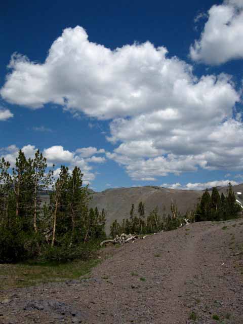
The Trails
Guide
Maps
Miles/Ele
Permits
Resupply
Forum
Current Weather Conditions
Weather Notes
Northern High Sierras
Central High Sierras
Southern High Sierras
Gear
Gear List
Gettin Started
Layering
Discussion
Testing yourself and your gear
Gear Reviews
Backpacking
SOUTH from the Kennedy Canyon junction
over
Big Sam across Emigrant Basin
to
Grizzly Meadow
Backpacking Emigrant Wilderness
Hiking
A Unique Route Between the Pacific Crest and Tahoe to Yosemite Trails across Emigrant Wilderness
Languages
Languages
Trail Arts
The art of walking
Physical Preperation
Trail Skills
The trail
Off the trail
Scrambling
Maps
Navigation
Camp skills
Food
Resupply
Food
Other
Photo Catagories
Trail Stories
Trail Culture
News and Science
Links
Groups
Books
Terms and Conditions of Use
| Guide INDEX Highway 108 to Highway 120 |
NORTH PCT |
SOUTH PCT Kennedy Canyon to Jack Main Canyon |
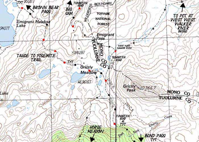
7.5 Topo MAP Emigrant Basin |
30 min MAP Sonora Pass to Bensen Lake |
PCT to TYT MILES AND ELEVATIONS |
TOPO MAP INDEX SONORA PASS |
Resupply North Kennedy Meadows. South Tuolumne Meadows |
National Forests Toiyabe & Stanislaus |
all maps index |
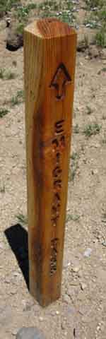
THE TUNGSTEN ROAD
Backpacking over Big Sam
around
Emigrant Meadow
to the
Tahoe to Yosemite Trail
in
Grizzly Meadow
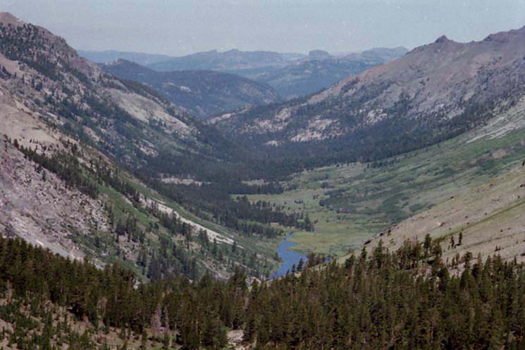
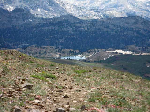
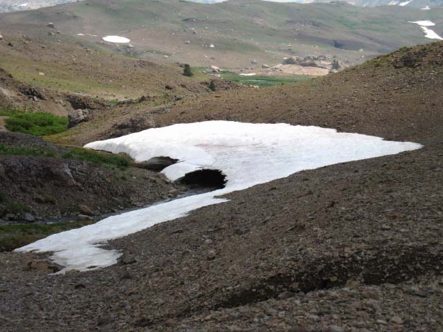
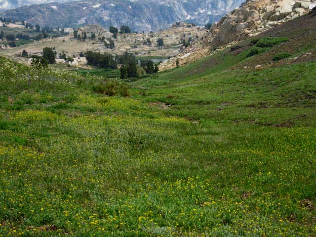
The This page describes hiking the 6.17 mile segment of the Tungsten Road South over the rounded 10800 foot crest of Big Sam tying the Pacific Crest Trail at the 9680 foot Kennedy Canyon trail junction to the Tahoe to Yosemite Trail crossing the 9480 foot trail junction in Grizzly Meadow under Grizzly Peak.
Check out the location of the junction at the top of Kennedy Canyon on the small and large scale maps below.
Here's a PDF of the Forest Service Emigrant Wilderness Map:
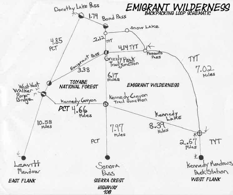
And Finally, here's my rough hiking schematic: The trail guide page below describes the Tungsten Road trail South from the Pacific Crest Trail at the Kennedy Canyon trail junction. At the Kennedy Canyon trail junction we could have turned our backpacking trip around to any of the Highway 108 trailheads, or continued South on the PCT. The Kennedy Canyon trail junction is a four-way junction on the Sierra Crestline with options running North, South, East, and West. We are hiking South by the compass into the Emigrant Basin. Hiking further South from Kennedy Canyon over Big Sam extends the length of our local backpacking loops out of Sonora Pass, Kennedy Meadows, or Leavitt Lake. The Tungsten Road also offers a Sierra Crestline alternative route to the East flank route of the PCT or the West flank route of the TYT across Emigrant Wilderness as we hike the long trails South to Tuolumne Meadows and points further South. Our next opportunity to turn a loop back around to the Highway 108 trailheads South of Kennedy Canyon trail junction comes 6.17 miles South down the Tungsten Road where the Tungsten Road intersects with the Tahoe to Yosemite Trail in Grizzly Meadow under Grizzly Peak. The Grizzly Peak trail junction is where this page of trail guide ends on the bottom of this page. We have figured out the mileage South from the various Highway 108 Trailheads to the Kennedy Canyon trail junction and on down to the Grizzly Peak trail junction below. We also have the miles of the Pacific Crest and Tahoe to Yosemite Trail routes on their respective Eastern and Western flank routes South from Highway 108 down to Tuolumne Meadows: Miles and ElevationsHere's a nifty little miles map from the Stanislaus National Forest and my Emigrant Backpacking Schematic:
I've got to include more detail and improve the scale of the Backpacking Trail Schematic, but it gives some idea about our fantastic hiking options around the high elevation elements of the Emigrant Wilderness. Hubs and Spokes This series of trail junctions along the Sierra Crest, and I'm including Bond and Dorothy Lake Passes on the South end of Emigrant Wilderness too, are important junctions allowing medium and long distance backpackers to craft amazing backpacking loops around, or hike long distance trailhead to trailhead backpacking trips across Emigrant Wilderness. This series of trail junctions along the crest opens the Sierra East and West. This would be nice anywhere along the Sierra Crest, but it is most fortuitous here across the top of the Emigrant Wilderness where fantastic granite gorges running down the Western flank are cut and surrounded by the volcanic chaos along the Sierra Crestline and spilling down the East flank over the crest. Yosemiland Emigrantus Emigrant Wilderness reminds me of Disneyland because the terrain here is so delightful, inviting, and exciting. The adventure and mystery of scrambling the great granite and volcanic features of the High Emigrant Basin and its surrounding Wilderness has brought so many delights of discovery and perspective as I became familiar with the terrain and started executing cross-country hikes and extensive scrambles that it puts the excitement an 8 year old feels going to Disneyland to shame. Here's what I say: Yosemiland Emigrantus E Plurbus Clampus Unum. Translation Deeper and Deeper Hiking further South can make all our local Emigrant Wilderness backpacking loops longer while drawing in more of the diverse terrains decorating both flanks of the Sierra Crestline across Emigrant Wilderness. Part of the beauty of this place is in its accessibility, with the PCT route running South along the East flank, the TYT route traversing the West flank and the Tungsten Road down the spine of the Sierra. This configuration makes for good accessibility... Hiking South to Grizzly Meadow extends our trailhead to trailhead trips starting and ending along Highway 108 from around 20 miles turning around through the Kennedy Canyon trail junction to around 30 miles turning around through the Grizzly Peak trail junction. Local Routes and Loops of Great Interest From Bigelow Lake we have two nearby routes Northeast returning to the TYT in Emigrant Basin, up Horse Meadow or via Bluebird Lake. This means that there are two "levels" of trails crossing the Western flank. The "high" route is the route of the TYT from Brown Bear to Bond Passes. The "low" route roughly parallels the TYT, but across the bottoms of the first set of canyons running West out of the Emigrant Basin. The "low" route is the trail from the Mosquito Pass trail junction in Summit Creek to Bond Pass, via either Horse Meadow or Snow Lake. The Sonora Pass Region Map linked to below-Right lays out these hiking options:
Continuing South over Bond Pass into the top of Jack Main Canyon (no matter how we got here!) still allows us to loop back around to the North by hiking the Northbound PCT through Dorothy Lake Pass towards the West West Walker Bridge. Check out the Emigrant Wilderness Backpacking Schematic above Left for a general outline of our potential backpacking loops around the Emigrant Wilderness, and the more detailed Sonora Pass Region Map linked to above Right for specifics of the various routes. The hiking map's black-dotted trails are linked to more detailed maps and the red dots to the trail guide. Click the Maps! Long Distance Backpacking Destinations Clicking the red dots on the topo maps of these routes below brings us to various positions along our trail South.
What you see is up to your route selection preferences. Backpacking High Emigrant Wilderness is a splendid experience however you approach it, and climbing over Big Sam is a joy even if the beauties of Emigrant Basin were not on the other side. But they Are. |
Kennedy Canyon Trail Junction
|
|||||||||||||||||||||||||||||||||||||||||||||||||
PCT to TYT |
TYT |
TYT across PCT |
We can set up a good backpacking trip plan using the miles and elevations figures in conjunction with the maps. Now let's scout out the trails and territory to our South on the trail guide page below to get an idea about the character and difficulty of the terrain, locate our potential break spots and campsites, and give ourselves some context on just how the terrain features are orientated.
| Emigrant Wilderness Basin Backpacking Map USGS 15 minute topo maps |
Sonora Pass Region Hiking Map USGS 30 min backpacking map |
| Emigrant Wilderness Backpacking Trail Schematic |
Emigrant Wilderness MILES Schematic National Forest Service |
EMIGRANT WILDERNESS
MILES, ELEVATIONS, GUIDE PAGES
| East Flank | Crestline | West Flank |
| PCT Miles and Elevations Sonora Pass to Tuolumne Meadows |
TUNGSTEN ROAD Miles and Elevations Kennedy Canyon to Grizzly Peak |
TYT Miles and Elevations Kennedy Meadows to PCT in Jack Main Canyon |
| Guide Page | Guide Page | Guide Page |
| Kennedy Canyon to Jack Main Canyon |
page below | Kennedy Meadows to Relief Reservoir |
Emigrant Wilderness
Backpacker Resources
and
Hiker Information
Emigrant Wilderness Backpacking Trail Information Over INFORMATION |
||||||||||||||||||||
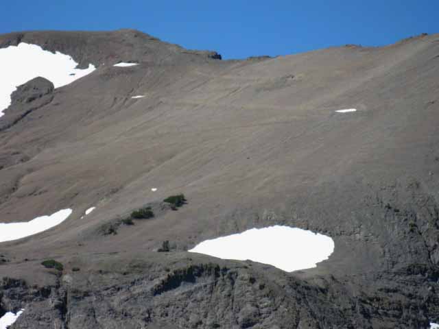
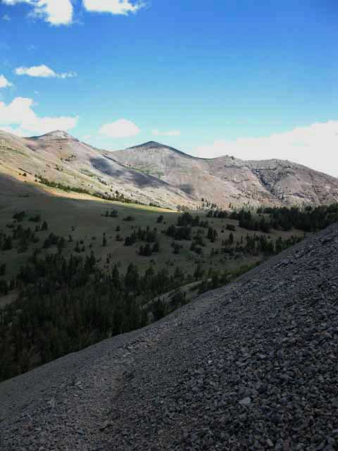
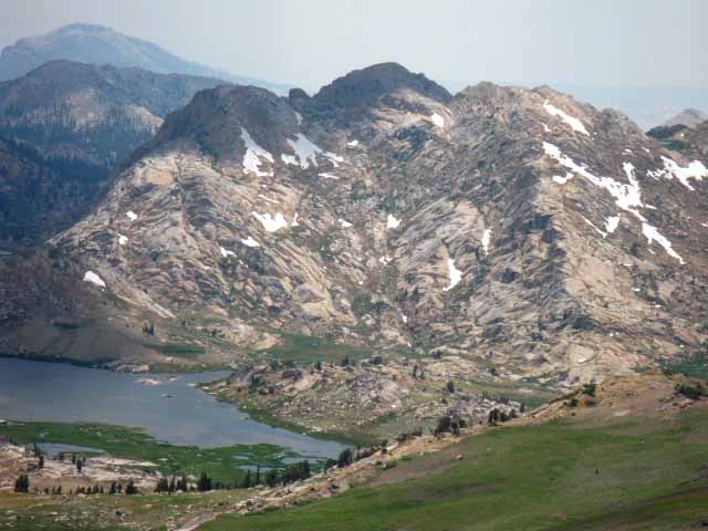
Start Big Sam and Surrounding Terrain
|
Sonora Pass Weather and Road Information These are the closest ground stations, point and regional forecasts to Jack Main Canyon Check out the ground reporting stations for real-time snow and temp data.
All Weather and Fire Information |
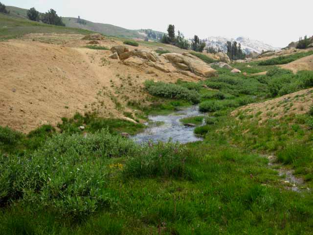
Emigrant Meadow
Purple Flowers & Purple Beetle
North Fork Cherry Creek begins
Shortcut to Grizzly Meadow & Lake in Grizzly Meadow
|
||||||||||||||||||
| > Forum < | ||||||||||||||||||||
This trail guide is designed to be a source of information for, and subsequently updated by backpackers using it through the comments and forum links for every segment of trail the guide covers. Anyone can post up comments, but only registered Members can post up stand alone articles & updates about this segment of the trail. Commentators cannot post images, but members can post images, maps and even embed videos in this Trails Forum for the Sonora Pass to Tuolumne Meadows section of the Trail Guide. Post up your cool stuff. Show us more! Learn-Teach-Share This guide is designed to help you "pull yourself up by your own bootstraps." You can access information and take it as you wish. You can add information to inform your fellow back country travelers. Here you can add updates, questions, comments, and additional information and advice from your experiences on trips using the trail over Big Sam from the PCT at Kennedy Canyon to the TYT at Grizzly Peak through the comments links. Check out this supplemental information through the forum links. Register, and add a page about each of your favorite trips through the Emigrant Wilderness in the Emigrant Wilderness Forum. Check out the Tahoe to Whitney .org Backpacking Trails and Topics forums |
||||||||||||||||||||
Kennedy Canyon Trail Junction
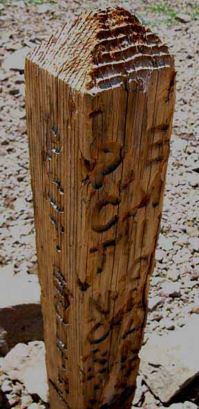 |
| Kennedy Canyon trail junction at the top of Kennedy Canyon on the Pacific Crest Trail. |
| A KEY FOUR-WAY TRAIL JUNCTION | ||
North |
||
| Southbound PCT East to West West Walker Bridge 4.66 miles GUIDE SOUTH Kennedy Canyon to Dorothy Lake Pass |
Kennedy Canyon Trail Junction |
West to TYT 8.39 miles GUIDE WEST Kennedy Lake and Creek to TYT on Summit Creek |
| South Tungsten Road to TYT Big Sam to Grizzly Peak junction 6.17 miles GUIDE SOUTH Kennedy Canyon to Grizzly Peak (below) |
||
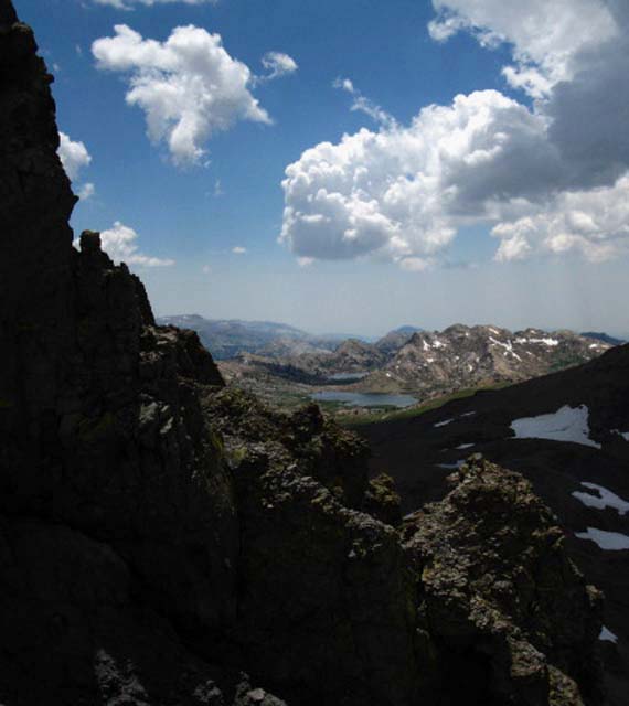
Kennedy Canyon Trail Junction Hiking Options Emigrant Wilderness Basin Backpacking Map First Turning Point South of Sonora Pass This junction can be our turning point back towards any of the three trailheads to our North along Highway 108 in proximity to Sonora Pass. We can hike West from here down Kennedy Creek to the Tahoe to Yosemite Trail down to Kennedy Meadows Pack Station. We can hike to the North along the PCT route back to Sonora Pass, or East down Kennedy Canyon on the PCT to turn out through Leavitt Meadow to our Northeast. Second Turning Point South of Sonora Pass From the Grizzly Peak trail junction we can also access a web of trails along the Western flank below the Tahoe to Yosemite Trail in the High Emigrant Wilderness. These are fine trails. If you think like I do, you will use these trail junctions located at greater and greater distances from our Highway 108 trailheads to craft longer and longer backpacking loops and trips through these hubs of trails at the top of Kennedy Canyon and in Grizzly Meadow. These two junctions assure that we can circle back to our original trailhead through a variety of route options, or hike across Emigrant Wilderness from one Highway 108 trailhead to another at greater and greater distances South of Highway 108. We'll discuss more about long backpacking loop and trailhead to trailhead trips backpacking options South from Highway 108 into Emigrant Wilderness as we hike further South down the trail over Big Sam into Emigrant Meadow to the trail junction under Grizzly Peak in Grizzly Meadow. Let's take a look at this upcoming Kennedy Canyon trail junction and our hiking options from a vantage point on top of the Southeastern End of the Leavitt Massif. |
Big Picture
of the
Surrounding Terrain
Looking Southwest at our Upcoming Route South to and over Big Sam from the South end of the Leavitt Massif
 |
||||
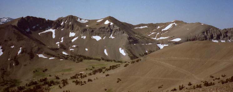
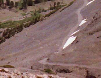
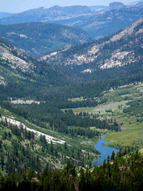
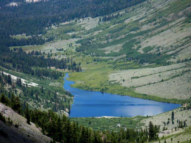
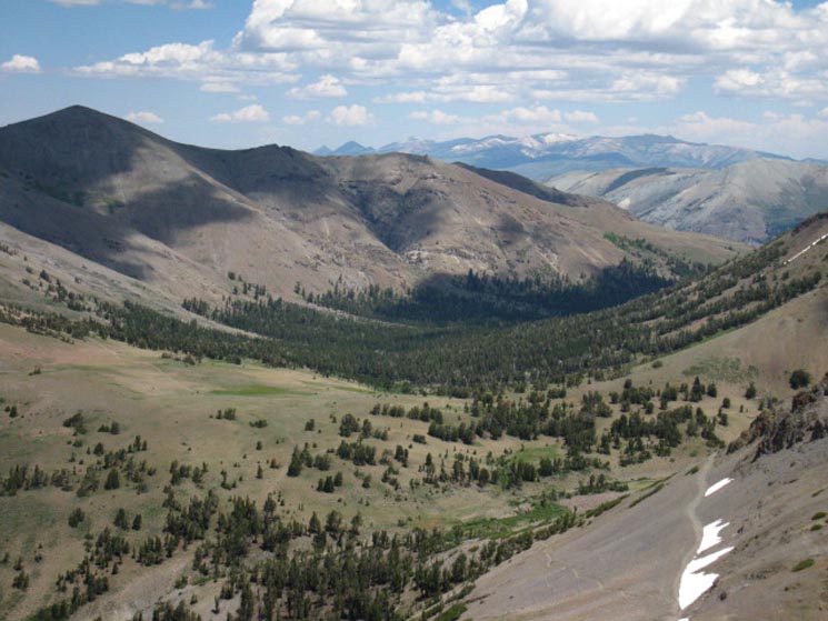
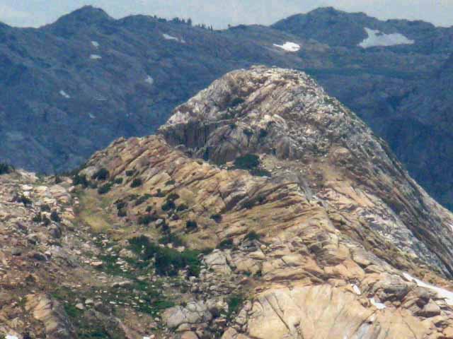
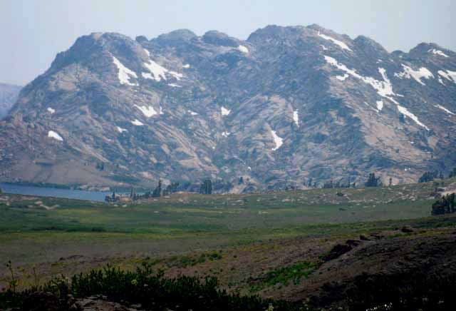
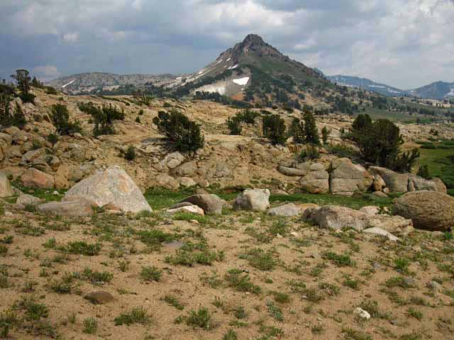
The Kennedy Canyon trail junction is located on the thinly forested flat between the two valleys descending Left and right from the middle of the image. We are standing on the Southeast edge of the Leavitt Peak's Massif looking Southwest. The valley descending to the Left, to the East, is the route of the Southbound PCT down Kennedy Canyon. Kennedy Creek flows down the valley descending to the Right, to the West down to Kennedy Lake on its way to the TYT 2 miles South of Kennedy Meadows Pack Station. We can see the Tungsten Road switchbacking South down the Southeast flank of the Leavitt Massif on the lower-Right of the image. We will be hiking down to the Kennedy Canyon trail junction on the unseen foot trail, rather than the bed of the Tungsten Road, which is designated as the "horse trail" off this Southeastern end of the Leavitt Massif. The foot path as well as the Tungsten Road's "horse trail" are marked on the map below: Sonora Pass to Kennedy Canyon Big Sam is the highest rounded peak along the ridge on the far Right side of the image, set back a bit by the great basin below its Northeast flank. It's low rounded peak is not as impressive as the peaks it shares crestline with, but its 10,825 foot height exceeds them. The Tungsten Road continues South through the Kennedy Canyon trail junction across the flat between the valleys descending East and West, continuing South over Big Sam to enter the Emigrant Basin on the other side of the mountain.
Again, Big Sam is the highest hump on the ridgeline in the distant Right of the image above. Let's get a closer look at the upcoming flat and our route along the mountain flank beyond.
|
Kennedy Canyon Trail Junction
between
Kennedy Canyon to the East
and
Kennedy Creek to the West
Southbound view approaching the base of the Switchbacks on the Southeast flank of Leavitt Peak
 |
||
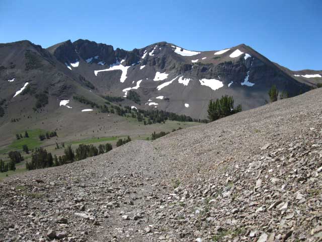
Above: A closer look at the Tungsten Road at our feet and past the upcoming trail junction. Kennedy Canyon drops off to the Left, the East, while Kennedy Creek and Lake lay in the valley descending to the Right, or West. On the far side of the flat below us the bed of the Tungsten Road was cut along the base of the facing mountains. Past the flat we can see the Tungsten Road cutting a faint line traversing across the lower flanks of the facing peaks. The Tungsten Road gradually ascends from Left to Right along a roadbed consisting of a narrow ledge cut into the massive skree flank of the facing mountain. On the Right side of the image we see the wide-open basin below the Northeast flank of Big Sam opening up. The East edge of Big Sam's basin is visible opening up on the Right side of the image above, but Big Sam sits out of sight just off the Right edge of the image, making up the West side of the basin. Note the faint line of the Tungsten Road traversing along the steep lower flank of the distant snow-spattered peaks facing us. The map indicates these small patches of snow are glacial remnants. Emigrant Wilderness Basin Backpacking Map Look past the top of the big tree in the middle-Right of the image to spot the faint line of the Tungsten Road's route across this steep flank. The Tungsten Road passes Right and Left in the background of the top of that tree on the distant mountain's face. That visible line of the Tungsten Road across that facing mountain's flank links the Kennedy Canyon trail junction to Big Sam. But we are going to take the faint shortcut trail just past the Kennedy Canyon trail junction to bypass the long horseshoe bend the Tungsten Road makes around the headwaters of Kennedy Creek. Hikers Southbound on the Pacific Crest Trail turn Left at the upcoming Kennedy Canyon trail junction to hike East down Kennedy Canyon. A Right turn West from just a few steps South of the upcoming trail junction brings us down towards Kennedy Creek to either the Shortcut Trail Southwest back up to the Tungsten Road or continues West along Kennedy Creek and down past Kennedy Lake to link up with the Tahoe to Yosemite Trail between Kennedy Meadows Pack Station and Relief Reservoir: Kennedy Meadows to Relief Reservoir We are continuing our hike South, straight through the upcoming Kennedy Canyon trail junction to hike over Big Sam into the High Emigrant Basin.
|
Northeastern View
from the
Northeast flank
of
Big Sam
at the
faint shortcut trail
intersecting with the
Tungsten Road at our feet.
Kennedy Canyon running East down the Eastern Flank of the Sierra Nevada
 |
||||
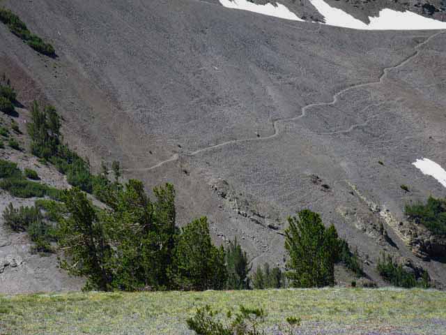
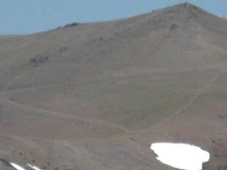
View Northeast Down Kennedy Canyon In the two image above this one we were looking at Kennedy Canyon from the Northwest up on Leavitt Peak. Above we are looking at Kennedy Canyon from the Southwest up on Big Sam. From our current position in the image above he Kennedy Canyon trail junction sits on the Left side, the North end of the flat above the top of the forest filling Kennedy Canyon. From our perspective above climbing Big Sam we can see below us where the faint shortcut trail coming up from Kennedy Creek intersects with the Tungsten Road at the location of the nearest bit of snow along the route of the Tungsten Road below us. Note the steepness of the drop West down the near canyon. That's the route down to to the TYT via Kennedy Crek past Kennedy Lake down to Summit Creek. That's not the route we're worried about here. We're checking out the excellent shortcut trail that cuts across the upper section of Kennedy Creek from the PCT trail junction at the top of Kennedy Canyon up to where it intersects with the Tungsten Road pictured above and below. South of where the shortcut trail joins the Tungsten Road the Tungsten Road turns directly South (Right, from our perspective up here on Big Sam's Northeast flank) into the basin below the Northeast flank of Big Sam. Note on the far Right lower edge of the image where we can see the Tungsten Road turning South into the basin. On the upper far Right of the image we can see a loop of the Tungsten Road circling around the basin to geain elevation approaching its climb over Big Sam. We are viewing all of this looking Northeast during our climb switchbacking up the Northeast Flank of Big Sam.
Let's get a closer and clearer look at where the shortcut up from Kennedy Creek ties in with the Tungsten Road and makes its turn into the basin.
|
Shortcut Trail coming up from Kennedy Creek
 |
||
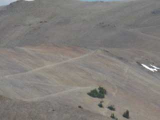
Shortcut up to the Tungsten Road approaching Big Sam. We can see the shortcut route coming out of the trees at the top of the berm running up the mountain. Beyond that we can see where the upper Kennedy Creek runs through a strand of green at the base of the mountain in the upper-Left corner of the image. Now that we've reviewed our upcoming route and shortcut route options South from Kennedy Canyon trail junction up Big Sam, let's check the route out up close. Map PCT Down Kennedy Canyon
|
Backpacking Emigrant WildernessOnward! Now that we have gained an overall view of the general terrain around and approaching our route South on the Tungsten Road up Big Sam, let's finish our hike down and off the South flank of Leavitt Peak by hiking down to and through the Kennedy Canyon trail junction. Most times I hike here to the Kennedy Canyon trail junction I've hiked 7.97 miles South through the Sonora Pass Trailhead, so I'm ready for a bit of a break, especially if I did not stop to visit Latopie Lake. I make the turn pictured below down to Kennedy Creek for some water and lunch/snacks at the boulder next to the creek along our way following the shortcut route up to the Tungsten Road over Big Sam. |
Big Sam
 |
||
Humm, it's around here somewhere... Looking for the shortcut route down to Kennedy Creek off the main trail route of the Tungsten Road. We are pointing ourselves towards the berm running down the mountainside on the far Left side of the image who's flank is decorated with the long snow patch on its Left side, and strands of whitebark pines growing along its top. We will climb almost straight up a steep trail up that berm to access the shortcut's traverse up and over to the Tungsten Road. There's some steep hiking up that berm. We can make out the route of the Tungsten Road on the mountainside above by the horizontal line of snow patches to the Right of the berm. The bottom of each snow patch is parallel. That's because their bottoms mark out the location of the Tungsten Road. Emigrant Wilderness Basin Backpacking Map
|
Shortcut trail up Big Sam
 |
||||
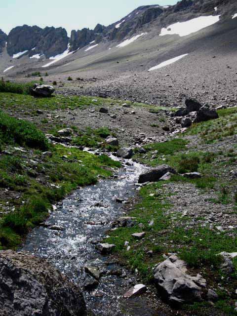
Here We Are! A Faint Trail Junction Above we are looking at the faint junction to the shortcut up Big Sam and the trail down Kennedy Creek to the TYT on the West flank. The Southbound Tungsten Road is the trail bending to our Left while the forested berm climbing the mountain in the distance beyond the descending hillside marks the location of the shortcut trail. The shortcut trail climbs up this forested berm before cutting West out of the top of the berm to intersect with the Tungsten Road. Above we see the faint seam in the terrain at our feet breaking off the Tungsten Road to the Southwest, our Right. Yes, we can see that this "junction" is a bit diffuse, being composed of a faint seam in the terrain bending off to our Southbound Right, West off main route of the Tungsten Road. Most years. Some years we can't really see any indications of foot wear on the subtle contour of the shortcut across the terrain. Some years we can see faint signs of recent use. Our landmark is the route of the shortcut up the flank of the mountain behind Kennedy Creek. Note the berm coming down the mountain flank in the background in the very center of the image above. It is the mound with the snowpatch and trees on it. This berm is a forested mound running almost straight down the flank of the mountain to Kennedy Creek. The shortcut trail climbs up to the top of this berm from Kennedy Creek. The shortcut trail traverses up to the Tungsten Road from the top of that berm. How to visually find these landmarks Independent of if our destination is Southbound over Big Sam or Westbound down along Kennedy Creek to the TYT on the West flank, we can hike down to Kennedy Creek to take a break, get some really fresh cold water, and rest up while observing the surrounding terrain from a stationary position for a few minutes before proceeding South or West. Those of us following the Tungsten Road South over Big Sam begin climbing the shortcut trail up the berm rising from the South bank of Kennedy Creek. Those of us hiking West down along Kennedy Creek first climb North from our breakspot along the creek back up to the top of the Northern side of its gorge to find the faint trail West downstream above the North bank of Kennedy Creek down to Kennedy Lake. The faint trail West down to Kennedy Lake stays above the North shore of Kennedy Creek's chaotic course down to Kennedy Lake. We Westbound hikers only visited Kennedy Creek for water and a break! Curious about the trail West donw to the TYT? Check out the trail guide page linking the TYT along Summit Creek with the PCT at Kennedy Canyon trail junction via Kennedy Lake and Kennedy CreeK Kennedy Lake and Creek
|
Top of the Shortcut trail up Big Sam
 |
||
We can see our goal, the shortcut trail traversing off the top of the berm on the South side of Kennedy Creek before we can see the creek below. Here we can see how the trail cuts West from the top of the forested berm. Note all the faint deer trails used to harvest the Spring Growth. The mountainsides are not so barren close up and they appear from a distance. At least during Spring. We are currently hiking down towards a positron from where we can see the shortcut climbing up that berm from Kennedy Creek to further guide our hike down to the red rock at Kennedy Creek. Right now we're guessing. Educated Guessing!
|
Tungsten Road Switchbacking up Northeast Face of Big Sam
 |
||
Beyond the shortcut in the distance we can see traces of our intermediate-distance goal, the Tungsten Road switchbacking its way up the Northeast flank of Big Sam. Emigrant Wilderness Basin Backpacking Map
|
Down to Kennedy Creek
View East at Headwaters
 |
||
Kennedy Creek flowing strongly just below its headwaters bowl. The Tungsten Road loops around the mountain flanks above the headwaters bowl of Kennedy Creek in the near distance.
|
Hunting Robin
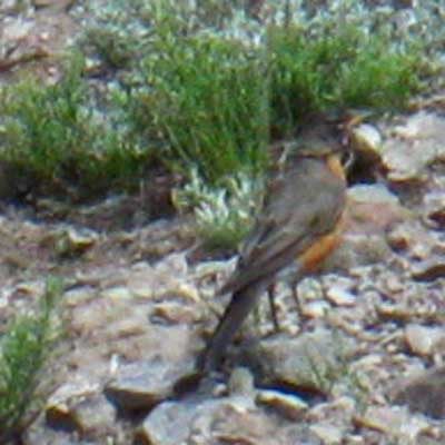 |
Robin hopping around picking off bugs at the top of Kennedy Creek. |
Kennedy Creek's Route down the Mountain
 |
||||
We can see the bends in the canyon Kennedy Creek flows through downstream from Kennedy Lake to Summit Creek. Relief Reservoir is just a bit Left, West, of the third bend Kennedy Creek makes around descending ridge arms below Kennedy Lake. The outline of the Dardanelles is visible along the top-Right of the image. The Dardanelles are situated along the Western edge of the Carson Iceberg Wilderness to our North. The map below-Left gives us an idea about the orientation of our position and perspective above, looking West down the canyon holding Kennedy Creek and Lake.
We can line up Kennedy Lake's Canyon on the map on the Left with the Dardanelles and the location of Kennedy Meadows depicted on the map on the Right. This gives us some idea and understanding of this terrain's complex layout.
|
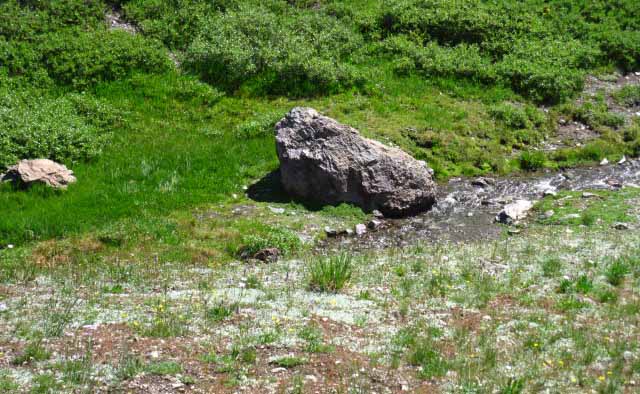
Break Rock at Kennedy Creek
The only shade around
 |
||
I take a break here. This rock is the only bit of shade and backrest around the point near where the shortcut trail starts up to the Tungsten Road, which is where we get water. Though there is water flowing across the Tungsten Road as it winds around the valley approaching Big Sam ahead of us in the basin I prefer to take a break here, water up and have lunch for an uninterrupted hike up Big Sam. Our next break will be at the top of Big Sam to enjoy the overarching view of the High Emigrant Basin and its rock and meadow. Emigrant Wilderness Basin Backpacking Map
|
The Shortcut up Big Sam Begins
 |
Tungsten Road Shortcut The very beginning of the climbing part of the Shortcut Trail on South shore of Kennedy Creek. |
Peak 10423 behind the Tungsten Road
 |
||
Climbing a bit higher on the Shortcut Trail we can see directly into the headwaters bowl of Kennedy Creek. Note the faint line above the patches of vibrant green. That is the Tungsten Road bending its horseshoe route around Kennedy Creek's Headwaters. Emigrant Wilderness Basin Backpacking Map
|
Long Views down the Kennedy Creek Valley
 |
||
The tail end of Kennedy Lake visible in its canyon with The Dardanelles in the far distance. Leavitt Peak caps the Head of the Right side of the valley, while Big Sam caps the Left, or South side.
|
Let's take a closer look
 |
||||
As we climb up the Shortcut Trail we start getting a series of great views of Kennedy Lake and the great valley that Kennedy Creek flows West down to Summit Creek. Beyond this East-West oriented valley below we can even see where this valley terminates into Summit Creek's valley. Summit Creek flows North down the mountain to its point of transformation into the Middle Fork of the Stanislaus River where Summit Creek enters Kennedy Meadows. Note the double pointed volcanic structures of the Western Dardanelles and the mass of the Dardanelles Cone in the distant background. Well, that feature is the Southwestern Corner of the Dardanelles Cone Massif. The Southbound TYT approaches the lake on the base of the far flank of the Dardanelles, then bends Northeast to climb around their Norhteast shoulder under the Dardanelles Cone into the Watershed of the Clarks Fork of the Stanislaus.
|
Closer Look at the Dardanelles in the Distance
 |
||
Long view down Kennedy Creek at The Dardanelles in the far distance. Let's check out the relationship of the TYT around the Dardanelles with our position climbing up Big Sam. Carson-Iceberg Wilderness Backpacking Map
|
The Dardanelles in the Distance
 |
||
The Dardanelles from Big Sam looking across the canyons holding Kennedy and Summit Creeks intersecting in the foreground. The West Dardanelle is the feature on the Left and the cone on the far Right of the image is the cone on the far Southwestern end of the Dardanelles Cone Massif. The Tahoe to Yosemite Trail's route passes along the other flank, the far Northwest flank of those Dardanelles Features, and then passes around the North and East flanks of the Dardanelles formations into the watershed of the Clarks Fork of the Stanislaus. That would be around the Right end of these features from our perspective above. If I am correct we are seeing the bulk of Bull Run Peak in the distance through the gap in the Dardanelles Ridgeline. Maybe not. It may very well be "Blood Ridge," located North of Highway 4 between the Highway and the North Mokelumne River.
|
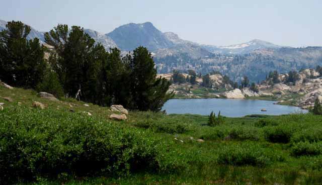
Kennedy Lake
 |
||
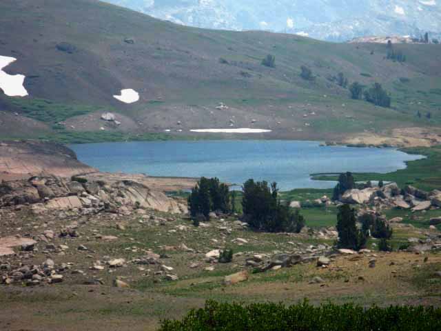
The full extent of Kennedy Lake, rippling under a gust of wind, comes into view as we climb higher up Big Sam. A very pleasant series of views of Kennedy Lake, Leavitt Peak, and the Dardanelles on the West flank, and Kennedy Canyon opens up on the East flank as we ascend.
|
Kennedy Canyon Beyond the Tungsten Road
 |
||
Looking Northeast down the Shortcut Trail at the top of Kennedy Canyon. We can see how the weight of the mountain is narrowing the Tungsten Road into the Tungsten Trail, and would push that off the mountain if not for the diligent work of trail crew. The fact is that Everything is Moving. Map PCT Down Kennedy Canyon
|
Bee on Big Sam
Life on the Trail As I climbed onto and followed the Tungsten Road along its circular route around the basin East of Big Sam during a 2009 trip between Lake Tahoe and Mount Whitney I encountered a quick series of living things. Though this basin appears barren from a distance it is full of life close up. It is not lush, but the terrain is alive. This series of living things works me really hard as nothing except flowers stand still, and even they blow around in the wind. Bugs require that I pursue them with pack on across fields of rocky skree if I want to even have a chance of getting a picture. If I take the time to take off my pack the bug is gone. The flower images generally require a series of deep-knee bends with the pack on to get the shot, especially if I am going to maintain my daily miles to stay on schedule to my next resupply. Once in position breath must be controlled to stabilize the camera. Holding your breath doing deep knee bends at 10 000 feet after running around a skree field is one of the definitions of crazy. This trail guide is written within the very real parameters of long distance backpacking. Count them well, and count them wisely. |
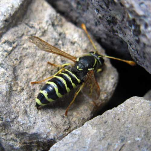 |
Bee scouring the rocky terrain. We are at about 10,200 feet of elevation here on a steep field of skree making up the mountains flank with not a whole lot happening. Then I note this bee really working the terrain. I wonder what he's looking for. I figure he may be looking for a dead bug he senses in the rock, or hunting for a live one. |
Dung Beetle on Big Sam
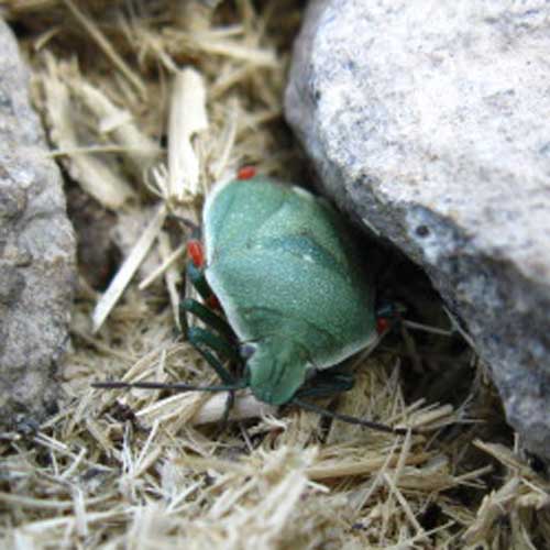 |
Dung Beetle on Big Sam. I had previously noted the very old broken down horse dung deteriorating through the rocky trail on Big Sam as I hiked up. The trail had very small segments that appeared to be lined with straw. Stepping over one of these spots I noticed this turtle of the beetle world scurrying about his business, or rather scurrying about the remnants of the horse's business. If you have any bug encounters of note in the High Sierra, any pictures of said encounters, or want to relate thoughts and experiences to your fellow hikers, please by all means post them at these places: |
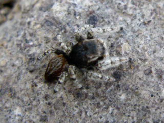
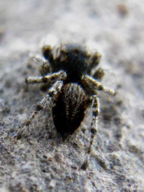
Spider on Big Sam
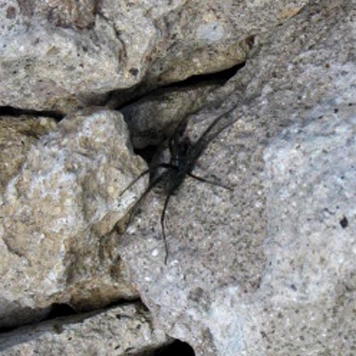 |
This guy was running around when we noticed each other. I approached and he retreated. I stopped and he would come out and look at me. As long as I did not approach him he was cool with keeping his eyes on me. Emigrant Wilderness Basin Backpacking Map |
Shortcut Joins Tungsten Road
 |
||
Break Time at the top of the Shortcut at the Tungsten Road. Note that the snow aprons have retreated from covering the Tungsten Road. A bit earlier in the season these sheet of stubborn hard slick snow cover the trail route, requiring a hairy traverse along your kicked-in steps. Waiting until later in the day makes steep hard icy snow into soft snow, which makes it less likely we will slide off. Map PCT Down Kennedy Canyon
|
Tungsten Road
West Walker Northeast of Kennedy Canyon
 |
||
The Tungsten Road More like the Tungsten Trail now... Kennedy Canyon and North end of the canyon of the West Walker beyond from the top of Shortcut route to the Tungsten Road. We can see the Sweetwater Mountains, the next mountain range East of the Sierra Nevada over in the distant Northeast.
|
North Bulge of Big Sam
 |
||
The North Crest along the top of Big Sam's Crestline. On the Right side of the image we see the beginning of the steep face of the North Flank of Big Sam. The North flank of Big Sam makes up the South side of the top of the valley Kennedy Creek flows West through. Emigrant Wilderness Basin Backpacking Map
|
Looking into the Basin below the Northeast Flank of Big Sam
Though it appears barren, it is not
 |
||||
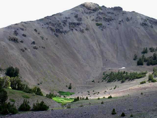
Hiking South Entering the basin under the Northeast flank of Big Sam. After rejoining the Tungsten Road at the top of the shortcut trail the Tungsten Road turns sharply South, making a Left Turn for Southbound backpackers into the throat of this wide basin below the Northeast flank of Big Sam. We have made that turn, and are looking directly South up the center of the basin.
The Tungsten Road circles around the full extent of this basin gradually gaining elevation. Note in this image above where the Tungsten Road turns Left, away from Big Sam up the East side of the basin, which we can see on the far Right side of the image. The Tungsten Road is turning Left up ahead of us to use the full width of the basin's perimeter as one long, slow, circular climbing traverse. Gently climbing around the East side of the basin the Tungsten Road is using the whole circumference of the basin to gradually gain elevation. This grand traverse around the perimeter of the basin eventually situates the Tungsten Road as high as possible along the easiest route possible to a position under Big Sam where it begins a series of switchbacks up the Northeast flank of Big Sam to the crestline just North of the peak. Alternatives to the Alternative Route The only problem with the fireman was his dog. Though a friendly dog, he would eat the gophers, squirrels and other ground life. That was totally irresponsible of the fireman. If he or his dog cannot carry their own food into the wilderness they should stay in the city. These places are wilderness areas to preserve them, not to feed your dog. This still makes me mad every time I think about this irresponsible Carson City Fireman and his hungry dog. Other than his bone-headed feeding philosophy he was a cool guy with a good dog.
|
Big Sam Butterfly
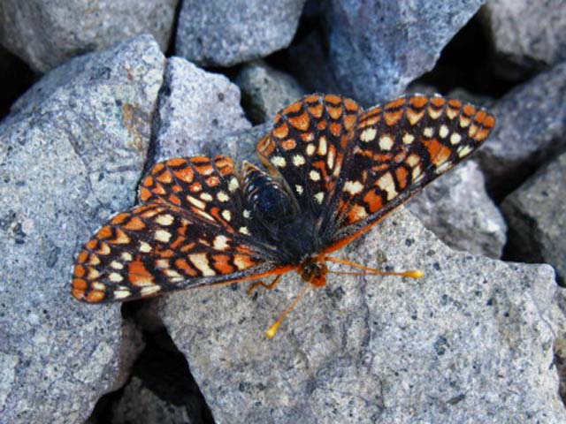 |
||
Butterfly on Big Sam. Though hiking through this terrain cannot but impart a deep feeling of almost desert-like desolation, and even isolation, depending upon fellow backpacker traffic, there is a tough, vibrant, and beautiful web of life here, though it may be stretched a bit thin in the extremes these harsh climates entertain. I've photographs snow fields on the side of Big Sam dotted with red algae growing within, while the surface is dotted with insects who made their first flights of Spring onto the snow, but not off. These insects will fall into the skree during the thaw to feed the thin web of life here. We will see the signs of Wintertime gopher activity and the bloom following the Spring Thaw up the mountain as we climb into the Big Sam basin. The algae, insects, tough flowers, thin grasses and fat gophers indicate a richness of life contra-indicated by our first glances over a distance at this seemingly barren terrain. The closer we get the more we see that this is substantially true, but this grand desolation is broken up by a hearty web of life stretched across the mountain, if a bit thinly. About the Butterfly: Doc Shapiro Says;
|
Closeup of the Big Sam Butterfly
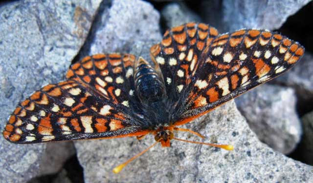 |
Big Sam Butterfly Thing up here sit still longer than things at lower elevations, giving me a better chance of sharing observations that are passing in nature. See the Bug Forum. |
Web of Creeks Draining Big Sam Basin
 |
||
One creek collects all the streams draining the basin and exits on its way to Kennedy Creek alongside the Tungsten Road's entrance to the basin. Big Sam Creek running down the center of the basin has been here every time I have, despite not being marked on the USGS maps. Southbound hikers turn into the Big Sam basin along this creek running out of the basin.
|
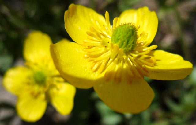
Big Sam Basin Sweet Blue Flowers
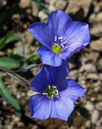 |
Blue Flowers growing on Big Sam in the Basin. Western Blue Flax Forum |
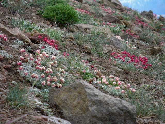
Pussypaws in Big Sam Basin
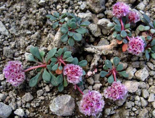 |
Darker pink pussypaws on Big Sam. Forums |
Terrain Surrounding Big Sam Basin
The Western Flank
 |
||
Peak on Western lower flank of Big Sam above Kennedy Creek far below.
|
Mountain Hopper in Big Sam Basin
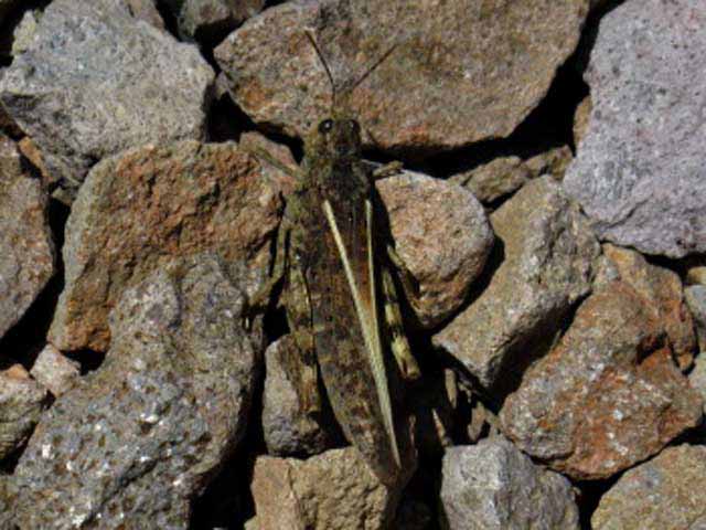 |
||
Mountain hopper on Big Sam. Forums
|
High Altitude Plant Blooming with Vibrant Red Flowers
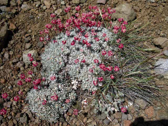 |
High altitude Flowers growing all over Big Sam. |
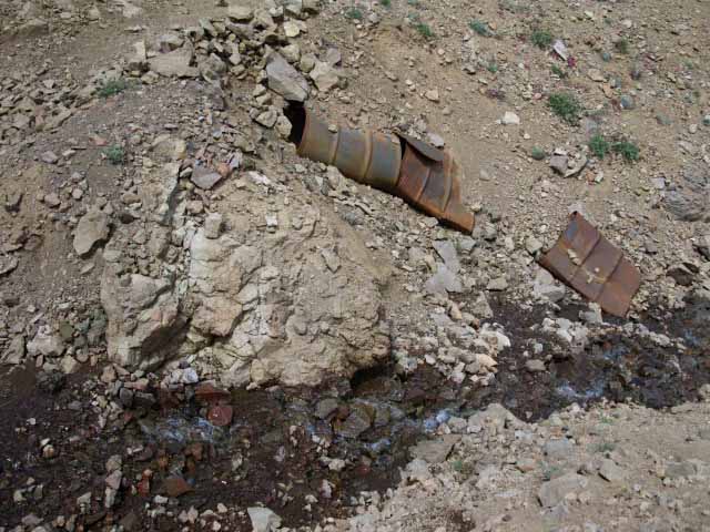
The Old Bridge over Big Sam Creek
 |
||
Remnants of culvert for Tungsten Road. As we follow the route of the Tungsten Road from the Southeast side of Leavitt Peak to where it breaks off of the Tahoe to Yosemite Trail route in Summit Meadow, we will note the difficulties of maintaining this road along the Sierra Crestline. Emigrant Wilderness Basin Backpacking Map
|
View North out of Big Sam Basin
 |
||
The Tungsten Road turns Eastward to begin its long loop gradually climbing around this big basin on the Northeast flank of Big Sam. Above we are looking North by the compass down the Southbound Tungsten Road, looking at the Southern flank of Leavitt Peak towering above Kennedy Lake. Kennedy Lake sits at the base of the valley between us and Leavitt Peak. Sonora Pass Region Hiking Map Here we are hiking around to the East side of the basin where there are shade producing whitebarks, plenty of water, and some nice semi-exposed campsites. I really like the color of the rock & the reddish glow of the terrain here.
|
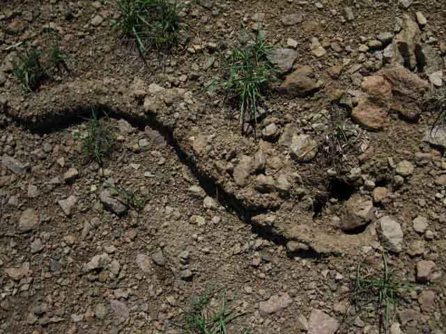
Mole Casing
 |
||
Mole casing on surface indicates life below. During Winter and Spring gophers pack the soil they've cleaned out of their tunnels into tunnels they dig through the snow. When Spring Thaw melts the snow the mole casings within are exposed, then gently deposited on the surface as the snow cover diminishes, then disappears.
|
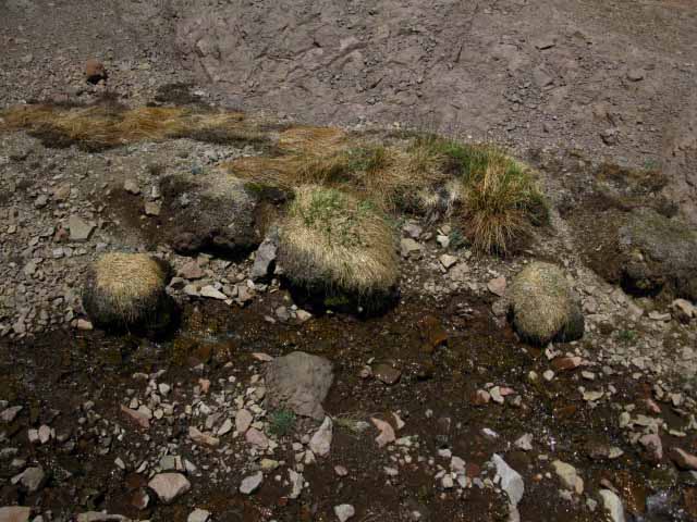
Grass Islands in Ocean of Rock
 |
||
Tufts of struggling grasses hold on next to the creek high up in the center of the basin. We are now hiking West around the basin to where the switchbacks up Big Sam begin.
|
High on Big Sam
View Northeast across Kennedy Canyon
 |
||||
Once we begin climbing the switchbacks up to the top of Big Sam our increasing altitude opens up a series of long views Northeast opens up Kennedy Canyon for closer inspection. Below we can see the whole layout of the flat dividing Kennedy Canyon on the East from Kennedy Creek's Western flow. On the bottom we can see the Shortcut Route up from Kennedy Creek intersecting with the Tungsten Road. Though we cannot see them in the image above, we can imagine the unified Tungsten Road & Pacific Crest Trail routes descending off Leavitt Peak from the middle of the Left side of the image. The PCT turns Left, East down Kennedy Canyon from the Kennedy Canyon trail junction, located on the Left side of the flat. Our Tungsten Road route disengages from the PCT at this trail junction continuing South around the headwaters of Kennedy Creek. The headwaters of Kennedy Creek are out of sight in the image above, though we can see Kennedy Creek running up to the top of its headwaters canyon in the middle-Right of the image.
USGS 15 minute topo maps
|
High on Big Sam
View North at Pacific Crest Trail on the South Flank of Leavitt Peak
Looking North back at our PCT route across valley holding Kennedy Creek. We are looking at the PCT coming to the End of, then descending the South flank of Leavitt Peak From our elevated position on these switchbacks climbing up the Northeast flank of Big Sam we can look North to see the Pacific Crest Trail along the South flank of the Leavitt Massif where the PCT intersects with the Tungsten Road coming over the mountain from Leavitt Lake. That's what that big triangle of trail in the picture on the Left below depicts. The PCT route splits to hike up or down the Tungsten Road from the left-hand corner of the triangle in the image at Left below. Southbound backpackers hiking up, to the Left, are following the Tungsten Road North over the mountain to Leavitt Lake. Hiking Right, down, keeps us on the Southbound Pacific Crest Trail. Go there: Tungsten Road junction with PCT on Leavitt Peak Massif Northbound PCT Hikers hit the lower corner of the triangle and take a Left to hike Northwest along the South flank of Leavitt Peak towards Sonora Pass. Northbound hikers taking a Right are hiking towards Leavitt Lake. |
|||
 |
 |
||
Above: The Tungsten Road coming over the mountain from Leavitt Lake is the upper right corner of the image. The Southbound PCT route comes down from the Left side to join the Tungsten Road in the lower corner of the triangle. From that junction in the lower corner of the triangle above the PCT route continues South along the ridge arm below the triangle of trail. The next image to the Right shows the PCT-Tungsten Road descending off Leavitt Peak.. Sonora Pass to Big Sam Backpacking Map |
On the upper-Right of the image above we can see the Left corner of the PCT-Tungsten Road trail junction triangle. This is where the upper trail heads North on the Tungsten Road to Leavitt Lake, while the lower trail continues South on the PCT. On the lower flank we can see where the main track of the PCT splits into the "horse trail" and PCT foot path routes down. We can also see where the horse and foot trails rejoin into one route on the corner the lowest switchback.
|
||
View East-Southeast
Looking over the rim of the Big Sam Basin
 |
||
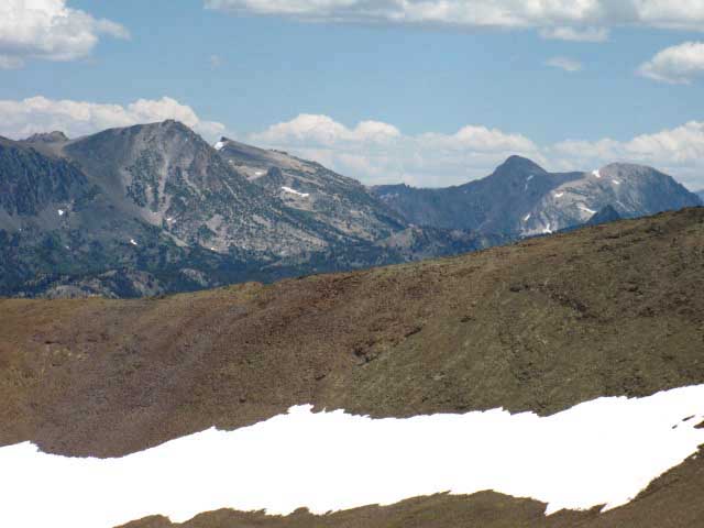
Hoover Wilderness Peaks to the Southeast over the shoulder of Big Sam. We're looking across the NE section of Emigrant Wilderness, across the West Walker River Watershed into the mountains of the Hoover Wilderness just Northeast of the North Yosemite Backcountry. Peak 11280 in Hoover Wilderness on the Left with the tip of Hanna Peak peeking out from behind. The silhouette of Hunwell Peak rises on the distant Right of the image above. The West Walker River and its Canyon are running North and South at the base of the Eastern flank off the Crestline between us and those mountains, closer to us. Inspect the PCT route through there on the Kennedy Canyon to Dorothy Lake Pass trail guide page. We would have hiked East down Kennedy Canyon from the Kennedy Canyon trail junction to stay on the Southbound PCT. Emigrant Wilderness Basin Backpacking Map
|
Beautiful Waxy Yellow Flower
 |
I found vibrant life at the very top of Big Sam's 10, 825 feet of elevation. These suckers waxy yellow flowers well contrasted the the burnt red color and textures of the hard shattered sharp talus of the terrain up here. |
Another View Southeast
 |
||
Hoover Wilderness and the North Yosemite Backcountry in the distant Southeast. We're approaching the top of Big Sam.
|
High Sierra Spider
 |
Almost up to the top of Big Sam I noticed a that a rock chip on a granite boulder was moving. Turns out it was not a walking chip of granite boulder, but a Spider designed to look like and blend in with its granite background, very high up at the top of Big Sam. |
Looking the Little Guy Right in the Eye
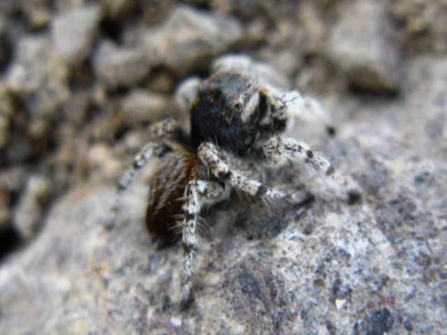 |
Most of the bugs, well, many of the bugs are fully aware I am chasing them. Some of the bugs are zombies, instinctively deflecting away from obstacles or encounters. But many bugs are self-aware of my pursuit, and decide how to deal with me from the range of options they see available. Flee or Hide are the two common choices, with defiance and aggression for the daring, strong, or well armed. The Jumping Spider above displayed all three of the later characteristics, after the first two failed. Above we see jumping spider has decided to just stop and stare at me: "Screw you human," mixed in with some plain-old curiosity: "Who the hell is 'bugging' me, and why?" Hey spider. Note the eye checking us out. We had done my "bug dance," meaning I was pursuing spider to check it out, not to eat, collect, or squish it. I was like, "what the heck is that?" Above the spider answered with, "What the heck are you, and why the heck are you chasing me?" |
Spider puts me in the rearview mirror and speeds off
 |
The chase is over. Spider departing. Note the backward-looking eyes. Happy Hunting and Good Luck! I'm hopeful to meet your kin next year... |
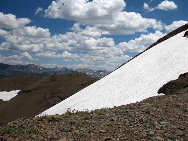
View from the Top of Big Sam
 |
||
|
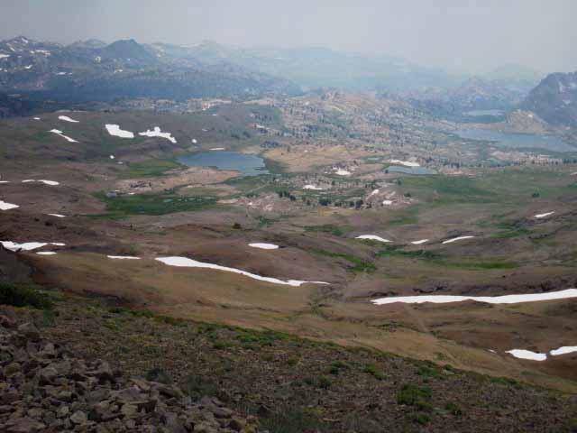
Well, not quite the top. The switchbacks up the Northwest flank of Big Sam bring us to the crestline ridge a bit to the North of the crest where our trail drops over to the Southwest flank of Big Sam. As we hike South towards the crest of Big Sam after reaching the top of the switchbacks we come to a position where we get this view to the Southwest around the bulk of the Northwest flank of Big Sam. Emigrant Meadow and Middle Emigrant Lakes from Big Sam. 2009. Emigrant Wilderness Basin Backpacking Map
|
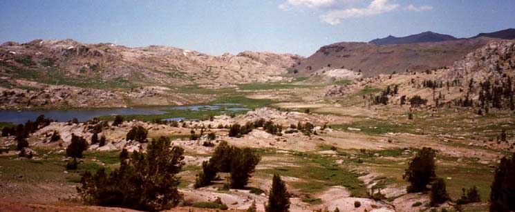
View Southwest into the Heart of the Emigrant Wilderness
Backpacking the High Emigrant Meadow
 |
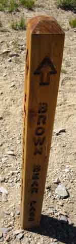
Taken years ago during 2003 or 3. To the Right of the Lake in the foreground sits Brown Bear Pass guarding the route of the Tahoe to Yosemite Trail Northwest down to Kennedy Meadows Pack Station. We can't see Brown Bear Pass in the image above, but we can take a look at a different perspective of the same terrain coming through Brown Bear Pass along the Tahoe to Yosemite Trail. |
Hiking Down the Southwest Flank of Big Sam
 |
||||
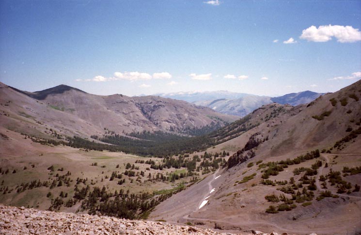
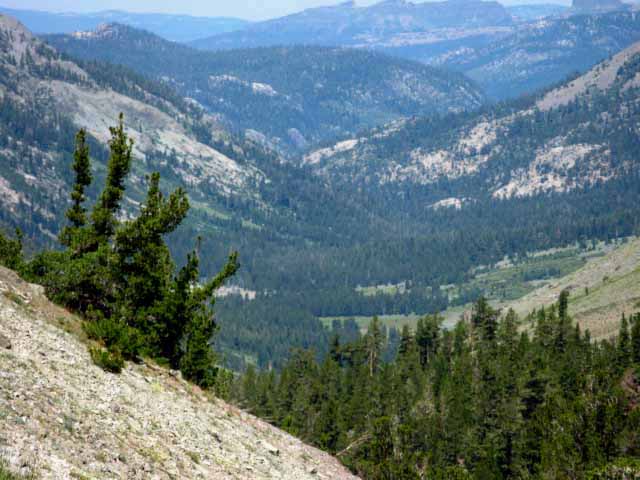
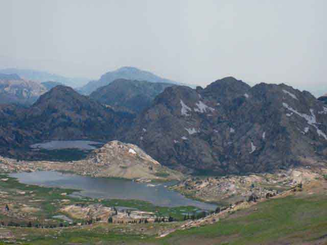
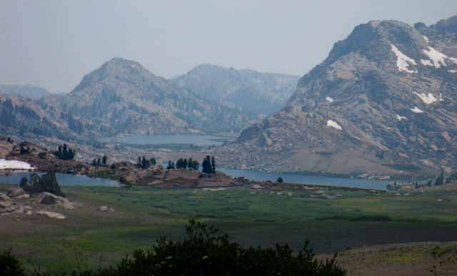
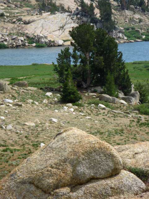
The High Emigrant Meadow section of Emigrant Basin from Big Sam. This is the most scenic and majestic way to view and enter the High Emigrant Basin. Emigrant Meadow stretches out to the Right of the lake in the foreground, Emigrant Meadow Lake. The TYT passes from Brown Bear Pass (which is just out of the Right side (Northwest) of the image)) around the green apron on the near Northeastern corner of Emigrant Meadow Lake where the trail junction leading down to Middle Emigrant, Blackbird, and Emigrant Lakes is located. Our trail South over Big Sam Meets the TYT in Grizzly Meadow under Grizzly Peak, on the other side of that ridge rising on the Left of the image above. Our route over Big Sam into "The Emigrant Basin" gives us a great "Bird's Eye View" view of the terrain before leading us into it. Our view gets better once we swing over onto the South flank of Big Sam for unimpeded views across the whole Emigrant Basin.
|
Little Lake Northeast of Emigrant Lake
 |
||
One of the two little lakes nestled into the Sierra Crest terrain to the Northeast of High Emigrant Lake appears as we descend sweeping switchbacks down the Southwest flank of Big Sam into the strip of terrain rising between Emigrant and Grizzly Meadows. Behind the Lake we see a channel in the terrain carrying the West West Walker River down from its headwaters in Grizzly Meadow into the West Walker River Watershed. Past the channel in the terrain we can see the West Walker River's canyon draining the East flank of the Sierra. Emigrant Wilderness Basin Backpacking Map
|
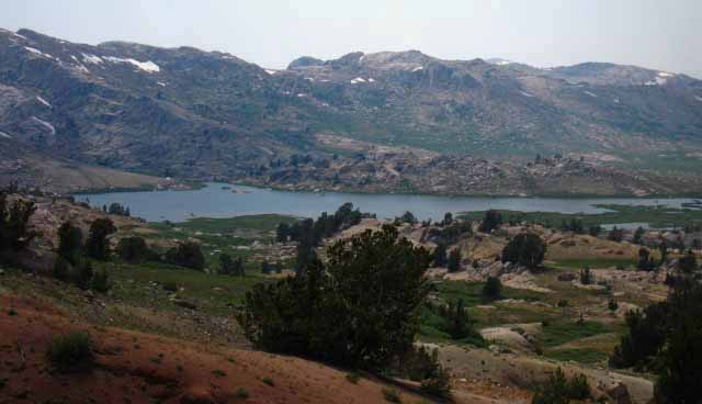
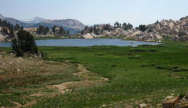
Emigrant Meadow with Emigrant Meadow Lake
and
Middle Emigrant Lake behind
 |
||
As we drop down the Southwest flank of Big Sam great views of the Emigrant Basin open up below. We see Emigrant Meadow Lake in Emigrant Meadow with Middle Emigrant Lake behind. Emigrant Lake is further down the canyon beyond Middle Emigrant Lake.
The green aprons around the lakes, along with the early date on the calendar both warn us that we are dropping down into a zone of dense mosquitoes. The Emigrant Basin is packed FULL of mosquitoes during the Spring Thaw and deep into Summer. This is not any problem if we are properly geared to deal with them. The mosquitoes are only one aspect of the blossoming and explosion of life that happens every Spring in the High Emigrant Basin. Everything is blooming, breeding, and feeding. Backpacker Mosquito Information All's we have to do is avoid being put on the menu, and we can kick back and enjoy the show! |
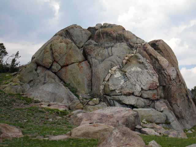
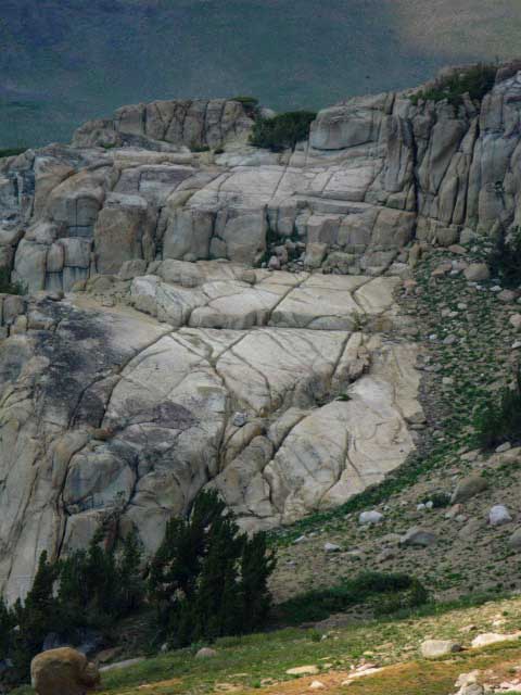
Great Granite Formation in Emigrant Meadow
 |
||
The granites here are intrinsically appealing, somehow accessing a frequency of physical engagement and emotional understanding not used within civilization. The rock gods can see you, even if you cannot see them. My point is that we humans "reflect" things. Our eyes, senses, and brains bring in environmental info, then we act. We act a lot better when we reflect natural environments! The very act of immersing our selves in nature changes both our senses and how we use them. Nature shows a whole set of alternative explanations of, and uses for human senses and intelligence.
|
South Flank of Big Sam Flowering
 |
||
High Altitude Wild Flowers blooming on the South flank of Big Sam. Big Sam looks barren from a distance, but it is not, especially during Spring. The greater fertility we see on the South flank of Big Sam than on the Northern is not uncommon on peaks up and down the Sierra Crestline. Thus we see relatively quicker and larger development of soils emerging out of the rock skree on the Western flank of the Sierra. Its greater portions of Sun and Rain hasten the cycles of life and death that create soil and expand fertility. Emigrant Wilderness Basin Backpacking Map
|
Emigrant Meadow Rock Formations
 |
Emigrant Meadow Lake. Emigrant Meadow stretches out to the Northwest, to the Right towards Brown Bear Pass, but our view is obscured by the interceding mountainside on the lower-Right. The TYT passes between the granite and Emigrant Meadow Lake along the visible shoreline, tucked in along the bottom edge of the granite formations we see in the lower-Left corner of the image. The route of the Tahoe to Yosemite Trail comes South across the lower-Left edge of the image above after hiking over Brown Bear Pass, crossing Emigrant Meadow to pass around the North shore of Emigrant Meadow Lake on its way to climb the low ridge dividing Emigrant Meadow on its Northwest side from Grizzly Meadow on its Southeast side. Our trail over Big Sam will meet with the TYT at the trail junction under Grizzly Peak on the East end of Grizzly Meadow, just a bit South of Emigrant Pass. Our route hiking down Big Sam climbs onto the North end of the low ridge dividing Emigrant from Grizzly Meadow, while the TYT will cross West to East further down the low ridge than our route. |
Emigrant Meadow
from the
South Flank of Big Sam
 |
||||
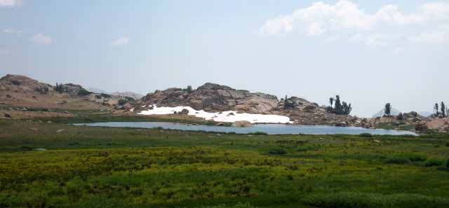
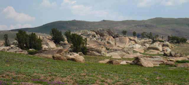
View Southwest descending South Flank of Big Sam The North end of the Relationship of the Lakes in Emigrant Meadow to the Lakes near Emigrant Meadow. Emigrant Meadow wraps around Emigrant Meadow Lake on the far Right of the image. Emigrant Meadow runs Northwest, to the Right in the image above, from Emigrant Meadow Lake to the base of Brown Bear Pass, which is just out of the Right edge of the image above. VIEW In the image above on this page we see High Emigrant Lake on the Left, little Red Bug Lake center-Right, Emigrant Meadow Lake in Right foreground, and Middle Emigrant Lake in the Right-background in the canyon running Southwest behind Emigrant Meadow Lake. Emigrant Meadow Lake is the only lake actually sitting in Emigrant Meadow. Notice the low-rise ridge behind High Emigrant Lake (the lake on the Left) running diagonally to the Southwest (L to R) across the middle of the image. Note that the composition of this low ridge is split between volcanic terrain closer to us and to its Left while the south end of the ridge is composed of granite as is the terrain to its Right, the terrain towards Brown Bear Pass. We can see the end of the ridge closer to us have been covered by volcanic material while the South end of the ridge is pristine. The line of this granite-volcanic interface runs Northwest and is submerged under the lake and meadow across Emigrant Meadow, but emerges to run through the center of Brown Bear Pass. This granite-volcanic interface running Northwest through Brown Bear Pass divides the whole Summit Creek Canyon down to Relief Reservoir: The monumental terrain of Granite Dome and Black Hawk Peak compose the South wall while the massive volcanic hulk of Disaster Peak tops off the vast volcanic ridge composing the canyon's North Flank. Up to our North in the Carson Iceberg Wilderness we could see granite terrain eroding out of its ancient volcanic encasements, down here we can find the extent of its coverage. We are finding the limits of the North Sierra's volcanic coverage as we hike South approaching the Yosemite bounday. Soon the Sierra Crest itself will be free from its volcanic coverage, exposing a great run of granite crestline down to Tioga Pass. This interface line between the underlaying exposed granite and the limits of these ancient flows capping it continues to our East over the Sierra Crest and down the East flank. The Emigrant Trail along the West West Walker down to the PCT at the bridge runs along one of the major lines dividing the volcanic from the granite. The bottom line is that what looks like a series of ancient eruptions poured out vast amounts of lava and volcanic detrius sufficient to bury many square miles of pristine High Sierra granite mountains and valleys from the South end of the Tahoe Basin down to the North end of Yosemite. Great lengths of the Sierra Crest are covered by volcanic materials from the top-down. Here in the Emigrant Wilderness we can trace out sections of the volcanic-granite boundary across the Sierra Crest and down its flanks, if we keep our eyes open as we hike its web of Sierra Crest trails. A whole lot of history lays at our feet. The Emigrant Wilderness provides a section of the Sierra Crest where we can approach segments of the interface between volcanic and granite terrain from all four directions to be able to hike a series of circle routes through and around long runs of these interface zones. Our trail South over Big Sam takes us past the Right (West) shore of High Emigrant Lake and its check dam approaching our traverse up onto the volcanic portion of that low volcanic-granite ridge we examined in the image above. We hike up that low ridge, right up to the interface with granite terrain, where we turn Southeast as we step onto granite to drop down to the Southeast side of the ridge it into Grizzly Meadow, which is located beyond the far-Left side of that low ridge. At that point we will be just North of the Emigrant Pass trail junction and the trail junction with the Tahoe to Yosemite Trail just beyond, both laying under the shadow of Grizzly Peak. Campsite I've always enjoyed camping at the little unnamed lake West of Grizzly Peak.
|
Purple High Sierra Daises
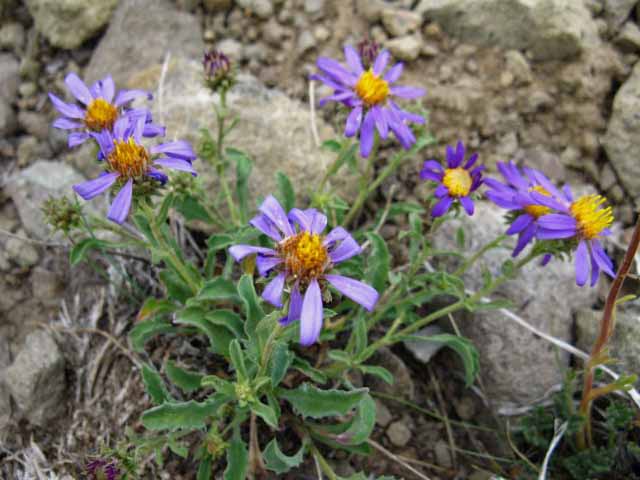 |
High Sierra Daises Tentative Identification: Erigeron pygmaeus - Alpine daisy High Sierra Flower Forum |
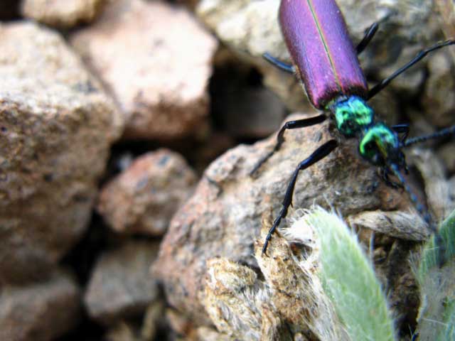
Brilliant Purple High Sierra Beetle
 |
||
Wow. The colors of this guy caught my eye off-guard. What colors! I was happy to see it, but thinking, "what the heck is this?" I've never been short of black beetles in the Sierra, but this guy was out of the normal color range I expect to see up here. This bugger looks much more tropical than alpine. Well, is the world "upside down" or what? Field Notes Just look at those brilliant colors. I've traced it down-maybe-to some kind of Stag Beetle.
|
Down to Emigrant Meadow Level
 |
||
Looking across the meadowlands above Emigrant Meadow Lake at the pinkish glow of the granite in Emigrant Wilderness adding another dimension to its unique experiences. We're coming off the volcanic flank of Big Sam towering above the North end of this "flattish" shelf of terrain holding a series of meadows and lakes wedged in along the Sierra Crestline down to Bond Pass. That's how I describe the Emigrant Basin. Below Big Sam and Bond Pass we see Emigrant Meadow Lake with granite mountains wrapping around its South shore. Just a short distance around to the Southwest is where the stark interface between granite terrain to the South and volcanic to the North runs straight through Brown Bear Pass. As we hike further down we'll see that this North end of the Emigrant Basin is slashed in half by the interface line running through this end of Emigrant Basin dividing its volcanic Northern half from its granite Southern end. Emigrant Wilderness Basin Backpacking Map
|
High Emigrant Lake
Note the low rise is now looking more substantial as we approach it
 |
||
High Emigrant Lake, Emigrant Wilderness. We can see the base of Grizzly Peak beyond the low rise we are going to begin traversing up once we hike past High Emigrant Lake.
|
Emigrant Meadow Lake and Middle Emigrant Lake
 |
||||
Emigrant Meadow Lake on the near-Right with Middle Emigrant Lake behind it. Red Bug Lake on Left of image. Blackbird and then Emigrant Lakes lay just a short way down the canyon behind Middle Emigrant Lake. At Emigrant Lake we meet the trail coming over Mosquito Pass from the TYT above Lunch Meadow. This trail continues Southeast from Emigrant Lake as well, offering us an alternative route South just a bit lower down the West flank than the route of the TYT along the Western Crestline. The Sonora Pass Regional hiking map below shows the route from Mosquito Pass to Horse Meadow and Snow Lake approaching Bond Pass as an alternative to the TYT route across Emigrant Basin.
Emigrant Wilderness National Forest Map PDF
|
Descending South side of Big Sam
North Fork of Cherry Creek
 |
||
Headwaters branches of the North Cherry Creek flowing off Big Sam. As we hike South off the crest of Big Sam we see that the South Flank of Big Sam is the headwater, the main Source of North Cherry Creek. Emigrant Wilderness Basin Backpacking Map Justifiably so, as Big Sam is the dominant feature above Emigrant Meadow. Below us we see that North Cherry Creek into High Emigrant Lake then through Emigrant Meadow ties together the string of lakes across the meadows like living blue pearls on a living blue string.
|
North Cherry Creek flowing off the South side of Big Sam into Emigrant Lake
 |
||
Let's look deeply into the Surrounding Terrain Note the low granite feature in the distance rising out of the ocean of volcanic material making up the substrate of the meadow. I should say "the mixed substrate" of the meadow. We can see by the interface lines drawn on the surrounding terrain where the lava that once poured over this terrain stopped, and that subsequently the erosion off of this deposited volcanic terrain began flowing when the hot material stopped. Thus much of the nearby low granite terrain not covered by ancient hot volcanic flows was later covered by volcanic material eroding off the remnants of these dead flows. Now we can see that erosion is scouring the lighter and weaker volcanic material from the granite it encases on the surrounding mountains, and the seasonal action of snow and thaw is moving this eroded material slowly down the mountain, into the meadows and down the creeks. It is as if a high tide of volcanic material is slowing being drained from around the underlying granite, exposing it after being entombed for thousands of years.
|
 |
Green Meadows, Blue Lakes, Pink Rocks. Sweet! Emigrant Wilderness Basin Backpacking Map |
Granite formations Decorate Meadow above High Emigrant Lake
 |
| Granite, grass, and flowers decorate meadow terrain above and to the North of High Emigrant Lake. |
Great Granite Bulb
 |
||
As we hike off the South flank of Big Sam into the meadow terrain above the North shore of High Emigrant Lake we are surrounded by delightful granite formations rising, no, erupting out of the floor of this great high altitude basin.
|
Sprinkles along shore of High Emigrant Lake
 |
||
High Emigrant Lake Watching the daily progression of the clouds and skies for indications of thunderstorms is wise mountain practice. Even if the thunderheads threatening dangerous lightening do not form, we may get some late afternoon rain to refresh our hike. Emigrant Wilderness Basin Backpacking Map
|
Rock decorates shoreline of High Emigrant Lake
 |
Sweet granite formations wade into the South Shore of High Emigrant Lake. |
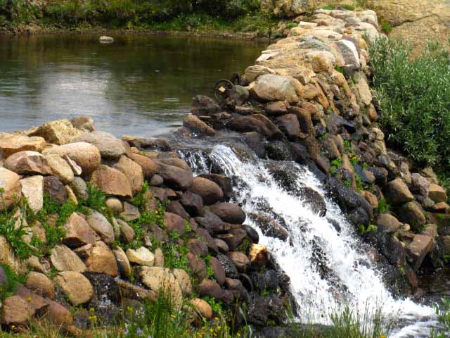
High Emigrant Lake Check Dam
 |
||
High Emigrant Lake Check Dam. It is a big one. Emigrant Wilderness Basin Backpacking Map
|
One of many Tadpoles below High Emigrant Lake Check Dam
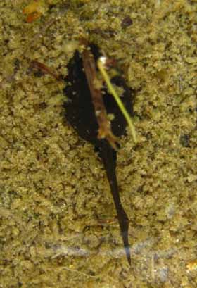 |
During July of 2009 there was a massive population of Tadpoles below the High Emigrant Lake check dam. This is one of the little buggers. Tell us what you know and think: |
North Cherry Creek
flowing
Southwest out of High Emigrant Lake
 |
||
The North fork of Cherry Creek begins in the confines of this grand High Sierra basin around High Emigrant and Emigrant Meadow Lakes. Here North Cherry Creek flows Southwest past the check dam creating High Emigrant Lake. Emigrant Wilderness Basin Backpacking Map
|
Fine Granite South of High Emigrant Lake
 |
||
Hiking South of the Check Dam on High Emigrant Lake we descend past a remarkable granite formation between our trail and Emigrant Meadow Lake and Emigrant Meadow to our West. Marked as 9818 on Emigrant Lake Topo Map
|
 |
||
Continuing South we find we are hiking lengthwise on, and traversing up the berm dividing Emigrant Meadow Lake in Emigrant Meadow from Grizzly Peak and Grizzly Meadow, thus our route coming over Big Sam stays above Emigrant Meadow Lake in Emigrant Meadow. That's a good thing during the height of the Mosquito season in Spring and early Summer. Emigrant Wilderness Basin Backpacking Map
|
View Northwest across Emigrant Meadow
 |
||
As we hike South the full extent of Emigrant Meadow opens up to our Northwest. We can see Brown Bear Pass on the far Northwest corner of High Emigrant Meadow. We can clearly see the interface line between the granite and volcanic terrain splitting Brown Bear Pass. The Tahoe to Yosemite Trail passes North and South through Brown Bear Pass' high point between the interface of volcanic and granite terrain. Also note Relief Peak rising above the volcanic side of Brown Bear Pass in the distance. Emigrant Meadow Lake is on the Left side of the image. Here's the view looking out over Emigrant Meadow from Brown Bear Pass:
|
Emigrant Meadow Terrain
We continue to lose a bit of altitude hiking South around the West side of High Emigrant Lake passing by beautiful massive granite formation decorating this high meadowland in the 3rd picture above, before we begin to climb again. We are now traversing up the volcanic Northern end of the little ridge dividing this high basin into two sides. Let's think about this. From the top of the South side of Big Sam we looked down to see a berm, a low ridge of terrain running roughly North and South across the Emigrant Basin dividing it between Emigrant Meadow to the Northwest and Grizzly Meadow to the Southeast. Note that the North side of this little ridge is red volcanic material while its Southern extent is granite. A very well-defined seam running through and around the High Emigrant Basin divides these two terrains just the same way we see the volcanic and granite seam splits Brown Bear Pass, as pictured above, as well as the valley holding Summit Creek, descending towards Kennedy Meadows Pack Station on the other side of the mountain. Grizzly Meadow sits on the East side of this little ridge, Emigrant Meadow on its West side. While this little feature looked quite insubstantial from Big Sam its 320 foot rise from the floor of the meadow is quite massive when viewed close up. This is a matter of scale. What looks quite small from a distance is quite massive close up. This ridge cuts off views of the whole Emigrant Basin from any one spot within the basin, but also makes it a "cozy" environment within Emigrant Basin. The granite portion of that low ridge is great scrambling territory! We will hike South from High Emigrant Lake up to, then follow the seam between red and white terrain up the top of this low ridge to where the trail route button-hooks around a few steps North of the Emigrant Pass Trail junction until we come to the low gap in this low ridge that is Emigrant Pass. A few steps past Emigrant Pass we come to the first of two quick trail junctions. But I rarely get that far. Shortcut Route Just before we hike South across Emigrant Pass as we begin to double back with the trail's button-hook movement, we notice the little valley pictured below, off to our Right, down to Grizzly Meadow and its little lake, what I call the East Grizzly Meadow Lake. Well, we can't quite see the lake from the trail, but we see a little valley running down to Southbound hiker's Right, to the South. As Grizzly Meadow and this little lake (the first of two unnamed lakes West of Grizzly Peak) are our destination for tonight's camp. Since our route for this trip does not turn Northeast at the Emigrant Pass trail junction to hike down to Cinko Lake and the West Walker River, we will cut off the trail and bypass the Emigrant Pass trail junction to hike South down this little valley to camp near the East Grizzly Meadow Lake. I call it the "East" Grizzly Meadow Lake because it is the Eastern of the two lakes to the West of Grizzly Peak along the Tahoe to Yosemite Trail. Otherwise we would walk straight South to and past the Emigrant Pass trail to take a Right turn at the second trail junction, the main trail junction under Grizzly Peak for the short walk West to our campsite by the lake in Grizzly Meadow just a couple of hundred yards West of Grizzly Peak. Instead of looping around my campsite along the trail route I will turn South off the trail to hike straight down through this little valley to my campsite. The image below shows our shortcut route down this little valley to the Lake. Tomorrow I will hike East from the little lake in Grizzly Meadow along the Tahoe to Yosemite route to the trail junction under Grizzly Peak to turn Right, South, for the relatively short hike along the Tahoe to Yosemite Trail route to Summit Meadow and over Bond Pass into Yosemite National Park. Woo-Hoo! Emigrant Wilderness Basin Backpacking Map |
 |
||
Shortcut down to East Grizzly Meadow Lake. Note the lake sitting down there in Grizzly Meadow just beyond the closest trees. Fine campsites are located in the granite formation shrouded in trees to the Left of the lake.
|
 |
||
From our position here, hiking down the little valley to East Grizzly Meadow Lake, Emigrant Pass is just out of frame to the Left along the low granite between us and Grizzly Peak. Just after hiking through the very indistinct Emigrant Pass we would have encountered the trail junction Left, to the Northeast to Cinko Lake and the West Walker River on the Left side of the base of Grizzly Peak, if we had stayed on the trail. A couple of hundred yards South of the Emigrant Pass trail junction the trail intersects with the Tahoe to Yosemite Trail's route coming South up from the Northwest out of Kennedy Meadows under Grizzly Peak. The South "Y" branch of the Emigrant Trail down the West West Walker breaks off from the Grizzly Peak trail junction. Continuing South from the Tahoe to Yosemite Trail junction under Grizzly Peak brings us first to Summit Meadow and then to Bond Pass. We can see where this Tungsten Road - Tahoe to Yosemite Trail junction is located looking at the the section of Grizzly Meadow visible at the right foot of Grizzly Peak in the image above. Emigrant Wilderness Basin Backpacking Map
|
Shortcut down to East Grizzly Peak Lake
 |
Fantastic granite formations holding sandy flats and stands of sheltering Whitebark Pine trees offer esthetic calm and excellent accommodations. |
 |
||
Hiking South down our shortcut and getting closer to the lake in Grizzly Meadow and this evening's campsite.
|
 |
Last steps to my campsite in Grizzly Meadow. The stand of Whitebarks anchors and shelters the flat around it. Little stands of trees defy the slow flow of erosion, their presence creating resistance that forms sleeping flats for passing backpackers. |
 |
||
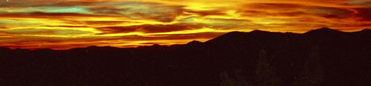
Tonight's surroundings. Bears cruise through, hawks wheel in the sky above, baby chipmunks play around in the trees, frogs hop about the lake while we watch it all under the changing light show of the setting sun. The closing of day activities is the prelude for the brilliance of the night sky.
|
 |
||
Grizzly Meadow campsite. Pad is my seat, whitebark is my backrest, food, water, hot chocolate and stove within easy reach surrounded by beautiful lake, meadow, flowers and animals. Emigrant Basin Backpacking Map
Too cool. top of page |
Grizzly Meadow Sunset
Tahoe to Yosemite Trail The Tahoe to Yosemite Trail passes North and South about thirty yards South of our campsite on the North side of the lake in Grizzly Meadow, between our campsite and the Lake. Tomorrow we will walk down to the Tahoe to Yosemite Trail and turn Left, East, (South on the TYT route) for the half mile walk past the unmarked Horse Meadow trail junction to the second trail junction, the Grizzly Peak trail junction where our Tahoe to Yosemite Trail route turns Right for the hike to Bond Pass. Below we are hiking the Tahoe to Yosemite Trail junction coming up from Kennedy Meadows connecting up first with the unmarked trail junction Southwest down to Horse Meadow, then with the Grizzly Peak trail junction. At the Grizzly Peak trail junction we meet the trail South from Sonora Pass over Big Sam, the trail down the West West Walker River through Emigrant Pass to the PCT at the West West Walker River Bridge, and the Southbound TYT towards our Bond Pass entrance into the North Yosemite Backcountry. |
Horse Meadow Trail
between
East Grizzly Peak Lake
and the
Emigrant Pass-Bond Pass Trail Junction
CCC trail crew moving down to Horse Meadow to set up their camp. 1:20 Backpacking Emigrant Basin Map
|
Trail Hub in Emigrant Basin at the Western Base of Grizzly Peak in Grizzly Meadow
| North and East | South | West | Trail Junction below Grizzly Peak | |||
 |
 |
 |
This is the central trail junction for High Altitude Hikers into the Emigrant Wilderness from trailheads all around the compass. Emigrant Pass is to our East, accessing the West Walker River down to Leavitt Meadow. Leavitt Meadow sits at the base of the Eastern Sierra. Or we can hike up the West Walker into Yosemite through Dorothy Lake Pass. To the North the trail over Big Sam intersects with the PCT between Kennedy Canyon and Lake. From there we can hike South over Leavitt Peak to Sonora Pass. To the West, back the way we came is the Kennedy Meadows Trailhead. South to Bond Pass from here brings us into the Yosemite Backcountry. From Bond Pass we can follow the PCT-TYT route South to Tuolumne Meadows, or follow Falls Creek down to Hetch Hetchy. At this trail junction we pick up the Tungsten Road coming from Highway 108. This WWII wartime road passes through the Leavitt Lakes basin over the Sierra Crest down to the strand of ridgetop between the Leavitt and Big Sam Massifs to climb Big Sam into the High Emigrant Basin. From here we will follow this old road to Summit Meadow where it turns to the old mine behind Snow Lake when we hike up to Bond Pass. |
|||
| Emigrant Pass. Before Emigrant Pass sits the junction NE to the West Walker. | Bond Pass. South to Yosemite
|
Brown Bear Pass. Northwest to Kennedy Meadows. |
Trail Hub in Emigrant Basin at the Base of Grizzly Peak
| A KEY FOUR-WAY TRAIL JUNCTION | ||
North |
||
Northwest |
Grizzly Peak Trail Junction |
Northeast to PCT Emigrant Pass to West West Walker Bridge 3.84 miles GUIDE EAST Kennedy Canyon to Dorothy Lake Pass |
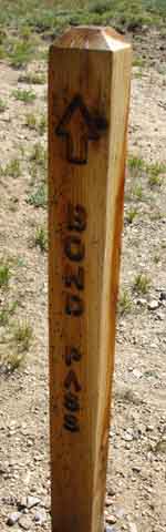
| South TYT Grizzly Peak to Bond Pass & Jack Main Canyon 3.08 miles GUIDE SOUTH Grizzly Peak to Jack Main Canyon |
||
NEXT GUIDE PAGE SOUTH:
Hiking South on the TYT over Bond Pass into Yosemite at the top of Jack Main Canon
The High Emigrant Basin Mini-Map
(Red Dots and Many Labels on the Map are Linked)
Our Position
Where the trails make an "X" shape West of Grizzly Peak
|
|||||
Trails from Emigrant Pass and Grizzly Meadows radiate out in all directions. Alright. If you got here, to the trail junction under Grizzly Peak, everything is alright.
Thinking of how to keep track of your information for planning an Emigrant Wilderness Backpacking trip? Become a member of Tahoe to Whitney High Sierra Backpacker's Forum! As a registered member you have your own account page where you can create private pages to store your planning information. We've got miles, elevations, and information embedded in the trail guide that needs to be complied into hiking plans for our various backpacking trips. When done with the trip you can file your own trip reports on the backpacker's forum for that section of the trails forums or for your own private reference. This is possible because members can create both "private" and "public" types of pages that can either be kept for reference or published on the forums. The "content type" for private notes is "personal backpacking notes." When you select this type of page it is not published in the forums nor across the home page of the forum. It is only accessible by the backpacker who created it. "Personal backpacking notes" are created with a standard text-editor that allows you to embed links, images, videos, and google maps in your planning page, as well as text. This means that you can link to all the pertinent trail guide, miles and elevations, and map pages necessary to plan out your trip. Create or open up your own planning pages when you put together information to plan your trips! We have other content types for general publication in the forums and across the home page of the forum. "Trail Notes," Backpacking Information," and "Backpacking Stories" are types of content that can be published in the various backpacking trails and topics forums and will also be published across the home page. Becoming a member of Tahoe to Whitney gives us a good place to compile backpacking information as well as allowing us to update and add details to the trail guide through the trails forums and comments features linked to each and every trail guide page. You can collect or construct information for your own use, to update the guide, and to inform our fellow backpackers about conditions and experiences on these long trails along the Sierra Crestline. Post up your trail updates, additional trips, comments, and questions!
|
PCT to TYT This particular trail adds one spoke to the hub of trails radiating out from the High Emigrant Basin of the Emigrant Wilderness. From this hub of trails we have the main Sonora Pass trailhead to our North, Leavitt Meadows to our Northeast, (via West Walker Bridge) and Kennedy Meadows to our Northwest, all along Highway 108. Hike to the trail junction in Grizzly Meadow from any of these three Northern trailheads. Now we have to decide which trailhead we will hike out of, what route to take to get there, or if we will even return to our starting trail head. We have a series of trails running West down to the trail tying Snow Lake with the bottom of Horse meadow to Maxwell, Blackbird, and Emigrant Lakes. This means we have fantastic options for turning our backpacking loop around from Grizzly Peak or the Summit Meadow trail junctions. The Sonora Pass Region Hiking Map lays out all of these options: |
| Northwest from this Junction to Brown Bear Pass (North on the TYT) |
South From this junction to Bond Pass (South on the TYT) |
| North from the Grizzly Peak trail junction over Big Sam to the PCT junction at Kennedy Canyon Scroll NORTH up this page |
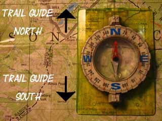
North: Latopie Lake to Kennedy Canyon South: Grizzly Peak junction to PCT in Jack Main Canyon
Backpacking Emigrant Wilderness |
Big Sam Connecting the PCT at Kennedy Canyon to the TYT at Grizzly Peak Now that we've completed this 6.17 mile section of trail to Grizzly Peak we have to decide what to do next. A big circle route backpacking around the High Elevation section of Emigrant Wilderness is always a good backpacking trip. We can hike either Northwest or Northeast from Grizzly Peak to the bottoms of Kennedy Creek on the West flank or Kennedy Canyon on the East for the hike back up to the Kennedy Canyon trail junction between the two. From Kennedy Canyon we can hike North on the PCT to Sonora Pass. From the bottom of Kennedy Creek we could continue North to end our trip through the Kennedy Meadows Pack Station Trailhead. From the West West Walker Bridge near the bottom of Kennedy Canyon we can exit the trail through Leavitt Meadow Trailhead. The Emigrant Wilderness Backpacking Schematic is helpful for figuring out Emigrant Wilderness backpacking loops. We also have a number of options hiking West through Snow Lake or Horse Meadow. From those positions at Snow Lake and the bottom of Horse Meadow we can hike Northwest to Emigrant Lake and cross Mosquito Pass to rejoin the Tahoe to Yosemite Trail on the North side of Lunch Meadow. That's a nice loop. On the other side of the mountain, the Eastern Flank, we can hike South from Grizzly Peak through Bond Pass and turn North on the PCT to hike into the West Walker River watershed draining the Eastern flank of the Sierra. From Dorothy Lake Pass on the PCT we can hike to any of the Highway 108 trailheads. Check out the maps, mileage, and trail guide pages then plan and execute your own custom backpacking trip through the beauties of the High Elevation sections of the Emigrant Wilderness, what I call the Emigrant Basin. Extend the Duration If you want to extend the duration of your High Emigrant Wilderness backpacking trip beyond your carrying capacity, give Matt a call at Kennedy Meadows Pack Station. Matt will set up a horsepacker to bring you out a fat resupply halfway through your trip. Just tell them when and where, give them your resupply load and money, and they will hook you up. I met this father and his backpacking kids near Blackbird Lake who hiked an extended backpacking trip around the high altitude beauties of Emigrant Wilderness by having Matt's riders ferry out a big resupply. Topo Hiking Maps 7.5 Map 30 min Map Trail Guide South |
Backpacking Trail Guide PCT North Latopie Lake TYT North |
|
Backpacking Trail Guide South to TYT Grizzly Peak junctionto PCT in Jack Main Canyon |
Backpacker ForumsHave a great Sierra Nevada trip or story to relate? A fine piece of gear? Or gear that failed?Post it onTahoetoWhitney.Org Anyone can post text comments, questions and trail updates on the forum page for Big Sam to Grizzly Peak. Members can post up their own pages, with pictures, embedded videos, and so on.Become a MemberMembers can also keep "private" notepages in their account for trip planning info collected from the guide and trip notes collected from the trails.If you have experiences, comments, questions, or pictures and videos of the Pacific Crest Trail between Sonora Pass and Tuolumne Meadows, post up here:Forum Section
|
Trail Guide North: PCT Latopie Lake to Kennedy Canyon Trail Guide South: TYT Grizzly Peak junction to PCT in Jack Main Canyon
Trailhead
Contact
Alex Wierbinski

Backpacking Lake Tahoe to Mount Whitney
Your Guide to the High Sierra Crest, including the Tahoe to Yosemite, Pacific Crest, and John Muir Trails
