The Trails
Guide
Maps
Miles/Ele
Permits
Resupply
Forum
Current Weather Conditions
Weather Notes
Northern High Sierras
Central High Sierras
Southern High Sierras
Gear
Gear List
Gettin Started
Layering
Discussion
Testing yourself and your gear
Gear Reviews
Backpacking
South Past Round Lake to Meiss Cabin
Meiss Country Roadless Area
Languages
Languages
Trail Arts
The art of walking
Physical Preperation
Trail Skills
The trail
Off the trail
Scrambling
Maps
Navigation
Camp skills
Food
Resupply
Food
Other
Photo Catagories
Trail Stories
Trail Culture
News and Science
Links
Groups
Books
Terms and Conditions of Use
Trail Guide |
NORTH Round Lake |
SOUTH To Meiss Meadow |
Topo Hiking Map South Upper Truckee to Carson Pass |
Maps INDEX |
MILES AND ELEVATIONS |
Tahoe to Whitney on YouTube |
 |
||||
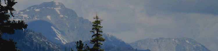
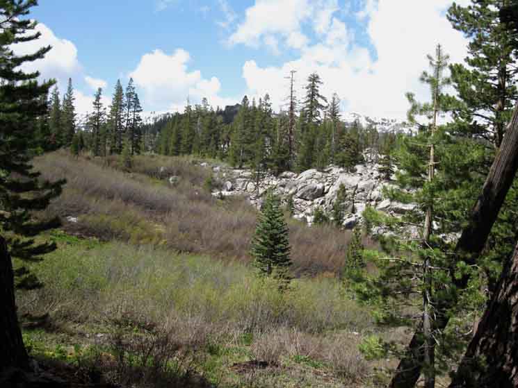
Climbing South from Round Lake we get a long view to the Northwest of Tallac Peak along the West Shore of Lake Tahoe. The Northwest shore of Round Lake is visible in lower-middle-Right. Tallac Peak is the highest peak on the West shore of Lake Tahoe. Freel Peak is the tallest on the East shore.
Miles and Elevations
|
| INDEX | ||||||||||||||||||
| Trails | Weather | |||||||||||||||||
location
Terrain
South from Round Lake
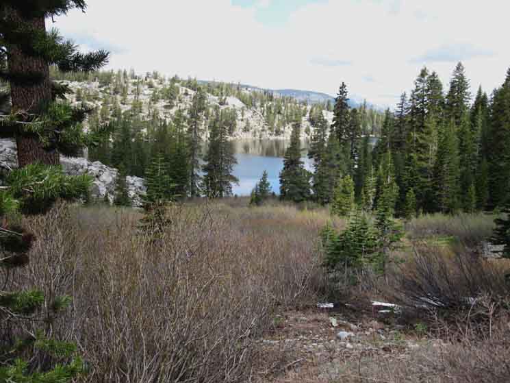
Meadow above the Southeast Shore of Round Lake
Video
Tahoe Rim around Meiss Meadow Roadless
Let's Think Ahead
Local or Long distance from Round Lake
Southbound Camping
South
|
Lake Tahoe-Meyers
Local Resupply Resources |
|
||||||||||||||||
| > Round Lake Forum < >Round Lake to Meiss Meadow Forum < |
||||||||||||||||||
Add to the Guide Supplemental information and hiker experiences about this whole section of the trail from the South Upper Truckee Trailhead to Meiss Meadow are organized into a convenient Trail Forum. In addition to Trails Forums, we also have forums for every Topic of backpacker interest, from gear to trail culture to a forum about the living things in the High Sierra. Check out all the Tahoe to Whitney .org Tell us what you see and experience on the High Sierra Trails! |
||||||||||||||||||
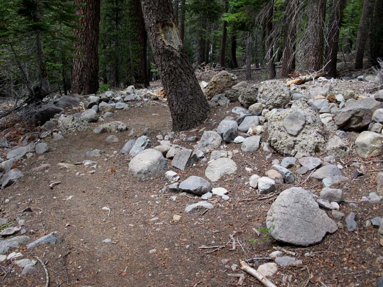
Massive Composite Boulder
| A huge composite volcanic boulder along the East shore of Round Lake, broken off from the cliffs towering above the East shore of Round Lake which rolled across our trail along its shoreline. The Northwest shore of Round Lake is visible in the lower-Left Background. |
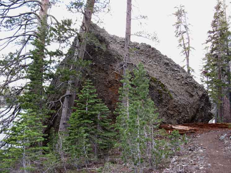 |
Note the composition of this huge composite boulder. It is made up of many different smaller stones held together in in a material that appears similar to a weak cement. As the images above and below demonstrate, these weak-cement style composite boulders are sitting alongside composite boulders composed of a much harder, denser, and finer volcanic material. Check out the composite boulder pictured below. The thing tying these different composite boulders together is their contemporary birthplace; all of these differing composite boulders are all breaking out of various layers of the deteriorating volcanic pinnacle and its associated cliffs towering above the East Shore of Round Lake. Terrain Forum |
South Upper Truckee Road Trailhead
|
||||||
Round Lake 4 miles South of the South Upper Truckee Road Trailhead. |
Trail Junction at Meiss Cabin 2.12 miles South of Round Lake. |
Carson Gap 1.52 miles South of Meiss Cabin |
Round Lake to Carson Gap |
||
MILES & ELEVATIONS
General
Information
Northwest to Southeast
along the
PCT-TYT
from
Echo Summit to Meiss Cabin to Carson Pass
North to South
from
South Upper Truckee to Meiss Cabin to Carson Gap
The South Upper Truckee Trailhead entrance to the Meiss Roadless Area via Round Lake is as good an entrance on to the long trails North and South as its is a start point for a short trips around/across the Meiss Country Roadless Area.
This easily accessible beauty here makes the South Upper Truckee a real good destination for a quick getaway on its own merits.
Hiking Map
Meiss Country Roadless Area
Hard
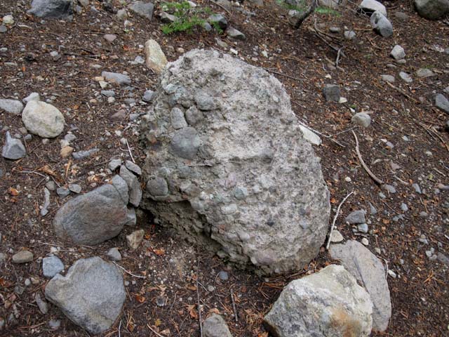
Fine-Grain Composite Volcanic Boulder Fragment
East Shore of Round Lake
A unique hard composite slab on the East side of Round Lake. This chunk of rock is a unique example of a super-thick almost plastic-like lahar material from an ancient volcanic flow. Like the composite boulders pictured above and further North down the trail, all of the composite boulders tumbled off the volcanic Round Lake Pinnacle and its associated cliffs rising above us to the East, and all rolled through the forest to their current positions along the East shore of Round Lake. Unlike the composite boulders pictured above, this boulder is composed of a super-hard dense volcanic material very unlike the weak-cement type material holding together the majority of composite boulders scattered around under the Round Lake Pinnacle. This may be a fragment of the main flow that drove the lighter lahars through this valley. |
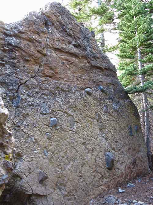 |
Note how large rocks are embedded whole in this harder, finer volcanic slab remnant of an ancient volcanic flow. The lower density of the volcanic flows that produced the lighter cement-like composite boulders was likely insufficient to be able to lift bigger rocks, as this slab did, into their flows. The other, lighter-material composite boulders we have seen on our way up here from the South Upper Truckee are composed of a weak-cement style composite material that captured and bound thousands of mostly smaller rocks, from pebble to palm-sized rocks, together. The boulder above is not breaking down into a pile of loose gravel anytime soon, as are the rest of the composite boulders held together by weak cement scattered around it. This composite boulder's very hard and very dense material appear to have two significant differences from the weak-cement composite boulders: It holds very much larger rocks than the weak-cement boulders could capture, and it will hold these big rocks for a much longer time period than the gravel bound up in the weak-cement composite boulders.
These two very different materials, as well as a variety of weak-cements holding together the less dense composite boulders tell us that a series of different ancient flows of very different compositions, temperatures, and densities surged through, and eventually filled this valley, apparently layer by layer. These materials flowed East into the Tahoe Basin down this ancient, previously glacial cut drainage. The whole span of our lives is no more than looking at just one frame of a very very long movie. The good thing is that all of the film leading up to our one frame is, "on the floor," for us to see, so to speak. Thankfully, the one frame of the film we can see shows us much of the previous plot of the movie we did not see. It looks to me like waves of lahars swept through the valley, filling it up layer by layer. After these waves of volcanic flows eventually slowed down and abated, the relentless flow of water over tens of thousands of years eventually re-cut and swept away the soft volcanic materials that filled the center of Christmas Valley. The power of erosion washing away the volcanic rock from the center of Christmas Valley is what left the Round Lake Pinnacle behind. Diverse Terrain Round Lake has it all, a fine lake decorated with the eroding time capsules of composite boulders, a unique volcanic pinnacle towering above dense forest, fine granite, and great campsites all sitting cozily wedged in dense forests between granite and volcanic terrain. The different types of volcanic composite boulders reflect the different characteristics of the forces that created this meandering interface between volcanic and granite terrain we straddled on the way up here from the South Upper Truckee Road Trailhead. This an interesting trail on many different levels, if we observe the terrain closely. It is physically challenging while being esthetically pleasing as the curiosities of its beauty challenge our understanding and imagination. The depth of the experience here stretches well beyond my sensory and intellectual ranges. Thus the Backpacker's Forums. The Backpacker's World It's a steep climb up to Round Lake from the South Upper Truckee Trailhead, especially for the first day of a trip. But it's a short hike up to Round Lake in exchange for great beauty. This "short but steep" terrain makes Round Lake a great place to do some warm-up trips to break us into Sierra Nevada hiking conditions. It's a great place to get and keep the legs and lungs ready for the long trail. Practical Considerations Look up at the Round Lake Pinnacle. There are lots of potential composite boulders up there, ready to fall. Heck, I'd say the Pinnacle itself has some chance of coming down all at once. That would make a noise! This situation is very much like snags: It is going to fall. The only question is when. The distribution of that field of composite boulders is why I always camp on the North shore of Round Lake, rather than the East. The odds of having a composite boulder fall on us here is likely equal to winning the lottery: Slim to None. But to win the lottery we'd have to first buy a ticket, and to have a composite boulder fall on us we'd have to camp on the East shore of Round Lake. Conclusion In the long view of things the Eastern shore of Round Lake is an old and active rock-fall target zone under the Round Lake Pinnacle. I look at it as I view the lottery: the odds are long, but somebody always "wins." My point here is that we should never camp under snags, big dead branches on trees, cliffs that are shedding rocks, or composite boulders. Most important is the underlying fact that we must observe, analyze, understand, and accommodate the inherent risks of the terrain as we encounter changing conditions, characters of terrains, and challenges on our way down the long trails along the Sierra Crest. Eyes Open--Brain Engaged... At our position here besides this huge block of solid ancient lava we are directly under the Round Lake Pinnacle. Check this view of Christmas Valley from Echo Summit which clearly shows the Granite in the foreground and the deteriorating Volcanic wall above us in the background.
Terrain Forum |
Hiking South along the East side of Round Lake
| Massive Volcanic Slab along East side of Round Lake. |
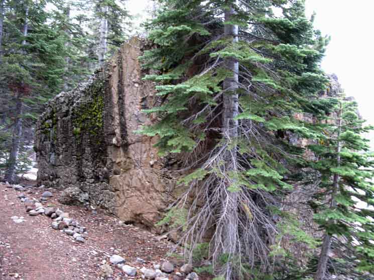 |
| These boulders all sit under the Round Lake Pinnacle. |
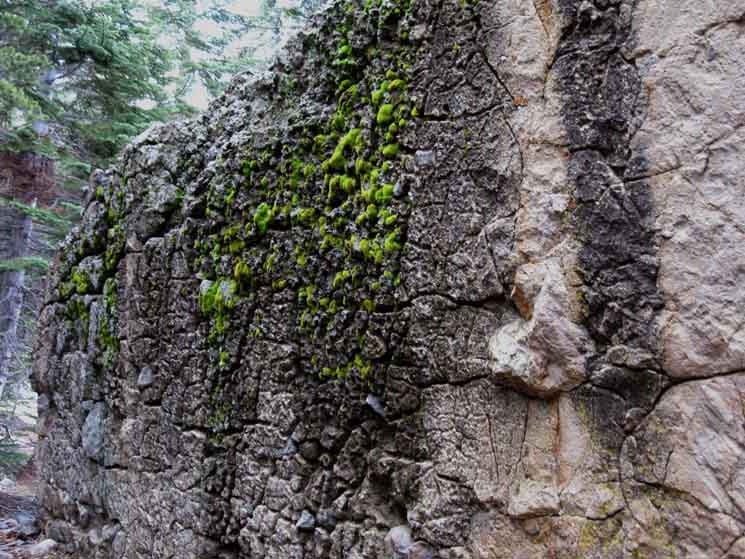
Composite Volcanic Slab
| Volcanic hard slab dappled with Moss. |
 |
| Massive Volcanic Slab along East side of Round Lake. |
Composite Boulder Field
around the
East Shore of Round Lake
Trail beginning to climb
above the
South Shore of Round Lake
 |
||
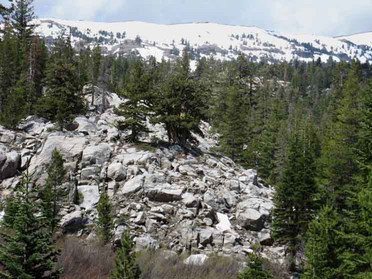
Looking back, North, as we climb South from Round Lake. The trail winding past the Southeast shore of Round Lake begins to climb through a field of mixed boulders up towards the edge of the meadow laying off the Southeast shore of the lake. This is not a volcanic-granite interface. This is what remains when that interface is confused by composite boulders releasing granite along with the wide range of different types of rocks these ancient lahars picked up, captured and carried here so long ago. The final breakdown of weak-cement composite boulders releases a strange mixture of diverse rocks collected from a range of terrains beginning deep within the volcanic bowels of the earth, flowing out of the Earth and over distant ancient mountainsides to scour them of their small rocks, mixing them all up, to finally be released here thousands of years later to enhance our High Sierra backpacking experience.
|
The Weak Cement Volcanic Material
 |
Among the specimens in this mixed field of granite and composite boulders off the Southeast shore of Round Lake are good examples of broken down composite boulders that allow us to better inspect the weak cement holding most of the composite boulders around here together. This material is remarkably similar to conventional cement that was mis-mixed, or improperly set. Kind of like the cement they make buildings out of in Mexico and China... |
Departing Round Lake
The Meadow Southeast of Round Lake
View Northwest back at Round Lake hiking South up towards Meiss Meadow
| Looking Northwest across Round Lake while climbing away from the lake to the Southeast. | ||
 |
||
South past Round Lake the trail runs up to a rough downward rushing meadow full of dense brush. The route of the trail climbs to and follows the high side of the meadow's upper perimeter up towards Meiss Meadow. During Winter this brushy downward meadow is a smooth snow covered byway up towards Meiss Meadow. During the snowy Spring of 2010 Ari and I snuck up on a coyote while approaching this meadow while finding our way to Round Lake through the forests to the Southeast, from Meiss Meadow. That coyote freaked out!
|
Late Spring
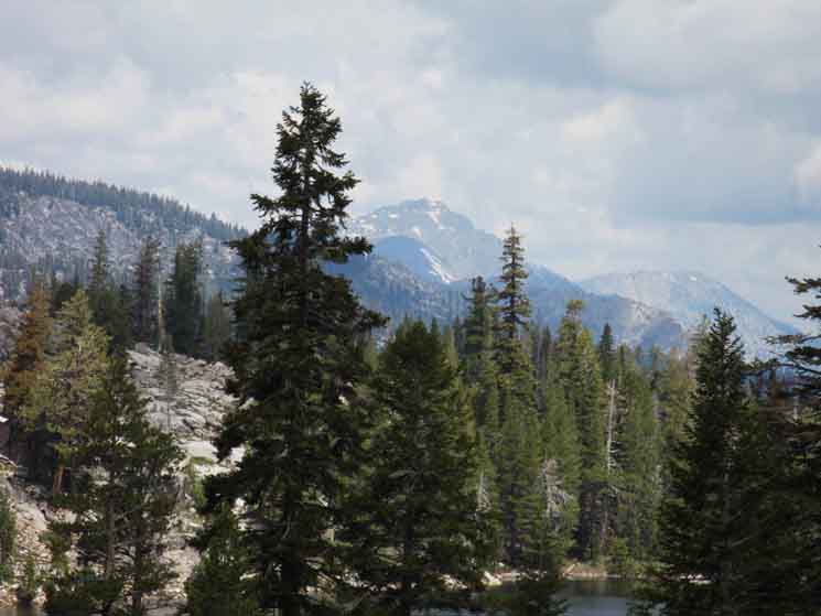
| View of Mount Tallac far to our Northwest while climbing South from Round Lake, Late Spring. | ||
|
||
Taking this long view Northwest we can see Tallac Peak along the distant West Shore of Lake Tahoe with the top of the Southern end of the ridge holding Rubicon Peak below and beyond Tallac Peak. Phipps Pass is located to the West (Left) down the ridgeline running Left from that most distant ridge.
|
Springtime
Early Spring view looking Southwest at the mountains making up the most Southwestern perimeter of the Lake Tahoe Basin. We're looking Southwest across of the lower section of the lower meadow above Round Lake. It looks to me like we are seeing the Southern flank of Little Round Top rising out of the Right side of the image below. Meiss Meadow lays at the base of this ridge on the far Left side of the image. |
||
 |
||
Snow line looks to be above 8200. Meiss Meadow may or may not have snow, but the Carson Gap over to Highway 88 and the Carson Pass will. Round Top and The Sisters will be snowed as well.
|
Hiking South out of Round Lake towards Meiss Meadow
Winter Route
Gap to the Upper Meadow
Below we are looking Southwest diagonally across top of brushy lower meadow above Round Lake, looking at the gap at the top of the lower meadow up to the upper meadow. We are on the maintained trail along the upper Eastern edge of this brushy lower meadow. During Snow conditions we will hike up the center of this meadow, up to the gap between the end of the rocky section and the beginning of the trees on the far upper side of the meadow. Our position on the Summertime trail to Meiss Meadow continues to our Left around the upper edge of this brushy meadow, while the Western Winter route to Meiss Meadow proceeds through that gap we can see in the picture below, between the end of the rock and edge of the forest on the far upper side of this brushy meadow. This route is not passable when the picture below was taken, due to the dense brush clogging the terrain. On the other side of that gap above the rock and below the trees we find another, upper meadow. From the Southwest corner of that upper meadow we can find a nice Wintertime snow route up to the North shore of Meiss Lake. Hiking Map South On the other side of the rocky granite formation bounding the West side of the meadow above Round Lake is where a South Upper Truckee River tributary, the one feeding Round Lake, makes its way through a steep and narrow channel cut into the granite terrain. I've been in there a couple of times during Winter and found it to be quite delightfully unique environment. |
 |
In Winter this meadow brush is buried under snow to provide easy travel over this part of our snow shoe trip South towards Meiss Meadow. We can point for Showers Lake, Round Top Lake, or string both lakes along a circle route that ends with us coming back down this meadow and Round Lake on our way back down to the South Upper Truckee Trailhead. The route of the trail skirts the meadow along its high side to avoid all of these problems. Until snows fill it all in, and we can access these more direct cross country routes. |
Top of the Meadow above Round Lake
North: Round Lake South: Approaching Meiss Meadow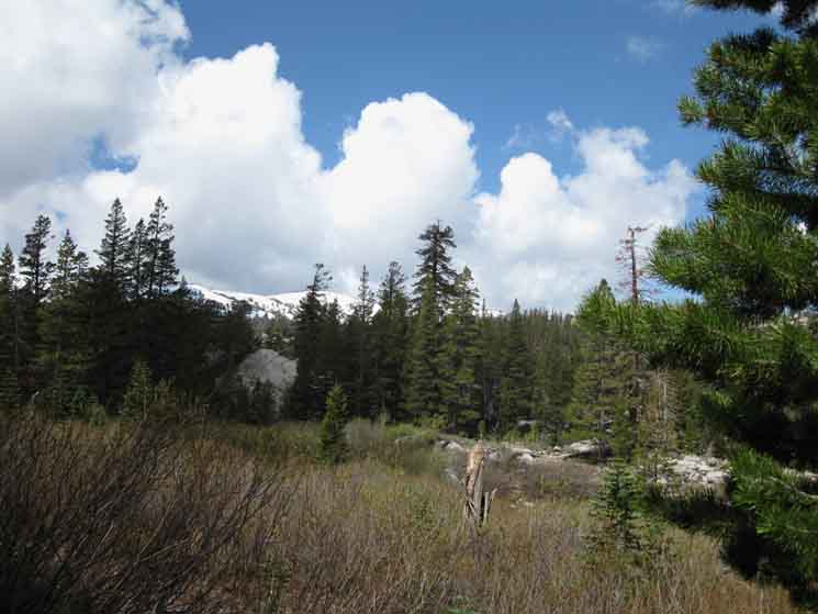
| I took the image below during a frustrating backpacking trip during the Winter of 2001, when a low level of snow drove me through much more dense brush than normal for Winter travel. This brush should have been deeply submerged under feet of Winter snow. This is a picture of what I was busting through: |
 |
| Arrrg! |
| Cross country travel above Round Lake during Winter should get easier, when all this dense brush is buried under snow. Snow cover really opens this place up, while great sections of terrain off the trail are otherwise clogged with dense underbrush when there's no snow. |
||
 |
||
During Spring the exposed brush becomes another route finding consideration. During Summer the exposed brush is a real obstacle.
|
| Upper Meadow above Round Lake |
 |
Looking North from upper meadow above Round Lake. We are looking North at where we passed from the Image by Ardalan Yaghmaie, early June 2010. |
Video
Coyote Encounter
just South of Round Lake
near the location pictured above and below
June 2010
|
Ari and I had begun at the South Upper Truckee Trailhead and returned to it after visiting Round Lake, Showers Lake, Round Top Lake and Round Lake again on our return to the trailhead. We took the Eastern route from Meiss Meadow down to Round Lake, and were finding our way to the lower meadow from the Southeast when I spotted a coyote moving through the terrain towards us out of the West. As I saw it before it saw us, I called a silent stop. Silence is golden. As the coyote unknowingly made its way towards us, I fumbled to get the camera out without alerting coyote to our presence by my motions. I had to stop before I had the camera ready. Coyote emerged from the dense brush maybe 20 yards in front of us. We were frozen in place, and we were not going to move. This first frustrated the coyote, who knew the picture it saw was wrong, very wrong, but as we refused to move the coyote could not quite figure out what was wrong. It's frustration soon turned to anger, and it was real ticked off at our audacity. It began a series of retreats, stopping each time to tell us what it thought about us. We did not get a good review. I started sweet-talking it, which did not really help. It appears coyote was trying to draw us off from something, possibly a den with pups. Well, no, I was not going to break my line for Round Lake to chase coyote, but she gave it her best efforts. |
North: Round Lake South: Approaching Meiss Meadow
Southbound options |
||
Long Distance Backpacking Options
|
| Meyers to Carson Pass miles and elevations |
Echo Summit to Carson Pass miles and elevations |
Another option is to turn South from Meiss Cabin to exit Meiss Country and end our trip through the Carson Pass Trailhead, a distance of about 8.42 miles, plus the extra distance added by the trail rerouting at and above the South Upper Truckee Trailhead.
Check out these maps to check out our other backpacking trip options: The Schneider Cow Camp trailhead is best shown on the bottom-Left of the 15 minute map, while it's trail route from its trailhead near Caples Lake to its junction with the TYT/PCT/TRT within the Tahoe Basin is completely laid out on the bottom of this 30 minute map, though the 30 minute map still shows a section of trail no longer maintained, being the section of trail leading to the South of Showers Lake.
The current trail from Schneiders Cow Camp intersects with the TYT/PCT to the North of Showers Lake.
Long Trails South
If we are hiking the long trails South out of the Lake Tahoe Basin via Meiss Meadow and the Carson Gap, our next question may well be, "which route should we hike" across Highway 88 down to the next trans-Sierra highway, Highway 4.
Should we backpack the Tahoe to Yosemite Trail route down to Lake Alpine or the Pacific Crest Trail down to Ebbetts Pass on Highway 4?
The discussion below deals with water conditions along both route options.
The PCT and TYT are routes of very different characters, the specific traits of each which will match up better with some hikers than others. The PCT is dry and volcanic along very well and deeply established trails. The TYT crosses much wetter granite terrain with a significant length of unmaintained trail. Give each some study time and pick the route which best suits your character, capabilities, and expectations.
Nonetheless, today, hiking South from Round Lake we will cross out of the Tahoe Basin through the Carson Gap to either begin our hike to the Southwest over Round Top and the Sisters along the Tahoe Yosemite Trail to Lake Alpine on Highway 4, or we will begin following the Pacific Crest Trail Southeast through Carson Pass towards Ebbetts Pass on Highway 4.
Today we begin our next section hiking South through the Sierra Nevada. We exit the Tahoe Basin to begin our hike across the Mokelumne Wilderness section of our trail South to Mount Whitney.
Check out the Carson Pass Region Map for details of our transition out of the Lake Tahoe Basin on to our selected Southbound trail. Or not.
I used to hike from the Tahoe Basin to Round Top and back during Spring, Summer, Fall, and Winter, but have given up the Summer Trip as I don't like having to stop at the Carson Pass Cabin and not get a permit for Round Top at the Carson Pass Cabin halfway through my trip...
Now (2008 and on, or so) the El Dorado National Forest is saying we need Winter permits for the CPMA. Sigh. How I'm going to get a permit from El Dorado for a trip beginning (Winter) in the Tahoe Basin is questionable. No, no question about it: it's just a hassle.
My point is that we can hike out of, and back into the Tahoe Basin as part of a fun short/medium distance backpacking trip during any season of the year.
We'll have to screw around a bit to obtain the proper permits from the LTBMU, who don't require permits for hikes in the Meiss Country Roadless Area, to get them to issue our permit for trips beginning in the Meiss Country on our way to Round Top and back.
Us long distance Summertime backpackers hiking South out of either the South Upper Truckee or Echo Summit Trailheads in the Meiss Country Roadless Area have already drawn our long distance permits from the Lake Tahoe Basin Management Unit specifying which campsites we will utilize in the Carson Pass Management Unit before we hit the trailhead.
South from Round Lake
Backpacking two miles South from Round Lake our trail tees out at the Meiss Meadow trail junction. This is the last point where the Pacific Crest, Tahoe to Yosemite, and Tahoe Rim Trail routes are unified for all Southbound backpackers.
From here the clockwise Tahoe Rim Trail runs Northwest with the other two trails, the counter-clockwise TRT runs Northeast towards Big Meadow, while the Southbound TYT and PCT continue South across Meiss Meadow on their way out of the Tahoe Basin via the Carson Gap.
Meiss Meadow is where our trail up from the South Upper Truckee Trailhead (or Big Meadow) intersects with the TYT and PCT passing North and South through the Meiss Country Roadless Area.
The PCT-TYT trail bisects the length of the Meiss Country Roadless Area, crossing the 12 miles separating Echo Summit from Carson Pass.
All Southbound backpackers will turn South, left, to hike the short 1.52 mile intermediate difficulty trail to the Carson Gap by crossing the Southern corner of Meiss Meadow to find the trail above the gully for the short climb up to Carson Gap's 8800 feet of elevation. Carson Gap is 400 feet above Meiss Cabin.
On the way up to the Carson Gap we will see excellent views North across the expansive South end of Lake Tahoe, its Southern and Eastern shores, and the Carson Range wrapping around them. The view to the North is gotten while hiking up to the Carson Gap, while grand views to the South don't open up until we approach the gap itself, where the view to the North is obscured.
No problem. We'll keep an eye on the view to the North as we hike South up to the Carson Gap.
Round Top and the Sisters
Carson Pass Management Area Map
Looking South from Carson Gap we observe the impressive forms of Elephant Back, the awesome ridge wrapping around Winnemucca Lake, Round Top, and then The Sisters, from left to Right. Out of sight behind us and to the North Lake Tahoe lays hidden at the base of its expansive Basin.
Standing in the Carson Gap puts us at the center of a low gap in the ridgeline of the Tahoe Rim that makes up the natural Southern exit from the Tahoe Basin.
Our position in the Carson Gap puts us about a mile West and about 400 feet above Carson Pass on Highway 88 if we are following the Pacific Crest Trail route Southeast, instead of breaking off to the Southwest to follow the Tahoe to Yosemite Trail.
Here's a close-up picture of what the Carson Gap looks like, looking North from the South, from a position hiking South on the TYT up to Round Top and the Sisters via the Lost Cabin Mine Trail. Check out this wider perspective of the Carson Gap taken from the trail between Winnemucca Lake and Round Top, which is the Westernmost of the 3 routes we have to choose from connecting the PCT to Round Top and the TYT.
We don't have to hike South through Carson Pass following the Tahoe to Yosemite Trail South unless we want to. There are two quicker routes to Round Top and the Sisters into Summit City Creek than the Winnemucca Lake trail junction situated a mile South of Carson Pass.
At an unmarked trail junction about 50 yards South of the Carson Gap breaks off to the Right (Southwest) from the Pacific Crest Trail to follow this first trail split of the Tahoe to Yosemite Trail to the Southwest, or we can continue hiking Southeast on the Pacific Crest Trail towards the Carson Pass along the PCT.
Tahoe to Yosemite Junction
If we are hiking the Tahoe to Yosemite Trail we have three basic routes to choose to get up to the top of Round Top and the Sisters on our way over to Summit City Creek.
The first two routes require we hike straight down from the unmarked junction just South of the Carson Gap to cross Highway 88 hiking towards Woods Lake. The second unmarked trail is just a little further South down the trail at the base of the descent South from the Carson Gap. These two trails meet at the creek, and run together down to Highway 88.
After joining together the combined trail leads down to a crossing of Highway 88 a bit West of Carson Pass. On the South side of Highway 88 we see and follow the dirt road Southwest (Right) to eventually take a Left turn (South)where this dirt road meets with the paved road to Woods Lake.
Approaching Woods Lake we'll find two ways up to Round Top, the Lost Cabin Mine Route and the Footbridge Route.
Lost Cabin Mine Trail
Just before reaching Woods Lake we will turn to our right to hike up the paved road looping through the Woods Lake Car Campground, if we want to hike to Round Top on the Lost Cabin Mine Trail.
We can pick up this trail as we hike down the paved road to Woods Lake, before we reach the Woods Lake Car Campground, because part of this trail sits off to the West of the paved road, paralleling it South to Woods Lake.
I find the best way to hook up with the Lost Cabin Mine Trail is by hiking down the paved portion of the road to and through the Woods Lake Car Campground.
A short trail at the top of the campground loop leads between two campsites to tie into the old jeep road up to the Lost Cabin Mine. The jeep trail narrows into our foot trail as it continues South past the rustic but active Lost Cabin Mine up to Round Top Lake. This route approaches Round Top from the North.
The Lost Cabin Mine Trail is a pretty hike that gives us some great views of the Carson Pass region, the South end of the Lake Tahoe Basin, the surrounding mountains, and good looks at the Carson Gap we passed through out of the Tahoe Basin on our way up here.
I prefer to take this route to Round Top Lake. It is the steepest but shortest route, and I always stop at Woods Lake for a snack break and to meet the locals. It's a pretty lake with people from up and down the East Sierra kicking back, picnicking, hiking and fishing.
I generally walk the more populated routes through places like Woods Lake so I can check out how it's being used, who's using it, and talk to them to find how they are doing.
How Ya Doing?
Footbridge Route
The second way up to Round Top Lake is the footbridge route across Woods Creek to our Left, East, as we walk down the paved road to Woods Lake and its Campground.
We'll cross the footbridge prior to reaching the Woods Lake Campground or Woods Lake. I still walk down to Woods Lake for a break before I hike the short distance back to either the Lost Cabin or Footbridge routes.
The Footbridge route is an easy intermediate difficulty trail bending Southeast after crossing the bridge to follow the rise on the East side of Woods Lake up to where we get into and follow a low valley leading up to the trail junction at Winnemucca Lake.
The Winnemucca Lake junction ties our trail together with the trail South out of Carson Pass, and to the Westbound trail up to Round Top Lake.
At this Winnemucca Lake trail junction we turn West to approach Round Top from the East.
Carson Pass Route
Our third option for connecting to the Tahoe to Yosemite Trail out of the Lake Tahoe Basin is to continue South on the Pacific Crest Trail from the Carson Gap to and through Carson Pass to the Winnemucca Trail junction located a mile South of the Carson Pass.
The Winnemucca Lake Trail breaks off the PCT to the Southwest towards Round Top Lake via Winnemucca Lake below the North face of Elephant Back. This route approaches Round Top Lake from the East. At Winnemucca Lake we will intersect with the footbridge trail coming up from Woods Lake, and at the Round Top Lake trail junction we will meet the South end of Lost Cabin Mine trail.
Check out the Carson Pass Hiking Map. Click the red dots.
That's the basics of our three route options we've got for today's hiking from Round Lake to Round Top Lake, if we're going to hike the Tahoe to Yosemite Trail.
Though it's only a 6.97 mile hike up to Round Top Lake from Round Lake, and downhill afterward into Summit City Creek, I'm likely to spend tonight enjoying the stunning view of the expansive horizon and surreal terrain at Round Top Lake.
Round Top Lake is a real nice place to spend a night on our way South on the Tahoe to Yosemite Trail.
Camping options are plentiful on the Tahoe to Yosemite Route
Round Top Lake is the second highest point we will have hit so far on the trail South from Meeks Bay, thirty feet lower than Dicks Pass. But there is water and great camping here, which Dicks Pass lacks.
I always like to camp at the highest point, if possible. Continuing past Round Top Lake brings us around the Western shoulder of the Western Sister.
From Round Top we'll descend down the Southwestern side of the Round Top-Sisters massif overlooking, then passing by the crystal blue waters of 4th of July Lake on our way down into Summit City Canyon. Round Top Lake, 4th of July Lake, and the campsite near the Summit City Canyon trail junction at the base of Summit City Canyon are excellent places to camp.
Fourth of July Lake is quieter than Round Top Lake, due to its further distance from the Carson Pass Management Area Trailheads, and I've never seen anyone in the campsite near the Summit City Canyon trail junction.
If either Round Top Lake or Fourth of July Lake in the Carson Pass Management Area are potential campsites on your route South along the Tahoe to Yosemite Trail, I strongly recommend that you make sure to name these locations on your backpacking permit.
If you want to start a hike out of Carson Pass make sure you inquire at the El Dorado National Forest about the Carson Pass Management Area Permitting policies.
Carson Pass Management Area
El Dorado Forest Service web site page.
Carson Pass Management Area
TahoetoWhitney notes.
Carson Pass Management Area
The Carson Pass Management Area was set up to manage Winnemucca Lake, Round Top Lake and 4th of July Lake because of their heavy usage by Tahoe and Sierra Locals, especially during the high Summer Season. Day hikers are also scattered all over the mountains around here during Summer.
During high Summer backpacking season weekends, I just stop for lunch or a break at Round Top Lake. It is just too busy to be enjoyable on Summer weekends. It is always better to pass through Round Top and the Sisters during the week, if possible. Then I spend a night.
Long-distance through hikers should have no problems camping here, as permits that cross more than one National Forest are generally honored by all special zones along the trails between Lake Tahoe and Mount Whitney.
When I am following the Tahoe to Yosemite Trail across Round Top, I generally list Round Top Lake or 4th of July Lake as one of my campsites on my through-hiking permit, and I have camped there for years without problems, so far. But in recent years they have marked out all of the campsites at Round Top and 4th of July Lakes, and fill them up every Summer weekend.
If we name a campsite at Round Top or Fourth of July Lake, and find a local backpacker with a local permit for that site we either share or use another campsite. No problem. We local and long distance backpackers should have no problem accommodating each other...
From the Carson Gap South on the Tahoe to Yosemite trail there is regular water all the way to our first ford of Summit City Creek. Conditions are much drier following the Pacific Crest trail South of the Carson Gap to Ebbetts Pass than on the Tahoe to Yosemite Trail.
Water
General Thoughts
on
Seasonal Water Conditions
From when the trails first fill up and flow as creeks during the thaw of early Spring, to the end of fall when only the main drainages contain weak flows, the Sierras will have displayed an amazing range of water conditions.
Approaching Summer the streams draining the perimeter of the bowls and upper valleys are still flowing. From that point on all of these drainages will begin receding until most creeklets that were flowing heavily in early Spring will be bone dry by late Fall.
In a broader context we can see that the long term emergence of drier conditions and a drier environment are creating low water situations earlier with each new year.
Generally only the main drainages in the High Sierras are flowing in late Fall. A good rule of thumb is to anticipate that the full flow of water through creeks and tributaries in Spring will gradually recede down to the main drainages in Fall, and then even the upper reaches of the main drainages themselves can dry out, meaning the rivers begin their flows down the mountains from much lower elevations in late Fall.
Each season is different, so late season travelers should check local conditions and just what kind of season they are getting into before, if not when they order their permits.
If you are planning on picking up your permit from a Trailhead permit box, consider calling the local Ranger District and seeing what their Wilderness Ranger has to say about water conditions.
The extremes in Sierra Nevada water availability are incredible. During the height of the Spring Thaw the rivers can kill you. At the end of Summer we will have a hard time finding water for significant stretches of trail.
Here's the link to the Ca. Dept of Water Resources reporting station maps. From there we can find all the river reports to get a general idea of water conditions.
I've also added water and fire reports to the High Sierra Weather page.
Specific Considerations
The Pacific Crest Trail South from the Carson Gap
If we are following the Pacific Crest Trail South our main concern will be where we are going to get water. Especially during Summer and Fall of the recent very dry years, which are forming into a new, drier environment.
The reason this is important is that from the Carson Gap moving South we are entering a fairly arid portion of the Eastern High Sierra, especially during these drought Summer years, and during late Fall of any year.
My next, and related concern is where to take breaks and where to set up fine campsites. I always insist that break spots be at/near watering points and at the top of every mountain or high points with views, if at all possible.
Do enjoy the views we have worked so hard to see. Take enough time to enjoy all aspects of the experience. Our final concern is where we are going to camp between the Carson Gap and Ebbetts Pass.
We'll check out campsites as we hike South on that section of the PCT guide.
The areas we are going to select campsites from are determined by our daily miles, and in some cases the distances between premium campsites will determine our daily miles.
Carson Gap to Highway 4, Ebbetts Pass
Carson Gap
Nice Pond and flowers, if in season. Iris blooms annually in the Carson Gap, and they are the crowing glory of the amazing Spring Bloom that spreads a carpet of color across the gap.
Pond water sucks. I water up for the next stage of the hike towards Ebbetts Pass out of the South Upper Truckee River at the last ford before climbing South to the Carson Gap.
For what distance do we water-up for?
Under "worse-case conditions" I'd say we could lack fresh water sources for 11.49 miles South of Carson Pass until we reach Tamarack Lake to the South of the Blue Lakes Road. Adding the distance from the South Upper Truckee river in Meiss Meadow, and that figure goes up to 14.4 miles.
Water Sources
Carson Gap to Ebbetts Pass on Highway 4
Pacific Crest Trail
There is plenty of water in the Meiss Country Roadless Area, and good water availability continues along the Southbound TYT.
But there's not so much good water hiking South on the Pacific Crest Trail. The water availability we experience is dependent on the season, and the Winter and Spring seasons have been diminishing in length and moisture with each passing year. The PCT between Carson and Ebbetts Passes begins quickly drying out after the Spring Thaw.
If we are heading South on the PCT, I advise getting water at the South Upper Truckee headwaters before climbing up to the Carson Gap. I carry water from there to Lost Lakes or Tamarack Lake. I would prefer not to water at the pond in the Carson Gap after grazing season begins, nor any of the ponds we find along the trail South.
In fact, after the Spring Thaw ends we can only depend on having a series of diminishing ponds South of the South Upper Truckee water source down to Lost Lake.
Though the ponds will have an acceptable quality of water after the Spring Thaw ends, it will quickly become stagnant and stale as Spring progresses into Summer and Fall.
The pond at Carson Gap, Frog Lake South of Carson Pass, and the ponds at the top of Forestdale Creek are all less preferable to the water in the South Upper Truckee River to the North, and the water in the Spring-feed creek coming off the Northeast side of Raymond Peak, which is my preferred source of water between Carson and Ebbetts Passes.
The series of lakes stretching South of Blue Lakes Road down to the spring fed creek coming off the Southwestern flank of Raymond Peak generally have acceptable water, but I prefer the fine spring fed creek.
Here's a list of places to get water for the 11.49 miles South from Carson Pass to Tamarack Lake.
Carson Pass
No Water at Carson Pass,
...but say hello to the Volunteers!
Frog Lake
OK in Spring, pond-like during Summer, and too low during Fall.
Crossing Forestdale Creek & Ponds
Forestdale Creek withdraws down the mountain below where our trail crosses early during dry years. The Forestdale ponds are nasty when low. I don't like pond water, and especially don't like it when the ponds are low...
Forestdale Divide above Blue Lakes and Headwaters of Summit City Creek
No water here, but it's got nice Views Southwest down Summit City Canyon and of Devil's Corral. Note that the Tahoe Yosemite trail dropped down to Summit City Creek on the West Side of the Sisters and Round Top. We are viewing Summit City Creek from the Eastern side of the same massif.
Lost Lakes
Good place for hot lunch with water, shade, improved sites, and a great view of the backside of The Nipple. But it's about a half-mile offset to the East from the PCT.
Though the map indicates the PCT goes by Lost Lakes, it does not. The trail and road have been rerouted, putting Lost Lakes about a half-mile East of the current (2014) trail route and Forestdale Road.
View South from under The Nipple
There is no water up here, but we can see the upcoming section of forest our trail enters that will soon give us relief from this fairly long section of exposed trail, and lots of water. Under that forest to our South are a series of lakes and creeks where we will find fresh clean water.
Tamarack Lake
Excellent camping sites, though accessible to cars.
If we are backpacking South on the Tahoe to Yosemite Trail there are many water sources all the way to the first ford of Summit City Creek from Meiss Meadow. In fact, the TYT route has lots of water, and water will not be a problem hiking this section from Carson Gap to Lake Alpine with a little investigation and planning.
The main water consideration for TYT hikers will be the hike from Camp Irene over Mount Reba and down to Lake Alpine.
If Lake Valley, the upper valley on Mount Reba below its crest, is dried out late in the season we will have to consider carrying enough water for the full 8.36 mile hike from Camp Irene to Lake Alpine.
The water availability assumption I make is for late Fall conditions, when water is at its shortest supply in the High Sierras. This generally means that the perimeter and side drainages of every bowl or valley that we will cross have completely dried up, and therefore the only running water will be the main drainage at the center of the Valley, or the middle of the bowl we are passing through.
Many times we will find that even the main drainage has retreated down mountain as Fall deepens into Winter.
Hiking Information
7.5 min
Topo Hiking Map
Meyers to Carson Pass
30 min
Topo Hiking Map
Meiss Roadless Area
to
Carson Pass Management Area
Next page South
Approaching Meiss Meadow
Backpacking Trail Guide North |
 |
Backpacking Trail Guide South |
Backpacker ForumsHave a great Sierra Nevada route or trip to relate?Post 'em on
On the Forum you can browse trail locations and add your experiences, comments, questions (& pictures and videos if you Register...) about hiking South out of the Echo Summit Trail Head. Besides the Trails Forums Tahoe to Whitney has extensive Backpacking Topics Forums dealing with about every topic of interest to backpackers. General comments about the South Upper Truckee to Carson Gap section of the High Sierra trails, or this particular location: Section
|
North: Round Lake South: Approaching Meiss Meadow
Trailhead
Contact
Alex Wierbinski

Backpacking Lake Tahoe to Mount Whitney
Your guide to the High Sierra Crest, including the Tahoe to Yosemite, Pacific Crest, and John Muir Trails
