The Trails
Guide
Maps
Miles/Ele
Permits
Resupply
Forum
Current Weather Conditions
Weather Notes
Northern High Sierras
Central High Sierras
Southern High Sierras
Gear
Gear List
Gettin Started
Layering
Discussion
Testing yourself and your gear
Gear Reviews
Backpacking
Ebbetts Pass
to
Tyron Peak
Carson Iceberg Wilderness
Hiking
The Pacific Crest Trail between Ebbetts Pass to Sonora Pass
Languages
Languages
Trail Arts
The art of walking
Physical Preperation
Trail Skills
The trail
Off the trail
Scrambling
Maps
Navigation
Camp skills
Food
Resupply
Food
Other
Photo Catagories
Trail Stories
Trail Culture
News and Science
Links
Groups
Books
Terms and Conditions of Use
| Trail Guide INDEX Highway 4 to Highway 108 |
North PCT Ebbetts Pass |
South PCT Tyron Peak to Murray Canyon |
7.5 Topo Map Ebbetts Pass to Wolf Creek Pass |
30 min Map Ebbetts Pass to Sonora Pass |
Ebbetts to Sonora Pass MILES AND ELEVATIONS |
ALL TOPO MAPS EBBETTS PASS TO SONORA PASS |
Resupply North Lake Alpine South Kennedy Meadows |
National Forests Toiyabe & Stanislaus |
all maps index |
Ebbetts Pass
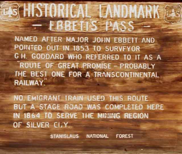
| Historical Landmark at Ebbetts Pass | ||||||
 |
||||||
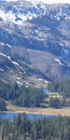
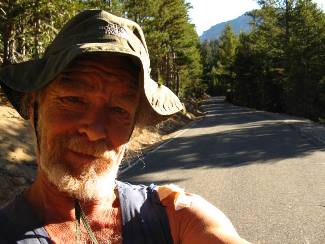
Ebbetts Pass Arriving at Ebbetts Pass marks the end of our 27.88 mile Southbound hike from Carson Pass to Ebbetts Pass across the Mokelumne Wilderness on the Pacific Crest Trail. Here at Ebbetts Pass we begin our next Southbound section of the Pacific Crest Trail across 29.44 miles across the Eastern edge of the beautiful Carson Iceberg Wilderness to Sonora Pass. We will experience significant changes in terrain and forest cover with this change in Wilderness areas. We'll have more forest cover, and we'll move into a fantastic transition zone between the predominant volcanic terrain we've been crossing into a zone of amazing golden to yellow colored granites through the great gorge on the upper sections of the East fork of the Carson River. Shortly after climbing South out of the headwaters bowl of the East Carson River's great canyon we will again plunge back into raw exposed volcanic terrain approaching Sonora Pass and Highway 108 across it. We'll continue South from Sonora Pass across exposed volcanic terrain until we finally approach and enter the very Northwestern corner of Yosemite National Park. The Southern part of this next section along the East Fork of the Carson River and the surrounding Eastern Sierra terrain, are one of my favorite places in the Sierra Nevada. Critical Southbound PCT Route Information
Hiker Information
|
Hiking South
|
||||||||||||||||||||||||||||||
| Index Hiking the PCT through the Carson-Iceberg Wilderness On this page |
||||||||||||||||||
VIDEO
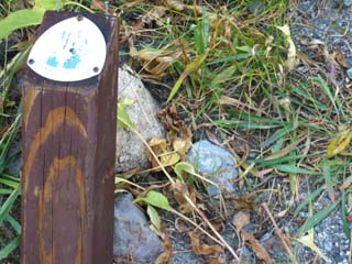
TRAIL JUNCTION
TRAIL JUNCTION
|
Weather and Road Information
All All High Sierra Weather Resources Comprehensive High Sierra Fire and Smoke Information |
|
||||||||||||||||
| > Backpacker's Forum < | ||||||||||||||||||
POST UP! All backpackers can post comments, information, updates and corrections concerning the following section of trail from Ebbetts Pass to Tyron Peak through the comments links on all the trail guide pages. Registered Members can post up stand alone posts about specific points along the trail or whole backpacking trips using text, images, maps and videos in the Trails Forum that supplements this section of the Trail Guide. Check out the Tahoe to Whitney .org Backpacking Trails and Topics forums. |
||||||||||||||||||
Basic Trail Facts
Overall
| Ebbetts Pass to Sonora Pass via PCT 29.44 miles |
Ebbetts Pass to Sonora Pass Miles and Elevations |
This Trail Segment
Ebbetts Pass
8732 feet
High Point of the Pacific Crest Trail across Tyron Peak
9320 feet
Tyron Peak is 4.92 miles South of Ebbetts Pass
Tyron Peak is 24.52 miles North of Sonora Pass
Murray Canyon is 5.95 miles South of the high point of the PCT on Tyron Peak
Ebbetts Pass to Wolf Creek Pass
15 minute backpacking MAP
Between Ebbetts Pass and Tryon Peak we don't have great spots to camp. Noble Lake is nice but has the water problems described below. Between Tyron Peak and Murray Canyon we have lots of nice spots to camp in.
Ebbetts Pass
Ebbetts Pass at 7:30 am on Tuesday, September 22, 2009. |
||
 |
||
Looking East down the quiet East flank of the Sierra from Ebbetts Pass. Very Quiet. Just me and the birds and squirrels.
Ebbetts Pass to Sonora Pass SOUTHBOUND PCT |
Ebbetts Pass
|
| Ebbetts Pass to Wolf Creek Pass 15 minute backpacking MAP |
Ebbetts Pass to Sonora Pass Miles and Elevations |
Ebbetts Pass to Tyron Peak:
The Trail Guide
First, lets check out the terrain through a video inspection
| Film Ebbetts Pass to Tyron Peak |
|||
Duration: 4:24. Views of Noble Canyon up to the headwaters of Noble Creek at Noble Lake and its surrounding basin, passing by the Bull Canyon trail junction and Bull Canyon to our East, on our way up to the high point of the Pacific Crest Trail over Tyron Peak. Views West of Hiram Peak, Highland Lakes, and lightening mountain on the Western Sierra flank from the high point crossing Tyron Peak.
|
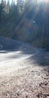
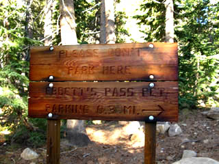
Trail Parking JunctionParking, and Southbound out of Ebbetts Pass As we see in the videos and images of Ebbetts Pass on the previous trail guide page, the location where the Pacific Crest Trail crosses Ebbetts Pass has little room for parking cars. It's a thin turnout with a trailhead bulletin board and a historical marker. And another new sign (2009) at Ebbetts asks that cars be parked .3 of a mile East down Highway 4. It says,
If you desire, you can drop off your packs and people at Ebbetts Pass, run the car .3 of a mile East down to the parking area, then hike back up to the trail junction that intersects with the PCT .36 of a miles South of Ebbetts Pass down to begin your backpacking trip. Begin your Southbound hike out of the Ebbetts Pass parking lot to intercept the Pacific Crest Trail .36 of a mile South of Ebbetts Pass where the trail from the parking area joins the PCT.
The Stanislaus National Forest has recently (Summer of 2011) redone the signage at a number of their trailheads. The old broken-down bulletin board at Ebbetts Pass is now gone, and some of the Silver Valley trailhead's old classic signs on the East Shore of Lake Alpine along the Tahoe to Yosemite Trail are gone too... Ebbetts Pass to Sonora Pass SOUTHBOUND PCT First Trail Junction South Hiking .36 mile from Ebbetts Pass South on the Pacific Crest Trail we encounter the trail coming up mountain from the parking lot Trail Junction. |
Ebbetts Pass Parking Lot
Trail Junction
| Junction down to the Parking area. |
 |
.36 of a mile South of Ebbetts Pass on the PCT. |
Traverse Into Noble Canyon
| Turning around to look North up the PCT while beginning our traverse down into Noble Canyon. |
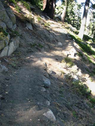 |
Shady and soft trails under the forest cover dropping down into Noble Canyon traversing along the East flank of the Sierra below the crestline. Easy on the feet and knees. |
Big Turn
 |
||
This big turn locates our position on the maps just a bit to the North of the Noble Canyon trail junction.
|
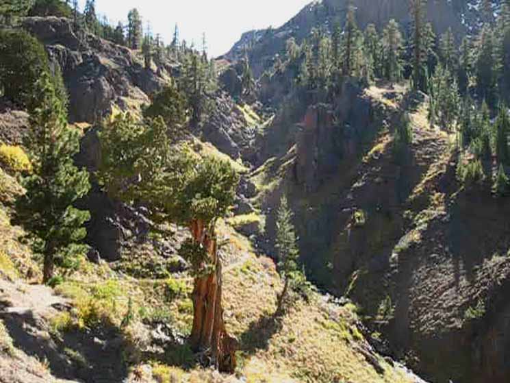
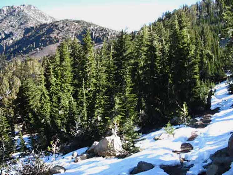
Out of the Forest Our trail South from Ebbetts stays fairly flat at first as we wind through the forested East flank of the Sierra below the ridge rising up to the high point Tyron Peak. We can make out a great volcanic wall to our Southwest when we get glimpses of the terrain through the trees. Rounding a ridge arm we enter the Eastern flank of Noble Canyon and begin our 400+ foot descent to cross Noble Creek. We exit the shade of forest cover as we approach Noble Creek.
3.01 miles South from Ebbetts Pass to the Noble Canyon trail junction. 1.91 miles South from the Noble Canyon trail junction to the high point on the gap over Tyron Peak.
Noble Canyon Backpacking Trip It's about a total of 6.5 miles of delightful downhill hiking from Ebbetts Pass down to Highway 4 at the Silver Creek Campground through Noble Canyon. |
| Light forest cover on the Western flank of Noble Canyon down to the Noble Canyon trail junction. |
 |
Noble Canyon holds Noble Creek. The two great peaks decorating the Eastern Flank of Noble Canyon are Highland and Silver Peaks, which we first observed coming around to the South flank of The Nipple. Ebbetts Pass to Wolf Creek Pass Map |
Noble Canyon with Consolidated Boulders
 |
||
Looking down Noble Canyon with a consolidated boulder in the Right foreground.
|
Noble Canyon
Forest and shade give way to open volcanic terrain with little cover as we cross from the North to the South side of Noble Creek's drainage, by direction of travel along the Pacific Crest Trail. We are hiking Northwest to Southeast by the compass. |
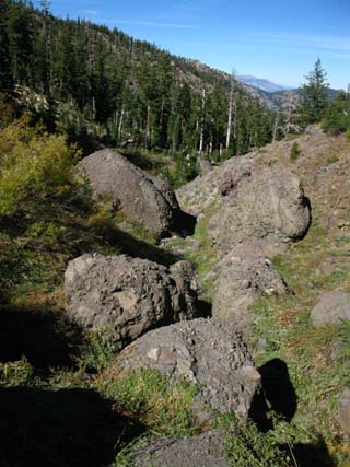 |
A string of composite boulders runs down the drainage of Noble Creek. These boulder are breaking off the rock face as the forces of erosion are cutting into the volcanic terrain along the Sierra Crestline above our position. These massive composite boulders are made up of thousands of different individual stones swept up and bound together by the cement created in massive ancient volcanic lahars. These composite boulders off falling off the surrounding cliffs are the only remnant of these ancient flows which once covered great expanses of the terrain. Composite boulders decorate segments of our trail from the Tahoe Basin through the Mokelumne Wilderness, and into the Carson-Iceberg Wilderness. Check this note about Composite Boulders. Also see Rock Star the Lahar Composite boulders eventually disappear, melting into great piles of different types of stones, then finally melting into the terrain. |
Other Consolidated Boulders
| Examples up in South Upper Truckee drainage. |
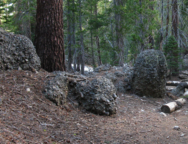 |
The image above is a field of composite boulders above Round Lake in the Tahoe Basin along a tributary to the South Upper Truckee River. Click the image to see more at Round Lake. |
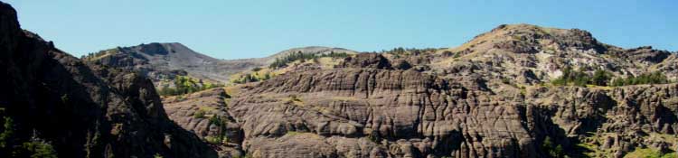
Sierra History Recent names of topographic features represent the character of our Western interaction with the terrain. Silver Creek, Noble Creek, Silver Peak, and the Silver Trailhead all hearken back to the great Silver Boom of the late 1850s that followed on the coattails of the Gold Rush. These mountains were overrun first by gold prospectors during the early 1850s, and then by seekers of silver in the late 1850s through the 1860s. Prior to the frenzy of the Gold Rush and Silver Boom explorers and early settlers probed the Sierra for a path to the Pacific, and many met hard ends. As we continue South we will encounter Disaster Peak, Relief Peak, and a series of terrain features that broke many wagons and killed many people while testing the fortitude and demonstrating the apparent lack of common-sense of many of the people who survived early attempts to cross the Sierra with wagons before the main roads were established. What the hell were they thinking? The Clamper's Historical monument at Sonora Pass attests to the hard end of many of these early attempts to cross the Sierra with the wrong gear for the conditions they encountered crossing the Sierra Nevada Mountains. If you have hiked or driven the length of Highway 4 or Highway 108 East to West across the Sierra crest and its approaches, you know what I mean. Those are a couple of mean roads! I can see crossing the Sierra without road or trail on foot, or with a well-equipped and well-provisioned horse and mule team. But not with a wagon. I can say one thing about the early attempts to cross the Sierra with a wagon: they did not scout the route, or they would not have tried it with wagons. The Sierra Nevada was a significant seasonal home and contributor to the life and welfare of native tribes established on both its flanks for between 15 to 30,000 years, depending on who's history you believe. Tribes from each flank moved into the Sierra during Summer to both harvest its resources and trade with each other across the Sierra crest. |
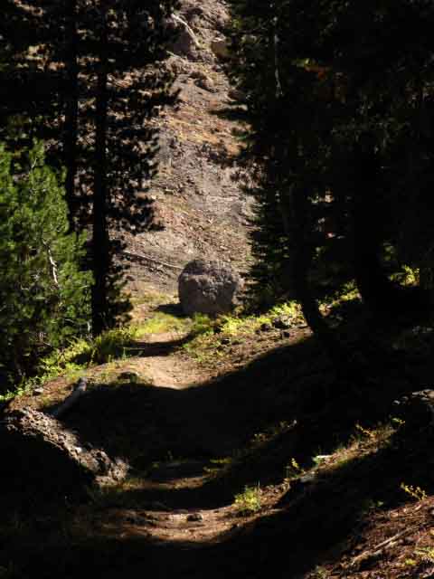 |
Approaching the end of forest covered trail and the top of Noble Canyon as we make the final distance down to Noble Creek. We'll bend Right past the boulder into the top of Noble Canyon where our trail bends around on a steep wall around to the other side of the canyon, which we can see beyond the boulder. We will have little cover for the next two, two and a half miles, until we reenter forest cover on the South side of Tyron Peak. |
Mountain Lion
| Big Mountain Lion Tracks crossing the trail. |
 |
We spot lion tracks at the head of Noble Canyon where the trail crosses Noble Creek North of Noble Lake. The prints were aged what I figured was a day and a half or two judging on their exposure to recent winds and dew. |
Time and Weather
Looking across Noble Creek at a section trail that moves every year when it's saturated with water. This piece of terrain is moving steadily down the mountain as it's saturated by each Spring's thaw. Though not moving as fast as the steeper volcanic flanks of Raymond and Sonora Peaks, this section of trail is acting under the same mechanism of gravity pulling great masses of unconsolidated volcanic terrain, the tailings of thousands of years of erosion, down the mountain as on Sonora and Raymond Peaks. The tailings of the erosion process are moving down the mountain. |
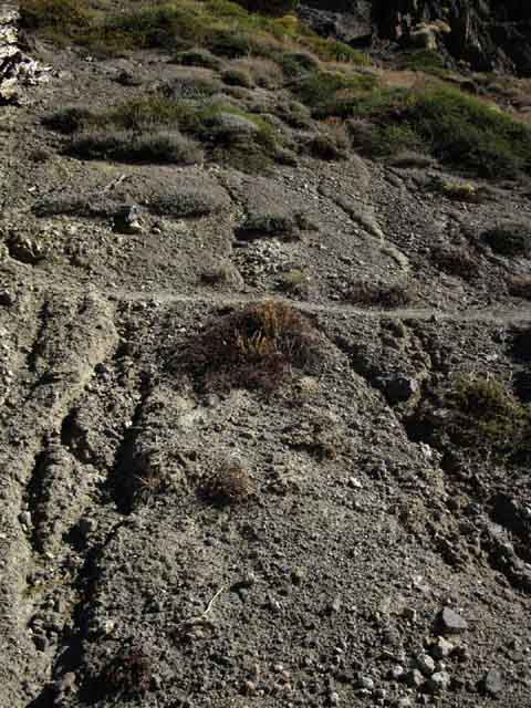 |
When saturated this unconsolidated soil can flow down-mountain. Note the lack of vegetation and deep runoff gullies caused by constant surface movement. When saturated this terrain will move as one mass. During the peak of a heavy Spring Thaw the runoff runs through this type of terrain, and the terrain wants to flow as water flows. It's unstable nature deters plant growth and just eats up trails laid across it. These unstable sections of trail require regular trail crew attention at the interval its rate of flow degrades the trail. Each season will turn the trail surface closer to the angle of repose of the flank. Here, where the trail is crossing a moderate angle, this erosion is not too much of a problem, but it is dangerous on the long steep flanks of Reynolds and Sonora Peaks. I figured that the rate of water-driven change in the Sierra, expressed through the forces of both erosion and plant growth, would radically slow as a new, drier weather pattern emerged. I observed ten years ago that increasing temps along the Equator had already pushed the Hadly Cells and the North Pacific High about 800 miles North of their typical positions. This 800 mile offset appears to be stable through the cycle of the seasons. This shift in seasonal position of the Hadly Cells and the High has in turn deflected the jet stream that typically carried wet storms out of the Northwest to the Sierra Nevada during Fall and Winter. These storms are now deflected to the East way up North on the Northwestern corner of the US, up by Seattle. Our moisture and weather has been deflected Southeast into the heart of the US, ironically, to where it is clashing with the increased flows of superheated air pushing North out of the Gulf of Mexico. That's working out real well... These changes in the basic pattern of global and regional atmospheric flows have changed the timing of our seasonal progression as well as the character of the seasons themselves. All water based erosion will slow. The growth rates of all trees and plant life will slow, until they burn. The next generation of plant life will be slower than the present. These observations appear to be proving true in the short term, but only a multi-decadal overview will ultimately prove or disprove my contentions. The really scary thing is the forces that altered the position of the North Pacific High and Hadly Cells are not just influencing our contemporary weather, but are still rapidly increasing. The forces of change are radically increasing as our traditional chemical and thermal atmospheric balances are lost. Time will be lost in the Sierra. Life is going to slow down in the Sierra Nevada. |
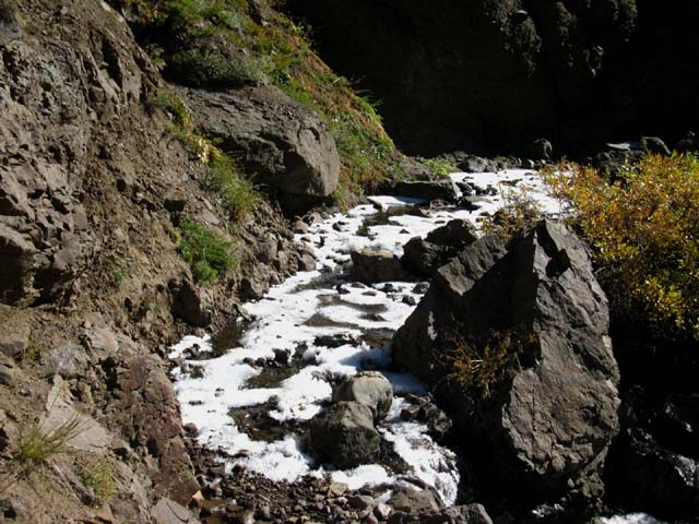
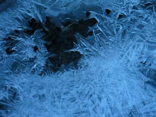
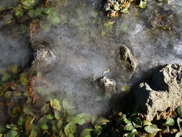
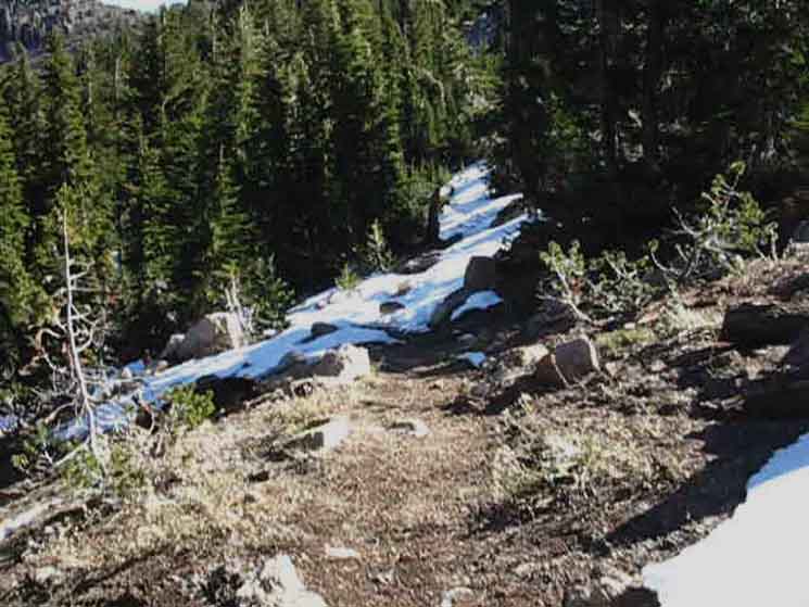
Crossing Upper Noble Creek
Noble Creek frozen where the PCT crosses. Looking back, North, up the PCT after coming around the elbow bend across Noble Creek. |
||
 |
||
Noble Creek tumbles across the trail at the top of Noble Canyon. I've never seen it flowing hard through here, but I'm sure it does during the Spring Thaw. This is the upper branch of Noble Creek that runs directly into the basin holding Noble Lake between the Southwest flank of Highland Peak and the Northeast flank of Tyron Peak. I'd think there would be a heck of a lot of water judging by how steeply this upper channel of Noble Canyon is being cut into the volcanic terrain. But the trail did not show it. The trail was well built up, wide and flat with a healthy stone creek bed where Noble Creek flowed across. Noble Creek is nothing more than a small cut across the trail. But this small cut has carved a mighty canyon below and a pretty nifty gorge here. Noble Canyon is configured like a fan at its top, with each blade of the fan representing a contributing creek feeding the main body of Noble Creek. The main body of the creek itself is quite feeble here, and pinches itself through a narrow chasm where our trail crosses. I'd love to see some images of Noble Creek and the PCT here during heavy Spring Thaw flows. Cold temps froze the creek where it crosses the trail in the picture above, forcing the backed-up water onto and down the trail where it too subsequently froze. October 2011. The image above is looking back North up the PCT after we hiked South across Noble Creek. |
Frozen Trail in the Shadows along Noble Creek
| Fall evening (Oct) brings a hard freeze to all the Eastern Sierra Streams. |
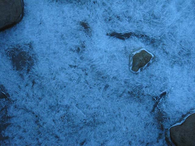 |
Walking across Noble Creek flat and slick as a thick plate of glass perfectly fit to the contours of the trail and creek. Cold temps bring great beauty, if you are ready to enjoy them. Be ready for cold temps at night, and sometimes during the days too. The evening before the picture above was taken all small bodies of running water froze SOLID. Into plates and blocks of solid ice. This indicated to me that the temperatures dropped very far very rapidly that evening. Larger bodies of running water, such as Wolf Creek, apparently had too much volume and movement to freeze solid, so it turned into a semi-solid slush. |
These images depict a serious cold snap during October that froze every Eastern Sierra drainage every evening. The Eastern Sierra looked as if it had frozen fingers of icy bone running up all the mountainside creeks until the rising Sun melted them back into motion. Cold temps are not limited to Spring and Fall in the Sierra Nevada Mountains. Summer evenings often drop into the twenties. |
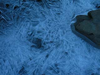
| Beautiful crystallization patterns. |
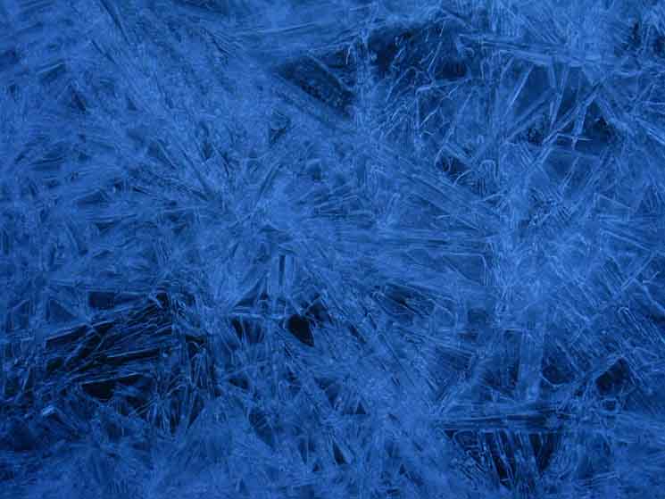 |
Hard frozen.The surface is flat, slick, and solid despite the pattern encased within. The surface was smooth to the touch. |
| Delicate new ice crystal growth meets burbling water. |
 |
Note the fine ice tendrils along the bottom edge of the hole. These appear to be the leading edge of crystal growth. By god, I believe they grow until they shrink with the rising temperatures of daytime, until the ice fades away, if the temps rise high and long enough. |
Trail Surface
| The Surface was smooth as glass. |
 |
The smooth surface encased a chaotic latticework of crystallization. |
A Sweet but Slick Surface
| Chaos latticework. |
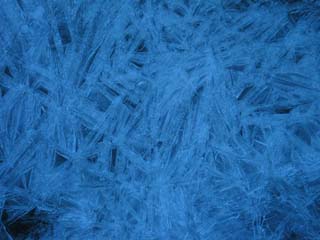 |
I'm trying to figure out the capillary - crystal growth action that made this happen... Life. It's such a pretty puzzle. |
Trail and the Top of Noble Canyon
Below we're climbing South away from Noble Creek out of where Noble Canyon is narrowing into a deep volcanic gorge. Hiking up to here we've traversed above and along a length of the trail in the downstream direction above the steep Eastern bank of Noble Creek. It is hard to see in this grainy image from a digital video below, but we can make out the line of the PCT across the rock face on the far side of the gorge. We can see the part of the trail that is in the light along the Right side of the face of the rock. Behind us, we'll be hiking up to where our trail bends 180 degrees across a the top of a finger of jagged ridge descending down from below Noble Lake. We're flipping over the top of that ridge and changing direction again as the trail moves into the ravine holding the creek flowing out of Noble Lake. Below we are looking North on the Pacific Crest Trail at the top of Noble Canyon narrowing into a gorge where our trail crosses Noble Creek. Once we cross over the end of the ridge behind us we're set up to directly approach the bottom of the switchbacks up to Noble Lake, which are off to our Left out of the frame of the image below. In the picture below we're looking Northbound back the segment of trail we just hiked, looking to the Southwest by the compass, at this fantastic volcanic formation sitting where the top of Noble Canyon narrows into a gorge draining the upper basin below Tyron Peak. A second upper branch of Noble Creek drains the upper basin out of Noble Lake. It seems like the main body of the creek draining the basin below Tyron Peak is squeezed through this volcanic vice. Tyron Peak lays in the furthest distant Left. |
 |
Noble Creek climbs through the gap to the Left of the volcanic face to drain the basin holding Noble Lake, but not Noble Lake itself. When we turn around to continue South on the PCT we will bend a turn into the next ravine to our East where the creek from Noble Lake flows into the canyon below. Ebbetts Pass to Wolf Creek Pass Map A nice flat, wide, and well dug out trail makes the elbow-bend across the tiny flow of Noble Creek through this apex of the trail across Noble Creek at the top of Noble Canyon easy. |
Volcanic Face
| Detail of Volcanic formation on NE flank of Tyron Peak. |
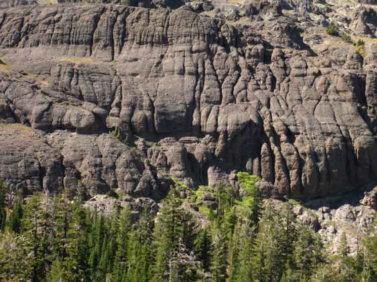 |
This appears to be the remnant of a massive Lahar as well as the source of the consolidated boulders we saw in the Noble Creek drainage below. |
| Crossing unconsolidated section. |
 |
Though no problem now, sections of unconsolidated volcanic material like the one above move when wet every year during the Spring Thaw. During wet years great sections of saturated soils move down the mountain, eating up great sections of trail. Even after a couple of years of moderate or weak Spring Thaw conditions the trail across this type of surface will be at or approaching the angle of repose, giving us little segments of harrowing trail until trail crew re-digs out the trail. We saw such sections up North along the flank of Raymond Peak, right here, and we will find such a section on the Southern Flank of Sonora Peak, what I call "the red rock trail." |
Shade
| This Juniper and its rock provide shade and a seat on our way up to Noble Lake. |
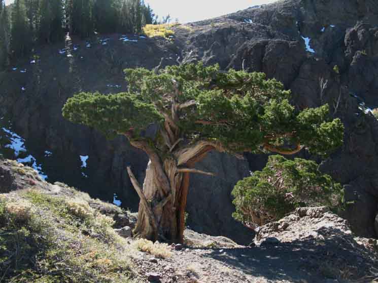 |
Beyond the tree we can see the very steep top end of Noble Canyon, which we just climbed out of. At the top of a quick set of switchbacks up about 250 feet of elevation we come off the flank onto a meadowed bowl beneath Tyron Peak holding Noble Lake at its lowest point. Like Trees? Check out Tree Forum. |
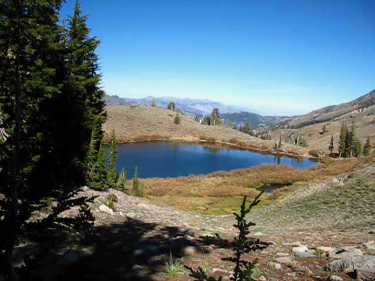
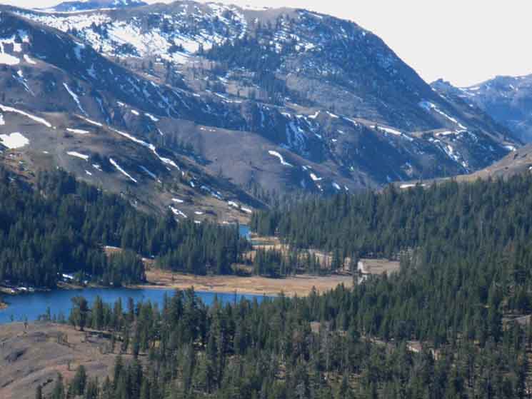
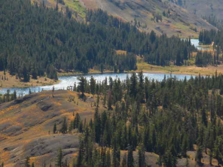
Noble LakeCompromised At the top of the steep switchback segment of our climb up the East side of Noble Canyon towards Tyron Peak we find Noble Lake nestled into a hilly shelf in the mountainside. It has a well developed flat on its Eastern side with light tree cover and water. I should say compressed and trodden-down flat. This means that Noble Lake is always a break spot for me on my way through this section despite its drawback. Noble Lake has a cow problem. Grazing herds like Noble Lake as much as backpackers do. This results in the flat on the East side of the lake being liberally decorated with cow shit every Summer, if not occupied by cows. The shore of the lake gets badly post-holed by hooves during Spring, and the cow dung changes the chemical balance of the water, resulting in a choking algae growth and "cow water." Cow water is water fouled by cows. Cow water is difficult to filter, and clogs many filters. I frigging hate cow water. I'm not against sensible grazing in the Sierra, but the condition of Noble Lake is not sensible. I don't know how cows and Noble Lake can be balanced so each are healthy, but the current situation is unacceptable. Oh yes I do know how to fix it. Half of Noble Lake should be fenced off to preserve the shore. It should be fenced to allow the cows access but denying them the chance to trash the whole shoreline. Also See Duck Lake Notes. 3.96 miles South of Ebbetts Pass. .98 mile North of the gap over Tyron Peak.
|
First Look at Noble Lake
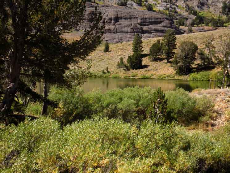 |
Late Summer conditions. Coming off the top of the switchbacks we see Noble Lake as soon as our height clears the brush surrounding its Northeast shore. Our trail gradually traversed 3.34 miles down 212 feet from Ebbetts Pass to the low point of this segment of trail across Noble Creek. Arriving at Noble Lake we've hiked .62 miles of the 1.58 miles from the low point of this segment of trail to its high point across Tyron Peak. |
Noble Lake and Tyron Peak
| Looking Southwest across Noble Lake. |
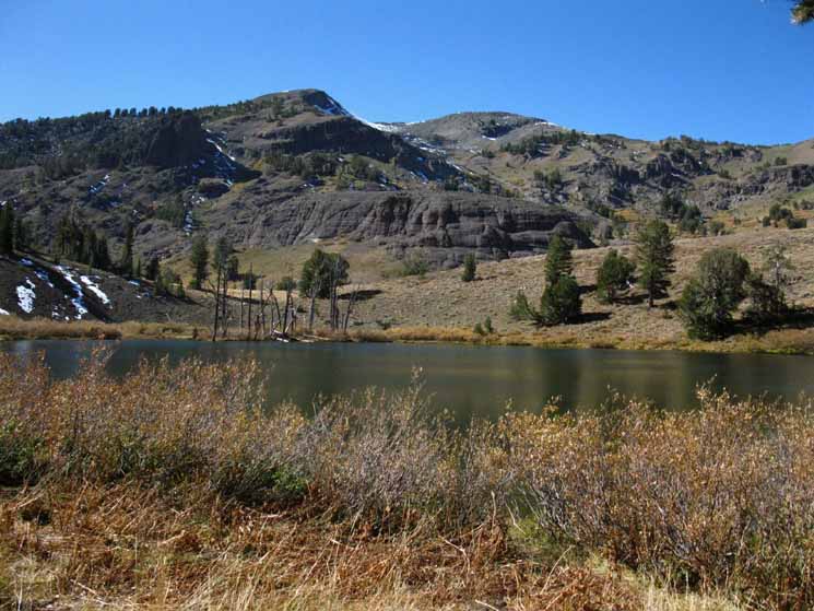 |
Tyron Peak's Southeastern running ridge line runs down to the Left to the low point in the ridgeline our Southbound Pacific Crest Trail route is pointing for. Tyron Peak is the high point. |
Time for Food and Not so much Water
| Campsite on East side of Noble Lake... |
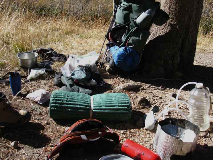 |
...where I always take a break. It looks like my pack exploded... |
Noble Lake Frog
The frog watches. Algae coats the lake bottom. |
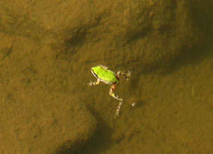 |
A tree frog decorates the surface. |
Noble Lake Cows
| Big frkn cow. |
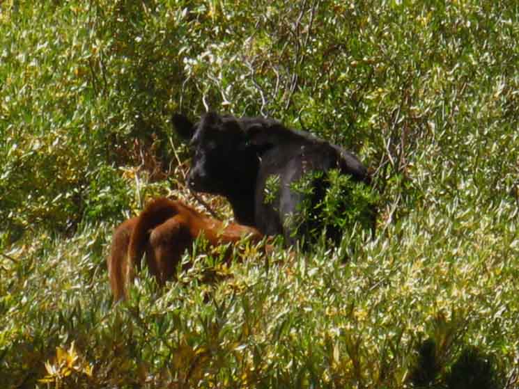 |
Source of Noble Lake algae: Noble Lake Cows. |
Feeling Froggy?
| The tree frog seemed little bothered by me, despite my insistence on taking his picture. |
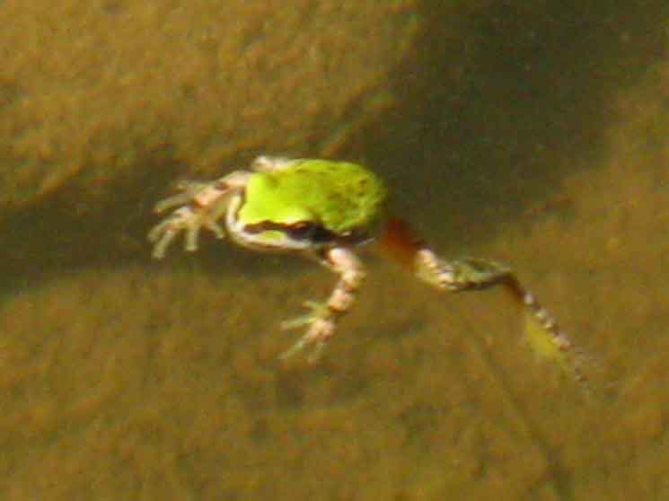 |
With a couple of lazy strokes tree frog floated itself out of my reach, and continued to watch me as closely as I him. Again, Feeling Froggy? If so, you need to jump on the frog information below. Forum Frog Identification All Frog Information Living Things Policy Living things policy "B" Policy "B" is that we check everything out. People complain about scientific knowledge. Facts are indisputable. Their meaning is not. |
Noble Lake Frog
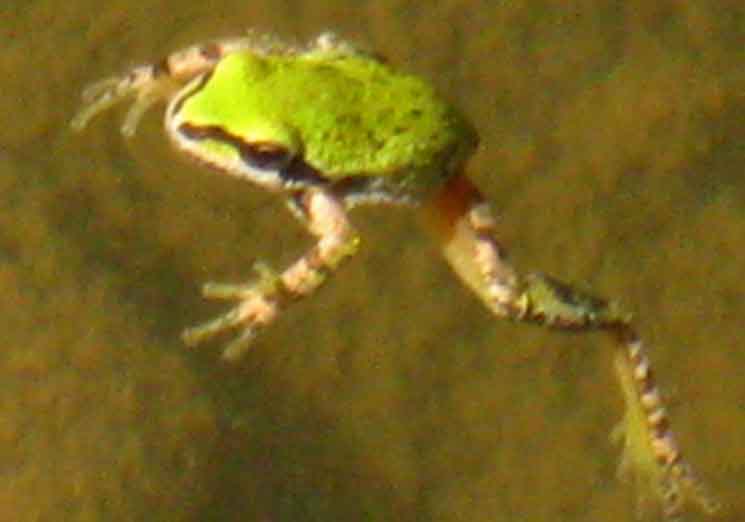 |
Just hanging around watching backpackers and cows generate flies. |
Hiking South from Noble Lake
| Noble Lake with Noble Canyon in background. |
 |
View looking a bit West of North. The campsite/break area is under the little stand of trees on the far Right, the East shore of Noble Lake. We can see how the terrain just drops off beyond Noble Lake. |
Higher Up looking Further South
| Noble Lake nestled between Tyron and Highland Peaks. |
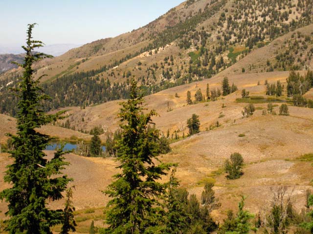 |
In the background we see the steep mountainside making up the East flank of Noble Canyon. The flank rises to cap itself with Silver Peak on its furthest end and Highland Peak atop its nearest point. Carson Iceberg Wilderness Map Noble Canyon is along the Silver-Highland massif's Western base laying out of sight beyond and below Noble Lake. We can see the smaller lake on the shelf in the terrain above and to the East of Noble Lake. |
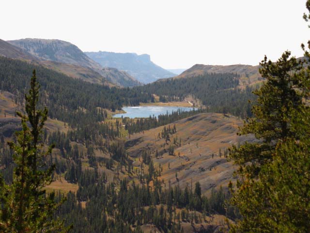
Bull CanyonTrail Junction and Local Landmark We encounter Bull Canyon two times. Once here, at this trail junction and another time as we hike North of Murray Canyon, where we can see Bull Canyon in the Northwestern distance emptying into Wolf Creek. Check out this image of Bull Canyon and Highland Peak from just North of Murray Canyon. Highland Peak is the mountain making up the NE side of Bull Canyon, the East side of Noble Canyon, and the Western mountain bounding Wolf Creek. Highland and Silver Peaks are a visible landmark until we exit the headwaters of the East Carson River 25 trail miles to the South of here when we cross the Carson Gap over to Wolf Creek Lake. To clarify, that's a different Wolf Creek down South, located off the East flank of Sonora Pass. Along this section of trail all the creeks eventually empty into the East Fork of the Carson River. Noble Creek and Silver Creek below it, the creek running out of the East side of Bull Canyon, and Wolf Creek all drain into the Mighty East Fork of the Carson River. We do cross out of the Eastern Sierra drainage of the East Fork of the Carson River for about 3 miles from the high point crossing Tyron Peak to the top of the rise above the West bank of Wolf Creek. We're hiking along the Western flank of the Sierra draining into the North Fork of the Mokelumne River across this upcoming short segment of Western flank trail.
4.47 miles South of Ebbetts Pass. 24.97 miles North of Sonora Pass. |
Bull Canyon
| Bull Canyon trail junction with the Pacific Crest Trail between Noble Lake and the high point of our trail over Tyron Peak. |
 |
Eastbound backpacking routes off of the PCT can be looped through Bull Canyon and back up to the PCT through Wolf Creek Pass, or down to the East Carson River and back up to the PCT through Murray Canyon. Carson Iceberg Wilderness Map We can click the black-dotted trail routes on the 30 minute maps for detailed maps, and the red dots for trail guide page information for that position. |
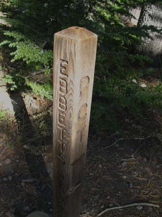
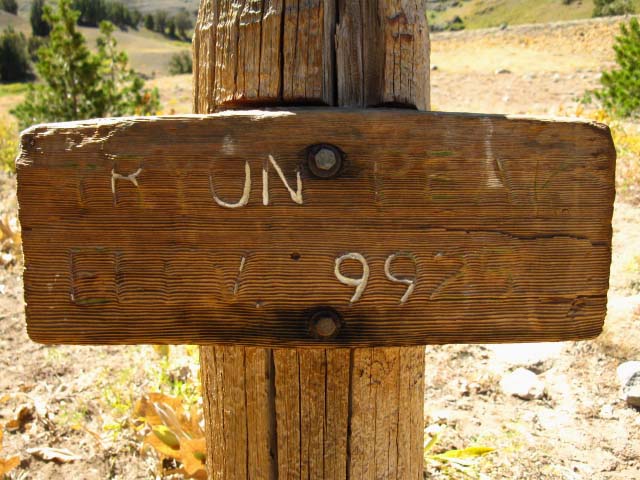
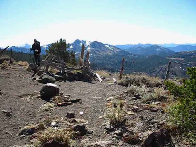
Tyron Peak JunctionDay Climb Route I have never taken this route up Tyron Peak as the Pacific Crest Trail South is going to bring us up to a point just below the peak. I'd come out here to day hike it if I could not come out here to backpack it!
The Tyron Peak trail junction is a short distance South of the Bull Canyon trail junction. |
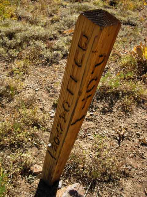
Peak Baggers
| This post marks a route up Tyron Peak. It says the elevation is 9925 feet. The 1979 USGS topo map says it is 9970, but I'm not one to quibble over 50 feet. |
 |
The PCT route South of here is bringing us up to and over the saddle on the East side of Tyron Peak, where the gentle side of the mountain offers us the easiest access to the peak. The trail behind this sign runs a more direct route up to Tyron Peak. We would have two routes up to the summit of Tyron Peak. The hiking route above would be the first, and the PCT route we are following South would be the second. Combined they would make a good loop over Tyron Peak from the trail junction above. |
South
|
| Ebbetts Pass to Wolf Creek Pass 15 minute backpacking MAP |
Ebbetts Pass to Sonora Pass Miles and Elevations |
4.92 miles South of Ebbetts Pass.
24.52 miles North of Sonora Pass.
Iced Ivy
| Deep rivulet frozen rock solid. |
 |
Deep-frozen vegetation. Running water froze solid very quickly, capturing the ivy within a plate of solid ice. It took some nippy temperatures to quickly freeze and inch and a half of running water solid! |
Highland Peak
| Highland Peak rising Northeast of Noble Lake's bowl. |
 |
The channel cut through the forest for the trail makes the location of the trail apparent even if the trail itself is buried. |
Fall Trail
| Snow remnants below high point on Tyron Peak in Late Oct 2011. |
 |
This is a product of the very late Spring snows and thaw of the Winter of 2010-2011. Snow berms in the shadows of forests and peaks persisted through Summer into the next Winter. |
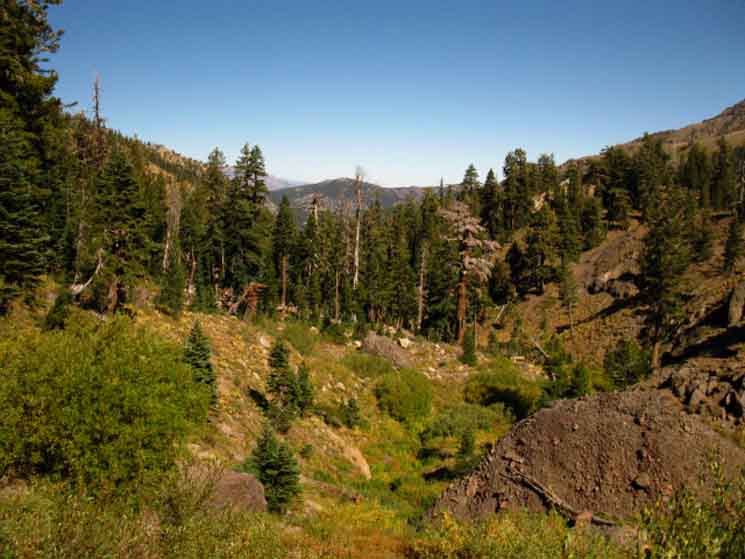
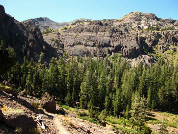
The Western Flank
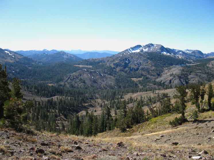
Well, for a moment! We're veering Left traversing down the the Western Flank for the next three miles or so, before we return to Wolf Creeks Eastern drainage. Below are a couple of views Southwest from the high point of the PCT across Tyron Peak. The two maps below will help us get some context on the trails that tie this complex terrain together with the Tahoe to Yosemite Trail.
Arnot Peak is the prominent dome-style peak among the multiple peaks topping the massif closest to us to the Left of the center of image. |
||
 |
||
Disaster Creek flows West between Arnot Peak and Lightening Mountain. Disaster Creek begins its flow down to the Clarks Fork out of Half Moon Lake, which is hidden behind a low rise to the Left of the stripe of yellow meadow we can see on the far Right of the image. That stripe of yellow meadow is Upper Gardner Meadow. Highland Lakes Backpacking Map Arnot Creek flows around the other side of Lightening Mountain, its Right or West side, which is beyond the yellow stripe of Upper Gardner Meadow.. We can see Stanislaus Peak in the far distance to the Left of Ari's head, on the far Left of the image. Stanislaus Peak is maybe 8 miles Northwest of Sonora Peak, rising between the converging routes of the Pacific Crest and Tahoe to Yosemite Trails. In the foreground we can find three routes down to the TYT, which we can follow South towards Stanisluas Peak and our Highway 108 trailheads, or North towards Lake Alpine on Highway 4. Let's take a more clear view of the terrain to the South. |
Three Drainages offer Three routes West to the Tahoe to Yosemite Trail
Disaster, Arnot, & Highland Creeks
Two creeks below us flow down the Western flank of the Sierra to the Tahoe to Yosemite Trail along Clarks Fork of the Stanislaus between the mountains pictured below, while Highland Creek runs through Spicer Meadow Reservoir on its way to join the North fork of the Stanislaus River way down the Western flank of the Sierra. We can follow each of the trails along these creeks to the Tahoe to Yosemite Trail. Disaster and Arnot Creeks flow Southeast and Southwest, respectively, around the triangular bulk of Lightening Mountain on their roughly 8 mile long courses down the Western Flank of the Sierra to the Clarks Fork of the Stanislaus. Our position on Tyron Peak puts us about 5 miles North of their trail junction above Upper Gardiner Meadow, so around 13 to 16 miles to the Clarks Fork. Carson Iceberg Wilderness Backpacking Map Though the trail distances down to the Clarks Fork of the Stanislaus from Ebbetts Pass is short, I'm ball-parking it at around 16 miles, the distance one would drive a car from Ebbetts Pass on Highway 4 to the Clarks Fork Road on Highway 108 is huge. Check out the road map at the bottom of the map linked to above. It is a long way around on the Highways, and rather direct by foot. The Arnot and Disaster Creek trails bring us down to the Clarks Fork Road, which intersects with Highway 108 where the Middle Fork of the Stanislaus River converges with the Clarks Fork of the Stanislaus River. This point is a few miles West down Highway 108 from Kennedy Meadows Pack Station, where the Middle Fork of the Stanislaus begins at the South end of the Upper Kennedy Meadow. Note Upper Highland Lake's sliver of blue peaking out from the West side of Hiram Peak in the upper Right corner of the image below. Highland Creek flows Southwest down to Spicer Meadow Reservoir beyond Lower Highland Lake. Following Highland Creek downstream for 6.46 miles brings us down to the Tahoe to Yosemite Trail at the Jenkins Canyon trail junction 11.38 miles South of Lake Alpine, just above the beautiful campsites around the top of Spicer Meadow Reservoir. If you go down there to camp. There are amazing campsites along Highland Creek just above Spicer Meadow Reservoir, as well as ancient cow camps in Hiram Meadow. The North Fork of the Mokelumne River flows towards us out of Upper Highland Lake, which is the Highland Lake visible in the upper Right corner of the image below, before it begins its grand button-hook bend around to the Northwest and eventually around to the Southwest into a magnificent granite canyon. A few miles down this canyon is where the route of the Tahoe to Yosemite Trail emerges from a great hanging granite canyon to cross the North Mokelumne River.
The Tahoe to Yosemite Trail can be accessed through all three of these creeks, Disaster, Arnot, and Highland from here. Hiking down Arnot or Disaster Creeks brings us to two different points on the Tahoe to Yosemite Trail along the Clarks Fork of the Stanislaus River. Hiking down Highland Creek brings us to the TYT at the top of Spicer Meadow Reservoir. |
||
 |
||
We can see Hiram Peak on the Right above Highland Lake, Lightening Mountain in the middle distant center-left of frame, and the Arnot Peak Massif rising out of the far Left side of the image. These mountains divide the drainages and the trails that follow them Southwest down to the Tahoe to Yosemite Trail. We are looking at a key pivot point for a whole lot of backpacking loops. Trails going in Six directions radiate out from this hub of trails in the Carson Iceberg Wilderness. |
Highland Lakes
Lower Highland Lake peeking out behind Upper Highland Lake. Hiram Peak rises beyond the Highland Lakes. Highland Creek runs down the canyon beyond the far lake. |
 |
The Highland Creek Trail route can bring us down to Tahoe to Yosemite Trail at Spicer Meadow Reservoir where the Highland Creek Trail turns North to its end at the Silver Trailhead on the East Shore of Lake Alpine. Late Fall. |
Highland Lakes
| Upper and Lower Highland Lakes. |
 |
Late Summer sporting Fall colors. |
Upper and Lower Highland Lakes
| The Dardanelles Cone silhouetted in the far misty distance behind Highland Lakes. |
 |
The Tahoe to Yosemite Trail runs around the base of The Dardanelles facing us. The TYT crosses over the Northern shoulder of The Dardanelles passing out of the watershed of the North Stanislaus into the Clarks Fork of the Stanislaus. Note the well-maintained road leading to Lower Highland Lake. That road connects with Highway 4 a bit West of Ebbetts Pass. Check out this map showing the trail connecting Lower Highland Lake (which we can barely see beyond the road through the forest cover) with the Tahoe to Yosemite Trail around the North Shore of Spicer Meadow Reservoir in the shadow of The Dardanelles. The Upper Highland Lake is the source of the North Fork of the Mokelumne River. |
North: Ebbetts Pass top of page South: Tyron Peak to Murray Canyon
High Point |
The Great Stanislaus Drainage What we see to our Southwest while crossing the high point of Tyron Peak is a web of potential backpacking loops. We are also getting a momentary view of the Western drainage of this whole section of the Sierra crest line, which composes a big chunk of the Carson-Iceberg Wilderness. Arnot and Disaster Creeks both drain into the Clarks Fork of the Stanislaus River along Highway 108 at the Southern boundary of the Carson-Iceberg Wilderness. Upper Highland Lake is the headwaters of the North Fork of the Mokelumne River. Lower Highland Lake feeds Spicer Meadow Reservoir though Highland Creek. Highland Creek offers a path to the Tahoe to Yosemite Trail at a point 11.38 miles South of the Silver Trailhead at Lake Alpine. Both Arnot and Disaster Creeks have trailheads along the Tahoe to Yosemite Trail route on the old paved road up along the Clarks Fork of the Stanislaus off of Highway 108. These trailheads are 17 and 23 miles South of the Silver Trailhead at Lake Alpine along the Tahoe to Yosemite Trail route, respectively. This big, messy, and unfinished Topo Map of the Carson-Iceberg Wilderness will give you an idea of the relationship between the Pacific Crest and Tahoe to Yosemite Trails through the Carson Iceberg Wilderness. Your imagination will put together excellent backpacking trips. Click the marked trail routes for detailed maps, and the red dots for guide information. Highland Creek, Arnot Creek, and Disaster Creek all head roughly Southwest to intersect with the Tahoe to Yosemite Trail. The various connector trails between the Pacific Crest and Tahoe to Yosemite Trails gives us many options for planning Grand Hiking Loops around the Carson Iceberg Wilderness. Check out my trip report on just such a Hiking loop of the Carson Iceberg Wilderness. Access A fine dirt road branching Southeast off of Highway 4 a few miles West of Ebbetts Pass brings us out to the Highland Lakes Car Campground, where PGE has nice campsites. Here we can access the Gardner Meadow or Highland Creek Trailheads. From Gardiner Meadow we can access the Arnot or Disaster Creek trails, or the Pacific Crest Trail at Wolf Creek Pass. From the Highland Creek Trail head we can hike down to the Tahoe to Yosemite Trail at Spicer Meadow Reservoir. Ebbetts Pass can be much more than a passing moment along the long trail. It is one of a series of trailheads leading into a complex network of very interesting backpacking trails that can themselves provide years of rewarding hiking. The Carson Iceberg Wilderness is an amazing place. 7.5 Map 30 min Map Next page South |
Backpacking Trail Guide PCT North |
 |
Backpacking Trail Guide PCT South |
Backpacker ForumsHave a great Sierra Nevada trip or story to relate? A fine piece of gear? Or gear that failed?Post it on
|
North: Ebbetts Pass South: Tyron Peak to Murray Canyon
Trailhead
Contact
Alex Wierbinski

Backpacking Lake Tahoe to Mount Whitney:
Your Guide to the High Sierra Crest, including the Tahoe to Yosemite, Pacific Crest, and John Muir Trails
