The Trails
Guide
Maps
Miles/Ele
Permits
Resupply
Forum
Current Weather Conditions
Weather Notes
Northern High Sierras
Central High Sierras
Southern High Sierras
Gear
Gear List
Gettin Started
Layering
Discussion
Testing yourself and your gear
Gear Reviews
Backpacking
Meiss Meadow
Hiking the Tahoe to Yosemite - Pacific Crest Trail routes South of Meiss Cabin out of the Lake Tahoe Basin
Languages
Languages
Trail Arts
The art of walking
Physical Preperation
Trail Skills
The trail
Off the trail
Scrambling
Maps
Navigation
Camp skills
Food
Resupply
Food
Other
Photo Catagories
Trail Stories
Trail Culture
News and Science
Links
Groups
Books
Terms and Conditions of Use
| Trail Guide INDEX |
TRAIL GUIDE NORTH |
TRAIL |
7.5 min Topo Map Meiss Roadless to Carson Pass |
30 min Topo Map Echo Summit to Round Top |
MILES AND ELEVATIONS |
Miles and Elevations INDEX |
Lake Tahoe Basin Management Unit PERMITS |
Tahoe to Whitney on YouTube |
Backpacking South
from
Meiss Cabin
through
Meiss Meadow to the Carson Gap
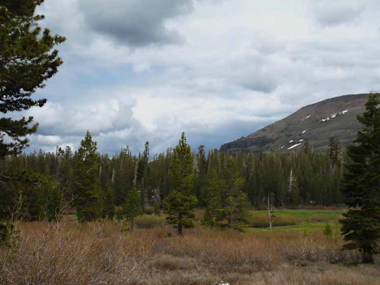
The South End of Meiss Meadow
On the page below we're continuing South along the unified Tahoe to Yosemite and Pacific Crest Trails route from the Meiss Meadow trail junction. The main trails trisecting the Meiss Country Roadless Area all met at the Meiss Meadow trail junction. MAP South and Out of the Tahoe Basin We hike South across Meiss Meadow past the cabin, barn, then bend South to ford and cross Meiss Meadow to the shade under the forest fringe along the base of the South-westernmost line of mountains, approaching the point where they're pinching-in to form the very Southern end of the Tahoe Basin. There's some nice campsites along this stretch of trail under the forest, once we cross Meiss Meadow, and it's here where we find our exit from the Tahoe Basin. The end of this forest fringe marks the point where we make our final little ford of the South Upper Truckee and turn almost directly South following alongside and above the South Upper Truckee's uppermost reach, climbing steadily alongside the massive channel it has cut into the South end of the Tahoe Basin. The line of the upper reaches the South Upper Truckee River carved both the Carson Gap we pass out of the Tahoe Basin through, and the line of the route we followed up to the gap from Meiss Meadow. Meiss Meadow Trail Junction |
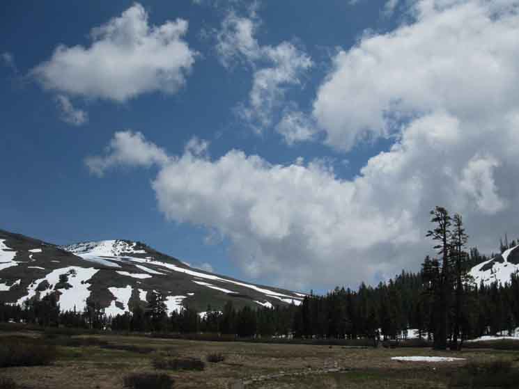
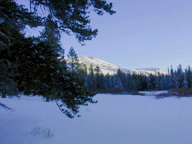
| Stevens Peak Below, we've reached the Southernmost end of Meiss Meadow, we have crossed over to the East side of the South Upper Truckee River, and are turning almost directly South for the climb up to the low gap in the surrounding Tahoe Rim, when we turn around to look North to see the view below, across the Easternmost end of Meiss Meadow. 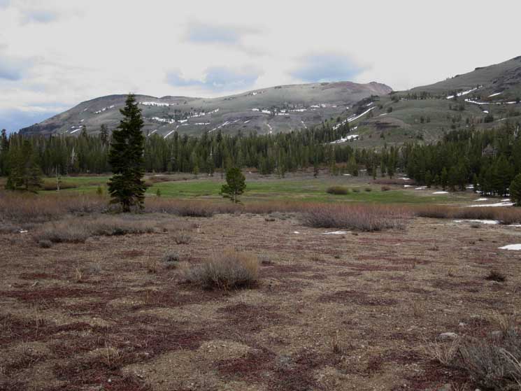 |
||
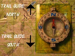
Looking North across the South end of Meiss Meadow. Compass and Trail The furthest Northern end of Meiss Meadow by location of the PCT-TYT is actually the Northwestern end of Meiss Meadow, while the Southern end of Meiss Meadow by trail direction is its furthest Southeastern extent. I hate to be confusing like this, but many times we find that our trail South runs as much to the East and West as it does to the North and South. I'll always refer to trail direction first, then correct, modify, and distill that frame of reference with the compass. The best thing we can do is to keep an eye on the relevant associated large and small scale maps as we follow the trail guide South down the Sierra Crest. Our goal is to get, and stay as oriented to the route of the trail through the terrain as possible. I refer to direction first in relationship to the direction of the trails, then refine this orientation with compass points. For instance,
Behind us in the image above is the ravine South up to the Carson Gap. |
| INDEX On this page |
|||||||||||||||||
MAP Miles and Elevations
Springtimes in the High Sierra:
Video
Views
South
All Weather |
Weather and Road Information Below find the closest Ground Stations, Point and Regional Forecasts near Meiss Meadow. We're between Echo Summit and Carson Pass, though closer to Carson Pass while still within the Lake Tahoe Basin. Satellite and Radar Imagery provides Long Range and Regional overviews.
|
||||||||||||||||
| > Forum < | |||||||||||||||||
Meiss Meadow Add to the Guide Check out all the Tahoe to Whitney .org Tell us what you see. |
|||||||||||||||||
Meiss Country Roadless AreaExiting
|
Views of Spring
June 2009 Views
Southeast
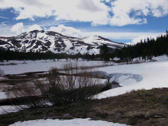
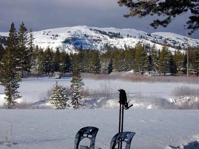
The unseen mountain with its Southwestern flank descending into the frame of the image from it far Left side is the Southwest flank of Red Lake Peak. We'll hike through the lowest point on that ridgeline, the Carson Gap, which is our Southbound exit from the Tahoe Basin. |
||
 |
||
We are located in Meiss Meadow, just South of the Meiss Cabin looking South down the trail and Southeast by the compass.
|
South Upper Truckee River
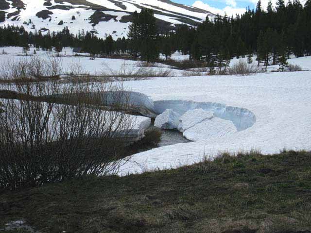
| The trail South through Meiss Meadow crossing the South Upper Truckee over to the South side of Meiss Meadow. Were going over to those trees in the distance to hug the edge of the forest before turning up to the gap. |
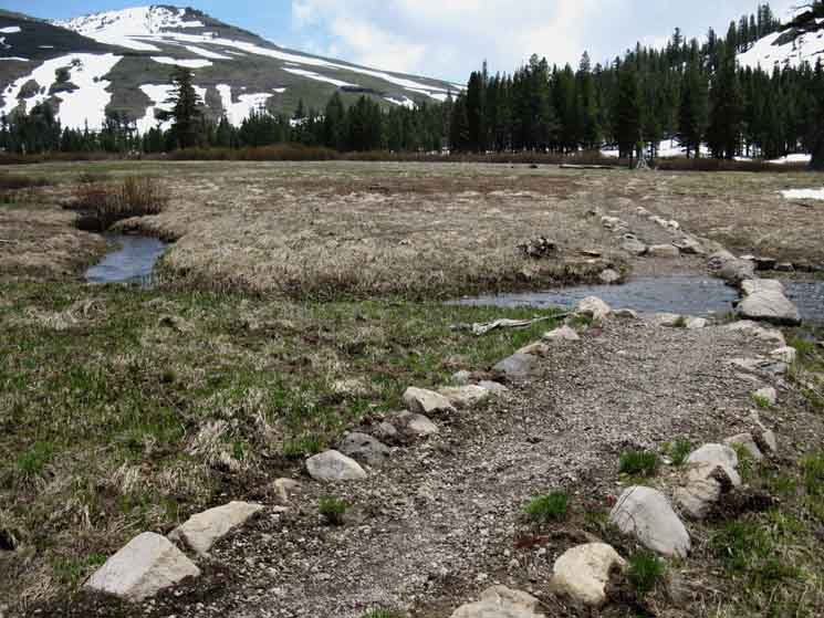 |
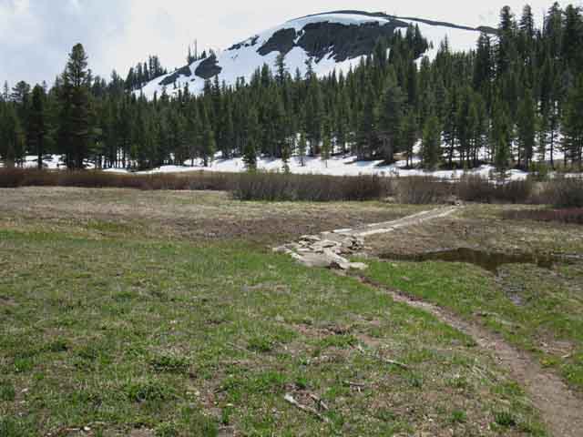
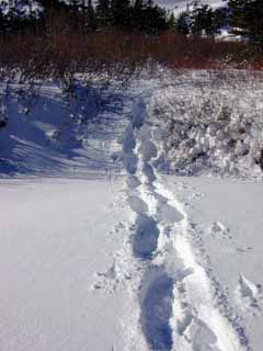
The trail across Meiss Meadow crossing the South Upper Truckee River in the middle of the meadow, after Spring Thaw, but before the Spring Bloom has begun in earnest. Note that the new green grasses are just beginning to break through the dead mat of last year's crop. We'll cross the South Upper Truckee one more time after this where we cross the bottom of the ravine flowing down from the Carson Gap. That last crossing point is located ahead of us near where the wedge of forest on the ridge descending from the Right side of the image tapers off into the edge of the meadow. There are some nice campsites ahead, located where we can see the trail ahead leading us into the edge of the forest. These sites are fairly busy. There is another campsite beyond, located near the final ford over the South Upper Truckee at the bottom of the gully up to the Carson Gap. To find that campsite we'll look our Southwest, to our Right, when we come to the next ford. The campsite is nestled in the edge of the forest above the ford at the bottom of the gully up to the Carson Gap. |
North: Meiss Cabin South: Carson Gap
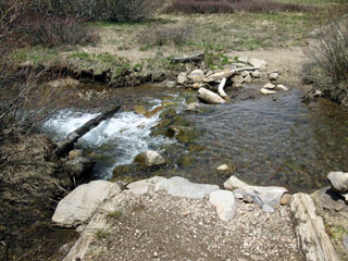
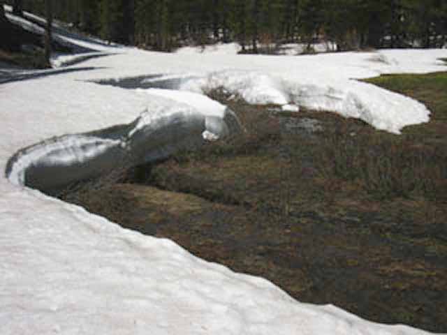
A typical late Spring Flow
| Spring runoff across the trail. | ||
 |
||
Though this is mild runoff because we are high up and late in Spring, Spring runoff can present many difficulties and serious dangers. Trails are running with water like creeks while the creeks that are normally very easy to cross during Summer are raging like rivers during the height of the Spring thaw. Well, they are if we ever get any snow in the mountains during Winter. In any case, be very careful! |
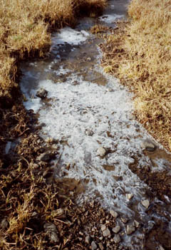
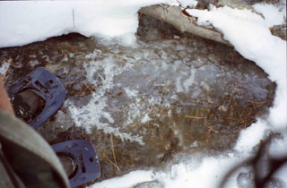
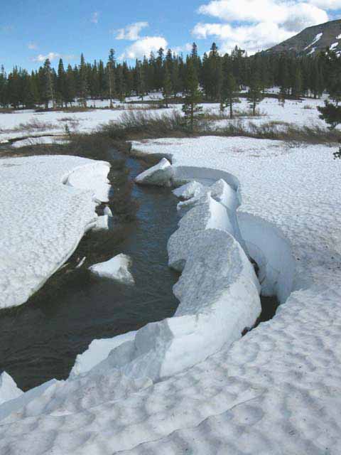
Nifty Fall Terrain
| Frozen Creeklet feeding the frozen South Upper Truckee River. | Quick frozen South Upper Truckee River It had ripples on its frozen surface. |
||||
 |
 |
||||
I am standing on the same part of the South Upper Truckee River during late-Fall as pictured by the two images above. Though the river will be hard frozen through Winter, we only get to see its frozen state for a short period of time between being frozen solid and being buried by Winter snow. Check out Wolf Creek flowing as slush during Fall. |
|||||
| After the temp drop in late Fall, water stops flowing at high altitudes. | |||||
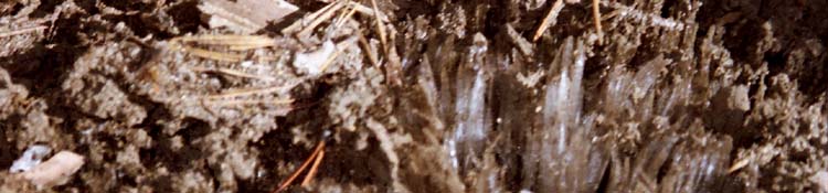
Ice Crystals growing
out of the
Soil
| Water Crystals growing out of the ground, early Spring. |
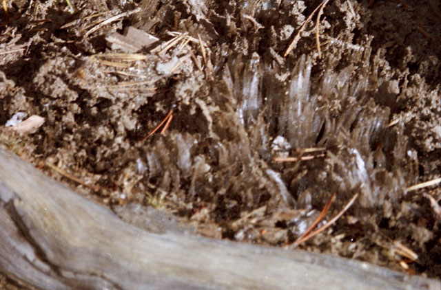 |
This happens whenever the temps drop into the low-twenties and high teens where there is enough moisture in the soil for capillary action to begin forming, growing really, ice crystals. At least I think it a capillary-type movement of freezing water that grows the ice crystals. Nonetheless, this type of crystal formation clears trails of all tracks. Thus knowing the history of recent temps along the trail is important for determining the age of tracks on that trail. After the ice crystals melt a "ruffled" trail surface remains, devoid of tracks. The ruffled soil is crunchy under the boot. Other factors that identify the age of tracks are their location in the terrain and exposure to winds, which means observing the recent history of winds is important. The type of terrain, its ability to hold tracks, and its moisture level are important, as is the recent history of dew falls. All of these factors influence the aging of tracks, and the tracks in each location age differently depending on these environmental and terrain factors. Pick a set of tracks and observe how they change as they pass through different environments and terrains. Everything provides Information. |
June 2009
The trail South through Meiss Meadow crossing the Meadow to hug the edge of the forest. This is the same low hill we observed while hiking up to Meiss Lake during Winter through the South Upper Truckee Trailhead via Round Lake. June '09. |
||
 |
||
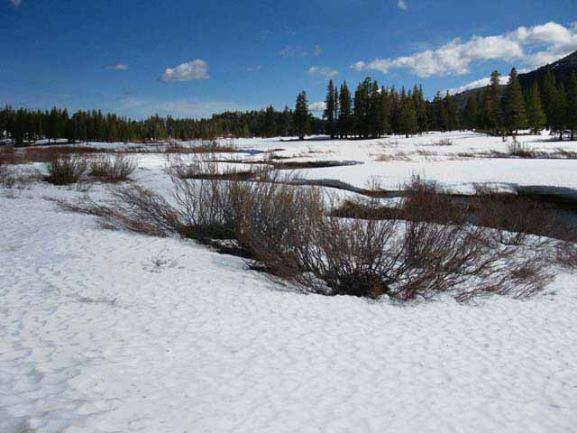
Trails are routed around the edge of fragile meadows when possible. Avoiding crossing Meiss Meadow is not possible.
|
June 2010, Same Place, Same View
 Red Lake Peak with its subordinate Southwestern peak above East side of Carson Gap. |
2010 started dry but Spring Snows saved the season. Note the great difference between conditions during June of 2009 and 2010 in the two pictures above. 2011 had deep snow through Summer across the Sierra Crest, while the Winter of 2012-2013 had almost no snow, while the Winter of 2013-14 brought virtually no snow at all to the High Sierra. Times are a changing, and changing fast. It seems like just yesterday when the prevailing winds on the West Coast of the US started changing out of their ancient patterns of the times of year and the directions they blew. Now, less than 20 years later, completely new prevailing seasonal winds patters blow, and the seasonal cycle of the progression of the seasons is fundamentally disturbed, and changing faster each year. I am glad I'm old! For those of you who are young, I suggest seeing the tattered remnants of our ancient ecosystem while you still can, before everything has changed. You don't have much time, so do it now. |
Detail
South
out of the
Tahoe Basin
towards the
Carson Gap to Carson Pass
 |
| What a difference a year makes! |
View Northeast
towards
Round Lake and Big Meadow
 |
||
View North-Northeast towards Round Lake and Big Meadow across shattered snowbanks collapsing onto Meiss Meadow. The Round Lake Pinnacle and its surrounding red rock formations are hidden behind the stand of trees in the middle of the image.
|
Snowbank
along the
South Edge of Meiss Meadow
 |
Previously collapsed snowbanks melting back off of Meiss Meadow, retreating towards the shade under the forest along the edge of the Tahoe Rim. The shrinking tops of these snowbanks provided a fine passage around the mushy quagmire of the recently exposed Meiss Meadow. |
Backpacking
out of
Meiss Meadow
over
Carson Gap to the Auto Bridge North of Woods Lake
on the
Tahoe to Yosemite Trail
route
March 27, 2010
| The first part of this video brings us through the Southeast end of Meiss Meadow, as depicted above, but during Fall. We pass through Meiss Meadow, and on to the Carson Gap on what would be the Pacific Crest and Tahoe to Yosemite Trail routes, if they were visible under the March snows. | ||
At the Carson Gap we stop to inspect and identify the terrain to our South, then head straight down the mountain from the Carson Gap to Highway 88. We are cutting off of the Pacific Crest Trail on what would be the Tahoe to Yosemite Trail route, during Summertime. But, during Fall it's just a snow-covered mountain.
|
This Guide is set up so that you can add your perspective & experiences here to broaden and add perspective to the trail guide view of Meiss Meadow. This guide incorporates backpacker input. Yours. Check and you will see that a Forum page is linked to every trail guide page. Here you will find supplemental information about the covered location, and the forums were specifically designed so backpackers can add trail information. Or trail culture information, or images of the living things, as well as notes on the trails, campsites, and best practices and gear. The fact is that my perspective alone is insufficient to describe this grand terrain or the range of experiences it can create. Questions, comments, and additions General Topics This Location's Forum |
North: Meiss Cabin South: Carson Gap
Views North
Back
towards
Lake Tahoe
and the
South Upper Truckee Trailhead
Summer Green The view North while approaching the South end of Meiss Meadow during mid-July. Verdant Greens dominate the landscape. This is the view North, looking in the direction of Round Lake and Lake Tahoe beyond from ground level in Meiss Meadow. |
 |
This is looking towards the Center Winter Route North down to Round Lake, and then on down to Meyers, and out of the mountains ringing the South end of the Lake Tahoe Basin. Check out the trail guide hiking South from Round Lake to Meiss Meadow for a description of the three Winter routes one can craft between Round Lake and Meiss Meadow. |
Views North
from
Meiss Meadow
as we
Climb out of the Lake Tahoe Basin
The View North, again, but from a a little higher up above the forest than the preceding picture. Round Lake sits below, and a bit North, of the volcanic cliff dropping off the mountain behind the trees. |
||
 |
||
Round Lake is situated on the far East side of Christmas Valley about four miles above the trailhead at the end of South Upper Truckee Road.
|
North: Meiss Cabin top of page South: Carson Gap
Same View June 2010
 |
Looking Northeast across Meiss Meadow towards Round Lake and Big Meadow. |
View North across the East End of Meiss Meadow
|
The above perspective is looking back to the North as we turn South to hike out of the Lake Tahoe Basin via the Carson Gap on our way to Highway 88 and the Carson Pass. Stevens Peak is the high peak on the far Right of the image, partially obscured by a ridge arm dropping off the West flank of the ridge between Red Lake and Stevens Peaks. |
Stevens Peak
This same mountain, but looking more towards the Northeast at where its Southern flank defines the North end of Meiss Meadow. |
 |
Meiss Meadow is a flat between the Carson Range mountain range coming down from the Northeast and the Sierra Range from the Northwest that define the Southeast corner of the Tahoe Rim where they meet. |
Round Lake Pinnacle
from
Meiss Meadow
Set Our Winter Route back to the Tahoe Basin on that Landmark
| Climbing even higher up towards the Carson Gap reveals a much clearer view the volcanic pinnacle and cliffs above Round Lake. | ||
 |
||
This is the view North as we climbed South up to the Carson Gap from Round Lake out of the South Upper Truckee Trailhead during 2001. Below is March 2010 over the same route.
|
Round Lake Landmark
 |
||
Round Lake Rock from Meadow below Meiss Meadow Round Lake to Meiss Meadow during Winter Once we get to the Southernmost end of those two meadow above Round Lake we've got clear shots at finding routes to the Southeast corner of Meiss Meadow, directly South to Meiss Cabin, or Southwest to the North shore of Meiss Lake. Above it looks like we're in the third meadow above Round Lake, which is also the third meadow below Meiss Meadow, if you count Meiss Meadow. This is what I refer to as the "Eastern" route up to Meiss Meadow. This meadow above terminates in a forested climb over to the second meadow below Meiss Meadow. We'll find the Eastern end of the second meadow, then find an easy passage into the East side of Meiss Meadow. If my route-finding skills are "on" we'll find a fairly easy path from Round Lake to Meiss Meadow during deep snow conditions. This will become more difficult if my route finding skills are not so good.
|
North: Meiss Cabin top of page South: Carson Gap
Meiss Meadow
during
Winter
Southeast View
around the
Southeast End of the Tahoe Rim
Once we get over most of the climb up from Round Lake and are just reaching the Northeast edge of the second meadow below Meiss Meadow we get some great views of Red Lake Peak. The volcanic formations topping Red Lake Peak are moderated, made more gentle, yet even more inaccessible and impressive looking by snow. Red Lake Peak's subordinate Southern Peak is over on the far distant Right of the image. Our path out of the Lake Tahoe Basin is through the low gap in the Tahoe Rim Mountains just out of sight behind the forest to the Right of the Western flank of Red Lake Peak's low subordinate peak. That's our exit from the Tahoe Basin, and that's where we're going. |
 |
The forest has already dropped into twilight shadow, making the last light on the mountains appear brighter. Snow on the trees remains from last night's mild snow storm, but tonight the clear skies will bring even colder temperatures. We're on our way up the Eastern route from Round Lake to Meiss Meadow, and reaching Meiss Meadow still requires we execute a bit of navigation through the complexities of the snow covered meadow above, and further South over a densely forested low rise beyond. Tomorrow. The arrival of local sunset demands we start looking about for a delightful place to camp where we can both be sheltered, watch the sunset on Stevens Peak, and have a clear view of the brilliant stars that are going to appear in the frozen Winter skies. |
Meiss Meadow during Winter
The Crystal Wonderland
when
very cold
Winter View to the Southwest from my campsite just below the North side of Meiss Meadow. I'm in the first meadow below Meiss Meadow. We are looking at the top of the part of the Sierra Nevada Range running Northwest to Southeast that makes up the Western edge of the Tahoe Rim, above the North end of Meiss Meadow. Little Round Top, rising above Showers Lake, sits on the far right of the image. We've just got to get through those trees to arrive in Meiss Meadow proper. |
||
 |
||
Snow in the trees remains from last night's snowfall. 2007. This was a sweet campsite.
|
Room with a View
| Sweet Snow Camp Edge of Meiss Meadow. |
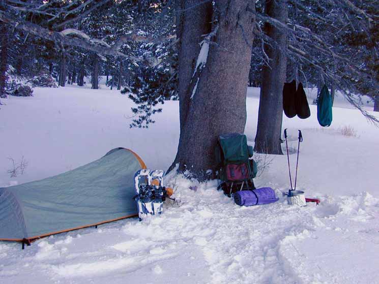 |
Rent is Free, but yet Costly. First, we've got the get here. Snow travel is very hard work. Second, we've got to maintains basic physical comfort. Winter gear is heavy. Third, if we've got the first two factors under control, We've a Great Seat to view the Winter Wonderland! Backpack backrest with pad for seat, within reach of all necessaries. Stove, food, hot drink all arrayed around my seat. Note food hung off of tree branch to deter varmints, though bears are not a problem... I can always imagine a coyote sneaking up, grabbing one of my food bags, and running off. Hanging my food up a bit will give me the time to disrupt any such nefarious plans. Pity the coyote I find hanging off my food bags! |
North: Meiss Cabin South: Carson Gap
Not Enough Snow!
Five Feet of Missing Snow in 2007
| This brush should be submerged by the snow. |
 |
Winter temperatures in the Sierras have risen, and snowfall has declined during the last 20 years. 2007. The rock past the brush landmarks the entry into my Eastern route down from Meiss Meadow to Round Lake. |
North: Meiss Cabin top of page South: Carson Gap
Hey Kids! I followed my "East" route up, being a route that turns to the East side of the buried trail to find a channel through the series of hills dividing the two meadow formations that sit between us and the top of our climb up from Round Lake to Meiss Meadow. |
 |
Though only a couple of miles in length, the terrain between Round Lake and Meiss Meadow is a joy to navigate in Winter conditions. This is some of the most exciting, satisfying, and profound fun you can have with lots and lots of clothes on... haha... During early 2011 I took a real beating here when stomach problems made eating and drinking difficult. I forced myself to minimal levels of consumption, but I was weak, tired, and cold. Proper nutrition during Winter trips is vital, and I suffered from its absence. |
Hiking South Out of the Lake Tahoe Basin
| Finding a way through the brush coming up to Meiss Meadow from Round Lake. Then we hike up to the Carson Gap to exit the Tahoe Basin. | ||
 |
||
The brush that should be covered with the ten feet of snow that is missing from most recent Winters. 2007. |
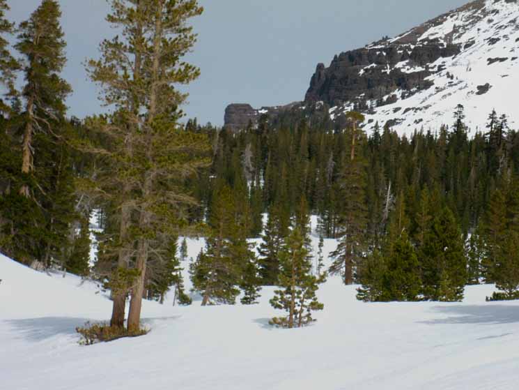
Approaching the Carson Gap
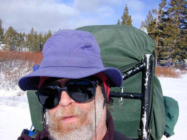
| The Carson Gap from North-Northeast side of Meiss Meadow. | How I look when I am very cold. | |||
 |
||||
 |
||||
The little climb South up the gully to the Carson Gap from the end of Meiss Meadow.
|
||||
| top of page | Another layer went on after this picture was taken. 2002. |
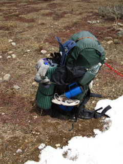
The Bottom Line I pack a 65 lb+ backpack during Winter Travels. Snowshoes, possibly crampons and ice axe, and certainly the ski poles add weight, but the weight of extra layers of insulation, and the heavy weight shell all put extra pounds into the pack. The food supply evens gets heavier, as the cold and heavy work increases calorie consumption. The heavy weight of the gear and difficult conditions create a heavy workload on the body, which creates great amounts of heat. Thus it is important to be wearing just the right amount of insulation to balance the cold external temperatures against the internal heat generated by travel. This makes for a brutal transition every morning. We're going to start the day's hiking wearing what we think will be the proper level of insulation to prevent us from either overheating or freezing. This means we start cold. The hard part of this transition from camp to trail starts with us removing our overnight-camp layers of insulation to begin the day's hiking cold in our travel layers. As soon as we remove the camp layers we've got to get up to operating temperature as quickly as possible. This transition from camp to trail can be brutal. I look forward to it every morning.
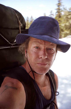
The picture on the upper Right is what I look like after about 45 minutes of heavy hiking in 28 degree temps, in light layering. My daily calculation of insulation had anticipated early clearing of overcast and an 8 to 10 degree rise in temperatures with the appearance of the Sun, which was not happening on my schedule. I could feel my skin trying to make itself thicker as the penetrating cold chilled out my arms to the point I could feel the temperature differences between my arm bones and the muscles attached to them. That's when I snapped the picture and slipped into the second layer. When we have wind, snow, or other chilling factors, we enhance the layering. When the sun comes out and the snow starts acting as a reflector oven, we withdraw layers. We're always chasing the perfect layering. |
The
Harness
of
Pain
AND
Pleasure
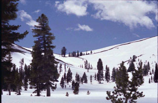
| The balance is good at the snow line below the Carson Gap during late Spring. | ||
 |
||
Heading to Round Top Lake on the South side of Highway 88 under the shadow of Round Top and the Sisters. Note the snow shoes lashed on the pack below the pad. It's time to pull them off for the hike up to the Carson Gap. |
Meiss Country Roadless AreaExiting the Tahoe Basin through the Carson GapMiles and ElevationsElevation Mileage |
North: Meiss Cabin South: Carson Gap
Meiss Meadow |
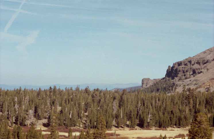
At the Round Lake Trail Junction near Meiss Cabin all of the trails from the 3 trail heads described on this guide converge, and head South together to exit the Lake Tahoe Basin through the Carson Gap. Except the Tahoe Rim Trail, which heads Northeast towards Round Lake and on to and through the Big Meadow trailhead beyond, on Highway 89 below the North side of Luther Pass. Backpacking Out of the Lake Tahoe Basin Beauties and Beasts of Meiss Meadow The frozen meadow sparkles in cold moonlight. Sometimes we can hear the coyotes seemingly lonely cries draw themselves together over the frozen terrain to have a group cry. Coyotes are one of the few animals that can sound happy and sad at the same time. The cries of the coyotes express a joy of life with a bitter edge. Through the Carson Gap The Carson Gap separates the Lake Tahoe Basin Drainage running down its North flank from the watersheds draining East and West down the Sierra flanks from the Carson Pass. We've followed a tributary of the South Upper Truckee River up to this point. Local Hikers The Meiss Country Roadless Area offers many fine trips for the short distance backpacker, as well as excellent trailheads to begin longer trips South into the heart of the High Sierras on our way South to Tuolumne Meadows and on down to that majestic chunk of ancient rock, Mount Whitney. 7.5 minute USGS hiking Map 30 min USGS hiking Map Next Map South The Carson Pass Region map shows where the Pacific Crest and Tahoe to Yosemite trails part company on the South Side of the Carson Gap following their divergent routes South down the Sierra Crest. The PCT tracks South along the Crest and East flank of the Sierra Nevada Mountains, the TYT along the West.
This Map
Next Map North The PCT, TYT, and TRT continue North together out of Meiss Country, across Highway 50 and into Desolation Wilderness. On the way they pass by our next potential resupply spot at Echo Lake Chalet and the opportunity for long distance backpackers to rest, repair, and resupply in South Lake Tahoe. 7.5 topo hiking Map 30 min topo hiking Map Echo Summit and South Upper Truckee South |
Backpacking Trail Guide North |
 |
Backpacking Trail Guide South |
Backpacker ForumsHave General Information about Backpacking to relate ?Post 'em on
On the Trails Forums we can browse trail locations and add our experiences, comments, questions (or pictures and videos) about hiking South out of the Echo Summit Trail Head. About the Meiss Country Roadless Area. The Topics Forums deal with everything else backpacking. Post your comments and questions on the relevant Segment Pages of the Forum, or Register to post your own pages about your trips and the trails through the Meiss Country Roadless Area in the Echo Summit to Carson Pass Forum. Forum Section
|
North: Meiss Cabin South: Carson Gap
Trailhead
Contact
Alex Wierbinski

Backpacking Lake Tahoe to Mount Whitney
Your guide to the High Sierra Crest, including the Tahoe to Yosemite, Pacific Crest, and John Muir Trails
