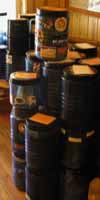
PCT food canisters sent home from Kennedy Meadows.
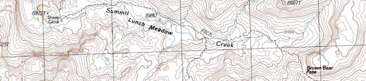
Backpacking map of the Tahoe Yosemite Trail through Emigrant Wilderness.
The Trails
Guide
Maps
Miles/Ele
Permits
Resupply
Forum
Current Weather Conditions
Weather Notes
Northern High Sierras
Central High Sierras
Southern High Sierras
Gear
Gear List
Gettin Started
Layering
Discussion
Testing yourself and your gear
Gear Reviews
2016
HIGH SIERRA TRAIL CULTURE REVIEW
and
Trip Report
High Emigrant Wilderness
North Yosemite Backcountry
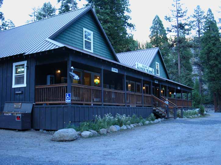
Kennedy Meadows Pack Station
&
Tuolumne Meadows
Backpacker Resupply
The Trip Plan
Languages
Languages
Trail Arts
The art of walking
Physical Preperation
Trail Skills
The trail
Off the trail
Scrambling
Maps
Navigation
Camp skills
Food
Resupply
Food
Other
Photo Catagories
Trail Stories
Trail Culture
News and Science
Links
Groups
Books
Terms and Conditions of Use
Part II
The Backpacking
Plan
Backpacking
Emigrant Wilderness
into the
North Yosemite Backcountry
The Backpacking Trip
Trip
Trail Guide PCT-TYT
Route The Descent "Mostly" remote because there is a relentless line of Pacific Crest Trail hikers pushing North through the North Yosemite Backcountry during mid-July of 2016. Emigrant Wilderness Backpacking The 3 Trailheads Less, More, or Just Right? These maps show multitudes of possible trail and route options.
Click the red dots on the detailed maps linking to those position's
Into Yosemite The Long Version
TYT & PCT TYT-PCT WE DIVERGE TRAILS RE-CONVERGE Lower Down the Western Flank
to Hetch Hetchy
Suggested Reading Lower
Tilltill Valley and Rancheria Falls This part of our backpacking trip is quite a plunge.
Local
RECAP
Many Study the maps, mileages, elevations, and guide pages to plan the custom Emigrant Wilderness backpacking trip that's perfect for you. Web of Trails The goal is to reach our destination, but it is also to find, see, and explore the range of our route options into, around, and back out of this fine terrain where Emigrant and Yosemite Wilderness meet. We really want to get some understanding of the layout and logic of this remarkable terrain. Sorry. I mean "White Wolf." The folks who work there call it Weird Wolf. The hike up from Hetch Hetchy to the Sierra Crest is a monster climb. Something for Everyone Sonora Pass Corridor All Access Alternative End Points Accessing Emigrant Wilderness backpacking South through Sonora Pass or Leavitt Meadow Trailheads can be well complimented by ending our backpacking trips through Kennedy Meadows. Web of Trails Hiking from Kennedy Meadows to Hetch Hetchy is going to show us some of the key connection points woven into this web of trails across this fine terrain. AlsoCheck Out
Ka-Ching
Highway 108 TRAILHEADS & Their Trails South MAPS
Emigrant Wilderness Digital and Paper Hiking Maps
Many Flexibility #1> This is High Altitude Terrain. #2> This is Steep Terrain. #3> Backpacks are Heavy. My suggestion: Short and Long Though short, these are still difficult climbing trails. The route to Kennedy Lake climbs 1400 feet from Kennedy Meadows while the trail to Relief Reservoir ascends 880 feet. This trip plan below and its trip report on the following pages cover the "high points" of the hike from Kennedy Meadows to Hetch Hetchy. Our associated trail guide also covers the remaining length of the PCT-TYT South to Tuolumne Meadows for those who are curious about hiking the longer 75 mile backpacking trip from Kennedy Meadows to Tuolumne Meadows instead of cutting off the PCT-TYT and dropping down to Hetch Hetchy. This Trip |
Backpacking 2016 Part II
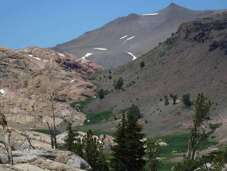
The Whole Route Kennedy Meadows Pack Station From Brown Bear Pass the difficulty of our route moderates following the TYT South for the next 5.12 miles across the High Heart of the Emigrant Wilderness, the High Emigrant Basin (definition). On the Southeastern end of Emigrant Basin we find the TYT's Northeastern-most exit point from Emigrant Wilderness through Bond Pass crossing into the Northwestern-most corner of Yosemite National Park. The total length of the Emigrant Wilderness portion of our trip measures 16.04 miles from Kennedy Meadows Pack Station to our Bond Pass entrance into Yosemite, of which the first 11 miles are the tough climb from KM to Brown Bear Pass. VIEW Red & White Northwest View Well, the North wall of this long canyon is almost uniformly volcanic, except for the bits of granite we see sticking out along the base of the North wall (Trail Guide Image). Looking closely we we can see a few places where the furthest extent of these ancient volcanic flows did not quite completely submerge the underlying granite, leaving it partially exposed (Trail Guide Image). From Brown Bear Pass our eye can follow and identify great lengths of the granite-volcanic interface running across Emigrant Meadow and wandering across the whole length of the Emigrant Basin from Brown Bear to and through Emigrant Pass. Into Yosemite Volcanic Apron Pushed East PCT vs. TYT
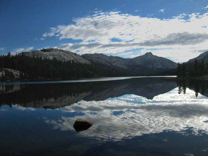
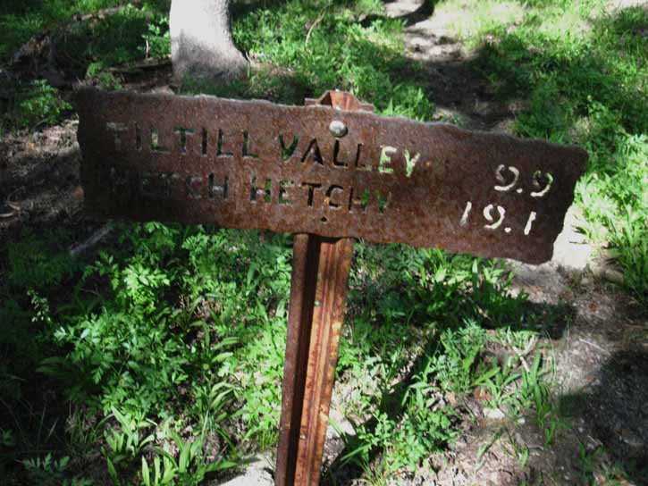
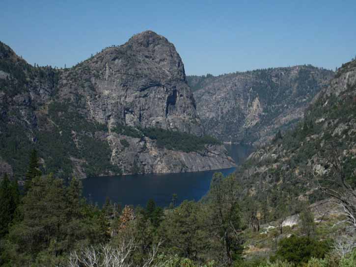
Our Unique Route Instead, we are going to follow a faint trail (as of 2016) 22.2 miles South from Tilden Lake down the West Flank of the Sierra to Hetch Hetchy, a total of 19.1 miles from the second trail junction below Tilden Lake, as seen below, to the end of our trip at Hetch Hetchy. Tilden Lake and Tower Peak Instead of continuing South along the TYT we cross the route of the PCT and depart both trails beginning our long descent down the West Flank of the Sierra to Hetch Hetchy. Don't worry, we will find a couple of serious climbing segments of trail during our grand descent! Hetch Hetchy and Tilltill trail junction References The old Yosemite steel trail signs give us "ballpark" figures. Reference Materials This second part of this trip is subject to fewer "on the fly" modifications than the first. The reason is that our food and energy reserves become bigger factors as we put more days and miles between ourselves and our next possible resupply spot, or to the end of our trip. We do not have the option of continuing South to Tuolumne Meadows without a sufficient combination of time, energy, and food to complete the task. Approaching Hetch Hetchy from Rancheria Falls.
Backpacker Weather
Below find the trail guide pages, maps, and miles information PART I
Further Southeast
Big Picture
TYT Backpacking Across Emigrant Wilderness Miles and Elevations
Digital and Paper Hiking Maps
TRAIL RATING Emigrant Wilderness Tahoe to Yosemite Trail Trip Plan
PART II
Trail Structure Changing Trip Plan
PART II Dedicated to the spirit
North Yosemite Backcountry Off the TYT-PCT Backpacking Maps
Off the TYT-PCT Backpacking Maps
TYT-PCT Backpacking Maps
Off the TYT-PCT Backpacking Maps
Yosemite Wilderness Digital and Paper Hiking Maps
The links to North Yosemite trail guide and map pages above do not include the final run of the combined Southbound TYT-PCT down Cold Canyon to Glen Aulin High Sierra Camp. Glen Aulin is perched above the top, the upper Eastern end of the Grand Canyon of the Tuolumne. Tilden Lake Off the TYT-PCT From this point our route is dedicated to the descent into the Grand Canyon of the Tuolumne. Our route departing the TYT-PCT begins its long, steep descent (mostly) down to Tilltill Valley along Tilden Canyon Creek below Tilden Lake. Even the steepest and deepest descents contain climbs, as does this one. We will find a couple of climbs during this long descent.
Finishing our steep descent to Tilltill Valley we find the steep descent continues down to Rancheria Falls, below which our final descending segment moderates into hiking the last steps of our trip along the undulating trail wedged in below the sheer cliffs of the Grand Canyon of the Tuolumne and above the ever-placid waters of Hetch Hetchy. A different way of looking at this is that our trip ends with us descending into dramatically increasing heat as we drop all the way down to the very warm shores of Hetch Hetchy. Don't underestimate the heat at Hetch Hetchy. I've experienced high 90s and low 100s every time I've hiked down there.
RELIEF STATION Web of the Spider
Total Trip Miles
That's the general outline of this trip and a review of some of its possibilities. Next page |
|||||||||||||||||||||||||||||||||||||||||||||||||||||||||||||||||||||||||||||||||||||||
Trail Report
&
Culture Review
INDEX
First page: 2016 Trail Culture INDEX Next page: Emigrant & Yosemite Trail and Culture Report
2016 |
|
Emigrant Wide Scope Flexible Application I have not talked much about the trails running Southwest descending across the lower parts of Emigrant down the West Flank of the Sierra towards Pinecrest Lake. The reason is that my routes typically stay up along the Sierra Crest, but that's not a good excuse; the trails down from the Sierra Crest across Emigrant Wilderness are fantastic. The problem is related to time and scale. Exploring the down-mountain potential of each section of crestline trail must be measured against the goal of covering the length of the Sierra Crest. First the length of the Crest, then its flanks.
Start: 2016 Trail Culture INDEX Next: Emigrant & Yosemite Trail and Culture Report |
Backpacker ForumsHave a great Sierra Nevada trip or story to relate? A fine piece of gear? Or gear that failed?Post it onTahoetoWhitney.Org Become a MemberIf you have experiences, comments, questions, or pictures and videos about the trail between Lake Tahoe to Mount Whitney, post up here.All backpackers can comment. Backpacking Trails Forum
|
Trailhead
Contact
Alex Wierbinski

Backpacking Lake Tahoe to Mount Whitney
Your guide to the High Sierra Crest, including the Tahoe to Yosemite, Pacific Crest, and John Muir Trails
