|
2015
2017
2016 High Sierra
Backpacking Calendar
January February March April May June July August September October November December
The Calendar of Record
This calendar is designed for the four-season backpacker. This calendar anticipates important dates in the Sierra Nevada, from the beginning of Winter expectations of fierce storms, deep snowpacks, through the Spring Thaw to fine Summer conditions.
We look for the dates and the conditions that determine when the density of our gear must increase to Winter thickness, when it can be thinned to the temps of Spring, and when we can finally strip down to the Summer Gear.
The points we transition to Winter gear has been pushing later into each year as Spring has begun earlier for decades.
Winter has radically shortened.
This changes the dates when our trails and resupply spots open up, and when we can begin our long treks down the Sierra Crestline. It affects when we plan, pack, and send our resupply packages.
These changes up the odds for PCT hikers to finish in one long season.
But these changes also up the odds for backpackers to get "caught-out" by unexpected "early" or "late" season" storms that in earlier days would have been "normal."
Thus these calendars will track the difference between "classic" Sierra seasonal conditions and the current conditions on the ground over as many years as I can watch the fun.
We will warn of the power of Nature as it's so beautifully expressed through Sierra Winters, while taking note of both its failures to produce expected precipitation, and the inevitable surprises such a complex system delivers.
We focus all this information understanding how each year's specific character affects the openings and closing dates of the Sierra for PCT hikers.
2014 Calendar 2015 Calendar
2017 Calendar
If you have any interesting information, observations, or dates of note that should be on the calendar, let me know, and if they are pertinent to backpackers they go up.
Hiker1@TahoetoWhitney.com |
Last Year
January 2016
North Desolation Wilderness
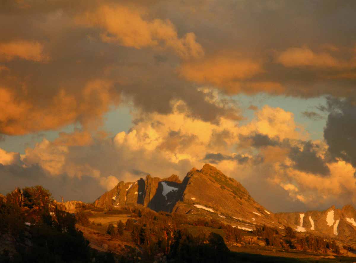
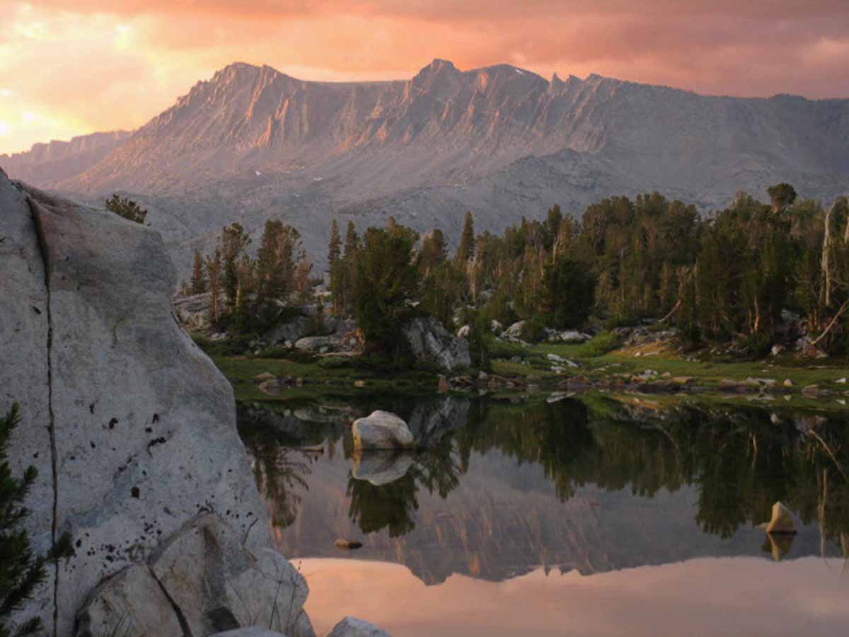
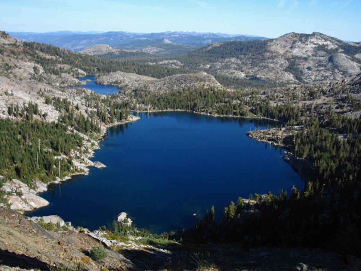 View North across Dicks and Fontanillis Lakes. Phipps Peak and Pass are the prominent peak in the middle-Right background. Note Middle Velma Lake nestled in below Phipps Peak. Our route from Meeks Bay on the West Shore of Lake Tahoe crossed Phipps Peak to join the Pacific Crest Trail in the Desolation Wilderness just a bit North of Middle Velma Lake.
Trail Guide Map Miles and Elevations
January 2016
| Sunday |
Monday |
Tuesday |
Wednesday |
Thursday |
Friday |
Saturday |
FULL WINTER CONDITIONS
The Fall Gear has been stowed or complimented by the heavy Gear of Winter.
Weather
Reserved permits for June 2015 now available from Yosemite NP and Desolation Wilderness.
All Permits
Yosemite Permits Desolation Wilderness |
29 |
30
|
31 |
1
Permits
Permits for JUNE 18 2016 available from Yosemite TODAY.
New Year's Day
Yosemite Permits
Desolation Wilderness
Hoover Wilderness
|
2
Backpackers
Full Winter Gear and precautions
REQUIRED |
3
|
4 |
5 |
6 |
7 |
8 |
9 |
10
|
11 |
12 |
13
SNOW CAMPERS
Track snow, storms, and temps to determine character of Winter.
We are looking for big gaps, mountains of High Pressure between storms. |
14 |
15 |
16 |
17
|
18
M L King Day |
19 |
20 |
21 |
22 |
23 |
24
|
25 |
26 |
27 |
28
Sierra approaching season-normal snow and precip for first time in years.
|
29 |
30 |
| 31 |
1 |
2 |
3 |
4 |
5 |
6 |
NOTE
2016’s El Nino weather is forming up for a reasonable snowpack for the first time in five years. 2014 and 2015 were the earliest openings of the high trails I remember. The year before was one of the latest. Extremes have become the new normal. This year's El Nino is setting up for a high probability of extremes rain and snow hitting the West Coast of the US. Where? is the question. The El Nino tropical flows have been transported North around California by a persistent ridge of High Pressure.
Let's see how that sucker stands up, now that heavy tropical activity has begun North of Indonesia. (And then stood down)
NOTE
JANUARY 2016 ASSESMENT
The key point of this season so far is the complete dominance of the Southwest Pacific as the El Nino affects the line of our Winter Storm Track. The normal storm track across the North Pacific is not operating. The Arctic is too weak and the Pacific too warm to draw tropical moisture up the Western Edge of the Pacific to the Arctic Circle, then cast it back down across the Eastern Edge of the Pacific across the West Coast of the US.
Tropical Moisture is not being drawn up to the Arctic Circle on the West Pac, but wandering across the North-Central Pacific. This flow will be composed of weak lows until the Equatorial belt of warm water girding the Earth (and carrying El Nino's fierce heat) rises North of the Equator.
At that point the tail ends of the fronts dragging behind weak Central Pacific Lows will dip into intense tropical moisture and start potentially transporting vast amounts of it East towards the West Coast of the US and the Sierra. Where it hits will be determined by the position and strength of the persistent High that has been annually forming in the East Pacific.
The Sierra will get hit if and when the persistent High Pressure zone off the West Coast breaks down. In either case, it breaking down or not, we can rest assured the Central US will get pounded when El Nino passes to our North to hit them. If these tropical El Nino flows are transported around us to the South, then the Southeast and East Coast will be sucker-punched by El Nino even if it flows around the South end of the Sierra.
There is a good chance that the El Nino tropical flows will pass North and South around us.
2014 Calendar 2015 Calendar 2017 Calendar |
Permits
Yosemite National Park and Desolation Wilderness accept reservations six months in advance for Summer backpacking dates.
June 2016 reservations are available in January, July in February, and so on.
Yosemite Permits
Desolation Wilderness
Hoover Wilderness
|
BACKGROUND
The trajectory of the cold, rain, and snows of January provide both excellent backpacking experiences and establish the terms, a baseline for this year’s transition into Spring Conditions.
Regular storm activity laid atop a deep pack of Winter snows wrapped in cold temps indicate a long Winter into Spring transition.
Light snows and irregular storm activity sprinkled on a thin snow pack under high temperatures indicates an early and rapid transitions into Spring and Summer conditions.
Tahoe to Whitney
Top of Page |
February 2016
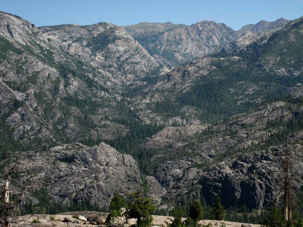
Summit City Canyon
January February March April May June July August September October November December
 UNMAINTAINED TAHOE TO YOSEMITE TRAIL
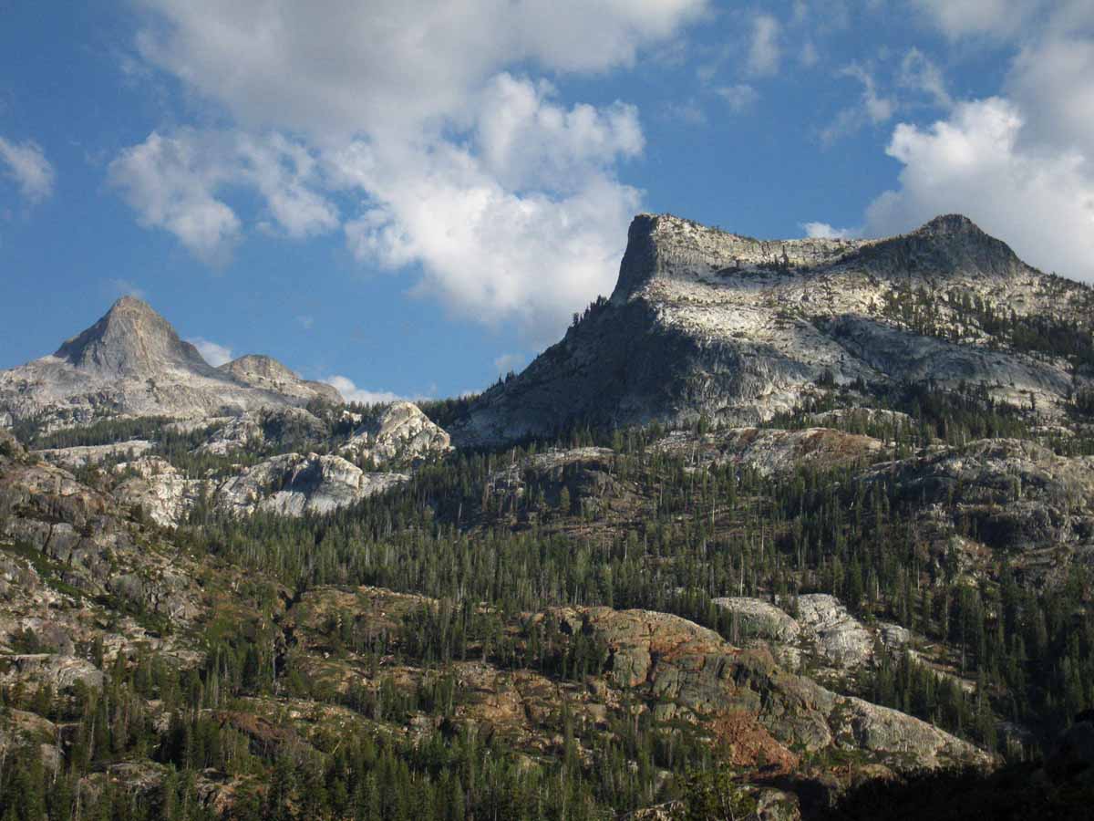
Above we see the full length of the Tahoe to Yosemite Trail's unmaintained route through Summit City Canyon in the Mokelumne Wilderness laid out at our feet. Note The Sisters in the upper Right hand corner, and Horse Canyon cutting deeply into Summit City Canyon in the upper-middle-left of the image. At the middle-bottom we can see the North Mokelumne river passing through its narrow gorge just above where it runs past Camp Irene, where we began this climb up the NW flank of Mount Reba we are viewing from. We can actually see the river-bed rocks cascading down towards Camp Irene in the shot above. See 'em? That's the North Mokelumne River.
That is the narrow section where the catastrophic Spring Thaw of 1997 pushed up a massive log jam in the bottle-neck canyon just above Camp Irene, causing massive destruction in and around the 75 foot deep pool of surging, grinding, smashing timber backed up behind it, which swept away all in its path when it finally snapped.
Devastation swept across the landscape and down the river valley which can still be seen and felt today.
Labeled Image
Trail Guide Map Miles and Elevations
February 2016
| Sunday |
Monday |
Tuesday |
Wednesday |
Thursday |
Friday |
Saturday |
PRECAUTIONS AND OPPERTUNITY
Backpackers are observing patterns and trajectory of Winter storms and temps to find Hiking Windows into the
Winter Wonderland.
2016 UPDATE
Snow on the Mountains!
Finally!
|
26 |
27 |
28 |
29 |
30 |
| 31
|
1
Above Average
Warmer Temps
&
Higher Humidity
Not a whole lot of strong weather, despite strong El Nino |
2 |
3 |
4
Winter Gear
Standard WARNING:
Be geared for
sub-freezing and sub-zero temps with wind chill
High Sierra Reporting Stations
THIS YEAR:
NOT TOO COLD AT ALL.
|
5
RECORD
AND
NEAR RECORD
HIGH
TEMPS
Great
Northeast Pacific Highs deflecting weak storms OUT OF THE SW around the Sierra. |
6 |
7
Vast High Pressure Zone
Building over whole
West Coast and West US.
|
8ADZPCTKO
"PLANNING STAGES"
2016
TWO EVENTS
IN
2015
April 22-24
April 24-26
I bet it will be later this year, or PCTers will hit snow in the Sierra...
NONE IN 2016 |
9
Record Level Temps
High Heat and Humidity...
Plum and Cherry trees blossoming at Sea Level. |
10 VERY HOT
Echo Summit,
Carson Pass,
Ebbetts Pass,
Sonora Pass
All reach low to mid-fifty degree temps.
Tuolumne Meadows achieves 60 degrees F. |
11
Bay Trees Blooming |
12
Last Day
CCC
Backcountry Trail Crew
Applications due
|
13
|
14
Valentine's Day
|
15
Presidents' Day
RECORD, or NEAR RECORD HOT TEMPERTURES
Heat continues since the beginning of the month. |
16
Weather Changing
We can see the disruptions preceding the bottom of the front line dropping down from the North. |
17 Tropical
Front
Bringing
15 inches to Ebbetts Pass
(76 total)
10 inches to Carson Pass
(76 total)
Sonora Pass: 15" to 65"
total.
FIRST indication Equatorial Belt of Warm Water moving North |
18 |
19
Weak Front
with light rains
Moderate Temps...
Yosemite Natural Firefall
History of,...
History
Tourist Fire Version |
20 |
21
Very Warm-Clear
Trend of Warm, Dry Month Continues virtually unabated. |
22
Very Warm-Clear |
23
Carson Pass
53 & 28 degrees 26 inches
Ebbetts Pass
54 & 33 degrees 63 inches
Sonora Pass
53 & 27 degrees 55 inches
Tuolumne Meadows
55 & 14 degrees 51 inches |
24 |
25
Another
Summer-like day |
26
Weak Front
broke across coastline. Gentle mists, lightest rains.
2-26-16
Weather Report and Predictions |
27
Another
Summer-like day |
28
Another
Summer-like day,
Humid Clouds-Near Record Temps |
29
Another
Summer-like day,
Humid Clouds-Near Record Temps
CONFIRMED
Equatorial Belt of Warm Water moving North |
1 |
2 |
3 |
4 |
5 |
Classic Feb
NOTES
Short days and long cold nights are the bookends within which we plan our trips.
High Sierra SNOW trips can be followed up with exciting trips into the moderate Winter Climate of Death Valley. Best time to see DV.
UPDATE
2016 Report
Feb. 15 Report
Great High Pressure Zones persisting off California Coast transporting El Nino Moisture from the Southwest around us to the North.
Very high temps and humidity persisting.
First Two Weeks of Feb:
Summer Conditions in the Depths of Winter... Spring Bloom conditions and plant activity.
Last Two Weeks of Feb:
Summer Conditions persisting in the Depths of Winter... with a couple of very weak fronts passing through. Spring Bloom continues unabated... setting up for a frost to pare-back this freakish, premature Spring Bloom.
Feb 2016 resumed the patter of the last few "Winters," being no Winter, with very unseasonably warm temps and high humidity. And no rain or snow worthy of talking about.
But this "Winter" is not "over," not by a longshot. A fierce El Nino just began its Northward journey from the Southern Hemisphere, North. eventually up into the prevailing Westerly Winds of the Northern Hemisphere. Or, the El Nino will create its own winds.
2014 Calendar 2015 Calendar 2017 Calendar |
Are Weather Conditions
Moderating?
Accelerating?
March can be Great for Snow Backpacking.
Reports: 24-hour Highs, Lows, & Snow Depth.
2016 OBSERVATIONS AND TRACKING
FEB 27 2016
Notably weak and warm Feb. El Nino only apparent through elevated temps and humidity. No indications of heavy tropical storm activity amidst tropical atmospheric conditions.
WHEN WILL THE SIERRA OPEN in 2016?
TRACKING 2016 CONDITIONS |
WEATHER STATUS
Then and Now
BASED ON RECENT MULTI-YEAR DROUGHT TRENDS
General:
Our Observations of how this series of Unusual Seasons works out determines our
Range of Hiking Possibilities and the Gear Necessary to Explore them as Winter breaks into Spring and on into Summer.
We have been in a deep drought, who's basic patterns appear unabated.
This year's difference seems to be a product of the extra moisture pumped out of the powerful El Nino occurring in the Pacific Ocean.
The Classic Feb. Question
Piercing Cold this month or just “Normal" Cold?
2016 Answer:
Hot as heck 1st through the 15th. No Cold.
The Classic Feb. Question
Heavy Snow Storms or None at All? No Storms of significance to 15th.
2016 Answer:
Feb. 15 Report
No real storms hitting the Sierra for over two weeks, snow looking funky, coming apart, but high humidity bringing light snow when temps drop...
Snowpack retreating. |
Adding Complexity
El Nino.
Last Year
2015 Prognostication:
FIERCE DROUGHT
"All signs indicate a very early opening of the Sierra Nevada this year."
2015 was the
"Earliest, hottest, driest. Earliest opening of Sierra in Summer conditions I remember, ever. NO WINTER."
The descriptions roll on... of the EPIC DROUGHT YEAR of 2015.
This Year
2016 Prognostication
See
Backpacker Alert
Feb. 1 2016:
OMG !
"Boiling El Nino verses the Vast High Pressure Ridge..."
Feb. 15 2016 Update
I still see a "normal-to-late" opening of the high trails, not opening until mid-July to fully clear the high passes of snow.
BUT, the upcoming shifts in weather are going to better resolve and clarify the confused-complex El Nino vs Ridging situation.
At this point in time I still see most of El Nino's moisture being transported around the Sierra by High Pressure Ridging, with enough of El Nino breaking through, every now and again,
to leave a slightly above-average Spring snowpack in late Spring after the melting and rain are all figured in.
Feb. 15 2016 Update
I am thinking a heavy early Spring snowpack hit by heavy Spring rains in late June and early July...
Last Two Weeks of Feb 2016:
Summer Conditions have risen and are persisting in the Depths of Winter... with a couple of very weak fronts passing through. Spring Bloom continues unabated... setting up for a frost to pare-back this freakish, premature Spring Bloom.
Feb 2016 resumed the pattern of the last few "Winters," being no Winter conditions at all, with very unseasonably warm temps and high humidity. And no rain or snow worth talking about.
But this "Winter" is not "over," not by a longshot. Our fierce but presently distant El Nino just began its Northward journey from the Southern Hemisphere, eventually to move up into the prevailing Westerly Winds of the Northern Hemisphere. Or, El Nino will create its own winds.
Brave New World
In terms of "normal" Winters blowing down to us on the "old" jet stream out of the Bearing Straight, we have not had one of those for too many years. Few speak to the fact that the directions of our seasonal prevailing winds long ago changed, and what that means.
2-26-16
Weather Report and Predictions |
Tahoe to Whitney
Top of Page |
March 2016
The Tahoe to Yosemite Trail across Emigrant Wilderness
January February March April May June July August September October November December
 View across the High Emigrant Meadow with Emigrant Meadow Lake of Emigrant Wilderness below, Grizzly Peak in the middle distance, and Tower Peak in the distance. Note the three ridges between Grizzly Peak and Tower Peak. Crossing the second ridge brings us through Bond Pass into the top of Yosemite's Jack Main Canyon, where we will rejoin the Pacific Crest Trail. Tower Peak sits at the head of Tilden Canyon, which is the last variant of the TYT from the PCT route on our way South across the North Yosemite Backcountry to Tuolumne Meadows.
Trail Guide Map Miles and Elevations
March 2016
| Sunday |
Monday |
Tuesday |
Wednesday |
Thursday |
Friday |
Saturday |
OBSERVE
The Winter and its Snowpack.
HEAVY? LIGHT?
Character and Sources of Storms?
Are Spring Conditions arriving with Spring?
Snowpack Status Sierra Reporting Stations
UPDATE
|
23
|
24 |
25 |
26 |
27
|
28
|
29
Summer Hiking
Plans
Permits
In agreement with the progress to Spring?
Hoover Wilderness Permit Reservations accepted |
1
Snotel Station Reports Current Snow Depth
Carson Pass
47 & 26 degrees, 64"
Ebbetts Pass
49 & 30 degrees, 58"
Sonora Pass
48 & 30 degrees, 50''
Tuolumne Meadows
23 & 53 degrees, 43"
|
2
West Coast High weakening and moving South.
Sprinkling; precursor of impending rain. |
3
Very Light Rain,
Finally, "Winter-like" conditions
|
4
Light Rain,
Finally, "Winter-like" conditions |
5
Light to Heavy Rain |
6
Heavy Rain |
7
Spotty Light Rain Clearing |
8 Marine Weather;
No precip.
Snotel Station Reports
Current Snow Depth
Carson Pass
37 & 24 degrees, 85"
Ebbetts Pass
32 & 22 degrees, 87"'
Sonora Pass
31
& 23 degrees, 67"
Tuolumne Meadows
5 & 30 degrees, 54" |
9
Cloudy to part clear |
10
Medium rain |
11
Light-medium rain |
12
Driving Drizzle-light rain
Tahoe to Whitney
&
PCT--JMT hikers
Order food, prep resupply packages, and repair gear.
Planning-Training. Resupply
|
13
Light Rain
START
DAYLIGHT SAVINGS TIME
Add one hour at 2 am.
GMT - 7 hours
(Ends Nov. 6)
Astronomical Information
Navigation Information |
14
No precip.
Snotel Station Reports
Current Snow Depth
Carson Pass
32 & 28 degrees, 93 "
Ebbetts Pass
32 & 28 degrees, 91"'
Sonora Pass
33
& 28 degrees, 69"
Tuolumne Meadows
26 & 32 degrees, 56"
|
15
Sustained period of no rain beginning now. |
16
UPDATE |
17
The
Big Green
One
Saint Pat's Day
UPDATE
|
18 |
19
First Day of Spring
9:31 PM PDT in SF.
The Vernal Equinox
|
20
|
21 |
22 |
23
UPDATE
|
24 |
25 |
26 |
27
|
28 |
29 |
30
SAFETY FIRST
Cayenne's First Aid Approach
|
31 |
1 |
2 |
NOTES:
Are heavy storms rolling in? From the North or South? Is a pattern forming?
UPDATE
The Week of March 16 Review
High Sierra Weather |
|
THE QUESTION
Have temps risen enough to start shifting into lighter Spring Gear from our heavy Winter Gear?
Correct Layering is Vital.
2014 Calendar 2015 Calendar
2017 Calendar
2016 OBSERVATIONS AND TRACKING
WHEN WILL THE SIERRA OPEN in 2016?
TRACKING 2016 CONDITIONS |
The nature of our Snow Backpacking trips are determined by the character of the snow.
Deep, soft, wet snow makes for rough going, as does fresh powder.
Cold hard well-packed snow can be faster than good trail.
Tahoe to Whitney
Top of Page |
April 2016
Tropical Thunderstorm climbs the East Sierra
over
Grizzly Peak
Emigrant Wilderness-Stanislaus National Forest
January February March April May June July August September October November December
A beautiful and powerful cell of tropical weather out of the Sea of Cortez slams the steep East Sierra flank with heavy lightening and downpours. The storm sucked up red, yellow and golden colors of the sands it crossed from the intervening deserts between our high mountain position in the Emigrant Wilderness and warm tropical seas far to our South.
Trail Guide Map Miles and Elevations
April 2016
| Sunday |
Monday |
Tuesday |
Wednesday |
Thursday |
Friday |
Saturday |
Spring Conditions?
It Depends.
Conditions on the ground, NOT a date on the calendar determines our gear and skills requirements.
Especially during these Crazy Climate Times.
Snowpack Status Sierra Reporting Stations
Trans-Sierra Highway Information
Summer's Coming!
Resupply Information
|
29
No Rain
|
30
|
31 |
1 (2015: JB declares Water Emergency)
2016
Snow Depth
Carson Pass
49 & 23 degrees, 75"
Ebbetts Pass
48 & 23 degrees, 75"
Sonora Pass
33
& 28 degrees, 69"
Tuolumne Meadows
17 & 50 degrees, 34.5"
|
2 |
3
2016
Clear and Warming
Easter
2015 STORMLETS
A set of Weak "Stormlets"
cross North Sierra
|
4
2016
Clear and Warming
See 2015 Report
8 " snow at Carson Pass
.3 at Tuolumne Meadows
Water Emergency
Early season Spring Trips!
|
5
Warm
|
6
2016
Heat Wave Records
See 2015 Report
2015: KM to Open last weekend
of this month.
24 hr High-Low & Snow Dp.
2016 Station REPORTS
Carson Pass
54 & 31 degrees, 69"
Ebbetts Pass
53 & 31 degrees, 67"
Sonora Pass
54
& 28 degrees, 55"
Tuolumne Meadows
63 & 25 degrees, 25"
|
7
See 2015 Report
19" snow at Carson Pass
6.5 at Tuolumne Meadows |
8
2016:
Weak Tropical Low Pressure Zone Threatening
2016 Backpacker Alert
WARM CONDITIONS
NORTH SIERRA NIGHTIME
LOWS ABOVE FREEZING
|
9 Rain & Snow
Across Sierra Crest
See
Regional Snow Analysis Sierra Nevada for this date.
2016 Station REPORTS
Carson Pass
54 & 35 degrees, 66"
Ebbetts Pass
54 & 36 degrees, 48"
Sonora Pass
51
& 34 degrees, 51"
Tuolumne Meadows
52 & 32 degrees, 19" |
10
COOLING AFTER
MAIN BODY OF STORM
PASSES
During this storm we saw a succession of warm rain removing snow, then cold conditions bringing snow deposition.
Overall our reporting stations saw a slight loss of snowpack during this Spring Storm.
|
11
24 hr High-Low &
Snow Dp.
2016 Station
REPORTS
Carson Pass
54 & 31 degrees, 68"
Ebbetts Pass
43 & 32 degrees, 63"
Sonora Pass
47 & 32 degrees, 53"
Tuolumne Meadows
48 & 27 degrees, 18" |
12
Backpacking
Plans?
Are our hiking plans and conditions on the ground in agreement?
2015
Earliest trail Opening in High Sierra History developing this year.
2016
Slight Below Average Snow,
EXCESSIVE HEAT.
Tahoe to Whitney Plan |
13
2016 Stormlet
Beautiful, delicate
Tiny Little Stormlet out of
Northwest pirouetting over Seattle...
Watch it today...
Regional Snow Analysis Sierra Nevada.
Adjust for this date.
Compare with last year!
|
14
Snotel Station Reports 2016:
Carson Pass
44 & 31 degrees, 64"
Ebbetts Pass
41 & 29 degrees, 59"
Sonora Pass
44 & 33 degrees, 50"
Tuolumne Meadows
44 & 25 degrees, 14" |
15
TRANS-SIERRA HIGHWAYS
REPORT
Opened
Mid-April 2015!
Not in 2016!
Ebbetts Pass &
Sonora Pass open in 2015!!
ROAD REPORTS
ROAD CLOSURE HISTORY |
16
2016
Hot Day
As last year, we experienced substantial offshore flows last week, (7th-10th) this year due to a low pressure zone to our South.
Big High Pressure Building
(2015 HOT DAY)
See 2015 Report
|
17
2016
Hot Day
ROADS OPENED AROUND THIS DATE
2015
ROAD REPORTS
ROAD CLOSURE HISTORY |
18
Snotel Station Reports 2016:
Carson Pass
56 & 33 degrees, 61 "
Ebbetts Pass
57 & 30 degrees, 52"
Sonora Pass
54 & 27 degrees, 47"
Tuolumne Meadows
59 & 24 degrees, 7"
SNOWTEL 2015
Tuolumne Meadows:
.8 inch!
See
2015 April Report |
19
2016: Hot
2015
Carson Pass 2 inches
Road Open
Ebbetts Pass 0 inches
Road Open
Sonora Pass 2 inches
Road Open
|
20
2016: Hot
THE BLOB RETURNS
NW US
ADZPCTKO.org
NONE IN 2016
TWO
2015 EVENTS
April 22-24
April 24-26
Annual PCT kickoff event.
NONE IN 2016
|
21
2016
Snotel Station Reports Carson Pass
55 & 39 degrees, 56"
Ebbetts Pass
53 & 39 degrees, 50"
Sonora Pass
53 & 35 degrees, 43"
Tuolumne Meadows
57 & 24 degrees, 1"
Unsettled but gentle
instability. Not yet the breakout of Spring Instability... |
22
2016
Unsettled Weather,
Weak Front Line and Low
2014
KM Opening
Very Early
2014
Small Storm REPORT |
23
|
24
2016
Post Stormlet
Snotel Station Reports
Carson Pass
44 & 21 degrees, 56"
Ebbetts Pass
46 & 21 degrees, 49"
Sonora Pass
45 & 21 degrees, 47"
Tuolumne Meadows
47 & 23 degrees, 0"
|
25
2016
Cold Temps
Weak Instability
2015
Post Storm Snow Depth Carson Pass 3 inches Ebbetts Pass 11
Sonora Pass 10
Tuolumne Meadows 6.1
|
26
2016
Cold Temps
Weak Front Instability
SPRING INSTABILITY
Ca experiencing gentle Spring-Summer transition SO FAR.
Mid-West getting pounded by tropical instability.
|
27
2016
Weak Front/low pressure
Light Precip.
Potential for Rain across
Northern Sierra Crest
ALL PRECIP FORECAST RESOURCES
Radar Resources
Satellite Views
Run Rain & Snow Models |
28
Clear Hot Day in Ca...
Light Precip & Snow in Sierra from Low Pressure to SE of Sierra Nevada.
A Persistent Low to SE over Four Corners.
Trough setting up over Ca Coast between offshore High and Low(s) to SE.
|
29
2016
Post Stormlet
Snotel Station ReportsCarson Pass
42 & 9 degrees, 58"
Ebbetts Pass
42 & 28 degrees, 50"
Sonora Pass
40 & 28 degrees, 45"
Tuolumne Meadows
47 & 21 degrees, 0"
2015
KM Actual OPENING
See 2015 Report
|
30
2016
Bloom & Weather
PLANNED OPENING
Kennedy Meadows Pack Station,
Highway 108,
|
Conditions Vs. Plans
Is there a huge snowpack?
None?
Have you Late Spring or Early Summer Hiking Plans?
Current conditions will tell you if your early season hiking plans are possible.
Let's compare:
APRIL 8 STATUS 2015
8% of Average Snowpack
APRIL 8 STATUS 2016
73% of Average Snowpack
APRIL 19 STATUS 2016
85% of Average Snowpack
Things are very different this year than the past 5 years. Early heat this year may do more to close the trail than open it.
Rather than early dry conditions we may well face early and enduring early-season soggy conditions.
Ca Dept of Water Resources
High Sierra Backpacker Weather
|
STATUS NOTES
2015: The Culmination of a Drought Cycle
Critical Water Shortage deepens with an almost complete lack of Winter precipitation across the lowlands nor snow across the Sierra Nevada.
Early season set of tiny "stormlets" April 6-8 bring no real relief, and do not establish a new trend of wetter weather. High building in after storms.
Though conditions beckon backpackers out, any precipitation falling on the Sierra Crest will still fall as snow. Great caution must be exercised by early season backpackers.
2016: The Other Shoe Boot has Fallen
Average to slightly below average snowpack threatened by high average temps, very early season high temps, and high humidity. Status of 2016 seasonal progress exemplified by breakout of Spring Bloom about a month early, on Feb 9. Crazy early high temps. All indications point to a premature Spring Thaw, potential crest-scouring rains, and a very soggy and mosquito plagued May and June.
Continued high temps and crazy rains may indeed bring another "early" opening of the Sierra, but unlike the past few years this one will be beset by potentially dangerous fording conditions, potentially very sloppy trail conditions, and the potential for torrential, if not just tropical Spring rains.
What happens when you keep poking old Ma Nature? Stay tuned, we are in the process of finding out... but I suggest great caution. This could be a knarly Spring. A couple of big rains on the snowpack will bring huge amounts of it off the mountain all at once. Very Knarly...
2016 OBSERVATIONS AND TRACKING
Snowpack Tracker
WHEN WILL THE SIERRA OPEN in 2016?
TRACKING 2016 CONDITIONS |
It is TIME
Consult with Resupply Location Information to assure resupply buckets are mailed in a timely fashion.
Some will go early, some will be mailed later...
High Sierra Backpacker Resupply
2015 REPORT
APRIL 2015 ASSESMENT
Earliest Trans-Sierra Highway Openings on Record?
YUP.
2016
The potential for warm rains scouring the crest of snow long before the traditional date of the end of freezing temps, which was on May 26 2015.
The end of Freezing Temps may arrive in April or early May this Year, as indicated by trends.
The tropical storm of April 7 to 10 has brought above-freezing overnight temps to the North Sierra on April 9, which is just plumb crazy.
FREEZER FORECAST
The Past Prologues the Future
2014 Calendar 2015 Calendar
2017 Calendar |
RESUPPLY TIPS
Always use plastic buckets to ship your resupply:
Any container a mouse can chew through or water can penetrate is at risk.
Think about what you'd like, as well as what you need in your resupply bucket.
A bottle of fine wine or quality whiskey is a nice thing on a cold Sierra night at the resupply with the bros...
Tahoe to Whitney
Top of Page |
May 2016
Forsyth Peak
January February March April May June July August September October November December
A glimpse at Forsyth Peak in the very Northwest corner of Yosemite National Park under the soft but fierce pastel clouds of a thunderstorm dying as sunset approaches.
Trail Guide Map Miles and Elevations
May 2016
| Sunday |
Monday |
Tuesday |
Wednesday |
Thursday |
Friday |
Saturday |
Last Spring Snow Trips?
Once the Spring Thaw gets going the rivers and creeks will rage, making fording very dangerous.
REPORT
|
26
Scouting Trips Page
When will the PCT-TYT, High Altitude Sierra Trails open in 2015?
2016
Observations
|
27 |
28
2015 A
Super Hot Day
WHAT’S UP??
High Sierra Weather
2015:
Earliest Spring-Summer transition in
RECORDED HISTORY.
|
29 |
30
2016
All Trans-Sierra Highway
Closed for Winter.
(Open at this time in 2015)
Caltrans
High Sierra Highways Condition and Status
ROAD CLOSURE HISTORY |
1
Spring Gear
Lighter than Winter, Heavier than Summer Gear. Maybe Now? |
2
-----2016-----
Snotel Station Reports Snow Depth REPORT
Carson Pass
49 & 31 degrees, 55"
Ebbetts Pass
50 & 30 degrees, 50"
Sonora Pass
48 & 25 degrees, 46"
Tuolumne Meadows
49 & 22 degrees, 0"
See 2015 Report
|
3
-----2016-----
Spring Instability
Persistent Low-Latitude
Lows to our E & SE have been circulating tropical moisture from East to West, generating offshore winds, T-Storms, and generally weak unstable weather.
High Pressure Cells in Pacific strengthening and moving North.
These High-Low configurations create unique air transport patterns:
West Coast Trough in play
|
4
-----2016-----
Weaker pattern of instability than in 2015.
2015
Spring Instability Begins
The weather makes a turn for the worse after an incredible warm and dry period.
No powerful storms, but constant clouds, rain and light snow falling for the next (21) days to the 27th...
See 2015 Report
|
5
WEATHER CONDITIONS
See
Regional Snow Analysis Sierra Nevada for this date
National Weather Service
Quantitative Precipitation Forecasts:
RAIN FORECASTS
High Sierra Weather
|
6
------2016------
RAINY DAY IN SIERRA
TEMPS & SNOW DEPTH
MESOWEST stations
Carson Pass
49 & 33 degrees, 51"
Ebbetts Pass
43 & 31 degrees, 46"
Sonora Pass
47 & 32 degrees, 43"
Tuolumne Meadows
29 & 48 degrees, 0"
HUGE SNOW LOSS DAY
|
7
------- 2016-------
RAINY DAY IN SIERRA
North Sierra Temps Above Freezing overnight.
Weak Unsettled Tropical Moisture from
EAST-SOUTHEAST
South Sierra at and just below freezing at night.
|
8
----2016----
MESOWEST stations
Carson Pass
40 & 33 degrees, 52"
Ebbetts Pass
40 & 33 degrees, 48"
Sonora Pass
44 & 31 degrees, 44"
Tuolumne Meadows
27 & 46 degrees, 0"
MOTHERS DAY
2015:
Unsettled Weather
in
Sierra Nevada
|
9
--------2016-------
Spring Weather Instability in Full Swing.
Predominate Character:
Warm Tropical Lows &
high temps on the crest.
2015 Snow Depth
Carson Pass 0 inches
Ebbetts Pass 0 inches
Sonora Pass 0 inches
Tuolumne Meadows .0 inches
See 2015 Report
|
10
Permits
Make Sure we have our long distance Summer permit plans worked out.
Desolation, Hoover, and Yosemite all begin accepting reservations 6 months in advance.
That would be in January...
Tahoe to Whitney
CONCERNS 2015:
EL NINO
BACKPACKER ALERT
|
11
Quantitative Precipitation Forecasts:
RAIN FORECASTS
2015:
WEATHER ALERT !!
Disorganized Low Pressure Zones
Two inches of precipitation anticipated in NW Sierra thru Saturday evening.
|
12
----2016----
MESOWEST stations
Carson Pass
60 & 34 degrees, 40"
Ebbetts Pass
59 & 31 degrees, 33"
Sonora Pass
58 & 28 degrees, 32"
Tuolumne Meadows
63 & 28 degrees, 0"
|
13
2016
Trans-Sierra Highways
OPEN
(Weather Permitting)
Vermilion Valley Resort
Reported first JMT hiker
on
May 14 2015
2015 Opening
Early!
|
14
----2016----
MESOWEST stations
Carson Pass
61 & 39 degrees, 38"
Ebbetts Pass
62 & 43 degrees, 26"
Sonora Pass
61 & 38 degrees, 28"
Tuolumne Meadows
63 & 28 degrees, 0"
2015
Sierra Cloudy, raining, sleet, snow. Very bad weather.
|
15
2016 Clear
2015:
Sierra continues to be wrapped in deep clouds spitting light rain and snow.
T-Storms too!
Temps barely at freezing overnight.
|
16
2016 Clear
When will the
PCT-TYT,
High Altitude,
Sierra Trails,
open in 2015?
2016?
|
17
2016 HOT
Ebbetts and Sonora Passes2015:
Closing for weak
Snow Storm:
Carson Pass 0 inches Ebbetts Pass 0 inches Sonora Pass 0 inches
See 2015 Report
|
18
2016 HOT
2015
Bloom reported PCT hikers hiking down closed Hwy 108 for resupply on the 19th.
|
19
---2016---
Carson Pass
61 & 36 degrees, 22"
Ebbetts Pass
61 & 39 degrees, 14"
Sonora Pass
60 & 33 degrees, 17"
Tuolumne Meadows
62 & 33 degrees, 0"
2015
Peter at
Lake of the Sky Outfitters in
South Lake Tahoe
Reports arrival of first three of this year's PCT hikers.
|
20
REPORT
Quantitative Precipitation
Forecast
VVR Anticipates 2016 Opening on May 20, ferry and resupply operations JUNE 1 |
21
VERY WEAK LOW
2015
Texas Pounded by
weeks of
Record Thunder Storms, Tornadoes, and massive floods.
Central and North Central Texas is basically underwater.
2016
Same Scenario for
TX-OK-AK & etc:
FREAK FLOODS NORMAL
|
22
VERY WEAK LOW
---2016---
Carson Pass
40 & 24 degrees, 23"
Ebbetts Pass
36 & 23 degrees, 15"
Sonora Pass
38 & 24 degrees, 17"
Tioga Pass
xx & xx degrees, 24"
May 22 2016
Backpacker Alert |
23
VERY WEAK LOW
---2016---
Carson Pass
45 & 22 degrees, 20"
Ebbetts Pass
44 & 26 degrees, 12"
Sonora Pass
38 & 24 degrees, 13"
Tuolumne Meadows
46 & 25 degrees, 0"
Tioga Pass
xx & xx degrees, 31?
|
24
2016
Sloppy Rain & Snow falling along
Sierra Crestline
2016
Nighttime Temps
Still staying below freezing at highest altitudes.
Looking for Inflection Point
KEY 2015 POINT
2015 Nighttime Temperatures
Staying above Freezing:
The inflection point for the traditional "Thaw" has arrived. |
25
2015 First Clear Day
over Sierra Nevada since May 6. |
26
--Cloudy--Driz--
--2016--
--Clearing Sky-Warming
Carson Pass
49 & 30 degrees, 18"
Ebbetts Pass
51 & 31 degrees, 7"
Sonora Pass E Flank
46 & 32 degrees, 10"
Deadman Creek
upper meadow
54 & 31 degrees, 33"
Tioga Pass
xx & xx degrees, 26?
MESOWEST stations
|
27
|
28
Sno-Park Permits
End of permit restrictions for use of Sno-Park parking lots.
|
29
2016
--Clear Sky-Warming
Heavy Troughing Pattern.
2016
Nighttime Temps
Staying above freezing at highest altitudes.
2016
North Sierra
Tahoe to Sonora Pass essentially passable.
South Sierra
Two to Four Feet melting rapidly.
Heavy Thaw Warning.
Beware Fording.
|
30----2916--HOT
Memorial Day
Classic High Sierra
OPENING DAY
2015 and 2016
Lake Alpine Lodge
OPEN
Depending on Weather
--2016--
--Clear Sky-Hot
24 hr High & Low+Snow:
Carson Pass
60 & 35 degrees, 8"
Ebbetts Pass
60 & 41 degrees, 0"
Sonora Pass E Flank
60 & 34 degrees, 0"
Deadman Creek
upper meadow
54 & 31 degrees, 26"
Tioga Pass DM
?? & ?? degrees, 23" ?? |
31
2016 HOT |
1 |
2 |
3 |
4 |
NOTES:
TRACKING SIERRA CONDITIONS CAREFULLY
The High Sierra resupply spots are all opening up this month or early the next, a good sign that we should have our trip plans and logistics down and done by now.
We have planned-out every overnight campsite we will sleep at and every individual calorie we will consume by now, meaning that we are about ready to finalize our buckets, seal them up, and determine the exact timing of their shipment to best match our anticipated arrival date.
2016:
SIERRA HIGHWAYS OPENING SECOND WEEK OF MAY
2015:
A Deluge of wet and sloppy weather, rain, hail, snow and lightening begins.
The beginning of a sloppy Summer of 2015.
2015
Earliest Opening of Roads and Trails in History?
MAY 1 STATUS 2015
2% of Average Snowpack
MAY 1 STATUS 2016
55% of Average Snowpack
|
Generally,
May gives us a good indication of the unfolding trajectory of Spring.
Specifically,
It is clear that the most powerful and enduring El Nino in history had the effect of leaving us with about half a "normal" snowpack in May.
The big "takeaway" from all these past forty years is the significant changes in fundamental weather patterns.
Weather patterns have broken down in lockstep with the unlimited growth of population, offshore production, and consumption.
Our pattern must change if we hope to pull the weather patterns back into fruitful configurations.
2016:
"Spring" bloomed in Feb.!
"Summer" heat is rising in Late May!
OPENING DATE ASSESMENT
opening of the High Trails across Mountain Passes.
North Sierra opens by May 29.
South Sierra still in Spring Snow Conditions
May 29
High Sierra Backpacker Weather |
The Tahoe to Whitney Trail Guide and Forum have been built, funded, and supported by my individual efforts, with help from friends and family.
THANKS!
If you feel these efforts are valuable to you,
you are invited to support them here:
This is the first full and free classic trail guide of and on the web.
A True "Digital Book,"
and a whole lot more....
Why Support Tahoe to Whitney?
Mission Statement |
|
May marks the center-point of openings of our High Sierra Resupply facilities
Kennedy Meadows Pack Station opened last month.
The Tuolumne Meadows Post Office, Reds Meadow Pack Station, VVR, and Muir will all open next month
Tahoe to Whitney
Top of Page |
June 2016
Magical pond on the South end of Seavy Pass
January February March April May June July August September October November December
 Seavy Pass is the high point in a wide bowl filled with beautiful ponds atop the ridge separating Bensen Lake from Kerrick Canyon along the combined TYT-PCT routes through the North Yosemite Backcountry. Above we are passing around the Southernmost pond before beginning the great descent to Bensen Lake.
Trail Guide Map Miles and Elevations
June 2016
| Sunday |
Monday |
Tuesday |
Wednesday |
Thursday |
Friday |
Saturday |
29
2016
Ebbetts Pass
Clear of Snow
Elev: 8765 ft |
30
2016
Sonora Pass
Clear of Snow
(East Flank Station)
8827 ft
|
31 |
1
VVR Opens
Depending on Weather
High Sierra
Weather
|
2
2016 Early Season Heat wave Building
SEVEN DAY
TEMP GRAPHIC
Rain, wind, snow too...
|
3
2016 Early Season Heat wave STRONG
VALLEY TEMPS TO 100s
KENNEDY
MEADOWS
2015
ADULT HORSEPACKER
CAMP-SCHOOL
2016
Carson Pass
8353 ft
Clear of Snow today
49 & 30°, 0"
Ebbetts Pass
51 & 31°, 7"
Sonora Pass E Flank
67 & 41°, 0"
Deadman Creek
Upper meadow West flank just below Sonora Pass
72 & 34°, 16"
Tioga Pass DM
xx & xx°, 17"?
|
4
2016
HEATWAVE, moderating.
REPORT
Heavy West Coast Trough pulling significant tropical moisture North.
Spring Instability Weak on West Coast/Sierra,
THIS YEAR,
but...
EXTREMELY HEAVY in Tex-Oak-Ark & Mid West to Colorado!!
15 year trend of weird tropical Spring, vast flooding, out of season tornados & etc. continuing to expand and intensify across whole South & Center of USA. WHY?
Early-season superheated tropical moisture smashing into Spring Chill of USA. BOOM!
Embrace Change? F.U.
|
5
|
6
REPORT
2015: TS BLANCA
|
7 |
8
T-storms and Rain from
TS BLANCA (2015)
Raining on the Sierra Crest
1.1 inches of rain predicted over Sierra next 7 days. |
9
|
10
KENNEDY
MEADOWS
PACK STATION
2015
ADULT HORSEPACKER
CAMP-SCHOOL
ENDS |
11 |
12
Reds Meadow
Accepts resupply packages
KENNEDY MEADOWS
PACK STATION
2015
KIDS HORSEPACKER
CAMP-SCHOOL
I
BEGINS |
13 |
14
2015 REPORTS
HEAT WAVE BUILDING,
LAST BITS of the
Sierra Snowpack
Our past
Sets the Table
for the
FUTURE |
15 |
16
FIRST DAY MUIR RESUPPLY SERVICE 2016
Ramadan Begins
KENNEDY
MEADOWS
PACK STATION
2015
KIDS HORSEPACKER
CAMP-SCHOOL
I
ENDS
|
17
KENNEDY
MEADOWS
PACK STATION
2015
KIDS HORSEPACKER
CAMP
II
BEGINS
2015
Tuolumne Meadows Post Office reports busiest times ever. |
18
REPORTS |
19
Father's Day
2016
Heat Wave Building
|
20
Summer
Solstice
2016
2015
North Sierra SNOW FREE
South Sierra rapidly losing thin pack along crestline.
First Day
of
Summer
22:35 Zulu Time |
21
Muir Ranch
2015
Begins offering resupply package pickup
|
22
2015
REPORTS:
This looks like the end of the Spring Instability and advent of full-blown Summer HEAT.
ENSO inputs seem to be going IR batshit... |
23
KENNEDY
MEADOWS
PACK STATION
2015
KIDS HORSEPACKER
CAMP
II
ENDS |
24
2015
REPORTS:
Heat Wave Building in,
Thunderstorm Mechanism is operating, enhanced by trough bringing moisture-rich air North.
Valley temps up to 103 this next week. These temps can drive fierce T-Storms. |
25
|
26
|
27 |
28 |
29 |
30 |
1
THINK AHEAD
CCC
Backcountry Trail Crew
Applications due
EARLY FEB 2017 |
2 |
NOTES: The Snowpack on the Sierra, storm activity, and temps during June are going to allow us to get a bead on when the Sierra Trails across the High Passes will start opening up, as well as the trails approaching them.
High Sierra Backpacker Weather
When the snows melt millions of mosquitoes rise from the saturated soils. It starts low down the mountain early in Spring and rises up the mountainside as Spring progresses. Be ready for the rising clouds of mosquitoes.
High Sierra MOSQUITOES
MARCH 2015 OBSERVATION REGARDING SPRING-EARLY SUMMER:
Everybody will open early, unless prohibited by use agreements. The issue driving behavior in June is going to be fires, not snowpack. This year is shaping up to have the hottest Wintertime temperatures pushing earliest opening of the Sierra trails and resorts with the least amount of snow and rain recorded since the Western settlement of California.
JUNE 2015 REPORTS:
A very warm unsettled month of May has brought continued unsettled Weather conditions into June. The overnight temps have been above freezing since late May, and the tropical remnants of Blanca appear to be scouring the remaining snow off the South Sierra quite quickly on June 10.
I expect a regular groove to be cut by hikers through what snow remains in the South Sierra mountain Passes along the JMT by the start of June.
2014 Calendar 2015 Calendar
2017 Calendar
|
Permits
Only remnants of reserved permits are available out of Yosemite, Mount Whitney Zone, and Desolation Wilderness.
Through-hiker permits into or across these areas are still available.
Permits
June 24 2015 REPORTS:
ENSO activity seems to be tormenting the central-East US with tropical moisture appearing as tornadoes and T-storms. The "gunsight" that points this energy our way is not seasonally adjusted to point at the Sierra, but it looks like the "clip" is full.
This means that as Fall cooling beings these tropical flows could be pointed our way, if ocean heating trends continue.
Or not. We could just as easily maintain drought conditions. I put the chances at tropical El Nino Fall rains at 50-50 from today's perspective. |
JUNE 2015 & 2016
ASSESMENTS
Tropical Thunderstorms, Rain and Snowstorms from supercharged El Nino torment lightly-geared PCT Hikers.
2015 NO THAW TO SPEAK OF: IT IS OVER.
2016 THAW PROGRESSING ON "TRADITIONAL," if a bit-A MONTH-earlier than "AVERAGE" SIERRA THAW TIMELINE.
The real danger of June is found between the swollen banks of rivers and even normally small placid creeks, surging with the power of the Spring Thaw. (Not this year)
During heavy Spring Thaws one can hear the grinding of unseen great granite boulders as supercharged river flows easily roll them downstream. (Not this year)
Carefully assess all river crossings, have contingency plans for being knocked down and losing your pack, and turn around if the dangers are too great. (All Years)
Tahoe to Whitney
Top of Page |
July 2016
Volunteer and Double Peaks
January February March April May June July August September October November December
Descending towards Bensen Lake we observe the massive climb following our descent when we continue South from Bensen. This is one of the hardest sections of the whole Tahoe to Whitney hike.
North Yosemite Backcountry
Trail Guide Map Miles and Elevations
July 2016
| Sunday |
Monday |
Tuesday |
Wednesday |
Thursday |
Friday |
Saturday |
Backpackers
Shift to Summer Gear well under way. Be ready for last bursts of Spring Weather.
Ignore the Calendar.
Gear up for the Conditions on the Ground, not a Date on the Calendar.
High Sierra Backpacker Weather
ON THE TRAIL
2015 REPORTS
July 2015
Current chances of experiencing
SEVERE WEATHER are INCREASED.
|
28
2015 REPORTS:
Vast Tropical Flows
|
29 |
30
2015 REPORTS |
1
Tuolumne Meadows
Post Office
OPEN
Depending on Weather
(OPENED MID JUNE 2015!!)
High Sierra Weather
|
2
2015 REPORT:
All Parks, Forests, Wilderness, Campgrounds and Trails are
BUSY
Permits |
3
|
4
Independence Day |
5 |
6
2015 REPORTS:
Serious Tropical Flows
drawn North by local low pressure zone moving East across Sierra bringing days of fierce Thunderstorms, Lightening, and Torrential Rains. |
7
2015 REPORTS:
Tropical Storms
Reno Floods. |
8
|
9 |
10
2015 REPORTS
|
11
George & Sue
Married
HAPPY ANNEVERSARY!
Ceremony at Burst Rock in Emigrant Wilderness, followed by a backpacking honeymoon into the Emigrant Backcountry.
And Tahoe afterwards... |
12
MOSQUITOES
Mosquitoes rise when the snows melt.
Mosquitoes are typically THICK.
2015 REPORTS:
Skeeters are thin. Early for thin...
|
13 |
14
2015 REPORTS:
Remnants of Baja Ca Hurricane drawn North into LA, South Deserts, and bringing more tropical storms to Sierra Nevada.
LA Floods
Hwy 10 Closed by Flash Flood |
15
Ramadan Ends |
16
2015 REPORTS:
It has been a "Tropical Summer," so far. This trend began in mid-May. |
17
|
18 |
19
2015 REPORTS:
Humidity Declines |
20
National Weather Service
7 Day Precip Forecast
Five Day Precip Forecast:
total in North Sierra.
Seven Days:
total |
21
|
22
|
23 |
24
|
25 |
26 |
27
|
28
2015 REPORTS:
Rocky Fire Fact Sheet (June 29) |
29
2015 REPORTS:
Rough Fire |
30 |
| 31 |
1 |
2 |
3 |
4 |
5 |
6 |
Standard JULY NOTES:
I’ve seen years when the snowpack sticks through the Summer, and years where the snowpack clears by mid-June. The past four decades the average annual snowpack has radically declined and the date the snow clears has gotten earlier and earlier.
Independent of the long term trends our trip planning and gear selection are guided by careful observations of the character of each season’s weather. This year is no different.
2015 REPORTS:
Freak Tropical Weather blowing North bringing unsettled weather into the Sierra since late May, and certainly persisting through now, mid-July. The El Nino conditions in the East-Central Pacific are already epic by July 22, which is very early in the timing of a typical El Nino "season."
This indicates a high probability of our already tropically-unsettled weather being supercharged by a heavy El Nino building into Fall. We will see. This tropical weather has served to suppress what would have been a disastrous fire season, and has served to put the drought on "suspended animation," somewhat retarding its progress.
Last two times I saw El Ninos like this (over last 40+ years) California suffered epic Fall flooding. Epic.
|
|
DANGERS
Monitor weather for afternoon Thunderstorms
Beware of dangerous fording conditions
Mosquito conditions are typically going Hog Wild during this time of year.
Not during 2015!
Mosquito Populations are still being depressed by the drought conditions, despite the Spring and Summer tropical rains.
2014 Calendar 2015 Calendar
2017 Calendar |
July brings the peak of the Summer Thunderstorm Season in the High Sierra. These are local weather, caused by heat waves in the San Joaquin Valley swept up the West Sierra Flank.
Hot wet air on a fast ride up the West Sierra flank to high elevations squeezes out what can be substantial daily rain and lightening activity lasting between 2 pm and sunset.
Don’t cross open ground under one of these storms. They are deadly. Lightening and Fording are the leading causes of High Sierra backpacker deaths.
2015 HISTORY
This year's constant series of thunderstorms are tropically born, not local. These thunderstorms are the product of distant moisture-rich tropical air being driven North by air currents generated by the intense tropical thunderstorm activity that generated them in the first place. These moisture rich airs are then sucked across the Sierra by an aberrant series of stubborn unstable low pressure zones over California and the West Coast of the U.S.
Tahoe to Whitney
Top of Page |
August 2016
View down Tuolumne River from Glen Aulin High Sierra Camp
January February March April May June July August September October November December
View down the Tuolumne River while hiking across the footbridge just South of Glen Aulin High Sierra Camp at morning sunlight lighting up the canyon.
Trail Guide Map Miles and Elevations
August 2016
| Sunday |
Monday |
Tuesday |
Wednesday |
Thursday |
Friday |
Saturday |
Prime Time Backpacking
Mosquitoes diminishing to irrelevance.
Hot Temps moderate into cool backpacking.
Lowering Sun brings increasing contrasts to terrain.
Hiker Traffic Decreasing.
MONTH OF FIRE
|
26
|
27 |
28 |
29 |
30 |
31
|
1
THINK AHEAD
CCC
Backcountry Trail Crew
Applications due
EARLY FEB 2017 |
2 |
3 |
4 |
5 |
6 |
7
|
8 |
9 |
10 |
11 |
12 |
13
Mosquitoes
Mosquitoes die as terrain dries.
August 15 is the drop-dead date during “normal” Years
|
14 |
15
Cold Evenings
August evenings are getting colder and colder.
Begin adding layers as Fall conditions emerge.
|
16 |
17 |
18 |
19 |
20 |
21
|
22 |
23 |
24 |
25 |
26 |
27 |
| 28 |
29 |
30 |
31 |
1 |
2 |
3
|
Typical Year : Wet years extends the mosquitoes’ reign past the 15th, Dry years shorten it.
Wet basins and lakes that hold water on vast sheets of solid granite below their green-grass coverings feed the mosquitoes later into the season than terrain that drains.
Thus we will find “holdout zones” where local mosquito populations remain high long after the surrounding terrain has dried out. My advice when you encounter one of these zones: RUN!
2015: Drought. Weird tropical weather through July. August to typical conditions, but under extreme drought context. Thus August began running up into one of the worse fire seasons ever. September's weather will decide. Massive El Nino Conditions are boiling the Central Pacific. Somebody is going to get flooded.
|
Stay Alert
Though August is wonderful, it also potentially puts us into range of early-season storms and temp plunges.
It’s getting time to start supplementing our Summer gear with bits of our thicker Fall Gear.
2014 Calendar 2015 Calendar
2017 Calendar |
The diminishing heat of Summer days are intermixing with the deepening chill of cold nights warning of approaching Fall conditions.
The Summer “high season” is now over, and trail traffic diminishes. The PCT hikers are long gone, and the JMT hikers are down to a trickle by the end of August.
The normal unpredictability of Sierra temp changes and storms are increasing, and so too should our gear selection start thickening up with bits of extra Fall insulation, to match the rising potential of cold conditions as the seasons change.
2015
HISTORY
The threats are fire and tropical weather.
The enduring trend of shortening Winters and the subsequent diminishment of Rain and Snowpack during the last 25 years has evolved into a completely different weather pattern. The storms out of the Northwest, in fact the whole North Pacific Weather Pattern has been disrupted. I would say it has been shattered.
The various unhinged elements of our old pattern have not re-established a new pattern, but two things are clear. First, our traditional pattern of Winter storms out of the Northwest has been shattered. It will likely re-occur every 3 to 7 years on a diminishing cycle, but it is done as the dominant feature of Winter weather on the whole Northwest Coast of the US.
Second, the temperatures and humidity have risen to levels un-natural for the North Latitudes.
The establishment of this new weather pattern is now re-ordering the type and distribution of plant and animal life rapidly, through fire.
New plants, animals, and trees will replace those burned.
For backpackers this means that the rising threats into this year's September are massive fires and unexpected tropical downpours. |
Tahoe to Whitney
Top of Page |
September 2016
Stunning colors of sunset in the John Muir Wilderness
Looking Northeast from near Island Pass at Blacktop Peak and its massive massif.
January February March April May June July August September October November December
Massif under Blacktop Peak from unnamed lake in Island Pass. Donohue Pass and Peak are to the Left out of the image.
Trail Guide Map Miles and Elevations: Not yet online
September 2016
| Sunday |
Monday |
Tuesday |
Wednesday |
Thursday |
Friday |
Saturday |
2016
A very threatening fire season that went ka-put with the early October tropical rains and snows.
2015 HISTORY
EL NINO BOILING THE CENTRAL NORTH PACIFIC
FIRES BURNING ACROSS CALIFORNIA.
For backpackers these conditions require awareness of potential Fire and Tropical Downpours.
|
30 |
31 |
1 |
2 |
3
|
4
|
5
Echo Chalet Closes
Labor Day |
6 |
7
2015 Butte Fire |
8 |
9 |
10
2015 Valley Fire |
11
Muir Ranch
Resupply Service stops accepting resupply buckets
Call Muir for Exact Date
|
12
|
13
Tuolumne
Meadows
Store, Grill, Post Office
Approaching closing date.
|
14 |
15 |
16 |
17 |
18
|
19 |
20
|
21
|
22
First day of Fall
14:22 UTC
Cooler Temps!
Shorter Days!
Note Weather Changes.
Thicker Gear for Fall
GEAR |
23 |
24
|
25
|
26 |
27
Galactic
Boo-Day
Happy Boo Day!
|
28 |
29 |
30
Muir Ranch
Last day to pickup resupply buckets.
Call Muir for Exact Date
|
1 |
Typical Year: The chances of early season cold and even an unexpected snow storm require we gear-up for the expected and the unexpected.
Each month is getting colder, bringing rising potential for some serious unexpected early snow as each day passes. Though hiking the Fall conditions of August, September and October offer some of the most spectacular views and beautiful experiences the High Sierra Nevada Mountain Range offers, we're also under expanding threat and increasing potential for a wide range of Winter weather conditions. We've got to keep an eye on the sky, as always. But especially during Fall.
2015 HISTORY : High temperatures and a boiling El Nino make snow seem like an unlikely memory and impossible future. Cauldrons of hot water from the West Coast of Mexico down to the South of Peru and reaching West across the Central Pacific have created a center of fierce tropical storm production in the Central-East Pacific generating lines of hurricanes it is pushing East-Northeast across the Central Pacific.
A persistent trough over California has been sucking vast unconsolidated chunks of this tropical moisture North in the early days of September. Here's what I see:
El Nino storms will miss California if the weird tropical high that has been setting up over the North Pacific during the drought Winters reestablishes itself and persists. This High will transport El Nino moisture around California and the High Sierra. This High is forming up as strongly in mid-September as are El Nino conditions. That makes sense, as it's the same un-natural heat in water and sky driving both.
We may see a historic flow of tropical moisture into California and the High Sierra If the Winter High Pressure Zone does not set up over the North Pacific, and North Pacific Surface heating and Arctic "weakness" (Another warm Winter Arctic) perpetuates the breakdown of the North Pacific Jet Stream.
Warming Arctic Winters are feeding the growing pattern of Winter storms coming out of the tropics from the West and Southwest. In the case of a warm Arctic Winter without building a Winter High over the North Pacific could transport potentially historically unparalleled storm activity moving vast amounts of tropical moisture across California and the High Sierra.
In other words, we could get slammed or shut down.
In either case these conditions are unique in the span of human history. Enjoy the ride.
|
The Season is Tapering Down
Labor Day marks the beginning of the end of the Summer Backpacking Season in the High Sierra.
Resupply Facilities begin closing up for the Season.
Danger
The potential for low temps is increased. Early season storm possibilities rise significantly.
Carefully begin monitoring weather conditions while
considering Fall additions to Insulation and Gear.
2014 Calendar 2015 Calendar
2017 Calendar |
September brings the full pallet of Fall beauty as cold conditions return to the High Sierra.
From the golden grasses around diminished lakes to the great sweeps of bright yellow aspens bursting through the uniform evergreen canopy, beauty is bursting forth even as much of life slows down to settle into its Winter sleep.
The weight of the bear-proof can be left behind, but the pack gets heavier as the necessity of thicker insulation and Winter travel gear demands we carry greater weight.
Well, not yet. But we are now watching carefully for the physical signs of impending Fall and the approach of Winter.
2015 HISTORY
BACKPACKER ALERT
The threats are fire and tropical weather.
The enduring trend of shortening Winters and the subsequent significant diminishment of Rain and Snowpack during the last 25 years has evolved into a completely different weather pattern. The storms out of the Northwest, in fact the whole North Pacific Weather Pattern has been disrupted. I would say it has been shattered.
The various unhinged elements of our old pattern have not re-established a new pattern (they are still changing!), but two facts are crystal clear. First, our traditional pattern of Winter storms out of the Northwest has been shattered. It will likely re-occur every 3 to 7 years on a diminishing cycle. Winters dominated by storms out of the Northwest is done as the dominant feature driving Winter weather on the whole Northwest Coast of the US.
(I see two factors driving the Degradation of the North Pacific Winter Weather Pattern:
Factor A> The significant warming of the Arctic Circle during Winter has diminished the polar region's ability to draw West Pacific storms up to the perimeter of its once powerful spinning vortex of brutal cold, to "power them up," and toss them across the West Coast of the US.
Factor B> The warmth of the North Pacific ocean surface and atmosphere during Winter in N Latitudes has deflected the path of the typical North Pacific Winter Jet Stream across the Northeast Pacific, leaving the West Coast of the US dry.
The combined effects of the warming Arctic Circle and North Pacific Jet Stream changes are also responsible for the great "slides" South of Cold Arctic air masses over the Mid-West and East Coast over the last few Winters, causing those "polar vortexes."
Typical Winter storm patterns are not being drawn up to the Arctic Circle, they are not being fired up by the spinning vortex of the North Polar Region during Winter, nor are the resulting super-charged storms riding the Jet Stream down to California. That's the pattern that's over, the old pattern that drove fertility in California and the High Sierra.)
Second, the temperatures and humidity have risen to levels un-natural for the North Latitudes. We appear to be moving towards a tropical "Wet and Dry"-season type of pattern at 38 N. We'll see. We've loosened the forces of chaos, now we will see what happens, and where they end up.
The establishment of new basic metrological conditions in the North Pacific and Arctic Ocean assures that this new weather pattern has just now begun to re-order the type and distribution of plant and animal life rapidly under its changed footprint, forcing all to adjust to the new reality. Here in California that will be through fire for the trees, and lack of water for the animals and humans.
New plants, animals, and trees more suited to the hotter, drier climate will replace those burned, until they too are supplanted.
For backpackers this means that the rising threats into this year's September are massive fires and unexpected tropical downpours. |
Tahoe to Whitney
Top of Page |
October 2016
Black Giant rises in pinks of setting sun beyond Muir Pass with Wanda Lake shimmering in the foreground
January February March April May June July August September October November December
The Black Giant backdrops Muir Pass from our campsite on a rise above Lake Wanda.
Just look at that! Tomorrow we scramble.
Trail Guide Map Miles and Elevations: Not yet online
October 2016
| Sunday |
Monday |
Tuesday |
Wednesday |
Thursday |
Friday |
Saturday |
Danger
Every couple of years late season backpackers are surprised by an Early-Season Snowstorm.
Two feet of unexpected snow strands backpackers.
ARE WE READY for the UNEXPECTED?
2016
This is one of those years.
|
27
B-Day
|
28 |
29
|
30 |
1
Reds Meadow
Stops
accepting Resupply Packages
Tuolumne Meadows
Facilities closed for sure!
|
2
2016
First Rain: Weak Front
Light N California Rain
FIRE THREAT SUPPRESSED
Deploy Fall Gear
GEAR
With the elements of Winter gear to survive unexpected cold events |
3
2016
Weak Front
Light N California Rain
|
4 |
5 |
6 |
7
2016 Very Hot |
8
2016 Very Hot |
9
|
10
When Will overnight Freezing Temps Happen?
What are the chances?
What are the temps Now? |
11 |
12
Kennedy Meadows Pack Station
On Highway 108,
Closes Today
|
13
VVR Closes
Depending on Weather |
14
2016
A Sweet, "throwback" Fall Storm
2015
FALL TEMP DROP
Freezing Overnight Temperatures in North-central and Northwestern United States. |
15
2016
Rare Oct Storm continues.
High Temps and Rain across Sierra Crest, Snow not sticking, temps staying high 30s, mostly.
A good dusting of snow! |
16
2016
Rare Oct Storm continues.
A good dusting of snow!
Rare, in that these once typical Oct storms have been diminishing for decades.
Cold temps must be anticipated, yet high temps creating very dangerous "freezing-wet" conditions.
2016 GEAR ALERT
COLD & WET ALERT
Excellent insulation layers required.
A gear kit designed for these potentially very harsh wet & cold conditions required.
Not quite a full Winter setup required, but one designed to deal with potentially very wet conditions with cold. Tricky!
FIRE THREAT SUPPRESSED |
17
2016
Clearing-Warming
End of two October Storms, which are "throwbacks" to an "earlier" period of weather more typical of thirty years ago than the current era.
Oct rain/snow is a very good thing for the forests and all Natural things dependent on the weather for life.
I hope we don't waste it. The Question: Will it Stick?
I don't believe it will.
Next predicted precip: Oct 23. |
18
2016
Clear and Warming
2016
FALL TEMP DROP
Temps have dipped/ are dipping below freezing along the Sierra Crest.
But, we are not experiencing sustained, widespread below-freezing temps YET.
Yet Backpackers must be seriously prepped-geared for the arrival of sustained cold.
One to four inches of snow on the Sierra Crest.
NOV 16
Deep Temp Drop |
19
2016
FIRST
SNOW DEPTH REPORT
Carson Pass 1"
Ebbetts Pass 0"
Deadman Creek BAD
Leavitt Lake 10"
Tuolumne Meadows .95"
Tioga Pass/Dana 3.2"
Gem Pass 10.3"
Mammoth Pass 4.9"
South Lake Cabin H2O"
Big Pine Sawmill 1.8"
Bishop Pass BAD
Charlotte Lake TEMPS
Upper Tyndall Creek .91"
ALL REPORTING STATIONS
|
20
2016
Very Hot Day
Clear
2016
Fall Prognosis
Looking for "Windows" between storms for snow adventures?
Clear cold nights & fine cold daytime backpacking conditions may be opening up for a few days...
...or the months of October and November.
We may finally have a "real" Fall snow-backpacking season!
A few more storms, say every 10-14 days, would be really nice! |
21
2016
Warm but Cooling
Clear with increasing moisture. Change can be felt.
|
22
2016
Warm but Cooling
High Clouds indicative of approaching front(s).
South Sierra Snow is thin, but remnants holding on, esp. on elevated, sheltered East Flank positions.
Weak storm expected late Sunday, early Monday. |
23
2016
Warm & Clear
NE facing aspects still holding snow, most of the rest is about gone.
Weak Tropical Activity N & South
Mono & E Alpine Counties seeing some high winds-
FIRE THREAT?!
|
24
2016
Weak Storms Approach
No Substantial Snow predicted until Thurs evening.
The approaching storm appear to consist of
"Warm Storms,"
holding high temps.
|
25
2016
Weak Storm
Diminishing through day
See Snow Station Report list on Oct 19 for current reports, OR:
ALL REPORTING STATIONS
WAY TOO WARM FOR MUCH SNOW.
Brrrrr! Cold Rain! |
26 |
27
2016
Weak Storm Fronts Crossing West Coast US
Out of the Southwest
Very Warm temps, not strong precip, rain falling up to 9000 feet.
Third Storm of October
The Persistent Low that dragged these storms out of the Southwest up into the Gulf Alaska is now moving South and East in Gulf Alaska will continue dragging tropical moisture North for DAYS.
Not strong, but persistent.
This is the third week of its persistency in the Gulf Alaska. |
28
2016
Weakening Storm Front
Diminishing showers
Six Days Rain Forecast
by
Six hour animated increments (Flash)
(With Six days by Chart)
|
29
2016
Broken Clear Cloudy North Sierra
Clear South Sierra
Carson Pass 0"
Ebbetts Pass 0"
Deadman Creek BAD
Leavitt Lake 3"
Tuolumne Meadows .0"
Tioga Pass/Dana 1.3"
Gem Pass 15.10"
Mammoth Pass .06"
South Lake Cabin H2O"
Big Pine Sawmill 2.0"
Bishop Pass BAD
Charlotte Lake TEMPS
Upr Tyndall Creek 1.91" |
30
2016
Heavy Rain Band
Tropical-Style!
WARM RAINS |
31
Halloween
2016
Diminishing Rains
WARM RAINS
2015 BACKPACKER ALERT
2015 NOTE
First Winter Storm
Warning & Storm
|
1
THINK AHEAD
CCC
Backcountry Trail Crew
Applications due
EARLY FEB 2017
|
2 |
3 |
4 |
5 |
NOTES: Cold conditions are a reality, even without unexpected snow and storms. Nighttime temps are cold and can PLUNGE.
2016
NOTE on TYPICAL OCTOBER ISSUES
Oct
A La Nina streak of Central-East Pacific very cold water was building, now is pulsing through mid-October.
This is generally indicative of a very cold dry Winter in the Sierra and West Coast.
ENSO GRAPHIC
I describe the factors controlling the outcome of the great planetary forces at play: An El Nino beyond all historical conceptions transitioning into La Nina conditions. A Great North Pacific High that is acting as persistent this season as the last four, and finally, an Arctic Circle that is not the spinning disc of fierce cold that traditionally draws the jet stream up to it.
(Oct 24 Update: Rising low "tendencies" over the NE Pacific have coalesced into a big, but not very deep, low pressure zone that established itself over the NE Pacific off Seattle a few days ago. It has been large and fairly stationary for a few days now.)
RUN THE SURFACE MAP
Mid-Pacific Weather Factors are all out of kilter. How they come to a balance between their competing and cooperating forces will determining exactly how the power and influences of this burbbeling La Nina will influence our Winter weather.
A La Nina typically brings cold, dry Winters. Not so far. We've seen a more "normal" an October than I've seen for decades.
2014 Calendar 2015 Calendar
2016
SPECIFIC OBSERVATIONS
Oct 16
Wow. We are experiencing the outlines of a classic, "traditional" wet Fall. Is this just a "wet" aberration in the progress of increasingly drier, warmer Winter weather? Or are these storms heralding a return to a snow covered Sierra Winter, for at least this year? The answer to these questions hinges on a number of "big" questions.
Will the North Pacific High reform and deflect the wet jet stream around us again this Winter? Will the Arctic cool down and behave normally? Will the La Nina strengthen, weaken, or disappear? All of these major weather "factors" have been behaving strangely. I expect their strange and surprising behaviors to continue, which will continue to bring unusual configurations of weather as they interact with each other in brand-new ways to produce brand-new weather patterns with new characters and behaviors.
Stay tuned. The real greatest show on the planet is playing itself out on the L, L, & G stages of life right in front of us!
(That's "Liquids, Land Masses, & Gasses." )
Oct 24 Update
Rising and persisting low-pressure "tendencies" over the NE Pacific have coaleased into a big, but not very deep, low pressure zone that established itself in a stationary over the NE Pacific off Seattle a few days ago. It has been large and fairly stationary for a few days now.
This concentration of persisting low pressure has sucked these warm storm fronts up from the Southwest, out from the waters and skies around Hawaii, since October 14.
Oct 29 2016
High Temps bring cold rains on the verge of being snow flurries, while snow flurries melt upon hiker contact: THIS IS VERY DANGEROUS.
Excellent Gear Required.
We must be able to stay warm in freezing rains.
RUN THE SURFACE MAP |
HIGH SIERRA
Winter Backpacker
WEATHER RESOURCES
ALL SNOW
INFORMATION
Snowfall
on the
Ground
Rain-Snow
Probabilities
Rain-Snow
Forecasts |
The Tweener
October is the last month we can almost rely on great backpacking weather.
We can bank on serious early-season storms every few years. Don’t get stuck out without the gear necessary to survive, keep traveling, and enjoy it.
This is one of those years...
2016
Wow. Two Oct storms by the 14th gives this Winter a more "typical," feel of a "traditional" wet Fall than we've been getting used-to over the past twenty years.
This is potentially a good omen for a fantastic Winter backpacking season in the Sierra.
This means those backpackers who've gotten accustomed to fine, clear weather in Fall better re-assess your Fall hiking plans for more traditional cold & wet conditions.
Winter Backpackers?
Get Ready to Rumble!
HAZARD ALERT
Oct 29 2016
High Temps bring cold rains on the verge of being snow flurries, while snow flurries melt upon hiker contact:
THIS IS VERY DANGEROUS.
Excellent Gear Required.
We must be able to stay warm in freezing rains.
2014 Calendar 2015 Calendar
2017 Calendar |
October in the High Sierra is stunningly beautiful, but potentially very dangerous.
Every few years a strong unexpected Winter Storm comes in early and dumps a couple of unexpected feet of snow on the High Sierra.
Leaving detailed trip plans with an outside monitor is required. Packing Winter Gear elements, knowing how to survive and travel in the snow, and having contingency plans is REQUIRED.
Tahoe to Whitney
Top of Page |
November 2016
Looking back at the two Palisades Lakes below, with the Palisades Mountains
rising to their Right as we climb through shattered rock to Mather Pass
January February March April May June July August September October November December
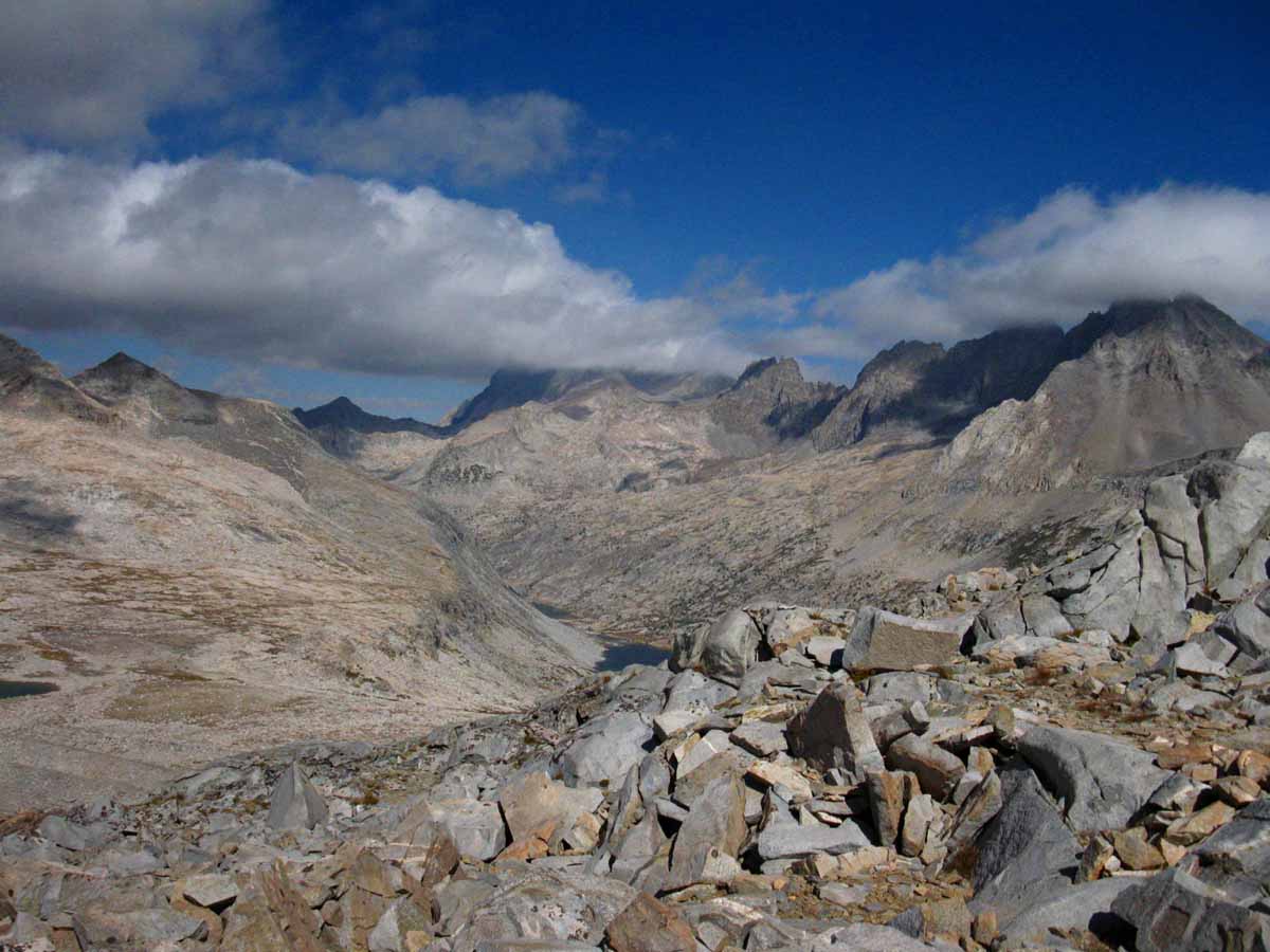
Turning around to take a last look at the Palisade Lakes below, the Palisades Range surrounding them on the Right, and us hiking through the shattered rock leading South to Mather Pass.
Trail Guide Map Miles and Elevations: Not yet online
November 2016
| Sunday |
Monday |
Tuesday |
Wednesday |
Thursday |
Friday |
Saturday |
Deploy Winter Gear
Our “base” layers are typically brought from Fall to Winter Standards during the month of November.
Our shell layers are thickened to Winter Standards as well.
Winter Shell, boots, socks, gloves and camp gear all come into play. I love my down snow-camp booties!
Retire the water filter and bear canister.
2016 Status
High temp storms out of the Southwest have been bringing
wet and snow conditions to the High Sierra. Wet and Cold conditions create a special kind of hazard that must be anticipated.
We enter November this year with
a
COLD & WET GEAR ALERT
November 16
COLD ALERT
|
28 |
29
|
30
COLD TEMP ALERT
added to
COLD-
WET ALERT
The enduring threat has been the High Temps bringing very cold rains & wet conditions to high altitudes. Storms transforming from snow to rain and back while they cross the Sierra.
These conditions are much more dangerous, and subjectively colder, than if it's just a bit colder and everything freezes up solid.
Temps in the Sierra and the storms are still warm enough to produce rain at high altitude AND getting cold enough to snow.
Now we are FINALLY getting periods of very cold temps (15 degrees), THEN experiencing high temps and rain.
Doubly-Dangerous,
and
Weird Shit!
So we have not seen a "typical" transition point of dropping temps changing these "wet" storms to snow conditions, yet, but are nonetheless seeing temps in the Sierra dropping.
So now our alert is expanding to cover
WET and potential SUSTAINED COLD CONDITIONS. |
31
Halloween
2016
Diminishing Rains
WARM RAINS
GEAR ALERT
Excellent insulation layers required.
A gear kit designed for these potentially very harsh wet AND cold conditions is mandatory.
Not quite a full Winter setup is yet demanded, but one designed to deal with potentially very wet conditions accentuated by plunging cold temps.
Think, "drenched, then frozen."
("shaken, not stirred")
Tricky!
THINK AHEAD
CCC
Backcountry Trail Crew
Applications due
EARLY FEB 2017
2015 BACKPACKER ALERT
2015 NOTE
First Winter Storm
Warning & Storm |
1
2016
Key Sierra Nevada Snow and Temp Reporting Stations
CLEAR
Carson Pass 2"
Ebbetts Pass 0"
Deadman Creek 4"
Leavitt Lake 11"
Tuolumne Meadows .71"
Tioga Pass/Dana 4.5"
Gem Pass 22.0"
Mammoth Pass 5.8"
South Lake Cabin H2O"
Big Pine Sawmill 2.0 "
Bishop Pass BAD
Charlotte Lake TEMPS
Upper Tyndall Creek 1.75"
ALL REPORTING STATIONS
2016
Tioga Road Closed from today to the 8th.
Sno-Park Permits
Required for use of Sno-Park parking lots through May 30. |
2
2016
Warm & Clear
These Wind directions out of SW generated/drawn in by the persistent low in the Gulf of Alaska will kill all West Coast Upwellings.
The winds generated by these storms come from exactly the wrong
direction for upwellings. |
3
2016
Warm & Clear
We are seeing continued high overnight and daily temps at high elevation.
In fact, my observations indicate average temps for all seasons have been steadily increasing for decades.
We are seeing the implications of those increases this Fall, and especially these last two days as conditions revert to "unseasonably warm" "Indian Summer" status with the lack of any storm activity.
Even the storms are warmer that typical, being sourced out of the tropical skies and waters of the Central, rather than the "cold" waters of the North Pacific.
Our average profile of air cooling from Summer to Fall to Winter levels has been seriously adjusted upward into higher seasonal averages.
We see this manifested as clear days building, rather than extracting heat.
Weather conditions, such as those of these last two days that would have created "clear and cold" conditions in the past are now producing "clear and warming" conditions today. |
4
2016
Very Warm & Clear
High (above freezing)
overnight temps persist except at the highest altitudes.
Probabilities of Overnight Freezing Next Five Days
|
5
2016
Unseasonably Warm (?) & Mostly Clear |
6
2016
Unseasonably Warm (?) & Mostly Clear
End
DAYLIGHT SAVINGS TIME
Subtract one hour at 2 am
GMT - 8 hours
(Started March. 13) |
7
2016
The
Low Pressure Zone currently filling the whole Gulf Alaska is very, very persistent.
Current Weather Map
This low has been continually dragging tropical moisture onto land North of Lake Tahoe for weeks now, excepting the 4 or 5 times it has "calved off" lows moving East dragging front lines across the Sierra.
Those have been our storms so far this year. |
8
2016
Unseasonably Warm (?) & Mostly Clear to hazy
|
9
2016
Unseasonably VERY Warm & Mostly Clear to hazy
Zero precip predicted for High Sierra next five days:
Five Day Precip Prediction
All the Latest Rain-Snow Prediction Tools/Models
Six Day Temp/Weather graphical forecasts
Vast Low Pressure Zone Persists in Gulf Alaska
High Sierra Snopack Melting Rapidly
All Snow Tracking Tools |
10
|
11
Veterans Day
2016
Unseasonably Warm & Weakly Changing
The Big Low wobbling around in the Gulf of Alaska continues...
Next Precip predicted for late Wed the 16th...
ALL PRECIP PREDICTIONS |
12
2016
Unseasonably Warm & Weak front moving Northwest, & located to our North, missing us completely.
|
13
2016
Unseasonably Warm. Low Pressure Zone persisting in Gulf Alaska.
Is the High building in Central-East Pacific the return of the "drought" high who's 20+ year growth has increasingly deflected storms around us for 20+ years?
North Pacific Surface Map
No matter. Stationary lows and highs in Gulf Alaska both cut off Sierra precip. |
14
2016
Cooling with approach of weak front attached to the Persistent Low Pressure in Gulf Alaska.
STANDARD WARNING:
Full Winter Gear
All Fall Gear elements have typically been replaced by Winter Gear by or at this date.
Each year varies...
GEAR
2016
Four+ storms during October this year, with two more up to this date in November. This compares well with last year's report:
SECOND STORMS 2015 Second front carrying tropical moisture from West of Hawaii arrives on West Coast.
Moisture transport along 1000 mile front. NO Arctic Storm behind the front, only big N Pacific High.
2015 vs 2016
The difference between 2015 and 2016 is night and day. Persistent High of 15' replaced by persistent Low of 16'.
The similarity between 2015 and 2016 is both the Lows and Highs have been stationary or slow moving, tending to "wobble" around in place.
|
15
2016
Weak front moving from SW to NE with Light Precip.
3 AM-16th-Very Warm
High 40s at all stations, low 40s at highest elevation stations.
Carson Pass 0"
Ebbetts Pass 0"
Deadman Creek BAD
Leavitt Lake 11"
Tuolumne Meadows .17"
Tioga Pass/Dana 1.9"
Gem Pass 22.0"
Mammoth Pass 1.2"
South Lake Cabin H2O"
Big Pine Sawmill 2.9"
Bishop Pass BAD
Charlotte Lake TEMPS
Upper Tyndall Creek .67"
ALL REPORTING STATIONS
See the previous 2016 Snow reports on Oct 9, 29, and Nov. 1. |
16
CLEARING
2016 COLD ALERT
Clear & cooling through clear skies.
Not much snow deposition. Passing front brought warmth, now chilling under clear conditions.
Not Much Snow last night:
Carson Pass 0"
Ebbetts Pass 0"
Deadman Creek BAD
Leavitt Lake 9"
Tuolumne Meadows .0"
Tioga Pass/Dana 1.7"
Gem Pass 20.2"
Mammoth Pass 1.2"
South Lake Cabin H2O"
Big Pine Sawmill 2.7"
Bishop Pass BAD
Charlotte Lake TEMPS
Upper Tyndall Creek .97"
Did this wet precip/snow do damage to the high elevation snow pack?
Clearing after storm bringing deep drop in temps. A 20 degree drop day over day from 15th to 16th. |
17
CLEAR and COLD
2016
FALL TEMP DROP
Freezing Overnight and Daily Temperatures in North-central and Northwestern United States/Sierra.
US OVERNIGHT FREEZING PROBABILITIES
Last year I observed this event on
Oct 16 of 2015.
We have had extended warm temps this year.
Though it has gotten "cold," this year and snowed, we still have not had sustained "Winter" temps until yesterday's plunge and today's clear and cooling conditions.
Typical Yesterday:
51 at 12NOON
&
20 (or less) at 7PM
This daytime drop in temps triggered this very late-dated "FALL TEMP DROP" declaration.
I fully expect more tropical weather to blow in and heat things back up to unseasonable levels.
But it is cold now. It will be cold if no tropical moisture blows in from the SW.
Cooling into Fall and Winter conditions has been stretched-out this year, but has finally arrived-today! |
18
CLEAR and COLD
2016
|
19
2016
Moderate front activity out of SW to NE.
Light-steady precip.
Persistent Low off NW Washington (The 7 week and counting Gulf Alaska Low) is dragging front-line mostly across N Sierra & NW US. |
20
2016
Moderate front-line bending out of SW to NE, almost N.
Light-steady precip.
Weak low crossing/lingering on Sierra while dragging front line East, WHILE persistent low re-forms in Gulf Alaska.
I anticipate some huge snow depositions. This would be a great setup for my traditional Christmas-New Year snow trip..., once it finishes, compacts, and conditions clear.
|
21
2016
CLEAR and COOL
Vast fairly stationary & persistent Gulf Alaska Low.
Carson Pass 9"
Ebbetts Pass 2"
Deadman Creek BAD
Leavitt Lake 15"
Tuolumne Meadows .03"
Tioga Pass/Dana 5"
Gem Pass 22.1"
Mammoth Pass 2.4"
South Lake Cabin H2O"
Big Pine Sawmill 2.4"
Bishop Pass BAD
Charlotte Lake TEMPS
Upper Tyndall Creek 2.53"
ALL REPORTING STATIONS |
22
2016
PM Light Precip overnight |
23
2016
AM Light Precip, into cool, broken clouds to clear.
IF the powerful High(s) in Southern Central Pacific stay(s) "low" in Lattitude,
AND the very persistent & stationary Gulf Alaska Low starts to move, to rotate around the top of the High, we will have the first clear example of a CLASSIC Winter storm track for the NW US forming up for the first time in many, many years.
Will it? Will it be reliable and endure?
We'll see, but all the "parts" are sitting there. Now we will see if they "play well" together...
Check this surface map,
Pacific O, 11-26-16
which is part of this sequence:
Nor Pac 96 hour Surface Forecast, 14 day loop. |
24
2016
Clear and Cool
Thanksgiving Day
|
25
2016
Clear and Cool
Cooler front approaching as broken lows move E.
|
26
2016
Early AM rains as front crosses. Late PM rains.
Small low rotating at Oregon border...
High building, moving N in NE Pac.
Lows from the Alutians will rotates across the top of this High into the NW US if this High moves into positon; the classic storm track.
The high moving up is disrupting the stationary low that's been sitting pretty in the Gulf Alaska for the past six weeks.
Nor Pac 96 hour Surface Forecast, 14 day loop. |
27
2016
High Pressure, building, Clear & Cool.
Carson Pass 17"
Ebbetts Pass 14"
Deadman Creek BAD
Leavitt Lake 32"
Tuolumne Meadows .19"
Tioga Pass/Dana 17.2"
Gem Pass 28.0"
Mammoth Pass 23.9"
South Lake Cabin H2O"
Big Pine Sawmill 3.2"
Bishop Pass BAD
Charlotte Lake TEMPS
Upper Tyndall Creek 8.37" |
28
2016
High Pressure
Clear & Cold. |
29
2016
High Pressure
Clear & Cold.
Two Weak Fronts approaching, grazing N Sierra? |
30
2016
Weak Front passing.
Low rotating around
North end, the top of a
NE Pacific
High Pressure Zone, Persisting.
Light Rain
Overcast & Cool.
This is more typical behavior for the "normal" storm track that has been becoming rarer and rarer over the past forty years.
If the NE Pac High moves too far North it will deflect Aleutian storms around the Sierra far to the North.
A massive Low has been setting up in Gulf Alaska and just sits there, If the NE Pac High drops too far South.
We are screwed by a High too far North or South; We need "just right." |
1
2016
Tioga Road Closed for Season |
2 |
3 |
NOTES:
Highways 120 and 4 will close for the season with the first heavy snowfall.
2015
EL NINO HISTORY:
A series of front lines "tied" to Central Pacific low pressure zones have been "dragged" across the West Coast by the lows. A persistent High in Gulf Alaska has been transporting the majority of this moisture to the North of the Sierra.
The North end of the front lines are tied to the Low, which is rotating around the top of the Gulf Alaska High, while the line of the front running to the Southwest is anchored in East-Central Pacific tropical activity. Vast amounts of tropical moisture are transported along the front line between the low to the Northeast and the High to its Southwest, mostly around the High Sierra.
(Transported N around the Sierra by the shape and position of the High.)
So far these front lines transporting tropical moisture have been squarely pointed at Seattle in the Northwest corner of the US.
Enough of the vast amount of moisture has escaped the containment of these combined Highs and Lows to give the Sierra a slightly over average, average year. That's during the biggest El Nino even ever seen.
2016
Things are very different approaching the Winter of 2016-17. Instead of the great High in Gulf Alaska that has become almost "normal," this year the Gulf Alaska is hosting a very persistent low pressure zone. This Low is what sucked in the storms of early October, and is responsible for what precip we've seen in November. This is very different than the previous 15 years!
We are emerging from the first wet October I can remember since the Fall of 2010.
Nov 2 2016
Persistent Low Pressure Zone in Gulf Alaska noted for dragging in early Oct storms (See Oct 27 entry above) is strong and maintaining position.
Nov 3 2016
So far I would characterize this Fall as Wet & Warm characterized by persistent NEast Pacific low in Gulf Alaska dragging tropical fronts out of the SW to the NE. This shape of the atmosphere has almost excluded Southern California from the flows of precip out of the Southwest, while the South Sierra has still received a good dusting of snow.
The pressure, wind and temp factors necessary to bring our traditional cold storms out of the Northwest across the Aleutians to the Sierra have not set up, leaving the door open for continued warm storm activity out of the Southwest as long as Gulf Alaska Low continues.
We are getting more typical precip, but it is all coming out of the SW on warm tropical flows drawn Northwestward by the low in Gulf Alaska.
I believe that these warm, wet storms in high altitude conditions are very dangerous, and a real pain in the ass for dedicated Winter Travelers. During snow travel water is best when it is deeply frozen and cannot melt upon body contact when either falling from the sky or through ground contact. These current conditions of warm on the ground snow and warm falling snow melting upon body contact both create the potential for very hazardous cold and wet conditions to quickly evolve.
Remember what always happens after we get drenched? It freezes! Traveling through warm snow does not require snow falling to get us wet. Everything we touch melts!
My best Winter trips have been the coldest. Deep Cold creates a unique stability.
Anticipate the worse, expect the best, and we will be prepped and ready for the rest.
Nov 7 2016
The
Low Pressure Zone currently filling the whole Gulf Alaska is very, very persistent.
Current Weather Map
This low has been continually dragging tropical moisture onto land North of Lake Tahoe for weeks now, excepting the 4 or 5 times it has "calved off" lows moving East dragging front lines across the Sierra.
Those have been our storms so far this year.
Nov 14
Persistent Low in Gulf Alaska dragging weak storm out of SW from NW of Hawaii!
Nov 16
Serious Daytime Temp Drop
Carson Pass
50 degrees at 1PM the
15th
26 degrees at 1PM the 16th
19 @ 8PM
Tuolumne Meadows
56 degrees at 1PM the
15th
32 degrees at 1PM the 16th
15 @ 8PM
Gem Pass
47 degrees at 1PM the
15th
24 degrees at 1PM the 16th
13 @ 8PM
Charlotte Lake
46 degrees at 10AM the
15th
26 degrees at 10AM the 16th
10 @ 8PM
Nov 20
Persistent Low in Gulf Alaska dragging weak storm out of SW from NW of Hawaii!
Nov 26 2016
High building, moving N in NE Pacific
|
HIGH SIERRA
Winter Backpacker
WEATHER RESOURCES
ALL SNOW
INFORMATION
Snowfall
on the
Ground
Rain-Snow
Probabilities
Rain-Snow
Forecasts |
GEAR ALERT
Oct 16 to Nov 16, 2016
Excellent insulation layers required.
A gear kit designed for these potentially very harsh wet AND cold conditions is mandatory.
Not quite a full Winter setup is yet demanded, but one designed to deal with potentially very wet conditions accentuated by plunging cold temps.
Tricky!
HAZARD ALERT
Oct 29 to Nov 16, 2016
High Temps bring cold rains on the verge of being snow flurries, while snow flurries melt upon hiker contact:
THIS IS VERY DANGEROUS.
Excellent Gear Required.
We must be able to stay warm in freezing rains.
And warm after the rains end and the evening chill descends.
Even if the sky is clear we must anticipate the type of hazards that both clear skies or unexpected storm activity could bring.
Today those risks would be both unexpected very cold conditions and unexpected storm activity in "warm" conditions capable of bringing freezing rain.
November 16
COLD ALERT
Temps Plunge
Full Winter Gear Required
Date
Vs.
Conditions on the Ground
The calendar says Winter Conditions, but what are the conditions on the ground?
Late season clarity can quickly shift to blizzard conditions.
Hope for the best, pack gear for the worse.
High Sierra Winter Weather
2014 Calendar 2015 Calendar
2017 Calendar |
With or without snow on the Sierra, November brings very cold temps, and clear skies can turn dark and unleash heavy snow very quickly.
Summertime backpackers are tracking the trajectory of Winter conditions to guess-timate the date snows will clear from the high trails during Spring.
Wintertime backpackers are carefully tracking conditions to determine the best times to access the Winter Wonderland, if and when Winter comes across the 2016-17 divide.
Tahoe to Whitney
Top of Page |
December 2016
Iconic sawtooth ridgeline on Mount Whitney
South of the final gentle climb to the Mount Whitney plateau
January February March April May June July August September October November December
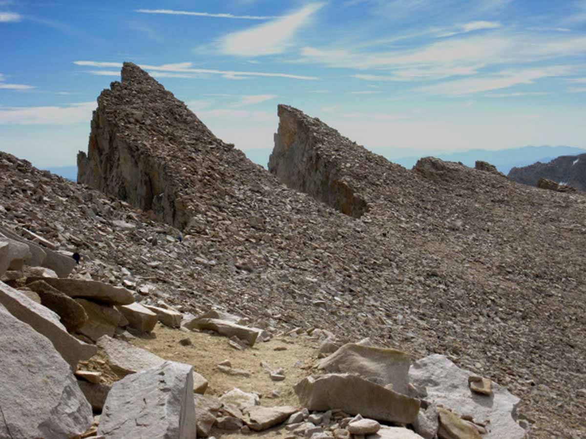
Hiking past the iconic sawtooth ridge on our last steps to the great almost-flat plateau that is the crest of Mount Whitney.
Trail Guide Map Miles and Elevations: Not yet online
December 2016
| Sunday |
Monday |
Tuesday |
Wednesday |
Thursday |
Friday |
Saturday |
Full Winter Gear
Time to pull out the full Winter Gear. A thick base layer with thick insulation and heavy shell layers necessary.
Yosemite-Hoover-Desolation
&
John Muir Trail Hikers:
Time to
Order Next Year's Permits!
Time to order/gather food for resupplies...
Latest Daily Snow Depth Summary
Daily Sierra Snowpack % of Normal pdf
Daily Snow-Water & Percent of Average
All Precipitation-Snow Data
All Snow Surveys
SWC & Snow Depth
|
29 |
30
Observe
Storm, Temp and Weather Patterns to properly time upcoming Winter Trips.
|
1
2016
Tioga Road Closed for Season.
High Pressure
Clear, Cool, & Bright.
Carson Pass 12"
Ebbetts Pass 9 "
Deadman Creek BAD
Leavitt Lake 28"
Tuolumne Meadows .17"
Tioga Pass/Dana 13"
Gem Pass 22.6"
Mammoth Pass 16.3"
South Lake Cabin H2O"
Big Pine Sawmill 1.7"
Bishop Pass BAD
Charlotte Lake TEMPS
Upper Tyndall Creek 6.3"
ALL REPORTING STATIONS |
2
2016
High Pressure
Clear, Cool, & Bright. |
3
2016
High Pressure
Clear, Cool, & Bright. |
4
2016
High Pressure
Thin High Clouds,
Cooling further. |
5
2016
High Pressure
Overcast,
Cool.
Rains Predicted Thurs
Wow. All the factors are out of wack. The Arctic is running ABOVE FREEZING.
The La Nina is "puttering" along.
A big, persistant Gulf Alaska Low just busted up.
Huge high pressure zones are haunting the Central and East N Pac.
I am betting on colder and drier conditions than all are predicting, but all the factors are in strange flux. |
6
2016
High Pressure bending down to South.
Overcast,
Cooling further. |
7
2016
High Pressure bending down to South.
Overcast,
Cold. Light Rain PM.
The bevy of Low pressure zones in Gulf Alaska are all 1000+MB (high)-While the Highs are all strong.
I.E., weak fronts.
Arctic Record Temps |
8
Snow Depth,
24 hour high & low temps.
Carson Pass 14"
31 & 12
Ebbetts Pass 11"
38 & 6
Deadman Creek BAD
32 & 3
Leavitt Lake 30"
33 & 20
Tuolumne Meadows .20"
38 & -3
Tioga Pass/Dana 15"
BAD
Gem Pass 22"
32 & 20
Mammoth Pass 18.8"
40 & 13
South Lake Cabin H2O"
22 & 38
Big Pine Sawmill 1.4"
20 & 33
Bishop Pass BAD
BAD
Charlotte Lake TEMPS
27 & 6
Upper Tyndall Creek 5.32"
22 & 32
ALL REPORTING STATIONS |
9
2016
High Pressure bending down to South.
Overcast,
Cold. Light Rain |
10
2016
Overcast,
Cold. Light Rain |
11
2016
Overcast,
Cold. Light Rain
|
12
2016
Overcast,
Cold. |
13
Snow Depth,
24 hour high & low temps.
Carson Pass 16"
35 & 19
Ebbetts Pass 19.4"
36 & 26
Deadman Creek BAD
33 & 12
Leavitt Lake 47"
31 & 26
Tuolumne Meadows .BAD"
36 & 16
Tioga Pass/Dana 23"
BAD
Gem Pass 29.7"
37 & 21
Mammoth Pass 26.8"
33
& 24
South Lake Cabin H2O"
40 & 26
Big Pine Sawmill 2.9"
37 & 26
Bishop Pass BAD
BAD
Charlotte Lake TEMPS
26 & 19
Upr Tyndall Creek 11 .75"
35 & 26
ALL REPORTING STATIONS |
14
2016
Overcast,
Cold. |
15
2016
Storm, moderate, again out of the Southwest from tropical waters SE of Hawaii.
(Called heavy by media, for its tropical rains, but it was medium to me,)
Big Highs forming in Gulf Alaska.
Arctic Circle
WARM & WEIRD.
La Nina puttering away.
We are seeing one weird "tropical" fueled wet Fall out of SW.
-during a La Nina-
progressing into ?
I see little chance of "normal" Winter conditions coming out of NW, so,
#1> Tropical Flows out of SW continue into Winter?
#2> Tropical Flows stop.
Cold and Clear conditions are coming, and will persist If the big High building into Gulf Alaska & NE Pacific persists.
2015 CHANGE POINT
Intense Tropical Thunderstorm activity forms North of Indonesia.
This is the typical precursor to California-targeted tropical flows.
El Nino flows have been transported to our North by high-pressure. So Far. |
16
2016
Overcast,
Clearing and Cooling.
Big High |
17
2016
Clear and Cold.
Big High |
18
2016
Clear and Cold.
Big High
Snow Depth,
24 hour high & low temps.
Carson Pass 20"
31 & 8
Ebbetts Pass 34"
34 & 6
Deadman Creek BAD
27 & 1
Leavitt Lake 69"
27 & 4
Tuolumne Meadows .46 "
(depth suspect)
35 & -8
Tioga Pass/Dana 49.7"
(Temps BAD)
Gem Pass 49.8"
29 & 9
Mammoth Pass 58.4"
28 & 7
South Lake Cabin 6.2 H2O"
33 & 7
Big Pine Sawmill 14.4"
26 & 1
Bishop Pass BAD
BAD
Charlotte Lake TEMPS
24 & -1
Upr Tyndall Creek 27.6"
27 & 13
ALL REPORTING STATIONS |
19
2016
Clear and Cold.
Big High |
20
2016
Clear and Cold.
Big High, weakening, but persisting.
Precip called for
Thursday to Tuesday. |
21
First Day
of
Winter
Clear and Warming
10:44 UTC
Cold & Dark Equinox,
The Cold Heart of Winter
UTC & Time |
22
2016
Clear and warm,
|
23
2016
Rain AM
Out of Southwest |
24
2016
Clearing
|
25
2016
Clearing and Cooling
Serious gusting winds
Christmas
Central-East Pac High(s) persisting, and almost in position to rotate storms from Gulf Alaska/Aleutians on a "normal" storm track to Sierra.
BUT, Arctic is warm, NOT cooling and NOT "spinning down" to "normal" mid-Winter ferocity.
THAT means the Lows in Gulf Alaska are wandering around, NOT being supercharged by Arctic cold, and NOT following an Arctic-Supercharged N Jet Stream path to NW America & The Sierra Nevada.
That's a HUGE CHANGE.
(in long term patterns)
OK, the Cen-East Pac has well-positioned, if strong, Highs in a kind-of normal location, but the Arctic is not co-operating. Too warm to fire-up our normal storm track...
Thus we also see huge sheets of very cold air sliding off the Arctic down onto the N Am Continent.
Wow. Watch and learn! |
26
2016
Clear and Cold
Snow Depth,
24 hour high & low temps.
FULL COLD WEATHER GEAR
Carson Pass 26"
21 & -3
Ebbetts Pass 36"
24 & 4
Deadman Creek BAD
35
& -4
Leavitt Lake 72"
23 & 2
Tuolumne Meadows .48"
(depth suspect)
36 & -8
Tioga Pass/Dana 48"
(Temps BAD-Snow Suspect)
Gem Pass 54.3"
40 & 7
Mammoth Pass 62.2"
40 & 9
South Lake Cabin 6.39" H2O
43 & 2
Big Pine Sawmill 13.6"
33 & 0
Bishop Pass BAD
BAD
Charlotte Lake TEMPS
33 & -2
Upr Tyndall Creek 31.88"
30 & 14
Not much of a Winter Snowpack (sad), but hey, at least we have one!
ALL REPORTING STATIONS |
27
2016
Clear and Cold
Big Highs |
28
2016
Clear and Cold |
29
2016
Clear and Cold
Big Gulf Alaska High, almost vast, with weak low moving WEST along its bottom edge...
Just what forces are "directing" our Winter this year, and during these "times?"
The Arctic no longer chills down to its typical low temps.
These higher Arctic temps radically change the path and behavior of the North Jet Stream.
Northern Jet Stream alterations
radically changes the weather all the way down through the mid-lattitudes, where extra heat moving North from the Equator pushes change from the South.
The changes in the North Jet Stream have altered the patterning and positioning of typical seasonal High and Low patterns in the NE Pacific, and how they disperse temps & moisture to create storms, let alone where they push and pull these storms.
All the inputs have changed, as have outcomes.
I can't begin to tell you how serious these changes are, especially when vast populations are dependent on the OLD weather pattern filling global mountain ranges with snow for year-long drinking and growing...
Our fundamental planetary weather security is seriously compromised. We seem unaware or uncaring about allowing greed & corruption to steal and devour the last bits of our Natural "prosperity," which is undermining our most fundametal security. |
30
2016
Haze and Cold
|
31
2016
Overcast and warming, but still Cold |
1
2017
Overcast and Warmer, with still Cold-sprinkles
2017
Backpackers
Time again to begin observing Winter transitioning into Spring. |
2
2017
Heavy Clouds and Cool, light precip |
3
2017
Stormy and Cool, but still Cold-regular precip, light to moderate strength
THINK AHEAD
CCC
Backcountry Trail Crew
Applications due
EARLY FEB 2017 |
4
|
5
2017 Calendar |
2017 Calendar
The Winter Backpacker
Very short days and long cold nights makes Winter hiking trips very different than Summer.
I’m hopeful the trails will be buried under yards of snow by December 2016…
If so, our goals, our speed, and our expectations have fully shifted into Winter Mode.
Our changing inner perspective ideally matches external environmental changes.
May your perspective always complement your environment, and visa-versa.
2014 Calendar 2015 Calendar
2017 Calendar |
NOTES:
Latest Daily Snow Depth Summary
Daily Sierra Snowpack % of Normal pdf
Daily Snow-Water & Percent of Average
All Precipitation-Snow Data
All Snow Surveys
SWC & Snow Depth
This 2016 High Sierra backpacking and backpacker's Calendar notes important hiking dates, our current and recent historical weather. We also track the expected and actual dates our resupply locations and the roads that feed them open and close. We also contrast and compare each Winter with its past performance, which puts seeing the radical changes that have already transformed global weather patterns even within the grasp of the average idiot urban consumer.
Taking the High Ground
The first step for reclaiming your real identity and spirit is to reestablish your primairy contact and context in and with Nature. This is the first step building a timeless alternative to the transitory ignorance and enduring lies of consumer "culture." Your observations of the structure and operations of Nature establishs an anthisis -YOURS- to the structure and operations of the social, political and economic institutions of man. Nature produces a vast body of biological balance, stability, and beauty, as well as interfaces of brutal, bloody, competition. You can "see" it all, so to speak, through Nature's lens.
The imputus, the motivating truth that ties Natural Balance and Brutality together is that Nature eats itself to survive. Nature's brutal process produces yet more life, more complexity and sophistication, and ultimately, the energy and stability for self-reflectiion. This was always IT's goal. Nature has given us wings to fly, the vision to see and take the keys to this Natural Kingdom into our own hands.
The workings of this great Machine of Life have been subordinated to the desires of man. IT'S energy, complexity, and fertility have been enslaved by, and chained to the lowest desires of man. We have taken our spiritual powers in Nature and formed them up like a suicide bomber, seemingly intent on finishing off the job of lobotomizing the very sophistication and complexity of Nature that created us in the first place.
Our best potentials are based on, woven within, and found in Nature. Social, economic, and political instutions which violate Nature's Balances are nothing more than engines of ignorance, illicit gratifications, and ultimately, deep tragedy.
We must "unchain" vast stretches of the Earth from the tyranny of our sick minds, and these spaces must be allowed to heal up. This loss of a great deal of the "soveregnity" of man over Nature is going to happen. The transition would be better for both parties if we submited to the balances of nature with free will, rather than be forced from the garden. Again.
The Real Deal:
Ancient Allegory
See, "god" did not "drive" Adam & Eve from the "Garden." No, "the knowledge of good and evil" was christianity's way of explaining human's finding of, and using self-reflective consciousness. It was this power we used to make the decisions necessary to destroy the eco-balance which kept the Garden of Eden lush, and the spirit clear in our eyes. We have taken and used the power of our sacred knowledge to pave over Nature and put up a parking lot, from our very first glimmerings of self-reflection, if you believe the christian allegory.
Well, the christians say we lost it because we did not deserve IT, while I say we lost it because we destroyed IT.
Now we finish that job begun so long ago, as the depth and reach of the "Evil that ate Eden" now exercises global domination. Yes, greed in the guise of great wealth and military power now dominates the whole Earth. Nature, and good folks everywhere are reeling.
I am not a christian, but their allegories work, when you take them out of their religious captivity... These words and stories have been around much, much longer than the chrisitians. So have you and I.
On Religion
Naw, I'm off it...
El Nino Year
December Tenth, 2015:
Intense tropical flows have so far been diverted around us by the same persistent ridge, the high pressure zone that's been gradually building, strengthening, and persisting over Winter in the Northwest and West
Pac over the last fifteen years. Yup, that one. I am betting that each time this ridge breaks down from here on out we will have a good chance of North and Central California getting seriously hosed. The ridge persisting will continue the deluge that everyone from Portland Oregon, and points North, has been getting pounded with, so far this year.
The distribution of El Nino tropical moisture has been controlled by the balance of factors I discussed in the December Backpacker Alert.
ALL YEARS
Season's Greetings:
Alex and all the members of Tahoe to Whitney hope you had a killer backpacking year, that you’ve seen amazing things and met incredible folks on the long trails between Lake Tahoe and Mount Whitney. Woo Hooo!
Now's the Time!
November & December is the time to reserve permits in Desolation Wilderness or Yosemite National Park for next June. Half of each ‘s Wilderness Permits for these heavily used areas are available six months before the start date of the backpacking trip. |
I was hoping my frostbite/heart is recovered enough to resume my annual Christmas-New Year Snow Camping Triangle at the end of 2016. Not Happening.
From Meyers to Round Lake to Showers Lake to Round Top Lake and back to Meyers is my traditional December 25 Christmas present to myself. Not Happening.
The terrain, the joy of navigation and route finding the snow-covered beauty of the High Sierra during Winter is a special experience well worth the efforts and hazards.
Happy Route Finding!
Tahoe to Whitney |
Top of Page
January February March April May June July August September October November December
2014 Calendar 2015 Calendar
2017 Calendar
top of page |


