The Trails
Guide
Maps
Miles/Ele
Permits
Resupply
Forum
Current Weather Conditions
Weather Notes
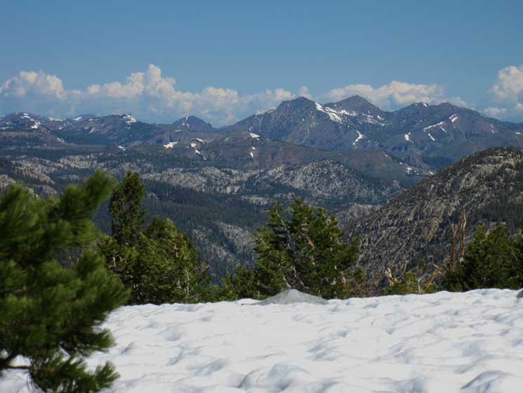
Northern High Sierras
Central High Sierras
Southern High Sierras
Gear
Gear List
Gettin Started
Layering
Discussion
Testing yourself and your gear
Gear Reviews
Backpacking
The East Fork of the Carson River
to
Sonora Pass
Carson Iceberg Wilderness
Hiking
The Pacific Crest Trail from Ebbetts Pass to Sonora Pass
Languages
Languages
Trail Arts
The art of walking
Physical Preperation
Trail Skills
The trail
Off the trail
Scrambling
Maps
Navigation
Camp skills
Food
Resupply
Food
Other
Photo Catagories
Trail Stories
Trail Culture
News and Science
Links
Groups
Books
Terms and Conditions of Use
| Trail Guide INDEX Highway 4 to Highway 108 |
Guide PCT North Boulder Lake to East Carson River |
Guide PCT South Sonora Pass |
7.5 Topo Map East Carson River to Sonora Pass |
30 min Map Ebbetts Pass to Sonora Pass |
Ebbetts Pass to Sonora Pass MILES AND ELEVATIONS |
ALL TOPO MAPS EBBETTS PASS to SONORA PASS |
Resupply North Lake Alpine. South Kennedy Meadows |
National Forests Toiyabe & Stanislaus |
all maps index |
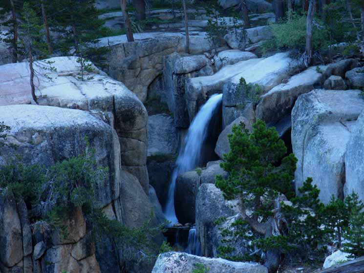
East Fork of the Carson River
and the
Pacific Crest Trail
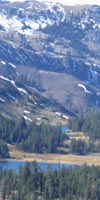
Ducks at the trail junction of the East Fork of the Carson River and the Pacific Crest Trails. The East Carson River Trail Junction is 8.74 miles North of Sonora Pass. |
||
 |
||
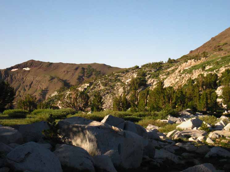
East Carson River Trail When I came through later in the Summer I fixed 'em up. This unmaintained trail down the East Carson River opens up a wide variety of loops and backpacking trips using Murray and Golden Canyons to our North, and also opens up great backpacking loops out of the remote Eastern High Sierra trailhead via the Corral Valley-Rodriguez Flat Trailhead. Loops using this 6.02 mile segment of trail North down the East Carson River are full of rewards. The East fork of the Carson River flows North, and we hike North along a difficult unmaintained trail, down to the magnificent Carson Falls where we again find maintained trail. Check out the maps below to situate ourselves in the Carson Iceberg Wilderness at the East fork of the Carson Trail and explore what hiking options this trail junction opens up to us.
|
The Unmarked Junction
|
| Carson Iceberg Wilderness 30 minute backpacking Map |
Ebbetts to Sonora Pass 30 minute backpacking Map |
But, we don't have to hike down the challenging unmaintained East Carson River Trail. The East Carson River and its big campsite are a great place to spend a night on any hike.
Continuing South on the PCT
If we are continuing our backpacking trip South along the Pacific Crest Trail we have a 4.65 mile long steepening grind up 2080 feet to the 10240 foot gap through the headwaters bowl of the East Carson River, a total of 5.86 miles to the 10536 foot Sonora Gap and another 2.88 miles down 893 feet to the 9640 foot Sonora Pass Trailhead on Highway 108.
This puts our total distance from the East Carson River trail junction to Sonora Pass at 8.74 miles climbing a total of 2376 feet over the first 5.86 miles. The 2.88 mile hike from the Sonora Gap to Sonora Pass is mostly level or down mountain.
I discuss how I "stage up," or plan my campsite locations approaching a resupply location to maximize my rest and resupply stop as well as finding the best campsites approaching and departing resupply on the previous Boulder Lake trail junction to East Carson trail junction trail guide page.
Northbound on the PCT
If we are hiking North we quickly come to the first 500 feet of climbing up grueling switchbacks, of the total 740 feet of climbing from the bottom of the canyon to the high point of the trail going around the backside of The Plug.
The switchbacks to the North are bringing us up to go around the backside of this huge granite feature blocking the Western shore of the East Carson River, which also makes an impressive feature decorating the Upper Carson River Canyon's Western wall.
Our trail North must climb around this obstacle, and climb it does, bringing the Pacific Crest Trail up steep switchbacks to trace its way North along the top of the Western Edge of the East Carson River's mighty granite gorge for a few incredibly scenic miles North of The Plug.
Southbound on the PCT
Our Southbound backpacking goal is to exit the headwaters of the East Carson River through the East Carson Gap.
The East Carson Gap is the low point along the steep ridge-arm running off the NE shoulder of Sonora Peak over to the ridge running off the Southwestern shoulder of White Mountain. This low ridge running between these peaks makes up the top of the East fork of the Carson River's headwaters bowl.
Hiking through the East Carson Gap we find the trail brings us Southwest across a short flat littered with great and small granite boulders to a vantage point overlooking Wolf Creek Lake. We're moving Southwest to put ourselves under the Eastern flank of Sonora Peak to begin our final climb traversing the Eastern Flank of Sonora Peak up to the 10536 foot Sonora Gap.
What I call the Sonora Gap is the low point where the ridge running off the Southeast corner of Sonora Peak intersects with the main body of the Peak.
Granite Volcanic Interface
The flat terrain across the top of the East Carson Gap the short distance to where we begin climbing to Sonora Peak's barren Eastern volcanic flank is across the last island of white granite we're going to be hiking across for a while.
This last tiny granite zone up in the East Carson Gap is the South end of the massive granite slash that the upper East Carson River's canyon cuts through the otherwise rusty red line of volcanic peaks along our PCT route South across the Carson Iceberg Wilderness from Ebbetts Pass.
Here we see granite outcroppings peeking out from under and around the highest tide of volcanic flows at the base of the Eastern flank of Sonora Peak which marks both the highest rise and furthest extent of the volcanic flows that completely covered most of the surrounding granite terrain.
This little zone is the peak of a tiny island of emergent granite, surrounded by the rising red tide of an enormous ocean of volcanic terrain capped by the massive red summits of the surrounding Sonora, White, Stanislaus and Leavitt Peaks.
But that was the past, frozen in time around us. Now the soft volcanic materials of these massive peaks are rapidly eroding away. The enduring granite is emerging from the grasp of its volcanic tomb as the softer volcanic materials are washing away in the slow fury of nature, as we saw in the upper East Carson River Canyon.
Space in Time
We are at a tipping point in time and space here at the top of the East Carson headwaters, on the flat below the East flank of Sonora Peak.
Here we are not just at the tipping point of a great battle between volcanic and granite terrain played out over geological time spans, but Sonora Peak divides a lot of watersheds.
We can look over one ridge into the West Walker drainage, and another into Deadman Creek West down to the Middle Stanislaus. Behind us the mighty East Carson flows North, and the Clarks Fork of the Stanislaus drains West off the West flank of Sonora Peak.
These rivers have all cut through the layers of volcanic materials that once filled them, and the river's grandfathers, the mighty glaciers, cut all the channels through the granite that all subsequent flows, both volcanic and water have followed.
Each of these watersheds' shapes reflects their unique geological history, each is a unique chapter, and a window into the amazing story of the evolution of beauty that is the Sierra Nevada Mountains over time.
Endgame of this Section of Trail
Resupply
All the terrain up here, be it volcanic or granite, is slashed with heavy swaths of Spring brush, and millions of flowers during the outburst of life that accompanies the Spring Thaw. The Spring thaw also brings vast populations of mosquitoes to the upper reaches of the East Carson River through the Carson Gap around Wolf Creek Lake until we get way up in altitude and out onto the more barren parts of the East flank of Sonora Pass.
Hiking around the West side of Wolf Creek Lake brings us up through the last bits of granite terrain we are going to see for awhile after we climb onto the volcanic Eastern and Southern flanks of Sonora Peak as we finish this last segment of the 29.44 miles on the Pacific Crest Trail between Ebbetts and Sonora Passes.
The next granite terrain we encounter along the Pacific Crest Trail will be along the West Walker River on the South side of Leavitt Peak at the base of Kennedy Canyon, about 16 miles South of Wolf Creek Lake.
We will soon be at Highway 108 at Sonora Pass, from where we hitch 8 miles West down to Kennedy Meadows Pack Station, to pick up our resupply covering the next 75 miles of trail down to Tuolumne Meadows.
On the way to Sonora Pass
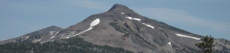
At the top of our traverse across the Eastern Flank of Sonora Peak above Wolf Creek Lake we will be standing in the Sonora Gap, the gap in the ridge extending off the southeastern corner of Sonora Peak separating Sonora Peak's Eastern and Southern flanks. The grand views in almost every direction (except NW, as Sonora Peak blocks our view) make this a nice place to take a break, depending on the wind, weather, and clouds.
I suggest no more than a momentary stop to take it all in if sideways snow is blowing in on a strong wind, or afternoon thunderstorms are forming around us.
The Sonora Gap is the cut in the ridge-arm where the Pacific Crest Trail passes from the Wolf Creek drainage off the East Flank of Sonora Peak over to Deadman Creek's drainage off the South flank of Sonora Peak, at least until we arrive at Sonora Pass.
Sonora Pass's position on the Sierra Crest divides the Eastern watershed of the West Fork of the Walker River from the Western drainage of the Middle Fork of the Stanislaus River via Deadman Creek off the West side of Sonora Pass.
We have taken a look at four different drainages during the last few miles of this hike, and we will have hiked across at least a bit of all of them by the time we reach the Northern boundary of Yosemite National Park. We just exited the East Carson, crossed the Wolf Creek to West Walker, and our last few miles from Sonora Peak to Sonora Pass are across the drainage of the Middle Stanislaus via Deadman Creek. Hiking South of Sonora Pass we're entering the watershed of the West fork of the Walker River.
Highpoint South of Lake Tahoe Basin
The 10,500 foot Sonora Gap is the highpoint on the Pacific Crest Trail since we started our trip in Lake Tahoe. If we are hiking North the Sonora Gap is the last place we will be above 10,000 feet in the Sierra Nevada Mountains along the Pacific Crest Trail. If we are hiking South elevations get steadily higher and higher as we eventually approach Mount Whitney. We'll cross 10800 feet climbing over Leavitt Peak's massif on the South side of Sonora Pass.
But, though the mountains get higher and higher the further South we go, the mountain passes get further and further apart as they get higher, unlike the close spacing of the mountain passes across the Northern Sierra. We'll see the best examples of this close spacing of high Sierra ridges crossing the five canyons of the North Yosemite Backcountry.
End of this page is the End of this Section
From our high perch up on the Sonora Gap we are faced with a brief 2.88 mile run South down to the 9643 foot elevation Sonora Pass on Highway 108. From Sonora Pass we hitch down to Kennedy Meadows to pick up our resupply and feed up before continuing South on the Tahoe to Yosemite Trail or hitching back up to Sonora Pass to continue South on the PCT.
The map below lays out all of our possible routes into and out of Highway 108.
Sonora Pass Region Backpacking Map
USGS 30 minute topo map
Click the black dotted routes for detailed maps, the red dots for trail guide information.
East Carson River
to
Sonora Pass
Trail IndexWe're coming down towards the end of the North Sierra. I place Tuolumne Meadows at the Center of the Sierra Nevada. What lays North of Tuolumne Meadows is North Sierra, and South is South Sierra. Yosemite is also actually its own special category. I consider Yosemite to be the center of the Sierra, distinct and unique from the wilderness areas to its North and South. Hiking South from the East Carson trail junction we must consider ourselves on the last legs of our hike across the North Sierra. We'll soon be hiking across the North Central Sierra, and arrive at the halfway point of our trip at Tuolumne Meadows before we know it. On this section of the Pacific Crest Trail, from North to South
Basic Facts The East Carson River Trail Junction is 20.7 miles South of Ebbetts Pass The East Carson River Trail Junction is 4.65 miles North of the East Carson Gap The East Carson River Trail Junction is 8.74 miles North of Sonora Pass
Unmaintained East Carson River trail North to Carson Falls: 6.02 miles |
||||||||||||||||||||||||||||||
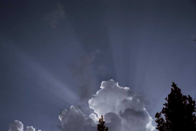
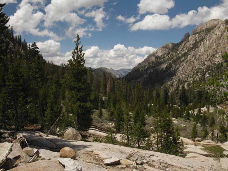
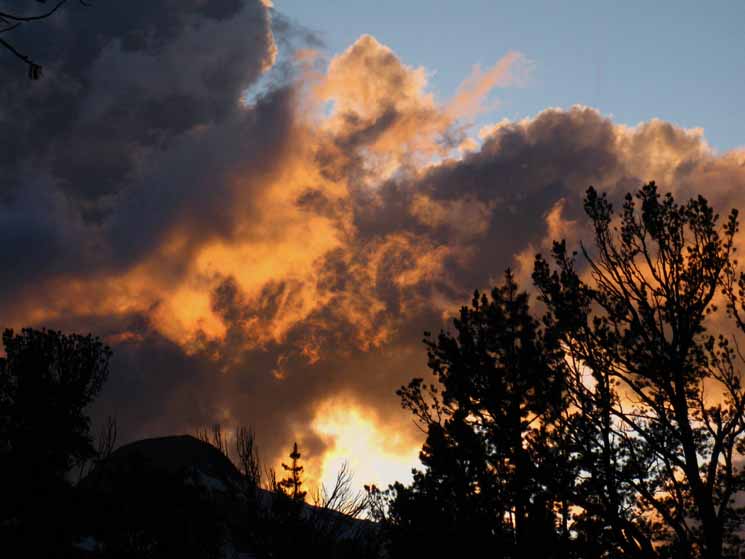
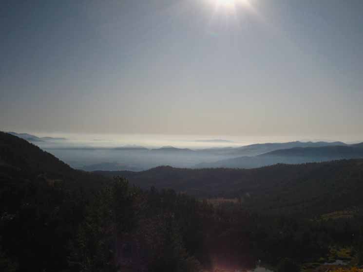
A beautiful Sky Promising fine Hiking
| Sunbeams promise to light the way to great trails, great views, and the great hiking that lays ahead of us to the High Points of this section of our backpacking trip. All of this hard work has a silver lining. |
 |
The water in the sky contributes as much as the water on the ground and rock to the beauty and character of the trail along the East Carson River. Hiking this section of trail as part of a long distance backpacking trip, a trip between Ebbetts and Sonora Passes, or part of a grand loop around the Carson Iceberg Wilderness are all worthwhile trips on their own merits. What's best for you depends on your time, money, gear, experience, and fitness situation. All of these factors can be brought into alignment to create the perfect trip for you. Check out the large and small scale maps of this area, the miles and elevations figures and study the guide to understand the challenge. Then start thinking about what you can do to get ready. Get in shape. Break in backpacking boots. Get some local hikes under the belt. |
Break Spot
at the
East Carson River Trail Junction
| It is tradition that I take a break at the East Carson River Trail Junction. |
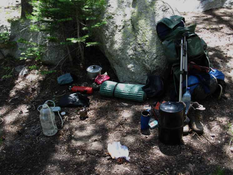 |
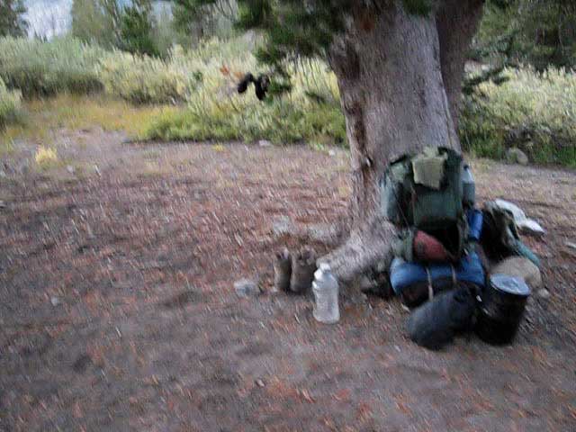
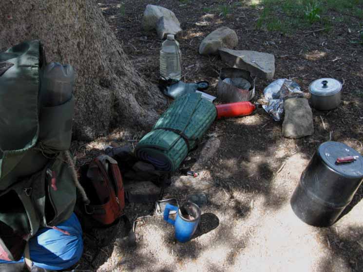
My sleeping pad is my seat, the boulder is my backrest, with all I need deployed around me. |
Let's Hike Left down to the East Carson River
 |
Arriving at the East Carson River junction I've refilled my water bottle and rehydrated, cooked up some lunch, and am having a nice break. Now I think I'll walk down the East Carson River trail to check out the campsite and upper ford over to the unmaintained trail running down the East Carson River. |
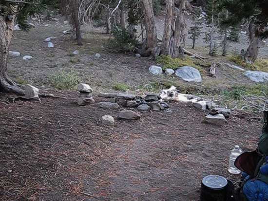
Big Campsite
down the
East Carson River Trail
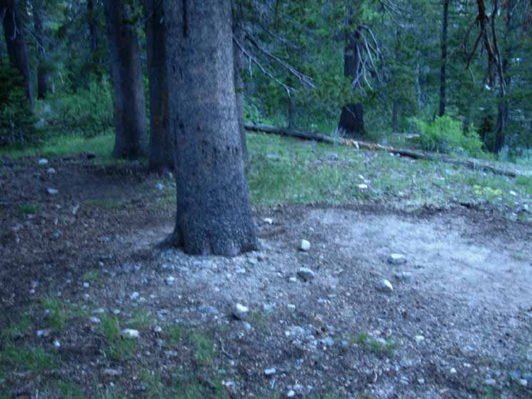
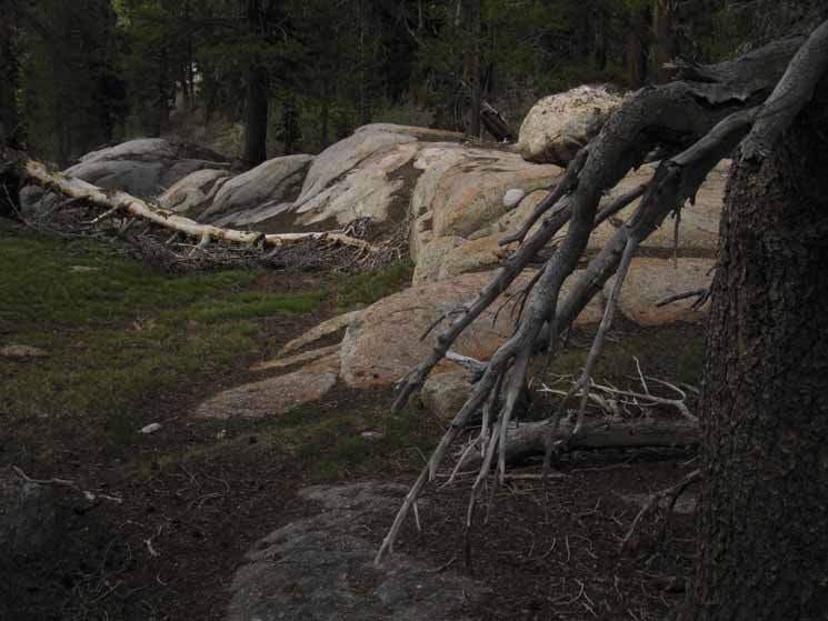
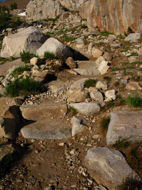
The Lay of the LandAt the East Carson River Trail junction with the Pacific Crest Trail there is an uneven campsite on the West side of the trail. The big rock just a few feet South of the junction makes a nice backrest and seat for a relaxing short break before we begin climbing South or North from this low point along the Pacific Crest Trail. The four-season creek sitting a few feet North of the trail junction provides convenient water. This junction is well shaded. Over the decades hikers entering and exiting the unmaintained East Carson River Trail at this location have setup a custom big campsite about 100 yards down the East Carson River Trail on an expansive flat spot sitting on the bank above the East Fork of the Carson River. It's a big site, sufficient for mounted or hiking parties. I'm talking to you, Scoutmaster! This is a great site for Backpacking Scouts. The upper ford over the East Carson River leads us onto a challenging 6 mile trail down to the renewal of maintained trail at Carson Pass. |
The Big Campsite
just down the
East Fork of the Carson River Trail
Big fire ring and wood for burning and sitting. We can see the East Carson River off the bank past the fire ring. |
 |
We are facing the East Carson River across the fire ring. The ford for the East Carson River Trail is down to the left. |
Tent Flat
| Flat sleeping bag spots galore. |
 |
This site is far superior than the small uneven campsite at the trail junction itself. |
Fools Names and Fools Faces appear in Natural Places...
| Facing the ford is this weird carving. |
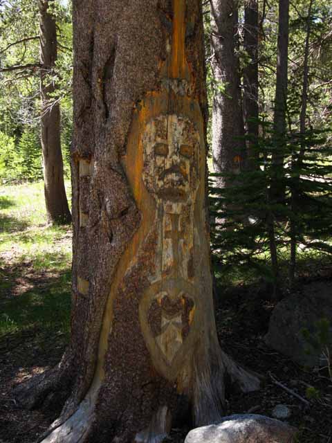 |
Don't carve the trees. Whoever did this is an idiot. I first saw this about 20 years ago. The tree lives on, which surprises me. Finding this carving the first time I hiked up the unmaintained East Carson River during the early 1990s informed me that I was approaching the Pacific Crest Trail. Seeing the carving was shortly followed by finding the first bit of recently used trail I'd seen since hiking South out of Carson Falls. It was a reassuring sight. But I still don't like to see carved up trees. |
Old Blaze
| Across the ford and North down the unmaintained trail we encounter pre-wilderness era designation carvings. |
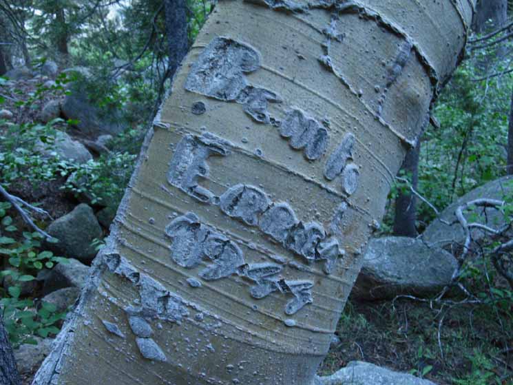 |
Benito Errea was here in 1944. The history of the East Sierra is full of Portuguese Sheep herders running flocks up and down the Sierra Pasturages, and hunting the mountains. The dense forest and close terrain of the location of this carving is indicative of a hunting party campsite, rather than a sheep herder. Forum Muir loved the sheepherders...and the Indians...ha-ha. |
East Carson River Ford
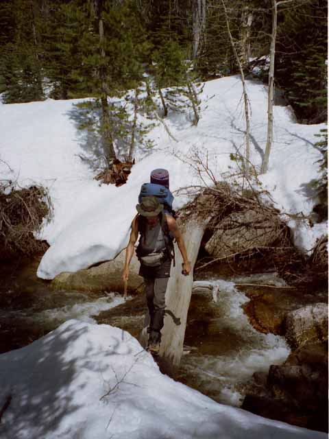 |
Greg crossing the upper ford of East Fork of the Carson River during an early Spring trip up the East Carson River from the East Sierra in 2004. |
Back to the Southbound Pacific Crest Trail
Back to the Junction
 |
This is an obvious trail junction independent of if it is ducked or not. The trail down to the campsite and ford is easy to see, having been worn into the terrain. |
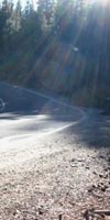
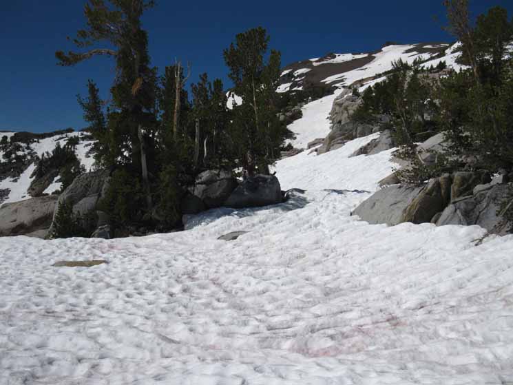
Southbound Up the PCT
| SPRINGTIME We can see the trail cut by the recent runoff. This scar will be healed by the boots of many backpackers, once it stops running with runoff. |
 |
As this image was shot during June, the water running down the trail indicates we will run into trails actively flowing with runoff water as we climb higher and closer to the melting snow. This cut is holding a gentle trickle. As we climb the trickle will rise to stream level flows, then as powerful as a small creek. We'll see the logic of trail design and construction when the trails are being tested by the power of the Spring Thaw. |
East Carson River
South
from the
East Carson Trail Junction
to
"Hunters Camp"
The Lay of the Land Southbound Continuing on South for another 1.21 miles to the Sonora Gap puts the overall distance from the East Carson River Trail junction to the high point of our trail across the Sonora Gap at 5.65 miles. Over this 5.65 miles we have a steady hard climb from 8160 to 10,536 feet of elevation. That's a 2376 foot climb. Upper At 1.01 miles South of the East Carson River trail junction we enter an open space in the forest that allows long views South to see the fine granite along the Eastern side of the river valley. A third of a mile later the trail moves closer to the East Carson, where we first hear, then see a beautiful "pocket" waterfall inset within its narrow granite channel. There are nice campsites on a flat above the falls. A short way up past the waterfall the terrain again opens up, this time to the West, revealing the stark massive block of pointed rock that I call The Prominence at the head of a little side valley wedged on the canyon side between Stanislaus and Sonora Peaks. A short ways South of the Prominence we come to the no fishing signs placed near a couple of fine campsites sitting on a deeply forested flat above the river. Between the East Carson River trail junction and Hunters Camp there are a couple of real nice campsites on shaded flats where the trail runs close to the river. Other than these locations we stay above and away from the river. This presents no problems to obtaining water. Numerous creeks feeding the East Carson River cut across the trail on a regular basis, even late in the Summer during a dry year. South of the Prominence we have a hard 1.16 mile hike up to the well-hidden Hunter's Camp, where the trees start thinning out and grand views down the length of the East Carson River's mighty valley open up. At Hunters Camp we can camp with our nice view, easy water, and an excellent food storage/shade tree, or just take a break, get water, and have a snack before we continue South, and out of the East Carson Drainage. I almost always stay at Hunters Camp when hiking through the East Carson. It is the best high campsite along the whole extent of the PCT along the East Carson River. East Carson River Trail Junction South up to the East Carson Gap 1.01 miles South from the East Carson River trail junction South to the first open space. 1.33 miles South from the East Carson River trail junction South to the Waterfall. 1.47 miles South from the East Carson River trail junction South to the Prominence. 2.63 miles South from the East Carson River trail junction South to Hunter's Camp. 4.65 miles South from the East Carson River trail junction South to the East Carson Gap. |
South Past the East Carson River Trail
 |
We can see the East Carson River through dense forest as we climb South from the East Carson River Trail junction. Though we get regular views of the East Carson, we will not get a whole lot of direct access to it. Our trail is pushed up on the Western wall of the canyon as far as practically possible, to keep it above the chaos of the Spring Thaw as far as possible. |
The Constant Climb South to the East Carson Gap
| Pacific Crest Trail looking South from South of the East Carson River trail junction. Time to Climb! |
 |
We will climb up, over, and around the numerous terrain features descending down to the East Carson River from the Stanislaus Peak Massif directly above us, to the West of the Pacific Crest Trail. |
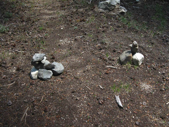
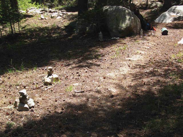
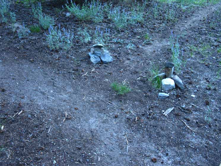
Trail Crew Materials
| Unique stack of rocks. |
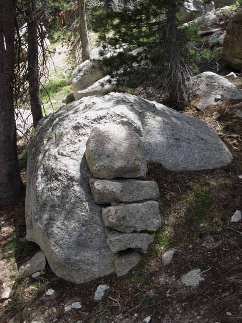 |
I suspect that this is a bit of old trail crew art work executed as a training exercise, to store rock for future trail repair, or it is another amazing natural expression of rock. I like it. I figure these were laid out one season for a set of repairs that never happened. |
Upper East Carson River Canyon
 |
Rock wall rises up to our East as canyon squeezes and river pushes through a narrow section. |
Now We Climb... The Climb begins. From the trail junction between the East Fork of the Carson River and the PCT up to the Sonora Gap we climb 2376 feet over 5.86 miles. |
| Rare open space on the trail South towards the East Carson Gap, looking Southeast up the East Carson. |
 |
Since entering the forest at the bottom of the switchbacks North of the East Carson trail junction we have been submerged under heavy forest cover. |
East above East Carson Gap
| Peaks along East side of East Carson headwaters to our South. We will clear forest cover when we finally enter the headwaters bowl. |
 |
We can see the ridge arms reaching down from the Eastern side of the canyon to form the river's route. |
Granite Rising to the East
 |
Fantastic terrain demands more time to study than the demands of our trail allows. |
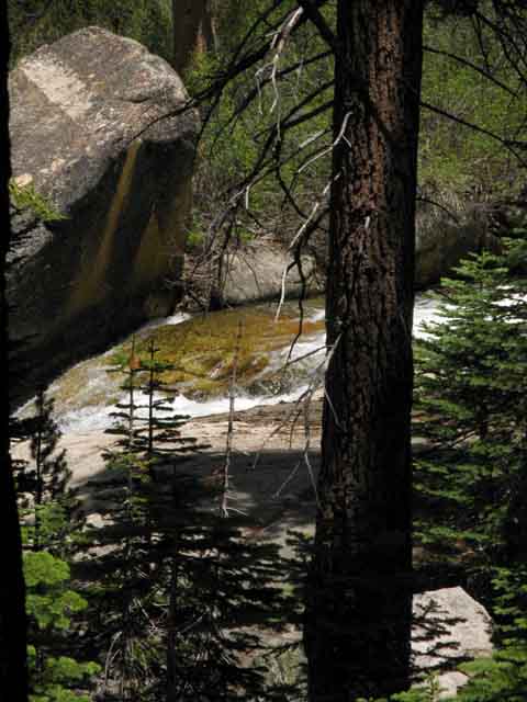
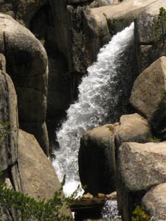
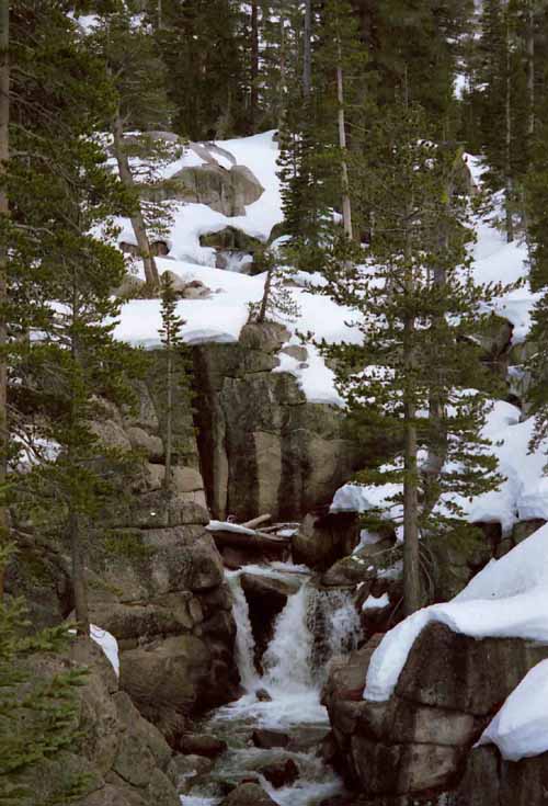
Approaching the Waterfall
| Surging creek from East entering East Carson River below the falls. |
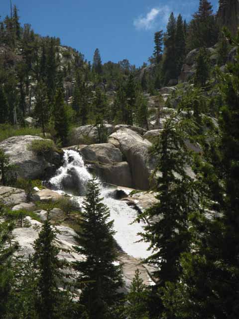 |
During Spring we can hear this tributary raging down to the East Carson River long before we can see it. |
Upper Carson Pocket Waterfall
| As we continue South the voice of one waterfall fades into the roar of the river until the rising sound of the next waterfall distinguishes itself from the cascading water above. | ||
 |
||
The waterfalls along the East Carson River cut into the terrain rather than falling over it.
|
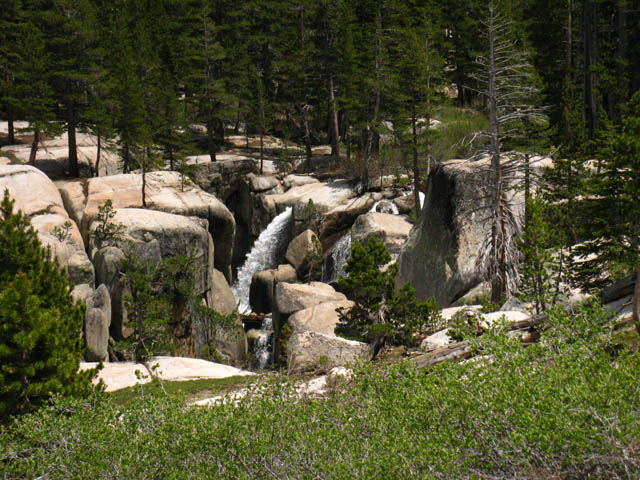
A Wonderful Waterfall
| This is such a nice sounding place, the complexities and colors of its maze of granite draws out and refreshes the spirit, |
 |
There's some campsites about 3/8ths of a mile upriver above this rocky run of the East Carson. |
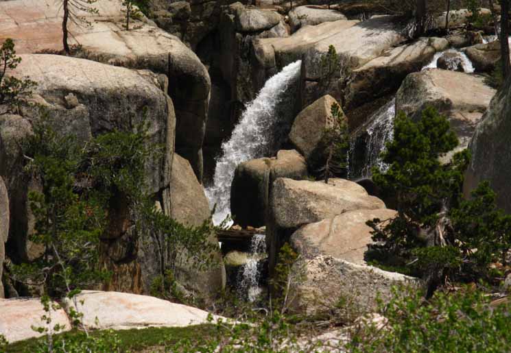
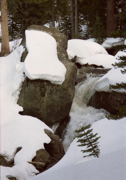
East Carson River Upper Waterfall
| Waterfall Pumps it up during Spring. |
 |
A beautiful spot along the trail. |
East Carson River Upper Waterfall
| Detail |
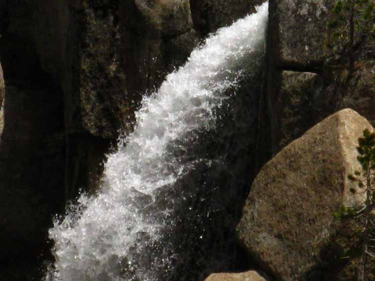 |
I am always torn between taking the time to enjoy every feature I see and the constraints of food and time which dictate the daily miles necessary to cross from Ebbetts to Sonora Pass. Thus I encourage everyone to take an extra day's food along on every section of trail so we can take the time to explore the things that interest us, instead of rushing by. |
East Carson River Upper Waterfall
 |
Different times of the day and different times of years bring different characters to old friends. As Fall deepens the river runs deep in its main channel, no longer pushing numerous flows through the fall. |
The Falls on the East Carson River during Late Fall and Early Spring
| Late Summer brings low flows, Fall no longer has the power to push the falls. The flow runs down the rocks it shot over just a few months earlier. |
 |
The roar of Spring fades as Summer grows, and as Fall deeps the flows slow. |
East Carson River Waterfall during Late Winter
| We can see the local storm history written in the layers draped on the quiet waterfall. |
 |
Oh, the River is still flowing, silent and cold, beneath the deep snow cover. A good creek-level flow is quietly pushing down the drainage and through the maze of this fall. The source of history, art, science, the source of Reality and of us can be seen and felt in the very constructions and presentations of nature. Go deep. It goes deeper than our capacity to explore. |
Above the Waterfall
| Early Spring fires things up again. |
 |
This rocky narrow section continues up the canyon above the falls. This rough section pinches into a narrow section that pushes trail and river together, the trail above a rocky cascade, then the river bends East, the trail West. Between the two sits an inviting deeply forested flat with great campsites. |
| Notice the steep angle down to the water. | ||
 |
||
The terrain funnels the snow steeply into this section above the falls, making it hard to pass by during the Winter and early Spring. You can see I'm on a steep section trying to pass by this bottleneck. This shot shows my development as a photographer. Previous to 2004 I would not pull out the camera during hairy moments. After 2004 I take pictures during many dangerous situations. |
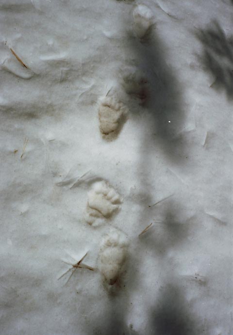
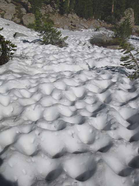
Spring Friend on the Prowl: Inside-Out Bear Tracks
| Old bear tracks turned "inside-out." | ||
 |
||
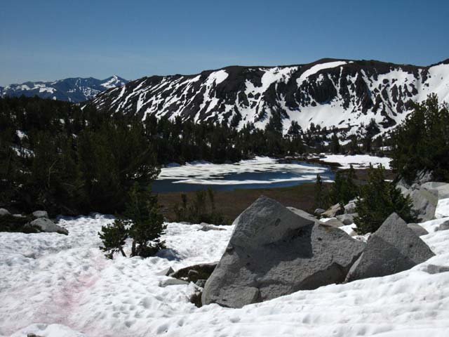
Track Effect on Snowy Surfaces The weight of a traveler across snow, in this case a bear, compresses the snow as it passes, leaving fresh tracks inset into the snow. As the snow mass melts with the passage of time the compressed snow of the tracks melts much slower than the surrounding snow. As the snow around the tracks melts and contracts, especially during Spring, the compressed snow of the tracks becomes elevated. Many times the compressed snow of the tracks ices-up, leaving a detailed rock-solid record of tracks frozen in ice and displayed for our inspection above the receding snow. I call these nifty tracks "Ice Fossils." If we know the local temp history we can begin to figure out how old the tracks are. In the case above the preservation of these bear tracks just served to inform me that the bears out here were already active. Ah damn! I did not bring my bear canister, and the bears are prowling about. Now I gotta hang my food. Damn. I thought the bears were still crashed out. I've been getting reports from different parts of the Sierra that some bears are not even hibernating. This was bound to happen with the long term trend of shorter and warmer Winters. The tracks above told me that not only were the bears awake, they were probing the snow covered mountains. The Spring Thaw at Wolf Creek Lake creates a wet quagmire around the apron of the lake that is just full of masses of insects and the ground critters feeding on them, all of whom Mr. Bear finds quite tasty. The snowline is high up on the mountain down below Wolf Creek Lake, exposing a huge wet quagmire across the width of the exposed meadow, which is bursting with as much life as the melted out apron around Wolf Creek Lake. Yummy! |
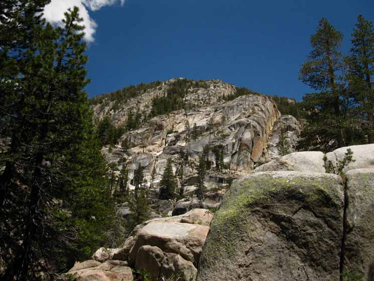
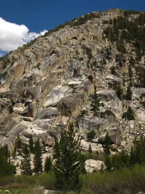
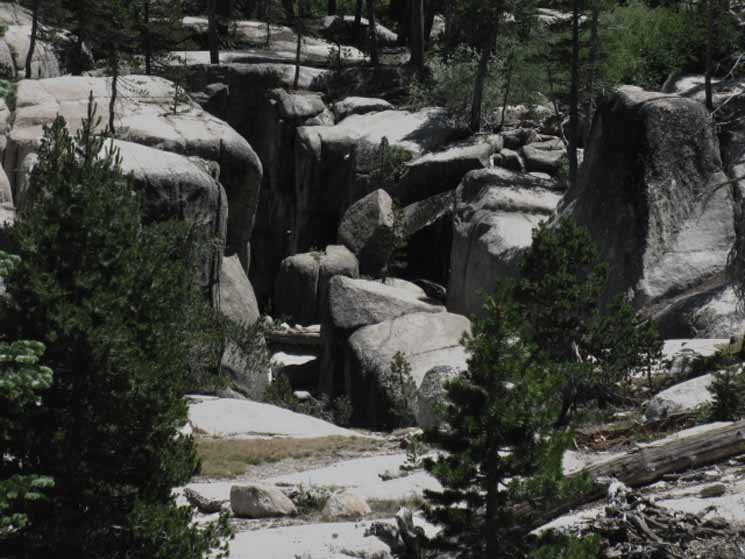
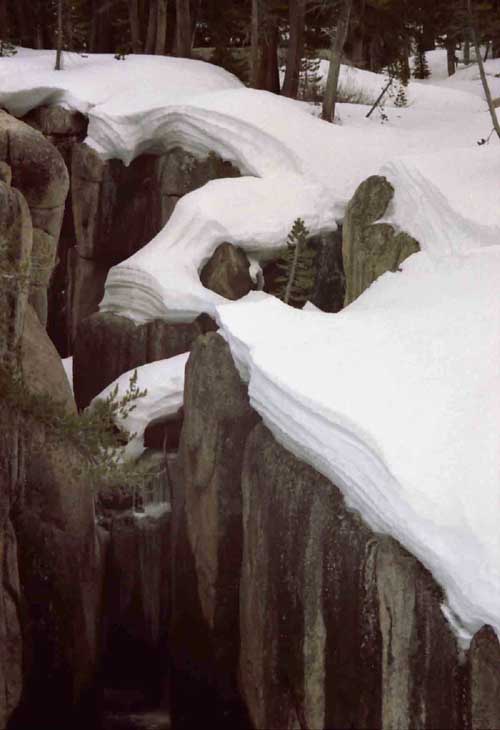
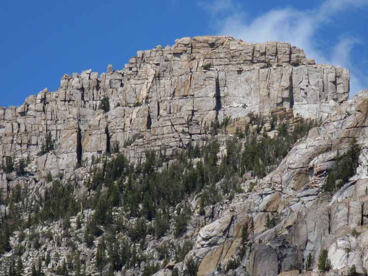
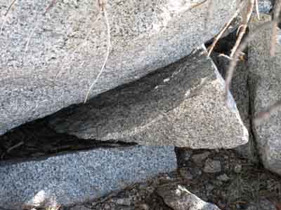
Fine-Jointed Granite Walls around the Upper Reaches of the East Carson River
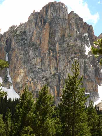
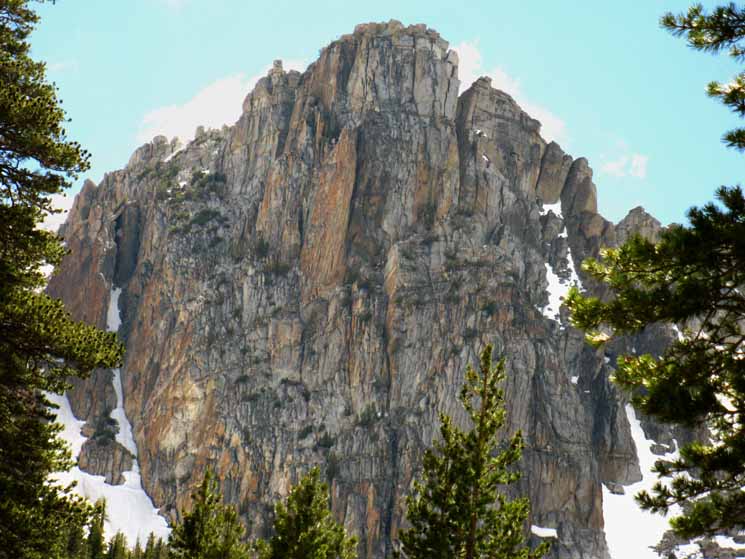
To the North of Peak 1073 on the East side of the River sits a sheer wall set back from the river along the Southeast side of the formation I call "the castle."
|
||
 |
||
Up and down the upper reaches of the East Fork of the Carson River we have seen very tightly jointed granite. This formation is one of the finest examples of the both the nice golden color of the rock, and its tight jointing. This rock, my climbing friends, looks like it has never felt the hand of man. Good luck backpacking to the trail position under it. Good luck crossing the East Carson River to get over to it, and you will need a huge amount of fortitude, stamina, and luck to get up to the base of this magnificent wall so you can begin your climb... Good Luck! |
| Detail of the Rock Face. |
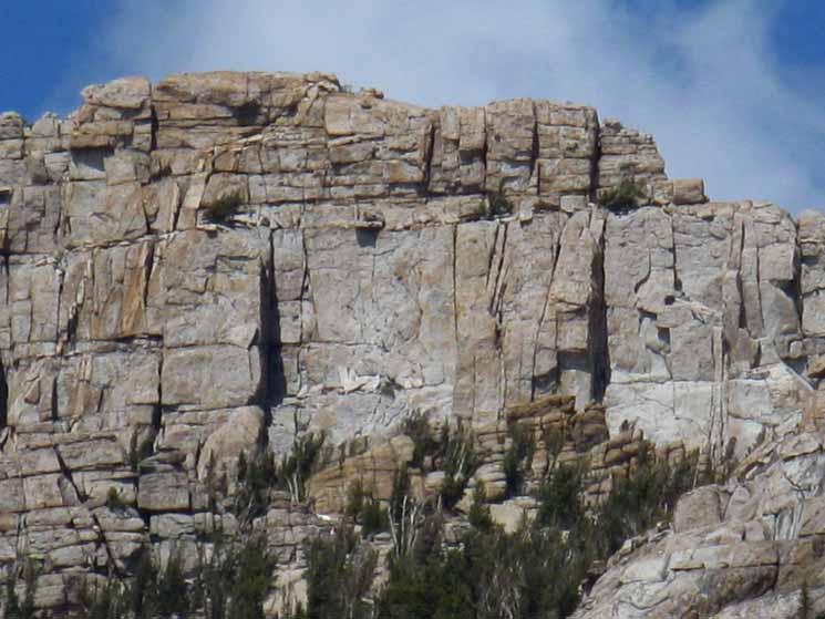 |
Every feature here reveals more details and information as you look closer. I figure that the best way to approach this feature may be from the East... the Western approach is difficult. |
Narrow Valley opening into Headwaters Bowl
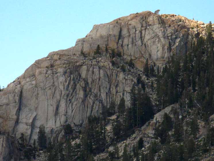
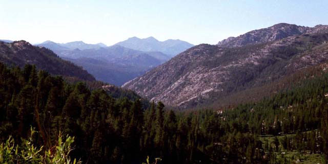
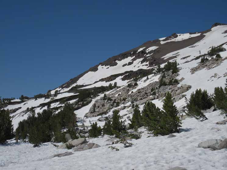
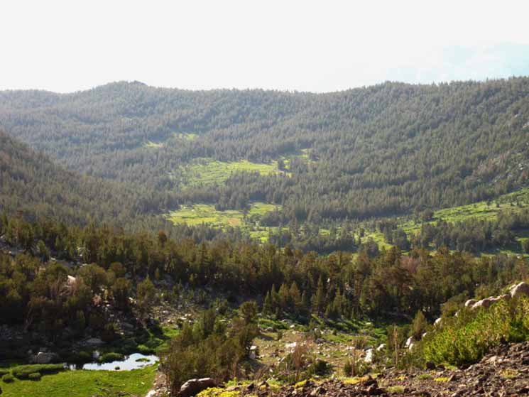
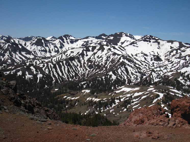
Since descending South into the Canyon along the East Carson River we have been under dense forest cover squeezed between high granite walls on one side, and the massive volcanic Sierra crest line hosting Stanislaus and Sonora Peaks on the other side. We finally emerge out from the dark forest in this narrow valley into the almost treeless headwaters bowl of the East Fork of the Carson River. Now we can see the forest for the trees, and get some long views of the terrain. As we climb higher we can not only look down into the valley of the East Carson River to trace our route up to our current position, but we can see as far North as Highland and Silver Peaks sitting just to the East of Ebbetts Pass. |
| The majestic beauty of the rock lining the East Fork of the Carson River never ceases to amaze me. |
 |
I find new beauty and new aspects and details on every feature every time I hike through this fine section of High Sierra Trail. |
East Carson River Canyon
| View North down the Valley during early Summer. |
 |
Heading South, up behind us, the trail climbs up onto the Western Wall of the Headwaters Bowl to avoid the wetness of Spring down near the East Fork of the Carson River. |
I should not tease climbers with virgin rock. But I've never seen any climbing parties testing these magnificent walls. I mean, just look at those cracks! I'm not much of a climber, but some of these walls along the East Carson River look real good even to me. The lack of climbers is likely due to the remoteness of the location, the difficulty of the approach, and the lack of knowledge in the climbing world about the walls that encase the Upper sections of the East Carson River. |
To our West
sits
The Prominence, exposed at the head of an open channel cutting up into the Stanislaus Peak Massif
| Summer. | Spring. | |
 |
 |
|
| 2009 | 2004 |
View West
The Prominence
| Hiking by the Prominence June 1998. |
 |
We can see the open channel in the mountains heading West, up to the base of the Prominence. This section of our trip up to the headwaters through here is comparatively flat. We're between the dominant local peaks running above the Western flank of the canyon. We're a little bit South of Stanislaus Peak and North of Sonora Pass. |
The Prominence
| The prominence is a noble feature. |
 |
Its shape, color, size, and texture all please the eye, clear the mind, and refresh the spirit. |
A bit South of the Prominence we find a flat above the East Carson River.
| When you see the Fishing Prohibition sign look to your East for nice campsites on a rise in a custom location above the East Fork of the Carson River. |
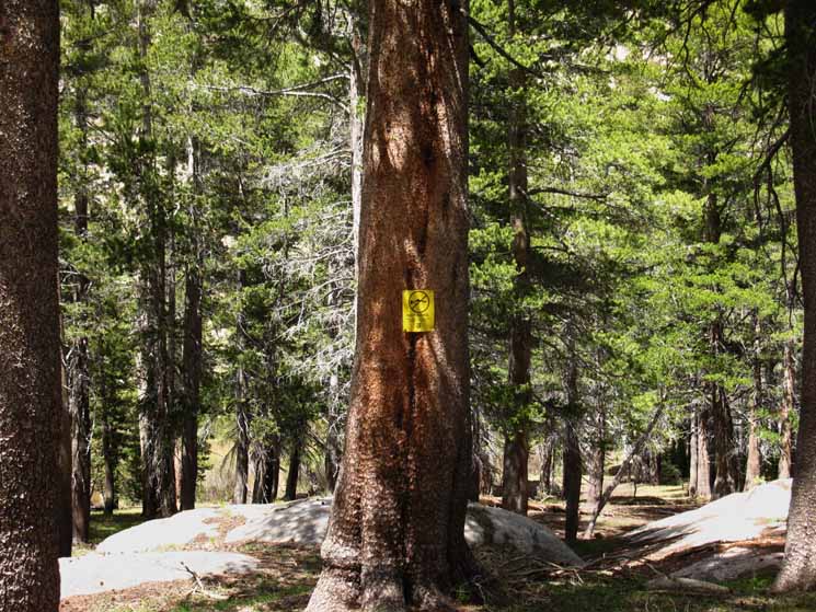 |
Hiking into the Carson-Iceberg Wilderness from the East of here brings you through a restricted fishing zone to protect the Paiute Trout. Each of the Creeks and Rivers in these complex mountains once had their own species of Trout. |
Species Protection
| Lahontan Trout Preserve |
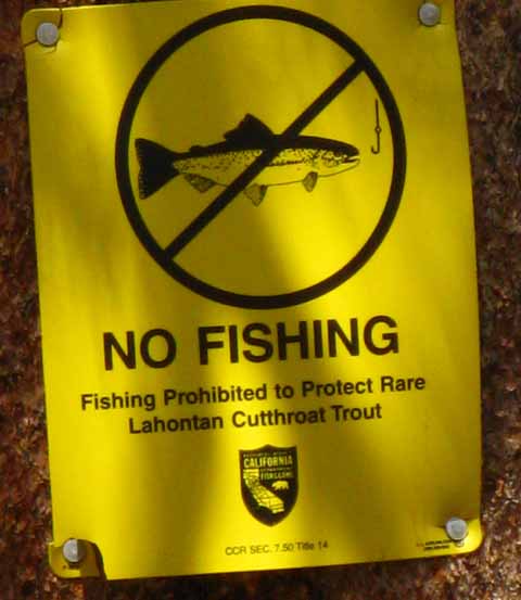 |
Most of these rare species have been lost or are threatened. The isolated course of the East fork of the Carson River and some of its upper tributaries still hold this rare and unique species. Recently the Silver King Creek was trapped, then poisoned to remove invasive trout, then restocked with its original inhabitants. |
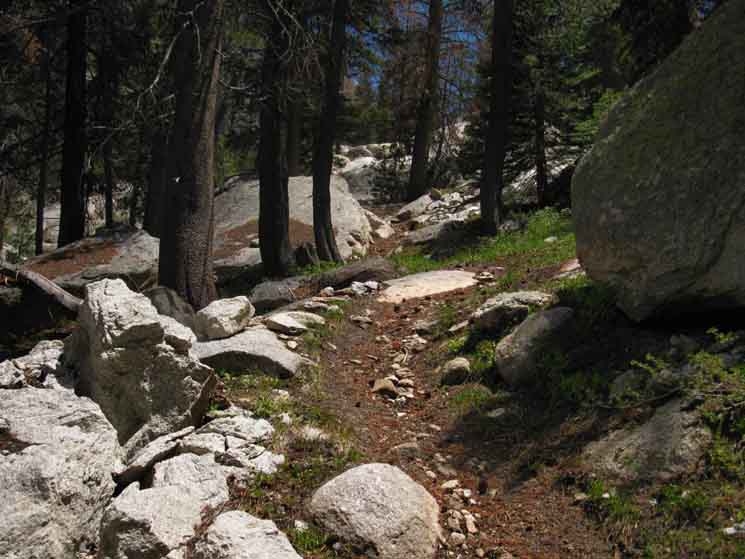
Climbing Serene Terrain of Forest and Rock works us hard
| The granite thickens and the forest thins as we hike higher up the East Fork of the Carson River. |
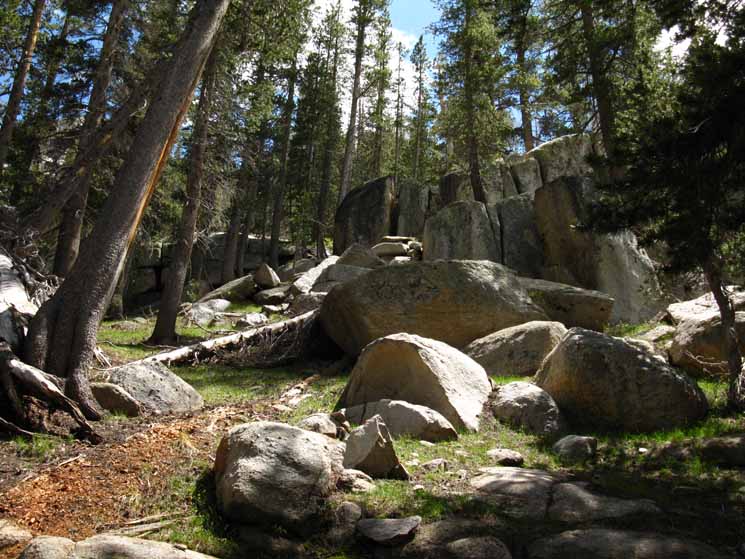 |
We are constantly rising over an endless series of rises descending from the Stanislaus Peak Massif to our West. Up, Up, and more Up. |
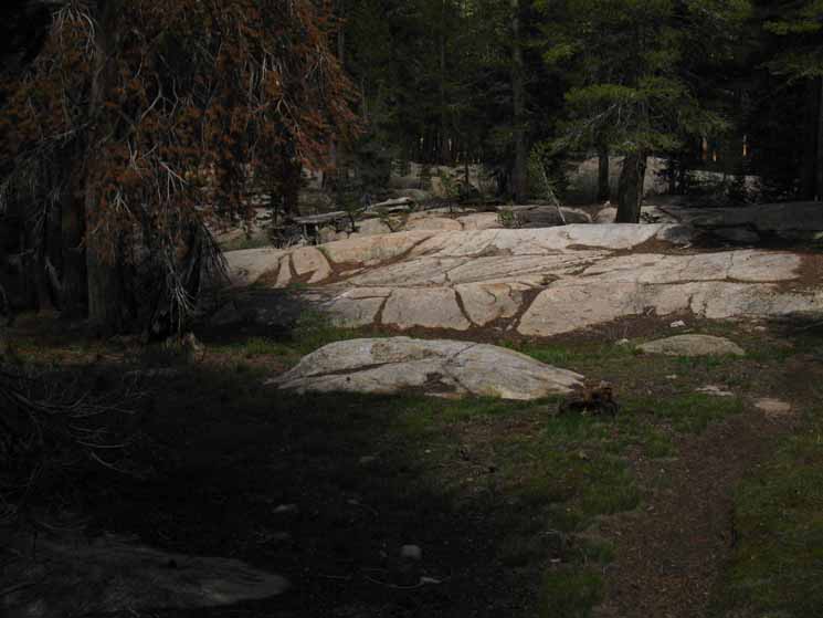
Forest Floor Granite
| Fine glacial cut granite flats along Pacific Crest Trail. |
 |
|
Forest Floor Granite
| Low glacial cut granite rings the meadows and soothes forest. |
 |
The rock and forest impart a delightful feeling, they create a good mood to passing backpackers. |
The Canyon Opens into the Headwaters Bowl
| Turning around to look North, down the East Carson River we have just hiked up. |
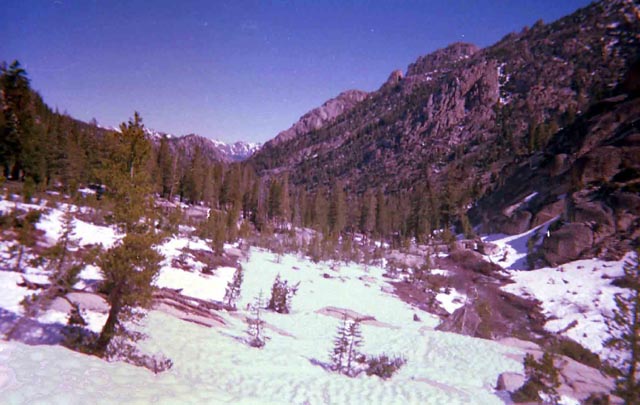 |
I am snow-shoeing off of the location of the trail route. The trail route is to the West, to the left of this position. I will not follow the trail route as the flattest way up to the East Carson Gap is across the snow-covered meadows along the river route up. In another month the flat meadows around the East Carson River here will be a saturated green meadow quagmire full of thick underbrush and mosquitoes. At that point in time you will be really happy the trail route stays high on the flank of Sonora Peak around the headwaters bowl of the East Carson River. |
Turning around to view the Carson Gap and Sonora Peak to our South
| The East Carson Gap Approaching the East Carson Gap during early Spring. We are hiking East of the Pacific Crest Trail route. The PCT route travels along the lower flank of Sonora Peak, the mountain on the Right. The East Fork of the Carson River is surging under the receding snow. |
 |
The Pacific Crest Trail route sits under snow on the far right of the image, running up to the Carson Gap between the line of trees and Sonora Peak. Once snow has covered the terrain, and consolidated, the easiest way up the mountain is following the river course, rather than the trail route. So we are hiking up the center of the canyon. The trail route is established so the trail can best survive under the snows of Winter, emerging intact to survive the floods of Spring in good enough condition to stand up to the backpacker, horsemen, and hiker traffic of Summer. Therefore the trail route is established high up on the mountain above and away from river bottom and surrounding meadows to avoid early-season wet spots and subsequently becoming part of the Spring Thaw's drainage system at the height of the Thaw. A poorly routed trail does not last long in the Sierra Nevada Mountains. During Winter and Spring time snow we can take the most direct route through the terrain, as I was doing here in 2004. |
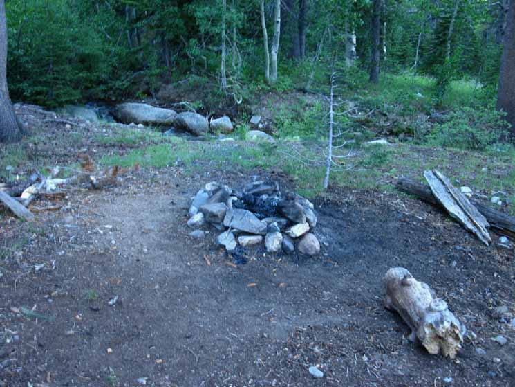
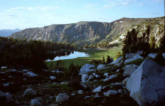
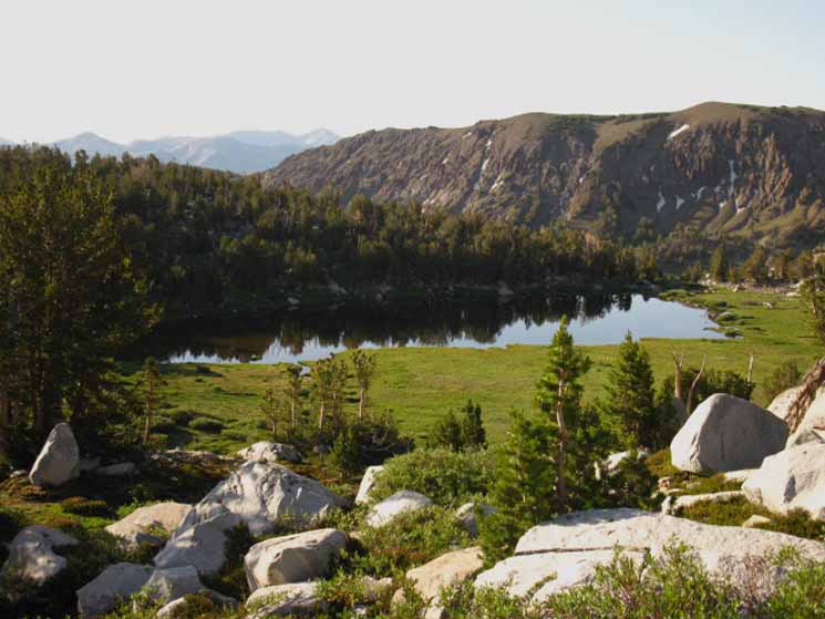
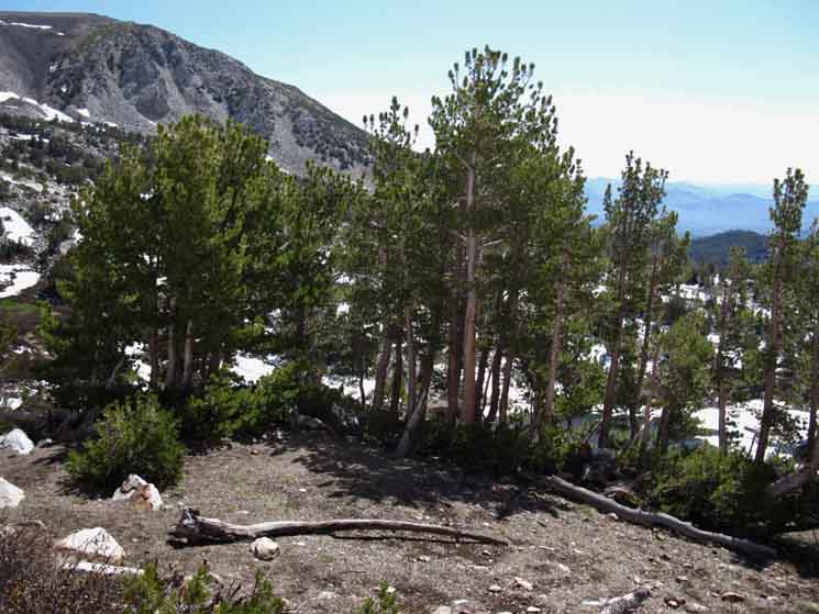
Hunters Camp
The Lay of the Land This old campsite sits high up the drainage of the East Carson River, along the messy tree line where you can first get long views down the East Carson River Valley through the thinning treetops, and you still have tree cover. I call this site "Hunters Camp." When I first encountered it in the early '90s it had the look and feel of a campsite that was set up for hunters in the 1890s, if not a location frequented by the original hunters who used this premium overlook to command the local terrain during the 1790s. This camp has the best vantage point, great water, and excellent sleeping and sitting spots. It must have been in 2004 or 2005 when the Forest Service completely deconstructed this ancient established site. The Forest Service removed the bench seats, took apart the fire ring, and spread the damn charcoal from the fire ring all over the area. The charcoal shards are all gone now, as of 2007. But though the forest service could disrupt this premium site's custom furniture, they could not despoil the site itself, and its timeless beautiful utility. I enjoy every stay here. Though this camp sits right next to the Pacific Crest Trail it is very hard to see from the trail, unless you keep your eyes open. 2.02 miles from Hunters Camp South to the East Carson Gap. 6.11 miles from Hunters Camp South to Sonora Pass. |
Hunters Camp
 |
||
Hunters Camp. Above we are looking South across Hunters Camp towards the East Carson Gap. The trail South is off the upper Left corner of the image above. Behind us is a nice whitebark pine tree in the center of a series of surrounding spots excellent for tents, beyond which the North perimeter of Hunters Camp is marked by a wall of brush, within which are set some nice big granite boulders. Along the North edge of the brush the Pacific Crest Trail tracks along a narrow granite shelf with some more big granite rocks. Below we can see the brush ringing the North perimeter of Hunters Camp. The Southbound PCT wraps around that wall of brush from Left to Right. Pushing through that brush brings us to the PCT and allows us to scramble up on the boulders over there, which gives us a great overlook of the whole upper East Carson River Canyon with views beyond to Highland and Silver Peaks above Ebbetts Pass. Quite an overview. Quite a campsite.
This site is at the top of the last climb before entering the headwaters bowl. The maps for this section have always struck me as being incorrect, likely a function of not being updated to reflect the numerous small route changes that have accumulated over the almost four decades since the maps were last updated.
Map and Route Notes This is not the way it is on the ground. The trail is rerouted to turns up a steep climb up mountain before fording the tributary. At the top of this steep chute climbing up alongside the tributary we ford it to pass across a narrow boulder-strewn granite ledge overlooking the whole upper canyon of the East Carson River dropping down below us. From this granite ledge we can also see a good distance North across the top of the East Carson Canyon, 25 miles Northwest at the massive forms of Highland and Silver Peaks way back where we crossed Ebbetts Pass to enter the Carson Iceberg Wilderness. Carson Iceberg Wilderness Hiking Map Hunters Camp is Very Close The Pacific Crest Trail circles around this custom little site of Hunters Camp from the where we forded at the top of the steep rise around the granite shelf to where we make the Left turn, basically making a button-hook shape around this well hidden campsite. Us Southbound backpackers must keep a sharp eye to our right after the steep creekside climb up to the boulder-strewn shelf with long views. We could break off the trail to the Right from there, South, pushing through the brush and around the boulders for about forty feet up to Hunters Camp. Or we can continue South on the trail with a sharp eye to the West, the Southbound backpacker's Right. The brush growing around Hunters Camp has been growing to full height and thickening up in recent years, giving this hidden camp even better cover than normal during recent years, as we can see from the image above. It's very easy to hike past Hunters Camp in either direction if we are not carefully observing the surrounding terrain. It is well hidden and blends in with the terrain, even though it is quite close to the trail. From Hunters Camp I can observe everyone who hikes past without them observing me, while sitting pretty up against my sitting tree in the center of camp drinking hot chocolate mixed with instant coffee. Out of the frame of the image below to the Right is a gushing four-season stream, the same one we hiked up the steep chute alongside to its ford point shortly before we hiked South to Hunters Camp.
This fine stream provides plentiful four season ice cold water to drink, cook, and wash. But no need to wash clothes or socks, as we'll have access to the washing machines, dryers, and showers at Kennedy Meadows Pack Station tomorrow. We'll arrive early at Highway 108 to hitch down to Kennedy Meadows as we're only 6.11 miles North of Sonora Pass. |
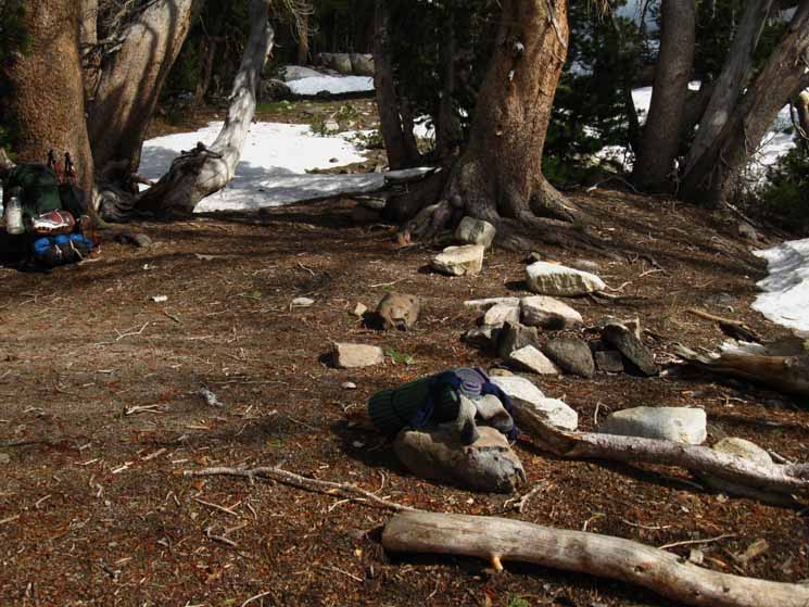
Center of Hunters Camp Activities
 |
Center of Food and Comfort Operations... My Sitting Tree in the Center of Camp The pad is the seat, the tree the seatback. Water, stove, food, journal, camera, and everything else I need within easy reach. I roll the food canister on its side to use as a foot rest, lay back against the tree and do some professional observation. You may laugh, but once we get settled in and quiet all the creatures come out and conduct their business. From this seat we have a view through thin forest into and across a high altitude meadow over to the East flank of this upper section of the East Carson Canyon. I've seen bear and bobcat in and around the meadow. Well, the bobcat actually walked right through the edge of the campsite area on its way downriver. Kitty Kitty Bear Race |
Video
| East Carson River Trail Junction to Hunters Camp | |||
Video: East Carson River Trail to high up in the E Carson Headwaters bowl. 3:20.
|
Sweet Spot to Sleep
 |
|
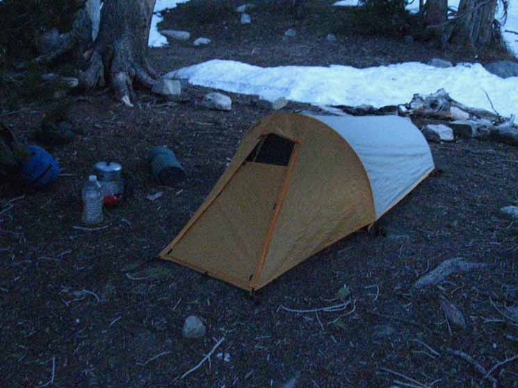
Secure backpacking tent set up at Hunters Camp, June 2009, East Carson River.
|
Views from Hunters Camp
Late afternoon view North from Hunters Camp. We can see a lot of the terrain we crossed to get here. |
 |
The two great peaks in the middle of the image are Highland and Silver Peaks dominating the terrain around Highway Four's passage through Ebbetts Pass. The low peak in the far distance, the next peak to the Left of Highland Peak is Raymond Peak, which is located deep in the Mokelumne Wilderness North of Ebbetts Pass. Closer to us we can see the long sloping back rising up to Peak 10082 located Left of Raymond Peak. Peak 10082 makes up the high point on the ridgeline shared with Tyron Peak. We crossed over that ridgeline under Tyron Peak, which is the next peak visible on the far horizon to the Left of Peak 100082. Tyron Peak makes up the part of the Sierra Crestline wrapping around Noble Lake's basin, and the Eastern extention of its ridge through Peak 100082 makes up the Southern Wall of Bull Canyon. Check out this map: Ebbetts Pass to Wolf Creek Pass Note how high up on the mountainside we are compared to where the East Carson River headwaters bowl is opening up below us, where the last two images looking North and South were shot. For much of the trail coming up from the trail junction with the East Carson River Trail we have been submerged in a thick forest, unable to view the surrounding terrain except for notable exceptions of the magnificent canyon surrounding us. Now we are climbing South out of the canyon getting great views to the Northwest of our route across the whole Carson Iceberg Wilderness across the top of the canyon as we emerge from its grand granite clutches. |
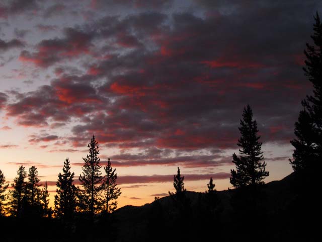
Sunset Skies around the East Carson River
| Fine sunset from Hunters Camp. |
 |
All the time, work and energy you put into backpacking is constantly rewarded with priceless experiences and perspectives. 2002 Tahoe to Whitney. |
Hunters Camp Sunset
| Ending the day at Hunters Camp rewards the long distance hiker. |
 |
2009 Tahoe to Whitney hiking trip. |
Hunters Camp Sunset
| Angry red faces appeared in the flaming clouds of sunset. |
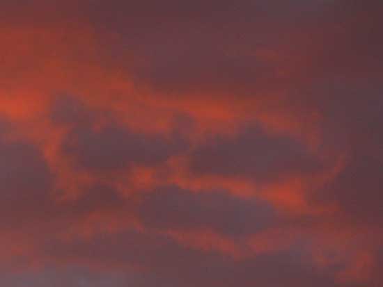 |
Layers of Crimson moisture and light. |
Hunters Camp Sunset
 |
Sweetness in the Sky. |
Highland and Silver Peaks above Ebbetts Pass
| The crisp morning air reveals much. |
 |
Highland and Silver Peaks dominate the background. Bull Canyon sits facing us below the Southwest flank of Highland Peak. The granite faced gorge of the East Carson River's Western bank far below is taking its first light of the new day. On the far Left of the image we can clearly see details of the sheer terrain on the backside of Raymond Peak, laying about 56.44 trail miles from our position here at Hunters Camp, to the Raymond Lake trail junction we hiked past three days ago. The low granite mountain in the middle foreground is Boulder Peak. |
Hunters Camp Garden
The Hunters Camp site has big boulders both above and below that offer excellent seats with a view. Great place to watch the light of day fade away, and come back the next day. The View North is down the rock-lined gorge of the Upper East Fork of the Carson River's Canyon. Our view to the East is of a broken meadow with sparse tree cover running down to the East Carson River, and up the East side of the narrowing canyon. To our South we can make out the headwaters bowl rounding up towards the East Carson Gap. We sit under the shadow of the Sonora Peak Massif looming over us to the Southwest. We've passed South under Stanislaus Peak, and it sits a bit North of our position on its shared ridgeline with Sonora Peak. During Spring and early Summer the terrain around Hunters Camp blossoms with life. It's like a great garden if you take the time to walk around and investigate the area.
I've created the Flowers Forum to help us identify some of the flowers we encounter here, and for hikers to post up our favorite known and unknown High Sierra Flower images. We've links to excellent resources to help us |
| Purple Mountain Heather. Note the bumblebee buzzing about a flower. |
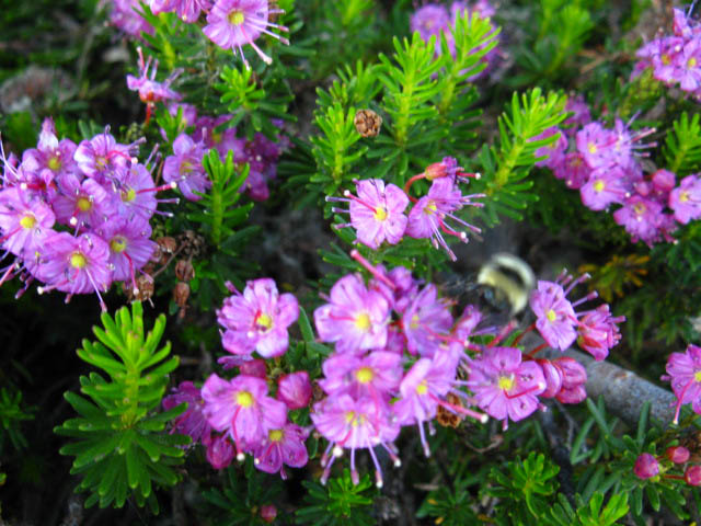 |
Flower Forum: |
Hunters Camp Garden Party
| White Mountain Heather. |
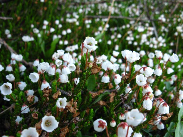 |
Flower Forum: |
| Crimson Columbine. |
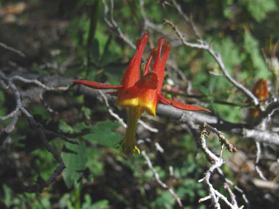 |
Flower Forum: |
Climbing to the Headwaters Bowl
 |
Looking North down the East Carson River Canyon while making our way South to the East Carson Gap during a Winter trip in the 1990s. We're turning around to look North as we climb into the headwaters bowl of the East fork of the Carson River. The Summer trail begins to climb to the Southwest here, looking to get out of the meadow quagmire that develops here during the surging high point of the Spring Thaw. This diversion is not necessary during Winter Conditions. During Winter conditions we find the best way up the center of the canyon. This generally means we will miss Hunters Camp, as it is buried in snow up on the Western wall of the canyon, along with the route of the Pacific Crest Trail. |
Looking North from just above Hunters Camp
Hunters Camp is located at roughly our elevation among the trees on the descending ridge arm on the Left side of the image. Our position here is between the East Carson Gap and the tree line, plowing through the dense underbrush growing up and over the trail. |
 |
Look left heading North down the mountain when you enter the tress. Hunters Camp is located to your left when you loop around a brush sheltered small open space. Just past Hunters Camp you will make a 90 degree turn Left to pass in front of a set of massive granite boulders. To your right a great view will open up to your North. Just past here you turn right to head down a steep section of trail down a rock grade. When you reach the steep section of trail down the mountain Hunters Camp is behind you. Hiking Southbound you cross a creek then bend right climbing up yet another steep section of trail which bends to the left, East, onto a nice flat at the top of the steep upgrade. As you walk past impressive boulders on your right hand an expansive view opens on your left. Past the boulders you turn 90 degrees Right, and make a loop bending Southwestward. Look to your right and you will see the Hunters Camp. |
Great Trail Crew work just below the East Carson Gap
| Rock Solid Trail Work lines parts of the last steps South up to the East Carson Gap.. | ||
 |
||
Parts of this trail work feels very old, as if was built early last century. |
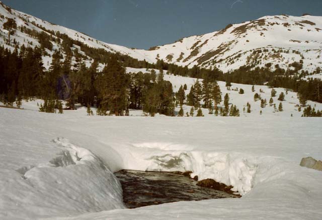
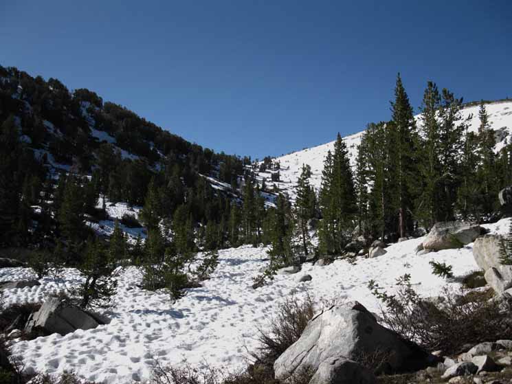
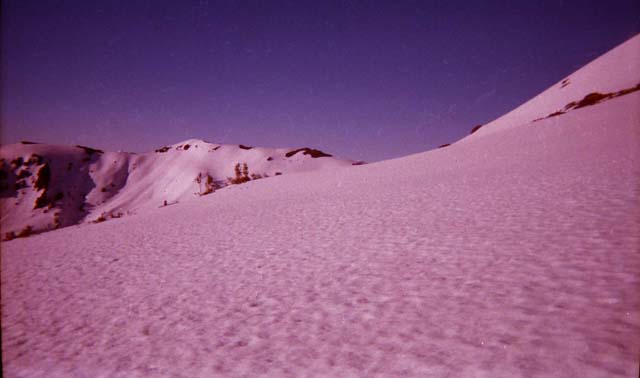
East Fork of the Carson River Headwaters Bowl During Springtime the whole upper section of the headwaters bowl of the East Carson River is flowing with water. Water is forming up into endless creek-lets running down the bowl, but water is flowing down all surfaces. In many locations on our way up here during various Spring Thaws I have heard the sound of the saturated soil sucking air as the heavy water surges through. Here, up on the headwaters bowl you can hear water running under and around the underlying rock during the height of the Spring Thaw. The whole headwaters bowl is tinkling with flowing water sounds dancing on the breeze during early Spring. The terrain in the headwaters bowl is a mixture of low broken granite filled in with the volcanic erosion from Sonora Peak, and bursting with intense underbrush growth during Spring. The large granite boulders the dot the way up to the gap are submerged in dense brush. This headwaters bowl was the thinnest point of the glacier that cut the valley. The glacier crushed the rock in the headwaters bowl flat before the big thaw revealed the amazing valley to the North the ice had cut. The saturated nature of the Spring Thaw up here quickly degrades the trail, and over the decades the trail crews have built "rock solid" section of solid granite trail through this ever-shifting terrain. |
Cold Views North
from the
East Carson River Gap
I seek out the view that each location provides. It could be the long view. Or it could be a view of interesting trail construction or conditions, a random bug or rambling bears, the endless flowers and trees, or the ever changing aspects of water on land and in the sky. Against the bottomless detail contained in every experience on the trail are the very practical considerations of long distance backpacking travel. Miles Per Day, baby. Every time I pass through the East Carson Gap that separates the East Carson River from the Wolf Creek drainage, if I am carrying a camera I take a picture when the climb reveals the surrounding terrain. |
| Getting old and getting cold. Just keep hiking... |
 |
2004 |
Springtime
in the
Upper Headwaters Bowl
of the
East Fork of the Carson River
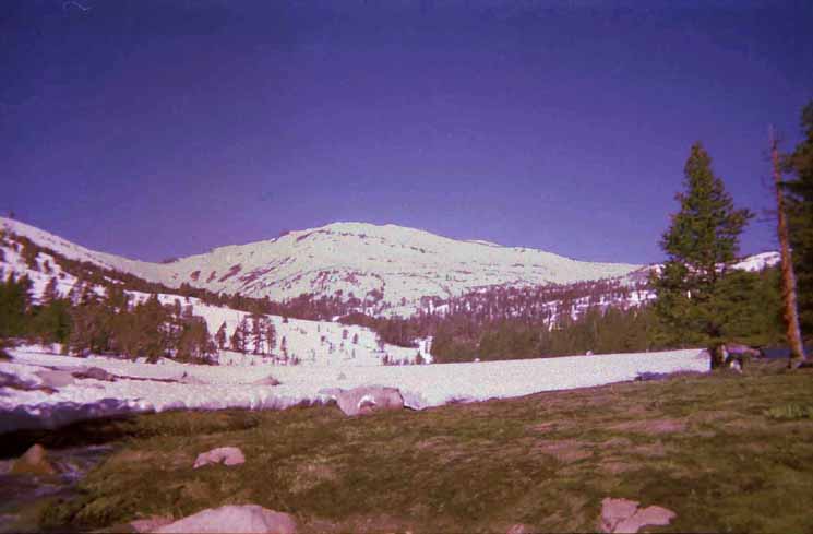
View North of the Pacific Crest Trail
| The"fine mess" of late Spring conditions: Wet snow offering uneven footing and no support, trails running like creeks, and saturated soils drawing your boots deep within their mucky embrace. Notice Stanislaus Peak the the upper left, and the plug sitting below it. |
 |
June 2010: Conditions that delayed and knocked many Pacific Crest Trail hikers off schedule... |
East Carson Gap
 |
||
Finding/planning the easiest route up to the East Carson Gap with the lumbering mass of Sonora Peak rising on the Right (West) and White Mountain rising to the East of the East Carson Gap.
|
Detail
 |
We're going to find the easiest way up over the snow conditions. The route of the Pacific Crest Trail is up on the West side of the headwaters bowl. Below we approach the East Carson Gap South along the Pacific Crest Trail. Above is the perspective of the Winter Conditions approach to the East Carson Gap, below is the perspective of the Summertime approach along the Pacific Crest Trail. |
East Carson Gap
View South "down" the Pacific Crest Trail
| Approaching The Gap above East Carson River Headwaters. Thinning whitebark pines line our route. |
 |
Last bits of Pacific Crest Trail route South to the East Carson Gap. Note the granite outcropping on the West (Right) side of the gap. This is the Northeast corner where the Eastern and Northern flanks of Sonora Peak meet, which, along with part of its lower East Flank above Wolf Creek Lake wears a mantle of granite surrounded by the massive burnt red hulk of Sonora Peak's loose volcanic terrain. Just a corner of Sonora Peak, the Northeast corner, is composed of granite. |
Difficult Climbing Surface
 |
Snow surface during late Spring exiting the East Carson River headwaters bowl. Slick, hard in the morning. |
Over the Top
Highland and Silver Peaks in the Distance
 |
Looking back to the Northwest across the Northern end of the Carson Iceberg Wilderness we've hiked across on our way South since entering through Ebbetts Pass. We're at the very top of the headwaters bowl of the East Carson River hiking South through the East Carson Gap to Wolf Creek Lake. The two dominant peaks on the Right are Highland and Silver Peaks. The distant peak to the Left is Raymond Peak in the center of the Mokelumne Wilderness. Peak 10082 is to the Left of Raymond Peak, and Tyron Peak to the Left of that. Boulder Peak is the highest peak in the middle-Left foreground. Golden Canyon is beyond Boulder Peak, and the great red ridge beyond boulder Peak divides Golden Canyon on this side from Murray Canyon on the other. Highland and Silver Peaks rise beyond Murray Canyon. We can hike through, around, or over all of it. Carson Iceberg Wilderness Hiking Map |
The Little Flat at the Top
of the
The East Carson Gap
 |
||
THE EAST CARSON GAP We note some cool patterns of exfoliation working these boulders. In the background Right we can see the East Flank of Sonora Peak rising out of the frame of the picture. We'll hike across that when we get there. In the center and center-Right of the image we can see an outcropping of granite. Our trail crosses that granite terrain hiking South for the gap in the brush we can see topping the granite outcropping. See that gap up there? Just beyond is a good four-season small stream. That stream is the water supply for two small sites perched up at the end of the granite, overlooking Wolf Creek Lake. Those sites are near the end of the granite, marking where we begin crossing the volcanic terrain constituting the vast majority of Sonora Peak and its Eastern flank. In the background Right we can see the ridge extending off the Southeast corner of Sonora Peak. We will traverse across the East flank of Sonora Peak beyond the granite outcropping to pass through a gap where that rising ridgline extends off the steep Southeastern corner of the main bulk of Sonora Peak. That will be our last climb across the Carson Iceberg Wilderness. The remaining bit of our hike down to Sonora Pass from that Sonora Gap up there is either level or down-mountain. Wolf Creek Lake is unseen, sitting in a depression in the terrain on the far Left side of the image, between the green apron of grasses and the distant golden brown ridge arm beyond. Wolf Creek Lake sits on a flat shelf in the mountainside wedged between the East flank of Sonora Peak and the Southwest flank of White Mountain. We'll start to get views of Wolf Creek Lake in a few steps, as we hike Southwest towards Sonora Peak.
|
East Carson Headwaters
to
Wolf Creek Lake
The Lay of the Land Passing Southbound through the Carson Gap we are grateful to enter a short length of flat trail twisting its way around and through a field of granite boulders, many of which have split apart along interesting arc lines. Exfoliation does not just form massive domes, it splits granite blocks into granite balls.
Above: Square block exfoliating in arcs creating a rounded granite rock. Cool. As we turn Southwest Wolf Creek Lake comes into view, and as we begin our climb up across the Eastern flank of Sonora Peak towards the Sonora Gap we get better and better views of the little lake sitting on its shelf wedged into the mountainside. Wolf Creek Lake-East Carson Gap The banks of Wolf Creek Lake are soggy and shallow, making drawing water difficult. The green apron around the lake holds moisture deep into the season, feeding large mosquito populations late into Summer. The creek running on the mountainside above the granite is too far away. I always stop here to look around, and take in the views, but I never camp here. I've seen folks camping here in Spring. They draw on the tarns for water, but tarn water is nasty. The high sites are much superior. The East Carson Gap is 4.65 miles South of the East Carson Trail Junction. The East Carson Gap is 4.09 miles North of Sonora Pass. |
Wolf Creek Lake through the Seasons
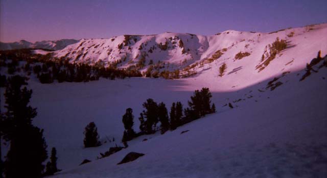
| Wolf Creek Lake during Winter conditions. | ||
 |
||
A cold shelf on the East side of Sonora Peak. We are pushing up to the Sonora Gap to see if there is any way in hell to make it down to Sonora Pass. I already know that it is highly unlikely that conditions will permit a descent to Sonora Pass, but I'm going to go check it out anyway.
|
Spring at Wolf Creek Lake
| Wolf Creek Lake during Spring conditions. |
 |
The apron around the lake is a bog. |
Summer at Wolf Creek Lake
| Wolf Creek Lake during Summer. |
 |
Moist soils around the Wolf Creek Lake continue to hold heavy mosquito populations deep into Summer. |
Lets take a closer Look
 |
||||
The lush apron around Wolf Creek Lake is full of mosquitoes. Heck, the mosquitoes up here on the East Carson Gap are making life hard. The end of an old jeep road sits at the bottom of the canyon we can see running down the East flank of the Sierra beyond Wolf Creek Lake. To exit the wilderness here we find our way through the terrain on the far shore of the lake, to bend East with the forest to parallel Wolf Creek down to the bottom of the canyon. The old jeep road ran up through the forest on the South side of the canyon to Wolf Creek Lake, but now it ends at the bottom of the canyon. The remnants of the old jeep trail lead down to the active fire roads. During Winter we can forget about the trail/jeep road and snow shoe down the center of the canyon to the dirt road, where we often find the snowline and groups of cool Marines who might just give us a ride out of the mountains... SONORA PEAK In the picture above we are looking West at the East flank of Sonora Peak after following Wolf Creek down from Wolf Creek Lake to the dirt road up from the Marine Base. The old jeep road heads up towards Wolf Creek Lake through the forest we can see on the Right of the image, but breaks down into rough trail a short distance West of our position in the image. To the Left of Sonora Peak we can see the Sonora Gap, which the PCT passes through on its way to traverse the South flank of Sonora Peak before descending to Sonora Pass. I took the above picture in 1998 after a Spring Snow Trip up the East Carson River from Poison Flat and the Corral Valley Trailhead on the Eastern Escarpment just a bit South of the town of Walker on Highway 395. During Winter and Spring snow trips I hike in from Highway 395 at the base of the Eastern Sierra. Check out the upper-Right corner of this map below for the entrance into this difficult but very rewarding Fall/Winter/Spring snow route. Asa Lake to East Carson River Often the snow conditions on the South flank of Sonora Peak make a descent to Sonora Pass too dangerous to complete, so I always have the option of hiking out down Wolf Creek after hiking up to the Sonora Gap to assess conditions on the South flank of Sonora Peak. This is the Pacific Crest Trail hiker's alternative route around the Leavitt and Sonora Peak Massifs when Spring snow conditions are beyond the skill and gear levels of the PCT hikers. Here's how you do it: West Walker Bridge South to Highway 108 Leavitt Meadow on the East Sierra. Down Highway 108 to US Marine Corps Base at Pickle Meadow on Highway 108. Cross the base and take the dirt road West up to Wolf Creek where it emerges from the snow-covered valley pictured above. These two maps show a good part of this Winter conditions detour for PCT hikers.
I've got an article about trips into the Carson Iceberg Wilderness from the East through the Rodriguez Flat/Corral Valley trailheads perched at 8000 feet on the East Flank of the Sierra. This trailhead offers us remote access to remote areas of the Carson Iceberg Wilderness including the beauties of the Carson Falls and the mysteries of the unmaintained trail to the PCT beyond the Falls.
|
Back to Wolf Creek Lake...
| Wolf Creek Lake in Fall colors. |
 |
The apron around the lake is hardening up, the mosquito populations finally diminished. We are looking to our Southeast over our Left shoulder as we are hiking South. |
Video
| East Carson River Headwaters around Wolf Creek Lake | |||
Video: Pacific Crest Trail North of Sonora Pass.
|
High Campsites
above
Wolf Creek Lake
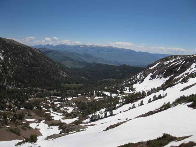
The Lay of the Land The Southbound Pacific Crest Trail bends Southwest from the flat in the East Carson Gap around to a position overlooking the West shore of Wolf Creek Lake. I never go down to Wolf Creek Lake unless I am hiking past it to exit the Sierra hiking down along Wolf Creek to find the dirt road up from the Marine Base. The dirt road is easily found at the bottom of the canyon beyond Wolf Creek Lake. The reason I avoid Wolf Creek Lake is that swampy verdant green apron around Wolf Creek Lake holds high populations of mosquitoes until it totally dries out late in the Summer season. From the Carson Gap Southbound hikers follow the trail turning Southwest for the H3 climb up the edge of a thin granite channel between the massive pile of volcanic terrain on Sonora Peak's Eastern Flank and Wolf Creek Lake to our East. At the top of this granite chute, before we cross onto exposed volcanic terrain on the East Flank of Sonora Peak, we will find two partially sheltered campsites overlooking Wolf Creek Lake, at the top end of the chute of granite terrain. The remainder of our trail up across the East flank of Sonora Peak to the Sonora Gap, and down Sonora Peak's South flank to Sonora Pass is across exposed unconsolidated volcanic rock. Not great terrain to cross if thunderstorms or lightening are happening or approaching. Watch the sky to avoid dying... Mountain Safety Forum Lightening When saturated during Spring this volcanic soil offers little support for either hiker or hiking trail. Spring Thaw runoff along the Pacific Crest Trail wrapping around the both the East and South flanks of Sonora Peak can be hard on the trail and the hiker. The trail up the East flank is always good, except for two sections that cross a steep drainage just below the North side of the Sonora Gap. The freeking trail breaks off the drainage here, and needs to be dug out on a regular basis by trail crew. The good news is that this is a very short segment of trail, if a bit harrowing. The real problems begin on the South Flank. The trail across the South flank of Sonora Peak is subject to regular degradation. Its soft unconsolidated volcanic materials are in constant motion, and move especially fast during heavy periods of Spring Thaw. I've seen and crossed great segments of this trail eroded down to, or very close to the angle of repose. If this segment of trail from the Sonora Gap across the South flank of Sonora Peak is in bad condition you will really really want excellent boots that provide superior traction and support. UPDATES? |
From Wolf Creek Lake to the Sonora Gap
| Steps up through the granite channel towards the exposed volcanic terrain leading to Sonora Gap. |
 |
Climbing up Sonora Peak from Wolf Creek Lake on the East flank of Sonora Peak. |
High Campsites above Wolf Creek Lake
| The first campsite South, and above Wolf Creek Lake is sheltered under a thin cover of White bark Pines. | ||
 |
||
This site has the distinction of being present during Winter and Spring, as the White barks create a little flat around them.
|
| The second site is little more than a throw down spot. |
 |
This site just South of the White barks site disappears when the snows fall. The water supply is South up the mountain to the creek running through the brush just above us. I mentioned and showed the location of this creek when we first hiked South onto the thin flat constituting the East Carson Gap. |
VIDEO
| High Campsites above Wolf Creek Lake | ||
Video: Wolf Creek Lake. 2:51.
|
Hiking Past the Campsite Area during Early Spring
 |
||
East Flank of Sonora Peak with the diminishing Spring Snowpack.
|
Sonora Peak and Gap
 |
||
Sonora Peak rises on the Right, the West. We are looking across the Eastern flank of Sonora Peak at the Sonora Gap. We're looking Southwest for our route across the Eastern flank of Sonora Peak up to the Sonora Gap. Sonora Gap is located where the descending Southeast corner of Sonora Peak flattens out into the ridgecrest extending off the Southeast Corner of Sonora Peak. We can see that point, and Sonora Gap off of the Left edge of the image above.
|
Campsite Above Wolf Creek Lake
 |
The campsites above Wolf Creek Lake are easy to see from the PCT, as they are right next to it. On the Right side of the image we can see a bit of Wolf Creek Lake surrounded by Spring Snow through the trees. |
Sonora Gap in Snow
| Heading up to the Sonora Gap to take a look at things on the other side. |
 |
After looking through the gap and sitting there for awhile, I'll retreat, coming down past Wolf Creek Lake to exit the snow near the dirt road down to and through the Marine Base. Unless I can find a safe route down the other side of the mountain. If not, I double back, and hike around Wolf Creek Lake to follow Wolf Creek down the Eastern flank until I come out of the snow. We'll be on the Eastern flank above the Marine Base, so we will find and follow the dirt roads leading down to it, and Highway 108 at Pickle Meadow. I've gotten offered lots of rides down the dirt road from the Marines, but they are not supposed to pick up backpackers, and I'm pretty serious about walking everywhere. But I really appreciate the offers. Thanks Marines. I have two skills. I can argue with anybody, and I can get along with anybody, and I can exercise both skills simultaneously... Marines seem to like that. |
Sonora Gap in Summer
| The Last bit of the Pacific Crest Trail up to the North side of the Sonora Gap. |
 |
Though the terrain looks fairly barren, folds in the Eastern Flank of Sonora Peak hold a huge amount of wildflowers deep into the Summer season. Though the Eastern side of the Sierra Nevada is typically dry and much more barren than the Western flank, this location features huge amounts of water flowing East through the soil, as well as the two all season creeks that run through here. Check out the Flowers Forum and The Sonora Peak Flowers Trail Guide page. |
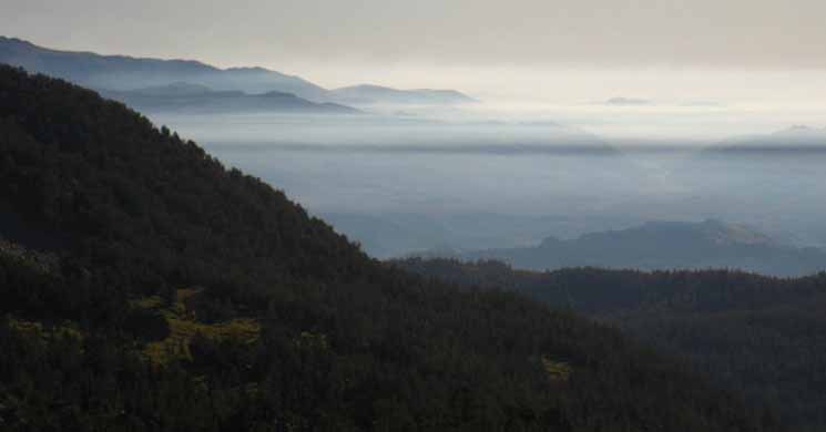
Mists blanketing the Eastern Sierra
 |
||
We're looking East across the length of the canyon holding Wolf Creek draining from Wolf Creek Lake out of the Eastern Sierra Nevada.
|
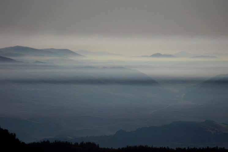
Misty Mountain Morning
| We have just climbed through the mist line. |
 |
We can see across the top of the mist as well as down into it from this position. An over and under view. Nice. |
Misty Mountain Morning
 |
A local mist hugs to the Eastern Flank of the Sierra over Highway 108's Eastern segment, which contains the Marine Base on the edge of Pickle Meadow and Leavitt Meadow too. |
| Looking East we are lucky to see delicate Morning Mists coating the terrain East of Sonora Peak. |
 |
Note that Highway 108 is visible coming through the valley East of Pickle Meadow. |
Wolf Creek drainage East
| Looking down the Wolf Creek Drainage to our East. You can see the South end of Wolf Creek Lake where Wolf Creek begins at the bottom-Left of this image. The creek turns east and runs down the center of this valley. |
 |
Winter Bail-Out Route-Spring Detour for PCT Hikers A Grunt's View... During Wintertime A Grunt's View... During Summertime I've done hiked cross country, in all seasons, for fun, for decades.. .This is the best fun... Read this book, Colder than Hell, to understand why Pickel Meadow Cold Weather Training Station was Established... This piece about the vets of the Chosin Retreat lays it out clearly. Humans need this, these all season capabilities, with or without weapons... You were made to operate in these conditions, if you can find those capabilities within yourself.... Put Yourself There What A Ball life is, and offers, to its intimate operators!! Trainer Perks I was wondering for a few years, how foot/ski prints appeared magically at the top of the Gap between the East Carson River, and Wolf Creek drainages, pointing down-mountain with no, "up-mountain", tracks, until I talked to the Marine Mountain Trainers (sgts), who pointed out that the heli-pilots and mountain trainers had to keep up their, "qualifications," whch required the pilots drop them at the top of the snow-covered mountains, and they ski down... Both the pilots and the Marine mountain trainers liked this. Sonora Pass Region Map This route up the valley is also the way back up to the PCT for Northbound hikers who are detouring around Leavitt and/or Sonora Peaks, or both, when they are covered with Spring snows. |
Looking East Out of the Sierra Nevada
East view of Sweetwater Mountains over Wolf Creek from Sierra Crest.
 |
Wolf Creek, the Sweetwater Mountains and Bodie Hills. From the perspective above we're looking East across and through the canyon that Wolf Creek turns East from Wolf Creek Lake for its short run down to the West Walker River, one of a series of creeks feeding the West Walker below Leavitt Meadow and above the Marine Base. Sonora Pass Region Map The valley pictured above is the Northern way around Sonora and Leavitt Peaks, while the trail along the West West Walker River is the Southern leg of the trail detouring around the peaks. In the Left background are the Sweetwater Mountains rising to the East of the Sierras, and the the Right, the South are the Bodie Hills. If you've never been out to the classic boom and bust ghost town of the East Sierra, Bodie, it's worth checking out if you are traveling by on Highway 395 between Bridgeport and Lee Vining. |
The Sonora Gap
Ahhhh..Approaching Sonora Peak's Eastern flank presents a bleak appearance. Though the East-facing flank of Sonora Peak looks barren and bleak as we approach, we find upon close inspection that it is not. Hiking across it we find that it is full of wildflowers from the earliest moment in Spring when the snows first retreat up the mountainside until deep into Summer when the last moisture feeing this year's life finally dries out. I have taken so many images of the flowers up here that I made a separate page just for one Spring trip's images.Spring Flowers
|
The Things on the Other (South) Side of Sonora Peak
Sonora Gap to Sonora PassThe Lay of the Land The first thing that grabs our attention when we hike into the Sonora Gap is the magnificent view of Leavitt Peak opening up wider with each step into the gap, until the last step brings the full impact of the view. It is a sweet and informative overview. A great section of meadow lays below the Northwest flank of the Leavitt Massif, between us and the Leavitt Massif along the edge of which Highway 108's sheer climb to Sonora Pass has mercifully moderated. There are many very nice free car campsites are scattered along Highway 108's last few miles through the meadow up to Sonora Pass. Behind us to the Northeast we can see the short valley Wolf Creek runs through off the East Flank of the Sierra, that we've observed while hiking up Sonora Peak's East flank. It's an impressive view. The second thing we notice is an exposed almost level trail of highly variable condition crossing the whole width of the South flank of Sonora Peak. The trail only turns South at the far Western end of the South flank of Sonora Peak. From the Southwestern shoulder of Sonora Peak we turn South and descend a short but serpentine course through rolling terrain down to Sonora Pass. From Sonora Pass we will hitch 9 miles West down Highway 108 to the one mile road down to our next resupply spot at Kennedy Meadows Pack Station.
2.88 miles from the Sonora Gap South to Sonora Pass. We're almost there! |
Last Steps to the Sonora Gap
 |
Our last breathless steps up to the 10536 foot elevation of the Sonora Gap. |
Video
| Sonora Gap to Sonora Pass | ||
Video: Sonora Gap to Sonora Pass. 5:04.
|
Sonora Gap Wildlife
| 2009 resident of the Sonora Gap. Lodgepole Squirrel. |
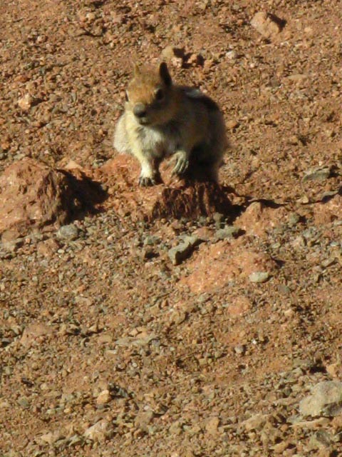 |
There are a few white barks up here. This guy was here in June and September of 2009, but was nowhere to be found in June of 2010. He seemed to be running a big scam on the PCTers, who he figured out he could quickly trail to feed him. He did his song and dance routine for me, but it failed to produce the desired outcome. |
Leavitt Massif
South of Sonora Pass
 |
Stepping into the Sonora Gap during a Spring Trip South to Tuolumne Meadows reveals the increasing challenge as we hike further South along the Sierra Crestline. Next ahead we see the Leavitt Massif rising to the South of Sonora Pass. |
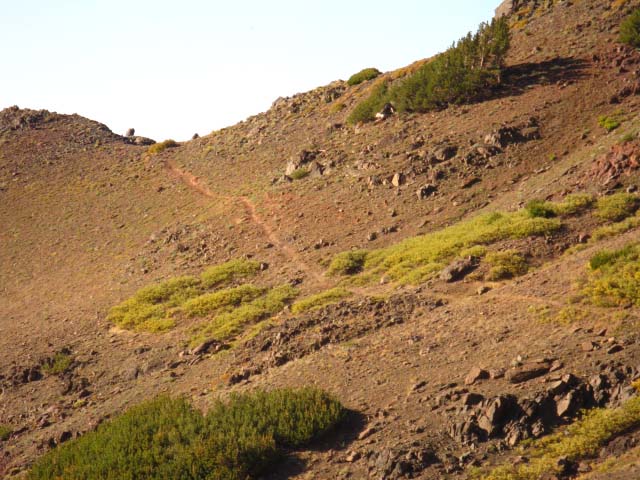
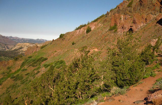
The Red Rock Trail along the South flank of Sonora Peak
Looking at the Southbound Pacific Crest Trail route heading West along the Southern flank of Sonora Peak. The terrain here is composed of broken-down eroded volcanic material of a rich burnt ruddy red color. The shortcut route sits just past the red rock volcanic structure where the line of the trail bends around the mountain. That point is roughly halfway along our East-West traverse on the South Flank of Sonora Peak. |
 |
|
A shortcut route down mountain appears just past the red rock formation visible along the ridge line on the other side of where the trail bends around the bulging mountain. You will look over the edge and down at the least steep part of the shortcut down to Sonora Pass. Lower down the shortcut it gets even steeper... The shortcut is very steep and slippery. There is very little traction and much moving sand and rocky debris flowing down an already moving terrain. Just add your weight and everything will try to start sliding down the mountain. I have gone down the shortcut two or three times in the last 10 years. It is do-able heading down for a fully loaded backpacker, but I don't suggest it. Cartwheeling down the mountainside is a distinct possibility... I fall down, generally in a fairly controlled manner, almost every time I take this shortcut. Kind of like "sliding into home plate." This is one of those places you could find yourself tumbling down a steep section of mountain if you don't watch out. "Stirred, not shaken?" No, in this case it is "slide, not tumbled" Heading up this shortcut route from Sonora Pass is challenging for a day hiker, difficult for a lightweight backpacker, and dangerous for a fully loaded heavyweight backpacker. Trail Conditions on the Red Rock Trail The trail was well dug out in late 2010. This status will last a few years. This terrain is in motion. Every Spring great sections of this mountain side flow down mountain. Two or three years after being well dug out by trail crew sections of the trail are already quite deteriorated. After four or five years this whole section is very hairy. The trail becomes very thin and its surface angle is very close to the angle of repose, along with the rest of the mountainside. So much water flows through the soils here every Spring that the mountain itself seems to be moving downward, including the trail bed. I've hiked through here a few times when the trail is so thin, and angled off-mountain so steeply that it tightens my butt and makes the hair on the back of my neck stand up.. Pacific Crest Trail Hiker Note This section is an early season bottle neck. When covered with snow this flank is impassable. I've only seen one PCTer do it when it was covered with 15 feet of late season snow. It was in the late 1990s or early 21st century. He was a tiny little bad-assed French dude who was trying to set a few long distance hiking trail records in one year (PCT+App Trail). He did not speak much English, and I speak no French. He was very lightly though very well geared, and he had two ice axes and crampons. He climbed up the near-vertical Southern face of Sonora Peak near the shortcut route, which is next to the big volcanic formation you can see just beyond where the trail rounds the mountain in the distance. The Frenchman then traversed the remaining South Flank of Sonora Peak over to the Sonora Gap, from where my pictures of Leavitt Peak were taken. I was surprised as hell to see him up there, and even more surprised that he had hiked all the way up to here through the thick snow conditions packing the Sierra from Mount Whitney all the way up to our position just North of Sonora Pass, that Spring. If anyone has any information about the crazy French dude who crossed the whole length of the Sierra Nevada under deep snow as part of a long-trails record effort, post up what you know in the East Carson River to Sonora Pass Forum. Oh, and I found and packed out the trash he had left on the East Flank of Sonora Peak. Sigh... How do you say "If you brought it in you bring it out" in French? Great skills do not absolve us of our responsibilities, no matter how privileged its makes us feel. If this section along the South flank of Sonora Peak is impassable because of snow (unless you are a seriously skilled, strong and fit ice-climber) during the occasional years that very heavy Spring snows persist into Summer, there is an excellent alternative route. You have two options, depending on trail conditions, your skill level, and your preferences. Coming North from Dorothy Lake Pass when you reach the trail junction at the West West Walker Bridge near the base of Kennedy Canyon. If you want to avoid the hike over the Leavitt Peak Massif turn Right at this junction to the East for the short hike to the trail junction turning down the Chain of Lakes Northeast towards the West Walker River rather than following the Pacific Crest Trail Northwest up Kennedy Canyon to the base of the South side of the Leavitt Massif. The trail down the West Walker River will bring you down to Leavitt Meadows and through the no-services Leavitt Meadows pack station to Highway 108. It's about 3.3 miles East on Highway 108 to the Marine Base. Enter the Marine Base and cross it to the North to pick up the dirt road West that will bring you to the mouth of the valley leading up to Wolf Creek Lake. At the North side of Wolf Creek Lake you will rejoin the Pacific Crest Trail North of both Leavitt Peak and the red rock trail on the South Flank of Sonora Peak. The second plan is much like the first, except that you hike the Pacific Crest Trail over Leavitt Peak to Sonora Pass on Highway 108, only to see that the trail along the Southern Flank is buried under 10 feet of nearly vertical snow and is impassable. Then your hitch East on Highway 108 down to the Marine Base, where you will pick up the dirt road up to Wolf Creek Lake. You will have to bypass the red rock trail along the Southern flank of Sonora Peak if it is covered with snow when you arrive. In any case you were likely hitch-hiking West from Sonora Pass to resupply at Kennedy Meadows anyway. After re supplying you may decide to continue North on the PCT via the dirt road to the Wolf Creek through the Marine Base as described above. |
South Flank of Sonora Peak
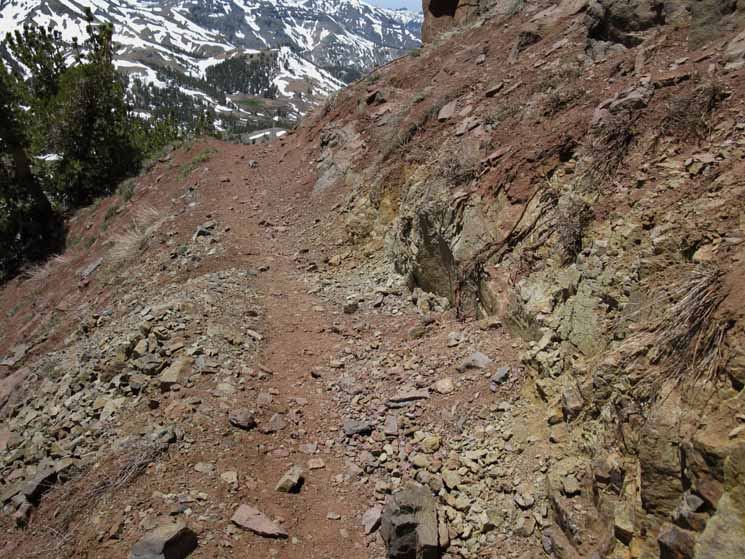 |
The Southbound Pacific Crest Trail pointing West along the South flank of Sonora Peak. This image was taken in June of 2009, after this constantly deteriorating segment of trail had been thoroughly dug out during 2008. This segment of trail had taken one year's damage from the Fall-Winter-Spring cycle, during which this trail deteriorates in lockstep with the severity of the Fall rains and the power of each year's Spring Thaw. Changing Characters 2009-10 had a weak-normal Winter. 2011-2012 had a very weak Winter. 2016-2017: Biggest Winter Precip & Snow in Recorded and Archeological History: Major Fires More Information Spring Report 2019, w/ review of 2015-2019 Weather Page, Tracking Seasons The Broken Weather This movement towards a drier climate in the Northwestern US is the product of a slow and steady change in the weather and wind patterns which have finally manifested themselves in a way noticeable to urban idiots and our corporate masters: They have run themselves out of a fundamental resource, water, while growing our population at a breakneck speed without any attention to the ramifications of their actions. Brave New World A whole new weather pattern has emerged, and this "drought" is nothing more than another waypoint on our rapid trip to a very unpleasant new "normal." It is already clear that this "new normal" will not produce the rainwater to supply the current over-bloated population in California, the vast populations in the deserts of the Southwestern US, let alone fulfill our leader's dreams of 50 million people in California by 2050.
|
Volcanic Formations along the South side of Sonora Peak
| Finely carved volcanic formations ornament our trail along the Southern flank of Sonora Peak. Far below we can see the forested meadows leading up to Sonora Pass from the West. |
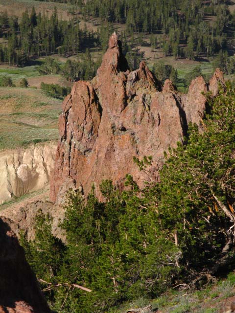 |
This thicket of White barks is likely where the Sonora Gap squirrels live. |
Looking South from Low and High Points at Leavitt Peak
Leavitt Peak and Massif
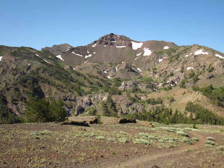
|
Pacific Crest Trail over the Leavitt Massif Sonora Pass also marks our point of departure out of the South end of the Carson Iceberg Wilderness into the Northeast corner of the Emigrant Wilderness. The Leavitt Peak Massif dominates the terrain to our South and is our gateway into the High Emigrant Wilderness. Er, Well, not really. PCT Skirting the East Edge of the Emigrant Wilderness And, more of the PCT over Leavitt Peak is actually within the Toiyabe National Forest than the Emigrant Wilderness. It's close. The trail bounces back and forth across the boundary line hiking between and around the peaks atop the Leavitt Massif. Nonetheless, our short interaction with Emigrant Wilderness is soon over, and let me assure you that you will see very little of the Emigrant Wilderness hiking the PCT. Hikers on the PCT are seeing very little of the Emigrant Wilderness. We can fix that. PCT Route Variation The Emigrant Basis is composed of the series of high altittude meadows and lakes along a flattened section of the Sierra Crestline. These are Emigrant , Grizzly, and Summit Meadows between Big Sam on the North, Bond Pass on the South, and its Western edge is roughly defined as being the tops of the canyons dropping off the West flank. Thank god that the PCT, the Superhighway of Trails, goes around this wilderness gem. It has kept this special place quiet. Geologically, the Emigrant Basin appears to be a kind of a high elevation shelf, an extended flattened section along the Sierra Crest when compared to the lines of massive peaks demarcating the Sierra Crest to our North and South. This "shelf" shelters beautiful high elevation meadows and complex volcanic and grantie features, but its unique character is derived from the juxtiposition of the sensual shapes and rich colors of its granite terrain highlighted by the stark interfaces where massive volcanic flows buried the granite. The Emigrant Basin is a location of supremely beautiful granite engulfed and hedged by ancient volcanic eruptions. The volcanic hulk of Big Sam marks the North end of Emigrant Basin. The mighty volcanic ridgeline dividing Summit Creek from Kennedy Creek to its North runs Northwest from Big Sam, capped by Relief Peak. This huge volcanic ridge makes up the North wall of the canyon rising above Summit Creek. Though the terrain is complex and hard to figure out, the trails are good, clear, and easy to follow. After crossing Big Sam a clear trail brings us to the junction with the TYT under Grizzly Peak. We follow the Southbound TYT to and over Bond Pass, at the bottom of which we rejoin the PCT at the top of Jack Main Canyon, after taking this delightful alternative route across the Emigrant Basin. The Southbound PCT had turned down Kennedy Canyon to the West West Walker River, and followed cuts in its drainage around and below the East side of this "shelf" of the High Emigrant Basin up to Dorothy Lake Pass, the PCT's entrance into the North Yosemite Backcountry into the top of Jack Main Canyon. The maps below lay out both the PCT and the Big Sam to Bond Pass variant: South of Sonora Pass on the Pacific Crest Trail PCT and TYT Routs South of Sonora Pass Hike the TYT Route South of Highway 108 on the TYT and PCT We've got a huge number of hiking options off the standard PCT and TYT routes South across the Emigrant Wilderness. The maps above give us a bird's eye view of this terrain and our hiking options across it, while the trail guide pages down both routes allow us to compare them. Trail Guide Pages Sonora Pass My point is that we have an amazing number of excellent trail options/route variations hiking South from Highway 108. All of these alternative routes eventually funnel us into the Bond or Dorothy Lake entrances into the Northwestern corner of the North Yosemite Backcountry where the PCT and TYT rejoin to continue South together down Jack Main Canyon. Northbound Another potential Northbound route option/variation is to hike West from the top of Kennedy Canyon to Kennedy Lake. The trail down Kennedy Creek from Kennedy Lake runs down to Relief Creek just above Kennedy Meadows Pack Station. This map below lays out this route option. Kennedy Lake in Emigrant Wilderness After resupplying at Kennedy Meadows the Northbound PCTer hitch-hikes up to Sonora Pass to continue North on the PCT. A Section of the TYT South from Highway 108? The Tahoe to Yosemite route South out of Kennedy Meadows Pack Station enters the Emigrant Wilderness low, advantageous to climb up through its multi-facted layers of terrain into the splendors of High Emigrant Meadow. The TYT crosses the Emigrant Basin to join up with our Southbound PCT route through Bond Pass at the top of Jack Main Canyon to run almost all the way to South to Tuolumne Meadows together from there. Almost. The point of all this is that we have significant route options that can significantly alter the character of our trip through the High Emigrant Wilderness. The Emigrant Wilderness is one of my favorite places in the High Sierra between Lake Tahoe and Mount Whitney on its own or as part of a long trip. Emigrant Wilderness is always an excellent place to put together endless combinations of backpacking trips on and off the trails. Besides having remarkable trails, it is full of cross country and scrambling routes. As with the Carson Iceberg Wilderness that we are departing, we can craft great backpacking loops tying together sections of the Tahoe to Yosemite and Pacific Crest Trails around or through the Emigrant Wilderness. In my opinion the best route Southbound through the Emigrant Wilderness for long distance backpackers is a combination of the Tahoe to Yosemite and Pacific Crest Trails. We'll explore our options through the Emigrant Wilderness as we continue hiking South on the Pacific Crest Trail from here as we encounter the upcoming trail junctions that make these variations possible. To be even more specific about route selection, the best route across the upcoming Emigrant Wilderness is the one you have not yet hiked. It even gets better. Once we've hiked these trails a couple of times and get some familiarity with the terrain we will be ready to do some exploring off the trails. I could spend a lifetime in both of these wilderness areas, the Carson Iceberg and the Emigrant, and barely scratch the surface of either's complexity and detail. So Let's try to peel a Layer of Complexity off the upcoming trail South First, Leavitt Peak is not visible in the images above or below, nor is Leavitt Peak visible from Highway 108 at Sonora Pass. The Leavitt Massif sports many fine peaks, but its highest and namesake peak is somewhat anti-climatic, being a low rounded mass located on the far Southwest side of the Massif, far from the gaze of casual viewers. Leavitt Peak makes that old phrase, "getting there is half the fun" more than half true. Below we are looking at a big part of the Leavitt Massif from 10,500 feet at the Sonora Gap, though Leavitt Peak itself is still not visible. The peak in the middle foreground is what most hikers identify as "Leavitt Peak." It is not. This is the 10,480 foot Northern face of the Leavitt Massif. Peak 10,480 is blocking our view of the actual Leavitt Peak. The peak sitting in the distant Left background is Peak 11,245. Shortcut and Winter Route up Leavitt Massif to PCT |
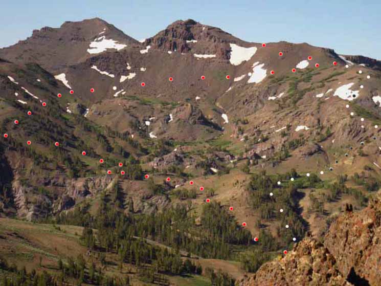 |
PCT is marked with red, shortcut is white, and very steep section with black in the white. Closer to the ground Let's Check out the upcoming trail The Pacific Crest Trail cut diagonally from Left to Right as it traverses up and across the whole width of the steep Northern flank of Peak 10480 facing us in the image above. But first it has to put itself into position for the traverse. As the Sonora Pass Trailhead is out of sight near the lower-right corner of the image above, this means that the PCT first crosses the middle elevation terrain in the middle of the picture from Right to Left to gain access to the subordinate ridge running Northeast off the Northeast shoulder of Peak 10480. That's our access point to the long traverse from Left to Right across the Northern flank over to the Northwestern shoulder, where the PCT and shortcut trails intersect. The red dots represent the route of the PCT, the white dots the shortcut route. We will travel a long ways back and forth on the PCT for very little distance South. On the other hand, we hike directly South on the Shortcut, but at a much steeper angle than on the PCT. A typical shortcut tradeoff. We don't get something for nothing. The PCT is very deeply grooved into the terrain, easy to find, easy to follow. Trail along the shortcut route can fade in and out. The shortcut, as marked on the Right side of the image, climbs directly onto the Northwestern shoulder of the Leavitt Peak Massif. There is a very steep section without any trail that crosses the distance from the top of the faint trail up from Sonora Pass to the faint trail on top of its Northwestern ridge arm. This very steep segment is marked by black dots within the white. Sonora Pass Over Leavitt Peak The low point of the Pacific Crest Trail across the Peak 10480's facing flank is on its Northeastern, or Left side of the image above. The second and third images following below exactly locate the East side of the trail where it turns onto the North flank of Peak 10480 for the climb to the Northwestern shoulder. The trail approaches the low point on the East flank by winding its way left (Southeast) through the hilly terrain in the center of the image up through the trees growing in lines up the steep green-tinted slope on the far-left side of the image above. From there we begin traversing up to our South, then turn West when we enter the North flank of the Leavitt Massif. The high point of the Pacific Crest Trail's traverse across the mountain's Northern flank is on the West, or Right side of the image above, where the PCT finally reaches the Northwestern shoulder of the Leavitt Massif. The PCT route cuts through the snowpatch to the Left, East, of the almost perfect circle of snow sitting on the far right side of the mountain's flank, to where it meets the top of the shortcut route. From above the circle of snow the PCT cuts back to pass to the West of the crest of Peak 10480 before it passes behind Peak 10480 to traverse acorss the mountain's Western flank just below its crestline. Local's Shortcut up Leavitt Peak On the Right side of the image above we can see the mountain's shoulders stepping down along the right side, the Northwestern shoulder of the North facing flank of peak 10,480. The local's shortcut route climbs straight up a steep flank to reach the top of the lowest shoulder on the far Right side of the image from the Sonora Pass Trailhead. This shortcut completely eliminates the long loop up to, and the traverse across the Northern Flank of peak 10,480. This shortcut route takes a mile off our total mileage. In exchange for that mile the last 200 yards up to the top of the shoulder requires we crawl uphill. Not class 5, (it's 3 to 4) but it works us hard, if briefly. In my case this section is always executed with a very heavy backpack. So be it. Instead of hiking back and forth and across the whole width of the Northern flank following the PCT I take the Local's Shortcut out of Sonora Pass. This requires that we climb straight up out of the Sonora Pass trail head to instantly begin climbing up to directly access the shoulder of the mountain rather than pussyfooting around. The final bit of the local's shortcut to get up onto the mountain's shoulder is very steep. The far right side of the image below shows the final section up to the top of the lowest descending ridge arm. Shortcut Route up Northwest Shoulder of the Leavitt Peak Massif The goal of the shortcut is to gain the Northwestern shoulder of the Leavitt Massif leading up to the unmarked but obvious junction with the Pacific Crest Trail by the most direct route possible. I show three start points for the shortcut route coming up from Highway 108, because I've walked them all. The route on the Left comes off the PCT South of the Sonora Pass Trailhead. Folks apparently wander down the PCT looking for the shortcut and then cut up the steep hillside. Not the best way... The center route comes up from Sonora Pass itself. The route off to the far Right is the most interesting to me. Notice how it follows the natural drainage down a mountainside gully. It's got a nice faint trail in there situated above the moving terrain of the Spring Thaw. The Western Route Here's how you find it:
Southbound Hikers Sonora Pass Over Leavitt Peak One Other Stupid Route Up I began hiking in on what would have been the PCT South through the Sonora Pass Trailhead, had it not been buried in snow, but kept a straight line for the base of Peak 10480 where the PCT would turn South, putting myself under the shortest route from the Western base of Leavitt's Northern flank for the climb up to the Northwest shoulder just below the top of Peak 10480. The PCT and the shortcut route join together above and just a bit to the Right of the almost perfect circle of snow on the Northwestern shoulder of the North flank of peak 10,480. The Pacific Crest Trail continues South from that point. Uses of the Shortcut Route This local's shortcut route up Leavitt Peak is the Winter route to climb Leavitt Peak during snow conditions. I've done it four times during Winter and Spring in heavy snow conditions, two of which were successful, and two of which were not. The two successful attempts were grand loops. I followed Hwy 108 in from the East, climbed Leavitt from the North, then exited East through the Leavitt Lakes basin to catch the road route, buried under snow, about 4 miles above the Leavitt Meadows Pack Station. From Leavitt Meadows it is another three miles to the snow gate sitting a mile West of the Marine base. Following the snow-buried route of the road on the way in from the snow gate to Sonora Pass makes navigation very easy, and saves lots of energy, if the Marines are maintaining the road. The Marines run a snowcat dragging a grate behind it over the mountain to allow training access. I've seen the road in both states of maintenance. It's really hard to lose the track of a road cut through forest and rivers, even when its buried in 15 feet of snow. It's an amazingly easy cruise when the road is maintained by snowcat pulling a grate. In and Out of the Remote East Sierra I generally hitch in and out of 395 corridor during all seasons, but East Sierra Transit runs buses up and down Highway 395. Update: Brenda, the manager of the base chow hall, quit in 2014 after 12 years working there. Good Luck to Brenda and Dan in all their pursuits! They still live out there, in Antelope Valley. I stop in to see them every time my Winter trail brings me in through Corral Valley Trailhead on Rodriguez Flat to Sonora Pass, and/or over the Leavitt Massif.
Above: Detail of the low point of the Pacific Crest Trail route across the Left or East side of the Northern Flank of the Leavitt Massif, seen from Sonora Gap. We can see the faint line of the PCT etched in melting snow. Line up the rock and snow features of this smaller image with the larger image in the second picture above to locate the low point of PCT as it begins its traverse across the North face of the Leavitt Massif. Later in Spring the trail along the North flank of the Leavitt Massif fully emerges.
Local Talent Bob walked up and said, "You going up?" and I said "yup, and over." Bob said, "Want to know the best way up?" and I said, "Hell yes," and Bob pointed at the mountain and said, from there to there. Then up to there, and over to there. Once you get there you will see the way over to the other side." And I said, "Thank you, Bobba-lou!" for that was exactly the best way to get up the shoulder of Leavitt when it's wearing deep snow, and composes the shortcut route during Summer. Anyone know how to get a-hold of Bobba-Lou? Last I heard his wife was working in the Long Barn gas station and store. |
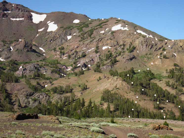
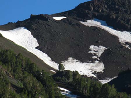
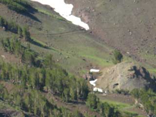
Leavitt Peak draped in Heavy Spring Snows
Below we look South at the Leavitt Peak Massif from the PCT on Sonora Peak, and we can see Leavitt Peak! In the image below Leavitt Peak is visible, almost hidden behind the right side of second peak back. We can see its gentle rise up to its flattened crown. Despite its impressive 11569 feet of elevation Leavitt Peak does not stand out on its own massif as do its surrounding peaks. This causes constant ms-identification of Leavitt Peak. Peak 10,480 makes up the Northern Flank of the Leavitt Massif and dominates the Northern side of the Leavitt massif. It is the nearest peak dead-center in the image below. Peak 11,245 is the second peak back, left of Peak 10,480. The pyramidal peak in the far left background is peak 11,260. To the left of Peak 11260 is where the PCT passes North and South through a narrow gap in the rocky crestline above Latopie Lake. The peaks and line of our PCT route through them are well depicted on this map: Sonora Pass Over Leavitt Peak Leavitt Peak is visible as the rising flattened summit sitting behind and Right of Peak 11,245, the second peak back. If you look closely you will see Leavitt Peak trying to hide behind Peak 11,245. Our Pacific Crest Trail route loops past, through, or around all of these peaks. Whoo-Hoo! During the past few seasons (2009, 2010, 2011) Late season Winter storms and heavy Spring snow storms have filled the mountains with snow far past the beginning of Summer. 2012 is a damn weird Winter (no Winter at all), and I'm putting the odds at 3 to 1 that this Summer's backpacking season will have an early start. This has proven truer each subsequent year, with 2014 having virtually no Winter at all! Leavitt Massif in Heavy Spring Snow |
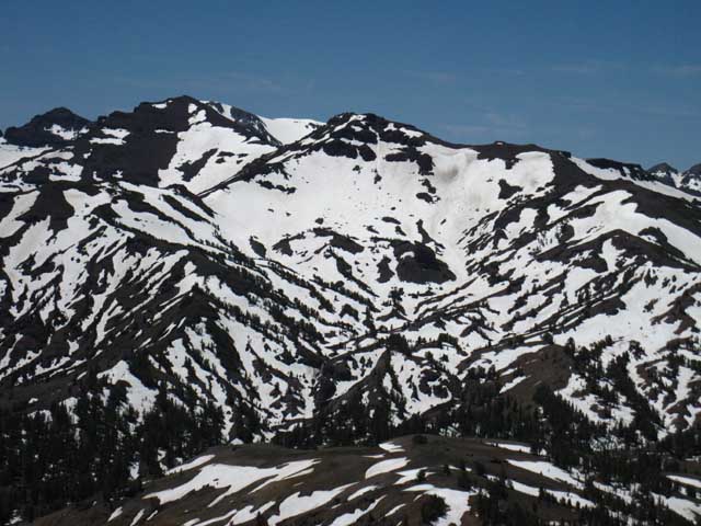 |
Leavitt Peak during Spring These recent snowy Winters and Spring Storms were bucking the long-term trend of shorter Winters and earlier Spring openings of the High Sierra trails during the last 30 years. I expect the trend of shorter Winters, earlier Springs, and Fall-time expanding deep into Winter to strongly reassert itself in 2012 (it did!) and expand through subsequent decades. If you want to see the Sierra within the remaining elements of its traditional weather and related natural systems you'd better see it now. (2012) It is rapidly changing. To go or not to go, that is The Question When deep snow conditions clog High Sierra trails through July some Pacific Crest Trail hikers choose to bypass the Sierra Nevada completely, hitching North to knock out a Northern section of Pacific Crest Trail not buried under snow. They return to hike the bypassed High Sierra sections later in the Summer when the Sierra finally emerges from snow. Other PCT hikers give the snow covered Sierra a try. Not a good idea unless you have significant snow travel and navigation skills, are an expert at dangerous river crossings, are well geared to survive unexpected snow storms, below freezing temps, and in good enough physical condition to endure some pretty harsh hiking and camping conditions. The snow covered Sierra Nevada is truly beautiful but dangerous. If you are not a deeply experienced and very fit backpacker starting your backpacking career with snow travel in the Sierra Nevada is not the best idea you've ever had. Snow travel really-really beats the shit out of you. Snow travel multiplies the dangers and difficulties of Summer backpacking. There are much less painful and dangerous ways to work yourself up to snow travel than throwing yourself directly into potential trouble. Trail Bypass for Early-Season Northbound Pacific Crest Trail backpackers The third option is to bypass the snow clogged trail section altogether. Northbound hikers on the PCT would follow the West Walker down to Leavitt Meadow from the West West Walker River rather than hiking up Kennedy Canyon to the South side of Leavitt Peak. From Leavitt Meadow continue East on Highway 108 to pass through the Marine Base on your way up to Wolf Creek Lake. Talk to the Marines, they will point the way. At the North side of Wolf Creek Lake you will pick up the Northbound PCT after having bypassed the steep snow-covered flanks of Leavitt and Sonora Peaks. It's a "down and around" rather than an "up and over" move. Southbound hikers execute this move in reverse. |
Approaching Sonora Pass
Woodpecker Tree
| Taking the shortcut down from the Red Rock Trail on the Southern Flank of Sonora Peak brings you past a huge White bark Pine. | As hard as I tried, and I tried hard, I could not get a good shot of the 12 to 15 of the little bastards who were having a real woodpecker party up in the tree. | |||||
 |
 |
|||||
| As I approached the tree I was overcome by the din of the very many woodpeckers giving each other the business in this tree. | In each of these two pictures you can make out one woodpecker. The one above is arching his body down, ruffling his feathers, and screeching at his buddies... They were rocking it. |
Sonora Pass sign marks the entrance to the Trailhead Parking, Picnic, and Horse-Packing facilities from Highway 108
| The Stanislaus National Forest administers Sonora Pass and its two Pacific Crest Trail trailheads: North into the Carson Iceberg Wilderness. and South into the Emigrant Wilderness. |
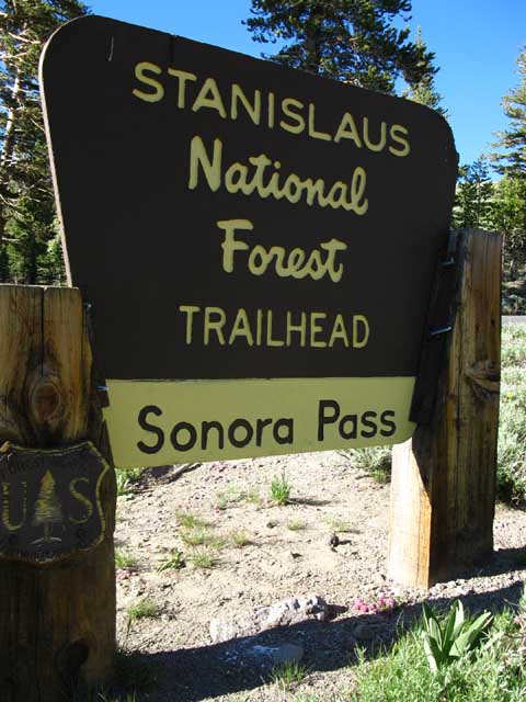 |
Though the trailhead South into the Emigrant Wilderness begins in the Stanislaus National Forest the trail soon enters and stays in the Toiyabe National Forest until you enter Yosemite through Dorothy Lake Pass. |
Caltrans, One of the many Posters of Signs at Sonora Pass.
| Mono County on the East side of Sonora Pass, Tuolumne on the West. |
Check out the Sonora Pass Page for more information about Sonora Pass. |
Hitch-Hiking West down to Kennedy Meadows Pack Station to pick up my Resupply Bucket
| Entrance to the picnic area, bathroom, stock facilities, and trailhead parking. No garbage cans, no water. |
 |
On a stick and a thumb. Pick me up. I want my Chile-Cheese Burger at Kennedy Meadows Pack Station ASAP. |
Resupply |
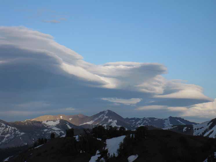 |
Clouds East of Sonora Pass responding to changing temperatures of twilight. |
North: Boulder Lake to East Carson River South: Sonora Pass
Sonora Pass |
Sonora Pass Arriving at Sonora Pass hiking Southbound is a relief, a disappointment, and promise of continuing beauty. It is a relief to finish this difficult section, a disappointment to leave the beauties of the Carson Iceberg Wilderness behind, and the promise of Emigrant Wilderness beauties will be well-fulfilled. For the Northbound Pacific Crest Trail hiker you have reached the thousand-mile mark at Sonora Pass, and have crossed three-quarters of the Sierra Nevada Mountains. The typical Pacific Crest Trail hiker resupplies out of Sonora Pass. The smart or well-informed hikers resupply at Kennedy Meadows Pack Station, and the rest hitch far from the Sierra crest line down to Bridgeport. I enjoy Bridgeport and its people and visitors, but the smart resupply move is to Kennedy Meadows. If you head to Bridgeport, stop by Rhino's for some good food, a bunch of beer, and a few games of pool with the locals.
THIS PAGE IS UNDER CONSTRUCTION: STAY TUNED FOR MUCH MORE! COME ON BACK NOW, 'YA HEAR?
7.5 Map 30 min Map Guide South Map South |

Backpacker ForumsHave a great Sierra Nevada trip or story to relate? A fine piece of gear? Or gear that failed?Post up on
|
North: Boulder Lake to East Carson River South: Sonora Pass
Trailhead
Contact
Alex Wierbinski

Backpacking Lake Tahoe to Mount Whitney:
Your Guide to the High Sierra Crest, including the Tahoe to Yosemite, Pacific Crest, and John Muir Trails
