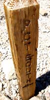
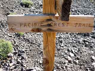
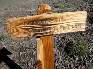
Trail Junction
The Trails
Guide
Maps
Miles/Ele
Permits
Resupply
Forum
Current Weather Conditions
Weather Notes
Northern High Sierras
Central High Sierras
Southern High Sierras
Gear
Gear List
Gettin Started
Layering
Discussion
Testing yourself and your gear
Gear Reviews
Backpacking
Latopie Lake
to
Kennedy Canyon Trail Junction
Accessing
Kennedy Canyon--Kennedy Lake--Big Sam & Emigrant Basin--Sonora Pass
Hiking
The Pacific Crest Trail from Sonora Pass to Tuolumne Meadows
Languages
Languages
Trail Arts
The art of walking
Physical Preperation
Trail Skills
The trail
Off the trail
Scrambling
Maps
Navigation
Camp skills
Food
Resupply
Food
Other
Photo Catagories
Trail Stories
Trail Culture
News and Science
Links
Groups
Books
Terms and Conditions of Use
| Trail Guide INDEX Highway 108 to Highway 120 |
Trail |
Trail |
Trail |
Trail |
15 min |
30 min |
TOPO MAP INDEX SONORA PASS |
Sonora |
RESUPPLY South |
National Forest |
|
all maps index |
A DRAFT-EDITION TRAIL GUIDE PAGE
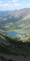
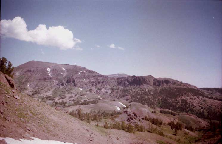
View South
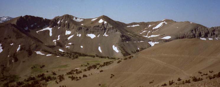
Latopie Lake
Leavitt, Koenig, and Latopie Lakes from Left to Right. Note Tower Peak in furthest distance.
Above Where We At Passing South The dirt road to Leavitt Lake, also known as the Tungsten Road (see the forum & more info below), runs South off Highway 108 about 3.2 miles East of Sonora Pass. Our view above is looking to our Southeast across the top of this high basin on the Southeast Flank of Leavitt Peak. The run of peaks we see above the lakes is the Sierra Crestline represented by the Southeastern ridgeline of the Leavitt Massif. We'll shortly be hiking Southeast along its far flank after passing through the South Gap onto the South Flank of the Leavitt Massif. The Southern Gap bringing us onto the South Flank of the Leavitt Massif lays 2.11 miles South of our current position in the North Gap along the route of the PCT. These next miles cross the highest reach of Leavitt Creek's Watershed reaching up through Leavitt Basin up the East Flank of the Leavitt Massif to Leavitt Peak itself. Our PCT route South passes under the East Flank of Leavitt Peak as we hike between the North and South Gaps. Though we pass under Leavitt Peak between the gaps, we do not access Leavitt Peak directly. The "standard" route to the top of Leavitt Peak passes through the South Gap, then turns Northwest, to the Southbound hiker's Right, immediatly after passing through the South Gap following the line of the Southeastern ridge arm up to the top of Leavitt Peak. Southbound hikers on the PCT turn Left, to hike Southeast along the top of the South Flank of the Leavitt Massif until we overlook the low gap in the Sierra Crestline dividing our position on the South Flank of the Leavitt Massif from the North Flank of Big Sam rising on the far South side of this upcoming low gap in the Crestline. Kennedy Canyon Trail Junction Let's take a look at the position of the upcoming Kennedy Canyon trail junction in relation to our hiking options down the Sierra Crest and/or its Eastern and Western Flanks. High Emigrant Wilderness Miles and Elevations Miles & Elevations
Check out the Kennedy Canyon Trail Junction Sonora Pass to Tuolumne Meadows High points along PCT
|
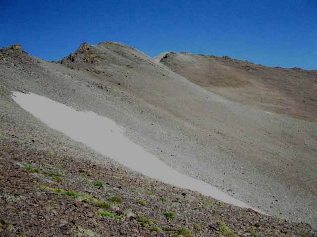
Below These views to our North of Sonora Peak rising to the North of Sonora Pass begin opening up behind us as we climb higher up and further South onto the Leavitt Massif, until we finally get our last & best view North (below) of Sonora Peak while passing South through the North Gap into the Leavitt drainage, and onto the Southeast flank of this massif, finally under Leavitt Peak itself. |
Last View North across Sonora Pass
at
Sonora Peak
featuring
Sonora Gap
 |
NORTH Above is our last view North of Sonora Peak and Pass before turning around to hike South through the North Gap on the Leavitt Massif. Before we leave them behind we might want to review the views we got of the Water-Water-Watersheds |
North Gap The crestline of this ridge running East off 11260 marks-out the Northern extent of the Leavitt Lake Basin watershed feeding Leavitt Creek under the Southeast Flank of Leavitt Peak. That's what the upper image above is looking into. We pass South through the "North Gap" on this ridgeline at a point about a mile and a half East of Leavitt Peak's highpoint along the main Sierra Crestline. Check out another perspective of the slash of the North Gap cut through the |
South Gap North Gap to South Gap This type of terrain is no longer "crafted" here... That would be the Weather. Tungesten Road After passing through the North Gap our PCT route turns West, Right, edging its way back towards Leavitt Peak along base of this Eastern spur of ridge just off the main Sierra Crestline. All the runoff below us runs Southeast down into the basin below, where it all turns Northeast on its way to forming Leavitt Creek. All these lakes and the liquid products of this whole drainage between the gaps flows Northeast down-mountain into the fold along the Eastern flank of the Sierra that Leavitt Creek, the Tungsten Road, and finally even Highway 108 all follow Northeast down-mountain to Leavitt Meadow. The East side of this map below clearly lays out the mixture of complexity and simplicity out of which this East Flank terrain is interwoven: |
Leavitt Creek The West Walker is the mother river which all these subsidairy creeks and the West West Walker all feed. The West Walker River drains a long section of the East Sierra Flank which continues along the East Flank of the Sierra long after draining everything from Tower Peak down to the river's junction with Highway 395. The trail up into Kirkwood Creek's hanging canyon continues climbing Southeast in a pocket of terrain along the East Flank of the Sierra Crest up to where it reaches the point where the boundaries of the Hoover and Yosemite Wilderness intersect above Twin Lakes and Kerrick Canyon.
Sardine and Leavitt Creeks drain slices of the East Flank, Leavitt Creek is subsumed by the West Walker River in Leavitt Meadow. Ironically, these rivers and creeks run through the type of terrain capable of beating the shit out of us most thoroughly
while at the same time relaxing and recharging us most deeply. The West Walker River continues North alonside Highway 395 through a narrow canyon that fills with its flood waters every couple of decades or so. The North end of this canyon opens about 13 miles South of the 395/108 junction into the South end of Antelope Valley at the town of Walker. The West Walker works its way to the North end of Antelope Valley where it finally flows into Topaz Lake. Highway 395 tracks around the Western perimeter of Antelope Valley before entering Nevada climbing out the valley's shallow North end. Back to Leavitt Peak That's an awesome watershed, and we are exploring some of its highest complexities. Maps--Miles--Elevations
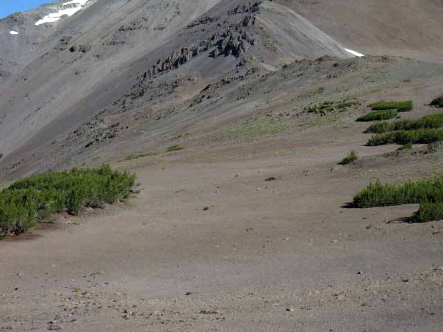
The North Gap Leavitt Peak is non-descript, so we are uncertain about identification, for a second. Latopie Lake sits about 400 feet of elevation below us, a short downhill half mile. 800 feet further down in elevation at about three miles to our Southeast we can see Leavitt Lake nestled in-between sheer ridge arms descending off the North Flank of Leavitt's Southeastern ridge arm. That's Leavitt Lake peeking out from the upper-Left corner of the image above. |
HIKING SOUTH Route of the PCT I Like Latopie Lake. Gap to Gap We have two potential routes between the Northern and Southern gaps bracketing this basin. One is a self-directed route off the PCT to and past Latopie Lake, returning to the PCT by hiking up through the valley South of Latopie. The other is the standard route of the PCT. As of 2016 the PCT is the easier of these two routes. Over the next couple of miles our hike South will either go around Latopie Lake on the PCT or visit Latopie followed-up by hiking a little cross country route South from Latopie Lake to rejoin the Southbound PCT where it passes through the Southern gap onto the South flank of Leavitt Peak. I've lightly dotted-in this little alt-route on our map: Sonora Pass to Dorothy Lake Pass |
Beyond the Gaps This second junction divides the hiking trail from the route of the Tungsten Road, designates this switchbacking segment of the road as sufficient for being, "horse trail," descending the next .96 of a mile down the steep South Flank of Leavitt Peak in a neat set of switchbacks. Trail and Road rejoin for the final steps gently descending off the South flank of Leavitt Massif to the Kennedy Canyon trail junction. Thus ends this page of the trail guide 5.59 miles South, |
Latopie Lake Access Leavitt Lake is accessed by four-wheel drive vehicles when the Tungsten Road (Forum) up from Highway 108 is passable, as described above and on the Forum..
|
Video Trail
Resupply
WELCOME TO TAHOE TO WHITNEY |
|||||||||||||||||||||||||||||||||||||||||||||||
View
EAST
DOWN
Kennedy Canyon
approaching the
Kennedy Canyon Trail Junction
Backpacking Around the Heart of Emigrant Wilderness
 |
|||||||||||||||||||||
View East of Southbound PCT route down Kennedy Canyon Key Trail JunctionKennedy Canyon Trail Junction Options Ahead
How Good is Backpacking Emigrant Wilderness?
The The Image Above Kennedy Canyon Trail Junction Hiking Options NORTH--SOUTH--EAST--WEST
Take A Long Perspective on Brutal Contradictions
PCT PCT Beyond Kennedy Canyon to our Entrance into the Northwestern Yosemite Backcountry Kennedy Canyon to West West Walker Bridge (Trail Guide Page)
Views North & East West Walker River and Canyon Hoover Wilderness
Views North & West The East Flank of the Sierra Crestline Emigrant Wilderness
More Options West Long Distance Resuppy Route PCT & Other Long Distance Northbound Hikers
Kennedy Canyon Trail Junction
Feeling Frisky? These maps lay out the PCT and TYT across Emigrant Wilderness and the trails connecting them.
The maps above lay out potential lines for Emigrant Wilderness backpacking loops big and small. Local Delights & Long Distance Insights
|
Video
Latopie Lake to the Kennedy Canyon Trail Junction
5.31 miles in 5:39 minutes
Where the Heck are We? The Pacific Crest Trail route circles around and above this shelf on the Eastern flank below Leavitt Peak as it makes its way over to the Southern flank of Leavitt Peak across the bottom of a great field of talus and then up and over a lateral moraine below Leavitt Peak over to the South Gap leading onto the South Flank of the Leavitt Massif. The fine campsite off the East shore of Latopie Lake is 3.07 miles South of Sonora Pass trailhead and 5.31 miles North of the four-way trail junction at the Kennedy Canyon trail junction, if we decide to go down and check out Latopie Lake. I always do, except when I hike around it about every five years, to check trail up there.
|
Hiking Off
|
| comments | forum |
Latopie Lake and the Surrounding Terrain
Latopie Lake is the highest of the three lakes we see in the complex terrain descending off the Southeast flank of Leavitt Peak, all situated to the Southeast below our position in the North gap. Outflow from these little lakes forms into Leavitt Creek flowing Northeastward down the valley to Highway 108, along with the dirt Tungsten Road. The Tungsten Road is a rough dirt track connecting the series of lakes pictured below to Highway 108 on the Eastern flank of the Sierra Nevada.
| ROAD MAP | More Below |
Check out the forested valley descending from Leavitt Lake to Highway 108 on the East side of our
topo hiking map.
Looking Southeast from above Latopie Lake on the Pacific Crest Trail the image below includes Koenig and Leavitt Lakes situated in their respective flats in the basin divided by sheer ridge arms running all the way up to the top of this ancient glacier-cut valley. Around each of these lakes we see that the broader, unified basin that runs into a valley below the lakes divides itself into a series of narrow canyons above each lake running up to the Sierra Crestline.
Our Southbound PCT route past Latopie Lake eventually brings us onto the Southern flank of the Leavitt Massif where we will be hiking along the top of the ridgeline guarding the tops of each of these Lake's mini canyons running up to our trail along the South Flank of Leavitt.
Check out
The 7.5 hiking map shows how our route along the South flank passes by the tops of these canyons above Leavitt and Koenig Lakes.
| comments | forum |
top of page
Southbound across the Leavitt Massif
Southbound PCT Hikers stepping through the gap in the mountaintops beside Peak 1100 above the North shore of Latopie Lake are suddenly stunned by the magnificent overlook of Latopie Lake, its nearby lakes, and the beautiful complexity of the surrounding terrain of the drainage basin running off the Southeast flank of Leavitt Peak.
Northbound across the Leavitt Massif
Northbound Hikers reaching the Northern gap at Peak 11000 will have already passed under the flat summit of Leavitt Peak, already crossed the great moraine, and will be traversing up the narrow soft trail climbing to the Northern gap in the ridgeline between Peaks 11260 and 11000 before the view of Latopie and its accompanying lakes below opens up to the Southeast.
Latopie Lake's position nestled into its shelf in the mountain's Eastern flank hides it from Northbound hikers until we are upon it, and have almost hiked past Latopie Lake.
Always Turn Around
Everyone must turn-around and look-around on a regular basis to maintain terrain awareness and context.
South of Latopie Lake
Southbound backpackers hiking the Pacific Crest Trail route around Latopie Lake will stay high up on the PCT above Latopie Lake. The PCT's route across the moraine stays above Latopie Lake and below Leavitt Peak as it makes its way 2.11 miles South from the North to the South gap onto Leavitt's South flank.
| comments | forum |
top of page
Kennedy Canyon Trail Junction
The four-way Kennedy Canyon trail junction we encounter at the base of the South Flank of Leavitt Peak offers us lots of backpacking trip options for shorter trips back to Highway 108 via either the East and West flanks of the Sierra.
-Two Flanks-
Three Routes In
Three Routes Out
EAST-CENTER-WEST
We can see from the topo hiking maps below that we can bend our route back around to the North down and around through either the East or West flanks of the Sierra from the centrally-located
Kennedy Canyon trail junction.
We can end our shorter and local point-to-point Emigrant Wilderness backpacking trips beginning at Sonora Pass at either Leavitt Meadow on the Eastern flank or Kennedy Meadows on the Western flank.
We can lengthen this trip by hiking further South to Grizzly Peak before turning North to return via either flank of the Sierra to either of these East and West flank trailheads along Highway 108, or even loop our way back to Sonora Pass. The schematic lays out the trail segments and junctions we can use to plan complex loops and trailhead to trailhead backpacking trips around the high elevation portions of the Sierra Crestline that makes up the Eastern limit of Emigrant Wilderness:
Emigrant Wilderness
Backpacking Schematic Map
I've sketched out the rough miles of each trail segment on the schematic map, and we will measure out the miles of our alternative routes and short-trip options from each trail junction as we encounter them on the trail guide.
West Flank
PCT to TYT
Kennedy Lake
See this Topo Hiking MAP covering the hike West via Kennedy Lake and Kennedy Creek down to the Tahoe to Yosemite Trail running North and South along Summit Creek. We'll turn Northwest to hike out through Kennedy Meadows Pack Station.
East Flank
PCT South
Kennedy Canyon
See this Topo Hiking MAP covering our potential route East via Kennedy Canyon following the Pacific Crest Trail to the West West Walker. Here local hikers can turn Northeast through three different trail routes to find their way out to Leavitt Meadow along the West Walker River.
There are also a lot of abandoned trails and very interesting runs of low granite formations from the mouth of Kennedy Canyon running East to the West Walker and South down to the bridge over the West West Walker.
To our North
PCT North
Sonora Pass
And finally, check out the map covering the PCT route we used hiking Southbound down to the
Kennedy Canyon trail junction from Sonora Pass.
Four Direction
TRAIL GUIDE PAGES
Below are the Trail Guide pages exploring our North, South, East, and West
backpacking options in Emigrant Wilderness from the Kennedy Canyon trail junction:
|
South
on the
Sierra Crestline
PCT to TYT
via
Big Sam
Big Sam to the Tahoe to Yosemite Trail at Grizzly Peak.
Hiking over Big Sam into the High Emigrant Basin puts us at the next level South. At the Grizzly Peak trail junction we will find our next set of hiking options to the four points of the compass from the Sierra Crestline opening up our route selection possibilities to the next level.
NEXT FOUR-WAY CRESTLINE JUNCTION
GRIZZLY PEAK TRAIL JUNCTION
Backpacking Options
from
Grizzly Peak Trail Junction
Griz Peak
TYT South
We can continue South on the TYT over Bond Pass into Yosemite. In the top of Jack Main Canyon local hikers would turn their loops back to the North using the PCT through Dorothy Lake Pass, while long hikers would enjoy their Southbound descent into Jack Main.
Griz Peak
Northeast to PCT
We can turn Northeast from Grizzly Peak through Emigrant Pass for the hike along the West West Walker River down to meet the PCT at its bridge. This unique trail closely explores interesting areas of the granite-volcanic interface. It has a very "cozy" trail-feeling.
Griz Peak
TYT North
Or, we can turn Northwest on the Northbound TYT running all the way to Kennedy Meadows Pack Station.
Griz Peak
West Trail and Cross-Country
We have trail and cross country options West through Horse Meadow and beyond Snow Lake nearby.
Full West Flank Access
From Grizzly Peak we have the whole Western Flank of the Emigrant Wilderness at our feet.
We can easily run down to Hetch Hetchy, Cherry or Eleanor Lakes, or to Pincrest Lake from
our position at
the Grizzly Peak trail junction.
Four Direction
TRAIL GUIDE PAGES
Below are the Trail Guide pages exploring our North, South, East, and West
backpacking options in Emigrant Wilderness from the Grizzly Peak trail junction, our next four-way trail junction along the Sierra Crest to the South of the Kennedy Canyon trail junction:
FORWARD
Southbound PCT
On the page below we're hiking from Latopie Lake on the PCT South to the Kennedy Canyon trail junction finishing our hike over the Southern half of the Leavitt Massif.
We also explore the short cross-country route South of Latopie Lake (rather than the PCT route around the lake) to rejoin the PCT route by hiking up the valley South of Latopie to the Southern gap where the PCT crosses onto the Southern flank of the Leavitt Massif.
We have two routes from the North and South gaps bracketing Latopie Lake. One follows the standard route of the PCT around and above Latopie, while the other hikes from gap to gap off the Pacific Crest Trail via Latopie Lake.
Our third option is to take the little spur trail off the PCT down to and back from Latopie Lake.
| comments | forum |
Looking Southeast
from the
Gap above Latopie Lake
on the
Pacific Crest Trail
The Pacific Crest Trail Route South around Latopie Lake Above Tungsten Road Segment of Bad Trail This very short section of the PCT circling around the North shore of Latopie Lake from the gap to the beginning of the talus field can be in very bad condition, especially when saturated by the thaw during early Spring. This little section of trail between the gap and the talus erodes away quickly and must be dug out by trail crew on a regular basis. Some years it is very narrow, almost non-existant. Hiking South on the PCT through the gap we begin traversing West by the compass along the mountain flank on the Southern Flank of Peak 11260 above Latopie Lake. Our Southbound PCT route bends South down onto and across the nose of the great gently descending field of talus below Leavitt Peak to put itself onto the flank of a great lateral moraine of shattered talus, both of which are gently rising up the East flank towards Leavitt Peak and its low-slung summit crestline. Bottom Line
Cross country route South from Latopie Lake to the PCT South of Latopie Lake a small hanging canyon runs up to the Southern gap where the Pacific Crest Trail crosses over to the Southern flank of Leavitt Peak. We will hike South from Latopie Lake to put ourselves into, and then up this little canyon to rejoin the PCT right before it passes onto the South flank of Leavitt. I Like Latopie Cross Country Fools Though the trail across the talus moraine has been repaired, and significanty upgraded, my little alternate cross country route is still my preferred route, as it is full of much more interesting terrain and things to see than the PCT route. More on this little route option and its evolution over the years below.
|
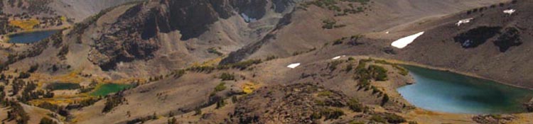
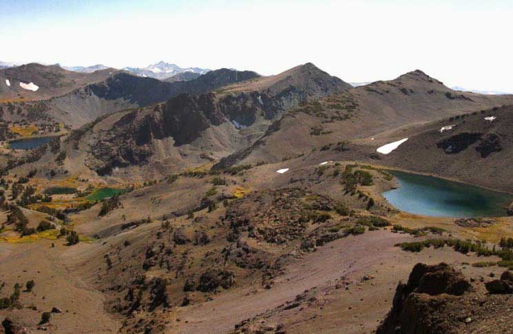
Leavitt Lake, Koenig Lake, and Latopie Lake
From Left to Right, respectively.
View of Complex Drainage Basin
from its North Limit at the Northern Gap
 |
||||
The East-Southeastern Flank of Leavitt Peak Above we are looking Southeast while passing South through the gap under Peak 11000 along the Pacific Crest Trail. This view reveals the complex terrain of the basin below the Southeast flank of Leavitt Peak. Leavitt and Koenig Lakes are at the base of a fan of a series of three sheer, narrow canyons rising up to the Sierra Crestline between each of the lakes. The series of peaks rising up behind and above Leavitt and Koenig Lakes make up the Northern flank of the Southeastern ridge arm descending from Leavitt Peak, wrapping around this basin and the lakes inside. We will be hiking on the far side of that ridgearm from the South gap until we descend off it along the Tungsten Road down to the Kennedy Canyon trail junction. Our Southbound PCT route will bring us around all of this on the far side of the ridgeline above Koenig and Leavitt Lakes, hiking along the Southern flank of the Leavitt Massif. Each of the lakes in the image above are drained by streams that join together forming Leavitt Creek. Latopie Lake is on the far Right. Above Latopie Lake we can see the nose of a huge moraine. The steepness of this great pile of sharp, broken volcanic rock flattens considerably as it runs up the East flank to Leavitt Peak. We can also see the top of the little canyon opening up directly beyond Latopie Lake. That would be directly above Latopie Lake in the image above. This canyon runs up to the Right, to the Southwest, up to where the PCT runs North-South across the top of this basin, climbing up to where it tracks along just below the ridge arm running Southeast off the summit of Leavitt Peak. In the middle distance we can see the peaks at the top of the sheer, narrow canyons above Leavitt and Koenig lakes. These will be the peaks decorating our route as we hike down the trail along the Southern flank of the Leavitt Massif below, hiking across their South flanks. We are hiking the PCT along their Southern flanks as we look to find our way off of the South end of the Leavitt Massif.
Southbound PCT If we do decide to hike down to visit Latopie Lake we have two options for continuing our Southbound hike from there. The first requires hiking back up the way we hiked down to Latopie Lake, to and from our present position on the PCT trail junction above the North Shore. Our second option is to hike a cross country route South from Latopie Lake rejoining the PCT at the Southern gap over to the Southern flank of Leavitt Peak via the canyon we see behind Latopie Lake. To rejoin the PCT hiking cross-country South from Latopie Lake we hike down off the South side of the flat holding Latopie Lake to a smaller flat below. This smaller flat is situated just Left of the patch of snow below and to the Left of the far end of Latopie Lake in the picture above. From that dot of snow we hike to our Right around and onto the Southern facing flank of the little hanging canyon South of Latopie Lake. From there we hike West, to the right, traversing up into and across this nifty little canyon to eventually find our way up to the PCT where it passes through the gap in the ridgeline over to the South flank of Leavitt Peak. From our position here overlooking Latopie Lake the Southbound Pacific Crest Trail tracks to our Right, West, to get off this steep flank and onto the nose of the huge talus field under the East side of Leavitt Peak. From there the PCT works its way across the talus field over to the lateral moraine piled up on the South side of the talus field. Check out the topo hiking map I've marked with both routes. Sonora Pass to Kennedy Canyon Hiking through the gap onto the South flank of the Leavitt Massif turns our Pacific Crest Trail Southeast for the traverse down to where the Tungsten Road comes over from Leavitt Lake. This marks our point on the South flank where we begin our final descent off Leavitt down to the Kennedy Canyon trail junction. The Tungsten Road and Tahoe to Yosemite Trail share route to the trail junction breaking off to Snow Lake. End of the Line Snow Lake is nestled under the ridge dividing Yosemite National Park from the Emigrant Wilderness just a few hundred yards South of Bond Pass. Climbing South over Bond Pass we find the TYT-PCT trail junction at the top of Jack Main Canyon. The Tahoe to Yosemite and Pacific Crest Trails rejoin in the top of Jack Main Canyon for most of their remaining 54.49 tough miles hiking South to Tuolumne Meadows. Premium Alternative Emigrant Wilderness Backpacking Routes We can tie both routes to the top of Jack Main Canyon from the Kennedy Canyon trail junction into a nice circle accessible from the Leavitt Meadow, Sonora Pass, or Kennedy Meadows Trailheads. Turn that Loop Home We have many options for backpacking across and around the High Elevation areas of Emigrant Wilderness.
Sonora Pass Region Hiking Map USGS 30 min backpacking map
Fourth Though I've focused mostly on building the PCT and TYT guides across Emigrant Wilderness along with the Tungsten Road that splits them, there is another, a fourth level of trail that roughly parallels the PCT and TYT across the High Emigrant Basin. This line of trail is lower that our other three. It begins at Mosquito Pass on the TYT and moves Southeast via Emigrant Lake, Maxwell Lake, and Snow Lake below Bond Pass. This line allows a fourth alternative route to backpack into or out of the High Altitude Heart of the Emigrant Wilderness. I've put together a supplemental page that lays out our options along this line. I'll follow up and break it down into guide pages after I push the standard routes covered by the guide to completion through the Whitney Portal. |
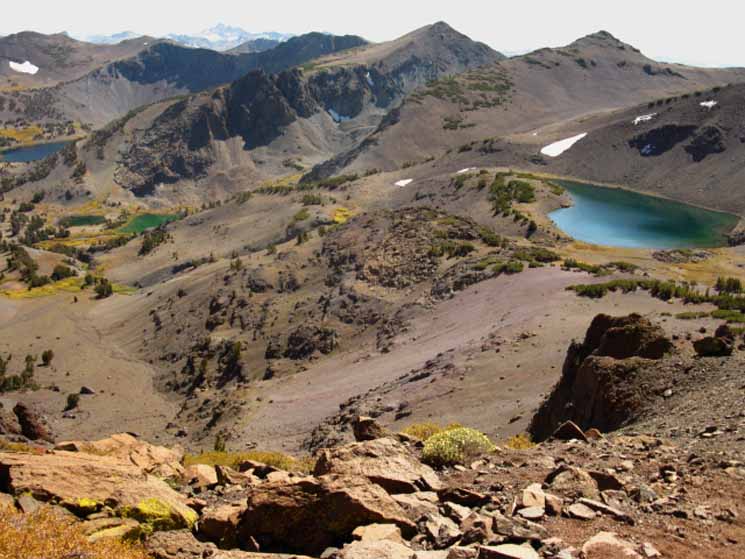
The Southeast Flank of Leavitt Peak
viewed from
Leavitt Lake
during a
Clear Winter day
Another View of our Position
 |
||||
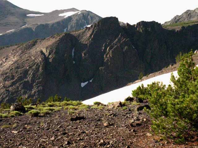
Another Perspective Leavitt Peak is the little bump on the furthest distant ridgeline on the Left. featuring Looking Northwest up at the Northern gap above Latopie Lake. This image was taken about 3/4 of a mile North of Leavitt Lake, looking Northwest at the Southeastern flank of Leavitt Peak. The Pacific Crest Trail passes North-South through the Northern gap, which is the lowest gap along the sheer Sierra crestline in the center of the image above. This Northern gap allows passage through the wall of this spur of ridge branching East off the main Sierra Crestline. The sheer crestline above wraps around and towers above the North shore of Latopie Lake. The pointy peak at center-Left in the image above is Peak 11260 along the Sierra Crestline. The Northern gap is the second and lowest gap to its Right, to the East of Peak 11260. The next very short little peak to the Right of the Northern gap is Peak 11000. Latopie Lake is located on the very flat forested shelf in the mountainside down and to the Left below the Northern Gap. Check out the map below to precisely locate all of these features. Sonora Pass to Kennedy Canyon The low, flat, insignificant looking summit of Leavitt Peak is visible on the far Left side of the image above, a bit to the Right of, and poking out from behind the interceding ridge arm descending in the middle-distance. The image above was taken after hiking South over the Leavitt Massif through the Northern gap through the mountain terrain pictured above after hiking to Leavitt Lake from Sonora Pass. I first tried this trip in Dec or Jan of 2007, but various problems drove me back to civilization from Sonora Pass. A couple of months later, in Feb or March, I tried the trip again and managed to get to Sonora Pass from the East, up and over Leavitt Peak, and down to Leavitt Lake. It was a real adventure, especially as high Winter temps seriously softened the snow pack, making travel difficult even going downhill, and downright scary on steep terrain. From the position of the image above I hiked Northeast down-mountain roughly following the route of the Tungsten Road down to its intersection with the snow-covered route of Highway 108. Highway 108 brought me down past the frozen Leavitt Falls (splendid!) into Leavitt Meadow to the snowgate a bit West of the Marine Base. From the Marine Base I was able to catch a ride the rest of the way out of the mountains. Oh-Rah!
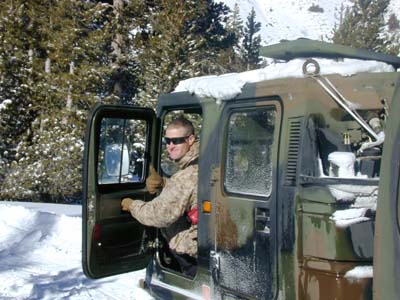
Mountain Marines Above: I meet the best Americans running around the cold High Sierra East of Sonora Pass each Winter. The captain in his snow-cat thingy pulling a cart full of mountain trainer sergeants... Hell'O Good Dudes... For more on this trip and Marines in the Mountains, see Current Conditions
|
The Cross Country Route As I mentioned on the previous trail guide page to the North, the Pacific Crest Trail hiking South from Latopie Lake to the Southern gap over to the South flank of the Leavitt Massif is now in fine condition as of 2006 or so... It was in poor condition prior to its substantial repair. What follows below describes the cross country route South from the South side of Latopie Lake turning Southwest up the little hanging valley laying to the South of Latopie Lake. We rejoin the Pacific Crest Trail route passing through the Southern gap over to the South flank of the Leavitt Massif. |
The Cross Country Route
 |
||||
On the Flat South of Latopie Lake The first section is a traverse that is a bit difficult, but the terrain flattens considerably as we hike further up into the valley and begin bending our route towards the flatter terrain at its center. Once we have ended our traverse down the South flank of the valley we find that most of the remaining distance up to rejoin the PCT is a fairly gentle grade on firmly-packed surfaces. Down to Leavitt Lake and the Tungsten Road? I have found most of the local folks out there to be very cool. During Winter I've hiked up the snow covered Highway 108 from the snow gate West of the Marine Base up to Sonora Pass, South over Leavitt Peak to Latopie Lake, then down and back out through Leavitt Lake down to Highway 108 along the (snow covered) Tungsten Road, then East back to the snowgate near the Marine Base. That's a hell of a fun Winter trip!
|
Unique Things
in the
Valley South of Latopie Lake
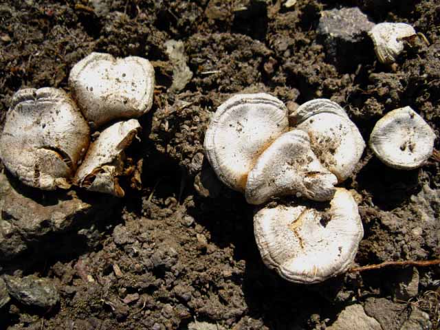 |
Unique and tough fungus. Mountain Mushrooms at 10400 feet of elevation. Wow. This entry: Identify it! |
 |
||
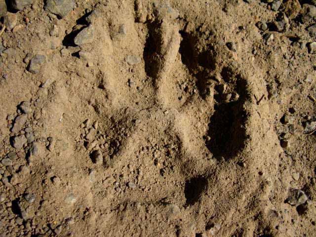
Bobcat track, most likely. Maybe a lion. A day old judging by the previous day's winds. Lots of little critters up here, and a few larger ones chasing them around, apparently. I keep my eyes open, travel quietly, and I've only encountered cats up here a few time in a few decades. They are very observant and very elusive. Here, Kitty-Kitty... Sonora Pass to Kennedy Canyon Forum Comments Why are cats prowling up here, especially when there are easier ways to cross over the crestline between forested valleys? The answer is a half-mile South of these cat tracks and/or scattered throughout the high forests of whitebark and fields of talus. A half-mile South from these cat tracks I encountered a great buck leisurely grazing along the Southern Flank of Leavitt Peak at above 10400 feet of elevation. The buck may have an edge. I never see hunters up here, and I look, only to find the highest of the deer hunters below these heights. This Buck came up high to avoid the hunters. But it appears that the natural predators, including this cat, are hunting the Sierra Crestline itself. It should be fruitful hunting for high altitude cats with or without the high altitude bucks. The fields of talus surrounding us house many small mammals.
|
Fine rock sculpture garden in upper valley
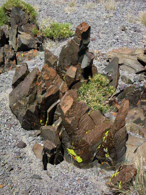 |
This little valley features a sculpture garden. A little Rock Sculpture Garden displaying color, shape, and life in this moonscape that is not as barren as it first appears. Note the flattish terrain. Once we get off the traverse and enter the center of the valley we soon climb up to an almost flat area. Unique Features Second, the rock garden features pictured above. I don't frkn know. Maybe they are occasionals, once bigger chunks of volcanic terrain carried down by the ancient glaciers and deposited here, then subsequently eroded into their unique shapes over thousands of years of erosion. Otherwise, the erratic shapes of these rock formation reaching skyward are totally out of place in this valley of smooth glacially carved terrain. Maybe these out of place rocks were shot here out of a volcanic cannon... those volcanos do blast rock quite some distance, sometimes. This might be a little piece of Disaster Peak sitting on Leavitt's Southeast Flank. In any case, I find the combination of the sharp shapes and ruddy red colors of these very irregular natural rock sculptures well highlighted by the delightful growth of plant and lichen, and their contrast with our uniform surroundins of glacially compressed, cut, and rounded gray terrain to be both relaxing and stimulating at the same time. Third, there is a big old human-build rock circle up here. It's located in the upper part of the flat section of this little valley, on the South side of the upper flat. This circle is about 30 feet in diameter, made up of medium sized rocks separated by about two and a half feet along the circumference of the circle, with a rock positioned in the center of the circle. This rock circle may very well be very old, or it may only be a century old. I think the first time I encountered it was in the mid-1990s, so I know it's older than 17. It might be pre-Western. If you want to find the rock circle stay on the South side of the upper flat as you hike through. I probably have pictures of this unique rock circle somewhere, but I have not found them yet. In any case, the cross country venture hiking up and across this isolated little valley to the South of Latopie Lake is a nifty little cross country hike. Though it is now harder than the PCT route through this segment of terrain "between the gaps," this little cross country route imparts a timeless feeling of inextricable and powerful ancient forces incrementally moving space through time, even now. |
Approaching the top of the Valley and the PCT
The Southern Gap
 |
||
As we reach the top of our little valley it opens up into the wide basin where the top of the great glacier that cut this mountain and its valleys began its downward flow. In the image above we have ascended past the flat across the center of the valley and are hiking up onto the North-facing flank of our little valley to join the Southbound PCT. The PCT is running North-South below the crestline under the East flank of Leavitt Peak above us to where it passes onto the Southern flank of the Leavitt Massif through the highest gap. That gap is obscured behind the middle peak to the Left above us. The gap itself is hidden behind that peak, while the ridgeline ascending behind it rises up to Leavitt Peak out of the Right edge of the image. We can't see the line of the Pacific Crest Trail yet, but it's up there. The ridge running off the top-Right side of the image above is the gently ascending ridgeline up to the summit of Leavitt Peak. That would be the route up to Leavitt Peak for you peak baggers. The North-South line of the PCT route runs along the base of that ridgeline. From our current position we've got to continue climbing up to the PCT, then turn Left to follow it South through the gap onto Leavitt Peak's South flank. Leavitt Peak is about three-quarters of a mile up the gradually ascending ridgeline, off to the Right out of the frame of the image above. Our position is below and Southeast of Leavitt Peak, and just below the PCT route. Looking up at the PCT route About a half mile to our North, off the Right side of the image above, is where the PCT route comes off of the big lateral moraine under the East Flank of Leavitt Peak onto the more solid trail under the the Southeastern flank of Leavitt Peak above our valley. This is where Leavitt Peak's Southeastern ridge arm begins its long descent. In the image above we're almost there, there being rejoining the PCT... maybe 400 yards. The gap where the PCT transitions between the East and South flanks of Leavitt Peak is also the point those folks climbing Leavitt Peak turn Right-Northwest- for their final climb up the ridge arm to the top of Leavitt Peak.
|
The PCT through the South Gap
over to the
Southern Flank of Leavitt Peak
 |
||
Approaching the Gap in the ridgeline between the Eastern and Southern flanks of Leavitt Peak along the Pacific Crest Trail.
|
Pacific Crest Trail through the Southern Gap
onto
Leavitt Peak's South Flank
 |
||
Crossing over to the South flank of Leavitt Peak we can now see into the high heart of the Emigrant Wilderness across the intervening valley holding Kennedy Lake and Creek. Note the rough nature of the talus piled up to the Left of the trail in comparison to the smoothness of the trail. This should clue us into the difference in effort required to cross rough talus or hiking smooth trails. It's a big difference. Stanislaus Trails has spent a lot of time breaking up this section of trail over Leavitt Massif during the last decade, between 2004 and 2014. This is a very improved segment of trail. All those small smashed up talus rocks making up the trail route took lots of sledge work. Lots and lots. Thanks trail crew! The valley to our South holding Kennedy Lake and Creek opens up below us as we pass onto the South flank of Leavitt Peak.
|
View South from the South Gap
Kennedy Lake and Kennedy Creek
 |
||||||
Kennedy Lake and Creek At the top of this West flank canyon only a low spot along the Sierra Crest between Leavitt Peak and Big Sam divides it from Kennedy Canyon dropping down the East flank of the Sierra. These two back to back canyons descending off each flank of the Sierra Crest opens up our route options at the upcoming Kennedy Canyon trail junction situated on the Sierra Crestline between them. Let's take a look down the valley holding Kennedy Lake and at our position up here on the South Flank of Leavitt Peak from a position climbing Big Sam. Kennedy Lake Local Backpacking Options The East-West trail running up and down the floor of this valley below us connects our upcoming Kennedy Canyon trail junction along the PCT with the Tahoe to Yosemite Trail at a point a couple of miles below Relief Reservoir and a couple of miles above Kennedy Meadows Pack Station. The Specifics The upcoming Kennedy Canyon trail junction is 3.48 miles South from our present position in the Southern gap overlooking Kennedy Lake. Kennedy Lake is 3.05 miles West down faint unmaintained trail from the Kennedy Canyon trail junction. From Kennedy Lake 5.34 miles of well-maintained trail continues West down to the junction with the Tahoe to Yosemite Trail. A 2.67 mile hike North from the Kennedy Lake-Tahoe to Yosemite Trail junction finishes off this Sonora Pass to Kennedy Meadows backpacking trip across the Northwestern edge of Emigrant Wilderness. Adding the 4.49 miles of distance from the Sonora Pass trailhead to our current location in the Southern gap, a trip from Sonora Pass to Kennedy Meadows Pack Station measures out at 19.03 miles. At our current position in the Southern Gap we have finished climbing (except for a few undulations along the South flank of Leavitt ahead) and it is all down-mountain hiking to Kennedy Meadows Pack Station from this point forward. Sonora Pass The "Eastern" version of this hike would take us East down Kennedy Canyon from the upcoming Kennedy Canyon trail junction to bend Northeast along the West West Walker River to end our trip through Leavitt Meadow. Hiking Maps and Guide PagesBackpacking Sonora Pass to Kennedy Meadows Pack Station
Want More of the Same? We can lengthen our Sonora Pass to Kennedy Meadows backpacking trip. Instead of turning West toward Kennedy Lake we continue South on the Tungsten Road climbing over Big Sam to Grizzly Peak. At Grizzly Peak we intersect with, and turn North on the Tahoe to Yosemite Trail for the hike to finish our Emigrant Wilderness backpacking trip by hiking down to Kennedy Meadows Pack Station from a position about ten miles further South into the heart of the Emigrant Wilderness than turning back through via Kennedy Lake. Eastern The schematic of Emigrant Wilderness Backpacking immediately below Hint: The deeper we get, the better the backpacking trip. South Over Big Sam
|
Emigrant Wilderness
Schematic
Backpacking Maps
Main Routes Map
 |
||
The miles figures cover the spans between black dots. A Plethora of Local Backpacking Trips The further we hike South from our selected Highway 108 Trailhead the more trail options we open up as we access the Kennedy Canyon and Grizzly Peak trail junctions along the Sierra Crest. These crestline trail junctions allow us to begin bending a route back towards our starting trailhead, or the trailhead we selected as our final destination. The role of these two Sierra Crest trail junctions in creating interesting Emigrant Wilderness backpacking trips/loops can be finally complimented by threading our local route (in either direction) through Dorothy Lake and Bond Passes, effectively using them as our furthest "turnaround" point for long trips out of, and back into, the Highway 108 corridor. NEW, IMPROVED... These two topo trail maps linked to below are the maps corresponding to the schematic trail map. EMIGRANT WILDERNESSTOPO TRAIL MAPS
HIGH
EMIGRANT WILDERNESS Linking the roughly parallel PCT and TYT trails on the Sierra's East and West flanks across the Crest makes a whole lot of cool backpacking trips in the highest elevation areas of Emigrant Wilderness possible. Not only is this place worth exploring, it has the trails necessary to explore it. And, once we reach "high points" along these trails we find extensive scrambling and cross country backpacking terrain beckons. |
View Southeast down the South Flank of the Leavitt Massif
Turning Left through the Southern Gap we begin hiking Southeast down the Southeastern ridgearm extending from Leavitt Peak. Below we are looking at the Southeastern ridge arm extending itself Southeast down from the summit of Leavitt Peak undulating with its series of mini-peaks. These peaks are also the tops of the ridgearms bracketing Leavitt and Bigelow Lakes that we observed hiking through the North gap above Latopie Lake into the Leavitt Lake Basin. These are the peaks located along top-Right of this image above.) Leavitt and Bigelow Lakes lay a few hundred feet down at the bases of these Sierra Crestline Peaks. We will get views to the Northeast through the gaps between these upcoming peaks. |
||
 |
||
Looking Southeast down the Pacific Crest Trail along the South flank of Leavitt Massif. The peaks along this crestline divide the canyons running down to Koenig and Leavitt Lakes below their Northeast flanks. Between each peak a narrow canyon opens up between their descending ridgearms. Our upcoming intersection with the Tungsten Road coming over this crestline from Leavitt Lake is a bit further down the ridgeline than we can see from our vantage point here. Out of sight of the image above, to our Right, we can see that this Southern flank of Leavitt Peak makes up the North side of the great valley holding Kennedy Lake and Creek. Check out Kennedy Lake and the South flank of the Leavitt Massif from Big Sam.
|
Looking Northwest back at the gap we hiked through
 |
Looking North at the gap between the South and East flanks of Leavitt Peak. Leavitt Peak ascends behind the gap. Rather than turning Southeast as we have on the Southbound PCT, hikers up to the summit of Leavitt Peak will turn Right coming South through this gap to hike Northwest up the descending Southeastern ridge arm of Leavitt Peak to attain the summit. |
Early Spring Bloom on South Flank of Leavitt
 |
||
Looking Southwest off the South Flank of Leavitt Peak Spring Flowers blooming above Kennedy Lake on the South flank of Leavitt Peak. Late 1990s. We are looking South by Southwest across Kennedy Canyon into the Summit Creek valley, over on the other side of the middle-distant ridge. Summit Creek over yonder is how the Tahoe to Yosemite Trail runs up to the High Emigrant Basin.
|
Little Lake in the Little Hanging Canyon
Below the
Southeast Flank of Leavitt Massif
and Above
Kennedy Lake
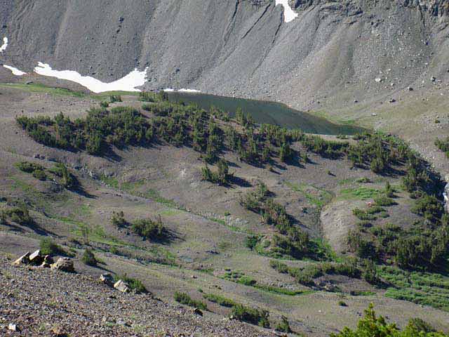 |
As we continue South along the South flank of the Leavitt Massif we see that Kennedy Lake's canyon, which was below us to our South when we hiked through the Southern gap onto the South flank, is being supplanted by a hanging canyon, a cleft in the canyon wall holding a little lake. Kennedy Lake and the bottom of the real canyon are now blocked from our view by this hanging canyon. The canyon holding Kennedy Lake is bending up to the Kennedy Canyon trail junction on the far side of the mountain rising behind this little hanging canyon. The creek running out of the Right side of the lake above runs down to feed into Kennedy Creek above Kennedy Lake. Sonora Pass to Kennedy Canyon Our Pacific Crest Trail route will bend South around the head of this hanging canyon (a short distance to the Left, to our Southeast in this image) to where our PCT route intersects with the Tungsten Road coming over the mountain from Leavitt Lake. We'll still be far above this stranded little lake. I've seen folks down there by this little lake only a couple of times over the decades, but I have seen folks down there. The creek draining this little lake flows West down to Kennedy Creek just above Kennedy Lake. Hanging Canyons? Hanging Canyon: A canyon who's floor has a higher elevation than the canyon it is merging into. Hanging canyons can produce excellent waterfall and cascade displays, as we will and have seen. Especially if we follow the John Muir Trail route down to Yosemite Valley from Tuolumne Meadows. Hanging canyons can be stunningly beautiful during Spring Thaw. Especially where a series of hanging canyons feed a basin, such as can be seen looking into the Ionian Basin (South of Muir Pass) during Springtime. |
Nice Flat for camping
 |
||||
Sweet Primitive Campsite This campsite is situated a bit closer to the upcoming trail junction with the Tungsten Road than the trail's gap onto the South flank of Leavitt. There is no water here unless there is snow to melt. There is a volcanic ledge above the trail to the Northeast that sometimes shades a line of snow late into the Summer season. It protected snow in the past, but will not do so into the future. I don't recommend this spot as a regular camping site. I have only used it when I was running behind and hiked into darkness during early Spring. The reason I stay here, rather than continuing the short hike down to Kennedy Canyon, is the availability of snow to melt for water. This spot is the most protected position on the Southern Flank. It is mostly a Winter and Spring campsite. I learned why blu-gaz does not work well at high elevation here that very cold Spring evening long ago. Unless you keep the cartridge inside your coat, with your water...
|
Wildlife up High
Buck on the South Flank of Leavitt Peak
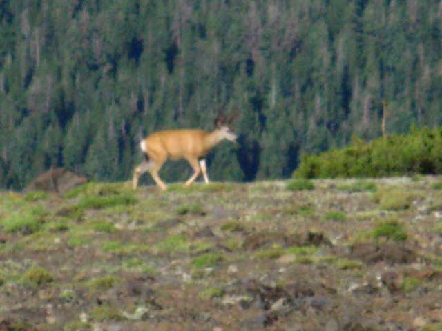 |
Buck grazing along on South Flank of the Leavitt Massif. July 30 2009. Topic |
High Elevation Buck above 10400 feet
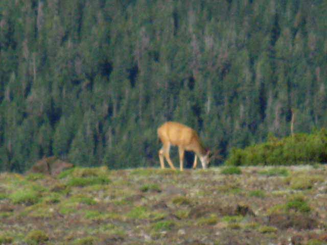 |
Stopping for a nibble. |
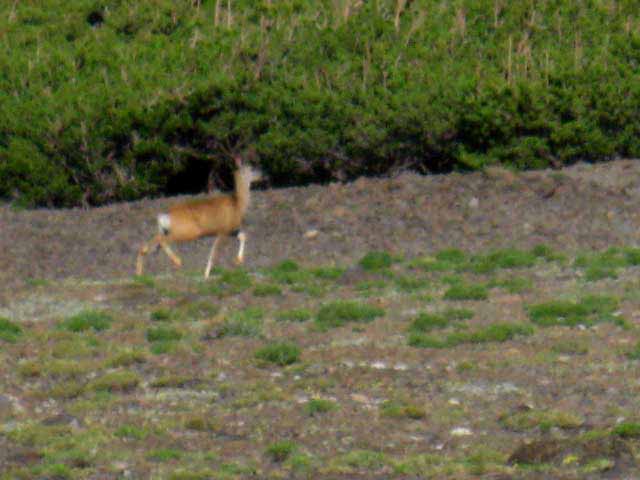
Trotting Away from Me
 |
||
Then trotting confidently and proudly away from the interfering backpacker. See-Ya!
|
Kennedy Creek
 |
||||
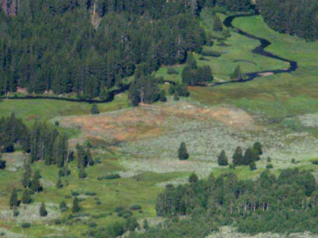
Kennedy Creek through sweet meadow below Kennedy Lake. The East-West trail along Kennedy Creek runs West down to join the Tahoe to Yosemite Trail a couple of miles South of Kennedy Meadows Pack Station. The trail running East down there above Kennedy Lake hooks up with the Pacific Crest Trail at the Kennedy Canyon trail junction, whle the trail running West tees-out with the TYT just a ways above Kennedy Meadows. That puts Kennedy Lake, and maybe even the Kennedy Canyon trail junction along the Sierra Crest within the range of aggressive, fit, and prepped day hikers out of Kennedy Meadows Pack Station.
Tahoe to Yosemite Trail Kennedy Lake is also a favorite destination for short distance backpackers out of the Kennedy Meadows Pack Station.
|
Pacific Crest Trail
Meets and Joins
the
Tungsten Road
for a
short distance
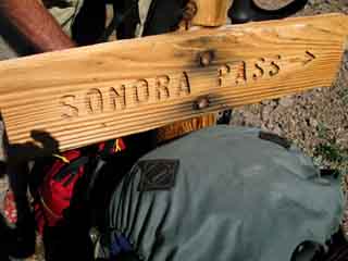
TRAIL JUNCTION
| Northern Leavitt Lake Junction | Same sign-other side | ||
 |
 |
||
Junction of the Tungsten Road from Highway 108 past Leavitt Lake with the Pacific Crest Trail high on the Southeast flank of Leavitt Peak. The sign and arrow are pointing the way North on the PCT towards Latopie Lake. From this trail junction the Southbound hiker begins descending off the South flank of Leavitt Peak down to the Kennedy Canyon trail junction. |
Trail junction from Leavitt Lake at the The lower arrow points Left, Southbound on the Pacific Crest Trail towards Kennedy Canyon.
Top of Page |
Tungsten Road Highway 108 to Snow Lake This rough old road road was built to supply WWII wartime tungsten needs. We must have needed tungsten badly to justify the significant work required to keep this road open. The Tungsten Road climbs steeply up rough terrain susceptible to damaging Spring Thaw flows along Leavitt Creek off of Highway 108 a few miles East of Sonora Pass. The road climbs through the Leavitt Lakes basin and up and over the Sierra Crest to intersect with our PCT route down to the strand of flat holding the Kennedy Canyon trail junction. Entering the High Emigrant Basin the Tungsten Road joins the TYT at Grizzly Peak and both proceed together South to Summit Meadow where the Road ends at the old tungsten mine behind Snow Lake and we continue South on the TYT over Bond Pass into the very Northwestern corner of the North Yosemite Backcountry. This map shows the whole route of the Tungsten Road: Sonora Pass Region Hiking Map
|
The Tungsten Road This trail guide is centered on the long distance trails along the crest of the Sierra Nevada. The Tungsten Road is not a long distance trail, but shares segments of its length with both the PCT and TYT along the Sierra Crestline. The Tungsten Road connects the PCT and TYT. It's not unique because it connects the PCT and TYT, which is very important, but in how it connects them. Before we get into that, here's various resources about the Tungsten Road I've collected: Mineral Resources of
the Emigrant Basin
Primitive Area,
Tungsten Road PCT to TYT and South to Snow Lake Backpacking Map USGS 15 minute topo maps Most of the trails connecting the PCT and TYT that we've seen cross the Sierra Crest. This is not how the Tungsten Road connects the PCT and TYT. The route following Tungsten Road South from Kennedy Canyon trail junction to Grizzly Peak is the only route along the Sierra Crestline across Emigrant Wilderness. The PCT deflects around the Crest to the East, the TYT to the West, but the Tungsten Road links these two trails with its crestline route. The Tungsten Road makes it possible to run a route all the way across Emigrant Wilderness along the Sierra Crestline, which neither the Pacific Crest nor the Tahoe to Yosemite routes can do on their own. Tungsten Road TYT The TYT and Tungsten Road share the trail for 1.35 miles South from the Grizzly Peak trail junction until we reach the first trail junction in the Northwest corner of Summit Meadow. Here a branch of the Tungsten Road peels off to our Southwest, the Southbound hiker's Right, down into the steep upper canyon of East Cherry Creek flowing down to Horse Meadow. Southbound hikers on the Tahoe to Yosemite Trail continue hiking Southeast, Left through the Summit Meadow junction for the short .86 of a mile climb to the Yosemite boundary running across Bond Pass. Orientation, Truck Distance and Trail Distance Start of the Tungsten Road Four Season Fun The snowmobilers are funny. They want to be social, but there has been a long war against snowmobilers on pristine National Forest and Wilderness lands. They see me, and they don't venture over until I wave, or wave back. Then they offer rides up the mountain... which I refuse, as I mentioned above. I'd like to see strict rules about mufflers. Screw the noise, but I would not outright ban snowmobilers. I'd balance their use to maintain pristine, quiet zones for folks like us, and regulate them to kill the damn noise and pollution, but I'm for maintaining reasonable, but limited snowmobile access. Access For most folks who hike the Tungsten Road out of its trailhead at Leavitt Lake this means that the hiking miles do not begin at the start of the Tungsten Road along Highway 108, but at Leavitt Lake where truck access ends and trail begins. This crestline connection also makes it a handy trail to put together local loops and alternative routes to the classic routes of the PCT and TYT. Historical Significance Historical Information The best source of information about the Tungsten Road I have found so far is the Mineral Resources of
the Emigrant Basin
Primitive Area, If you have information post it up below. One of the most fascinating aspects of the Emigrant Basin, and the Emigrant Wilderness generally, is the complex and unique geology that makes this place so beautiful. Though commissioned as an economic study, this mineral resources survey linked to above presents a comprehensive geological history explaining the beauty of Emigrant Wilderness in scientific terms. This just makes this place more beautiful! The geology of the Sierra is what sparked the Gold Rush and subsequent Silver Boom, and it has drawn in prospectors with each evolution of mineral use in technology, as the survey points out. The introduction to the survey of the Emigrant Basin Primitive Area states that; " No known published reports describe the mineral deposits of the
Emigrant Basin primitive The Montezuma Mine at Snow Lake was claimed in 1942 as one of a series of claims around Bigelow Peak, the peak above Snow and Bigelow Lakes. The survey states that Montezuma Mine was worked by mules which carried 12 tons of ore out during 1951. P.58. Another mine was also located down East Cherry Creek, aptly named the Cherry Creek Mine, or the Whittle Claim, which was established in 1954 and 1955. The Cherry Creek Mine was serviced by the branch of the Tungsten Road splitting off to the Northwest down East Cherry Creek from the current location of the trail junction on the North edge of Summit Meadow leading down to Horse Meadow. The top of Horse Meadow was the top of the Cherry Creek mining claim. It appears that the Tungsten Road was built sometime subsequent to the development of the Montezuma Mine in the early 1940s. On page 54 the Survey describes Tungsten Road in use during 1970: " (Tungsten Road is) ...a restricted-access road branching from
State Highway 108 This description is wrong in one respect. Both of the major climbs the Tungsten Road makes exceed 10,000 feet in elevation. There is no point along the nearby line of the Sierra Crest that is less than 10200 feet in elevation. The first 21 pages of the introduction to the survey are worth reading, especially page 9, as it provides a fascinating view into the complex geological history of this amazing place. It explains the terrain in basic geological terms that the layman backpacker, with a little bit of guide-book help, can understand and use to identify and understand the geological complexity this incredible place displays. It's like a geological crime scene; the guts of our planet have been ripped out and are spread all around everywhere. It's up to use to understand what it all means. My basic guide for geological history is The Sierra Club's Naturalist's Guide to the Sierra Nevada, which lightly touches every aspect of the Natural History of the Sierras. Using the Sierra Club's general natural history in conjunction with the specifics of this survey give us a fascinating look at the genesis of Emigrant Wilderness. Physical Location of Tungsten Road The Tungsten Road South from Leavitt Lake runs up and over the ridgearm behind Leavitt Lake to intersect with the Pacific Crest Trail at 10,600 feet of elevation along the Southeastern flank of that Leavitt Massif ridgearm. From there the PCT and Tungsten Road proceed South descending together to the Kennedy Canyon trail junction. From the trail junction at the top of Kennedy Canyon the PCT turns East down Kennedy Canyon while the Tungsten Road continues South over Big Sam into the heart of the Emigrant Wilderness.
The Tungsten Road crosses the Sierra Crest on the far upper-Left of the image above, between the cone sticking up from the crestline and the next peak rising to the Right of that. That's 10720 feet of elevation. The Tungsten Road's intersection with the PCT is just over the top of that segment of the crestline. Check with the Bridgeport Ranger District of the Toiyabe National Forest for the condition of the drivable segment of the Tungsten Road from Highway 108 to Leavitt Lake. They will say "use at your own risk," and "be able to get out of what you get into." Good Advice! *** Updates June of 2016 (Fall 2011) I have been told by a few hikers that the Toiyabe Forest has closed the Tungsten Road from Highway 108 up to Leavitt Lake to vehicle traffic. Previously the Toiyabe Forest ran a scraper up the road to Leavitt each Spring (more or less) to clean it up for four-wheeler traffic. My information was that the Toiyabe now keeps the gate closed all Summer long. A call to the Bridgeport Ranger District of the Toiyabe National Forest on Nov 20, 2012 and a brief conversation with Mike has dispelled that rumor. The Tungsten Road from Highway 108 up to Leavitt Lake is open for vehicular traffic during Summer and for snowmobiles during Winter. As with the many dirt roads into the Sierra maintained by the National Forest, they try to run a scraper through every Spring, but this may or may not happen. The Bridgeport Ranger District does not guarantee that their dirt roads are graded or in good condition. Give the Bridgeport Ranger District of the Toiyabe National Forest a call for the latest information on road conditions.
|
Hiking the short distance between these junctions along this strip of ridgline I met
Terripan
 |
||
Terripan, a ripping cool backpacker out of Mammoth Lakes. We kicked it at the South junction and enjoyed the view. The top of Big Sam is visible to the Right of Terripan's headband.
|
A short distance South from the above junction we come to junction dividing the hiking and horse trails down to the Kennedy Canyon Trail Junction
 |
||
North to Sonora Pass--South to Yosemite Second Tungsten Road trail junction. The first was the Tungsten Road intersecting with the PCT. This second junction is where the Tungsten Road"s switchbacking line down the South flank of Leavitt Peak is designated as a Horse Trail to the Kennedy Canyon junction, while the distinct foot path takes a straight line down the flank to the Kennedy Canyon trail junction.
|
Flat between Mountains and Valleys This well-situated flat sits between our position on the South end of the Leavitt Peak and Big Sam rising to the South. Kennedy Canyon descends to the East, and Kennedy Creek runs West down in its valley. |
 |
||||||||||
Above: Looking South from the Southern flank of the Leavitt Massif We are viewing the terrain South of Leavitt Peak from the Southeastern flank of the Leavitt Massif before dropping down to the Kennedy Canyon trail junction. In the foreground Right of the images above and below we are looking at the same section of the horse trail-Tungsten Road zig-zagging down and off the Southern flank of the Leavitt Massif toward its intersect with the foot trail, but from different directions. Below we can see that our foot trail option off Leavitt Peak intersects with the end of the lower switchback of the horse trail, which is the Tungsten Road. The image below views the Southeastern descent of the PCT-Tungsten Road off Leavitt Peak from the treeline at top of Kennedy Canyon. Our Kennedy Canyon perspective makes it clear that the foot trail is a much more direct route off the East flank of Leavitt Peak than the Tungsten Road. In the middle distance of the image above we can see the flat between Kennedy Canyon to the East and Kennedy Lake to the West where the Kennedy Canyon trail junction is located. The Big Sam Massif rises on the South side of the Kennedy Canyon trail junction. Big Sam itself is the low rounded high point decorated with patches of snow in the distant background Right of the image above. That's Big Sam!
Below: Looking North at the Southern Flank of the Leavitt Massif Tungsten Road-PCT There are a couple of lengths of the foot trail route coming down the South flank of Leavitt Peak that are degraded, steep, and a bit slippery at the top of the trail. From the Kennedy Canyon trail junction below we can backpack South, West or East. North is at our back. Mapping our View
Trail Guide
|
Bird's Eye View of Kennedy Canyon trail junction options
We're hiking down the South flank of Leavitt Peak, but we're going to take a second to figure out our route options from up here before losing elevation and our high perspective.
|
Heading down to the flat
Last bit of Tungsten Road down to Kennedy CanyonTrail Junction
 |
||
Looking South at the Tungsten Road-Pacific Crest Trail down to the Kennedy Canyon trail junction beyond the switchbacks.
|
Looking Southeast
across
Kennedy Canyon
 |
||
Kennedy Canyon viewed from the North while hiking down to the Kennedy Canyon trail junction from the South flank of Leavitt Peak. The Pacific Crest Trail runs East-West through Kennedy Canyon, turning right through its base to begin climbing for Dorothy Lake Pass. Kennedy Canyon to Dorothy Lake Pass
|
We can see the outline of the Tungsten Road carved along the base of the far mountainside past the flat on its way to climb Big Sam
Last Step South to Kennedy Canyon Trail Junction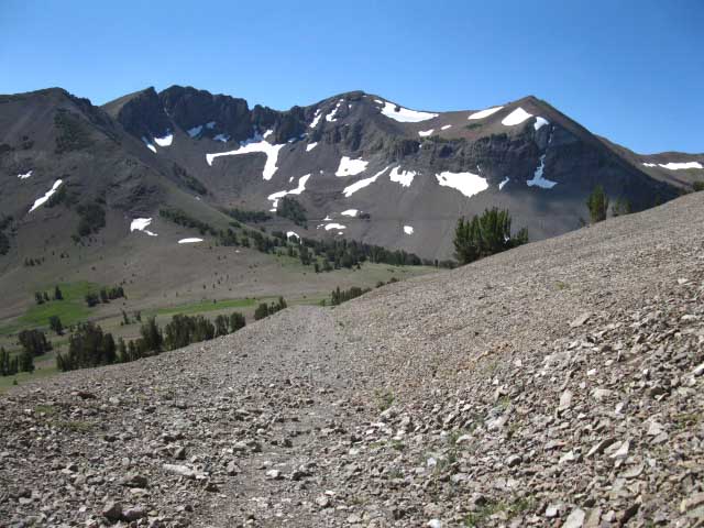 |
||
Looking South down the Pacific Crest Tail from our position hiking South down the Tungsten Road off the Southern flank of Leavitt Peak. A low saddle South of Leavitt Peak separates Leavitt Peak from the Big Sam Massif to the South. Valleys dropping off both the Eastern and Western flanks of the Sierra descend from this flat between Sierra Crestline peaks. Before us we see the low saddle dividing Kennedy Canyon running down the East flank from Kennedy Lake down the Western flank. South beyond the low saddle we can also see the Tungsten Road South of the Kennedy Canyon trail junction cutting across the base of distant facing mountain on its way to climb over Big Sam. Big Sam is just out of sight off the Right edge of the image above. Which way we proceed will depend on our hiking plan.
|
Looking East Down Kennedy Canyon at the Southbound Pacific Crest Trail route
East Down Kennedy Canyon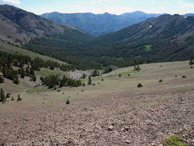 |
||
Looking East down Kennedy Canyon. Dropping down lower off the South flank of Leavitt we get a view straight down Kennedy Canyon. This will be our route if we are hiking South on the Pacific Crest Trail. At the bottom of Kennedy Canyon the PCT turns Right to begin its climb up to the Yosemite boundary through the West Walker watershed. The West and West West Walker Rivers run past the end of Kennedy Canyon.
|
Kennedy Canyon Trail Junction
Crucial Trail Junction Backpacking Emigrant Wilderness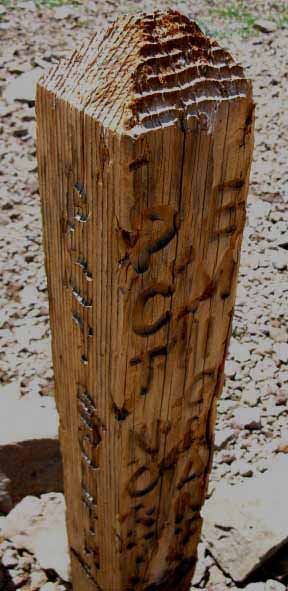 |
||
Kennedy Canyon trail junction.
|
| Backpacking Emigrant Wilderness FROM Kennedy Canyon Trail Junction via these Trail Guide Pages |
|||
| North PCT Sonora Pass to Latopie Lake |
South PCT (East by Compass) Kennedy Canyon to Dorothy Lake Pass |
South to TYT Big Sam into Emigrant |
West to TYT Kennedy Lake |
| Backpacking Emigrant Wilderness Backpacking Maps |
|||
| Sonora Pass to Latopie Lake |
Central Emigrant Wilderness Backpacking Map |
PCT to TYT Kennedy Lake to Summit Creek |
|
South Long Distance That's where all this hiking is leading us, by one route or another: We are "funneling" into the top of Jack Main Canyon for our final run to From the Kennedy Canyon Trail Junction we have two basic routes to get into the top of Jack Main Canyon in the furthest Northwestern corner of Yosemite National Park, where the routes of the PCT and TYT join for the remainder of our hike South to Tuolumne Meadows. PCT TYT From Grizzly Meadow we continue South along the combined Tungsten Road-TYT to where the Tungsten Road turns South and the TYT climbs into Yosemite over Bond Pass just below the top of Jack Main Canyon, just a tad South of Dorothy Lake. It's All Good
The restrictions of even imaginative route-making on long distance backpacking trips induces us to return to explore Emigrant Wilderness through backpacking loops and trailhead to trailhead hiking arcs unconstrained by the demands of high-mileage long distance backpacking. Emigrant Wilderness and the adjacent Toiyabe National Forest have more meaningful experience than I have time and energy. It's I do hit bottom. Such is the Human Conditon.
Medium Distance We can plan many medium distance backpacking loops from the various trailheads along Highway 108 (Sonora Pass, Leavitt Lakes, Leavitt Meadow, Kennedy Meadows) that can pivot on this Kennedy Canyon trail junction between Kennedy Canyon and Kennedy Lake. This low point along the Sierra Crestline allows us to carve out some pretty fine short-to-medium distance trailhead to trailhead routes around and across a Northern slice of the Emigrant Wilderness via the Kennedy Canyon trail junction. Central Emigrant Wilderness Some hiking trip options South from the Kennedy Canyon trail junction West and West West Walker Rivers We can see how the configuration of trails and junctions here opens this place up. More Options The West West Walker and its trail along the Chain of Lakes both merge into the West Walker and its trail Northeast to Highway 108 through Leavitt Meadow. Both routes are really pretty! This area surounding Walker Meadows to the North of the WW Walker Bridge up to the base of Kennedy Canyon and then East to the line of the Chain of Lakes contains a lot of terrain quite adequete for cross-country exploration. There are lots of abandoned trail routes and animal trails that probe most of this delightful little shelf of terrain. Check this area out on the map below. Explore this Unique Area I really neeed to get out there and explore more along the West West Walker below its bridge... This feeling of unique isolation in there continues down along the trails leading us down and out of the wilderness through Leavitt Meadow along Highway 108 at the base of the East Flank of the Sierra. Like other Sierra Nevada Trailheads and Trails, this one through Leavitt Meadow up through Chain of Lakes to Walker Meadows and back to Kennedy Canyon can be busy during peak Summer holidays, but nothing like Yosemite or Desolation Wilderness. Check the far East side of this map for a detailed view of this area: Sonora Pass to Dorothy Lake Pass I have not hiked from Leavitt Meadow to the PCT route at the West West Walker bridge for at least ten years. More accurately, I did a series of hikes out of Leavitt Meadow about 17 years ago to check out the West Walker River, the Chain of Lakes, and the trail up to Emigrant Pass along the West West Walker.
But, as we are already so far in at the West West Walker River Bridge, it would be a shame not to turn South to follow the PCT route up past Lake Harriet, Stella Lake, and through Dorothy Pass Lake. We can get up to observe the great terrain of the Saurian Crest and Tower Peak while climbing up to the Toiyabe-Yosemite boundary along the Southbound PCT in the West Walker River's watershed. It's very nice, and we can bend a loop back down to the West West Walker bridge over Bond Pass to hike back through Emigrant Pass... Central Emigrant Wilderness
Turning West From the Kennedy Canyon trail junction Sonora Pass to Kennedy Meadows hikers will begin turning their horseshoe shaped route the other way, West from the Kennedy Canyon trail junction, towards Kennedy Meadows Pack Station via Kennedy Lake. Last Turnaround Point for the Longest Backpacking Loops in Emigrant Wilderness From Dorothy Lake Pass a short hike South down Jack Main Canyon along the PCT brings us to the trail junction leading Westward up to Bond Pass. This would be our turnaround point if we are circling back to complete a loop back to Sonora Pass, Kennedy Meadows, or Leavitt Meadow. Once we hike North through Bond Pass our destination determines our trail selection. Another option is to continue South over Big Sam from the Kennedy Canyon trail junction to pick up the Tahoe to Yosemite Trail route at Grizzly Peak. From Grizzly Peak we can turn to the Northwest to hike a big arc from Sonora Pass to end our backpacking trip at the Kennedy Meadows Pack Station. As we can see, hiking South from Sonora Pass offers two levels of length for looping hikes. Our Southbound leg follows the Sierra Crest to turn North through one of three levels of trail junctions South of Sonora Pass. The first level turn-around is through the Kennedy Canyon trail junction. The next level turns around through Grizzly Peak. At the top of Kennedy Canyon and at Grizzly Peak we encounter trails to both the Northwest and the Northeast. The trail Northwest is the Tahoe to Yosemite Trail heading down to Kennedy Meadows Pack Station via Summit Creek. The Northeast trail drops down the Eastern flank of the Sierra towards Leavitt Meadow via the West and West West Walker Rivers. Once we get to Jack Main Canyon along either the PCT or TYT route we can only loop back towards Highway 108 on the other. Or continue South through the North Yosemite Backcountry to Tuolumne Meadows.
We've essentially a series of loops of increasing size we can backpack around and through the spectacular beauties and amazingly diverse terrain of the Emigrant Wilderness. Well, as long as we don' t mind dipping into a bit of the Toiyabe National Forest and Yosemite National Park along the outer limits of our bigger backpacking loops. Hiking loops and trailhead to trailhead hiking trips South from Sonora Pass allows us to plan trips that can explore trails along the Sierra crest as well as the Eastern and Western Flanks of the Sierra from the Yosemite boundary to Highway 108. These are fantastic short-to-long distance backpacking loop and trailhead to trailhead trips around and across the Emigrant Wilderness and Toiyabe National Forest. Stunning trips, really. I recently (July 2012) put together a 90 mile trip beginning and ending at Kennedy Meadows Pack Station. Map Words Southbound hikers out of Sonora Pass can take either route South from the Kennedy Canyon trail junction (PCT or the Tungsten Road over Big Sam to TYT at Grizzly Peak) and end up in the same place at the top of Jack Main Canyon in Yosemite, though through completely different terrains. On the trail guide continuing below I've laid out Trail Guide pages hiking all of these route options. We can spend years exploring the Emigrant Wilderness...
|
North PCT: Sonora Pass to Latopie Lake South PCT: Kennedy Canyon to Dorothy Lake Pass
South to TYT: Big Sam into Emigrant West to TYT: Kennedy Lake
Latopie Lake |
||||||||||||||
Latopie Lake to the Kennedy Canyon Trail Junction The Kennedy Canyon trail junction is just another trail junction for long distance backpackers along the Pacific Crest Trail route South towards Yosemite, yet it is also a critical trail junction for local backpackers hiking long circle routes or trailhead to trailhead trips around or across the Emigrant Wilderness, respectively. From the Kennedy Canyon trail junction trails emanate in all four directions. North to Sonora Pass along the Northbound Pacific Crest Trail. West to the Tahoe to Yosemite Trail a couple of miles South of Kennedy Meadows via Kennedy Lake. South into the heart of the Emigrant Wilderness to join up with the Tahoe to Yosemite Trail at Grizzly Peak via Big Sam. East by the compass hiking Southbound on the PCT down Kennedy Canyon. We can get to the Kennedy Canyon trail junction from all the "nearby" Highway 108 trailheads, being Leavitt Meadow, Sonora Pass, and Kennedy Meadows. Thus we can bend our route through the Kennedy Canyon trail junction to end our hiking trip at any of the other Highway 108 trailheads along the Sierra Crest and both flanks. Check out the maps, miles and elevations, and trail guide pages linked to below to plan your long distance backpacking trip through Emigrant Wilderness along the Pacific Crest & Tahoe to Yosemite Trails, or shorter backpacking trips hooking these trails up to remain within Emigrant Wilderness. Maps-Miles & Guide Pages
|
Scroll up to view PCT route North to Latopie Lake from the kennedy Canyon trail junction
This Trail Guide Hikes North to South If you are hiking South to North then you may want to inspect these pages from the bottom up. I'm experimenting with linking to the bottom of each Northbound Page to simplify use for Northbound hikers. What do you think? |
Backpacking Trail Guide PCT PCT |
 |
Backpacking Trail Guide South West |
Backpacker Forums Have a great Emigrant Wilderness backpacking loop or story to relate? A great cross-country scramble over its unique granite? A fine piece of gear? Or gear that failed?Post it onTahoetoWhitney.Org Become a MemberAll backpackers can comment.
|
| High Sierra Trails | High Sierra Topics |
If you have experiences, comments, questions, or pictures and videos of the Pacific Crest Trail between Sonora Pass and Tuolumne Meadows, share 'em here.
Weave your threads of experience into the fabric of the guide.
Forum Section
Sonora Pass to Tuolumne Meadows
Forum Segment
Latopie Lake to Kennedy Canyon
trailhead
Contact
Alex Wierbinski

Backpacking Lake Tahoe to Mount Whitney
Your Guide to the High Sierra Crest, including the Tahoe to Yosemite, Pacific Crest, and John Muir Trails
