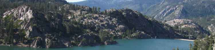
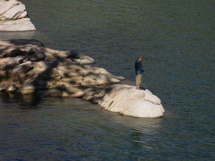
Looking back at Relief Reservoir as we climb South on the Tahoe to Yosemite Trail towards Brown Bear Pass.
The Trails
Guide
Maps
Miles/Ele
Permits
Resupply
Forum
Current Weather Conditions
Weather Notes
Northern High Sierras
Central High Sierras
Southern High Sierras
Gear
Gear List
Gettin Started
Layering
Discussion
Testing yourself and your gear
Gear Reviews
Part III
Backpacking Trip
EXECUTION
Trip Report
&
Trail Culture
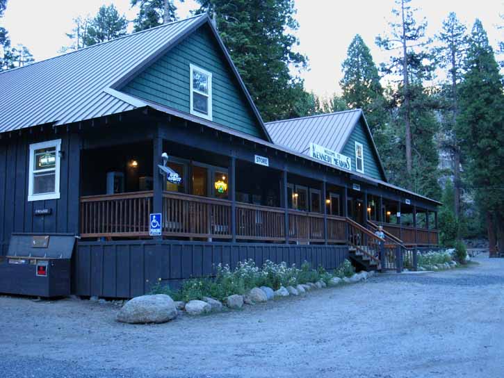
Kennedy Meadows Pack Station
BACKPACKING
Tahoe to Yosemite Trail
across
Emigrant Wilderness
&
Its Local Backpackers
Languages
Languages
Trail Arts
The art of walking
Physical Preperation
Trail Skills
The trail
Off the trail
Scrambling
Maps
Navigation
Camp skills
Food
Resupply
Food
Other
Photo Catagories
Trail Stories
Trail Culture
News and Science
Links
Groups
Books
Terms and Conditions of Use
Part III
The Backpacking Trip, Trails, and Culture
REPORT
Backpacking
Emigrant Wilderness
into the
North Yosemite Backcountry
Backpacking Report Emigrant Wilderness
Kennedy Meadows Resupply Though offset 9 miles down the West Flank from the PCT across Sonora Pass, Kennedy Meadows feels like part of the PCT. EARLY JULY Highway 108 is just a bit more than 1000 miles (1016.9) North of the Mexican border along the Pacific Crest Trail. Edge of Trail Culture KM has a unique local character and culture that's all its own, as well as reflecting the national and international characters of PCT hikers...
We check out a sample of Emigrant's Backpackers of 2016, below. We will again run into the thick flow of Northbound Pacific Crest Trail hikers once our TYT crosses over Bond Pass out of Emigrant Wilderness and into Yosemite to where it rejoins the PCT in the top of Jack Main Canyon. Then the trail gets busy again. Let's get this party started! |
Backpacking 2016 Part III Start Point Correction: One Carrier? Beyond the far end of the Lodge we can see the gate where our trip begins by picking up the Tahoe to Yosemite Trail continuing South from Kennedy Meadows into Emigrant Wilderness. Backpackers on the Pacific Crest Trail have hitched down to Kennedy Meadows from Sonora Pass, which means they have to hitch or find a ride back up to the route of the PCT crossing Sonora Pass at the top of Highway 108 to continue their trips. Sonora Pass and the Pacific Crest Trail are located 9 miles East of Kennedy Meadows. Nine miles of the most steeply climbing section of Highway 108 up the West Flank. Our trip South on the TYT starts through that gate beyond the Kennedy Meadows Lodge.
More
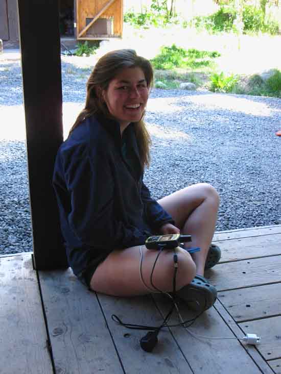
At Kennedy Meadows Backpacker Services
Information
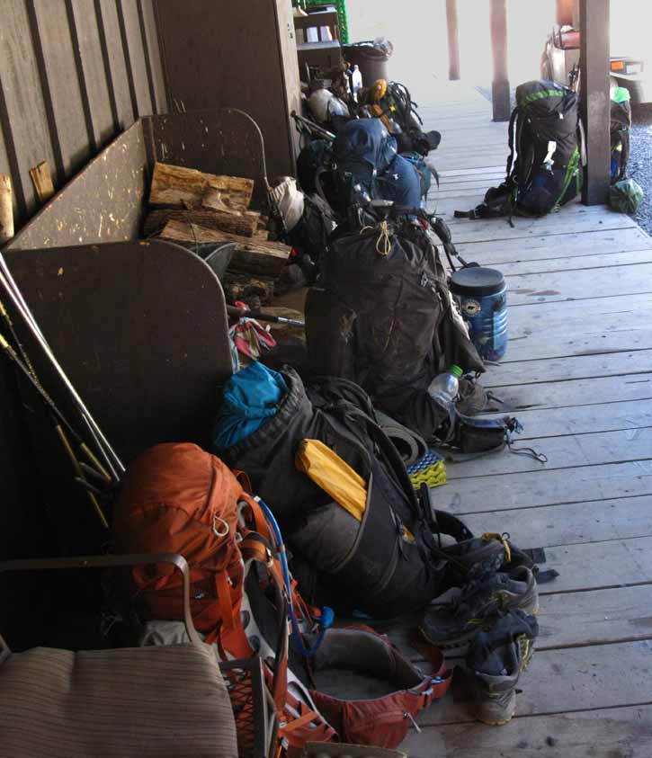
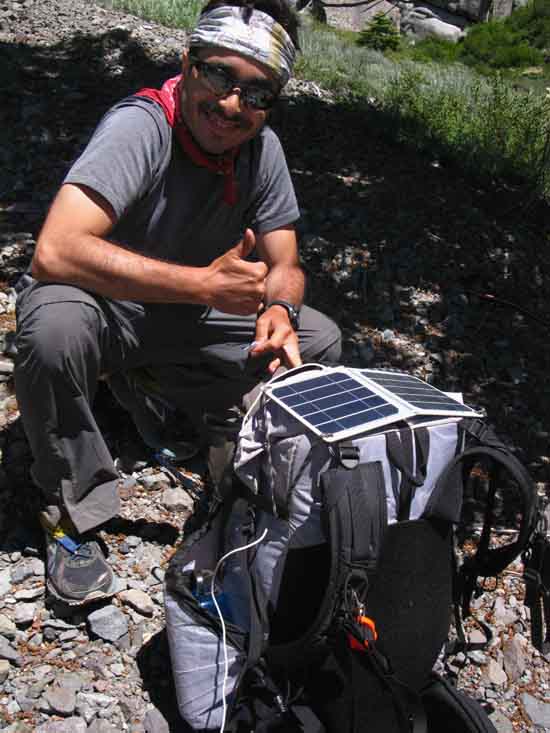
Pack Attack Kennedy Meadows provides minimal text and email wi-fi (?) and charging service.
|
Trail Report
&
Culture Review
INDEX
Over the Years
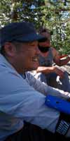
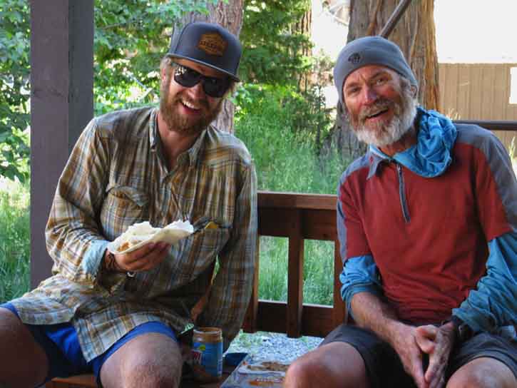
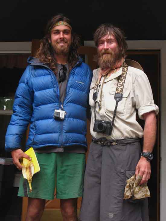
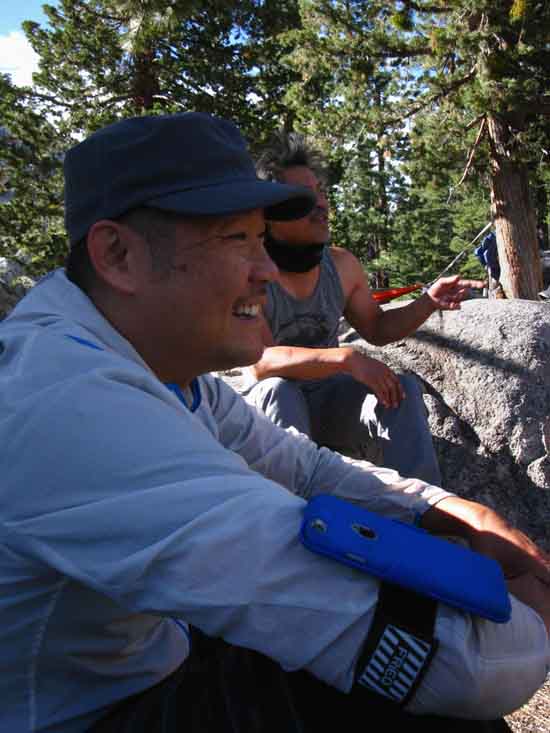
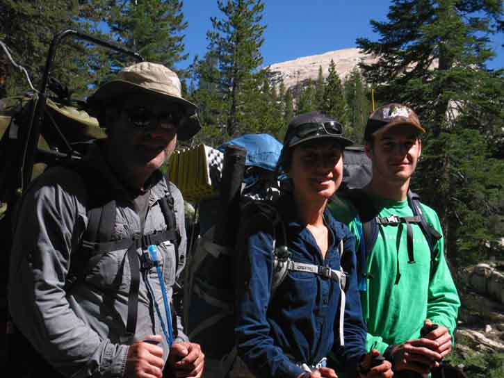
2016 Why are these People Smiling? All in the Family TRAIL ANGEL Emily has family, relatives, and friends deployed around Kennedy Meadows all having a good time. I believe Emily started down her path to "Trail Angel" to really help out a PCT hiker in need, then just naturally helped out the rest of the PCT hikers until she was worn out! Backstory Returning to Kennedy Meadows Emily began talking to the very interesting groups of PCT hikers about their fellow hiker, and their trips, which induced Emily to give a bunch of PCT hikers rides up to Sonora Pass to continue their Northbound hikes. PCT hikers can expect to see folks like Emily who's good will helps them through a tough spot along the trip. These folks are known as "Trail Angels" by the PCT hikers, and the things they do, as, "Trail Magic." Emily is typical of the many folks who visit the Sierra every year that I look forward to meeting. Emily is one of them. |
Backpacking Into Emigrant Wilderness Before getting started we need the trail guide information for backpacking the TYT South into Emigrant Wilderness, and to put this information into a usable context. Here it is below, including information on the route of the PCT.
First
Kennedy Meadows to Relief Reservoir Our final approach to Relief Reservoir descends the last mile to our campsite's location on its Southeast shore. I prefer making this climb/hike up to Relief Reservoir during the morning or evening when the narrowness of the lower canyon has not build up excessive heat, and the exposure across our final approach is minimal. Starting our trip into altitude, climbing, and heat simultaneously is stressful.
Trail Guide Page Map
|
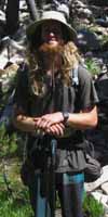
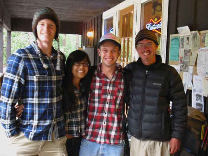
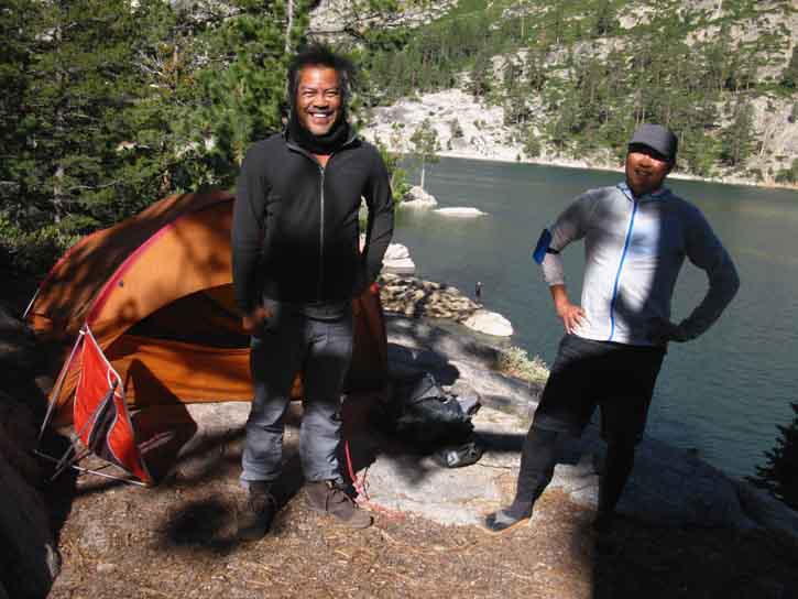
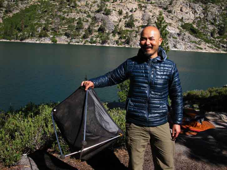
The 3 Bros After setting up my camp on the Southeastern shore of Relief Reservoir in the very late afternoon I was wandering around scouting out the other campsites in the area and situating the location main trail leading from the campsites back to the TYT. I had taken the shortcut from the Southbound TYT into the campsite area. I was taking the main route back to the TYT. The main route connecting Relief Reservoir campsites to the TYT terminates in a nice, big campsite under a big fat juniper tree (Trail Guide: Relief Reservoir Campsites) where I found the Three Bros camped. The dudes invited me to kick back and enjoy the warmth of their nice fire, their good will and spirits, and the good spirits from their bottle. So I had a nice drink and a great conversation. It was very nice to meet the Three Bros at Relief Reservoir. The Ideal Weekender I passed through the Three Bro's camp again on my way South the next day and kicked back for a while before hitting the trail South.
Good Campsite Conversation
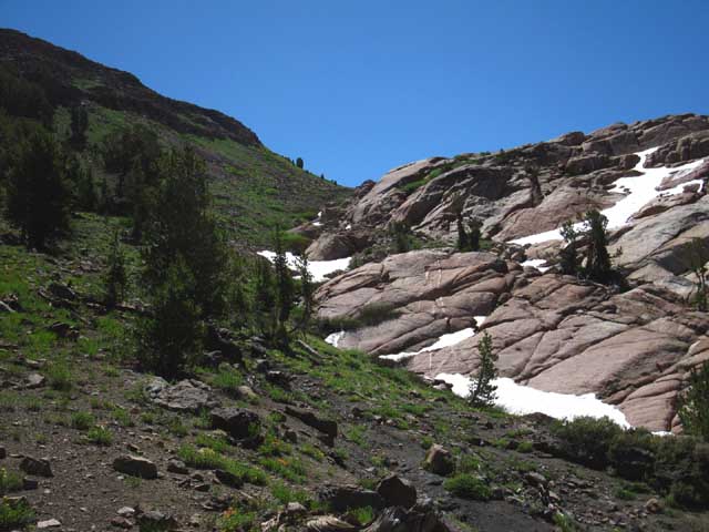
Nice Setup After my second visit with the three bros I followed the main trail back to the Tahoe to Yosemite Trail. Along the way I was thinking that their short but sweet trip into Relief Reservoir for a long relaxing weekend was something I should do more of. I was thinking it would be nice to spend another night at Relief Reservoir and kick it with the 3 Bros, but decided to push South. Following the Southbound Tahoe to Yosemite Trail next brings the long steady climb to Brown Bear Pass accessing the Emigrant Basin along the Sierra Crest. Next |
Relief Reservoir
To the Crest This image shows us climbing up from Relief Reservoir to get into the center, the mouth of the canyon, where Summit Creek runs. I describe the canyon as "bifurcated" and "very interesting" because the South wall of the canyon is composed of the pure granite of the amazing Granite Dome feature, while the North wall of the canyon is the Western nose, the West end of the amazing volcanic ridge capped by Relief Peak. These images give us some idea of how the canyon is uniquely split down the middle between granite and volcanic terrain. We find a series of very nice campsites located along Summit Creek running all the way up to Brown Bear Pass once we climb up into the mouth of the valley. First we hike up to and by the series of mostly-restricted campsites above Saucer Meadow (as of 2016, contact Summit Ranger Station), then make the climb up through a narrowing canyon into and through an amazing gap leading us out into the constrained open space at Sheep Camp, and finally we hike into expanding meadow as we pass by the sites located at the bottom and then the top of Lunch Meadow as we make our final approach to Brown Bear Pass.
Trail Guide Entries
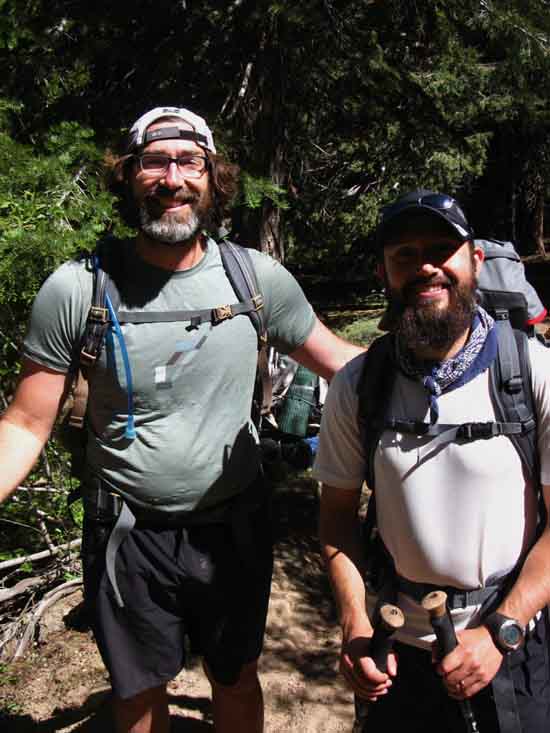
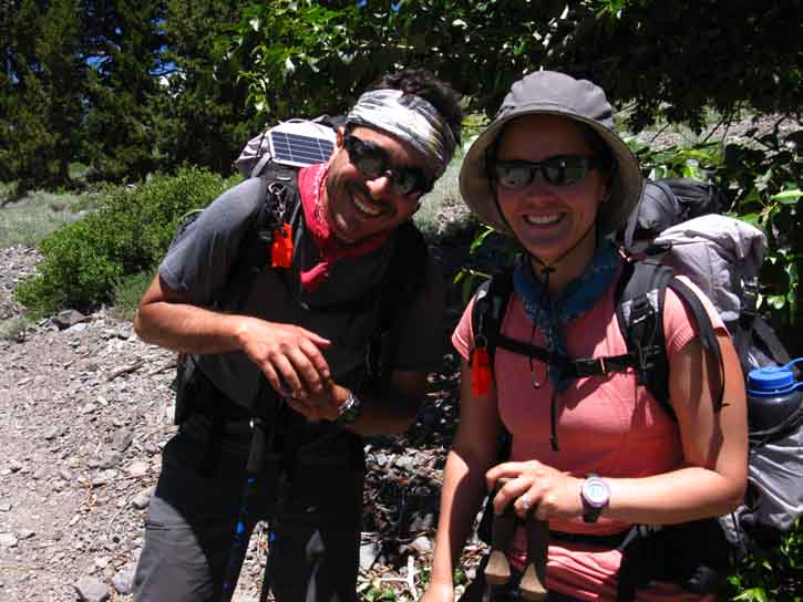
I like all of these campsite locations, and have sequenced trips over the years so I could eventually camp at all of them, independent of the mileage demanded by hiking the long trails. Along this year's hike we encountered backpackers typical of the range of folks we meet out here backpacking Emigrant Wilderness. |
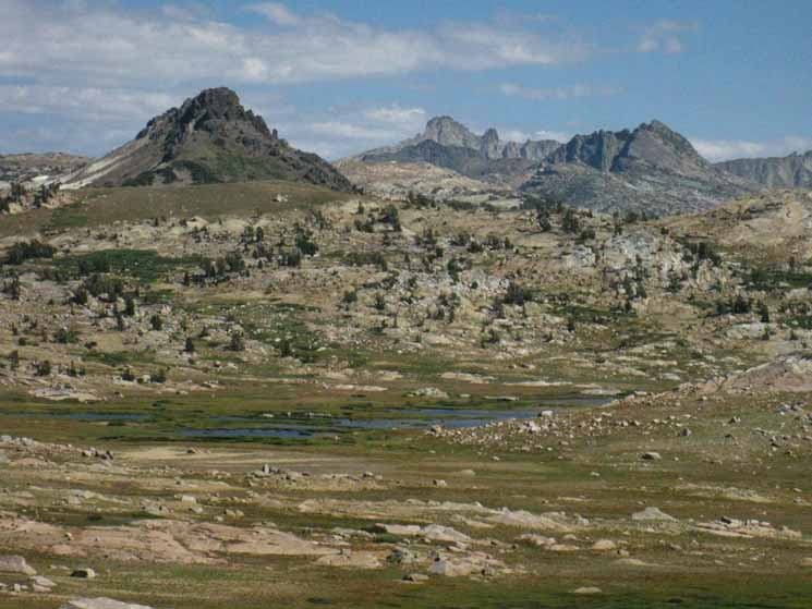
View The middle peak in the furthest distance is Tower Peak marking the line of the Yosemite Boundary along the Sierra Crest. We first observed and began "tracking" Tower Peak approaching Sonora Pass along the PCT, and began to see greater detail (guide) as we got closer to the Yosemite boundary. Our route along the TYT will put us under fine views of Tower Peak from Tilden Lake (guide). The mountain in the middle-distance on the far Right is Forsyth Peak (Guide Page) marking both the top of Jack Main Canyon and the Yosemite boundary along the Sierra Crest. The PCT runs down the Western Flank through Jack Main Canyon along the base of Forsyth just below where it entered Yosemite through Dorothy Lake Pass. So, the PCT runs along the near base of Forsyth Peak, while Dorothy Lake Pass is located just to the Left of Forsyth Peak. Grizzly Peak is the volcanic core located closest-Left. It marks the line of the Sierra Crest, but across the Emigrant Basin. Trails in every cardinal compass point emanate from three trail junctions located at the base of the Western flank of Grizzly Peak. Check out the map of the relationship of Brown Bear Pass, Grizzly, Forsyth and Tower Peaks: Map Next Brown Bear Pass to Bond Pass
Our line on the Tahoe to Yosemite Trail tracks almost directly to Grizzly Peak, bending around the Left shore of Emigrant Meadow Lake. Arriving at the trail junction under the West flank of Grizzly Peak we turn Right, to our South on the now combined Tungsten Road-TYT towards our Bond Pass entrance into Yosemite National Park. In the image above our line on the Tahoe to Yosemite Trail intersects with the Pacific Crest Trail just a tad bit to the Right of Forsyth Peak in the top of Jack Main Canyon. But first, we make almost a straight line for Grizzly Peak, the nearest and most-Left of the three major peaks in the image above. There are three trail junctions at the Western base of Grizzly Peak giving us access to all points of the surrounding Emigrant Wilderness as well as the strip of Toiyabe Forest covering the East Flank. The total distance from our position on the TYT in Brown Bear Pass to the PCT-TYT intersection in the top of Jack Main Canyon is 5.99 miles. The trail junction at Grizzly Peak is 2.91 miles from our position in Brown Bear Pass.
Bond Pass into Yosemite |

Next Into the |
Last page: HIKING PLAN Emigrant to Yosemite Wilderness Next page: Report: PCT Hikers North Yosemite
2016 |
|
|
H THIS PAGE IS UNDER CONSTRUCTION: STAY TUNED FOR MUCH MORE! COME ON BACK NOW, 'YA HEAR?
Last: HIKING PLAN Emigrant to Yosemite Wilderness Next: Report: PCT Hikers North Yosemite |
Backpacker ForumsHave a great Sierra Nevada trip or story to relate? A fine piece of gear? Or gear that failed?Post it onTahoetoWhitney.Org Become a MemberIf you have experiences, comments, questions, or pictures and videos about the trail between Lake Tahoe to Mount Whitney, post up here.All backpackers can comment. Backpacking Trails Forum
|
Trailhead
Contact
Alex Wierbinski

Backpacking Lake Tahoe to Mount Whitney
Your guide to the High Sierra Crest, including the Tahoe to Yosemite, Pacific Crest, and John Muir Trails
