The PCT Trailheads pointing hikers North and South of Sonora Pass are newly marked with Trail Signs.
Though the sign North marks the existing route, the
Southbound route from the trailhead has been slightly modified. The Southbound route change varies from the old route for less than a half-mile before resuming the line of the old route.
NORTH
The location of the PCT North from Sonora Pass was a bit unclear. Now the route North is well defined by the new trailhead sign.
SOUTH
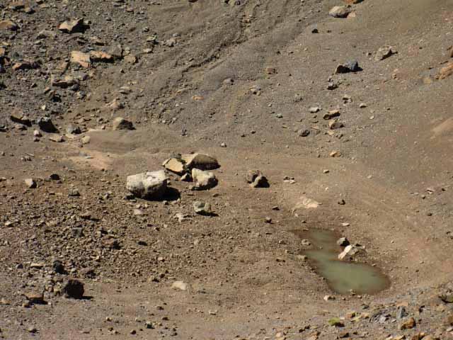
The old trail South from Sonora Pass was clearly laid out, but the old route passed through a wet patch just South of the trailhead. It was showing signs of too much use.
SOUTHBOUND CHANGE
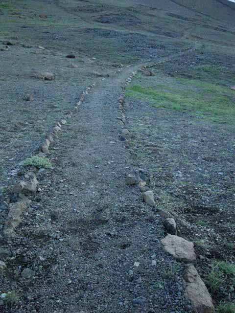
The new route South from Sonora Pass has now been rerouted a bit, as indicated by the sign below, now climbing to/with the shortcut route before resuming the line of the old PCT route South of the degraded wet zone.
The Southbound trailhead is also dressed-up with the new trailhead sign we see above Right.
Local
Resources & Backpacker Resupply
near
Sonora Pass on Highway 108: Kennedy Meadows Pack Station 9 miles West of Sonora Pass.
Great folks, food, drink, supplies and resupply service.
This trail guide is designed to be a source of information for, and subsequently updated by hikers and backpackers visiting Leavitt Peak through the comments and forum links on each trail guide page covering this area.
Registered Members can post up stand-alone posts about this section of the trail with images, maps and videos in the Trails Forum for this Sonora Pass to Tuolumne Meadows Pass section of the Trail Guide.
Unidentified hikers can add updates, questions, comments, and additional information through the comments links. Check out this supplemental hiker information through the forum links on all the guide pages.
All backpacking trails and backpacking topics discussed on this guide are set up to exchange information with hikers. Tell us what you know.
Hiking
the Pacific Crest Trail South
Into
&
Out of Sonora Pass
But First, Hiking the PCT South into Sonora Pass Descending Southbound on the Pacific Crest Trail off the South Flank of Sonora Peak down to Sonora Pass brings us out the South end of the Toiyabe National Forest's (contact info) Carson Iceberg Wilderness down to cross Highway 108's low gap through Sonora Pass in the Sierra Crestline.
Continuing South we begin climbing out of the Sonora Pass's gap to traverse up the North Flank of the Leavitt Massif into the Northeastern-most corner of the Emigrant Wilderness of the Stanislaus National Forest (contact info).
TYT & PCT
Despite there being two "major" named trails entering the Highway 108 corridor near Sonora Pass, being the PCT and TYT, only the North and Southbound PCT Trailheads are located at Sonora Pass itself. The third trailhead located near Sonora Pass is the Northbound Saint Marys Pass Trailhead of the Tahoe to Yosemite Trail, located three-quarters of a mile West down Highway 108 from Sonora Pass.
Admin
All three trailheads near Sonora Pass are administered by the Summit Ranger District of the Stanislaus National Forest, despite the fact that the Northbound PCT out of Sonora Pass enters the South end of the Toiyabe's Carson Iceberg Wilderness.
I'm pretty sure the National Forests do this unified admin thing of the trailheads at the top of Highway 108 for economic efficiency. There is no need for both Forests to send folks up for trailhead upkeep.
North
Sierra Crest Trailheads
Tahoe to Yosemite
I've found that the West Flank National Forests manage the trailheads along the Sierra Crest they share with the East Flank Toiyabe, from the point we exit the South end of the Tahoe Basin down through Sonora Pass.
The El Dorado National Forest manages Carson Pass while Stanislaus manages Ebbetts and Sonora Passes trailheads.
I figure that the vast size of the Toiyabe National Forest, managing the whole East Flank of the North Sierra from Tahoe to Yosemite, induces its smaller neighboring National Forests along the Western Flank to assume administative responsibility for trailheads located on their shared boundary along the Sierra Crestline. This includes all the trailheads along the North Sierra Crestline located at all the major mountain passes. They are all managed by the West Flank National Forests.
The Fourth Trailhead
The Summit Ranger District of the Stanislaus National Forest also administers the complimentary fourth trailhead balancing out the odd-number of three trailheads locate at and near the Sierra Crest: The Southbound TYT Trailhead continuing South out of the Highway 108 corridor is located 9 miles down the West Flank on the South end of Kennedy Meadows Pack Station.
Starting from Sonora Pass
I've found that the Ranger Districts on both flanks of the Sierra approaching Sonora Pass (based in Bridgeport and Pinecrest, respectively) will issue permits for all the trailheads at the Pass. The folks at the Summit Ranger District of the Stanislaus at Pinecrest, and the Carson District of the Toiyabe in Bridgeport have all been really cool over all seasons of the years I've contacted them as I've approached the Sierrra Crest from both flanks.
I'm pretty sure the Ranger Station issuing the permit sorts-out the correct Ranger District to send the permit for proper accounting.
We find a recently installed seasonal local permit (2016?) box at Sonora Pass. It's not uncommon for large National Forests to have lots of self-registration permit boxes for travel within their boundaries.
The use of self-registration has reversed in recent years as forest managers have responded to increasing fire dangers with increasing permit requirements and restrictions.
They want to use issuing permits, and fire permits, as "instructional moments" to reduce fire threats and access.
NorthandSouth on the PCT The PCT's North and Southbound Sonora Pass trailheads are located on the Sierra Crestline. Both are sitting on and splitting the National Forest boundary line running North and South along the Sierra Crest. Here the Sierra Crest divides the Stanislaus National Forest on the West flank from the Toiyabe on the East.
Northbound
PCT
Toiyabe to Tahoe
The Northbound Pacific Crest Trail quickly climbs onto the South flank of Sonora Peak, then enters the Toiyabe National Forest at the point it crosses the shortcut junction, about halfway along the length of its traverse across the South Flank of Sonora Peak.
The Northbound PCT crosses a slice of the Stanislaus National Forest while traversing the Western half of Sonora Peak's South Flank. After that the Northbound PCT remains on the East Flank of the Sierra and within the Toiyabe National Forest for the next 57 miles to our North until we enter the Lake Tahoe Basin through Carson Gap, with only a couple of short exceptions along the way.
Northbound hikers will still be on the East Flank of the Sierra hiking thorough the Tahoe Basin, just no longer hiking in the Toiyabe National Forest, but in the LTBMU.
Southbound
PCT
Toiyabe to Yosemite The Southbound PCT's route hiking over Leavitt Peak South of Sonora Pass literally bounces us back and forth across the National Forest boundary line running down the Sierra Crest, between the Toiyabe NF to our East and the Emigrant Wilderness of the Stanislaus National Forest to our West, as we cross Leavitt Peak's mighty massif. (massif definition)
A Fine Line
The wandering line of our Southbound PCT straddles the Sierra Crest as it weaves its way along the line of the National Forest Boundary through the series of impressive crestline peaks decorating Leavitt's Massif. On Leavitt Peak the PCT actually ascends to, and crosses a massif along the Sierra Crestline itself, rather than traversing one flank or the other, as is typically the case.
Wandering between the line of peaks along the Sierra Crestline crossing Leavitt Massif sometimes brings us to East flank positions hiking along the top of the Toiyabe National Forest descending to our East. Other positions bring us to the very top of the Stanislaus Forest as we hike along the uppermost Western flank of the Sierra Crest. What we see almost depends on which way we turn.
Our most interesting positions are those rare places along any crestline trail that actually run along the Sierra Crestline. Those places with the East and West flanks clearly, sheerly, and dramatically descending East below one foot and West beneath the other. We have a few of these amazing segments of trail straddling our fine line hiking across the top of Leavitt Massif.
Our hike over the Leavitt Massif is one of those amazing segments of trail between the Sierra Flanks, rather than along one or the other. The trail over Leavitt is peppered with a series of crestline viewpoints balanced between awesome views East and West.
Coming Down Descending South to the top of Kennedy Canyon at the base of the South flank of Leavitt Peak we find the PCT route turning East down Kennedy Canyon to emerse itself wholly into the East flank experience of the Toiyabe NF for the remainder of its 9.51 mile run South to the Yosemite boundary at Dorothy Lake Pass.
PCT South
from
Kennedy Canyon Trail Junction The rest of our hike South along the PCT from the top of Kennedy Canyon to our entrance into the Northwestern corner of Yosemite through Dorothy Lake Pass is solidly within the Toiyabe National Forest.
After tracing out our crestline route following the National Forest Boundary across the massive bulk of the Leavitt Massif, the Pacific Crest Trail turns East to track around the heart of the Emigrant Wilderness, and the line of the Sierra Crest, a-ways down the East flank.
The next peak South rising above us along the Sierra Crestline from the Kennedy Canyon Trail Junction is Big Sam. Departing the route of the PCT at Kennedy Canyon to follow the Tungsten Road South over Big Sam would bring us into the Emigrant Basin (definition), if we intend to follow the actual Sierra Crestline to our South, rather than a named trail.
The High Emigrant Basin (definition)
Staying on the Sierra Crestline would keep us on the Tungsten Road continuing South over Big Sam into the High Emigrant Basin. The trail over Big Sam intersects with the route of the Tahoe to Yosemite Trail at the Grizzly Peak trail junction in the heart of what I call the High Emigrant Basin. We have a trail guide page following the Tungsten Road South from the PCT in the top of Kennedy Canyon to the TYT at Grizzly Peak.
We effectively find another four-way trail junction on the Sierra Crest in the series of trail junctions located under the shadow of Grizzly Peak, as we did at the Kennedy Canyon trail junction.
This second four-way trail junction to the South of the four-way trail junction atop Kennedy Canyon really opens up our local backpacking loop options, as well as giving us a variety of long-distance routes across Emigrant Wilderness.
I define the High Emigrant Basin as being composed of the string of Emigrant, Grizzly, and Summit Meadows along a "shelf" wedged into the Western Flank of the Sierra just below the crestline. The Sierra Crest acts as the Eastern edge of the series of meadows running from the base of Brown Bear Pass to the base of Bond Pass. The Western edge of this narrow strip of meadowed terrain are the tops of the vast granite canyons draining the Cherry Creeks off the Sierra Crest to the West, down across the vast slab of glacially carved granite that essentially composes the vast majority of the Emigrant Wilderness.
This route over Big Sam is a fine way to enter these canyons feeding the watersheds of Emigrant Wilderness, into their tops along the Sierra Crestline. Exploring the Emigrant Wilderness below the Crestline trails that this trail guide focuses on is worthwhile. The classic Forest Service Emigrant Wilderness Map below shows us the trails down the length of these canyons.
This line of meadows making up the Emigrant Basin are the headwaters meadows for two of the three Cherry Creeks draining West through Emigrant Wilderness from the Sierra Crest. These creeks run
down the Western flank of the Sierra to Cherry Lake, which then feeds the Tuolumne River.
We can also find access into the tops of Buck Meadow Creek and the South Fork of the Stanislaus River leading down to Pinecrest Lake from the Emigrant Basin.
The low line of the Sierra Crest making up the East edge of the High Emigrant Basin, once we hike South over Big Sam, almost looks like we can throw a rock over it, though we can't.
I'll take the High Route,...
You'll do what you need to do... The Southbound PCT's route East down Kennedy Canyon from the Kennedy Canyon trail junction to enter Yosemite through Dorothy Lake Pass is our low route option circling around the Emigrant Basin along the base of the East Sierra flank.
The Tungsten Road follows the crestline over Big Sam into and across High Emigrant Basin of the Emigrant Wilderness.
I am happy about that, even when I hike the PCT route around it. Why, you ask?
Protected Zone Routing the PCT around Emigrant Wilderness means that the high elevation heart of the Emigrant Wilderness,--the Emigrant Basin-- laying within the rough rectangle of terrain created inside lines drawn from Brown Bear Pass to Big Sam to Bond Pass via Grizzly Peak, remains relatively undisturbed by the overwhelming traffic experienced along the PCT every year. I am thankful the High Basin of the Emigrant Wilderness is not overrun by PCT hikers every year.
These maps give us another view of the route of the Tungsten Road down the Sierra Crestline through the High Emigrant Basin, and the route of the PCT around it:
I appreciate how the routing of the PCT protects the High Emigrant Basin even when I am following
the PCT around this high altitude wonderland.
Custom Trailhead Resources Fan--Freeking--Tastic Free Car Camping Ample free car camping locations to the East and West of Sonora Pass along Highway 108 are great for backpackers staging up for backpacking trips hiking North or South out of Sonora Pass, for family car campers who want some unique camping experiences, and/or for folks driving over the Sierra Crest who want to soak up more than the excitement driving Highway 108 offers.
Kennedy Meadows Pack Station and Resort sits nine miles West of Sonora Pass offering cabin and bunkhouse lodging, three delicious meals a day, supplies, and great folk.
PastandPresent The narrative above cannot be completely accurate as folks had the ill-conceived idea of pushing wagons across the Sierra Crest through Sonora Pass long before 1862. The first wagon train approached Sonora Pass during 1841. The people made it to the Sierra Nevada, but left their wagons in the desert.
Hell, the wagons of the Bidwel-Bartleson expedition of 1841 did not even make it to the Eastern Sierra Escarpment during that first attempt. The wagons broke down in the desert, and the Westerners continued walking West without the wagons. They kept trying, despite all setbacks. Not much choice, when stuck between a vast desert and impenetrable mountains. Walk or Die looked to be their only options.
We've compiled a number of historical resources about this route that became know as the Sonora Pass-Mono Road. The reference materials are all good reads.
Wagon Roads South of Sonora Pass The 1862 route mentioned on the sign above was in fact a replacement route for the original wagon route over Sonora Pass and Saint Marys Pass, which likely continued in use until the Deadmean Creek route, this current route, was complited in 1868. The Sonora-Saint Marys Pass route was a replacement for the previous route up the West Walker River over Emigrant Pass. That's if the original route did not actually turn up the East Flank via Kennedy Canyon and down the West Flank past Kennedy Lake.
The route through Sonora and Saint Marys Passes into the top of the Clarks Fork of the Stanislaus River's Headwaters Bowl had supplanted the West Walker Route.
This two pass route was reportedly used from 1855 to 1868, when it was finally supplanted by the current route down Deadman Creek, which is the route Fletcher is credited with discovering in 1862. The sign above is either unclear, imprecise, or incorrect, most likely a bit of each. Folks had been crossing Sonora Pass since 1855.
Check out the Sonora Pass Road History above for more details.
Regardless, these early routes over the Sierra Crest South of Sonora Pass were desperate attempts to run wagons over. Inspecting this first old route up the West West Walker River by hiking the contemporary trail following this same wagon route up to Emigrant Pass from Leavitt Meadow via the PCT trail junction at the West West Walker River Bridge, we see just how crazy or misinformed anyone who thought they could get a horse-drawn wagon up through there really was.
It would be more feasible to disassemble your wagons, pack them onto the horses, and lead the horses across the Sierra Nevada.
Pioneer Route
The Old Way In...
For hikers this first old wagon road & trail connects Highway 108 at Leavitt Meadow to the PCT at the West West Walker Bridge. Then we can hook up
with the TYT at the Grizzly Peak trail junction via Emigrant Pass. From there we'd follow the TYT Northbound to Kennedy Meadows.
Route Evolution
I am not at all surprised that this first trans-Sierra wagon "route" South of Sonora Pass through Emigrant Pass was abandoned in favor of the "earlier" route mentioned on the sign above, by stringing together a road over both Sonora and Saint Marys Passes into the Clarks Fork. That route is a much better "naturally" graded route through this precipitous terrain than those crossing the crestline South of Sonora Pass.
Saint Marys Pass & The Clarks Fork Scouting out the TYT route over Saint Marys Pass into the Upper Clarks Fork shows us that though this terrain has more favorable "natural" grading, we can see how the soft volcanic terrain proved difficult, if not near impossible to maintain a trail through, let alone a primitive wagon road.
The issue was that the gentler grade over Saint Marys Pass and down the Clarks Fork belied the constant threat of flooding and landslide brought by bad weather and every Spring Thaw within its narrow, steep, and unstable canyon.
Footsteps of History
Echo
in Clarks Fork's Upper Canyon The last segment of the Southbound Tahoe to Yosemite hiker's trip across the Carson Iceberg Wilderness begins stepping onto the paved Clarks Fork Road at Arnot Creek. From that point we follow the Clarks Fork Road along the Clarks Fork of the Stanislaus River to the end of the paved road.
From the end of the paved road we continue following the old trail upriver until the trail fades into the terrain and we finally follow our own self-selected route climbing out of the Clarks Fork's magnificant headwaters bowl up to Saint Marys Pass.
We will have earned our grand views of the Sierra Crestline from Saint Marys Pass, before giving them up on our hike down to the Saint Marys Pass trailhead on Highway 108. The Saint Marys Pass Trailhead is located just short of a mile West of Sonora Pass down Highway 108.
Let's Explore
The Evolution of Route
The progression of the history of roads across this segment of the Sierra Crestline offers no surprise: the crazy difficulty and hard to maintain status of the first route found through Emigrant Pass was abandoned in favor of the better grading of the route over Sonora Pass to Saint Marys Pass and down the Clarks Fork.
We can explore all these routes on foot with backpack. Let's take a look at the route of the TYT Southbound into Sonora Pass via Saint Marys Pass, the "old" wagon route.
Paved
Clarks Fork Road
The lower portion of the original wagon road up the Clarks Fork is still in use as a road today. The paved Clarks Fork Road branching off Highway 108 accesses a series of Federal Car Campgrounds, trailheads into the remote heart of the Carson Iceberg Wilderness, and a number of private Summer homes as well as facilities for various religious and secular groups before reaching its modern end. And, Clarks Fork Road is the segment of our Tahoe to Yosemite Trail running on paved ground from where we emerge out of the Arnot Creek Trailhead to where we pass through the Clarks Fork Trailhead at the end of the paved road.
Clarks Fork Road
& Highway 108 Where Rivers Converge
We find the junction of the Clarks Fork Road with Highway 108 located where the Middle and Clarks Forks of the Stanislaus River converge. This junction is about seven miles West of the Kennedy Meadows turnoff on Highway 108 (Image) (Road Map), about 17 road miles West of the Highway 108 running across the Sierra Crest at Sonora Pass, and 32 miles West of Highway 108's junction with Highway 395 at the CalTrans depot.
The Clarks Fork Road is posted (image) at 48 miles West of Sonora (its junction with Highwy 49) and 98 miles West of Modesto (where 108 begins at Highway 99).
This lonely intersection is located where our long drive East climbing the West flank of the Sierra along Highway 108 takes a big turn South, bending Southeast into the sweet valley of the uppermost Middle Fork of the Stanislaus. This fine valley begins just above its intersection with the Clarks Fork, and runs for seven miles to and then through the turnoff for Kennedy Meadows Pack Station to the Kennedy Meadows Trailhead.
Natural Sweet Spots
This convergence point of these two rivers and their two valleys rising above forms a wishbone shaped sweet spot on this section of the Western Sierra Flank. The valleys of each of these major rivers reach up through the highest elements of the West Sierra Flank to the Sierra Crest. These valleys are natural sweet spots for beauty and unique lines up to the Sierra Crestline via both river's valleys.
IT
Begins
This six-thousand foot level where the Clarks and Middle Forks of the Stanislaus converge also marks the elevation where the granite and volcanic formations capping the Sierra Crestline begin emerging out of forest cover in scale, and the mountain steepens sharply for their final climb to the crest.
At this 6400 foot level we are just reaching the point where we can see the dense forests climbing the flank begin reaching narrowing fingers of thinning forest up higher angles towards the crestline, reaching up, into, around, and between the vast granite and volcanic terrain features climbing steeply above us, signaling our proximity to the last, steep run of terrain leading up to the Sierra Crestline.
The Bottom Line
Everything gets steeper as we climb higher on road or trail from this point, this 6400 foot level convergence point where Kennedy Meadows and the bottom of the Clarks Fork Road are situated, as we drive or hike either route up to the higher elevations towards the Sierra Crestline.
Eastbound Up the Sierra Flank
Highway 108
Passing the Clarks Fork Road turnoff traveling Eastbound up Highway 108 I count nine car campgrounds along the seven mile length of this sweet run of almost level valley before we reach its end at the turnoff for Kennedy Meadows Pack Station. Highway 108 begins steeply climbing to the crest following Deadman Creek up from here, though the Valley of the Middle Fork continues down to the end of Kennedy Meadows.
Clarks Fork Road
&
NORTHBOUND
into the
CARSON ICEBERG WILDERNESS
Traveling up Clarks Fork Road we find there are two Federal Car Campgrounds located along the length of our TYT hike up the paved portion of Clarks Fork Road. This map depicts the route of the Tahoe to Yosemite and Pacific Crest Trails North into the Carson Iceberg Wilderness from the Sonora Pass and Saint Marys Pass Trailheads.
FED
Car Campgrounds
Check the Wilderness Maps above and below for the names and locations of the various car campgrounds here,
and reference their status through the Stanislaus National Forest link below, as well as fees, rules, and reservation information.
Clarks Fork Trailhead
The Southbound Tahoe to Yosemite Trail hiker drops onto the Clarks Fork Road at Arnot Creek to begin our 4.17 mile climb up the paved portion of the Old Clarks Fork Road to its end, where we reenter the Carson Iceberg Wilderness passing through the Clarks Fork Trailhead, located on the edge of Iceberg Meadow under Iceberg Peak.
Click the red dots on the detailed map above for trail guide entries.
The subsequent easy hike upriver above the end of the paved road through the Clarks Fork Trailhead eventually brings us onto more difficult unmaintained trail, and finally up into the untrailed Headwaters of the Clarks Fork.
From the North end of Clarks Meadow we've got to route-find our way into and then out of the Clarks Fork granite headwaters bowl over Saint Marys Pass to the Saint Marys Pass Trailhead on Highway 108. The TYT Saint Marys Pass Trailhead is located less than a mile West of where the PCT & Highway 108 cross Sonora Pass.
That describes the physical and historical terrain along the TYT North of the
Saint Marys Pass Trailhead
...
Good Ending
to a Hard Start Though the current route of Highway 108 West down Deadman Creek was a harder route to initially cut through the terrain, it only had to be cut once through the solid granite terrain of Deadman Canyon. That rock is moving very slowly.
The modern Deadman Creek route is very different from the first route over the Sierra Crest South of Sonora Pass through Emigrant Basin, and especially the second route through Sonora Pass and Saint Marys Pass down the Clarks Fork. That first route is too narrow and climbs too steeply, and the second route was unstable and in motion then, and is still in motion today.
Both of these early routes crossed large segments of unconsolidated terrain that were difficult in optimal conditions, and rapidly gave way with the weather, snow, and thaw of each and every season. These routes required impossible amounts of maintenance and brought great hardship to unprepared travelers.
The first two routes were best for two and four legged travelers, with only the toughest wagoneers having even a snowball's chance in hell of getting their wagons safely over the first route to civilization, and the second only during those brief periods it was maintained.
Shifting the wagon route to cross Sonora and Saint Marys Passes initially made it easier to get over the crest, but the route down the Clarks Fork proved difficult to maintain over any length of time.
The current route of Highway 108 following Deadman Creek down mountain well balances the difficulty of the route
with its relative ease of maintenance.
Physical Physically, Sonora Pass is the low point along the North-South orientation of the Sierra Crestline where trans-Sierra Highway 108 crosses the crest of the Sierra Nevada Mountain Range.
The Pacific Crest Trail's North-South route along the Sierra Crestline crosses the East-West line of Highway 108 at Sonora Pass. This access makes the Kennedy Meadows Pack Station located about nine miles down the West Flank along Highway 108 a standard resupply spot about halfway along the 150 miles separating Tahoe from Yosemite for hikers on either the PCT or TYT.
Two huge dark burnt-red volcanic mountains guard the flanks of Sonora Pass to its North and South along the Sierra Crestline. Sonora Peak rises to the North of Sonora Pass's low point along the Sierra Crest, with the Leavitt Peak Massif rising to its South.
Physically, the high point to the South of Sonora Pass along the Sierra Crestline is Leavitt Peak (guide entry below ). Leavitt Peak itself sits crowing the backside of the massive bulk of its complex massif, preceeded by its squadron of subordinate peaks. Our route South threads its way through and around this sea of peaks atop the Leavitt Massif. Road Map.
Hiking North of Sonora Pass we find the PCT takes a much simpler route up to and traversing the South and Eastern flanks of the relatively simply terrain composing the vast triangular volcanic bulk of Sonora Peak (image below).
Administrative
Lay of the Land To our North two huge National Forests administer vast swaths of the Eastern and Western Sierra Flanks, respectively,
running far North of our position at Sonora Pass. To our South both of these East and West flank National Forests end along the Yosemite National Parks's Northern and Eastern boundary lines, which are still about twenty miles to our South from our position at Sonora Pass.
"Respect My Authority"
Administratively, Sonora Pass is the point along the North and South alignment of the Sierra Crestline intersecting with the East-West route of Highway 108. Highway 108 and the Sierra Crestline are both themselves landmark and geological features used to determine the lines dividing the various layers of High Sierra administrative authorities, all locally intersecting at Sonora Pass.
Our Trans-Sierra Mountain Passes are typically at the top of the headwaters of great river valleys descending Westward. Westbound, the Trans-Sierra Highways cross the Sierra Crest into the tops of these canyons, following the river course through its upper sections until the road can get up onto a descending ridgearm as it drops into the top of the High Sierra's Western foothills.
Eastbound, the Trans-Sierra Highways all descend rapidly and steeply down the sheer East flank of the Sierra after crossing the Sierra Crestline.
Typical Boundaries
The Sierra Crestline is the main boundary. It divides the East and West Flank National Forests and Parks for the length of the range.
The East-West lines of the Trans-Sierra Highways running down both flanks of the Sierra are typically the lines marking the boundaries dividing the National Forests, Wilderness Areas, and Ranger Districts administering the Sierra flanks to the North and South of the Trans-Sierra Highway routes.
The North-South line of the Sierra Crestline combined with the East-West lines of the Trans-Sierra Highways are a good way to get some context on the divisions between the National Forests on the East and West flanks, and the lines separating the West-flank National Forests and wilderness areas from each other.
Sonora Pass
East and West
The Sierra Crestline running North and South through Sonora Pass divides the authority of the Toiyabe National Forest along the East Flank of the Sierra Nevada from the Stanislaus National Forest's jurisdiction over the Western.
North and South
ON the West flank Highway 108 divides the Carson Ranger District of the Carson Iceberg Wilderness on its North side from the Summit Ranger District's administration of the Emigrant Wilderness to its South, while both wilderness areas are within the Stanislaus National Forest.
The Toiyabe National Forest administers the East flank of the Sierra both to the North and South of the Highway 108 corridor, including the Eastern end of the Carson Iceberg Wilderness to the North and the Hoover Wilderness Area to the South.
East Flank
The Toiyabe National Forest
For our purpose hiking South from Tahoe to Yosemite along the Pacific Crest Trail we enter the Toiyabe when we exit the Tahoe Basin until we enter Yosemite. That puts us primairly into the Toiyabe National Forest for the vast majority of our trip.
The Toiyabe National Forest covers the East flank of the whole North Sierra Nevada Mountain Range, including the East flank of the Carson Range, (the West Flank of the Carson Range wraps around the East Shore of the Tahoe Basin), all the way down to the bottom of the Hoover Wilderness.
Therefore hikers on the PCT route between Lake Tahoe and Yosemite are predominantly hiking on the East Flank of the Sierra through the Toiyabe National Forest from the time they exit the Tahoe Basin until they enter the Northwesternmost corner of Yosemite.
West Flank
Stanislaus National Forest
The Stanislaus National Forest administers the Western flank to the South of a line drawn just a bit North of Highway 4, down to Yosemite National Park boundary.
The Stanislaus is big, but it's less than half the size of the Toiyabe.
West Flank
El Dorado National Forest
The El Dorado National Forest administers the West Flank of the Sierra to the North of the Stanislaus National Forest. Its shared Southern boundary with the Stanislaus National Forest line is located a bit to the North of Highway 4. The El Dorado covers the Western Flank of the Sierra running North up to, and then wrapping around the Western Flank of the Sierra Crestline below where the line of the Sierra Crest becomes the top of the Tahoe Rim wrapping around the Western edge of the Tahoe Basin.
Highway 108
West Flank
Highway 108's East-West line from Sonora Pass down the West Flank of the Sierra marks out the boundary dividing the Carson-Iceberg Wilderness to the North of Highway 108 from the Emigrant Wilderness to its South. Both these Wilderness are administered by the Stanislaus National Forest.
We're Backpacking South... Backpacking Emigrant Wilderness The Emigrant Wilderness is interesting for a number of reasons, not the least of which is that the Northeastern and East edges of Emigrant Wilderness wrap around the Northwestern and Western boundaries of the North Yosemite Backcountry.
Back of the Back...
The location and the nature of the terrain in Emigrant Wilderness make it the backcountry of the Northern Yosemite backcountry, in that backpacking the Emigrant Wilderness is like Yosemite, but without the vast crowds and the overwhelming attention.
Backpacking Emigrant Wilderness
The beauty of this place makes backpacking the Emigrant Wilderness an excellent destination on its own terms, as well as a beautiful section along our long distance backpacking trips. This is one of the places deserving a return trip for further exploration by PCT hikers who passes through too rapidly.
This Sonora Pass trailhead opens up many fine local Emigrant Wilderness backpacking trips, as well as classic trips North to Tahoe and South to Tuolumne Meadows. Both of those backpacking trips North to Tahoe and South to Tuolumne are roughly 75 miles from Sonora Pass.
Halfway Point
This makes Sonora Pass the halfway resupply point for Tahoe to Yosemite Hikers on either
the PCT or TYT routes.
East and West
FLANKS
Both the Toiyabe and Stanislaus National Forests run North & South of Highway 108's trans-Sierra route, each covering their respective flank of the Sierra, but only the Stanislaus administers the Emigrant Wilderness, which is only located on the high Western flank of the Sierra wedged between Highway 108 to the North, the Sierra Crestline to the East, and the Yosemite National Park Boundary to the South.
The Carson-Iceberg and Mokelumne Wilderness Areas North of Sonora Pass both lay across the Sierra Crestline, with portions on both the East and West flanks. The area of the Carson Iceberg Wilderness on the West flank is administered by the Stanislaus while its East side is administered by the Toiyabe National Forest.
North of the Carson Iceberg, the Mokelumne Wilderness is likewise split up. Its Western portions are administered by the El Dorado National Forest while its Eastern areas are under the Toiyabe National Forest.
The Emigrant Wilderness is exclusively a West Flank Wilderness Area.
TRANSITIONS
Rising to the South,
Descending to the North.
TERRAINS
Volcanic vs. Granitic
Rising to the South Sonora Pass's 9628 feet of elevation is the second highest of the Trans-Sierra Highways. The highest is Tioga Pass at 9943 feet over Hwy 120 a short distance East of Tuolumne Meadows (map).
Hiking South from Lake Tahoe the altitudes of Sierra Peaks and Passes we encounter are gradually rising, and will continue to do so all the way down until we climb the highest mountain in the Continental US, Mount Whitney at the end of our hike. Reciprocally, the altitudes of trails, peaks, and passes for Northbound backpackers are declining through Lake Tahoe.
The Sonora Gap (guide entry) to our North is the Northbound backpacker's last point of trail above 10,000 feet. To the South Leavitt Peak marks the first section of our trail approaching 11,000 feet, reaching 10,800 feet of elevation crossing through the gap to the North of Latopie Lake. It will not be our last. Overall, the character of our hike is gradually changing. Our altitudes are slowly declining if we are hiking North and increasing to the South.
Terrain Transitions
Southbound PCT hikers will be experiencing abrupt terrain transitions as well as gradual increasing in altitude. The nature of the terrain shifts radically from Volcanic to Granite when we make the transition from the East to West Flanks of the Sierra through Dorothy Lake Pass.
After hiking South on the PCT from Lake Tahoe across predominatly volcanic terrain along the top of the East Flank of the Sierra, hiking through Dorothy Lake Pass brings us onto the West Flank of the Sierra and into the granite wonderland of the North Yosemite Backcounty for the remaining 56 miles of our hike South to Tuolumne Meadows.
Mandatory Resupply Spot Highway 108 across Sonora Pass is the first road and resupply opportunity Northbound PCT hikers out of Tuolumne Meadows encounter after 74 miles on the trail. Time to resupply! Most (91%) of Northbound PCT hikers hitch-hike down to Kennedy Meadows from Sonora Pass to pick up the resupply package they sent to themselves there.
Less than One in Ten It seems to me that a small but significant group of strong backpackers make the hike from Tuolumne Meadows to Lake Tahoe without resupply. Over the years those who omit Kennedy Meadows seems to compose a bit less than one in ten of PCT hikers, and are generally in the lead pack or are among the front-runners of the "main body" of the annual PCT "Pack."
Southbound hikers on either the PCT or TYT on their way down to Tuolumne Meadows are also resupplying at Kennedy Meadows Pack Station for their next 74 mile segment of trail to Tuolumne Meadows.
I have enjoyed Kennedy Meadows' hospitality for decades.
Folks starting backpacking trips here are Driving to Sonora Pass. There is no public transportation to or across Highway 108 from the West, though there is a bus line running up and down the Highway 395 corridor we can catch at the Eastern end of Highway 108.
Though I Hitch through the Valley of Death... Hitchhiking East across the San Joaquin Valley sucks big time. Not having a truck has made for some hard trips making my way East across the valley to Highway 108 from the West Coast. Once we get to Highway 108 "proper," past where it splits off from Highway 120, it gets much easier to get rides up to the Sierra Crest.
Resupply Horizons The next standard resupply spot North of Sonora Pass along the route of the PCT is 69 hiking miles North where we find Highway 50 across Echo Summit. Highway 50 gives us easy hitch-hiking access down to South Lake Tahoe. We also have the option of a mid-point resupply by hitching West down to the Lake Alpine Lodge along Highway 4 from Ebbetts Pass (Trail Guide). Ebbetts Pass crosses the Sierra Crest 29.44 miles North of Sonora Pass along the Pacific Crest Trail route.
Halfway Point Resupply Lake Alpine Lodge Highway 4's passage through Ebbetts Pass is located on the Sierra Crestline roughly halfway between Sonora Pass and Echo Summit. Hitching from the remote Ebbetts Pass about 15 miles West brings us to the Lake Alpine Lodge.
Though there's not a lot of traffic along the 4 Corridor, a high percentage of its drivers
will give backpackers rides.
The Lake Alpine Lodge accepts backpacker resupply packages sent through UPS and holds them at NO CHARGE for the backpacker.
Many
Local and Long
Backpacking Options Sonora Pass Trailheads provide long distance backpackers many excellent hiking options for an amazing variety of very challenging long and short backpacking trip opportunities both North and South from Sonora Pass along both the Pacific Crest and Tahoe to Yosemite Trails.
EXPLORE THEM.
The goal of this trail guide page is put at your fingertips every bit of information about your backpacking possibilities and potentials
out of Sonora Pass' Trailheads:
This trail guide's "indexes" approach Sonora Pass from the North and depart to the South in accordance with this trail guide's North-to-South direction hiking down the Sierra Nevada's crestline and high flank trails:
South of Sonora Pass To our South we have the 74 mile section of the PCT to Tuolumne Meadows. But that's just the beginning. Sonora Pass Trailhead is our "North-Central" entrance into Emigrant Wilderness if we consider Kennedy Meadows Pack Station as our West flank entry point and the Leavitt Meadow Pack Station as our potential Eastern entrance/exit to the wonders of backpacking Emigrant Wilderness.
Backpacking Emigrant Wilderness
In that case we could consider Pincrest Lake as our "drain point."
Pinecrest Lake is located on the lowest elevation Western edge of Emigrant Wilderness.
Trips from the TYT to Crabtree, Pincrest Lake, or Cherry Lake bisect the Emigrant Wilderness from top to bottom, depending on exactly where we start and where we end.
This guide focuses on the Sierra Crestline Trails.
At the Top
We have three excellent trailheads along the top of the Highway 108 corridor running South to Emigrant Wilderness to begin or end our Emigrant Wilderness backpacking trips. Each of these trails accesses the Sierra Crestline or trails down the Eastern and Western Flanks criss-crossing the Sierra Crest through Emigrant Wilderness.
Big Circles
This parallel configuration of trails along the Sierra Crest through Emigrant Wilderness means that we can craft great backpacking loops (up to 90 miles) circling the beauties of the Emigrant Wilderness centered along the Sierra Crestline, which eventually bring us back to Sonora Pass, or exiting through our selected Eastern or Western flank trailheads mentioned above.
At the Bottom of Emigrant Wilderness
Heck, one trip I hiked the TYT to the unnamed lake next to Grizzly Peak, then found my own cross-country route to the Southwest down across the whole width of Emigrant Wilderness to Pinecrest Lake. That was a ball. Like a pachinko ball. I "bounced" my way over, around, and through a long series of beautiful route-finding challenges until I "drained" out the bottom of the Emigrant Wilderness at Pinecrest Lake.
The Emigrant Wilderness contains endless potential for high altitude and long distance backpackers along and tying together its unique route down the Sierra Crestline with the parallel trails along both its flanks. But Emigrant has more, if you can believe it. The Emigrant Wilderness also features a series of amazing trails running down the Western Flank of the Sierra through a series of canyons cut through the vast plate of granite composing this wilderness wrapping around the North Yosemite Backcountry.
This Vast Granite Plate
See, that's the thing about the Emigrant Wilderness, besides the amazing granite-volcanic interface we encounter hiking the TYT up Summit Creek. The Emigrant Wilderness is the "Northern Extension" of the vast granite outcropping along the Sierra Crestline centered in Yosemite, running all the way down to Yosemite Valley. The Emigrant Wilderness is the Northern "Wing" of that vast granite plate.
Though extensive, this "North wing" of the "Yosemite Plate" runs West from 10 to 11500 feet of elevation along its portion of the Sierra Crest all the way down to about 5600 feet at Pinecrest Lake and 4702 feet at Cherry Lake. Though extensive, it is only the Northern extension of the main run of the vast granite pluton characterizing Yosemite.
Remember, Emigrant Wilderness is the Northern Wing of Yosemite's Vast Granite Plate. The main width of the run of Yosemite's Vast Granite Plate across the heart of Yosemite is Monumental. Emigrant is merely Epic.
The monumental scale of the East-West width and depth of the vast granite plate
composing Yosemite National Park runs (in my opinion) from Brown Bear Pass to Donohue Pass along along this plate's outer perimeter along the Sierra Crest. Between these two points the vast expanse of Yosemite's granite narrows down and descends Westward until it terminates in Yosemite Valley.
The highest perimeter of this run of granite along the Sierra Crest narrows down as it looses width and descends all the way down to the 3600 foot floor of Yosemite Valley.
The expansive width of Yosemite's North-South run of pure granite along crestline above Yosemite is complimented by the magnitude of its Western reach, which descends to points lower in elevation than any run of granite to its North and South. Little of the granite of the Crestline found along the Sierra Crest can be found below 7000 feet, and almost none at the 3600 foot level. Except in Emigrant Wilderness and Yosemite, where the granite runs further West and lower in elevation than anywhere else along the run of the Sierra Nevada Mountain Range.
The scale of solid granite reaching down the Western Flank is amazing in terms of both its length running along the Sierra Crest, and its depth, being measured both by how far West and how low in elevation this run of pure granite stretches out to the West of the Sierra Crestline. This vast run of granite has been cut by glacial ice into two major mountain ranges with two major watersheds. These are the Sierra and Cathedral Ranges holding the Tuolumne and Merced Rivers.
That's one big chunck of granite terrain for us to explore.
Two Ranges
&
Two Watersheds
First, the central section of this vast plate (say from Bond to Donohue Pass) drops West off the line of the Sierra Crest, down to the floor of the high elevation canyon cut by the Tuolumne River, centered on its namesake meadow. To the West of the line of the Tuolumne River this plate next is next carved into the the white granite spiers and peaks making up the 11000 foot crestlines of the Cathedral Range. The Merced Watershed drains the Western flank of the Cathedral Range down to and through Yosemite Valley, which is another dimension of this vast granite plate running from just South of our postion at Sonora Pass, running from the Sierra Crest down to the 3960 foot floor of Yosemite Valley.
But, impressive as the width and depth of this run of granite is, just measuring its East-West reach does not do it complete justice. The run of this plate to the North and South, taking in the Emigrant Wilderness to its North up through the Cherry Creek Watershed, and running South down to Clarks Range and the West Flanks of the Ritter Range measures out a unique physical space that has few rivals, both for the scale of its vast granite plate described here, but also because of the range's youth. These young mountains have only been sharpened to perfection by their one glacial experience, rather than having been worn down and dulled a by multiple glaciations.
We are experiencing a special time during a young mountain range's youth.
PCT
North of Sonora Pass Hiking North from Sonora Pass we can break the route of the PCT into 3 potential sections. The first section brings us 29.44 miles North to Highway 4 at Ebbetts Pass. Continuing North to Highway 88 we pass through Carson Pass 57.32 miles North of Sonora Pass, and finally cross Highway 50 dropping into the Tahoe Basin through Echo Summit 69.23 miles to our North from Sonora Pass.
Variable Length Section Hiking We can hike each of these individual sections between mountain passes as individual trips, or string them together into longer hikes. My favorite variation is blowing-up a section hike into a grand loop around its surrounding wilderness area.
Immediately North of Sonora Pass we find that fantastic backpacking loops of up to 90 miles can be formed by connecting the Tahoe to Yosemite Trail route along the West side of the Carson Iceberg Wilderness to the PCT's route along the Crestline to form-up grand backpacking loops via the series of trails connecting them.
The Sonora Pass Region Hiking Map The map below lays out the the first ten or twelve miles of both the PCT and TYT routes North and South of Sonora Pass, and the trails connecting them. Click the black dotted trail routes for detailed maps of that area, red dots for guide information about specific locations.
Let your mind's eye see the potential for great backpacking loops around Emigrant and Carson Iceberg Wilderness out of the top of the Highway 108 corridor. Do remember that the TYT through the Upper Clarks Fork is a very difficult cross-country, "find it yourself" route.
Here's the Plan: Bits of the TYT and PCT can be tied together by these connector trails to make grand hiking loops around both the Carson Iceberg and Emigrant Wilderness Areas. Hikers using this approach can plan and execute loops as short as 20 miles and as long as 90 miles around the high elevation terrain of either the Emigrant or Carson Iceberg Wilderness.
Southbound Backpacking Loops
into Emigrant Wilderness For Southbound hikers Sonora Pass's 9643 foot altitude trailhead offers high altitude access to Leavitt Peak and the Emigrant Wilderness of the Stanislaus National Forest beyond. Though hiking Southbound from Sonora Pass begins along the Pacific Crest Trail, once we get over Leavitt Peak the trail junction at the top of Kennedy Canyon gives us three choices: two trails into the Heart of the Emigrant Wilderness, and one around it through the Toiyabe.
Independent of which route we hike, East, West, or South from the top of Kennedy Canyon, we can return to the Kennedy Canyon junction using the web of trails spread-out over Emigrant Wilderness by creating our own custom loop and/or trailhead to trailhead backpacking trips beginning by hiking South out of Sonora Pass. Our local backpacking loop possibilities and the terrain we cover expands with each trail junction we encounter hiking further South into Emigrant Wilderness along the Sierra Crestline.
The Kennedy Canyon junction is the first of thee junctions along the Sierra Crest between Sonora Pass and Yosemite we can use to bend nice backpacking loops around Emigrant Wilderness.
Kennedy Canyon Trail Junction The four-way Kennedy Canyon trail junction at the base of the South flank of Leavitt Peak (on the next guide page) is the first of two four-way junctions along the Sierra Crestline crossing Emigrant Wilderness opening up all quadrants of the Wilderness for our exploration. The Kennedy Canyon trail junction opens the West and West West Walker River drainages to our East in the Toiyabe National Forest. It opens the West flank via Kennedy Lake down to the TYT along Summit Creek. Or, we can hike directly South over Big Sam along the Tungsten Road to intersect with the TYT in Emigrant Meadow at our next crestline trail junction located in the shadow of Grizzly Peak in Grizzly Meadow.
The following Southbound pages of this trail guide explore all of these Emigrant Wilderness backpacking options, and so should you. This place is beautiful, and each of these routes opens up unique terrain to explore. Hiking through Emigrant Wilderness once leaves more unseen than seen.
Grizzly Peak Trail Junction The next "four-way" trail junction South of the Kennedy Canyon trail junction along the Sierra Crestline opens up our next level of Emigrant Wilderness backpacking options. This next "four-way" junction to our South is actually composed of the three trail junctions located under Grizzly Peak in the High Emigrant Basin. The combined effect of these three trail junctions gives us access to trails leading in all four compass points.
(Grizzly Peak Guide Page)
Two Trail Junctions
to
Paradise
These two four-way trail junctions along the Sierra Crest South of Sonora Pass each link the routes of the PCT and TYT, each gives us access off the crest to trails along both flanks and visa-versa, and both of these trail junctions open up some fine loops around the heart of the Emigrant Wilderness.
And trust me, these High Emigrant Wilderness trails are worthy of spending twice the energy hiking them demands, to explore their beauties.
How Good is Backpacking Emigrant Wilderness?
It's that good!
PCTandEmigrant Wilderness
Backpacking Loops Though the following series of guide pages does follow the route of the PCT South from Sonora Pass to Tuolumne Meadows in Yosemite, our hike down the PCT also offers up a series of junctions we can use to modify our PCT route by hooking it up with the Tahoe to Yosemite Trail to craft both alternative long-distance backpacking routes across Emigrant Wilderness on our way to Tuolumne Meadows, or for big backpacking loops roughly remaining within Emigrant Wilderness.
These loops will likely enter a bit of Yosemite and cross some of the Toiyabe even as the majority of their miles remain within Emigrant Wilderness.
Longest Emigrant Wilderness Backpacking Loops
The last and Southernmost of our links between the PCT and TYT across Emigrant Wilderness is beyond the Emigrant boundary in the top of Jack Main Canyon. Our Southernmost turnaround point for big Emigrant Wilderness backpacking loops (along the Sierra Crestline) is where the PCT and TYT reunify for the majority of their remaining final 54 miles South to Tuolumne Meadows.
That point is in the top of Jack Main Canyon.
Rather than continuing South into Yosemite local backpackers will turn their Southbound hike to the North by switching between the PCT and TYT. Local backpackers will change direction from South to North by hiking through both of the two mountain passes cutting into the top of Jack Main Canyon.
We can hike South into the top of Jack Main Canyon through Dorothy Lake Pass on the PCT or through Bond Pass on the TYT. Whichever route we entered, we will use the other to exit. We will change direction by hiking Northbound back out of the top of Jack Main Canyon on the other trail.
Our furthest turnaround point for Emigrant Wilderness backpacking loops swings us through both the mountain passes accessing the Northwestern-most corner of Yosemite National Park, if only for a brief visit, maybe a night at Dorothy Pass Lake, as we switch from the Southbound version of one classic High Sierra Trail to the Northbound of the other.
Or we continue down Jack Main Canyon towards Tuolumne Meadows or Hetch Hetchy in the Grand Canyon of the Tuolumne:
Pick your Pleasure!
PCT to TYT LINKS The PCT-TYT junction in the top of Jack Main Canyon is the third and final junction we will see connecting the PCT and TYT across Emigrant Wilderness. The other two junctions linking the PCT up with the TYT are at the Kennedy Canyon trail junction and the Grizzly Peak Trail from Emigrant Pass to the West West Walker Bridge, besides the junction in the top of Jack Main Canyon.
We can use these trails to link the PCT and TYT's divergent routes across Emigrant Wilderness into unique long backpacking loops that mostly stay inside Emigrant Wilderness. Or we can chart an alternative route across Emigrant Wilderness to that of either the TYT or PCT.
Let's Get Loopy This PCT topo hiking map of the terrain South of Sonora Pass shows the series of trail junctions linking the PCT and TYT that can form the basis of a series of PCT alternative routes or local backpacking loops of expanding lengths over a variety of routes around the Emigrant Wilderness.
We really can't hike classic Southbound loops out of Sonora Pass, as the first trail junction we reach is 7.97 miles South of Sonora Pass at the Kennedy Canyon trail junction. Those first miles are the length of our hike over Leavitt Peak. So, we've got 7.97 miles of in-and-out hiking over Leavitt Peak beginning and ending any loops we swing out of Sonora Pass.
Thus
I'd classify Southbound backpacking loops out of Sonora Pass as being "lollypop loops," rather than classic loops, as we've got the extensive hike in and out of the trailhead ("The Stick") before we can turn any loops.
Northern Loops Similar hiking options are available for Northbound hikers out of Sonora Pass into the Carson Iceberg Wilderness. As we have two Northbound trailheads at and near Sonora Pass we can hike better loops North out of Sonora Pass than we can to the South.
The PCT and TYT routes North of Sonora Pass all the way up to Ebbetts Pass are connected by a series of trails allowing hikers to craft great or small loops into and around the High Elevation section of the Carson Iceberg wilderness at least as well as we can craft loops around the High Elevation parts of Emigrant Wilderness.
Problems-Problems Or Opportunity? The only problem with the Northern loop plans is that the TYT through the Upper Clarks Fork of the Stanislaus over Saint Marys Pass (guide page) is hiked through very rough unmaintained trail, and partially across a route-finding challenge through difficult untrailed terrain. There are specific warnings and descriptions of the dangers and difficulties (and delights) on the guide pages for the unmaintained Tahoe to Yosemite Trail through the Headwaters Bowl of the Clarks Fork of the Stanislaus River.
Heed them well, or potentially "find" (lose?) yourself in either a Natural Heaven or Hell.
Heaven or Hell? Only your capacity and expectations applied to Nature answers that question.
Thus I advocate a logical, gradual evolution of skills, fitness, and experience.
The map below shows the main long distance trails both North and South of Sonora Pass.
Remember, click the red dots along the marked trail routes for more information about that location, the black dots for detailed maps, and that these maps can be magnified in your browser for greater detail.
These short to longer backpacking loop trips out of Sonora Pass are good warm-up trips if we don't quite feel ready to hike 74 miles all the way down to Tuolumne Meadows from Sonora Pass.
Find backpacking trip distances and a pace that suits your fitness, capacity, and expectations.
It's a good idea to build the length and duration of our first long distance high altitude backpacking trips gradually. Start with shorter easy trips and extend them as we develop skills, fitness and experience. Expanding the scope of a series of trips until we can easily hike the long trail South down to Tuolumne in Yosemite or North up to Lake Tahoe from Sonora Pass is a lot better than doing it the first time in great pain.
Introduction to Hiking the Tahoe to Yosemite Trail
Application
of Backcountry Skills, Fitness, and Engagement We've gone over the big and little topics required to put together long trips such as the Tahoe to Whitney in the Introduction to the Tahoe to Whitney Trails. Then we examined these issues through training and test trips, finally fully focusing all our assets into Planning a Tahoe to Yosemite Trail Backpacking Trip, or at least a long hike that carefully tests all of our assumptions and expectations for validity. Then...
The Trail is Our Oyster Then we should be hiking the Long Trails along the length of the Sierra Nevada Crestline. The Tahoe to Yosemite Trail, the John Muir Trail, and eventually the whole length of the Sierra Nevada between Lake Tahoe and Mount Whitney.
The Sierra at our feet, our heads in the clouds, and our mobile observation units (us) backpacking across some of the best observation and engagement the Natural World offers.
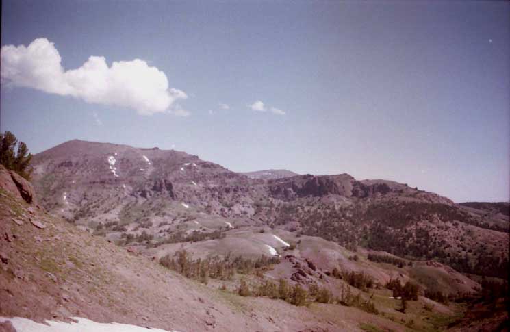
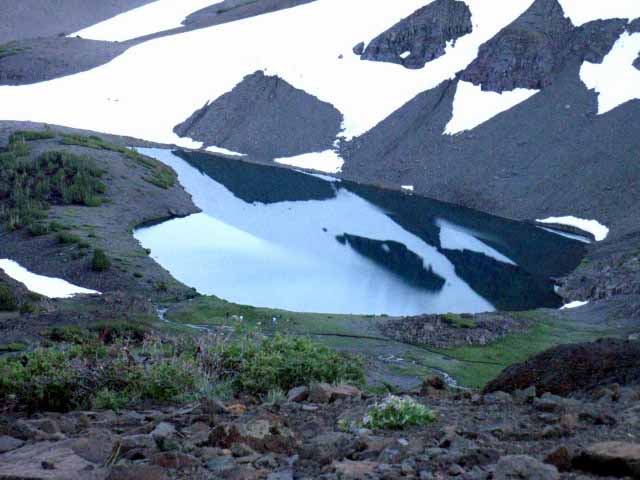
The Big Viewof theLeavitt Massif
approaching Sonora Pass
Southbound on the Pacific Crest Trail
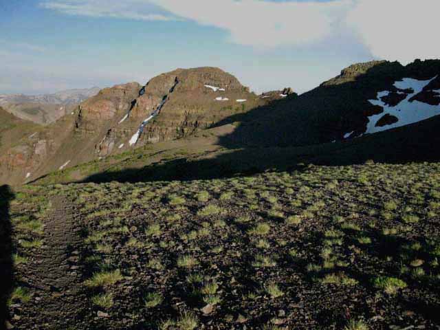
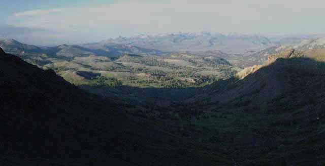
Above North Flank of the Leavitt Massif As we hike South on the PCT approaching Sonora Pass the Leavitt Massif rises to dominate our Southern skyline. Let's take a close look at Leavitt Peak, as we immediately begin climbing it hiking South through the Sonora Pass Trailhead. The image above is the North face of our next challenge, the Leavitt Massif, while the image below marks
our potential routes up it.
Our view of the peak above is looking South from the top of the low hill just North of the Sonora Pass picnic area. We are hiking South into Sonora Pass on the shortcut route (Map-locate shortcut's PCT junction about halfway along the length of the trail across Sonora Peak's South Flank). We enter the Southbound shortcut route by sliding down its steep, sandy chute from the PCT along the South flank of Sonora Peak to make our way to the old jeep trail. The shortcut route is difficult up or down for fully loaded backpackers.
Anyway...
Sonora Pass is just ahead of us in the image above. Sonora Pass itself is located below our line of sight down the trail we see at our feet running down to the base of the hill, a bit right of the center of the image above. The line of the trail points directly towards Sonora Pass.
First, before we begin climbing Leavitt Peak, let's take a look at the detailed 7.5 min USGS hiking map highlighted with the PCT route. The red dots along the marked trail route on the map link us to the trail guide descriptions, images, miles, elevations, and even videos covering our hike across the Leavitt Massif. All of that information will help provide context for understanding our upcoming challenges.
FIRST
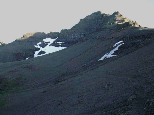
That's NOT Leavitt Peak... In the image above we are not viewing Leavitt Peak itself, but the North face of the Leavitt Peak Massif.
(Massif definition)
Lots of folks think the peak pictured above is Leavitt, but it is not. Leavitt Peak itself only comes into view after we climb the North face and begin making our way South along the West Flank of Peak 10480.
(View of Leavitt Peak below)
Peak
10480 The high peak we are looking at above is Peak 10480. Peak 10480 is the highest point of the North flank of the Leavitt Massif. We can also see Peak 11245 peeking out from behind Peak 10480's Left or East flank. Our trail threads its way up, around, and through these two peaks, along with the small sea of mountain peaks decorating the top of the Leavitt Massif. Open up the large and small scale trail maps to correlate this guide's images and descriptions of these peaks with the maps' contexts and designations.
RangeofReality The Balance of Pleasure and Pain
The Leavitt Massif can be experienced (beheld) by the viewer across a range of interpretations. The nature of our understanding of the abstract spatial relationships between peak and trail can be complex. My abstract perspective shifts from studying terrain complexity to absorbing beauty, and is next drawn to the brutal physical logic of the High Sierra Trail and Terrain that ties all interpretations together. These various aspects of the experience draws complex responses out of backpackers.
Nature draws out tears of fear, tears of joy, tears of pain.
Increasing the intensity of our physical workload immediately induces physical rigors and stresses brought on by hard work. These changes can be good or bad, depending on the backpacker. Changes in perception always follows changes in activity levels. The most basic increases of our physical workload brings parallel changes in our emotional state, how we, "feel," and, if powerful enough, may even affect perception itself.
Ideally, the physical challenges of difficult climbing up a beautiful High Sierra Mountain such as Leavitt Peak draws our physical strength and endurance into a perfectly balanced platform for perception. Ideally, our physical capabilities provide a suitable platform to carry our perception into pleasurable perspectives as we climb into higher intesities of elevation and of experience.
Our less preferable outcome is that the sum of our assets against the demands of our efforts provide platform for the brutal pain of an under-trained, over-loaded, suffering backpacker to enslave the totality of our miserable physical and emotional reality to merely survive the punishing intensity of a harsh situation.
I am sure we will "touch all the bases" of experience, eventually, and hopefully we will be ready for each in its turn.
Can't See It from Here The actual summit of Leavitt Peak (below) is not visible in the image above. Check out the previous trail guide page hiking South over Sonora Peak where we identify the features and trails of Leavitt Peak from a bird's eye view from high up on Sonora Peak. Or, continue South along the trail guide below (down this page), to check out our hike along the Sierra Crestline up to and around the low rising mass of Leavitt Peak, up close and personal. Let's get going!
UptheNorth Face of the Leavitt Massif
The Pacific Crest Trail South from Sonora Pass begins at the base of the short but thick arm of trees climbing a short distance up the ridge from the bottom Right corner of the image below. The Southbound Pacific Crest Trailhead is located at the base of that stand of trees, which is Sonora Pass. Let's take another look at Sonora Pass from the South. (below)
The PCT's route South out of Sonora Pass begins climbing gently to the South through the open space between thin stands of trees above and below. The Southbound PCT is beginning a fairly flat traverse arcing from Right to Left along the easiest and driest route Southeast.
2016 Update
PCT South from Sonora Pass now climbs up the ridge with
the shortcut route. At the top of the ridge it drops back down to the old route of the PCT, to set itself up for its long traverse up the North Flank of the Leavitt Massif under Peak 10480.
Sonora Pass is located
between the feet of Leavitt's steep Northeastern and Northwestern ridge arms bracketing the North flank of Leavitt Massif. They are rising and wrapping around us to our Southeast and Southwest. Our goal from the trailhead is reaching almost the top of the Northeastern ridge arm descending off the Left (East) side of Peak 11480 in the images above and below.
We've marked the PCT route South from Sonora Pass moving up that ridgearm on the image below.
The PCT tracks Southeast from Sonora Pass to the base of the Eastern ridge arm descending off the Left side of the North Face of Leavitt Massif, then switchbacks up its lightly forested green flank. This is the ridge arm on the left side of the images above and below.
After climbing high up the flank of this ridge arm we begin traversing South onto, and then across the North flank of the Leavitt Massif under Peak 11480. We find ourselves on one long continuous gradually climbing traverse from the point where we reached the top of the switchbacks on the Northeast ridge arm continuing all the way across Peak 10480's North flank to the Northwestern shoulder descending off the Crest of Peak 10480.
That's the point where the white dots of the shortcut trail intersect with the red dots of the route of the PCT on the upper-Right of the image below.
The PCT's grand traverse of Leavitt's North Face accesses this Northwestern shoulder to hike the final length of trail to the crestline up its stair-stepping shoulder onto the Western flank below Peak 10480's summit. Once we reach the crestline, the location of the highest Red Dot below, we pass from the Northwestern shoulder onto the Western flank of the Leavitt Massif. At that point we get our first view of Leavitt Peak to the South.
PCT and the Shortcut/Winter Route up the
North Face of Leavitt Massif
Red Dots
White Dots
PACIFIC CREST TRAIL
WINTER ROUTE
& SUMMER SHORTCUT
The Shortcut Route Our shortcut route cuts directly to the chase. Rather than hiking from Sonora Pass East all the way over to the Northeastern ridgearm, then traversing West all the way back across the North flank of Leavitt Massif to the Northwestern ridgearm, our potential shortcut route hikes directly up onto the Northwestern ridgearm from the Sonora Pass Trailhead, as indicated by the white dots on the image above.
The red dots depict the route of the PCT first swinging a long ways East and then back to the West
before moving any appreciable distance South.
Hiking straight up to the Northwestern shoulder from Sonora Pass involves crossing a couple of segments of faint trail, and a couple of very steep segments. Once we've found the way and climbed the steep segments up to the top of the Northwestern ridge arm the shortcut ends where we rejoin the PCT high up on the Northwestern shoulder.
That position is where the white route of the shortcut meets the red route of the PCT in the image above.
Another View
Check out my description and Bird's Eye images of the Shortcut up Leavitt Peak viewed from the Sonora Gap on Sonora Peak and other views from up there of the standard PCT route up the North flank of Leavitt Peak.
The shortcut route up the North Flank of the Leavitt Massif is also the Winter route.
This place is a Winter Wonderland both before, but especially after, Highway 108 is closed for the Winter.
ROAD SIGN
National Forest Sonora Pass Road Sign located a hundred yards West of Sonora Pass along Highway 108.
This sign marks the road to the trailhead parking.
TRAIL SIGN
Southbound Pacific Crest Trailhead at Sonora Pass.
The Southbound Sonora Pass Trailhead is visible from Highway 108 while crossing Sonora Pass.
Picnic Area and Northbound Trailhead
Just West of Sonora Pass we see this sign and the road to the stock, parking, and picnic area with pit toilets. No garbage cans or water. They have some pretty fancy structures for horse and mule packing.
The Northbound Trailhead is located along the access road to the picnic area. The Southbound Trailhead is located at Sonora Pass.
The East Flank plunges precipitiously under Sonora Pass, while the West Flank stretches out into a couple of mile of Sub-Alpine Meadow before the road plunges down the West Flank aside Deadman Creek.
Southbound Statistics
MILES
Sonora Pass over Leavitt to Latopie Lake 3.07 miles
Sonora Pass over Leavitt to Kennedy Canyon 7.97 miles
Southbound
Trailhead at Sonora Pass
Located a few dozen feet South of Highway 108 crossing Sonora Pass.
Sonora Pass
over
Leavitt Peak to Kennedy Canyon
The Quick Description
Behind this sign the Southbound Pacific Crest Trail bends Southeast up to and then traverses across the Northeastern shoulder of the Leavitt Massif to get onto the long traverse across the mountain's North flank below Peak 10480.
From the Northeastern shoulder we access and traverse the North flank over to the Northwestern ridge arm, where we climb to access the crestline above the West flank of the Leavitt Massif.
A short hike down along the West flank brings us South to a flat across the crestline over to the East flank. On the East flank we descend a winding route around to where we climb to the North gap above the North Shore of Latopie Lake.
Circling around Latopie Lake we hike under Leavitt Peak itself on our way to the the South gap in the crestline onto the South flank of the massif. The South Flank marks the beginning of the end of our hike over Leavitt Peak.
The PCT shortly intersects with the Tungsten Road coming over from Leavitt Lake and both descend off the South Flank of the Leavitt Massif down to the trail junction atop Kennedy Canyon.
PCT Shortcuts
in Both Directions
Both the North and Southbound Pacific Crest Trail out of Sonora Pass have shortcuts from near their trailheads up to the main PCT trail routes cutting about a mile off the length of the beginnings of both trails out of their respective Sonora Pass Trailheads.
Northbound Shortcut
The Northbound shortcut up Sonora Peak is treated at the end of the East Carson River to Sonora Pass page.
I don't suggest it.
FYI
The last, upper segment of the Northbound shortcut up to PCT North of Sonora Pass is very slippery, steep, and not recommended for heavily-laden Northbound travelers. You will be trying to dig your fingertips and toes into a long expanse of steep, loose terrain climbing the upper-middle and upper sections of the Northbound shortcut. Lightly packed backpackers and day hikers have a better chance of making this climb without accident.
It is much easier for Southbound backpackers to deal with this steep descent than climbing it. My opinion, yours may differ. Most people have a harder time going down than up. But this is a very steep and slippery route in either direction and is not recommended for backpackers. I have done it a few times. Every time I hike this route the shortcut is a decision point.
Should I or shouldn't I?
Hummm.
Southbound Shortcut
I believe the shortcut South from Sonora Pass up the North Face of Leavitt Massif is in better condition than Northern shortcut up Sonora Peak, but conditions can change quickly and vary over time. Opinions also differ.
We had the best view of our Southbound options for hiking up the North face of the Leavitt Massif from the North, when we gained a bird's eye view of the Leavitt Massif hiking through the Sonora Gap onto the South-facing flank of Sonora Peak.
I fixed up an image of the North face of Leavitt Peak Massif as viewed from the Sonora Gap (on the Southeast corner of Sonora Peak) that illustrates the locations of both the PCT and shortcut routes up the North flank of Leavitt Peak.
We examined our potential routes up the Northern Flank of the Leavitt Massif from the South flank of Sonora Peak as we approached to begin determining the lay of the land and which route across it is best for us.
Now we are going to hike them both, just to make sure.
This trailhead is easy to find.
Drive to Sonora Pass. Look South from Sonora Pass where Highway 108 crosses and you will see this board marking the Southbound PCT entry into Emigrant Wilderness.
The Northbound Trailhead is within the picnic area next to the pit toilets.
Looking North Down at the Southbound
Sonora Pass Trailhead
There are two trails South from the PCT trailhead at Sonora Pass. The lower, thicker main trail is the Pacific Crest Trail South from the Sonora Pass Trailhead. (MODIFIED 2016: The lower, "old trail" has been closed.) The upper trail is the shortcut trail moving up to approach the Northwestern ridge arm descending off Peak 10480. Peak 10480 is the highest peak visible atop the North Flank of the Leavitt Massif. It is often mistaken for Leavitt Peak.
2016 MODIFICATION
The old route has been closed. The new route starts from the same trailhead, but now cuts up the hill above the trailhead to a "modified" shortcut route before dropping back down to re-accquire the PCT.
The Sonora Pass Trailhead and its information board are still located where we can see the truck parked under tree cover, above. That's where the Southbound trailhead marker pictured in the second image above is located. Now we bend Right and begin climbing, rather than following the old, lower route, in the image above.
Highway 108 crosses Sonora Pass less than 40 feet off the Right edge of the image at truck-level.
SHORTCUT ROUTE
The fainter upper trail is one of our options for starting up the shortcut route. I prefer the other option, the route beginning on the other side of this little ridge we are looking down at. To start up the shortcut route on the other side of the ridge below we walk West down Highway 108 from Sonora Pass on the South side of the road to a little patch of asphalt wedged under the Western shadow of the ridge above, pictured below.
This "other" start point of the shortcut trail is located a very short walk West from Sonora Pass down Highway 108 to the point where the Westbound road begins to bend Right towards the entrance of the trailhead parking area. Here, as we see above, we find a short nub of asphalt to our Left, to our South, at the end of which begins the informal trail shown below.
That's the little wedge of asphalt we see on the middle-far right of the image above, just feet West of Sonora Pass along the road.
Look to our Left (South) as we walk West and we see that there is almost always a car parked in the cutout during the Summer hiking season. Walk down to the back-Left end of this short little paved cutout to see where our faint shortcut trail begins climbing up to the Northwestern ridge arm.
Both of these start points of the shortcut trail up from either side of the ridge rising to the South of Sonora Pass join together at the top of this lowest reach of ridge before beginning the steep climbing section up onto the top of the Northwestern ridge arm descending off Peak 10480.
Peak 10480 is the peak topping the Northern Face of the Leavitt Massif, as we saw above.
Standard PCT Route up the North Face of Leavitt Massif
On the North Face
View East back down the PCT winding its way back, around, and then "fishooking" down to Sonora Pass. The flank facing us with its thin tree cover on the Left is the Northeastern ridge arm descending from Peak 10480. We can see the continuing line of our trail etched into the terrain along the flank of that ridge arm.
We are looking East, back at where our Southbound PCT climbed its circular route up to our present position via that Northeastern shoulder of Leavitt Peak. Our trail route has now turned West for the long traverse (behind us) up across Leavitt's exposed Northern flank under Peak 10480 to the Northwestern shoulder of the peak.
Turning around we get a...
Southbound View towards thedescending Northwestern Shoulder
View West by Compass across the North Flank of the Leavitt Massif
View West Across North Flank of Leavitt Massif
Turning around, we are looking at the Southbound Pacific Crest Trail's (West by the compass) long traverse climbing gradually across the North flank of the Leavitt Massif under Peak 10480. We are hiking steadily upward towards the rising Northwestern shoulder of the Leavitt Massif, visible in the distance.
Our trail intersects with the shortcut trail coming up from Sonora Pass at the ridgearm, where we turn South following the ridgeline up to the crest.
The traverse in the two images above ends on the Northwestern Shoulder where the trail turns Left (South) for the final climb up the Northwest Ridgearm of Peak 10480. We climb to the crestline just West of the top of Peak 10480, where we cross over onto the uppermost Western flank of the Leavitt Massif under the summit of its North flank high point, Peak 10480.
At that point the true summit of this mighty massif, Leavitt Peak, will come into view to our South.
Shortcut Trail junction on the
Northwestern Ridgearm
PCT Junction
Top End of the Shortcut on the Northwestern Ridge Arm:
The PCT is the upper trail bending onto the Northwestern Ridge Arm, the lower trail is the Shortcut coming up the Northwestern Ridge Arm from Sonora Pass
In the image above we are looking at the top end of the shortcut route as we are hiking up the Northwest shoulder of the Leavitt Peak Massif where it joins up with the Pacific Crest Trail. This is the point where the PCT turns onto the Northwestern ridgearm of the Leavitt Massif.
The remainder of our Southbound PCT to the crest follows this ridgearm up onto the top of the West Flank of the Leavitt Massif just below its series of crestline peaks.
Back to the Bottom
Before continuing up to the Leavitt Crestline, let's go back to down to Sonora Pass and take a look at our options for hiking the shortcut trail up to this position. The shortcut shaves about a mile off the distance of the PCT from Sonora Pass hiking up to the top of the massif.
Distance is traded for difficulty.
Length for Steepness.
Starting theShort Cut Route from
Sonora Pass on
Highway 108 up to PCT on Leavitt Massif
Obscure Start Point
Shortcut "Trailhead"
Walking less than fifty yards West from Sonora Pass along the South side of Highway 108 we find a thumb of asphalt projecting South off the road with a bit of "use trail" (definition) leading off from its end, as pictured above.
This is one of the two start points of the lower end of the shortcut route up Leavitt Peak.
The other start point for the shortcut route begins by veering Southwest (Right), up the fainter trail from the standard Southbound Sonora Pass PCT Trailhead as seen above.
The Sonora Pass Trailhead is located on the other side (the East side) of the nose of low ridge dropping down to make up the South half of Sonora Pass. I prefer the trail up from the West of Sonora Pass, as pictured further above, and immediately above.
The shortcut trail pictured immediately above is running South from the end of the little asphalt parking space pictured further up on the page. It takes a nice line up the lower end of the ridge arm.
Viewto theNortheast
Looking down, back at the Shortcut Trail's approach to the steepest segment of the shortcut trail up onto the crest of Northwest ridge arm of the Leavitt Massif from the Northwestern Ridge Arm.
We are looking back to review the critical, the "crux" move of the Shortcut.
Hikers South on the shortcut from Sonora Pass reach the point where the trail generally ends into wet meadow where the use trail fades out into meadow and the moving soils of Spring.
That would be the horizontal trail across the top of the image below.
From the top end of that trail running horizontally across the upper part of the image below we begin looking West, to our Right, for traces of trail or a good route leading us up to the base of this ridge arm.
In the middle and bottom of the image below we can see where this year's hiker traffic has cut a line of use trail across the soft soils just below our position.
Southbound hikers will approach the steep segment of the ridgeline along that path to scan it for our optimal route climbing to the top.
Then we climb.
Looking Back
In the image above we've followed the shortcut up to the base of the final steep climb onto the Northwestern ridge arm of Leavitt Massif. We made our way West across the meadow below, and found a good route for scrambling up onto the top of the Northwestern ridge arm descending off the Leavitt Massif.
Pick the best line for you.
Before continuing up the ridgearm to reconnect with the Southbound PCT at the top of the shortcut, we're turning around to take a good look back to the Northeast, and down at the bits of the shortcut trail we can see coming up from the lower part of the ridge.
PCT and Shortcut
Reunite
Once we get up to the top of this ridge arm we have fairly easy hiking up to meet the PCT where its long traverse up and across the North flank of the Leavitt Massif ends at the unmarked junction with the top of the shortcut route on Northwestern ridge arm.
Once we intersect with the PCT we will make the final short climb South by both the direction of our trail and the compass to our highest point on the North Flank of the Leavitt Massif, which is where we our trail passes under Peak 10480 onto the West Flank of the Leavitt Massif.
I was hiking up the well-grooved section of the shortcut trail pictured above when I noticed two hikers above me, near the position where I took the image above. They were climbing up the very steep section just under the flatter top of the Northwestern ridge arm, the one we must almost crawl up to gain access onto the flatter terrain atop the ridge arm.
We have to do a bit of scrambling, almost climbing, to get up on the top of the Northwestern ridge arm, so I was intently watching the hikers ahead of me for clues about where the best route up to the ridgearm was located, to learn from either their mistakes or wisdom, when I noticed that one of the hikers was a little kid.
I caught them at the top of the climb onto the Northwestern ridge arm where they were taking a break after the steep climbing segment, so I joined them for a break. In the image above we can see dad's shadow next to mine, and that of his smaller kid next to our shadows along the bottom of the shot.
Pumped and Thrashed
Dad had trained up his 11 year old kid as a dedicated low altitude backpacker, and today Dad explained that he was bringing his son's skill and experience up to the next level by climbing Leavitt Peak for his first mountain. The kid had a big, beaming smile. The shortcut route includes some real scrambling/almost climbing which made it real exciting for the kid, who was enjoying it immensely. The kid was pumped. Me? I was thrashed.
That's the difference between youth and age...
They continued up the ridge arm and I continued my break. My pack was geared and loaded for a trip down to Tuolumne Meadows, and it was very heavy. After my break I made my way up to the PCT and followed it up to where it passes onto the West flank below Peak 10480, where I again encountered dad sitting on a rock aside the trail. His kid was scrambling up to the top of Peak 10480, thinking it was Leavitt Peak.
Wisdom Draws the Map
Dad told me that Peak 10480 was far enough a destination for his kid's first mountain hiking experience. Dad knew Leavitt Peak was further South along the massif, but also knew that hiking all the way to Leavitt Peak and back was a distance too far for his kid's first peak.
So they drove up to the Leavitt Massif and summited Peak 10480. The kid thought it was actually Leavitt Peak, and dad did not have the heart to tell him otherwise.
Success!
I watched the kid reach the top of Peak 10480, turn and wave, completing his first high altitude ascent as I continued South, knowing that he and his dad had years of excellent adventures ahead.
Looking Back
View from Leavitt Peak Massif of
Sonora Gap to our
Northeast
The Route of the PCT across Sonora Peak
THE LONG VIEW
Looking North-Northeast from Leavitt Peak
at
SONORA PEAK
The Sonora Gapand the Northbound PCT
OrientationandContext
Now that we've hiked South up onto the Northwest ridge arm of Leavitt Peak longer and longer views are opening up as we climb higher and higher. First, we're going to look North to figure out the key points along the line of our Southbound Pacific Crest Trail that brought us down through Sonora Pass and now up to our position on the North Flank of Leavitt Peak.
Looking back constantly, and especially from high points, helps us better understand the wider context of the surrounding range, how Sonora Pass fits in, and how the PCT, TYT, Highway 108, and their associated trails run through it.
We always turn around for "looks" back while moving forward.
Sonora Peak, Gap, and Pass
Sonora Gap is the high point the Pacific Crest Trail passes through North of Sonora Pass. Sonora Gap is located where the PCT crosses Sonora Peak's Southeast-running ridge arm, pictured above, to access Sonora Pass between Sonora and Leavitt Peaks. In the image above we are looking North back at the where the South Flank of Sonora Peak terminates along its Southeastern ridge arm.
The Pacific Crest Trail crosses that ridgearm through the position I call Sonora Gap. Sonora Gap is located just a bit below where the background form of White Mountain intercepts the line of Sonora Peak. We can make out details of Sonora Gap if we look closely.
Shortcut Route
The PCT runs East and West along the South Flank of Sonora Peak, the flank facing us above. Let's take a look at the whole length of the South flank stretching from the Sonora Gap on its East end to the trail's far Western end, where the PCT finally turns South for its gentle but convoluted descent to Sonora Pass. To do that we'll have to take a look at The Whole South Flank of Sonora Peak
The shortcut route descends steeply from about halfway along the length of the South flank. It plunges down sandy chutes wedged between sheer red volcanic formations. This slippery route finally slides us down to the top of a well-grooved alternative trail leading into Sonora Pass from the North. (The PCT comes in from the NW.) The top of the shortcut route is a rough, steep, and very slippery sandy route and not suggested for heavily-laden backpackers.
South Flank of Sonora Peak
The vast majority of the traverse across the South Flank of Sonora Peak is
out of sight off the Left edge of the image above. That image of the whole expanse of Sonora Peak linked to above is from a position a bit higher up the mountain, and a bit further South, seen as we climb to the gap overlooking the North Shore of Latopie Lake, below.
Big Views-Big Context BIG TERRAIN
Passing South through Sonora Gap gave us our first big-view overlook of Sonora Pass before descending to its gap in the crestline, and we took good advantage of it. We closely observed the terrain around Sonora Pass and located and identified our route options hiking up the North Flank of Leavitt Massif.
Now we are climbing South out of Sonora Pass and taking in the long views of the terrain to its North, as we can and while they last.
Our careful observations of Sonora Pass and its surrounding terrain from Northern and Southern high vantage points reveals the beauty and complexity of the surrounding terrain.
Views from Leavitt Peak Massif
North by Northwest
Saint Marys Pass Trailhead
NORTHWEST
West Flank of the Sierra below Sonora Pass
SAINT MARYS PASS TRAILHEAD TYT
Before we transition off the Northwestern ridge arm of Leavitt Peak onto its West-facing flank we can look Northwest to see the Saint Marys Pass trailhead and Highway 108 snaking its way up to Sonora Pass.
Highway 108 wraps around the North side of the expansive high altitude Meadow marking the upper reaches of Deadman Creek. About two miles West of Sonora Pass we make our last steep climb up Highway 108 into the bottom of the headwaters meadow of Deadman Creek.
From the bottom of the meadow we find an expanding meadow reaching up to max width at the Saint Marys Pass Trailhead, where both Deadman Creek and its surrounding upper meadow reach thinning fingers up towards Sonora Pass.
This is the location of the "Deadman Creek near Kennedy Meadow" weather reporting station. The station site is located in the meadow pictured above at 9250 feet of elevation. The position of the weather station is located a short distance out of the Left frame of the image above.
A narrowing finger of that meadow we see above and a diminishing branch of its creek reach nearly to Sonora Pass itself, almost three-quarters of a mile to the East out of the Right side of the image. In the image above we can see Highway 108 wrapping its way around the North edge of the upper meadow, which it does all the way up to Sonora Pass.
The Deadman Creek Headwaters is a very sweet and expansive high altitude meadow.
There are a series of really nice car campsites along the North edge of the road up to Saint Marys Pass Trailhead's faint dirt road, then a series of sites along both sides of the road up to Sonora Pass.
There
are a whole series of campsites set back in the forest a short ways
out of the Left edge of the image above.
The Saint Marys Trailhead is located in the upper Left corner of the image above. Note the light reflected off the car parked in there. The location of upper tributaries running into Deadman Creek's headwaters meadow locate the series of nice free car camping sites located along the North edge of this high altitude West flank meadow. Oh, and there are some nice car campsites located a short ways down the East flank of the Sierra beyond Sonora Pass, also along Highway 108.
Note the car campsite locations marked on our backpacking map.
Permit Requirements
Though you don't need a camping permit for car camping on National Forest Land,
you will need a fire permit for any campfires, and even camp stoves nowadays.
Climbing higher up the Northwestern Ridge Arm we encounter the...
PCT and Shortcut Route
Junction
Unmarked Trail Junction on the Far Western End of the North Flank
Where the shortcut route up the Northwestern ridge arm of Leavitt Peak joins the Pacific Crest Trail on the upper ridge arm.
We've followed the diffuse shortcut route up the Nothwestern ridgearm of the Leavitt Massif to the junction reconnecting us with the Southbound PCT very close to the top of both route's climb to the top of the North Face of Leavitt Massif.
At this point extensive views East and West open up, and we are approaching intriguing folds in the terrain along the crestline contorting this high elevation terrain into mysterious configurations.
Deadman Canyon
The route of Highway 108 down the West flank.
Working our way higher up on the Northwestern ridge arm of the Leavitt Massif we begin getting good views of Deadman Creek and Highway 108 running West through the Big V.
Our changing position unmasks their position within the complex terrain and rotates them momentairly through our changing perspective as we move further South and higher up.
The Big V is under the shadow of its own cloud.
We can also make out the Dardanelle Cone, just barely. The dark block in the middle of the horizon ridgeline is the Dardanelles Cone, which is located near the route of the TYT running North and South along the Western flank.
The Sonora Pass region hiking map depicts the relationship between our position above the Saint Marys Pass trailhead and our route South on the PCT better than my descriptions.
Note the Big V is granite while Leavitt Peak is volcanic.
Approaching
The Top of the North Flank of the Leavitt Massif
Peak 10480
North Peak on the Leavitt Massif
Almost to the top of the Leavitt Peak Massif.
Approaching the Northwest corner of Peak 10480 Southbound on the Pacific Crest Trail. Here the trail transitions from hiking up along the NW shoulder to a chute between the North to the West flanks over the next several hundred yards until we come out cleanly onto the West flank.
We are entering the "top terrain" across the Leavitt Massif, a unique bit of high altitude reality. It starts when the climbing trail stops climbing and we find our trail threading through and around unique washes and flats nestled in at the top of our climb up the North flank before coming out onto the West.
5.98 Miles of Fun
For the next 5.98 miles from the top of the Shortcut Route we will be crossing a unique high altitude wonderland only ending where we step off the bottom of the South flank of Leavitt Massif at the Kennedy Canyon trail junction.
There we will find and explore new and different wonders that those along the mountaintop.
Each crossing of a high altitude massif brings us through its own special wonderland. Each mountain's character is determined by the unique combination of geological and climatic factors, of trail design and routing, and its subsequent evolution is ultimately determined and decorated by nature's "roll of the dice," being the wind, the weather with its rain and snow, and finally the Spring Thaw, all of which are still carving all the high altitude spaces our trail crosses into unique configurations.
The length and routing of the Pacific Crest Trail following the Sierra Crestline over Leavitt Massif makes this segment of trail especially interesting.
After getting up to the top of the North flank and over onto the West Flank we pass a series of Crestline Peaks approaching Leavitt Peak proper hiking South along the very top of the Western flank just below the Sierra Crestline.
I've thrown down the bag and spent the night up here between the two peaks behind Peak 10480 during all seasons, with late Winter being my favorite trips. Sunset and Sunrise views combined with the luck of finding unparalleled nighttime dark-sky clarity have made these spots ideal campsites for this Winter traveler.
The Leavitt Massif is is a really nifty little zone of high altitude trail that I really enjoy.
We continue South along the top of the Western flank until we approach a rounded, low spot along the Sierra Crestline. Here the Pacific Crest Trail crosses over to the Eastern flank. From the top of the East flank we make our way Southeast-ward down along a bending S-shaped traverse route descending to the flat wrapping around the "hole."
From the hole we only have a short climb to the gap overlooking the basin running off the Southeastern Flank of the Leavitt Massif under Leavitt Peak. This is the basin holding Leavitt, Koenig, and Latopie Lakes. I call that gap the North Gap. Passing through the gap we find ourselves looking down at Latopie Lake, the highest in the series Leavitt Lake's two neighboring lakes.
Latopie is also the prettiest little lake of the three in my eye.
From the gap above Latopie Lake a close inspection of the terrain down-mountain to our Southeast reveals the 3 lakes wedged into and between the folds, wrinkles, and canyons below the North Face of the Southeast ridgarm running off the Leavitt Massif.
These lakes can also be accessed coming up the rough dirt Tungsten Road from
Highway 108 along
a fold in the Eastern Sierra flank. The whole length of the Tungsten Road South to its final end at the prospect sites along South Cherry Creek can be traced out on the map below.
Physical, Biological, and Spiritual Forces of
Man and Nature
This segment of our hike over Leavitt Peak and through its maze of subordinate peaks, unique terrain features, and shifting views puts us into a world of physical realities created and maintained by unique expressions of the physical and biological forces of Nature.
These unique physical realities are metaphysical junction points. In fact, these mountains are "crossroads" of Natural physical and psychological energies.
Physically, the Sierra Nevada Range affects the weather of the Western US and is instrumental in the distribution of water, and therefore life, across vast regional ecosystems as well as the life distributed up and down its own flanks.
Psychologically, mountains are where many human cultures have traditionally pointed "seekers," those desiring to translate the simple physical operations of Matter and Life into profound
psychological and spiritual truths.
These physical and psychological forces need a catalyst.
The Magic Factory
Our catalysts are our own blood, sweat, and tears of pain and pleasure. Our work surface is our physical contact with the Face of Nature as represented by the Sierra Nevada Itself. Our mantra is beat out by the rhythm of our footsteps dancing down our self-created routes, all timed to the deeper patterns laid down by our hearts and lungs running within the greater seasonal cycles of Nature.
That's the Magic Factory.
IT is part you, part Nature.
All of our "beats," being each of our steps, all our breathes, and our continuing string of heartbeats are each living, physical reflections of our status, the condition of our contact with Nature as we hike from Lake Tahoe to Mount Whitney. Each is a forum through which expressions of the deeper reality we "feel" are communicated through.
This runs the gauntlet of sublime infinite beauty, pleasure, and truth framed with
crushing pain followed inevitably by death.
These are the bookends along the trail of life if we reach out for them:
Everything and Nothing.
We are the potentially perfect instrument expressing Nature's Beauty and Power, but we have to train, tune, and prepare ourselves to reflect the physical and spiritual powers of Nature, rather than be crushed by them.
Or be distracted, deflected, and absorbed by Evil pursuing its siren songs of false self-gratifications.
Gandhi loves you, h-Zeus cries and dies for your sins, but good 'ol Mother Nature can and will
Kill You in a Hot Second.
Don't mistake your dreams for our realities.
IT
is Out There.
It's important to know who you are dealing with, both internally and externally.
Above we have more or less reached the highest point of the trail up the Northwestern Ridgearm of the Leavitt Massif. We are now beyond the top of the ridgearm crossing from the North to West flanks, just West of Peak 10480 topping the North Flank. Note the tongue of snow along the Left side of the image emerging out of the snow patch before us. That's the Southbound route of the PCT leading us onto the West Flank of the Leavitt Massif.
We are hiking South bending Left following the buried PCT route around the uppermost bit of the North flank just below peak 10480, which is just out of the Left edge of the image, as seen below.
The image above depicts the really interesting kinda-flat irregular area wrapping around the top of the Northwestern ridge arm dividing the North from West flanks just below Peak 10480.
Looking to our East, our Southbound Left, we come under the Western Summit of Peak 10480.
Check out this same peak as viewed from the North, as we were hiking South down into Sonora Pass, above. In that image we are crossing over to the West flank just West, to the Right, of the North Summit.
Our viewpoint in the image above is just beyond the one represented by the uppermost red dot on the route-marked image.
Bright yellow lichen glows like psychedelic paint splashed across the summit of Peak 10480.
The glowing yellows alternate with dark and bright iron rusting out of the volcanic terrain itself. Both factors work to light the top of Peak 10480 like a beacon under the proper combination of light and perspective.
Walking around we find the Arcof theRock Covenant
Arc of the Rock Covenant rock on Leavitt Massif. This formation is in the same class of art as the legendary "touching of wingtips of angels" and Leonardo's, "god giving man the finger."
As we travel South to Mount Whitney we will see a continuing series of stunning natural sculptures and structures who's beauty is far beyond the hand of man.
I know where there is a stone cathedral built by the hand of Nature on the North flank of the mountain dividing Lake Wanda from the Ionian Basin, Peak 12960.
A real-live stone edifice made out of great sheared plates of granite shorn and fallen into place like a vast celestial house of cards, two stories tall, walled, floored, roofed, capped, and all wedged into the sheer mountain's North flank.
I just wandered into it while climbing Peak 12960.
Peak 11260
Whitebark pines growing as shrubbery along the upper West flank of the Sierra Crestline, Peak 11260 dead ahead. Leavitt Peak is just down the Sierra Crestline.
Our hike on the PCT across the Leavitt Massif threads around and between most of the subordinate peaks decorating the massif along our crestline route. Crossing the length of the Leavitt Peak Massif we will get fantastic long views off all four flanks with sweeping views of the surrounding terrain to the North, South, East and West.
Leavitt Peak is passable during all four-seasons, making it an excellent goal for Winter backpackers from both Western and Eastern flank start points. Those points are quite distant for Winter travelers once Highway 108 closes for the Winter. That closure only makes the trip better...
In the image above we are hiking South along the West flank of the Sierra just below peak 11245 on the crestline, which is out of sight up to our Left. Ahead of us we are going to shortly cut Left, East, climbing over the crestline onto the East flank to pass around the East flank on a nice route around the East side of the triangular form of Peak 11260, ahead of us in the picture above.
Let's take a look at Peak 11260 from high up on Sonora Peak. Sonora Peak is the next peak to the North of Sonora Pass. We got some good looks at all the peaks on the Leavitt Massif when we came through the Sonora Gap, the PCT's high point on Sonora Peak.
Image
North Face of Leavitt Massif on this page above, from Sonora Pass.
(Peak 11260 is peeking over the Left (East) flank of the North Face Peak 10480.)
Image
About all of the Leavitt Massif with Spring Snow from Sonora Peak, can be seen on the previous guide page to our North, as we approached Sonora Pass backpacking Sonora Peak.
The last image linked above shows most of the Leavitt Massif Peaks, 1100, 11260, 10480, and even including the N Face of Leavitt itself, peeking out from behind the Right side of Peak 11260.
Image
And we observe Leavitt Peak from the Northwest, from the Tahoe to Yosemite Trail just a bit South of Saint Marys Pass.
Let's check out a map showing the relationship between our hiking options North and South out of Sonora Pass on the PCT with each other and the TYT route North out of Saint Marys Pass Trailhead. The Saint Marys Pass Trailhead is located less than a mile West down Highway 108 from Sonora Pass.
The map above is high resolution and can be magnified. The trail routes on this map are linked to detailed maps of that specific segment of trail while the red dots along the trail routes link to the trail guide entries for each specified position.
Our various views of the Leavitt Massif can help give us some context on the relationship between Peaks 11260, 10480, and Leavitt Peak's positions all running South along the Leavitt Massif Crestline.
Understanding of both the beauty and the challenging nature of Leavitt Massif emerges from a careful examination of its complex terrain from the pictures, maps, miles and descriptions.
Note: Passing South of Peak 10480 we notice a flat between Peaks 10480 and 11245. From the center of this gap between peaks we have a panoramic view taking in both the Eastern and Western horizons.
I don't mention Peak 11245 much in the guide because its position behind Peak 10480 on the North Flank obscures 11245's position behind it from our observations from most of our view points, and therefore from most of our images.
Yet our trail passes by a magnificent gap in the Sierra Crestline between Peaks 10480 and 11245 as we make our way South around Peak 10480. Hiking up into that gap we find a nice flat dead in the center of the gap.
I once spent a cold Winter night on this flat where I was able to watch sunset and sunrise. The prevailing winds blowing across the Sierra Crest had blown the snow out of the gap, leaving me the fine narrow flat spot in the middle of the otherwise jagged rocky surface that had been perfectly flattened by thousands of years of heavy snow and pressed into a design much like a parquet floor. Walk the short distance up and over there to check out the views East and West (and up and down) when you're hiking across the North Flank of the Leavitt Massif past 10480 and 11245.
During the evening I was awoken by the sound of fierce winds. I did not put up a tent, so it was not the sound of wind gripping and ripping on the tent. Upon waking I was stunned to observe that the air around me was quite calm. I was expecting to fight being pulled off the mountain by the sounds of things. What woke me, and what I was hearing was the fierce sound of a very high speed high altitude wind far above me. The sky far above was ripping and popping, making other-worldly sounds. A powerful jet stream must have been tracking over my campsite high up on the Leavitt Massif.
I was laying flat on my back in my bag listening to the sky and being mesmerized by the brilliant stars when something very interesting happened. The field of stars in the sky above me shifted to the East by about 35 degrees, then shifted back to their normal position.
I rubbed my eyes and shook my head, then again looked skyward, and the stars were still shifting 20 to 40 degrees to the East, then flashing back to their "normal" position above me. It was really strange and beautifully disturbing.
The light from the field of stars in the night sky above me was shifting as the fierce winds moved whole blocks of the atmosphere, as well as the starlight moving within them, forty degrees to the East!
I had never, nor never since have seen anything like this effect. I use technics to wring the most information out of visual data, but these were visual distortions created in the real world, not a mental parsing of input. The shifting of the starlight passing through those cells of atmosphere created the appearance of stars "flapping" in the wind much like that of a spectral flag rippling and snapping on a high spiritual wind.
The things we normally did not see, the air itself, was distorting the things we normally did see, in this case the stars themselves.
If I did not know better, I would say the Universe Itself had gone crazy,
and the Stars were dancing to Windsongs in the crystal clear night sky.
The Universe is not crazy, the Winds sing no Songs that Stars dance to.
I am a perfectly rational being.
I watched this unusual "Ancient Light Show" to the soundtrack of the ripping sky until I fell deeply, peacefully, and soundly asleep atop the mountain below the singing winds and dancing stars.
Yes Virginia, the Stars do dance and the Winds do sing, but only during our best waking dreams.
Peaks 11260 and Leavitt Peak from Left to Right as we proceed South on PCT along the high Western Crest of Leavitt Massif. The trail is bending and climbing to our Left, to the East to pass over a flat spot along the Sierra Crestline bringing us over to the Eastern flank of Leavitt Massif.
Hiking South along the Western flank below Peak 11245 we are looking directly at Leavitt Peak's North Face. Our route is bending us up to our Left towards the low and long flat along the crestline between Peaks 11245 and 11260 that we cross over to the Eastern flank.
Crossing to East Flank
over a
Low Flat Along the Sierra Nevada Crestline
Crossing the Sierra Crestline. Peak 11260
Rising ahead-Right
Hiking over the flattish berm of a Sierra Crestline to the East flank between Peaks 11245 and 11260. The last quarter-mile between these two peaks is hairy during mid-Winter, when this approach is steep. Either you trust your crampons and your ability to self-arrest, or you will freak out.
Maybe a bit of both... haha.
I had to calm my ass down the first time I traversed the icy flank approaching this gap in the heart of Winter. I hike in from the end of the road closure at the Marine Base, if not from Little Antelope Pack Station. Little Antelope is located on a spur of the Sierra further North up the Crestline above the town of Walker.
Long views East-Southeast open as shadows lengthen with approaching sunset highlighting the patterns wearing off the volcanic mountain's flanks. We are hiking onto the East Flank of the Sierra towards the V gap just inside the line of dark shadow above the snow field in the upper Right corner of the image above. That v is the gap the PCT passes through to overlook Latopie Lake.
From the position pictured above we will hike down a very short ways then turn a hard Right to traverse along the East Flank as the trail bends left, turning East for a few hundred yards before turning Right, to the South, for the climb up to that gap hidden in those shadows along this subordinate ridge arm breaking to the East off the Sierra Crestline.
We'll cross through the gap in that ridgearm in the upper Right of the image to get ourselves over to the basin on the Southeast Flank of Leavitt containing Latopie Lake.
From our current position to the Latopie Gap our upcoming trail roughly describes
a big "S" shape bending us ultimately to the Southeast of our current position.
The S Turn to the North Latopie Lake Gap
Looking at the East Flank of Peak 11260
Looking South by the Compass
East Flank of Peak 11260.
Southbound on the East flank looking South down the trail.
We can see the faint flatness of the trailbed on the very bottom-right of the image.
Crossing over to the East flank of the Leavitt Massif we can see faint signs of the Southbound Pacific Crest Trail at the bottom, the beginning of its S shaped curve across the terrain below Peak 11260.
This highly improved trail (as of 2012) bends around from our current position along the East flank onto a flat above "The Hole." Holes are unique feature that we find in different locations along the volcanic sections of the Sierra Crest. The last hole we came across was in the Sonora Gap. I call that hole in the Sonora Gap the "Sonora Hole."
This Hole is located just below and to the West of the North Gap we cross to overlook Latopie Lake.
The snow decorating the wall furthest to the Left in the image above melts into the hole, which we cannot see behind the interceeding shoulder of terrain from here.
There is a big hole under that bend in the Sierra Crestline.
The trail from our current position in the picture above bends a long arc to the Southeast, our Left, before turning South (Right) for the climb up to the gap. We can clearly see exactly how and where this Spur of the Sierra Crestline breaks off to the East from the main North South line of the Crest over Leavitt Massif and through Leavitt Peak.
Leavitt Peak is to the South of Peak 11260 along the crestline. We are going to pass South through the gap in that Eastern Spur over onto the Southeastern Flank of the Massif.
About a hundred yards to the Left of the brightly illuminated crestline on the Left (East) side of the image above we will find the gap our trail passes South through the gap between Peak 11260 on the Sierra Crest and Peak 11000 on its Eastern Spur Ridge.
That gap gives us access to the Southeastern flank of the Leavitt Massif, and we will be positioned on the North wall above the basin descending to the East from Leavitt Peak itself. Latopie, Koenig, and Leavitt Lakes are all nesteled-into the basin running down the Southeast Flank of the Leavitt Massif on the other side of that spur.
We will take a break as we pass through the gap to enjoy expansive views of the complex basin holding the lakes and the Eastern Sierras beyond.
View Northeast Sardine Meadow with Highway 108 twisting its way down the East Flank of the East Sierra
Approaching the gap we turn around as we are getting long views North and East.
We note the lattice-work of pine forests girding rock and meadow down the East Flank of the Sierra below Sonora Pass.
McKay Creek drains the Northeastern section of the Leavitt Massif below and to the Right in this view looking Northeast from the East flank of the Leavitt Massif. We are hiking below Peak 11260. Above we are looking at the terrain climbing up the East Side of the Sierra Crestline towards Leavitt Peak and Sonora Pass.
The position below us is maybe two miles East of Sonora Pass along Highway 108.
Sardine Creek drains Eastward, from Right to Left below us, from Sonora Pass. McKay Creek is draining our position and feeding the results into Sardine Creek as it flows by the base of the mountain under our high position on its Northeastern flank.
A short distance further East down mountain below us Sardine Creek will be subsumed into Leavitt Creek flowing down along the Tungsten Road from Leavitt Lake and its surrounding basin. Our Southbound route on the PCT is now approaching and about to enter the upper section of the Leavitt Lake Basin.
The Highway 108 Corridor
I met a nice older couple a few years back who really like hiking around Sardine Meadow along Highway 108, up to Sardine Falls. They are not big, strong backpackers. They are old, but still able to carry a pack comfortably a few miles a day.
Sardine Meadow
They park along Highway 108 and backpack up to camp above Sardine Meadow along McKay Creek below the Falls. They told me it was real quiet and very pretty in there. They visit remote locations such as this, and camp, really enjoying the special sense of serenity that these remote but still accessible gems offer, as it appeared from their "glowing" descriptions. They were glowing!
In any case, Sardine Meadow looks pretty cool from up here, and has always had an inviting look when I've passed it moving up and down the East Flank of Highway 108.
The Highway 108 corridor from Sonora Pass East to the US Marine Corps Base (map) has a heck of a lot of very special high altitude places easily accessible from the Highway. There are car campsites, four-wheel fire roads, the Tungsten Road out to Leavitt Lake, a waterfall, and an excellent day use overlook with fantastic views.
Those are the high points I can think about off the top of my head.
You can explore around and find some real "hidden Natural Treasures" out here.
Stanislaus National Forest
Fixed up this section of trail between 2006 and 2009
Unconsolidated Terrain
Trail Work
Looking back North at the trail we just walked down after crossing over to the East flank, looking back at what I consider the "bottom" of the great S curve below Peak 11260.
Stanislaus trail crew has dug out the loose soils of the trailbed and lined it with stones to hold the soil longer between dig-outs. I'm pretty sure they did this around 2007 or 2008.
The deal here is that everything is unconsolidated.
Everything is Moving.
The erosion cycle here is from volcanic material to volcanic sand, along with the release of whatever materials the original volcanic flows swept-up into them as they originally flowed across the terrain. That's where the rocks we see lining the trail came from. They were long ago swept up by volcanic flows and finally released, virtually intact, tens of thousands of years later by the inextricable forces of erosion.
They were then collected and lined-up by trail crews.
That's the source of the non-volcanic rocks we see littering the terrain up here.
All of this material is moving rapidly down-mountain. This terrain flows like a liquid when fully saturated. Not a fast-moving liquid like molasses, but even more slowly.
The wearing down of volcanic mountains is like the almost
imperceptible movement of the tides.
Though we cannot see the moving water of most tidal flows, we can see all the indications and signs of its constant motion. Despite the rate of change of tides and mountain erosion being below the level of our conscious perception, our observation skills give us the ability to interpret, understand, and anticipate the implications and consequences of these almost invisible forces.
These unconsolidated mountain flanks are moving, and Forest Service Trail Crews anticipating those motions lay trails designed to forestall as much of this motion as possible.
Long View Northeast from East Flank of Leavitt Peak Massif below Peak 11260 under rapidly approaching sunset. We are looking into Antelope Valley in the hazy far distance beyond the descending foothills of the Eastern Sierra. Antelope Valley sits in the shadow of the Eastern Sierra with the ultra dry Sweetwater Mountains stretching North and South along the horizon.
The gap between the far edge of the nearer green ridges and the beginning of the distant ruddy mountains is filled by Antelope Valley. The towns of Walker and Coleville, and Topaz Lake at the end of the West Walker River are its high points.
There are some real nice people out there in the High Desert Highway 395 corridor running North and South along the the East Flank of the Sierra Nevada Mountains from Lake Tahoe to Mount Whitney.
Highway 395 runs North and South along the West Side of Antelope Valley.
Better view of the High Elevation Meadow feeding McKay Creek
McKay Creek Headwaters
Looking down into the top of the upper meadow around the very upper section of the series of braided streams weaving themselves into McKay Creek above Sardine Falls.
Below the falls McKay Creek joins Sardine Creek near Highway 108 as it flows through Sardine Meadow for the ride down into Leavitt Creek. Sardine Creek joins Leavitt Creek near the beginning, the North end of the Tungsten Road. There is a very steep section of terrain between our position here separating us from the flat we see in the upper meadow below us.
The look of an easy hike up or down from here to that meadow is an optical illusion. The descending terrain below us steepens considerably before again flattening out into meadow.
I've run into and talked to a few hikers who backpack up to Sardine Falls from Highway 108 East of Sonora Pass. They have all told me that it is very quiet and beautiful down there, from Highway 108 and Sardine Meadow up to Sardine Falls.
Exploring is very interesting and a heck of a lot of fun.
The Sonora Pass Corridor is a fun place to explore.
The trail's route on the topo hiking map linked below is marked with red dots which link specific points on the map to their citations, images, and films on the trail guide.
The hole above is depicted on the USGS Map as the small pond to the Northwest of Peak 11260.
Ponds like these, as Sierra Glaciers too, are in rapid retreat approaching extinction.
Final steps South up to gap passing over onto the North flank of the basin holding Latopie Lake up high and Leavitt and Koenig Lakes down lower. The very top section of the trail above is pointing to Peak 11000 on the Left or East side of the trail. The North-South route of the trail passes through the gap just about four hundred yards to the West of Peak 11000, which is out of the Left edge of the image above.
Peak 11260 is rising out of the West, or Right edge of the image. The crest of Peak 11260 is a bit less than five hundred yards West of the gap.
Just beyond the top of the visible trail we can see a colorful eroded bit of ridgeline sticking up. That bit of hard volcanic sculpture marks the East side of the gap we pass through to overlook Latopie Lake.
Cha-Cha-Changes
The trail approaching the gap previously ran straight up to the gap, but trail crew gave it a zig-zag during the mid 2000s to better control erosion. We can see a faint darkened groove of the old trailbed coming straight down from the Latopie Gap where the new trail route kicks out to the West.
The changes in trail routing across this short segment of flank are typical of those that slowly change trail mileage measurements as many small alterations accumulate over time.
Formation glows with its own glowing rust colors bleeding out of it and vibrant colors growing on it.
Colors on the Sierra Trail Gap over to Latopie Lake.
Views Latopie Lake Gap North: Great Bulk of Sonora Peak and the Sonora Gap
View North from the Gap
Sonora Peak and Gap
Looking North-Northeast back at the Sonora Gap where our Southbound Pacific Crest Trail route made the transition from Sonora Peak's East to South Flanks (See: North Guide Page). The PCT traverses the entire length of Sonora Peak's South Flank before beginning its descent to Sonora Pass.
Our view of the Sonora Gap is somewhat obscured by White Mountain in the background. The Sonora Gap is the same position we were observing as we first got some long views when we started climbing the shortcut route up Leavitt's Northwest Ridgearm, above.
Sonora Pass lays unseen in the low point between our position here, high up on Leavitt Peak,
and Sonora Peak to our North.
From our position above we turn around to hike South through the gap between Peaks 11260 to our West and 11000 to our East into a nice overview of Latopie Lake and the basin holding Leavitt and Koenig Lakes.
Hiking through the Gap
Let's take a look at this gap along its East-West ridgeline as we descend from Leavitt Lake during a Winter trip: Southeast FlankofLeavitt PeakduringWinter
Latopie Lake is nestled on a shelf under the talus field descending the East flank below Leavitt Peak's actual crest, while also being the highest lake in the Leavitt Lake Basin.
Note the figures around the North shore of Latopie Lake, near the Left edge of the shoreline nearest us. Though people camp on the North shore the best sites are a couple of sweet protected hard-surface sites in the whitebark pines along the more protected East Shore of Latopie Lake, which we can see up towards the upper-Left of the image. Note the snow in the shape of Texas in the upper right corner of the image above.
The campsite on the East Shore of Latopie is a sweet spot that I have spent many delightful evenings enjoying. It is also on a harder surface that will be undisturbed by our use.
Three High Lakes
Leavitt Lake on the lower far-left, Koenig Lake almost hidden in the middle, and Latopie Lake on the right. We are viewing this looking South from the gap next to Peak 11000.
Note that both Latopie and Koenig Lakes sit in little valleys between sheer ridges descending off a segment of the Sierra Crestline hidden behind and above the lakes. That segment of the crestline is the very same South Flank of Leavitt Peak our route is going to traverse after we pass through the South Gap onto the South flank of the Leavitt Massif.
Our Southbound PCT route crosses the tops of both those valleys before intersecting with the Tungsten Road coming up and over the furthest ridge from Leavitt Lake. The Tungsten Road and PCT join for the final descent off the South Flank of Leavitt Peak to the Kennedy Canyon trail junction, where they again diverge.
Oh, and in the furthest distance we can see what looks like Tower Peak roughly marking out the distant location of the boundary between the North Yosemite Backcountry on the Western Flank of the Sierra to its Right, and the Hoover Wilderness covering the East Flank to its Left.
Tower Peak and the Yosemite-Hoover boundary is depicted in the Southeast corner of the map below.
Looking at the North Shore of Leavitt Lake and the Tungsten Road with their associated dirt roads, trails, and a few humans. The active Tungsten Road makes its way North down the mountain to a well-marked gated dirt road on Highway 108 about three and a two-tenths of a mile down the East Flank of the Sierra from Sonora Pass.
Though the bed of the Tungsten Road continues South over the ridge arm wrapping around Leavitt Lake, the Tungsten Road South of Leavitt Lake is closed to vehicles. Our PCT route passes along the ridgetop above Koenig and Leavitt lakes as that ridge is the South Flank of the Leavitt that that we must traverse before dropping off the South flank of Leavitt's Southeastern Ridgearm, which happens to wrap around Leavitt and Koenig Lakes.
The last segment of our route along the South flank of Leavitt Massif runs above & South of Koenig and Leavitt Lakes as it approaches its intersection with the Tungsten Road climbing over the Southeastern ridge arm from Leavitt Lake.
Rumors
This means that backpackers with four-wheel drives can begin backpacking trips from Leavitt Lake. Is that still true? Rumor has it that the dirt road up to Leavitt Lake from Highway 108 has been closed to vehicular traffic.
A call to the Bridgeport Ranger District of the Toiyabe National Forest on Nov 20, 2012 and a brief conversation with Mike has dispelled that rumor. The Tungsten Road from Highway 108 up to Leavitt Lake is open for vehicular traffic during Summer and for snowmobiles during Winter.
I can attest to the snowmobilers up there during Winter.
As with the many dirt roads into the Sierra maintained by the National Forest, they try to run a scraper through every Spring, but this may or may not happen. I have seen the lower section of the Tungsten Road between Highway 108 and Leavitt Lake in very bad shape during Summer.
For more information on this area and Tungsten Road conditions up to Leavitt Lake check with the Bridgeport Ranger District of the Toiyabe National Forest.
A short distance after passing South through the gap in the ridgeline above Latopie Lake we find a faint track through loose soil winding its way down to Latopie Lake.
Because of the loose soils this trail moves with each season's rains, snows and thaw. Sometimes we can see it clearly, other times not so much.
The trail junction is marked with a poor but unnecessary duck marking the quasi-route down to Latopie Lake.
Folks around Latopie Lake doing camp things
... Fire?
I rarely find folks at Latopie Lake.
People on North side of Latopie Lake. What's up with the fire?
Trail Culture at Latopie Lake Camping on the North Shore of Latopie Lake
USGS Crew and Hikers
Culprits
USGS crew and two Tahoe to Whitney backpackers at Latopie Lake. No, fires are not cool nor permitted at Latopie Lake's elevation.
Notice the guy in short-sleeved cotton T-shirt reaching in from the Left side of the fire . The USGS crew encountered an improperly equipped traveler and offered him their extra layers and made a fire to keep him warm. I offered my tent. The fire was part of a reasoned response to a potentially dangerous situation for the under-geared traveler.
The USGS crew was conducting a small mammal survey.
And saving an under-prepped hiker from a world of hurt.
Action shot of the campsite on the East side of Latopie Lake nestled in its tiny grove of Whitebark Pines. This site is sheltered from wind, has shade, flat, reasonable seating, easy access to Latopie Lake's fine water, and fine views overlooking Leavitt Lake and its surrounding basin.
Note the wool shirt. Old School. This image was taken deep in the last century. I was using wool insulation and wool shell layers. I carried my Navy Pea Coat into the mountains during the early '90s. I was a stubborn "hold-out" for traditional fabrics who only changed to synthetics for snow travel.
That was a very heavy approach. The weight of wool insulation and shell gear became prohibitive as the duration and length of my trips expanded. Soon the weight of natural insulation was replaced by synthetics, and the weight savings converted into food for longer sections and longer trips between resupply.
The gear changes but pack weight remains the same.
Hiking South from Latopie Lake could be as simple as climbing North back up to the Pacific Crest Trail the way we hiked in, and continuing South on the PCT. Prior to 2006 I would not even consider hiking back up to the Pacific Crest Trail for two reasons.
First, I don't like going backwards, even for a little distance if I can avoid it. Hiking back and up returning to the PCT is both back and up, neither of which are my preferred hiking choices if other reasonable options are available.
("Let's go back and take the hard-climbing way up." Ha-ha, yeah, sure. Next time.)
Bad Trail
Second, this segment of the Pacific Crest Trail from the Latopie Lake trail junction South to the gap in the Sierra crestline South of Leavitt Peak where the PCT crosses onto the South flank of the Leavitt Massif was a very, very poor-qualitysegment of trail for very many years. I became accustomed to hiking through Latopie Lake along my own route rather than around it along this segment of very poor-quality PCT.
I killed two birds with one alternative-route "stone:" I visit Latopie Lake and take a nice little cross country hike via Latopie Lake to reconnect with the PCT at the Southern Gap that was easier than its corresponding section of the PCT around Latopie Lake. Well, that used to be true...
Before
Almost the whole length of Pacific Crest Tail hiking South past the informal Latopie Lake junction to the Gap onto Leavitt's South Flank was composed of a very rough, very sharp talus field that was very difficult to cross.
This segment of the PCT was composed of unstable rock that teeter-tottered with every step taken, and each step onto these unstable rocks was surrounded by other sharp-edged rocks capable of slashing our boots. Seriously.
The length of the PCT from the Latopie Lake junction to the South Flank of Leavitt was through a massive field ofvery sharp unbroken talus terrain. Not one step could be taken without pivoting on a very sharp rock next to many other very sharp rocks.
Our last moves on this treacherous trail before resuming normally challenging trail required we work up and over a big lateral moraine completely composed of this same very sharp unstable talus. Falling down in this type of inherently unstable terrain will slash you. Just backpacking through this surface slashed-up the boots and the sharp rocks always go for our ankles. It was a very demanding and tiring segment of trail.
For both of these reasons I've always hiked down to Latopie Lake as a start for my bushwacking-route from the South shore of Latopie Lake up the little valley to its South to rejoin the PCT where it crosses through the Sierra Crestline gap onto the South flank of the Leavitt Massif. I navigated my own little cross-country route around this bad section of sharp unstable rock. Why not?
Though the condition of the talus trail along the PCT around Latopie Lake has been radically improved, the cross-country route around Latopie is still a fun alternative route for fit and experienced backpackers.
Cross-Country
South Latopie Lake to PCT
To hike cross-country South from Latopie Lake we hike down off the South end of the elevated shelf Latopie Lake is perched upon to the little flat we see below its South end, drawing us off the South-Southeast edge of Latopie's little shelf.
From this little flat we bend West-Southwest selecting the best line to get us around the edge of the mouth of the little valley (Page South) to the South of Latopie, probing and looking to position ourselves on the best route West as we make our way onto the South-facing flank of this little valley.
From the lower-most South-facing flank of the valley we need to get up to the upper-Left North-facing flank at the very top of the valley which the PCT crosses into the gap leading onto the South flank of the Leavitt Massif.
Our first job is to pick the best line traversing down to the most optimal position in the center of the valley giving us access to the best line working our way up and to our Left, ascending out of the center of the valley Southwest onto its North facing flank on our bee-line to the South Gap.
Our job is to find the easiest route we can find down to the center of the valley and back up along its North-facing flank to where it intersects with the line of the PCT tracking just under the crestline above us. Our goal is to hit it at the point it passes through the gap onto Leavitt's South Flank.
This requires we accurately identify and guide ourselves by important landmarks as we hike.
This image shows the valley sitting South of Latopie Lake, as well as the series of lakes in the Leavitt Basin, each lake with its little valley reaching Southwest up to the Sierra Crestline. Our trail passes thorough the South Gap to hike the length of the South Flank of Leavitt running above and behind the lakes. At the second patch of snow to the upper Right of Latopie Lake we turn right, West (in the valley image above), to enter the South-facing flank of this little valley South of Latopie Lake.
Cool Little Valley
Within this little valley hundreds of thousands of years of the weight of glaciers followed by thousands of years of heavy snow have flattened parts of the talus rock terrain in the upper sections of the valley into a surface reminiscent of a parquet floor composed of bits of shattered rock pressed flat, creating unique designs. It's pretty cool terrain, a backpacker's ideal dance floor...
Picking the line of our specific route through the terrain we want to cross on our way up to the PCT is important through this little cross-country segment. As we climb higher up into the valley we see the PCT route is running North-South to the South gap high up on the East flank just under the crestline below the actual Leavitt Peak.
Our best plan is to generally find a good line traversing down to the center of the valley to position ourselves for the easiest climb up the center to the point we locate a good line traversing up the North flank of the valley pointing us to where the PCT passes through the South Gap in the crestline onto the South flank of Leavitt.
There is quite a nice "feel" in this desolate little valley. A fleeting feeling of timelessness permeates the cool sheltered valley. About halfway up to the PCT there is an old circle of stones someone laid out a long time ago.
The lower section of our route through the valley is across rough talus, but not as rough as on the PCT South from Latopie to the gap was, until recently.
After Current Trail Conditions South of Latopie Lake
2014
During the past 10 years the Stanislaus Trail Crew has diligently broken down a three foot wide path about a mile long through the rough talus trail section that began just South of the Latopie Lake Junction, working South to the end of the lateral moraine approaching the Gap.
This section of trail is now a fine broken rock and gravel trail because trail crew applied some serious sledge hammer treatment to break it up.
This work was in conjunction with generally fixing up the line of the PCT across Leavitt.
Many Trail Crew Blisters, much Callus, and no more Talus.
I was really shocked at how good of a job the trail crews have done when I last hiked this section of the Pacific Crest Trail that threads its way up and around Latopie Lake. I had fallen into a pattern of swinging my route through Latopie Lake. I had not hiked around Latopie Lake along the actual Pacific Crest Trail route for many years.
I was ready for a difficult section of hiking through talus when I hiked through there to re-check out this little segment of trail. I was real happy to see this great work by the Stanislaus National Forest trail crews.
Latopie Lake is not just a point of beauty along the Pacific Crest Trail nestled between mountain shoulders high up on Leavitt Peak.
Latopie Lake is also an excellent destination for short backpacking trips.
Got a couple of days off?
Want to experience high altitude but don't have the time to go too far?
Hike out to Latopie for a nice hike over Leavitt Peak, an evening at high altitude, then a nice hike back out through either Leavitt Lake or Sonora Pass the next day.
If you are a peak-bagger thinking about hiking to summit Leavitt Peak you may consider extending your one-day hike up to Leavitt Peak (totally do-able) into an overnight affair rather than a one-day hit and run. If so, then Latopie Lake is the place where you want to stash your gear when you hike for the Summit of Leavitt Peak, as well as being the best place to spend the night on the mountain.
Northbound hikers on the PCT planning on hitching West down Highway 108 from Sonora Pass to resupply at Kennedy Meadows may find Latopie Lake to be the perfect place to stage-up close to the Sonora Pass trailhead the night before hitting Highway 108 to hitch down to Kennedy Meadows to resupply early the next morning. Why?
MEH..
Because I don't find Sonora Pass itself an ideal place to camp. Though there are tables and two pit toilets there is no nearby water, there is traffic, and there are "no camping" signs. PCT hikers that arrive at Sonora Pass late at night never seem to see the no camping signs, and I've never seen anyone bother them. Because of these factors I always try to stage up a few miles North or South of Sonora Pass the night before I plan on hiking into and hitching out of Sonora Pass to resupply at Kennedy Meadows.
For Northbound hikers on the PCT Latopie Lake is an ideal place to camp if your arrival at Sonora Pass would be approaching dark. I find it far better to get an early start the next day from Latopie Lake to have a full day at Kennedy Meadows than rush around after dark to reach Kennedy Meadows only to arrive after the store and restaurant have closed.
Relax and dally a bit at the finest spots along the trail.
If you have experiences, comments, questions, or pictures and videos of the Pacific Crest Trail between Sonora Pass and Tuolumne Meadows, post up here.
All backpackers can comment.
Members can post their own pages with images, videos and text.
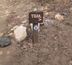
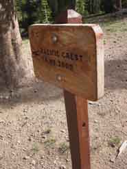
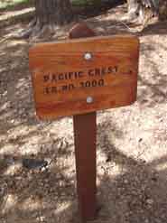
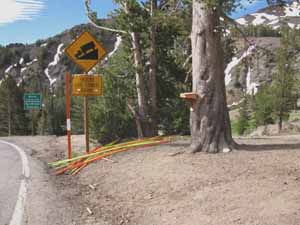
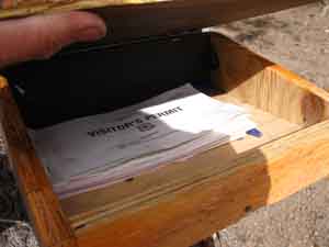
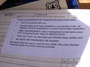
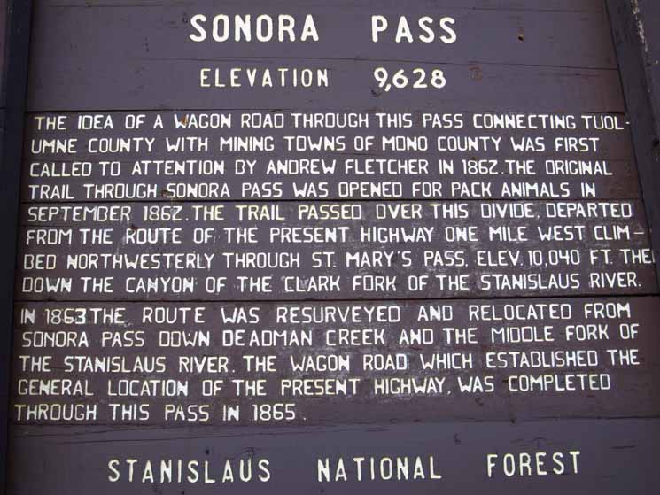
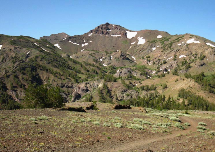
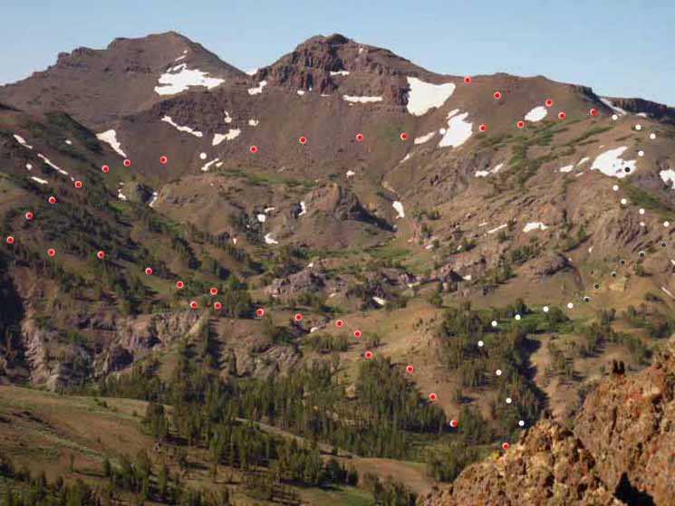
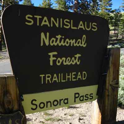
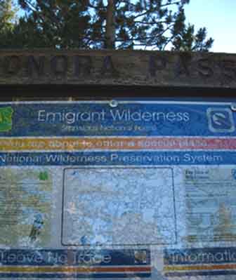
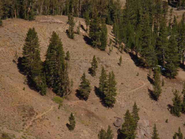
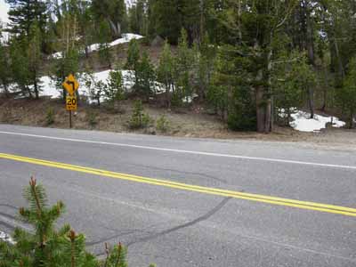
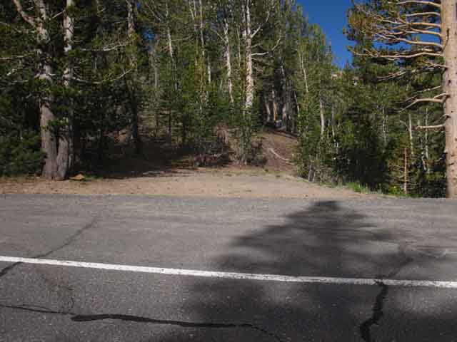
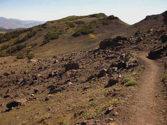
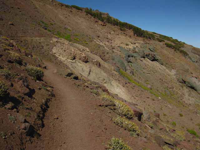
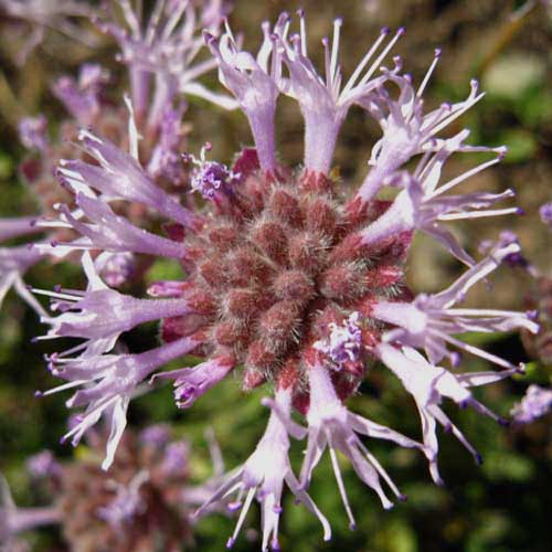
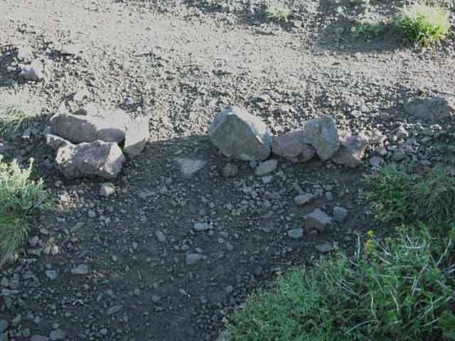
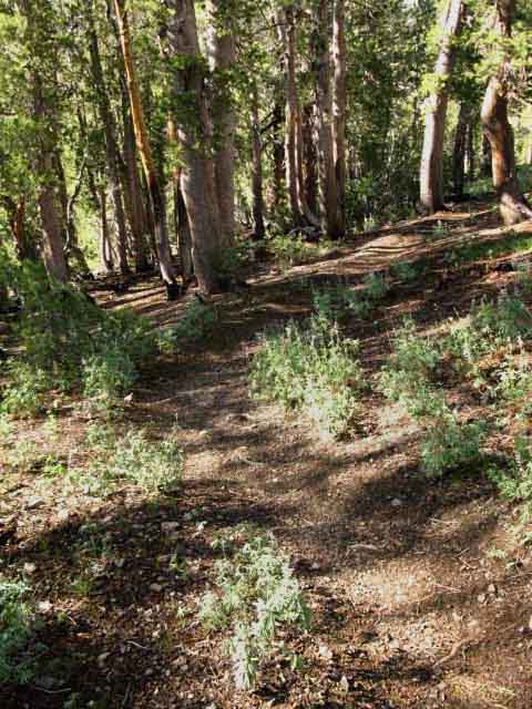
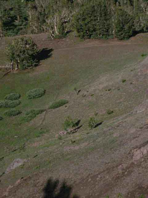
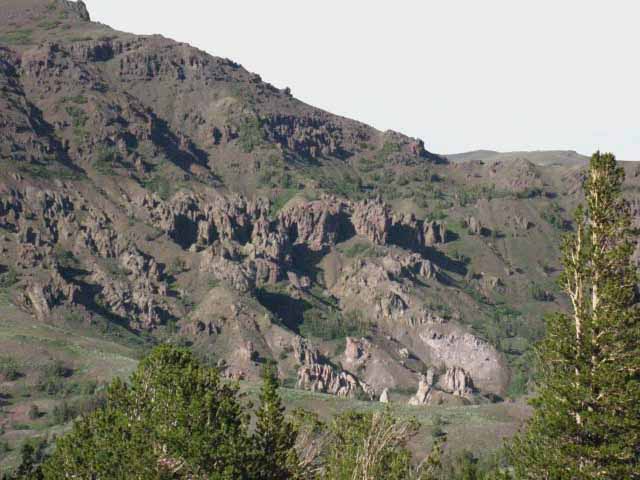
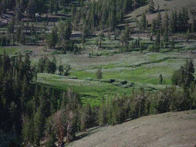
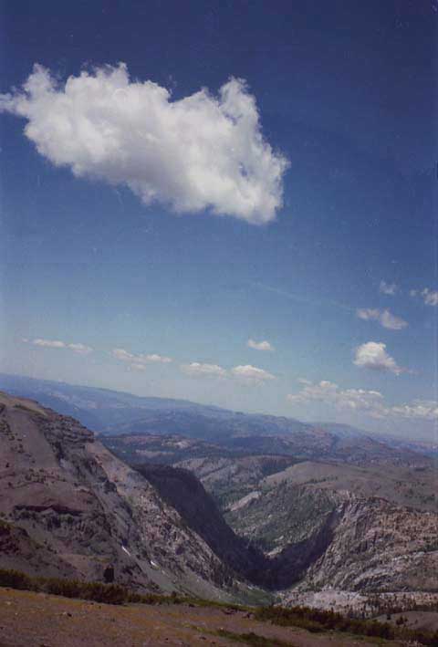
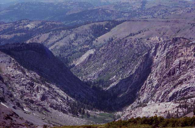
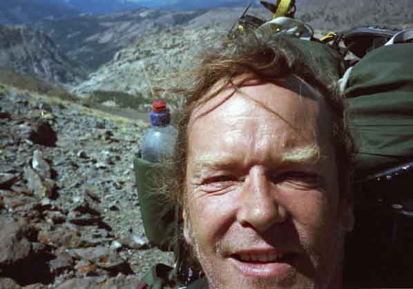
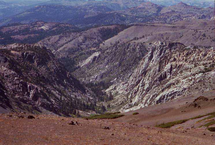
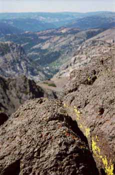
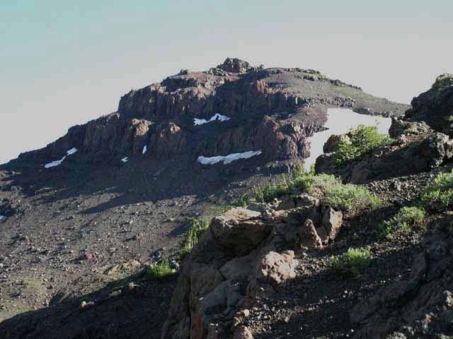
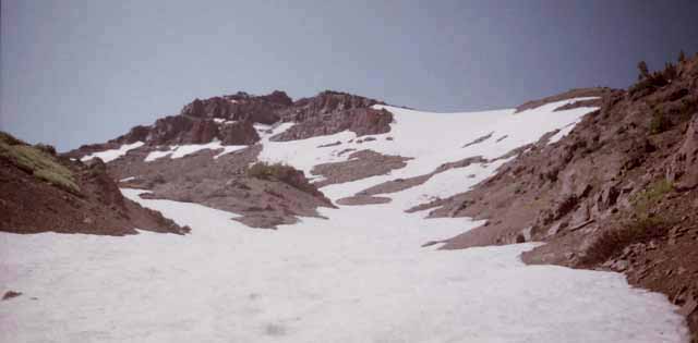
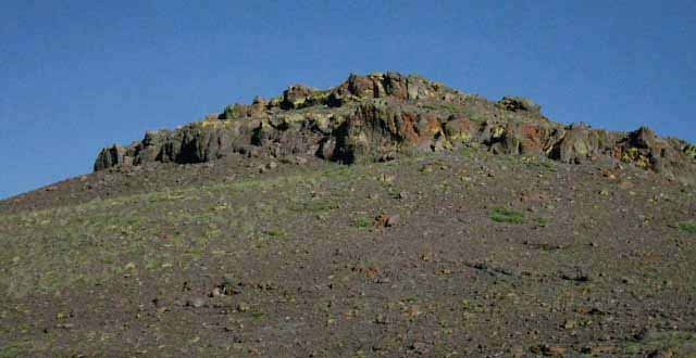
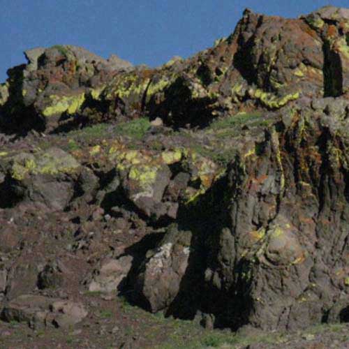
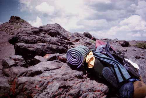
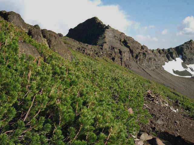
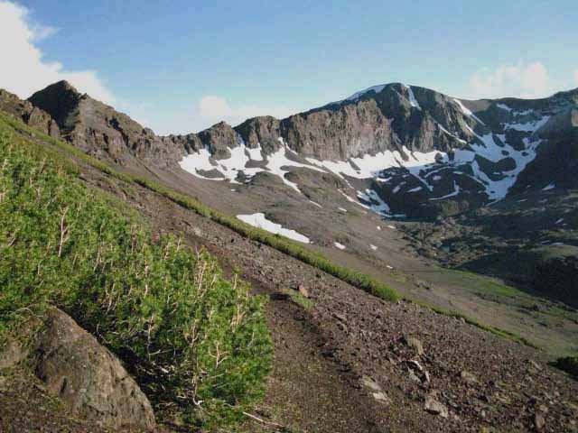
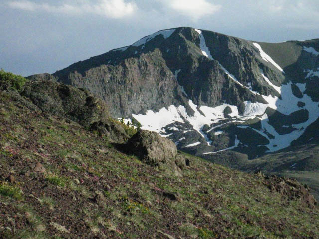
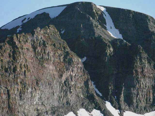
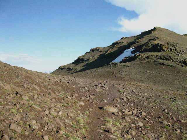 Hiking over the flattish berm of a Sierra Crestline to the East flank between Peaks 11245 and 11260. The last quarter-mile between these two peaks is hairy during mid-Winter, when this approach is steep. Either you trust your crampons and your ability to self-arrest, or you will freak out.