
The Trails
Guide
Maps
Miles/Ele
Permits
Resupply
Forum
Current Weather Conditions
Weather Notes
Northern High Sierras
Central High Sierras
Southern High Sierras
Gear
Gear List
Gettin Started
Layering
Discussion
Testing yourself and your gear
Gear Reviews
Backpacking
Round Top Lake
on
Round Top and The Sisters
Hiking
The Tahoe to Yosemite Trail
Languages
Languages
Trail Arts
The art of walking
Physical Preperation
Trail Skills
The trail
Off the trail
Scrambling
Maps
Navigation
Camp skills
Food
Resupply
Food
Other
Photo Catagories
Trail Stories
Trail Culture
News and Science
Links
Groups
Books
Terms and Conditions of Use
| Trail Guide Section INDEX |
TYT North Woods Lake |
TYT South Fourth of July Lake |
PCT |
Topo Hiking Map CPMA |
SOUTH TYT Topo Map Carson Gap to Lake Alpine |
NORTH TYT Topo Map South Upper Truckee to Carson Pass |
Topo Map |
Carson Gap to Lake Alpine MILES AND ELEVATIONS |
EL Dorado National Forest |
Tahoe to Whitney on You Tube |
Round Top Lake
Trail Junction
| EAST | NORTH | SOUTH | ||
To the PCT |
TYT North Lost Cabin Mine Trail to Woods Lake. 1.61 miles |
TYT South Round Top Lake page below |
||
Carson Pass Management Area |
|
TYT Further North Carson Gap to Woods Lake. 1.79 miles |
TYT Further South Round Top Lake to Summit City Creek via Fourth of July Lake |
|
| East | North | South | ||
 Trail East to Winnemucca Lake. |
 Trail North to Woods Lake. |
 Trail South to Summit City Canyon. |
||
EAST |
NORTH |
SOUTH Summit City Canyon |
||
ROUND TOP LAKE Round Top Lake is in the CPMA and the Mokelumne Wilderness, and both are within the Northeastern corner of the El Dorado National Forest. The CPMA is a very small and a very busy and beautiful backpacking spot, especially during Summer weekends. These factors combine to make getting local backpacking permits difficult during Summer Weekends. Lots of hikers and backpackers come here during Summer Weekends. Tahoe to Yosemite Trail hikers find themselves crossing through the heart of the Carson Pass Management Area on our way over Round Top and the Sisters, by one route or the other, while PCT hikes only scrape the Eastern edge of the Carson Pass Management Area on their way through Carson Pass. The CPMA poses interesting issues for Tahoe to Yosemite Trail hiker who wishes to camp here on their way South, for this area has been restricted to a few designated campsites at Round Top Lake and its other premium campsite locations. Check out my information on the CPMA for how I handle my trips through this delightful area. Backpacker's InformationTotal Miles
POST UP! All backpackers can post text comments about the following section of trail through the comments links on all the trail guide pages. Registered Members can post up stand alone post about the trail with text, images, maps and videos in the Trails Forum that supplements this section of the Trail Guide. Check out the Tahoe to Whitney .org Backpacking Trails and Topics forums |
||||||||||||||||||||||||||||||||||
Video
Three ways from Carson Gap to Round Top Lake
Three Ways from Carson Gap to Round Top Lake Duration: 13:27 In the video above we hike the PCT route from the Carson Gap through Carson Pass. Turning Right, to the Southwest on the Tahoe to Yosemite Trail route at the Winnemucca Lake trail junction opens up views across the Carson Pass Management Area revealing the terrain our two other potential routes cross between Carson Gap and Round Top Lake. When we arrive at Winnemucca Lake we pass the trail junction where the "middle" route, the trail coming up from Woods Lake arrives at Winnemucca Lake. Continuing West to arrive at Round Top Lake we take note of the third route up to Round Top Lake, the Lost Cabin Mine trail coming up from the campground near Woods Lake. This is the most Western of the three routes. Our route up from Carson Pass via Winnemucca Lake was the most Eastern route. This video covers the Eastern route from Carson Gap to Round Top Lake through Carson Pass and Winnemucca Lake. This is the most lengthy route between these two points. The Woods Lake trail guide page covers the other two routes, of which the Lost Cabin Mine Trail is the most direct and steepest route, while the "middle" route over the footbridge near Woods Lake up to Winnemucca Lake splits the difference in difficulty and distance between the "Eastern" and "Western" routes. Our next move is from Round Top Lake to Fourth of July Lake on our way down to enter the unmaintained section of Tahoe to Yosemite Trail along Summit City Creek.
Summit City Creek to Bee Gulch Video Playlist |
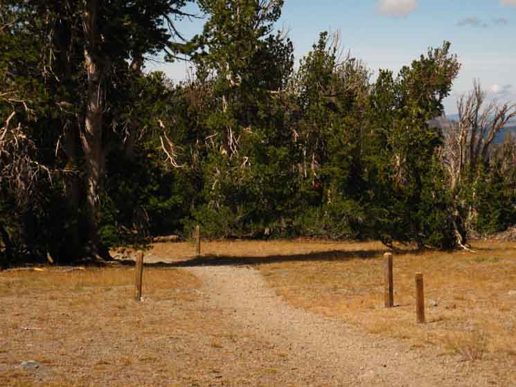
Hiking to Round Top Lakelocal and long distance hikers Round Top Lake Trail Junction Elevation Each of the 3 routes up to Round Top Lake bring us here to the trail junction at Round Top Lake from our exit point from the Tahoe Basin through the Carson Gap. From Round Top Lake our next steps depend on our particular backpacking trip. This MAP depicts the Tahoe to Yosemite Trail backpackers will hike West through this junction, maybe after spending a night by Round Top overlooking the Lake and the South Tahoe Basin. The horizon is huge from Round Top Lake, stretching from West around to Northeast, with the Tahoe Basin making up a good part of the Northern Horizon. Hopefully we will see one of Round Top's stunning sunsets when we pass through. Tahoe to Yosemite Trail hikers drop a lot of elevation from here. Hiking South past Fourth of July Lake on our way down into Summit City Creek assures we will not see the sun set on the horizon for at least a couple of days. The un maintained section of trail South of the Summit City Creek trail junction experiences sunset when the sun drops behind the canyon wall.. Local Loops Most hikers at Round Top Lake are on short local trips staying within the Carson Pass Management Area. These backpackers will camp here at Round Top Lake, or maybe hike on to Fourth of July Lake, before hiking back to their original trailhead, most often at Carson Pass. The three trails up to Round Top Lake allow local hikers to craft a small loop route to and from Round Top Lake if desired. A bigger loop option for local hikers is to loop Round Top, rather than just hiking up to Round Top Lake and back. Longer Local Loop To loop hike Round Top we will follow the Tahoe to Yosemite Trail route from Round Top Lake past Fourth of July Lake into Summit City Creek. Instead of following the TYT route down Summit City Creek we turn up Summit City Creek to hike up to Forestdale Divide, where we follow the Pacific Crest Trail North back to Carson Pass. This loop can be further extended by hiking to the Blue Lakes before intercepting, and turning North on the Pacific Crest Trail. |
Long Distance Backpackers Mileage
|
Long Distance Backpackers
Mileage
|
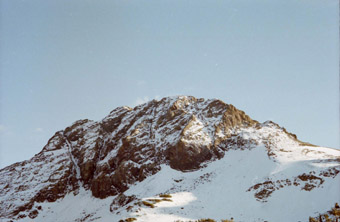
Round Top Lake
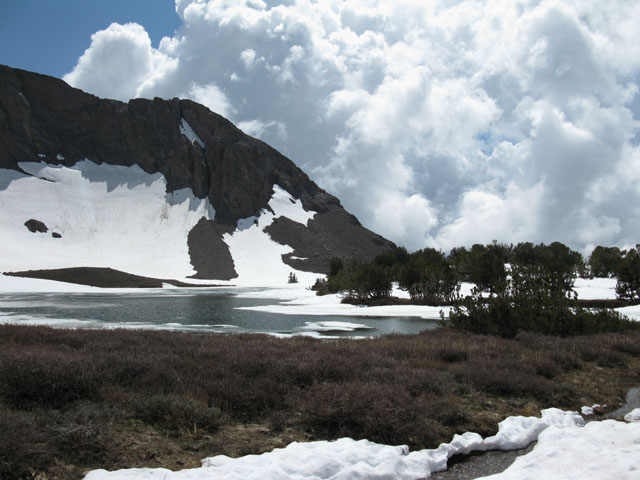 |
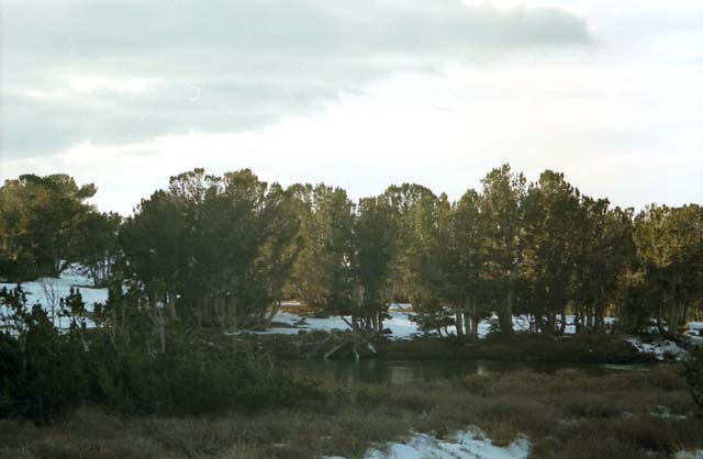
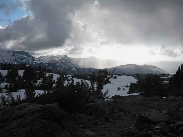
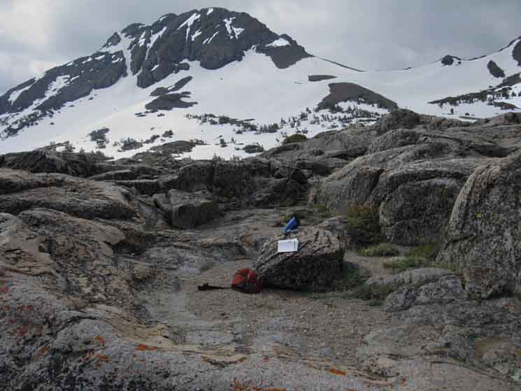
Round Top Lake Spring Thawing June '09 with nifty monster wall of clouds in Southwestern background. The TYT bends around the far shoulder on its way to Summit City Creek.
The Spring ThawThis is the view West-Southwest while backpacking West to Round Top Lake via the Winnemucca Lake approach from the East during the Spring Thaw of 2009. Note the trail emerging from snow in the foreground right. The trail junction coming up to Round Top Lake from the Lost Cabin Mine trail is just ahead. It turns North (Right) to head down off the mountain towards Woods Lake. The trail in the foreground continues West (Straight) through the Round Top Lake trail junction up ahead to pass around the Southwestern flank of this mountain, Round Top and The Sisters, on its way down to Fourth of July Lake. The flank of the West-most ridge off the West side of The Sisters is seen descending behind the lake. Our TYT route South passes the far side of where the trees meet the base of the mountain flank in the distant center-Right of the image above. The six campsites at Round Top Lake are scattered through those trees along the trail South of the Round Top Lake trail junction. The Tahoe to Yosemite Trail route Trail wraps around the Western flank of Round Top and the Sisters on its way to drop down into Summit City Canyon hiking past Fourth of July Lake. Fourth of July Lake is nestled 2.3 miles South of the Round Top Lake trail junction in a small hanging amphitheater slung between and below this mountain, and the peak just to the West, aptly named Fourth of July Peak. |
Round Top Lake
 |
 |
The last steps hiking up to Round Top Lake on the Lost Cabin Mine trail route. This route approaches Round Top Lake from the North. There is a perfectly maintained trail under this snow. Round Top sits in the background. The Tahoe to Yosemite Trail route turns Right, to the West, at Round Top Lake. |
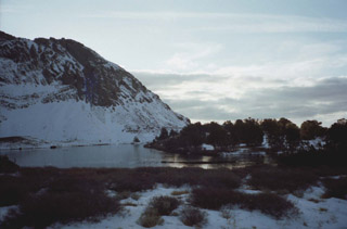
Round Top Lake frozen in November |
November, Round Top Lake frozen
 |
White bark pine grove on the Northwest side of a frozen Round Top Lake during November. |
Round Top Lake
A Sweet Place Round Top Lake sits in a depression at the foot of The Sisters, the twin 10,000 foot peaks that share this chunk of crestline with Round Top. I put the elevation of the trail junction on the North side of the lake at 9360 feet. Round Top, crowning the crestline at 10,381 feet, is actually offset a bit to the Southeast of its namesake, Round Top Lake, and The Sisters. If you scout about, or camp on the Northern side of the lake, I think you will find spots where you can enjoy the expansive views North that sweep the horizon from East to West. Camping in the depression that Round Top Lake sits in is not advised during the Winter. Very cold air settles in this depression, making it considerably colder than the higher terrain around the lake. Er, well, ignore that advice. There are six assigned campsites. Very Few Campsites The CPMA laid out designated campsites to both limit the number of overnight permits and contain the damage of campsites to a few locations. This tiny area administers Winnemucca Lake (three sites), Round Top Lake (six sites), and 4th of July Lake (six sites). (See these important permitting notes about Camping at Round Top Lake) Round Top Lake also offers an occasional bonus for spending a night here: Amazing Sunsets, and a rich array of wildlife. Though most brilliant during the Winter months, sunsets from Round Top Lake can be breathtaking. And Round Top Lake features a wide array of life during all seasons. Backpacking South on the Tahoe to Yosemite Trail, you head West from the Round Top Lake trail junction to pass around the Western Shoulder of the Western Sister following the trail down past Fourth of July Lake on your way to Summit City Creek. Round Top Lake is a nice place to spend a night on your Tahoe to Yosemite hike, so put it on your hiking plan, and name it on your permit for an evening's campsite if it fits into your mileage and time management plans. Round Top Lake as a stand-alone DestinationThis is a great place to break in kids, or give your "significant other" a backpacking experience that's only a small doses of difficulty providing maximum beauty. The Carson Pass Management Area has an excellent "pain of backpacking to pleasure of backpacking" ratio. Round Top Lake is a high elevation location, but its short distance from the three trailheads to the top keeps it from torturing beginning backpackers too much. |
South to the Round Lake Trail Junction
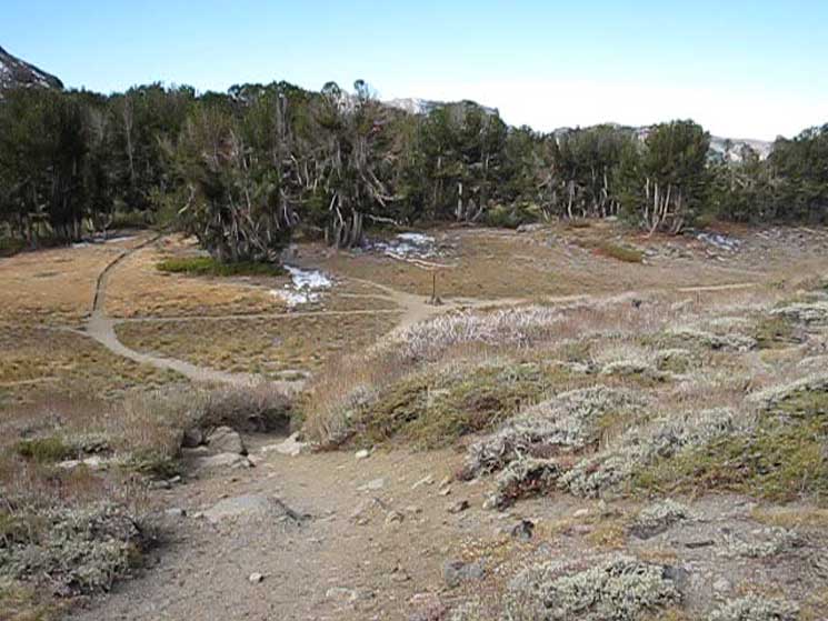 |
Above we're hiking "South" by trail direction on the Tahoe to Yosemite Trail route option from Winnemucca Lake approaching the Round Top Lake trail junction. We're actually hiking West by the compass, and will continue West on the Southbound Tahoe to Yosemite Trail past Round Top Lake. We can see the trail coming South up from Woods Lake approaching the junction from the Right, the North, as well as the Southbound Tahoe to Yosemite Trail route continuing West, up into those trees, which are wrapping around the Northwest shore of Round Top Lake past the junction. That's where the Round Top Lake Campsites are located. |
Hiking South
through the
Round Top Lake trail junction
The six campsites at Round Top Lake are all located along the Tahoe to Yosemite Trail off the Northwest shore of Round Top Lake. That would be South, past the trail junction pictured above. The campsites begin as soon as we hike South on the Tahoe to Yosemite Trail through the Round Top Lake trail junction, which is hiking West by the compass. Our Southbound Tahoe to Yosemite Trail will bend to point Southwest by the compass as it swings around the West flank of Round Top and The Sisters after hiking past Round Top Lake. |
 |
Campsites begin within feet of hiking South of the Round Top Lake trail junction. In the background is the Westernmost end of the crestline of Round Top and The Sisters. Our trail will bend around the base of this steep feature until we are pointed South by the compass. |
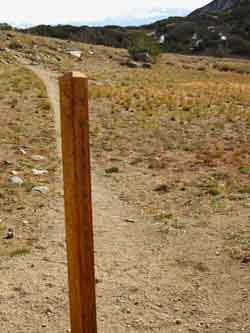
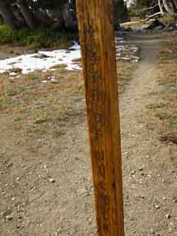
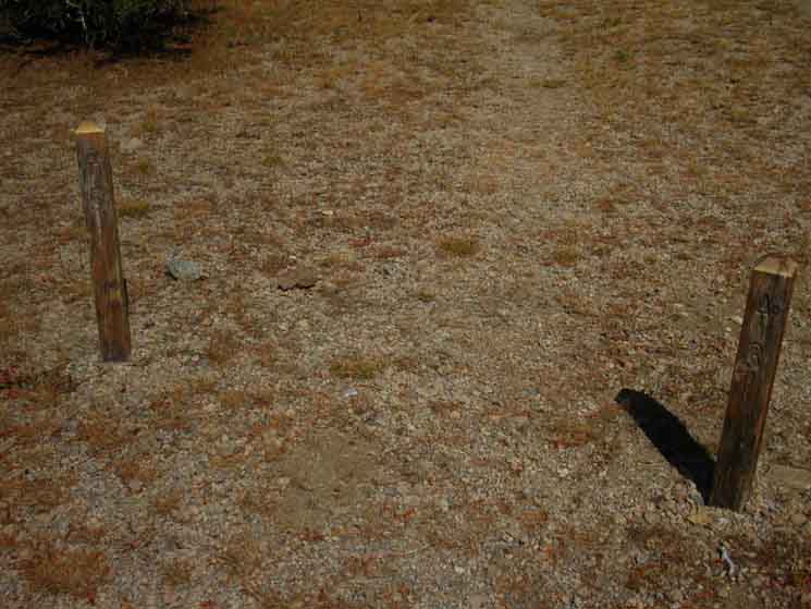
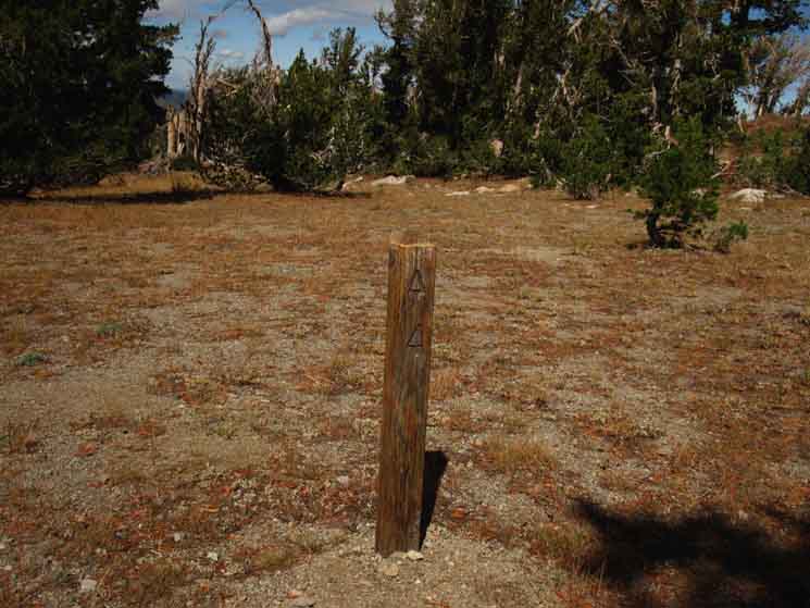
Campsite 2
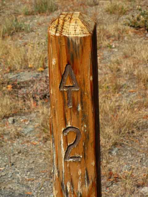 |
| Closeup of the post in the second image above, campsite Two at Round Top Lake. |
Southbound
Tahoe to Yosemite Trail
 |
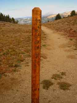
A Cluster of Campsite Posts On the Right are campsites 3 and 5. To the Left is campsite 6, and 4 is located by the most distant post. Campsite 2 is just feet behind us. I'm not sure where camp 1 is. Which campsites do you prefer? |
5 and 3 to the Right
 |
Campsites 5 and 3 are on the North side of the trail South. We'll get good views of the horizon, and sunsets, from out there. |
Campsite Six to the Left
 |
Looking across camp 3 and 5 posts on the North side of the trail at the post for camp 6 on the South side of the trail, a bit closer to Round Top Lake. The Southbound Tahoe to Yosemite Trail is running from Left to Right, East to West by the compass here. We can see the flank of the Westernmost Sister rising through the trees. Round Top Lake lays between the tree line and the base of the rising flank of The Sister in the background. |
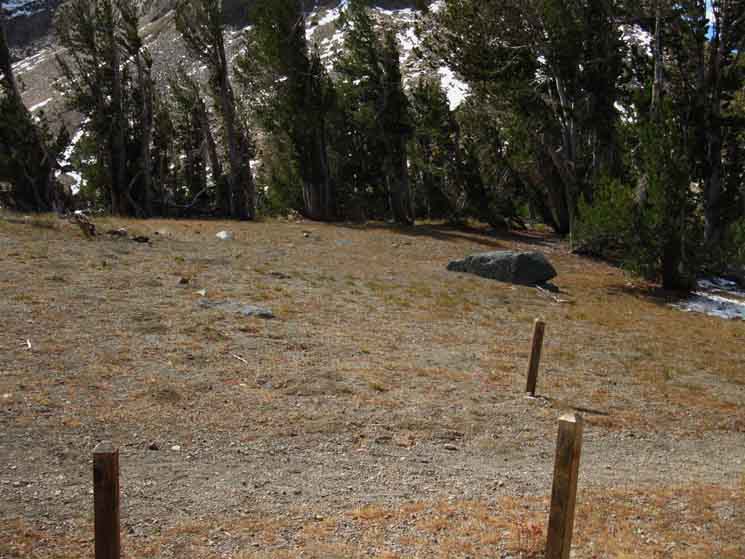
Camp 4
 |
Camp 4 is the last campsite hiking South from Round Top Lake. It's off the North side of the trail. |
Round Top Lake Below we're going to roam around the area around Round Top Lake to check out the weather, views, terrain, wildlife, and its amazing sunsets. I suggest taking off the pack, taking a break, and then checking out the area around Round Top Lake before finishing the last bit of our hike South through the campsites to begin our descent into Summit City Canyon via Fourth of July Lake. Well, that's if you are not going to spend a night here. My first suggestion is to spend the night at Round Top Lake. If you can't spend the night here, then do take a break and check it out. |
Video
Round Top Views
|
A swift tour of Round Top Lake. 2:36.
Video Playlist |
Round Top
 |
Round Top dusted with late Fall Snow. |
Round Top Lake frozen solid in November
 |
Sunset casts a red glow on Round Top Lake's frozen surface. A clear and very crisp evening. |
Round Top Lake in Snow Conditions I've enjoyed a triangle route out of the South Upper Truckee Trailhead for many years. In 2010 I brought my friend Ari along for four nights of snow camping as we etched out the following route. Ari really enjoyed it. This terrain is beautiful in Spring and Summer conditions, but quite special during its first seasonal steps towards the Spring Thaw. The basic route I enjoy tracks from the South Upper Truckee Trailhead up to Round Lake to Showers Lake within the Meiss Country Roadless Area in the Tahoe Basin. From Showers Lake we hike out of the Tahoe Basin through the Carson Gap up to Round Top Lake. We'll return to the South Upper Truckee trailhead again through the Carson Gap and again past Round Lake on our way back down to the South Upper Truckee Trailhead. I don't suggest trying the short but steep route between the South Upper Truckee Trailhead to Round Lake in snow conditions unless you've scouted it carefully in Summer conditions. The route described above can be broken down into a number of shorter trips remaining within either the Meiss Country or Carson Pass Areas or even shorter trips tying the various legs of the trip together during Summer or Winter. In other words, you can do as long or as short a backpacking trip as you desire.
The two maps above cover the terrain for trips remaining within either area, and across both, as I would prefer. The Meiss Country Roadless Area and Carson Pass Management Ares are good places for experienced backpackers to begin picking up Spring snow backpacking and camping skills. During Spring the temps have risen and the chances of bitterly cold powerful storms decreases. But we must exercise caution tempered with respect for the power of nature to surprize us. On both sides of the equation, as nature brings both unexpected pleasures as well as pains. Carson Pass has a web of blue-diamond marked Winter trail routes basically following the trail routes from Carson Pass to Woods Lake and on up to tree line below Winnemucca Lake. A blue diamond route also moves South from Carson Pass to the tree line below Elephant Back. |
North: Woods Lake South: Fourth of July Lake
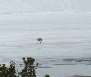
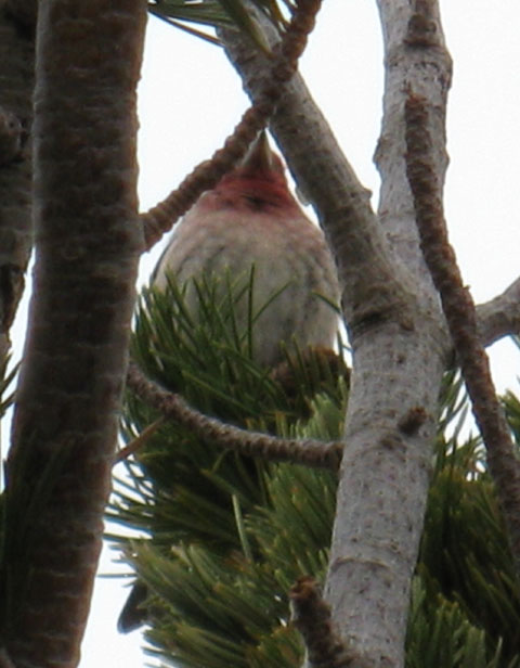
Wildlife
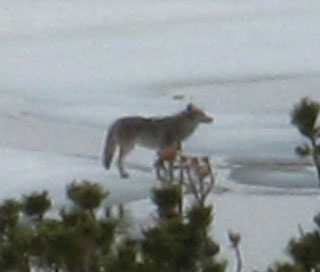
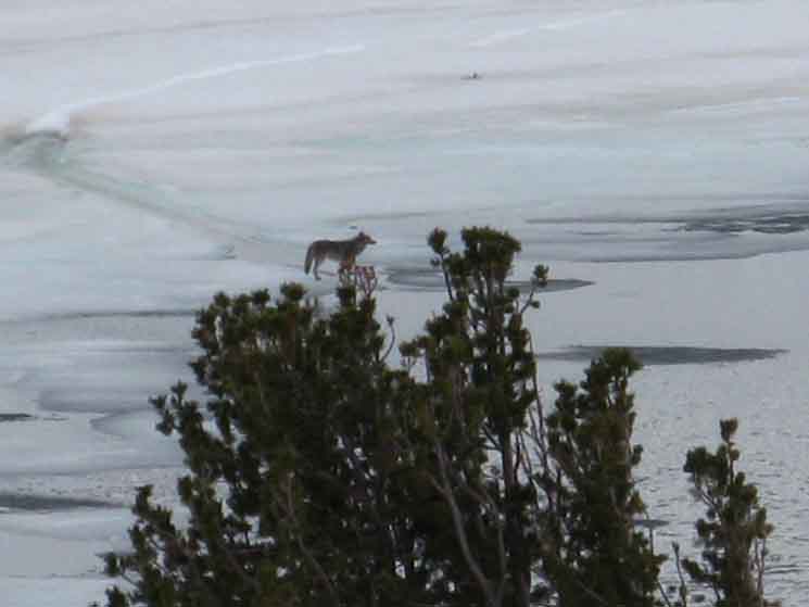
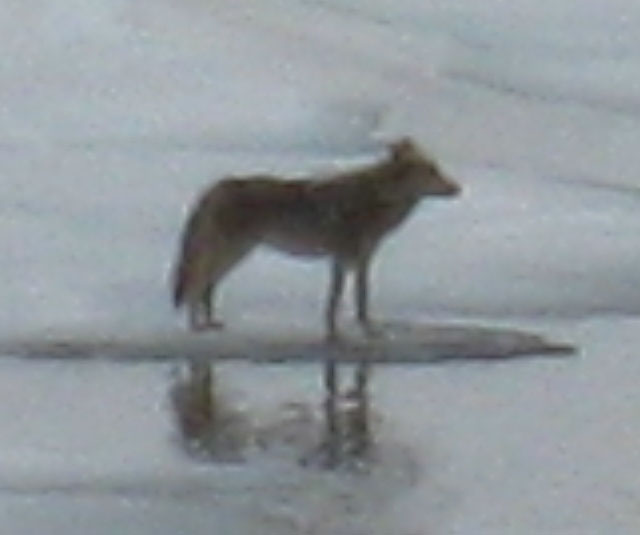
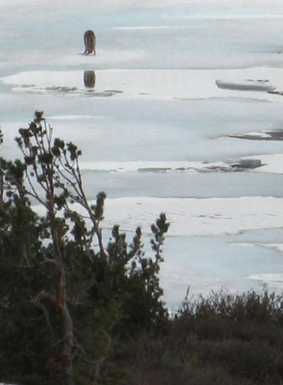
Coyote on the frozen surface of Round Top Lake
June 2009
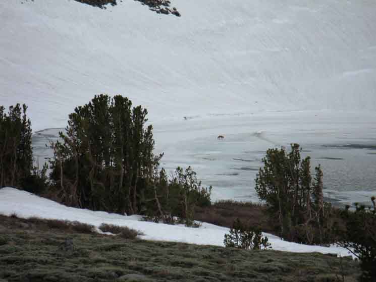 |
A coyote prowling away on the soft surface of Round Top Lake. |
Closer Looks
 |
 |
|||||
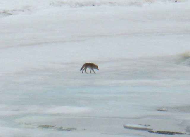
Coyote Sees Something
Not Me...
 |
I nestled in to observe the coyote without it observing me. |
Observing a Coyote on Round Top Lake
In early June of 2008 I departed the South Upper Truckee trailhead for a Spring snow trip to Round Top Lake. After arriving at Round Top Lake the next afternoon, I set up camp above the depression Round Top Lake sits within, and I posted myself up in a position where I could observe Round Top Lake, the flanks of Round Top and the Sisters, as well as the terrain bounding the Northern apron of the lake. I don't camp in the depression in the terrain around the lake. It contains and preserves very cold air, which I camp above. After observing the large number of birds and small mammals running about enjoying the advent of Spring, I was not too surprised to see a large and rather well-fed coyote dropping down onto the soft-frozen surface of Round Top Lake off the Southwestern flank of The Sisters. Looking behind me towards the tree and rock cover on the North flank of the Round Top massif I noted that there were many birds, squirrels, and various forms of coyote food running around. But the coyote before me on the lake was sniffing about in locations that were not frequented by its prey. I figure it was checking out the location for signs of other coyotes. After doing an extensive recon of the semi-frozen surface of Round Top Lake this Coyote headed East, and began a swift climb up the steep snow covered flank of the mountain towards the crest of Round Top itself. The coyote moved rapidly up the soft snow flank coming off Round Top. I lost sight of the critter when it entered a patch of White bark Pines among snow and exposed boulders, perfect cover that it disappeared within. |
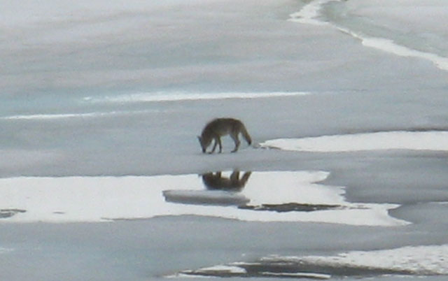
Coyote on Round Top Lake
| Onto a slushy surface. |
 |
| top of page |
 |
| comments |
 |
| top of page |
 |
Observing the Coyote on Round Top Lake. Also See the Video |
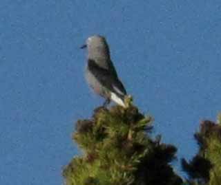
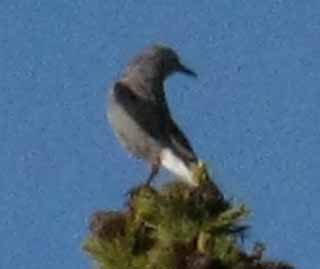
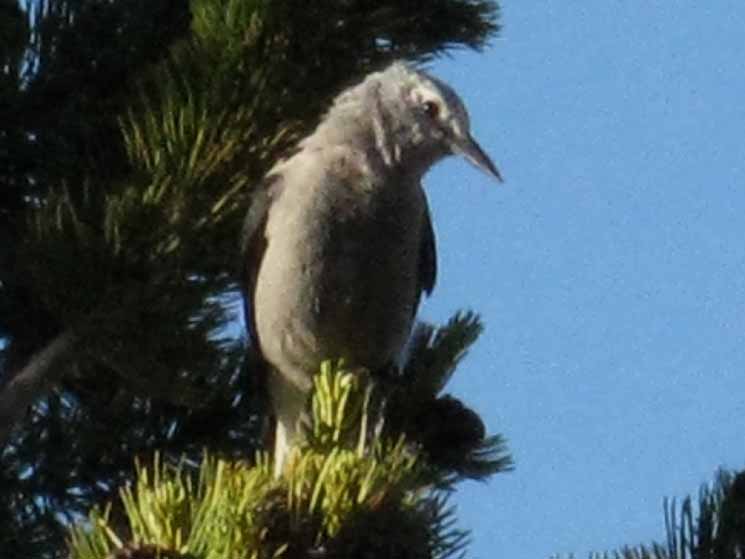
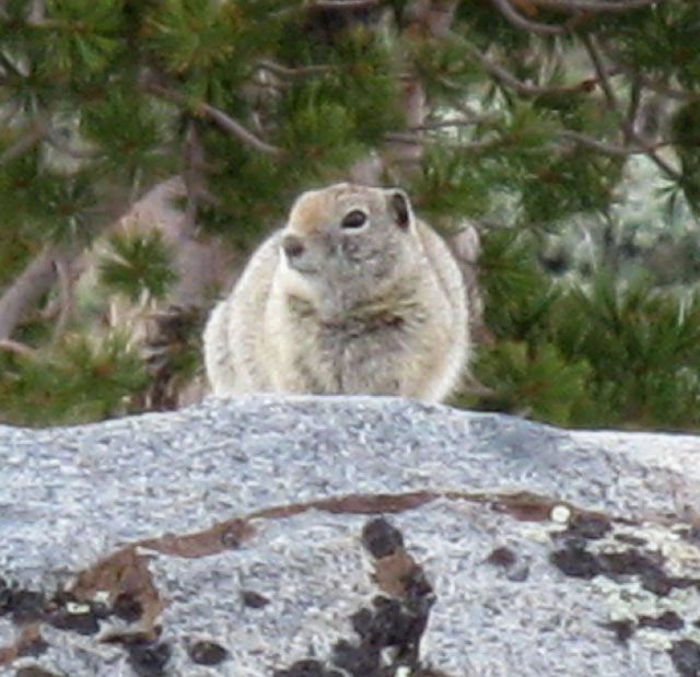
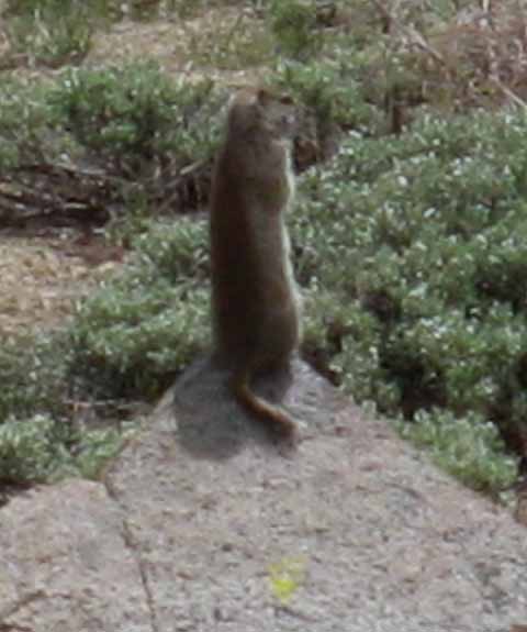
Wildlife
Many creatures call Round Top home
 |
 |
|||||
| top of page | ||||||
| Robin. | ||||||
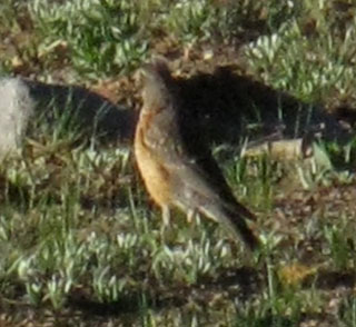 |
As the snow cover recedes the grasses grow, drawing a blossoming of life. The insects eat the grass, the birds eat the insects, and the coyotes eat everything. One thing draws another, until the feeding and breeding frenzy draws to a close as the mountains dry out.
|
|||||
| comments |
And they keep a sharp eye on us!
 |
| top of page |
Wildlife
 |
 |
| top of page |
 |
North: Woods Lake top of page South: Fourth of July Lake
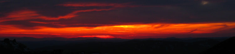
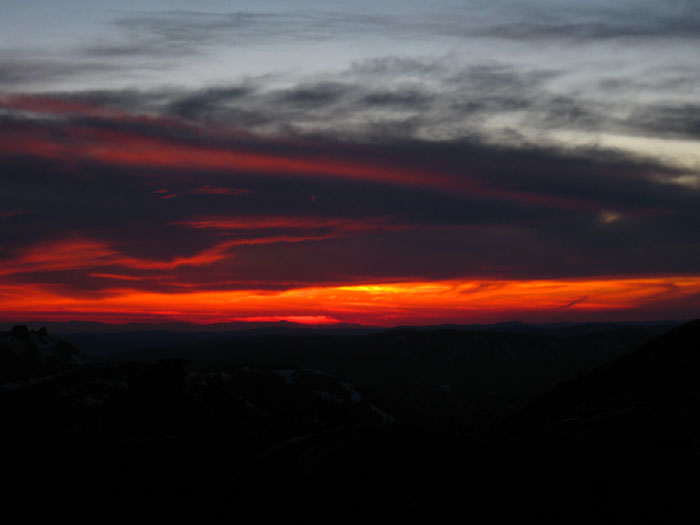
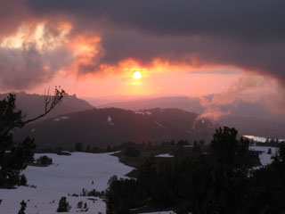
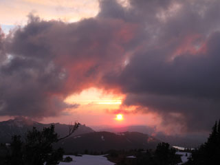
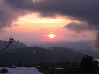
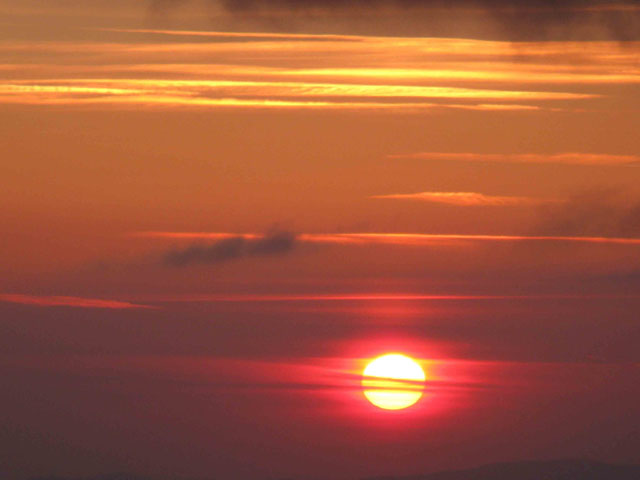
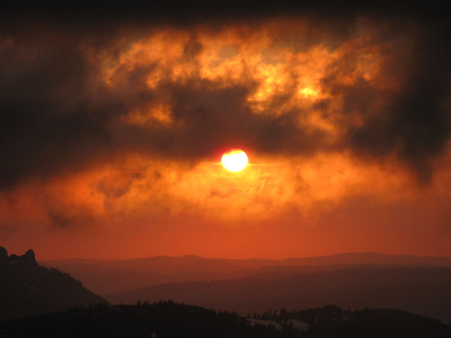
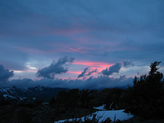
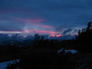
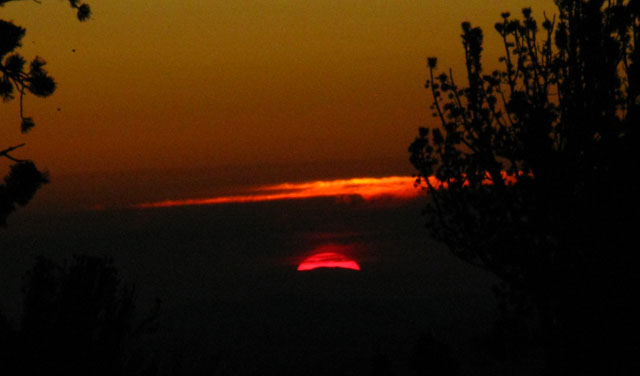
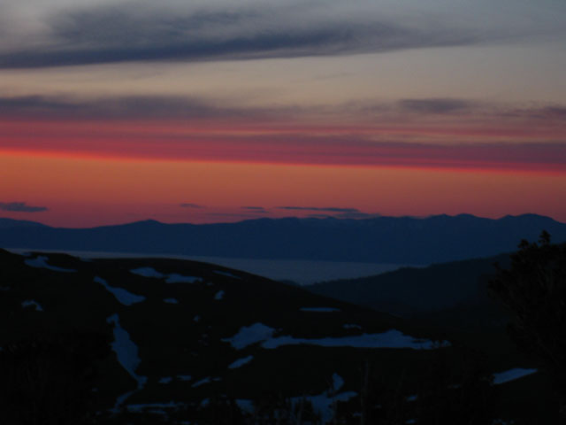
5 Stunning Sunsets from Round Top Lake
I've always tried to set up my schdule to camp at Round Top Lake during Summertime Tahoe to Yosemite and Tahoe to Whitney backpacking trips. The reasons are the combination of terrain, truly remarkable views, the abundance of wildlife, and the way the grasses and trees fit into all the above. And the Sunsets. Our longs views into the setting Sun of the Western horizon sometimes put amazing masses of moisture between us, the setting Sun, and the horizon. |
 |
 |
 |
|||||
| comments | ||||||
 |
 |
|||||
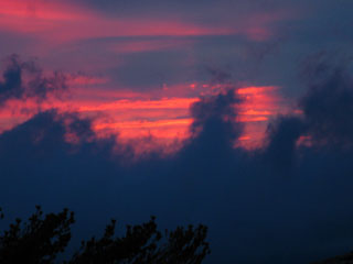
Great Nuke Fire in the Sky
 |
||
|
Ridges of the Western Sierra under Round Top Lake Sunset
 |
| Ridges composing the Western Flank of the Sierra glowing under the setting Sun. |
Light Show over Kirkwood from Round Top Lake
 |
Spring Showers wrapped within a melody of light, fog, and clouds. The ridge behind the sunrays is the Kirkwood Ski Resort. This was such a cool experience. I was getting peppered by showers, crazy beams of light, animated clouds and living fogs. A vortex of energy making all its expressions dance. I was expecting a big dude in white robes and beard to poke its head through the show... |
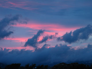
Low Clouds surging across a Florescent Horizon
 |
 |
|||||
| comments | ||||||
 |
 |
|||||
Last Light
 |
Backpacking to Round Top is rewarding, especially at sunset. We get such a grand sweep of the horizon from here. |
What
|
Sunset over Lake Tahoe from Round Top Lake
 |
All of the images above feature the natural colors recorded by my camera without any alteration. |
Find a comfortable seat
to enjoy the
Excellent Views from Round Top
| Lake Tahoe Basin in the Northern distance. |
 |
Lake Tahoe sits to the North through the Carson Gap, which is visible as the low ridge arm in the middle distance. Red Lake Peak rises to the Northeast of the Carson Gap on the far Right of the image, Little Round Top caps the Tahoe Rim Ridgeline to the Northeast, to the Left of the Carson Gap. We're scouting around to the East of Round Top Lake to get this view, scrambling over to where the East end of the shelf in the mountain below The Sisters holding Round Top Lake runs down to Winnemucca Lake. May 2002. |
A fine Point of Observation
and
Relaxation
| Round Top in Spring. |
 |
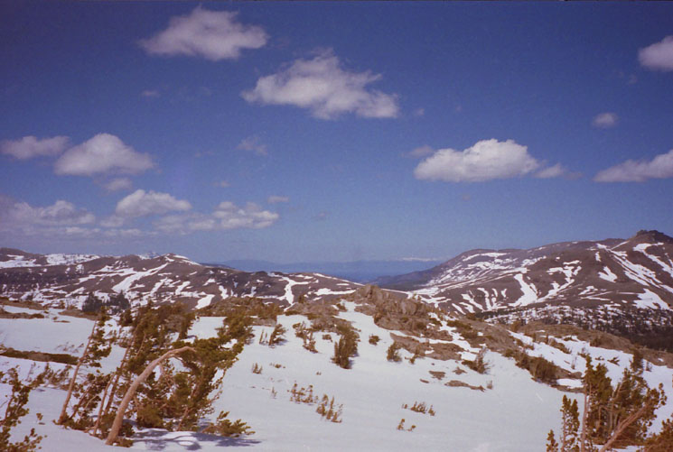
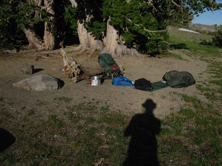
Round Top behind my perch. Note coffee cup, journal, book, and butt pack. This, my friends, is the perfect seat nature made for me to enjoy life. Well, one of them. When I say "perch," I mean a rock that provides not just one fine angle of support, but many. The perspectives from this rock offer as many good points of view as it does positions of comfort. Every now and again I would swich positions from uprigh to reclined, then sit upon the rock, each time gaining a new perspective of the surrounding beauty from a new position of comfort. Besides offering great seating and views, the natural shape of the terrain shelteres us from the wind while it collects the ambient heat of the Sun. Note how the pedastal/seating rock is in a rock bowl well below the height of the surrounding rock. We are protected from the winds while we collect the heat of the Sun. I took occasional notes and read from my book and watched as light, clouds, and mists with an odd patch of rain here and there cascaded across the sky. I adjusted and evolved through multiple angles of repose, each with unique perspectives of the surrounding terrain. During this trip I decided to spend a second night at Round Top Lake, rather than depart the next morning. My typical pattern is to arrive late in the afternoon and depart early the next morning. Round Top Lake and the surrounding mountains and sky were so beautiful that I decided to stay a second night. Once I decided to stay I went back to camp and re-divided up my food supply to accomodate the extra time on trail. My standard policy is to pack an extra day's food for every five day period between resupply spots. As this particular trip was a four-night, five day snow trip I had already packed calorie-rich daily rations, and supplemented my menu with abundant high-nutrition split pea and black bean soups. I had enough food for the extra evening on the trail. This decision, and the ability to accomodate my food needs for the extra day, opened up a whole day to walk around and explore the area around Round Top Lake and the surrounding shelf on top of the mountain its situated on. To find the rock pedastal that fit me so perfectly, and sit in it. Though much of the meadow and forest ground was covered with deep snow, much of the granite terrain to the North of the Round Top Lake bowl had collected enough heat to melt itself out of Spring's snowy grip. This thermal reality made for great scrambling. |
Lake Tahoe from Round Top
| View of Lake Tahoe under the Clouds from Round Top and The Sisters. |
 |
We're looking North, over the Southwest edge of the Tahoe Rim mountains wrapping around the Meiss Country Roadless Area, into Christmas Valley. The dark ridge arm descending towards Lake Tahoe in the far middle-Left foreground is the Eastern flank of Christmas Valley rising above the East side of Meyers. That's down by the trailhead of the The South Upper Truckee, the Southernmost of the three Lake Tahoe Trailheads described on this trail guide. |
July at Round Top Lake
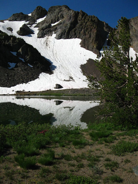 |
The trajectory of Winter into Spring into Summer changes every season. Though the timing of these seasonal transitions change, the beauty of the process remains constant. What changes is the character of the seasons. The character of this endless cycle of seasonal transitions change with the changes in their timing. At one time these changes brought a cycle of harsh and mild Winters, of fierce and gentle Spring Thaws, leading to moist and dry Summers. Now the changes in timing are pushing Spring and Fall deeper and deeper into Winter, pushing a series of dry Summers that are deeply changing the character of the Sierra Nevada, and the rest of the West Coast of the USA. This cycle always brings scenes of serenity. Now the character of that serenity is getting a dry complexion. A peaceful moment observing The West Sister draped in snow remnant viewed in and above Round Top Lake, July 16, 2009. |
Summertime at Round Top Lake!
Sweet Camping, Views, and Terrain
| Temps are hitting the low 80s during the day, and the mid 40s at night during mid-July. |
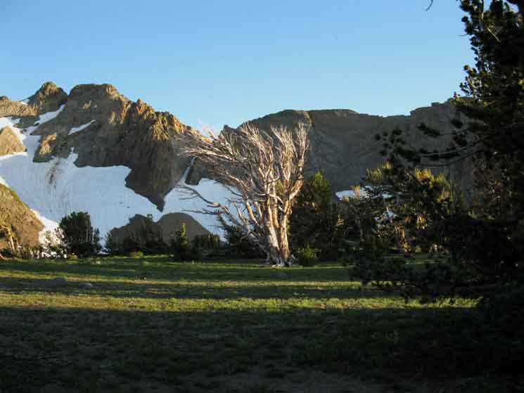 |
Bleached white bark snag before East Sister, beginning to reflect the direct light off the setting Sun off its reflective white surfaces. |
| The deepening colors of the setting sun light up the whitebark snag like a torch. |
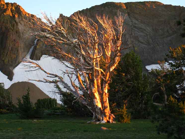 |
Bleached Whitebark snag taking on sunset red colors at Round Top lake. |
| July 16 at Round Top Lake. Round Top, beginning to glow in golden sunset hues, in the background. |
 |
Sunset hues brighten White bark Pines. Round Top in background. |
| Though temps are up during July, and during Summer, the Sierras can deliver very cold weather at any time. |
 |
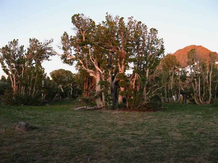
Mornigh light on my fine campsite. Fine campsites surround Round Top Lake, but we can only use the ones on the Northwest shore. |
Round Top Lake is a fine four-season backpacking location for short trips, and a great place for a break or camping on long distance backpacking trips. Because of its special beauty, I must recommend camping at Round Top Lake, despite its overcrowded state on Summer Weekends. |
South from Round Top Lake
Tahoe to Yosemite Trail
 |
|||
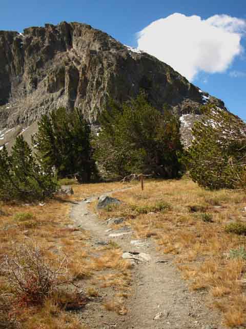
Hiking South on the Tahoe to Yosemite trail from Round Top Lake. Beyond the thin stand of whitebark pines and campsites on the Northwest shore of Round Top Lake our trail South crosses exposed terrain as it wraps around the Northwest flank of Round Top and the Sisters. Melissa Coray Peak rising from behind the flank of The Sisters on the far Left of the image and the sheer flank of Thimble Peak juts skyward on the far Right side of the image above. I think that's the top of The Cornice ski run, or somewhere close to it. Many Winter nights I've watched the Kirkwood snowplows grooming the flank under Thimble Peak. We can see the trail is turning Southwest as it follows the bend of the circumference of the mountain around to the Southwest. Hikers on the Southbound Tahoe to Yosemite Trail coming up from Winnemucca Lake have been hiking West by the compass. Now the trail is taking on the Southwestern line it will roughtly follow all the way down to Camp Irene. Here at the Round Top Lake trail junction we are standing at 9360 feet. Camp Irene is the low point of our next section of trail at 5280 feet. We will lose these 4080 feet over the next 13.13 miles by first dropping down into Summit City Canyon on our way to drop even deeper into the great canyon of the North Mokleumne River.
|
North: Woods Lake top of page East: Carson Pass via Winnemucca Lake South: Fourth of July Lake
Round Top |
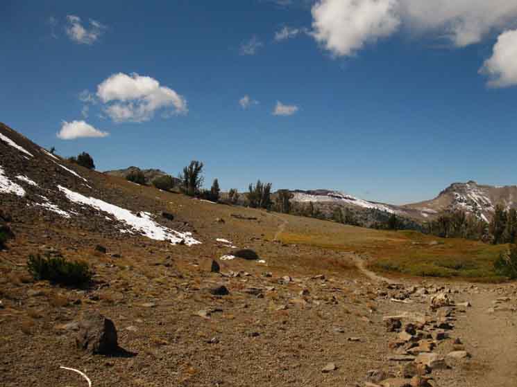
Round Top Lake is an excellent place to camp on your Tahoe to Yosemite Route, or it can be an excellent location for a very short backpacking trip. If you are on short or long High Sierra backpacking trips across Highway 88 near Carson Pass, Round Top Lake is worth at least taking a nice break and camping here to enjoy its beauty. Long Trips through the Carson Pass Management Area Long distance Hikers passing through the Carson Pass Management Area should not have to obtain a second permit to camp in the Carson Pass Management Area, if they listed any of the lakes in the CPMA as one of their nightly campsites hiking down the long trails. All National Forests, National Parks, and special zones must honor permits issued to long distance backpackers by other National Forests, National Parks, and special zones. Every now and again the Whitney Zone goes crazy and insists that other NF's regulate permits with a Mount Whitney exit, as during the Whitney Zone Sticker experiment. These end badly. As of 2012 I understand forests near Whitney are restricting the number of Eastbound Whitney exit permits they are issuing. As always, check ahead of your departure time, with the National Forest and specific Ranger District issuing your long distance backpacking permit for any current restrictions. Short Trips in the Carson Pass Management Area If you are considering a short Summertime weekend trip to Round Top in The Carson Pass Management Area, you may not be able to get a permit due to permit restrictions. The Carson Pass Management Area was set up to specifically manage the Round Top-Sisters massif and is very busy during Summer weekends. This may cause you to consider bypassing Round Top Lake, and camping at Fourth of July Lake as an alternative to camping at Round Top Lake. Being a bit further from the trail head, lower down on the mountain, and with more contained views, Fourth of July Lake's permits will remain after Round Top Lake's are taken. No big deal! Fourth of July Lake is a wonderful place to camp. CPMA contact information Hike the Region! There is free car camping in the National Forest Lands to the West of Woods Lake along the dirt road that branches off the paved road to Woods Lake. Bring the family and friends for a car camping trip, and run them up to the beauties of Round Top Lake, or head North across Highway 88, to enter the Tahoe Basin and Explore Meiss Meadow on day hikes or short backpacking trips. More Information 7.5 Topo Hiking Map 1 x 2 degree Topo Index Map Click along the trail routes on this large map for links to maps and trail guide pages. This map is an experimental index of the underlying maps and trail guide pages. 30 min Tahoe to Yosemite Topo Hiking Map 7.5 Topo Hiking Map Note: South |
High Sierra Backpacking Trail Guide NorthWoods LakeEast |
 |
High Sierra Backpacking Trail GuideSouth |
Backpacker ForumsHave you hiked these mountains before? Do you have a great route or trip to relate?Post it on
|
North: Woods Lake East: Carson Pass via Winnemucca Lake South: Fourth of July Lake
Trailhead
Contact
Alex Wierbinski

Backpacking Lake Tahoe to Mount Whitney
Your guide to the High Sierra Crest, including the Tahoe to Yosemite, Pacific Crest, and John Muir Trails
