
The Trails
Guide
Maps
Miles/Ele
Permits
Resupply
Forum
Current Weather Conditions
Weather Notes
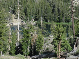
Northern High Sierras
Central High Sierras
Southern High Sierras
Gear
Gear List
Gettin Started
Layering
Discussion
Testing yourself and your gear
Gear Reviews
Backpacking
Carson Gap
to
Woods Lake
to
Round Top Lake
Hiking
Tahoe to Yosemite Trail South out of the Lake Tahoe Basin
Languages
Languages
Trail Arts
The art of walking
Physical Preperation
Trail Skills
The trail
Off the trail
Scrambling
Maps
Navigation
Camp skills
Food
Resupply
Food
Other
Photo Catagories
Trail Stories
Trail Culture
News and Science
Links
Groups
Books
Terms and Conditions of Use
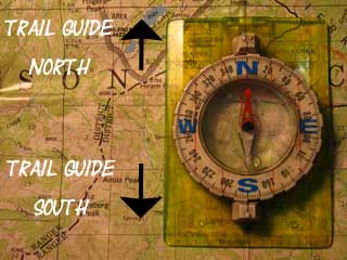
| Trail Guide Section INDEX |
Trail Guide NORTH Carson Gap |
Trail Guide SOUTH Round Top Lake |
Topo MAP Carson Pass Region |
SOUTH Big MAP Mokelumne Wilderness |
NORTH & SOUTH MAP Echo Summit to Bee Gulch |
NORTH MAP South Upper Truckee to Carson Pass | Carson Gap to Lake Alpine |
Map Index Carson Gap to Lake Alpine | EL Dorado National Forest | Tahoe to Whitney on YouTube |
Hiking South
out of the
Lake Tahoe Basin
on the
Tahoe to Yosemite Trail
The Carson Gap
Spring
 |
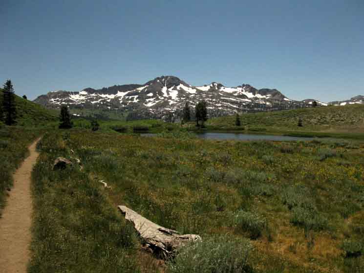
| Round Top and the Sisters under Spring snows of May 2007. |
Late Spring
 |
| View South through the Carson Gap on June 7 2009. |
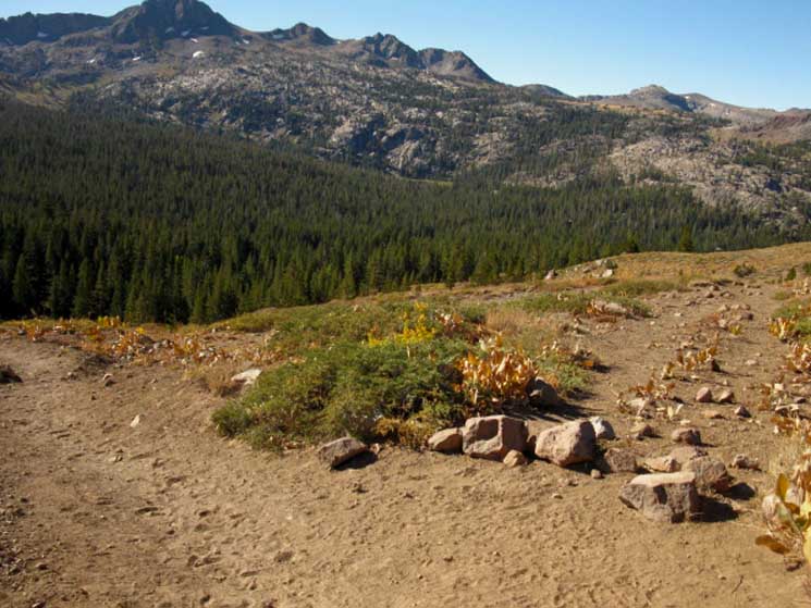
Summer
 |
| A month later, on July 16 2009. |
Tahoe to Yosemite Trail
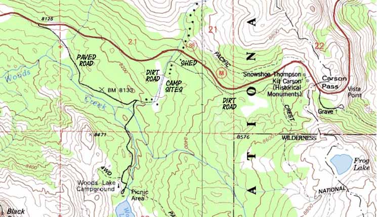
Carson Pass Management Area Mokelumne Wilderness Map Good choice. I prefer the Tahoe to Yosemite Trail route South, despite the difficult 9.54 mile segment of this route that lacks a formally maintained trail. This segment of unmaintained trail is situated along Summit City Creek down to Camp Irene across the Mokelumne Wilderness. Carson Iceberg Wilderness Map The Tahoe to Yosemite Trail presents challenges not found on other long distance High Sierra trails. OK, back to the Carson Gap and our immediate route options down to Highway 88 and back up to Round Top Lake. We've three. I call them the East route through Carson Pass via Winnemucca Lake, the Central Footbridge route, and the Western Lost Cabin Mine Trail. Trail Guide Continuing past the Woods Creek footbridge approaching Wood Lake we can see that two of these three routes possibilities up to Round Top Lake wrap around Woods Lake. The Central footbridge route climbs gently around the East shore of Woods Lake while the Western Lost Cabin trail route climbs stiffly around its Western shore. The shorter the route to Round Top Lake the steeper its approach. Refer to the Carson Pass region topo map for visual representations of these routes, and the surrounding Carson Pass Management Area. The Summit City Creek to Mount Reba map lays out the next stage of our trip down the Tahoe to Yosemite Trail. Remember, click the red dots on the maps for that location on the trail guide! Click both the red and black dots on the 30 minute maps for refinements of all trail details. Backpacker's Index
Total Miles via Carson Pass Route: 4.79 miles via Footbridge Route: 3.90 miles via Lost Cabin Mine: 3.40 miles Round Top Lake to Lake Alpine Backpacker Resources and Hiker Information
POST UP! All backpackers can post text comments about the following section of trail from Carson Gap to Round Top Lake through the comments links on all the trail guide pages. Registered Members can post up stand alone post about the trail with text, images, maps and videos in the Trails Forum that supplements this section of the Trail Guide. Check out the Tahoe to Whitney .org |
|||||||||||||||||||||||||||||||||
Northern
Tahoe to Yosemite Trail Junction
below the
Carson Gap
 |
||
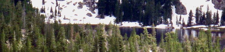
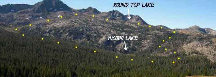
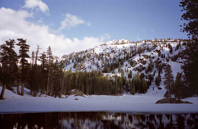
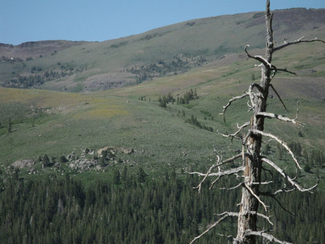
Looking to the Southwest Round Top, The Sisters, Woods Lake and the Tahoe to Yosemite Trail. Round Top and the Sisters are the backdrop for our two routes up to Round Top Lake. The picture above gives us an overview of the terrain these routes cross. First, we've got to locate Woods Lake. Woods Lake is nestled in at the base of the granite directly below "The Stepsister," which is the third peak to the Right of Round Top, who's top I cut off in the above image. Woods Lake is surrounded by a visible bright green meadow trimming its shore at the interface between the granite and forest. Can you see its dark surface ringed by green meadow in the image above? Our Western route along the Lost Cabin Mine trail climbs up the forest-filled granite channel to the Right of Woods Lake, its West, and roughly follows that line of forest up and around to the top of the granite formation rising to the West of Woods Lake up to Round Top Lake. Round Top Lake sits in a depression below the Westernmost Sister. The West most Sister is the second peak to the Right of Round Top with the split crest, and its lower 'Stepsister," sits off to its Right, or West. The Central route via the Woods Creek footbridge wraps around the Left side of Woods Lake, its Eastern side, up through dense forest to the upper Left corner of the image above where we can the top of the open valley. From that position our trail bends West, to the Right, climbing the flank below Round Top up towards Round Top Lake. Let's take a look at the routes in relation to Woods Lake.
This also shows an excellent 7.3 mile loop route for overnighters or day hikers to explore.
In the bottom of the second image above is the unmarked 1st cutoff Southwest down to Highway 88 towards Woods Lake on the Tahoe to Yosemite Trail. This junction is about 50 yards South down the South flank of the Carson Gap. Taking a right at the Tahoe to Yosemite Trail junction with the Pacific Crest Trail pictured above takes us down to Highway 88. But first the trail drops down the Southern flank below Carson Gap to cross the creek which then parallels our trail down to Highway 88. I point out all of these features 2 minutes and 12 seconds into the video below. |
Elevations
Carson Gap Highway 88 Woods Lake Footbridge Round Top Lake Trail Junction
Shortest distance from the Carson Gap to the Round Top Lake Trail Junction: |
What's Next The whole point of this next segment of trail is to make the easiest transition off the shared route of the PCT-TYT to the singular route of Tahoe to Yosemite Trail across the West flank of the Sierra. At Round Top Lake we are in position to pass around the Southwestern flank, the right shoulder of Round Top and The Sisters, to follow the TYT route down into the Summit City Creek drainage. Summit City Creek bends Southwestward along the Western flank of the Sierras towards the North Fork of the Mokelumne River and ultimately to our resupply point at the Lake Alpine Lodge on Highway 4. |
Local Backpacking We're entering the Carson Pass Management Area of the El Dorado National Forest by hiking South out of the Meiss Country Roadless Area of the Lake Tahoe Basin Management Unit. These trail guide pages reflect the deep enjoyment I get tying these two areas together for snow backpacking trips, from the time when the snows first cover the terrain until the Spring Thaw surges. You may not be up to the snow backpacking thing, but you may want to plan backpacking trips with more miles than either the Meiss Country or the CPMA offer. A favorite Winter backpacking trip of mine is South Upper Truckee Trailhead to Round Lake to Showers Lake, all in the Meiss Area. From Showers Lake on day three we hike out of Meiss Country to Round Top Lake in the CPMA, and back to Round Lake for our fourth and final night. I only do these local backpacking trips during snow conditions. During Summer I'm always hiking through both the Meiss Country Roadless Area and the Carson Pass Management Area on my way further South on either the PCT or TYT. The guide pages below covering the Carson Pass Management Area will be as helpful for local backpackers as long distance. Carson Gap to Woods Lake and Lost Cabin Mine trail to Round Top Lake. Footbridge Route to Winnemucca Lake PCT to Winnemucca Lake to Round Top Lake |
Video Though it is hard to see it, I'm following an informal route that is visible during Summer hiking conditions. We're headed South from the Carson Gap down to cross a little creek. On the other side of the creek we see a trail running from a lower junction along the PCT, down to Highway 88. We will turn Right to follow this faint trail down to an old trailhead on Highway 88. Duration: 7:13
|
||
The Tahoe to Yosemite Trail
crosses
Highway 88
West of the Carson Pass.
Views |
||
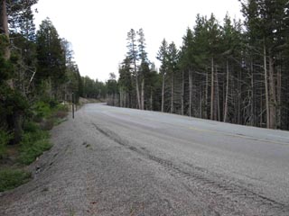
At the base of the Carson Gap we encounter Highway 88 to the West of Carson Pass as we hike South. |
Looking North back up the trail to the Carson Gap from Highway 88 | |
 |
 |
|
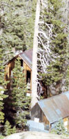
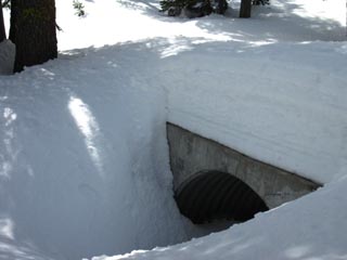
Looking South across Highway 88 at the shed. I think this is a Caltrans shed. A spur of the dirt road to the Right of the shed connects Highway 88 to the dirt road we are hiking for. The total length of the dirt road from that shed over there to where we step onto the paved road to Woods Lake is .46 of a mile. |
Looking North up the trail towards Carson Gap from Highway 88 at the informal trailhead/trail up to the Gap. |
|
| East and West on Highway 88 |
||
 |
 |
|
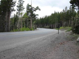
| Highway 88 looking East towards Carson Pass. The Carson Pass is a short ways past the bend in the distance. | Highway 88 looking West. Note how the bend seriously reduces the distance oncoming traffic can see us, and us them. Caples Lake and the Kirkwood Ski Resort are a few miles to the West. |
|
To Woods Lake Carson Pass Region Map Be Careful crossing Highway 88, especially listening for Eastbound cars coming fast around the almost blind corner to our West. |
||
Carson Pass Region
Road Map for Backpackers
Follow
the
Dirt and Paved Roads
to
Woods Lake
The dirt road on the South side of Highway 88 just a few feet South of the shed meets us after hiking down from the Carson Gap and crossing Highway 88. From the shed we can see this dirt road parallels Highway 88 coming down from Carson Pass, which sits to our left, to our East. We are not concerned with hiking East towards Carson Pass. Follow this road to the right, and it immediately bends to the South for a couple of hundred yards of descent, at the bottom of which the dirt road turns to the West for a couple of hundred more yards to bring us down to where it connects with the paved road to Woods Lake. It's .46 of a mile from the shed on Highway 88 to where we hit the paved road to Woods Lake. This whole route, the dirt road from Carson Pass and the paved road to Woods Lake, is Blue-Diamond marked for Winter Travelers heading to Woods Lake and Round Top Lake from Carson Pass. Paved Road to Woods Lake Woods Lake is a fine place to have lunch or a snack with the retired folks, day visitors, and the family campers who inhabit this area during the Summer months, before we climb one of the trails to the high point of this segment of the trail, at the Round Top Lake trail junction. |
Dirt Road from Highway 88 to Woods Lake Paved Road The map below shows the portion of our Tahoe to Yosemite Trail coming down from the Carson Gap to Highway 88, where we encounter the Dirt Road dirt road on the South side of Highway 88. We'll follow this dirt road South for .46 of a mile to the paved Woods Lake Road. |
||
 |
||
I wanted to precisely locate this section of dirt road because of its status as National Forest. This means folks can camp there for free. Lots of locals have been coming up here for years, and it's a great spot for backpackers hiking into twilight to throw down for a night. Map Note The new PCT trail route is higher up on the hill to the Northeast of the position depicted on the map above. No matter. Our route follows an unmaintained trail down from Carson Gap over to the East shore of the creek, and down to this old trailhead on Highway 88 across from the shed, and the dirt road down to towards Woods Lake.
|
||
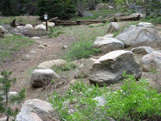
| Campsites Along the Dirt Road Between the Shed to Woods Lake Paved Road |
||
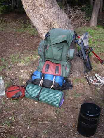
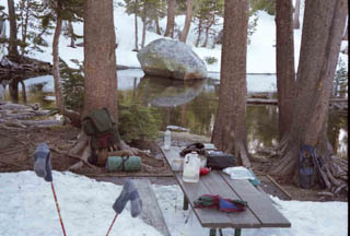
Hiking towards Woods Lake from our Highway 88 crossing point I calculate my time and space. How much time do I have to cover how much space? I marked the location of some of these free campsites on the map above. The weather was darkening towards more rain as sunset approached, so I figured I'd establish camp before any potential sunset showers started. The location of the campsite below is at the top of the downhill section of the dirt road about a hundred yards below the shed along Highway 88, but after the road turns to point straight South. There's a site above, in the corner where the dirt road off Highway 88 connects to the dirt road between Carson Pass and Woods Lake. That site is much too close to Highway 88. Off with the Pack! Deciding to camp I disassemble just enough of the gear slung off and lashed to the back of my pack so that the pack makes a fine seat back when propped up against a tree. I use my sleeping pad as a seat pad, and pull out the food canister to use as a leg rest. Time to Kick Back and watch the Sky! The trail can put some heavy physical strain on us. Counteracting this strain with some serious relaxation is vital. In just a couple of short minutes I've got my stove boiling some water for hot chocolate, some snacks in my hand, feet elevated, and butt and back perfectly supported by the pack that previously strained. I'm going to kick back and observe, until my observations tell me to put up the tent. |
||
 |
 |
|
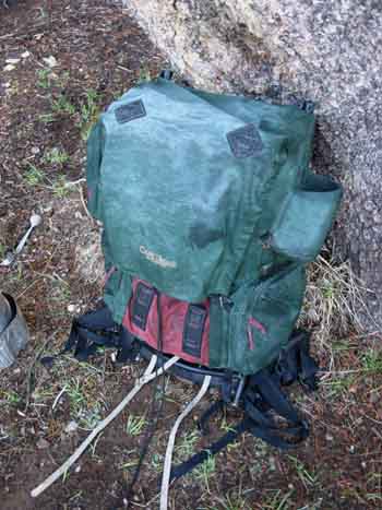
Backpack set up as a very nice seat for relaxation. Butt pad, excellent backrest, and the food canister is the foot rest. I was kicking back until bits of rain started falling with the setting sun. Time to put up the tent! |
Those dark rolling and boiling clouds we've been watching all day long have thickened up with the falling darkness. Above, the pack secured for a potentially rainy night. |
|
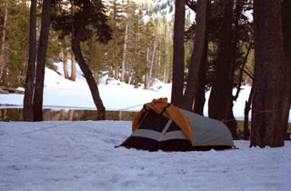
Time for the Tent
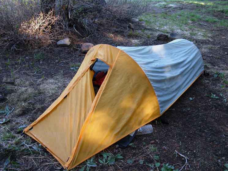 |
Walrus Microswift protects from Spring rains. We were getting light snow up higher in elevation, showers and light rain down lower during the 6th and 7th of June, and the storm was diminishing. Though this storm was nothing serious or powerful, it was persistent even as it weakened. This persistence persuaded me to put up the tent before dark. I hate it when I'm woken at two in the morning by rain insisting that I put up my tent. The rain was coming to an end and going to stop, but it was not going to stop quite yet. |
Bright Sunny Morning
Drying the gear along the dirt road between Highway 88 and Woods Lake
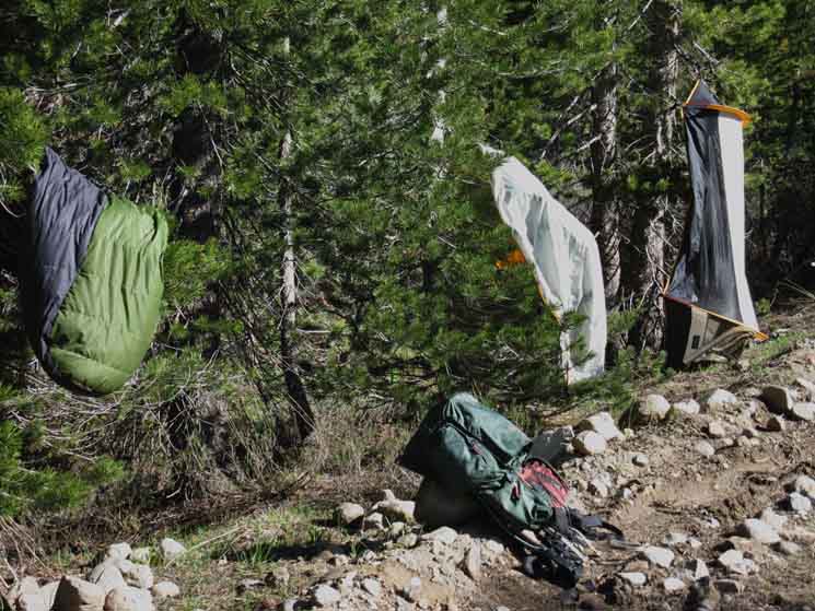 |
The end of the storm passed with light overnight rains, as expected. I used the morning sun to dry my gear after camping in one of the informal (free!) National Forest car camping sites along the dirt road between Highway 88 and the paved road out to Woods Lake after a rainy Spring night. Every now and again we'll stop and pull our our tent, sleeping bag, and splay out our insulation across trees to both dry it out in the Sun and freshen it up with the breeze and Sun. This will be a constant daily activity if we've been experiencing heavy morning dew falls. |
Hiking up to Round Top Lake
| Paved Road to Woods Lake Once we reach the paved road it's good to begin thinking about which of the two possible routes that can take us up to Round Top Lake from Woods Lake we're going to hike. The footbridge route up via Winnemucca Lake or the Lost Cabin Mine trail route. |
| The Road to Woods Lake from Highway 88 is well marked for Summer and Winter Snow Travel |
|||
 |
 |
||
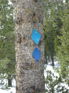
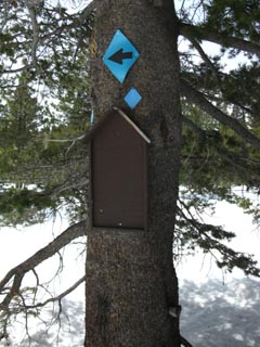
| The dirt road from Highway 88 to Woods Lake is well marked by blue diamonds for all season travel | The arrow is pointing to Woods Lake from where the paved and dirt roads intersect | ||
|
|||
Paved Road to Woods Lake
 |
||
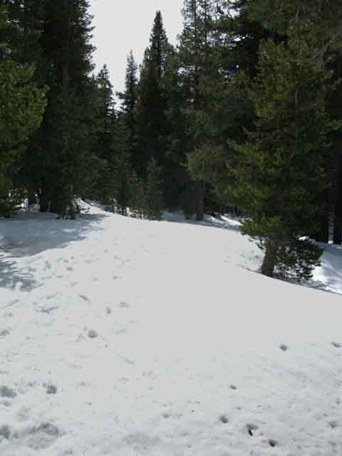
Paved road South to Woods Lake under snow. We know the paved road is here from previous hikes and from the wide channel through the forest.
|
| National Forest Free Car Camping Notes |
|||||
|
Auto Access The main and safest access to this dirt road is off the paved road from Highway 88 to Woods Lake that breaks off from Highway 88 to the East of Caples Lake. Hikers crossing to the South side of Highway 88 see the dirt road down from the Carson Pass just beyond the shed. From here drivers and hikers note that the dirt road dirt road runs up East up to Carson Pass as well as Southwest to the Woods Lake Paved Road. Everyone turns Right here to follow along the dirt road down to where it intersects with the paved road to Woods Lake. Free Car Campsites Driving across the Sierra on Highway 88 and want to spend a night at elevation? Take an immediate right where the dirt road off Highway 88 Tees with the dirt road coming West down from Carson Pass. As the road bends around to the South we note a series of improved car campsites along the left side of the dirt road. There's a nice little creek behind them that supplies water. Luxury! This road continues for a little less than a half- mile to where it's West end links up with the paved road to Woods Lake. Car camping sites run the whole length of this road, and they are much further apart than an official National Forest car campground! Drive-Ins National Forest Camping Rules There are fine free National Forest car campsites near the Sierra Crest on Highways 88, 4, and 108. Most of these sites have been used by smart car campers, hunters, day hikers, and as backpacker's staging points for decades, some places for more than a century. These sites were accessed by foot and horse prior to auto access. They will be accessed by foot and horses when cars are gone. When we hike through here in Summer, we will see many car campers taking advantage of this free camping. I've talked to a few of them over the years, and it seems that families have been coming up here to camp here for years as annual events. Remember, though we don't need a permit to camp, we do need a permit for fires and to even use stoves. Here's a simple rule of thumb for the modern era: These car campsites fill up for most of the high Summer vacation season. The strategy most of these car camping families employ is to send up a few people early, during the week, to pick a good site and occupy it prior to major holiday weekends, while the main group begins arriving as the weekend approaches to begin their holiday festivities. My backpacking permit acts as a fire permit too, but if you are driving through and want to camp here and make a fire, you can get a fire permit at the Amador Ranger Station on the way up Highway 88, or at the Carson Pass Cabin if we approach from the North through the Tahoe Basin (Highways 89 to 88), or from the East (88 East) out of Nevada. If we are starting any trip from the Carson Pass area, these sites are a nice place to spend our first night acclimating, especially if it was a long distance drive (hitchhike!) up from our home to the Carson Pass, or if we arrived too late in the afternoon to begin our backpacking trip. Check out the Google Road Map of the Carson Pass Area which marks the dirt road along which the car camping sites mentioned above are located. Hey, I'm always here. Email me with intelligent queries. I'll even answer stupid questions...
Why I spent a rainy Spring afternoon and overnight in one of these sites on June 6th 2009 after hiking out of the Tahoe Basin from the South Upper Truckee Trailhead. Here's the deal Not even rubber-coated nylon. Anyone who backpacks in rubber-coated fabrics know that the hiker's sweat inside the rubber is as wet as the rain outside. And much nastier... The classic "breathable" waterproof/water resistant materials can be "waterproof" for up to three days. That's the longest I've ever gotten any "dry" conditions to last inside my gear. After three days in driving rain everything is wet. Everything. I'm talking about using the most advanced materials properly. After three days of driving rain all fabrics are wet. Tent, shell, insulation, socks, boots, I mean everything. And let's imagine we're still facing two more days of driving rain. I've experienced many storms coming off the Pacific Ocean of five days duration. That's when the insulating and wind protection capabilities of our gear comes into play. Our insulating layers must insulate when wet. We've got to be smart enough to employ all of our wind protection gear and skills when we're wet and vulnerable to wind over a period of days. Otherwise our energy and health will seriously decline. The shell must maintain wind resistance when its totally soaked, and the underlying insulation layers must insulate when wet. I went through a twenty year backpacking cycle during which Lost Coast backpacking trips were always part of the annual backpacking cycle. Sometimes I'd use Lost Coast as backpacking methadone, when seemingly unending Winter storms closed the Sierra. I'd hitch up to Lost Coast during Winter to get my backpacking fix. Other times I'd use Lost Coast as part of recovering from injury. Lost Coast is a great place to work up the physical skills necessary for comfortable Sierra travel. If we can work out, and work up our injuries to the point we are running up and down the ridges along the Lost Coast we will not hurt too much when we begin crawling our way up to the Sierra Crest. The "full" Lost Coast Loop, from Usal Beach to Shelter Cove up to the Mattole River and the nearby tiny-tiny town of Petrolia for resupply (and a great deli-sandwich), is a frkn amazing trip. Talk to the locals. The turnaround point at Petrolia is deep in the backcountry of the Emerald Triangle. It's a unique country culture. I tell them all the truth, that I'm a backpacker. I'm there for the most beautiful experience their local terrain can offer, that I can find. That's how I found all them. Trail culture varies from trail to trail. Once that soaks in through their local perspectives and polarizations, they are all pretty good folks. That leads to a whole lot more stories, which this is not the proper place to tell. I hike Lost Coast up to the Mattole and back to the Southern Usal Beach Trailhead, so I always swing East up into the Kings Range rising above the beach on the return leg South from the Mattole River down to Shelter Cove. And other unique local characters. The trail culture up there can be pretty crazy. Most times our observation and analysis is tuned for the natural world. But we've got to stay tuned into the signs of human use, especially when backpacking up in Humboldt County. Comments Let's continue hiking South on the Tahoe to Yosemite Trail...
|
|||||
North: Carson Gap top of page South: Round Top Lake
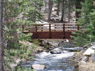
The Auto Bridge
over
Woods Creek
Right: A quarter of a mile past the junction between the dirt and paved road to Woods Lake, we come to a Forest Service pit toilet and parking lot on our right side, a cement bridge over Woods Creek to Woods Lake ahead, and our first option to hike up to Round Top Lake to our Left, to the East, via Winnemucca Lake. If we turn left here in Winter to begin the hike up to Winnemucca Lake, we'll look for the blue diamonds that follow the Eastern shore of Woods Creek up to the footbridge, and past it, up to the trail junction at Winnemucca Lake. |
|
| Above: Woods Creek cement auto bridge, early Spring... | |
Below: Hiking South along the paved road to Woods Lake Looking South at the footbridge over Woods Creek South of the auto bridge. |
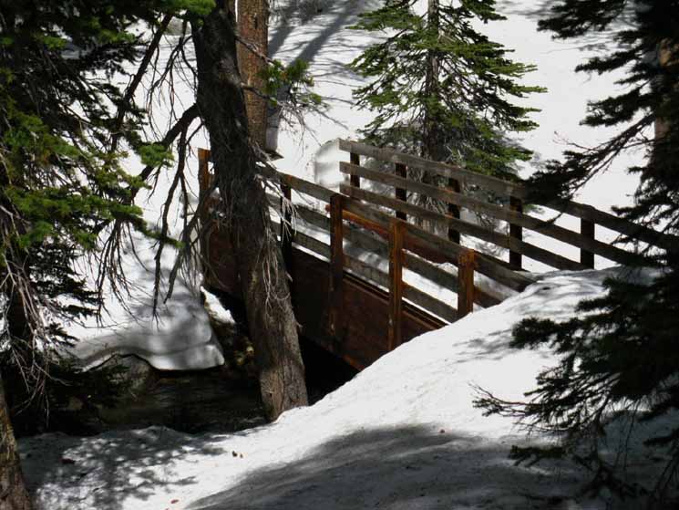
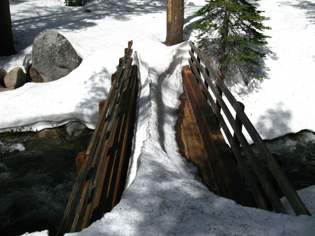
Left: A short ways down the paved road past the Woods Creek cement bridge South towards Wood Lake there is a footbridge over Woods Creek that leads up to Round Top Lake via Winnemucca Lake. If we followed the blue diamond route along the East side of Woods Creek from the auto bridge, we will approach this foot bridge from the East side of Woods Creek as we hike towards Winnemucca Lake. We can cross the footbridge here to follow the well marked Winter trail up to Winnemucca Lake. We'll turn West at the Winnemucca Lake trail junction to complete the last part of our hike up to Round Top Lake. |
 Comments? Questions? |
The Middle route option to Round Top Lake
Taking the Footbridge Route
on our left
up to
Round Top Lake via Winnemucca Lake
The Footbridge over Woods Creek |
|
Above and Below: June 6 2010
|
||
Footbridge over Woods Creek with remnants of Spring Snow, June. Less snow is more work! |
Video
Woods Lake
to
Round Top Lake
through
Spring Snow
|
I often take the route from Woods Lake past Winnemucca Lake to Round Top Lake in the Winter and Spring. This video shows this route during Spring snow conditions. Video Playlist
|
Two Ways to Round Top Lake Footbridge Route
|
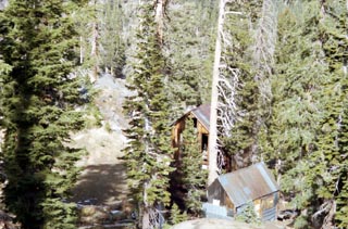
Woods Lake Time for a Break! Here at Woods Lake there are bathrooms, water taps, picnic tables, and garbage cans. All things of luxury for a nice backpacker's break before hiking either the footbridge or Lost Cabin routes up to Round Top Lake. Local backpackers and day hikers will still have to get, and pay for day use or overnight backpacking permits from the Carson Pass Management Area. Long distance backpackers hiking in and through on a valid permit issued by their starting trailhead are good to go, and need no further permitting from the CPMU, nor pay any day use fee while stopping for lunch at Woods Lake. |
Woods Lake
Hiking to Woods Lake The Perfect Lunch Break As we hike South on the paved road we will reach Woods Lake shortly past the footbridge route up to Winnemucca Lake off to our Left, and the Lost Cabin Mine trail we'd pick up at the top of paved loop of the Woods Lake Campground off on our Right. Woods Lake has fresh water taps, bathrooms, garbage cans, and picnic tables overlooking the lake when the car campground is in operation. It's a seasonal fee area, but backpackers hiking through with a valid permit don't have to worry about day use fees. Woods Lake is not a part of the Carson Pass Management Are. It is a fee-based day use area with picnic tables and little paved paths around the North side of the lake. A nice Federal Car Campground sits just North of Woods Lake, the Woods Lake Campground. The campground is full, and Woods Lake is busy during the whole Summer high season.
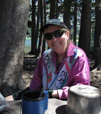
I've eaten one of my two daily lunches at Woods Lake a number of times as I pass through on my way over Round Top on the Southbound Tahoe to Yosemite Trail. I've met really nice car campers, day hikers, fishermen, and a number of retired people from Nevada out for day trips. This is Dianne, from Gardnerville Nevada. She and her son came up to Woods Lake for an afternoon of fishing, hiking, and kicking it in this beautifully relaxing place. And for good reason. It's a really relaxing place to kick it for a while, watching the locals fish, and paddle their boats around the lake. Here's a PDF from the El Dorado National Forest about, and with a map of General Information |
| Woods Lake with receding ice in May. | ||
 |
||
Crest of Round Top rising above its lower flanks above Woods Lake. As I was tired and the lateness of the day would have brought me up to Round Top at or just past Sunset, I decided to camp at Woods Lake. I camp here when snow has closed the road access. Otherwise it's illegal.
|
If we hike back to the Footbridge, or... Footbridge route to Winnemucca Lake The trail on the East side of Woods Creek bends South to pass through the densely forested terrain rising above the East shore of Woods Lake up to the edge of the forest. At the edge of the forest we can see the rest of the trail follows the bottom of an exposed valley up to Winnemucca Lake. Our last option up to Round Top Lake is the Westernmost of our three trails up to Round Top, via the Lost Cabin Mine Trail. We'll hike a very short distance North, back up the paved road to Woods Lake to the entrance to the car campground. At the top of the paved campground loop we'll see the trail between campsites up to the Lost Cabin Mine Trail.
|
Our Western route option
Round Top Lake via Lost Cabin Mine Route, on our right
When we see the foodbridge route branching Left from the paved road to Woods Lake, we have to decide between two potential routes up to Round Top and the Sisters. We can either follow the trail to our Left, East across the footbridge up to Round Top via Winnemucca Lake, as described above. Below, we continue South past the footbridge seeking the Lost Cabin Mine Trail up to Round Top. Shortly past the footbridge we will encounter the Woods Lake campground on our right. Enter the campground through the main entrance, and at the top of the campground loop road we find the short trail cutting between the top two campsites up to the old jeep road leading left, South, to the Lost Cabin Mine and Round Top Lake. This PDF has a map of the car campground and notes the trail to the Lost Cabin Mine trail General Information Turn Left, South, up the mountain to Round Top Lake at the jeep road. The trail passes above this still active mine. This route is the quickest, but steepest, route up to Round Top Lake. The Woods Lake campground has a host during Summer, so you can ask the host for directions if you feel lost. |
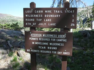 |
Lost Cabin Mine Trail sign above Lost Cabin Mine Car Campground. Notice that Fourth of July Lake is listed as 3.5 miles distant? That makes it 1.5 miles past Round Top Lake. I have the distance from Round Top Lake to Fourth of July Lake at 2.3 miles, and I stand behind that distance. Ironically, I have the distance from just below this trailhead to Round Top Lake at 1.61 miles, rather than the two miles posted on the sign above. So overall, I have the distance to Fourth of July Lake at 3.91 rather than the sign's posted 3.5. |
|
 |
|
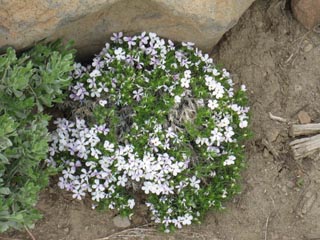
Spring decorates the Lost Cabin Mine trail with a colorful array of flower bouquets. |
High Sierra Wildflowers on the Lost Cabin Mine trail
 |
 |
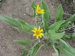
Fresh Lone Mule Ear flowering along the Lost Cabin Mine trail. |
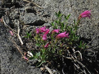
Flower along Lost Cabin Mine trail, Penstemon (bridges?) |
Woods Lake from Lost Cabin Mine Trail
 |
 |
| Looking East at Woods Lake from the Lost Cabin Mine trail | The Lost Cabin Mine |
Looking North
at the
Carson Gap
 |
||
Looking back to where the Pacific Crest and Tahoe to Yosemite Trails come through the Carson Gap, while climbing up to Round Top Lake on the Lost Cabin Trail.
|
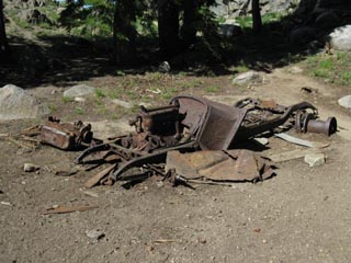
Mine Equipment
New and old above the Lost Cabin Mine
 |
 |
Old Truck once used as power source for mine work. Note the pulley mounted on the rear hub. |
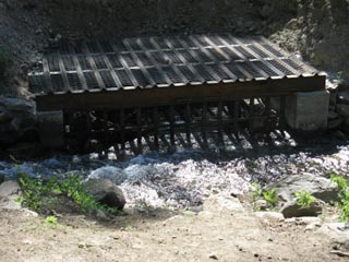
Sediment trap to collect gold dust? The trap is installed on the creek draining from Round Top Lake. It is modern, and in use today, as is the Lost Cabin Mine. The mine is well protected by no trespassing signs. |
Old Stone Cabin
past
Lost Cabin Mine
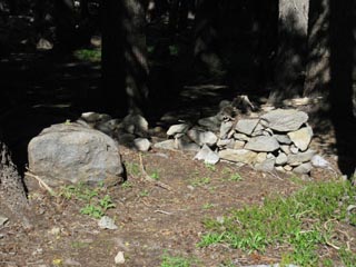 |
| Remains of the old stone cabin just past the dead truck and sediment trap. |
Red Mountain Heather
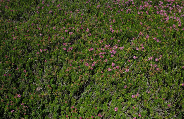 |
Massive Red Mountain Heather mat blooming during Spring along the Lost Cabin Mine Trail. |
Snow fed wet meadows draining this rocky mass
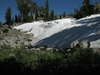 |
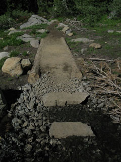 |
| July snow Berm holding onto shadow above the huge mat of Red Mountain Heather. | Build up trail work crossing wet meadow. |
Though the Round Top Massif is predominantly rock, it is drained by many fragile, though rocky, meadows and grass-lined streams. Snow berms hidden in Northeast shadows keep these meadows wet and streams gurgling late into the Summer. |
|
Enter Mokelumne Wilderness
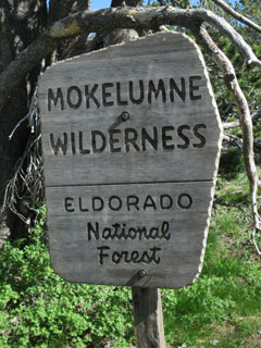 |
| A short distance after exiting the forested section we cross the Mokelumne Wilderness Boundary at a point roughly splitting the distance between the Lost Cabin Mine and Round Top Lake. |
Arrive Round Top Lake
 |
||
The last steps to Round Top Lake on the Lost Cabin Mine Trail. After the difficult stiff hike up the steep section from Woods Lake we reach the low gully that brings us across a moderate angle up to the Round Top Lake trail junction. Round Top and the Eastern Sister in background.
Next Page |
North: Carson Gap South: Round Top Lake
Southbound |
Our trail options to Round Top Lake This page was successful if you understand your three Southbound Options to hook up with the Tahoe to Yosemite Trail hiking South out of Tahoe Basin through the Carson Gap to Round Top Lake. Heck, if you read the trail guide page to the North, you should also have some understanding of the differences between the Tahoe to Yosemite Trail and the Pacific Crest Trail between Highway 88 and Highway 4. From Round Top Lake South there are no logical alternative trail options to the Tahoe to Yosemite Trail to Lake Alpine. Hell, it seems like there is no trail across miles of our route South to Lake Alpine. True, but there is a route. Have a nice restful night at Round Top Lake's beautiful high elevation campsites, as a large part of tomorrow's hike through Summit City Creek is going to require that every step you take is the product of your observations and decisions. I generally don't stop near Woods Lake as depicted above, but it happens every now and again. I almost always stay at Round Top Lake when I hike through the CPMA. Read a discussion on difficulties of the Summit City Creek segment of the Tahoe to Yosemite Trail, and continue South on this trail guide for a description and pictures of this fun, challenging, and difficult segment of the Tahoe to Yosemite Trail. Camping OptionsNorth of the Carson GapCarson Gap Pond Meiss Meadow Meiss Lake Showers Lake South of the Carson GapHighway 88 and Round Top Lake AreaCar Camping Between Highway 88 to the paved road to Woods Lake there are free car camping spots along the dirt road that are quite suitable for backpackers. For free car camping heaven check out the roads to Blue Lakes and the dirt road out to Tamarack Lake... Check out the Car Camping Forum, and there is more information about local car camping on the Carson Pass Trail Guide Page. Favorite Spots to camp in the Carson Pass Management Area
Summit City Creek, below the Southwest flank of Round Top"Boy Scout Camp," Summit City Creek
7.5 Hiking Topo Hiking Map 30 min Topo Hiking Topo Map Next page South |
Backpacking Trail Guide North |
 |
Backpacking Trail Guide South |
Backpacker ForumsHave you hiked these mountains before? Do you have a great Sierra Nevada route or trip to relate?Post it on
|
North: Carson Gap South: Round Top Lake
Trailhead
Contact
Alex Wierbinski

Backpacking Lake Tahoe to Mount Whitney
Your guide to the High Sierra Crest, including the Tahoe to Yosemite, Pacific Crest, and John Muir Trails
