

The Trails
Guide
Maps
Miles/Ele
Permits
Resupply
Forum
Current Weather Conditions
Weather Notes
Northern High Sierras
Central High Sierras
Southern High Sierras
Gear
Gear List
Gettin Started
Layering
Discussion
Testing yourself and your gear
Gear Reviews
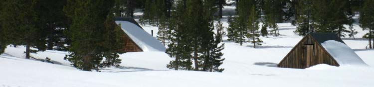
Meyers to Meiss Cabin
Miles and Elevations
for
Backpackers and Hikers in the Meiss Country Roadless Area
Languages
Languages
Trail Arts
The art of walking
Physical Preperation
Trail Skills
The trail
Off the trail
Scrambling
Maps
Navigation
Camp skills
Food
Resupply
Food
Other
Photo Catagories
Trail Stories
Trail Culture
News and Science
Links
Groups
Books
Terms and Conditions of Use
MILES TYT-PCT |
MILES PCT |
MILES TYT |
MILES TRT Meyers |
REGION PCT-TYT |
TRAIL TYT-PCT |
MAPS |
ALL |
ALL |
Miles & Elevations
|
|||||||||||||||||||||||||||||||||||||||||||||||||||||||||||||||||||||||||||||||||||||||||||||||||||
South
|
South
|
South
|
North
|
Backpacking Miles
Meiss Roadless Ares
| Also see Echo Summit to Carson Pass miles and elevations |
Echo Summit to Carson Pass backpacking map |
This trail South from the South Upper Truckee Road Trailhead to Round Lake is a short but fierce climb. Heavy bicycle traffic put a tremendous strain on the route which was magnified by a recent fire.
This has caused the LTBMU to reroute and significantly extend the length of the trail up to Round Top Lake. I figure it's around four miles from the Meyers Trailhead to Round Lake now.
The miles below were originally measured when the trail followed the road past the Forest Service Summer Housing, before the trailhead was moved to the South Upper Truckee Road, and the trail rerouted to accommodate bicycle traffic.
| Location | Elevation | Mileage | ||
| Start: Meyers Trailhead | 6520 | 0 | ||
| +680 | 1.13 | |||
| Into the Burnt Area | 7200 | 1.13 | ||
| +600 | 1.45 | |||
| Dardanelles Lake Junction | 7800 | 2.58 | ||
| +120 | .23 | |||
| Big Meadow Junction | 7920 | 2.81 | ||
| +160 | .58 | |||
| Round Lake | 8080 | 3.39 | ||
| - | .07 | |||
| Round Lake Rock | 8080 | 3.46 | ||
| +120 | .39 | |||
| Up the Down meadow | 8200 | 3.85 | ||
| +200 | 1.66 | |||
| Meiss Cabin, TYT-PCT Junction | 8400 | 5.51 | ||
| +400 | 1.52 | |||
| Carson Gap Pond | 8800 | 7.03 | ||
| Total elevation Gain Meyers Trailhead to Carson Gap Pond +2280 feet over 7.03 miles |
||||
The Tahoe to Yosemite
and
Pacific Crest Trails
Part Company
at the
Carson Gap
NORTHERNMOST of 3 Routes to the TYT
PCT/TY trail junction just South of the
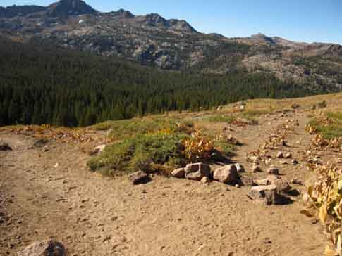
Carson Gap looking Southwest at Round Top and The Sisters.
Just South of the Carson Gap we find the 1st Southbound Trail Junction breaking Southwest off the Pacific Crest Trail to the Tahoe to Yosemite Trail.
For Southbound backpackers the Pacific Crest Trail continues to our left, Southeast, along the main trail down to the Carson Pass.
The Tahoe to Yosemite Trail turns right pointing almost directly down the mountain to Highway 88.
See the map for clarification.
Carson Pass Region Map
South out of the Lake Tahoe Basin
The following figures represent the two route options we have South from the Carson Gap Pond, either South and down to Carson Pass along the PCT or straight down to Highway 88 pursuing the TYT.
We have three distinct routes connecting the PCT and TYT as we hike across Highway 88. All three meet at Round Top Lake.
Two of our options approach Round Top Lake from the North. They are accessed from the Carson Gap via Woods Lake. Our third route to the TYT continues South on the PCT a mile past Carson Pass, where we find the Eastern approach to Round Top Lake through the Winnemucca Lake trail junction.
All the Tahoe to Yosemite Trail mileage measurements to Lake Alpine begin from the Carson Gap. Which route you choose determines the miles for this section of the TYT.
Three Routes to Round Top Lake and the TYT| Miles | Map | Woods Lake Routes |
Video |
are measured to Highway 88 directly below the Carson Gap, while the Pacific Crest Trail route mileage and elevations are measured to the Carson Pass.
EXITING THE LAKE TAHOE BASIN
Location elevation miles
Carson Gap 8800 7.03
Tahoe to Yosemite Trail
TheTahoe to Yosemite
Shortcut
to
Hwy 88
Carson Gap 8800 7.03
-400 feet .6 miles
Hwy 88 8400 7.63
This figure represents the mileage through first two of three Tahoe to Yosemite trail junctions
South of Carson Gap.
Pacific Crest Trail
ThePCT
to
Carson Pass
Carson Gap 8800 7.03
-200 feet 1.39 miles
Carson Pass 8600 8.42
From Carson Pass we can pursue the TYT via Winnemucca Lake, or continue South on the PCT.
NORTH
| PCT-TYT Meeks Bay to Echo Summit Miles and Elevations |
PCT-TYT Echo Summit to Carson Pass Miles and Elevations |
This page
Meyers to Carson Pass
Miles and Elevations
SOUTH
| PCT Carson Pass to Ebbetts Pass Miles and Elevations |
TYT Carson Gap to Lake Alpine Miles and Elevations |
Note |
This trail guide, like the High Sierras, divides itself into ups and downs. Our miles are generally done either going up to the top of the mountain, or we are coming down from the mountaintop into the valley that separates us from the next mountain. This means that the relationship of the mileages and elevations to the peaks and the valleys is going to be very important in determining how many miles we can reasonably expect to cover that day. This relationship will be instrumental in planning where we are going to camp every night, and ultimately this information will determine how many days it takes us to cover a given distance. This in turn establishes our proper food load. Between The South Upper Truckee Road Trailhead and The Carson Gap we are basically climbing the whole way. The steepest section is from the trailhead to Round Lake, where we gain 1560 feet in roughly 4 miles, depending on what distance you measure the new trail routing. Round Lake sits at 8000 feet of elevation. This route is a short but sharp intermediate 1 difficulty trail, a real reminder of the rigors of High Sierra Backpacking, if we've forgotten. At Meiss Meadow we intersect with the Pacific Crest and Tahoe to Yosemite Trails as they pass North and South through the meadow. From this trail junction we have 400 feet of elevation over a mile and a half of distance between us and our exit from the Tahoe Basin through the Carson Gap to our South. Local hikers have the option of hiking 9.09 miles North on the combined TYT-PCT from Meiss Meadow to the Echo Summit Trailhead via the beauties of Showers Lake. Remember this important rule: Every descent route generally holds many mini-ascents, and every ascent generally has many mini-descents within its route. Your mileage will very rarely just go up, or just go down. You are going endlessly up and down. |
Backpacker Forums Post it on Above we come to the Front Page of the High Backpacking Trails and Topics Forums. Below we break the forums down into categories:
Anyone can post text comments in the existing forums, but only members can post up new topics, along with images, maps, and formatting. If you have experiences, comments, questions, trip reports, trail conditions updates or pictures and videos of the Tahoe to Yosemite/Pacific Crest Trail from Echo Summit to Carson Pass, post up here as an unknown hiker or as a member: Section: |
PCT-TYT
Miles North
Echo Summit to Carson Pass
PCT Miles South: Carson Pass to Ebbetts Pass TYT Miles South: Carson Gap to Lake Alpine
Trailhead
Contact
Alex Wierbinski

Backpacking Lake Tahoe to Mount Whitney
Your guide to the High Sierra Crest, including the Tahoe to Yosemite, Pacific Crest, and John Muir Trails
