

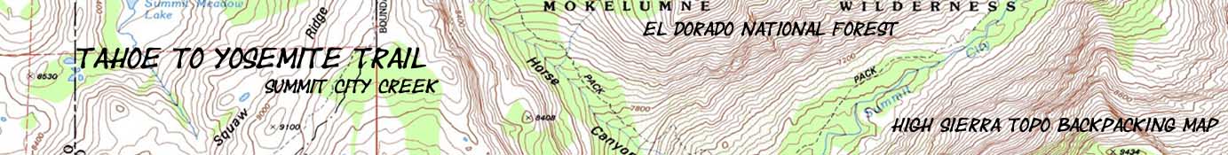

Mokelumne Wilderness Backpacking Map
Tahoe to Yosemite Trail through the El Dorado National Forest
7.5 minute USGS Backpacking Maps of Summit City Creek to Mount Reba

| Tahoe to Yosemite Trail Maps and Mileages |
Tahoe to Yosemite Trail Trail Guide |
Tahoe to Whitney Indexes |
More Tahoe to Yosemite Trail Miles and Elevations |
Weather, Map Data | |||||||||||||||
| North Map Carson Pass |
South |
Miles and Elevations Carson Gap to Lake Alpine |
Map INDEX Carson Gap to Lake Alpine |
Trail Guide |
Trail Guide Section Highway 4 to 108 |
Page Lake Alpine |
Miles and Elevations Lake Alpine to Saint Marys Pass |
All Miles Tahoe to Whitney |
Maps |
All |
Carson Gap to Lake Alpine |
Sonora Pass to Tuolumne Meadows |
KM to TM |
map, miles, elevation & Permit information |
|||||
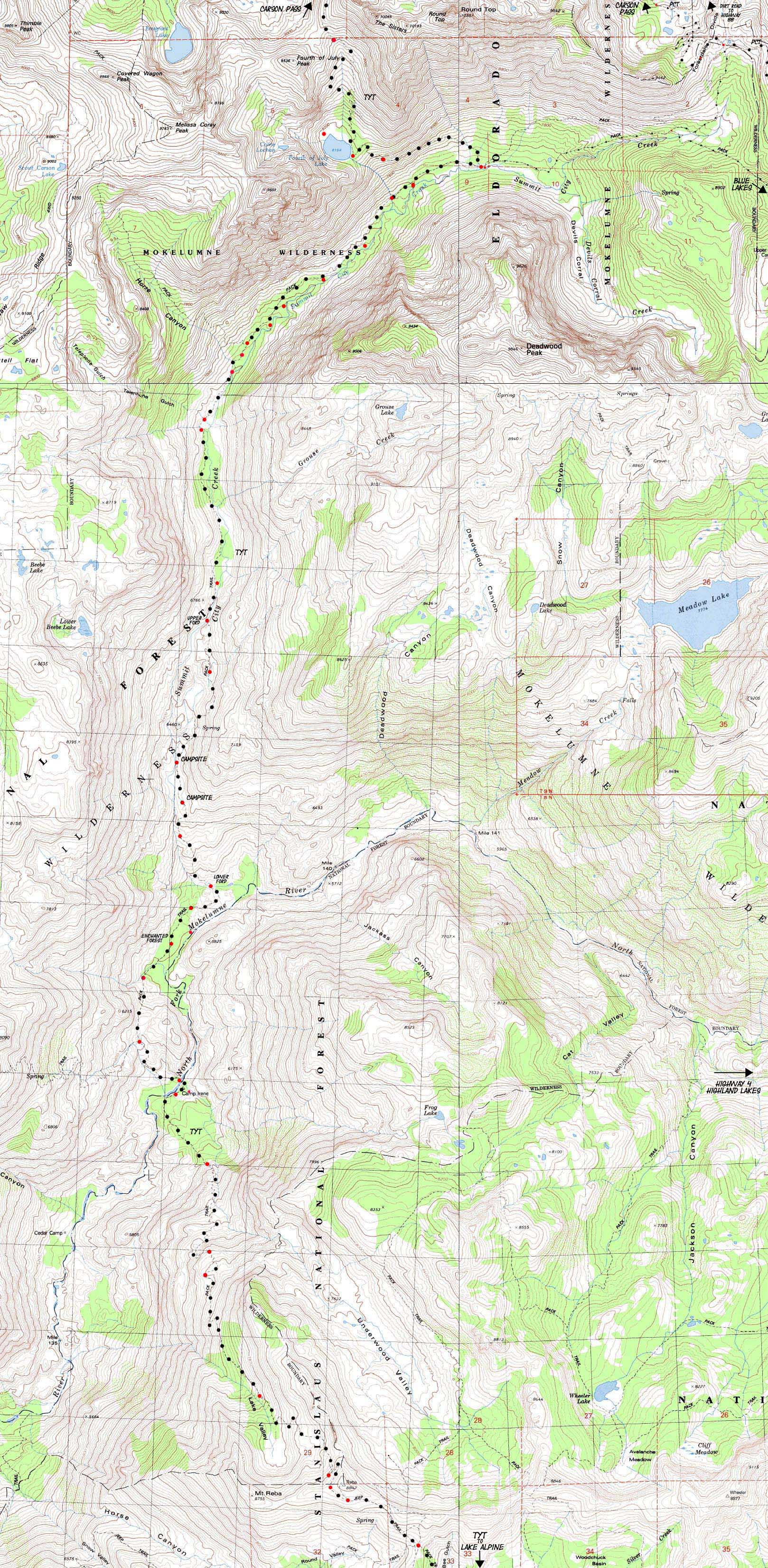
15.99 miles from Fourth of July Lake to Mount Reba through the grand granite canyon holding Summit City Creek
The Northern Unmaintained Segments of the Tahoe to Yosemite Trail
| TYT North Carson Pass Management Area |
TYT South Lake Alpine |
Long View Echo Summit to Lake Alpine |
TYT South Lake Alpine to Saint Marys Pass |
|
TYT North 7.5 minute map: Carson Pass Management Area TYT South 7.5 min map: Lake Alpine Long View 30 min section map: Echo Summit to Lake Alpine TYT South 30 min Map: Lake Alpine to Saint Marys Pass
Mapology |
||||
MAP NOTE What's important for our general reference purpose is that each side of a square is 1000 meters, or a Kilometer. From my point of view that is 1093.6 yards or .62 of a mile. Diagonal: 1414.22 meters, if my trig is correct. That converts the diagonal distance into 4,639.8 feet or .88 of a mile.
|
Backpacking maps, miles, permits & elevations Information |
|
Mileages and Elevations Specifics Location Elevation Mileage Round Top Lake Junction 9360 0 -1196 2.3 Fourth of July Lake 8164 2.3 -724 3.23 Summit City Creek Junction 7440 3.53
Boy Scout Camp *** *** (Summit City Junction to Horse Canyon)-560 2.43 Horse Canyon 6880 5.96 -160 .8 Telephone Gulch 6720 6.76
Rock Zone *** *** (Telephone Gulch to Upper Ford) -160 1.71 Upper Ford 6560 8.47 -440 1.32 Water/Nice campsite 6120 9.79
Water *** *** (Campsite to Lower Ford) -580 1.19 Lower Ford Summit City 5540 10.98
Ducked Rock to Forest *** *** (Lower ford to forest) -20 .32 Unblazed forest to Rock 5520 11.30 -40 .71 Blazed Rock to Camp Irene 5480 12.01 Munson Meadow Junction 5640 12.48 Camp Irene 5280 13.05 top of Mt Reba 8720 18.29 Bee Gulch Junction 8440 19.16
Back to Tahoe to Alpine section of the Trail Guide Index Back to Round Top Lake |
USGS topo maps Information Map Names: Caples Lake, Carson Pass (1992), Pacific Valley, and Mokelumne Peak. 4 USGS 7.5 minute Topographic Maps.
Compass Offset: Magnetic North is 17.5 degrees East of True North
scale: 1:24 000 Contours: 40 feet
Mileages and Elevations Lists Tahoe to Yosemite Back to Tahoe to Alpine Trail Guide Index Pacific Crest Trail
Backpacking Permitting AuthoritiesEl Dorado National Forest National Forest Contacts via TW: El Dorado NF National Forest web page: El Dorado NF
TW information : Carson Pass Management Area Fed information: Carson Pass Management Area
TW information : Mokelumne Wilderness Wilderness Area: Mokelumne Ranger Districts: All
Toiyabe National Forest National Forest Contacts via TW: Toiyabe NF National Forest web page: Toiyabe NF Fed info: Mokelumne Ranger District: Carson Ranger District More InformationTrail Guide: El Dorado National Forest information Trail Guide: Stanislaus National Forest information
|
map North: Carson Pass map South: Lake Alpine
| Elevations | More Information | ||
Round Top: 9360 feet Summit City Trail Junction: 7440 feet Camp Irene: 5280 feet Mount Reba: 8720 feet |
Trail Guide Section: Carson Gap to Lake Alpine Trail Guide Page: Summit City Creek trail junction |
||
Highway 4 Corridor
Important Points and Resources
|
View Highway 4: Ebbetts Pass, Lake Alpine, and Bear Valley Road Map in a larger map |
As Highway 4 marks the end of this section hiking down the Tahoe to Yosemite Trail I have added this roadmap so we can put surrounding roadmarks into context. For instance, our Tahoe to Yosemite Trail route crossing Highway 4 is about 15 miles West of where the Pacific Crest Trail crosses Highway 4 at Ebbetts Pass. Between here and there we have a couple of good entry points along Highway 4 hiking South into the heart of the Carson Iceberg Wilderness through Pacific Valley and Highland Lakes Roads. These are great places to begin or end long backpacking trips looping around the Carson Iceberg. The upcoming Carson Iceberg Wilderness is as fun to walk loops around as it is to walk across... |
Map Credit: |
U.S. Geological Survey, Department of the Interior The
|