


Hiking
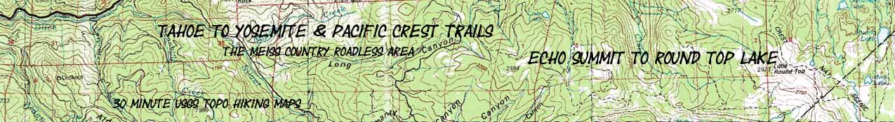
Echo Summit to Round Top Lake
30 min Map
Backpacking
The Tahoe to Yosemite and Pacific Crest High Sierra across Meiss Country Roadless Area

| 30 Min Topo Maps NORTH & SOUTH |
PCT & TYT Maps SOUTH |
Trail Guide Information |
Miles and Elevations |
Maps: PCT and TYT North |
Related Information | ||||||||||||||||
Topo map index |
North |
South |
Detailed Topo Map |
South 30 min PCT map |
South 30 min TYT map |
Trail |
Trail Guide PAGE Echo Summit |
Trail Guide |
Echo to Carson Pass |
Meyers to Carson Pass Miles and Elevations |
7.5 min full MAP |
30 min PCT map NORTH Phipps Pass through Echo Summit |
all maps | all pages | |||||||
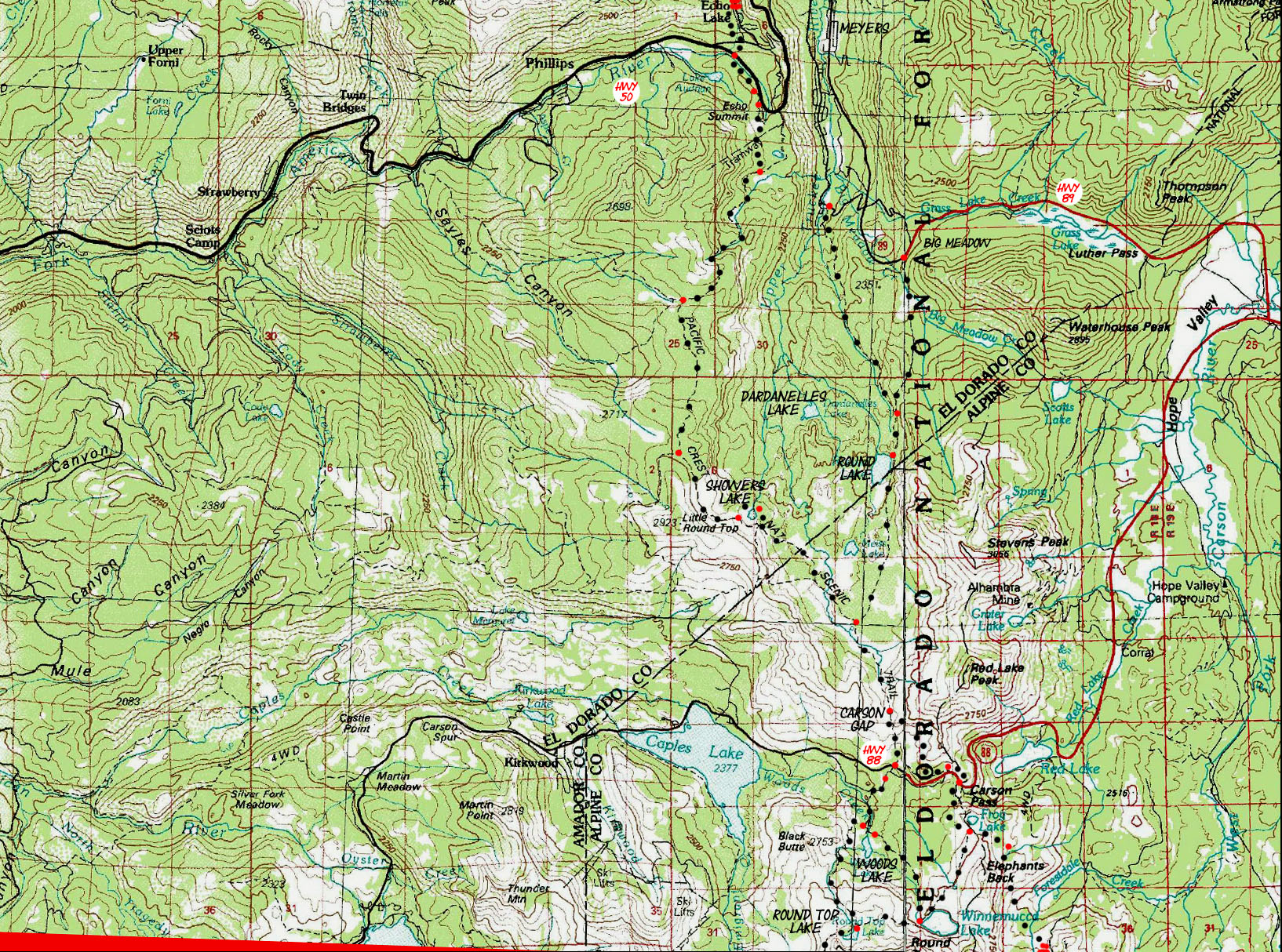
Echo Summit to Carson Pass PCT: 12 miles Click RED DOTS and BLACK DOTS on Map Echo Summit to Round Top Lake, TYT: 14.51 miles
North 30 minute topo map: South Desolation Wilderness Click RED DOTS and BLACK DOTS on Map SOUTH TYT 30 map: Echo Summit to Mount Reba SOUTH PCT 30 map: Carson Pass to Ebbetts Pass
|
North 30 minute topo map: South Desolation Wilderness 7.5 minute version of above topo map: Echo Summit & South Upper Truckee to Carson Pass South Carson Pass Region topo Hiking Map
SOUTH TYT 30 map: Echo Summit to Mount Reba SOUTH PCT 30 map: Carson Pass to Ebbetts Pass
Location Information |
||||
Map Notes: The above compilations of maps from 1976 and 1985 do not depict the actual location of the routes of the trails at the time of this publication in 2013. For instance, the route South of Echo Summit has been significantly changed, as well as the trail through Showers Lake. Over the years these trails have been extensively rerouted. Check the 7.5 maps for the USGS's, and my most up to date depiction of trail routing. Miles and Elevations-"Route Evolution" Forum Route Comments Comments These maps fulfill the purpose of putting the main trails into a broader regional context, and outlining the basic location of their routes. Main Features: The map above depicts the Echo Summit and South Upper Truckee Trailhead options for beginning your Backpacking trip in the Lake Tahoe Basin into one of my favorite places, the Meiss Country Roadless Area. Though the Meiss Country Roadless Area is small it is ideal for local High Sierra backpacking trips, as well as a great place to begin longer section hikes, and it is a pleasant section to hike through on your way down to Tuolumne Meadows along the Tahoe to Yosemite or Pacific Crest Trail routes, and even longer walks down the length of the High Sierra Crest down to Mount Whitney. This place is quiet, leading into the deeper quiet deep in the Summit City Creek Canyon. Desolation Wilderness is not quiet. If you want a quiet start during the middle of Summer you have quiet in Meiss Country. The 30 minute map above gives us a wider view of our basic trailhead and trail options for both the Echo Summit and South Upper Truckee routes to Round Top Lake along the Tahoe to Yosemite Trail route than tighter focus of the 7.5 minute map. The Roadmap below shows you how to get to these trailhead access point into the Meiss Country Roadless Area. Also see the instructions on each trailhead's guide page.
The Carson Gap marks the extent of the Tahoe Basin Drainage, The Meiss Roadless Area, and the Lake Tahoe Basin Administrative Unit. Just South past the Carson Gap the Southbound backpacker reaches the first junction where the Pacific Crest and Tahoe to Yosemite trails part. As you can see on the next map, the Tahoe to Yosemite route passes to the West of Round Top and the Sisters, while the Pacific Crest route passes to the East side of this mountaintop. Administrative UnitsThe Carson Gap overlooks Highway 88 and the Carson Pass, and marks your entry into the Carson Pass Managment Unit, a special zone of the El Dorado National Forest, and then you pass South into the Mokelumne Wilderness. Which National Forest you are in when you pass through the Mokelumne Wilderness depends on your route. The Pacific Crest Trail will enter the Mokelumne Wilderness in the Toyibe National Forest, which Administers the Eastern sides of both the Mokelumne and Carson-Iceberg Wilderness. The Tahoe to Yosemite backpacker will be passing through the Western side of the Mokelumne Wilderness, which is administered by the El Dorado National Forest except for your last few miles West from Camp Irene on the Mokelumne River, which is administered by the Stanislaus National Forest. From Lake Alpine to Sonora Pass the Tahoe to Yosemite backpacker is passing through the Western side of the Carson-Iceberg Wilderness, which is administered by the Stanislaus National Forest. MAP NOTE What's important for our general reference purpose is that each side of a square is 1000 meters, or a Kilometer. From my point of view that is 1093.6 yards or .62 of a mile. Diagonal: 1414.22 meters, if my trig is correct. That converts the diagonal distance into 4,639.8 feet or .88 of a mile.
|
Mapping Information |
|
Miles and Elevations Location Elevation Mileage Start: Echo Summit 7377 0+143 .91 Frog Pond trail junction 7520 .91+140 .50 Footbridge 7640 1.41+520 .74 Overlook 8160 2.15+600 .74 Peak 8905 high point 8760 2.89Peak 8905 to Meiss CabinElevation drop: 360 feet over 6.28 miles Peak 8905 high point 8760 2.89 -240 .6 Sayles Canyon/Bryan Mdw Jnct 8520 3.49-120 .85 Sayles Canyon, second junction 8640 4.34+320 1.27 Schneider's Camp junction 8960 5.61-160 1.19 1st Showers Lake junction 8800 6.80-120 .41 2nd Showers Lake junction 8680 7.21-280 1.88 Round Lake trail/Meiss Cabin 8400 9.09Meiss Cabin to the Carson GapElevation Rise: 400 feet over 1.52 miles Round Lake Jnct/Meiss Cabin 8400 9.09+400 1.52 Carson Gap Pond 8800 10.61Continuing South from the Carson Gap...Elevation Drop: 200 feet over 1.39 miles to the Carson Pass on the PCT Elevation Drop: 400 feet over .6 miles to HWY 88 on the TYT Carson Gap Pond 8800 10.61 |
Left Map Name: Placerville Calif.-Nev., 1976, 30x60 minute Topographic Right Map Name: Smith Valley Calif.-Nev., 1985, 30x60 minute Topographic
Compass Offset: Magnetic North is 17 degrees East of True North
scale: 1:100 000 Contours: 50 meters
Lake Tahoe Basin Backpacking Permitting AuthorityLake Tahoe Basin Management UnitNational Forest: LTBMU Area: Meiss Country Roadless AreaPhysical locationBetween Highways 50, 89, and 88
Two Routes South from the Carson Gap TYT: Down to Hwy 88 elevation miles to Hwy 88 8400 .6 mile Echo Summit to Hwy 88 11.2 miles The Tahoe to Yosemite Trail breaks off to the Southwest at the Carson Gap, where the TY trail branches off towards Round Top Lake. PCT: To the Carson Pass elevation miles Carson Pass 8600 1.39 miles Echo Summit to Carson Pass: 12 miles The Pacific Crest Trail continues to Carson Pass from the Carson Gap. |
More Miles and Elevations InformationSouth THIS LOCATION: Echo Summit to Carson Pass Miles and ElevationsAlternative Trail Route: Meyers to Carson Pass miles and elevations
South, PCT Route: Carson Pass to Ebbetts Pass miles and elevationsSouth, Tahoe to Yosemite Route: Carson Gap to Lake Alpine miles and elevationsNorth North: Echo Summit to Meeks Bay Miles and Elevations |
|
North map: North Echo Lake South map: Echo Summit, South Upper Truckee to Carson Pass
| Elevations | More Information | ||
Lake Tahoe: 6226 feet Echo Summit Trail head: 7377 feet Upper South Truckee Trailhead: 6520 feet Meiss Cabin: 8400 feet Carson Gap: 8800 feet Round Top Lake TYT: 9360 feet Forestdale Divide PCT: 8840 feet |
Trail Guide, Section: Meeks Bay to The Carson Gap Trail Guide, Segment: Echo Summit or S.U. Truckee
Google Map: All Lake Tahoe trailheads |
||
Map Credit |
U.S. Geological Survey, Department of the Interior The USGS Download free USGS topo maps: Move the Map to the Sierras. Select size of Maps you wish to download. Click "Mark Point" on map to see the USGS map grid of the selected map scale. USGS Topographic Maps |