The Trails
Guide
Maps
Miles/Ele
Permits
Resupply
Forum
Current Weather Conditions
Weather Notes
Northern High Sierras
Central High Sierras
Southern High Sierras
Gear
Gear List
Gettin Started
Layering
Discussion
Testing yourself and your gear
Gear Reviews
Backpacking
Boulder Lake Junction
to the
East Carson River Trail
Hiking
The Pacific Crest Trail between Ebbetts Pass and Sonora Pass
Languages
Languages
Trail Arts
The art of walking
Physical Preperation
Trail Skills
The trail
Off the trail
Scrambling
Maps
Navigation
Camp skills
Food
Resupply
Food
Other
Photo Catagories
Trail Stories
Trail Culture
News and Science
Links
Groups
Books
Terms and Conditions of Use
| Guide Index Highway 4 to Highway 108 |
North PCT Murray Canyon to Boulder Lake Junction |
South PCT East Carson River to Sonora Pass |
7.5 Topo |
30 min Map Ebbetts Pass to Sonora Pass |
Ebbetts Pass
to Sonora Pass MILES AND ELEVATIONS |
ALL TOPO MAPS EBBETTS TO SONORA |
Resupply |
National Forests Toiyabe & Stanislaus |
all maps INDEX |
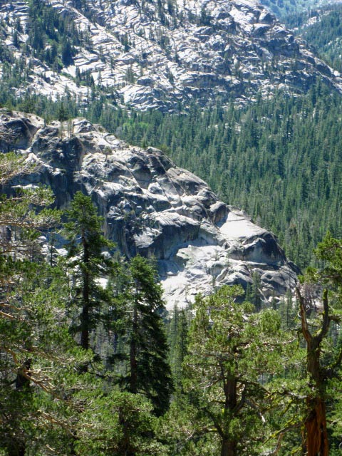
The Boulder Lake Trail Junction
on the
Pacific Crest Trail
Hike West to the TYT:
Boulder Lake Trail on the Clarks Fork of the Stanislaus River to the PCT
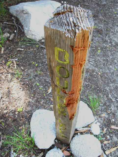
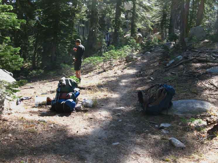
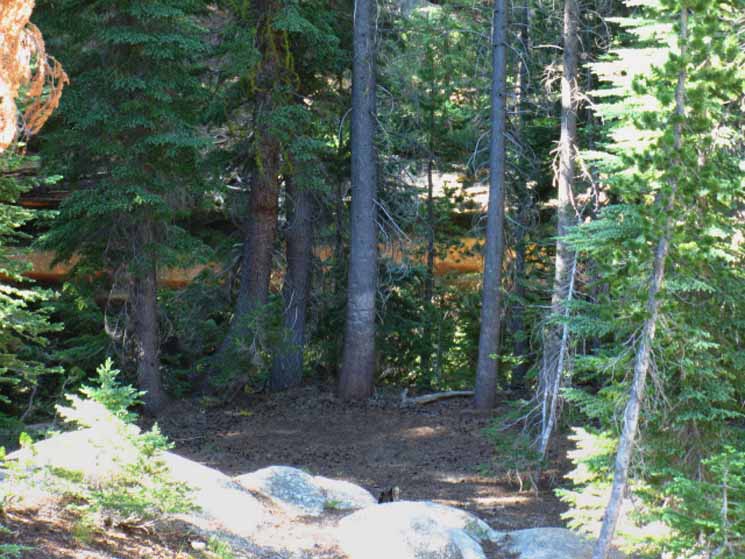
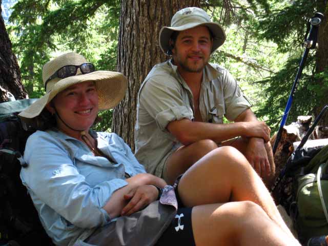
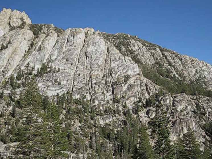
| Boulder Lake trail junction decorated by the local Bears. | ||
 |
||
|
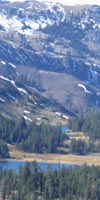
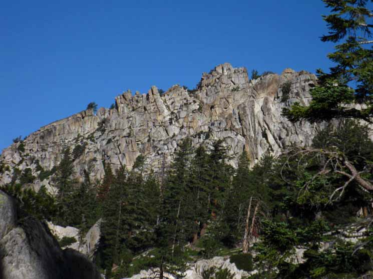
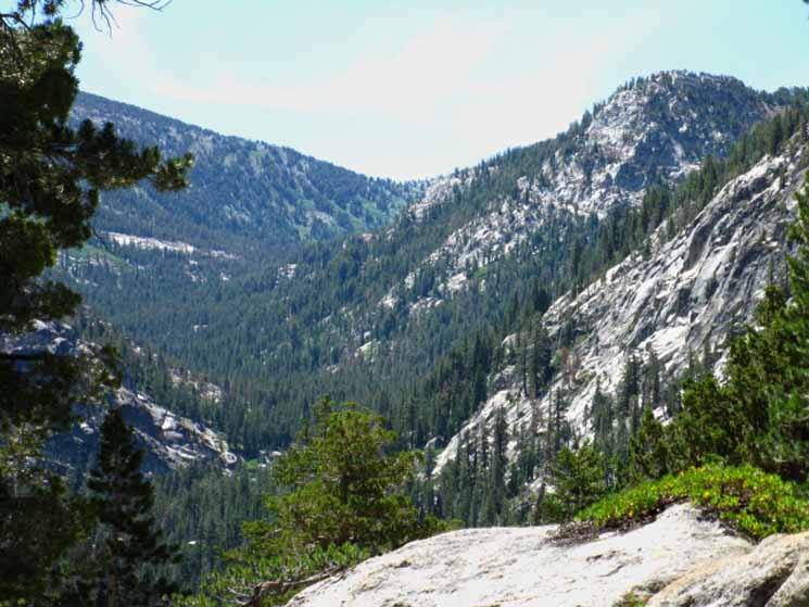
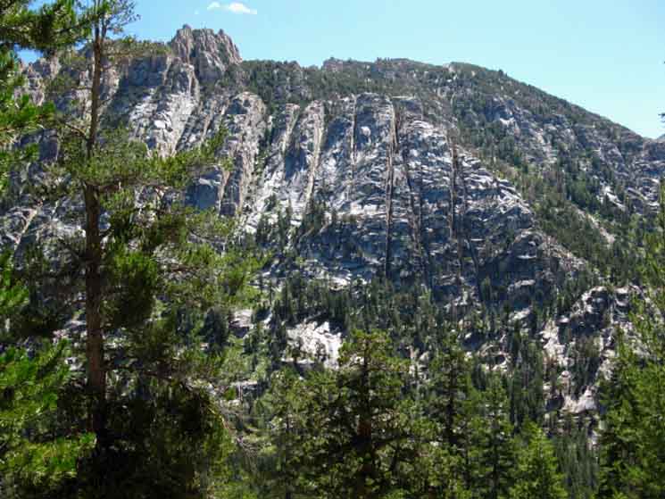
Arriving at the Boulder Lake trail junction puts us over two-thirds of the way South from Ebbetts to Sonora Pass. The trail pointing West from the Boulder Lake trail junction along the Pacific Crest Trail brings us a short 2.74 miles Southwest to the Tahoe to Yosemite Trail along the Clarks Fork of the Stanislaus. This trail could bring us down to the TYT at the point where the Southbound TYT deteriorates as it climbs to approach the Clarks Meadow, then disappears into route status for the final segment of the hike from Clarks Meadow to Saint Marys Pass. This junction offers fit, strong, and well skilled backpackers hiking South on the Pacific Crest Trail an alternative route over the Tahoe to Yosemite Route to Highway 108 that is much quieter, and much more challenging than the well maintained and heavily used route to Sonora Pass along the PCT. This TYT alternative route to Highway 108 is only recommended for experienced backpackers in strong physical condition capable of route finding, that is navigating without aid of trail, ducks, or blazes. Map West
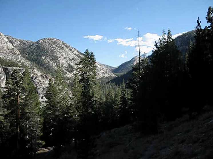
Regional Overview Continuing South on the PCT we are three miles from reaching the unmarked trail junction where the unmaintained trail coming up the East fork of the Carson River joins the PCT. There's a nice campsite a short ways down the unmarked East Carson Trail above the East Carson River, and a nice camp before we drop down there located behind "The Plug." |
Boulder Lake Trail Junction
to the
East Carson River
Basic Facts Topo Hiking Maps Asa Lake to East Carson River Map15 minute Topo Backpacking Map
Ebbetts Pass to Sonora Pass Pacific Crest Trail Miles and Elevations Boulder Lake junction is 3 miles North of the East Carson River trail on the PCT
The Boulder Lake junction is 17.71 miles South of Ebbetts Pass on the PCT The Boulder Lake junction is 11.73 miles North of Sonora Pass on the PCT
The Boulder Lake junction on the TYT is 2.74 miles West of the Boulder Lake Junction
Boulder Lake TYT Boulder Lake PCT |
||||||||||||||||||||||||||||||
Boulder Lake Trail Junction
to the
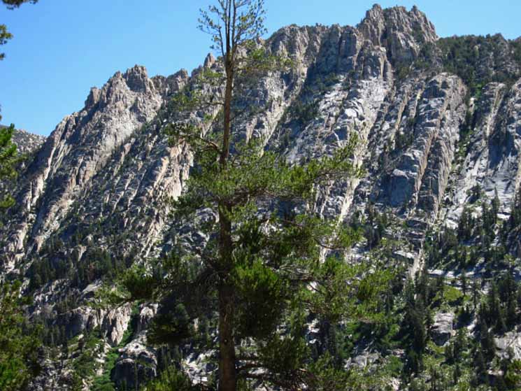
East Carson River
Basic Facts, Around Boulder Peak Up and Down the Sierra Crestline This pattern has held true since passing South of Carson Pass. We first crossed The Nipple Massif, then the Raymond and Reynolds Massif, down to the Tyron Peak Massif, and on down to our current position in a granite break between huge volcanic massifs. We will cross the last of this series of massive volcanic massifs stretching South from Carson Pass when we cross the Leavitt Massif South of Sonora Pass. The 9393 foot granite mound of Boulder Peak is incongruous both because of its small size and girth (compared to the volcanic massifs North and South of it) as well as its granite composition when compared to the massive 11,000+ foot volcanic crests of Stanislaus and Sonora Peaks, and their massive girth shaping our trail to the North, when compared to the much smaller size and bulk of Boulder Peak's granite mound to their South. Boulder Peak is puny in comparison. Boulder Peak represents the fact that there is a gap in the Sierra Crestline here. Dynamic Terrain Though sheer walls of fantastic golden red and creme colored granite rise out of the East Carson River Canyon to our East and Southeast, the massive volcanic mountains topping the Western wall of the canyon extend further South than the headwaters of the East Carson River Canyon, and North up to Lake Tahoe. This canyon is one big piece of "emergent" granite, rising as the forces of erosion scour away its soft volcanic encasement one raindrop, carried on storm-driven gust, at a time. Despite the exquisite beauty of the granites in the East Carson Canyon we can see that they composes a minority of the terrain, a notable exception, a granite island in a sea of volcanic terrain. The vast majority of terrain from Ebbetts to Sonora Pass is volcanic. The percentage of granite terrain around us will decline as we hike higher up the mountain until it is completely buried under the Eastern flank of Sonora Peak. Two Rivers, Two Trails Boulder Lake Trail Junction The Tahoe to Yosemite Trail is 2.74 miles below us to the Southwest via the Boulder Lake trail. This Boulder lake trail junction offers the shortest length of the four trails linking the PCT and TYT across the Carson Iceberg Wilderness. This opens up challenging Loops around the Southern Carson Iceberg Wilderness: below! South from Sonora Pass The Boulder Lake the closest link between the PCT and TYT along the trails from where these routes divided exiting the Lake Tahoe Basin, to where they rejoin below Bond Pass in Jack Main Canyon. East and West Flanks To our South the massive Stanislaus and Sonora Peaks rise to divide the Eastern Carson River from the Western Clarks Fork. This particular little piece of low granite crestline between this two sets of volcanic peaks is special because it is one of the rare places where we can actually stand between these Eastern and Western drainages while hiking the PCT route across the Carson Iceberg Wilderness. Tyron Peak and Wolf Creek Pass are the other two I can think of along this length of the trail between Ebbetts and Sonora Passes. From Boulder Peak South to the Boulder Lake trail junction the PCT peeks into both the East and West drainages from a short segment of decidedly granite terrain between long stretches of volcanic terrain stretching North and South. Hiking the PCT North or South of this short section from Boulder Peak to the Boulder Lake trail junction we will again be decidedly on the Eastern Flank of the Sierra, and within predominantly volcanic terrain. South of the Boulder Lake trail junction we will climb over The Plug to plunge deep into the canyon of East Carson River, finally touching its floor. Continuing South Hiking Northbound on the PCT from the Boulder Lake trail junction we too will be hiking the Eastern flank of the Sierra for 99% of the hike up to the Lake Tahoe Basin, again with a couple of notable exceptions (Tyron Peak, The Nipple above Blue Lakes, and the top of the Silver Fork of the American River drainage at Carson Pass), until we enter the Lake Tahoe Basin. As I have said, the PCT route between Tahoe and Yosemite is fundamentally an Eastern Sierra route through the expansive volcanic terrain of the Toiyabe National Forest. Continuing South from the Boulder Lake trail junction the Pacific Crest Trail brings us around the back side of "The Plug," a massive granite feature on the Western wall of the East Carson Canyon, then switch-backs us down to the East Carson River. Backpacking Loops The Boulder Lake trail linking these Eastern and Western drainages gives us easy access to the stunning high country up to and around the headwaters of both the Clarks Fork and the East Carson Rivers without having to hike too many miles. But these are hard high altitude miles. Headwaters Loop That would be a difficult 23 mile backpacking loop because of the typical challenges of altitude and High Sierra terrain, but even more difficult because the segment up the Clarks Fork of the Stanislaus on the Tahoe to Yosemite Trail is unmaintained, and a segment of it is even untrailed. Headwaters Loop II Imagine hiking North from Sonora Pass on the PCT down to the East Carson River Trail, just as in the first loop described above. But instead of hiking all the way South to the Boulder Lake junction, we had turned Right (North) at the East Carson River unmaintained trail to find the route along the East fork of the Carson River down to Carson Falls. The first loop trip described above is a tough trip, but the second loop includes two of the toughest segments of unmaintained/untrailed backpacking trails in the North Sierra. These are the the East Carson River Trail and the upper section of the TYT over Saint Marys Pass. These difficult unmaintained trails are not a joke. These are two serious routes that require excellent fitness, observation, analysis, and route finding skills. The Carson Iceberg topo hiking map traces out these routes, and is decorated with lots of other intriguing loops, if you use your imagination to see them. Those would be ninety mile backpacking loops. The map below leaves little to the imagination in the Southern Carson Iceberg and Northern High Emigrant Wilderness: Sonora Pass Region Backpacking Map The map above depicts a lot of terrain and accesses a lot of backpacking information. Most of the black-dotted trail routes on all the 30 minute hiking maps are linked to detailed 15 minute backpacking maps. The red dots are linked to the trail guide report for that location. Continuing Passing around the backside of "The Plug" through a channel of forest over to the South end of "The plug," we have a short hike South across exposed terrain before we begin switch-backing down to the East Carson River. Currently (2013) the switchbacks are centered on the steep four-season creek tumbling down the canyon-side. Either the trail or the creek has moved since the maps were drawn. I'd say it was the trail that was repositioned... Once at the bottom of the switchbacks the Pacific Crest Trail becomes a a gentle descent for a short hike through dense swaths of vibrantly spreading (2013) Aspens to the unmaintained East Carson Trail junction on the Southbound hiker's Left. Don't Miss Carson Falls! I am one of the people who yearly ducked the PCT-East Carson junction each Spring when I hike the route as the snows recede, and we can find the junction to properly duck it, but I do not duck the E Carson Trail itself. Just its trail junction with the PCT. Two Campsites near the Trail Junction East Carson River Trail Junction Hiking South on the PCT from the East Carson trail junction we face a 4.65 mile ascent up 2080 feet of elevation to the East Carson Gap at 10,240 feet, our highpoint on this segment of our trail along the East fork of the Carson River. Another 2.88 miles hiking South from the Sonora Gap brings us first West, traversing the length of the Southern flank of Sonora Peak, before turning South down to Sonora Pass at 9624 feet where Highway 108 crosses the Sierra Crest. The cowboys at KM can use horses to get away, but most choose to stay and talk to the crazy "hippy" backpacker. Great dudes, those Kennedy Meadows Horsepackers. And Gina too. She's a darn good cowgirl-horsepacker. I don't just "scout" the trails, but I engage with the various aspects of trail culture, as any of who have read the guide are aware. And, there is lots of trail culture at Kennedy Meadows Pack Station. The East Carson River trail junction to Sonora Pass: 8.74 miles Staging Up for Resupply and Days Off Hunters Camp is 6.11 miles North of Sonora Pass, a distance we will cross before the Sun is far above the Eastern horizon tomorrow morning, and before the steady trickle of Summertime traffic begins to flow over Sonora Pass. I consider it the finest place to camp between the East Carson trail junction and Sonora Pass. It's preferable, if it fits into your daily mileage in relation to your location on the trail and the time of day. We have a very practical goal. We'll be getting to the Kennedy Meadows Pack Station before they stop serving breakfast. They have excellent breakfasts at Kennedy Meadows Pack Station. Rest and Resupply Plan Let's see if we can find Matt Bloom, and see what's going on in his cowboy/horsepacker brain... Kennedy Meadows is a trail hub for all sorts of backpackers, hikers, hunters, horsemen, fisherfolk, families, and so on. Half of Oakdale's ranchers and such folks show up every Summer, and a selection of Valley horsemen and hunters, later in Fall. OK, you staged up? I'm ready for a night at Hunters Camp then two at KM! Time to "get on down the trail!" |
MAP ISSUES
Boulder Lake trail junction
with the
Pacific Crest Trail
Boulder Lake Trail JunctionMap Anomaly What It Means Topo Maps Affected Affect Boulder Lake Junctions This junction still exists on the ground along the Pacific Crest Trail as of my last observation in October of 2011. Post up to inform if this junction has been removed. Consulting Paper Maps Online's 2008 Stanislaus National Forest Map revealed the same status as on the 2009 Forest Service Map, that the upper length of trail from Boulder Lake East to the Boulder Lake trail junction on the PCT had been removed from both maps. Money Well Spent This is one of a very short list of taxpayer expenditures that I am very proud of, along with our friends at the National Weather Service. Your downloaded maps can be expertly viewed and manipulated using the Free Adobe Reader, and further geospacial tools employed by downloading the Free Terrago Toolbar into Adobe Reader. Load these maps up into Photoshop, and you can easily create your own customized set of hiking maps for any trip imaginable in the Sierra Nevada, if you have a capable printer. Or hiking maps for anywhere in the US of A, for that matter. Last Contact These low granite ridges on either side of us running West off of this low granite segment of the Sierra Crestline, this low section situated between and below the massive line of volcanic peaks running North and South of our position, gives us a great Western access route onto or off of the Sierra Crestline. As we take our last steps approaching the PCT the trailbed has about dissipated into the forest floor among an outburst of growing young pines, lodgepoles I believe. This short segment of trail from Boulder Lake to the Boulder Lake junction on the PCT does not need a trail to be easily passable by anyone with the most fundamental route finding skills. Keep it between the ridge arms and keep it pointed East and we will hit the PCT, if we pointed ourselves in the correct direction from Boulder Lake. All we have to do is stay in the granite ravine running up from Boulder Lake to the Sierra Crestline. You would have to work to get lost here, but I am sure somebody reading this could make it happen. Thus my email is at the bottom of each page... Second Southern Route Route Finding This Southern route to Boulder Lake is longer, over more complex terrain, and may very well require that the hiker find the position to begin our traverse over to Boulder Lake. It is much more complex than the straight shot down to Boulder Lake from the Northern marked trail junction. I know Steve the Cowboy, his rancher brothers and dad, and some crazy local hikers know the current status of this Southern "route" between the PCT and Boulder Lake, as well as following general conditions in the surrounding terrain. All of you with information should share your experience and insights through the forum. In Conclusion... The Boulder Lake Trail from the marked trail junction along the PCT goes faint a few times on its way down to Boulder Lake, but it is a very easily follow-able route even when the trail diminishes. Share your experiences here: |
The Boulder Lake Trail Junction
| Break-time at Boulder Lake Trail Junction along the Pacific Crest Trail South of Boulder Peak. | ||
 |
||
Another Sweet Spot along the Trail
|
Look West, High Sierra Hikers!
| Boulder Creek trail West from the Pacific Crest Trail. | ||
 |
||
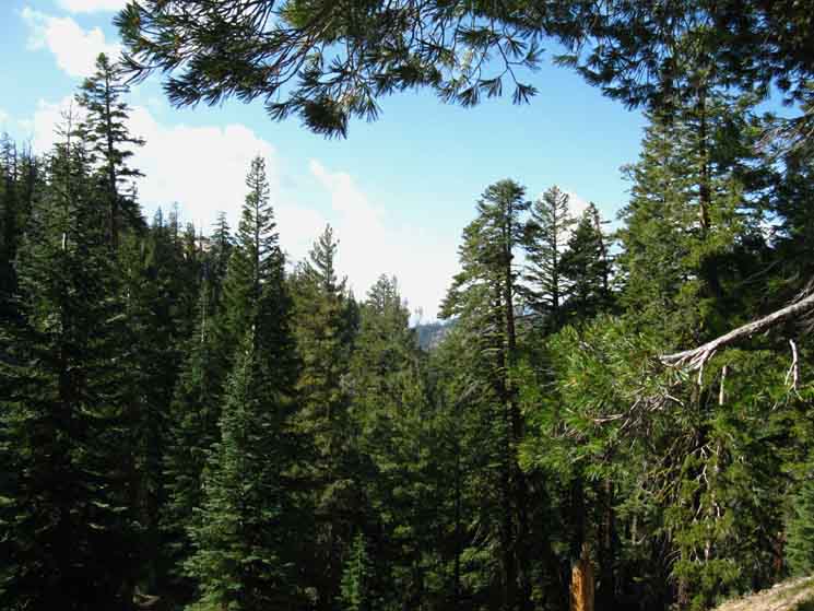
This is the forest around the unmaintained trail West from the marked Boulder Lake junction down to Boulder Lake. It is not a difficult route to follow, and most of the trail down to Boulder Lake is visible. From Boulder Lake a well maintained trail runs Southwest down to the Tahoe to Yosemite Trail at Boulder Creek, which is upriver from the Clarks Fork Trailhead at the end of Clarks Fork Road. That would be about the easiest route I could think of to get us to the heart of the Sierra. Call it 5.3 miles from the Clarks Fork Trailhead to the Boulder Lake trail junction on the PCT. From Boulder Lake we follow Boulder Creek down the base of a ridge Southwest to the Clarks Fork of the Stanislaus River. We can see that ridge through the canopy in the center of the image. That ridge lays beyond Boulder Lake, and our route West to Boulder Lake will bend Southwest with that ridge down to the Clarks Fork of the Stanislaus.
Trail Guide Page West |
Westward Ho!
View Down to the Tahoe to Yosemite Trail
The view of the Boulder Creek drainage from a bit further North down the PCT, just before we hike South to the Boulder Lake trail junction, gives us an overview of the Boulder Creek/Boulder Lake drainage down to the Southwest that can help us discern the shape of the forest and the location of our trail to the TYT. We're looking at the seams in the terrain that Boulder Creek traces out on its way down the West flank of the Sierra from our position on the Pacific Crest Trail down to the Clarks Fork of the Stanislaus River. The view above is looking down this canyon from ground-level at the trail junction on the Pacific Crest Trail. The picture below gives us an overview of this cool route connecting the PCT and the TYT from a bit North of the Boulder Lake trail junction. |
 |
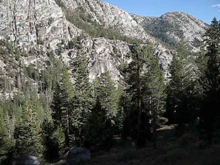
The Trail from the PCT to the TYT follows the Logic of the Terrain We are looking at the terrain the trail West from the Boulder Lake trail junction on the PCT crosses on its way down to Boulder Lake, and on to the Clarks fork of the Stanislaus River. The trail from the PCT to Boulder Lake lays in the bottom of the ravine immediately below us, out of sight below the bottom edge of this image, descending from Left to Right, being East to West, across the whole width of this image. Boulder Lake is located out of sight off the Lower-Right corner of the image above. We cannot see where the trail from Boulder Lake continues on its way down to the Clarks Fork of the Stanislaus from Boulder Lake because Boulder Lake is hidden from our view out of the Lower Right corner of the image. But we can see the rocky ridge extending halfway across the image from the middle Right edge of the image, descending Left to the center of the image. The trail from Boulder Lake down to the Clarks Fork of the Stanislaus River runs along the base of that ridge. Line up the image with the map to get a better overall context on the trail in the terrain: Boulder Lake PCT to TYT The trail Southwest from Boulder Lake intersects with the Clarks Fork of the Stanislaus River at the base of the huge shadowed ridge descending from Left to Right, its base descending across the middle of the image. The Clarks fork of the Stanislaus River flows West along the foot of that massive shaded ridge. Carson Iceberg Wilderness Hiking Map |
South
|
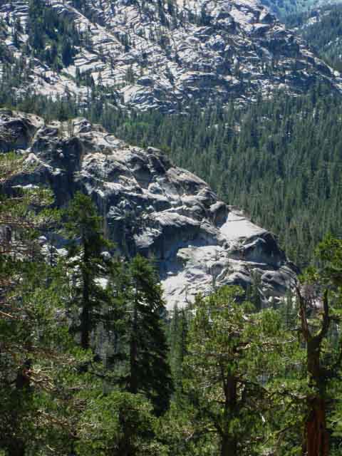
Granite
Hiking South on the Pacific Crest Trail from the Boulder Lake trail junction we turn around to look North. The gully with the trail West down to Boulder Lake runs across the terrain between us and the low granite ridgeline running up to become part of the low granite Sierra Crest along this segment of trail. |
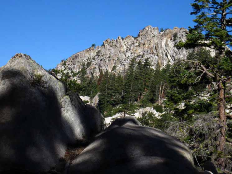 |
We hiked around the top of that ridge before dropping down to the Boulder Lake trail junction. Granite again dominates the terrain. Passing South of the Southern Sharkfin granite began to emerge out of the red soils of volcanic terrain and has grown to dominate the terrain as we hike South. |
| Looking North across the drainage holding the unmaintained trail down to Boulder Lake we take note of the South side of the ridge to the North between us and Boulder Peak. |
 |
We are not only passing into granite terrain from the volcanic, but the unique colors, shapes, and jointing of the granite along the East Fork of the Carson River is amazing. It's proximity and interweaving within the surrounding granite terrain makes this are unique. |
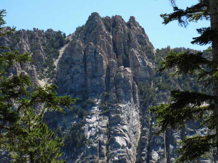
Curious Rock Formation
Inclusions
| Unique rock formation lays like a ribbon across granite, South of the Boulder Lake trail junction. |
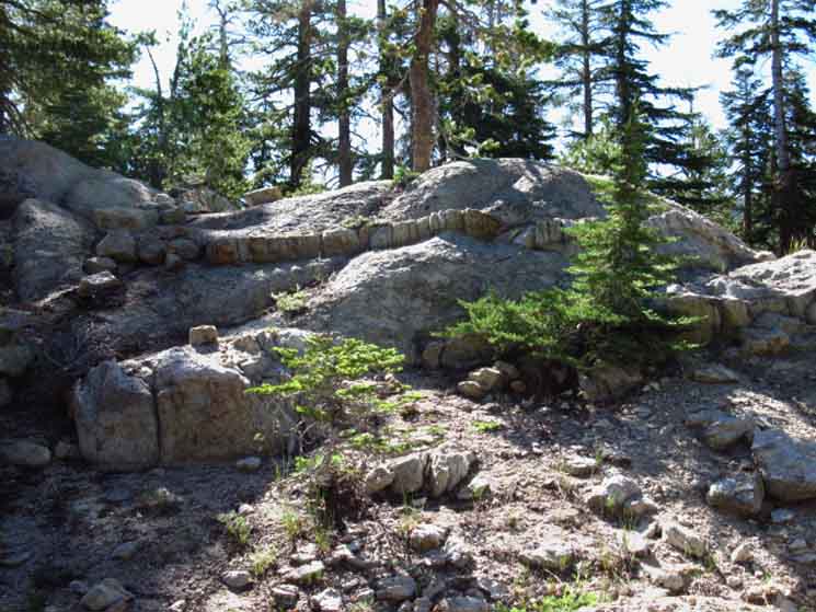 |
A curious formation. There's a similar formation of inclusions on the other side of the mountain on the TYT route along the Clarks Fork of the Stanislaus River. See any interesting geology and terrain? |
| A closer look reveals a string of blocks sitting atop glacial carved granite. |
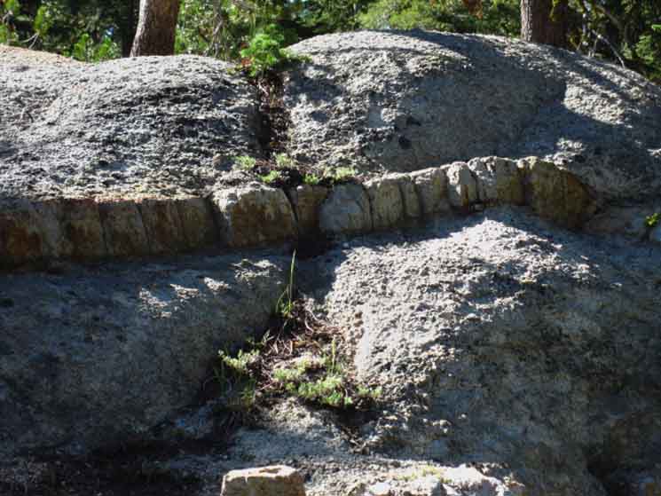 |
These rocks are different than the granite they sit upon, yet appear "original." |
An inclusion in the original granite pluton exposed by glacial carving? An inclusion exposed by thousands of years of weathering? Both? |
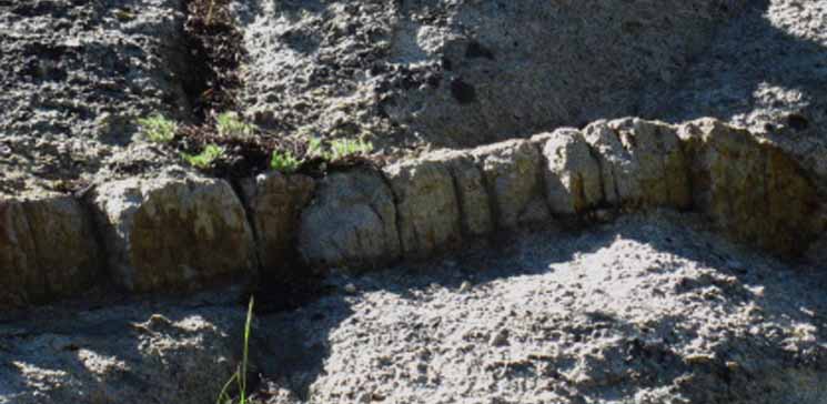 |
Has subsequent erosion worked to separate and highlight this geologically exposed and then glacially vein of included rock? It's a puzzle. Check out the interesting inclusions I spotted along the Tahoe to Yosemite Trail along the Clarks Fork of the Stanislaus River on the West side of Stanislaus Peak. |
Dead Pond & Southern Route down to Boulder Lake
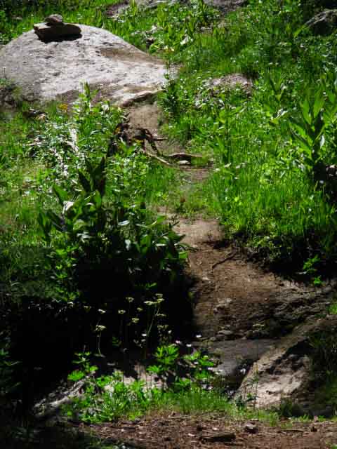
Traversing Westward down the South flank of Peak 8722 we see a black pond (Vernal Pond) through the forest. We continue dropping down to the the pond, where the Pacific Crest Trail again turns South to make the gentle climb around the backside of "the plug," Peak 8990. Both the 1985 30 minute and 1977 7.5 maps show a trail junction at this position heading West down to Boulder Lake. There is no marked junction here, though it looks like a valid route either down to Boulder Lake or the Clarks Fork of the Stanislaus could be found through the terrain beyond the pond. The terrain between the black pond and Boulder Lake is complex. The route follows a ravine down mountain to a point where the hiker must turn Northwest to traverse out of the gully to Boulder Lake. If this point is not marked the cross country hiker will have to determine the turning point based on observation and analysis. Have you hiked this unmaintained route? Relate your experiences here. I'll scout it out next time through this section. |
 |
The black pond is not marked on the Disaster Peak USGS topo map. "Dead, ""Black," or Vernal Ponds are not fed by active streams. Thus they hold the runoff from the Spring Thaw until they finally dry out. Have you hiked this route down to Boulder Lake from the PCT? Post up your experiences and impressions. |
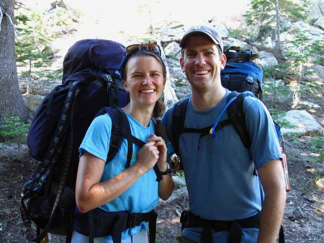
| Hiking around The Plug Hiking South past the black pond we climb up a short chute to access the backside, the West side of "The Plug." The terrain behind this massive piece of granite is of less angle that the surrounding terrain, with shelves of almost flat nicely forested ground quite suitable for camping. It is suitable for camping because of the small four season stream draining the backside of The Plug. Check out the map to note the location of the stream. Boulder Lake junction to Sonora Pass Map Trail Culture We're going to note the local and long distance hikers we encounter. This is not to specifically identify folks, but to reflect the wide range of folks who make up trail culture. Trail encounters are a rich aspect of trail culture. Thus we note trail encounters not only with backpackers, but with day hikers, with the fisherfolks, horse and llama packers, rangers, scientists, resupply staff and even the "wilderness tourists" we meet on the edge of wilderness while crossing trailheads and at Yosemite. These are all members of an extended family held together by our common connection with the wilderness, if they know it or not. I ran into Becky, Kent, Radar, and Carly as they were coming down the chute and I was climbing up. We met where a little flat extended the trail, a convenient place to stop and chat for a moment. |
| Becky and Kent. | ||
 |
||
Doing a quick weekend Sonora to Ebbetts Pass hike with their fine trail dogs. Two nights on the trail, 30 miles, and that's their weekend. Check out more local and PCT hiker contacts along this section of trail during a 2010 hike to check out the character of a big sample that year's PCT and local hikers. You can be one of these folks. |
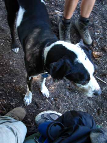
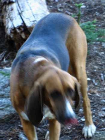
High Sierra Hiking Dogs
Good Dogs!
| Radar. | Carley. | |||||
 |
 |
|||||
Trail dog watching nature while hanging out with the new guy. Note my backpack. I have learned to take it off when I chat up hikers. During 2000 I figured I should build this guide, and I began picking the brains of backpackers I meet along the trail. I started carrying a camera, and going off-trail for better shots... |
Carley was more worked by the trail than radar. A bit faded
|
Trail Encounter Doggy Treats for the Solo Backpacker I pride myself on moving effectively across terrain generating minimal extraneous movement, sounds, or disturbance. This is executed while observing the surrounding environment as deeply as possible for the level of attention the trail itself demands. I was climbing above the dead pond rapidly and silently around a bend that brought four long-haired dreddy* hippies with their two dogs into view. I saw them before I came fully into their view. Both dogs eyes' shot to me, four ears perked and pointed at me. They were laid out in such a way they could observe the corner I was coming around. They were deciding whether to move more than eyes and ears, measuring the need to get up and bark, to check me out. "Was I a threat?," I watched the dogs think as they watched and listened to me without moving a muscle. To assure them that I was not, I smiled a big smile, pretend-patted my thighs vigorously, and shook my head like I wanted them to come and play, while hunching down. Looking "playful" while climbing with a heavy pack is not easy. Both dogs lazily wagged tail, but neither moved naught except eye and ear muscles during our whole encounter, except their lazy wags of acceptance. I apparently speak dog "sign language." I looked cool. I wanted to play. I know their type. No extra running up and down the trail. Nope. They hit belly the moment hiking stops, finding every instant of rest possible. They always position themselves for the best observations. They only pay attention to the important or very interesting smells hiking down the trail, they did not stop to smell every bush, and run to catch up. That's for puppies, politicians, and fools. We came to the same conclusions about each other, from our different perspectives. The hippies were obviously PCT hikers who had just passed the 1000 mile mark across Sonora Pass. They were grizzled. I prefer my hippies grizzled, rather than fried. Once trail dogs identified me as a non-threat, I observed their hippy masters without worrying about dogs exposing my position. Each hippy was intent on some task they were concentrating on, working on something each was grasping with one hand and manipulating with their other, something in each of their laps. After a short while my curiosity got the best of me. I didn't want to scare or startle them, so I gently coughed, which still startled them as it broke their intense concentration. "What the HELL man?, was the startled reply of a tall thin dreadlocked kid as he jumped up at my cough, pretty much to no one at all. Then he looked at me, then turned to the dogs, and repeated, "What the hell, man?" I stepped in and said, "don't blame the dogs...," but could not exactly explain why not, so I segued into, "...hey, I'm Al, and what the heck are you guys all doing?," as the dogs, who had risen in the commotion, circled around to sniff me up close and get some love. It seemed like we already knew each other, and just formalized it with some sniffing and petting. They were Good Dogs. The humans quickly caught up with their dogs' evaluation. They were three hippy dudes and a chick, and they said, sadly and in unison, "We're all scraping our pipes. We're out of smoke." Poor hippies! And so far from Lake Tahoe, the next congregation point for their type... So, I,... well I,... I, "Stoner." I revealed my trail name to them, and take the Fifth on the rest of the story. But, you can rest assured that this story ended with happy hippies, and everyone lived happily ever after, as happens in all good hippy tales. I mean trail tails. Well, let's just say everyone's tails were wagging when we hiked in opposite directions. "Kibbies for my doggies, whiskey for the horses, tape up those boots, and stone them damn hippies, Full Speed Ahead..." This "Good Dog" encounter was during the 2002 Tahoe to Yosemite hike, when "the trail" had baptized me with the trail name, "Stoner." Folks called me "Wizard" in 2000, and around 2004 I picked up "Nails." When folks ask me my "trail name," I can honesty answer, "Stoner," the "Wizard" who is hard as "Nails." Or I can shrug, say, "You tell me," and get another. Ask me your trail name with caution. I will tell you what I see and know. I know Good Dogs when I see them. |
Trail Culture
South of the Dead Pond. Pacific Crest Trail hiker encounters, 2009, below. Pacific Crest Trail hiker encounters, 2010. Continuing South past Becky and Kent I found Riff-Raff and Ben & Jerry totally kicked back in a fine shady flat spot alongside the trail. They were taking a much needed rest. They were recharging their batteries, which had been severely tested by the 1000+ miles they had already hiked, including the last very difficult section between Tuolumne Meadows and Sonora Pass. That's a rough section. |
| Riff-Raff and Ben & Jerry. |
 |
PCT hikers out of Ohio. We are hiking through backpacking representatives from around the nation, and meeting backpacking folks from all over California and around the world when we hike against the South-to-North annual flow of the main body of Pacific Crest Trail hikers as they surge North through the Sierra Nevada. Timing out just when this will happen each year, which varies with the size of the Winter snowpack and the development of Spring weather conditions, allows me to plan an annual trip South through the main body of PCT hikers. I'm not alone with my curiosity and support. I know a guy who put up a table and stove at Sonora Pass for a couple of days during the peaks of the PCT flow for a couple of seasons, and cooked pancakes for all PCT hikers who came through. I unload all extra food to passing PCTers as I approach each resupply spot. It is not unusual for PCT hikers to be somewhat, if not very short of food. So I ask them. I provide first aid to those if I see them limping or otherwise hurting. Hiking through the PCTers gives us an idea about the character and condition of each year's crop. I find every aspect of PCT hikers interesting. I'm a Sierra dude, and see little need to hike the PCT, but I fully support PCT hikers. I find the teams, the solo hikers, the distribution of male to female, of national origin, and of age and experience are fascinating. The variety of experiences each person undergoes, and how they take it gives us a look at a unique spectrum of human experience fallen off the edge of civilization into nature, which is where meaning is squeezed out of life. Some PCT hikers are squeezing, some are being squeezed by the experience, then we switch. All grow. If the boot hurts, don't worry too much. It'll soon be on the other foot! |
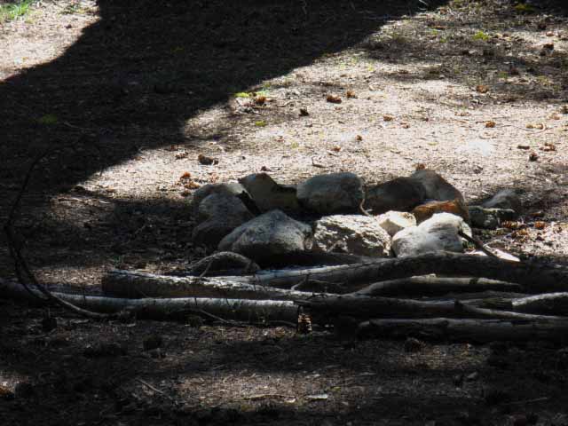
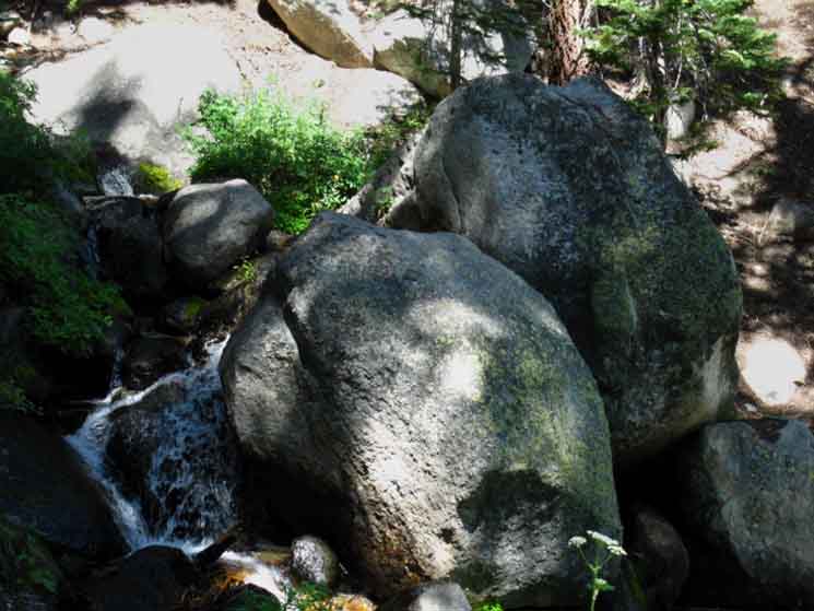
| Backside of The Plug Passing around the backside of "The Plug' we encounter a fine campsite with great views and easy water. Boulder Lake junction to Sonora Pass Map |
Campsite near the top of the last rise behind "The Plug." "Plugsites?" |
||
 |
||
This campsite is located by the stream running North and South along the backside of "The Plug," AKA Peak 8990.
Boulder Lake junction to Sonora Pass Map |
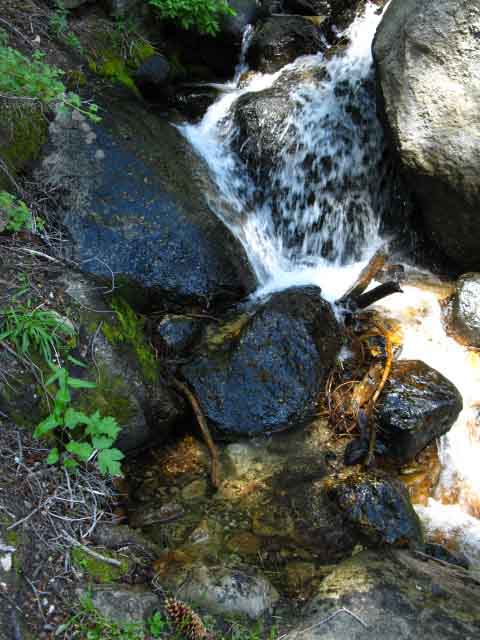
Creek Behind The Plug
| Creek South of Campsite. |
 |
This is the upper section of the creek that runs East along the West side of The Plug, before it plummets down into the East Carson River. Our PCT route crosses the upper section of the creek as we pass around the backside of The Plug. Boulder Lake junction to Sonora Pass Map The map reveals the gently graded well-watered terrain on the backside of The Plug, which translates into good campsites that can support exploration of the complex terrain on and around The Plug. |
Views, Break Spots, and Backpackers on the backside of the The Plug
| View Northeast through the trees. |
 |
The East Carson River Gorge is more that the Eastern backdrop of this section of trail. It is the dominating feature. We'll get longer views of this whole face as we continue South and lose elevation. |
Local Backpackers
| Road Dawg, Buffy, and Bill taking a break on the nice shaded flat behind The Plug. |
 |
On a Sonora Pass to Ebbetts Pass trip. Note the fine campsite beyond. Hikers out of the East Bay Area. These guys are hiking a quick weekend section of the PCT, like Becky and Kent above. |
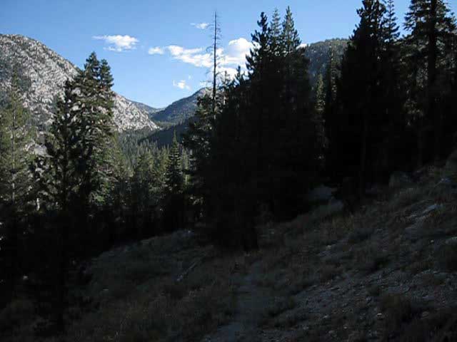
Hiking South approaching the Switchbacks down to the East Carson River
| Coming out from behind the plug we get a front view of the exotic rock formations on the South side of Peak 10440, on East side of the East Fork of the Carson River. |
 |
Ka-Ching! Boulder Lake junction to Sonora Pass Map The rocky red volcanic ridgeline in the background Right is rising to Whitecliff Peak. |
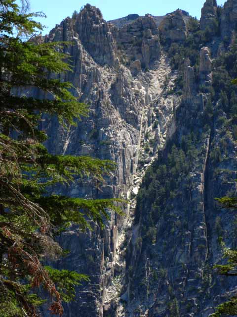
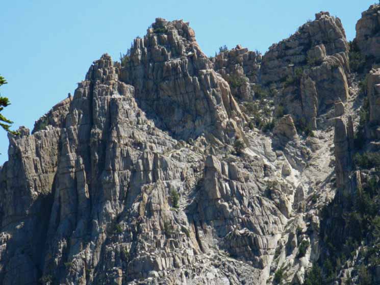
Great Granite Wall
| View across and down East Carson River. |
 |
This is the same structure we looked at across the canyon from the South side of Boulder Peak. I really love the dynamic perspective we have of the rock here as route progress rotates our views. |
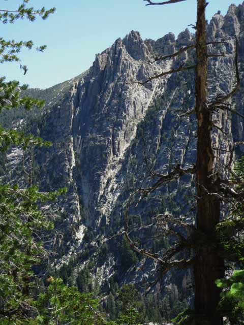
Thrones of the Rock Gods
| Looking North down the East flank of the East Carson River Canyon. |
 |
This is the head of the formation below Peak 10440. This feature looks like some kind of Valhalla for Climbers, a kind of rocky heaven where good climbers go when they die, to climb the thrones of the rock gods. Great spirits climb these mountains, intermingling with their rocky roots. |
East Carson Gap at the Head of the Canyon
| To the South: Our Goal, The E Carson Gap. |
 |
We pass out of the East Carson River headwaters over to Wolf Creek Lake through this low point in the terrain linking Whitecliff and Sonora Peaks. Boulder Lake junction to Sonora Pass Map |
Sweetness at our Feet
| Flower, red, Indian Paintbrush. |
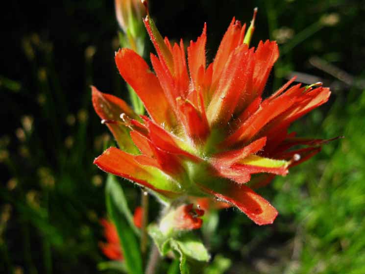 |
Grandeur across the Canyon
| Switch-backing down to the East Carson River we start to observe key landmarks for hikers on the unmaintained East Carson River Trail below. |
 |
If you plan on ever hiking in from the East and then turning South up the unmaintained East Carson River Trail, getting to this stretch of canyon wall indicates it is time to pay close attention to the details of the features along this section of the East Carson River. The layout of these features will guide you to the upper ford when the unmaintained trail along the East Carson River fails. Above is the feature I call the Castle, below the Cup. |
East Carson River Rock Formations
Arches of the Rock Gods Looking North down the gorge protecting the upper reaches of the East Carson River. |
 |
The arc of this groove once held the bottom-edge of the glacier that slid down through these fingers of the East Carson's gorge's rocky grip. |
East Wall of the East Carson Canyon
| The arc of the groove sits atop a massive vertical granite formation. |
 |
The trail between Carson Falls and the PCT traces its route thousands of feet below these sheer walls. We were looking across the canyon at this feature as we hiked South from Boulder Peak and around the backside of The Plug. |
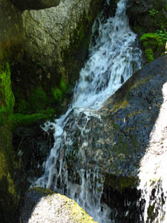
Switchback Creek
| The switchbacks down to the East Carson center on this creek running almost straight down the Eastern wall of the canyon down to the East fork of the Carson River. |
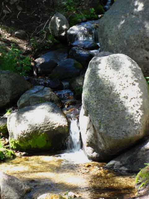 |
Thus we will hike by a series of gentle relaxing waterfalls pushing a column of cool air down the mountain along with water, as our switchbacking trail repeatedly crosses this creek on its way down to the East Fork of the Carson River. |
Descent to the East Carson RiverThe Lay of the Land Switchbacks. Long twisting trail laid like a piece of twisting ribbon floating down the mountainside. The switchbacks are centered on a stream tumbling down the steep flank of the canyon side. Each time the trail crosses the stream the ears are delighted by the tinkling sounds of falling water, the eye by the shimmering cascade down the mountain, and the skin by the coolness of the breeze brought along by the falling water. We reach 8880 feet of elevation hiking behind "The Plug," just a bit North of where we begin our 720 foot descent down these switchbacks to the 8160 foot elevation at the Pacific Crest Trail junction with the East Carson River Trail. The trail surface of the switchbacks is fairly soft, much of the trail is shaded by forest clinging to the mountainside, the switchbacks are well graded. 2.99 miles total distance from the Boulder Lake junction hiking South to East Carson River trail junction, including this section of switchbacks down to the East Carson River. Map Anomaly 11.73 miles from the Boulder Lake junction South to Sonora Pass. 17.71 miles from the Boulder Lake junction North to Ebbetts Pass. |
Video
Down the Switchbacks
| Boulder Lake Trail Junction to East Carson River unmarked trail junction. | |||
Video: East Fork of the Carson River on the Pacific Crest Trail. 3:55.
Carson Iceberg Wilderness Hiking Map Been here? Done That? Add your hiking perspective and experiences to enrich ours: |
Headwaters of the East Fork of the Carson River
Upper section of the East Carson River from the switchbacks down to the East Carson. This is beautiful country. We are headed down into the forests. |
 |
The PCT roughly parallels the winding course of the East fork of the Carson River up to the gap, beginning from where our trail finally touches down in the bottom of the canyon. That point where our trail touches down in the bottom of the canyon is roughly where the nose of the granite ridge descending down to the forest from the lower Left (East) edge the image reaches river level. That point in the bottom of the canyon is directly lined up with the small tree in the middle foreground of the image. That's pretty precisely where the East Carson River trail junction is located, and where our climb up to the East Carson Gap begins. |
Switchback Creek
| We cross this creek many times hiking down the switchbacks to the East Carson River. Check out the video above for some shots of this creek. |
 |
| top of page |
Sweet Sounding Cool Water
 |
Creek centering switchbacks down to East Fork of the Carson River, |
East Carson River Headwaters
| The upper East Carson ford is hidden behind the tree in the foreground middle-left of the image. | ||
 |
||
The East Carson Gap where we exit the headwaters bowl of the East Fork of the Carson River is visible as the low point on the most distant ridgeline. Compare our view up to the East Carson Gap hiking down the lower end of the switchbacks shown above against the 30 minute topo map of this section. Above we can look across all the terrain between the unmarked East Carson trail junction and the East Carson Gap as depicted on the map. The view above depicts the section of the PCT from it's junction with the East Carson Trail up to gap in the headwaters bowl. We're actually up on the second switchback above hitting the canyon floor.
Carson Iceberg Wilderness Hiking Map |
Another Perspective: Critical Landmark for hikers coming up the East Carson River Trail
 |
Looking East across the East Carson Canyon at the great wall rising opposite The Plug. I refer to the block feature along its crestline as "The Castle." This landmark tells hikers on the East Carson River trail that they are approaching the upper ford of the East Carson River and joining up with the Pacific Crest Trail. The upper ford is located where the Southern end of this great ridge drops down to the canyon floor. |
The Cup and The Castle
| View East of the East side of the East Carson River as we descend the switchbacks South down to river level. |
 |
The highest point of the formation on the Right along the crestline of the image above is the "Castle" landmark. If you are following the unmaintained trail up the East Carson River from Carson Falls this formation informs us we are approaching of the location of the upper ford. Hiking coming up the East Carson River from Carson Falls will begin looking for the end of this ridge and the nearby ford over to the PCT as we pass this formation Southbound along the unmaintained trail. Boulder Lake junction to Sonora Pass Map |
Views North from the lower section of the Switchbacks
| View North, downstream through the great canyon holding the East Fork of the Carson River. |
 |
View North down the East Carson River Canyon. |
Where Are We?
We are in an Exceptional short section of Granite Terrain between vast stretches of Volcanic Terrain
| Detail of landmark "Castle" formation above. |
 |
I call this formation The Castle. It looks like a castle when you are looking almost straight up at it from the East Carson River Trail. It is a noticeable feature viewed from its base, looming up out of the forest at the top of a vast wall. After spotting this formation from the East Carson Trail hikers looking for the PCT will think about starting to bend Southwest to find the upper ford over the East Carson River as we reach the end of this ridge. The upper East Carson River ford is very close to the East Carson River trail junction on the Pacific Crest Trail, and has a nice trail connecting the ford and the campsite just above the ford with the PCT. |
Detail: Grand Granite Formation rising from the East Bank of the East Carson River
We are looking East at the granite wall rising from the East Shore of the East Carson River across the river from our position on the switchbacks on the Western side of the canyon. The ford separating the East Carson River Trail from the Pacific Crest Trail is just South (Right) of where the near granite ridge arm, descending laterally to the lower-Right corner of this image, reaches river level. |
|
Yup, the ford's rigggght down there. Really. This "castle" landmark keeps us squared-away in relation to the location of the upper ford of the East Carson River for hikers coming up the East Fork of the Carson River's unmaintained trail from Carson Falls. My trail song is,"Cup to Castle, end of ridge, meadow, cut right, and the ford comes into sight, all after you pass that nice old campsite...," and so on. Sing me a trail song with your feet beating the rhythm. Check out the far East side of the Carson-Iceberg regional topo map to review the unmaintained East Carson River route up from Carson Falls. I have not put up any trail guide pages for that unique route, but I'm sure I will once I finish the main body of the guide between Tahoe and Whitney. Carson Falls is an excellent destination all by itself, but is most easily accessed through the remote Eastern Escarpment of the Sierra from Highway 395. Access through Old Mill Road to Rodriguez Flat and the Corral Valley Trailhead. Boulder Lake junction to Sonora Pass Map |
Ridgeline Dropping Down to Upper Ford
The next three images depict the terrain where the unmaintained route coming up the East Fork of the Carson River meets the route of the Pacific Crest Trail. Hikers on the Pacific Crest Trail will hike past the unmarked East Carson Junction and the ford to the unmaintained trail down the East Carson River beyond the ford. |
 |
The great granite ridge capped by the Castle shows us the end of the unmaintained trail is near. In the Right foreground a great ridge arm is dropping down off the end of the Castle Ridge to mark the point where the unmaintained route fords the East Carson River. |
View Southeast. We are looking at the bottom of the granite ridge arm dropping from "The Castle" ridge formation pictured above. The unmaintained East Carson River Trail's ford is just out of the right side of this image where the end of the granite ridge arm enters the forest on the canyon floor. |
 |
I know this because I have carefully observed the various landmarks that inform and guide hikers finding their way up the East Carson River on this unmaintained route. After a few times through I should be able to eliminate all guess work, and plot a memory + visual landmarks route through this difficult terrain. So should you, as your backpacking skills progress to route finding and navigation capabilities. |
The East Carson River Trail Upper Ford and Junction
 |
Coming down to forest top level gives us a good view of the terrain. The upper ford of the East Carson River trail is located in the forest near the Right end of the granite ridge descending from Left to Right across the middle of the image, and it's junction with the PCT is just to the Right of there, off of the Right edge of the image. Boulder Lake junction to Sonora Pass Map |
View up the East Carson River
| Upper section of the East Fork of the Carson River. |
 |
Almost down to River Level The ford point of the unmaintained trail coming up the East Carson River to the PCT is located just to the Right of the base of that ridge arm. The PCT route is just to the Right of the ford. We are one more switchback above the canyon floor and the gradual short straight descent to the unmarked trail junction with the unmaintained trail down the Canyon of the East Carson River. There's one real nice campsite and one marginal campsite at the East Carson trail junction. We can see the Carson Gap marking our exit from the headwaters of the East Fork of the Carson River in the far distance at the head of the canyon, which I put at about five miles. Boulder Lake junction to Sonora Pass Map |
East Carson River Canyon Floor Detail
| A closer look. We can see the route of the East Carson winding upriver beyond the descending granite ridge arm. |
 |
Our Southbound Pacific Crest Trail route down the switchbacks is bringing us down into this forest alongside the East Carson River. Once we get to the base of these switchbacks it is a short hike South to the East Carson River Trail junction, where we are going to take a break before beginning the 4.65 mile climb up to the Sonora Gap through the E Carson Gap. We're going to eat some food, drink some water, and rest for a while at the trail junction. Once we get under the forest it will get harder to see the surrounding terrain. The Pacific Crest Trail passes to the right of the granite ridge on the far side of the forest in the image above. The East Carson runs through the forest, closer to our side of the canyon than the granite ridge. |
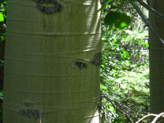
Aspens at the bottom of the switchbacks
| The last cascade of the creek that accompanied us down the Switchbacks. | Fat Aspens greet us at the bottom of the Switchbacks. | |||
 |
 |
|||
| A thick green canopy of Aspens shade us as we cross a small creek feeding the East Carson before reaching the East Carson River Trail junction. | ||||
| Yeah! Hiking down steep descents, even switchbacked ones, is hard on the knees. | top of page |
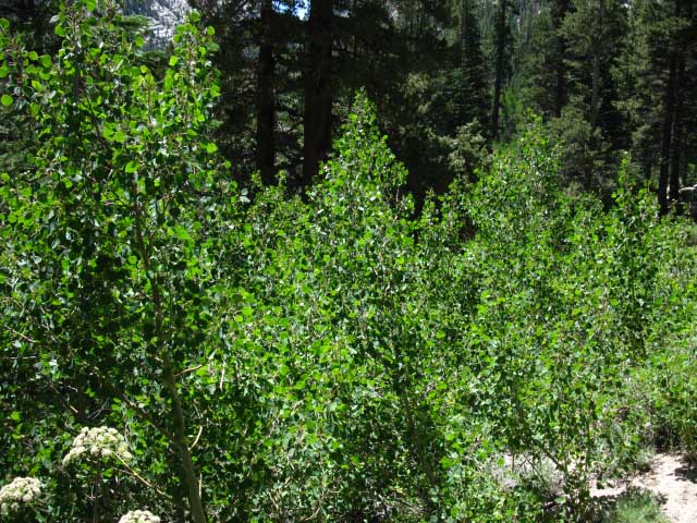
River Bottom Aspens
| Bright Green of Aspen suckers breaking towards sunlight. | ||
 |
||
We are now just a very short distance North of the East Carson River Trail junction with the Pacific Crest Trail. The Aspens are all one unit, one tree that clones itself to spread a network of root suckers into amenable terrain.
|
East Carson River Trail JunctionEbbetts Pass to Sonora Pass Elevation 20.7 miles South of Ebbetts Pass 8.74 miles North of Sonora Pass The section of trail between this junction North along the East Carson River down to Carson Falls is unmaintained and unmarked. Not many trail markings through here, and the ducks and the blazes there are older and grumpier than I. During decades hiking this difficult route I have only encountered other backpackers here once. I was heading upriver when I heard them breaking through to my South, so I stopped and sat quietly to watch their approach. They were two couples in their late '50. That was surprising, but they looked very fit. They were working very hard to pass over the rough terrain and were not observing past their current obstacles, so I remained unobserved. As their route was going to bring them directly to my position, and I figured that walking up to me would scare the shit out of them in this remote location, I gently coughed to reveal my position without shocking them too badly. All four of their heads shot up from their down-ward gazes as if a bomb had gone off when I coughed. This made me laugh, as I never hike with my head down... for long... I want to be and see the surprises, and never-ever be surprised. We exchanged brief greetings, and I continued South to the PCT, and they resumed their head-down trudge North to the beauties of Carson Falls. |
East Fork of the Carson River
The Unmaintained Trail North to Carson Falls
| My custom pedestal ducks. | ||
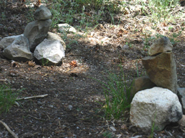 |
||
No, these ducks are not setup to survive the Winter Snows. I plan on putting them up again next Spring when I can break through... Beyond these duck a fine trail leads us a tenth of a mile down to a fine expansive campsite. The upper ford over the East Carson River is just beyond the campsite. Crossing over the ford brings us North along the East fork of the Carson River through 6.06 miles of challenging unmarked and unmaintained trail to Carson Falls.
|
After I finish the Main Guide I will depict this amazing section of trail down to Carson Falls. In the meantime here's a report on the |
Backpacking Trail Guide North PCT |
West to the TYT |
Backpacking Trail Guide South PCT |
East Fork of the Carson River |
Backpacking Ebbetts Pass to Sonora Pass H 7.5 Map 30 min Map Next page South |
Backpacker ForumsHave a great Sierra Nevada trip or story to relate? A fine piece of gear? Or gear that failed?Post it on
|
North: Murray Canyon to Boulder Lake Junction South: East Carson River to Sonora Pass
Trailhead
Contact
Alex Wierbinski

Backpacking Lake Tahoe to Mount Whitney:
Your Guide to the High Sierra Crest, including the Tahoe to Yosemite, Pacific Crest, and John Muir Trails
