The Trails
Guide
Maps
Miles/Ele
Permits
Resupply
Forum
Current Weather Conditions
Weather Notes
Northern High Sierras
Central High Sierras
Southern High Sierras
Gear
Gear List
Gettin Started
Layering
Discussion
Testing yourself and your gear
Gear Reviews
Highway 4 to Highway 108
Backpacking Topo Map Index
of
Carson-Iceberg Wilderness Maps
featuring thePacific Crest Trail & Tahoe to Yosemite Trail
Languages
Translate
Trail Arts
The art of walking
Physical Preperation
Trail Skills
The trail
Off the trail
Scrambling
Maps
Navigation
Camp skills
Food
Resupply
Food
Other
Photo Catagories
Trail Stories
Trail Culture
News and Science
Links
Groups
Books
ALL |
MAP TYT-PCT |
MAP TYT-PCT |
REGION TYT-PCT |
LOCAL PCT TYT |
MILES |
TRAIL TYT-PCT |
TRAIL |
Highway 4
to
Highway 108
Topo Hiking Maps
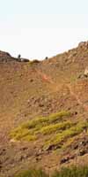
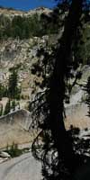
Backpacking Introduction Local and Long Distance Excellence The configuration of the terrain dividing the Tahoe to Yosemite on the West flank of the Sierra from the Pacific Crest Trail along the crest and East flank between Highways 4 and 108 allows four trails connecting them across the length of the Carson Iceberg. These 4 connector trails allow us long distance backpackers on the TYT and PCT to craft a huge number of alternative routes. Long hikers on the PCT and TYT can switch over from one to the other trail. And back again. These interconnections between the TYT and PCT means that medium to very long distance backpacking loops around the Carson Iceberg Wilderness can be crafted by hiking out of the starting trailhead of our choice along one of these famous trails and hiking back on the other. There is something to suit everyone's style, skill, tastes, and fitness in the Carson Iceberg Wilderness from short and easy to long and hard. If I did my job correctly I'm hopeful the following maps and their related guide and mileage pages reveal and draw you into your perfect backpacking loop around the Carson Iceberg Wilderness. Hard and Lonely A fine way to approach the Carson-Iceberg is to enter via the steep Eastern escarpment of the Wilderness, such as through the Corral Valley Trailhead near the Little Antelope Pack Station up on Rodriguez Flat. Access is from Highway 395. Find Yourself in the Carson Iceberg Wilderness Map Potentials The Stanislaus NF splits administration of the Western flank of the Carson-Iceberg Wilderness between the Calavaras Ranger district on its North end and the Summit Ranger District of the Southwest end. |
|||
 |
|||
|
|||
 |
Topo Hiking Maps for Lake Alpine to Saint Marys Pass |
|||||||||||||
| 7.5 min USGS backpacking Topo Maps 1:24 000 |
30 minute USGS backpacking Topo Maps 1:100 000 |
||||||||||||
TYT ROUTE Lake Alpine
TYT South
|
|
TYT to PCT Highland Creek TYT to PCT Trail Junction
Highland Lakes
|
|
TYT ROUTE Jenkins Canyon to Saint Marys Pass on TYT TYT South
Clarks Fork
|
Tahoe to Yosemite Trail West Carson-Iceberg Wilderness
Pacific Crest Trail East Carson Iceberg Wilderness
New Carson-Iceberg Wilderness Topo Hiking Map
National Forest Service |
||||||||
Context TYT Miles and Elevations
|
|||||||||||||
Topo Maps |
|
Planning Maps To plan our trips North or South from Ebbetts Pass we should refer to this trail guide. The USGS is the mother lode of Geographic Science... The 1 x 2, 30 minute, and 7.5 series topo maps are free to download and open in the free Adobe Reader. We can also download the free Terrago Toolbar for Adobe from the USGS site, which gives us limited trail measurement capabilities. Watch the TerraGo tool carefully, it screws up. Here's the USGS Store site. It will provide the proper maps to plan this and every other part of our trip. Navigate the map to Stockton Ca, and follow Highway 4 up to Ebbetts Pass. Magnify the map until the quadrangles appear. Check the "mark points" selection, click the desired quadrangles. Click the marker, and a selection of maps at different scales will appear. Then install the Terrago Toolbar for extra spatial measurement capacity. I have set myself up with a well-organized collection of USGS maps covering all my main routes and side trips from Lake Tahoe to Mount Whitney in various scales. I find these maps very helpful to properly plan trips. Use these detailed USGS topo maps, and the maps, mileages, and trail guide pages laid out here on Tahoe to Whitney to plan the details of your backpacking trips starting at, or hiking across Ebbetts Pass. To check out a selection of National Forest and Wilderness paper hiking maps, as well as online versions, check out
|
Hiking Maps For trail use I prefer to carry the USDA National Forest Wilderness Maps or their commercial counterparts when hiking either the Mokelumne or Carson-Iceberg Wilderness. The Online versions of these maps allow us to inspect a couple of the federal maps to see if they fit our trip's specifications. These Federal Wilderness Maps are a fine balance between size and detail. Each well covers its respective wilderness area. Commercial Counterparts The irony is that all the maps are based on the Federal data and maps. The commercial expressions of this data are just formatted and presented differently. Nonetheless, familiarity gained by planning with the detailed USGS maps will make better sense of our trail maps during our trips. I try to line up the maps with images of all the key terrain features in the trail guide along our routes too. Federal Trail Maps North South Though long-distance hikers may consider these topo hiking maps too "big," the extra coverage provided by these "whole wilderness" topo maps allow the backpacker to clearly and correctly identify terrain features within their range of vision. I always want to know what I'm looking at, and how my route fits into the "big picture" of the overall terrain. Unlike topo hiking maps that only display a "sliver" of the terrain, such as Halfmile's Trail Maps, these wilderness-sized topo maps allow you to situate and saturate yourself in the terrain. |
Good Long-Distance Backpacker Practice I send myself my selected hiking topo map for the upcoming trail section in my resupply package, along with a stamped, self-addressed envelope to send my last map home. As most of the resupply points have mail services this plan works out well. |
|
TYT Southbound The Arnot and Disaster Creek trails are ideal for loops staying within the Carson Iceberg Wilderness, though the Disaster Creek trail also offers Southbound PCT hikers a good way down to the unmaintained segment of the TYT across Saint Marys Pass, along with the Boulder Lake Trail to its South. The Alternative Route ...And Back Again Some folks on the TYT may want to trade the segment of the hike along the Clarks Fork Road, and possibly avoid the difficult segment of unmaintained trail from Eureka Valley trail junction to Saint Marys Pass in exchange for the well maintained PCT through the amazing beauties of the upper course of the East Fork of the Carson River. The important thing is to know your options and select the one that best fits your physical and psychological profiles. The first and last connector trails are also ideal for Southbound TYT hikers who just want to extend their hike across the Carson Iceberg Wilderness, and see as much of this beautiful place as possible. Some Numbers The red dots on the maps lead to all the important trail junctions. Highland Creek is the Northernmost and longest of the four trails that we can use to tie the TYT and PCT together across the length of the Carson Iceberg Wilderness. The Boulder Lake trail is the Southernmost and shortest connector trail. Combining these two trails with our TYT route across the Carson Iceberg lengthens our route sufficiently to bring us through most of the high points of the Carson Iceberg Wilderness. Best of Both Worlds Northbound Hiking North from Lake Alpine is only suggested for experienced, adventurous, and fit PCT section hikers. This does not affect many PCT hikers. Most PCT hikers are looking for speed North, not extra obstacles. PCT section hikers may decide to swing down to the Tahoe to Yosemite Trail route to experience the quiet intensity and beauty of the remote and unmaintained section of the Tahoe to Yosemite trail North of Lake Alpine. Our other long-distance Northbound option is to remain on the standard PCT route to and through Ebbetts Pass on our way North to the Carson Pass. I've done about every variant of this maneuver. All are outstanding, some are great... All Around Options These trails are, from North to South, the Highland Creek, Arnot Creek, Disaster Creek, and Boulder Creek trails. We can utilize these connector trails no matter where we begin our Carson Iceberg Wilderness backpacking trip. The Carson Iceberg offers access from the North via Highway 4, the South via Highway 108, and the East off of Highway 395. We can start from any trailheads around the perimeter of the Carson Iceberg and loop back using various combinations of the main and connector trails. The PCT, TYT and these four connector trails are our main options for hiking around the Carson Iceberg Wilderness. What you do with them is up to you. I suggest that you explore them all in expanding circles as your skills and fitness grow. See you Out There! |
The next maps |
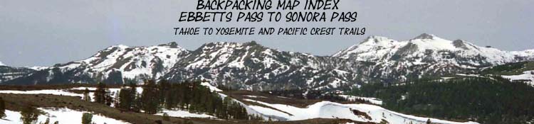
Topo Backpacking Maps for Ebbetts Pass to Sonora Pass |
|||
| 7.5 min USGS backpacking maps 1:24 000 |
30 minute USGS Backpacking Maps 1:100 000 |
||
| PCT Ebbetts Pass to Sonora Pass Maps | PCT Ebbetts Pass to Sonora Pass Maps | ||
|
|
East Carson Iceberg Wilderness
West Carson-Iceberg Wilderness
New
National Forest Service |
||
Context Miles and Elevations |
|||
PCT Miles and Elevations
Sonora Pass to Tuolumne Meadows see above |
The next maps |
Map INDEX North: Highway 88 to Highway 4 top of page Map INDEX South: Highway 108 to Tuolumne Meadows
High Sierra Backpacking Map |
||||||||
Backpacking Map Information and Instruction
USGS MAP LOCATOR Free USGS Maps for Downloading
MAP NOTE From my point of view that is 1000 yards or .62 of a mile. Diagonal: 1414.22 meters, if my trig is correct. That converts into 4,639.8 feet or .88 of a mile. |
Backpacker ForumsTahoetoWhitney.OrgYou comments, questions, and experiences are vital for a full view of the Sierra Nevada Mountains.There are Section and Segment Forums dealing with each part of the trails as well as Forums covering backpacking topics.
I can start the communication about nature and man, but it takes many perspectives to properly take it all in.Put your voice in the chorus... Forum
|
Map INDEX North: Highway 88 to Highway 4 top of page Map INDEX South: Highway 108 to Tuolumne Meadows