

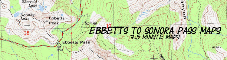

Backpacking Topo Map
Boulder Lake Trail Junction
to
Sonora Pass
Hiking Maps
The Pacific Crest Trail between Ebbetts Pass and Sonora Pass
Four 7.5 minute USGS Topo Backpacking Maps of the South End of the Carson Iceberg Wilderness

MAP |
NORTH |
SOUTH |
SOUTH |
NORTH |
Ebbetts Pass to Sonora Pass Miles and Elevations |
Click RED DOTS linking to Trail Guide Pages |
Trail Guide |
Northwest High Sierra |
permit, map info, & Road Map |
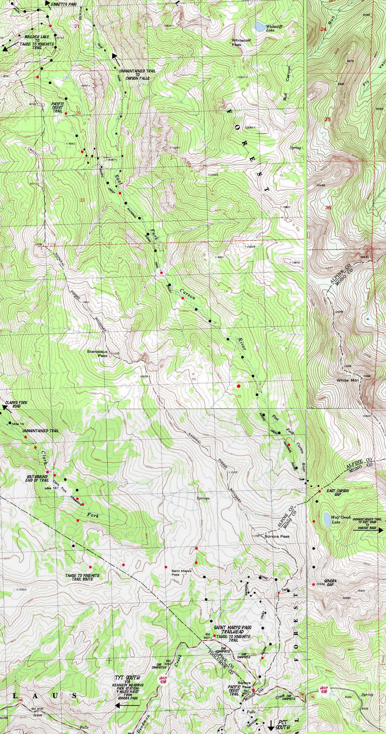
USGS Disaster Peak Topo Hiking Map
Boulder Lake Trail Junction to Sonora Pass past the unmarked East Carson River Trail Junction
11.73 miles total
CLICK THE RED DOTS FOR TRAIL GUIDE INFORMATION
CLICK LABELS POINTING TO ADJACENT TOPO HIKING MAPS
| NORTH PCT 15 min Topo MAP Asa Lake to East Carson Junction |
NORTH PCT 30 min Topo MAP Ebbetts to Sonora Pass |
Click RED Dots |
SOUTH PCT 15 min Topo MAP Sonora Pass to Latopie Lake |
SOUTH PCT 30 min Topo MAP Sonora Pass |
|
| NORTH PCT 15 min Topo MAP Asa Lake to East Carson Junction |
NORTH PCT 30 min Topo MAP Ebbetts to Sonora Pass |
Click RED Dots |
SOUTH PCT 15 min Topo MAP Sonora Pass to Latopie Lake |
SOUTH PCT 30 min Topo MAP Sonora Pass |
Mapology |
||||
MAP NOTE What's important for our general reference purpose is that each side of a square is 1000 meters, or a Kilometer. From my point of view that is 1093.6 yards or .62 of a mile. Diagonal: 1414.22 meters, if my trig is correct. That converts the diagonal distance into 4,639.8 feet or .88 of a mile.
|
Hiking |
Main Features So far we have been hiking moving Southeast along Eastern flank of the High Sierra crest approaching the top of the Western bank of the East Carson River. After a sweet look South up at the fine granite lining both sides of the upper canyon of the East Carson River we will now come off the Sierra crestline to descend switchbacks down to near the East Carson River before we make the final climb up to and through its headwaters bowl. Though we have dropped into the river valley from the crest line, the trail generally keeps its distance from the East Carson River as we climb the upper reaches of this valley, with a few notable exceptions. Coming down to river level we encounter the informally marked junction with the well-established unmaintained route heading Northeast, down the East Carson River. This junction is well-established. The route down to Carson Falls is not. Don't attempt this unless you are an experienced backpackers in good shape with excellent route finding skills. Nonetheless, a fine campsite sits about a hundred yards East down this trail junction. This large site is sheltered from the trail, overlooks the East Fork of the Carson River, and is a real nice place to camp. A rough campsite sits a few feet to our Right just off the PCT, to our West. The Pacific Crest Trail junction with the East Carson River Trail marks the end of our descent and the beginning of climbing for hikers in either direction. The Southbound hiker faces the long steady up mountain hike to the East Carson Gap, and then on through the 10,500 foot Sonora Gap before the trail flattens out for the traverse across the South Flank of Sonora Peak before we descend to the 9600 foot Sonora Pass. The Northbound hiker climbs the switchbacks back up to the Sierra crestline, followed by the roller coaster of ups and downs of crossing the drainages off the crest. North of Murry Canyon the trail begins gently descending to Wolf Creek Pass, then enters the N Mokelumne River watershed for a minute climbing to cross Tyron Peak. The map above depicts the Pacific Crest Trail from the Boulder Lake Trail Junction to Sonora Pass via the Upper reaches of the East Fork of the Carson River, Wolf Creek Lake, and the Sonora Gap. Click the labels w/ arrows pointing to adjacent hiking maps to see those maps. Click the red dots for the trail guide page entry for that location. From that point you can enter your comments-questions-or-experiences in the forum for that location... |
High Sierra Road Map |
Permits, Map, Miles, & Elevation Information |
|
California Highways 50, 88, 4, and 108
MAP NOTE What's important for our general reference purpose is that each side of a square is 1000 meters, or a Kilometer. |
Miles and Elevations Ebbetts Pass to Sonora Pass Boulder Lake Junction 8560 17.71 +1 .0 East Fork Carson Junction 8160 20.7 +1 .0 First Open Space 8560 21.71 +1 .0 Waterfall 8640 22.03 +1 .0 Prominence 8720 22.17 +1 .0 Hunters Camp 9,240 23.33 +1 .0 E Carson Gap 10,240 25.35 +1 .0 Sonora Gap 10,536 26.56 +1 .0 Sonora Pass 9643 29.44 11.73 miles total
Ebbetts to Sonora Pass
Ebbetts Pass
South PCT topo map |
Four USGS topo Maps Upper Left USGS topo Map Lower Left USGS Topo Map Contours: 80 Feet Upper Right USGS Topo Map Contours: 40 Feet Lower Right USGS Topo Contours: 40 Feet All Maps Compass Offset scale: 1 :24 000
Permits National Forest North of Sonora Pass, PCT National Forest Contacts National Forest Website National Forest Website National Forest Website PCT South of Sonora Pass, National Forest Contacts National Forest Website Physical location |
Nearby trailheads |
Sonora Pass Disaster Creek & Clarks Fork Gardner Meadow |
Detailed Topo MAP North: Swampy Lake to Boulder Lake Click red dots on all maps HUGE Topo 30 MAP South: Sonora Pass
| Elevations | More Information | ||
Ebbetts Pass E Carson Gap Sonora Gap Sonora Pass |
Trail Guide, Section Trail Guide Location Google Map |
||
Map Credit |
U.S. Geological Survey Use search term "Meeks Bay," and "Address," as search type to locate this USGS map. USGS Topographic |
Trailhead
Comments: on this
Forum Section
Ebbetts Pass to Sonora Pass
Forum Segment
Boulder Lake to East Carson River Junction