
The Trails
Guide
Maps
Miles/Ele
Permits
Resupply
Forum
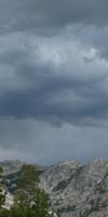
Current Weather Conditions
Weather Notes
Northern High Sierras
Central High Sierras
Southern High Sierras
Gear
Gear List
Gettin Started
Layering
Discussion
Testing yourself and your gear
Gear Reviews
Backpacking
Jack Main Canyon to Wilmer Lake
past the
Tilden Lake Trail Loop
Backpacking
PCT & TYT
across
Yosemite National Park
Hiking
The Pacific Crest and Tahoe to Yosemite Trails
from
Highway 108 to Tuolumne Meadows
Languages
Languages
Trail Arts
The art of walking
Physical Preperation
Trail Skills
The trail
Off the trail
Scrambling
Maps
Navigation
Camp skills
Food
Resupply
Food
Other
Photo Catagories
Trail Stories
Trail Culture
News and Science
Links
Groups
Books
Terms and Conditions of Use
| Trail Guide INDEX Highway 108 to Highway 120 |
PCT
|
PCT
TYT |
HETCH 7.5 |
7.5 Lower 30 min |
30 min
TOPO |
Sonora
|
RESUPPLY
|
National Forest-Park PERMITS Toiyabe NF (Hoover) & Stanislaus NF (Emigrant) & Yosemite NP |
all maps index |
BACKPACKING
The
North Yosemite Backcountry
The Top
|
|||||||||||||||||||||||||||||||||||||||||||||||||||||||||||||||||||||||||||||||||||||||||||
Where We AT |
Backpacker Information
Miles
Down
Jack Main Canyon
6.47 miles
South Bond Pass trail junction to the Tilden Lake Trail Junction
8.22 miles
South Bond Pass trail junction to the Wilmer Lake Trail Junction
North Yosemite
Miles and Elevations
Backpacking Maps
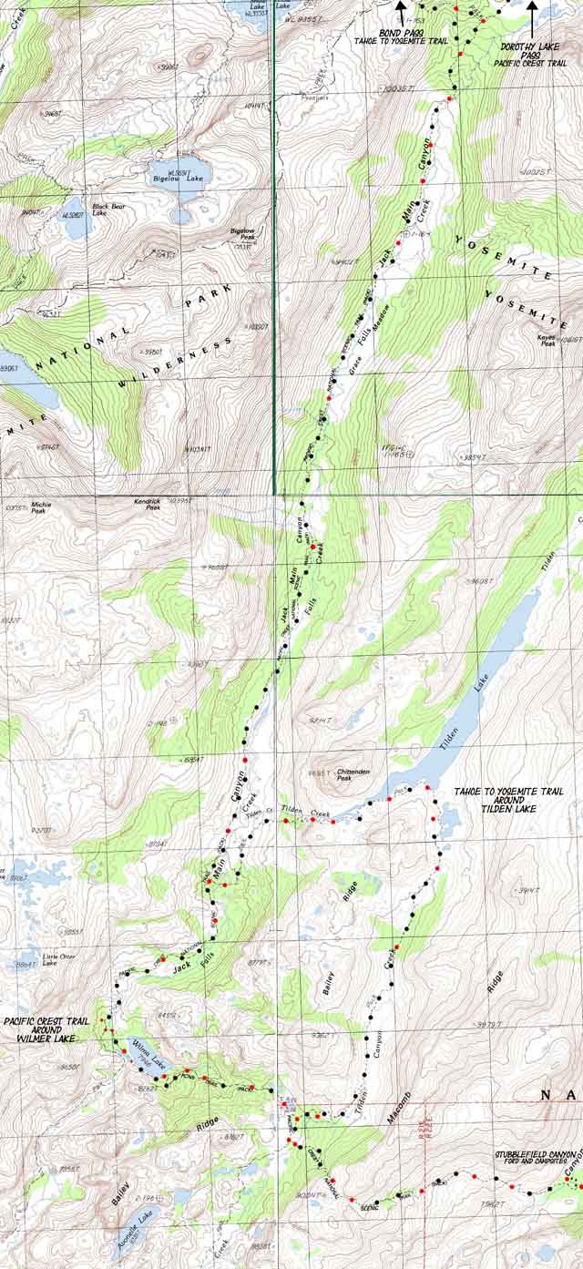
| Jack Main Canyon to Tilden & Wilmer Lakes 15 min North Yosemite Topo Hiking Map |
Sonora Pass to Bensen Lake North Yosemite 30 min Backpacking Map |
North
| Northwest TYT Brown Bear to Bond Pass |
Northeast PCT Kennedy Canyon to Jack Main Canyon |
South
| South TYT Tilden Lake Loop |
South PCT Wilmer Lake to Stubblefield Canyon |
and
Hiker Information
| Backpacking Trails and Topics Forums |
Backpacking Index |
||||||||||||||||||||||
Top of page
Trail Junction
Let's talk Miles: The Long and the Deep of it.
Video
PCT hikers
Lay of the Land
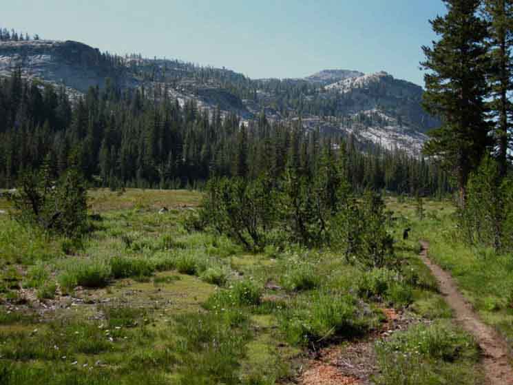
Hiking South down Jack Main Canyon
Skeeter Alert: Boggy Conditions bring lots of Skeeters
Fine Wildflower: Alpine Gentian
Video
Yosemite to Tahoe hikers: Xilonin & Ixchel
|
Sonora Pass Weather and Road Information These are the closest ground stations, point and regional forecasts to Jack Main Canyon Check out the ground reporting stations for real-time snow and temp data.
All
All
|
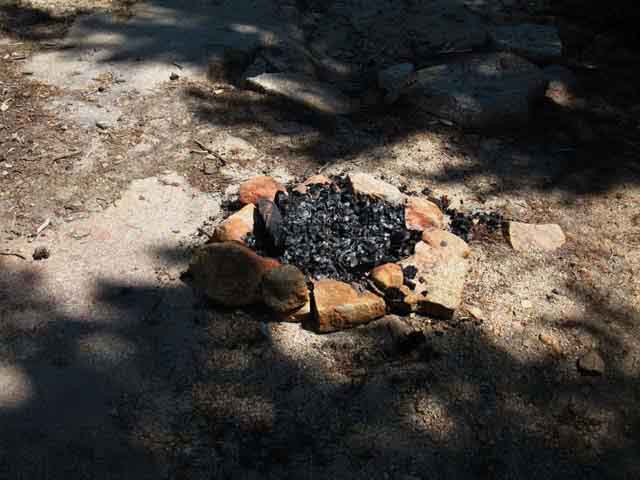
Campfire & Campsite South end of Grace Meadow
Campfire & Campsite South end of Grace Meadow
Entering Rocky Terrain South of Grace Meadow
Yosemite to Lassen Hiker: Raul
Hiking Walker Pass to Syskious: Alison and Jack
Tahoe to Yosemite Hiker Erin
Trail Junction
Video
Trail Junction |
||||||||||||||||||||
| > Forum < | ||||||||||||||||||||||
POST UP Any unknown hikers can post comments, ask questions, and add scouting/trip report information without registering, but only registered backpackers can post up stand alone articles about this segment of the trail in the associated North Yosemite Forum. Everyone can post text! Post up your cool experiences! Post up your terrible experiences! Learn-Teach-Share Add trail updates, questions, comments, and additional information about this part of the trail through the comments links. Check out this supplemental information through the forum links. Check out the Tahoe to Whitney .org |
||||||||||||||||||||||
Skip to Page Index
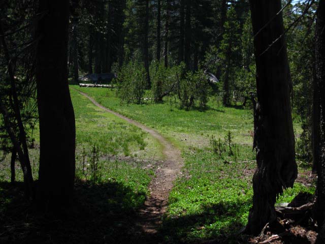
ViewDown Jack Main Canyon
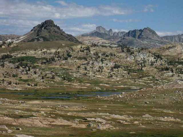
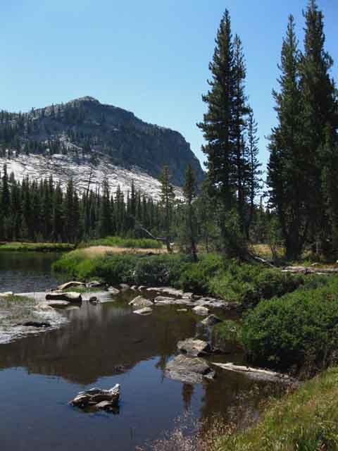
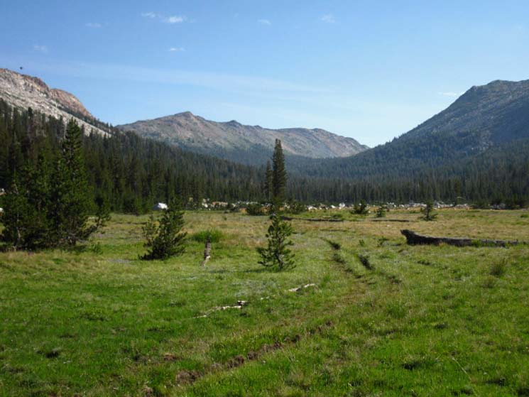
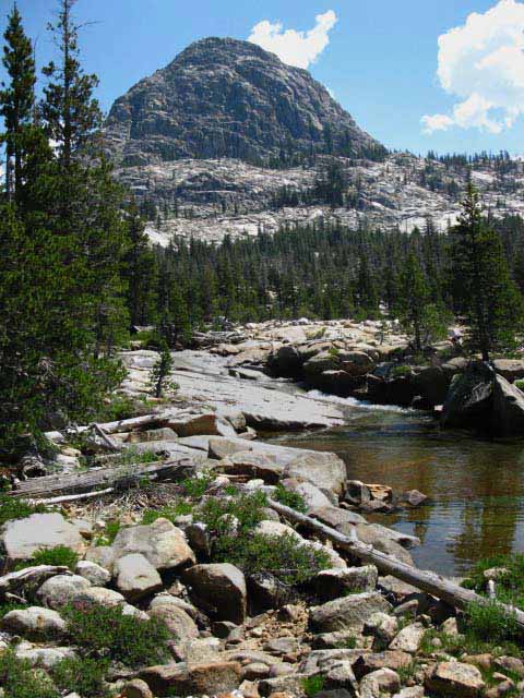
The "Big Picture" This is the first time the PCT and TYT have shared trail since departing the Lake Tahoe Basin through the Carson Gap 89.3 miles to our North on the TYT and 76.24 miles along the route of the PCT. South Top of Jack Main Canyon
PCT PCT Yosemite Sierra Crestline TYT-PCT-JMT I believe that backpacking trips across Yosemite, such as the hikes from Sonora Pass/Kennedy Meadows Pack Station to Tuolumne Meadows via the TYT, then continuing on South down to Reds Meadow on the JMT is a "must do" backpacking trip for serious High Sierra Backpackers. POTENTIAL PERMIT ISSUES Walk Far and Prosper My approach is simple: Let's cover as much ground as possible.
The Conclusion Not so with the Tahoe to Yosemite Trail. The TYT remained on the West flank of the Sierra after departing the Tahoe Basin down to its junction with the PCT in the top of Jack Main Canyon, and continues on the West flank on down to Tuolumne Meadows. The TYT is a West Flank Route, excepting its run from Meeks Bay around the Tahoe Basin to the Carson Gap in the Tahoe Basin. Lake Tahoe is an East Flank lake.
The TYT The source of the different characters of beauty we experience on the Pacific Crest Trail along the Sierra Crest from those along the Tahoe to Yosemite Trails come from the same source. The process and specifics of the growth and birth of the Sierra Nevada geology created its own geologically-driven climate patterns.
Engine of Life These primary geological forces played out to create a significant environmental differential between the long Western flank, the Sierra Crest, and its abrupt Eastern flank. The differential is based on drawing the rain out of moisture-laden Pacific Storms as they climb the long rising Western flank of the Sierra to the crestline. The long rise up the Western flank draws out the moisture, leaving little for the Sierra Crest, less for its dry Eastern flank, and almost none for the deserts stretching East under its long rain shadow. If you want to get out of the Sierra fast, off the Sierra Crestline fast, you hike out the sheer but short Eastern flank. The Western flank of the Sierra stretches out for dozens of miles. This fact is also handy for planning backpacking trips: The Eastern flank trailheads offer direct but difficult access to the Sierra Crest. Twin Lakes just to our South well illustrates this.
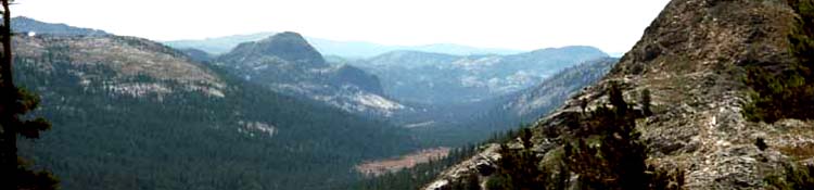
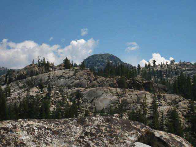
The Western Sierra Flank Viva La Difference... Sonora Pass Region Trail Map The map above is part of the 30 minute series continuing South to Tuolumne Meadows. The map below focuses more on the route of the PCT, but really shows how Grizzly Peak in the Emigrant Basin is the axle in a hub of trails radiating in all directions.
Scroll down to the larger map. Note that each area of all the 30 minute maps are linked to detailed maps of Emigrant Wilderness backpacking trails. Click the black-dotted routes for more detailed maps, and the red dots on the detailed maps for that location's trail guide information. PCT We cover the PCT route South into North Yosemite on the PCT trail guide page to our North, the Kennedy Canyon to Jack Main Canyon page. TYT I do like the TYT route across Emigrant Wilderness... it is stunningly beautiful as we see above. Different Routes to the Same Result Here's a schematic rundown of our Southbound PCT and TYT routes entering the top of Jack Main Canyon into the North Yosemite Backcountry from the North. The schematic demonstrates that we've a lot of potential routes to get us here. Once here in the top of Jack Main Canyon Southbound long-distance backpackers, no matter how they got here, face a difficult 54.49 mile segment of trail South to Tuolumne Meadows. Down Jack Main Canyon Once we cross Bond Pass into Yosemite there are no trails connecting Yosemite to the Emigrant Wilderness for about 25 miles, until we get all the way down and out the bottom of Jack Main Canyon where we climb onto Moraine Ridge! But not to worry, our PCT & TYT routes turn East to follow the Sierra Crestline South long before we hike all the way down to Moraine Ridge. PCT & TYTRoutes across North Yosemite
New Map Hetch Hetchy Reservoir sits below the bottom of Jack Main Canyon. New
Lower Jack Main Canyon |
Boundaries The top of Jack Main Canyon is where these three boundaries dividing the Emigrant, Yosemite, and Toiyabe jurisdictions intersect. This boundary splits the natural drainages as well as the Sierra Crestline. The Emigrant Basin is drained by the branches of Cherry Creek, which eventually run into the Tuolumne River below Hetch Hetchy. The waters draining the West Flank in Yosemite run directly into the Tuolumne River above Hetch Hetchy. The East Flank drainage all runs into the West Walker River. Sonora Pass Region Hiking Map
|
Watersheds
Five Canyons of the North Yosemite Backcountry There are five trails from our PCT-TYT route across the North Yosemite Backcountry down each of these five canyons to the Grand Canyon of the Tuolumne. They are The trails West of Pate Valley running down Jack Main, Tilden, and Kerrick Canyons to the Grand Canyon of the Tuolumne all bring us to overlooks perched above the waters of Hetch Hetchy Reservoir on trails slashed into the steep walls high above this drowned Grand Canyon. Offthe TYT-PCT Backpacking Maps
We through hikers cross the tops of this series of five closely spaced canyons North of Tuolumne Meadows in rapid succession, making this a difficult section of our TYT-PCT trail.
Northbound The long descent off the South flank of Mather Pass followed by the long ascent up to Pinchot Pass is typical of the long distances between significant Passes as we hike South on the JMT. We experience completely different terrain crossing the North Yosemite Backcountry. There is very little distance between the deep descents and steep climbs across the North Yosemite Backcountry. For Northbound hikers this section begins with the very very long and very hard 11.9 miles climb out of Glen Aulin that does not end until Miller Lake, where we have really just entered the "washboard." The series of closely-spaced ascents and descents North of Miller Lake ends with the long, hot, hard climb up Jack Main Canyon. Between these hard start and finish climbing segments lay the North Yosemite Washboard. This is a very difficult section, work-wise. The trails are clear and easy to follow with the mind, but this segment of trail puts a real strain on the body. Thus this section is referenced as "Yosemite's Washboard," and "The Five Canyons," is spoken with great respect. My overall rating for this section is "Hard 2." "Hard" is the highest difficulty rating I give, and "2" is the middle of three degrees of difficulty, with 1 being the most difficult. Many lengthy segments of trail along this section are rated as the most difficult, being Hard Ones. So us Southbound backpackers should enjoy the long descent down to the Tilden and Wilmer Lake junctions, because those are going to be the easiest miles we hike until we exit the Five Canyons starting our long, almost uninterrupted descent down Cold Canyon from the McCabe Lake trail junction.
My Count This is a very cool section of trail. It is very difficult and very beautiful. Crossing these Five Canyons is the theme of this next segment of the Sonora Pass to Tuolumne Meadows section of our Tahoe to Whitney Backpacking trip. It's a good one, and the Five Canyon are going to work us hard, and return to us priceless experiences and beauty in exchange for our work! My review of a couple of decades of PCT hikers have told me that experienced PCT and veteran Sierra Hikers consider the Five Canyons the hardest section of trail between Tahoe and Whitney. As the Sierra Nevada is by far the hardest section of the PCT, this makes the Five Canyons the hardest section of the whole PCT in the estimation of lots of backpackers. I've hiked all over, and this 75 mile section is much harder than any other 75 mile section I've hiked. The next-most difficult would be the longer but easier hike from Muir Ranch to the Whitney Portal. Hike the Tahoe to Whitney Trails and compare them yourself! I rate the Sonora Pass to Tuolumne Meadows and the Muir Ranch to Whitney Portal as the first and second hardest sections of trail between Tahoe and Whitney.
|
Wilderness, Water, Forests and Lakes Now that our Southbound PCT has finally crossed back onto the Western Flank of the Sierra (the TYT never left the West flank) into Yosemite rejoining the TYT, both trails now cross not just through, but also above some spectacular backpacking terrain in the North Yosemite Backcountry, as did the TYT crossing the highest elevations trails of the adjacent Emigrant Wilderness to our North. Though this trail guide is centered on the main high elevation trails, as the vast majority of my backpacking trips are, there are many fine backpacking trips in the lower elevation areas of both the Emigrant and Yosemite Wilderness this guide does not cover, but points to. Pointing South and Southwest Hiking South on the TYT across Emigrant Wilderness into the Northwest corner of Yosemite opens up a series of trails to the trailheads at the 4659 feet of Lake Eleanor or the even lower 3795 feet of elevation at Hetch Hetchy hiking down the length of Jack Main Canyon. The incredible granite and forest terrain dropping off the West flank of the Sierra runs all the way down to these low elevation Pinecrest, Cherry and Eleanor Lakes, and even further down to Hetch Hetchy in the Grand Canyon of the Tuolumne at the base of Jack Main Canyon. This is majestic terrain, even though it brings us so low in elevation. Check out Peter and Jason's report about hiking the higher elevations above Cherry and Eleanor Lakes but below the TYT-PCT: These two federal maps of Emigrant Wilderness and Yosemite National Park below put our long distance routes along the TYT and PCT into context with local trails down the West flank of the Sierra branching off from our crestline routes hiking the PCT & TYT. Tying these stunningly beautiful lower trailhead access points to our TYT and PCT routes along the Sierra Crest opens up a wide range of amazing backpacking trips...
|
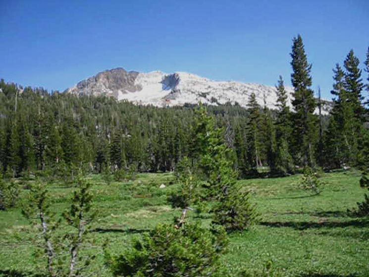
The I generally try to start and stay high up on the sub-alpine Sierra Crestline trails, but I make occasional exceptions when crossing the beauty of Emigrant and the North Yosemite Backcountry. Thus the bottom of my elevation limit is drawn all the way down to Hetch Hetchy's very low 3797 feet of elevation in Yosemite. Man, it's hot down here! And dry as Hell, despite the vast reservoir at our feet. Bottom-Up Down at the bottom of the "mountain zone" Cherry and Eleanor Lakes sit next to each other divided by the Yosemite Boundary running along the top of Kibbie Ridge between them. Cherry Lake sits to the Northwest in the Stanislaus National Forest, Lake Eleanor to the Southeast. Hetch Hetchy lays to the Southeast of Lake Eleanor, all three in fairly close proximity as the crow flies, though separated by many many miles of road travel. Emigrant Wilderness National Forest PDF Map Rim Fire Information Coming in from The Top Sonora Pass Region Hiking Map High and Low Routes This opens up a series of potential backpacking loops of various diameters out of the trailheads surrounding the North Yosemite Backcountry.
|
Master Loops I've had stretching out this difficult section by adding extra segments while hiking through under consideration for quite some time. I only though about adding to this section after I'd hiked through on the main PCT-TYT route enough times to have a good degree of familiarity with it. This is a very long section of trail with complex terrain full of detail. It's a hard section to get to know. I've hiked through here less than forty times but likely more than 30. I've hiked through the North Yosemite Backcountry starting out of Kennedy Meadows, Sonora Pass, Leavitt Meadow, and Twin Lakes down in the Hoover Wilderness. I've hiked out through Hetch Hetchy twice. Almost every trip I've taken across the North Yosemite Backcountry has been part of a longer trip. Most of my "Yosemite" hiking trips start in either Lake Tahoe or Kennedy Meadows. Needless to say I have little trouble getting my desired "Yosemite" permit, because I draw it from the LTBMU or Stanislaus National Forest. Yosemite permit problems solved! I've been thinking a better approach would be taking dedicated backpacking trips looping the North Yosemite Backcountry by hiking Northeast out of Lake Eleanor or Hetch Hetchy, or West through Glen Aulin for loops tying the main PCT-TYT route to the Grand Canyon of the Tuolumne around the North Yosemite Backcountry. Steve comments on just such a backpacking loop out of Hetch Hetchy circling around the North Yosemite Backcountry in the Stubblefield to Kerrick Canyon Forum. Steve's Awesome Hetch Hetchy North Yosemite Backpacking Loop North Yosemite Backpacker's Forum Hetch Hetchy has a Backpackers Camp. Hetchy Hetchy from the Northeast
|
The Lower Emigrant Wilderness Though our route along the Tahoe to Yosemite Trail stays high up, at an average elevation of 9700 feet along the Sierra Crestline through Emigrant Wilderness, there are great expanses of granite terrain dotted with lakes all surrounded, almost drowned by dense lodgepole forests in the high elevations just below the Whitebark Zone along the Sierra Crestline, running all the way down to Highway 108 at Pinecrest Lake. Below the Crest I would not go so low in elevations if the trail down Jack Main Canyon to Hetch Hetchy was not so darned beautiful! The same is true for the Emigrant Wilderness between the Crest and its Western boundary line. I'd point at the difficulty and length of the trails across and around it as the cause of the quiet trail conditions in the North Yosemite Backcountry. The 30 minute Map series below well depicts this segment of our TYT-PCT trail across the North Yosemite Backcountry and the upper drainage of the Five Canyons. |
| comments | Forum |
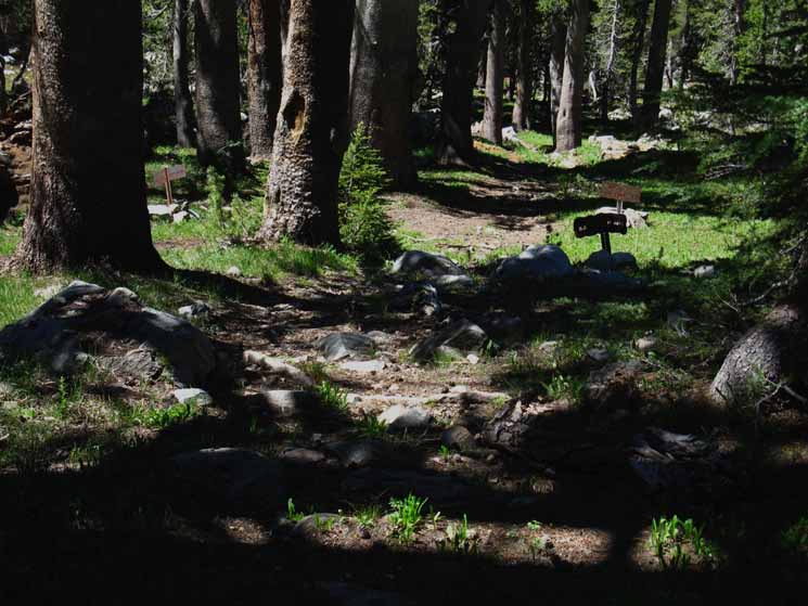
The Last TYT-PCT Divergence At the Tilden Lake trail junction the Southbound TYT breaks off East to loop around Tilden Lake. The PCT continues South down Jack Main Canyon to the Wilmer Lake trail junction, where this particular trail guide page ends. At the Wilmer Lake trail junction the PCT also turns East, as the TYT did at the Tilden Lake trail junction. The PCT and TYT rejoin to the South of Tilden Lake and East of Wilmer Lake between Macomb and Bailey Ridges, and from that point their once again unified routes share the remaining 44.56 miles of trail Southeast across the North Yosemite Backcountry to Tuolumne Meadows. The 5.36 mile TYT loop around Tilden Lake is 1.81 miles longer than the PCT around Wilmer Lake to the reunion point of the trails East of Wilmer and South of Tilden Lakes.
|
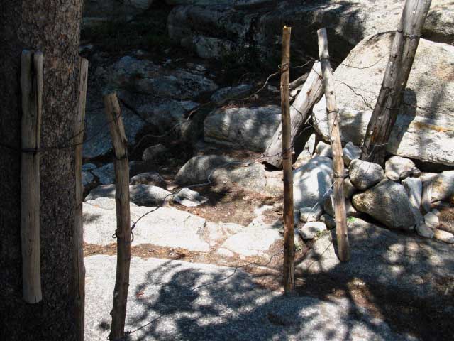
Trail Signs
at the
Top of Jack Main Canyon
 |
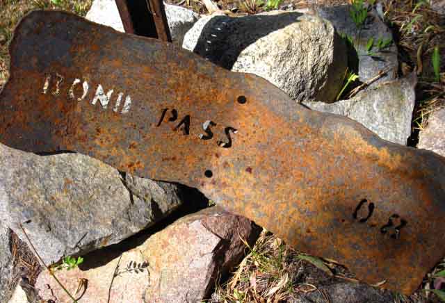
TYT-PCT Trail Junction We cut onto the South branch of the trail "Y" approaching the PCT coming through Bond Pass, because we are hiking South down Jack Main Canyon. If we were hiking North out of Jack Main Canyon on the PCT we would have stayed to our Left on the Northern arm of the trail "Y" down from Bond Pass. Let's take a closer look at the Southern junction of the TYT-PCT in the top of Jack Main Canyon below Dorothy Lake. |
Bond Pass
to the
Northwest
on the
Tahoe to Yosemite Route
across
Emigrant Wilderness
 |
||||
Yosemite Trail Sign Mileage Bond Pass North on the TYT to Bond Pass? This lower branch of trail Northwest up to Bond Pass from the Pacific Crest Trail at the top of Jack Main Canyon shortly meets with the trail coming up from the Northern arm of the "Y." This Southern junction up to Bond Pass is 1.74 miles South of Dorothy Lake Pass along the PCT. PCT-TYT Connection We're 16.91 miles South of Kennedy Meadows Pack Station along the Tahoe to Yosemite Trail and 19.22 miles South of Sonora Pass on the PCT. Northbound hikers on the TYT depart the PCT at this junction in the top of Jack Main Canyon while the Southbound TYT hiker's route merges with the Pacific Crest Trail for most of the rest of the hike down to Tuolumne Meadows, excepting the TYT's upcoming loop around Tilden Lake.
The miles South from Kenned Meadows Pack Station along the TYT to our current position at the base of Bond Pass in the top of Jack Main Canyon: Kennedy Meadows to Bond Pass
|
Hiking out of Yosemite
North on the Pacific Crest Trail
 |
||||||
NORTH on the PCT Let's take a quick look at the options we have hiking North on the Pacific Crest Trail past Dorothy Lake and through Dorothy Lake Pass into the Toiyabe National Forest. Above we see the sign putting the PCT North to the South shore, the nearest shore of Dorothy Lake at .6 of a mile. I have it at 1.47 miles to the Northeast shore of Dorothy Lake, I have it as a total of 1.74 miles North on the PCT to Dorothy Lake Pass from here. A Camping Option for the Passing TYT hiker? The proximity of Dorothy Lake to the Tahoe to Yosemite Trail at the top of Jack Main Canyon means that if our hike South along the TYT over Bond Pass happens towards the end of the day we have the option of hiking the .6 mile up to camp alongside Dorothy Lake. Dorothy Lake and the surrounding terrain are worthy of some extra examination and exploration if we are passing by during the middle of the day. We can hike up to the lake, set up camp, relax for a while, then go exploring around Forsyth Peak to the East of Dorothy Lake.
TRAILHEADS to our NORTH I measure 19.22 miles Northbound along the PCT to the Sonora Pass Trailhead where Highway 108 crosses the Sierra Crest from our current position in Jack Main Canyon. Looking at the trail to Bond Pass above we saw that the Kennedy Meadow Pack Station Trailhead stashed along Highway 108 down on the West flank of the Sierra is 16.91 miles distant through Bond Pass following the Tahoe to Yosemite Trail from our current position. Catbird Seat The Sonora Pass Region Map below depicts this terrain on both flanks of the Sierra South of Sonora Pass, while the Emigrant Wilderness Trail Schematic lays out the basic East, West, and Crestline route options we have to get from here to Highway 108:
The miles hiking Southbound up the West flank of the Sierra along the TYT from Kennedy Meadows and South along the PCT around the East flank from Sonora Pass on Highway 108 to our current position in the top of Jack Main Canyon are measured here:
The distance hiking North from the top of Jack Main Canyon through Bond Pass and over Big Sam along the Tungsten Road to the PCT trail junction at the top of Kennedy Canyon is measured here: Kennedy Canyon to Bond Pass Our position here at the lower trail junction joining the TYT and PCT in the top of Jack Main Canyon is either our furthest turnaround point for loops back to Highway 108 across the Emigrant Wilderness and/or the Toiyabe National Forest, or we are at the jump off point into our next segment of trail across the North Yosemite Backcountry. Hopefully both, given enough time and chances. |
Hiking South
into
Yosemite
on the
Pacific Crest
and
Tahoe to Yosemite
Trails
 |
||||||
SOUTHBOUND
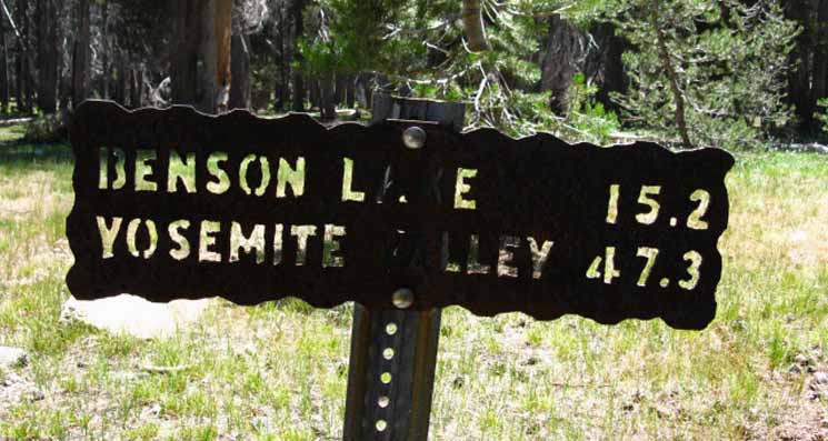
North Yosemite This sign points us South on the combined TYT and PCT down Jack Main Canyon to Tilden and Wilmer Lakes. One can also hike past the Tilden and Wilmer Lake trail junctions down to Hetch Hetchy. I have the distance from this Southern Bond Pass trail junction to Hetch Hetchy at 27.66 miles. Thoughts on Signs, Mileage, and Measurements For example, let's take a clear look at the miles down Jack Main Canyon along our Southbound route:
Mileage
Tahoe to Whitney Trail Guide Miles
I could have just repeated the trail miles cited by various trail posts. But I decided to make a best measurement based on the most current information I could generate. |
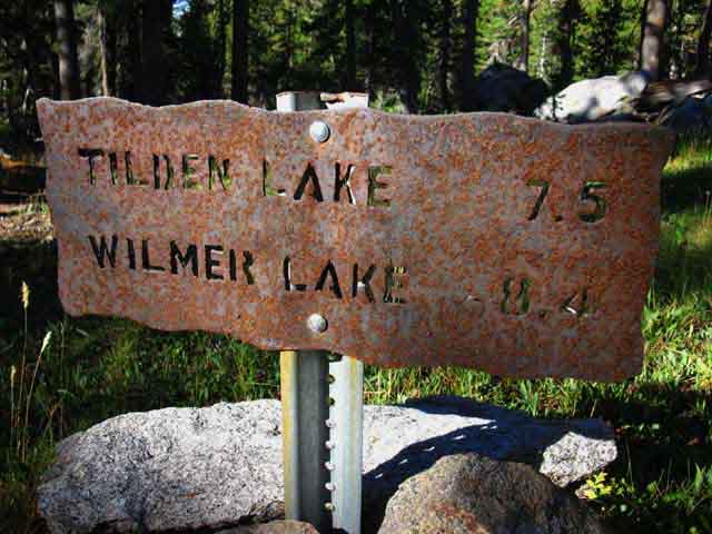
Tahoe to Whitney Trail Miles For example, the Tahoe to Whitney Miles below for the same distances cited on the Yosemite trail sign pictured above differ: Tahoe to Whitney Miles
I call out 6.47 miles to the Tilden Lake trail junction, and another 1.42 miles up to Tilden Lake to put the total miles to Tilden Lake at 7.89 miles, a third of a mile more than the mileage called out by the Yosemite trail sign above. I put the miles to the Wilmer Lake trail junction at 8.22 miles with another third of a mile to the I-beam ford on the West side of Wilmer Lake, bringing my total miles to Wilmer Lake to 8.52 miles. My Wilmer Lake figures are not much different than the Yosemite Trail Sign Miles. You will find that the miles I measure on this guide both differ from and correlate with the trail signs and other guides. I am not too worried about these differences. For the most part they are minor, and reflect different slices of time crossing a changing landscape. Why? Mileage Disparities I discuss how I measure trail miles in the Backpacker's Forum miles discussion. A cursory search of Yosemite History indicates that these steel plate cutting torch trail junction markers we encounter hiking across Yosemite were installed in the early 1950s. These signs are more durable over the years than the distances they measure down the trails. I suggest that you reference the various guides and maps, hike the trails, then note and estimate the very significant differences between the observed trail routes you hike as best you can from the trail routes as depicted on the USGS topographic maps, and compare this with the miles called out by other reference sources. Even after tracking and measuring all these "unmapped" route changes we still have a degree of error. This degree of error will expand as trail routes and distances will subsequently change out from under our current measurements a small bit from season to season and these changes will amass decade over decade. I believe measurements along a segment of trail have the potential to "cycle" through a range of distances as trail crew and trail designers explore all the various ways they can solve terrain problems. Can't follow the Dancing Snake if we can't Dance! Your shared experiences inform others! Is the backpacking easier than I said? Harder? Longer? Shorter? How you experienced it will inform others! I offer three versions of miles across Yosemite: my measurements, the miles posted on the Yosemite trail junctions and Trailheads, and your figures, should you want to post them. Compare contemporary miles measurements with those of the early editions of the classic Starr's Guide to see how significantly trail mileage changes over the decades. Things are changing, and your experiences are a part of it. Rock Never Sleeps Surf the Tides of Life "Certainty" is an illusion used to calm the insecure in this constantly changing world of ours. We've got to be ready to surf the waves of change. The "Mountain Surfer's" Ultimate Navigation Tool: YOURSELF Observe-Analyze-Engage. Find the best mileage figures available, set up your daily miles and campsites, then make sure you are ready to respond to a few surprises. I have high confidence in my miles figures, but the game is constantly changing! Uncertainty is a source of joy as well as fear, and this trio is the source of many adventures, when you properly balance them with your excellent skills of Observation-Analysis-Action. The Bottom Line We accept that trail distances between Lake Tahoe and Mount Whitney are constantly changing. The Spans of Our Lives are but a mental Snapshot, a narrow slice observing Time and Space do a bit of its Grand Dance. These large, and even the smallest changes in the terrain we cross are indicative of, and reveal the vast but sometimes almost invisible forces that have powered change for longer than we humans have had ancestors to observe them. These are very old things in the mountains. Trails and Routes I define "route" as the logical course of travel through the natural layout of terrain. The "trail" is the specific use path along the route. Routes and trails are different. During Summer the use path will cut directly through dried out meadows, during Spring it will divert around them. The "route" brings us the other side of the meadow, the "trail" is our specific way of doing it. The "trail" along our "route" then varies by season. Professional Trail Crews and Forest Managers then establish trail avoiding seasonal weak spots, such as meadow crossings. The very act of formalizing a trail can focus enough use on it to break down the trail. We clearly see this across the meadows of Yosemite and Desolation Wilderness. Basic overuse causes Trail Crew and Forest Managers to constantly alter trail locations along a route to prevent, or at least try to spread the damages of trail overuse across a wider area of the route, if containing the damages is not possible. The Bottom Line The huge rock riff-raff backfill reroute around the lower Evolution Basin, the trail section carved into solid rock below Nevada Falls, and the rock channel cut below the South flank of Forrester Pass all come instantly to mind. All will remain stable for a thousand year, if not thousands. These substantial cuts bringing our trail through solid granite will last for thousands of years, while trail across a High Sierra Meadow between high mountain passes disappears every Spring. The Route Remains the Same Routes are made by Nature, trails by Man. And animals. Manimals make trails! This means that the miles of each section of the trail between Tahoe and Whitney will differ somewhat from published mileages. Everyone's published miles. This also means that we must have the fitness, food, and readiness to deal with unexpected additions to mileage. Have some slack in the pack! If we are already feeling the strain of altitude, of a heavy pack, of climbs up steep Sierra mountainsides these extra unanticipated miles can weigh heavily on our experience. If we are in excellent conditioning with a bit of extra food these stresses will be minimized. How You Feeling? The bottom line is that our role in the terrain is to observe, reflect, protect, analyze, and engage It. The state of individual reality engaged with nature is a process that feedbacks the essential spirits of nature back into the center of the individual's being. This will not be a pleasant experience when our capabilities are mismatched to our mission. This will be most rewarding when they are properly challenged, but not overwhelmed. Each of us is potentially an interface between nature and man during the slice of time we are privileged to define It. Most of us are not. Most of us have chosen to reflect social-material defined identities ("consumer-status"), rather than natural and ethical standards ("citizen-ethical status"). The former seeks pleasure, the latter expresses meaning. Most of us have turned inward, and only use our lives to reflect society's material definitions of "reality" as the selfish pursuit of "pleasure" and self-gratification. The role of man in nature has been choked out of modern society, to all of our great loss. Nonetheless, each of us are still little mirrors of Life, ornaments of Life designed to follow and reflect Its ever changing beauty and power, independent of how we each use and position these "assets" within contemporary society. These reflective assets also allow us to mirror Life's ever-changing trail distances! Be a Clear Mirror of Life Survival Mode! Fast and Slow It behooves us to get all the factors that support daily mileage under control before we hit the trail. The pains brought by pairs of soft feet and ass cheeks cannot be underestimated. Preventing blisters and ass rash through training prior to your long distance backpacking trip is the heart of wisdom. Long vs. Deep The upcoming trail section through Yosemite National Park brings the contradiction between the need for miles and the need to explore every detail into sharp focus. Our extra's day's food gives us the flexibility to take two half-days off for exploration, rest, or just to have the flexibility to camp at both Bensen and Smedberg Lakes, even though they are so close together. Remember: Miles, feelings, and fitness are variable. Make sure you can cope with unexpected swings in all three! Tahoe to Whitney
|
Video
Bond Pass
to the
North side of Grace Meadow
10:40 Lower, or South Bond Pass Trail Junction to Grace Meadow Diminished Grace Meadow Note that the USGS map series is the basis of every high quality mapping application, product, and paper map published depicting US topography. Every product of the private map companies is a custom formatted and highlighted version of the USGS maps. Thus they contain the same route and vegetation errors that build up between new versions. I've eliminated these errors where I can accurately define the new locations of trail, and noted the locations of disparities between the present route and map in the "map notes" below each trail map on Tahoe to Whitney. These changes in the extent of Grace Meadow can be seen by comparing the 2010 Forest Service Map of Jack Main Canyon with the 1990 USGS 15 minute map, and the 2000 backpacking image above. If we were able to observe upper Jack Main Canyon and Grace Meadow from above, from a "God's Eye" view of a twenty year time-lapse compressed into one minute, we'd see an army of trees rise out of the meadow side soils and march in waves timed with each Spring and Summer, quickly engulfing upper Grace Meadow in a jacket of forest. We'd see the trail rotating like a looping jump-rope along the Western interface of Grace Meadow at the edge of the expanding forest along the West wall of Jack Main Canyon. Grace Meadow to Tilden Lake trail junction These routes which joined up at the head of Jack Main Canyon now split to circle around their respective lakes. The TYT and PCT rejoin between Bailey and Macomb Ridges after each passes around its respective lake. Jack Main Canyon to Tilden & Wilmer Lakes Backpacking Map Let's take a look at the mini-topo map below, of how backpackers on both the Tahoe to Yosemite and the Pacific Crest Trails get to the top of Jack Main Canyon:
Mostly from the 1990 Tower Peak USGS 7.5 minute topographic map with bits of the Emigrant Lake, Tiltill Mountain, and Piute Mountain maps.
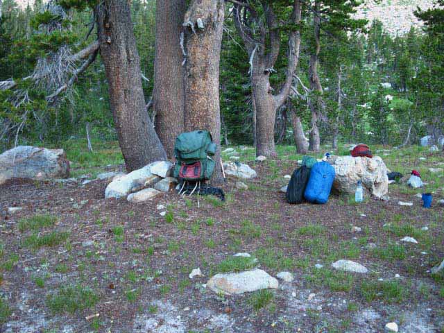
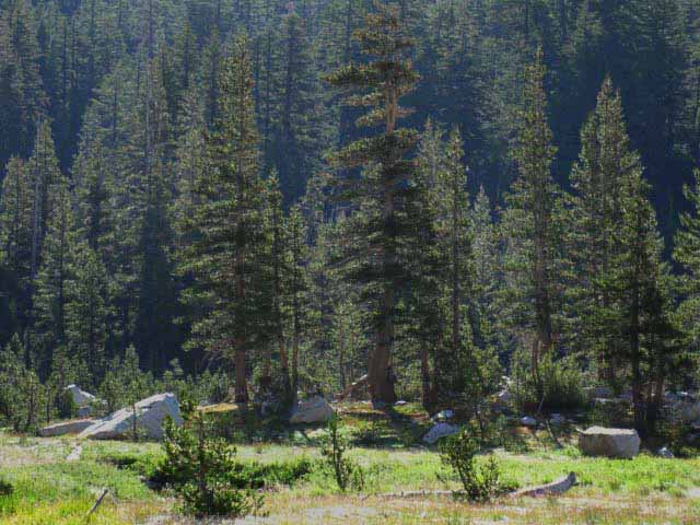
Jack Main Canyon Campsites Hiking down Jack Main Canyon in 2013 showed many new sites laid out along the PCT-TYT. Let's not make any new campsites in Jack Main Canyon. New sites are completely unnecessary. Let's try to focus our camping in the best existing sites, which are not always the most obvious sites. Trail crew will sweep the canyon of these stupid sites sooner or later. If we find a nice spot in Jack Main Canyon, there is likely a nice campsite nearby. I've randomly walked out into Grace Meadow to the islands of lodgepole pines scattered down the length of the meadow and found campsites in these stands of trees every time! |
Medic at the Top of Jack Main Canyon
PCT Territory
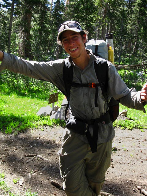 |
PCT hiker on July 31st of 2010 If we hike South on the PCT during late June and early July (depending on the specific trajectory of each year's Winter snow and Spring Thaw) we will run into the main body of each year's PCT hikers. There's generally a mass of a couple of hundred PCTers spread out along the trail. These are the folks who started off the Mexican border roughly at the same time. Above we meet Medic of the Medic and Flyboy brothers hiking team North through Jack Main Canyon on July 31st of 2010. The mosquitoes were thick as smoke. One of Medic's PCT Stories Medic and his brother Flyboy were among them. Medic called up that famous yearly High Sierra mountain rock festival, Mountain Air, and offered the volunteer services of a whole bunch of PCTers that were stuck together. The end of the concert lined up well with the opening of the mountain trails, and this intrepid group of PCTers headed South to resume their hikes into the South Sierra. Other PCTers had bypassed the Sierra when the South Sierra failed to clear of snow in late Spring, hitching North to hike the North Sierra. I noted two groups of PCTers during 2010. Those who went to the rock festival and those who did not. I saw some of those who did not much later in the season when they returned from the Canadian border to complete the Sierra Nevada section of the PCT. Then there's the story of how Flyboy got his name... haha... You can read it on |
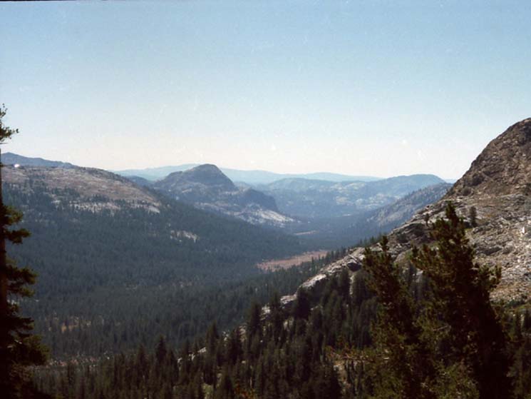
Lay of the Land
Hiking Down Jack Main Canyon Though we will turn out of Falls Creek to Tilden Lake or Wilmer Lakes, Falls Creek and the trail continue down through the complex terrain of Jack Main Canyon to the Tuolumne River at the very heart of the Grand Canyon of the Tuolumne. Highway 108 Trailheads Complex Terrain down Jack Main Canyon below Wilmer to Lake Vernon We can see the top of this terrain on the bottom of the map above. The bottom Right corner of the National Forest Emigrant Wilderness Map below shows the backpacking potential of this very beautiful area clearly, while the Yosemite National Park Map fills in the blanks.
I have the distance from the Southern Bond Pass trail junction to Hetch Hetchy at 27.66 miles.
If we were so inclined we could follow Falls Creek most of the way down to Hetch Hetchy if we hike past our junctions East on the Tahoe to Yosemite Trail to Tilden Lake and the Pacific Crest Trail's junction to Wilmer Lake. Another alternative is to hike South towards Tiltill Valley from where our TYT and PCT routes rejoin between Bailey and Macomb Ridges. I've hiked down to Hetch Hetchy a couple of times. It's a very beautiful hike. There is a big climb up onto Moraine Ridge, but it is mostly down mountain, way down the mountain to Hetch Hetchy's 3795 feet of elevation. The hike down to Hetch Hetchy brings us down the wondrous beauty of Jack Main Canyon to a position passing around a confused matrix of associated canyons down to where we climb onto Moraine Ridge. Approaching Moraine Ridge we hike through some remarkably sized Red Firs, then down into the zone of the Jeffery Pines. I cannot overstate the beauty and complexity of this terrain below Wilmer Lake down to Moraine Ridge. update June 2013 Highway 108 Trailheads to Hetch Hetchy On the Forum
To Hetch Hetchy: Snake in a Lake The page that follows below takes us down Jack Main Canyon along Falls Creek past the TYT turning off at the Tilden Lake trail junction down to the PCT junction near Wilmer Lake. At Wilmer Lake we turn East following the Southbound PCT to where it rejoins the TYT between Bailey and Macomb Ridges. |
Grand Overview
of the
PCT & TYT
from
Upper Jack Main Canyon through Grace Meadow to the Tilden Lake Junction
Sometimes the Best way Forward is to Look Back South Bond Pass Trail Junction Below we are turning around to look back at the ramp up at the shelf holding Dorothy Lake at the very top of Jack Main Canyon. The image below looks North back from the top of Grace Meadow at where the two Bond Pass trail junctions are located on the "ramp" up to Dorothy Lake Pass. The two junctions between the TYT and PCT are located about halfway up and at the top of the forested "ramp" leading up to the shelf Dorothy Lake sits on. Dorothy Lake and then the low gap of Dorothy Lake Pass come in rapid succession once Northbound hikers climb the ramp into the flat holding Dorothy Lake at the top of Jack Main Canyon. Northbound hikers on the Tahoe to Yosemite Trail turn Northwest at the first Bond Pass trail junction to turn their climb towards the great gap in the ridgeline on the upper-Left edge of the image is where the TYT comes through Bond Pass. Our South Bond Pass trail junction along the PCT is located roughly in the center-Left of the ramp lined up with Bond Pass's gap in the ridgeline. Compare this image below taken in 2009 with the USGS map of upper Jack Main Canyon from 1990. The 1990 map does not shows the forest we see below from the North end of Grace Meadow up to the base of the forested ramp, nor does it show the current forest density up to the Bond Pass junctions and Dorothy Lake. We discuss and explore more of Jack Main Canyon's features on the Jack Main Canyon trail guide page. Looking Back, North
Bond What we are looking at in the image above is two passes. The first is through the gap in the Left wall, the Southeast facing flank of Jack Main Canyon where the Tahoe to Yosemite Trail out Emigrant Wilderness passes through the 9760 foot Bond Pass to link up with the PCT route entering Yosemite through the 9480 foot Dorothy Lake Pass across the top of Jack Main Canyon. To the Right of the gap in North Wall of Jack Main Canyon we can see the forested "ramp" rising from the end of Grace Meadow up to the shelf holding Dorothy Lake. At the top of the canyon we can see where the last, uppermost reach of Jack Main Canyon bends Northeast from the top of the ramp to its 9480 feet high point on the Sierra Crestline across Dorothy Lake Pass. At the top of that forested "ramp" is the short shelf holding Dorothy Lake. Dorothy Lake Pass is just a few feet above and North of Dorothy Lake. The Pacific Crest Trail route runs Northeast up that forested "ramp" past the two Tahoe to Yosemite Trail junctions leading over Bond Pass up to Dorothy Lake. From the South end of Dorothy Lake we have about .87 of a mile along Dorothy Lake before making the short climb through the lake's namesake low pass into the Toiyabe National Forest and onto the East flank of the Sierra Nevada. Once we cross over Dorothy Lake Pass exiting Yosemite Northbound PCT backpackers have ended our hike on the Western Flank of the Sierra. From Dorothy Lake Pass the Northbound PCT stays mostly on the Eastern flank of the Sierra all the way up to the Tahoe Basin. The length of the PCT on the Western flank of the Sierra Nevada Mountains North of Dorothy Lake Pass can be measured in steps. We are going to turn around to continue South. Us Southbound backpackers will remain on the Western flank of the Sierra until we cross out of the South end of Yosemite hiking the combined PCT-JMT South through Donohue Pass. Jack Main Canyon to Tilden & Wilmer Lakes |
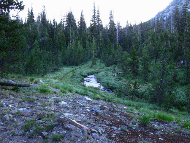
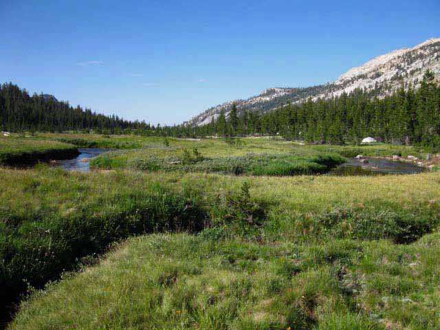
Now Let's look forward at Grace Meadow in Jack Main Canyon
Sometimes the best way forward is to look Forward Upper Jack Main Canyon The pictures above and below are complimentary. The image above looks up Jack Main Canyon from Grace Meadow and the picture below looks down Jack Main Canyon at Grace Meadow and Chittenden Peak with the angled spine of Peak 9412 at its Northwestern base. We can see Chittenden Peak and its accompanying formation 9214 rising in the middle-Left of the image backdropping Grace Meadow. Tilden Lake is on the other side of Chittenden Peak. Note the thin blade of golden meadow below Peak 9214 beyond the mass of Grace Meadow. Line up our viewing position here at Bond Pass with Grace Meadow and that sliver of meadow in the distance on this map to match up a physical perspective with the map's abstraction. Grace Meadow on the Maps Meadowcide, executed by Lord Lodgepole, in the Jack Main Canyon... The 1990 USGS map shows Grace Meadow with a much greater extent than this bird's eye view. Grace Meadow has shrunken considerably from its extent recorded in 1990 when the maps were last updated. This is supported by the wild growth of young lodgepoles we observe up and down this upper section of Jack Main Canyon. Jack Main Canyon to Tilden & Wilmer Lakes Above we are looking South by the compass down the upper section of Jack Main Canyon from above Bond Pass at Chittenden Peak and Peak 9214 below its Northwestern flank. Hiking South from our viewing position above Bond Pass our TYT rejoins the PCT in upper Jack Main Canyon. Hiking Southbound from the Southern of the two TYT-PCT trail junctions near the top of Jack Main Canyon we begin descending a short steep segment of rocky trail through dense lodgepole forest that I call the "ramp" until the descent moderates approaching the top of Grace Meadow. Well, I mean approaching the top of the intermixed forest and meadows that begin at the base of our ramped descent from the TYT trail junction. Though we hear running water hiking South from the Bond Pass trail junction (and see it during the Spring Thaw) our best bet for a break spot with water is to hike down to the bottom of this short steep section of rocky forested trail into the top of the now-forested meadow, which is also where creek and trail meet in a nice break spot. Some fool set a fire ring and camped here at this upper junction of trail and creek at the end of meadow-flat terrain at the top of Jack Main Canyon, which is unacceptable. There are legal campsites just down the trail. This spot where trail and Falls Creek first come together at the top of Jack Main Canyon is too close to the water to be a legal campsite. But it is an excellent break spot... Looking South from the Bottom of Grace Meadow The Tahoe to Yosemite Trail turns East out of Jack Main Canyon following Tilden Creek up to Tilden Lake just South of Chittenden Peak. After a delightful walk along the South shore of Tilden Lake the TYT bends South down Tilden Creek Canyon towards its reunification with the PCT further down the canyon. The Pacific Crest Trail continues South down Jack Main Canyon for another 1.75 miles past the Tilden Lake trail junction to the Wilmer Lake trail junction, where it too turns East. Jack Main Canyon to Tilden & Wilmer Lakes Below: Hiking South down the rocky moderately steep combined PCT-TYT trail below the South Bond Pass trail junction. Our trail South is descending the "ramp" between the flat Dorothy Lake sits on from the upper end of the fading reach of Grace Meadow. |
Down We Go
Thick Lodgepole Forest below Bond Pass Trail Junction
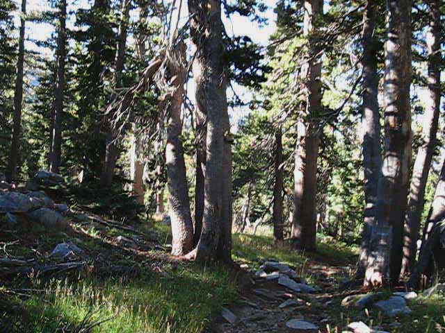 |
Descending rocky trail Southbound through forested terrain below Bond Pass down the top of Jack Main Canyon. Falls Creek is off to our Left, East, out of reach until the trail and creek come together at the base of this descending ramp. |
Gone Slow and Mountain Man
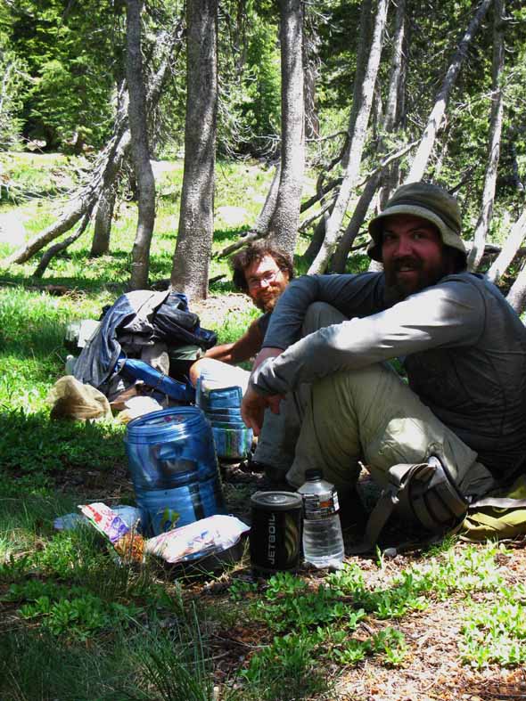
At the base of the descent South towards Grace Meadow there is a little flat spot where Falls Creek and our combined PCT-TYT trail first intersect at the head of Jack Main Canyon. There is a fire ring here too, but its close proximity to Falls Creek marks it as an illegal site. Ok for a break, but please move down the trail an eighth-mile to a proper legal campsite if you plan on camping around here. The next and nearest excellent camping sites to the North are along the South shore of Dorothy Lake. To the South they would be at Tilden and Wilmer Lakes, depending on our route. I always stop here at the top of Jack Main Canyon for a little snack, some water, and a relaxing break. This is also the highest place we can observe the trout in Falls Creek. Sitting here in early Summer 2013 brought a stream of Northbound 2013 PCT hikers through, approaching the Thousand Mile Mark at the West West Walker River Bridge on their grand trek from Mexico to Canada. Gone Slow and Mountain Man kicked back and had a nice break with me, where we discussed Life, the PCT, the Trail, and other assorted topics of importance. Hell of nice guys. A whole line of PCT hikers stopped in and said "hello." I recorded these encounters in the 2013 High Sierra Cultural Report. Gone Slow and Mountain Man really liked the "Squeeze Bag" water filters, and the filters themselves, but noted that the integral water bags only last for 700 miles before the material splits. Post up your experiences or comments about the Sawyer System.
Mountain Man was getting tagged by the skeeters. His shoulders were one big bite. Check out the |
Variability of Hiking Conditions in Jack Main Canyon Moisture and Mosquitoes
Boggy conditions in upper Jack Main Canyon. We have a couple of seasonal tributaries and creeks weakly draining off of the "ramp," and those draining the upper end of Grace Meadow Falls Creek. This, and about everything about Grace Meadow and Jack Main Canyon feed the huge growth of voracious mosquitoes prowling Jack Main Canyon from as soon as rising Spring Thaw temps allow them to live until the drying meadows of late Summer finally deny them life. Be prepared. Be very very prepared. The mosquitoes are no joke. All individuals planning High Sierra backpacking trips in Spring and early Summer who are not fully prepared for high density mosquitoes will suffer in proportion to their lack of protection. Not just suffer physically, which would be bad enough. The fact is that the physical effects of the mosquitoes will bleed into your psychology, driving you as mentally crazy as physically tortured, if not more. I've seen folks really suffer from the mosquitoes. |
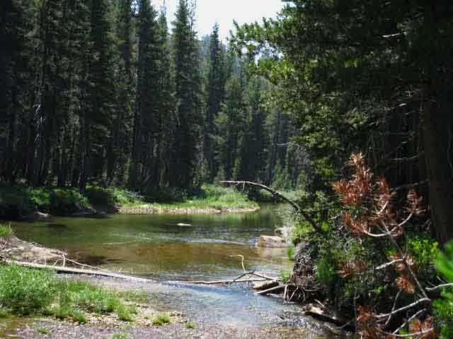
Down to Falls Creek in Jack Main Canyon
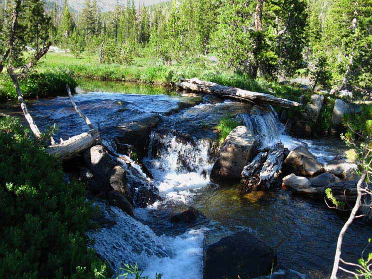 |
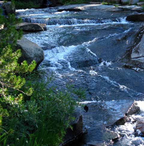
Delightful little falls and mini-cascades along Falls Creek. Looking at the upper Left-hand corner of this image locates this position below the forested slope below Dorothy Lake. Jack Main Canyon to Tilden & Wilmer Lakes |
Meadow-Forest Interface becoming diffuse in much of Grace Meadow
 |
Deep side channel of Falls Creek above Grace Meadow. The main body of the creek has split off to the East, leaving this deep channel. Vibrant swaths of young lodgepole pines are bursting out of the moist soils. |
Slash of Dead Lodgepoles Regrowing Strongly
 |
Jumble of fallen timber and rock in upper Jack Main Canyon. Over the years hiking through Jack Main Canyon I've observed one big slash of lodgepole turn white, and die. I've seen the lodgepoles blown down by wind and snow. Every time the lodgepoles takes a shot they respond with greater vigor. In a few short years a thick carpet of surging young lodgepoles puts a promising cover on the scarred ground. Death is a good fuel for life, properly balanced. Though we have dropped down and off the steeper section of trail between the Bond Pass trail junction and Grace Meadow we are still hiking through more forest than meadow. We can see the vigorous growth of young lodgepoles are still driving this forestation of Grace Meadow in upper Jack Main Canyon. |
 |
Into where the 1990 map indicates the North side of Grace Meadow should be, which is more of a bald spot in the encroaching forest than a meadow. Keyes Peak on the Left, to our Southeast. Jack Main Canyon to Tilden & Wilmer Lakes |
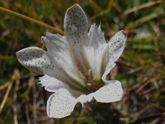
White Wildflower with Green Spots
Alpine Gentian
 |
||
Beautiful white wildflower, Grace Meadow August 24 2012.
A great part of the Sierra Experience are its living things. Check out the Post up your observations, experiences, and images. |
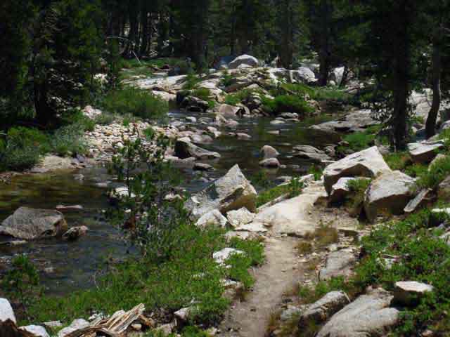
Falls Creek looking forward, South
 |
Narrow breadth of Falls Creek high up Jack Main Canyon. Deeply carved bed of the Pacific Crest Trail. |
Falls Creek looking back, North
 |
Tiny Falls Creek threads its way inconspicuously through the massive U-shaped glacially carved groove that is upper Jack Main Canyon. Jack Main Canyon to Tilden & Wilmer Lakes |
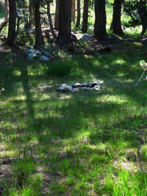
Campsite above North Grace Meadow
 |
A Grace Meadow Campsite. We have noted many campsites hiking down Jack Main Canyon. Just getting started backpacking? An old hiker? Check out the Camp and Trail Skills page for some good tips and solutions for basic backpacking problems: |
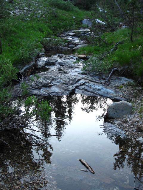
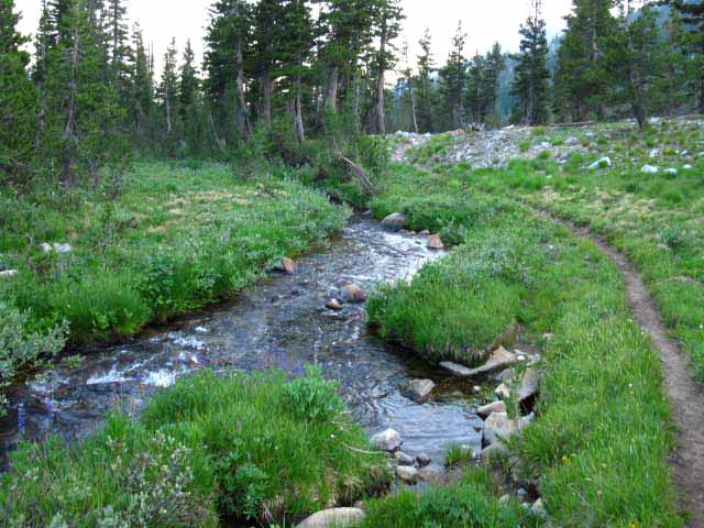
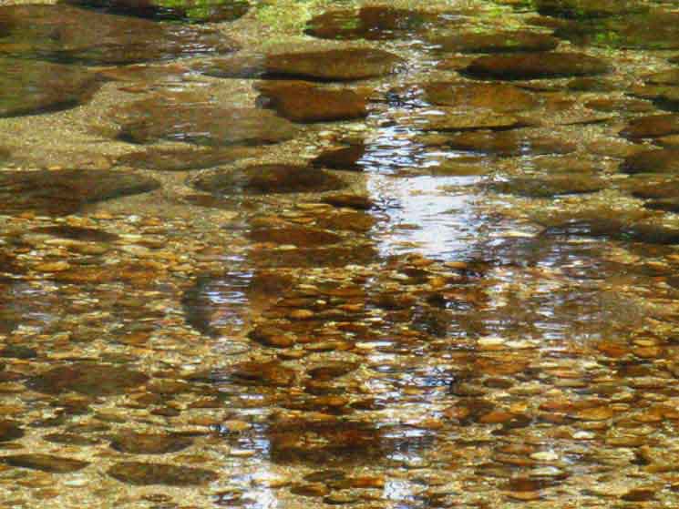
Falls Creek
 |
Falls Creek on North side of Grace Meadow. When I walk I listen. When the sound of the water picks up, it tells me to wander over and check out the water's change of sound, if it sounds interesting. The sound of beauty is the song of the creek leading us to its delightful, and sometimes terrifying sights, especially when the full power of a strong Spring Thaw reveals itself. The Sounds of Nature are informative. They bring intensity from powerful flows of water across land, electricity snapping through the sky, and wind bending trees to their breaking point. The Sounds of Nature can bring relaxation on the buzzing wings of a solitary bumblebee and delight on the fragile melody of seasonal tributaries approaching their end. Dread on the dynamo-like sound of a billion mosquito wings beating. The soundscape will bring warnings of things to come before they themselves arrive, be they good or bad. Listen Carefully! |
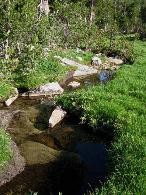
Falls Creek flows over Sweet flat Slabs
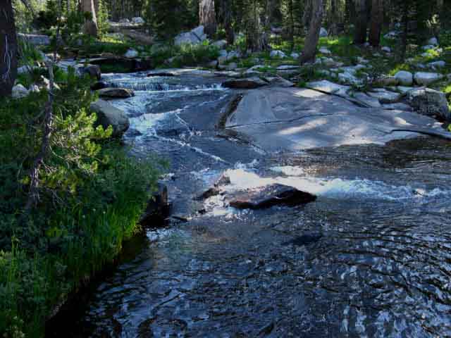 |
A wider view of this delightful terrain where I expect to find Hobbits fishing Falls Creek on the North side of Grace Meadow. A nice enjoyable spot to watch the day end to the cascading melody of Falls Creek. |
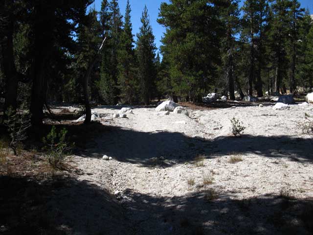
The Area of Chalky Sand
 |
||
|
Dry sandy rise. We noted the first little rise after reaching meadow-level, now we've come to a second, which I've always noted as the "chalk" rise, for obvious reasons. It's chalky white. There's a couple of campsites here, and it's reasonably near Falls Creek. I spent a night here once during the early years of this new century. After dark I was in my sleeping bag messing around getting ready to sleep when I was startled by a real loud noise. A very loud gunshot-like "pop," followed by a rapid series of "pops," during which an even louder crashing noise began, and continued after the "pops" stopped. The weight of a snag, by the sound of it a standing dead tree of great size, had exceeded the ability of its rotting trunk to hold, which resulted in the popping noises of its internal structure breaking. The great crashing sound was the upper section of the tree first hitting, then taking the lower section of the snag to the ground with it. A big snag just took a big step towards turning itself into soil. Any squirrels on that sucker when it went down went for a wild ride! I popped right up out of my sack ready for action. Then I looked around to make very sure I had not thrown down my sack within reach of any surround snags. I followed up by checking overhead to make sure no dead branches were in proximity. I execute this "safe camping" procedure every evening as part of selecting camp, and stashing me and the gear for the evening, but after hearing that falling snag tear shit up I rechecked everything!
North Yosemite Miles and Elevations |
Video
Grace Meadow to the TYT Tilden Lake Trail Junction
20:24 Take a walk with me through Jack Main Canyon's Grace Meadow along side Falls Creek down to where the trail to Tilden Lake climbs out of the canyon. Sweet! Sonora Pass to Bensen Lake Next Video: |
Keyes Peak beyond Grace Meadow
 |
||
Keys Peak from North side of Grace Meadow.
|
Falls Creek
 |
||
Placid Sierra Sky Blue waters of Falls Creek begin to widen in North Grace Meadow. Video I like trout. They have unique personalities. Predatory personalities, with a lot of aggression to balance their caution as prey. Try this: NEVER just tromp loudly up to a creek or pool. Walk quietly so the Trout will not "hear" your approaching footsteps. They are also watching, so be sly! Yes, Trout listen and watch carefully for approaching land animals. Heavily laden backpackers send min-earthquakes into the terrain that the trout can hear through the water, which guides both their observations and their retreat. During the mornings Trout will be out fishing, and later in the afternoon they will be hanging out in rocks and protected under the riverbanks until they come out for their evening hunt. If they are hiding, stamp the ground solidly three times with one foot, and watch carefully. "Thump-Thump-Thump" All the hiding trout will push their noses out to the edges of their hiding places to take a look at what made these discontinuous sounds. They certainly are curious!
|
View South
 |
Great S Bend in Falls Creek across Grace Meadow. View South down Jack Main Canyon across Falls Creek from Grace Meadow. We can just see Chittenden and Peak 9214 peeking over the top of the forest on the Left. |
Approaching South end of Grace Meadow
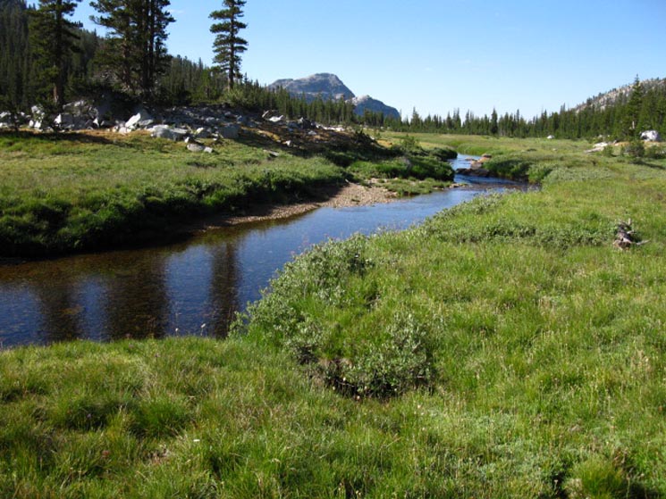 |
Chittenden Peak behind Peak 9214 behind Falls Creek flowing through Grace Meadow. The Tahoe to Yosemite Trail climbs to reach Tilden Lake at the base of the far flank of Chittenden Peak. Jack Main Canyon to Tilden & Wilmer Lakes |
Top of Jack Main Canyon
 |
Looking North at the top of Jack Main Canyon Bond Pass through Left gap in Mountain, Dorothy Lake Pass is on a nice flat at the top of Jack Main Canyon. The ridge arm we can see crossing the top of Jack Main Canyon precedes the flat shelf holding Dorothy Lake. Northbound hikers on the PCT climb that ramp up to Dorothy Lake followed by a very low climb up to Dorothy Lake Pass beyond the lake. Jack Main Canyon to Tilden & Wilmer Lakes |
Long Distance Backpackers
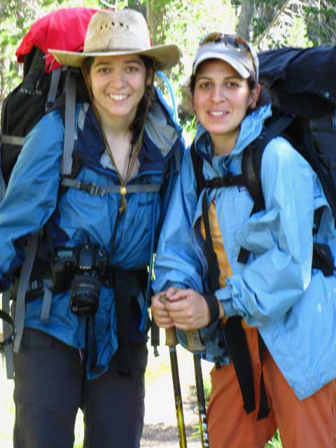 |
July 30 2009, Xilonin & Ixchel. Yosemite to Lake Tahoe. Quotes: "Beautiful Valley, (Jack Main) Ugly Mosquitoes." "We love it." |
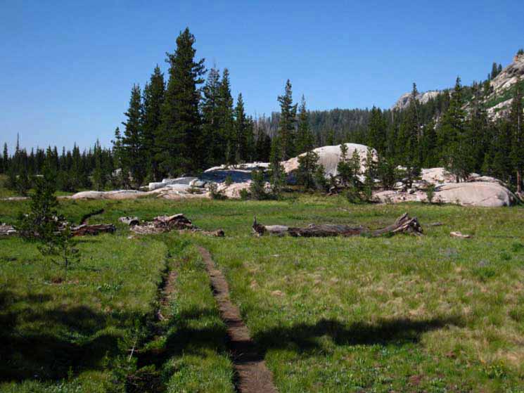
Islands of Forest dot Grace Meadow
 |
Islands of forest make great campsites in Grace Meadow, Yosemite. |
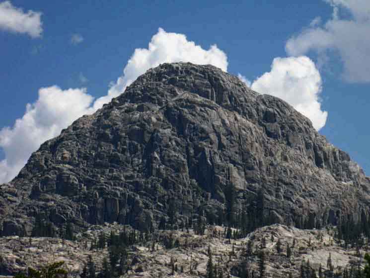
Chittenden Peak and Peak 9214
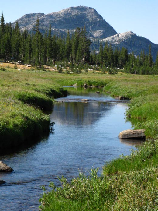 |
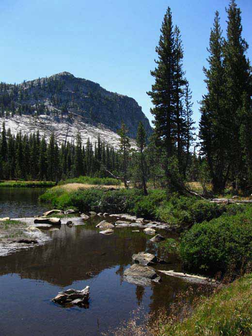
Chittenden Peak dividing Falls Creek in foreground from Tilden Lake on its South Flank. Jack Main Canyon to Tilden & Wilmer Lakes Bensen Lake to Virginia Canyon |
Peak 9214
 |
Peak 9214 behind Falls Creek flowing through South end of Grace Meadow. Peak 9214 sits just Northwest and below Chittenden Peak's 9685 feet of elevation. We've got less than a half mile to our South where this length of meadows and forest end, where we begin a moderate rocky descent for about 3/4ths of a mile to the Tilden Lake trail junction. |
Jack Main Canyon Campsite
 |
Very recently used fire ring We can rest assured that the Pacific Crest Trail route has lots of campsites along its course. It's just a matter of numbers. Hundreds of PCT hikers start each year. Add to that number to the hikers coming out of the Toiyabe National Forest and the Emigrant Wilderness, let alone hikers on unique routes from Tuolumne Meadows and Hetch Hetchy. That's a lot of backpackers hiking through Jack Main Canyon. I call the Pacific Crest Trail the Superhighway of Trails. This "PCT" effect intensifies as we enter popular areas, such as Yosemite, and when we approach trailheads. This traffic is not a bad thing. Nature is really good for people, even if people are not real good for nature. We respond to this "imbalance" between nature and man with "leave no trace" ethics, although that is impossible. We always leave traces, as the double and triple trail beds ground into Yosemite's fragile soils show us. Trail Crew works hard to keep the damaging effects of so many feet on the trails from turning them into creeks during the Spring Thaw and destroying the surrounding terrain. Another pleasant effect of people in unadulterated nature is how it draws a high caliber of people into its boughs, and makes them even better. Nature: You figure it out. Backpacker's Forum: Fire Policy Also See: Camp Style |
Wildflower line our Path
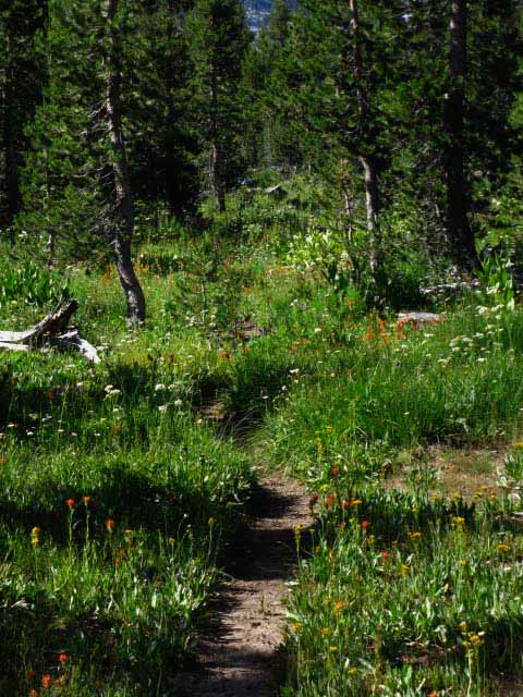 |
SWEET Walking through fields of blooming wildflowers makes me smile inside and out. |
Wildflowers in Jack Main Canyon
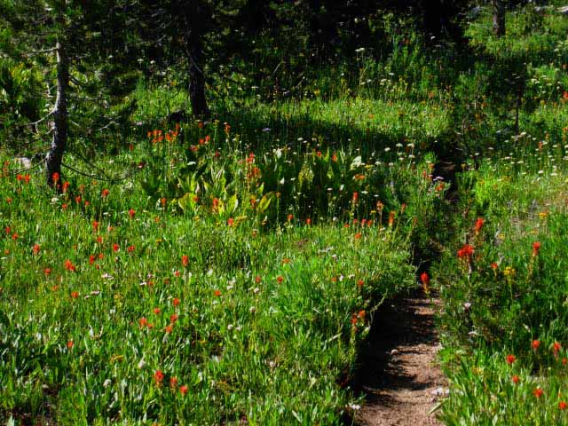 |
The flowers' bloom extends to different dates depending on the Winter snow pack and the trajectory of the Spring storms, thaw, and local drainage. High Sierra Wildflowers are a hardy lot. |
Jack Main Canyon Campsite
 |
Alright, this fire ring is unnecessary. I hate to be "judgy," but this looks like a site established by a group hiking up the canyon too lazy to find one of the many already established fire rings. Well, I don't make fires (Fire Policy), so I don't understand that anyway. The "circle of light" blinds us to the world outside of it. There's no reason to build a fire ring when there are better sights without the "circle of light." Policy and Practice We backpackers need to control and constrict our campsites to the best natural spots that will always pop up after trail crew sweeps, by not creating a crazy string of random campsites down the canyon. These sites just cause trail crew do unnecessary work. Making them clean up after backpackers distracts them from keeping our trails open and clear. It's hard to imagine how much harder High Sierra Travel would be without the diligent work of trail crew. Until we start scrambling and hiking cross country routes. Jack Main Canyon to Tilden & Wilmer Lakes |
Approaching Southern Limit of Grace Meadow
 |
||
Peak 9214 with Chittenden Peak peeking out from behind on the Right. They look different from below than from above. Views of Chittenden Peak Views of Chittenden Peak from Afar and in context with Grace Meadow. Tilden Lake wraps around the Southeastern base of Chittenden Peak.
|
Landmark Granite on the South Side of Grace Meadow
 |
Just a sweet looking island of granite marking the beginning of last bit of the meadow beyond, before we begin the rocky descent to the Tilden Lake trail junction. |
Backpacking Beauties of Jack Main Canyon
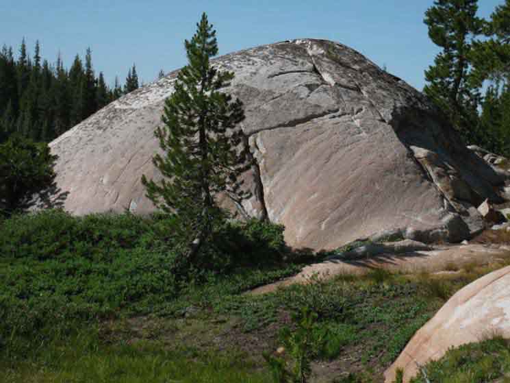 |
Fine granite mound in the South end of Grace Meadow. |
Terrain descends and turns rocky South of Grace Meadow
 |
ROCK We have not needed or seen many ducks since up on the shortcut to the South junction on the TYT below the South flank of Bond Pass. Hell, we'd have a had time finding enough rocks to build a duck along much of Grace Meadow. The last duck on the PCT must have been down by Cascade Creek on the other side of Dorothy Lake Pass. My point is that the terrain North of here is well-grooved into soft terrain requiring little additional guidance. To our South we are dropping down into some hard-surfaces where ducks can have great utility. |
Great Rock Slab
 |
A few ducks have utility, but too many ducks are like too many cooks with too much salt. I'm not a great fan of this type of duckage, where hikers "keep it between the lines." Not a big fan... Independent of how you like your trails marked , the terrain changes markedly below Grace Meadow. The almost level meadow terrain turns more steeply down-mountain, the soft bits of meadow trail surface replaced by rock, and our trail route now diverts around hard rock obstacles rather than the deep spots across wet meadows. |
Backpacker Chilling
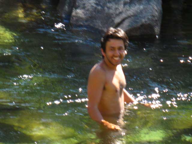 |
Raul's Bath on the way from Yosemite to Lassen. July 30 2009. Raul and the hiking team of Xilonin & Ixchel seemed to be staying close. The water is freeking cold at the end of July. High Sierra rivers and creeks run cold all year long, but feel deadly cold during Winter and the Spring Thaw. |
Sweet Sweeping Bends in Falls Creek
 More great bends in Falls Creek.
These bends flow through rock, unlike the great bends across the width of Grace Meadow's soft meadow soils to our North.
More great bends in Falls Creek.
These bends flow through rock, unlike the great bends across the width of Grace Meadow's soft meadow soils to our North.
|
Alison and Dan on the Long Trails
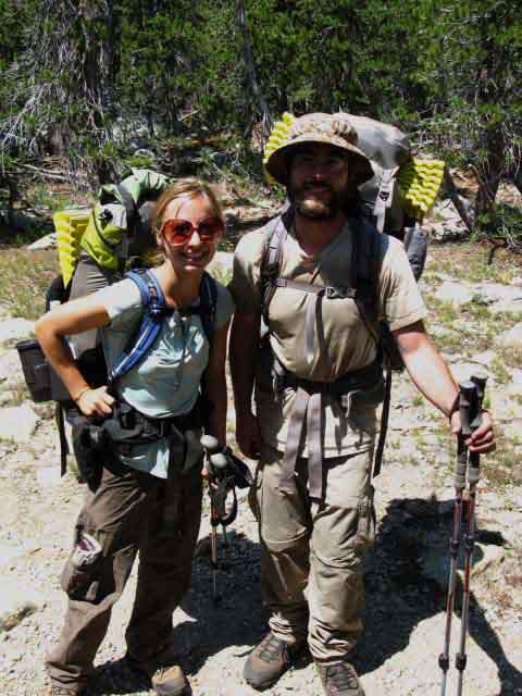 |
Alison and Dan. July 30 2009 Walker Pass to Syskious That's a pretty cool trip.... Remarks Long Distance Backpacking in the High Sierra: I ask the hikers I encounter lots of questions, as you may have figured out by now. Well, at least the ones I get to share a minute or two with. We long distance backpackers have places to go, things to see, and mountains to get over before twilight falls. |
Tahoe to Whitney Trail Guide and Forum About their "tips," about what they think is most important, about what you on the trail now would tell you getting ready for the trail in the past. This site is designed so we can help each other familiarize ourselves with the factors that affect the success and quality of our long distance backpacking trips along the Sierra Nevada Crest. That's why every trail guide page has the "comments" links to its own forum page. Every comments link goes to the forum page for that particular segment of trail. Registered backpackers can post up their own pages in the various backpacking trails and topics forums. Besides covering every section of the main High Sierra Trails we also cover all the main backpacking topics. Registered members can post up trip reports in the trails forum or gear reviews in the backpacking topics forums. At the very least I expect you current and recent backpackers to post up your experiences and impressions about the classic trails covered, or even touched by the guide. I want to draw in the experiences of those who've hiked these sections and segments of the Sierra Crest trails, as well as any questions from those who want to hike these trails. I query backpackers on the trail and here on the guide so we can at least keep those who follow from falling into the common pitfalls. Alison and Dan were... Not real happy with their Merrill boots: "5 out of 10" What's up With That? Merrill is a fine boot. But plastic backstays are stupid.
|
Chittenden Peak
 |
Getting around the bends in Falls Creek below Chittenden Peak marks our approach to the Tilden Lake trail junction. There's more than a few nice campsites in the areas between where the creek and trail part for the bends. I've walked around here and found all sorts of amazing spots off the trail. The Tilden Lake trail junction and ford are pushed South of where the trail actually begins climbing to Tilden Lake under Chittenden Peak. Jack Main Canyon to Tilden & Wilmer Lakes |
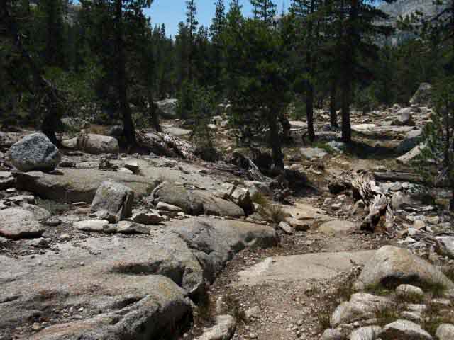
Fine Slabs down Jack Main Canyon
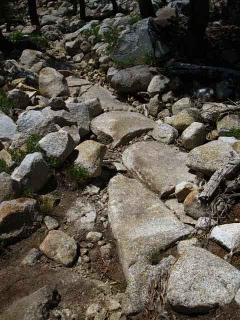 |
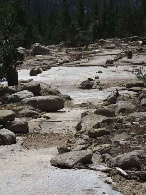
Great slabs offer stable trail through rocky terrain below Grace Meadow. In some locations it seems like Trail Crew followed amazing natural routes of granite trail through the terrain, tying these natural runs of "trail" together with amazing works of man-made trail. |
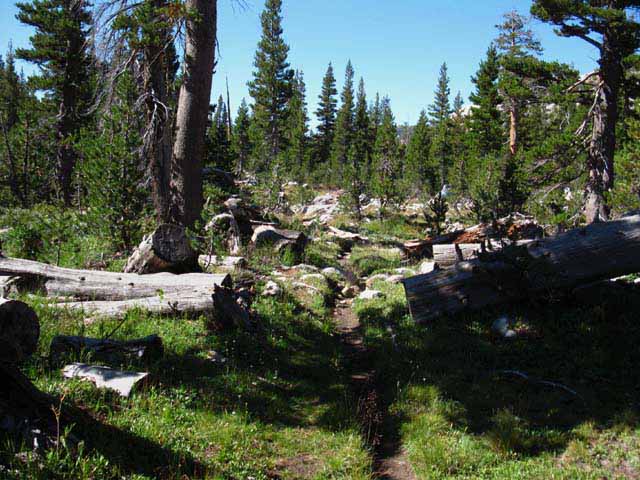
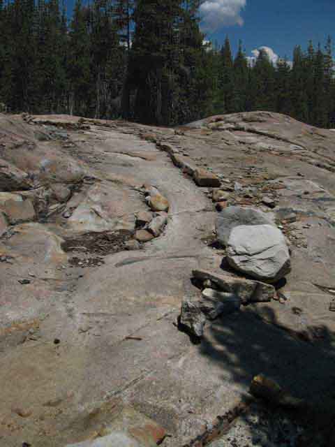
Rocky Trail below Grace Meadow
 |
Rocky Trail below Grace Meadow. We can see the rock outline of a drainage channel crafted by trail crew across the route. This was laid out to both protect the terrain and guide future work here, by the looks of it. Post up if you see this segment of trail "paved-in," finished by trail crew. Rough trail between Grace Meadow and Tilden Lake trail junction. |
Layer of Granite Veneer
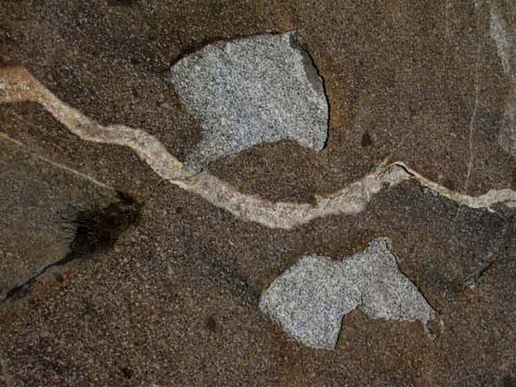 |
A red layer of granite less than 1/16th of an inch thick completely coats this granite boulder. The quartz vein decorating the "surface coating" superficially penetrates the underlying granite. |
Massive Granite Formation between Grace Meadow and Tilden Lake junction
 |
Trail circles around the foot of a sweet glacially cut and cracked granite feature. |
Erin and Chittenden Peak
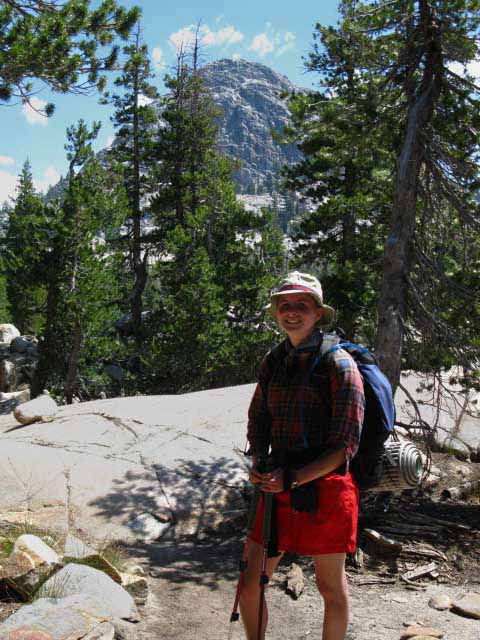 |
Erin backpacking down Jack Main Canyon. We can see we are passing South of Chittenden Peak. Jack Main Canyon to Tilden & Wilmer Lakes |
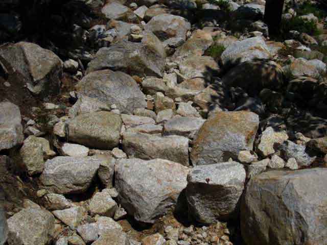
Puzzle Piece Trail
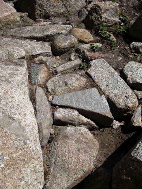 |
Rocky trail below Grace Meadow in Jack Main Canyon fit together like pieces in a perfect puzzle. |
Sweet Slab-land
 |
Our trail, Falls Creek, and a great field of granite. Jack Main Canyon to Tilden & Wilmer Lakes |
Chittenden Peak
 |
A good look at the Southwestern face of Chittenden Peak over our Left shoulder to our Northeast as we approach the Tilden Lake trail junction hiking South down Jack Main Canyon. |
A dark
Dry Wash leads us to the Tilden Lake Trail Junction
 |
| We drop down into seeking the trail through a dark dry wash right before we encounter the Tilden Lake trail junction. |
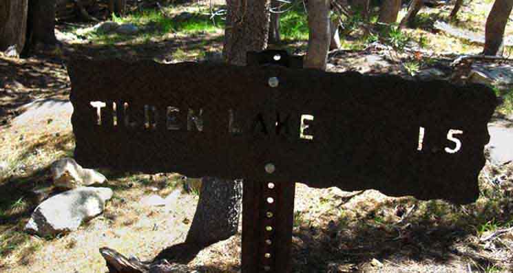
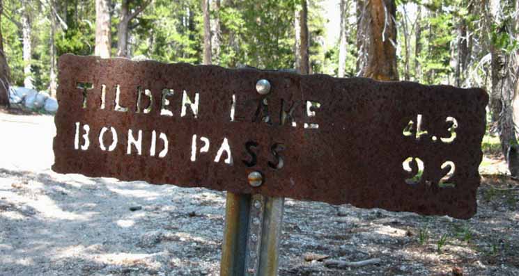
The Tilden Lake Trail Junction
The Tahoe to Yosemite Trail around Tilden Lake
East to Tilden Lake
 |
||||
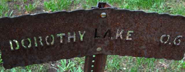
Yosemite Trail Sign Mileage My review of historic maps shows the route around Tilden Lake was the original route from Jack Main Canyon South on what later become the routes of the Tahoe to Yosemite and Pacific Crest Trails. The route around Wilmer Lake was not added until after 1931 according to the evolution of historical maps. I especially like the 1931 map of Yosemite National Park on page 906 of Green's Yosemite: the Park and its Resources. This map shows us that our TYT and JMT routes across North and South Yosemite, respectively, including the "golden triangle" from Tuolumne Meadows into Lyell Canyon via Yosemite Valley, are essentially unchanged since 1931. One difference is that in 1931 we only had one route South from Jack Main Canyon, the current TYT route around Tilden Lake. The PCT route around Wilmer Lake was added sometime after 1931. Tilden Lake
Why the Difference in miles? This is the last variation between the Tahoe to Yosemite and Pacific Crest Trails for the remainder of our hike South to Tuolumne Meadows. The TYT route splits from the PCT for a 5.36 mile hike up to Tilden Lake then down Tilden Canyon to rejoin the PCT between Bailey and Macomb Ridges South of Wilmer Lake. The distance along the PCT via Wilmer Lake from the Tilden Lake junction to rejoin the TYT between Bailey and Macomb Ridges is 3.55 miles. Trail Guide Page |
||||
Trail Miles |
||||
Yosemite National Park Tilden Lake 1.5 miles |
|
Tahoe to Whitney I call out 1.42 miles to the Southwest end of Tilden Lake from the Tilden Lake trail junction. .89 miles along Tilden Lake totals 2.31 miles to where the trail turns South down Tilden Canyon. Rejoining the PCT: |
||
North Yosemite
|
||||
The Tilden Lake Trail Junction
South to Wilmer Lake
 |
|||
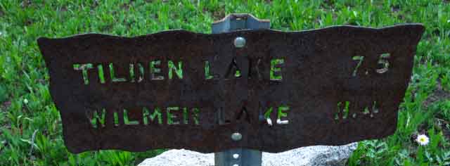
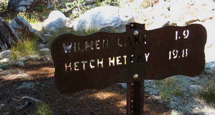
Yosemite Trail Sign Mileage Wilmer Lake
Trail Guide We discuss hiking down Jack Main Canyon to Hetch Hetchy above, and about our Trailhead options on Highway 108 for a hike down to Hetcy Hetchy on the Kennedy Canyon trail guide page. |
|||
Trail Miles |
|||
Yosemite National Park Wilmer Lake 1.9 miles. |
Tahoe to Whitney I measure the miles South to the Wilmer Lake trail junction along Falls Creek at 1.75 miles, then add another .3 of a mile to the I-beam ford on the West side of Wilmer Lake. This puts the total miles from the Tilden Lake trail junction to Wilmer Lake at 2.05 miles. |
||
North Yosemite
|
|||
2016
Trail Marking Update
New PCT Emblems
 |
During a 2016 trip across the North Yosemite Backcountry I noted the addition of significant new Pacific Crest Trail emblems bolted along the PCT junctions in Jack Main Canyon. I suspect these new emblems mark the length of the Pacifc Crest Trail across Yosemite. Post up your observations of these new emblems: |
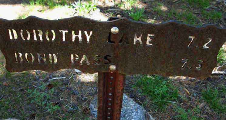
The Tilden Lake Trail Junction
Northbound up Jack Main Canyon
 |
|||
Yosemite Trail Sign Mileage Trail Guide: Scroll Up to Bond Pass and Dorothy Lake |
|||
Trail Miles |
|||
Yosemite National Park Dorothy Lake 7.2 miles Bond Pass 7.3 miles |
Tahoe to Whitney Miles I measure the distance from the Tilden Lake trail junction to the Yosemite National Park boundary at Dorothy Lake Pass at 8.21 miles. I put the miles North up Jack Main Canyon to the South Bond Pass trail junction along Falls Creek at 6.47 miles, and another .87 from there up to Bond Pass, making the total distance 7.34 miles. |
||
North Yosemite
|
|||
Continuing South down Jack Main Canyon
Video
Tilden Lake trail junction to Wilmer Lake trail junction
1.75 miles South from the Tilden Lake trail junction to the Wilmer Lake trail junction. 5:57 North Yosemite
|
 |
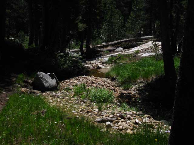
Approaching the point where Falls Creek splits below Grace Meadow and above the Tilden Lake trail junction. We can see Falls Creek dividing ahead. Below Grace Meadow the trail winds its way through a variety of terrains, including forest, bits of meadow, and granite terrain. Mostly granite terrain once we drop below Grace Meadow. Jack Main Canyon to Tilden & Wilmer Lakes |
Park Like Terrain
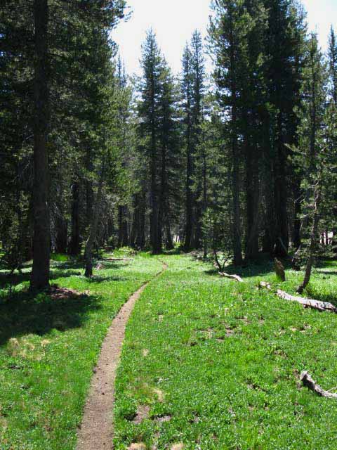 |
With nice small sections of intimate meadows. |
 |
Forest intrusion into the meadows. |
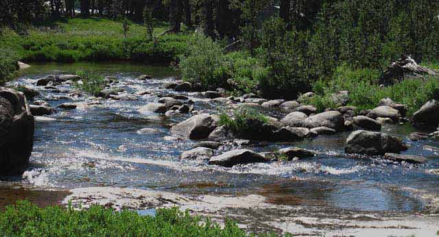
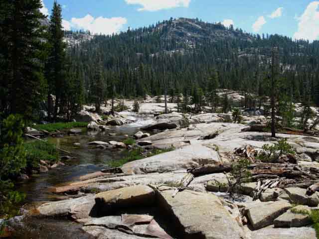
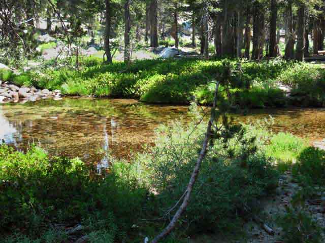
Approaching Wide Spot of Falls Creek
 |
Falls Creek expands and calms for a stretch as we hike further down Jack Main Canyon. We can see that the small creek in upper Grace Meadow has expanded and deepened into a substantial flow during Summer, indicating the degree of difficulty of fording it can present during the Spring Thaw and early Summer conditions. |
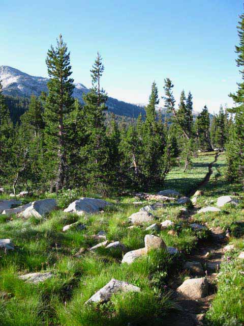
Rocky Terrain dominates our Hike South of Grace Meadow
 |
Section of open rocky terrain between Tilden and Wilmer Lake junctions in Jack Main Canyon. |
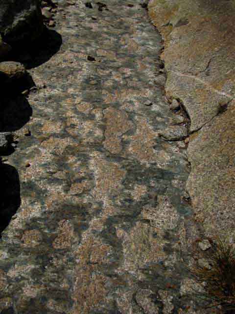 |
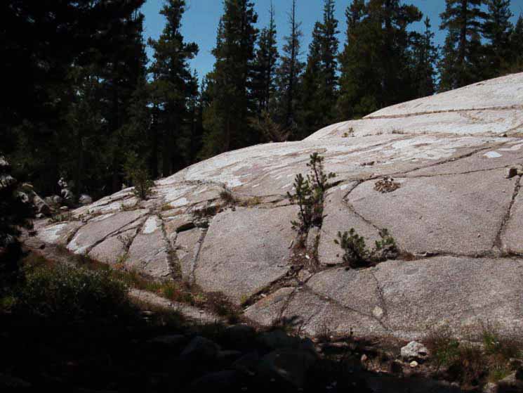
Solid granite trail surface with a veneer of mineral first scraped off the granite by the glacier passing over, now slowly worn off by the boots of passing backpackers and horsefolk. |
Slick Burnished Rock
 |
Looking North back up a solid section of burnished trail we just descended. Slick when wet and slippery when dusted with sand, solid slabs of smooth granite demand our full attention. The position of the trail across rock has polished, or burnished the outline of the trail into the rock itself. |
Chittenden Peak
 |
Last look at Chittenden Peak across the complex terrain of Bailey Ridge as we hike further down into rocky terrain below the Tilden Lake trail junction. Jack Main Canyon to Tilden & Wilmer Lakes |
Erratic
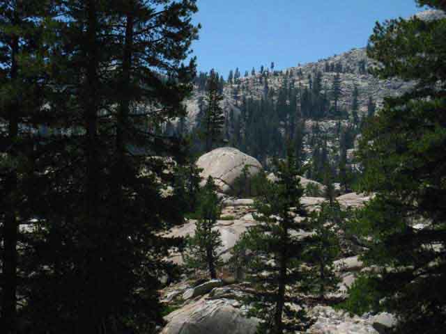 |
Wow, that's a cool boulder. Massive in size. A very large erratic that was polished, broken off, transported and polished some more, and eventually deposited here for our enjoyment. |
Cue Ball of the Rock Gods
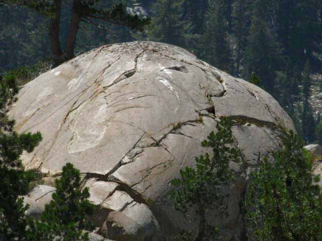 |
Likely carved and smoothed out in place by glacial ice before the power of the ice broke this massive chunk of rock off the mountains higher up Jack Main Canyon. |
Bailey Ridge
 |
Looking East at the inviting complexity of Bailey Ridge. Terrain Complexity along Bailey Ridge increases as we hike down to the Wilmer Lake trail junction in Jack Main Canyon. Jack Main Canyon to Tilden & Wilmer Lakes |
Long Distance Backpackers
 |
Stretch and Bandit, AKA Heidi and Bruce, Summer 2009. Horseshoe Meadow to Squaw Valley on the East shore of Lake Tahoe. This is a great hike encompassing the length of the High Sierra Crest. |
View East towards Bailey Ridge
 |
Looking East across waves of finely carved granite, just a bit up Jack Main Canyon from where our Southbound Pacific Crest Trail route turns East at Wilmer Lake. Very complex terrain. |
Jeffery Pine in Granite
 |
Great milky quartz veins in rusty colored granite topped by determined Jeffery Pine. Jack Main Canyon to Tilden & Wilmer Lakes |
Stock Gate
 |
Stock gate North of Wilmer Lake cabin in Jack Main Canyon. Finding stock gates indicates an upcoming pasture area. Pasture areas are used by horsepackers resupplying backcountry trail crew and science camps. In the case of Wilmer Lake a trail crew campsite is located just a ways down Jack Main Canyon beyond the upcoming Wilmer Lake trail junction, and a snow survey cabin is located in Jack Main Canyon across Falls Creek from Wilmer Lake. The cabin will be off to our Right as we approach the Wilmer Lake trail junction. The mule packers need someplace to keep and graze their stock overnight after riding in with the resupply. This gate marks the North limit of the pasture area for Wilmer Lake. |
Hiking around a dark forested area we see Falls Creek spreading out before the upcoming ford
 |
Falls Creek approaching Wilmer Lake ford. |
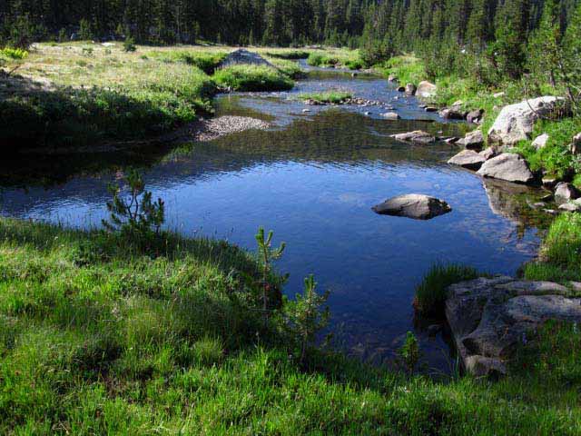
Great Falls Creek Pool
 |
We see Falls Creek spreads out above Wilmer Lake Ford. Below the ford the creek forms up into a great pool dividing the PCT around the shore of Wilmer Lake from the trail continuing down Jack Main Canyon. The PCT-TYT route fords Falls Creek turning Southeast from our Southwest line down Jack Main Canyon. After making the ford our trail runs back into the narrowing neck of forest wedged in between the marshy West shore of Wilmer Lake and the great pool of Falls Creek. |
Wilmer Snow Survey Cabin
above us to our
Southbound Right
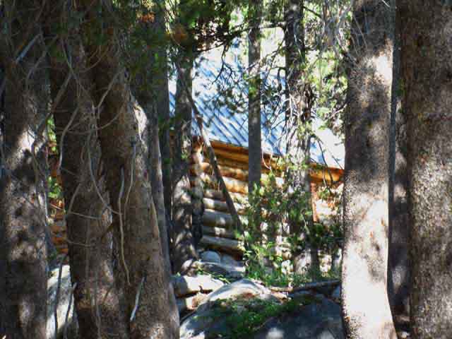 |
Approaching the Wilmer Lake trail junction we can see the Wilmer Lake Snow Survey Cabin hidden in the forest off to our Right. Jack Main Canyon to Tilden & Wilmer Lakes |
Wilmer Cabin
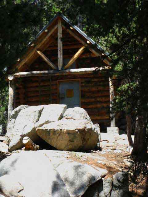 |
||
The cabin for snow course measurement in Jack Main Canyon. The majority of the snow survey reports in Yosemite and Emigrant Wilderness are done manually or by taking photos of snow measurements from the air. I like the modern network of remote ground reporting stations. They report temperatures, precipitation, snow depth, and humidity.
|
Hiking past the Wilmer Cabin we come to its faint trail
 |
The Pacific Crest Trail is the heavy trail running across the top of our field of view, while I am standing on the faint, but very noticeable trail to the Wilmer Cabin. When we see the faint trail leading West to the Wilmer Cabin we have already passed the cabin, which is set back well off the trail. |
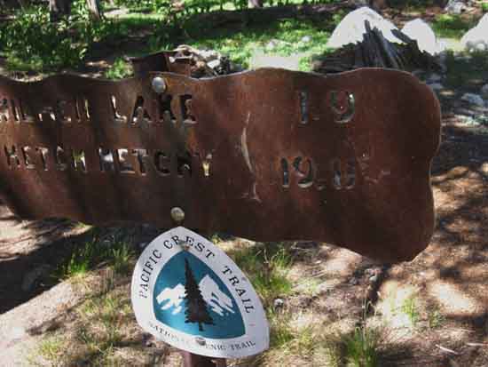
Wilmer Lake Trail Junction
in
Jack Main Canyon
Pacific Crest Trail South to Tuolumne Meadows
Trail Down Jack Main Canyon to Hetch Hetchy
PCT-TYT North to Highway 108
|
PCT-TYT
Wilmer Lake Trail Junction in Jack Main Canyon
Pacific Crest Trail South to Tuolumne Meadows
 |
|
Yosemite Trail Sign Mileage Next Trail Guide Page South |
|
| Trail Miles | |
The "To Yosemite Valley" miles on the Yosemite Trail Signs
We too are walking down to Yosemite Valley, but we are swinging through Tuolumne Meadows on our way to the Valley, while the miles indicated on the trail signs generally measure the miles to Yosemite Valley through Glen Aulin to Tenaya Lake down to Sunrise Creek. Jack Main Canyon to Tilden & Wilmer Lakes Sonora Pass to Bensen Lake |
Tahoe to Whitney Miles To Bensen Lake Shortcut (+ .8 to Bensen Lake along Bensen Lake shortcut) Total Shortcut route to Bensen Lake North Yosemite To Bensen Lake trail junction (+ .4 to Bensen Lake from Bensen Lake trail junction) Total
Wilmer Lake junction to Tuolumne Meadows Store |
Leading the way South on the PCT
to the
Falls Creek Ford
 |
| Looking Southbound towards the Falls Creek ford over to Wilmer Lake we can make out a PCT emblem being consumed. |
Northbound
on the
Pacific Crest and Tahoe to Yosemite
Trails
Up Jack Main Canyon
 |
|
Yosemite Trail Sign Mileage |
|
| Trail Miles | |
Why Are the Tahoe to Whitney miles different than the Yosemite Trail Signs? If we take a look at the USGS 7.5 map and the 30 minute map we will notice that the South Bond Pass trail junction is not included on either. I have taken the liberty of adding the South Bond Pass trail junction on the TahoetoWhitney maps, along with the leg of trail making up South side of the "trail triangle," or trail "Y." Currently there are two Bond Pass trail junctions along Jack Main Canyon which converge on their way West up to Bond Pass. We have a situation where the Southern junction of the Y that is not shown on the USGS maps is the trail junction that is signed. I take the omission of the Southern Bond Pass trail junction from the USGS maps to indicate that the Yosemite Trail Sign is measuring the trail up to the North Bond Pass trail junction, then up to Bond Pass. The mileage figures I call out to the Right are measured along the current route as of 2014, thus accounting for the difference in miles between the Yosemite Trail Signs from the mid 1950s which measured the distance to the only existing trail up to Bond Pass, the Northern trail I have come to view the steel plate trail junction miles as advisory, rather than authorative. |
Tahoe to Whitney Miles To Tilden Lake Trail junction Tilden junction to Tilden Lake Total Wilmer junction to Tilden Lake North Yosemite To South Bond Pass trail junction Bond junction to Bond Pass Total Wilmer junction to Bond Pass
Jack Main Canyon to Tilden & Wilmer Lakes Sonora Pass to Bensen Lake |
Southbound
down
Jack Main Canyon
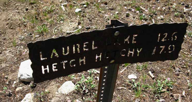
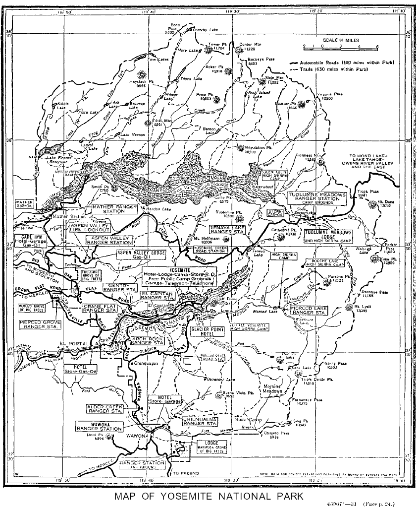
This Guide Page is under construction.
You input is welcome.
TRAIL GUIDE PAGES
NORTH and SOUTH
on the
TYT and PCT
| North PCT Dorothy Lake Pass |
South PCT Wilmer Lake |
| North TYT Bond Pass |
South TYT Tilden Lake |
NEW
Down |
Falls Creek |
||
The North Yosemite Backcountry This page begins where our long-separated PCT and TYT trails come back together again in the top of Jack Main Canyon for most of the final run South to Tuolumne Meadows. I consider Yosemite to be the center of the Sierra Nevada Mountain Range, and I put Tuolumne Meadows in the center of the center. This means that our hike across the North Sierra is coming to a step by step close as we close in on Tuolumne Meadows. The North, Central, and Southern Sierra are all unique, with each offering additive beauties to those contributed by the others. Passing further South is good, though I will miss the Northern Sierra as we hike towards the center of the Sierra at Tuolumne Meadows. At Tuolumne Meadows the TYT ends and we will pick up the Southbound John Muir Trail passing through Tuolumne Meadows, one way or the other. We're continuing into the South Sierra down to the Mount Whitney Portal, if we do it via Yosemite Valley backwards on the JMT, or if we pick up the Southbound JMT in Tuolumne Meadows. South Sierra Nevada Mountains The JMT and PCT share most of the trail South from Tuolumne Meadows to our turn for Mount Whitney at Crabtree Meadow. The notable exception is from Thousand Island Lakes down opposite walls of the canyon of the Middle fork of the San Joaquin River down to Reds Meadow Pack Station. This means there are less alternative routes along the mainly combined route of the JMT-PCT hiking the South Sierra Crest than there were between the TYT-PCT dividing the East and West flanks of the North Sierra. 7.5 Map 30 min Map
|
Backpacking Trail Guide NORTH North North |
 |
Backpacking Trail Guide SOUTH South South |
Hetch Hetchy
Backpacker Forums Have a great Sierra Nevada trip or story to relate? A fine piece of gear? TahoetoWhitney.Org "Unknown Hikers" can post up their experiences, comments, questions, about the Pacific Crest Trail between Sonora Pass and Tuolumne Meadows. Registered Members can post up images, embed videos, and post up stand-alone articles and information posts in the Trails and the Topics Forums too. Become a MemberBoth Members and Unknown Hikers can post up questions, comments, and information here:Forum Section
|
Trailhead
Contact
Alex Wierbinski

Backpacking Lake Tahoe to Mount Whitney
Your Guide to the High Sierra Crest, including the Tahoe to Yosemite, Pacific Crest, and John Muir Trails
