
The Trails
Guide
Maps
Miles/Ele
Permits
Resupply
Forum
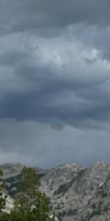
Current Weather Conditions
Weather Notes
Northern High Sierras
Central High Sierras
Southern High Sierras
Gear
Gear List
Gettin Started
Layering
Discussion
Testing yourself and your gear
Gear Reviews
Backpacking
Lower
Jack Main Canyon
Wilmer Lake
down
Jack Main Canyon
to the
Tilden Canyon Trail Junction
(Towards Hetch Hetchy)
Hiking The
NORTH
YOSEMITE NATIONAL PARK
Hiking
A SIDE ROUTE
Alternative Route
Linking
the
PCT & TYT
to
Hetch Hetchy in the Grand Canyon of the Tuolumne River
Languages
Languages
Trail Arts
The art of walking
Physical Preperation
Trail Skills
The trail
Off the trail
Scrambling
Maps
Navigation
Camp skills
Food
Resupply
Food
Other
Photo Catagories
Trail Stories
Trail Culture
News and Science
Links
Groups
Books
Terms and Conditions of Use
Trail Guide Alt Route
|
GUIDE PAGE |
7.5 Topo MAP Lower Jack Main Canyon |
30 min MAP North Yosemite Backcountry |
Sonora Pass to Tuolumne Meadows MILES AND ELES |
TOPO MAP INDEX SONORA PASS to Tuolumne Meadows |
Resupply South |
National Forest PERMITS Toiyabe & Stanislaus & Yosemite |
All maps index | ||
NORTH |
SOUTH |
Grand Canyon |
||||||||
North
Yosemite National Park
NEW
DRAFT TRAIL GUIDE PAGE
Jack Main Canyon
To & From |
|||||||||||||||||||||||||||||||||||||||||||
|
Backpacker's Necessary Information
Index
MAPSUpper
Jack Main Canyon
Detailed Backpacking Trails
MAP
| Lower Jack Main Canyon Detailed Backpacking Trails MAP |
Grand Canyon of the Tuolumne River Large-Scale Backpacking Trails MAP |
| FED PDF MAP EMIGRANT WILDERNESS Detailed Backpacking Trails MAP |
Wilmer Lake Miles and Elevations Along the PCT |
| Though this trailads. |
Backpacking Trail Information Wilmer Lake Index |
|||||||||||||||||||||
Wilmer Lake Trail Junction in Jack Main Canyon
Falls Creek Pool
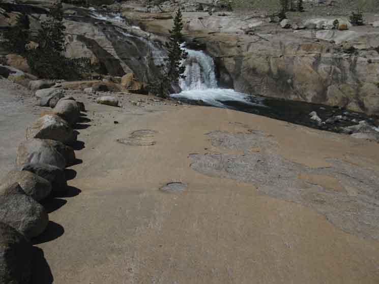
Run of Meadow & shallow descending rock surfaces
The Canyon narrows below
Into Complexity
Forest
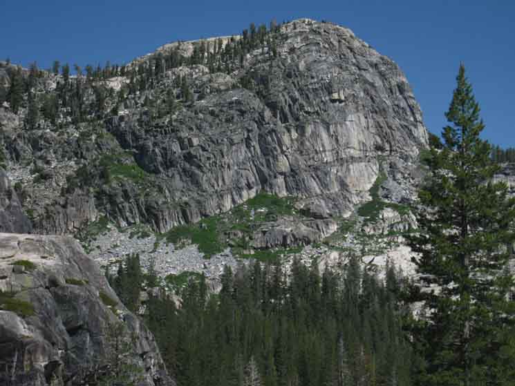
Bailey Ridge Characteristic Rock
Wildlife butterfly
To a Gap
Lake above trail to Tilden Canyon
Trail Junction |
North Weather and Road Information
All
|
||||||||||||||||||||
| > Forum < | |||||||||||||||||||||
POST UP
All backpackers can post text comments about the section covered by this guide page below through the comments links on this, and all the trail guide pages.
Registered Members can post post more information besides text, including images, maps and videos in their own posts on the Trails Forum that supplements this trail guide page's coverage of the trail from Wilmer Lake to Stubblefield Canyon.
Jack Main Canyon
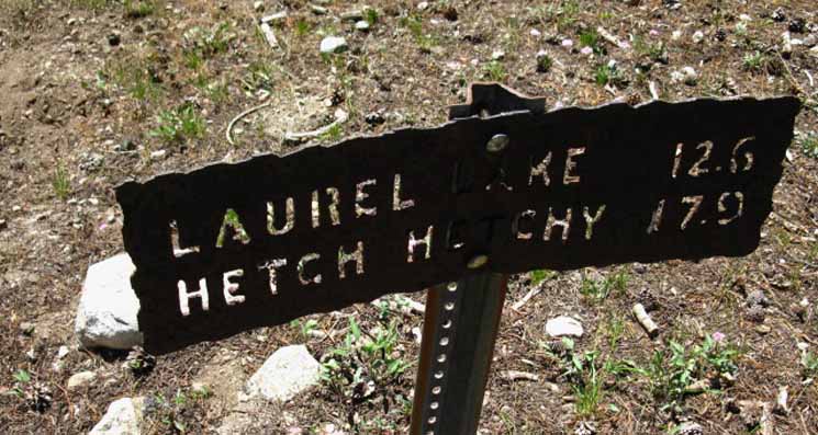 |
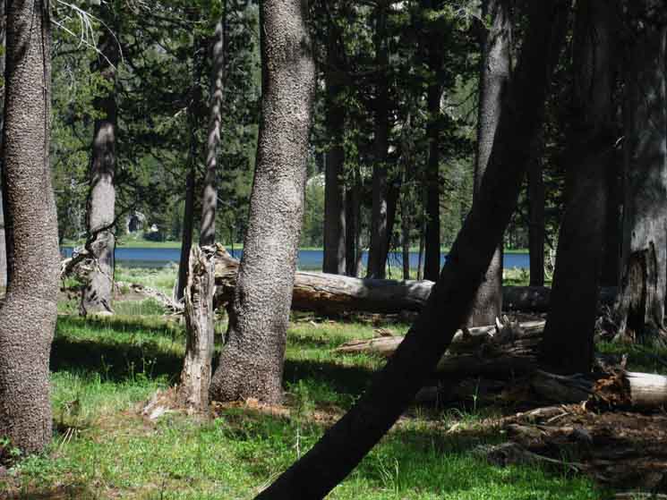
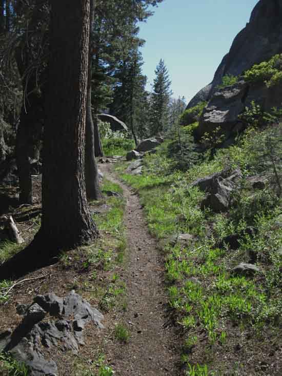
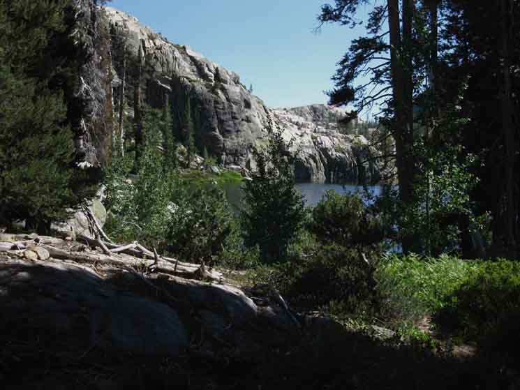
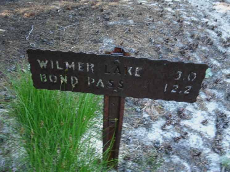
Trail sign indicating 17.9 miles from Wilmer Lake to Hetch Hetchy via Lower Jack Main Canyon. Hiking downstream from Wilmer Lake brings us through dense forest away from the Falls Creek Ford point to the South end of this little rock bowl, where our trail bends Southwest, shortly to run up along the bank of Falls Creek again. |
Down Falls Creek:
The Pool
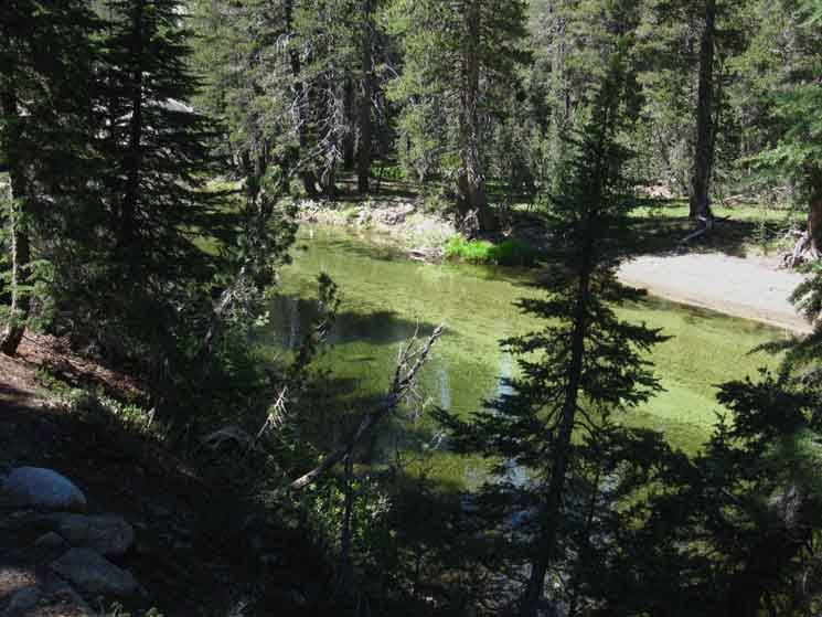 |
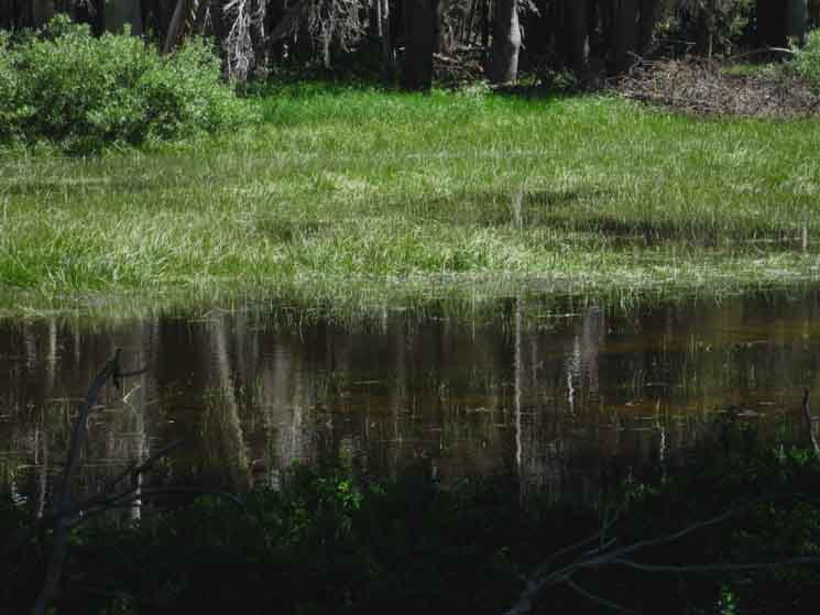
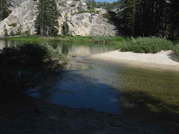
Falls Creek below Wilmer Lake forms up into a long pool, maybe a couple of hundred yards long. The interesting thing about this olympic swimming pool style pool is that it wraps around Wilmer Lake, only separated from the lake by a narrowing neck of sediments long ago deposited. It is unique here, hiking down Lower Jack Main Canyon, but is very deceptive looking for hikers on the PCT route around Wilmer Lake. I initially believed I was looking at two lakes the first time I hiked through here, which was on the PCT. I had to stop and pull out the map to clarify the situation. |
Trail Downstream
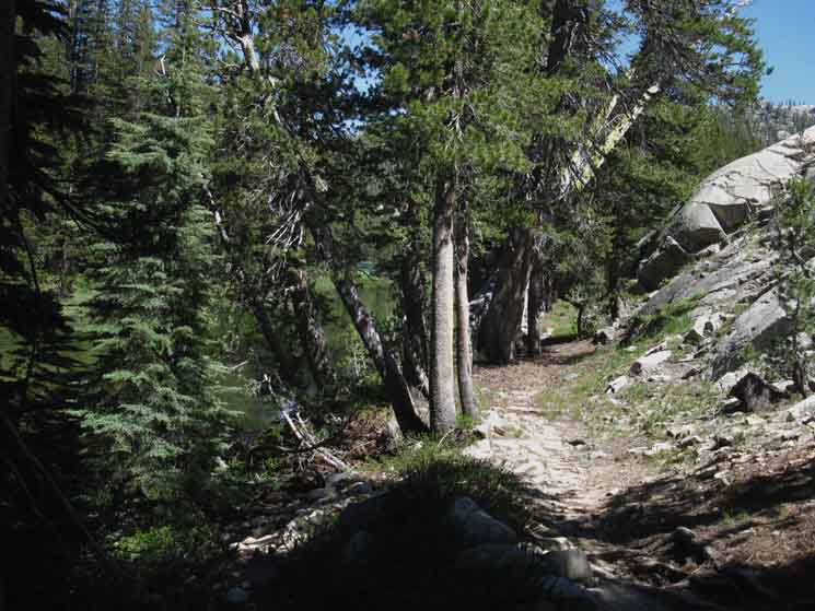 |
Trail South down Jack Main Canyon from Wilmer Lake. Pool on our Left, to our North, with granite hedging the trail on our Right. This upper segment of Lower Jack Main Canyon tracks roughly Southwest, bending almost to the West after we hike past the trail to Tilden Canyon. The "West" and "East" walls of Jack Main Canyon will soon be more accurately described as the "North" and "South" walls, respectively. That's when terms such as, "downmountain-Left," and, "an upriver Right" can supplement our compass orientation, and hopefully play a part imparting understandable context. |
Wilmer Lake across Falls Creek Pool
 |
Wilmer Lake across Falls Creek. Looking beyond the end of the pool we can see the strand of terrain dividing Falls Creek from the little dash of blue marking the location of Wilmer Lake beyond. The Pacific Crest Trail runs that strand. |
Fish
Falls Creek Pool Fish. I've got some shots of fish in the pool somewhere. |
Wilmer Lake across Falls Creek Pool
 |
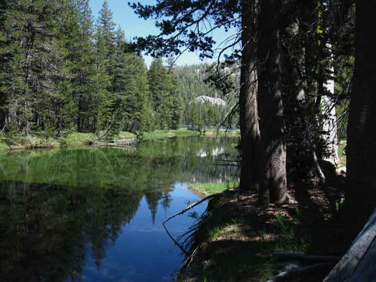
| A better look at Wilmer Lake beyond the end of Falls Creek pool, where the pool begins to transition from a placid pool feeding fish, meadow and forest, back into a force of Nature cutting granite. |
Wilmer Lake
 |
Looking across the spit of terrain dividing the pooling flow of Falls Creek from Wilmer Lake. Note the verdant apron around Wilmer Lake. That holds skeeters! |
Falls Creek
Exits
The Pool
 |
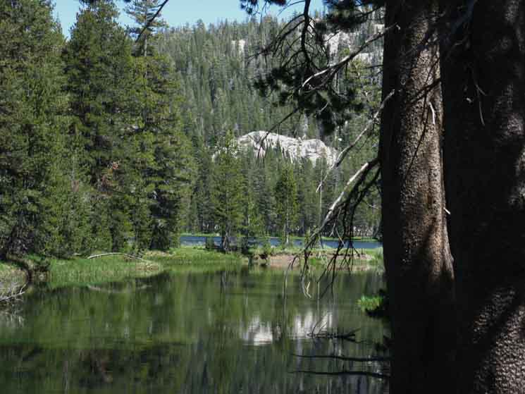
| Falls Creek picks up speed after passing through the pooling around Wilmer Lake. |
At the End of the Pool
 |
Last look at Wilmer Lake upstream across the pool of Falls Creek. |
I Spy
Two PCTers Hiking By
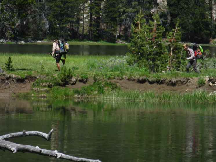 |
Pacific Crest Trail hikers crossing the strip of land separating Falls Creek from Wilmer Lake. The granite formations composing Bailey Ridge and the Western wall of Jack Main Canyon bulge out towards each other into a unique configuration pinching their East and West walls almost together. This point is just a bit further down the canyon to our Right from where the image above was taken. We are almost at the downstream end of the pool where the pinched canyon backs up Falls Creek I figure all the sediments in the whole basin holding Wilmer Lake along this segment of Falls Creek are mostly the result of erosion sweeping down sediments to be caught-up in this big "sediment trap" created by the shape and configuration of this little open bowl carved into the flank of Bailey Ridge. I suspect this whole little bowl holding Wilmer Lake is sitting on a solid granite base long ago covered by silt deposits, meadow, forest, and Wilmer Lake. |
Winter Route
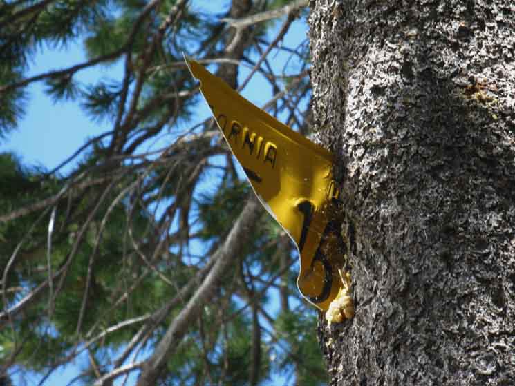 |
Old licence plates used as Winter blazes marking the trail for the snow survey and other Winter Travelers. |
Fat Creek Moving Downstream
 |
| Turning the bend around the end of the pooling section Falls Creek hurries down into short green forested area. We see a nice formation of Bailey Ridge just downriver from Wilmer lake. After its short quick run down from the pool Falls Creek widens out through this bit of gentle descent. |
Trail Work Trail Drain
 |
Trail work in Jack Main Canyon. A runoff drain. |
Wheeee
 |
| Falls Creek starts picking up some downward speed as we approach the formation on Bailey Ridge we observed above. |
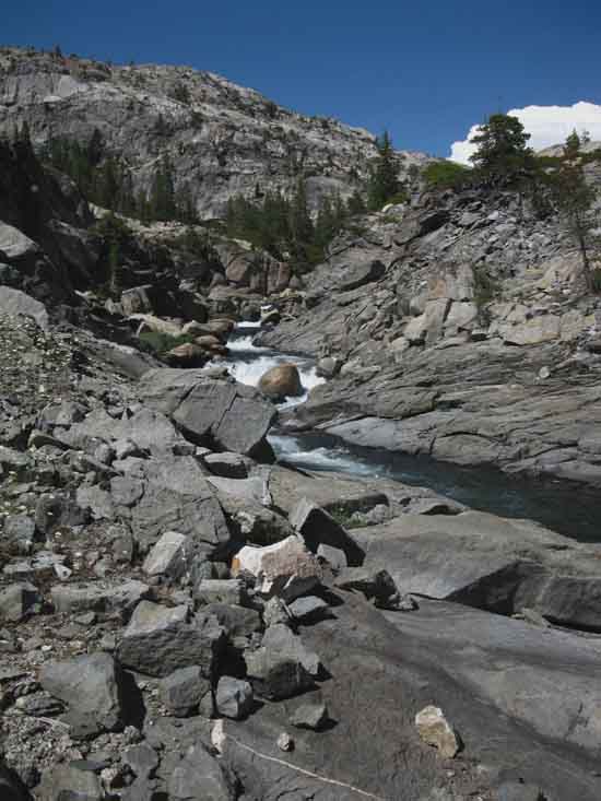
Into the Narrow & Deep
Bend
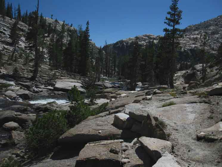 |
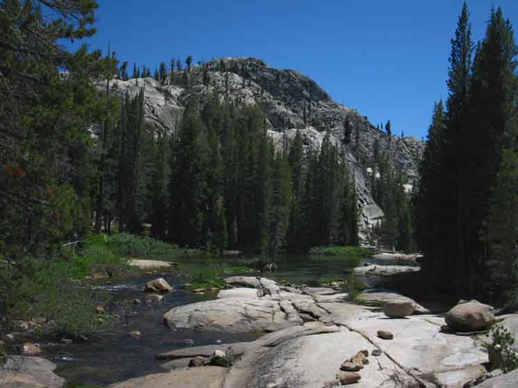
As we move down Jack Main Canyon below Wilmer Lake we begin to see, and get a feel for how our trail and Falls Creek follow the shape of Jack Main Canyon. Ahead we make out the next feature in the canyon deflecting our trail. We will follow the trail down along the base of the sheer and deep segment of Jack Main Canyon we see ahead. |
Through the
Narrow & Deep
Bend
 |
Entering the slot of the canyon looking down Jack Main Canyon. Beyond the near formation we can see another, massive pale-gray granite arm of Bailey Ridge. Beyond that we can see the dark mass of Tiltill Mountain. That's how I see them. I could be wrong. Check out and align the map the next time you hike through to the bottom-end of this gorge like section of the Lower Jack Main Canyon trail. Note the trail at our feet bending down to our Right. We're going to follow Falls Creek down into the forest in the middle-Left distant that we can see the tree tops of |
Looking UP
West Wall of Jack Main Canyon
 |
Looking up at the sheer Western Wall of Jack Main Canyon as we hike through this narrow & deep segment of canyon below Wilmer Lake. |
My Kind of Rock Garden
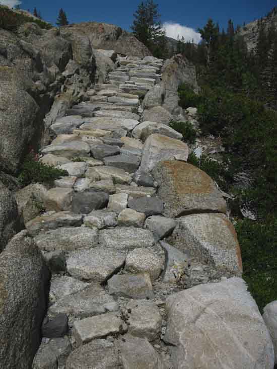 |
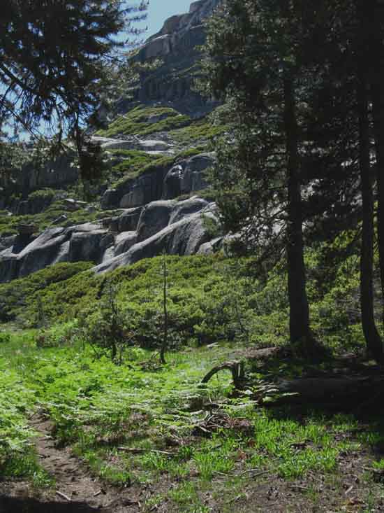
Looking back up a view of trail climbing upriver. Racked, stacked, and packed. Jack Main Canyon displays the same 100+ years of trail work that makes Yosemite so distinctive. |
Upriver Series of Mini-Falls
 |
Looking back up the canyon from the end of the gorge-like segment. Our viewpoint above, just a bit East of North, has us looking at the formation descending down to pinch off the pooling segment of Falls Creek along Wilmer Lake. As we see below, we are also much closer to the next bit of forest. |
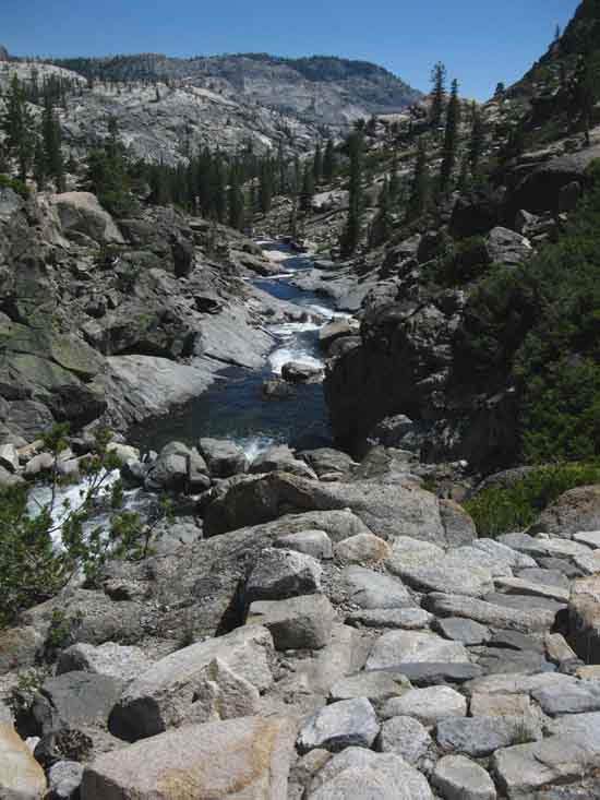
Down River
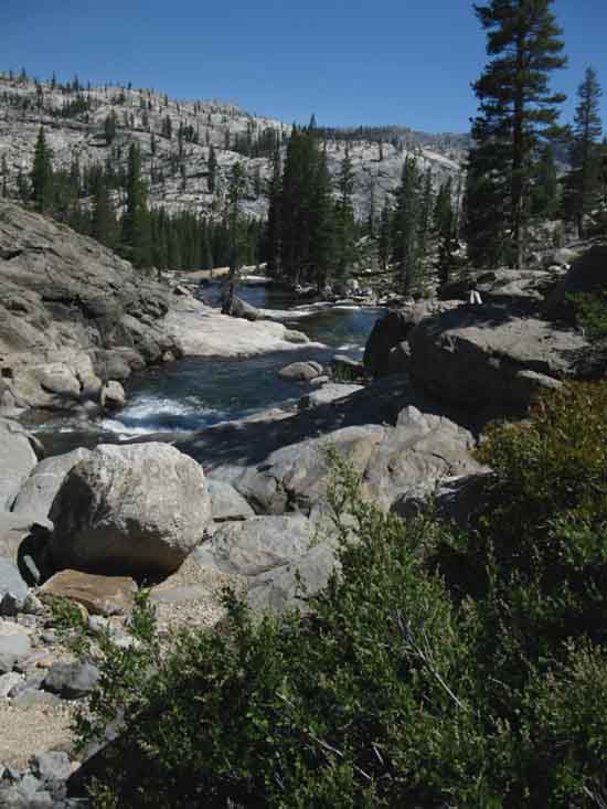 |
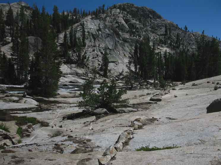
Looking downriver we see Falls Creek bending away to the East as we make our way down to the nice stretch of canyon floor with strips of forest and meadow with rising distributions of both temperate ferns and dry manzanita, the distribution determined by just how those ancient glaciers cut the literally fantastic jumble of granite peaks and ridges. We also notice it is getting warmer as we descend. |
Wildflower Walkway
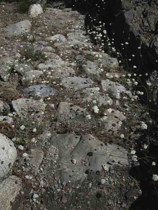 |
Sweet layer of delicate white flowers seemingly floating on air at the end of their thin threadlike stalks. The lack of traffic allows the brittle display to prosper. |
Into Forest Bits
 |
We turn around to take a look upriver after coming through the narrow slot of the canyon below Wilmer Lake, then descending into the forest. Having followed the bend of the canyon to the Southeast we've dropped into a fairly flat bit of canyon floor pointed Southwest. Little bits of meadow and thin forest along the canyon floor under some magnificent granite features. Well, that's red mountain heather under the trees. Some kind of heather |
Details-Details
 |
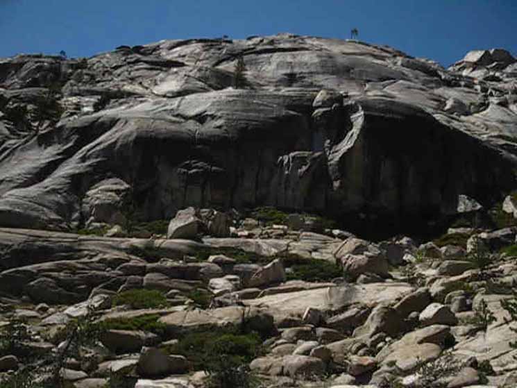
Bailey Ridge Beauty
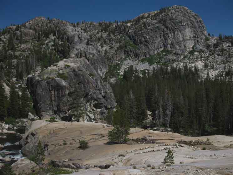 |
Distinctive line of Bailey Ridge between Jack Main Canyon and Avonelle Lake. Trail route bending towards the Southwest from the Southeast. |
Grounded at Last
 |
| Hey Good Looking! Ha-ha... Silhouette Jack Main Canyon granite sheet. |
Upriver View
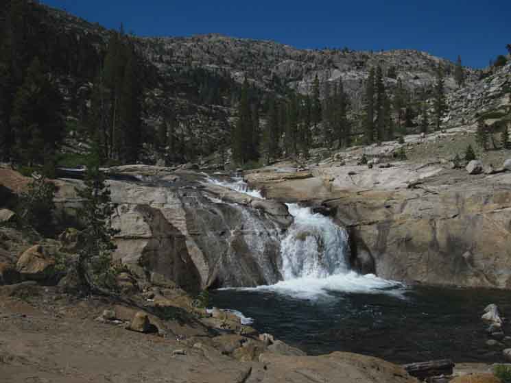 |
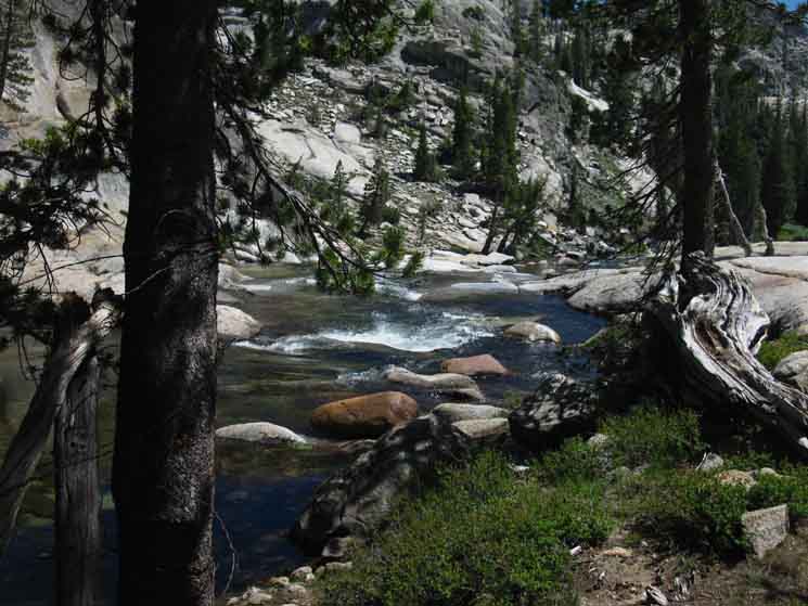
Cascading bit of Falls Creek into a small but delightful fall. |
Walk through The Park
 |
| Water, Rock, and Trail. And Liz... |
Cool Observer on a Hot Day
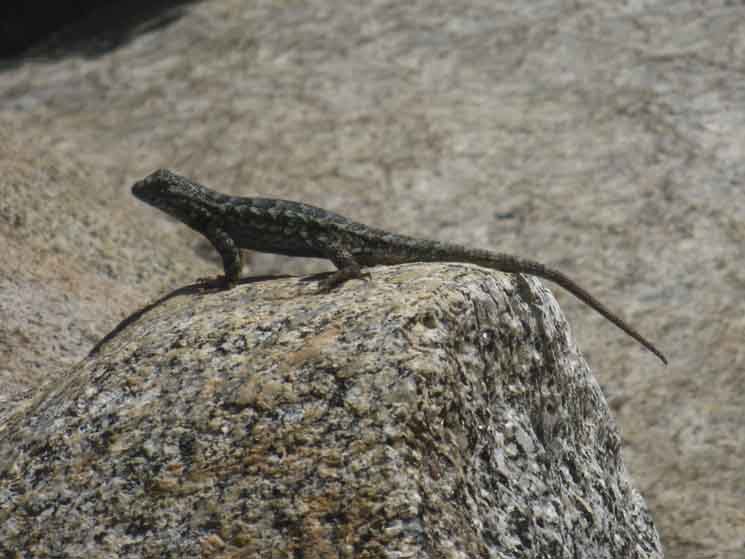 |
Lizard in Lower Jack Main Canyon below Wilmer Lake. The granite plates making up good sections of the floor of Jack Main Canyon begin transitioning between outcropping and meadow forest over covering. The physical transition is indicative of a parallel series of transitions revealing changing aspects of the web of life as we move across elevations, composition of terrains, and exposure aspects. |
Hey
 |
||||
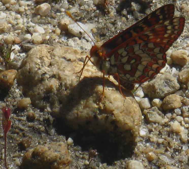
Butterfly and bud.
|
The Winter Route
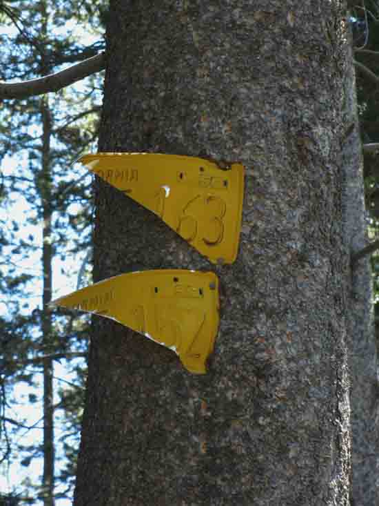 |
We see the 1956 licence plates marking Winter route above trail junction leading East to Tilden Canyon Creek below Wilmer Lake. |
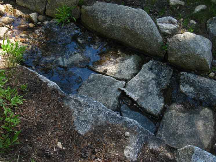
Boggy-Meadowy-Pondish
 |
| Not quite a lake, not quite a meadow, this super-saturated terrain may turn into a pond. |
View Southwest
 |
Southeast Flank of Peak 8273 descending to our Southwest as we hike to the narrowing end of this long, wide run of Jack Main Canyon. |
View Northeast
 |
Looking Northeast The nice meadow with all the brush before us, likely holding lots of berries and other goodies during Spring, are complimented by a quick run of bear signs as we run up to and though a gap before dropping down to the trail junction to Tilden Canyon to our East. |
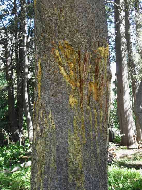
Bear Signs
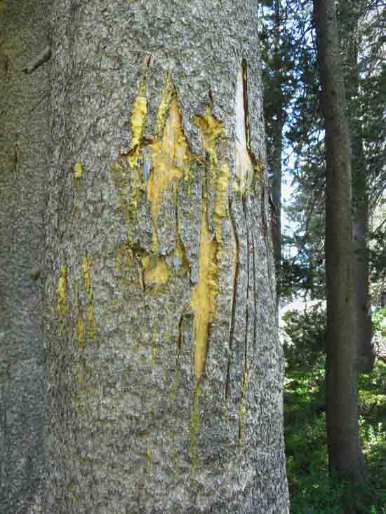 |
Bear slashed lodgepole in Lower Jack Main Canyon. |
Bear Scat
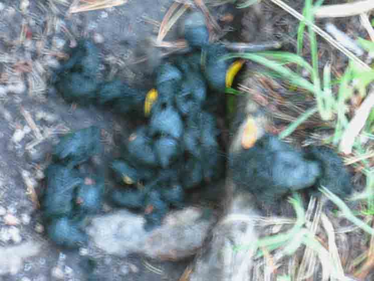 |
| Bear dookie along the trail in Lower Jack Main Canyon. |
Bear Notes
 |
Another bear slashed tree not far from the previous. |
Along West Edge
of
Lower
Jack Main Canyon
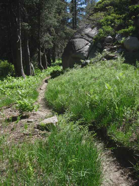 |
| Hiking through forest and meadow segment down Lower Jack Main Canyon. |
Pond Above Trail Junction
to
Tilden Canyon
 |
Pond in Lower Jack Main Canyon just above trail to Tilden Canyon. |
West Edge of Jack Main Canyon
 |
Climbing to a low gap as we approach the trail East to Tilden Canyon. Falls Creek has turned South-Southeast (to our Southbound Left in the image above), to circle around this feature we are "gapping" above. Falls Creek and our trail will rejoin at the trail junction and ford point for the trail East to Tilden Canyon. |
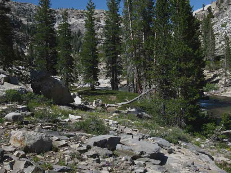
Temperate Zones
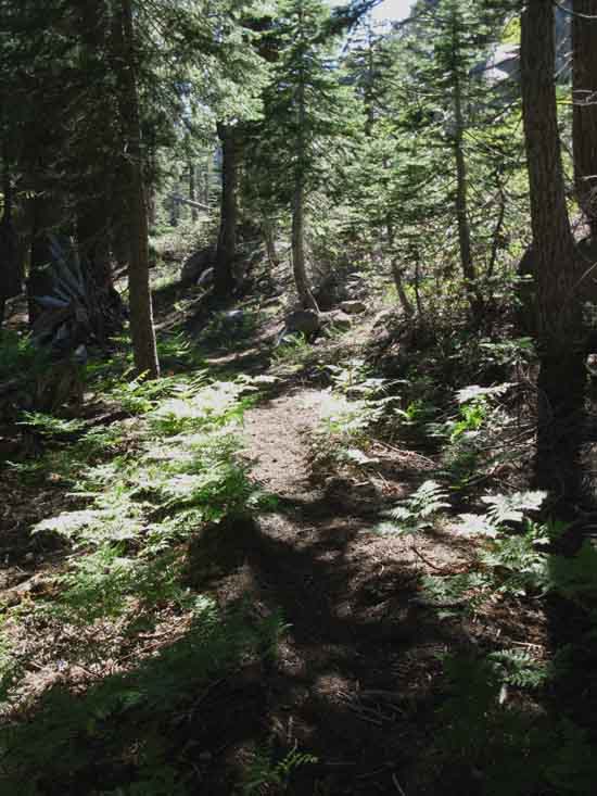 |
Fine example of temperate forest in Lower Jack Main Canyon, Yosemite. |
Butterfly
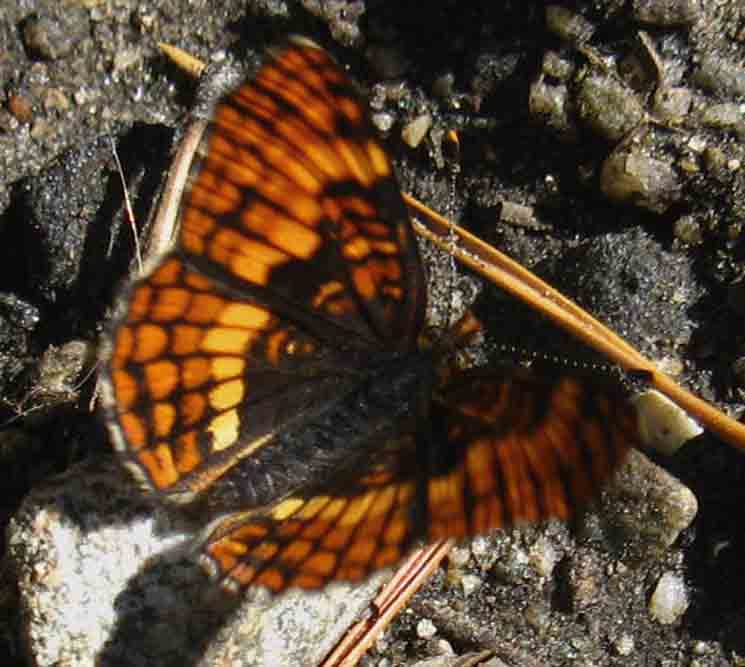 |
| Butterfly in Lower Jack Main Canyon. |
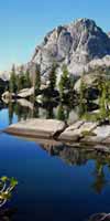
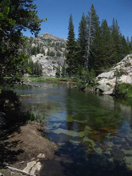
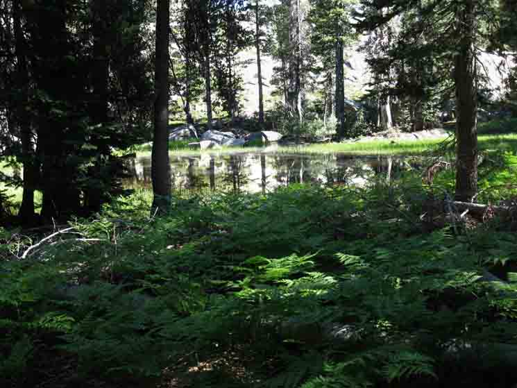
Lake Above Trail Junction
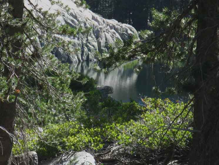 |
We reach a small lake before arriving at the trail junction East to Tilden Canyon. |
Rotating Around
the
Lake Above Trail Junction
 |
Views of the Lake above the trail to Tilden Canyon from Jack Main Canyon. |
Lake Upstream of Trail Junction
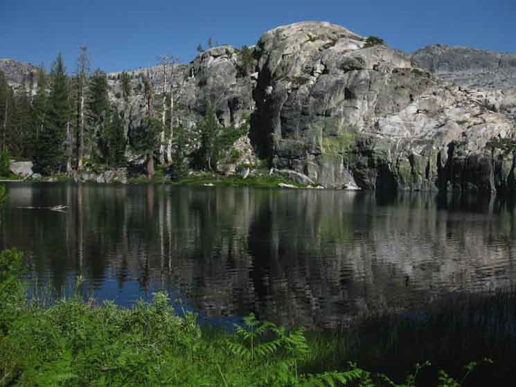 |
View Northeast across Small Lake above trail to Tilden Canyon from Jack Main Canyon. |
Lake Above Trail Junction
 |
View North across Small Lake above trail to Tilden Canyon from Jack Main Canyon. |
Miles to Hetch Hetchy
EAST
via
Tilden Canyon
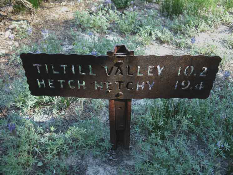 |
Trail junction in Lower Jack Main Canyon to Tilden Canyon. |
Miles Up Jack Main Canyon
 |
Up Jack Main Canyon. Distance up Jack Main Canyon from trail junction to Tilden Canyon. |
Falls Creek Ford
to
Tilden Canyon
 |
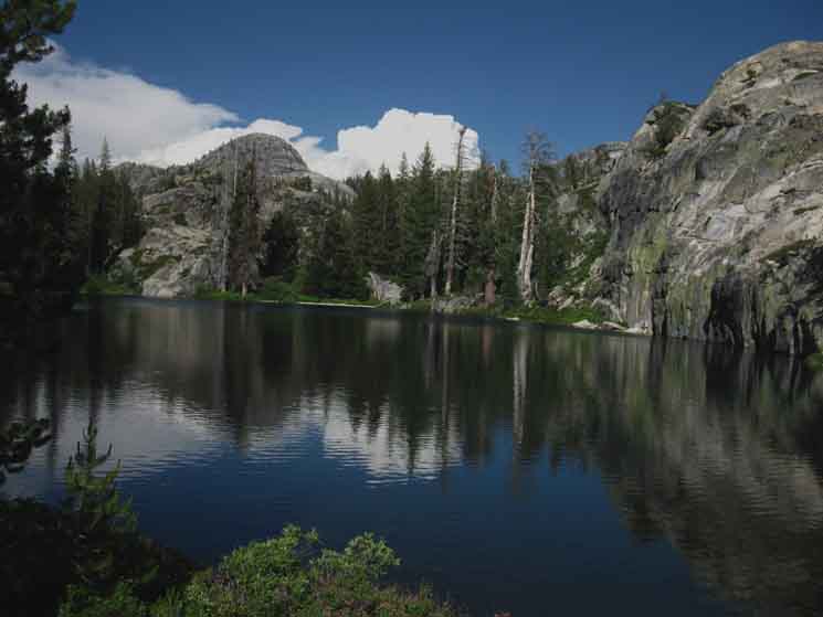
TRAIL JUNCTION This trail climbs Northwest over the beautiful Bailey Ridge, giving access to Avonelle Lake, before descending into Tilden Canyon. This trail drops into Tilden Canyon at just the point where the canyon is turning Southeast to merge into Rancheria Creek, and the trail coming South down from the PCT-TYT is climbing out of the turning canyon to continue South along the ridgeline down to Tiltill Valley. Trail Junction to Jack Main Canyon from Tilden Canyon We last saw Falls Creek at the end of the long meadow-kinda flat section upriver, where it bends around the rock formation with the gap we hiked through. Now it's back after circling all the way around the rock feature. At this point Jack Main Canyon bends more to the Southwest while another arm of the canyon runs on a line pointed thirty degrees further South. Do check out the map of this very complex terrain. This is wild scrambling terrain for advanced outdoors folks. The two cuts of the canyon split on Andrews Peak. |
North, South, and East
of the
Tilden Canyon Trail Junction
in
LOWER
Jack Main Canyon
|
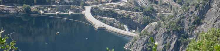
Hetch Hetchy Trailhead
Mileages
Trailhead Distances |
Trailhead Distances from Hetch Hetchy Trailhead up to Rancheria Falls & Beyond |
North: Upper Jack Main Canyon South: Tilden Canyon Trail Junction to Hetch Hetchy
Trail Junction |
||
The Next Canyon to the East Next Page South THIS PAGE IS UNDER CONSTRUCTION: STAY TUNED FOR MUCH MORE! COME ON BACK NOW, 'YA HEAR?
Trail
Maps
|
Backpacking Trail Guide North NORTH |
 |
Backpacking Trail Guide South SOUTH |
Backpacker ForumsHave a great trip or story to relate about Yosemite or in the Sierra Nevada? Post it on Above we come to the Front Page of the High Backpacking Trails and Topics Forums. Below we break the forums down into categories:
The Trails Forum acts as your place to put up input, comments, relate your experiences, or ask questions about each segment and spot along the length of our combined TYT-PCT-JMT trails. The Forum is your place to supplement the trail guide. Anyone can post text comments in the existing forums, but only members can post up new topics, along with images, maps, and formatting. If you have experiences, comments, questions, or pictures and videos of the Pacific Crest Trail between Sonora Pass and Tuolumne Meadows, post up here as an unknown hiker or as a member: Forum Section
|
Trailhead
Contact
Alex Wierbinski

Backpacking Lake Tahoe to Mount Whitney
Your Guide to the High Sierra Crest, including the Tahoe to Yosemite, Pacific Crest, and John Muir Trails
