

at Camp 13
The Trails
Guide
Maps
Miles/Ele
Permits
Resupply
Forum
Current Weather Conditions
Weather Notes
Northern High Sierras
Central High Sierras
Southern High Sierras
Gear
Gear List
Gettin Started
Layering
Discussion
Testing yourself and your gear
Gear Reviews
Trail Segment
Tuolumne Meadows
to
Lower Cathedral Lake
Trail Section
Tuolumne Meadows to Yosemite Valley
BACKPACKING
YOSEMITE NATIONAL PARK
Section Hiking
The John Muir Trail
South
to
Happy Isle
Languages
Languages
Trail Arts
The art of walking
Physical Preperation
Trail Skills
The trail
Off the trail
Scrambling
Maps
Navigation
Camp skills
Food
Resupply
Food
Other
Photo Catagories
Trail Stories
Trail Culture
News and Science
Links
Groups
Books
Terms and Conditions of Use
| Trail Guide INDEX Tuolumne Meadows to Yosemite Valley |
Trail Guide Trail Guide |
Trail Guide JMT SOUTHWEST Cathedral Lakes to Sunrise High Sierra Camp |
7.5 |
30 min |
MILES Tuolumne Meadows to Yosemite Valley MILES and ELEVATIONS |
TOPO MAP INDEX Tuolumne Meadows to Yosemite Valley |
Resupply South |
National Park PERMITS Yosemite Backpacking PERMITS |
|
Page Below
Tuolumne Meadows
to
Cathedral Lakes
Detailed Map
Miles & Elevations Tuolumne Meadows to Yosemite Valley
Backpacker Resources
North and South Except maybe with some disdain. Our transition from North to South Sierra was simply marked by passing through Tuolumne Meadows from the North to South Sierra Crest. This simple transition always seemed to me to be too quickly dismissive of the deep run of granite down to and back from Yosemite Valley. It is this run of granite that the whole world pictures when they hear the words, "Sierra Nevada." The page below begins our deflection off of our typically exclusive high altitude routes along the High Sierra Crestline to dip down along the John Muir Trail into Yosemite Valley to sample its treats, treasures, and tourist traps. Everything is thick down there, the good, the bad, the ugly, and the beauty. We'll execute the return leg of our route by deflecting off the JMT to hike up the Merced River to Merced Lake above Little Yosemite Valley. We will eventually intercept the JMT just a bit over five miles South of where we first turned off the Crestline for our hike down to The Valley from Tuolumne Meadows.
This Day
The Golden Triangle |
|||||||||||||||||||||||||||||||||||||||||||||||||||||||||||||||||||||||||||
Being here on this trail guide page indicates we have decided to add the alternative route of the Golden Triangle Route down to Yosemite Valley from Tuolumne Meadows, and back, to the overall length of our Sierra Crestline backpacking trip from Lake Tahoe to Mount Whitney.
Start Point What goes in must come out... That's the Golden Triangle, in a nutshell. From Vogelsang High Sierra Camp our decision to either return to Tuolumne Meadows, where we began the Goldern Triangle, or to intercept the Southbound John Muir Trail in Lyell Canyon to follow it South out of Yosemite depends on the nature of our trip. Back to the JMT
Two
Details
Resupply Strategy
Good for All
Out of the Fire,
I may well make Tuolumne Meadows backpacker camp my first hitch-hiking destination after departing the Whitney Portal at the end of the trip. I find the atmosphere at Tuolumne Meadows and its Backpackers Camp nice places to moderate my transition back into "civilization" after such a long trip in the wilderness. Tuolumne Meadows also offers good hitch-hiking to anywhere.
Side Tripping
|
Let's Roll
After visiting the beehive of Yosemite activity we will hike into a place where most folks will only see us if we want them to, before finally jumping back onto the John Muir Trail for the hike down to Reds Meadow. That's our well-balanced long distance hiking plan adding in the Golden Triangle to our Tahoe to Whitney backpacking trip. Now we just have to do it.
Let's Roll
Trail Information
Length Depth
|
Why the Golden Triangle?
'Cause it's Beautiful !
The beauty along our lines down to and back out of The Valley are quite remarkable, as is this whole "Golden Triangle" side trip. This section of trail is world renowned for the wide scope of its deep beauty all packed within such a short distance.
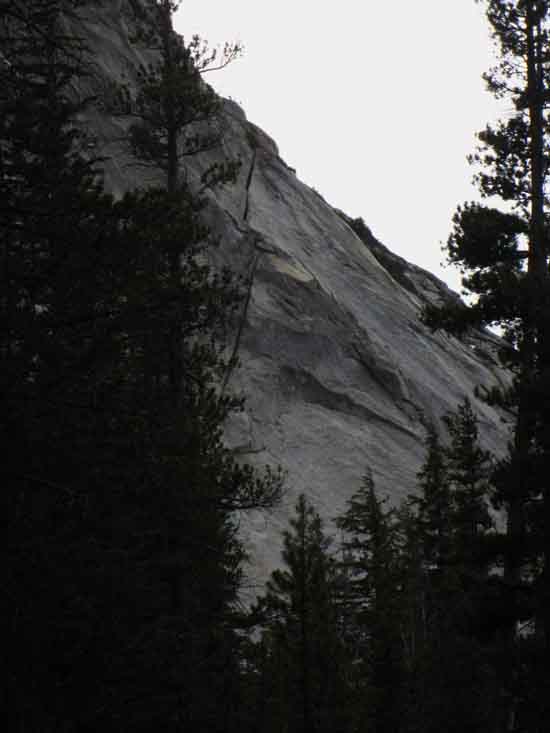
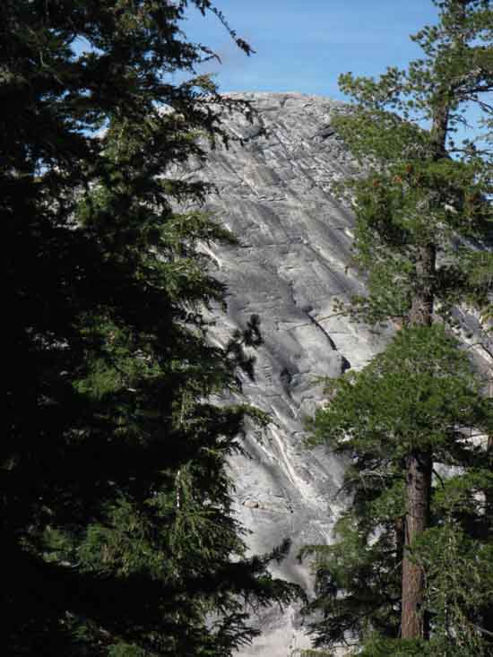
Into the Rabbit Hole One thing is for sure: hiking down to the Valley Floor will be a very different experience from our last two grand sweeps down the Western Flank along the route of the TYT. Though both our previous low points of elevation brought us through beautifu terrain, neither of them ended in anything resembling the Natural and human spectacles composing the scene in and around the floor of Yosemite Valley itself, let alone hiking down and back through the majestic terrain of the Cathedral Range with grand views of the Clarks Range rising above the Southern Shores of the Merced River above Yosemite Valley. This is one interesting rabbit hole.
Viva La Difference Most interesting to me is the terrain. The biggest difference between our hike down to Yosemite Valley and our other low points along the Tahoe to Yosemite Trail is the unique run of granite terrain from the Cathedral Crestline down to the 4000 foot Valley Floor, and back up to the crest again. The great granites of Central Yosemite descend further down in elevation than any other part of the Sierra, and this vast swath of high to low elevation granite terrain stretches across the whole width of the Golden Triangle and its Merced River Watershed down to Yosemite Valley. That is interesting. Very interesting, and worth the extended efforts of adding the Golden Triangle to the length of our Tahoe to Whitney backpacking trip to investigate. |
The Third
and
Deepest
of our
Great Descents
Each of our previous grand descents along the TYT brought us down through zones of life as we lost elevation, as does our descent into Yosemite Valley. Our previous descents also brought also brought us further down-mountain from the concentrations of exposed granite typical of the Sierra Crest.
In Comparison We are still surrounded by an ocean of granite when we descend below 7000 feet on the John Muir Trail hiking down to Yosemite Valley. Though it is an ocean of granite now covered and collared by dense middle-elevation forests and lower-down by thickets of low-elevation manzanita and generous runs of aspen as we descend even further, Central Yosemite is fundamntally a vast ocean of granite terrain running from the 11000 foot crestline of the Cathedral Range down the West Flank of the Sierra to the 4000 foot floor of Yosemite Valley. I find it strange to see such magnificent expansive granite at such low elevations. Awe inspiring...
Dropping Elevation and Maintaining Standards?!
Social Elements
Balance of Contradictions Many less experienced backpackers gain comfort from the proximity of many other hikers. Others find the "social" aspects of highly regulated, high-density backpacking somewhat uncomfortable.
There and Back
Again Yosemite is the "maximum experience," in terms social and physical, in terms that can be
The Full Monty I normally don't say this, as life is not a game and I despise "players," (bug, meet heel...) but this is a natural stage you want to be "playing" on. I say jump on this grand stage and start dancing! Well, at least start training and collecting gear and experience so you can hike into its heart, |
Local Scene
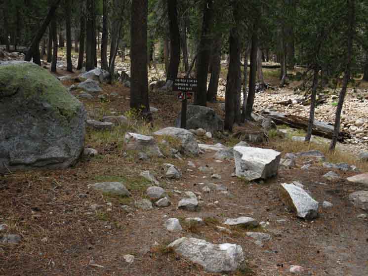
To Cathedral Lakes
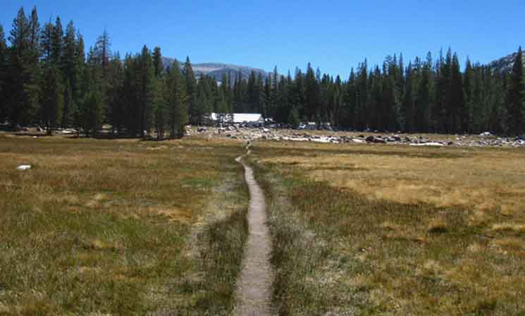
Our first steps Southwest out of Tuolumne Meadows entails hiking four miles up almost a thousand feet of elevation to the two small associated basins nested-in under Cathedral and Tresidder Peaks, each holding one of the Cathedral Lakes. Crossing Cathedral Pass begins our plunge down to Yosemite Valley. Well, we actually don't hit the high point of the trail until we pass under Colombia Finger, which location is a bit higher than Cathedral Pass. We will follow tributaries of the Merced Watershed down to the edge of the Canyon of the Merced River, then down onto the floor of the canyon itself to reach the main flow of the Merced to follow it down into the heart of Yosemite National Park pulsing with all sorts of activity in Yosemite Valley. |
INTRODUCTION
Into
Central Yosemite Wilderness
Nature of the Golden Triangle Section
Up & Down
The Sierra Crestline
Terrain Complexity Rush Creek drains the basin under the location where the South ends of the Cathedral Range and Kuna Crest butt-up against the the North end of the Ritter Range. Rush Creek drains the great basin under these flanks East into June Lake, eventually. These two maps below lay out the interface between the Central and Southern Yosemite Wilderness topped by the Cathedral and Clarks Ranges, the actual Sierra Crestline composed of the Kuna Crest, the Ritter Range to the South of Donohue Pass and the Southern Yosemite boundary. This delightfully complex terrain can absorb as much exploration as we can invest. It can eat six of me, and demand desert. |
| Central & South Yosemite Hiking Map 30 minute topo hiking map |
Donohue Pass to Fish Valley 30 minute topo hiking map |
I really enjoy the Western Flank views of all this while hiking along the rim of Merced Canyon below
Sunrise High Sierra Camp.
Getting down to Sunrise High Sierra Camp marks where we begin traversing off the flank of Sunrise Mountain and out of the subordinate canyon of the Cathedral Fork of Echo Creek to line ourselves up with the position where the fold in the mountain that Sunrise Creek will begin flowing down to the Merced River.
Word Failure |
Floor of the Merced River Canyon
Little Yosemite Valley
Our route along the John Muir Trail finally drops us into Little Yosemite Valley. Little Yosemite Valley is the last and Westernmost of this series of little mixed forest and meadow valleys sprinkled along the length of the Merced River Canyon. Wow. What a way to end our run down the West Flank of the Cathedral Range and begin |
Little Yosemite Backpackers Camp
Merced River Swimming Hole-Beach
There's even a nice, safe "swimming hole" slow-moving section of the river with a very relaxing sand beach, just beyond the trail junction South of Little Yosemite Valley Backpackers Camp. Here at Little Yosemite Valley the Merced River takes a leisurely moment flowing gently past the Backpackers Camp before picking up whitewater speed for its dramatic plunge off Nevada Falls to make its final grand entrance into The Valley. I would not enter the water any closer to Nevada Falls. |
Final Grand Descent
From the edge of Nevada Falls we will work our way down an arc of trail carved, almost tunneled into the sheer living rock of the dramatic cliff face mentioned above, cliffs reaching straight up to the uppermost rim of Yosemite Valley, up to Nevada Falls from the John Muir Trailhead at Happy Isles. It is a lot of fun hiking in and out of The Valley. Hard fun, but deep fun.
Double Trouble Happy-Happy Isles!
Facing the Music The grind up the mountain on the way out is a classic climb. Trail Difficulty & Backpacker
Into the Ocean Us solo backpackers must be girded for lots of contact. |
Hinterland to Heartland
We've been hiking across the remotest routes in the North Sierra for a couple of weeks since departing the Tahoe Basin. Things change when we enter Yosemite National Park. The transitions into increasing levels of activity began in earnest entering Yosemite National Park, picked up speed as we approached Tuolumne Meadows, and will reach "full to capacity" density-status once we hike through Tuolumne Meadows along the John Muir Trail down to The Valley. I mean step through the Happy Isles Trailhead into Yosemite Valley. Shit gets crazy once we reach the Half Dome trail junction, and the highest density of trail traffic walks with us from there down to The Valley. We can see the change reflected in the physical character of the trails. We can see the change in the people on the trail.
Easy in, Easy out Entering Yosemite National Park into Jack Main Canyon we are hiking into intensifying zones of what can only be called increasingly "structured" hiking, increasingly regulated access, eventually hiking into areas of defined "backpacker camps," as we get closer and closer to Yosemite's most populated areas. Each step we take South on the main trails towards Tuolumne Meadows brings more contacts, with all activity increasing in stages of intensity as we pass TM and draw closer to Yosemite Valley and its facilities, until we finally enter that mixed-up heart of Yosemite National Park, and experience the tragic beauty of Yosemite Valley. We experience a unique and strange mixture of inherent natural tranquility layered with increasing human contacts until we finally step onto the insanity on floor of Yosemite Valley. I know my "adjustment" is going well when I enjoy this long transition. Especially if the herds of day hikers trudging dutifully up the Muir Trail to the Mist Trail junction were paying enough attention to not drive me off-trail as I attempted to descend through them. Sigh... You got rides? We got rides! Giddy-up, Dude. Rich folks can "buy" the ultimate in "natural" luxury experiences in Yosemite Valley and through tours of the High Sierra Camps, as they buy premium experiences in Disneyland. Yosemite Valley is much like the sad Orcas imprisoned in glass swimming pools for the observation and amusement of fat tourists. Free Yosemite!? Stupid Human Tricks More is not necessarily better. Do we really want Nature to be a tourist attraction for hundreds of millions of mega-city inhabitants? Is that Nature? Is that the "role" of humans on Earth? Nature is the factory of accurate observers. Cities manufacture idiots. |
So Different
Backpacking through Central Yosemite is going to be a much different experience than hiking the remote trails in the Carson Iceberg and Mokelumne Wilderness Areas in terms of trail traffic and trail culture. One is dominated by man, the other by Nature. Up there in the North Sierra we tread trails that look and feel like no-one has trod them for a century. Down here we have trails showing the polish and wear of a century of constant use. We are entering a unique physical and social reality when we hike across Yosemite. Man and Nature in such close interaction reveals much about both, if we look closely. An interesting contrast in our experiences over the time and space of our hike has developed, being a relationship between density of use and the quality of experience. This relationship deepens, or at least becomes more apparent as we get closer to The Valley. The nature of people, and how we perceive and frame nature changes the further we get away from large groups of people. Nature predominates. The predominance of man's influence returns as we move closer to large population centers, even "seasonal" big cities, such as Yosemite Valley. Chorus of Angels Vs Chorus of Crap I call it destruction. This contradiction becomes starkly apparent in Yosemite Valley. In Yosemite Valley the noise of loud crowds, ceaseless traffic, and cities of car campers with armies of foot-tourists creates a city-like social reality, a din, all surrounded by the silent screaming beauty, the true Power of Nature that drew us all here in the first place. We are the contradiction that drives off that we seek, unless we are careful. Let's Explore these, our contradictions, to see how the beauty of Nature affects the behavior of man, and how man affects Nature as a sub-theme of our hike through Yosemite National Park. In fact, I suggest you run this test on yourself, to see how moving through degrees of isolation from deep Nature to deep natural Disneyland affects your being. Soothes the Savage Beast? Or sets it Free? Shreds the "box" it came in? We'll see! |
| Tuolumne Meadows Hiking Map 15 minute topo hiking map |
Tuolumne Meadows to Yosemite Valley Miles and Elevations |
Hiking Southbound
on the
TYT-PCT
into
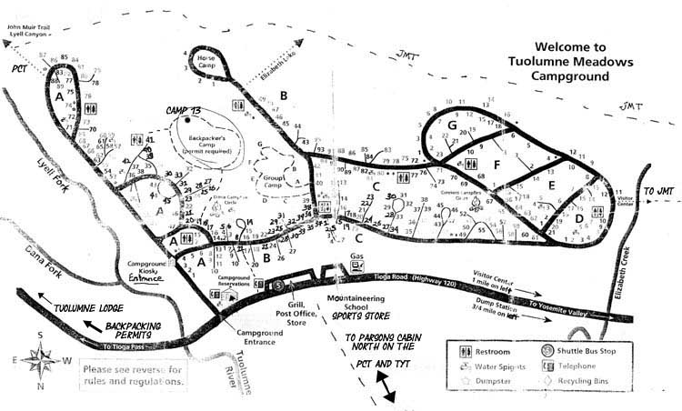
Tuolumne Meadows Main Backpacker Facilities
Layout and Location
Also See
Tuolumne Meadows Resupply Page
&
Tuolumne Meadow Permits
 |
|||||||||
On the far side of the white canvas Store is the main road of the Tuolumne Meadows Campground. Highway 120 runs East and West past the front, this side, of the Tuolumne Meadows Store. Both roads track East and West beyond the Left and Right edges of the image of Tuolumne Meadows Store above. Tuolumne Meadows Hiking Map Southbound Remember, camping is prohibited within four miles of Yosemite Trailheads. This means picking up our resupply, getting it packed, and having some food and fun while leaving enough time to get at least four miles from our trailhead before dark. I always stay a night or two in rest and resupply mode at Tuolumne Meadows. JMT to The Valley The Tuolumne Meadows to Donohue Pass guide page is for Southbound hikers remaining on the Sierra Crest. We can cut to the Right passing around to the back of the store to follow the Campground Road West to where we first encounter the trail to Lake Elizabeth, and hiking past that we next encounter the John Muir Trail to Cathedral Lakes behind the Tuolumne Meadows Visitor Center. That puts us on our way to follow the classic JMT route down to the famous Happy Isles Trailhead in the world-renowned Yosemite Valley. By "famous," I mean really-really busy. A "you can't believe how busy," world-renowned level of busy. The beauty of Yosemite Valley and its surroundings either equals, exceeds, suites, or falls short of the expectations of each backpacker confronting a place as busy and as regulated as are the Central Yosemite Wilderness and The Valley. Only you can decide which judgment/experience applies to you. And when it applies. The Central Yosemite Wilderness and Yosemite Valley which are so busy during the height of Summer can be quite peaceful and quiet early and late in the hiking season. The timing of our Yosemite trips is going to affect their nature. The timing of our trips determines the level of activity we will encounter, even down to the day of the week and time of day we hike a particular segment of trail, especially the famous trails to famous places. The Golden Triangle is best executed during the week and as far away from major Summer vacation period holidays as practically possible. This will keep us off crowded trails during peak periods of use. Planning Long Distance High Sierra Backpacking Trips
Our TAHOE to WHITNEY Route Options
What You Gonna Do? I think of this as adding or skipping the Golden Triangle Alternative Route on our hike from Tahoe to Whitney. Questions, Comments, and Your Experiences making this decision Welcome: Golden Triangle
|
TUOLUMNE MEADOWS
Federal Facilities Maps
 |
||||||||||||||
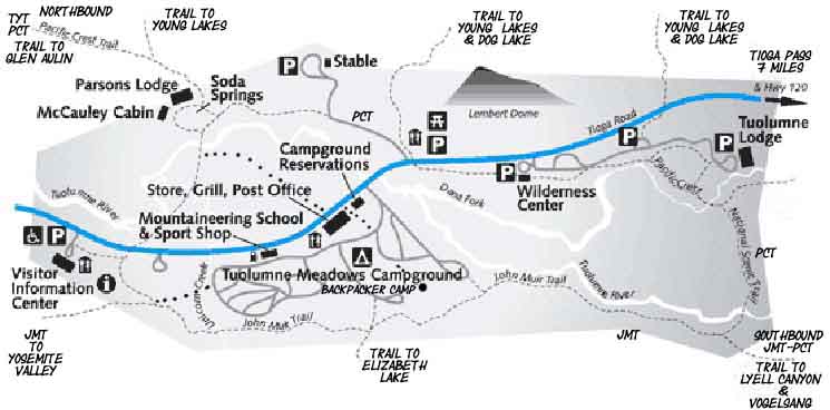
Map showing relationship of our position to the North and Southbound routes of the PCT and John Muir Trail. If we are Southbound onto the John Muir Trail we have a couple of ways to get to the John Muir Trail, depending on if we are staying a couple of nights in the backpacker camp or hiking directly to the JMT. I am kicking it here for two nights, so I am going to rest and feed up before dropping into The Valley. Here's a better map, but upside-down from my North to South way of looking at things.
Miles and Elevations RESUPPLY & PERMITS We've got guide pages on Tuolumne Meadows Resupply and Permits
Comments and/or Questions? Tuolumne Meadows Resupply & permits current information and questions requested.
|
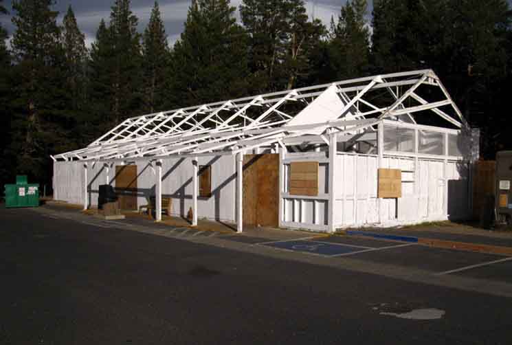 |
Tuolumne Meadows store after being made ready for Winter Closure. |
Local Conditions
Summer Storm Video
Tropical Thunderstorms in the Sierra
High Sierra Backpackers Camp, Tuolumne Meadows
Tuolumne Meadows Hiking Map
|
Tuolumne Meadows Landmark
Lembert Dome
 |
Lembert Dome is the predominate landmark within Tuolumne Meadows, besides the meadow itself. Above we are gazing across the Face of Lembert Dome from Tuolumne Meadows while transitioning from the TYT to the JMT, and afternoon into evening. A Morning View of Lembert Dome.
|
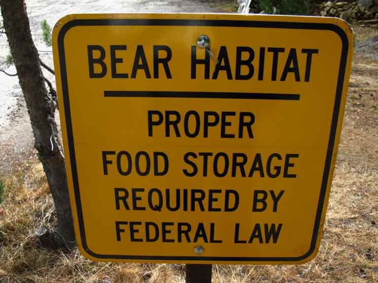
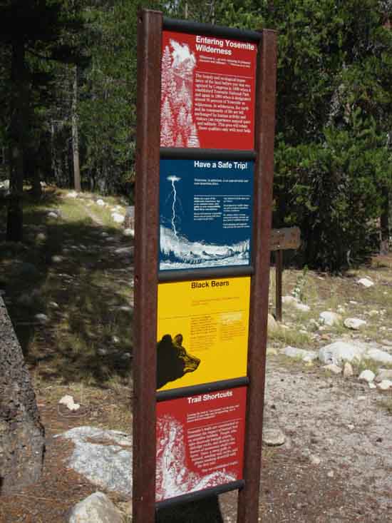
Sign in the
Tuolumne Meadows Car Campground
 |
||||
Federal Law, common-sense, and basic practical safety all require we carefully control our food. This is a road sign in the Tuolumne Meadows Car Campground. Bears plague the luxury of the Car Campers, even when they obey all the rules. I find it impressive to know that bears have ripped car doors off. I have not yet seen it personally, but just the knowledge of the ability makes me feel good, for some strange reason. I guess it's that security does not come with walls and doors, but only with good practices. Everything else is voodoo, guesswork, and avoidance of responsibility. I figure that the logic behind bear behavior provides an informative context for understanding the stark differences between how Nature works in direct contact with typical human behavior and assumptions. That's why they have "Bear Rangers" patrolling human encampments in Yosemite. Nature will eventually eliminate all bad practices, but I like to be ahead of that curve.
|
Video
Tuolumne Meadows
to
Cathedral Lake
| John Muir Trail
Crossing The first section of our Golden Triangle Alternative Route through Yosemite Valley as we hike the length of the High Sierra from Lake Tahoe to Mount Whitney. I avoided these sections for years due to fears of overcrowding, but my curiosity overcame my trepidations, and the results confirmed my original conclusions. Central Yosemite Wilderness centered on Yosemite Valley is one of the natural wonders of the world, while simultaneously providing a most dramatic showcase for both the folly and sensitivity of man. Video Title Image |
|
||||
Hiking around to the backside of the Tuolumne Meadows Store, Grill, and Post Office we find the Campground Road running East-West roughly parallel with Highway 120. We're going to break-off our normal transition from the PCT-TYT hiking South down the Northern Sierra onto the JMT-PCT hiking South down the South Sierra at Tuolumne Meadows. Instead of staying up on the Sierra Crest passing through Tuolumne Meadows, we're going to detour down to Yosemite Valley as part of our hiking trip from Lake Tahoe to Mount Whitney. We might as well try to see it all. On the video above we are going to turn Right on the Road behind the Tuolumne Meadows Store, Grill, and Post Office towards the West, following it to the very Westernmost reach of the road, where we find the trail connecting us to both the John Muir Trail tracking Southwest towards Cathedral Lakes and Pass, and the Tuolumne Meadows Visitor Center off to our North, our Right. We will check out the spur trail a short ways North down to the Visitor Center on Highway 120 to look across Tuolumne Meadows, before turning back around to the Southwest to hike the John Muir Trail up to Lower Cathedral Lake on our way over Cathedral Pass and past Sunrise High Sierra Camp into the monster descent down to Yosemite Valley. Enchilada, Whole.
Summer Thunderstorms in the Sierra Nevada
Tuolumne Meadows Hiking Map
|
Start Point The John Muir Trail Climbing to Cathedral Pass
8575 feet 0 miles South of Tuolumne Meadows 21.8 miles North of Yosemite Valley
The John Muir Trail Map and Miles
Miles & Elevations Tuolumne Meadows to Yosemite Valley
|
JMT "Route" to Visitor Center
from
Tuolumne Meadows Post Office
to the
JMT to Yosemite Valley
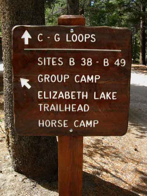 |
Tuolumne Meadows Campground Road South to Elizabeth Lake Trailhead. We are facing West hiking West along the Northern Ring Road in the Tuolumne Meadows Campground. The arrow is pointing South, to our Left down a paved campground road to where the Elizabeth Lake Trailhead is situated, before the road loops around the Horse Camp on the loop at the end of the road. We're going to continue hiking West, straight through this intersection.
|
| Transitions
Crossing Where We At The deal here at TM is we have a web of trails and a road coming messily together. Specifically, the routes that concern us are the end of the Tahoe to Yosemite Trail, the Pacific Crest Trail continuing North & South through Tuolumne Meadows, and the John Muir Trail bending around the perimeter of TM. The John Muir Trail makes its great Southbound turn into the South Sierra after its Northbound climb out of Yosemite Valley, bending to the South along the South edge of Tuolumne Meadows. Thus the John Muir Trail offers us Southbound backpackers along the Sierra Crest a classic trail "Y" junction at Tuolumne Meadows: One arm of the Y branches off to the Southwest, down the JMT to The Valley. The other arm of the Y points us Southeast down the JMT towards Mount Whitney. I believe both arms of this Y point us to Whitney. One is just the long way. Tuolumne Meadows Hiking Map Why We Here Southbound These facilities are the Post Office and Store for resupply, the Grill for hot and cold food, and the Backpackers Camp for rest. About every long distance backpacker draws on at least one of these resources, if not all of them, repeatedly. The Hub Bent Spokes It is not clear how to get to the facilities from the various trailheads we emerge through. Clarity If you are anything like me, you will be very ready to live without a pack on your back as quickly as possible every time we hit our rest and resupply stops. I love my pack, but sometimes we just need a little time away from each other. It's good for our relationship... Context & Goals You will feel it too. Imperative I have seen imperative make tired groups look rested as they pick up speed approaching rest and resupply spots. Personally, I've started trotting down the trail as I get closer to resupply. Order of Operations Northbound Many Northbound Pacific Crest and those fairly rare Northbound John Muir Trail Hikers hiking out of Lyell Canyon are deflected onto the portion of the JMT wrapping around the South end of Tuolumne Meadow's Federal Facilities. This trail essentially bypasses the Tuolumne Meadows facilities. The direct line of the JMT around the perimeter of Tuolumne Meadows completely bypasses our rest and resupply facilities at the TM Store, Grill and Post Office! That's why it is almost unused by JMT hikers. The JMT bypassing Tuolumne Meadows tends to confuse them, if anything. The question most JMT hikers have is, "how do I get most directly to the Post Office to pick up my resupply package?" Answering that question is one of our goals here. Not to mention that the route of the JMT around Tuolumne Meadows under forest cover misses taking in expansive views of Tuolumne Meadows, let alone bypassing our rest and resupply opportunities! Not Good. Therefore Northbound JMT & PCT hikers arriving at the road/trailhead interface of the Tuolumne Meadows Campground in the mouth of Lyell Canyon should get on the road they see just North of the trailhead, find the Backpacker's Camp on the hill to your Left (West), just a short distance down the road to drop gear, stash your food, and then hike over to the Tuolumne Meadows Store and Grill for a burger and a beer. If it looks confusing, ask a car camper along the road. You will hike up a low hill to your Left, behind the car camping sites to your West, after walking just a bit South of the loop of car campsites leading to the Lyell Canyon Trailhead. See the maps above. That's the most direct way for Northbound hikers on the JMT-PCT to access Tuolumne Meadow's backpacker camping resources (and drop pack) before continuing on through the car campground to tap the Grill and Store for some serious calorie consumption. Oh yes, we are going to eat. North to Southbound Southbound JMT hikers out of Yosemite Valley are best served by breaking off the JMT at the second trail junction, the "Visitors Center" junction after passing the first "Wilderness Boundary" junction where we hiked out of the Yosemite Wilderness. I like this route better than walking down Tioga Road, though that's an option too. I'm an observer, and on this bit of my hike I want to take a look at what this year's crop of car campers at Tuolumne Meadows are looking like. I'm meet some real cool car campers, and some real jerks too! The Middle Route to Resources WHY For hikers on two of the trails into Tuolumne Meadows the Grill is our first stop, for the other trail it is Backpackers Camp. Unless you have a different order of operations in mind. I am fine with that, just as long as we don't end up "exploring unknown terrain" (getting lost) wandering around the car campground or adjacent Federal facilities. I am providing advice and directions for navigating the Tuolumne Meadows Federal facilities because I've observed lots of backpackers entering Tuolumne Meadows and wandering around needlessly burning time and calories until they figure out where all the resources are located. "A little context can save a lot of calories." North and Southbound In any case, JMT hikers have an obligation to be nice to the locals, the staff, and represent the best character elements of High Sierra Backpacking Culture while hiking through Tuolumne Meadows. OK? Nature Every and Any Trails wrap around Tuolumne Meadows, roads connect us to its human facilities within. JMT Route in TM The TM Campground roads give both North and Southbound JMT backpackers the most direct routes to access our food, resupply, and backpacker camping facilities at Tuolumne Meadows than the JMT route, and once we get to the camping and resupply facilities the roads give us easy access the various trailheads required to continue our trip in any direction after our very refreshing rest and resupply stop at Tuolumne Meadows. |
Hiking the JMT
to
The Valley
West along the Northern Tuolumne Meadows Campground Ring Road
 |
||
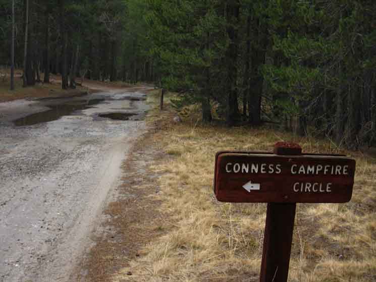
Tuolumne Meadows Campground road to Conness Campfire Circle. We are hiking West towards the Visitor Center through the car campground on the way to the John Muir Trail. Highway 120 is running East & West off to our Right, parallel with our Westbound walk along the campground road. This sign is indicating the second road branching off to our Left that we are walking straight past. Well, not quite "straight," as the road is undulating to the South, to our Left.
Tuolumne Meadows Hiking Map
|
Same Road, Further West
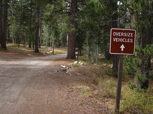 |
Following the Tuolumne Meadows Campground Road to the John Muir Trail into The Valley. We are now tracing out the Westernmost reach of the road, and beginning to see its bend to the South ahead. That's where we'll keep walking West off the road and out of the campground. I guess my fat pack qualifies me as an "oversize vehicle." It sure feels true. |
End of the Line
 |
||||
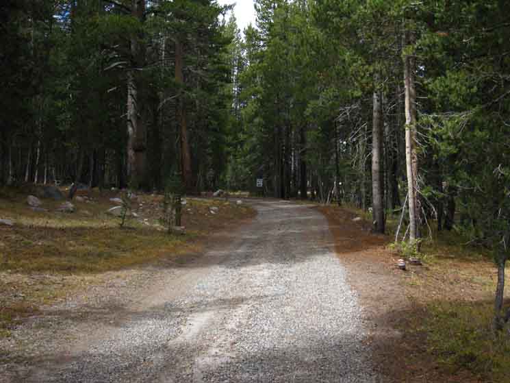
We're coming to the Western end of the campground road for us hiking the John Muir Trail to Cathedral Lakes on our way to Yosemite Valley. But not for the road itself, which loops back around onto itself, past where we find our trail breaking Right off the road, continuing West to link up with the John Muir Trail at the trail junction behind the Tuolumne Meadows Visitor Center.
|
West End Tuolumne Meadows Campground
Trail to the JMT
 |
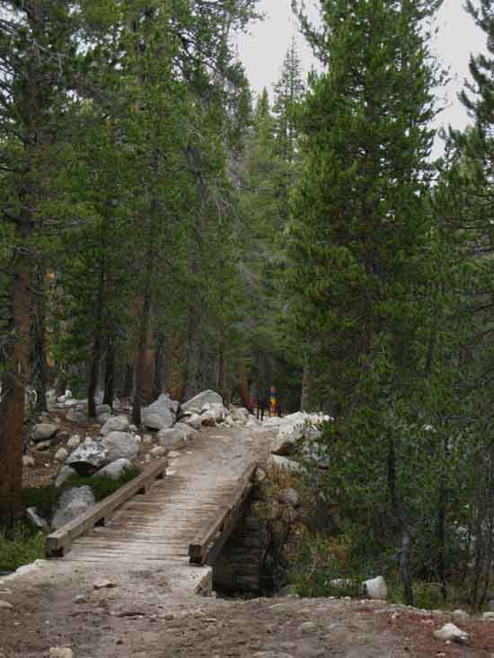
West end of Tuolumne Meadows Campground, Coming to the furthest Western end of the campground road we find the road beginning to bend to the South, our Left, away from Highway 120. We're going to follow the bend around to where we'll find a little trail leading us West, to our Right, to the bridge over Unicorn Creek, and beyond the bridge to the junction with the John Muir Trail. Not far now... Hiking West across the bridge brings us to T-out with the very short trail running North-South linking the Tuolumne Meadows Visitor Center on Highway 120 to the John Muir Trail running around the back of the VC. Highway 120 is just a few dozen yards to our Right, the North. The JMT is a few dozen feet off to our Left, our South. We continue West towards this little segment of trail linking 120 to the JMT past the Visitor Center. |
Unicorn Creek
 |
||
South to Unicorn Creek from Tuolumne Meadows Backpacker Camp. Look! The sign boss, the sign!
|
Unicorn Creek Bridge
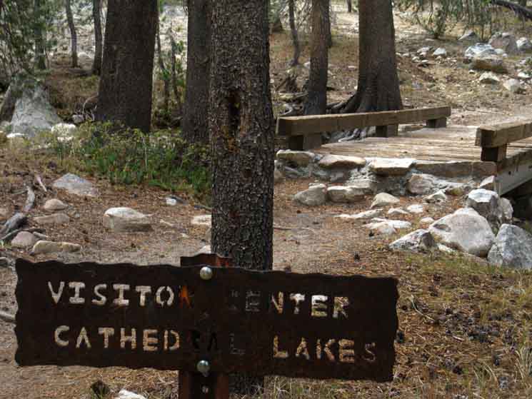 |
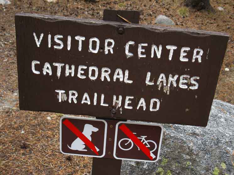
| Approaching trail connecting Tuolumne Meadows Visitor Center to the John Muir Trail. |
Visitor Center Trail Junction
Climbing to Cathedral Pass
8620 feet .94 miles South of Tuolumne Meadows 20.86 miles North of Yosemite Valley
Map and Miles
Miles & Elevations Tuolumne Meadows to Yosemite Valley
|
Hiking to The
Visitor Center junction along the John Muir Trail
 |
||
Easy-Peasy
|
Northbound
Hiking North
Beyond the Visitor Center
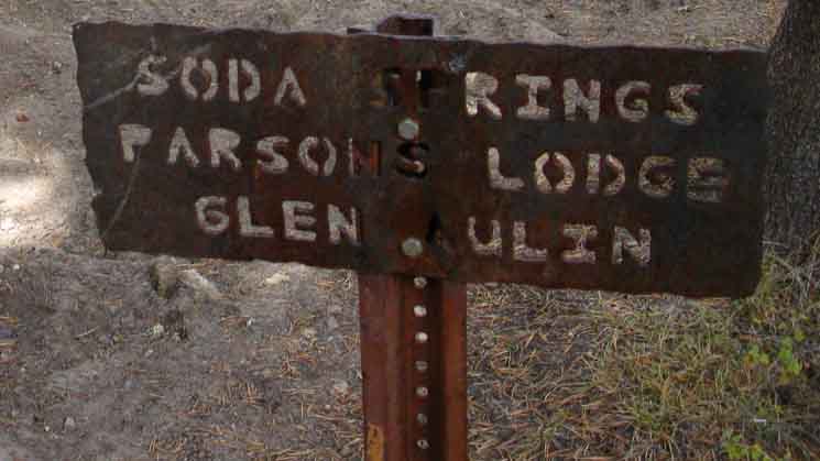 |
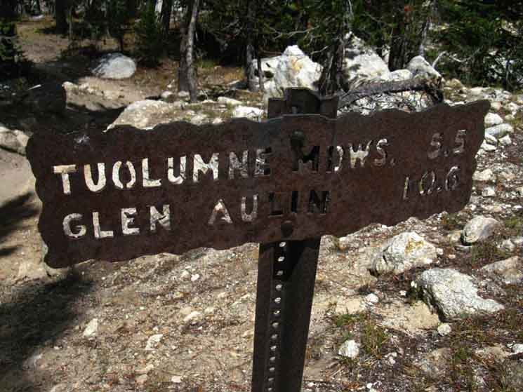
Soda Springs, Parsons Lodge, and Glen Aulin to the North of Tuolumne Meadows beyond the Visitor Center. An old service road runs from the Visitors Center across Tuolumne Meadows to the bridge below Parsons Lodge, where hikers can connect with the PCT-TYT North to Glen Aulin, and eventually our next resupply 75 miles to our North at
Tuolumne Meadows Hiking Map
|
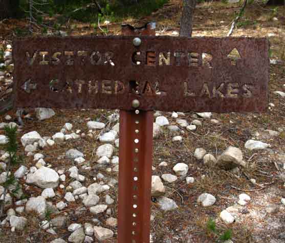
Southwest on the John Muir Trail
Visitor Center junction
along the John Muir Trail
To Yosemite Valley!
 |
|||||||
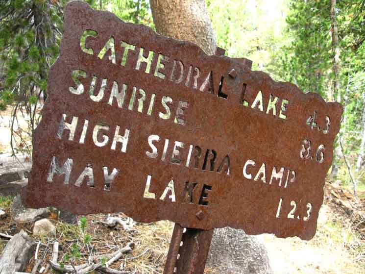
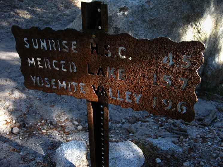
Miles on the John Muir Trail cited on the sign above at the junction behind the Tuolumne Meadows Visitor Center hiking Southwest. We are hiking "backwards" on the JMT, to Cathedral Lakes and Sunrise High Sierra Camp beyond. It is a tenth of a mile North to the sign on Highway 120 at the Visitor Center according to the differences between that sign and the one above. This sign above puts Sunrise High Sierra Camp at 8.6 miles from our position on the JMT at this junction behind the Tuolumne Meadows Visitor Center. We have three figures for the miles to Sunrise HSC from here: 8.6 miles as cited on the sign pictured above. Steel Sign Totals That makes our total from here at the Visitor Center trail junction to Happy Isles 21.8 miles. According to the Steel Yosemite Trail Signs themselves. But we've got to take all posted trail miles with a degree of skepticism. Yosemite's signs do not necessarily agree with each other, as we see arriving at the next Yosemite Trail Miles Sign, at the wilderness boundary below. I measure it at .94 of a mile from here at the Visitor Center Junction to the Post Office in Tuolumne Meadows, making the total from the Post Office to Happy Isles 22.74 miles, based on the miles cited by the Steel Yosemite Trail Miles Signs. This trail guide cites 20.86 miles measuring this same segment of trail to Happy Isles Trailhead from this trail junction, and a grand total of 21.8 miles from the Post Office in Tuolumne Meadows. I'm sure that each of us has experienced trails where we've said, Now we know why. Miles and Elevations
|
NORTH
Sign At the Visitor Center
on
Highway 120
 |
||
Trail sign at the Visitor Center and Highway 120. If we turn North and hike the short length of trail to Highway 120 we'll find our little trail up to the John Muir Trail marked on Highway 120 by the the sign above, which leads us to the bridge over Bubs Creek, and the JMT to Cathedral Lakes.
|
JMT Southwest
Towards Cathedral Lakes
 |
Continuing hiking West towards Cathedral Lakes along the John Muir Trail from the junction behind the Visitor Center in Tuolumne Meadows. A rocky and sandy track. |
More Sand than Rock
 |
||||
Sandy conditions from broken-down fragile topsoil.
|
View Southeast
Rising Above the Forest
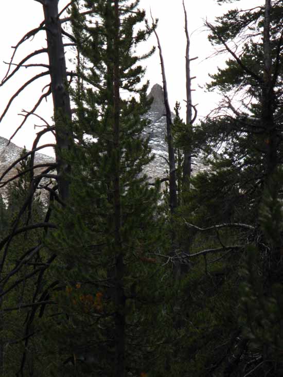 |
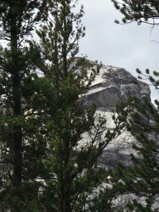
Southeast, looking back over our Left shoulder, we see the Cockscomb on the Cathedral Range Crestline rising above the forest. Take a look at the Cathedral Range rising above the South perimeter of Tuolumne Meadows from |
Looking to our West-Northwest
-Southbound Hiker's Right-
 |
||
To the Northwest we can see the top of part of the the tail-end of the the Fairview Dome formation rising above the forest.
|
Budd Creek Bridge
Yosemite Wilderness Boundary
 |
Budd Creek Bridge approaching the Yosemite Wilderness Boundary. We can see the boundary post in the distance beyond the bridge. A trail to the Right leads down to a little parking area along Highway 120 entering the West Side of Tuolumne Meadows. Our route along the JMT now veers Left, to our Southwest, to begin the climb up to Cathedral Lakes and Pass. |
Wilderness Boundary Trail Junction
Climbing to Cathedral Pass
8590 feet 1.46 miles South of Tuolumne Meadows 20.34 miles North of Yosemite Valley
Map and Miles
Miles & Elevations Tuolumne Meadows to Yosemite Valley
|
 |
||||
Wilderness boundary marker at Budd Creek in Tuolumne Meadows.
|
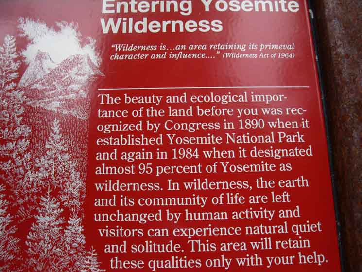 |
| Entering Yosemite Wilderness |
Towards Yosemite ValleyOur goal is a bit unusual, when measured against the typical traffic here. We can see two significant backpacking groups at play here. First, we have the John Muir Trail running at full capacity out of the Valley. I must say that Yosemite does a good job keeping things somewhat quiet. This Southbound herd of John Muir Trailers is balanced against many local backpackers out of Tuolumne Meadows (and associated trailheads) who's destination, or one destination, is Cathedral Lakes. Hiking South from Emigrant Wilderness into Yosemite we have noted the increasing trail traffic and wear entering Yosemite, then its increase as we hiked closer to its high heart beating with activity in Tuolumne Meadows. Approaching Tuolumne we experienced greater human impact. Now, passing Tuolumne Meadows approaching The Valley we will see both increasing human impact and restrictions on human use. We are in what I call, "The Hot Zone," where the intense beauty of Nature has drawn the intense attention of mass culture, and intense mass culture and incredible beauties of Nature literally sit side by side. It's the crazy and sane, it's fire and ice, it's Man and Nature. There's some crazy shit below, once we finish this upcoming hike through Cathedral Pass, my friends! I mean in both cultural and natural terms. Wear Factor MAX The feet of so many people have literally worn-in, imparted a look of heavy use on virtually every soft-trail surface (and the notorious Yosemite "triple- trail"), and have polished-up most of the hard rock trails too, even in the most pristine areas. Any good Forest Manager knows that there is no such thing as, "Leave No Trace." We all leave traces. "Leave No Trace" is a philosophy, an ideal approach to wilderness travel and Nature. The best we can hope for is controlling our actions that the traces we inevitably leave behind are not too destructive, if not fatal. Trail Culture Max |
 |
||
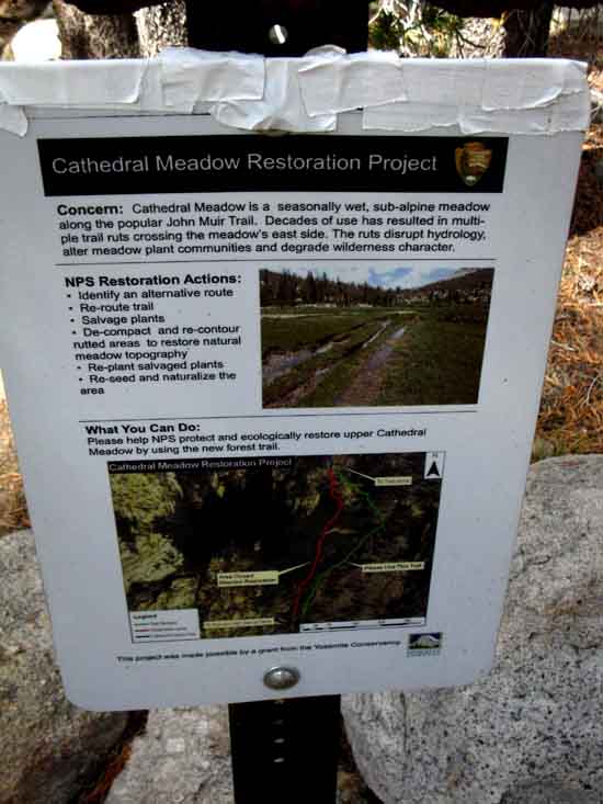
Cathedral Meadow Restoration Notice. Note the medical tape holding the sign together. Medical Tape is always part of my First Aid kit, though I did not use mine to repair the sign. I assume trail crew came upon the sign problem, and used what they had on hand to fix it. It's a good practice to carry med tape... I prefer it over duct tape. Med tape does not leave adhesive on the skin after removal, as does duct tape.
|
 |
Have a Safe Trip in the Yosemite Wilderness. I address safety and fitness issues in the introductions to hiking the TW and TYT to this guide.
This is also a good mountain safety reference:
High Sierra Mountain Safety Incidents and Topics
|
Miles to the Beginning of the John Muir Trail
 |
||||||||
MILES Adding 1.46 miles from here to the Tuolumne Meadows Post Office put the total miles at The sign at Happy Isles Trailhead in Yosemite Valley measures the distance to Tuolumne Meadows at 27.3 miles, and cites the whole length of the John Muir Trail at 211 miles to Mount Whitney. The Happy Isles sign may well be referring to the route through Merced Lake over Tuolumne Pass to Tuolumne Meadows, or the route past Evelyn Lake into Lyell Canyon, as indicated by the trail sign entering Lyell Canyon. In either case the one thing we know for sure is that the end point of our hike is at Happy Isles Trailhead in The Valley. The question is then, "where are the Yosemite Trail Signs placing the start point of our section in Tuolumne Meadows?" Put another way, we know one reference point is at Happy Isles Trailhead. Where then does Yosemite National Park measure the end point of this section in Tuolumne Meadows?
MILES
MAPS
OH-MY-MILES !
|
WEST
Miles West Along Highway 120
to
Tenaya Lake and May Lake
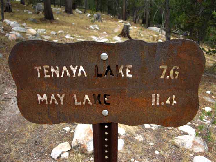 |
Miles to Tenaya and May Lakes from West end of Tuolumne Meadows at the Wilderness Boundary. This trail breaks off from the John Muir Trail running West to parallel Highway 120, following it West and then Southwest to Tenaya Lake. I'm pretty sure the trail to May Lake branches off before reaching Mendlicott Dome. Well, not exactly a trail. I will bet dollars to dimes that there are unmarked cross country routes from near where Cathedral Creek crosses Highway 120 both South to May Lake and North to Glen Aulin.
|
Miles on the JMT
East
Towards Tuolumne Meadows
Federal Facilities
 |
||
Eastbound John Muir Trail from our position on the West end of Tuolumne Meadows. East, Back the way we came, towards the Visitor Center, where one could turn North towards Glen Aulin, as indicated by the sign above. The 3.8 mile distance is to Tuolumne Lodge on the far East Side of Tuolumne Meadow's Federal Facilities. I have this distance at 2.92 miles from here to Tuolumne Meadows Lodge by hiking through the campground and past the Post Office, rather than following the John Muir Trail route around the South perimeter of the Federal facilities. My route is shorter by being more direct, so I imagine the 3.8 mile figure cited above reflects the distance following the JMT around the perimeter of the Federal facilities before hiking up to the bridge across the Tuolumne River on Highway 120. The route cited on this guide (the miles page) is the most direct route from this Wilderness Boundary to the Post Office and on to the Tuolumne Meadows Lodge beyond.
Tuolumne Meadows Hiking Map
|
Hiking
|
Sandbox
 |
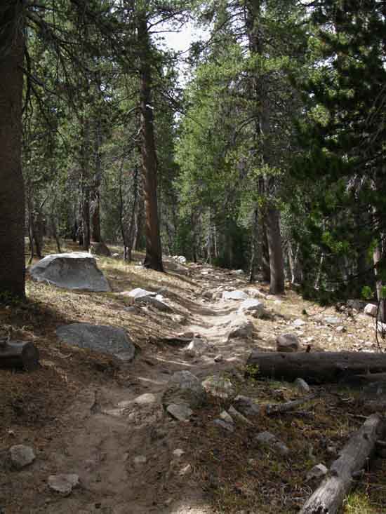
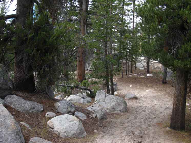
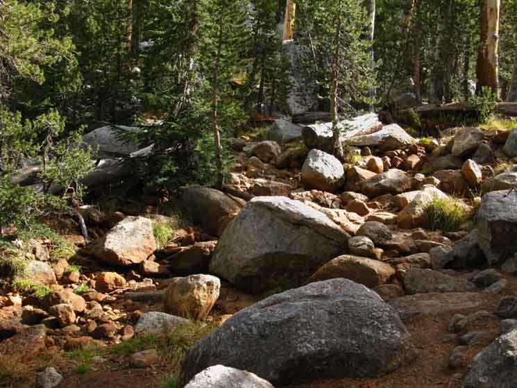
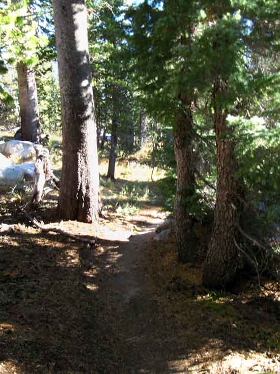
Sandy trail to Cathedral Lakes. Our nice trail working its way through dense forest is occasionally offset by long views over forest cover at the surrounding granite wonders. Well, we are getting longer views when we find breaks in the forest cover as we climb higher. |
Quiet Moments
 |
||
Wildlife. The deer saw me, was unconcerned, but began to walk away, as deer seem to do even from things they are unafraid of, if unfamiliar. Their common behavior is to walk away from non-or-minor threatening unknowns, in my experience. This "walk away" behavior is a more relaxed expression of Deer's very cautious character. Deer instantly run when they are at all seriously concerned with an impending threat, if the "freeze" is not called for. Deer do the "freeze or flee" decision dichotomy under serious threats.
|
Sheer and Sweet
 |
Above the Forest Keeping our eyes open behind us as we proceed gives us some interesting views of the decorative crown of the Cathedral Range rising above Tuolumne Meadows over our Left shoulder. We are rewarded with a whole series of unique views of the magnificent surrounding peaks and domes peeking through breaks in forest cover, if we keep our eyes open and up. We see great granite formations rising above the top of the forest cover, through breaks and cracks |
Miles of Smiles
 |
||||
Under the Forest We meet the nicest folks out here.
|
Massive
North End of the Cathedral Massif
 |
The vast granite feature making up the very Northern end of the Cathedral Peak Massif. We are moving around it's Northern base to Cathedral Lakes laying under its Western Flank, off to the Right in the image above. |
In Pursuit
Day Hikers Ahead
 |
||
Catching up with family of day hikers on their way up to Cathedral Lakes.
|
Scoping Each Other Out
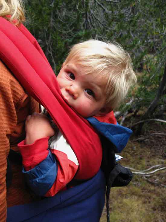 |
Yo, Little Bro. Interest shows in his eyes. |
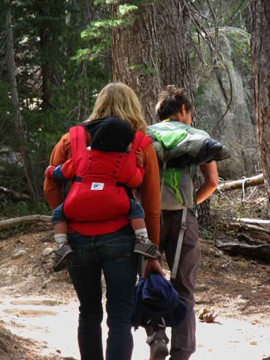
Family Hike
 |
||
We stop to say hi to the whole family unit. What-Up in the Wilderness Wonderland? Growing family getting the Kid into the Mix while the parental units maintain Natural engagement. I call that a future hiking unit being familiarized with the environment.
|
Expansive Views Open Up
 |
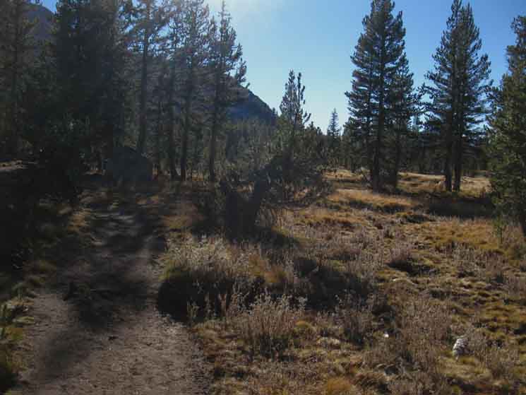
We are beginning to climb high enough to get glimpses of the surrounding landmarks beyond our forest cover, when we finally get high enough to get good glimpses out from and above our covering forest. We get our first views Northeast into Hoover Wilderness. We are looking across Tuolumne Meadows, which is out of sight below, it's position obscured by the forest. This is going to get good! |
Degraded Surfaces
 |
||||
Heavy traffic breaks down to a sandy trail up to Cathedral Lake. The close-in forest terrain is nice and cozy, despite trail traffic and wear. An intimate feeling of quiet rises and falls with the density of forest.
|
Up the Trail
 |
| A gap in the forest cover exposes a Northwestern Flank of Cathedral Peak as our route turns more directly South as we continue hiking towards Cathedral Lakes. |
Cathedral Flank
 |
||
A closer look at the sheer Northwestern Flank of Cathedral Peak approaching Cathedral Lakes.
|
On the Trail
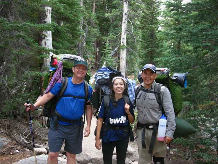 |
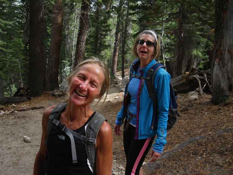
Three cool backpackers on the trail out of the heart of Yosemite. Trevor, Alahandra, and Larry. Two things happen out here. Nature animates and Nature drains. Nature fills the spirit with life while putting great demands on the flesh. How we look and feel on the way out is our final gage of how we balanced these two fundamental forces. This triplet of hikers was looking good. |
To the Northwest
A Rising Wall of Rock
 |
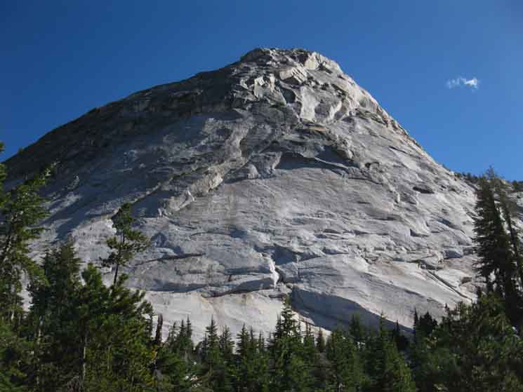
||
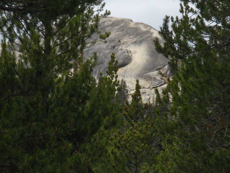
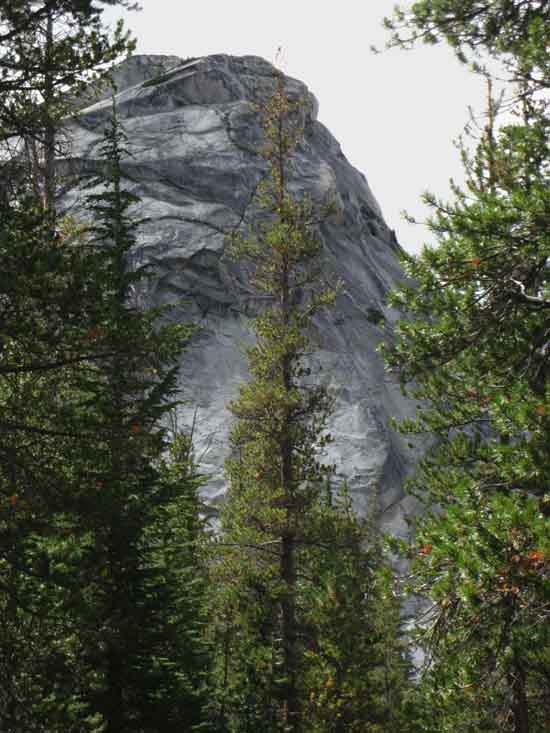
Looking to our Northwest we see the main dome of Fairview Dome rising above its surrounding collar of forest. Well, we begin to pick it out between the trees. We've seen elements of its "tail," its great descending smooth oblong granite ridge that we've seen peeking through the forest to our Northwest as we've climbed from the wilderness boundary. Now the quite impressive main rock's commanding presence demands our attention. We can throw a rock and hit it. Looks like some nice potential scrambling over on Fairview Dome.
Some Fine Views
End of Fairview Dome
|
Mostly-Happy Herd
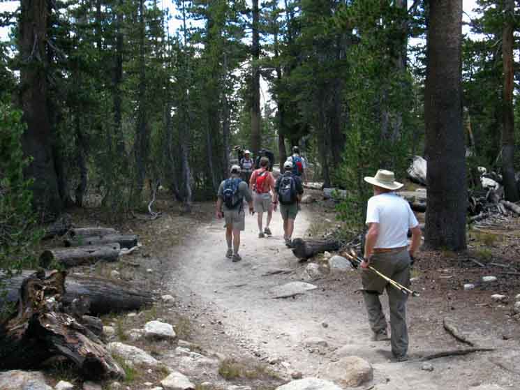 |
Eight day hikers on trail to Cathedral Lakes from Tuolumne Meadows. A Small Herd! Though somewhat damaged and heavily loaded I was moving quickly through lots of day hikers. Their density depends on the times of year we hike through. October gets really quiet. July is really busy. Use caution around the crowds of day hikers on Yosemite Trails. Many are not paying attention and will walk right into fully loaded backpackers. Some are struggling along. Others are watching everything. Our skill is knowing which ones are walking blindly and which are engaged observers. It's pretty clear... Our skill is enjoying the differences as we all hike along, not just from our start to end points, but also hiking between the various "stations," the mental and physical spaces we visit hiking through wide ranges of human experience triggered by the rigors as we push towards our goal. Pain, Pleasure, and so on... |
Along Cathedral Crestline
 |
||
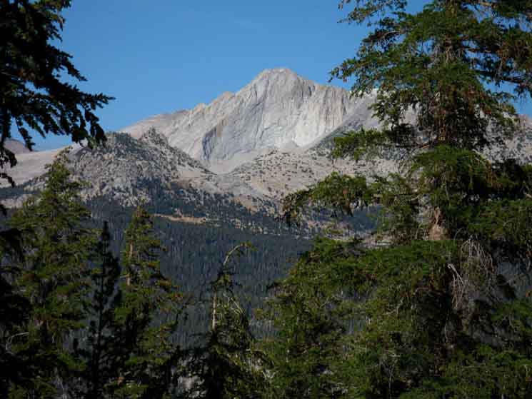
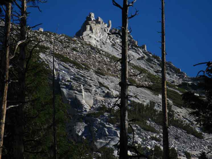
Feature on Cathedral Peak of the Cathedral Range. Check out the view of our position here under Cathedral Peak from Cold Canyon as we came hiking down the route of the PCT-TYT. The view from the bottom of Cold Canyon shows us the "ramp" of terrain we are climbing Southwest from Tuolumne Meadows leading us up onto the shelf where the Cathedral Lakes are situated under Cathedral, Echo, and Tressidor Peaks just below Cathedral Pass.
|
Cathedral Rock Rises Abruptly
 |
| Sweet granite formations along Cathedral Peak's massif running up to its starry summit. |
TYPICAL
Climbing Trail
But, with more sand...
 |
||
Sample of climbing to Cathedral Lake from Tuolumne Meadows. After climbing to, and enjoying crossing a flattish sandy shelf on our way up from the wilderness boundary, we resume climbing again.
|
Northeast: View of Mount Conness
 |
Rising above Fairview Dome combined with finding a crack in the dense forest cover opens up a view Northeast to take in the Sierra Crestline capped by Mount Conness. Ragged Peak in the foreground-Left.
Map of Mount Conness East of Yosemite
View of Mount Conness to our East |
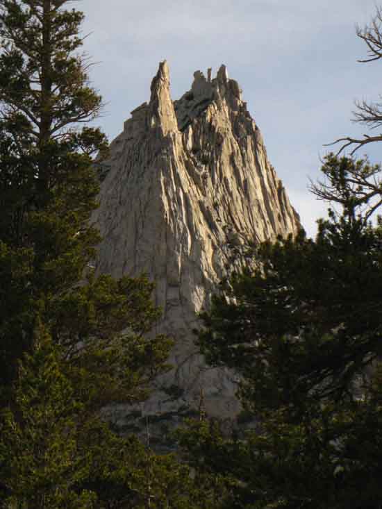
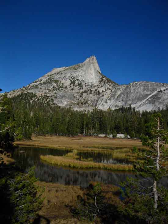
Cathedral Peak
 |
||
Coming around to the West Flank of Cathedral Peak we begin to enjoy observing the unique changeability of the character of its Peaks from a rotating perspective complimenting its many aspects.
|
Cathedral Peak
 |
Cathedral Peak Formations rotate into a clearer view as we hike South around the base of the Cathedral Peak and upward under its Western flank towards the Cathedral Lake trail junction. We can see that what appeared as a bulky mountain top while hiking down Cold Canyon appears as a fragile silhouette from here, as we get close-up rotating views of the crestline from the John Muir Trail under Cathedral Peak. |
Day Hikers
 |
||
Nice couple having a great time day hiking all around Cathedral Lakes. You will meet the nicest folks out here. Folks who are animated and engaged.
|
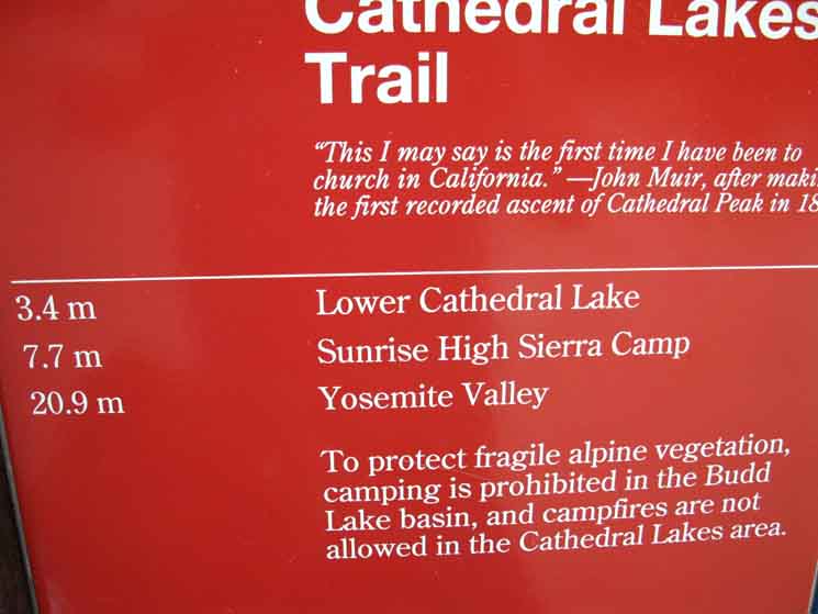
Lower Climbing to Cathedral Pass
9430 feet 4.05 miles South of Tuolumne Meadows 21.8 miles North of Yosemite Valley
The John Muir Trail Map and Miles
Miles & Elevations Tuolumne Meadows to Yosemite Valley
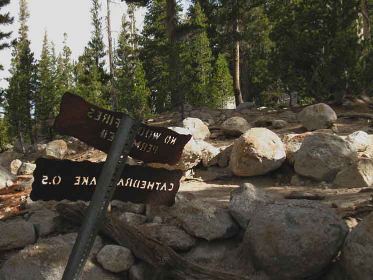
Half a mile spur trail off John Muir Trail out to Lower Cathedral Lake.
|
Cathedral Lake Trail Junction
Trail Junction
SOUTHWEST
to Lower Cathedral Lake
 |
||||
Cathedral Lake Trail Junction under Cathedral Peak directing us onto the spur trail out to the lower lake. The JMT continues up a short segment of gently-rising terrain before resuming brief middle-difficulty climb to Upper Cathedral Lake preceding Cathedral Pass.
Tuolumne Meadows to Yosemite Valley
|
North JMT
Back To Tuolumne Meadows
(The Top of This Page)
 |
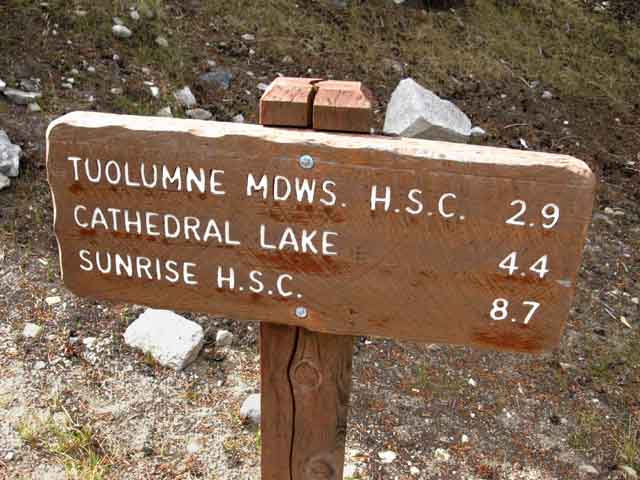
Yosemite miles sign cites 5.5 miles from Tuolumne Meadows to Cathedral Lakes junction. This is a reasonable figure depending on where "Tuolumne Meadows" is. If the Tuolumne Meadows Lodge High Sierra Camp is considered "Tuolumne Meadows," then the 5.5 miles measured to its location on the far Eastern end of the Tuolumne Meadows Facilities, a mile and a half East of the Post Office, may not be out of the range of reason. This trail guide cites the distance from the junction above to the Post Office at 4.05 miles, and the distance to the Tuolumne Meadows Lodge from there at 1.46 miles. The total distance from here to the Lodge is 5.46 miles according to our measurements, making this particular sign correct, if interpreted correctly.
Tuolumne Meadows to Yosemite Valley
We discuss signs, miles, and zero points above. |
South JMT
Cathedral Lakes to Sunrise High Sierra Camp
(The Next Page)
 |
||
This Steel Yosemite Trail Miles Sign TW Trail Guide Miles
Tuolumne Meadows to Yosemite Valley
|
Hiking to
Lower Cathedral Lake
Down the Spur Trail to Lower Cathedral Lake
 |
| We look back at the JMT winding its way through a boulder field as we split away to the Southwest dropping down towards Lower Cathedral Lake. |
Creek to Meadow
 |
||
Our trail fords, then follows a rough path down along the creek connecting Upper Cathedral Lake to the Lower Lake.
|
Forest-Meadow Interface
 |
Trail to Lower Cathedral Lake. Followed the jumbled run of the creek down to a brightening forest-meadow interface. |
East Edge of Lower Cathedral Meadow
 |
||
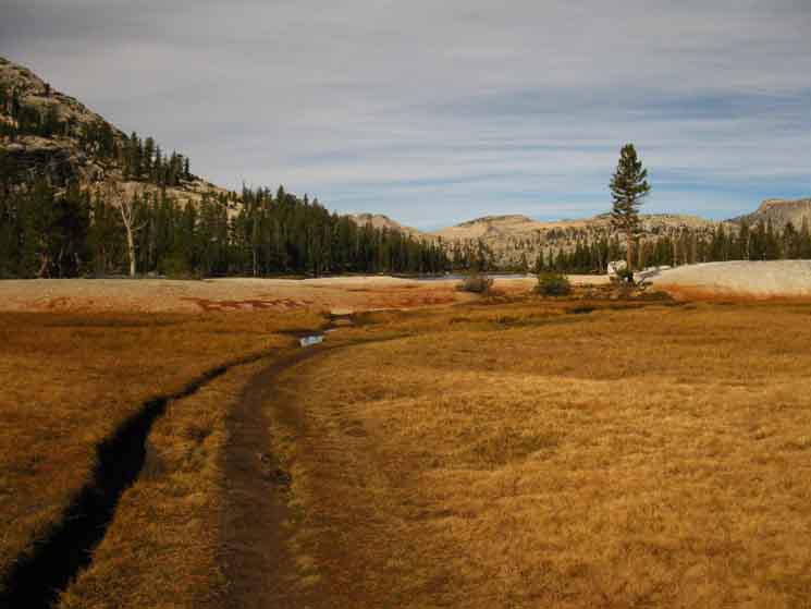
At the bottom of the creek we come to the perimeter of an expansive meadow wrapping around the granite arm wrapping around the East Shore of Lower Cathedral Lake. We are Westbound entering East fringe of meadow around East Shore of Lower Cathedral Lake.
|
View West across Lower Cathedral Meadow
 |
| First view of Lower Cathedral Lake and its protective granite berm wrapping its Eastern shore. |
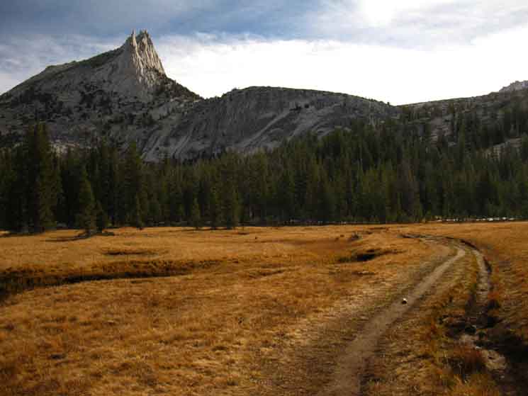
Northwest sits Cathedral Peak
 |
||
Looking back to our East at Cathedral Peak as we hike West to its namesake lake to end our day as the day draws to a close.
|
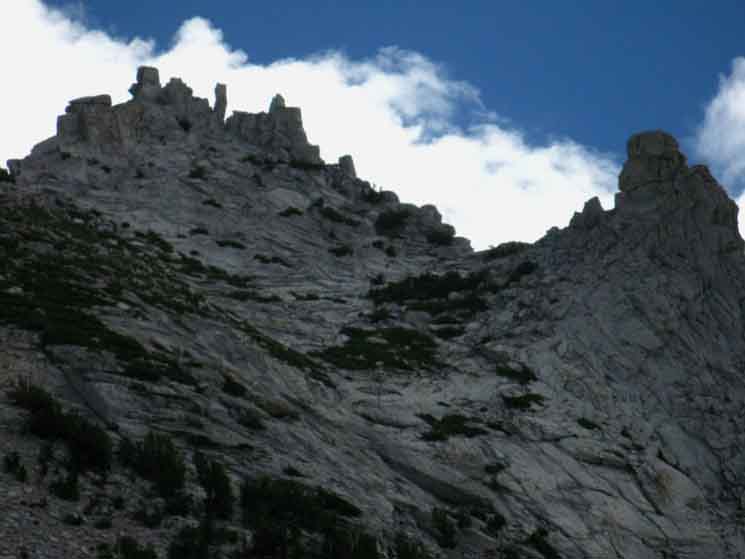
Detail of Complex top of Cathedral Peak
 |
Detail of Cathedral Peak from Lower Cathedral Lake. Each perspective adds to our understanding while adding layers of complexity to the character of the mountain, one layer at a time. |
Fantastic Wall wrapping around Lower Cathedral Lake and Meadow
 |
||
Looking South from atop the granite berm running across the splendid Lower Cathedral Lake's Basin dividing its Meadow component on our Left, the East, from Lower Cathedral Lake on our Right. Atop the wall, over off its Eastern edge, the Left edge of the image above, sits the upper flat cradling Upper Cathedral Lake just below Cathedral Pass.
|
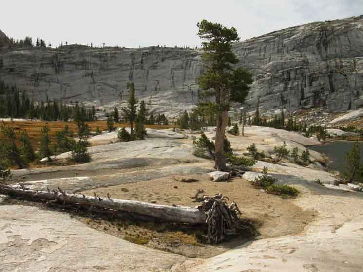
Lower Cathedral Lake Campsite
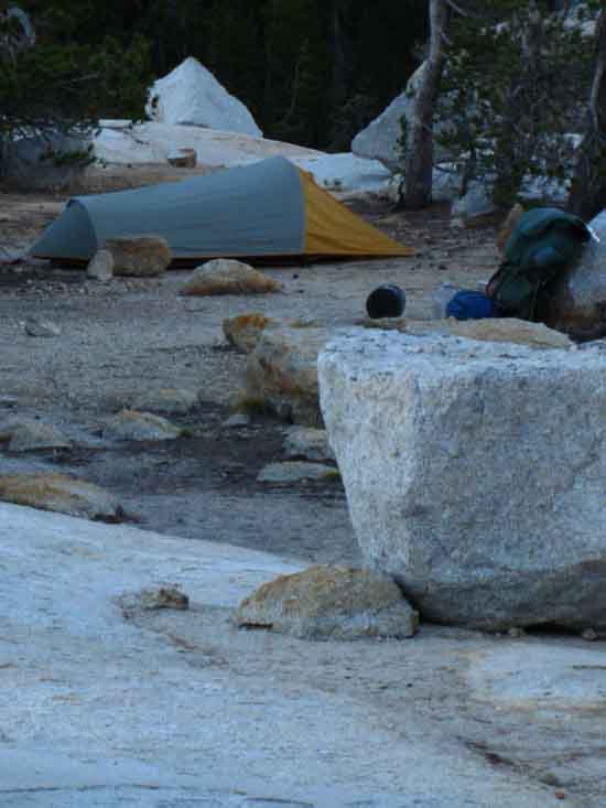 |
Campsite established on the granite berm above both meadow and lake, a good place to observe the "action" as day turns into evening and finally night. Also above the meadow zone of the mosquitoes. My backpack is acting as my backrest, while the Garcia food canister is the foot rest. A very nice platform for relaxed observations... |
Harsh Glare of Approaching Sunset
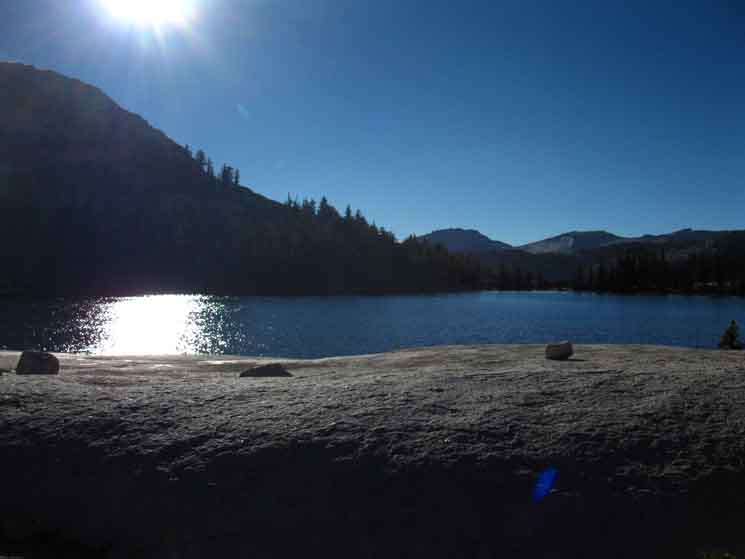 |
||
Afternoon Sun dropping towards horizon above Cathedral Lake. In our eye.
|
Night Falling
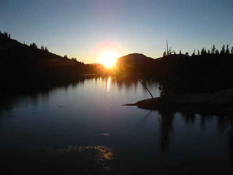 |
| Sunset on Lower Cathedral Lake. |
Golden Twilights
 |
||
Cathedral Peak on the far Left, the rounded crestline of Peak 11168 in the middle-most distance, and Echo Peaks jutting up on the far Right side of this image of Sunset's amber glow from our Lower Cathedral Lake campsite. Long languorous shadows begin hunting and trapping the last bits of glowing sun between their growing fingers.
|
Last of the Golden Amber Glow
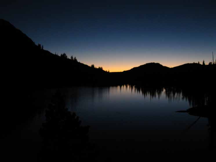 |
Gone. The golden glow is the last bit of day to go. Last of the shadows withdrawing with the last of the golden glow fades as darkness asserts |
Cool Clarity of Morning Views
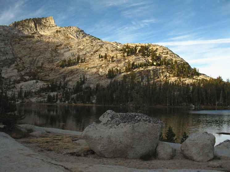 |
||||
Lower Cathedral about to get first direct light of day.
|
Steel Gray Morning after Golden Sunset
 |
||
Another Aspect of Cathedral Peak.
|
Back to the John Muir Trail
Northbound,
Next Page South: |
North: Tuolumne Meadows, top of this page South: South to Sunrise and Yosemite Valley
Backpacking |
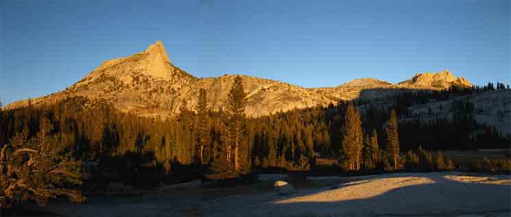
The Golden Triangle Yosemite is a large National Park that I break down into North, Central, and South regions for the convenience of the Long Distance Backpacker. We hike into the most Northwestern region of Yosemite through Bond or Dorothy Lake Passes on the Tahoe to Yosemite and Pacific Crest Trails, respectively. To our East-Northeast are the Hoover Wilderness Trailheads, to our South-Southwest lays the Grand Canyon of the Tuolumne River. We arrive at roughly the center of the Sierra Nevada hiking into Tuolumne Meadows. Here the end of the Tahoe to Yosemite Trail is supplanted by the John Muir Trail heading South along the Sierra Crest from Tuolumne Meadows. Since I consider everything South of Tuolumne Meadow to be the South Sierra, our explorations of the center of Yosemite will be quite limited. Unless... The GC
THIS PAGE IS UNDER CONSTRUCTION: STAY TUNED FOR MUCH MORE! COME ON BACK NOW, 'YA HEAR?
7.5 Map:
30 min Map
|
Backpacking Trail Guide PCT-TYT North Glen Aulin |
 |
Backpacking Trail Guide JMT South |
Backpacker ForumsHave a great Sierra Nevada trip or story to relate? A fine piece of gear? Or gear that failed? Post it on Above we come to the Front Page of the High Backpacking Trails and Topics Forums. Below we break the forums down into categories:
Anyone can post text comments in the existing forums, but only members can post up new topics, along with images, maps, and formatting. If you have experiences, comments, questions, or pictures and videos of the Pacific Crest Trail between Sonora Pass and Tuolumne Meadows, post up here as an unknown hiker or as a member: Forum Section
|
Trailhead
Contact
Alex Wierbinski

Backpacking Lake Tahoe to Mount Whitney
Your Guide to the High Sierra Crest, including the Tahoe to Yosemite, Pacific Crest, and John Muir Trails
