The Trails
Guide
Maps
Miles/Ele
Permits
Resupply
Forum
Current Weather Conditions
Weather Notes
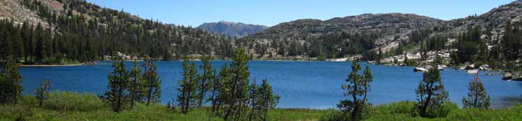
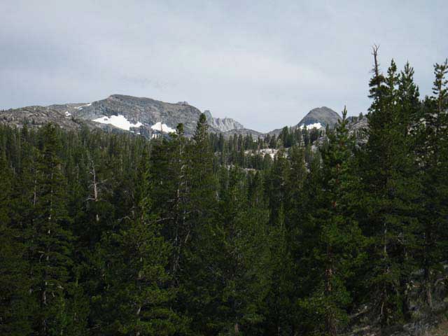
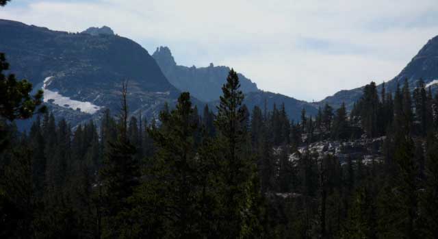
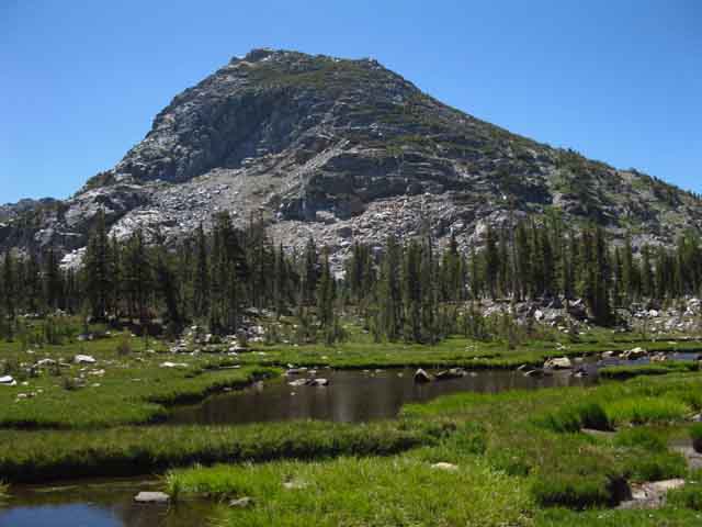
Northern High Sierras
Central High Sierras
Southern High Sierras
Gear
Gear List
Gettin Started
Layering
Discussion
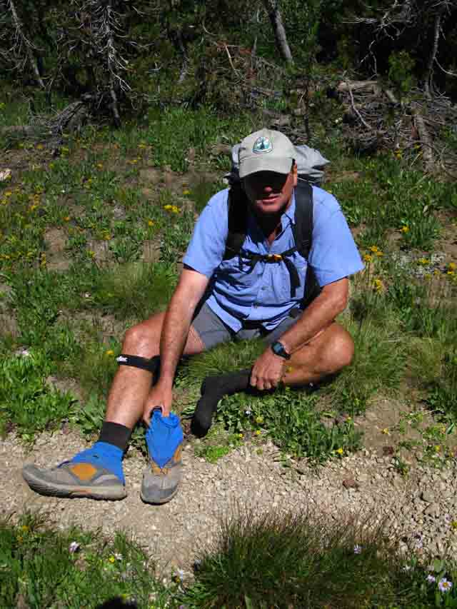
Testing yourself and your gear
Gear Reviews
Backpacking
The Pacific Crest Trail
The
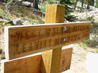
West West Walker River Bridge
through
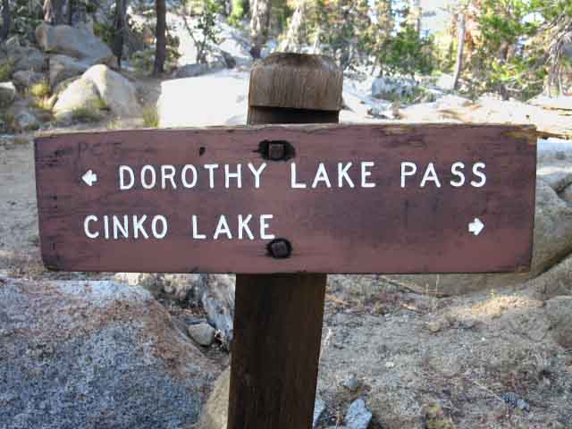
Dorthy Lake Pass
To the
Tahoe to Yosemite Trail
atop
Jack Main Canyon
Hiking
The Pacific Crest Trail from Sonora Pass to Tuolumne Meadows
Languages
Languages
Trail Arts
The art of walking
Physical Preperation
Trail Skills
The trail
Off the trail
Scrambling
Maps
Navigation
Camp skills
Food
Resupply
Food
Other
Photo Catagories
Trail Stories
Trail Culture
News and Science
Links
Groups
Books
Terms and Conditions of Use
| Trail Guide INDEX Highway 108 to Highway 120 |
GUIDE |
GUIDE |
Southwest |
Southwest MAP Emigrant Meadow South PCT MAP Kennedy Canyon |
30 min MAP Sonora Pass to Bensen Lake |
Sonora Pass to Tuolumne Meadows MILES and ELEVATIONS |
TOPO MAP INDEX SONORA PASS |
Resupply North Kennedy Meadows South Tuolumne Meadows |
National Forest & PARK PERMITS Toiyabe & Stanislaus & Yosemite |
|
all maps index |
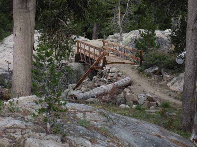
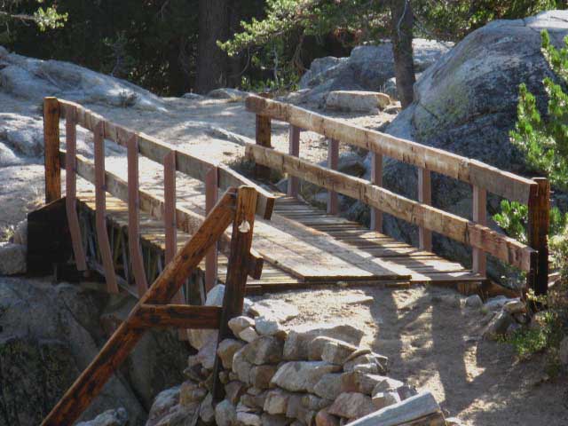
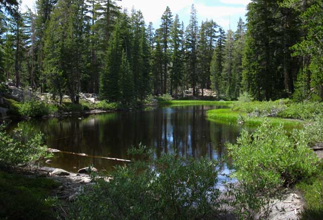
West West Walker Bridge
Southbound
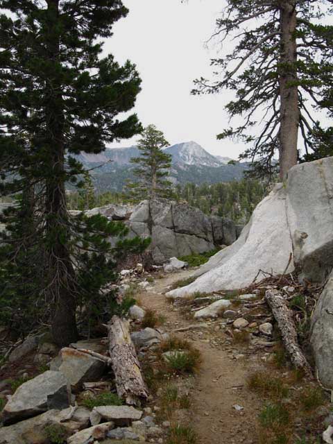
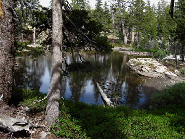
Approaching the West Fork of the West Walker River & its Bridge
View from the North
 |
||||||||||||
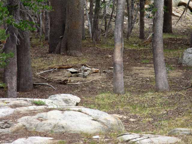
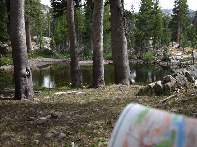
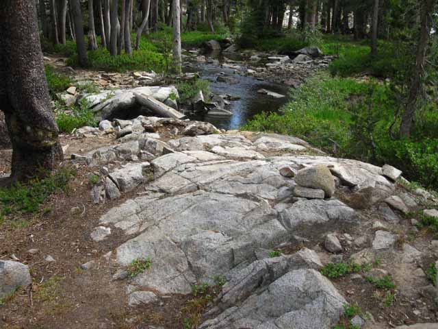
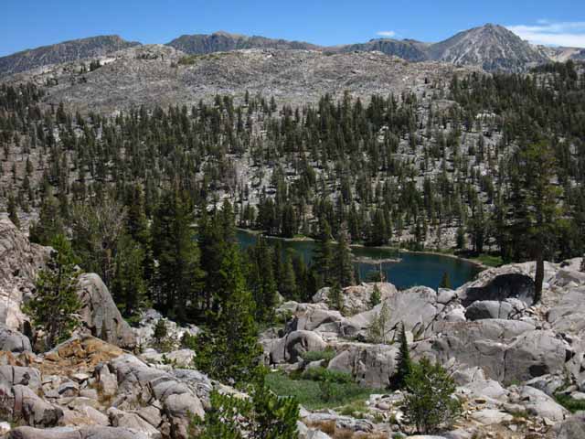
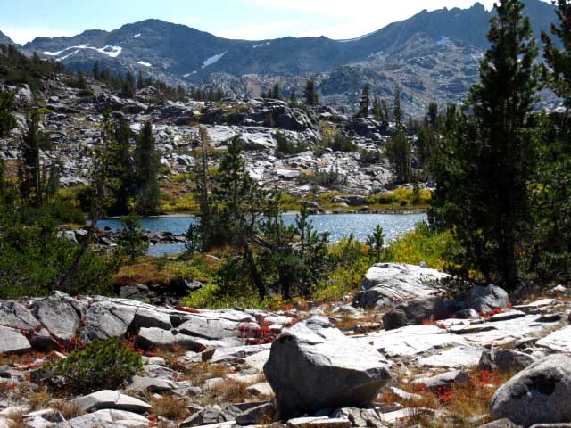
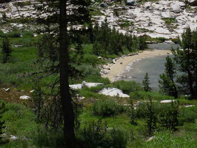
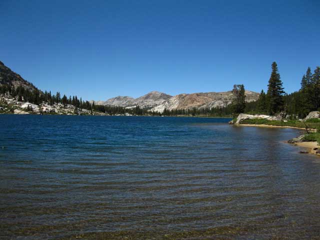
Looking Southeast at the PCT crossing the West West Walker River footbridge. There is a nice little flat meadow area with a couple of fire rings on this side of the bridge below the great boulder in the foreground. I'd cross the bridge and turn down-stream a bit for a secluded campsite here. DETAILED MAPS
LARGE SCALE MAPS
TECHNICAL
Map Resources
Further South Bensen Lake to Virginia Canyon Map
|
The
West West Walker Bridge
West West Walker River Bridge to Dorothy Lake Pass 5.12 miles |
Vital Statistics
TRAIL GUIDE UNDER CONSTRUCTION
Gett'n closer! Up and Down
Backpacker's
|
|||||||||||||||||||||||||||||||||||||||||||||||||||||||||||||
West Flank |
East Flank Sonora Pass to Dorothy Lake Pass 15 minute backpacking map |
Sonora Pass to Tuolumne Meadows
PCT
Miles and Elevations
Regional Maps
| Sonora Pass Region Hiking Map PCT-TYT USGS 30 min backpacking map |
Sonora Pass to Bensen Lake PCT USGS 30 minute backpacking map |
| Though this Looking Glass |
Trail Guide Index
PCT
|
||||||||||||||||||||||||||
Video
Trail Junction
Trail Junction
Trail Junction
Trail Junction
Video
Video
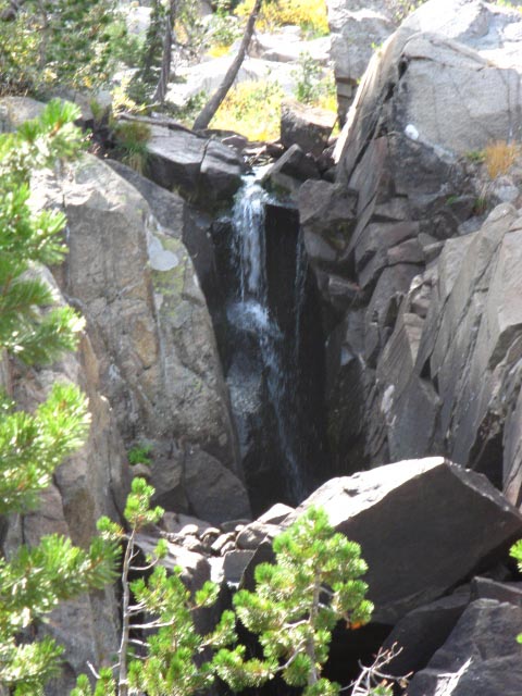
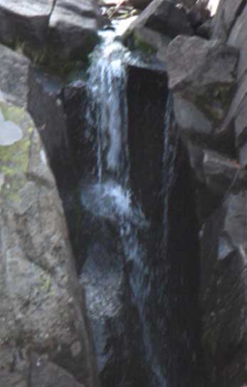
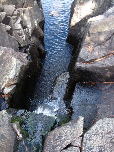
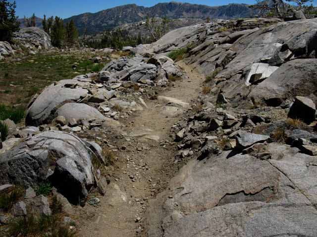
Rock channel
Video
Between
YOSEMITE-TOIYABE
|
Toiyabe
All
All
Comprehensive
|
|||||||||||||||||||||||||
| > Forum < | ||||||||||||||||||||||||||
Backpacking Emigrant Wilderness We find interesting Eastern access to all three of these wilderness areas as we hike the PCT route South down into and back out of this nub of the Toiyabe on the page below. These trails offer lots of nice backpacking loop opportunities. If we break off the PCT to follow the watershed of the West Walker River upriver out the top of its canyon we will find the trail splitting between branches to leading to the Twin Lake Trailhead of the Hoover Wilderness and a fine trail into the North Yosemite Backcountry through the top of Kerrick Canyon. North Yosemite Backcountry On this map we can see how the trail up the West Walker River parallels the Western-flank line of our PCT route, once it crosses the crest into Yosemite, but along a more direct route following along the base of the East Flank of the Sierra rather than crossing the massive set of granite canyons descending off the West flank, as does our hike South along the classic route of the combined PCT-TYT. Post up any information or experiences you want to share, or questions you have about this Eastern access to the Emigrant, Yosemite, and Hoover Wilderness Areas through the comments links below, or the forum linked-to above. |
The Tahoe to Whitney Trail Guide and Forum have been built, funded, and supported by my individual efforts, with help from my friends and family. THANKS! If you feel these efforts are valuable to you, This is the first full and free classic trail guide of and on the web. A True "Digital Book" |
West Fork of the West Walker River & Bridge
Detail
 |
|||||||||
West-West Walker River Bridge Local Camping Take a Right after crossing the bridge to follow the PCT South.
DETAILED MAPS
LARGE SCALE MAPS
TECHNICAL
Map Resources
Further South Bensen Lake to Virginia Canyon Map
We discuss the fantastic local hiking options the West Walker River |
Video
The West West Walker River and Bridge
A quick look at this four-way trail junction
Take a look at the West West Walker River, its Bridge, and its associated campsites. A few feet South of the bridge we come to a four-way trail junction. 3:26 minutes The real question here is, West West Walker River Bridge Trail Junction Backpacking Miles
Local and Regional Backpacking Maps
Sonora Pass to Tuolumne Meadows
|
The West Walker River West West Walker River South of that trail junction we can again access the West Walker River one last time by hiking North up Kerrick Canyon, off the combined route of the PCT-TYT in the heart of the North Yosemite Backcountry. Hiking up to Buckeye Pass at the top of Kerrick Canyon puts trails Northwest into the top of the West Walker River and Northeast down to Twin Lakes at our feet.
Three Leavitt Meadow Trailhead is important because it gives us Eastern access to the unique slice of the Sierra Crest running under the East Flanks of Emigrant Wilderness and Yosemite all the way down to and into the top of Kerrick Canyon. The Leavitt Meadow Trailhead into the upper West Walker offers access into the remote beauties of the Eastern Emigrant, North Hoover, and North Yosemite Backcountry Wilderness Areas along a unique approach. Sweetness
PCT Shortcut Beauty and The Beast East Flank West Flank We really could not have more different environments on either side of the Crestline.
The Width of the West Walker With our mind's eye we can see the imaginary line running along the top the Sierra Crest, which is the top of the West Walker's Western canyon wall, marking out all the granite terrain to its West as within Yosemite National Park. The West Walker Canyon runs up a nomad's land of the Toiyabe National Forest wedged in between the volcanic terrain of the Hoover to its North and East with the granites of Yosemite climbing to the Sierra Crestline and running South and West, with Emigrant bounding the canyon wall to our Northwest. Things are very different on the other side of the Sierra Crest, along its Western flank.
West Flank North Yosemite Backcountry
The map on the Left below shows how the trail coming up the West Walker climbs out of the top of its canyon along Kirkwood Creek approaching Twin Lakes. The map on the Right shows the trail down the West West Walker from the Leavitt Meadow Trailhead on Highway 108.
Hiking up the West Walker River brings us to a ranger cabin where we enter Upper Piute Meadow manned by volunteers each Summer. Well, it was. One year long ago I met the volunteer dude who lived out there for a Summer. He loved it up there. He said they tried to put a volunteer up there every Summer.
Toiyabe National Forest MAPS
Map Resources
We discuss the fantastic local hiking options this opens up below.
East Side Access to the West Walker River
The Bensen Lake Loop Twin Lakes is also where the famous "Bensen Lake Loop" begins. This loop brings us over the Sierra Crest down Kerrick Canyon to the PCT-TYT route. We follow the trail South to Matterhorn Canyon from Bensen Lake to return to Twin Lakes out the top of Matterhorn Canyon through Matterhorn Pass, then Rock Island Pass. The Bensen Lake to Virginia Canyon 30 minute map lays out the whole length of the Bensen Lake Loop: Bensen Lake to Virginia Canyon This is one majestic backpacking loop. It is the Northern Sierra version of the "North-South Lakes Loop" down on the JMT in the South Sierra. We also have a comparable loop around the North Yosemite Backcountry that shares the trail down upper Kerrrick Canyon with the Bensen Lake Loop.
Coming Back for More
|
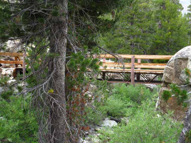
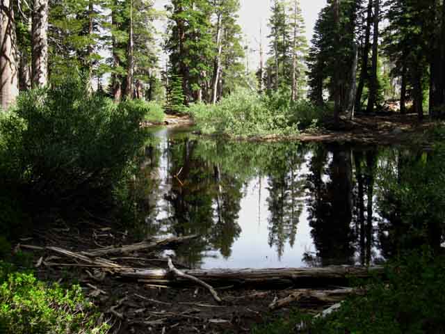
Looking North
at the
little meadow hosting a flurry of nice big and little Campsites
 |
View North across the West West Walker footbridge. Campsites are scattered in the grassy flat in the trees on the North side of the bridge. We can see the benches and fire ring of the big campsite in the upper-Right of the image above. See it over there? |
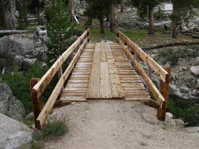
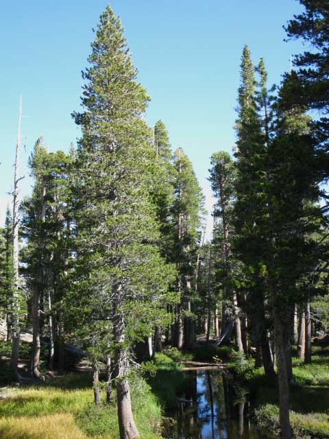
View from the South
 |
Northbound PCT hiker view approaching the upcoming West Walker River Bridge, or the Southbound hiker looking back. |
West-West Walker River Bridge Cinko Lake Loop
Local Hikers and PCT Bail-Out Just a few feet South beyond the West West Walker River Bridge we encounter a trail junction tying together four important trails. This is an important trail junction for local hikers hiking starting South out of Leavitt Meadow Trailhead as well as those backpackers ending their local hikes through the Leavitt Meadow Trailhead. Local hikers will find all sorts of excellent scrambling terrain to explore around here. That is a very pretty quadrant of terrain.
The PCT The bailout route exits to Highway 108 through Leavitt Meadow Trailhead, reenters the Sierra via the dirt road through the US Marine Base located a 3.64 miles East down Hwy 108 from Leavitt Meadow Trailhead. This bypass rejoins the Pacific Crest Trail by following the road across the Marine Base to the dirt road climbing the ridge behind the Marine base, West to where the road ends at the base of the valley draining Wolf Creek off the East flank of Sonora Peak.
Sonora Pass Region Hiking Map
Important Local Trail Junction Hiking East through this junction opens up the options of either hiking down to Leavitt Meadow Trailhead by turning South through the next trail junction just to our East at the nearby Long Lakes via the Chain of Lakes trail or continuing East to the trail along the West Walker River. Both of these options bring us to Leavitt Meadow Trailhead, but the Chain of Lakes route is shorter.
Long Lakes and Chain of Lakes I say temporary lakes as they are slowly being sedimented in, and lodgepoles are slowly marching into the sedimented aprons around these lakes, gradually transforming meadow into forest floor. Look around. We can see this process going on across the diminishing meadow terrain we have hiked the perimeter of since hiking South out of the bottom of Kennedy Canyon on the segment of trail down to the West West Walker Bridge. Forests and Soil are on the Move here.
Nice Leavitt Meadow Loop Possibilities
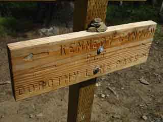
Kennedy Canyon to Dorothy Lake Pass TYT
From the Leavitt Meadow Trailhead we can hike 20+ mile backpacking loops to the West West Walker Bridge and back, push it out another six miles to circle around Cinko Lake, or expand our loop to incorporate as much or as little of the High Emigrant Wilderness as we can bite off. I've met all sorts of backpackers out here enjoying these grand loops. Fishermen. Couples. Families. Solo Dudes like me. All having the times of their lives. Join Us!! Post up your explorations here among the meadows, rivers, lakelets, and amazing granite formations wedged in-between the bottom of Kennedy Canyon South to the West West Walker Bridge, East to the Walker River and North down to Fremont Lake. This rectangle of terrain is a fantastic place to explore on scrambles, once we get an understanding of the overall lay of the surrounding terrain.
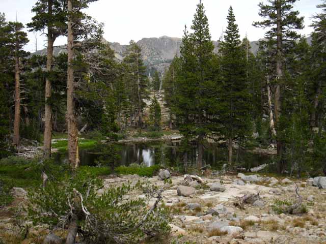
From the West West Walker River The Southbound PCT We're climbing again, this time into a close-in densely forested channel that the West West Walker flows through on its way down to Walker Meadows from the interlaced fingers of granite and volcanic terrain along the Sierra Crestline above. We encounter our next trail junction one-fifth of a mile South of the West West Walker River Bridge trail junction. Out of the West West Walker River The Grizzly Peak Trail Junction Hummm... that the Grizzly Peak junction opens up a bunch of very exciting backpacking loops and trips...
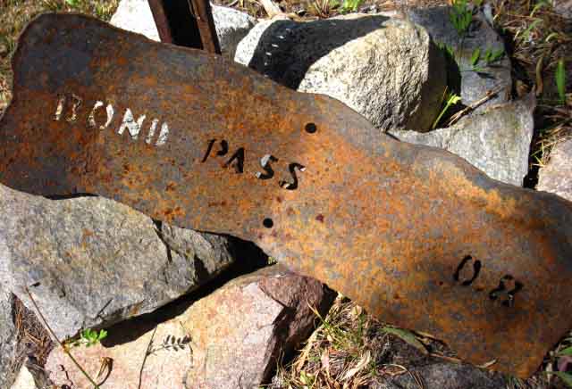
Side Trips We can hike to the Northwest, down to Kennedy Meadows Pack Station along the Northbound Tahoe to Yosemite Trail. We can hike to the Southeast, also along the TYT to the PCT at the top of Jack Main Canyon to return to our current position at the WW Walker Bridge by hiking North on the PCT through Dorothy Lake Pass. Another great route is hiking North from Emigrant Pass over Big Sam and Leavitt Peak to Sonora Pass through the Kennedy Canyon trail junction. The Emigrant is overlaid with a web of well-interconnected trails. Putting together the correct combination of these trails will create the perfect trip for you, your fitness, and skill levels. Ain' t the Emigrant Grand?
Beyond the Trail Junction My whole point here is that local backpackers can use the series of key trail junctions, the Kennedy Canyon, Grizzly Peak, and Bond-Dorothy Passes to craft varying lengths of backpacking loop trips either bringing us back to our original trailhead or to one of the other trailheads along Highway 108. By a variety of routes. I have no problem designing 70 mile loops around the high altitude sections of Emigrant Wilderness and that very special sliver of the adjacent Toiyabe National Forest holding the West Walker River watershed aloof from, and wedged in-between its three surrounding Wilderness Areas. We can tie them together with our feet. In the map below and the fourth image below we can see that our Southbound PCT above the West West Walker Bridge is now briefly unified with the trail South to Emigrant Pass. These trails will split up .19 of a mile South of our position here at the trail junction at the West-West Walker River Bridge.
|
Location
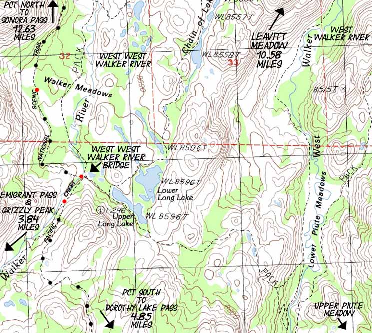
of the
West West Walker Bridge along the Pacific Crest Trail Route
Click the Map
|
||||||||
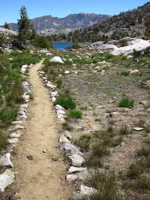
Detailed Hiking Map of the West West Walker River Bridge Distances measured North and South from West West Walker River Bridge. NORTH The first is the Westernmost route North along the East bank of the West West Walker from the bridge, which shortly veers Northeast to intersect with our second trail Northeast, the trail past the Chain of Lakes. Our Easternmost trail to Leavitt Meadow is the trail running the length of the West Walker River, into which the other two trails merge before entering Leavitt Meadow. Turning at the Upper Long Lake trail junction to hike Northeast past the sweet Chain of Lakes points us more directly towards the Leavitt Meadow Trailhead than hiking East to the West Walker River Trail. The problem with the three trails Northeast to Leavitt Meadow is that they are all intriguing trails surrounded by beauty. A constant frustration of mine is not being able to see it all. I urge myself to patience, and put my mind towards figuring out my next moves to expand my understanding of the terrain, which expands "the list." "The List" represents where my trail knowledge ends and trip planning begins. For local hikes one of these three trails is a good way out to the West West Walker Bridge from Leavitt Meadow Trailhead, the other two offer good ways to loop back to Leavitt Meadow to end local backpacking loops of less than 30 miles out to the West West Walker Bridge or up to Cinko Lake. Our local short-distance backpacking loop options out of Leavitt Meadow are laid out on the maps linked to below.
Emigrant Wilderness Backpacking Loops
I neglected to include the Cinko Lake trail linking the PCT with the West West Walker River on the Schematic, it is omitted from the Sonora Pass Region Maps, but "marked in" on the Sonora Pass to Bensen Lake map. SOUTH All the Rivers and their associated trails along the West and the West West Walker Rivers run Northeast out of the mountains through Leavitt Meadow on the Eastern flank of the Sierra along Highway 108. Except our PCT route North and South. Get Your Maps On Another link to the USGS if the above fails. They do that... Map Planning You're welcome to print out the maps on the Tahoe to Whitney Guide for your own use. At some point in time I'll be offering a map service. Using the Forum to Plan Trips and Collect Information These pages will become part of your permanent reference materials and be a foundation for building further trips. You can add after-trip information to correct and sharpen your trip planning. You can reopen your personal backpacking planning pages by going to "My Account" and clicking on the "Track" tab. This will list out all the pages you've constructed. To construct a page register, click "create content," and select "Personal Backpacker Notes" to create private pages only available to you through your account. If you want to publish stories, notes, updates, or opinions across the home page to add information to the various backpacking trails and topics forums you must select another type of content. These "Personal Notes" are a great way for you to keep track of the miles and elevations of your trips, and just how you planned out your campsites, food, and gear for future reference. Your account as a member of Tahoe to Whitney can be a helpful tool for collecting the information off this trail guide to plan out your backpacking trips. And remember, the Backpacking Trails and Topics Forums are currently in a primitive form. The forum site is moving slowly towards a redesign that will transform it into the most informative and easy to use backpacking forums on the whole darn internet! In the meantime it is a great feature for collecting and storing backpacking information gleaned off this trail guide and backpacking forums, and id a good place to collect up and centralize information drawn from a number of sources. Remember:
|
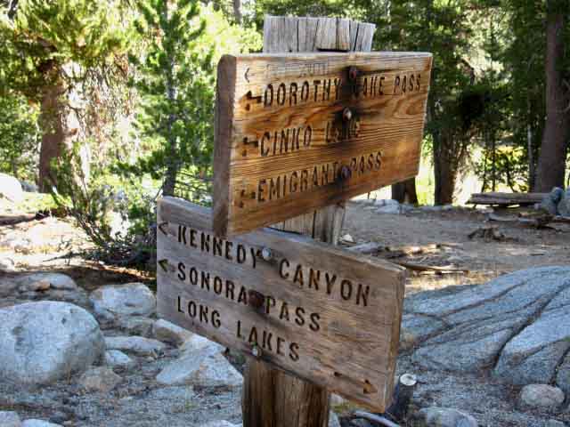
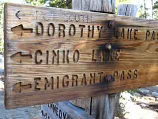
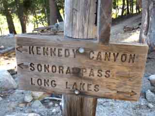
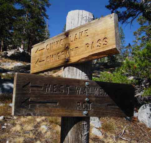
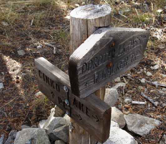
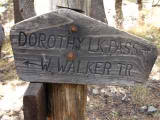
West West Walker Bridge Trail Junction
Four Way Trail Junction
on the
Southeast side of the West West Walker Bridge
 |
||
West West Walker Bridge Trail Junction The upper sign pointing towards us points the way South on the PCT up the mountain towards where the PCT trail up to Dorothy Lake Pass splits off the trial up to Emigrant Pass. The interesting thing is that both these trails can bring us South to the top of Jack Main Canyon, not just the PCT... The two upper destinations on the lower sign point North towards Kennedy Canyon on the PCT route to Highway 108 at Sonora Pass. The bottom destination on the lower sign points East to Long Lakes. That trail continues East past Long Lakes where it passes East by the junction Northeast up to the Chain of Lakes, continuing East to descend into Lower Piute Meadows along the West Walker River in its sweet canyon. At Lower Piute Meadow we pick up the trail running the length of the West Walker River, from its trailhead on Highway 108 at Leavitt Meadow up to the top of its headwaters bowl. The best map I have up of the length of the West Walker River is the Sonora Pass Region Hiking Map
|
The Pacific Crest Trail
The West West Walker Bridge to the Eastern Cinko Lake Trail Junction
Cinko Lake Loop A Northbound Video This is a distance of 2 miles, mostly descending as we hike North. There's another Upper Cinko Lake trail junction, the Western junction along the trail up to Emigrant Pass. Cinko Lake lays along a trail connecting the PCT to its East with the trail to Emigrant Pass to its West. The miles from the bridge through Cinko Lake on both trails is laid out above.
Sonora Pass to Bensen Lake
Sonora Pass to Tuolumne Meadows
Sonora Pass Region Hiking Map
9:28 |
Trail Junction on the Southeast side of the West West Walker River Bridge
Detail
Hiking the PCT South into Yosemite via Dorothy Lake Pass
 |
 |
||
Southbound PCT Alternatively, continuing Southwest past this next PCT junction up the West West Walker brings us to the nearby Cinko Lake trail junction. We can cut over to the PCT via Cinko Lake as well. Continuing Southwest past the Cinko Lake trail junction brings us up through the headwaters of the West West Walker River to Emigrant Pass, which sits next to Grizzly Peak, where we intersect with the route of the TYT coming across the High Emigrant Basin from Kennedy Meadows Pack Station. |
Northbound PCT Northeast If we continue East past the Long Lakes we intersect with the trail running North and South along West Walker River beyond. Situate Thy Self:
|
Four routes out of a three-way Junction I figure that the old route down the East bank of the West West Walker river from the bridge is still a route if not a maintained trail. It stretches North along the West West Walker from the bridge until it bends Northeast to intersect with the Chain of Lakes Trail.
|
Sign Pointing East and West near the West West Walker River bridge
 |
||||
Local Landmarks The noting of meadows points out an interesting feature of this area: The West-West-Walker, the Chain of Lakes, and the West Walker all run parallel and very close to each other, separated by distinctively beautiful steep and narrow granite ridges. Each channel between these close-spaced formations is full of river, rock, forest, and meadow terrain that is real sweet. There is a unique little zone between these meadows that warrants further exploration.
The map linked to above can be magnified in your browser for close inspection. The red dots along the main trail routes marked on the maps bring you to the specific trail guide entry for that location. Each map is linked to the next map continuing to the North and South along the main trail routes, and to the East and West as necessary to depict the connections between the main Pacific Crest and Tahoe to Yosemite Trail routes. Explore the maps and the guide pages, then get out and explore this special section of the Toiyabe National Forest and its associated trails through the Emigrant Wilderness. It will enrich your life.
|
The Other Trail South from West Walker Bridge The West West Walker Bridge is the center of a triangle of trails up to Cinko Lake. Note on the map that Cinko Lake is situated between the trail running up the West West Walker to Emigrant Pass and the Pacific Crest Trail to Cascade Creek. This trail configuration makes Cinko Lake a premium turnaround point for backpacking loops out of Leavitt Meadow.
|
Hiking .19 miles South
on the
Pacific Crest Trail from the WW Walker Bridge
we encounter the next
trail junction
 |
||||||
The PCT Bends Southeast The sign is also pointing Southwest towards Cinko Lake & Emigrant Pass, to our Southbound Right, continuing up the West West Walker River. The Southbound Pacific Crest Trail veers left here, to the Southeast, towards Dorothy Lake Pass. Here Southbound hikers on the PCT route begin climbing out of the granite channel cut into the terrain the West West Walker flows down to cross over and around the noses of a couple of granite Sierra ridge arms descending off the crest into the watershed of the West Walker River on our way over to Cascade Creek. Along the way we pass by the Eastern end of the Cinko Lake trail. We can loop through Cinko Lake to return to this point. Past the Eastern Cinko Lake junction we approach Cascade Creek, who's course we will follow up to Dorothy Lake Pass's entrance into the Yosemite Backcountry. Turning onto Cascade Creek the forest cover begins to thin as we climb into exposed terrain for the final climb over Dorothy Lake Pass. Alternative Route South towards Tuolumne Meadows Continuing straight up to Emigrant Pass from the West West Walker Bridge puts us in position to turn South to Bond Pass from Emigrant Pass along the Tahoe to Yosemite Trail. This route option allows us to rejoin the Southbound PCT route to Tuolumne Meadows at the top of Jack Main Canyon. Route Selection My criterion for route selection is balanced between what I have not hiked before against my desire to repeatedly hike trails to better understand their character and detail. I figure it takes at least three trips down a particular trail to get somewhat familiar with it. My approach generally works out like this: I hike the PCT route through an area. Then I hike the TYT route through the same area. Many times. Then I come back and hike big loops tying these two routes together. Then I figure out my favorite spots, and make trips to spear them all. The Next Step Our best access to the Sierra Crest during Winter is either through one of the open trans-Sierra highways or coming in the Eastern flank off of Highway 395.
Sonora Pass to Bensen Lake
Sonora Pass to Tuolumne Meadows
|
The Southbound backpacker begins the climb to Dorothy Lake Pass here, where the Pacific Crest Trail breaks off from the West West Walker River.
Northbound Though the WW Walker is descending as it flows to the Northeast, the Northbound PCT only stays level for a short distance before it begins climbing gently to position itself above the meadows, then steepens its climb a bit to situate itself for the turn up into Kennedy Canyon. Once to the top of Kennedy Canyon the climb North over the Leavitt Massif begins in earnest. At the 11000 foot high point across Leavitt Peak we've climbed 2400 feet over 9.97 miles from the low point of the trail at the West West Walker River Bridge. PCT NORTH |
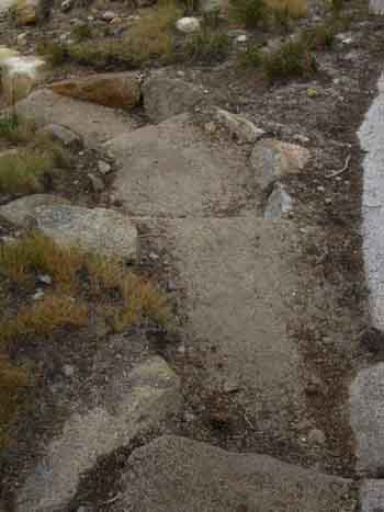
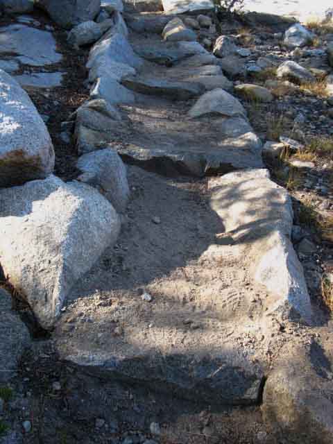
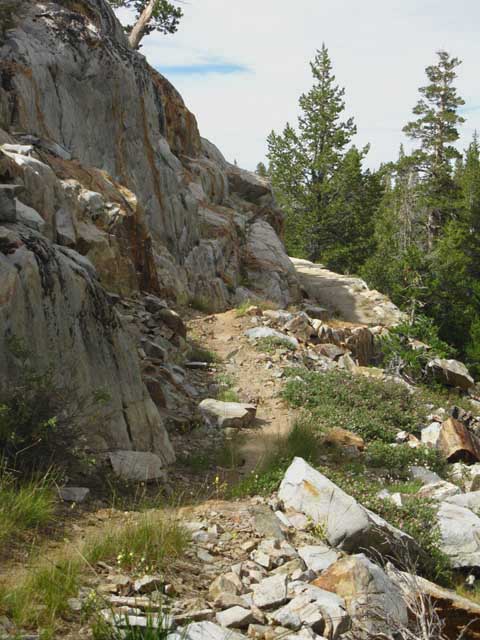
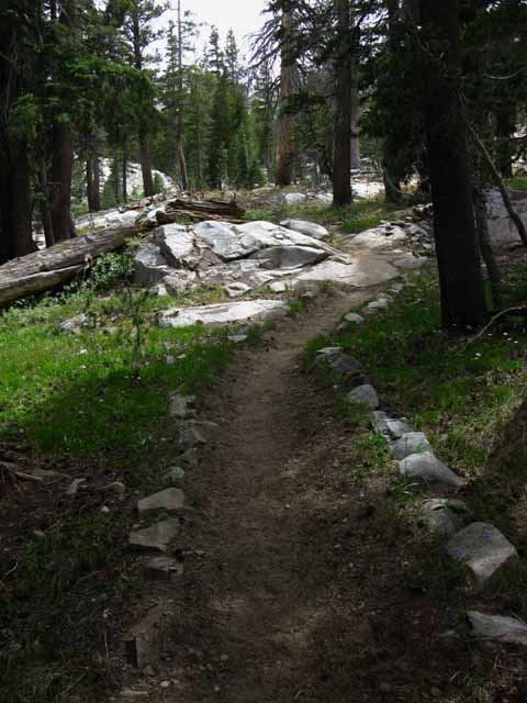
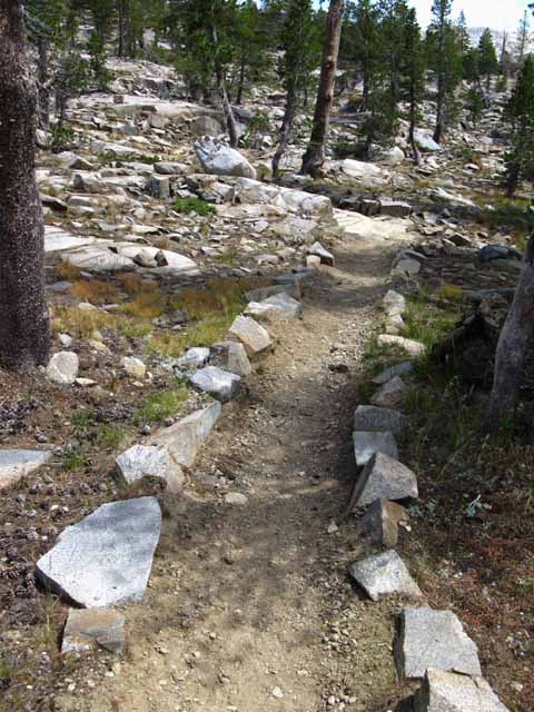
Fine Trail Work
| High Quality Expert Trail Work | ||||
 |
 |
|||
TRAIL CREW:
|
||||
View to the North-Northwest
Granite - Volcanic Interface
 |
||||||
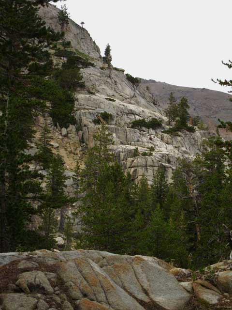
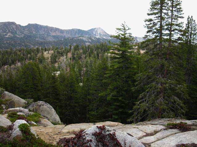
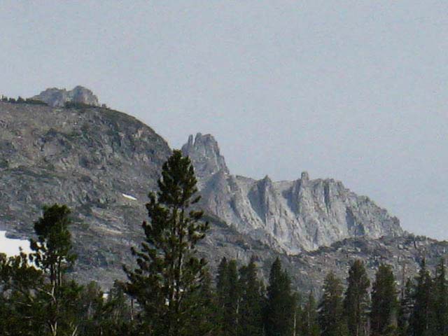
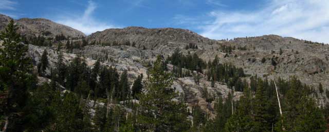
East Flank of the Sierra Nevada looking North-Northwest Here's what we're climbing for. Hiking Southeast on the PCT route climbing out of the West West Walker River's narrow valley we turn around to take in the view North along the East Sierra flank. Our view North is of the North wall of Kennedy Canyon across intervening terrain. The furthest ridge across the width of the image makes up the South-facing Northern flank of Kennedy Canyon. That distant red ridge is the East end of the Southeastern ridge arm descending off the Leavitt Massif. Note the granite ridge rising up to the Sierra Crest on the far Left of the image above. Then note the difference between that and the subsequent ridges we can see further North along the East Sierra Crest. We can see the low granite of Hollywood Basin beyond the near granite terrain but before the far volcanic terrain of Kennedy Canyon beyond the basin. The West West Walker River runs through the base of the valley before us down to the West West Walker River Bridge. Its rapid down-mountain flow moderates hitting the more moderate terrain of Walker Meadows at the bridge.
Sonora Pass to Bensen Lake
Sonora Pass to Tuolumne Meadows
|
Kennedy Canyon
from above the
East Bank of the West West Walker River
 |
||||||
Granite and Volcanic Terrain We're turning around to look Northwest across the East flank of the Sierra just below the line of the Sierra Crest. We're looking at fine granite terrain across the West West Walker River after turning Southeast with the PCT climbing away from the river. The great granite wall rising above is the West wall of the canyon rising above West bank of the West Walker River. The West Walker River flows in the deep channel cut into the granite between our position and the granite face. Note the volcanic ridge beyond the granite in the upper-Right of the image. We are looking Northwest at the volcanic terrain that makes up the Northern wall of Kennedy Canyon, which is also the Southeastern Flank of the Leavitt Massif. The near granite cliff rising above us is the East flank of the Sierra below the Sierra Crest and is the East end of granite sticking out from under ancient volcanic flows that buried the Sierra Crestline here. The Sierra Crestline above marks out a granite-volcanic interface. In the distance beyond the granite wall we can see the backside of the ridge composing the South wall of Kennedy Canyon descending across the upper-Right corner of the image. That ridge is completely covered by volcanic material, except the very bottom of its Eastern extent. Remember that we hiked around the little bit of granite sticking out from under the East end of that ridge when we turned South coming out the bottom of Kennedy Canyon. The fantastic granites of Hollywood Basin lay between the granite wall above us and Kennedy Canyon's volcanic ridge. Hollywood Basin is an indentation of granite below the Eastern flank of the Sierra between our current position and the volcanic terrain of Kennedy Canyon. Hollywood Basin looks really inviting for some adventurous scrambling. That looks like a "hard way" to the Sierra Crest! PCT Route Emigrant Pass Trail Transitions This transition makes the Emigrant Trail a very pretty and interesting trail from the West West Walker Bridge to Emigrant Pass next to Grizzly Peak in Emigrant Basin. More on that above. Shifting Views hiking South Hiking out of and above the West Walker first gives us unique views of the bifurcated granite and volcanic terrain along the Eastern flank of the Sierra, as in the image above, then our views North up the "slot" of the West Walker Watershed wedged in-between the Emigrant Wilderness to our West and the Hoover to the East really opens up as we climb past Lake Harriet and Stella Lake to Dorothy Lake Pass. Once we get higher up the East flank we will trade in these obstructed Northern views for fantastic views to the North and Northeast, especially of the stark volcanic ridge rising above the East bank of the West Walker River Valley and the two hard to distinguish canyons at its foot. We are in a "tab" of the Toiyabe between the Emigrant and Hoover Wilderness Areas. Our view North finally terminates hiking across the low flat crossing Dorothy Lake Pass onto the West flank of the Sierra and into Yosemite National Park. The Hoover Wilderness PDF map below-Right lays out the boundaries, roads, and trailheads accessing the Hoover Wilderness, rather than the trails in the wilderness. The map on the Left lays out the through-trails, being the TYT and PCT and their connector trails, which is where most of our attention is centered.
West Walker River The Northwest edge of the Bensen Lake to Stubblefield Canyon backpacking map shows part of the Sierra Crestline where the Hoover and Yosemite boundaries intersect. Bensen Lake to Virginia Canyon This boundary configuration leaves the West Walker River Watershed as a pocket of territory running North and South between Emigrant Wilderness to its West, Yosemite to its South, and the Hoover Wilderness to its East and Southeast. Hoover Wilderness Exclusion The Hoover Wilderness was subsequently expanded in 1957 and converted to a wilderness area, and is apparently in the process of absorbing the West West Walker Watershed. The whole history of the Hoover Wilderness can be threshed out of the This history covers a wide swath of time and space. It lays out the very basic parameters of indigenous cultural history from 7000 bc through the "transition" to Western culture in the 1830s. I linked to the Forum page of Toiyabe History so you could post up your insights and additional sources for information about the History and status of Toiyabe National Forest and its Hoover Wilderness. The current big issue in the Hoover Wilderness has been allowing or not allowing snowmobile activity into the prospective wilderness area along the West Walker River. Snowmobiles are currently allowed as of 2014.
The way into the West and West West Walker Rivers is through the Leavitt Meadow Trailhead. I put up this forum dedicated to reports on backpacking trips out of the Leavitt Meadow Trailhead: East Emigrant-West Walker in the Toiyabe Forum
|
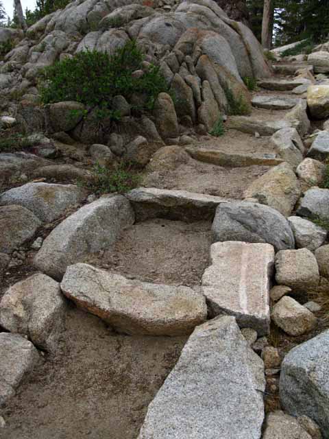
Rock Solid Trail
 |
||
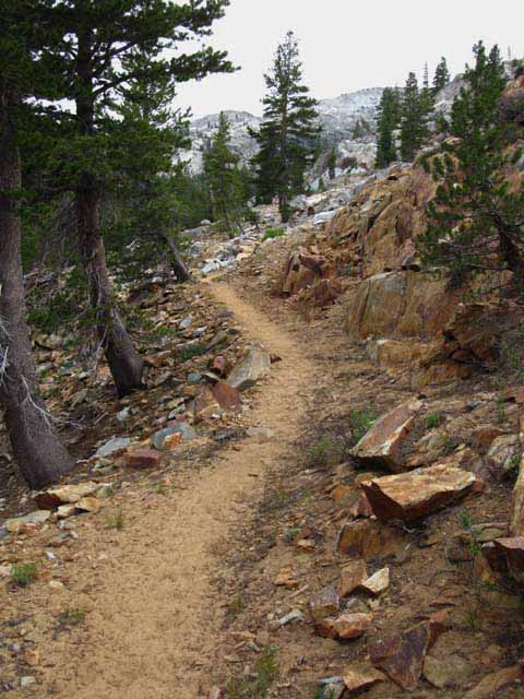
Moderate difficulty climb. H3 to I1 from West West Walker River to Dorothy Lake Pass.
|
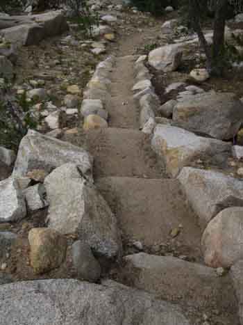
Trail Work integrated with and within the Terrain
 |
||||||
This is Art: Trail designed and executed to fit into the terrain. It is wondrous trail to a wonderland across a wonderland. Wonderful! Sonora Pass to Bensen Lake
Sonora Pass to Tuolumne Meadows
|
Detail
 |
Hiking over the first ridge South of the West West Walker River. |
Views to the far Southeast
Unnamed Peak North of Hanna Mountain
 |
Views to the Southeast begin to open up as we climb Southeast up and over the ridge above the Eastern shore of the West West Walker River. Climbing to the top of the ridge East of the West West Walker gives us broad views of the ridges wrapping around the upper end of the West Walker River Watershed. That peak in the distance is one of them, a "numbered" peak along the ridgeline. We can begin to see the complexity of the peaks along the Sierra Crestline divided between the Hoover Wilderness and the North Yosemite Backcountry down there to our Southeast. |
Detail of Ridges Feeding and outlining the West Walker River
 |
||||||
VIEWPOINT Bam! Reaching highpoints climbing South over the ridge out of the West West Walker River into the drainage of the West Walker we come to a fine point overlooking the terrain to the Southeast. The predominant peak in the distance is the 11280 foot peak located between Anna Lake and Hanna Mountain along the ridge crest running to our East from our Northeast to our Southeast. Anna Lake sits on the other side of the low gap cutaway on the far Left side of the ridgeline. Hanna Mountain is hidden behind Peak 11280. The crest of that distant ridgeline is the Eastern Boundary of the Hoover Wilderness. Everything on this side drains into the West West Walker River in the Toiyabe National Forest, including the runoff from our position, and from the West West Walker river behind us as well. Immediately below that distant ridge is Long Canyon, which is a major subordinate canyon East of the West Walker climbing to the Southeast out of the West Walker's main canyon just a bit South of Fremont Lake. We can see a dark ridge below the most distant ridge. That ridge divides Long Canyon on its far side (East) from the main canyon of the West Walker River on this side. Sonora Pass to Bensen Lake The light-colored granite ridge in the foreground between us and these two more distant ridges is the Western rim of the West Walker River's canyon. We're still in its watershed, but on its Western slope up to the Sierra Crest above the main cut of the canyon below. This section of our trail essentially hikes around the Western edge of the watershed of the Walker River and its Western tributary, the West West Walker River. The West Walker River is a lot bigger than our brief view of it hiking around its upper Western section. The West Walker River runs South to North from here along the base of the Eastern flank of the Sierra to drain the whole East Sierra flank up to its end at Lake Topaz in the North end of Antelope Valley. The narrow canyon between Sonora Junction and Antelope Valley floods violently on a regular basis, wiping out the Highway and damaging the town of Walker every 10 or 15 years or so. I can remember at least three floods through there since 1962... The road map is helpful for understanding how the Sierra shifts to the East South of Sonora Pass. It also depicts the West Walker canyon North to Antelope Valley along the Eastern flank of the Sierra. I like this whole region of the East Sierra from Bridgeport up to Lake Topaz. Carson-Iceberg Wilderness Map,
Sonora Pass to Bensen Lake
Sonora Pass to Tuolumne Meadows
|
Terrain Note Northbound backpackers through this section hiking down from Dorothy Lake Pass to the footbridge across the West West Walker River may have noticed that this section is not all down-mountain. In fact we have two distinct little sections of uphill to climb up as we head down the mountain between the upper and lower junctions to Cinko Lake. Southbound backpackers should be pleasantly surprised that the lower half of the long climb up to Dorothy Lake Pass has a couple of level and even little downhill sections. My Broader Point... My point here is that the raw elevation changes between the lower and upper points of any section of trail do not measure all of the little ups and downs we encounter between the high and low points of a trail section. Trails rarely just go up or down. Most trails go up and down. Even trails that are primarily climbs have bits of descent, and trails that descend have segments that climb. |
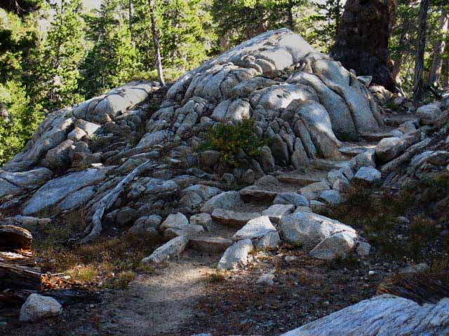
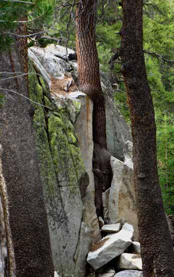
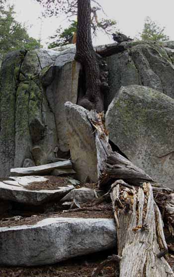
Big Leverage on Big Rocks Successive growth of trees in a crack along the edge of this rock wall are levering out big sections of rock. Note the old fallen tree, the predecessor of the current resident of this expanding crack, laying across the boulders in the image on the Right. Next... |
||
 |
 |
|
 |
||||
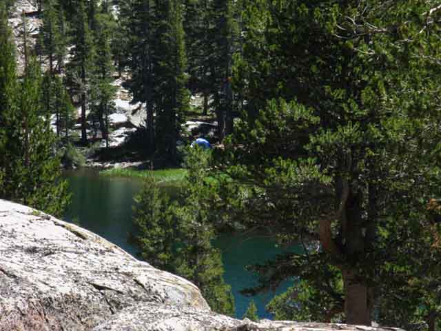
Campsite. Note tent/sleeping spot to the Right of the fire ring.
|
Red and White and Black
 |
||
Red Section.
|
Black and White Section
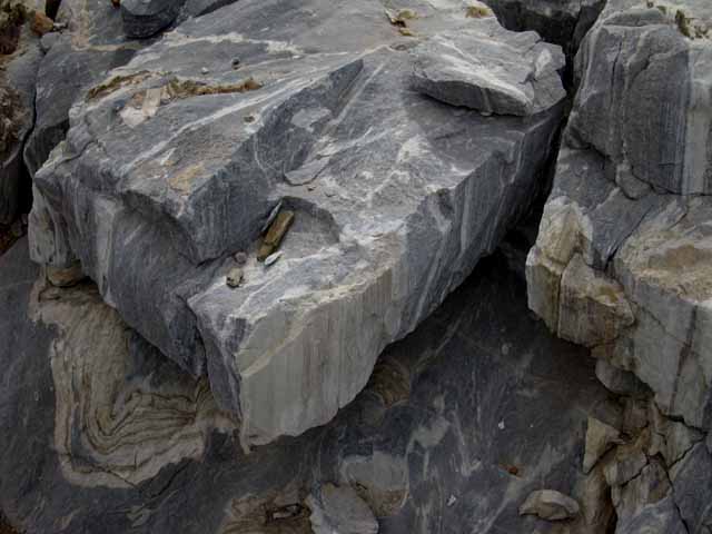 |
Followed by a section of distinctive black and white rock. This stuff reminded me of Serpentine rock that we will begin to see as we enter Matterhorn, and especially Virginia Canyons to our South in Yosemite, though this rock is black and white rather than green. It has that serpentine "feel" and texture, though not the color. |
Three Views of Tower Peak to the Southeast
 |
||||
Tower Peak is peeking over the crestline along the middle-center of the image. Better views of Tower Peak open up as we continue working our way Southeast through the terrain.
|
The Way South
 |
11755 foot Tower Peak is the dominant regional peak along this section of the Sierra Crest. At the top of the headwaters of the West Walker River we find a trail South up to Tower Lake sitting under the Northwest flank of Tower Peak. Bob Burd's Sierra DAY Peak-Bagging Adventures |
Yet More of Tower Peak
 |
||
Hiking further South our views of the details of the tippy-top of Tower Peak and the fangs on its Northern crestline open up. Fk Yeah! I have a Climbing Tower Peak story that was told to me my a Marine Lt who was stationed at Pickle Meadow. Though it is not my crazy climbing story, it's a good one, and I will relate it at some point in the future...
|
View North
 |
Looking back at the view North of a nifty section of trail along a ledge carved into a rock wall above the forested cut in terrain below. Pacific Crest Trail hiking South from the West West Walker River. Hiking South on the Pacific Crest Trail from the West West Walker River we hike East out of its drainage over a ridge arm then along the Eastern Edge of great granite mounds descending off the Sierra Crestline above the strip of forest and meadow we see below-Right in the image above. |
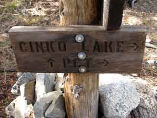
EAST
Cinko Lake Trail Junction
 |
||
The East Cinko Lake trail junction. We encountered, and walked a short distance on the trail approaching the Western trail to Cinko Lake along the West West Walker River after crossing the bridge over the West West Walker River. Now we are situated on the East end of the trail connecting our PCT route with the trail up to Emigrant Pass from the West West Walker Bridge. Hiking West to and then past Cinko Lake joins us up with the trail coming South up from the West West Walker bridge to Emigrant Pass. Emigrant Pass sits just feet to the Northwest of Grizzly Peak. These trails open up significant options for great backpacking loops around the stunning Emigrant Wilderness and these associated areas in the Toiyabe National Forest. My advice: Oil up your hiking boots, pull out your pack and clothes, clean your stove, and pack your food. The Emigrant Wilderness (and this little bit of the Toiyabe National Forest) is calling you! Emigrant Basin Backpacking Map Especially check the lower Right-hand corner...
|
| Video Harriet Lake Northbound to Upper Cinko Lake trail junction. |
||
Sonora Pass to Bensen Lake
Sonora Pass to Tuolumne Meadows
|
EASTSIDE
Cinko Lake Trail Junction
 |
 |
||
West to Emigrant Wilderness The trail West to Cinko Lake ends 1.52 miles West where it Tees out into the trail running from the West West Walker Bridge to Emigrant Pass. Cinko Lake: .87 mile Emigrant Pass: 3.38 miles West West Walker Bridge: 3.38 miles Emigrant Basin Backpacking Map
|
PCT North on the PCT to West West Walker Bridge Next trail junction South at the Cascade Creek trail junction. South to Dorothy Lake Pass From the Cascade Creek trail junction we have the option of following Cascade Creek Northeast down to the West Walker River or South up the PCT towards Dorothy Lake Pass. |
Dry Sage alongside Green Finger of Vegetation following creek
East Flank Sage |
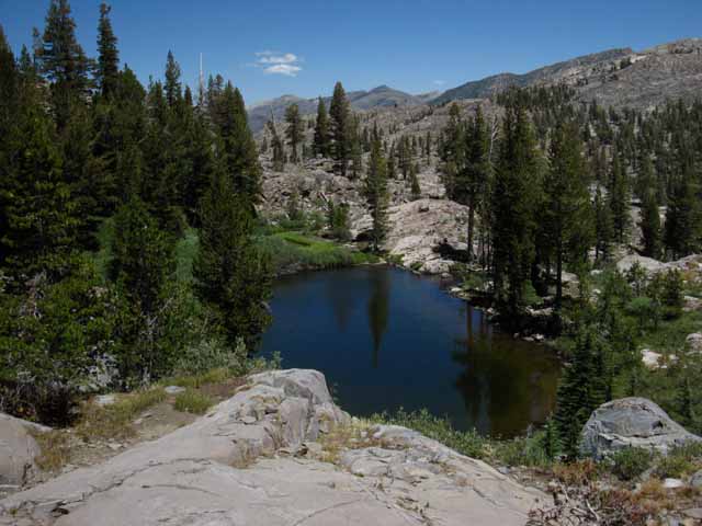
The Creek South of the upper Cinko Lake trail junction. NOTE: The 1990 USGS 7.5 minute Tower Peak map does not depict this creek. The 1985 30 minute USGS Bridgeport map does. This creek runs Northeastward down from high up the Sierra Crestline starting from just a bit to the Northeast of Grizzly Peak near Grizzly Lake. This creek ultimately feeds the West Walker River through a gap in the terrain to the East of Upper Long Lake to flow into the West Walker at the bottom of Lower Piute Meadow. The campsite shown above accesses this creek as its water source. East Flank Arid Ecosystem These dry sage conditions continue East up and over the mountain ranges East of the Sierra, and into the deserts extending East from them, water conditions permitting. Above we see a finger of dry sage terrain reaching up to its upper Western limit of sage-growth. This little finger of sage represents aggressive sage growth reaching up into the bottom of the forest and grass zone along the East Sierra. This "wetter" zone of forest and grass is supported by the higher moisture levels higher up on the East Flank. Below this line of moisture the East flank rapidly dries into desert-like conditions. |
South of the Junction we encounter a small stream with a small but verdant meadow hedged in by granite and forest
 |
||
Looking Northwest Map Note The USGS 7.5 map shows the black ponds below, but not the little creek we can see above running around the perimeter of this cute little meadow. The USGS 30 minute map shows the creek but not the black (vernal) ponds. During this slice of time, during the last decade of the last century and the first decade of this Century I have observed both ponds and a creek. We are safe visualizing both the creek from the one map and the ponds from the other to visualize the features along the PCT South of the Cinko Lake junction.
|
Diffuse Interface between Forest and Meadow
Looking Northwest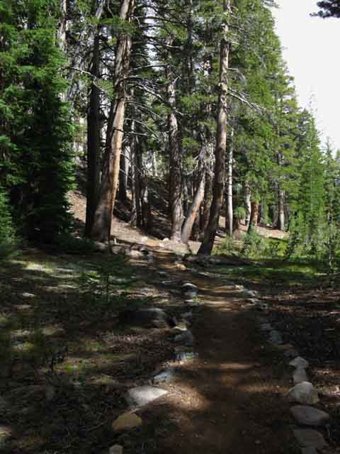 |
Nice Trail! Shaded PCT on a soft trail surface along the interface between forest and meadow South of the Upper Cinko Lake trail junction. This very nice flat gap in the descending ridgeline allows us easy passage between the Upper Cinko Lake trail junction and the Cascade Creek/West West Walker trail junction. |
Black Ponds
 |
||
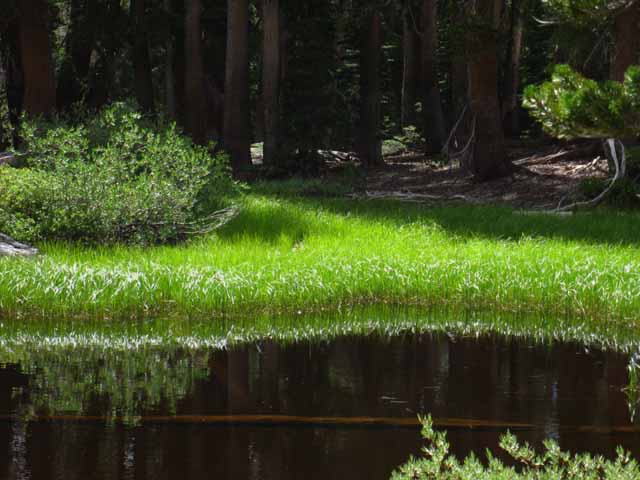
Color, Light, and Darkness Runoff brings sand and soil to fill these ponds, grasses grow in to root the runoff soils, and a meadow begins emerging, tightening and closing its grip around the diminishing pond. The surrounding lodgepoles are not far behind the grasses. The lodgepoles begin marching in on the heels of the grasses, creating their own slowly tightening circle of timber wrapping around and infiltrating the apron of grasses as they slowly strangle out the black ponds. Such is the succession of life. Life eats itself to survive both individually and as part of large groups actions,
|
Rock Water Scale
 |
||||
Rock rising out of the South edge of the Northern black pond measures and records recent pond history.
|
 |
A record of the annual drop in pond level is naturally recorded. Note the bright layers left behind when the pines unleashed their pollens. |
Looking
North from Between the Ponds
 |
Lower, or the North Black Pond on PCT below the Cascade Creek trail junction. The line of our trail above is running us on a line out of the Northwest to the Southeast through a low gap in the granite terrain descending the East Flank of the Sierra. |
View South from Between Ponds
 |
||||
The Upper, or Southern, smaller black pond between Cascade Creek and Cinko Lake trail junctions.
Sonora Pass to Bensen Lake
Sonora Pass to Tuolumne Meadows
|
Better than a Walk in the Park
 |
Our trail runs through the narrow, cool, and very pretty forested glade filling the flat spot/slot running us from the Upper Cinko Lake trail junction to the Cascade Creek/West West Walker trail junction. The whole length of the distance hiking through this channel in the terrain holding these two ponds is less than half the total .72 of a mile distance between the Cinko and Cascade junctions. Note the flat with two ponds between the East Cinko Lake and Cascade Creek trail junctions on this map: |
Small Delights
 |
||
North end of the upper, or Southern, black pond in its glade. Little "special zones" like this are strung-out along the course of our route like pearls on a line. These are places where the unique configurations of the terrain have conspired to focus the forces Nature into concentrations of life. These places bind the available weather, water, matter (in the form of runoff soils), and Sunlight (the "aspect" of the place) together into living real time expressions, manifestations of local and grand spirits of the inherent consciousness. That is why and what we see. Here.
|
Cascade Creek Trail Junction
NEW
New Signs were Posted at the trail junction down Cascade Creek to the West Walker River as seen in 2012
 |
 |
This West Walker River junction on the Pacific Crest Trail is the quickest way for Northbound PCT hikers to bail out to hike around, to bypass Leavitt and Sonora Peaks, if the snow conditions on these two mighty peaks are impassable or impossible for you..
This reroute happens to early PCT hikers who are not snow tested almost every year.
These old Trail junction signs have been removed but they correctly point back to the way it was.
 |
||
West Walker trail junction as seen in 2009. I prefer these old rustic trail signs to the new. I have no idea why they replaced them.
|
 |
 |
||
Southwest to Cinko Lake and Emigrant Pass along the Northbound PCT. Southbound PCT continues upward. This sign was viewed coming SW up Cascade Creek from the West Walker River. |
Northeast down to the West Walker River, South on the PCT to Dorothy Lake Pass. Kennedy Canyon to Dorothy Lake Pass
|
 |
||
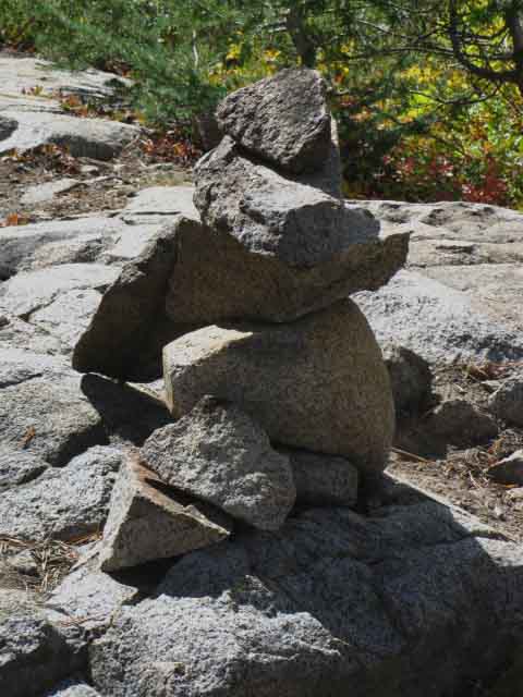
Great duck South of Cascade Creek & West Walker trail junction. Anyone have information about this duck, and what it signifies? I think it marks a campsite off the trail.
|
Something Moves Through the Forest
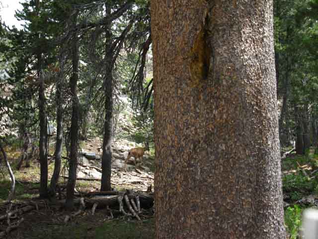 |
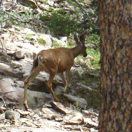
Spotted Movement in the chaos of the forest and rock. I had a handy tree for cover and used it, but to no avail. This old girl had seen me first, and decided to move away, even though her motion and sound would give away her position. |
 |
||
Looking closely I saw an old doe walking away. She had seen me and decided to split, which made me aware of her position despite her slow, quiet retreat, but not for long. She was out of there. The doe's ear is on me even though her eyes are not. I'm fooling no one hiding behind this stupid tree...
|
Two Small Black Ponds South of Cascade Creek Trail Junction
 |
||||
At the North pond along Cascade Creek with map in hand. Sonora Pass to Bensen Lake
Sonora Pass to Tuolumne Meadows
|
 |
South of the two ponds along Cascade Creek. |
 |
||
Note the arc cut in the distant ridgeline. It shows the Winter hiker they are lining up with Dorothy Lake Pass.
|
 |
||
Trail below Harriet Lake. Kennedy Canyon to Dorothy Lake Pass
|
Cascade Creek
 |
||
Cascade Creek running downstream below Lake Harriet. Harriet is a short ways behind us at the top of a short moderate difficulty hike.
|
View West-Northwest
 |
Hiking South into top of narrowing canyon along Cascade Creek looking to our North. Tree and mountain wear away on different time scales. The great granite mound is descending off the Sierra Crestline. Careful analysis shows a low ridge between our position and the background feature. The background granite feature is the one rising to the Northeast behind Cinko Lake. |
Thinning Forest Cover
 |
||
Easy trail below Lake Harriet. Terrain is shifting from mostly green trees with a minority of granite to a majority of granite and minority of green. Soon we will be out in open granite, and the angle of our climb will increase.
|
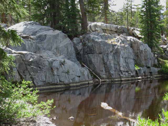
Cascade Creek and Mini-Falls
 |
||||
Cascade Creek is fed from Bonnie Lake and Lake Harriet. This is the branch running down from Lake Harriet. We see it falling into the bottom of a pocket, a wide crack carved through solid granite.
Sonora Pass to Bensen Lake
Sonora Pass to Tuolumne Meadows
|
Cascade Creek and Mini-Falls
 |
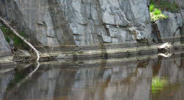
A nifty little "pocket" falls, almost inset into the terrain rather than flowing over it. Here the water flows over and between a granite feature that its ancestral ice long ago carved through the granite. |
Cascade Creek
 |
Detail of the little waterfall. The pocket of rock holding the flow also captures and shelters the cool air flowing along with the cold stream. This creates an air-conditioned zone of chill along this warm section of trail made warmer by our efforts climbing towards Dorothy Lake Pass. The enchanting sounds of the tinkling waterfall and the inviting cool of its accompanying breeze relieves our physical overheating while delighting our senses. |
Cascade Creek
 |
||
Looking down the little falls into the pocket of cool rock.
|
Cascade Creek
 |
|||||||
Cascade Creek flowing Northeast towards its drop into the canyon of the West Walker River. Since turning South coming out of the gap holding the Black Ponds we've hiked along a short fairly flat section of Cascade Creek. The image above is our view coming to the end of this shelf. We have a short 200 foot elevation moderate+ climb over the next quarter-mile to Lake Harriet. Our best maps showing our overall position in relation to all of our surrounding hiking options is the bottom-Right half of our Sonora Pass Region Maps, their Southeastern corners:
Both of these maps above show our proxmity to the upper reaches of the West Walker River. That link opens up the whole of the Northernmost Yosemite Backcountry to our examination through long-distance backpacking loops. Clicking either of the maps above along their PCT routes near Cascade Creek brings us to the more detailed map of this area. Right now we are especially interested in the potential of the trail through the upper sections and top of the West Walker River's Canyon leading up to the top of Kerrick Canyon. The detailed map shows us the back-back way into Yosemite: Kennedy Canyon to Dorothy Lake Pass (Twin Lakes would be the "back" way into Yosemite. These trails can be stitched together to create remarkable loops around the North Yosemite Backcountry and the thumb of the Toiyabe National Forest capping it: The Other Bensen Lake Loop
Sonora Pass to Bensen Lake
Sonora Pass to Tuolumne Meadows
Clicking the red dots on all the maps brings us to the trail guide for that position.
|
Short Views West-Northwest
 |
||
Western granite ridges rise above West West Walker River to the Sierra Crest. Emigrant Pass and Grizzly Peak and Meadow are to the Left, the West West Walker Bridge to the Right. The PCT is the Eastern prong of the wishbone-split of the Emigrant Pass Trail from the PCT South of the West West Walker River bridge.
|
Long View North
 |
||||
West Walker River Watershed Climbing out of the forests South to Harriet Lake we finally can turn around to get long views North at the West Walker River drainage along the Eastern flank of the Sierra Nevada, to the Left. The Pacific Crest Trail turns Left, West, at the base of the great volcanic ridgeline in the far distance. That ridgeline runs West up to the Sierra crestline composes the Northern wall of Kennedy Canyon running up to Leavitt Peak, eventually. Southbound hikers turn West up Kennedy Canyon, Northbound hikers descended Kennedy Canyon to turn South on our way to here at our current position. Also note that the ridgeline descending in the middle distant Left side of the image is composed of granite, while the distant wall of Kennedy Canyon is volcanic. What an interesting interface.
|
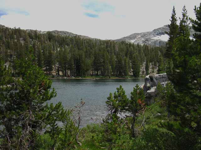
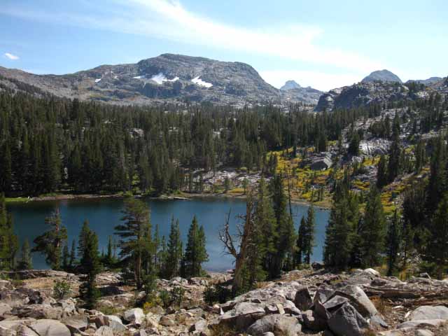
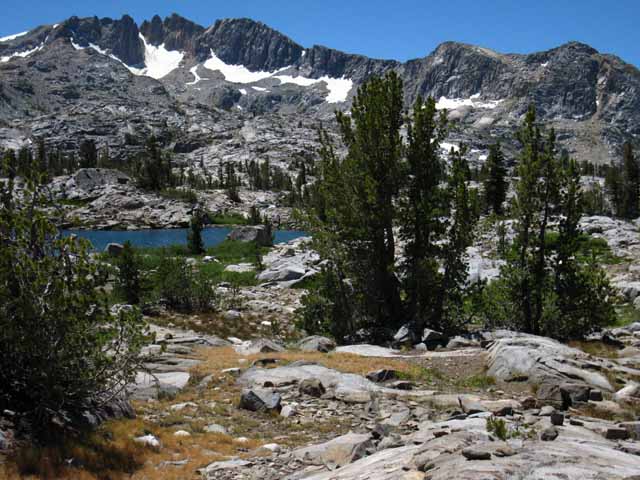
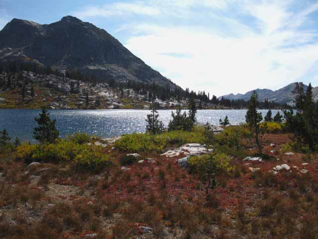
Lake Harriet
 |
||||
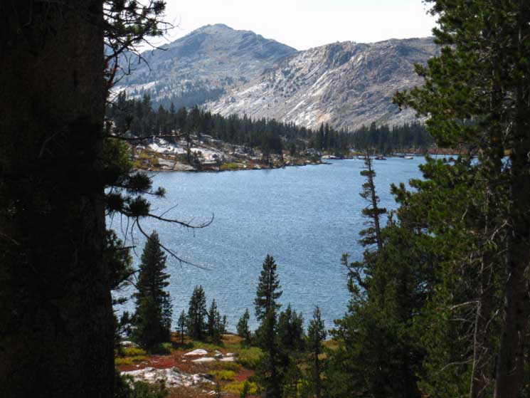
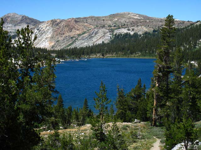
Reaching the Northwest corner of Lake Harriet. 9320 feet Lake Harriet. The Pacific Crest Trail touches the Northwest corner of the Lake. A short distance South of this point is a nice shaded breakspot along the Western shore of Lake Harriet. It's a break spot because it's been over-camped. Camping is still allowed there, but I expect it to be restricted sometime in the future, or it will heal up on its own. The view above is looking Southeast. We are approaching the treeline. Forests have thinned and the lodgepole have given way to whitebarks.
Sonora Pass to Bensen Lake
Sonora Pass to Tuolumne Meadows
|
| Video Dorothy Lake Pass Northbound to Harriet Lake. |
||
Kennedy Canyon to Dorothy Lake Pass
|
Lake Harriet
 |
||
The Sierra Crest Another image from Lake Harriet's Southwestern corner. This view is little bit East of South at the Sierra Crest. Tower Peak is peeking through saddle. Sonora Pass to Bensen Lake
|
Very Nice break spot for through hikers on the West Side of Harriet
 |
Break spot on West side of Lake Harriet. Campsites circle Lake Harriet. As a small lake Harriet offers less elbow room than Stella Lake. Stella Lake is not a big lake, but the way it's laid out gives it a huge circumference offering backpackers much more space to stretch out. |
Lake Harriet
 |
||||
Climbing around Lake Harriet. Looking Southeast at the tips of Tower Peak in the furthest distance. We can see more of Tower Peak through the gap from this elevation, but this view will be lost as we climb South. Sonora Pass to Bensen Lake
Sonora Pass to Tuolumne Meadows
|
Lake Harriet Campsites
 |
||
Just about to turn away from Lake Harriet Though there is an over-improved site on the West Shore of Lake Harriet, I consider this site a break spot rather than a campsite. That's because this site is wedged in-between the shore of the lake and the route of the Pacific Crest Trail. As a campsite it's too close to the lake for my tastes, not much privacy from the trail, though it may be barely legal as a campsite.
|
Pond above Lake Harriet
 |
||||
The pond to the South and above Lake Harriet. We can see the ridgeline above the East side of the West Walker Watershed running out to the North. In the furthest distance we can make out Peak 10230 above the Southeast corner of Leavitt Meadow.
Sonora Pass to Dorothy Lake Pass
|
PCT hiker View of Lake Harriet
 |
View of Lake Harriet from the South, dropping down from Stella Lake. We now have a completely different perspective on the gap in the ridge and peak 11280. The gap in the distant ridge is partially obscured by the intervening granite ridgetop on the Left of the image, though we can clearly see Peak 11280 along the Right side of the volcanic ridge in the distance. |
Peak 10230
 |
||||
Way down by Leavitt Meadow Looking Northeast at Peak 10230 as we climb South out of the basin holding Lake Harriet. Peak 10230 is located on the North end of the red volcanic ridge to our East, the one with the gap and the Hoover Wilderness boundary running along its crestline. But the boundary line turns East before it gets down to Peak 10230, putting Peak 10230 just beyond the Northern limit of the Hoover Wilderness to our East. Poole Lake is located just to the Northwest, the Left, of the base of Peak 10230. Peak 10230 and the end of this ridge tower over the Southeast corner of Leavitt Meadow. Poole Lake sits above the Southeast corner of Leavitt Meadow, and Peak 10230 rises to the Southeast of Poole Lake. Sonora Pass Region Hiking Map
|
Lake Harriet up to Stella Lake
 |
||
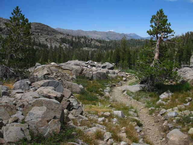
Barren Exposed Reflective Terrain Shattered granite with a trail through it. Shattered anything is hard to cross without a trail. Climbing past Lake Harriet's 9230 feet of elevation we are ascending a total of 275 feet out of the thin forest surrounding Lake Harriet across exposed reflective granite to Stella Lake's 9505 feet of elevation. It's bright up here.
|
North Shore of Stella Lake
 |
||||
North shore of Stella Lake. 9505 feet Coming to the end of the climb up from Lake Harriet we find an expansive flat on the East side of the Sierra Crestline below Dorothy Lake Pass holding Stella Lake. Sonora Pass to Bensen Lake
|
Hiking around the West Shore of Stella Lake
 |
||
Forsyth Peak on the Right side. We are looking almost directly South at the curving North-Northeast face of Forsyth Peak, in fact. Those patches of snow are listed as glacial remnants on the USGS Tower Peak 7.5 minute maps, but they are rapidly disappearing remnants of remnants.
|
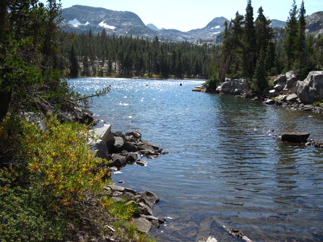
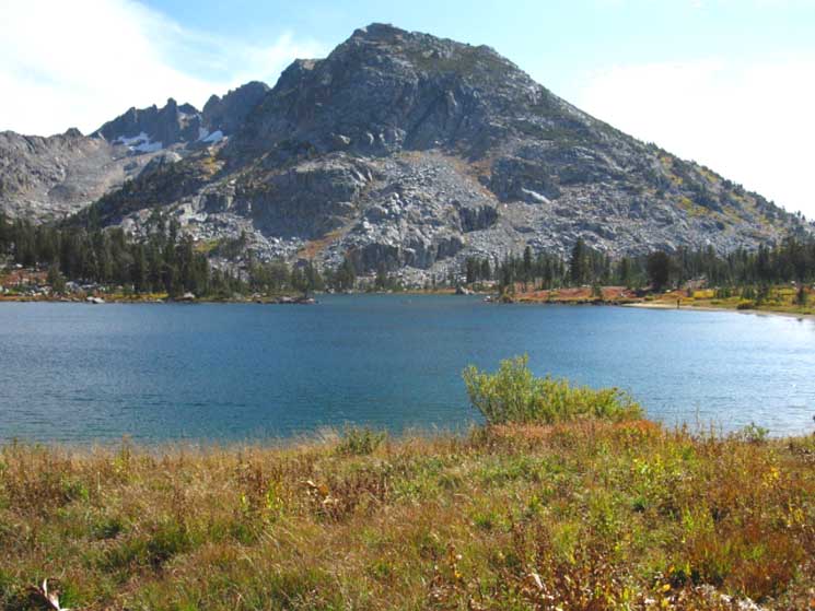
Stella Lake
 |
View South across Stella Lake. In the near distance is the ridge running down from Forsyth Peak to its Western end. The base of that ridge sits off the Southeast corner of Dorothy Lake.
|
Stella Lake
 |
||
Thin neck between North and South segments of Stella Lake. In the background we can see the very Western end of the main ridge arm descending off of Forsyth Peak to the Southeast of Dorothy Lake, which we will bend around hiking down the top of Jack Main Canyon.
|
The Pacific Crest Trail
 |
| PCT: Superhighway of Trails. |
The Pacific Crest Trail
 |
||||
Northbound Pacific Crest Trail along West shore of Stella Lake, view looking North. Lined up with the red volcanic ridge and its characteristic arc.
Sonora Pass to Dorothy Lake Pass
|
Stella Lake and Forsyth Peak
 |
North end of Stella Lake, view looking South. |
Stella Lake and the Gap in the Volcanic Ridge to our Northeast
 |
||||
View Northeast across length of Stella Lake highlighting its Northeastern and Southwestern bodies of water. The West Walker River flows through the valley on the far side of near granite ridgline and the near side of the red volcanic ridgeline with the arc across its crest. The Eastern section of Stella Lake is out of view to the Right in this image.
|
Stella Lake and the Gap in the Ridge from Dorothy Lake Pass
 |
Stella Lake from Dorothy Lake Pass. |
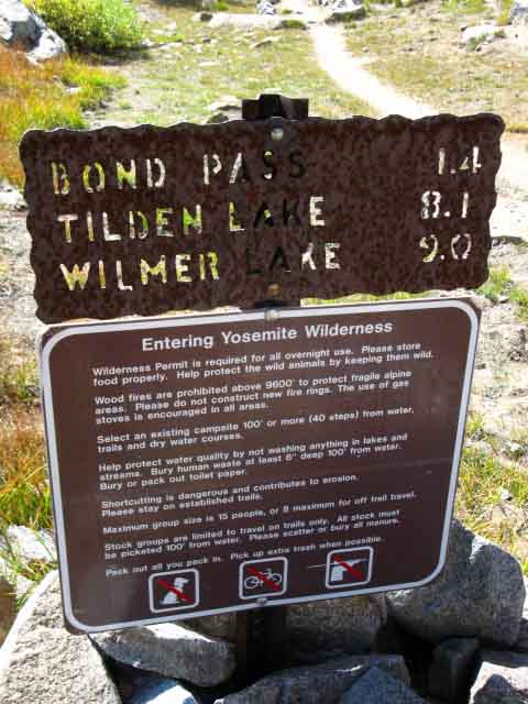
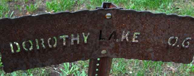
Dorothy Lake Pass
 |
||
Dorothy Lake Pass. We now encounter the steel trail signs of Yosemite National Park. Locations and mileage are cut through the steel plate with a cutting torch. Our first encounter with the heavy metal signs carved by cutting torches that define Yosemite trail signage. These signs became the established standard for Yosemite in the early 1950s as a solution for bears removing conventional trail signage. See "trails and roads" in Yosemite: the Park and its Resources (1987) by Linda W. Greene, specifically page 771 about the steel cut trail signs installation. Also see "Cranky Bears" in the Forum. Mileages and routes etched in steel cannot reflect the changing routes and miles on the ground. This is generally true with all mileages posted on trail signs. Check out this discussion about miles at the South Bond Pass trail junction to our South at the top of Jack Main Canyon. Backpacker's Forum miles discussion Sonora Pass to Bensen Lake
|
Dorothy Lake Pass
Thinking about
|
The Rules
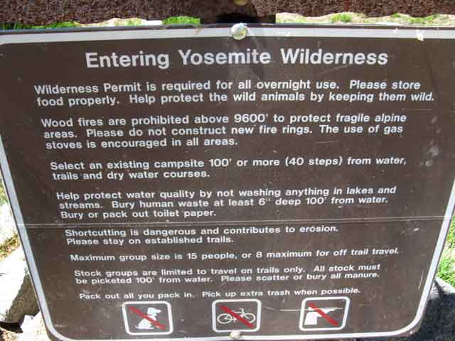 |
| Yosemite rules posted at Dorothy Lake Pass. |
Yosemite National Park
 |
||||||||
Geological Marker in Dorothy Lake Pass.
DETAILED MAPS
LARGE SCALE MAPS
Sonora Pass to Tuolumne Meadows
|
View Northeast
Gap in the Volcanic Ridgeline Marking Hoover Wilderness
 |
Looking Northeast through Dorothy Lake Pass from just steps South of the Pass. Hoover Wilderness
Check the map for boundary details. Sonora Pass to Dorothy Lake Pass That "cutout" of the Toiyabe National Forest between Yosemite and Hoover is slated to be absorbed into the Hoover Wilderness.
|
View Southwest
First View looking South at Dorothy Lake
 |
||||||
Dorothy Lake at the top of Jack Main Canyon.
|
Trail Descending to North Shore of Dorothy Lake
 |
Dorothy Lake from the North side. Sonora Pass to Tuolumne Meadows
|
North Shore of Dorothy Lake
 |
||
North shore of Dorothy Lake.
|
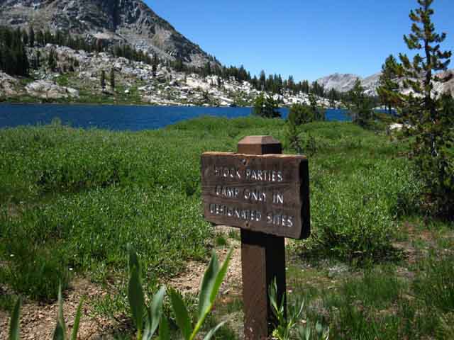
Dorothy Lake Stock Notice
 |
||
Stock Camp notice on West side of Dorothy Lake. Stock restricted to designated campsites.
|
View South across Dorothy Lake
 |
||||
Jack Main Canyon beyond Dorothy Lake.
|
Trail above West Shore of Dorothy Lake
 |
Meadow, forest, Dorothy Lake and the surrounding mountains make a nice walk.
|
 |
||||||
Forsyth Peak in the glare of the setting sun, and I'm running way behind... Beautiful Fall colors decorate the terrain.
Maps, Miles, & Onward
Sonora Pass to Tuolumne Meadows
Next Map South Jack Main Canyon to Kerrick Canyon
|
West End of Forsyth Peak's Ridge
 |
||||
View across the South shore of Dorothy Lake at the annex of the lake branching out to the Southeast.
Toiyabe and Yosemite
|
Forsyth Peak
 |
West end of Forsyth Peak's Ridgeline. |
South Shore of Dorothy Lake
Early Summer |
||
West end of Forsyth Peak's Ridgeline behind South shore of Dorothy Lake.
|
View North across Dorothy Lake and through Dorothy Lake Pass
 |
||||||
Getting around to the South Shore Dorothy Lake and looking North across the lake lines up Dorothy Lake, Dorothy Lake Pass, and almost lines up that distinctive cut on the distant volcanic ridge in Hoover Wilderness that we've been using as one of our local landmarks. Now we'll turn around to continue South down Jack Main Canyon leaving the East Flank and its preponderance of volcanic terrain behind entering Yosemite.
Toiyabe and Stanislaus Sonora Pass to Dorothy Lake Pass
Toiyabe and Yosemite Sonora Pass to Tuolumne Meadows
|
Small Unnamed Lake South side of Dorothy Lake through the Seasons
Spring-Summer Green
 |
Pond South of Dorothy Lake. |
Fall Colors
 |
||
Small Lake on flat before entering forest and Jack Main Canyon South of Dorothy Lake.
|
Bear Tracks
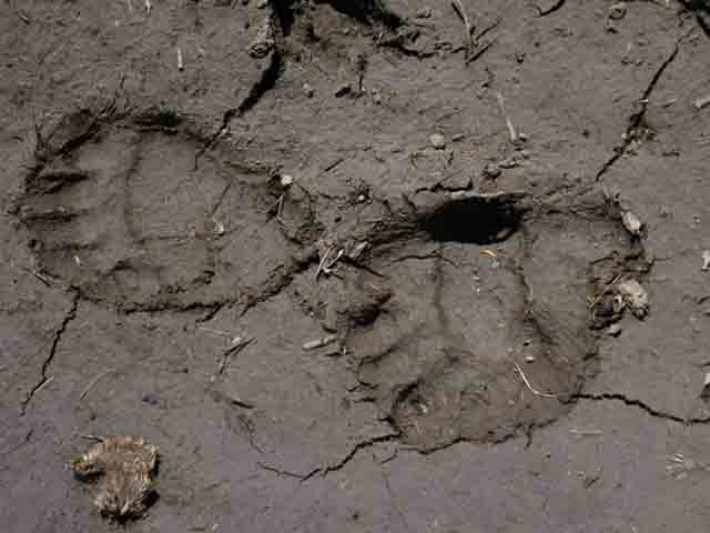 |
Bear tracks near pond South of Dorothy Lake. |
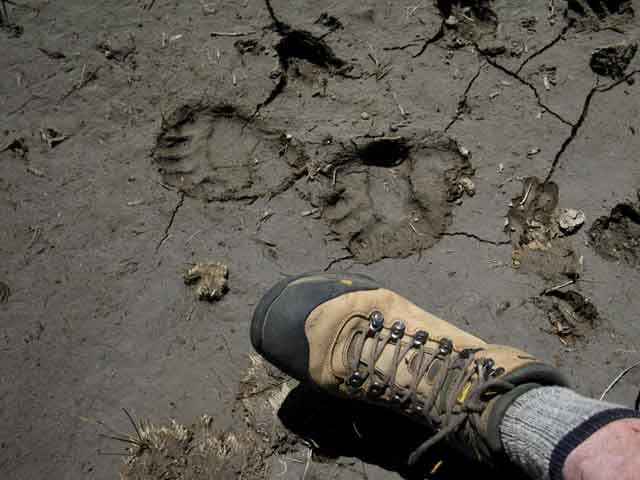
Bear Tracks in Scale
 |
||||||
Comments: Bear Forum
Toiyabe and Yosemite
|
Bears and Butterflies?
You Gotta Love this Place
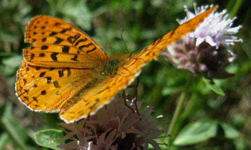 |
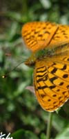
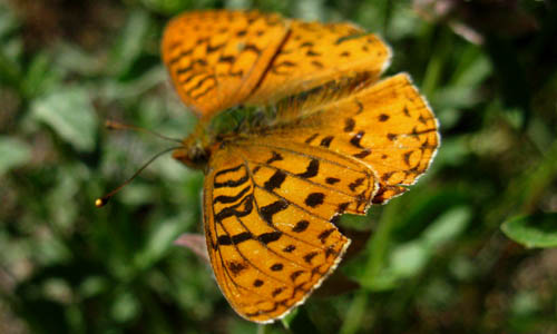
| Butterfly near the pond South of Dorothy Lake. |
Butterfly
 |
||
Butterfly near the pond South of Dorothy Lake. Does that look like the outline of a lizard-head on the butterfly's near wing?
|
Lush
 |
| South side of the pond South of Dorothy Lake. |
Dry
 |
||
Walking through Nature during changing colors and climates of different seasons makes me think that the seasonal changes in the colors of nature are the ultimate source of "style." A small part of human styles are still pragmatic changes in clothing styles that reflect the changing needs of the changing seasons. But most human styles are ornamental changes in color and pattern that are dull reflections of Nature's mastery of color, pattern, texture and form. Nature is the master palette serving up color and style.
Sonora Pass to Tuolumne Meadows
|
One of the Montys
 |
||
Monty, hiking from Sonora Pass to Lone Pine. Monty informed me that he was one of the two "hiking Montys." I have it from a good source that "The Two Hiking Montys" like to do high mileage High Sierra hikes. Go, Montys, Go!
|
Crispy Red Ground Cover
 |
Sweet colors squeezed out by Fall's dropping temperatures. Fall colors light up the trail before entering the forests of Jack Main Canyon. the plants were all dried out and crunchy if you stepped on them. |
Signs of Heavy Trail Use begin in Yosemite
 |
||
Trail approaching Jack Main Canyon. We get the double-trail shortly after entering Yosemite. I'd say the heavy use up here is a product of the heavy annual PCT hiker use. Hikers on the PCT are likely the largest part of the number of hikers who cross Dorothy Lake Pass. They would also account for the majority of the hiker traffic on the trails between Tuolumne Meadows and Sonora Pass. That fact tells us that these trails become very very quiet late in Summer into Fall, as the bulk of Pacific Crest Trail hikers have long passed, when even the number of section hikers reduces dramatically. North Yosemite gets quite in late Summer into Fall.
|
Stock Area
 |
||||
Stock were tied here.
Toiyabe and Yosemite
|
Video
Bond Pass to Dorothy Lake Pass
| Turning North on the Pacific Crest Trail from the Tahoe to junction below Bond Pass to Dorothy Lake Pass. | ||||
|
North
Bond Pass Trail Junction:
Nondescript unmarked trail junction NW to Bond Pass
 |
||
The North Bond Pass trail junction. This is the first of the two junctions along the Pacific Crest Trail breaking off to the Southbound hikers Right, Northwest up into the Emigrant Wilderness in the Stanislaus National Forest crossing Bond Pass. This view is looking Southbound down the now combined Pacific Crest-Tahoe to Yosemite Trail routes running together down Jack Main Canyon. This trail junction is not posted with trail sign as is the Southern end of this"Y" trail junction coming down from Bond Pass.
|
A short distance Southbound along the Pacific Crest Trail down Jack Main Canyon past the unmarked Bond Pass trail junction we reach the Second, Southern Trail Junction up to Bond Pass. This junction is well-posted.
South
Bond Pass Trail Junction:
Trail Signs
Bond Pass and the Tahoe to Yosemite Route Northwest across Emigrant Wilderness
 |
||||
Northwest to Bond Pass on the Tahoe to Yosemite Trail Backpackers planning on hiking the Tahoe to Yosemite Trail through Bond Pass join up or split off from the PCT right here in Jack Main Canyon depending on if you are hiking North or South. Northbound hikers on the TYT depart the PCT at the top of Jack Main Canyon here while the Southbound TYT hiker's route finally rejoins with the Pacific Crest Trail. The last time we saw the Pacific Crest Trail was departing the Southern end of the Lake Tahoe Basin. We can use this junction to turn medium and long distance local backpacking loops back around to the North towards any of our Highway 108 trailheads by threading the Dorothy Lake and Bond Passes. These are the Tahoe to Yosemite Trail on the West flank of the Sierra, the Tungsten Road over Big Sam to Bond Pass, and the Pacific Crest Trail along the East flank.
Kennedy Meadows to Jack Main Canyon on the TYT
Trail Guide Page
|
Hiking North on the Pacific Crest Trail
 |
PCT North to Dorothy Lake Pass. Back the way we came. The page above covers the trail from Kennedy Canyon trail junction through Dorothy Lake Pass to our present position. |
Hiking South on the Pacific Crest Trail
 |
||||||
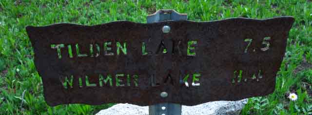
Down Jack Main Canyon South on the combined TYT and PCT down Jack Main Canyon to Tilden and Wilmer Lakes, respectively. One can also hike past these junctions down to Hetch Hetchy.
Sonora Pass to Tuolumne Meadows
The Jack Main Canyon Below the TYT and PCT The Tahoe to Yosemite Trail turns East out of Jack Main Canyon at Tilden Creek, the Pacific Crest Trail turns East around Wilmer Lake. Backpacking trips ending by crossing Hetch Hetchy Dam at the bottom of Jack Main Canyon are delightful, independent of which particular route you use to enter the top of Jack Main Canyon. I have it at 29.4 miles from Dorothy Lake Pass to the Road on the far side of Hetch Hetchy Dam. Added to the 15.43 miles from the Leavitt Meadow Trailhead to Dorothy Lake Pass means we can cross the Sierra from East to West, from Leavitt Meadow to Hetch Hetchy over 44.83 miles. Leavitt Meadow Trailhead to Hetch Hetchy: 44.83 miles
Trail Guide Page
|
Next |
ADJACENT
Trail Guide Pages
| North PCT Kennedy Canyon Trail Junction to West West Walker |
South PCT-TYT Dorothy Lake Pass to Tilden or Wilmer Lake |
| North TYT Bond Pass to Brown Bear Pass |
| North TYT to PCT Grizzly Peak to Big Sam |
West TYT Kennedy Lake to TYT above Kennedy Meadows |
North PCT: Kennedy Canyon to West West Walker South PCT: Dorothy Lake Pass down Jack Main Canyon
Next |
One of our two routes into the Northwestern-most corner of the North Yosemite Backcountry. Both routes have joined at the Southern Bond Pass Trail Junction that ended this page.
H THIS PAGE IS UNDER CONSTRUCTION: STAY TUNED FOR MUCH MORE! COME ON BACK NOW, 'YA HEAR?
7.5 Map
30 min Map
Next
South: |
Backpacking Trail Guide PCT |
 |
Backpacking Trail Guide PCT-TYT |
Backpacker Forums Have a great Emigrant Wilderness backpacking loop or story to relate? A great cross-country scramble over its unique granite? A fine piece of gear? Or gear that failed?Post it onTahoetoWhitney.Org Become a MemberAll backpackers can comment.
|
| High Sierra Trails | High Sierra Topics |
If you have experiences, comments, questions, or pictures and videos of the Pacific Crest Trail between Sonora Pass and Tuolumne Meadows, share 'em here.
Weave your threads of experience into the fabric of the guide.
Forum Section
Sonora Pass to Tuolumne Meadows
Forum Segment
Kennedy Canyon to Dorothy Lake Pass
The Tahoe to Whitney Trail Guide and Forum have been built, funded, and supported by my individual efforts, with a little help from my friends and family. If you feel these efforts are valuable to you, you are invited to support them here: |
Trailhead
Contact
Alex Wierbinski

Backpacking Lake Tahoe to Mount Whitney
Your Guide to the High Sierra Crest, including the Tahoe to Yosemite, Pacific Crest, and John Muir Trails
