
The Trails
Guide
Maps
Miles/Ele
Permits
Resupply
Forum
Current Weather Conditions
Weather Notes
Northern High Sierras
Central High Sierras
Southern High Sierras
Gear
Gear List
Gettin Started
Layering
Discussion
Testing yourself and your gear
Gear Reviews
Hiking
Seavy Pass to Smedberg Lake
via
Bensen Lake
"The Rivera of the Sierra"
Backpacking the
North Yosemite Backcountry
Hiking
The Pacific Crest and Tahoe to Yosemite Trails from the Sonora Pass Road to Tuolumne Meadows
Languages
Languages
Trail Arts
The art of walking
Physical Preperation
Trail Skills
The trail
Off the trail
Scrambling
Maps
Navigation
Camp skills
Food
Resupply
Food
Other
Photo Catagories
Trail Stories
Trail Culture
News and Science
Links
Groups
Books
Terms and Conditions of Use
| Trail Guide INDEX Highway 108 to Highway 120 |
North PCT-TYT GUIDE Stubblefield Canyon to Seavy Pass |
South PCT-TYT GUIDE Smedberg Lake to Miller Lake |
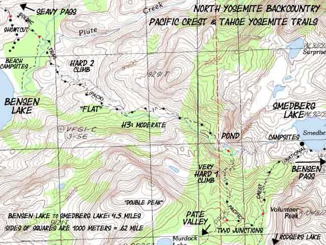
7.5 Topo MAP Seavy Pass to Smedberg Lake via Bensen Lake |
30 min MAP Sonora Pass to Bensen Lake |
Sonora Pass to Tuolumne Meadows MILES AND ELEVATIONS |
TOPO MAP INDEX SONORA PASS |
Resupply North Kennedy Meadows South Tuolumne Meadows |
National Forest-Park PERMITS Toiyabe NF & Stanislaus NF & Yosemite NP |
all maps index |
Yosemite National Park
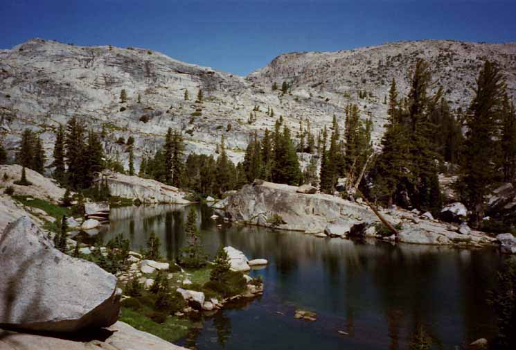
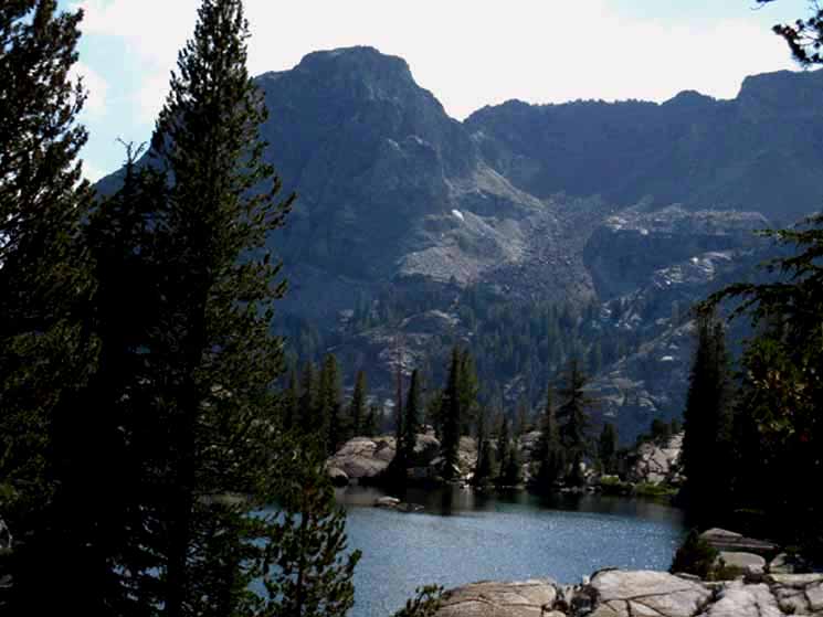
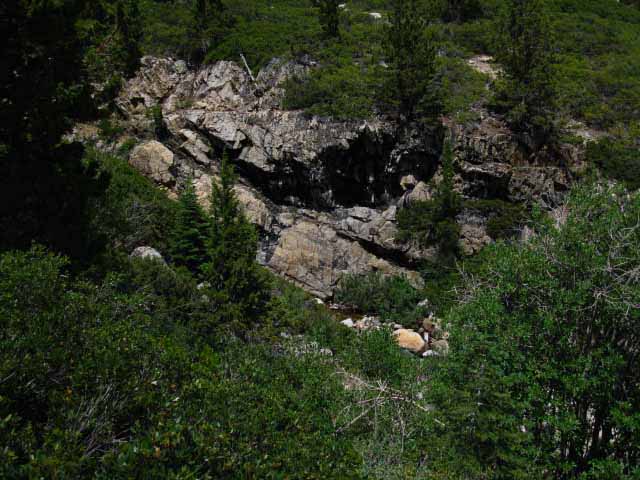
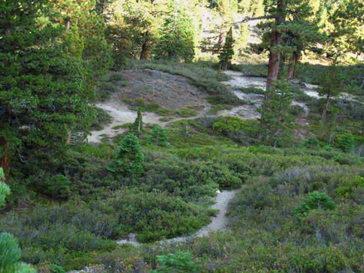
Seavy Pass Bowl
|
||||||||||||||||||||||||||||||||||||||||||||||||||||||
| Stubblefield Canyon to Bensen Lake 15 minute Yosemite Hiking Map |
Ponds Forum | Bensen Lake to Virginia Canyon North Yosemite 30 min Backpacking Map |
Where We're At
PCT-TYT
Highway 108 to Highway 120
Our current position at the North Gap of the Seavy Pass Bowl is 39.21 miles South of Sonora Pass along the Pacific Crest Trail or 36.9 miles hiking South of Kennedy Meadows Pack Station on the Tahoe to Yosemite Trail.
We're 34.5 miles North of the Tuolumne Meadows Store, Post Office and Cafe building. The Southbound Pacific Crest and Tahoe to Yosemite Trails are unified down to Tuolumne Meadows, while their Northbound routes split up at the top of Jack Main Canyon.
Physical Context
Hiking South out of Kerrick Canyon we climb a short but steep 240 feet up .74 of a mile to the narrow gap leading through the top of Kerrick Canyon's South wall into this intriguing high altitude bowl.
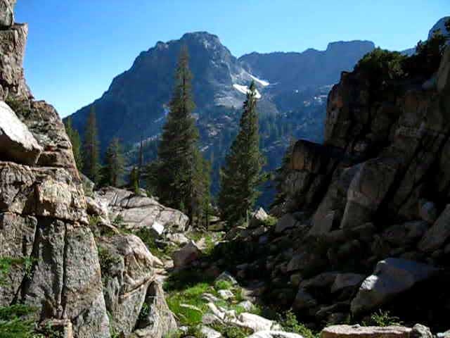
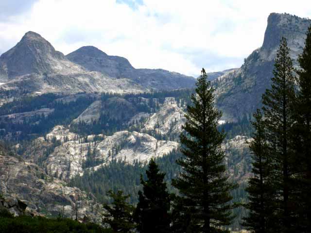
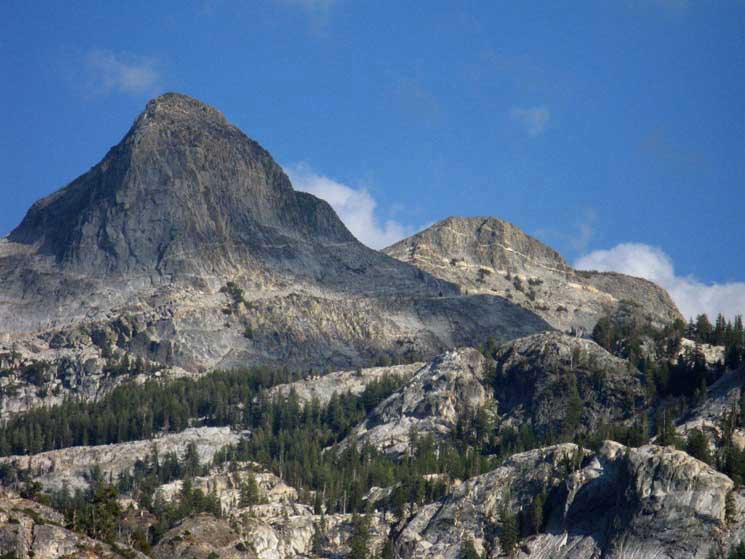
Seavy Pass and its surrounding terrain, this flattish slot across the ridgetop that I call the Seavy Pass Bowl, sits below and just a bit East of the East face of the granite wall topped by Piute Mountain. We have hiked far enough East up Kerrick Canyon (Southbound on the TYT-PCT) to get past where the ridgeline topped by Piute Mountain pinches a vast wedge of rock to the Northeast, making up a good section of the South wall of Kerrick Canyon. We had to hike East past this chunk of granite before we could turn South to hike up through this ridgetop wonderland laying East of Piute Mountain.
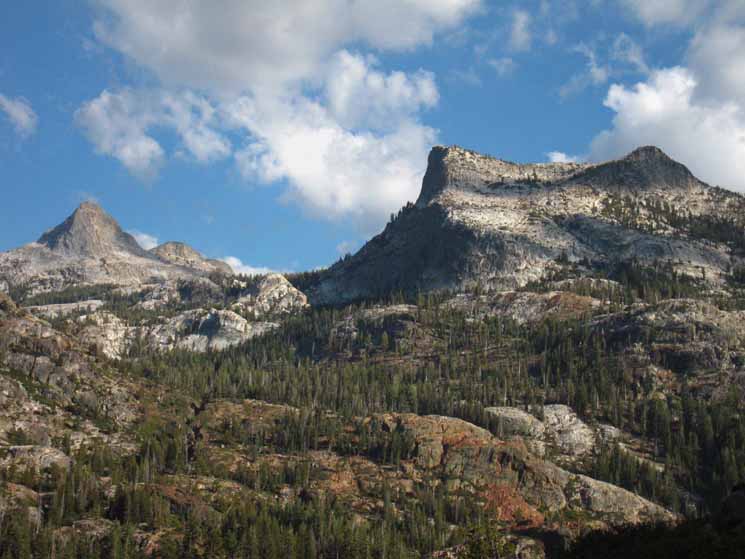
Piute Mountain and Peak
Unlike most ridgecrests running parallel with their underlying ridges, the ridgeline capped by Piute Mountain runs perpendicular to the line of Kerrick Canyon. Kerrick Canyon runs roughly East-West while the top of Piute Mountain's ridgeline capping the Southern wall of Kerrick Canyon runs North-South across the ridge, rather than along it.
This map shows the unique orientation of Piute Mountain and its ridgeline in relation to our route out of Kerrick Canyon through the "Seavy Pass Bowl" and down to Bensen Lake:
Stubblefield Canyon to Bensen Lake
15 minute Yosemite Hiking Map
The map shows how the run of crestline capped by Piute Mountain uniquely straddles the ridge dividing Kerrick Canyon from Bensen Lake. The makes Piute Mountain's sheer Eastern flank the Western wall of the Seavy Pass Bowl, if not providing the Western backdrop of vast granite for our hike through this bowl cut into this massive granite ridgetop.
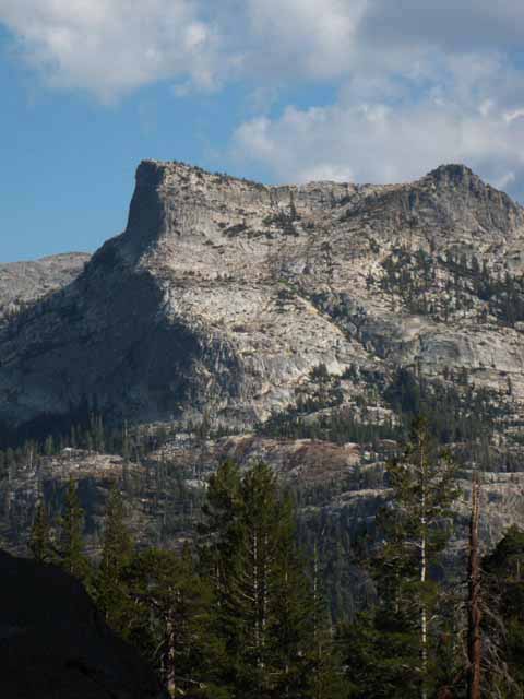
The peak I cite as "Piute Peak" in this trail guide is what I call the landmark peak jutting off the far South end of Piute Mountain's perpendicular ridgeline. Piute Peak towers majestically over both the South end of the Seavy Pass Bowl and the West shore of Bensen Lake. Piute Mountain is the highest point along this ridgecrest on its North end. Piute Peak dominates the South end of this unique ridgecrest.
South into the Seavy Pass Bowl
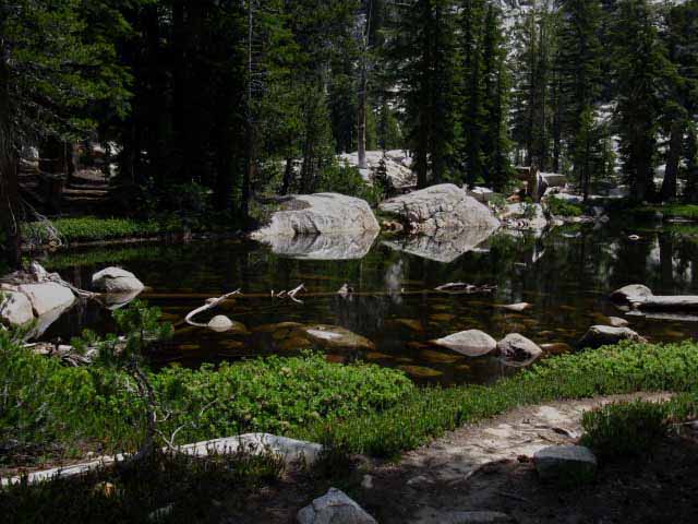
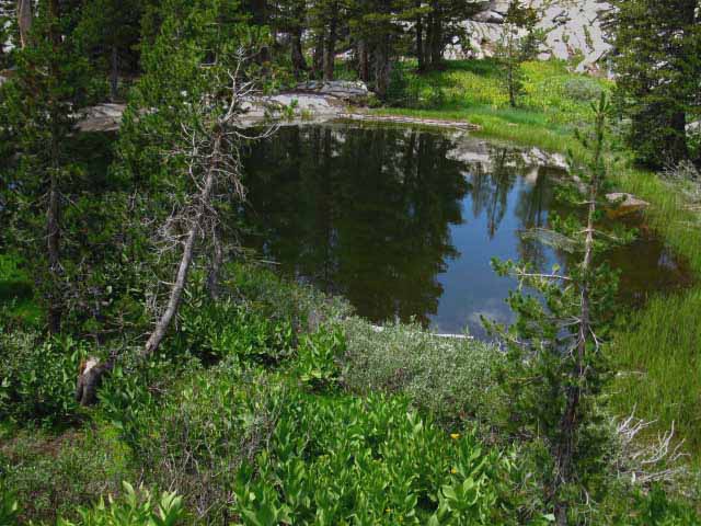
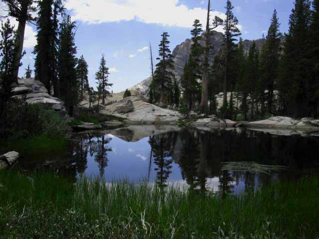
Hiking through the gap into the bowl we find our trail jungle-gyms up, down, around, and through poetically carved granite formations circling around a series of vibrant black and blue ponds all collared by dark green swaths of forest and filled in by opportunistic bright bits of meadow, dusted with a thick sprinkling wildflowers across the length of this magical basin.
The existential beauty in the Seavy Pass Bowl imparts meaning to life. The meaning Seavy Pass Bowl communicates is "Life is Beautiful."
Physically, this bowl is unique because it is dug out of the ridgetop between Kerrick Canyon and Bensen Lake. Ancient ice has carved the most interesting features into the stunning granite terrain atop this magnificent ridge.
This is a real special place. We walk slow through here.
Our short but sweet 1.22 mile hike through the Seavy Pass Bowl ends where we pass through the granite gap on the South side of the bowl into the gorge slashed into the rock below Piute Peak. Here our steep plunge down to Bensen Lake begins.
The Bensen Hole
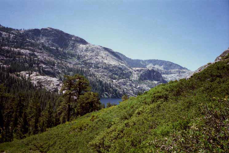
Bensen Lake fills the bottom of this deep valley between Seavy Pass to its North and Bensen Pass to the South. I call this section between these mountain passes bracketing Bensen Lake the "Bensen Hole."
This segment of trail is the "Bensen Hole" because hiking down to Bensen Lake and back out again is like backpacking down into a deep hole and back out again. This is a bad-assed section of trail that works even the fittest hikers hard. And, this assessment of difficulty does not factor in the extensive series of very steep canyons and tall ridges laying both North and South of our position at Seavy Pass along our combined TYT-PCT route.
Most Difficult Trail Segment?
This particular segment of trail hiking down to and back out of the Bensen Hole between Seavy and Bensen Passes seems to me to be the steepest, deepest, and most closest-spaced of the whole series of ascents and descents in the North Yosemite Backcountry between Tuolumne Meadows and Lake Tahoe, if not the most difficult section of trail between Tahoe and Whitney. It just might be.
And, the Seavy Pass Bowl is located at roughly the halfway point of this section of trail between Highway 108 and Highway 120. We had to work hard to get here to this difficult segment of trail and we will have to work hard to get out of here.
The Bensen Hole is only one of this series of closely-spaced ridges and valleys making up the "Five Canyons" of the North Yosemite Backcountry between Jack Main Canyon to the McCabe Lake trail junction at the top of Cold Canyon, but it is the deepest and steepest of them all.
The Bensen Lake Hole may be the deepest descent and the steepest ascent along the length of the Tahoe to Whitney Trails, but it is still only one in this series of rapidly-encountered, closely-spaced massive ridges divided by narrow but steep canyons composing the North Yosemite Backcountry.
AKA
"Yosemite's Washboard"
It's a hard hike to even get to this hard segment of trail.
Fun ahead, fun behind.
Fun at our Feet. Time to Dance.
Trail SectionInformation
Highway 108 to Highway 120
| North PCT to Sonora Pass |
North TYT to Kennedy Meadows |
South PCT-TYT to Tuolumne Meadows |
| 39.21 miles | 36.9 miles | 34.5 miles |
| PCT Sonora Pass to Tuolumne Meadows Miles and Elevations |
TYT Kennedy Meadows to PCT in Jack Main Canyon Miles and Elevations |
Trail Segment
Information
Seavy Pass to Bensen Pass
Southbound PCT-TYT
| North Seavy Pass Gap South to the Bensen Lake Junction -1520 feet over 2.99 miles |
Bensen Lake Junction +1499 feet over 4.5 miles |
|
West Shore of Smedberg Lake +941 feet over 2.2 miles |
Trail Segment Totals North Seavy Gapto Bensen Pass 9.69 miles 3960 feet of elevation change Southbound PCT-TYT
|
from the
Seavy Pass Trail Junction
To Our Northeast
| Seavy Pass Trail Junction to Twin Lakes Trailhead via Buckeye Pass 13.58 miles |
Seavy Pass Trail Junction to Twin Lakes Trailhead via Peeler Lake 12.9 miles |
Bensen Lake to Bensen Pass
Hiking South from Bensen Lake up to Smedberg Lake and on up to Bensen Pass begins our most difficult and highest climb since hiking over Leavitt Peak, South of Sonora Pass. We are climbing up 2440 feet of elevation over 6.7 miles to Bensen Pass from Bensen Lake, including the very steep section of trail climbing 720 feet up to the first Pate Valley trail junction from the first flat. But it's not all up, as I indicated by the term "first flat."
Pate Valley Trail Junctions
We get a bit of a break when we climb into a narrow meadowed flat above Bensen Lake before we make the very very steep climb up to the first Pate Valley junction. Once we reach the first Pate Valley trail junction the trail mostly descends to the nearby second Pate Valley junction after a low climb.
The second, Southern Pate Valley trail junction swings a trail South past Rodgers Lake before joining the trail from the first, Northern Pate Valley trail junction for their descent through Rodgers Canyon into Pate Valley on the floor of the Grand Canyon of the Tuolumne River.
Shortcut Trail to Smedberg Lake
A few feet South down the PCT-TYT from the second Pate Valley trail junction we see an unmarked shortcut trail breaking off to our Right. This is the old PCT-TYT route to Smedberg Lake. The shortcut route is marked as the regular route of the PCT & TYT on the old USGS 30 minute Bridgeport map from 1985. I have marked in the new PCT-TYT route with black dots next to the old route displayed on this 30 minute map.
Bensen Lake to Virginia Canyon
North Yosemite 30 minute Backpacking Map
The shortcut route hugs the Western base of Volunteer Peak on a much more direct line to Smedberg Lake avoiding the descent the PCT-TYT takes before it makes the moderate difficulty climb to the top of the ridge overlooking the West shore of Smedberg Lake. The shortcut moves directly to the ridge, rather than dropping down to get under it, as the new section of trail does.
The 15 minute Bensen Lake to Miller Lake map below lays out the new route with precision, my route laid out on the 30 minute map above is less precise. The old steel-cut trail signs were manufactured long before this extensive addition to the length of the trail, so the mileage on the Pate Valley trail junction signs pointing South to Smedberg Lake are not accurate.
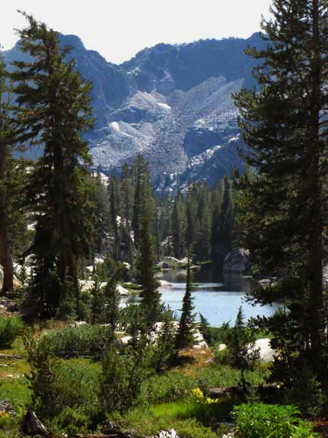
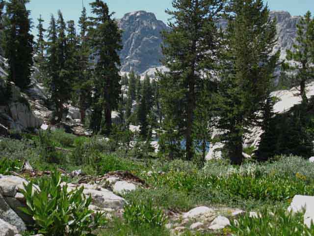
Smedberg Lake
Smedberg lake sits at the bottom of an expansive flat offering lakeside break and fine campsite spots on our way up to Bensen Pass. Climbing South from the South end of the Smedberg Lake flat we climb a short distance to peer into a second, upper meadow hidden behind the Smedberg Lake flat. Pushing South we make a difficult climb to our next and last high meadow flat.
A nice little meadow with a good four-season creek flowing out of it sits below our final climb up to Bensen Pass. Looking Northeast across the edge of the meadow along the line of our trail we can see the slot of golden-light soil wedged in the surrounding crestline known as Bensen Pass.
Looking directly to our
South, to our Right while entering this last little meadow reveals the location of a nice campsite at the base of the great granite feature guarding our Southbound entrance to this tiny alpine meadow.
Three Sweet Flats
Yes, all three of these nice meadowed flats between Bensen Lake and Bensen Pass are inclined, but they almost feel flat after the steep climbs required to reach each of them. We would count four flats if we included the little meadow flat South of the Smedberg Lake flat. But we hike past the edge of that little flat, rather than across it on our way climbing towards Bensen Lake.
Though this segment of trail between Bensen Lake and Bensen Pass is short and steep, it is broken up by this series of sweet "flats" that give us a bit of a break between steep climbs.
Backpacker's Resources and Hiker Information
Maps-Miles-Elevations
North Yosemite 30 min Backpacking Map
Stubblefield Canyon to Bensen Lake |
Bensen Lake to Miller Lake 15 minute Yosemite Backpacking Map |
North Yosemite
Miles and Elevations
Trail Information Index
| Backpacking Trails and Topics Forums |
Backpacking Trail Information Seavy Pass to Smedberg Lake Linear Index |
||||||||||||||||||||||
Video: Seavy Pass Bowl from North to South
Entering Seavy Pass Bowl
North Pond
Northeast Pond
Center Pond
South Pond
Snow Bent Lodgepole
Out the South Gap
Video: Seavy Pass Bowl to Bensen Lake
South through Rock Channel
Bird Buddies
Black and White Rock: Granite and Quartz
Temperate Zones
View of Terrain South of Bensen Lake comes into view Our Climb South of Bensen Lake
Ford: Bens Bridge
First View of Bensen Lake
MAP: Bensen Lake Shortcut to Smedberg Lake
North Side Shortcut to Bensen Lake
Bensen Lake Backpackers |
North Weather
Below find the closest Ground Stations, Point and Regional Forecasts near Bensen Lake. Satellite and Radar Imagery provides Long Range and Regional Overviews. Check out the Ground Reporting Stations for real-time current snow and temp data.
All Weather
All
|
Trail Note: Trail Difficulty Climbing South to Smedberg Lake
Bensen Lake Spur Trail
Video: Bensen Lake to Smedberg Lake
Bensen Lake to Pacific Crest & Tahoe to Yosemite Trails junction
View: North to Seavy Pass
Hanging Valley below Volunteer and "Double" Peaks
View: Awesome
Pate Valley Junction North with Llama Packers
Final Approach to Smedberg Lake
Southbound along West Shore of Smedberg Lake
|
||||||||||||||||||||
| > Forum < | ||||||||||||||||||||||
All backpackers can post text comments, questions, or add information and share their experiences on this segment of trail from Bensen Lake to Bensen Pass through the comments links on this page.
Every comment link on every trail guide page goes into the forum for that segment of trail.
Your experiences become part of the guide.
Registered Members can post text, images, maps and videos on their own pages in the Trails Forum to supplement this section of the Trail Guide.
Check out the Tahoe to Whitney .org Backpacking Trails and Topics forums.
The Trails Forums cover the main High Sierra Trails from Lake Tahoe to Mount Whitney paralleling trail guide construction.
The Backpacking Topics Forum covers about every topical issue any long distance backpacker would face in high elevation mountains. The Topics Forum is also being constructed in conjunction with the trail guide.
As I slowly move South completing the trail guide so too the Trails and Topics Forums evolve. I hope to complete all three simultaneously. Make sure to post up your bits of wisdom and experience in this compendium of High Sierra Backpacker information.
Video
South
from
Kerrick Canyon across Seavy Pass through its Bowl
19:06 This rather long video brings Southbound backpackers through the short 1.57 mile hike from the Buckeye Pass-Seavy Pass trail junction in Kerrick Canyon up to, then through the most delightful Seavy Pass Bowl to its far Southern end, where we begin our steep descent to Bensen Lake. The video is long because this short length of trail is stunningly beautiful, and it depicts this terrific terrain during different seasons and different times of the day.
|
Approaching Southern Entrance to Seavy Pass Bowl
 |
Final steps South out of Kerrick Canyon to enter the bowl surrounding Seavy Pass. Stubblefield Canyon to Bensen Lake |
Grazing at the Entrance to the Seavy Bowl
 |
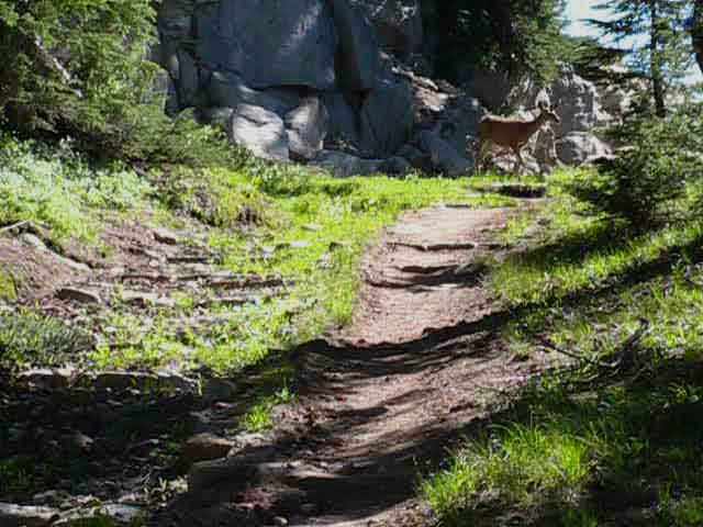
Keeping the grasses neatly trimmed along the trail. Little birds benefit from the presence of the trail. Early in the morning groups of chickadees will work their way down the trail, using the exposed interface between trail and tall grass to get easy access to pluck insects from deep in the grass. They are a noisy and boisterous lot as the hop-fly over each other scouring a length of trail. When I catch up with a flock working the trail, I stop and give 'em some "in character" clicks to let them know I'm there, which has many times prevented them from freaking out and flying up into the trees, allowing me to observe their unique approach to trail life. They eliminate it! I slow down my pace to watch their rowdy little flock hop scotching over each other down the trail plucking the insects off the exposed stalks of trailside grasses. |
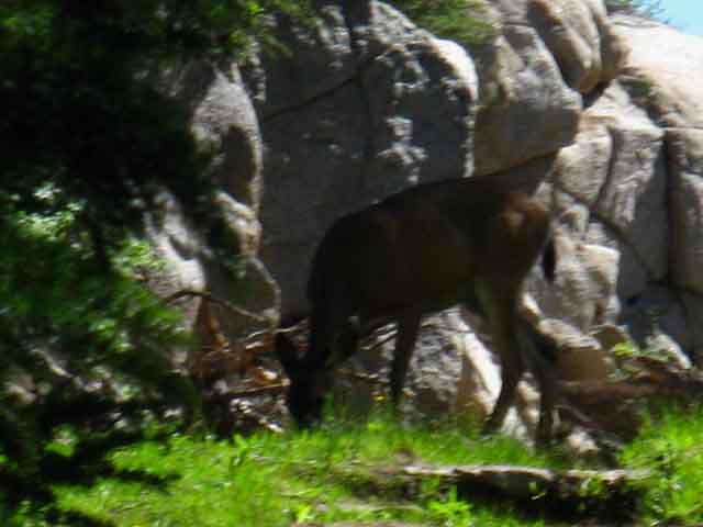
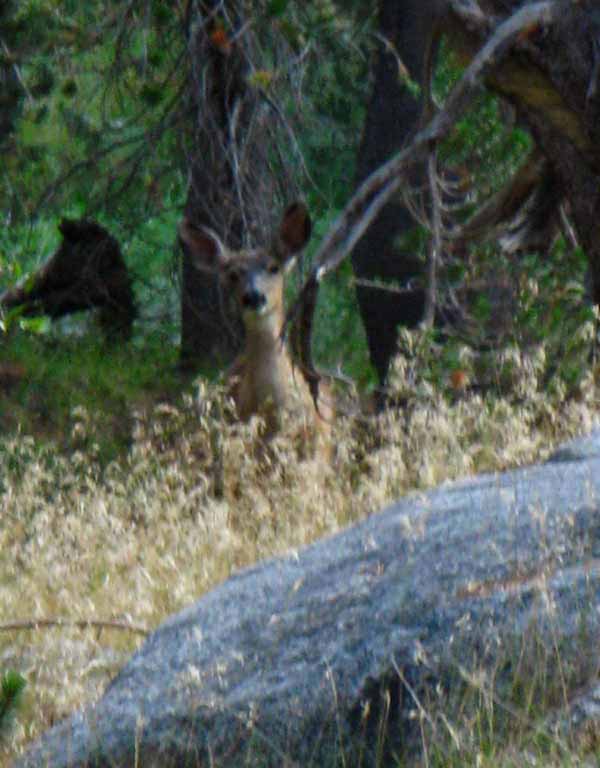
Deer in the Gap to Seavy Pass Bowl
 |
I stopped and watched the doe graze for a while, then clicked to let it know I was coming through. The doe moved away from my path showing minimal concern with my approach. |
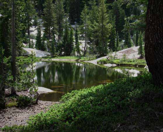
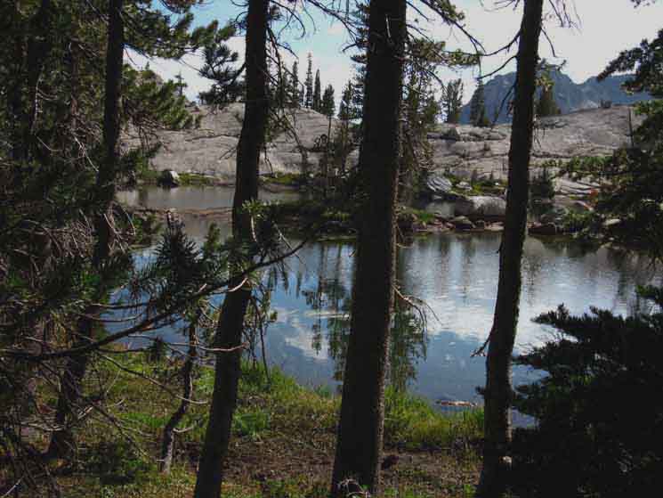
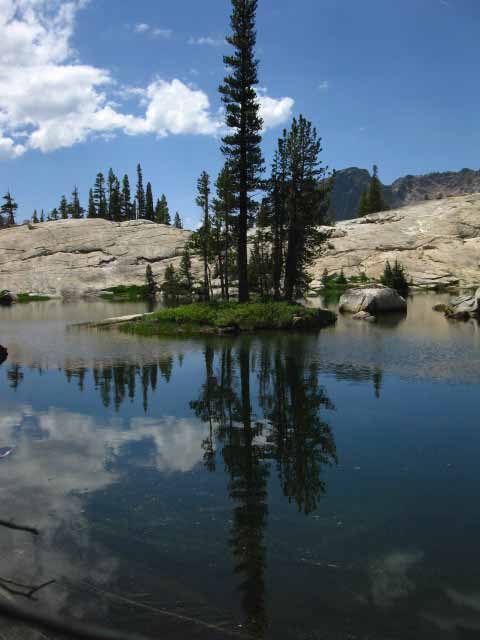
North Pond in Seavy Pass Bowl
 |
Our Southbound trail bends Left to climb around this pond and the various degrees of seasonal marshiness we find surrounding the big pond. Stubblefield Canyon to Bensen Lake |
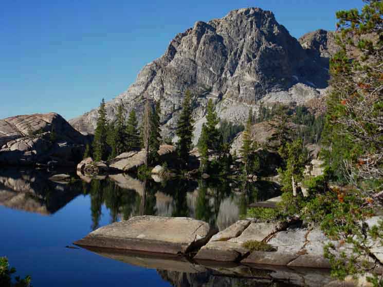
Piute Peak beyond North Pond
 |
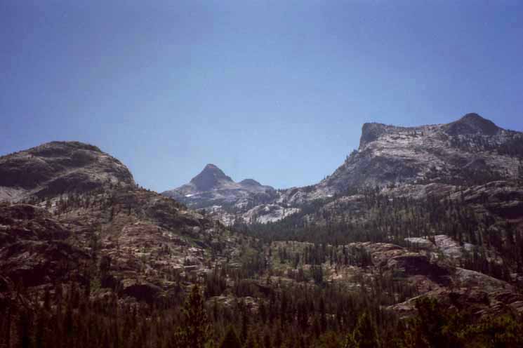
The trail climbs to our South-Southeast around the North pond, up over the low gap that is Seavy Pass laying a very short distance past the Northeast pond pictured below. The peak peeking through the trees I call "Piute Peak" is our target; its position marks the location of the gap out of the Seavy Pass Bowl, though it is beyond the great gully we will descend down to Bensen Lake. I've always called this distinctive peak "Piute Peak," sitting on the South end of the ridge capped by Piute Mountain, which we cannot see in the picture above rising to the Right out of the scope of the above image. Stubblefield Canyon to Bensen Lake |
PCT Hiker
 |
I encountered a wounded PCT hiker on the granite slab overlooking the North Pond in the Seavy Pass Bowl in 2000 or 2001. He was having some serious knee issues that were approaching complete breakdown, but was still good to walk himself out. I've been that guy, and self-rescued like an expert... He was approaching the 1000 mile point, which I'd call a pretty big section of the Pacific Crest Trail. |
By the Northeast Pond
 |
Hiking up around the Northeast perimeter of the bowl brings us past this dark pond sitting in the Northeast corner of the Seavy Pass Bowl. Stubblefield Canyon to Bensen Lake |
 |
The Northeast Pond. Hiking South past the pond we drop down a rocky face to make a convoluted climb up to the the low gap composing Seavy Pass. |
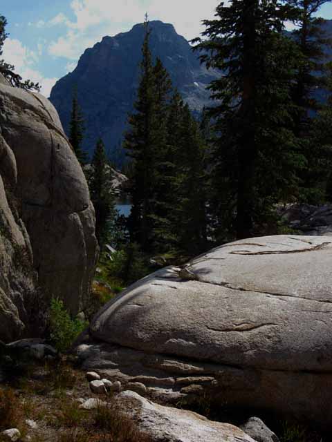
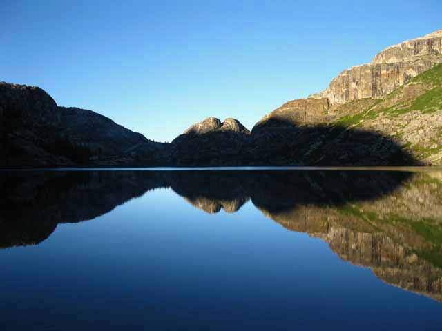
View South from Seavy Pass
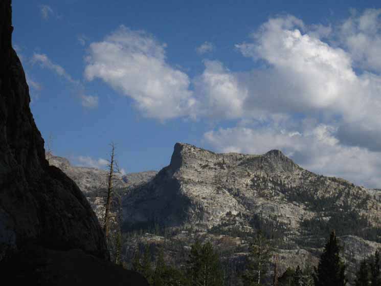
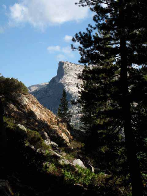
Piute Peak Dominating the Terrain in the Seavy Pass Bowl
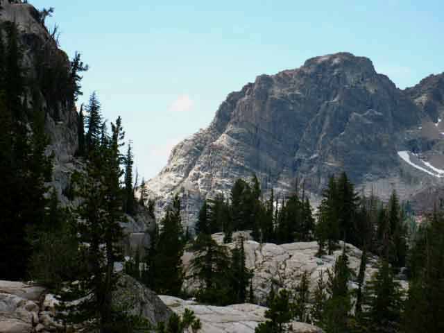 |
Coming through Seavy Pass we get a great view of the complex nature of the terrain backdropped by Piute Peak. Let's take a look back at our position here at Seavy Pass from the South shore of the South Pond. The trail through Seavy Pass winds around, through, and over a delightfully convoluted course of great granite features. Coming South through Seavy Pass we descend again to cross a series of tiny strips and drips of Alpine Meadows as we make our way from the Northeast pond through the rocky maze of Seavy Pass, meadow and forest to the middle pond. The image above shows the jumble of forest and granite, and we can imagine the bits of meadow wedged in below and in-between the visible rock and forest. The high point of Seavy Pass is reached by a trail that bends a unique course through a maze like set of turns through a granite passage along the Eastern perimeter of the Seavy Pass Bowl. This landmark of Piute Peak marks our destination, where we pass through a rock channel out of the Seavy Pass Bowl. Stubblefield Canyon to Bensen Lake |
Meadow Bridge
 |
Dropping South of Seavy Pass we cross another small wet meadow. We find a finely reinforced section of trail across seasonal Spring Thaw creek in this tiny wet meadow wedged between great formations of granite. We'll now begin another low climb winding around rock and forest that will bring us around a sweet trail to the Middle Pond. |
Tiny Meadow
 |
Mini-Meadow and Lodgepole Growth Zone below the South side of Seavy Pass, the low spot from where we begin another low climb over a convoluted granite feature, the low rise of which is visible ahead in the image above. We turn a horseshoe shaped bend over the upcoming granite rise which bends us down to the Northeast shore of the Center Pond. |
Down to the Center Pond
 |
Coming around and through another set of low granite formations we make a big switchback down to the shore of the middle pond. Again, we see Piute Peak establishing a static reference point as we twist and turn up and down around the East perimeter of the Seavy Pass Bowl. Stubblefield Canyon to Bensen Lake |
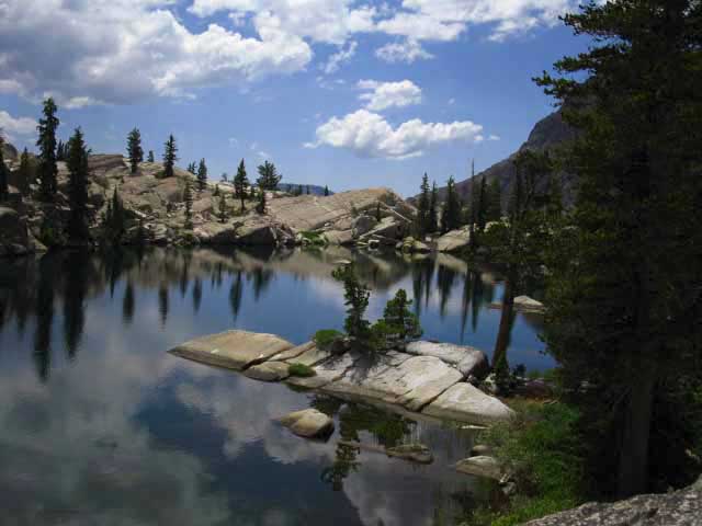
Center Pond in the Seavy Pass Bowl
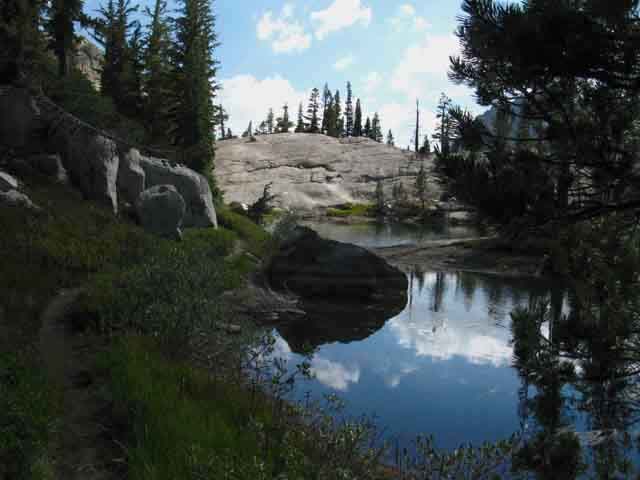 |
Our Southbound direction down the unified Pacific Crest-Tahoe to Yosemite Trails lands us on the Northwest corner of the Middle Pond, where we are surrounded by the close-in forests and rock terrain, except for this narrow long view to the Southeast we see across the Middle Pond. Views of the Middle Pond and its delightful surrounding terrain open up following the Pacific Crest Trail South along the shore of the middle pond. |
Looking to the Southwest across the Center Pond
 |
This is such a cool place. Coming out of the claustrophobic terrain on the Northeast corner of the Middle Pond the terrain opens up. It's funny, because the broader view we get of the surrounding local terrain when our view expands at the Center Pond only gives us a bigger and better look at the high degree of complexity of the surrounding terrain. The broader views of the overall complexity of the surrounding terrain we get from the high points and open spots we cross along the trail through Seavy Pass Bowl show us that the very complex route of the trail is only complimented by the overall complexity of the terrain. Register and post up your pictures of this beautiful place here. |
Great Rock Slab
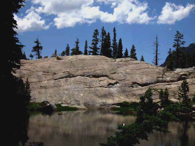 |
The great rock slab on the Southeast shore of the middle pond is impressive. Stubblefield Canyon to Bensen Lake |
View West across the Middle Pond
 |
This view picks up the simultaneous starkness and isolation as well as the subtle color and beauty we feel passing the center pond. This is Peak 9489 dividing our position in the Seavy Pass Bowl with Kerrick Canyon below its far flank. Stubblefield Canyon to Bensen Lake |
The Middle Pond
 |
The middle pond wedges itself into the surrounding granite. |
Fine Pond in Seavy Pass Basin
 |
View Northwest across the Center Pond across Peak 9489 at the vast granite making up the North wall of Kerrick Canyon rising towards Price Peak. Stubblefield Canyon to Bensen Lake |
Deer Focus
 |
Mom points ears, eyes, and nose as she spies me approaching, but does not freak out or flee after a little sweet talk. |
Fawn
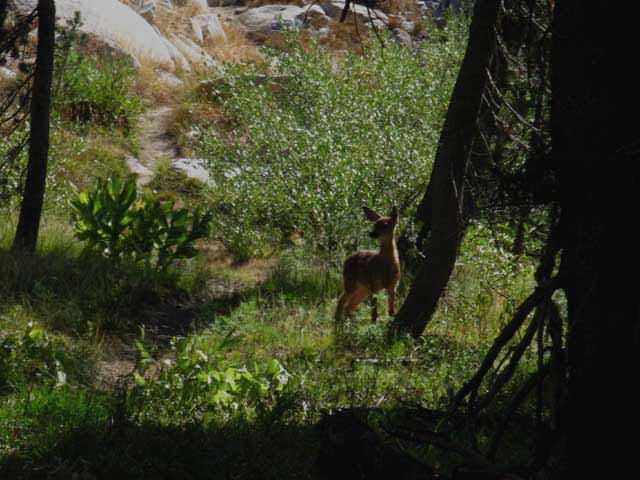 |
Little doe alert for approaching problems, but does not pick me up approaching. Mom had her fawn covered. Mom had already spotted and checked me out. |
Approaching the South Pond
 |
South pond peeking out between boulders, Piute Peak in background. The great boulder in the foreground has a delightfully smooth surface. Stubblefield Canyon to Bensen Lake |
South Pond and Peak
 |
The South Pond. We can see the gap in the granite around the far South end of the South Pond where we will exit the Seavy Pass Bowl to begin our descent down to Bensen Lake. We'll drop into the gorge beyond the gap for a knee-knocking descent. |
Baby Pond
 |
Pool off the North edge of the South pond. This pond is really large in Springtime. |
South Pond Pond
 |
Pool off edge of the South Pond with Piute Peak in background. Ponds, Pools, and Peaks. I don't need a whole lot more than this. The only problem is how short the distance is across this unique place. That, combined with the 15 mile a day minimum miles required to make it efficiently between our resupply spots shortening the time we can dally, makes the Seavy Pass Bowl a short but sweet thing. I guess that rareness is part of what makes this place unique. We wind our way through a delightfully convoluted maze of terrain features, our pace slowing as the density of beauty naturally draws the balance of our attention from the trail to the surrounding terrain. |
Nice Field of Mule Ears
 |
Mule ears. A large field off the Northwest shore of the South Pond. Large for this constrained space, at least. It seems that there is a bit of everything in the Seavy Pass Bowl. |
South Pond
 |
Looking East hiking around the South pond. Note that we can spot "Double Peak" in the far distance. Double Peak rises to the South of Bensen Lake along our steep upcoming climb to Bensen Pass. Our TYT PCT route passes under the steep flank rising to the peak on the Left of the two peaks visible in the distance. Our view of Double Peak really opens up between where we hike out of the South Gap out of Seavy Pass Bowl to where we drop under forest cover and are obscured by the terrain in the gorge on our way down to Bensen Lake. The Bensen Lake to Miller Lake map better depicts the relationship of Double Peak to our route. Double Peak is just Northwest of Murdock Lake on the map below. Bensen Lake to Miller Lake Note that the two Pleasant & Pate Valley trail junctions sit just a little more than a half-mile to the Southeast of the top of Double Peak, between Double and Volunteer Peaks. |
Old Bent Lodgepole
 |
Old snow bent tree on South side of South pond, Seavy Pass. As we hike around the Northwestern shore of the Southernmost pond in the Seavy Pass Bowl we come upon this solitary hobbled old lodgepole pine, my old buddy. I've been "rooting" for this guy since the first time I hiked through in the early 1990s. I key on landmarks. This was one of my first landmarks. I believe I first encountered this tree in the early 1990s. I noted it as a living, physical manifestation of the life and death struggle of living things interacting with brutal Sierra Nevada Winters the first time I hiked through here. This sucker has seen some trauma and some drama, and still keeps chugging along... Old bent tree was doing good for many years despite looking like it was almost broken once, then struggled to survive being bent by heavy snow and pressed hard every Winter, which stunted its growth. All energy focused on survival, rather than growth. Note how the tree is not touching the ground in 2009, above. |
Bent Lodgepole in Seavy Pass Bowl
 |
During recent trips (2010-2012) the health of the bent tree has been in decline. The tip of the tree is touching the ground, which is not a good thing. I lifted the "tip" of the tree off the ground with a rock a few years ago (2010 I believe) so that it could persevere a bit longer. I don't generally do anything to tip the balance of the scale of life and death in the Sierra. I don't generally interfere with the process of life, death, and the recharging of life that death feeds. We have serious problems in that humans have badly damaged the balance between life and death on this planet. We have put all the life into humans and all the death into nature. Humans are going to be upset when the balance springs back. My respect for how death feeds life requires that I don't feed any animals, that I don't tip the balances of power nature establishes. I noted this tree on my first voyage through here in 1995 or 94. You may see that trees work both competitively and as a group. A group of trees will throw down their lives in a rocky barren environment over thousands of years until their dead bodies create the very soil that their ancestors eventually thrive on. This stubborn little lodgepole will eventually support and feed, rather than represent life in Seavy Pass Bowl no matter what I do. It will become the soil its descendents grow from, as have its ancestors before it. |
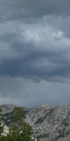
Great Clouds Climbing up the West flank towards the Sierra Crest
 |
Cloudy afternoon punctuated by bright afternoon light with stiff breezes, 2012. The High Sierra presents a range of "looks" during different times of the day and different times of the year. Just one location reflects so many characters and interactions that it is hard to really know anything. And every time we think we know something, we find the exception to the rule! That's why your perspective is so important. The totality of a reality can only be covered by a variety of perspectives. That's why every page of this trail guide is shot through with comments links where you can post up your comments and experiences. Other hikers can read them through the links to the Trail Forum. Your experiences can help us capture the various aspects the trails present. Every time I hike through here I walk out to the end of the rock "pier" in the foreground of the image above, to just enjoy the perspective. |
South Pond
 |
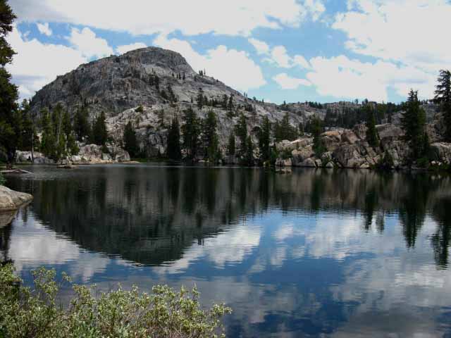
Clear morning in 2010. Early mornings are nice. The air becomes still for a period of time depending on conditions. Sometimes it's a long time, sometime it's a few seconds. These moments are the "balance points" between night and day, when the forces of nighttime are winding down to zero and the forces of day are rising from zero. Stillness balanced between the end of night and the rising day. These are nice times. Once you cruise around here for a while during different times of the day and different seasons you understand why it is important to spend a lot of time in the back country. Note the boulders below the trees along the far South side of the pond. We will hike South through that boulder field away from the South Pond pointed directly at the center of the mountain in the the distance, which I call Piute Peak, to exit the Seavy Pass Bowl and begin our steep descent down to Bensen Lake. The Seavy Pass Bowl Video captures some of the different aspects of this special place during different times of the day and different times of the year. Stubblefield Canyon to Bensen Lake |
South Pond
 |
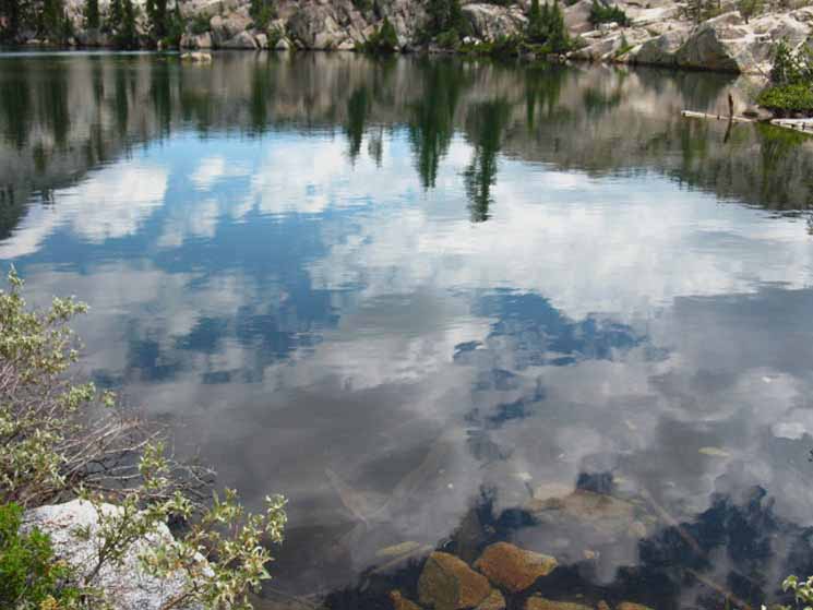
Hiking around the South end of the South pond in the Seavy Pass Bowl on a bright, starkly reflective day. The bottoms of the clouds seem just out of reach until we touch them on the surface of the pond. Summer '09. |
Contemplating the View Northeast across the South Pond
 |
Our viewpoint is from the South side of the South pond looking Northeast. Some perspectives we get here just seem to draw us in. |
View Northeast across the South Pond
 |
Almost reaching the far South shore of the South Pond we turn around to look back to our Northeast at the way we hiked here. We hiked South along the base of the steep Left flank of the great granite formation rising above the South Pond, pictured above. We are also looking back at the location of Seavy Pass, located along the Left (Western) base of the granite formation above. The view from the link above is towards our position from Seavy Pass. Stubblefield Canyon to Bensen Lake Behind us continuing to the South we have almost hiked to the gap leading out of the South end of the Seavy Pass Bowl. Our trail South continues to our Right along the edge of the South Pond. Turning around we see... |
The far South End of the South Pond
 |
We are now facing South-Southeast, hiking South looking at the very Southern end of the South Seavy Pass Pond. The trail bends to our Right over low granite drowning in manzanita to enter a channel in the granite cutting down to where the trail turns Left to begin switchbacking us down into the top of the ravine for the steep hike down to Bensen Lake. Our brief hike through the wondrous Seavy Pass Bowl is almost over. |
South
Out of the Seavy Pass Bowl
 |
South Gap out of Seavy Pass Bowl Pushing through clinging underbrush into a narrow granite gap gives us a feel of intimacy with the terrain. One more Aspect... It is a joy to find the Winter route through terrain well known in Summer conditions. It can be an exercise in anxiety to pick the proper Winter route through terrain that's unfamiliar in Summertime! All of our Winter activities should logical extensions of our evolving skills and Summer explorations into the Winter arena. Winter Backpacking in the High Sierra I was discussing the possibility of a fantastic Winter adventure through here with Anders when a series of physical mishaps overtook each of use in turn, making this difficult degree of Winter travel, if any Winter travel at all, unwise. |
Video
Seavy Pass Bowl to Bensen Lake
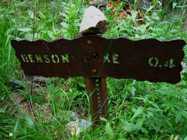
10:24 This video brings us around the South shore of the South Seavy Pass Bowl Pond through the granite gap down switchbacks into the top of the gorge down to Bensen Lake. Stubblefield Canyon to Bensen Lake Descending South we get some fantastic views to the Southeast of Volunteer and Double Peaks over on the far Southeast side of the valley holding Bensen Lake. Though our present route through the Seavy Pass Bowl is complex, it is short. The trail from Seavy Pass down to Bensen Pass is a significant descent, but half the difficulty and distance of the climb South from Bensen Lake. Looking beyond Bensen Lake, hidden from our sight far below in its deep valley, we see a lot. Climbing South from Bensen Lake our first objective is hiking the H2 trail up to the flat under Double Peak. An H-1 super-steep trail leads us up from the flat under Double Peak to the quick series of two junctions wedged in-between Volunteer Peak and Double Peaks. Then we have the quick down and up mile long hike to Smedberg Lake. Unless we venture the shortcut route, which is about half the distance. More on that below. If you love backpacking this terrain is a form of Nirvana. Yet we are a long ways from Sonora Pass to the North or Tuolumne Meadows to the South. This is not an easy place to get to, or get back from. You must be in good shape, with reasonable skills, and well geared to enjoy this special place. The beauty experienced here justifies the time and work required to develop the skills necessary to get here. We can get an eye full of the Volunteer and Double Peak complex to our South from just a couple of vantage points while exiting the Seavy Pass Bowl. So keep your eyes open so you don't just hike past it! Check the images below, the maps, and the video above to get an idea about the nature and layout of this amazing complex terrain. Likely we will have lunch at Smedberg Lake. Tomorrow. Tonight we will camp at Bensen Lake. Some trips I plan to camp at Smedberg Lake, others at Bensen Lake. Independent of where we camp tonight, t's hard to stage up to pass through the Seavy Pass Bowl during the early morning, when stillness balances the dark shadows of the receding night with the searing light of a High Sierra sunrise. The campsite in Kerrick Canyon is too far to get to the Seavy Pass Bowl at first light. Camping in Seavy Pass Bowl What makes Seavy Pass Bowl beautiful gives it a long and deep bite. A solid granite base sits below the thin layer of organics supporting the meadows, forests, and ponds that have evolved and scratched out a living here since the end of the last ice age. This underlying granite holds the water that supports massive populations of mosquitoes far deeper into the season than well-drained terrain. Though the mosquitoes appear to love old pond water, I don't. This is completely different than camping at Bensen Lake, where a prevailing breeze out of the West consistently keeps the mosquitoes from the great marsh wrapping around the Bensen Lake beach campsites at bay, and the superior waters of the Yosemite Backcountry fill our cups. Onward Since we have an extra day's food in the pack we can camp at both Bensen and Smedberg Lakes if we want to. Hell, we can camp at Seavy Pass, Bensen Lake, and Smedberg Lakes if we don't mind having to push hard for the remainder of the trip. As we approach Bensen Lake we identify the Southbound shortcut from the Pacific Crest Trail to the North side of the Bensen Lake Beach. We'll also continue South on the PCT-TYT to the Bensen Lake trail junction where the official spur trail leads .4 of a mile off of our PCT-TYT route out to Bensen Lake. Southbound backpackers are approaching two routes out to Bensen Lake, the first being the unmarked shortcut to Bensen Lake and subsequently the marked .4 of a mile spur trail out to Bensen Lake. |
Finding our way down the granite channel
 |
A nifty channel through beautifully carved granite leads us South out of the Seavy Pass Bowl. Carved by nature, not man. Cool. This is the space you should experience rather than read about in a book or trail guide. It's out there for you to experience on your own. Describing the joy of hiking through a gap in a High Sierra crestline in the North Yosemite Backcountry falls far short of the joy experienced doing it. |
Down
 |
Trail through granite channel steepens below South side of Seavy Pass Bowl. Ahead of us we can now make out the steep ravine we are dropping into and will follow South down to Bensen Lake. At the end of this channel we hit a couple of sets of steep rocky switchbacks into the top of the ravine. |
Our Last Lineup
 |
We've been targeting Piute Peak since we entered the Seavy Pass Bowl. Though the trail circles around as high up the Eastern perimeter of the Seavy Pass Bowl as possible to trace out a convoluted route to avoid the quagmires of Spring that fill the Seavy Pass Bowl, the Southbound trail always returns to point at Piute Peak, as I call this feature. We are pointed South from Seavy Pass Bowl on the combined Tahoe to Yosemite and Pacific Crest Trail routes and we are rapidly approaching the ravine down to Bensen Lake. We'll lose sight of Piute Peak as we drop into the ravine, only to have it reappear to tower above us when we finally emerge from forest and ravine to hit the beach at Bensen Lake. Our speed down this next section to Bensen Lake is our knee's impact limit. Not just what we feel during descent, but we've also got to anticipate how such sustained impacts will affect us tomorrow. Stubblefield Canyon to Bensen Lake |
At the End of the South Channel
 |
Striking black-spattered lichen on gray granite slashed with white quartz candy stripes welcome us to the switchbacks into the top of the gorge. Note bending trail switchbacking down in lower Right hand corner of image. We have some heavy switchbacks below. |
Trailside Encounter
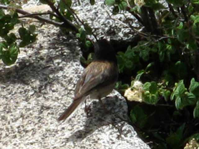 |
Trailside bird hops off, somewhat surprised by my appearance. I saw the little dude first, and clicked him a warning, about me. He checked me out, clicking a warning, about me, back. I'm generally surprised when animals don't know I'm coming, what with the frkn squirrels generally sounding off at my approach. The squirrels were noticeably more high strung during my 2012 Kennedy Meadows to Rae Lakes hike than any of my previous long hikes down the Sierra. But since the squirrels sound off about everything and nothing, lots of critters ignore their constant BS. If I'm "on," I can chill out the squirrels before they sound off. At least the sane ones. Some of those squirrels are crazy. Might be the plague. It runs through the mountains, and may explain why the darn squirrels seem more crazy some years than others. Backpacking Topics Forum |
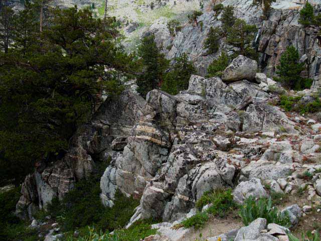
Black and White Stripes
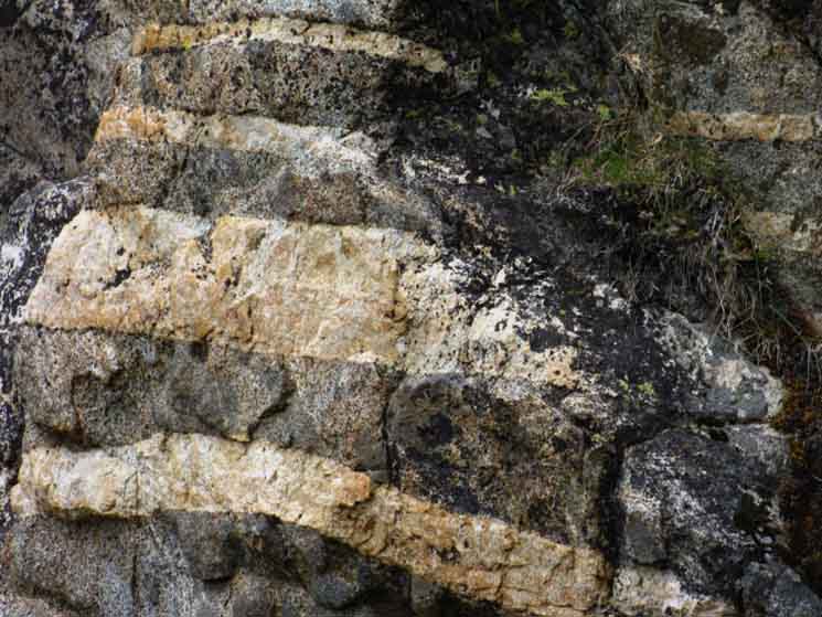 |
Glacier-carved granite reveals quartz veins slashing through the granite creating configurations of unique beauty, with a splash of black lichen thrown on for good measure. All this was long cooked up in the oven of the Earth until birthed out by tectonic contractions to be sliced, diced, and dissected by glacial ice. What a long, strange trip its been... |
Temperate Zone
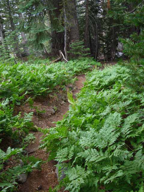 |
Ladyfinger ferns growing in high altitude temperate zone South of Seavy Pass. Above us in the Seavy Pass bowl we experienced sub-alpine Meadows and Ponds, now we are crossing temperate zones in the shaded forest stashed on fertile flats within this deep canyon. We will quickly hike down into a dry manzanita zone approaching Bensen Lake. Stubblefield Canyon to Bensen Lake |
Fine Butterfly
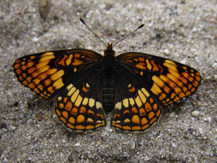 |
Something is watching me... THE EYES OF NATURE ARE UPON US Butterfly in temperate zone South of Seavy Pass. Sometimes the butterflies run me ragged to get a picture. This guy was fairly undisturbed by my presence. Field Crescent Comments-Identification-More Butterfly Information Backpacking Topics Forums |
Majestic Hiking
through the
North Yosemite Backcountry
 |
||
"Double Peak" See that forested flat to the Left of Double Peak behind the snag? That's where the two trail junctions to Pate Valley via Pleasant Valley are located, at the top of our brutal climb up from the pond above the top of the meadowed flat.
Our trail South from Bensen Lake passes below that sheer cliff making up the North flank of Double Peak. |
The Northern of the Double Peaks
 |
View East hiking down to Bensen Lake from Seavy Pass. |
Full Scene
PCT-TYT
South of Bensen Lake
 |
View East of Volunteer Peak from South of Seavy Pass Bowl. Volunteer Peak is center-Left peak in the distance. Bensen Lake lays far out of frame, and out of sight at the base of the double-peak sitting on the Right side of the image. |
"Double Peak"
 |
Observing our upcoming trail route South of Bensen Lake. I call this mountain "Double Peak" for obvious reasons. Over the past couple of decades I've hiked through the North Yosemite Backcountry I've snapped shots from fairly predictable positions, as well as everywhere possible. This collection begins to span different seasons and different times of day, resulting in images that hopefully reflect the changing looks and characters of the same terrain over time as the angle of the Sun and environmental conditions shift with the seasons. Sometimes it's bright and loud, other times subdued under a cloud. It's a kaleidoscope of ever changing character, beauty, and life all tumbling about a center of rock solid reality. |
Volunteer Peak on Left, Double Peak on Right
Different Years-Different Views
 |
||
Above we have a more detailed view of the terrain our upcoming route climbing South of Bensen Lake up to the gap between Volunteer and Double Peaks crosses. Hiking South of the South Pate Valley trail junction our trail gets around Volunteer Peak, located on the Left of the image above, to approach Smedberg Lake. We will climb up to the bottom end of the forested flat laying beyond and below the red rock in the foreground of the image above. A fairly narrow gorge holding the creek coming down from Smedberg Lake surrounded by a narrow meadow runs up the mountain on the other side of that red ridge in the foreground. That's the route our PCT-TYT climbs to the South out of Bensen Lake. Bensen Lake to Miller Lake At the very top of the forested flat we encounter a pond and ford from where we turn South beginning the Hard 1 segment of our overall Hard 2 climb up to the North Pate Valley trail junctions between the peaks. From the pond we climb through and around the steep rock formations to the Left of the two big white granite mounds rising just to the Left of the base of Double Peak in the image above. Our trail climbs to the Left of those two great granite features up to the forested flat between Double and Volunteer Peaks where the Pate Valley trail junctions are located. That is one hell of a climb, believe you me! We can see the forested area where these two Pate Valley trail junctions are located in the space between Volunteer and Double Peaks behind the upper granite dome to the Left from the base of Double Peak. That's the high point of that segment of the trail, until we climb the ridge to the West of Smedberg Lake. The trail up from the pond at the top of the forested flat to the Pate Valley trail junctions is a very difficult section of trail. Bensen Lake is out of frame below the bottom-Right corner of this image. It is a H2 trail from Bensen Lake to the forested flat leading to the pond.
Below see "Double Peak" from below Volunteer Peak. |
Volunteer Peak Jutting out on the Left, Double Peak on the Right
 |
Terrain South of Bensen Lake We can see where the two trail junctions down to the Grand Canyon of the Tuolumne sit in the line of dark forest between the bases Volunteer and Double Peaks. Our route South will be climbing up the gorge (which holds the forested flat) we can see running diagonally towards Volunteer Peak along the bottom of the image. The creek running down from Smedberg Lake runs down that gorge that our trail will follow up. Bensen Lake to Miller Lake We turn away from the Northwestern course of the creek in that gorge along the forested flat to climb out of that gorge to the South from where we come upon the pond. From the pond our trail turns South for the serious climb up to the gap between Volunteer and Double Peaks. |
Volunteer Peak
 |
Volunteer Peak on Left, seeming to rise out of an ocean of granite whitecaps. We have the unmarked "old trail route" shortcut and the contemporary route of the modern PCT-TYT South to Smedberg Lake from the Southern of the two Pate Valley trail junctions, up there in that line of forest below Volunteer Peak. Bensen Lake to Matterhorn Canyon |
Bens Bridge
 |
Approaching ford over Ben's Bridge. Dropping into forest cover and the complexity of the terrain in the gorge below the South gap of the Seavy Pass Bowl ends our long views South, and draws our attention to our immediate surroundings of trail and terrain. We've been bombing down this steep trail using the excellent traction and footing offered by rocks bedded along the edge of the trail. Sometimes it's easier to stay out of the main trailbed, especially on trails with lots of loose rocks as on this segment of trail. I call this Bens Bridge because I watched a trail crew dude construct this fine bridge over two Summer seasons. Ben and Erin put lots of thought into designing this bridge properly for stable longevity. It was during 2001 and 2002, when I managed to pull off back to back Tahoe to Whitney hikes. Stubblefield Canyon to Bensen Lake |
Naming Trail Crew is a sort of generational thing, where each generation puts their contribution in. There are no "personal" trail features, so to speak. Each person makes their contribution, puts "their rock on the trail," so to speak, as part of a continuing legacy we backpackers experience as access. Mostly I don't meet the folks who create specific trail features. Most of them are long dead. At best I can know a crew is in an area for a couple of seasons and can relate the new chipped stone added to the trail to their rotating presence through the backcountry. But every now and then I see the construction and equate it with the constructor. This must be understood in generational terms, as succeeding generations of trail crews take over construction and maintenance duties from the last. |
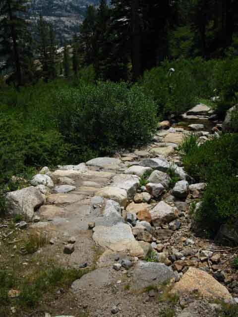 |
Bens Bridge The goal is ease of passage for hikers, and survival of the trail feature itself through as many heavy Spring Thaw flows as possible. Great trail construction engages and directs the massive forces generated by the thaw along its lines of support, using the same principals as employed by an arch, but horizontally on the ground rather than vertically off the ground. Load forces are directed to the structure's points of support, for as long as man's creations can resist natural forces' inevitable victory. Stubblefield Canyon to Bensen Lake |
Center of the Bridge
 |
Nice flat walkway across the center of Bens Bridge. As good as underwater footing gets... during the Spring Thaw. I can't help but admire the generations of trail construction work in Yosemite National Park. Layer upon layer of physical work over generations of trail workers creating and reflecting a continuous cultural reality. Trail Crew culture is an important, a foundational element of trail culture. These folks actually think about us backpackers as they construct the details of their horse-and-Spring Thaw resistant trails. Well, the best of trail crew does. These trail crew thoughts are brought to life by a responsive backpacker's steps. |
Great Rocky Gorge
 |
Seasonal Creek South of Seavy Pass Bowl Manzanita and brush between fingers of forest. See the trail coming down the mountain through the manzanita on the upper Right of the image? We dropped down along that segment of trail to approaching the creek to climb back up to our present position on the other shore. This is what I mean by "No descent is all down," especially as this descent from Seavy Pass to Bensen Lake is STEEP! Except for the little segments of trail we have to climb... Stubblefield Canyon to Bensen Lake |
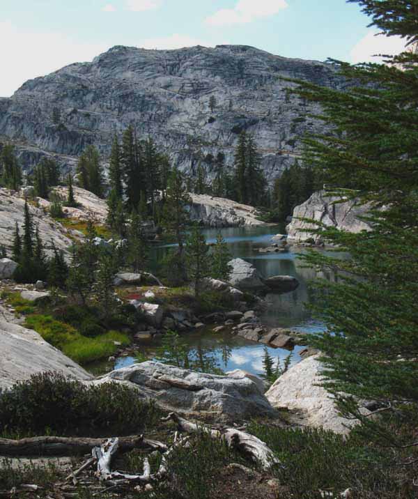
Turning our heads South, We get our First Views of Bensen Lake
 |
First Look at Bensen Lake across Manzanita Mountainside Our first look at Bensen Lake to our Southeast hiking South on the Tahoe to Yosemite Trail. Or our last view of Bensen Lake hiking North. We can see forested terrain in the lower Left corner of the image where our shortcut "route" brings us down through a convoluted route to the North side of the Bensen Lake beach. Taking the shortcut, rather than following the regular route of the PCT-TYT trail South around the backside of the meadow/marsh/forest (far to the Left out of the frame of the image above) to the Bensen Lake trail junction means having to find our way to the lake over uncertain ground. The shortcut route represents the difference between hiking a straight line (more or less) to the beach from the PCT-TYT as we approach the bottom of our descent, or hiking around the circumference of a big "C," with our current position being on the bottom of the "C," and Bensen Lake being at the top end of the "C." Our shortcut cuts almost directly from the top to the bottom of the "C." C what I mean? Parts of the shortcut trail are composed of little more than pieces of deer trail tied together by our sense of direction. Selecting the correct segments of deer trail will lead us almost directly to Bensen Lake. Image above from 1998 or 1999. Stubblefield Canyon to Bensen Lake |
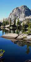
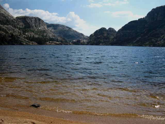
Bensen Lake
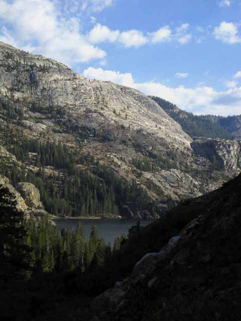 |
2012 Now that we are approaching Bensen Lake we should look at the map of the difficult climb South to Bensen Pass. I gage the lower part of the climb South from Bensen Lake to Smedberg Lake as the most difficult segment of this next section. Let's take a look at a map. The hike from Bensen Lake up to the Pate Valley Trail junction climbs 2000 feet over 3.1 miles. That's a good climb. North Yosemite |
Topo Hiking Map
Bensen Lake Shortcut to Smedberg Lake
 |
Bensen Lake trail junction to West side of Smedberg Lake is 4.5 miles. Shortcut to Bensen Lake Note that when we get down to the level of the meadow we follow along the meadow-rock interface for a short distance, until we get a straight shot at the beach across the corner of the meadow. Part way across the meadow we come to the back gate of the meadow, which was really torn up in 2012. They will come fix it up when trail crew again stays at Bensen Lake. Add .4 of a mile each way from the Bensen Lake trail junction to the lake. North Yosemite Bensen Lake to Matterhorn Canyon |
Down to the Shortcut on the North Side of Bensen Lake
 |
We are hiking South looking down at the flat holding our somewhat diffuse shortcut junction on the North to South descent down to Bensen Lake from Seavy Pass. There was a small fire ring here for years, but it's gone as of 2012. This shortcut brings us directly to the North side of the Bensen Lake beach, rather than hiking further South along the PCT to the Bensen Lake trail junction, then the .4 of a mile further out to the lake. At the low mound in the upper middle-Left we can see where our shortcut trail turns Right down the shortcut route to Bensen Lake where the PCT - TYT bends Left. The shortcut moves Right from the near side of the barren mound in the middle-left of the image, while the PCT-TYT route continuing South moves to the left of the mound. The shortcut trail heads down to Bensen Lake. A few feet to the Right, out of this image, the shortcut trail to Bensen Lake breaks up into a web of deer trails. It looks like a big trail for the first sixty feet or so, then fades away. No problem. Let's find the best route down to Bensen Lake. Take a bearing on the lake, and observe the terrain leading to it, and to the Right and Left. Let's take the best route down to our next point of decision, which will be at a thin flat on the way down. Although the shortcut trail starts strong, it quickly disintegrates into many potential routes through the terrain. We noted the position of Bensen Lake through the trees to help guide our route selection. Yes, we are going to have many points where we make decisions about our direction, each predicated on reaching the Northwestern corner of the lake. We're going to follow a series of route selections to Bensen Lake based on a series of small route decisions, each predicated upon balancing the best combination of the "easiest" and the "most direct" of our options. Terrain gets easier to our Left, the mountain terminates in some steep terrain to our Right, and our best route is "middle-Right." Don't push too far to the Right. Even a fairly bad series of decisions should shortly bring us down to Bensen Lake. If you push too far Right you will have to move Left to less steep terrain. If you push too far Left, you will turn Right to get out of the quagmire of swampy meadow, dense stands of broken forest, and mosquitoes. I started taking this shortcut route when it a decent trail, and have continued as it has evolved into a really fun route. Stubblefield Canyon to Bensen Lake This place is soooo cool. |
Two Options South We can continue South along the PCT-TYT trail past the shortcut trail if we are not visiting Bensen Lake. Or if we prefer to hike the regular trail to Bensen Lake. Bypassing Bensen Lake is not suggested, but I do understand. There are many Pacific Crest Trail hikers who are more interested in completing the PCT objective than anything else. I don't agree, but I do understand. My disagreement hinges on motivation expressed. The motivation that brings one deep into nature should be fully exploited by fully exploring the terrain this motivation brings us into. You cannot say you "did" it if you did not actually experience it. Engaging and absorbing some small element of the natural reality is much different than running through nature as if it is some kind of endurance athletic event. I would say your avoided it, rather than engaged it. Hiking past notable features and beautiful things puts speed before content, or at least unhinges even the most fundamental balance between speed and content. This "destination" approach puts the end before the means, putting reaching the destination before the nature and quality of the experiences of the trip itself. I believe our means determines the nature of our end. If the goal of our trip separates us from experiencing the spirit and beauty of the natural world we are hiking through the triumph of reaching the end of our trail has lost the natural meaning of our trip. Oh, it's a human endurance marathon all right, who's requirements have eliminated the ability to absorb the the nature or spirit of the terrain. Our motivations themselves determine the goal we seek, which determines how we experience the reality we pass through. When our goals are honestly established and well-balances we can synthesize our long distance backpacking means with our true ends, which are not the ends of trails, but observing, analyzing, and reflecting natural engagement into a meaningful experience, while trying not to miss the scenic high points. My goal is to give you the tools to get the most out of YOUR trip, for YOUR expectations and values, as well as a place that to contribute these experiences. (under construction: Stay Tuned.) If not visiting Bensen Lake, we can hike down to the Bensen Lake Trail Junction to begin the stiff climb up to, and around Volunteer Peak to Smedberg Lake. We'll get water just South of the Bensen Lake trail junction if we are not stopping at Bensen Lake. But it's a tragedy if you're hiking through once on the PCT/TYT and not visiting the splendors of Bensen Lake. That is the definition of being in too much of a hurry, too tired, or too overloaded. I've seen folks pass Bensen Lake for all of the above reasons. Or, we can continue below to find our way to Bensen Lake on the Shortcut trail, then resume our Southbound hike along the regular trail from Bensen Lake back to the PCT/TYT junction, conveniently located on the South side of the beach. Even if Bensen does not fit on your campsite schedule, you gotta stop there for one of your daily breaks, if not a very long lunch. Long enough to soak up at least of the beauty of this sweet place. That is my minimum visit to Bensen Lake, lunch and a long break, even when the trail is a most harsh mistress. |
South on the PCT-TYT Route
to the
Bensen Lake trail junction
 |
|||
The Bensen Lake trail junction. Hiking South to Bensen Lake on the regular PCT-TYT route from the unmarked shortcut junction on the North side of Bensen Lake brings us through dense forest shredded by fingers of meadow. Well, it's dense forest on a marshy meadow-forest interface. Be ready to jog through this zone of dense mosquitoes. Bensen Lake itself is generally free of mosquitoes, even though this dense forested-meadow-quagmire wrapping around the backside of Bensen Lake, laying behind the golden sand beach along its Northern shore, is totally full-up of mosquitoes. Full-up. Even late in the season, because of its marshy nature. The mosquitoes are generally held back from the campsites along Bensen Lake's North shore campsites by prevailing winds channeled up the valley and blowing across Bensen Lake. The mosquitoes cannot defeat the prevailing breeze to eat the folks along the golden sands of Bensen Lake's Beach. Bensen Lake is mosquito free if the prevailing breeze exceeds a few miles per hour.
|
Following the Shortcut to Bensen Lake
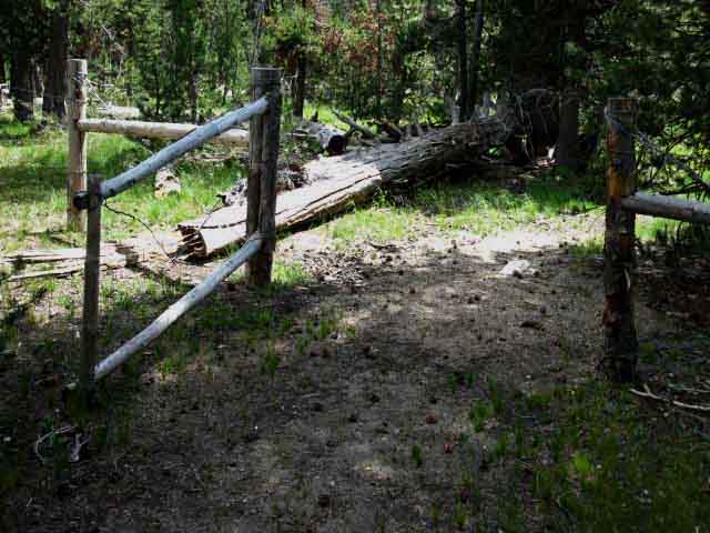 |
To the North Side of Bensen Lake. The North end of Bensen Lake's extensive meadows are fenced off for stock. The North part is where our shortcut route passes through. The fenced meadow area facilitates the horsepackers who resupply the backcountry trail crews, as well as being used by guides from pack stations and passing horse folk. In 2009 the fencing and stock gate were pretty trashed, as was the stock gate South of Matterhorn Canyon. In 2012 they were even worse. I marked up the map above showing the end of the shortcut trail at the gate above, which is about a hundred and fifty yards from the beach. If they fix them up you can still pass through the meadows. Just leave the gates as you found them. Latched if they were latched, and unlatched if they were unlatched. Close them if you see stock in the pasture. |
| Either way we get there, to the North Shore of Bensen Lake via the Shortcut, or to the South Shore of Bensen Lake via the regular trail, Bensen Lake is a good place to take a full day off, to enjoy a half-day break from hiking, or at least for one of our long daily food-rest breaks. |
North Side of the Bensen Lake Beach
 |
Looking West across the big campsite on the North side of Bensen Lake's golden sand beach. Note the berm separating the shore from the camping area. The berm mitigates some of the breeze blowing off the lake. The breeze blowing off the lake is what keeps Bensen Lakes free from the dense mosquito populations inhabiting the meadows and forest behind the beach, to our Right out of sight of this image. Behind this big campsite (to our Right) we see the green meadow fenced in for pasturage. This big campsite is set up to be supported by Horsepackers. This is the location where Trail Crew camp when they are stationed at Bensen Lake. |
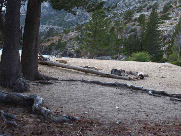
Bensen Lake
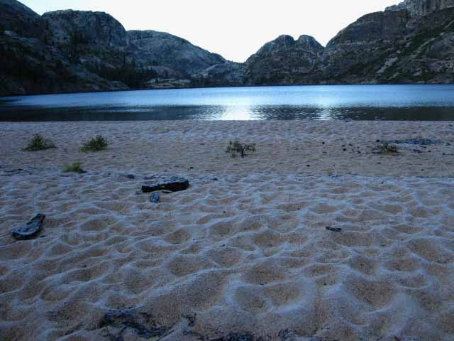 |
Golden sands of Bensen Lake's beach touched by frost before the first rays of the sun touch the surrounding mountains. |
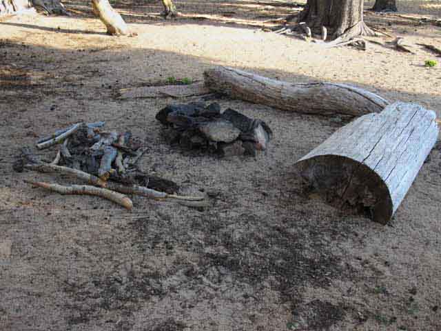
We notice the Old Keyway Firepit on the North Side of the Beach
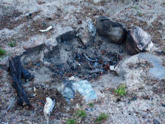 |
Keyway fire pit dug out during late 2009. Old Keyway firepits tell a story. These are dug out by trail crew, and the established sites they represent are backcountry campsites used by trail crew, science teams, as waystations by horsepackers bringing supplies to more distant destinations, as well as civilian hikers. |
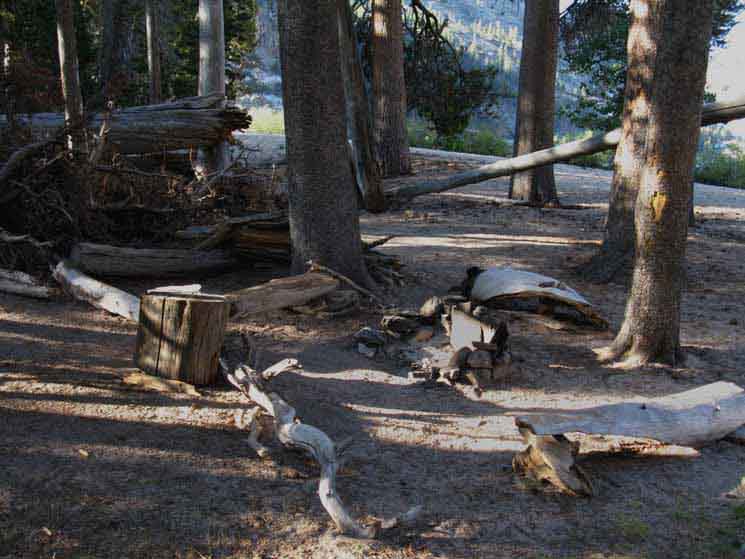
Same Firepit, different Status
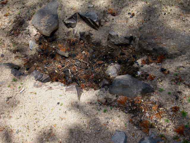 |
Keyway fire pit filled in during 2012. Keyway firepits have other signs of their original creators. An area of pasture will be fenced out nearby, here at Bensen Lake in the meadow directly behind the main campsite area on the North end of the beach. A protected flat large enough to establish a the kitchen, pantry, washing and water facilities for a large crew will surround the keyway firepit. Looking about we will find numerous little flats, the individual campsites of the crews, behind the meadow away from the general area of the main camp and firepit. Trail crew members will have their personal campsites established a short distance away from the main crew campsite. |
Backcountry Professionals
North Yosemite Backcountry Trail Crew
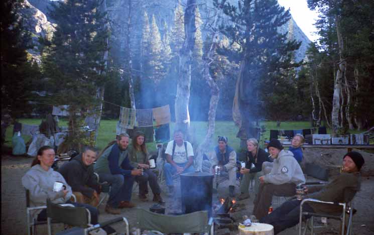 |
Keyway fire pit being professionally employed by Yosemite Backcountry Trail Crew. Early on the morning of Thursday, September 27, 2001. Comments? Trail Crew Wisdom or experiences? Check out the Trail Culture Forum, specifically the Trail Crew and Trail Work Forum. Want to check out working on a trail crew? Most folks start with a Summer in the California Conservation Crew Backcountry Trail Crew Program. CCC is the "entry level" for a career in trail crew. After getting through the CCC the next step in the career evolution is getting a position on a National Forest trail crew. After successfully completing a Summer on a NF Trail Crew folks move up to the elite of trail crew, the National Park Backcountry Trail Crews. |
To the Northeast of the Big Campsite Above
 |
This clean little site was situated a little behind, and a bit South of the big campsite pictured above. I figure this camp is used by horsepackers when they are on their way out to and back from supplying trail crews when they are camped in Jack Main Canyon, as was the case in 2012 when this image was shot. That year a trail crew was camped in Jack Main Canyon, and this little camp spot just screamed "horsepacker" at me. They had it all set up for their next visit while ferrying supplies out to the distant trail crew camp. |
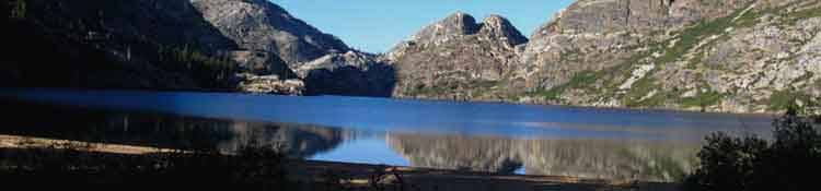
Campsites Splitting the Length of the Bensen Lake Beach
 |
Lots of benches, stump seats, and a sophisticated fire ring featuring a granite plate to absorb and reflect heat. Walking South down the beach from the big campsite on its North end we find a series of campsites wedged in between the North edge of the beach and the dense forest and marshy area filling the basin behind Bensen Lake and its beach. This is a series of great campsites along the forest/marsh to beach interface. Above we're looking Southeast down the length of Bensen Lake Beach from the campsite situated at the point roughly splitting the length of the beach. |
Bit of Washed Up old Tree makes a Great Campsite
 |
| Or you can camp on the beach, preferably behind a wind block. |
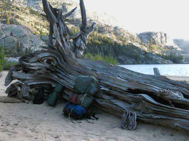 |
Fine windbreak at windy Bensen Lake. I've ended up camping here many times, despite the much more sophisticated campsites along the edge of the beach. The reason is that this site is the most wind sheltered of all the sites. The beauty of camping at Bensen Lake is not just the physical beauty of the lake and surrounding mountains, trees, and marshy meadow. The beauty blows in the prevailing wind out of the Southwest that blows across Bensen Lake into our faces. The prevailing breeze blowing across Bensen Lake's surface works to keep the vast population of mosquitoes living in the marshy forest area behind the beach at bay. Above I am perfectly protected from both wind and mosquitoes. The mosquitoes cannot possibly fly against the wind from their marshy home to my position, and the hefty bulk of this long fallen and worn snag shelters from the wind. |
Great Lodgepoles on South Side of Beach
 |
On the South side of the beach a set of great lodgepoles and the golden sands of the Bensen Lake Beach provide a nice throw down spots when the winds are not too strong. |
Bensen Lake Beach Beauty Various aspects of Bensen Lake |
First Light on Bensen Lake
 |
||
Stillness of first light on the water. Southbound Backpacker's Day from Bensen Lake We Southbound Backpackers might want to awaken extra early when camping at Bensen Lake. We have the great climb to Bensen Pass to open the day, which we might want to complete before the Sun rises too high in the sky. Our bodies will save a tremendous amount of energy by not having to cool themselves while climbing this monster. This energy will come in quite handy for our next major climb later in the day during the height of afternoon heat, when we are going to make the climb out of Matterhorn Canyon to Miller Lake. Getting to Miller Lake from Bensen Lake crosses 14.1 miles of very difficult terrain. I give it an overall rating of H2 with good segments of H1. From Miller Lake we are 11.9 miles North of Glen Aulin High Sierra Camp and a total of 17.41 miles to the Tuolumne Meadows Store, Post Office, and Cafe. I generally stage up at Glen Aulin for a night before hiking to Tuolumne Meadows. I do this for two reasons. First, Glen Aulin is a "classic" High Sierra Camp. It has lots of rookie, young, and old backpackers and folks who feel much more secure backpacking near other folks. Backpackers start congregating together in "camps" when we start getting closer to the main crossroads of nature and civilization at Tuolumne Meadows and Yosemite Valley. Glen Aulin has a custom of all the campers getting together on the overlook to observe the sunset over the Grand Canyon of the Tuolumne. If there is a Ranger out there they will give a talk. I don't get to talk a whole lot with rookie backpackers unless they've pushed themselves deep onto the Sierra Crest or High Sierra Backcountry, or I'm hiking through Tuolumne Meadows and Yosemite Valley. Nearing these main trailheads we begin to meet bunches of rookies, and I must say they are a delightful bunch of folks! What Fun!! The fame of the beauty of Yosemite draws new folks into backpacking. Yosemite's well maintained trails, lots of backpackers and Rangers, and high degree of use offers a degree of reassurance to beginning backpackers who are nervous about venturing alone out into nature. Having so many people around is what makes me nervous! Different Strokes for Different Folks! My second reason for always staying at Glen Aulin is so I can get to Tuolumne Meadows very early in the morning the next day to fully enjoy my first of two days off before continuing South towards Mount Whitney. I need "days off" from all this fun!
|
Retreating Shadow
 |
Unveiling Bensen Lake. |
Morning Light illuminates Half the Basin
 |
Bensen Lake and its surrounding environment take on a number of characters. Above we have the promising spread of new day's brightness. |
Nice Day at Bensen Lake
 |
Bensen Lake during Afternoon We've hiked a long way to get here, 141.9 miles from the Meeks Bay Trailhead of the Tahoe to Yosemite Trail. If we started South from Highway 108 we are at the mid to high thirties in mileage. Maybe we should take a day off here. We can spend two nights here if we packed an extra day's food. |
Below find just a small sample of the folks we've met at Bensen Lake. |
Walking Ranger
 |
Walking Ranger at Bensen Lake. 2002 or 2003, I believe. |
Walking Wildman
 |
Note the wool shirt... 2002 or 2003, I believe. |
Grambo
 |
2004? Too cool for Al, part of a self-appointed hiking "elite." Be Nice. |
PCT SECTION HIKERS
 |
Steve and Brenda, originally from Arizona, breaking camp at Bensen Lake on the morning of July 28 2010. The 2010 Summer hiking season was seriously delayed by deep snows. This was the year that many kids went to work the Mountain Air concert waiting for the Sierra to clear of snow. Steve and Brenda bypassed the Sierra, hiking a section of the Pacific Crest Trail in Oregon, then doubled back to hike the High Sierra when it cleared of snow. |
TRAIL NOTE Now we begin the big climb South, first up to Smedberg Lake, then on to Bensen Pass. The first part of our hike to Smedberg involves running the .4 of a mile gauntlet of mosquitoes living in the great swampy forest/marsh behind the Bensen Lake Beach. Once we make the run back to the PCT-TYT, we will shortly ford Piute and its sister stream above where they join to flow into Bensen Lake. Then begins the climbing. The first stage of this climb has us switchbacking up H-2 terrain about 400 feet into what seems to be a "flat," at least after the climb up there. We follow this H-3 flat up along Piute Creek for awhile, until the difficulty again stiffens to H-2 as we climb away from Piute Creek up to a sweet blue pond. The hike from the pond to the Pate Valley trail junction is a most difficult section of trail. Towards the top of our climb the steepness mellows out as we approach the first of two junctions to Pate Valley. Let's look at how we rate the trails. Trail Ratings H-1: Most Difficult H-2: Very Difficult H-3: Difficult
M-1: Highest degree of moderate difficulty M-2: Moderate difficulty M-3: Low moderate difficulty
E-1 Most difficult Easy Trail E-2 Easy Trail E-3 Very Easy Trail
I'm sorry if I have not completed all the information related to trail difficulty ratings as I struggle to write the guide. I will. I am currently working the guide up to "draft" form, getting it up to snuff for the great final rewrite after finishing the guide down the TYT and PCT to Tuolumne Meadows. Many details of trail, terrain, and the natural and human cultures that intertwine between the two are being added. Each topical layer of the guide content, such as difficulty ratings, gear, living things, and navigation are being added as the core trail guide descriptions are completed. This trail rating system is an objective-subjective system. The ratings are not only based on the objective physical terrain, but on the subjective physical status of the hiker as well. This means that a fully-fit hiker (regular 7 mile 750 foot climbing jogs, weightlifting for structural strength, with some good flexibility) will find the objective ratings accurate, while a less fit hiker must add ranks of difficulty to the trail rating dependent upon their individual level of fitness. Thus the objective-subjective trail rating system. The point of all this is to properly link our trip planning with an accurate assessment of our capacity for training to predict outcomes. We can all write checks with our brains that our legs can't cash. I'd prefer to avoid that situation. It is preferable if our plans for daily hiking miles reflects our established and tested capabilities. Thus we have trail ratings predictive of the increased difficulty for less than optimal levels of fitness. |
Bensen Lake
Continuing South
on the
PCT-TYT
 |
Back to the PCT-TYT Trail Junction On the South end of the Bensen Lake Beach we find this trail to the Northeast back to the main trail. .4 of a mile down this trail through forest and marsh alongside Piute Creek we rejoin the North-South line of Pacific Crest and Tahoe to Yosemite Trails across the North Yosemite Backcountry. Get ready to move fast across this next .4 of a mile. The trail back to the PCT-TYT cuts deep through the ultra soft soils of the marshy terrain behind the Bensen Lake Beach is that is chock full of mosquitoes. Yet Bensen Lake is mosquito free... Thank the prevailing wind that blows out of the Northwest up mountain across Bensen Lake keeping the mosquitoes off the fine campsites along the fringe of the beach-forest-meadow interface. |
Video
Bensen Lake to Smedberg Lake
Bensen Lake lays 31.6 miles North of Tuolumne Meadows and 42.2 miles South of Sonora Pass along the PCT.
The next 6.7 miles hiking from Bensen Lake to Bensen Pass via Smedberg Lake is the steepest climbs along our hike down from Lake Tahoe to Tuolumne Meadows, if not all the way down to Mount Whitney.
22:46 minutes |
||||||
Trail
to the
Pacific Crest & Tahoe to Yosemite Trails
 |
Piute Creek I've seen lots of folks fishing here, reporting good fishing for the most part. Well, not "lots" in a normal sense of the word for this sadly overpopulated state of California. It is an extensive hike to get out here, which restricts the number of folks who get access to these creeks and lakes to serious backpackers. |
Forest and Meadow side Trail
along
Piute Creek
back to
PCT-TYT
 |
The trail to Bensen Lake. I've never seen this segment of trail NOT harboring mosquitoes. The huge populations residing here during Spring and early Summer eventually moderate during September and October, but the moisture in the marshy terrain supports mosquito life until the cooling temperatures finally kill them. |
Bensen Lake trail junction
on the
PCT-TYT
|
||||||||||
Back to the Bensen Lake trail junction Above we see the trail junction along the PCT-TYT for the standard spur trail out to the Bensen Lake Beach and Campsites. This is the logical route back to the PCT-TYT from the Bensen Lake Beach for Southbound backpackers, and for Northbound backpackers uncomfortable with the route-finding necessary to follow the Northbound shortcut trail through the pasture behind the North end of the Bensen Lake Beach. We Southbound backpackers entered Bensen Lake Beach through the shortcut then followed the trail from the South end of the beach back to the PCT-TYT junction above. Incorporating the shortcut route along our visit to Bensen Lake significantly reduces the added .8 of a mile out to and back from the lake along the main spur trail, if you can easily follow this fading shortcut. The shortcut puts Bensen Lake "in line" along our route, rather than being a small addition to this section's miles.
PCT Contradictions I've literally observed thousands of PCT hikes who are engaging what I call the "PCT shuffle." This is my nickname for the characteristic quick, short-stepped gait that a high percentage of successful PCT hikers fall into. The PCT Shuffle is a quick walking rhythm composed of many flat-footed (neutral) short low impact steps maintaining the center of gravity just a bit forward from neutral, with full mental concentration on the trail surface. The PCT shuffle is a form of trance-walking, and its main purpose is quick low impact movement through terrain at the deep expense of observation and engagement. The more we focus on the trail the quicker we go and the less we see. Until we go so quickly we see nothing. I question the logic of this approach when it causes you to miss or not enjoy high points of scenic beauty along our trip, becoming virtual slaves to "production." Either you are not strong enough to do it with joy and flexibility, and/or you are biting off more than you can currently chew, swallow, and properly digest. Doing something without knowing it is a common modern hollow "achievement," more like completing boot camp or running a marathon than backpacking through Nature. Sadly, the goal of the PCTer is the end, not the trip itself.
No time for that! We've got a "goal" here! So they hike right past Bensen Lake, just one of a series of beauties their goal-obsession has blinded them to. The external human "goal" of the PCT, hiking the whole thing in a season, removes the time most folks would need to gain some small understanding of what they are hiking through. No time for that! We've got a "goal" here! We rush hither and tither, to and fro up and down the PCT, with each step imposing our own narrow human standards, qualifications, and justifications to validate ourselves, not ourselves in nature, but to validate our social egos using nature as a sort of Shakespearian stage for personal drama. Humans are amazing creatures who can take tremendous amounts of self-generated physical abuse. Good for you. You can pass Marine Corps Boot Camp and run marathons for all I care. That would be High Sierra backpacking. I try to keep these two characteristics properly balanced when I have a choice in the matter. Most PCTers have chosen imbalance, and are too goal obsessed to see the forest from the trees. Goal-obsession is a social flaw PCTers carry into the backcountry. It blinds them to Nature's differing agendas, purposes, and meanings. It separates them from what they walk through. Extended emersion in Nature, not your subjective goals, is the true treasure every backpacking trip brings. My hope is that Nature rips the social expectations right out of every PCTers' soul, leaving them with their natural capacity to observe, absorb, and reflect the beauty of Nature without the distortions of social expectations. Maybe you make the Canadian border, maybe not. But a better person will step off the PCT at the end of the season than the person who stepped onto the trail at the beginning. Isn't that our real goal? |
||||||||||
Miles Southbound
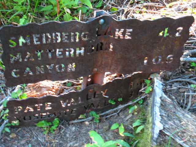 |
||
Bensen Lake trail junction sign, Southbound miles.
The miles South called out by the Yosemite Trail Sign have long been undermined by trail reroutes. A major lengthening of the trail from the second, Southern Pate Valley trail junction to Smedberg Lake has added about 3/4ths of a mile. Yet my miles cited to Smedberg Lake are only .3 of a mile longer than called out by the Yosemite Trail Sign. I cite the specific locations I measure the distance between. The Yosemite Trail Signs do not, and this may account for some of the disparity between my figures and Yosemite's. Does the Yosemite Sign measure the distance to the West side of Smedberg Lake? The center horn that sticks out into the lake where the camping restrictions are? Who knows. These minor inconsistencies, a tenth of a mile here, a third there, are relatively minor along segments of our trail. But they build up over the sections, and become significant over the course of 500 miles of potential routes between Lake Tahoe and Mount Whitney. Thus I strive to keep my measurements accurate, between specifically cited positions, and inclusive of the many changes in the route over the years. |
Woodpecker
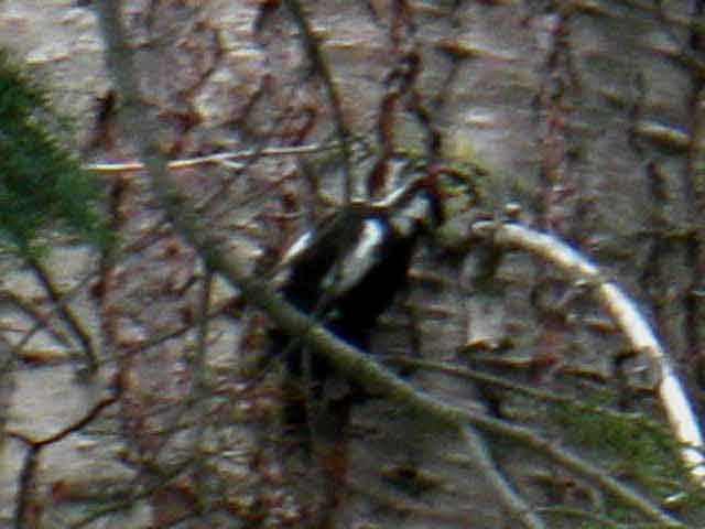 |
Woodpecker. When I hear the sound of these birds pounding their heads against the trees I'll go look for them, if they are reasonably near the trail and the terrain is reasonable. |
Piute Creek Fords
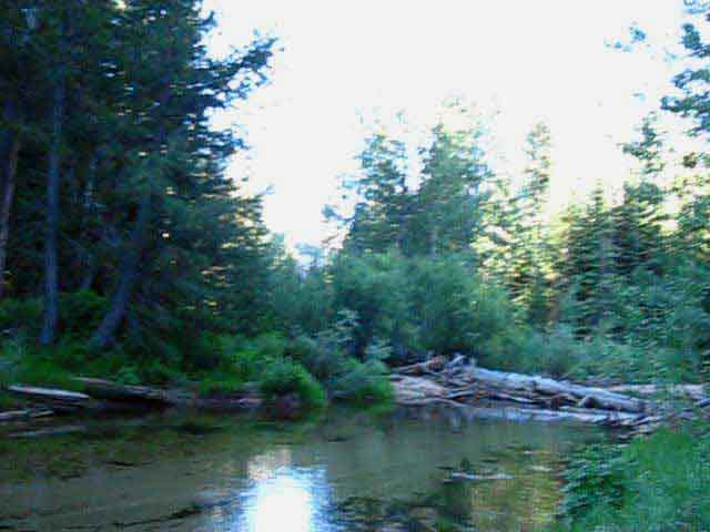 |
"Piute Creek" low and slow in late July 2010, North Yosemite Back Country on the Tahoe to Yosemite and/or Pacific Crest Trails. Well, this is not really Piute Creek, but the unnamed creek that comes out the gorge above Bensen Lake feeding the head of the wet meadow behind Bensen Lake. Piute Creek joins this creek after coming down through the untrailed granite gorge out of the depths of the North Yosemite Backcountry, which we encounter a few yards after crossing this unnamed creek. This creek and Piute Creek merge just a few short yards downstream from our current position. Another, third creek drains into Piute Creek right before it flows into Bensen Lake. This last creek draining into Piute Creek is the bottom of the Creek running down from Smedberg Lake who's course we will follow, roughly, up to base of the flanks of the mountains rising to our South, being the West flank of Volunteer Peak and the North flank of Double Peak. Bensen Lake to Miller Lake The 2010 video is from a trip where I had managed bad blisters with good dressing. Yet each creek crossing requiring wading wasted another set of dressings and tape. This was a problem as I was getting low on medical supplies. Thus I was looking for ways to avoid the wades. I use the plural, "wades," because we cross two streams in quick succession a short distance South of the Bensen Lake trail junction. This first one above is a feeder creek to Piute Creek laying just ahead. |
Piute Creek Dead Ford
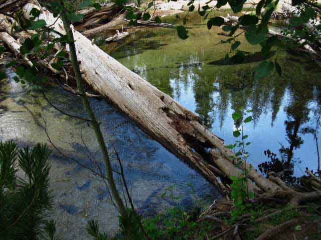 |
Life is a gamble. A deteriorated ford across Piute Creek invites disaster. After the second ford we meander through temperate forest with ferns growing off its floor for a short distance before be begin to climb. |
Departing the Temperate Zone in the great meadow zone above Bensen Lake
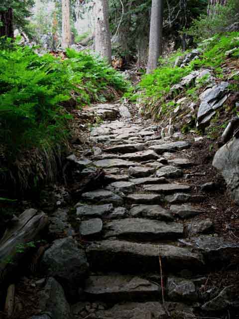 |
Well-armored trail turns up South of Piute Creek in North Yosemite Backcountry. |
Ford
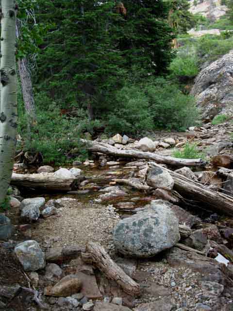 |
Third Creek South of Bensen Lake trail junction in Yosemite. Fording the Creek coming down from Smedberg Lake. The lower part of our route up to Smedberg Lake roughly tracks the seam in the terrain this creek follows down from Smedberg Lake. In the image above we're crossing the lowest of the three times we'll ford this creek climbing up to the pond where we finally turn Southeast away from the Northeast course of this creek. Bensen Lake to Miller Lake We will follow this little stream until it turns Northeast towards Smedberg Lake where the pond and our uppermost final ford is located. Past the pond at the upper ford we turn Southeast out of the very uppermost section of the meadowed flat, which has narrowed into a steep valley or gorge, to make the monster climb up to the first of the two trail Pate Valley trail junctions. Both trails from these Pate Valley trail junctions lead South down Rodgers Canyon to Pate Valley in the Grand Canyon of the Tuolumne River. The second and Southernmost Pate Valley trail junction swings its trail around Rodgers and past Neall Lakes before joining the trail from the North Pate Valley trail junction for the hike down to the Grand Canyon of the Tuolumne River. Both of these trail junctions are located close together on the shoulder of mountain laying between "Double" and Volunteer Peaks. |
Our View Directly North
Climbing South of Bensen Lake
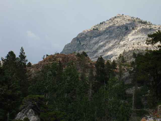 |
The peaks along Piute Peak to the Northeast of Bensen Lake. Our meandering trail to the Southeast has formed up into long switchbacks. Bensen Lake to Miller Lake Piute Creek runs over on the other side of the red ridge crossing the middle foreground. The great chunk of granite rising beyond is one of the peaks rising above the Northeast end of the marsh behind the Bensen Lake Campsites. |
Looking to the Northwest at the PCT route North of Bensen Lake
The Trail up from Bensen Lake to Seavy Pass
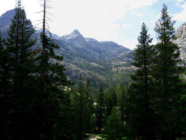 |
As we climb higher we get views of the PCT route to the South of Bensen Lake, under Piute Peak up to Seavy Pass. Stubblefield Canyon to Bensen Lake |
Shadow and Light
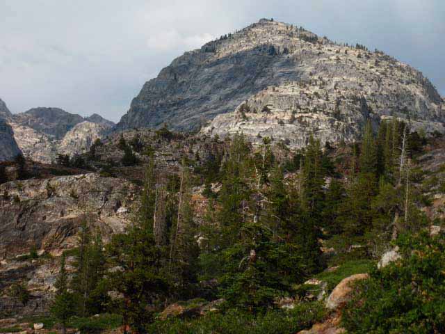 |
Peak rising to the Northeast of Bensen Lake. This is the same peak as in the second image above, but now we've hiked high enough to get a broader view of its bulk and context. Clouds play shadows off contrasts on the surrounding formations. |
Approaching First Flat South of Bensen Lake
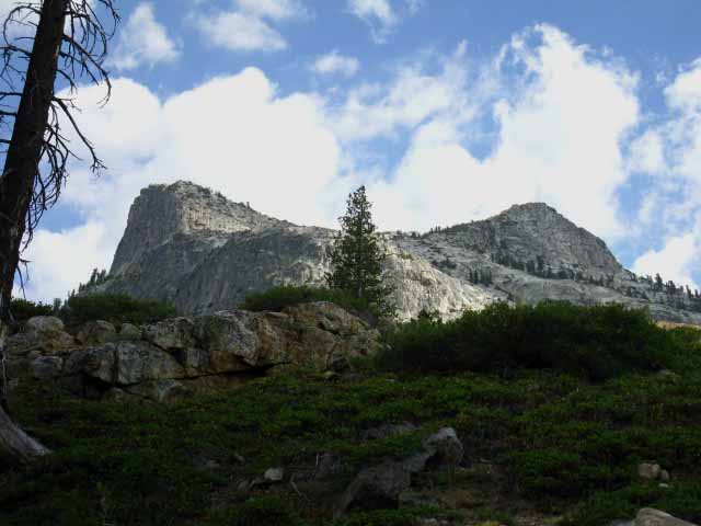 |
Double Peak |
North Flank of Double Peak Towers Above Us
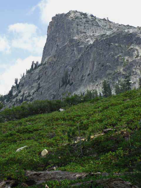 |
Hiking up under the sheer North face of "Double Peak" on our hike from Bensen Lake up to Volunteer Peak. |
View East-Southeast by Compass, Southbound on Trail
The Flat Meadowed Area
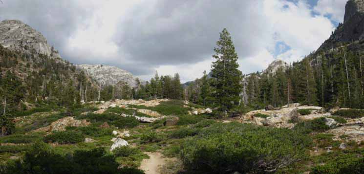 |
Flat approaching steep climb to Volunteer Peak. Volunteer Peak is behind the tree, the sheer face of "Double Peak" rises on the Right. Let's take a look at this terrain from the South exit from the Seavy Pass Bowl. We're also watching cloud behavior carefully. At the end of this flat we will climb up to the shoulder to the Left of Double Peak laying between it and Volunteer Peak. Bensen Lake to Matterhorn Canyon |
Volunteer and Double Peaks
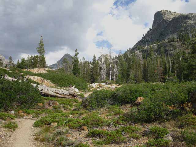 |
Climbing further into the forested flat Volunteer Peak rises back into clear view. Volunteer Peak at center Left at the head of the flat, Double Peak towering to the Right. |
Ford
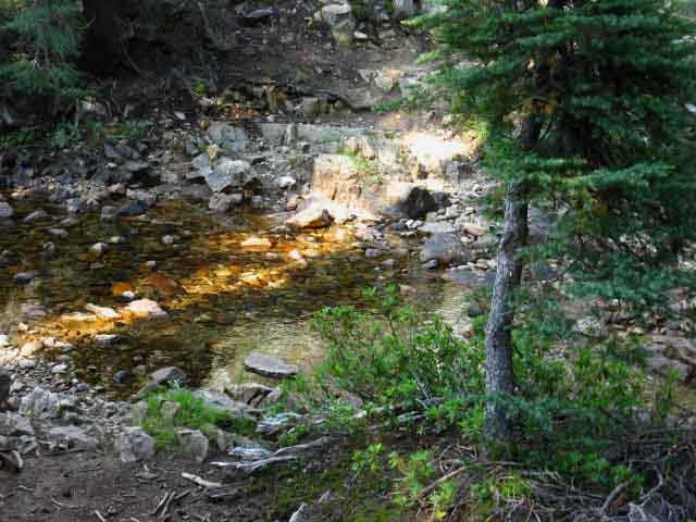 |
Creek coming down from Smedberg Lake running across a flat area below Volunteer Peak. This is our second ford of the creek descending from Smedberg Lake. Bensen Lake to Matterhorn Canyon |
Volunteer Peak
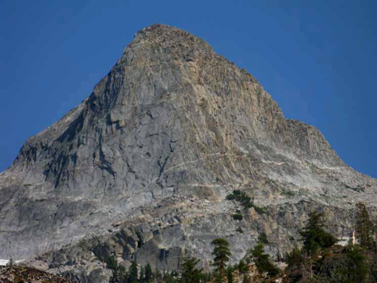 |
Volunteer Peak from the head of the flat. |
View Northwest
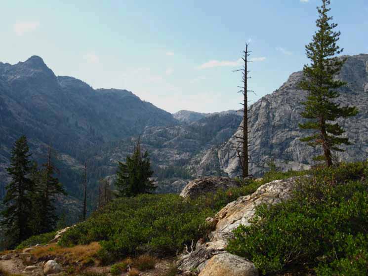 |
Piute Peak and Seavy Pass on the North side of the Bensen Hole. Bensen Lake sits out of sight far below, and a bit to the Left. I'm thinking that we can see the North Wall of Kerrick Canyon in the far distance. Bensen Lake to Matterhorn Canyon |
Southeast View
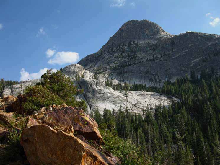 |
View Southeast of North Face of the North Peak of the Double Peak. Note detail of lower Left-hand corner below, once we get a few feet higher up the trail. |
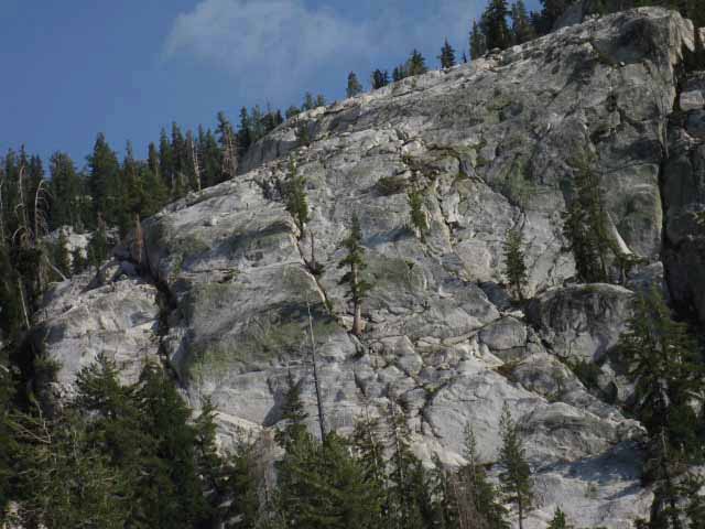 |
Steep cliff decorated with lodgepoles. Our route works its way up to between Volunteer and Double Peaks to the Left of this slab. Bensen Lake to Matterhorn Canyon |
Huge Trees Minor Details on Massive Face
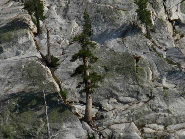 |
This is a close-up of the tree in the center of the image above. Trees are better climbers than I. So are bears. |
Sweet Pond
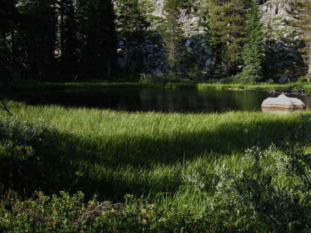 |
Pond below big climb to Pate Valley trail junction. |
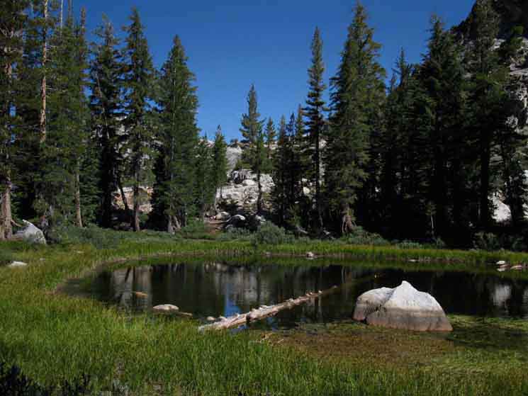 |
Volunteer Peak rises to the Right. |
Overall View
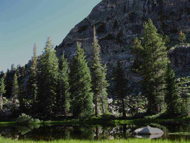 |
The creek draining Smedberg Lake passes near this little pond/lake. July 2010 |
Creek from Smedberg Lake
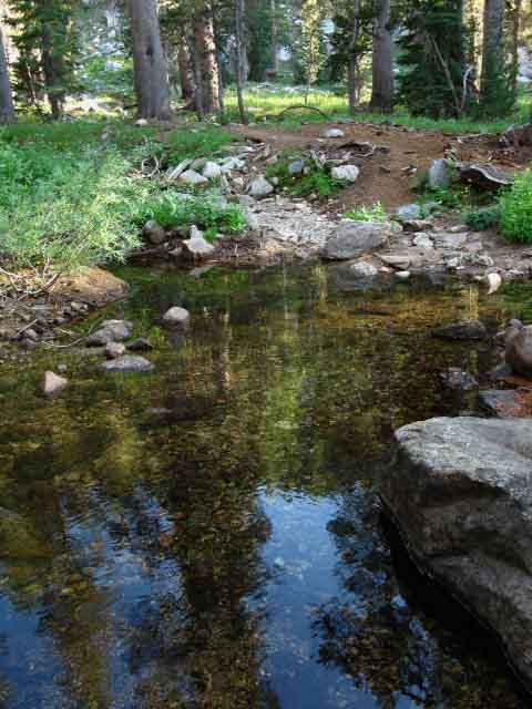 |
Creek by pond below Volunteer Peak. Bensen Lake to Matterhorn Canyon |
TIME TO CLIMB !
The Trail Steepens Significantly
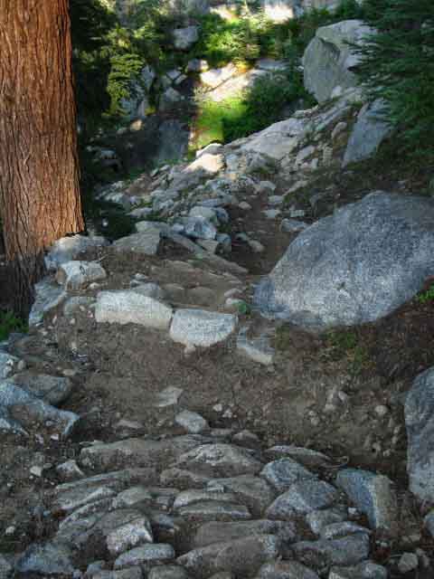 |
Parts of the trail are more like a rock wall than a rock trail. Looking down an incredible steep section of climbing trail above the pond. You'll see. |
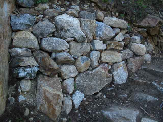 |
Built-up switchbacks climb steep terrain towards Volunteer Peak. |
Nature of the Terrain
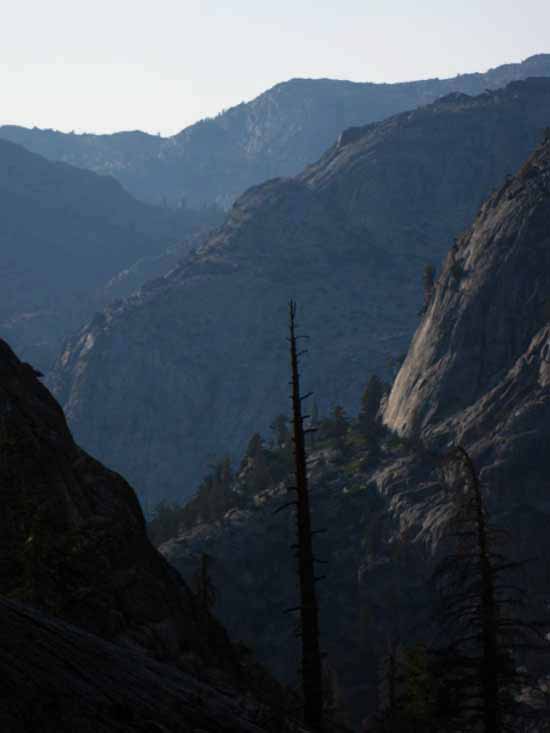 |
The steepest and most difficult trails offer the greatest rewards. This is truly majestic terrain. And believe you me, you earned this view. |
The Climb Moderates
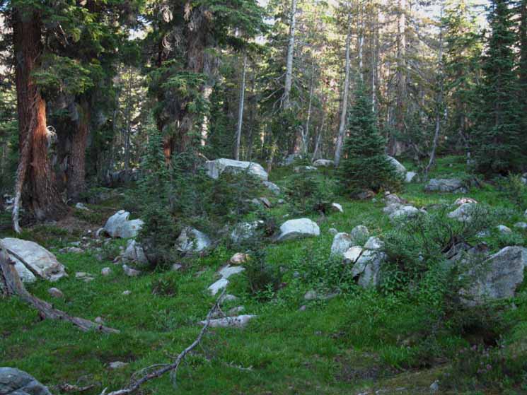 |
BAM! The climb moderates from a steep climb up a rocky cliff side to a stiff climb into rocky forested meadow. After a monster climb the switchbacks snaking up this cliff moderate into steep meadows surrounded by dense and old growths of forest laying between "Double" and Volunteer Peaks. We have observed this forested flat since we hiked out the South Gap from Seavy Pass.... now we are finally climbing into the bottom of this forested flat. A bit more moderate climbing (say Hard 1 to Hard 3...) will bring us up to the first Pate Valley trail junction. |
The Trail Turns Since climbing past the pond we have been climbing an incredibly steep trail to the Southeast. Steeper than the Golden Staircase. Steeper than the climbs up Whitney. Steeper than Forrester or Glen or Pinchot Passes. This climb is the badboy of the Sierra Crest Trails, including anything else along the lengths of the PCT, TYT, and JMT. At the top of the climb the trail turns, and by segments moves us to point Northeast, and we catch our first closeup glimpses of Volunteer Peak approaching the first in the quick succession of the two trail junctions Southwest to Pate Valley down in the Grand Canyon of the Tuolumne. Check the map: Bensen Lake to Matterhorn Canyon |
Climbing up under Volunteer Peak
Volunteer Peak viewed from the Southwest
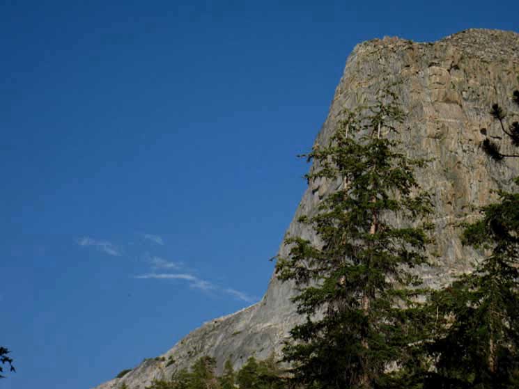 |
We are looking almost directly East. Just a tad North of East... The image below is of the same part of the Volunteer Peak, but during different lighting conditions, revealing different aspects of the changing colors, contrasts, and characters of the terrain. |
Detail of Volunteer Peak
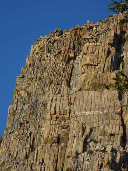 |
Detail of color and form as well as the close jointing of Volunteer Peak granite. This sucker was internally shattered by the weight and pressure of the upstream glacier. From this position we have just gotten our first close up look at Volunteer Peak, and we are moving closer. We're going to rotate clockwise around the base of Volunteer Peak from 8 to 2 on the clock dial. |
"Rotating from from 8 until 2 O'Clock" does not even spark an echo of recognition on too many bright young faces. Hell, on most bright faces... I'm not arguing against "progress." Digital can represent information in a circular nature of reality (such as on a clock face) as easily as through a linear digital read-out. I figure that this "next generation" digital trail guide at least clues you in that I'm not against digital technology per se. As a means to an end. The end of this Trail Guide will lead you away from technology back to Nature. Go Get It! My deeper point is that the Sun, Moon, Earth and Stars all rotate. Our Galaxy is the fishbowl our Solar System rotates around. The universe, representing all time and space, is itself the fishbowl our Galaxy swims around within, making our planet's rotation through each night's sky a grand tour of almost half of space, and all of time. These are facts that you, your spouse, your kids, and all your friends and family need to know.
The rotary nature of time and how time is generated and regulated by, and is a part of representing the pace of our physical location. These relationships should not, must not be replaced, or even dumbed down by meaningless digital readouts. Not for me, not for you, and certainly not for the kids. Time is too big for its definition to be limited to a digital readout on our wrists. It must been seen in the workings of the Solar System. It must be felt in the changing seasons. To know looking into deep space is looking back in time at the stellar machine that produced all the known elements necessary to observe and feel time and space completes the loop of life through matter. Observation and analysis of, and engagement with the fundamental elements of time and space are what this guide and the accompanying backpacking forum are all about. I am a practical, non-superstitious, non-religious person. But I must say that this nature-life-human stuff is magical in its most mundane manifestations. And it Rotates. I want you to know it, to see it, to feel it, and reflect it from your unique perspective. |
Locate Ourselves in our Galaxy Alright, we know roughly where we are on the planet Earth, we know what season it is, what time Sunset occurs, almost exactly where the axis, the North-South line upon which the Earth spins is centered on the North Star, and therefore what quadrant of the Galaxy and Universe are visible crossing tonight's sky. These are bits of contextual knowledge all backpackers should know. If not, we can refer to the resources below to glean these bits of information:
Totally Cool. Now we can sit around at night and measure time and perfectly know the compass points. But there is another cool thing we can figure out every Summer evening: What direction we are spinning around the Sun in relation to the center of our Galaxy? We should be able to say: "The center of our Galaxy is over there (pointing to it), we on the Earth are rotating this way, and our planet is moving (1/365th) in that direction (pointing), and our orbit describes an arc that will turn us to point in the opposite direction (point behind you) on (the date six months away). The Sun and the center of our Galaxy remain in the same positions six months later, but the position of our planet changes in relation to them, and so too do our nighttime views of our Galaxy and the surrounding Universe change. During Summer we are looking towards our Galactic Center, during Winter we look away. Our first points of reference are that the Sun is directly behind us looking up at Midnight on two nights six months apart. Knowing that we have taken care to observe both "hemispheres" of our universe over the course of a year, noting the rotating position of the Milky Way changing in our night skies. During Summer we note that the great bulge of the Milky Way, being the center of our galaxy, is located almost directly to our South in the Constellation Scorpius. We can only get a good look at Scorpius during Summer, when the nighttime view from our planet points into the plane of the Milky Way, rather than away from it as during Winter. We can anticipate the changes in our nighttime views using the really cool adjustable Sky Chart or Horizon View on Your Sky. Set a date for the sky in mid-June, then adjust the perspective so we are looking directly South at Scorpius, where the center of our Galaxy is located. Facing East at Midnight during Summer we are facing the direction our planet is rotating around the Sun, showing the relationship of our orbit to the Sun and the axis of our planet to the center of our Galaxy. We note that our "on the ground" observations put us "high and outside" of our Galactic Center, in baseball parlance, being way out, about three-quarters of the way out the galactic disc from our Galaxy's central bulge, with our solar system is sitting above the main plane of stars making up our galactic disc. We are about 28,000 light years out from our Galactic Center and 20 light years above Galactic Plane. It takes 220 million years for our Solar System to complete one orbit around our Galaxy, consisting of a "Galactic Year." This means that our Solar System is between 20 and 21 "Galactic Years" of age, which translates into 4.6 billion Earth years. See The Galaxy for more information. Looking up at Midnight pinpoints the exact portion of our planet in the Zodiac. The Zodiac is the Star Map charting the progression of our view of the stars at Midnight as the Earth rotates around the Sun. The Zodiac is the ancient night sky map, calendar, and clock of our universe that tracks our planet's change in position across each night's sky as our orbital motion traces out one degree of our rotation around the Sun every day. The Zodiac will tell us what major stars/constellation will be overhead at Midnight of any date. Check this out: Seasons and the Zodiac If anyone can draw an accurate "X" in these slowly shifting sands of time and space, it is backpackers who keep their eyes open and their minds clear. Sailors are pretty good at it too. Well, since our view of the universe from Earth will gradually circle back around onto itself over a year, I guess we are all running around in little circles every day as we progress around the big circle every year, as we rotate around very much larger circles, if we know it or not. Digital watches offer information without knowledge. They offer a linear interpretation of a circular situation. Don't get me started on velcro shoelaces! The basic assumptions required to find our Galactic Position are that we can track time to midnight during Summer, find the Milky Way, and trace its increasing density South to its central bulge. Then engaging our brain with a little imagination and some good reference materials will make our position in the Galaxy and even the vastness of the Universe a little clearer. Then we visualize the position of the Sun, estimate our current position in our annual path around it, and the relationship of our revolving position to the center of our Galaxy. Wow. Haha, I should put up a trail sign.... It will feature a single vertical line with an arrow on the top pointing up, the bottom of the line will also feature an arrow, but pointing down. It will say: "We Are Here."
Our heads are deep in space, our feet are planted firmly on this Earth. Make sure you at least print out and bring a current Sky Chart along on your backpacking trips! |
The Northern of Two Trail Junctions to Pate Valley
Continuing South
(One of the two Southbound signs was detached from its post in 2009.)
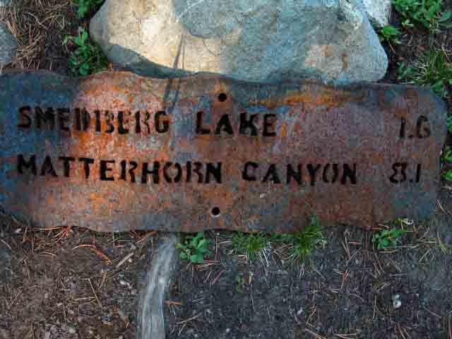 |
||
The detached Southbound PCT-TYT Yosemite backpacking trail junction mileage sign.
|
The Other Southbound Trail Junction Mileage Sign still on the Post
 |
||
Sunray lights up Northbound mileage sign on Pacific Crest Trail from North Pate Valley trail junction.
|
Northbound
 |
||
Back the way we came. Note the distance to Buckeye Pass. Buckeye Pass is at the top of Kerrick Canyon, situated at the top of a steep climb up from the Twin Lakes Trailheads off of Highway 395 near Bridgeport.
|
Southwest to Pate Valley via Pleasant Valley
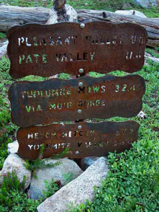 |
||
This is our latest way to get South down to the Grand Canyon of the Tuolumne River. Our first opportunity was to follow Jack Main Canyon down to Hetch Hetchy, the next was in Tilden Canyon down to TilTill Valley above Hetch Hetchy, and the last was at the Kerrick Canyon Ford to follow Rancheria Creek down to Pate Valley. Our North to South route along the Western Flank of the Sierra below the crest line is paralleled by a North to South trail from the O'Shawnessey Dam at the head of Hetch Hetchy up the Tuolumne River to Glen Aulin. At Glen Aulin these two trails join for the hike up to Tuolumne Meadows. Between Jack Main Canyon and Cold Canyon are four additional routes linking our PCT TYT route with the trail along the Tuolumne River.
Bensen Lake to Virginia Canyon |
Fortunate Encounter, 2012 At the North Pate Valley trail junction I met two crews of Llama packers, part of the same group. |
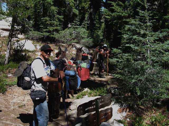 |
David Herrenson leading a fully laden 3 Llama train down to Bensen Lake. That's him flippin us the peace sign in the distance. Don't let that fool you. He's a hell of a good dude. August 26 2012. |
About a Half-Hour Later Dad Arrived
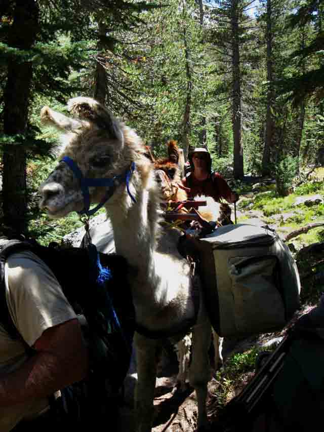 |
Jim Herrenson passes with Llama train and associated backpackers in tow. |
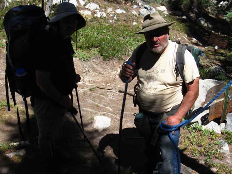 |
Jim Herrenson on Right, a backpacker buddy of his on Left. All the dudes were wearing packs with their personal gear, while the Llamas were carrying most of their camping and cooking gear and the food. |
Llamas on the Pacific Crest Trail
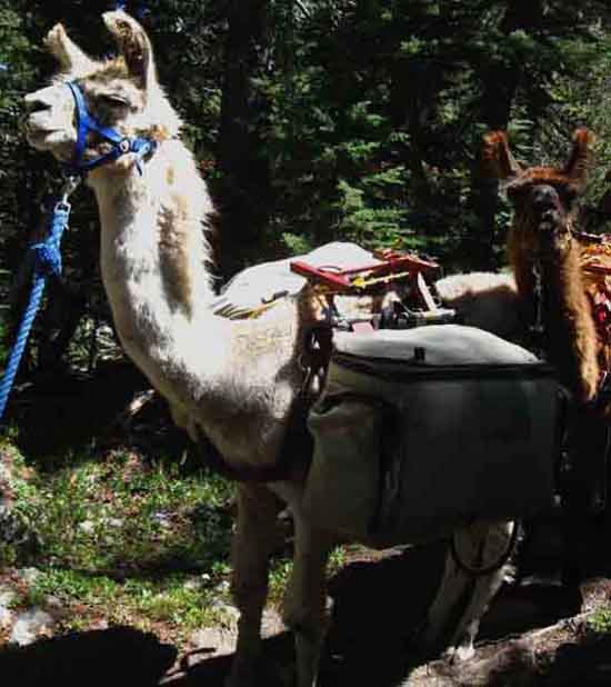 |
LLamas checking us out. Curious creatures. Beware, they spit and bite. |
Llama Tracks
 |
The first time I encountered Llama tracks I said, "WTF??" |
Hiking South to the Southern Pate Valley Trail Junction
To Our Northeast
Volunteer Peak
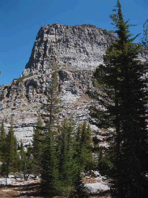 |
South of the first trail junction we have a little ascending terrain to cross before the trail slopes down to the second junction. Bensen Lake to Matterhorn Canyon |
To Our Southwest
"Double Peak" Peak Towers Above
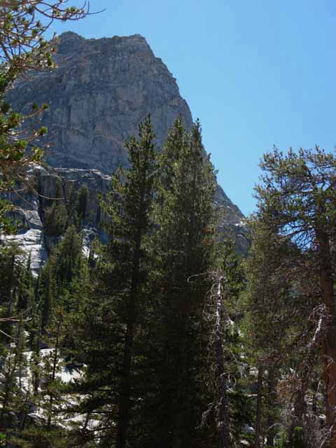 |
We have passed under the sheer North flank of "Double Peak" and climbed up to the shoulder between it and Volunteer Peak. Looking back, to the Southwest by the compass, gives us a whole new perspective on "Double Peak." I call this landmark mountain along our route "Double Peak," because of how it appears when we first see it hiking from North to South from the Seavy Pass Bowl. |
To Our Southwest "Double Peak"
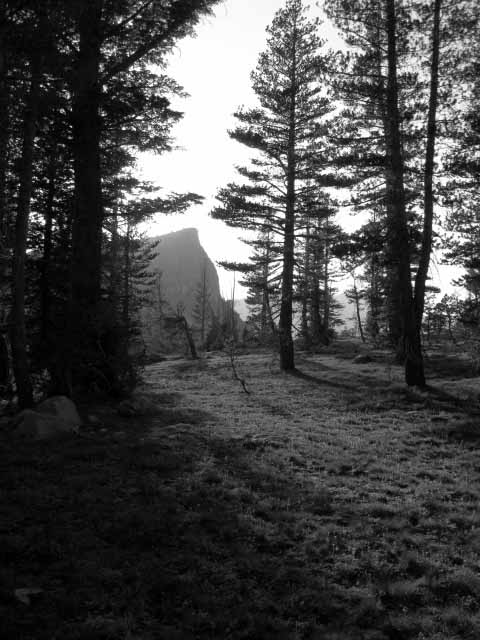 |
Turning around to view Double Peak to our Southwest as we hike East- Northeast between the Pate Valley trail junctions. Glare of the setting sun is lighting up the Western horizon. |
High Sierra Chipmunk
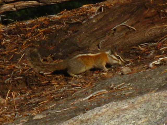 |
||
Cute little chipmunk. Little dude's colors blend right in with the tree composting on granite.
|
The Southern of Two Trail Junctions to Pate Valley
Continuing South
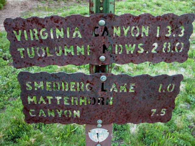 |
||
Continuing South along the combined Pacific Crest Trail and Tahoe to Yosemite Trail from the South Pate Valley Trail Junction below the West side of Volunteer Peak.
|
Northbound on the PCT TYT route
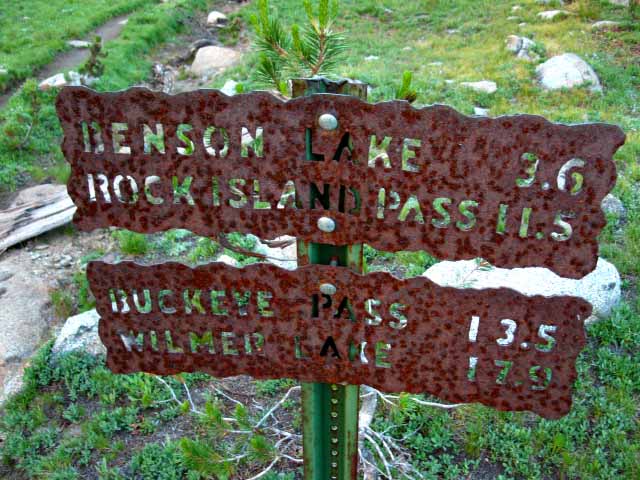 |
||
Back to the North, the way we came, along the combined Tahoe to Yosemite and Pacific Crest Trail routes through the North Yosemite Backcountry. Rock Island and Buckeye Passes are both accessed hiking up Rancheria Creek from the trail junction in Kerrick Canyon below the North side of Seavy Pass. The trail up Rancheria Creek crosses over the Sierra Crest to East Sierra trailhead at Twin Lakes accessed from Highway 395 near Bridgeport. Wilmer Lake is the PCT option to Jack Main Canyon. A couple of miles East of Wilmer Lake we have the option of hiking the Tilden Lake Loop route to enter Jack Main Canyon a couple of miles further North of Wilmer Lake.
|
Southwest to the Grand Canyon of the Tuolumne
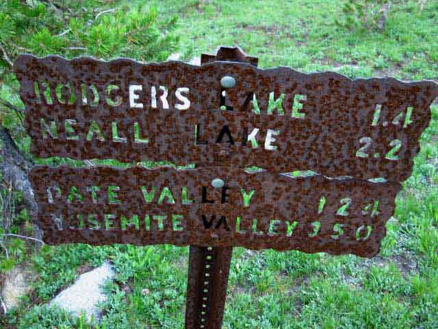 |
||
Pate Valley is the first location above the Hetch Hetchy Reservoir that actually drops onto the floor of the Grand Canyon of the Tuolumne River accessible from our Southbound PCT - TYT route. Jack Main Canyon is the Western/Northern link from the Sierra Crest trails down to O'Shawnessey Dam plugging the Grand Canyon of the Tuolumne, while Cold Canyon is the Eastern/Southern route our PCT TYT route follows down to the Tuolumne River above the Grand Canyon of the Tuolumne. I've hiked from Lake Tahoe down to Hetch Hetchy, and the TYT - PCT down to Glen Aulin many times, but I have not yet swung the route off the crest and up the Grand Canyon of the Tuolumne River. I gotta do that sometime.
|
One Mile South to Smedberg Lake The Trail Descends Hiking South along the Tahoe to Yosemite and Pacific Crest Trail routes from the Southern of this rapid succession of two trail junctions we begin a short but steep descent of a couple hundred feet putting us in position to rotate Northeast (clockwise) around a lower part of the West flank of Volunteer Peak towards its North flank. To get to Smedberg Lake under the North flank of Volunteer Peak we will follow the trail down to make one more short climb, being our final climb to the top of the granite ridge overlooking the West shore of Smedberg Lake. Once we hike down, and North under the West flank Volunteer Peak we begin switchbacking East up a set of pretty amazing long switchbacks of moderate difficulty. The reason they are amazing is the granite terrain has been carved into what I call a set of "houses of the holy" rising ledges. Smedberg Lake sits to our East at the bottom of the ridge. From the top of this low granite ridge arm we can see the Northwest corner of Smedberg Lake below. We can make out where our next break/camp site is located on the West shore of Smedberg Lake. The Bottom Line Both I and the Yosemite trail sign both measure the whole distance between the Southern Pate Valley trail junction and the West side of Smedberg Lake at one mile. This is remarkable, because this new section of trail is much longer than the old route these old signs refer to. Alternative Route The old route stays high up under the West flank of Volunteer Peak while the new route goes low. I have not checked it out yet, but I'm pretty sure that's what this unmarked route does. I am going to take it next time through. Until then I cannot vouch for the integrity or safety of the route. Post up if you've hiked it:
|
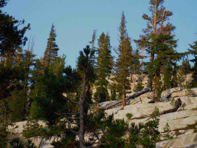 |
DESCENDING We are looking Northeast as we are losing altitude hiking North under the West flank of Volunteer Peak (to the Right out of image) to put ourselves in position to climb over this ridge to Smedberg Lake. We have to descend a bit further, continuing to hike North and down a short ways further before we begin climbing East over this ridge, but a bit further to the North down the ridgeline. We are looking to our Right over at the low ridgearm descending off the Northwestern corner of Volunteer Peak. Our route up to overlook Smedberg Lake is across this ridgeline, but further to the Left, North out of the frame of this image. Once we descend a couple of hundred feet of elevation, and move a few hundred yards North we will switchback up this ridge. |
Looking Back
Turning Around to A View West by Southwest, of "Double Peak"
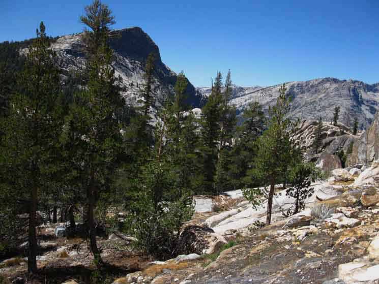 |
||
Double Peak from the East We've descended from the Southern junction and hiked North under the West flank of Volunteer Peak, and now we've turned East and begun to churn out the back and forths required to get over the great granite switchbacks climbing over the granite ridgeline extending off the Northwest corner of Volunteer Peak laying between our current position and Smedberg Lake. The remaining short moderate-difficulty climb East to Smedberg Lake is directly behind us. Always Turn Around... Check out our view of "Double Peak" from the far Northern side of the valley above Bensen Lake, from a position just below and South of our exit point from the Seavy Pass Bowl. I mean "North" on the trail, which is Northwest by the compass. We can see above that our current 9200 foot elevation and position to the Northeast of "Double Peak" significantly alters our perspective and the presentation of "Double Peak." It looks far different here from how it looked from our positions hiking South out of the Seavy Pass Bowl, and climbing South from Bensen Lake. Our changing perspective on these wonders of nature keep them fresh and unique after repeated hikes. They don't get old, you do. The first few times through it's a challenge to understand the fundamental logic of the terrain, let alone observe the many aspects and characters it expresses around the circle of seasons and perspectives. Each time I hike through the North Yosemite Backcountry I find new perspectives. I find constant confirmation of my theory that the more I get to know a piece of terrain the more I understand how little I really know. A delightful problem: Endless, relentless detail emerges from Nature confronting every calorie of my curiosity, six to one. Every calorie I expend here shows me six calories I could spend. Which leads to six hundred, then six thousand...
|
Looking Forward
Final Ridge separating us from Smedberg Lake
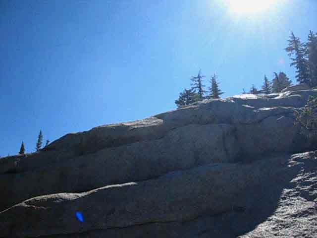 |
Burning Sun Rising on Reflective Granite Surface View Southward on the Trail, (East by the Compass) at the long low virtually unjointed slabs of smooth glacial cut granite. This mass of granite composes the ridge we will switchback up to overlook Smedberg Lake. This granite ridge is descending off the Northwestern corner of Volunteer Peak, which is rising magnificently, but out of view on the Right side of the image above. |
Last Ridge on our way South to Smedberg Lake
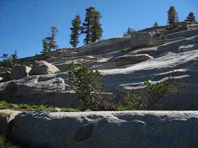 |
||
The Ridge Tapers The ridge tapers off a bit running off the Northwest corner of Volunteer Peak, just out of the Right edge of the image. A bit further to our North, out of the Left side of the image, switchbacks snake their way up over this ridge to Smedberg Lake. Trail crew showed amazing sensitivity integrating the natural lay of this carved granite into a nice set of switchbacks over the top of the ridge. This solidity of this vast slab of unjointed granite extending Northwest off the Northwest corner of Volunteer Peak is in direct contrast to the shattered granite that composes the thumb of Volunteer Peak rising skyward. The shattered look of Volunteer Peak makes me think it was on its "last legs," already fully shattered by glacial pressure and ready to be swept away as debris when the glacial onslaught subsided, leaving this ridge of solid unjointed granite next to the shattered bulk of Volunteer Peak. Though the shattered bulk of Volunteer Peak looks quite different than the massive lengths of unjointed, polished solid granite composing this ridge right next to it, they are of the same granite. The difference is how this granite was situated in reference to the movement of the glaciers. The ice polished the granite beneath it while shattering granite standing against its massive flow. I think when we look at the smooth ridge in the image above, laying under the shattered hulk of Volunteer Peak, we are seeing how two different fates befell exactly the same piece of High Sierra granite. Given a few more decades the glacier would have swept away Volunteer Peak and polished its remaining base as it polished the ridge above under the Northwest corner of Volunteer Peak. We will continue to hike North under the ridge until we get below where moderate difficulty switchbacks using the glacial carving of the ridge bring us East over the ridge to Smedberg Lake. We are working our way to the Left (North), while descending a couple of hundred feet of elevation before we turn East and climb the ridge. The picture above gives us a good impression of the changing character of the granite that make the trail through this section of terrain kladiscopic. It's crazy what we hiked through to get here. We hiked past/by the stunning blue beauty of Bensen Lake and its legendary golden sand beach. Climbing from Bensen Lake through forest, meadow, pond, finally up sheer trails offering grand views of the precipitous terrain and mountaintops surrounding Bensen Lake. Getting this perspective of nature defines us as lucky. Incredibly, these unique terrains have all been packed into the last four difficult miles we've hiked since departing Bensen Lake. Four of Four Hundred miles. Four Hundred and Seventy, maybe five hundred miles if you push the Tahoe to Whitney as long as possible. The experiences packed into this place are quite dense.
|
Top of the Ridge
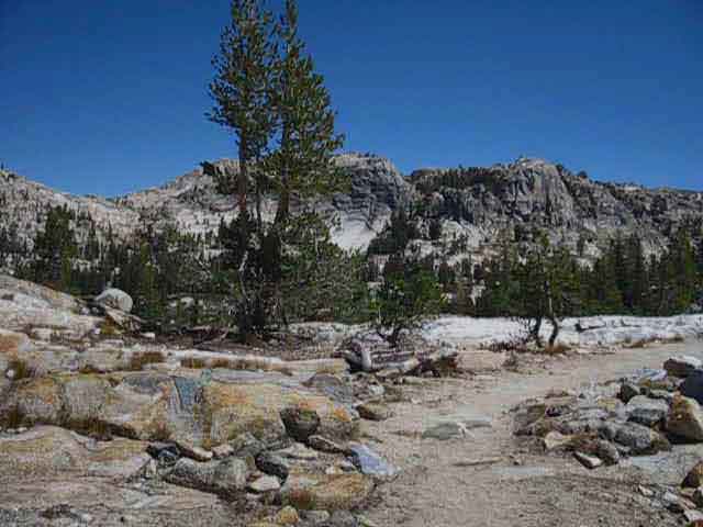 |
||
View to the Northeast This is the first place we can see Smedberg Lake. It is visible on the bottom Right side of the white boulder sitting on the sloped granite situated in the middle far-Left side of the image above. Yes, that bit of blue smudge down there is Smedberg Lake. It's easy to see when you are there, but a little harder to see through imagery.
|
Bottom of the Ridge: Smedberg Lake
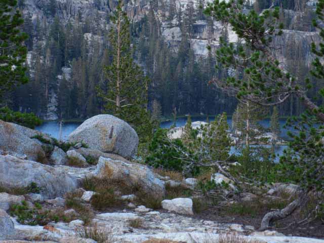 |
View to the Northeast Smedberg Beyond the Boulder Many years after shooting the wide-view second image above I shot the close-up image above. Each picture was intended to be the perfect depiction of our very first glimpse (hiking Southbound) of Smedberg Lake. They both are, in their own ways. The second image above was taken from the actual first point we can see Smedberg Lake with the human eye hiking South on the trail. Sadly, the camera falls far short of the eye. The same line of perspective ties these two images together of our first clear view of Smedberg Lake. The second image above was taken from the true position where we can see first see Smedberg Lake, though not in the image. I can see a blue haze there, but the lake view is not definitive in the second image above. Both images are of the same boulder, the same lake, but from different years brought closer by their shared perspective if different scales. From the perspective in the first image above the boulder is surrounded by Smedberg Lake. In the second image we can see the surrounding terrain, but not Smedberg. You will see Smedberg from that position if you put yourself there. I am longing to be there. When we turn around to rejoin the trail we begin the quick descent down this great (in shape and form, rather than size) granite ridge, down to our potential break, lunch, or campsites on the West shore of Smedberg Lake. One of three things will happen. I always stop on the West shore of Smedberg. I figure that we will camp at Smedberg every other time we hike between Sonora Pass and Tuolumne Meadows. I alternate campsites between Bensen Lake or Smedberg Lake to try to put myself in every terrain between Bensen and Smedberg during a different time of day, and year. We will camp at Smedberg every other time through here. If not camping here, I make sure Smedberg Lake is one of my daily two "long" lunch spots. If we're not correctly timed for a long lunch, we will stop at Smedberg for a break. Plus, we will also linger as we hike along the South shore of Smedberg, as the beautiful vistas slow our pace, and even stop it, for a moment or two. The backcountry presents a progression of aspects and characters during the progression of seasons. We will never just hike past Smedberg Lake! That would not do any kind of justice to this location or the time and effort we spent to get here. Heck, we've still to stop at two more stunning viewpoints as we pass South along the South Shore of Smedberg Lake. There are two more locations along the lake that require we stop and observe the beauty carefully. OK, we've two more viewpoints we are going to engage around Smedberg Lake, then, depending on the season we are hiking through, there is the stunningly special zone where our trail crosses the Golden Sand Creek above Smedberg on our way up to Bensen Pass. We've got to stop long enough to observe and soak up the feeling of that special place too. Though this short segment of terrain between Bensen Lake and Bensen Pass is very difficult in physical demands, and because of this section's long length between resupply points (call it 75 miles from Highway 108 to 120) requires some degree of haste, the very unique beauty here is rich in fine detail sitting within a seemingly endless expanse of grand beauty demanding we take some time to explore it, if not just soaking it in. This requires a plan. That's easy. Every time through we will explore a new aspect of Smedberg Lake and its Surroundings. |
Approaching Smedberg Lake down the South Side of the Ridge
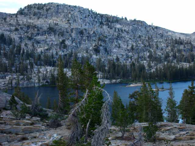 |
||
Hiking over the flat at the top of the ridge we follow a set of switchbacks down glacially cut grooves in the granite, similar to the flats cut on its West flank, but more like grooves or channels than the flats cut on the West flank. I figure this difference is due to differences in glacial pressure between the upstream and downstream facing flanks.
|
Smedberg Lake Crossing the flat top of the ridge rising above the West shore of Smedberg Lake we swing into a set of descending switchbacks down to the Southwest corner of the Lake. I really like these switchbacks. They are made for speed. They draw your feet to the positions that bring jumps and cuts that are really fun. Other positions that present the same type of inviting terrain are such at the fantastic trail on the South side of Donohue Pass, the great descent on the South side of Forrester Pass, and many other great downhill runs we will encounter as we hike South along the Sierra Crest. All the ups and most of the downs are challenging along the Sierra Crest. Yet there are long and short downs that are composed of solid granite positions that invite backpacker imagination, grace, and speed across terrain. Once you get grooved into the work load, and determine if you are prospering or being punished, and you have the options of exercising restraint and recharging as you hike downhill, or run down the mountains. Once we get on it we will start jogging up the mountains. The little run down to Smedberg from the top of the ridge is one such fun run. I carry about a 45 pound standard Summer-geared pack at this particular point between resupply spots. It's all fun.
Let's start hiking down. As we approach the bottom of these SOLID rock switchbacks down to the West shore of Smedberg Lake, we are going to start looking for the most direct route over to the campsites pictured below, before we drop all the way down to lake level. Diagonal is the most direct way over to the campsites. Campsites extend along the West shore in a fine granite bounded narrow flat, extending about 60 yards from the base of the granite ridge to the West shore of the lake. Hard rock surfaces may obscure our route over to the campsites by not providing a "trail," but we can find the way over to the lake as we lose elevation. Or we can turn Left when the trail reaches lake level, rather than turning Right to follow the trail South around the South shore of Smedberg Lake. At lake level we will Southbound Backpackers look over to our Left at a faint trail to the West shore campsites. My point is that you should start looking to cut over to the West shore campsites once you get three-quarters of the way down the granite ridge. |
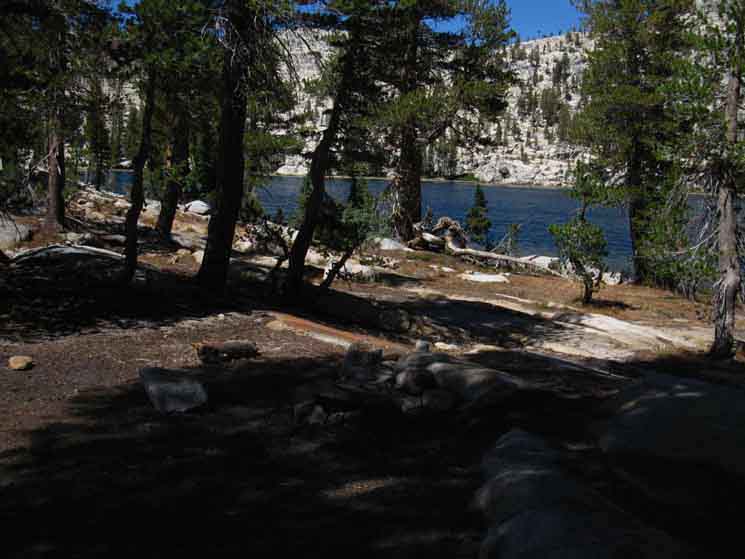 |
If we follow the combined Pacific Crest-Tahoe to Yosemite Trail turning Right from the point it touches down on the Southwestern corner of Smedberg Lake, to trace its way along the South shore of Smedberg, we will miss the excellent campsites along the West shore of Smedberg Lake, off to our Left at the bottom of the trail, pictured above. These are the best sites in proximity to the Pacific Crest Trail around Smedberg Lake. There is another good campsite over on the North shore of the lake, one of the campsites the North Yosemite Backcountry Trail Crews rotate through every few years. A group of flat campsites sit around this central area pictured above, while a string of campsites run North along the West shore of Smedberg Lake to the point where granite features make camping unlikely. There are a couple of fairly private campsites at the far North end of this strip of campsites, maybe 50 yards beyond the main area pictured above. |
Lap of Backpacker Luxury at Smedberg Lake
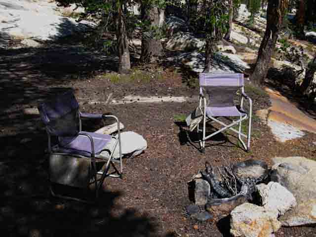 |
||
I came through Smedberg twice during the Summer of 2010. The two images above are of the same place, but the image immediately above is decorated with fine camp chairs in the bright Sun, which also reveals the fire ring. The first time I hiked through during the early Summer of 2010 I found these fine camp chairs at the main fire ring on the West side of Smedberg Lake. I had a nice break and lunch sitting pretty in one, with my legs lofted onto the other. Oh Yes. Serious comfort. I've always understood why a significant portion of backpackers carry one of those "backcountry folding chairs." They are comfortable as hell, and it is a real pleasure and luxury to have a chair on the trail. These look a lot like the chairs trail crew uses in the backcountry. Possibly they fell off a mule, or were inadvertently left behind when trail crew moved camp. In any case, there chairs were at Smedberg early during the 2010 season, but were gone at the end of the season. I knew they would be gone later in the season. Yosemite does not tolerate "clutter" in their backcountry.
|
Water Pier on West Shore of Smedberg Lake
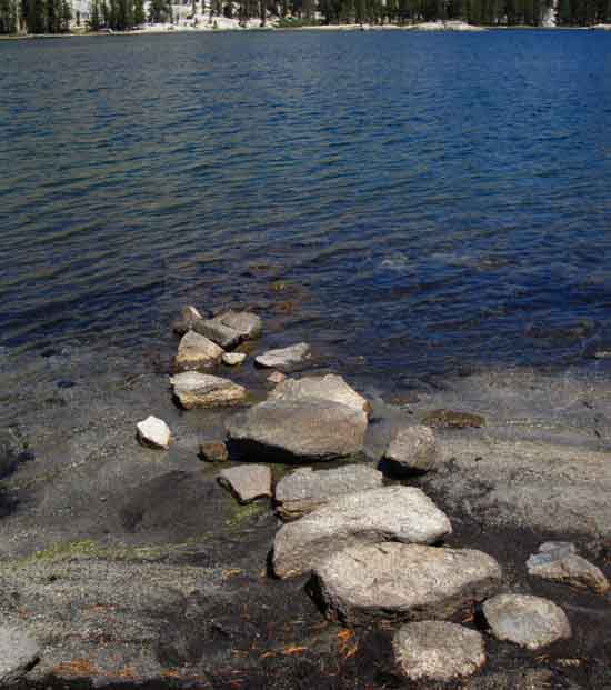 |
||||
Backpackers will encounter many lakes in the High Sierra having wide shallow shores. Shallow water extends far towards the center of the lake. These long shelves of very shallow water can make it difficult and frustrating to obtain water, especially if you are filtering directly into a container. A few years ago (2009 and later) someone built out this little pier of rocks to put the backpacker into deep enough water to filter or fill up the jug. A high percentage of Sierra Lakes have shallow shores. I figure it's due to power of the Spring Thaw moving sand and soils across the surface of the terrain over thousands of years, gradually filling in the shoreline, and eventually the center of the lake. This "filling in" function of the saturation phase of Spring, with surface flows carrying and depositing huge amounts of material pushes meadows into shrinking lakes. Water Everyone needs water. Clean water. That means filtering your drinking water. Most folks filter water at river or lake, and bring it to camp for cooking and drinking. The "Backpacking Topics" section of the High Sierra Backpacking Trails and Topics Forums has a Food and Water Forum dealing with gear use while the Mountain Safety Forum covers water contamination.
The shallow water extending from the shore requires hikers to find a place along the shore where they can either filter their water or fill up a container. Shallow lakes make both tasks difficult. Extensive shallows make finding a comfortable, effective place to locate your intake hose quite difficult. That's why the rock structure pictured above was created. We can find an uncomfortable position on the pier where we can filter our water. If we are flat-out stupid. Only Filter the Water You Drink We will only filter what we need for drinking. This will reduce our filtering time, effort, and filter wear by up to 70%.
As you can see, the forum is set up both for comments from unknown hikers and articles from Registered Users. You are cordially invited to post up about your most favorite and most effective water system as well as your greatest frustrations with water gear! |
Fungus at West Shore Smedberg Lake Campsites
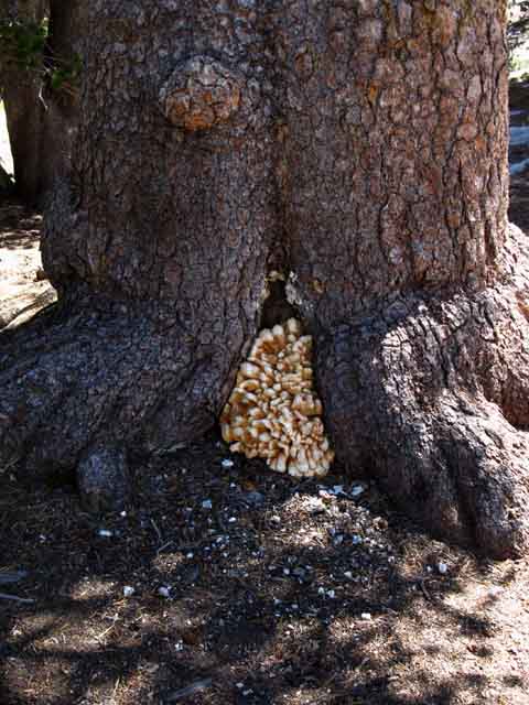 |
Interesting fungus growth on tree in West Smedberg Lake campsites. Saturday August 29 2012. |
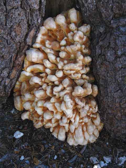 |
Detail. |
When a Tree Hang Goes Bad
 |
One of my established tasks in the Sierra is to haul out trash that's not too heavy for me to carry out. Over the years I encounter the hanging remnants of bad food hangs. A cord flying over a tree branch will wind around the tree branch if the thrower improperly stops or pulls back on the cord. You've got to slow it down gently, then give it some more slack, to keep that rock from spinning your cord around the tree branch. I note the location of the cord and will eventually carry it out when the branch eventually falls off. |
Fortunate Encounters Most time that we hike through Smedberg Lake there are not any folks here. On the other hand, hiking through when the main body of the Pacific Crest Trail hikers pass through brings either campmates or neighbors, depending on the circumstances. Below are a few of the fine folks I've met at the campsites on the West side of Smedberg Lake. |
 |
Will and Dad on the West side of Smedberg Lake. August 1 & 2 2009. |
Seven Person Car Switch Hike
 |
||
These guys had a great plan: One party of four hikers parked their car at the Twin Lakes trailhead and began their hike towards Hetch Hetchy. The second group of hikers parked their car at Hetch Hetchy, and began hiking towards Twin Lakes. The two groups met at Smedberg Lake, and traded car keys. The group that started at Twin Lakes then drove the car of the Hetch Hetchy group home, while the Hetch Hetchy group hiked to Twin Lakes and drove that car home. I thought that was a pretty good plan. Hikers Above: It appears that I failed to get your names and details, or have not found your email. Contact me to fill out the details of your trip. This was a bunch of scientists/math/computer folks, if I remember correctly. There are lots of scientists on the High Sierra Trails.
|
Back on the Southbound Trail After finishing our stay, or our break at the West shore campsites we will hike the faint path along the shoreline back to the Southbound PCT-TYT. Our trail continues South along the South shore of Smedberg Lake to the end of the Lake, where we turn Southeast up a narrowing meadow to start our next significant climb, our 3.2 mile hike up 941 feet of elevation to Bensen Pass. The first mile of our hike South is fairly flat as we hike around the shore of Smedberg and its accompanying meadow. |
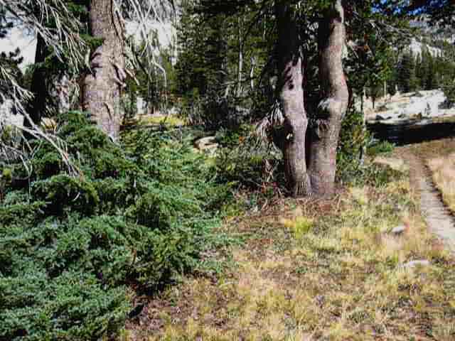 |
Hiking to the Southbound PCT-TYT route from the campsites along the West shore of Smedberg Lake. The deeply grooved trail is the PCT-TYT pointing South. This is the point where the Southbound trail PCT-TYT reaches lake level and turns Right to follow along the South shore of Smedberg Lake to our South. The faint trail to our campsites along the West shore of Smedberg is behind us. Hiking South on the PCT-TYT down to the lake we would turn off Left off the trail hiking a short distance to the West shore campsites. Above we are hiking South from the West shore campsites, just about to rejoin the Southbound PCT-TYT. |
Hiking around Smedberg Lake during Afternoon
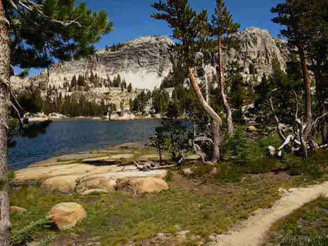 |
Fantastic Terrain! |
Smedberg in the Morning
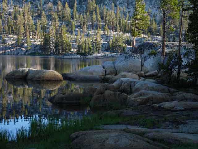 |
||
Along the South Shore of Smedberg Lake The trail hugs the shoreline, twisting over and around the romantic granite formations marking the South edge of the lake. This is a really cool little length of trail. The trail is really neat in how it works through the rock marking the edge of the lake. The shape of the granite here is pleasing to the soul. The slashes of verdant green marsh and forest between the edge of the lake and the rising mountains are interfaces between subtle and grand beauty.
|
Josh Meyers at Smedberg Lake
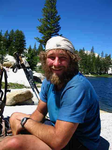 |
Josh is a photographer who was contracted by Backpacker Magazine to hike and photograph the PCT for an upcoming article. Thursday July 29 2010 Josh has a website called Trekking Photography More Trail Arts |
Smedberg Lake
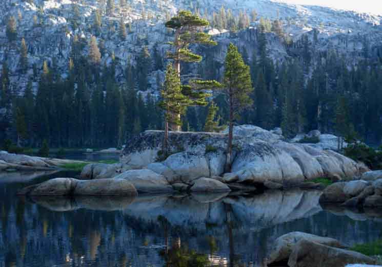 |
Peninsula extending off the South Shore of Smedberg Lake It is a very inviting location. Thus this little peninsula was once a popular camping site who's overuse has been under site restoration for years. Southbound Hikers bend South away from the lake just South of the restoration sites up into the open meadow above Smedberg Lake. Northbound hikers make their first physical contact with Smedberg Lake at the restoration site as the trail bends West to pass along the South shore of the lake. |
View: North
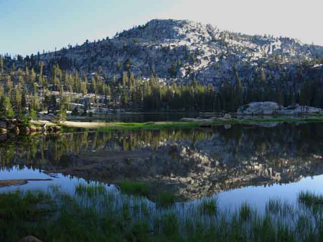 |
Hiking South along Smedberg Lake's West shore. Here we are looking almost directly North at the peak separating Surprise Lake in the basin on its Left side from Sister Lake sitting in its basin to the Right of the peak. |
Morning Light
first Sparkling upon, then Rippling across Day's First Breeze
on
Smedberg Lake
 |
| Magical moment as dancing reflections of morning light through tendrils of morning mists reveal subtle interactions between moisture, temperature, and air currents across the surface of Smedberg Lake. |
 |
||||
Morning Light shimmering on the first breezes across Smedberg Lake. A bit more rise of Sun and temperature clears the spectral reflections of light and mist into the classic mirror image early morning moments of stillness and reflected beauty that graces the Sierra Nevada. Until this first breeze blows waves of distortion across our mirror image. I find that I never have as much time as I'd like to sit and enjoy the different aspects of the changing day in the Sierra. The demands of the trail always draw us on. That's why I always pack at least one extra day's food when hiking this stunningly beautiful and complex section of trail between Highway 108 and 120. We also have options as to which route we take to get here at Smedberg Lake from Highway 108. TYT or PCT? North side Trailheads Kennedy Meadows Pack Station Backpacker Resupply Master Map Highway 108 Trailheads Miles and Elevations
Alternative Route Options to Smedberg Lake Another would be backpacking in through Hetch Hetchy, either backpacking up Jack Main Canyon to the PCT-TYT at Wilmer Lake. We also have the option of hiking up the Grand Canyon of the Tuolumne to Pate Valley from Hetch Hetchy, then up past Rodgers Lake to the Pate Valley trail junction on the PCT-TYT between Volunteer and Double Peaks. Route from Twin Lakes: Bensen Lake to Virginia Canyon Our last way backpacking to Smedberg Lake is hiking North from Tuolumne Meadows on the combined Tahoe to Yosemite-Pacific Crest Trails. |
Light Cracks the Gap-Stillness Shadows the Lake
 |
East End of Smedberg Lake Our Southbound trail is now bending Southeast, turning up the meadow off the Southeast corner of Smedberg Lake. We're now at 1:00 O'Clock on our 8 to 1 O'Clock clockwise rotation around Volunteer Peak, and beginning to hike Southeast away from Smedberg Lake. Bensen Lake to Matterhorn Canyon |
Turning Southeast away from Smedberg Lake
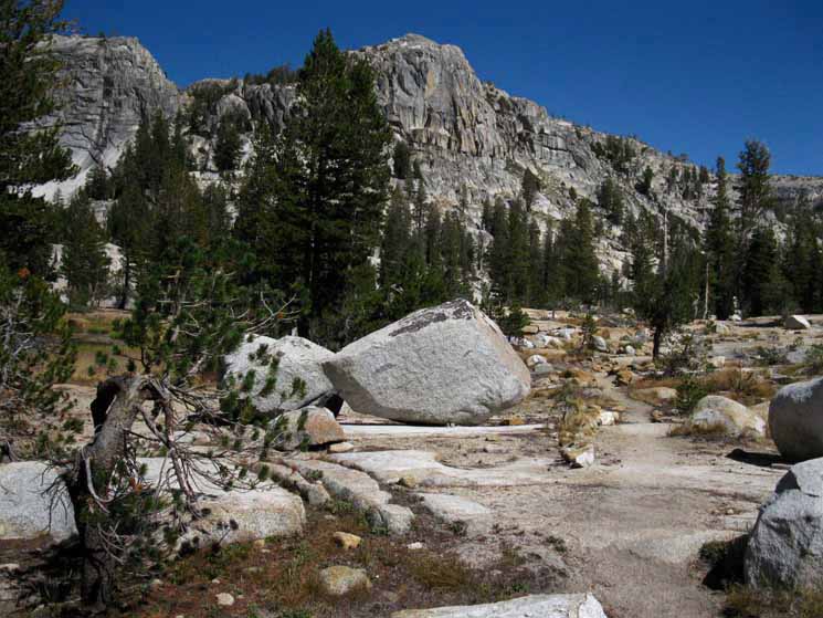 |
Hiking South from Smedberg Lake Great Rocky Meadow running Southeast from Smedberg Lake Note where the ridgeline ahead tapers off to the Right. On the far Right side of the image note the tree partially blocking the view of the ridgeline in the far distance. That distant ridgeline wraps around the upper meadow we will pass through below Bensen Pass. Our Pacific Crest-Tahoe to Yosemite trail route turns up for that climb between these near and far ridge lines, which points us East towards Bensen Pass. We're going to work upward climbing between sets of ascending meadows over there. I judge it as two meadows we pass by and one we hike around the edge of between Smedberg Lake and Bensen Pass. That's how I divide up the remaining 2.4 miles we have up 840 feet of elevation to Bensen Pass. I call the this stretch of trail we are looking at above the first meadow. Beyond the trees we will make a small climb up to pass along the perimeter of what is essentially an upper-back level of this meadow, which I call the "second" meadow. Passing by the edge of the "second" meadow we begin a significant climb up to the third meadow, from where we can look along the North edge of the third meadow to see our goal of this segment of trail, Bensen Pass. Check it out on the map. Bensen Lake to Matterhorn Canyon |
Turning Around
to
Look Back at East Shore of Smedberg Lake
as we
hike to the South
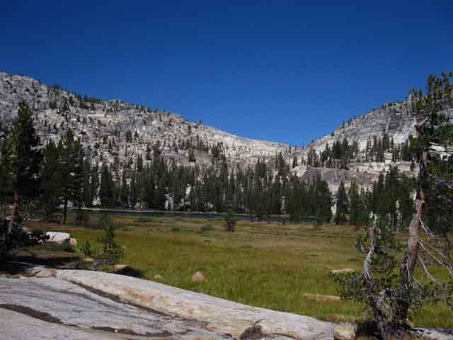 |
Always Turn Around! Next Segment of Trail South On the next page we will finish our 2.2 mile hike up 941 feet of elevation to and through Bensen Pass's 10,160 height. From Bensen Pass we have a 4.8 mile descent dropping us down 1680 feet of elevation through Wilson Creek to 8480 feet of elevation at the Matterhorn Creek ford. There is a nice campsite on the North side of the ford and the trail junction climbing out Matterhorn Canyon to Miller Lake sits a few feet South of the Matterhorn Creek Ford. |
North: Stubblefield Canyon to Seavy Pass South: Smedberg Lake to Miller Lake
The Heart |
Seavy Pass steeply down to Bensen Lake, and steeply up to Smedberg Lake H THIS PAGE IS UNDER CONSTRUCTION: STAY TUNED FOR MUCH MORE! COME ON BACK NOW, 'YA HEAR?
7.5 Map South 7.5 Map North 30 min Map |
Backpacking Trail Guide PCT & TYT North Stubblefield Canyon |
 |
Backpacking Trail Guide PCT & TYT South |
Backpacker ForumsHave a great Sierra Nevada trip or story to relate? A fine piece of gear? Or gear that failed?Post it on Above we come to the top of the High Backpacking Trails and Topics Forums. Below we divide the High Sierra Backpacking Trails from the High Sierra Backpacking Topics Forums:
Anyone can post text comments in the existing forums, but only members can post up new topics, along with images, maps, and formatting. If you have experiences, comments, questions, or pictures and videos of the Pacific Crest Trail between Sonora Pass and Tuolumne Meadows, post up here as an unknown hiker or as a member: Forum Section
|
Trailhead
Contact
Alex Wierbinski

Backpacking Lake Tahoe to Mount Whitney
Your Guide to the High Sierra Crest, including the Tahoe to Yosemite, Pacific Crest, and John Muir Trails
