


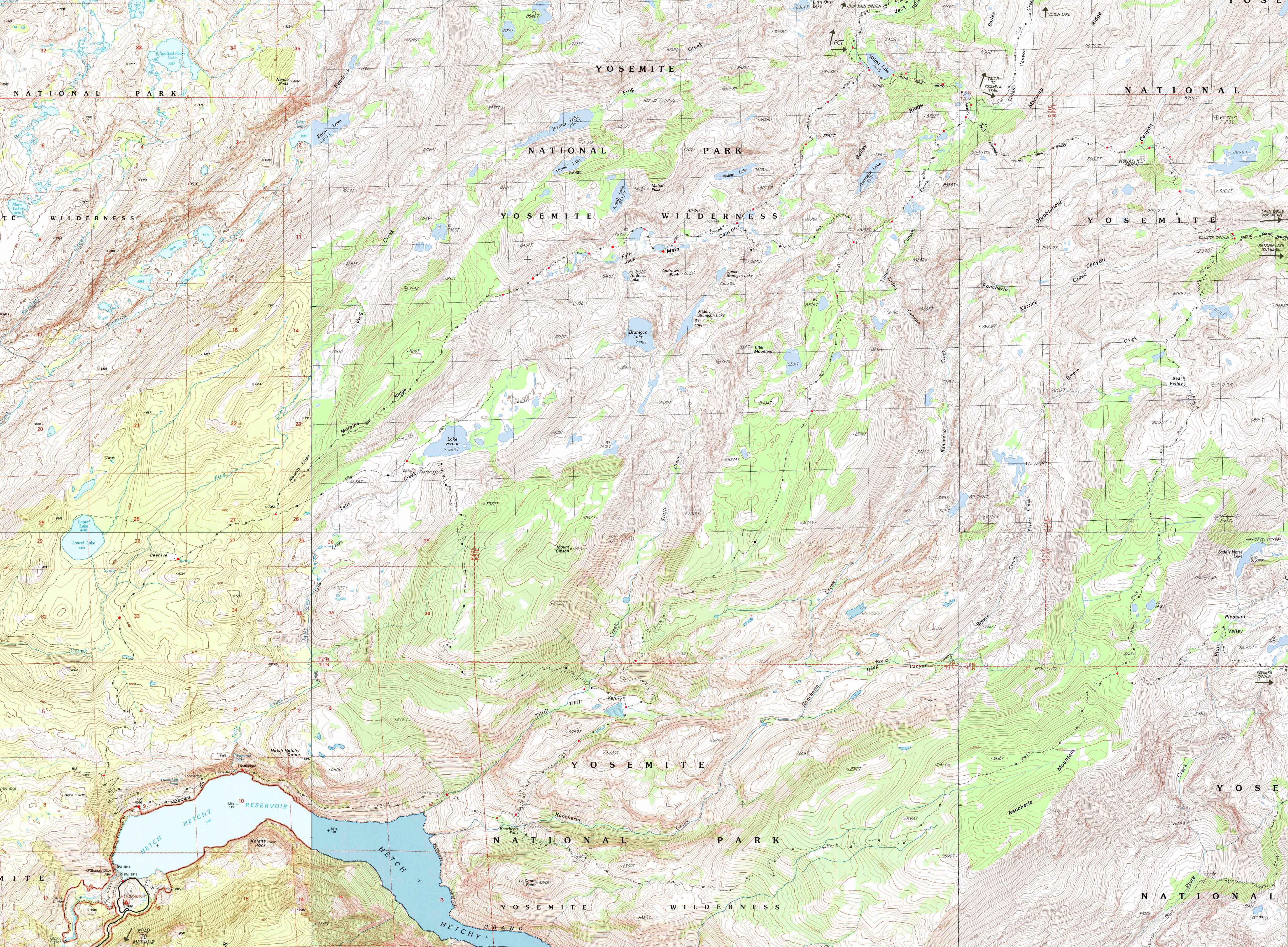
North Yosemite Backcountry
Backpacking Map
Jack Main Canyon, and Tilltill Valley, and Kerrick Canyon
to
Hetch Hetchy
Six
7.5 minute USGS Backpacking Maps

Maps |
Maps PCT-TYT |
Map |
Trail Guide |
PCT |
TYT |
Trail Guide |
30 min |
|
Click RED DOTS for links to Trail Guide Page |
LOCAL |
|
The Best Backpacking Map
of
Lower
Jack Main Canyon,
Tilltill Valley, and Kerrick Canyon
Routes
SOUTH
off the
Pacific Crest
and
Tahoe to Yosemite Trails
to
Hetch Hetchy
Click the Red Dots
| PCT-TYT Map North Upper Jack Main Canyon |
TYT Map Further North Bond Pass into High Emigrant Wilderness |
Grand Canyon of the Tuolumne River Click Red Dots |
Map SOUTH PCT-TYT Stubblefield Canyon to Bensen Lake |
|
PCT-TYT |
TYT |
Click Red Dots Grand Canyon of the Tuolumne River |
Map |
Location |
||||
Basic Layout The map above depicts these first two of the Five Canyons of the North Yosemite Backcountry that both drain the West Flank of the Sierra and carry a couple of nice trails South by the compass down to Hetch Hetchy.
Main Features of Note These are the best hiking-backpacking maps of Hetch Hetchy in the North Yosemite Backcountry up to the Sierra Crest. Note that the Map historically mis-names Wilmer Lake: It's "correct" name is Wilma, not Wilmer Lake. I was told the story by rangers and trail crew, but it eludes me at this late hour, constructing the basics of this map. After a bit of research I've come up with a story and a history:
Another note of interest.
|
Mapology |
||||
MAP NOTE What's important for our general reference purpose is that each side of a square is 1000 meters, or a Kilometer. From my point of view that is 1093.6 yards or .62 of a mile. Diagonal: 1414.22 meters, if my trig is correct. That converts the diagonal distance into 4,639.8 feet or .88 of a mile.
|
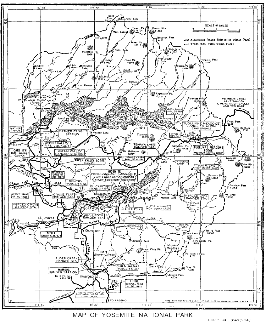
Hetch Hetchy
to
Crane Flat
&
Tuolumne Meadows
| Road Maps specifying locations of the endpoint of our backpcking trip to Hetch Hetchy in relation to Mather, Highway 120, Crane Flat and Tuolumne Meadows. |
Mapping, Mileage, |
|
|
USGS Maps
North Northeast
Southwest South Southeast
Compass Offset
scale Contours
Backpacking permitting authority:Yosemite Backpacking Permit Information Wilderness AreaYosemite Physical locationNorthwest Yosemite above Hetch Hetchy |
next map: last map:
| Elevations | More Information | ||
Wilmer Lake Hetch Hetchy Surface Elevation Change: |
Trail Guide, Section Highway 108 Corridor to Tuolumne Meadows Jack Main Canyon to Hetch Hetchy |
||
Map Credit |
U.S. Geological Survey, Department of the Interior: Move the Map to the Sierras. Select size of Maps you wish to locate. Click "Mark Point" on map to see the USGS map grid of the selected map scale. |