
High Sierra
Backpacking
Trail Guide
Forums
Sierra
Weather
WeatherNotes Northern
Sierra Weather
Gear
BACKPACKING
YOSEMITE NATIONAL PARK
Tuolumne Meadows
Up
Lyell Canyon
to the
Ireland Lake Trail Junction
Accessing
Rafferty Creek and Ireland Creek
Trails
to
Vogelsang High Sierra Camp
Trail Section
John Muir Trail
Tuolumne Meadows
to
Reds Meadow
Languages
Trail Skills
Mountain
Safety
Food
Planning
Trail Arts
More
Information
Social
| Trail Guide INDEX JMT-PCT Tuolumne Meadows to Reds Meadow |
Trail Guide NORTH TYT-PCT Glen Aulin to Tuolumne Meadows |
Trail Guide SOUTH WEST JMT Tuolumne Meadows to Yosemite Valley |
Trail Guide JMT-PCT SOUTH JMT-PCT Ireland Creek to Donohue Pass |
7.5 Topo Map Tuolumne Meadows MAP |
30 min |
Tuolumne Meadows to Reds Meadow MILES and ELES |
TOPO MAP INDEX Tuolumne Meadows to Reds Meadow |
Resupply South |
Forest & Parks Permits Toiyabe & Stanislaus & Yosemite |
|
| Southwest Lyell Canyon, Ireland Creek to Vogelsang High Sierra Camp |
||||||||||
Tuolumne Meadows
to
Donohue Pass
South
Miles
Maps & Miles
South
Central & South
Backpacker Resources
Lakg the Tahoe to Yosemite Trail.
Start Point Fast & Slow I believe there is time for everyone to do everything. A time for fast, and time for deep. Tuolumne Meadows Facilities Short, Sweet, Think about it. 75 miles between resupply spots demands 15 mpd to make it in 5 days. 30 miles between them means we can hike it in two days, and still easily carry food for two extra days of scrambling. We have options. Scrambling Heaven You can put yourself into one of the most beautiful places on Earth, then just sit there for a day or two and watch it carefully. Or fish. Or scramble. Do IT Your Way Sigh. For me that sometimes means driving ever onward, following the call of the trail. Define Luxury Explorama There are lifetimes of exploration surrounding this next short section of our trail. Amazing Arenas Beyond Reds A SPECIAL ZONE I always "pencil-in" one or two "extra" nights in each of these 3 sections, than would be required by the mileage separating each of the resupply spots between Tuolumne Meadows and Muir Ranch. This is not nearly as possible North and South of this run of resupply stops. Long & Hard These long, hard sections of trail to the North of Tuolumne Meadows and South of Muir Ranch are each going to work and challenge us hard. That is good. That is even more reason to take advantage of these shorter sections of trail between Tuolumne Meadows and Muir, to really enjoy the different approaches differing levels of logistical support afford. To take the time and enjoy delving into the depth and details of aspect of the High Sierra experience when you can. PLANNING We'll get into Reds early on day four, rather than early on day three, but we'll have seen a whole lot more, and a whole lot of new territory that we'd never see if we did not slow down to scramble around a bit. Tuolumne Meadows The John Muir Trail Golden Triangle Discussion Local and Long Loops Miles South
|
|||||||||||||||||||||||||||||||||||||||||||||||||||||||||
Hiking Southbound
TYT-PCT
into
Tuolumne Meadows Main Backpacker Facilities
Layout and Location
Also See
Tuolumne Meadows Resupply Page
&
Tuolumne Meadow Permits
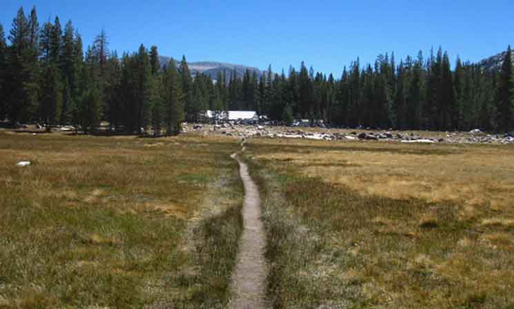 |
Behind the Store is the main road in the Tuolumne Meadows Campground. To To We want to be on the guide page following the JMT route from Tuolumne Meadows to Cathedral Lakes and Pass on our way following the JMT "backwards" down to Yosemite Valley. This Page Below Classic Long Distance |
 |
||||
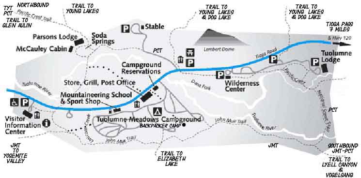
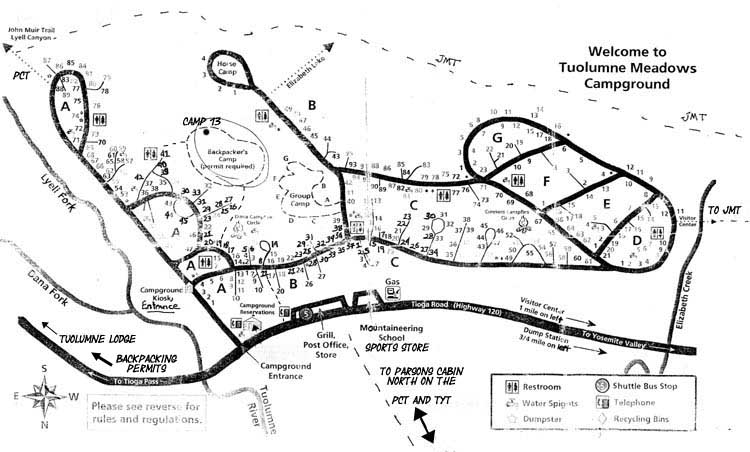
Map showing relationship of our position to the North and Southbound route of the John Muir Trail. Though I note "PCT & TYT" on the bottom of the map above, the actual route of the PCT deflects around the whole Grill, Store and Post Office Facilities as shown on the map below. On the map above I took the liberty of showing how a PCT hiker would break off the line of the PCT for the most direct access to the camping, food, and resupply facilities at Tuolumne Meadows. There is no reason at all to swing through the Tuolumne Lodge on the route of the PCT unless you really want to, or are going to eat and stay there. Very few PCT hikers use their facilities. Most PCT hikers use the Backpacker's Camp and resupply through the Post Office. The only time I hike up to Tuolumne Lodge is when I want to sneak into their shower facilities, and the only time I do that is when I manage to come up with a towel.
If we are Southbound onto the John Muir Trail we have a couple of ways to get to the John Muir Trail, depending on if we are staying a couple of nights in the backpacker camp. I am. Here's a better map, but upside-down from my North to South way of looking at things. We hike South into the upper-Left corner of the map, breaking off the PCT to cross the bridge at Soda Springs. On the far side of the bridge we follow the trail to the Tuolumne Meadows Facilities. From there we hike to the Backpacker's Camp, after a hot hamburger and cold beer! Our position in the Backpacker's Camp puts us close to the resumption point of our hike South to Mount Whitney, but now we are trading-in the end of the Tahoe to Yosemite Trail for the beginning of the John Muir Trail, but only after resting and resupplying for a day or two at Tuolumne Meadows.
RESUPPLY & PERMITS
Miles and Elevations
Miles and Elevations
|
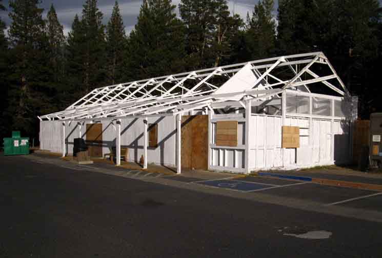 |
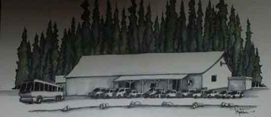
Tuolumne Meadows store after being made ready for Winter Closure. |
Lembert Dome
Climbing, Tuolumne Meadows, and Culture
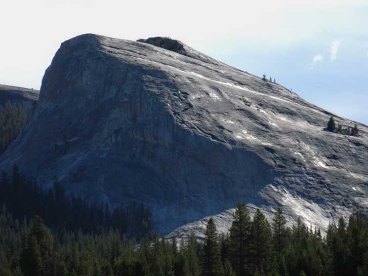 |
Lembert Dome in dark shadows and bright lights during a Fall sunrise. An Evening View of Lembert Dome. I climbed the brightly-lit face. I should say I was talked into climbing it by a noted smart-ass climber who figured he'd see if I was worth hanging out with. Jeeze, I was backpacking through on TW hike number two or three. I met the kid in the TM parking lot very early in the morning. I was waiting to eat, and he to pay for his day's climbing (food and gas) with his bounty of recycled bottles and cans. I was commenting on him drinking too much, judging by his recycling, and he started to explain that he was a climbing bum, and... ...and hey, he realized he was talking to a smartass backpacker screwing with him. But I was looking at Lembert Dome, and not being a hiker, asked, "can you climb that?" He had climbed El Capitan a few times, having just finished a big, multi-day, two-dude "expedition" style El Cap climb. He was pumped up and ready to go. His response was, "can you?" Well, hell, I don't know, but I did know that my big mouth had just roped me into climbing Lembert Dome. "I'm a backpacker." "You want to climb it..." "do you think you can..," and, "aw, yeah, come-on, I'll show you how, Sammy Shannon asked me, while evaluating me, while himself deciding if he should walk me up Lembert Dome. Jeeze, I think to myself, it does not look too bad... So I ended up following Sammy walking up the steepest section of the Southwester-most Flank of Lembert Dome. Sammy picked a line from the furthest bottom-Left of the long, well-lit granite shoulder from where it's obscured by forest up to the small stand of trees we can see halfway up to the top on the far-Right of the image. Getting from the bottom up to the trees was the hard part. After that it was easy. It was not easy to get there. I was wearing my heavy hiking boots, and I had not a clue about climbing. I learned an incredible amount of things about friction, flakes, traction, and gravity that day. And much more the next, when Sammy "geared me up," and brought be rock climbing in Tuolumne Meadows. A Good Tool in the Belt That's what I got for screwing around with a climber...
Learn This knowledge will make you a better backpacker. Climbers and Climbing Culture in Tuolumne Meadows
Trail Culture
|
Mountain Safety
Summer Thunderstorms in the Sierra Nevada
High Sierra Mountain Safety News & Topics
Tuolumne Meadows Hiking Map
|
Tuolumne Meadows That's Mile Zero. We cut South along the path around the East end of these facilities to the paved Car Campground Road, then make our way Southeast to the end of the campground road along the Tuolumne River. Here we find signs and a footpath to the John Muir Trail on the Southeast end of the Tuolumne Meadows Car Campground. Campground Maps Trail Junction
EAST SIDE
Maps & Miles
30 min Maps
Location
.51 miles .1 mile
|
End of Campground Road
to
Southbound JMT
(Tuolumne River is to our East-Left)
 |
||||||
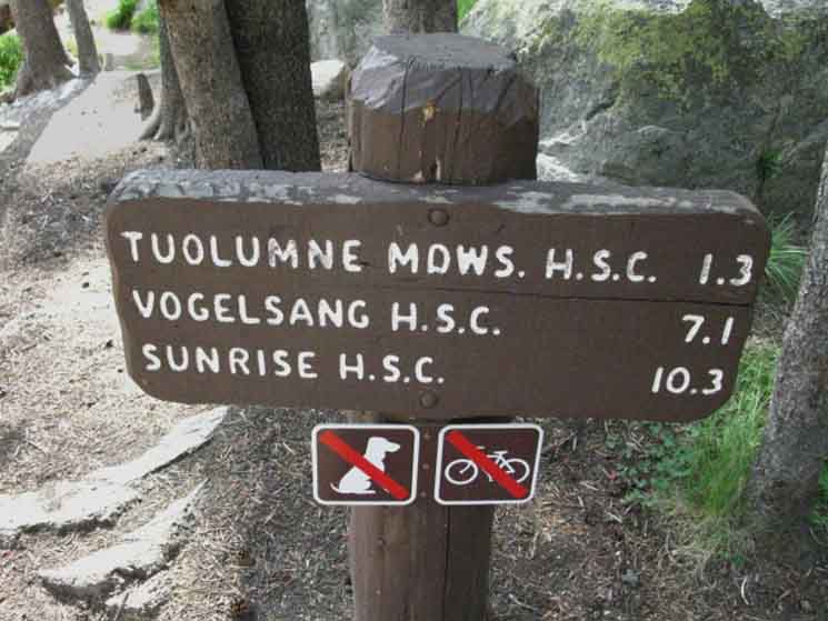
End of Campground Road 2202 Hiking .2 of a mile South off the end of the paved campground road brings us to the The reference to Vogelsang is Southbound on the JMT-PCT into Lyell Canyon, from where we can access Yosemite Valley. The Sunrise citation points us North towards Yosemite Valley on the John Muir Trail route to the Valley. Though either direction on the JMT out of Tuolumne Meadows can bring us to Yosemite Valley, our destination is Southbound towards Reds Meadow.
|
To the John Muir and Pacific Crest
Trails
 |
||||
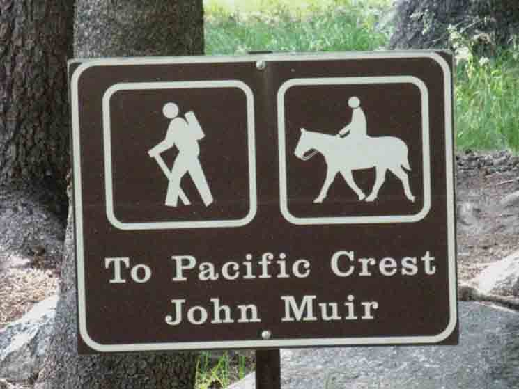
One-tenth of a mile from the end of the paved campground road to the John Muir Trail at the Tuolumne River. Technically, the Pacific Crest Trail bends around the Tuolumne Meadow Car Campground and Facilities, instead passing through the Tuolumne Lodge, the High Sierra Camp. Here on the South end of Tuolumne Meadows the PCT turns East to cross the Tuolumne River .92 of a miles South of our position here. The PCT crosses the bridge to pass through the Tuolumne Lodge, the High Sierra Camp, before passing under Lembert Dome on its way into the North Yosemite Backcountry. Its route bypasses the Store, Grill, and Post Office facilities! On the other hand, the John Muir Trail bends around the Southern Boundary of the Tuolumne Meadows "wilderness cutout," also bypassing the main Post Office, Store, and Grill facilities. Let alone the Tuolumne Meadows Backpackers Camp. That's a shame, because the first thing every backpacker wants is to access these facilities. And also, because we meet some very cool folks from around the world, the whole US of A, and from all over California at Tuolumne Meadows Facilities and its backpacker's camp every year! Both the John Muir and Pacific Crest Trails bend around the most important facilities at Tuolumne Meadows for long-distance backpackers, being the Post Office Resupply point, the store, grill, and backpackers camp. Check the Tuolumne Meadows Trail Maps below for details, and the facilities map above, too, because just about every hiker on the John Muir or Pacific Crest Trail, in either direction, is faced with the question of, "How the Hell do I get to my resupply at the Tuolumne Meadows Post Office, access the Store for all their tasty treats, and the Tuolumne Grill for breakfast pancakes and frosty-freeze cones? Oh, and find the Backpacker's Camp, too? Those are the real questions PCT & JMT hikers have approaching Tuolumne Meadows, and the questions we answer here. One of the goals of this guide is to show hikers on both the PCT and JMT how to best and most quickly access rest and resources at each resupply spot. No messing around, no wasted time or energy. How to get in and out without problems, despite how far away from our necessary resources the route of our trail goes!
Trail Section Forum
|
John Muir Trail
North & South
The SOUTHBOUND Northbound I find a few hardcore PCT hikers always cross the bridge (.82 mile South) to follow the "official" route of the Pacific Crest Trail to the Tuolumne Lodge. Once they get there they find out their resupply, the store, and grill are all back across the Tuolumne River. I suggest Northbound hikers avoid breaking off to the Tuolumne Lodge unless you have a specific reason to go there, such as a dinner reservation (required), or have reserved one of their tent cabins (required). Other than those, you will find no services for backpackers at the Tuolumne Lodge, and will soon be hoofing it down to the most excellent backpacker supplies and services at the
Maps & Miles
30 min Maps
Location
.61 miles .82 mile
|
Wilderness Boundary
into
Lyell Canyon
 |
||||
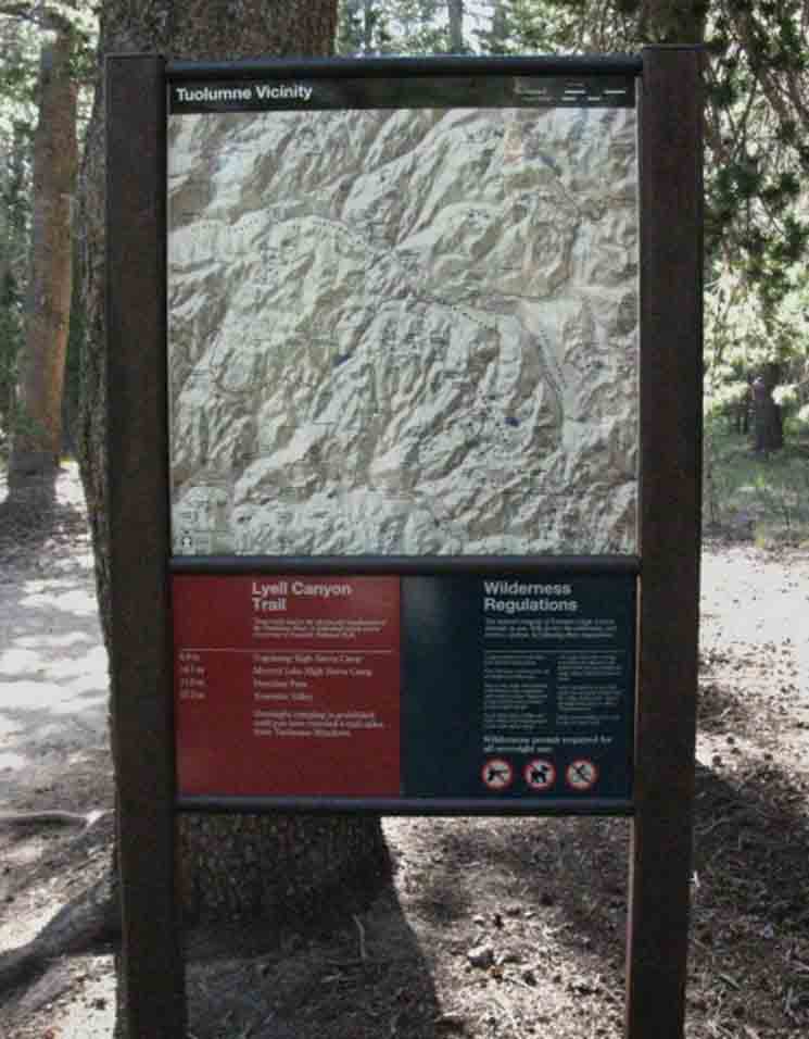
Southbound Yosemite Wilderness boundary into Lyell Canyon. Well, the trail South from the end of the paved car campground road actually tees-out onto the John Muir Trail here. The Southbound John Muir Trail continues South, to our Left, down Lyell Canyon, while the Northbound JMT turns West, our Right, to stay in Yosemite Wilderness just on the South side of the Southern wilderness boundary of the Yosemite Facilities-Highway 120 wilderness "cutout." The facilities maps above shows the route of the JMT around the South end of Tuolumne Meadows, while the PCT wraps around its North and East. Open up the Tuolumne Meadows 15 minute map along with the 30 minute Central Yosemite map when you review this section of our route to get the wide and narrow contexts.
Trail Section Forum
|
John Muir Trail
Southbound
Up
Lyell Canyon
(PCT-JMT)
and to
Yosemite Valley
via
Vogelsang
new sign
 |
||
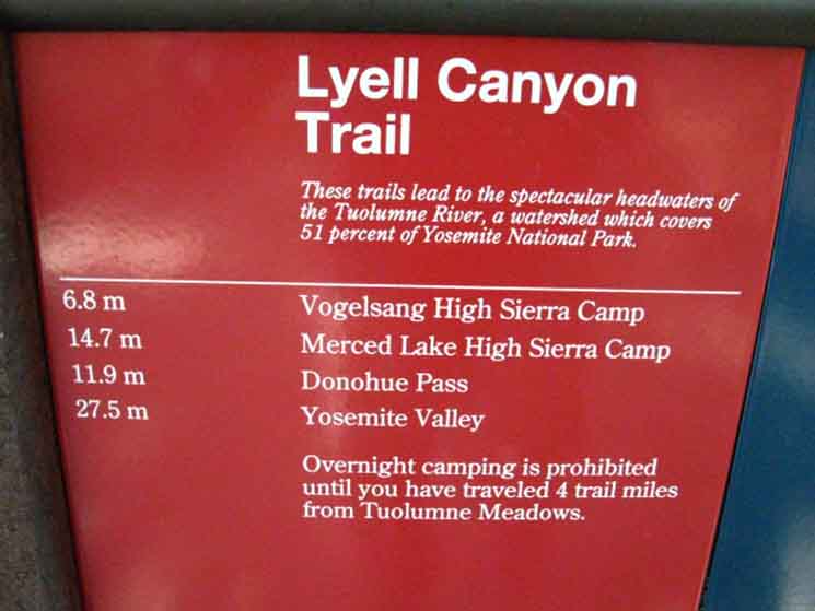
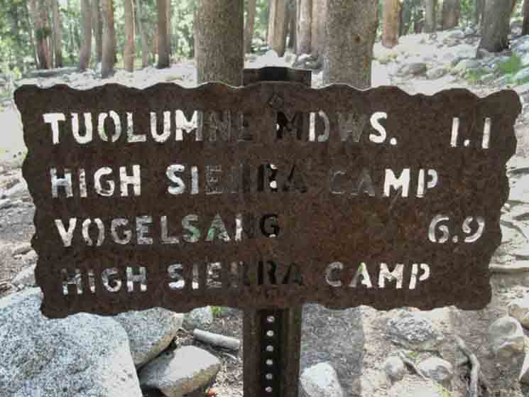
Modern Trailhead Miles Post at the mouth of Lyell Canyon on the John Muir Trail in Tuolumne Meadows. The first distance, 6.8 miles cited above refers to the route up to Vogelsang High Sierra Camp by turning South up Rafferty Creek and passing through Tuolumne Pass. We also look at Tuolumne Pass from the four-way trail junction in Vogelsang High Sierra Camp. From that four-way junction in Vogelsang I count 19.85 miles down to Happy Isles Trailhead (scroll up) in Yosemite Valley via Fletcher Creek, which puts our miles to Yosemite Valley at 26.07 total via Fletcher Creek from our position above, rather than the 27.5 cited above, which I figure is the distance hiking the other route from Vogelsang HSC over Vogelsang Pass to Merced Lake. JMT Junction to Yosemite Valley
Mileage Disparity
|
Old Trail Sign
South JMT
up
Lyell Canyon
 |
||
Trail Miles on old steel sign pointing South up Lyell Canyon on the John Muir Trail. Trail Section Forum
|
North
John Muir Trail
down
Lyell Canyon
route to
Yosemite Valley
 |
||
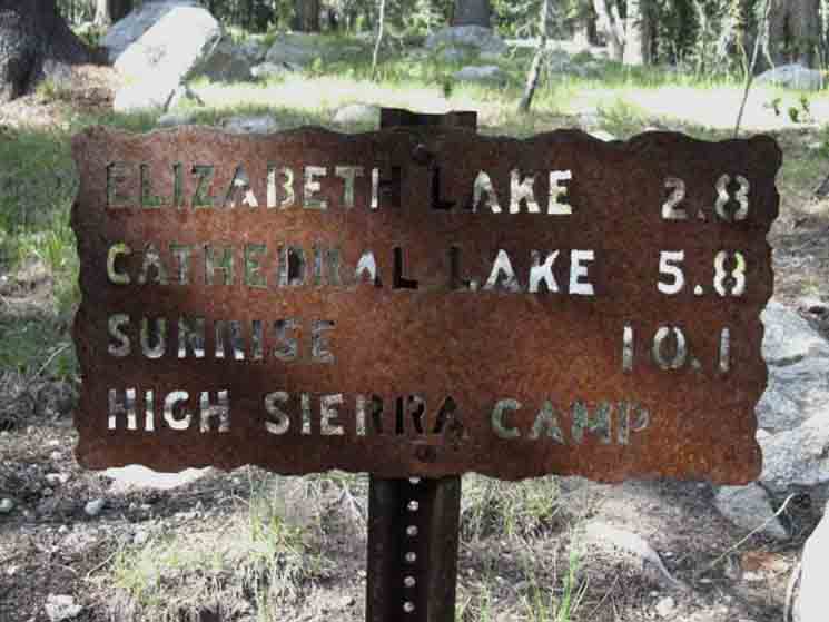
"BACKWARDS" Here the John Muir Trail towards Yosemite Valley bends around the South edge, the Southern boundary of the Tuolumne Meadows Facilities "cutout" of the Yosemite Wilderness. The actual route of the JMT stays in the Yosemite Wilderness along the South edge of this boundary, as we can see on the map. Tuolumne Meadows Hiking Map Since most John Muir Trail hikers are coming out of the Yosemite Valley they cut out of the Yosemite Wilderness into the Tuolumne Meadows Facilities on the Western edge of the Tuoluimne Meadows Car Campground (guide) near the Visitor Center. Virtually everyone hiking the John Muir Trail stops at Tuolumne Meadows to resupply.
Tuolumne Meadows Backpacker Resupply Facilities & Services
Now begins our 12.08 mile hike to the Yosemite Boundary crossing Donohue Pass by hiking the first 8.51 up the relatively flat floor of Lyell Canyon to the point where we begin to climb. |
Hiking South
up
Lyell Fork of the Tuolumne River
 |
||
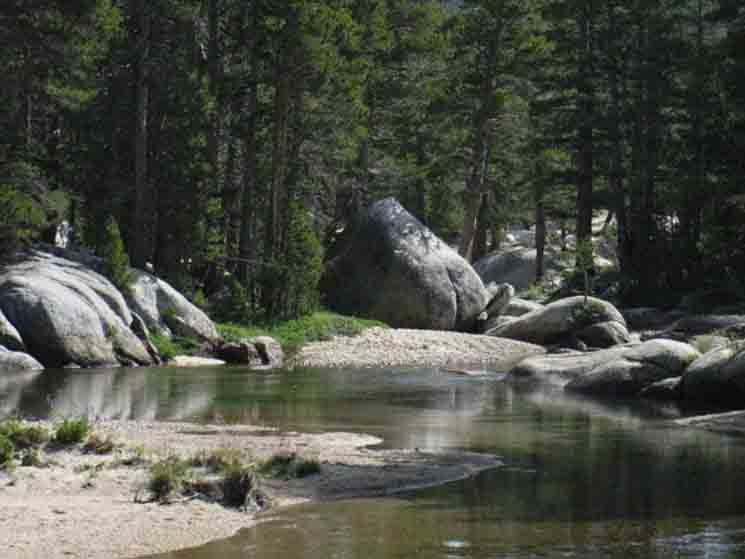
Hiking the John Muir Trail up Lyell Canyon. Trail Section Forum
|
Lyell Fork of the Tuolumne River
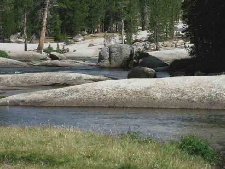 |
Continuing South up Lyell Canyon on the John Muir Trail.
|
John Muir Trail
North & South
Trail Junction Maps & Miles
30 min Maps
Location
1.43 miles .6 mile
|
East over Footbridge
to
Tuolumne Lodge
 |
||
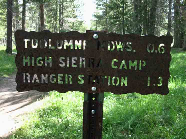
The distance following the Pacific Crest Trail East across the Tuolumne River to the Tuolumne Lodge. Most Northbound Pacific Crest Trail hikers continue North on the John Muir Trail to the end of the car campground road, and down that road to pass through the Tuolumne Meadows Car Campground to the Post Office, Store, and Grill facilities. The typical Northbound Pacific Crest Trail hiker spends the night in the Tuolumne Meadows Backpackers Camp, as does the typical Southbound hiker on the John Muir Trail/ Some hikers on both routes do hike up to the Tuolumne Lodge, where tent cabins can be rented, if available, and "family-style" dinners had, if there is an open seat at one of their "family-style" tables.
Tuolumne Meadows High Sierra Camp
Trail Section Forum
|
South on the John Muir Trail
from the
Tuolumne Lodge Footbridge Trail Junction
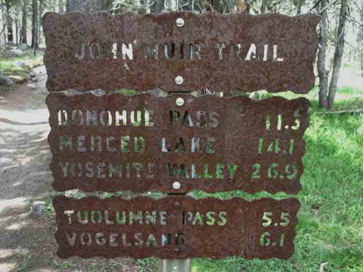 |
South on the John Muir Trail from the bridge to the Tuolumne Lodge. JMT But these are not all miles South on our combined routes of the John Muir-Pacific Crest Trails. The mileages on the sign above also reflect a route down to Yosemite Valley through the Heart of the Central Yosemite Wilderness. To Yosemite Valley This detailed map below covers the route from Lyell Canyon via Evelyn Lake to Merced Lake via Vogelsang:
Merced Lake to Lyell Canyon
Our other route through Tuolumne Pass is better covered by this large scale map, which also shows the remainder of trail from Merced Lake to Yosemite Valley:
30 min Map
Here's the index for the trail guide covering those routes via Vogelsang to Yosemite Valley: Yosemite Valley to Lyell Canyon via Vogelsang Top of Page |
North
on the
John Muir Trail
from
Yosemite Lodge Footbridge
 |
||
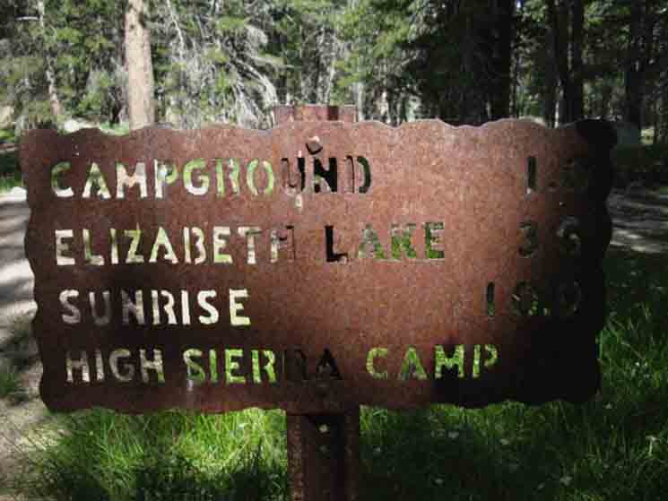
North on the John Muir Trail towards Tuolumne Meadows from the trail junction for the Pacific Crest Trail's footbridge Northeast to the Tuolumne Lodge. 1.0 miles North on the JMT to the Tuolumne Meadows Car Campground. 3.6 miles to hike around the South end of Tuolumne Meadows to the trail South up to Elizabeth Lake. 10.9 miles North on the JMT to Sunrise High Sierra Camp from here. From this point we continue hiking South on the JMT-PCT, up Lyell Canyon, Trail Section Forum
|
Minor Creek North
of
Rafferty Creek
 |
||
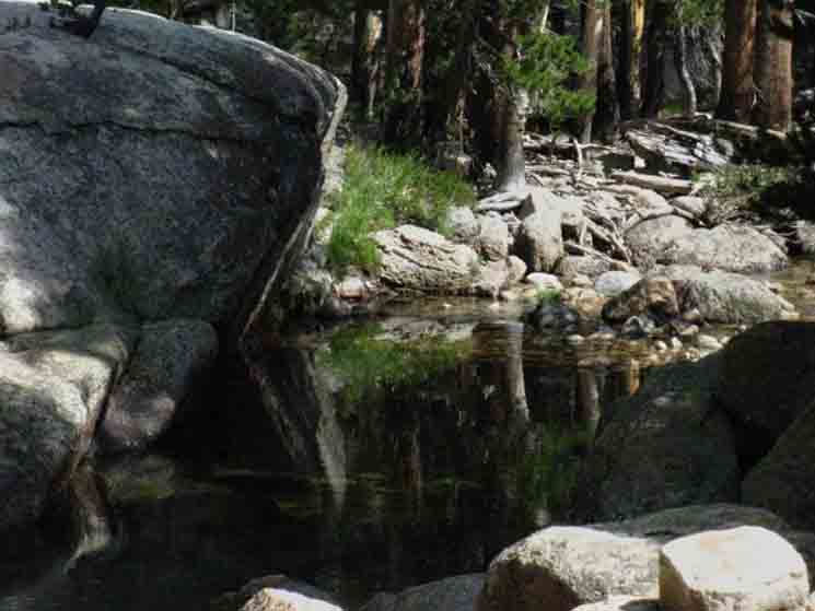
We find the minor creek pictured above just a short ways North of the Rafferty Creek trail junction, just before we encounter the Rafferty Creek trail junction. It was pooling in Lyell Canyon on its way to the Lyell Fork of the Tuolumne River.
|
John Muir Trail
North & South
Rafferty Creek Trail Junction Trail Guide at Vogelsang Vogelsang High Sierra Camp Main Trail Junction
Smart long distance backpackers on the John Muir and Pacific Crest Trails will note all these salient facts for potential future use on return trips to explore all this more deeply.
Maps & Miles
30 min Maps
Location
2.07 miles .64 mile
4.17 miles 10.62 miles
|
Off the
John Muir Trail
hiking
South Up Rafferty Creek
 |
||
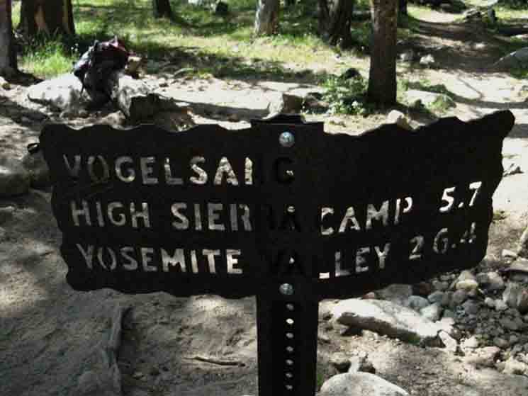
Trail up Rafferty Creek to Tuolumne Pass and Vogelsang just (.74) beyond, from Lyell Canyon. At
Miles to Vogelsang from Yosemite Valley
Here's how I have it: We are 2.07 miles South of the Post Office. This trail up Rafferty Creek crosses 4.76 miles from this junction to Tuolumne Pass. It is .74 of a mile from Tuolumne Pass to the main junction in Vogelsang High Sierra Camp.
TOTAL
Trail to Tuolumne Pass and Meadows from Vogelsang High Sierra Camp
Trail Section Forum
|
Trail North
JMT-PCT
Back to Tuolumne Meadows
Wilderness Boundary
 |
||
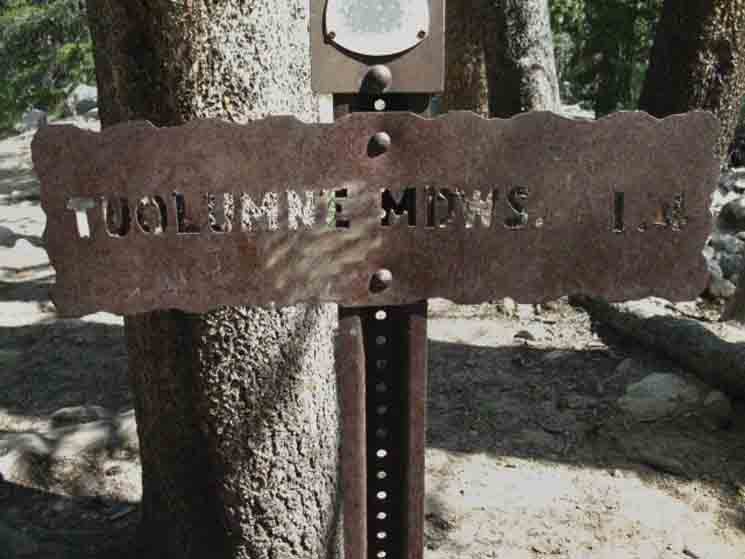
1.4 miles North on the John Muir Trail to the Wilderness Boundary at the Tuolumne Meadows Car Campground. We can see a very faded Pacific Crest Trail emblem above the miles plate. Behind Us:
|
Hiking South
Rafferty Creek Footbridge
 |
||
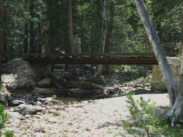
Looking South Upward Bound But for now, and until we reach the end of the flat floor of Lyell Canyon, we have a nice, almost-flat gradual ascent hiking South up Lyell Canyon. This is easy hiking. Trail Section Forum
|
John Muir Trail
Mount Dana
Southeast
from
North End Lyell Canyon
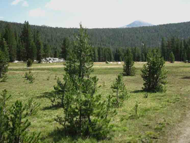 |
We are essentially looking diagonally to our Southeast across the open mouth of Lyell Canyon. That means this is our last view of Mount Dana to the Southeast from the North end of Lyell Canyon. Our view of Mount Dana will be obscured as we push deeper up into Lyell Canyon under the line of the Kuna Crest. We get another, last look at Mount Dana just after we cross over Donohue Pass, then scramble up the South end of the Cathedral Crestline above the two hidden lakes we've scrambled off the John Muir Trail to explore and camp beside.
|
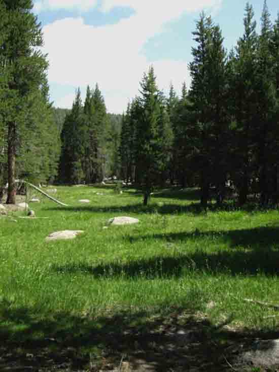
Looking East across
North End of Lyell Canyon
 |
||||
Bending Lyell Canyon In the image above we are at that bend in Lyell Canyon, looking across this narrow point of Lyell Canyon as the course of the canyon bends Southeast.
Trail Section Forum
|
looking Southeast
North End Kuna Crest
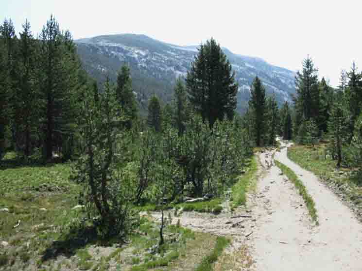 |
Entering Lyell Canyon on very overused trail. |
Marmot in the Meadow
 |
Wildlife Small Mammals Forum, References, and Identification
All High Sierra Identification Guides & References Top of Page |
Trail
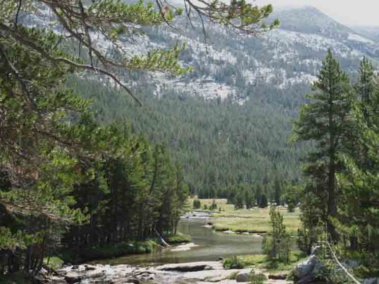 |
We're hiking South to the next major bend in Lyell Canyon, where it bends almost directly South once we hike past the Ireland Lake trail to Vogelsang. |
On the Trail
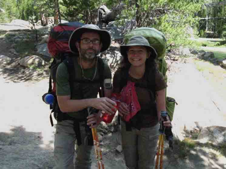 |
We hike South into the Northbound team of David and Sarah Razor hiking from Agnew Meadow to Tuolumne Meadows, then looping back, somehow. That's the plan! |
View Southeast
Donohue Peak
Triple Junction
 |
||
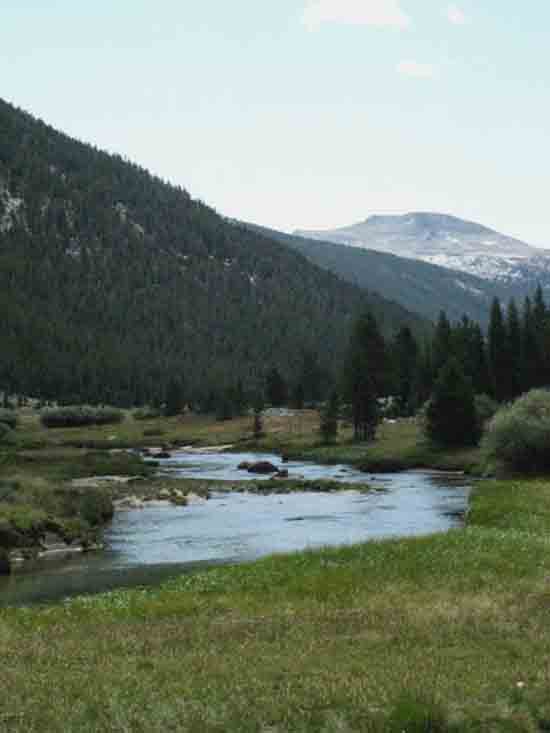
Donohue Peak at the distant South end of Lyell Canyon. The Sierra Crestline is running North-South along the crest of the Eastern Valley wall, as the Kuna Crest, to our East, Left in the image above. The Crestline of the Cathedral Range makes its arcing bend, wrapping around the Watershed of the Merced River, to our West, to our Right along the top of the Western Wall of Lyell Canyon in the image above. In front of us the line of the Sierra Crest runs across Donhue Peak before it descends to Donohue Pass, before climbing West to intersect with the South end of the Cathedral Crestline just South of Mount Lyell, where the Sierra Crestline meets the North end of the Ritter Range and the South end of the Cathedral Range at Rodgers Peak. We are at the point three classic High Sierra mountain ranges intersect crossing Donohue Pass. We hike South up Lyell Canyon to finally climb up very close to the point where these three daughter ranges of the greater Sierra Nevada Crestline converge: The Kuna Crest of the main Sierra Crestline runs into the bottom of the Cathedral Range, where the Sierra Crestline continues South along the top of the Ritter Range. This is the best map for that region: Central & South Yosemite Hiking Map So, the location of our PCT-JMT crossing Donohue Pass lays just a short distance to the Right of the base of the Western Flank of Donohue Peak shown above, along that run of the Sierra Crestline, composing a low point along the Sierra Crestline just East of the point where three mighty components of the High Sierra Mountain Range converge. That point, being Donohue Pass, is a short distance out of the Right side of the image above of Donohue Peak above. Trail Section Forum
|
Refreshing
Water & Light
Show
Lyell Fork of the Tuolumne River
 |
||
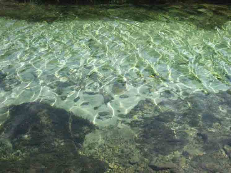
Translucent distortions It seems the water is also in on this "Range of Light" thing. Sparkling waters of the Lyell Fork of the Tuolumne River.
|
Riders
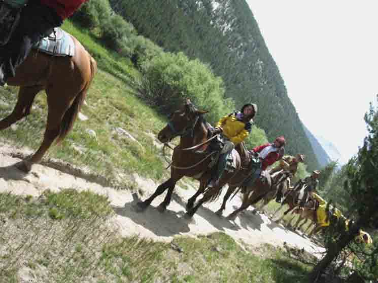 |
Horseparty riding from Vogelsang to Tuolumne Meadows. I'm pretty sure it's Vogelsang they are coming from, 'cause the horsepackers were bringing back both camper supplies and empty stock from resupplying a High Sierra Camp. Along the way hiking out of Yosemite Valley to Merced Lake I noted the horsepackers resupplying the Merced Lake High Sierra Camp, informing me the Yosemite Valley horsepacking station was resupplying Merced Lake, with the Tuolumne Meadows horsepacking station servicing Vogelsang. So I figured these folks were coming out of Vogelsang. |
South-Southeast
Donohue Peak and Pass from Lyell Canyon.
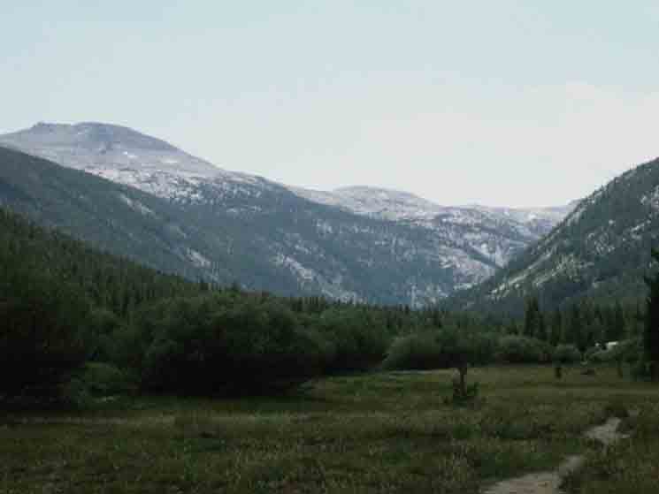 |
Donohue Peak and Pass from Lyell Canyon. Beyond the gash in the Cathedral Range running up to Ireland Lake we can see Lyell Canyon bending to the South around Potter Point, which is rising out of the Right edge of the image above. (Southwestern edge of the image). Straight ahead and a bit to the Left, the Southeast, we can see the hulking mass of Donohue Peak, and off to its Right we can see the low, faint rise on the furthest distant Sierra Crestline where our combined John Muir and Pacific Crest Trail routes depart Yosemite over Donohue Pass into the Ansel Adams Wilderness. Donohue Pass is located to the Right, to the Southwest of both the massive bulk of Donohue Peak, and to the right of the low rise we see on the furthest line of the Sierra Crestline in the furthest distance. |
A Closer Look
at
Donohue Pass
to our
South-Southeast
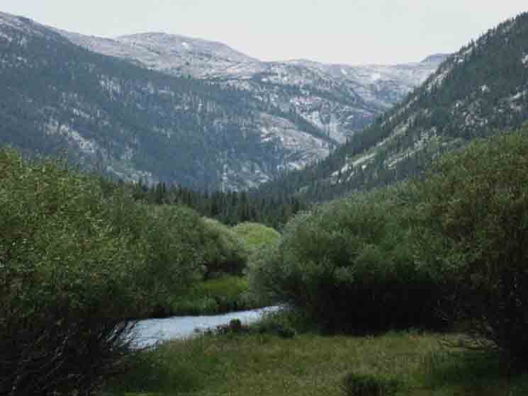 |
||
Taking a closer look at the low rise along the Sierra Crestline in the center of the second image above. (We also get a look at that mound of granite from below the footbridge.) The combined route of the JMT-PCT runs around the base of the Right flank of that low rise we can see at the furthest distance in the middle of the image, in the middle of the distant crestline crossing the image. Donohue Pass is located at the base of the Right Flank of that low rise. As we trace out the apparent crestline running West (Right) from the low rise we can see a dark mass jutting up on the far Right of the image. That is just below Peak 12356, which is a short distance down the Southeastern bending curve of the Cathedral Crestline from Lyell Peak. Peak 12356 caps the South end of the Cathedral Crestline it shares with Mounts Lyell and Maclure. So, our trail proceeds up the floor of Lyell Canyon past the upcoming Ireland Lake-Vogelsang trail junction to depart the John Muir Trail for the hike up to Ireland Lake and/or Vogelsang, or we stay on the Southbound JMT-PCT following the bend in Lyell Canyon up to the end of the floor of Lyell Canyon. Approaching the end of Lyell Canyon we begin getting some pretty good views up at the South end of the Cathedral Crestline where the Sierra Crestline running off the South end of the Kuna Crest merges back in, tying-in the line of the Sierra Crest between the Cathedral and Ritter Ranges. We're crossing over to the East Flank of the Sierra through Donohue Pass. East Flank Ahead It's pretty freeking amazing up there at the top of Rush Creek. We climb out of the South end of the flat floor of Lyell Canyon, still following the Lyell Fork of the Tuolumne River up, now climbing steeply, until we bend hard to the East, to make our way around the Right flank of that low rise in the center-Left of the image above, which marks the location of Donohue Pass. We can also bend our route climbing to Donohue Pass to target local peaks. Turning West out of the Tuolumne River up the Maclure Creek approaches the Maclure Glacier and Peak, while continuing up above the John Muir Trail on the Lyell Fork approaches Lyell Peak and Glacier. The JMT up Lyell Canyon is the main approach route for climbers targeting Mounts Lyell and Maclure. The other way in is through June Lake up Rush Creek and over Donohue Pass. Trail Section Forum
|
View Almost Directly
South
Potter Point and Amelia Earhart Peak
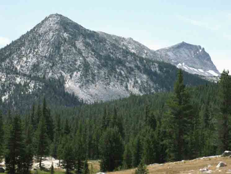 |
||
TRAIL SOUTHWEST Trail up to Ireland Lake trail junction, then on to Vogelsang High Sierra Camp.
We're approaching a trail junction with a trail leading up alongside Ireland Creek climbing up along the Western base (the Right side) of that ridge we see above running down from Amelia Earhart Peak to Potter Point. That trail runs up to Ireland Lake, which is hidden in a fine basin nestled in below the visible flank of Amelia Earheart Peak we see above. Bypassing the Ireland Lake Basin on that trail leads us "the long way," up to Vogelsang High Sierra Camp from Tuolumne Meadows. This route above gives us a third route to access the Merced River and the trails down into Yosemite Valley, other than the route of the John Muir Trail over Cathedral Pass, and the route through Tuolumne Pass via Rafferty Creek. Now we've found the route over the Cathedral Range via Ireland Lake to Vogelsang, seen above. Third Route to Yosemite Valley Local Yosemite Backpacking Loops So many trails, so many options, so little time! Trail Section Forum
|
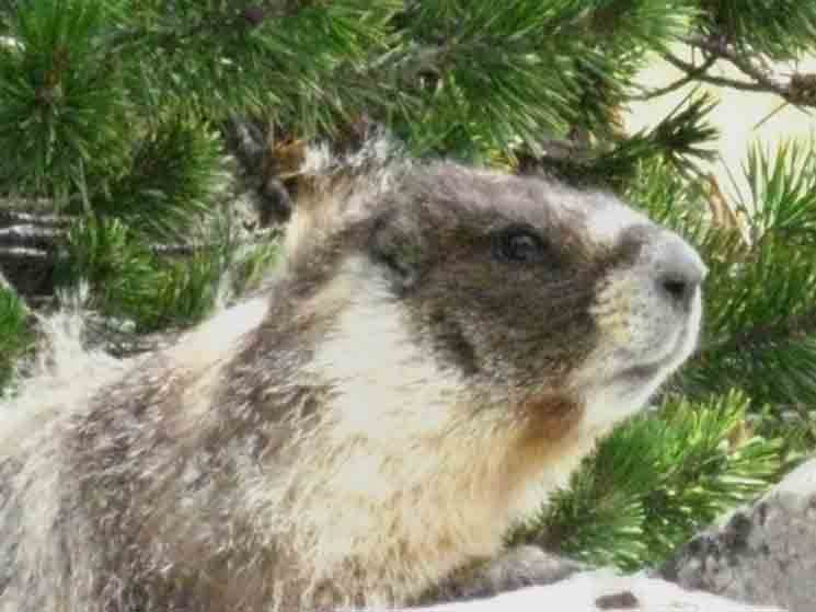
Marmot Activity
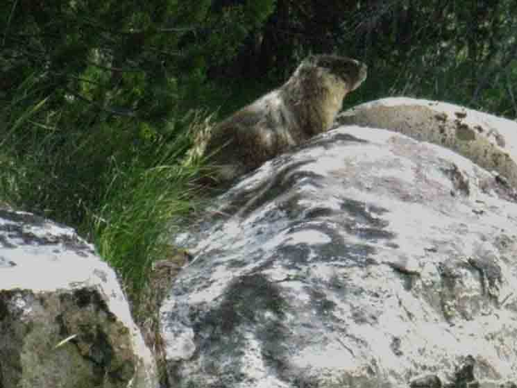 |
A marmot in the forest area around Ireland Creek in Lyell Canyon. |
Marmot Closeup
 |
||
Marmot Moment.
Trail Section Forum
|
Bit of Forest along the Meadows
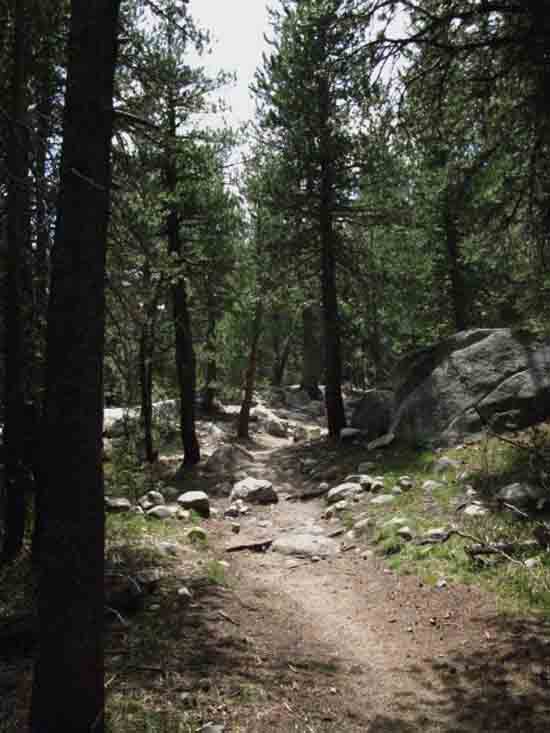 |
Trail through the edge of forest along its sloppy interface with Lyell Canyon's meadows.
|
So Many Forms of Beauty
Up Lyell Canyon
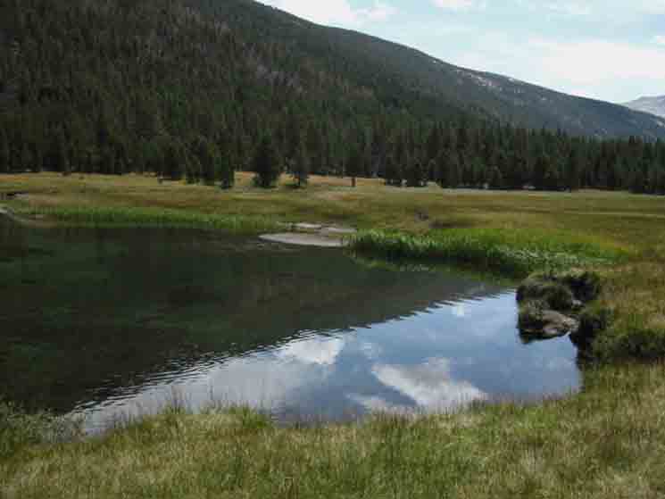 |
So very relaxing while being so very strenuous. Top of Page |
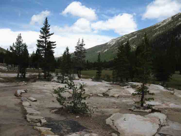
So Many Forms of Beauty
Down Lyell Canyon
 |
||
So very relaxing while being so very strenuous. Well, this is not so strenuous, being "Easy 2" trail.
Trail Section Forum
|
John Muir Trail
North & South
Ireland Creek Trail Junction Here we find a trail leading Southwest up along Ireland Creek, first to a trail breaking off the main trail to find the end of the surprisingly expansive basin wedged-in under Parsons and Amelia Earhart Peaks holding Ireland Lake. Continuing to follow the main trail past the Ireland Lake junction climbs us out of the basin holding Ireland Lake continuing toward the Cathedral Crest beyond an unnamed lake, then around Evelyn Lake before it finds the Tuolumne Pass gap, where we cross the Cathedral Crestline above and to the Southeast of Tuolumne Pass approaching Vogelsang High Sierra Camp. Our hiking options from here at this JMT-Ireland Lake trail junction are to continue Southbound on the combined routes of the JMT-PCT up Lyell Canyon, to turn Southwest for the hike up to Vogelsang on the Cathedral Crestline via Ireland Creek, or turn around and go back to Tuolumne Meadows, which the page above amply covers.
Trail Guide Pages
Vogelsang HSC is situated in a picturesque location towards the Southern end of the crestline of the Cathedral Range of Yosemite National Park. Donohue Pass is our Gateway into the Ansel Adams Wilderness of the Inyo National Forest.
Merced Lake to Lyell Canyon to Island Pass
30 min Maps
Location
SOUTH
OF 4.17 miles 5.6 miles 6.24 miles
TO 6.45 miles 28.01 miles
SOUTHWEST 6.09 miles 25.94 miles
|
Southwest
Second Vogelsang Junction
Ireland and Evelyn Lakes to Vogelsang
 |
||
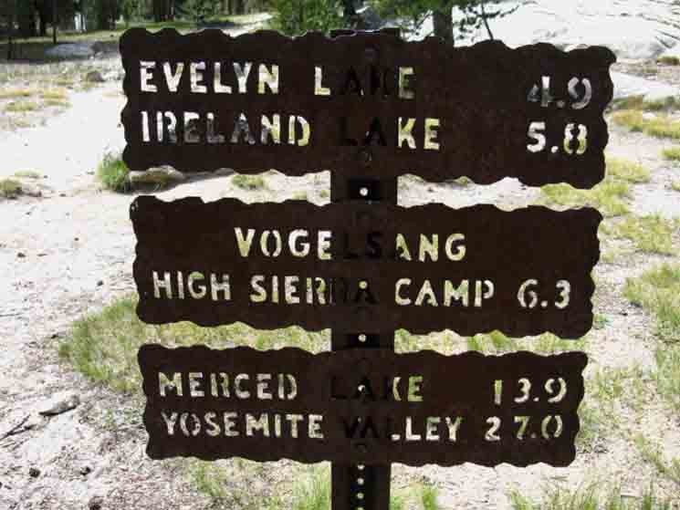
Miles sign at the trail junction leading to Vogelsang HSC via Ireland and Evelyn Lakes. Our last option up to Vogelsang was back at the Rafferty Creek trail junction. That route through Tuolumne Pass is much more direct than this option. Trail Section Forum
|
North
John Muir Trail
down
Lyell Canyon
to
Tuolumne Meadows
Wilderness Boundary
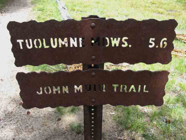 |
One of the three trail signs at the Ireland Creek trail junction along Lyell Canyon leading Southwest to Ireland and Evelyn Lakes on the way up to Vogelsang High Sierra Camp. |
End of this Trail Guide Page
North
Trail Guide Pages
30 min Maps
|
| Next
Hiking
|
North: Glen Aulin to Tuolumne Meadows South: Donohue Pass
Backpacking |
||
The Golden Triangle Yosemite is a large National Park that I break down into North, Central, and South regions for the convenience of the Long Distance Backpacker. We hike into the most Northwestern region of Yosemite through Bond or Dorothy Lake Passes on the Tahoe to Yosemite and Pacific Crest Trails, respectively. To our East-Northeast are the Hoover Wilderness Trailheads, to our South-Southwest lays the Grand Canyon of the Tuolumne River. We arrive at roughly the center of the Sierra Nevada arriving at Tuolumne Meadows. Here the end of our Tahoe to Yosemite Trail down the Sierra Crest is supplanted by the John Muir Trail heading South along the Sierra Crest from Tuolumne Meadows. Since I consider everything South of Tuolumne Meadow to be the South Sierra, our explorations of the center of Yosemite will be quite limited. Unless we take an alternative route that will run us down to Yosemite Valley, first backwards on the John Muir Trail to Yosemite Valley, then back up to the JMT at the point 5.6 miles South of Tuolumne Meadows where we will resume our Southbound hike on the JMT through the Ireland Creek trail junction in Lyell Canyon. That would be the Golden Triangle Route. Hiking the Golden Triangle Route in conjunction with, or I should say in addition to our hiking into Yosemite across the North Yosemite Backcountry, and our hiking out of Yosemite through Donohue Pass will give us a fairly broad and deep view of this magnificent park on our way down the Sierra Crest from Lake Tahoe to Mount Whitney. Otherwise, we are just trading in the end of Tahoe to Yosemite Trail in Tuolumne Meadows for the route of the John Muir Trail moving South down Lyell Canyon as described on the page above.
THIS PAGE IS UNDER CONSTRUCTION: STAY TUNED FOR MUCH MORE! COME ON BACK NOW, 'YA HEAR?
7.5 Map:
30 min Maps
|
Backpacking Trail Guide PCT-TYT North Glen Aulin
Southwest to Tuolumne Meadows |
 |
Backpacking Trail Guide JMT Ireland Lake Junction in Lyell Canyon
Southwest to |
Backpacker ForumsHave a great Sierra Nevada trip or story to relate? A fine piece of gear? Or gear that failed? Post it on Above we come to the Front Page of the High Backpacking Trails and Topics Forums. Below we break the forums down into categories:
Anyone can post text comments in the existing forums, but only members can post up new topics, along with images, maps, and formatting. If you have experiences, comments, questions, or pictures and videos of the Pacific Crest Trail between Sonora Pass and Tuolumne Meadows, post up here as an unknown hiker or as a member: Forum Section
|
Trailhead
Contact
Alex Wierbinski

Backpacking Lake Tahoe to Mount Whitney
Your Guide to the High Sierra Crest, including the Tahoe to Yosemite, Pacific Crest, and John Muir Trails

