
The Trails
Guide
Maps
Miles/Ele
Permits
Resupply
Forum
Current Weather Conditions
Weather Notes
Northern High Sierras
Central High Sierras
Southern High Sierras
Gear
Gear List
Gettin Started
Layering
Discussion
Testing yourself and your gear
Gear Reviews
Backpacking
The Lower Ford of Summit City Creek
to
Camp Irene
Hiking the Tahoe to Yosemite Trail in the Mokelumne Wilderness
Languages
Languages
Trail Arts
The art of walking
Physical Preperation
Trail Skills
The trail
Off the trail
Scrambling
Maps
Navigation
Camp skills
Food
Resupply
Food
Other
Photo Catagories
Trail Stories
Trail Culture
News and Science
Links
Groups
Books
Terms and Conditions of Use
| Trail Guide INDEX Carson Gap to Lake Alpine |
TYT North Lower Summit City Creek Ford |
TYT South Mount Reba |
7.5 TYT Map Lower Ford over Mount Reba |
Section TYT Map Echo Summit to Lake Alpine |
Last 7.5 TYT Map Horse Canyon to Lower Ford |
Big |
Map Index Carson Gap to Lake Alpine |
Carson Gap to Lake Alpine MILES AND ELEVATIONS |
Permits | Tahoe to Whitney on You Tube |
||
| EL Dorado National Forest |
Stanislaus National Forest |
|||||||||||
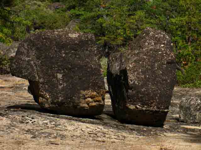
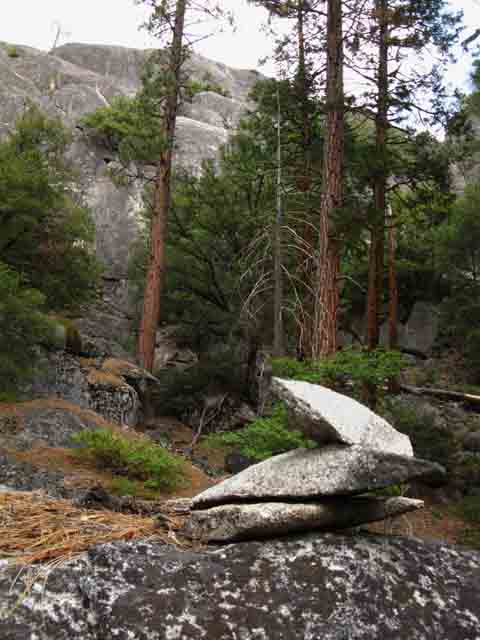
South Across the Lower Summit City Ford
 |
||
Lower Summit City Creek Ford.
|
Video
Lower Ford to Camp Enchantment
Hiking South from the lower Ford of Summit City Creek brings us through a short length of terrain that has ancient antecedents: trackless forest. We are hiking into the very heart of mythology contained within ourselves: We are going to enter a forest, what I endearingly call "The Enchanted Forest," where these deep primal experiences can be drawn out of us by the terrain itself. I would say, "We have nothing to Fear but Fear Itself," but I always measure my degree of caution "mathamatically," by dividing the difficulity of the trail section by my level of skills over my current degree of physical fitness. That calculation tells us if we should be scared, and just how scared we should be. Er, I mean "exercise caution," and "just how cautious we should be." Climbing South out of the channel above Summit City Creek's lower ford gives us low overviews of the complexity of the surrounding terrain as we hike the moderate climb up through rock, manzanita, and some thin forest to our entrance into the dark terrain of the Enchanted forest. Here reality hits, and it hits us hard. No trail. No track. No nothing. How do we go? Experience will guide you, even if you have to build it from scratch. Well, hopefully not from scratch. I take solace in the fact that if you've gotten this far down and out of Summit City Canyon on that route you have already demonstrated the basic skills and fitness required to safely hike this section of trail. The fact is that the difficulty bumps up a notch for the upcoming short hike through The Enchanted Forest. It does not matter if you find your experience on the Left route, the Right route, or right down the center. All the routes we can push South down through this upper section of the Enchanted Forest all lead us down to into the Enchanted Forest Basin filled up by the Enchanted Forest, to the center of the bottom of this boot-shaped flat filled with dense forest of this Enchanted, and enchanting Forest. If you really want to figure out this tiny but very dense piece of complex terrain, then scout it out. Hike down either the East or Western side of the forest down to the bottom of the basin. When you get to where you figure you are about halfway down, walk diagonally to the other side. On the Eastern edge we are hiking along the interface between the edge of the forest and great granite features extending East to overhang the narrow channel of the North Molkelumne River. This is delightful but serious scrambling terrain: don't get hurt or lost scrambling out there. No one will find your body for a long time... On the Western side of the forest we find the edge of the forest limited by the granite terrain turning upward into a massive High Sierra ridge. Once we get down to the floor of the Enchanted Forest the placid course of the North fork of the Molkelumne River lays to our East, to our West a wall of mountains, and to our South a perimeter of granite cut with the drainage we willl climb out of here through, on our way South to Camp Irene.
NEXT video: Enchanted Campsite to Camp Irene |
The Lower Ford of Summit City Creek
|
|||||||||||||||||||||||||||||||
Backpacking Information This is the most Second most difficult cross-country section along the whole Tahoe to Yosemite Trail. Though the Lower Ford is followed by clear trailbed for awhile, the trail soon melts into dense untracked forest. The Most difficult section, in my opinion, is between Boulder Creek to Saint Marys Pass at the South end of the Carson-Iceberg Wilderness. Or maybe this one is, if you measure it from Horse Canyon to Camp Irene. In any case both of these sections of trail require physical fittness and cross country navigation skills far beyond the levels necessary for PCT hikers. Common Sense is required.
|
Lower Summit City Ford 5580 feet Mileage 7.31 miles South to the Top of Mount Reba from the Lower Ford. 10.09 miles South to Bee Gulch trail head on the East Side of Lake Alpine and Highway 4. The Bee Gulch trail head is .75 of a mile East of the Lake Alpine Lodge along Highway 4, where we will pick up our next resupply package and get some good hot and frest food. The Lake Alpine Lodge is located on the West side of beautiful Lake Alpine. Bear Valley, which has a nice store and deli, is three miles further West down Highway 4. It's an easy hitch if you are patient. See the Lake Alpine Region Map for details of route down to Highway 4. |
Lower Summit City Ford Mileage 7.45 miles North to the Summit City Creek trail junction to Fourth of July Lake. 14.38 miles North to Highway 88 via the Lost Cabin Trail route, of the three possible routes to Hwy 88 over Round Top and The Sisters. See the Carson Pass Region Map for details of the three routes past Round Top down to Highway 88. |
Topo Hiking Maps
7.5 Detailed Maps Fourth of July Lake to Lake Alpine 30 min Section Maps Click the Red Dots along map routes for more information. Click the Red Dots and marked routes on the Index map for detailed maps and trail guide pages. |
Mileage2.51 miles between Upper and Lower fords.2.07 miles between Lower ford to Camp Irene. Elevation Lower Ford: 5480 feet. Lower Ford to Camp Irene Two ascents along 2.07 miles to Camp Irene from Lower Ford. 80 foot climb from lower ford to top of hill entrance into North edge of Enchanted Forest Hill South of Lower Ford +80 feet to 5560 feet. Enchanted Forest Basin 5440 feet Top of route South out of Enchanted Forest +280 feet to 5720 feet of elevation. Down 440 feet to Camp Irene's 5280 foot elevation. |
INDEX On this page |
||||||||||||||||||
Miles and Elevations
VIDEO
Last Steps South to the Lower Ford
View Surrounding Terrain when we can!
Into the Top of the Enchanted Forest
Campsite at the Northeast End of the Enchanted Forest Basin
VIDEO
Campsite on the Northeast Edge of the Enchanted Forest Basin
Into the Enchanted Forest Basin
|
Weather Trailheads to the North are located along Highway 88 where our Tahoe to Yosemite route and its variations cross Carson Pass. Trailheads to the South are along Highway 4, which we will cross at the East Shore of Lake Alpine. Direct links to Highway 88 and 4 are located below. Below also find the closest Ground Stations, Point and Regional Forecasts near Our isolated position along the North fork of the Molkelumne River between Highways 88 and 4. Note that the ground reporting stations that are at the same elevation and aspect of sections along our route may be somewhat representative of the conditions we will experience. The latest Satellite and Radar Imagery linked to below provides almost real-time Long Range and Regional overviews from an almost God's Eye perspective.
All Weather All Comprehensive Though focused on High Sierra Weather between Lake Tahoe and Mount Whitney, all the weather resources above can be adjusted to cover your favorite backpacking area or your home. |
South Out of the Enchanted Forest Basin
Following Ducks Out of the Enchanted Forest Basin
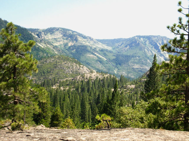
View of Summit City Canyon and North Molkelumne River Canyon
View Southeast of our upcoming route to Mount Reba
Burnished Trail
Granite Flats and Forest trimmed Meadows
South Flank of Great Granite Feature North of Camp Irene
Plunging through Brush to Camp Irene
Great Wall North of Camp Irene
VIDEO
Molkelumne Wilderness Volunteers at Camp Irene
|
||||||||||||||||
| >Forum< | ||||||||||||||||||
POST UP!
All backpackers can post text comments about the following section of trail through the comments links on all the trail guide pages. Registered Members can post up stand alone post about the trail with text, images, maps and videos in the Trails Forum that supplements this section of the Trail Guide.
Hiked this section of the Tahoe to Yosemite Trail lately?
Post up a
Scouting Report
Check out the Tahoe to Whitney .org Backpacking Trails and Topics forums
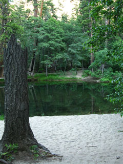
The Lower Ford of Summit City CreekThe last trail guide page, "Granite Flat campsite to the Lower Ford," described our Southbound approach to the Lower Ford of Summit City Creek. We continue. Rejoining Summit City Creek after coming down the Manzanita-covered mountainside from the Granite Flat we find ourselves working our way downstream around and through a mass of shattered timber in a narrow slot of dense forest sheltering the creek. About 200 yards downstream from entering this slot we find the well marked fording spot, and see that the ford is a set of slippery green tinted boulders, too far apart for a comfortable human step, especially as they are bearded-up with aprons of slick green algae. These above-water fording boulders are moist spots of slick rock surrounded by slow moving calf-deep cold water in mid-July. Such is the lower ford. The slickness of the boulders, compared with the ease of a quick tennis-shoe ford across the shallow waters, prolongs deciding between options. My last decision through here, in 2010, was to carefully work my way across the slick boulders. The Alex balancing act. The previous time through here I changed into my tennis shoes, ie, my fording shoes, and waded across on the slick rounded rocks that were submerged, rather than the slick rocks that sit above the creek's surface. Spring seasons that feature heavy runoff flows will rearrange fording boulders, so each year can be very different. Or the same. It depends on each Season's weather. The lower ford is not a challenging ford by any measure, but it is often slick, which requires an extra layer of caution for us solo backpackers in remote regions. |
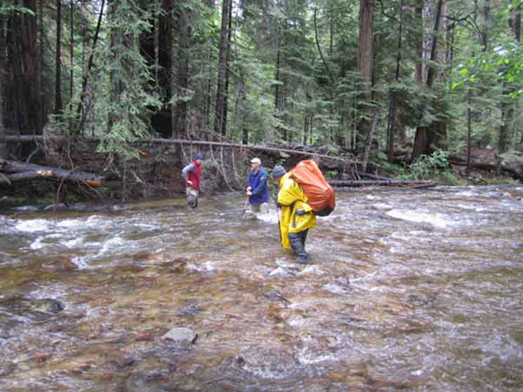 |
Mokelumne Wilderness Volunteers crossing Summit City across the lower ford. I am going to verify this image. It really looks to me like the ford of the North Molkelumne River at Camp Irene... |
Hiking South from the Lower Ford
 |
South from the Lower Summit City Creek ford. |
Flat above the Ford hiking South
 |
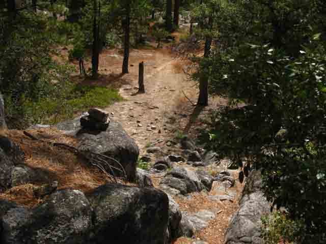
Flat above and South of the Summit City Creek lower ford. A moment of open terrain with observable trail. |
View from just above and South of the Lower Summit City Ford
 |
North Molkelumne River canyon cutting up the West flank of the Sierra towards Highland Lake. Below us Summit City Creek flows into the North fork of the Molkelumne River. |
After a short climb we encounter the Black Pond
 |
Dried out. |
 |
Trail around Black Pond. Looking West by Southwest along our line of travel we observe Peak 7813. Peak 7813 is the dominant peak rising above the Western edge of the Enchanted Forest. As we hike South through the Enchanted Forest our view of this landmark peak will rotate with our progress. When we can get glimpses of it through the dense forest canopy of the Enchanted Forest. |
Final Steps up the hill to Enter the Enchanted Forest
 |
Climbing to the top of the North side of the granite feature South of the lower ford of Summit City Creek. The top of the Northern limit of the Enchanted Forest lay on the other side of the crest. |
 |
Last steps up to the top of the hill behind the Black Pond. At the top of the hill we will enter a rock channel filled with brush and push into the top of the Enchanted Forest. |
Enter the Enchanted Forest
 |
Pushing through tree branches and brush to enter the top of the Enchanted Forest. The Enchanted Forest begins where the granite boulder ends. |
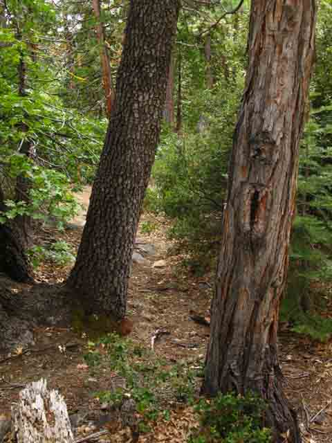
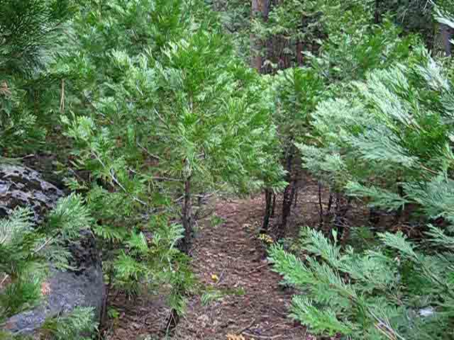
Hiking in the Top of the Enchanted Forest
 |
Dense forest floor liter and radical young tree growth create very engaging conditions. One gets the impression that the trail dissappears. You would be correct. |
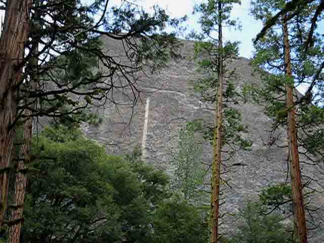
A look back, North, at the feature above the end of Summit City Canyon
| Looking to our Northwest as we hike West to the top of the Enchanted Forest we note that Peak 8395 is guarding the end of Summit City Canyon. This formation sits towards the end of Summit City Canyon West of the end of Summit City Canyon campsite. | ||
 |
||
The location where the canyon holding Summit City Creek ends and the creek flows down mountain into the canyon of the North Fork of the Mokelumne River features hard rock ridges towering above us, dense manzanita surrounding us, and great jumbles of massive granite formations defending the junction between these water courses. Oh, and the spaces between the granite on the ground is stuffed full of manzanita or dense forest... |
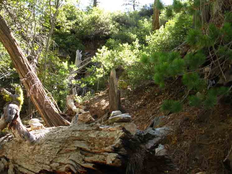
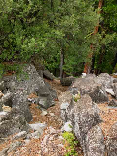
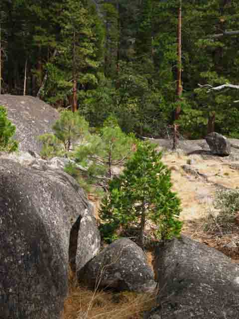
Onto the RockAfter crossing Summit City Creek's lower ford we climb up a v-shaped crack in the soft bank directly behind the fording point. Climbing up onto an exposed flat above the South side of the lower ford we bend to our Right along well trod path that then turns up and around to our Left to climb up a channel that begins to describe out big climbing buttonhook up and over the North side of the granite formation bounding the North end of the Enchanted Forest. This granite feature we are climbing, to enter the top strip of the Enchanted Forest, is the North flank of the feature who's South flank composes the Northern limit of the Enchanted Forest Basin on its South side. Our bending turn up the gully to our Left ultimately carves a tight hook back around to our Right, to the Northwest, where we bend Westward to pass a black pond to finally make our final climb to the top of this granite feature to enter the top of the Enchanted Forest. Bits of trail, good ducks, common sense, and basic route finding skills easily guide us from the lower ford up this hill and past the Black Pond to our enty into the Enchanted Forest. Only our common sense and basic route finding skills will accompany us into the Enchanted Forest... When we reach the North upper edge of the Enchanted Forest we are hiking almost directly West. This brings up an important point. I do not believe that the map of the terrain South of the lower ford is accurate. It does not show the sharpness of the hook move that the trail route makes on its way up to the black pond preceding our entrance to the forest. I'm not sure, but I believe it may hav been rerouted sometime in the past. The main route marked on the map linked to above is the one on depicted by the USGS in 1979. My route, marked in gray, is different. As you can see by my alternative route on the map, I believe the actual route through the terrain is different than the one on the map. This is only important because all signs of trail end when we enter the Enchanted Forest when crossing over the top of the hill past the black pond. I believe we enter the Enchanted Forest a bit higher up the hill than described on the USGS map. There are virtually no signs of trail visible until we exit the Enchanted Forest. (note: 2012 brought some trail work to this section, noted below) In any case, if you are following this nicely ducked route South of the lower ford (no matter exactly where it sits) when you pass by the "black pond" (a small body of dead water dyed black by bark tannin that's not fed or drained by a creek), you have a short climb to enter what I call the "Enchanted Forest," pictured below. The picture below is looking South into this trackless forest section South of the Black Pond. Independent of exactly where on the map the trail loops into the forest past the black pond, when you enter this section of forest all indications of trail end. |
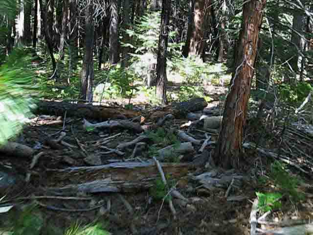
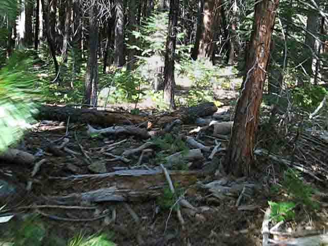
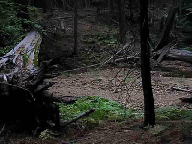
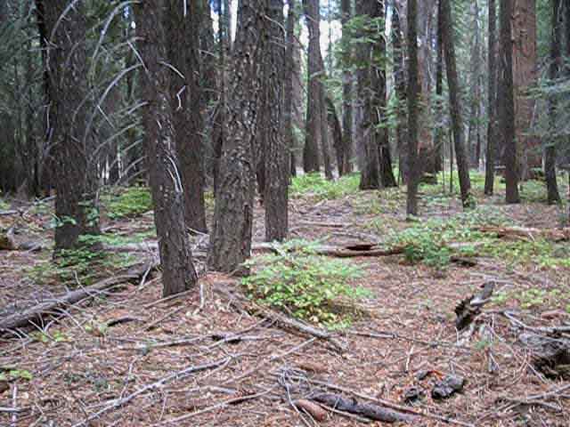
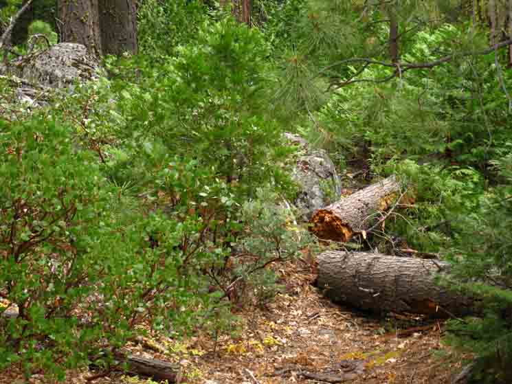
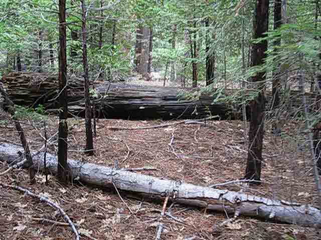
The Dense Unblazed Forest South of the Lower Ford of Summit City Creek
| This is the forest you enter after climbing the hill past the black pond South of the lower ford of Summit City Creek. | ||
 |
||
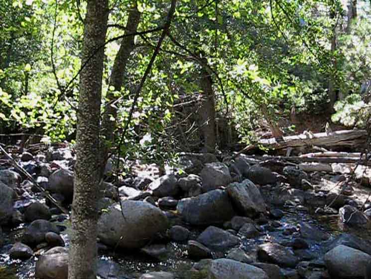
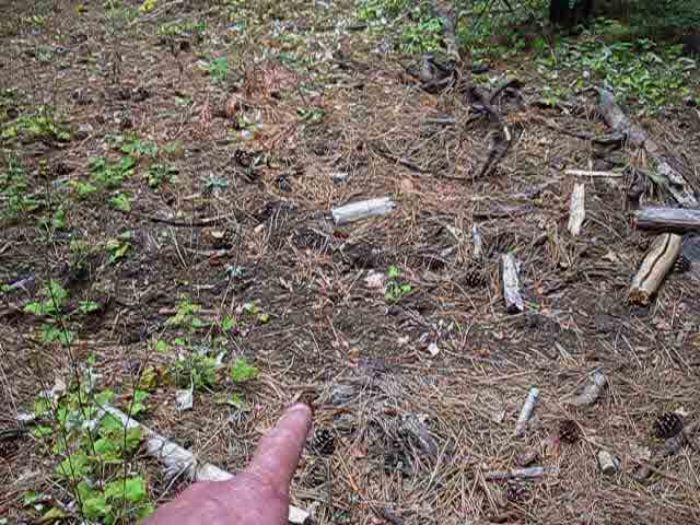
Note the dense forest-floor liter without the benefit of trail or trail bed. When we enter the Enchanted Forest past the black pond, we immediately turn Left, and start down a gently graded slope into even heavier forest. Again, note the forest floor debris and unstable surface. Note the lack of trail or indications of trail. Ducks and blazes end here. You are really going to have to watch where you put your feet at the same time you are looking for the proper direction to hike. This is a brief and small, but intense, laboratory for the development of route finding skills. Thus I advocate preserving this section as it is. There is no discernable trail, ducked or blazed route from this point until our exit from this forest about a third of a mile South of this point. Not far, you say? Well, the density of terrain stuffed into this small space is amazing. You will see a couple of faded blazes leading you into the forest, but they are the last that you will find, except for the occasional faded remains of very very old blazes that are all but indistinguishable from the random patterns on bark. The blazes past here are lonely, and they point the way to nowhere.
If you do not watch the surrounding terrain carefully while maintaining your direction along your self-selected route, you will wander off of it. This place demands you use skills. No auto pilot hiking here! Eyes Open. Thinking Cap "On." |
Southbound into the Enchanted ForestNote the position of the trail where it enters the green-shaded forest section South of the lower ford on the Summit City Creek map. I call this small boot-shaped section of forest The Enchanted Forest. Though it looks simple, this is the most complex piece of navigation along the whole Tahoe to Yosemite Trail route. I put the segment of trail from the lowest ford of the Clarks Fork of the Stanislaus through Clarks Meadow and over Saint Marys Pass out of the Clarks Fork headwaters the second most difficult segment of trail.
As I mentioned above, I believe the current trail route enters the forest to the a bit Northwest of the position as it is marked on the USGS map. I believe that the actual trail route "hooks" up and around to the Northwest much more than the old route depicted on this map indicates. This is just a heads-up. I may be wrong. I will check this segment of the route out carefully in 2011 if I heal up in time... The trail from the lower ford to the forest entry over the top of the hill past the Black Pond was well-ducked as of July 2009, and it was well-ducked during every trip I have made through that section for the last 20 years. The ducks between the Lower Ford and the entry into the forest past the Black Pond have been stable for years because they are not swept away by the Winter snows or the Spring thaws. Odds are this section will also be well ducked in the future. Now let's enter the Enchanted Forest. * * * Again, lets observe the trail route through this forested section on the topo map. We are looking at the point on the map South of the lower ford where our route enters the forest. We need to understand the terrain between where the trail enters and exits this forested section. On the map this forested section appears roughly shaped like a boot. I call this forested section "The Enchanted Forest." First, let's take note of the interface between rock and forest along the West side of the boot, across from our entry point into the forest. This rock-forest interface is tracking to the Southwest. If you hike a bit South of West from the point where the trail route enters the forest you will encounter this forest/rock interface. Follow this rock/forest interface Southwest, down to the point where you will see the trail finally exiting the forest through a gap in the rock in the heel of the boot. Notice that the trail out of the boot climbs out where this seasonal creek flowing into the Southwestern edge of The Bowl, on its way to the N Mokelumne River at Camp Irene. This is what I call the "Western" route through this tough little section, and it will do. But if you take the "Western" route you will miss out on exploring the rock formations North of The Bowl, and not see the white sand beach that lines the shore of the North Mokelumne River where it passes along the Eastern side of The Enchanted Forest Bowl. I call the lowest section of level forest within these rock/river boundaries "The Bowl." When we first enter the Enchanted Forest our route South will take you lower in elevation. When the terrain flattens out we are in The Bowl. The Western Boundary of The Bowl is a rock wall. The North Mokelumne River is the Eastern limit of The Bowl, and the big rock we just hiked around the West side of forms the Northern boundary of The Bowl. Our route South out of the Enchanted Forest hikes around the backside of the great granite feature that creates the steep and narrow gorge separating the Enchanted Forest from Camp Irene along the course of the North Molkelumne River. As we entered the Enchanted Forest around the backside of a great granite feature on its North side, so too will we exit the Enchanted Forest around the backside of the great granite feature to its South. Steep gorges preceed and follow the North Molkelumne River's tranquil flow along the edge of the Enchanted Forest. We enter the Enchanted Forest from the North, and basically stay between the rock wall to our West and the Mokelumne River to our East as we make our way South to seek the resumption of marked trail on the Southwest corner of the Enchante Forest Bowl. Note on the topo map that the North boundary of "The Bowl" (the lower flat section of the Enchanted Forest) consists of the South flank of the rock formation which we climbed around the North side of while hiking South from the lower ford of Summit City to enter the Enchanted Forest. The Enchanted Forest climbs up the back side, the Western side of this fantastic granite feature, and the Northern limit of the Enchanted Forest sits on the back, or West side of the high point of this great granite feature. The North Fork of the Mokelumne River sits beneath and to the East of this rock formation. That is why we are climbing around the West side. The Bowl sits below the South flank of this rock formation. Summit City Creek sits to the North of this rock formation. Between the rock wall on the West side of The Bowl, and the waters of the North fork of the Mokelumne River on the Eastern side of The Bowl sits a deep, dense, dark little forest, sporting a forest floor littered with deep debris and obstacles. Among the obstacles are a couple of deep drainage trenches cutting across it. After exploring the white sand beaches along the West shore of the North Molkelumne and having a nice break enjoying the ambience of this secluded location we have to make our way Southwest across The Bowl to where our Tahoe to Yosemite Trail route exits its Southwest corner. This means that the key elements that will guide you down to, and through The Bowl, are your own navigation skills, your ability to observe and understand your location within the terrain, and the limits and nature of the terrain itself. There is no trail, only futile old almost-invisible blazes that no longer mark a path. NO PROBLEM! Full Understanding is a three hour expenditure of time and energy away. Three basic Routes down to and through the Enchanted Forest The Eastern Route We have three options after approaching and entering the top of the forest. We are hiking West to enter the top of the Enchanted Forest when we bust through the brush, so turning South to hike along the Eastern edge of the Upper Enchanted Forest requires we make a hard turn Left, to the South, just as we enter the top of the Enchanted Forest. By staying as far to our Left (East) as possible as we hike South, and following along the Eastern interface between the forest and the rock formation to our East, we will head down and South into the bowl by the Eastern route. Stay as close to the rock formations that begin rising to our left, the East, as possible, while staying in the forest. As we drop down towards The Bowl we soon find access to massive granite formations opening up to our Left, to our East, towards the gorge the North Mokelumne River is slipping through above the Enchanted Forest Basin. These formations to our East lead nowhere. They are dead-ends off of our track. But they compose an amazing bit of terrain that is worthy of exploration. If you explore them to their Southeastern extent, you will find amazing bits of terrain, and be able to observe elements of the sections of the North Fork of the Mokelumne River where it cuts a precipitous course through this sheer canyon, almost completely hidden within the steep and deep gorges that the river funnels through to pass by the Eastern edge of the Enchanted Forest. We can also see the sheer gorge dividing the Enchanted Forest from Camp Irene from different positions out on the rock. Scramble this cool granite formation to take a look down at the North Mokelumne above the Enchanted Forest Basin. The first time we will encounter the North Molkelumne River will be at Camp Irene if we don't expend some extra effort. We can see the North Molkelumne River twice before Camp Irene. The first place is from the rocks North of the Enchanted Forest Basin, and the second is from the East edge of the Enchanted Forest Basin itself. Both of these locations must be sought out. They are not along the most direct route across the Enchanted Forest. These hidden features were cut into this stunning landscape first by ancient glaciers, and recently by the flow of the mighty North Fork of the Mokelumne River itself. These massively profound granite formations are well worth the time and effort it takes to even get a glimpse of them, let alone fully explore them. Unless you set up camp in The Bowl, and give yourself the time necessary to explore them, and this cool little section thoroughly. That's a good plan... Thus the utility of trips that give the backpacker enough time to thoroughly explore a place. You will see amazing things and places if you give yourself some exploration time, which means carrying more food, which means a heavy backpack. Food is time. The key consideration for extra explorations are how well you have supplied yourself with enough food to support some off-route explorations. This is a stunningly beautiful place with many hidden treasures that you will find only if you give yourself the time to camp in The Bowl, and expend the energy to explore the surrounding terrain. These kind of places are why I pack an extra day's food for each section of our trail between resupply spots, and a nifty little retro Kelty daypack... Yeah, extra food, heavy-duty gear, daypack, and the trail guide tools of tripod, cameras, batteries and charger make for a frkn heavy pack... If you do head East to explore these formations, you can stash your pack to make your scrambling easier. Make sure you remove your bear proof food container from your pack, and properly stash your food so a bear does not violently remove your food canister from your pack, (What I call a "packectomy") and that you position your food canister so that bear cannot roll it off a cliff, into the water, or too far away from your stash point to easily recover. Even more importantly, MAKE SURE that you can find your pack again when you return from your scramble. Most importantly, be very careful exploring these granite formations, especially if you are a solo backpacker as I. If you get injured in this remote location scrambling far off the beaten track, off of a route that is already off the beaten track, you're screwed. There will be no rescue. It is likely no one will find you for years, if ever. Screw up out here and it will be a self-rescue situation. Self-rescue is a bitch. Imagine you feel like you should be in a hospital. Then image you are feeling like that deep in the High Sierra Backcountry, days of hard work from the nearest trailhead. Self-rescue is a bitch. So be careful! Continuing South past the granite formations along the Eastern edge of the Enchanted Forest down towards The Bowl will bring us across a series of small drainages cutting diagonally across our path towards the Southeast, towards the North Mokelumne River. The first couple of drainages flow into rocky jumbles that are obviously dead ends for hikers, but as our path through the forest flattens out approaching The Bowl, we will be able to follow the lowest drainage into the center of the bowl. These small drainages are not marked on maps. I think it is the third drainage that cuts left down onto the forest floor of The Bowl towards the North side of this stunning strip of forest and beach along the North Fork of the Mokelumne River. The lowest gully, usually the fourth we encounter on the way down, is the largest and cuts roughly across the center of the Enchanted Forest Basin. These little drainage gullies change year-on-year, so don't depend on my "count." You will have a good idea it's a good drainage to follow East when you see it is draining into a forested flat, The Bowl, on its way to the river. At this point we can cut East and follow the drainage, or just hike across the forested flat Eastward to the River's pristine white sand beaches, shaded under ancient groves of Cedar, Sugar Pine, Spruce and Jefferies all sitting in the shadow of the sheer granite monolith rising out of the Eastern Shore of the river across from The Bowl. This is a stunningly beautiful and very remote location. I get excited writing about it... And this is the only place you can drink from the North Mokelumne River before you reach Camp Irene. There is a nice stream laying below the Munon Meadow trail junction, but that's a ways away. A nice break on the white sand beaches along the North Molkelumne River with the Enchanted Forest at our backs is a must-do while hiking through here. The Middle Route Instead of turning a hard Left to the South at of our entrance into the top of the Enchanted Forest we continue about 50 or 70 yards West before bending Left to hike down to The Basin. We find the best route possible as we follow the center-low point running down the middle of this strip of Enchanted Forest down to the basin. Along this route we will encounter all of the gullies running from our Right to Left diagonally across our route. This is the "Middle" route. The Western Route After we enter the top of the Enchanted Forest instead of turning a hard left to hike the Eastern route down we continue West as far as possible until the terrain begins to push us off to our Left, to the South. We avoid getting pushed too far to our Left as to keep an eye off to our Right, to ascertain the best route down the Western edge of the forest. If we push too far to the Left, the East, we will end up hiking down the center of the forest, and if we push even further East we will encounter the Eastern route along the Eastern interface with the granite. Continue to follow this forest/rock interface South along the Western side of The Bowl until we come to where the rock wall forming the outer boundary of the Enchanted Forest runs down to the Southeast. At the far Southwestern corner of the Enchanted Forest Basin we find ducks and blazes marking where our Tahoe to Yosemite Trail route cuts up through a gash in the rock wall onto an easily noticeable fairly well-ducked trail up the backside of the great granite feature dividing the Enchanted Forest from Camp Irene. The Enchanted Forest is below the North flank of this feature, Camp Irene below its South Flank. The Munson Meadow trail junction sits on the South edge of its back side. Sticking along the Western route down into the Enchanted Forest Basin will bring us into a zone of thinner forest with a better surface for hiking. The Western route also leads more directly to the crack in the wall exit from the Enchanted Forest Basin on the Southwest edge of the Basin. But, taking the Western route misses visiting the white sand beach along the West bank of the North Molkelumne, which also keeps us out of the most impressive densities of forest in the center of the basin. My Pleasure I favor the Eastern route through the Eastern side of the Upper Enchanted Forest down to The Bowl. This route allows me to explore the massive granite formations that compose the Northeast boundary of The Bowl, before I cut down to and across The Bowl to visit the remote white sand shores of the North Mokelumne River along Eastern side of The Bowl. Let's try to see it all: Hike down the Eastern route a few hundred yards, then cut West-Southwest across the upper Enchanted Forest to its Western limit. Hike down the Western edge until you feel you are close to the bottom and entering the The Bowl. At that position turn Southeast, which points us towards the North Molkelumne River. Cross the Northern edge of the Enchanted Forest Bowl on your way over to the North Molkelumne River for a sweet break, lunch, or a night's campsite. This is an extraordinarily remote, remarkably hard to find, and almost spooky location that makes an excellent place to camp. Don't make fire rings, or do anything to this pristine little location except enjoy it... If you want a fire ring use the little campsite on the far North end of the Enchanted Forest Basin sitting along the North Molkelumne Riverbank. It's far enough away to be a legal site, by my measure. Or we can plan a route across all the routes down to the Enchanted Basin. We point our course to the Southwest from our entry point into the enchanted forest to work our way Southwest diagonally across this upper arm of the Enchanted Forest to the rock wall that bounds the Western side of the bowl. Once this diagonal course brings us down to the Western side of the basin we can follow this Western rock/forest interface South-Southwest down into Western side of The Bowl, if we are still above it, or we can hike to the Southeast, away from the Western edge of the Enchanted Forest on our way to visit the North Molkelumne River on the East side of the Enchanted Forest bowl. One way out of The Bowl There is only one way out of The Bowl. It is on the Southwestern corner of The Bowl where a seasonal creek emerges from the surrounding ridge. This makes it easy to find the trail out of the South side of The Bowl. The simple fact is that from any position on the North side of the Enchanted Forest Bown you can track roughly South until you pick up the creek bed that tracks out of the crack in the rock wall where our now well-ducked trail continues South towards the Munson Meadow trail junction and on to Camp Irene. Follow the creek bed Southwest up to where it first enters the forest, and you've found the fairly well ducked trail to Camp Irene. UPDATE Yeah! Congratulations! You've successfully passed through the non-trailed section of the Tahoe to Yosemite trail, and now will enjoy almost-maintained trails almost all the way South to Tuolumne Meadows in Yosemite. There is a good, if faint, trail route (or fairly good ducks) from the Munson Meadow trail junction to Camp Irene. NOTE The only exception is further South, at the South end of the Carson Iceberg Wilderness where we have a small cross country section following a faint trail or no track from the North end of Clarks Meadow up to the headwaters bowl of the Clarks fork of the Stanislaus River over Saint Marys Pass and down to the Saint Marys Pass Trailhead on Highway 108. The Saint Marys Pass Trailhead is located about a mile West of Sonora Pass. |
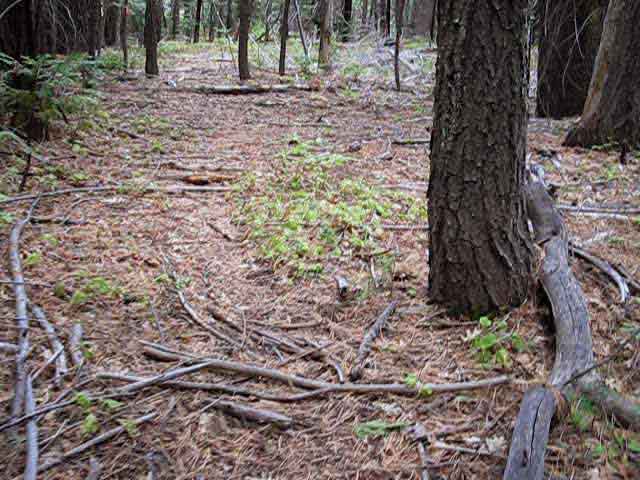
Hiking down from our entrance into the dark and dense Enchanted Forest to its main body aside a magnificant section of the North Molkelumne River we will come across a series of washes cutting diagonally across our Southbound route. Following a small creek running in the fourth wash down to the Mokelumne River across the Enchanted Forest Bowl. |
||
 |
||
This is the fourth drainage wash coming down the Eastern |
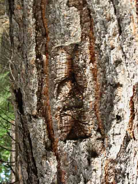
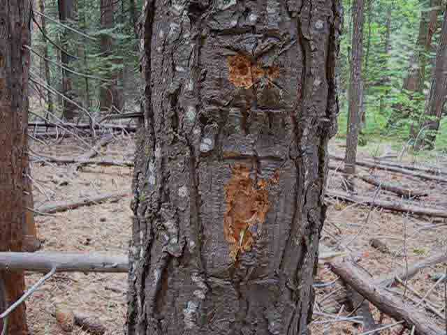
| The faded blazes are being absorbed by the trees. | ||
 |
||
This faded blaze sits in a dense forest with no discernable trail, or any other blazes, for as far as you can see. |
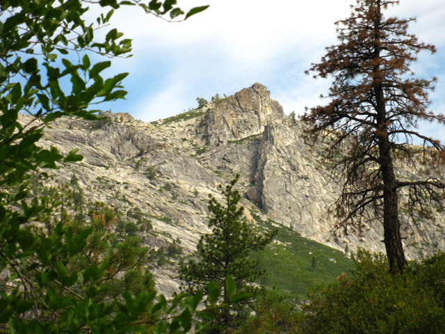
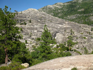
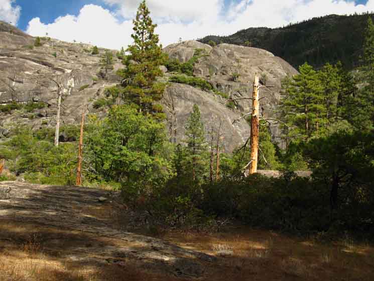
| Peak 7813, towers above the Western ridge line above our little strip of untracked forest. | ||
 |
||
This is the dominant peak, a dome really, to the Northwest of Camp Irene. The base of this peak makes up the Western boundary of The Enchanted Forest. |
In The Bowl alongside the North Fork of the Mokelumne River, there are large examples of some of our favorite Sierra Trees
 |
v |
 |
v |
 |
v |
| Big Sugar Pine. | Large Incense Cedar. | |||||
| In the chaotic jumble of this dense forest, these titans have cleared out space around their massive canopies. | The sheer granite walls on all sides combine with the dense forest to create a hushed zone of deep quiet in The Bowl. |
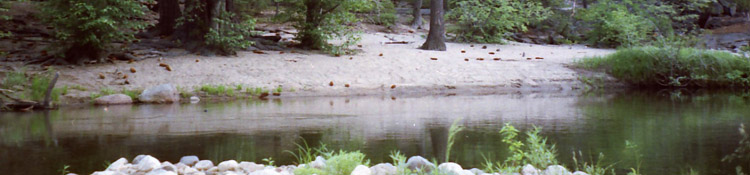
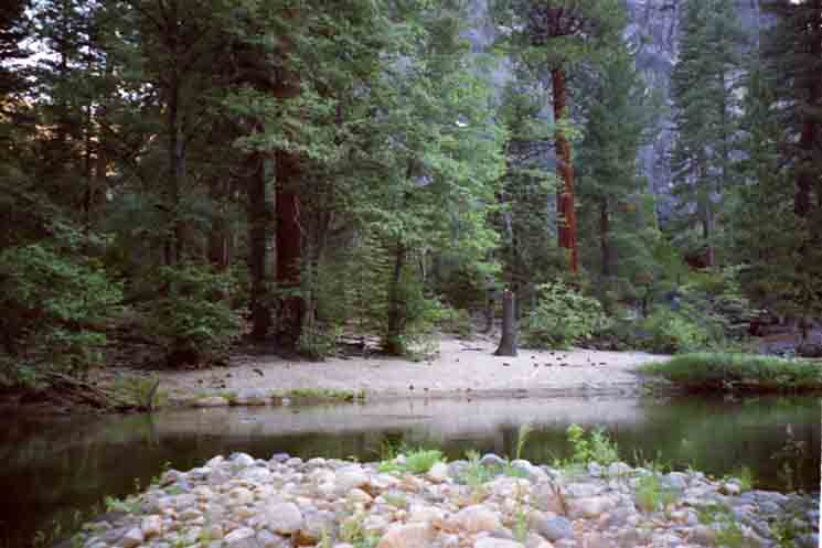
Deep in the TerrainThe trees pictured above sit about 40 yards from where white sand beaches line the shores of the North Mokelumne River as it passes by The Bowl. Last year (2009) I stopped alongside this pure white strand of beach, cooked myself a hot lunch and coffee, completely re hydrated myself, and stocked up on water for the remaining short hike to Camp Irene. The beauties of the terrain were as refreshing as the fare. Man, food tastes great on the trail. After lunch I left my pack behind, and took a long walk around the perimeter of The Bowl. I found it to be a completely delightful place to spend a night. It has excellent assets: Old growth trees towering over a dense young forest growing out of a dense jumble of smashed forest floor liter. Massive granite formations and mountain tops peeking down at you through the dense canopy. Soft white sand beaches along a most remote stretch of a beautiful river. It's a winning combination. Add to all of these beauties the special feeling imparted by the hushed quiet and deep isolation created within this unique environment. This small densely forested space enclosed by sheer granite walls imparts a special feeling. Whoah! If you are uncomfortable being alone, this place will really freak you out! If you enjoy deeply isolated locations, you will find this place is a little bit of heaven on Earth. |
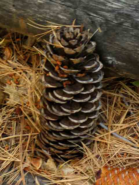
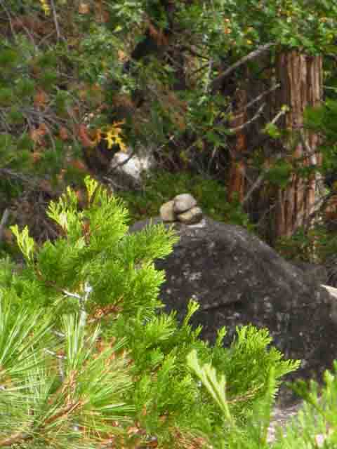
| A Big Boy: Sugar Pine Cone | ||
 |
||
I always listen carefully when traveling under the Sugar Pine. |
 |
v |
| Soaked, Salted, and Scraped. | ||
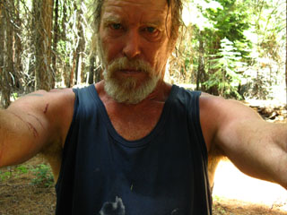 |
||
And worth every bit of it! This is where I take lunch, wash myself and my shirt, and enjoy the beauties of The Bowl from my spot leaning against a tree in the soft white sands along the shore of the North Mokelumne River. Deeelightful... |
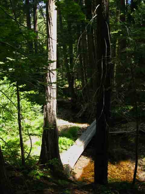
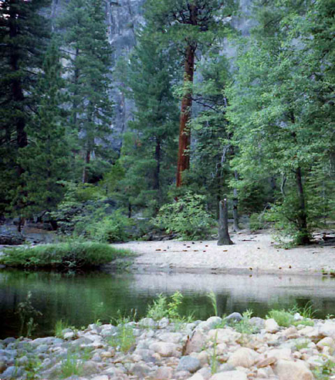
North Molkelumne River
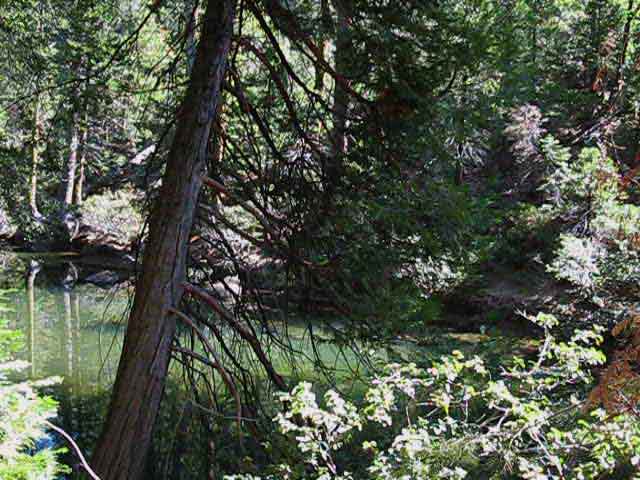 |
North fork of the Molkelumne River below Summit City Creek. Johnny has a nice 2015 report on this fine strip of river, rock, sand and forest. |
Video
Hiking South from the Campsite along the North Molkelumne River at the North End of the Enchanted Forest Basin to Camp Irene
The Tahoe to Yosemite Trail route as marked on the maps does not intersect with the North Fork of the Molkelumne River as both pass the Enchanted Forest Basin. But this does not present a problem. The trail as marked on the map does not exist on the terrain. The route you craft through the terrain can swing East when entering the Basin of the Enchanted Forest. When you descend to the dense forested flat turn East and hike over to the North Molkelumne River. It's a sweet stretch of terrain where the river and forest meet with a strip of white sand between them. Totally Sweet... Nestled upriver at about the Northern limit of the Enchanted Forest's Basin along the River (unless you want to climb) is a functional little campsite. It has a nice rock to lean up against, a fire ring, good shade and well sheltered from the wind. I prefer to camp further downstream at random spots that have a nice tree to lean against with a view of the cliffs on the East side of the river and a great sandy spot for my sleeping pad. I don't have any need for a fire ring as I don't make fires unless it is an emergency or I have company.
|
Fire Ring at the North Campsite
 |
Enchanted campsite along North Molkelumne River. |
 |
Break time at an Enchanted Forest Campsite. |
 |
Fire ring at the Northern Enchanted Forest campsite. |
 |
Walking South along the West bank of the North Molkelumne River from the Northeast end of the Enchanted Forest. We'll hike South along the bank of the North Molkelumne until we decide to cut Southwest seeking the "crack in the wall" of granite terrain surrounding the Enchanted Forest. A couple of hundred yards South of here we will turn towards our Southwest, or turn Southwest when we encounter the Great Wash. |
 |
Great Wash in the Enchanted Forest. Cross it high or low to continue hiking Southwest. |
Higher up the mountain...
|
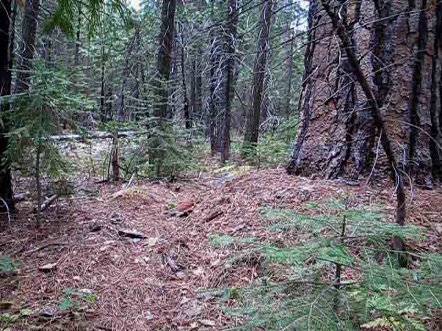
The image above is of the "fourth wash," but much higher up on our hike into the basin of the Enchanted Forest. In the associated video for this segment of trail I mention how we had turned "Left," East down to the basin before we had crossed the "Fourth Wash." That move put us on the North end of the lower basin of the Enchanted Forest. Crossing here and then cutting East to the North Molkelumne River in the basin brings us to the center of the Enchanted Forest basin a bit South of the North Campsite pictured above. Up here the Fourth Wash is shallow and delightful. Further down the slope where it crosses the bottom of the Enchanted Forest basin it sometimes flows powerfully, like a river during the Spring Thaw. Up hight is where you want to cross the fourth wash early in the hiking season. If we cross the fourth wash way up here we end up in the center of the flat basin at the heart of the Enchanted Forest. If we veer Left, to our Southeast from here we end up on the far North end of the Enchanted Forest Basin. The three washes above this position all drain into the complex granite feature dividing the lower ford of Summit City Creek from the North Molkelumne. Don't hike East, to our Left, along any of the first three washes above the Fourth Wash. If we hike West, to our Right from the Fourth Wash (or if we hiked to the West from above this position when we entered the dense forest) we will approach the "crack in the wall" exit from the Enchanted Forest without visiting the North fork of the Molkelumne River where it bounds the Eastern border of the Enchanted Forest. Know that the configuration and number of these washes will change with every Spring Thaw. The key fact is that there will be a lower wash flowing down to and across the Enchanted Forest basin. It is up to each hiker to correctly identify the nature of the terrain. In any case your route through here is up to you: you can see the Western route down and across the Enchanted Forest, the middle route, or the Eastern route. Or you can explore the perimiter of the whole boot-shaped forest that rolls down to the basin and defines the shape of the perimiter of the Enchanted Forest. |
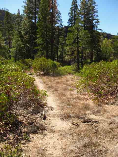
Across the lower Great Wash we find Trail
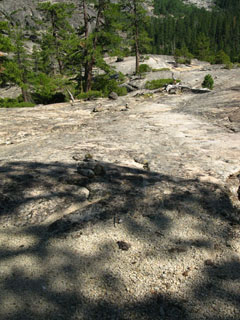
South end of the Bowl: Trailbed and Washouts!
Even more recent (2013) work on the Tahoe to Yosemite Trail Route...
 |
Recently refreshsed duck along Tahoe to Yosemite Trail. I figure this was done by Trail Slug & his pal. |
Trail
 |
v |
 |
Faint trail on the Southwest side of the Enchanted Forest. |
 |
Faint Trail, but yet trail... |
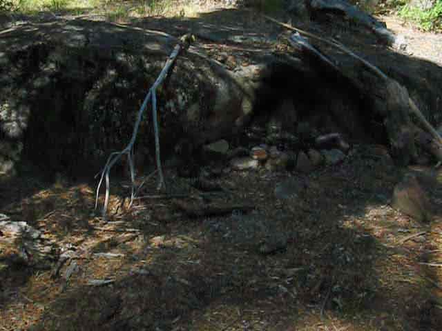
A Washout?
 |
First time I've seen a washout here... This washout is better than most of the trail we've hiked South of Horse Canyon! |
Munson Meadow Junction followed by a more or less ducked route to Camp Irene
Out of the Bowl onto the RockLet's get back to the map, and check out the overall shape of The Enchanted Forest. The forest forms an "L" or a boot shape. Our Southbound exit from the trackless forest in The Bowl is located on the heel of the boot. A creek also flows into The Bowl at the same place our trail exits this forested bowl. Note where we entered the Enchanted Forest following the ducked trail on its North side, at the top of the boot, and turned left, or South just past the Dead Pond. At that point we were in the forest, but were sitting on the North rim of The Bowl, faced with making our way South down into and across the densely forested bowl. Our ultimate goal was the Southwestern corner of The Bowl, where our trail South resumes. But how will you even know you are in "The Bowl?" You will know are are in The Bowl when the terrain is flat, the N Mokelumne bounds the forest to your East, and a steep rock wall marks the Western boundary of the Enchanted Forest. Out of The Bowl from the East side of The Enchanted Forest If you are looking at the Mokelumne River, then you are on the East side of The Bowl. Your knowledge that the The Bowl is boot shaped will put you on a Southwest line across the forest towards the heel of the boot from our position on the shore of the North Mokelumne River. You will also be looking out for the creek that runs from the gap in the rock that our trail exits through, but you will continue roughly Southwest if you encounter the creek or not. If you reach the rock wall where it is running to the SE, you are below the intersection that composes the heel, and you must hike to your Right towards the heel. If you reach the rock wall, and it runs to the SW, you are above the intersection that composes the heel, and you must hike to your left towards the heel. If you are on the West side of the Enchanted Forest As mentioned above, you have different basic routes you can attempt between your entry to the Enchanted Forest at the black pond, and your exit point through the heel of the boot. If you are paralleling the rock wall on the West side of the Enchanted Forest, your Southwest direction should take you down to the heel. I can't find my damn pictures of the crack in the wall where the Southbound trail resumes South of The Bowl. Sorry... |
Blaze on the Southwest Edge of the Enchanted Forest
 |
Blaze on the Southwest edge of the Enchanted Forest. |
Route South out of the Enchanted Forest
 |
Faint route South out of the Southwest corner of the Enchanted Forest. Johnny reports, |
Up and Out of the Enchanted Forest:
A fine route up the throat of the drainage/creek course running down into the South end of the Enchanted Forest
Note:
This section is in motion. By motion I mean that the terrain is running down the gully. This type of moving terrain does not hold trail well, and many sections of our climb up and out of the Enchanted Forest are attempting to tie the observable parts of the route together across untrailed terrain.
In terms of the layout of the local terrain, the trail here is climbing the backside of a great granite formation that pinches the N Molk into a narrow channel between itself and the thousand-foot almost verticle wall on the other side of the river. This pinch point along the short stretch of river separating the the Enchanted Forest from Camp Irene is where the log jams form during catastropic thaws and the inevitable floods that follow.
This sheer pinch point forces us the long way around the backside of this granite feature on the South end of the Enchanted Forest, just like the granite feature on the North side of the Enchanted Forest did.
The "front" (East) flanks of these granite formations are sheer faces overhanging the North Molkelumne River. Great scrambling terrain, but unpassable as a route through the terrain.
Thus the hiker's route is forced over their "back," their Western sides. Hiking South out of the Enchanted Forest we are hiking a route just like the one we just climbed into the North end of the Enchanted Forest: Over the back, or Western side of the great granite feature that makes up the Northern bookend of the Enchanted Forest.
This fact has greater meaning than determining the logic of the walking route through here. It means that our hiking route and the North fork of the Molkelumne River are separated by two fantastic granite formations that both possess all the features of a maze and a jungle gym constructed of living granite on a scale that makes this place the mother of all medieval gothic cathedrals, all wrapped into one majestic experience.
This is a temple of the rock gods...
Now, don't think I am advocating that you just start wandering to your East out onto/into this maze. That would be crazy. One must first find and understand the hiking route, how it twists through the terrain, and carefully observe these two great granite outcroppings (North and South of the Enchanted Forest) carefully as we wind out way through them on this diffuse Tahoe to Yosemite Trail route.
Once we have hiked through and observed the lay of the land in here a few times it is time to plan some scrambles into our trip through here. First we adjust our schedule to camp here. Instead of having lunch at the white sand campsites in the Enchanted Forest, we will stop and camp. The next day we will devote the day to exploring one or the other of the great granite features that bound the Enchanted Forest to its North and South.
These exploration things take some planning, and proper planning comes in stages. The first few times through familiarity with the route is accquired. That itself is an adventure. A degree of familarity is required before scrambling off the route to explore the beauties and delights found in the nooks and crannies of this brutal Eden.
As I mentioned on the last video, you don't want to get lost or hurt while scrambling off the trail route here. No one will find your body for a long long time...
 |
Trail South to Camp Irene. |
Faint Rout climbing South
 |
v |
Ducks lead the Way
 |
Ducks along faint trail route. |
Big Pine Tree
 |
v |
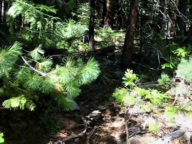
Duck into rocky route
 |
v |
Brushy faint Route
 |
Faint trail through brushy gully. |
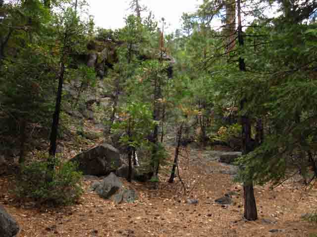
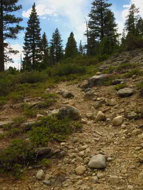
Climb to the flat South of the Enchanted Forest
 |
Approaching first flat South of the Enchanted Forest. |
View up Summit City Canyon
 |
View up Summit City Canyon. |
 |
Summit City Canyon on the upper Left side of the image and the Canyon of the North Molkelumne River on the Right. The great granite massif topped by Deadwood Peak divides Summit City Canyon from the Canyon of the North fork of the Molkelumne River. The Enchanted Forest lays below this flat. |
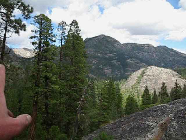 |
Pointing out Summit City Canyon. |
 |
Hiking South across the lower flat. |
 |
v |
 |
Final climb out of the Enchanted Forest before our descent to Camp Irene. |
 |
v |
Treebeard the Blaze
 |
v |
 |
v |
 |
v |
 |
Down to Camp Irene and up to Mount Reba beyond. |
The Munson Meadow Trail Junction
| A half mile South of your exit from The Bowl you will encounter the remains of the Munson Meadow trail junction. | ||
 |
||
Munson Meadow Trail Junction |
Down the Mountain towards Camp Irene
| There are a series of Ducks visible leading the way down the rock surface. | View of the Western flank of the canyon bounding the North Mokelumne heading down to Camp Irene.. | |||
 |
 |
|||
| View above: Northeast | ||||
The trail through here was decently ducked and easy to follow in 2009 and 2013, though I had to stop and look around a couple of times before continuing. |
||||
| Besides the numerous ducks, the trail is actually burnished into the granite along parts of this section of trail. | comments or questions |
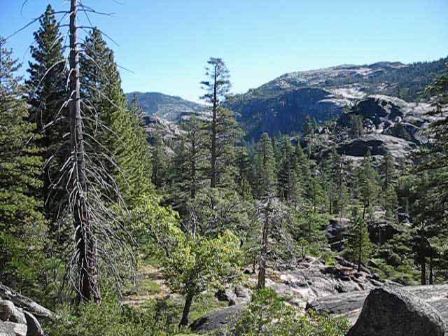
The Long View South from above, and North of Camp Irene
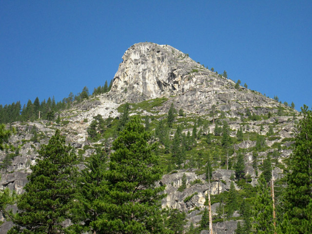
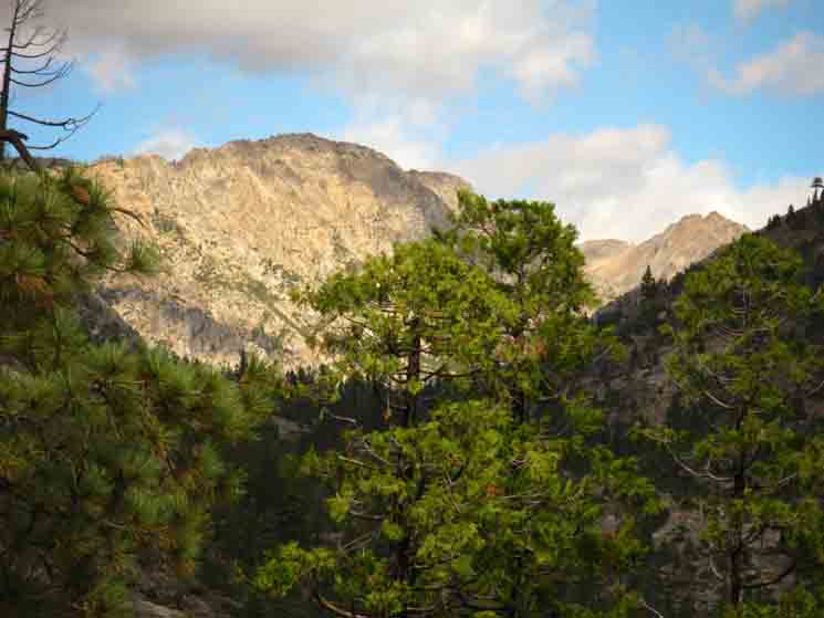
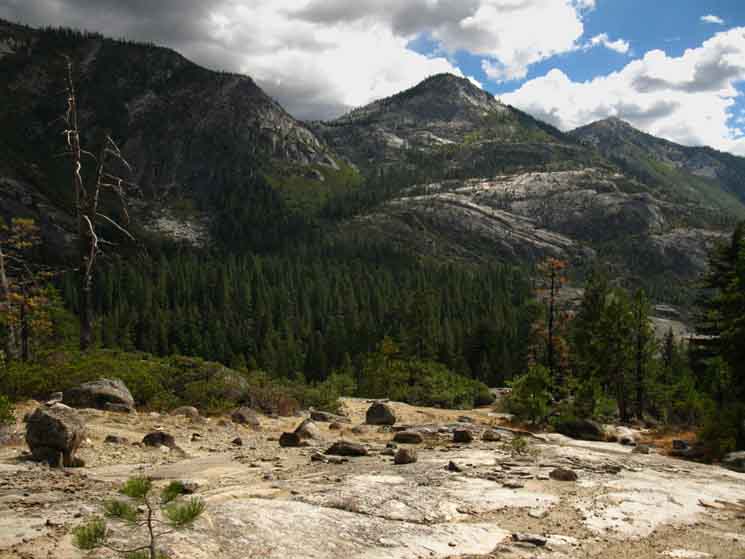
Mount Reba is the rounded mass dominating the left side of the ridge. Underwood Valley sits to the Left of Mount Reba. Lake Valley sits to its Right. The flank of Peak 8353 is visible descending from the Left of the image. Camp Irene sits below the larger granite mound at center-left in the foreground. We're heading down there now. From Camp Irene we will climb up and traverse the visible flank of Peak 8353 on our way to cross below the mouth of Underwood Valley. From there we will pass around the near side of the mass of Mount Reba, roughly at the interface between the white rock and forest, to enter Lake Valley. From Lake Valley the trail will take us up to the crest of Mount Reba, from the Right side of the peak. |
||
 |
||
This image was taken from past the Munson Meadow Junction where we bend Southeast on our way down to Camp Irene. Below this point we will not be able to see the surrounding ridge and mountaintops from within the forest. |
Down Down Down
 |
A steep descent brings us off the rock flat, and we can hear the tinkling sounds of water dancing on the sound of wind through the forest. |
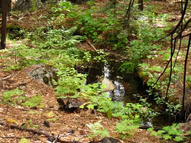 |
Creek with fresh cold water in a quiet shady zone where the only sounds are the quiet tumbling sounds of water and the wind in the trees. The last time through these delightful sounds were provided a rolling thunder bass line by a passing afternoon thunderstorm. That was sweet. |
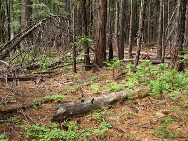
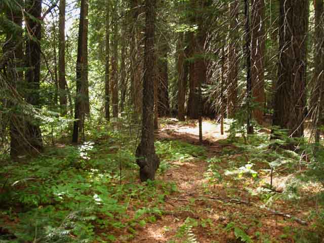
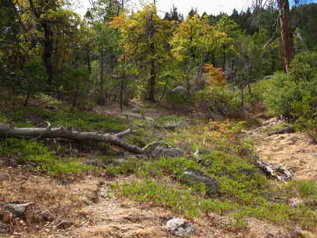
Meadow, Forest and Rock
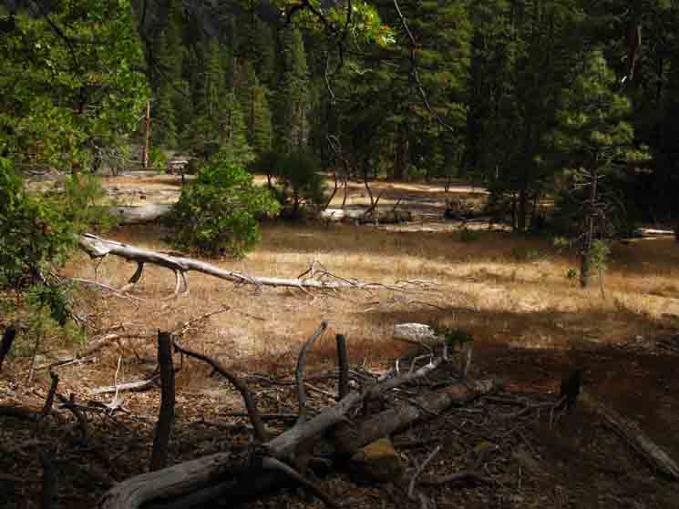 |
Semi-open terrain. Meadow is limited by great sheets of flat granite, and both granite flats and meadow are trimmed by fine forests. A decent trail runs down to Camp Irene. |
 |
Great Split Rock on the granite flat leading us down to Camp Irene. A nice route brings us down from the Munson Meadow trail junction to Camp Irene. Above I'm looking 90 degrees to my Left, North, from the line of the route down to Camp Irene. |
The South Side of the Granite Feature on the North Side of Camp Irene.
 |
Granite feature North of Camp Irene along the N Molkelumne River. The precipitous terrain created by this massive granite feature is why our trail route swung around its Western or backside before turning Southeast towards Camp Irene. |
 |
Coming off a section of dry meadows and granite flats we can see dense forest below that separates us from Camp Irene. |
 |
Ducks guide us South to Camp Irene. |
 |
v |
Thick Terrain characterizes our last steps to Camp Irene
 |
Into the dense brush for final steps to Camp Irene. |
Great Granite Feature North of Camp Irene
 |
This is the South Flank of the great granite feature that divides the Enchanted Forest from Camp Irene. This feature creates the West side of the gorge the North Molkelumne River flows through from the Enchanted Forest to Camp Irene. |
Through a Thicket of Junniper
 |
The final steps to Camp Irene plunge us through a dense thicket of young trees. |
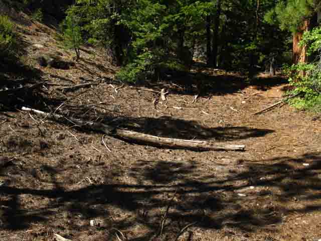
Last Obstacles between Us and Camp Irene
SOUTHBOUND ROUTE INTO CAMP IRENE
 |
Camp Irene is on the other side of the fallen timber. |
Serene Camp Irene
 |
Viewing the finest campsite at Camp Irene, on the North Bank of the North fork of the Molkelumne River from the South Bank. Note the rocks at our feet on the South Bank. Note the broken snag on the far bank. |
Camp Irene Video
I generally ford downstream during low water, and a little bit further upstream duriing high water conditions. Johnny's Explorations But that's not the best part. Johnny scrambled the steep and narrow canyon dividing
|
Looking South across the River at the South Bank
 |
Looking South across North fork of the Molkelumne River at Camp Irene on the Tahoe to Yosemite Trail. Note we are standing next to the broken snag pictured in the second image above. |
Mokelumne Wilderness Volunteers at Camp Irene
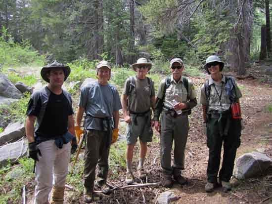 |
Above: Mokelumne Wilderness Volunteers at Camp Irene, 2013. From left to right Chris, Art, Mike, Tom & Ranger Reed. Mokelumne Wilderness Volunteers. Thanks to Ranger Reed for the image. |
Camp Irene
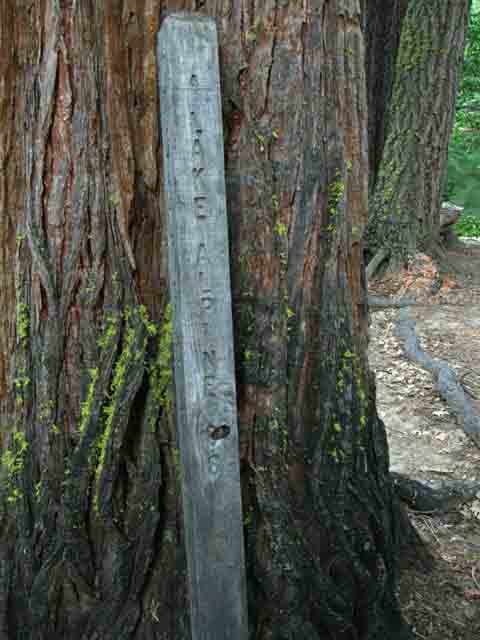 |
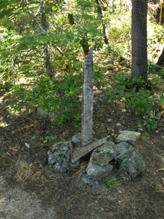
Lake Alpine: 8.8 miles. This dude was leaning on a tree next to the fording spot in late 2009. |
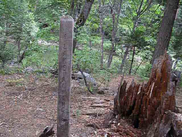
Replanted
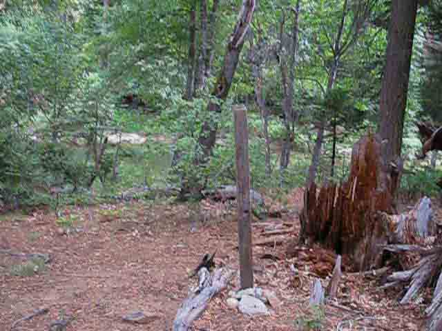 |
Replanted as of 2013. Camp Irene miles post and North Molkelumne in background. |
A Closer Look
 |
Pointing the way to Lake Alpine. Lake Alpine: 8.8 miles |
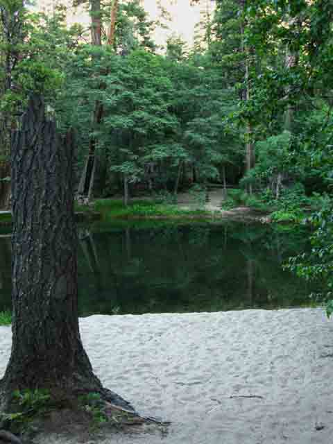
Campsite on the North Shore of Camp Irene
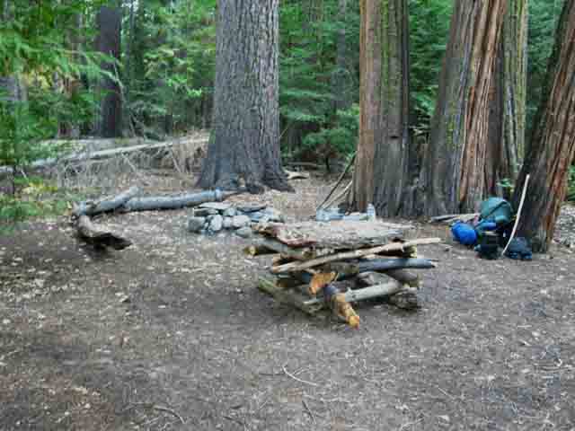 |
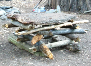
I almost always stay at the best camp at Camp Irene, which is on the North Side of the North Fork of the Mokelumne River. During my 2009 visit this camp was equipped with log benches, a fancy fire ring, and a table made out of branches with a bark tabletop. 2013: Table gone, but 10 beeeers were anchored and chilling in a pool along the N. Molelumne River: Cheers! |
Camp Irene5280 feet Mileage: 5.24 miles South to the Top of Mount Reba. Mileage: 8.02 miles South to Bee Gulch trail head at the East Side of Lake Alpine. NOTE: The sign post at Camp Irene says, "Lake Alpine 8.8" As you can see, I call the distance at 8.02 miles, and I stick by that number. Crossing National Forest Boundaries When you cross the North Fork of the Mokelumne River Southbound, you are exiting the El Dorado National Forest, and entering the Stanislaus National Forest. You will exit the Mokelumne Wilderness hiking South across the top of Mount Reba. The Carson Iceberg Wilderness begins South of Lake Alpine. |
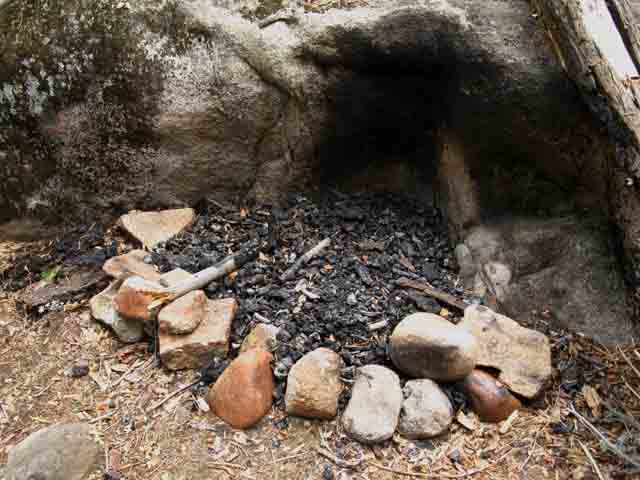
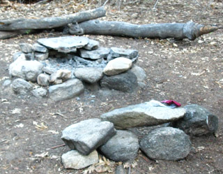
Camp Irene campsite details
| Fancy Fire Ring with heating surface.. | The bark and branch table. | |||||
 |
 |
|||||
| With a rock stool for the fire tender. | I'm generally too busy hiking to build things, but I am often amazed and amused by the things people build. |
Serene Camp Irene
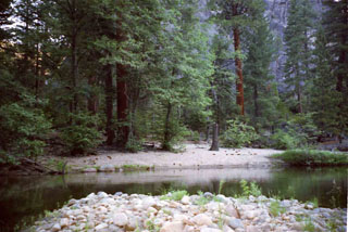
| View of the beach on the North Side of Camp Irene, from the rocky South side of the River. | Looking South across the fine white sand beach on the North side of Camp Irene. | |||
 |
 |
|||
The campsite on the North side, across the river, is hidden up in the trees above the beach. The campsite on the South side of the river is much rougher than the fine camp on the North side. |
The North Fork of the Mokelumne River comes out of its narrow channel to flow through a wide section at Camp Irene. | |||
| top of page | ||||
| Camp Irene Camping | ||||
Camp Irene is a place where the physical quiet easily reaches into personal tranquility. There are three basic places to make camp at Camp Irene. North Side of the River My favorite place is on the North side of the river. A massive rock formation lines the river on the North side of this camp, a sandy beach sits in front, and a dense thicket of a forest bounds the Southern extent of the camp on the North Shore of the River. An excellent flat features a fire ring, some improvised seating, and a stick and bark table. Plenty of soft flat spots for you to crash out. I have never seen anyone camping here when I camp here. |
South Side of the River At the Ford The South side of the River at the Camp Irene ford is a jumble of rock and forest. Though there are a couple of sites here, they are rough, nothing like the site on the North side of the river. I always prefer to camp at the camp on the North side of the River. |
South Side of the River Downriver After the ford the trail continues South along the River for a few hundred yards before turning up for the big climb up Mount Reba. There are a couple of real nice sites on the little rises sitting between the trail and the river. I camped in a nice place here once a long time ago, and met Evan when he camped here. |
| Another view of the sandy beach along the North Shore of Camp Irene along the North Fork of the Mokelumne River. | ||
 |
||
I'm pretty sure the cinnamon colored tree is a Giant Sequoia. |
Backpacking & Camping South of Camp IreneThe location of the campsite South of Camp Irene pictured below is marked on the topo map as the red dot just South of Camp Irene, alongside the North Fork of the Mokelumne River. As we have crossed the river Southbound, we are now in the Calaveras Ranger District of the Stanislaus National Forest. The Stanislaus National Forest is the permitting authority you will contact to begin a Northbound trip into this area from Highway 4 trailheads. The Southbound Tahoe to Yosemite Trail will shortly turn away from the North Fork of the Mokelumne River to begin its long climb up to the top of Mount Reba, where we will exit the Mokelumne Wilderness. Before climbing upward, the trail follows along the North shore of the Mokelumne River for a few hundred yards where there are a couple of nice campsites. |
Evan and the Bear Moved to the next page |
North: Lower Summit City Creek Ford South: Mount Reba
The Catastrophic Thaw of 1998 |
From the moment your Southbound route brings you into the chute of forest preceding the lower ford of Summit City Creek, until you begin climbing up the Northern flank of Peak 8353 South of Camp Irene, you are passing through an area devastated by floods that swept down the North Mokelumne River in the Spring of 1998. Much of the underlying "strangeness" that I still sense while hiking through here is a product of the remnants of the wreckage from this powerful event. Evidence of this event still decorates the terrain. I was hiking Northbound from Tuolumne to Lake Tahoe during the Summer of 1998. As I dropped down towards Camp Irene coming down from Mount Reba, the trail disappeared into the most amazing thing: I estimate 13 feet of smashed tree debris was sitting above what had been ground level. All the small and medium trees were gone. Big trees that survived were sticking up through the debris mat, stripped of bark for dozens of feet, and showing signs of great trauma. This terrain stretched from Camp Irene through The Bowl, and up the slot of forest around the lower ford of Summit City Creek. This terrain was very difficult to cross. It was a spongy, unstable irregular mass of tree bits, smashed in every configuration possible, from toothpicks to 30 foot long trunks snapped like toothpicks, to "shredded" logs stripped naked of bark and branches, piled yards deep in an unstable mass across the terrain. Every step across this unstable surface was like walking on a rope bridge, and each step threatened to punch my feet and legs deep into this mass of shattered wood bits, and be impaled on bits of root and branch in this amazing mass of debris. All of the small and medium sized trees in the flood zone had been swept up, smashed into splinters, and deposited as wreckage in this huge mat of debris. Large trees that remained rooted showed damage high up on their trunks, and none were holding low branches, as they were all scoured off. I found my way to Camp Irene through and over the debris, and thought about what I was seeing. It was a strange and desolate sight. Precipitous Spring Thaw It quickly became apparent that the heavy Spring rains earlier that year had caused a catastrophic thaw. I could see indications that the water level at Camp Irene had been at least 75 feet above the normal river level. I could estimate this by the height of the debris up the mountainside that I had encountered coming down off of Mount Reba. The "bathtub ring" of debris was at 75 feet above river level on all surrounding terrain, but I saw a better indication of the high water level that is still visible at Camp Irene to this day. Look carefully at the steep rock formations and high cliffs that surround Camp Irene, especially the formation on the Northwest side of Camp Irene's location. You will notice smashed trees deposited high up on that cliff by the high water level of this flood, and abandoned there when the flood waters retreated. Those trees remains deposited high up on the cliffs are a remnant of the Catastrophic Spring Thaw of 1998. The heavy Spring rains and the catastrophic thaw only told part of the story I was seeing. As the rapid thaw swept down huge amounts of trees in its rush down the mountain drainages, the trees were carried down until they jammed up. It was crystal clear to me that a major jam up happened in the steep gorge between The Bowl and Camp Irene. The high water level in front of the jam up at Camp Irene reached 75 feet as it came through. I don't have an estimate for the water level behind the jam-up, though it had to be higher than the high water mark at Camp Irene. Behind the jam up all the timber in the surging pool created by the logjam ground itself to splinters. When the pressure of the water and debris behind the jam up hit the critical point, the jam up broke and a massive wall of water full of timber debris swept downriver. This massive jam-up explains the devastation that had swept through the Enchanted Forest, and left the huge amount of tree debris burying the forest floor. The high-water mark was far above the height of the Lower Ford of Summit City Creek, where you can also see evidence of the jam-up and scouring that took place. After the jam up broke, a huge amount of water filled with surging, shattered timber, blew down river, smashing everything in its path. This jam-up first flooded, then scoured, everything along our Tahoe to Yosemite trail route from the lower ford of Summit City Creek through the Enchanted Forest and The Bowl, and swept through Camp Irene at a height I estimated at 75 feet above highest Spring Thaw high water mark. In the wake of this devastation, nature quickly snapped into action. Aftermath Within three years of this devastating flood sand had been carried in by each years storms and Spring runoffs to quickly fill the deep mat of shattered timber with soil. Grasses, shrubs, and trees quickly followed. I think that big parts of the giant mat of wood debris was actually composting itself. That would explain the rapid transformation from devastation to rapid growth. Many parts of the present terrain around Camp Irene have now healed so completely that you cannot tell the flood occurred. In any case, massive bursts of tree growth quickly replaced all of the young timber the flood had swept away. This explains why you are confronted with dense thickets of young trees throughout the Enchanted Forest. Many of the mature trees who had monopolized the light were swept away, and now the next generation is struggling en masse to fill the void. This massive growth will be thinned out as the firs and pines eventually push up a canopy and sweep the forest floor of all the runts by denying them light. This is why you see very mature and very young trees making up the majority of the tree population within the flood zone. All of the young and smaller trees were swept away in 1998, leaving only the big boys behind. Now the Enchanted Forest and The Bowl are full of young trees growing rapidly, flying to fill in the void left by the flood's devastation. They fill it quite densely, for now. Since the flood devastated the forest floor through this small section of trail, backpackers have been struggling to find their way through these areas (The Bowl in The Enchanted Forest) where all signs of trail bed were swept away and buried with a dense mat of debris by the fearsome power of nature. THIS PAGE IS PRETTY MUCH DONE, BUT STAY TUNED FOR MUCH MORE! I'm looking forward to seeing you POST UP the highlights of your adventures through here on the Carson Gap to Lake Alpine Trail Forum. And, I have never shot videos through this section, which I am looking forward to doing during the Summer of 2011, if at all possible... So, COME ON BACK NOW, 'YA HEAR? And, the fact is that you won't really "know" a trail until you run it at least four times, camped at all the sites on the route, and explored the nooks and crannies of the terrain along the way....So keep on coming back to unlock the endless treasures along this fine route. 7.5 Topo Hiking Map Big 7.5 Topo Hiking Map 30 min Topo Hiking Maps South: Mount Reba |
Backpacking Trail Guide North |
 |
Backpacking Trail Guide South |
Backpacker ForumsHave General Information or Questions about Long-Distance Backpacking, Gear, or the Sierras?Post it on: TahoetoWhitney.OrgYour comments and questions posted from this page appear on the Camp Irene Forum Page.Register to post your own stand-alone pages about your trips and the trails around Camp Irene on the Carson Gap to Lake Alpine Forum.Trail Section: Carson Gap to Lake AlpineTrail Segment: Lower Ford to Camp Irene |
North: Lower Summit City Creek Ford South: Mount Reba
Home Page
Contact
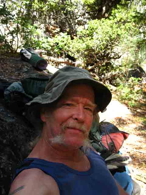
Alex Wierbinski

Backpacking Lake Tahoe to Mount Whitney
Your guide to the High Sierra Crest, including the Tahoe to Yosemite, Pacific Crest, and John Muir Trails
