The Trails
Guide
Maps
Miles/Ele
Permits
Resupply
Forum
Current Weather Conditions
Weather Notes
Northern High Sierras
Central High Sierras
Southern High Sierras
Gear
Gear List
Gettin Started
Layering
Discussion
Testing yourself and your gear
Gear Reviews
Trail Segment
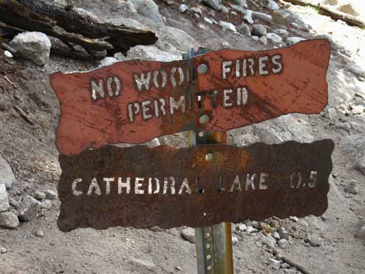
Cathedral Lakes
to
Sunrise High Sierra Camp
Trail Section
Tuolumne Meadows to Yosemite Valley
BACKPACKING
YOSEMITE NATIONAL PARK
Section Hiking
The John Muir Trail
South
to
Happy Isle
Languages
Languages
Trail Arts
The art of walking
Physical Preperation
Trail Skills
The trail
Off the trail
Scrambling
Maps
Navigation
Camp skills
Food
Resupply
Food
Other
Photo Catagories
Trail Stories
Trail Culture
News and Science
Links
Groups
Books
Terms and Conditions of Use
| Trail Guide INDEX Tuolumne Meadows to Yosemite Valley |
Trail Guide NORTH Tuolumne Meadows to Cathedral Lakes |
Trail Guide SOUTH Sunrise HSC to Little Yosemite Valley |
7.5 Topo |
30 min |
MILES Tuolumne Meadows to Yosemite Valley MILES and ELEVATIONS |
TOPO MAP INDEX Central Yosemite |
Resupply South |
PERMITS National Forests & Parks Toiyabe & Stanislaus & Yosemite |
|
Cathedral Lakes
to
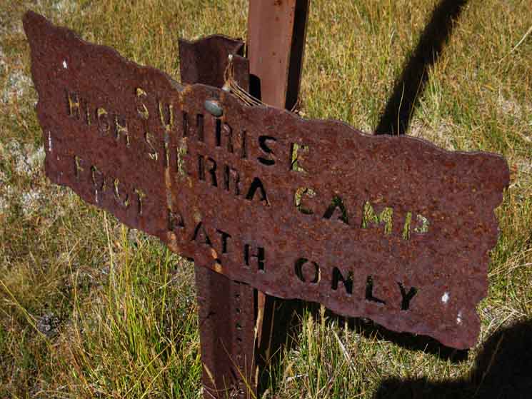
SUNRISE
High Sierra Camp
Page Below
Miles & Elevations Tuolumne Meadows to Yosemite Valley
Backpacker Resources
Lakg the Tahoe to Yosemite Trail. |
||||||||||||||||||||||||||||||||||||||||||||
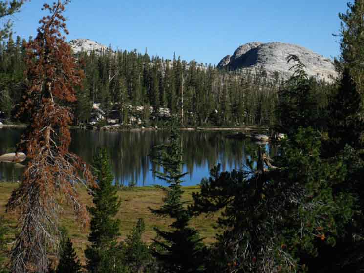
Lower
9430 feet 4.05 miles South of Tuolumne Meadows 21.8 miles North of Yosemite Valley
The John Muir Trail
The John Muir Trail
Maps and Miles
Miles & Elevations Tuolumne Meadows to Yosemite Valley
|
Cathedral Lake Trail Junction
to
Sunrise High Sierra Camp
VIDEO
Upper Cathedral Lake through Cathedral Pass and down and around to Sunrise High Sierra Camp.
|
Lower Cathedral Lake
Trail Junction
SPUR TRAIL
SOUTHWEST:
Spur Trail
to
Lower Cathedral Lake
 |
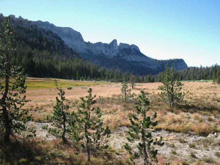
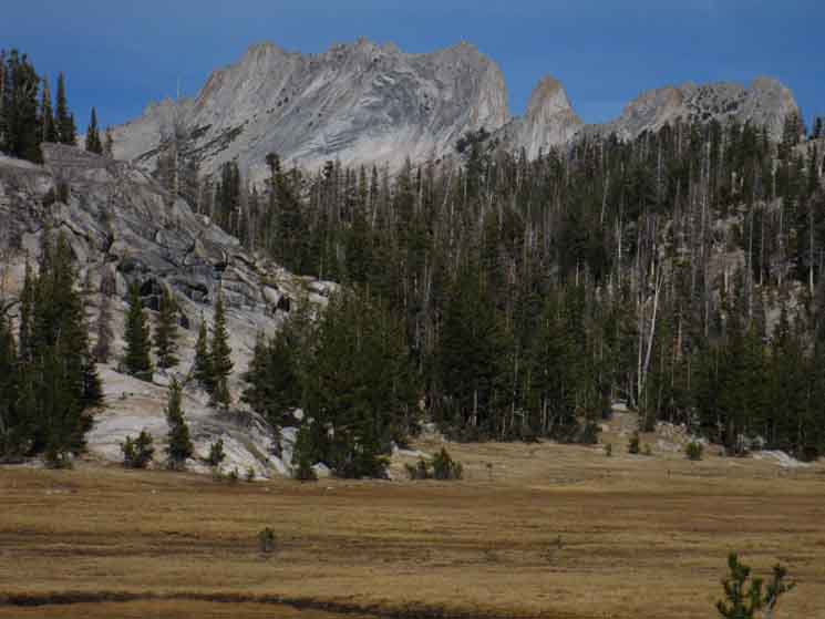
Above: Lower Cathedral is at the end of a sweet half-mile spur trail. We explored Lower Cathedral Lake on the last guide page to our North. Lay of the Land Upper Cathedral Lake is nestled-in surrounded by tufts of meadow and islands of isolated granite formations on this nifty shelf wedged-in under Tressider Peak and above the lower Lake. Our Southbound John Muir Trail tracks up to near the Northeastern corner of Upper Cathedral Lake, then is deflected around the perimeter of the thin meadow wrapping the East and Southeast Shores of the Lake by restoration work. Easy-Peasy A gentle grade brings us up to and through Cathedral Pass. The transition from rising to descending is subtle, and we find it somewhat ironic that these gentle grades are bringing us into one of the most sheer and precipitous landscapes in the world: The Yosemite Wilderness wrapping around Yosemite Valley. So begins our 16.71 mile great descent into Yosemite Valley. What a Long, Strange Trip its been Our plan is to drop into the Central Yosemite Wilderness along the classic route of the John Muir Trail, then climbing out along a different route. Our plan is designed to give us as much scope and perspective on the Central Yosemite Wilderness as possible while fitting perfectly, complimenting really, the overall design of our Tahoe to Whitney backpacking trip. The Numbers Good to the Last Drop Wild Nature I speak of substantial lengths of time and space within Natural spaces unmitigated by human influences. Our mental and physical health, as well as our meaning, both as individuals and as a society rely on this relationship between man and Nature. Cultivate yours. Let's plow on. |
North JMT
Back
to
Tuolumne Meadows
(The Top of The Previous Page)
 |
||||||
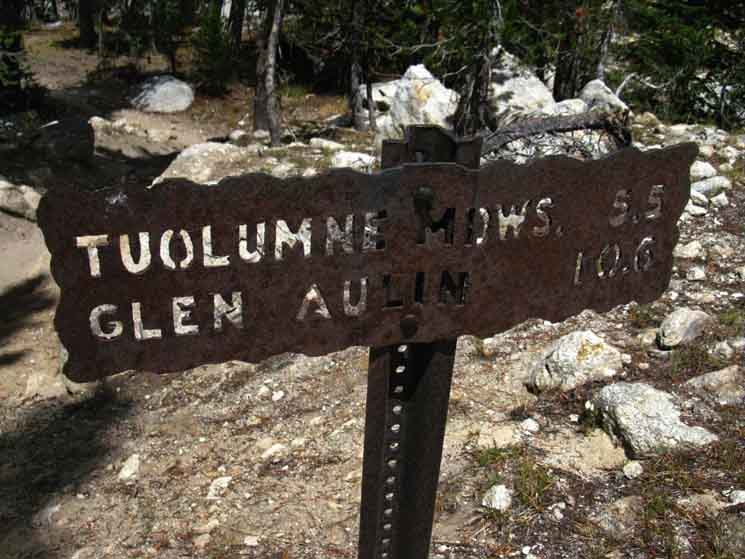
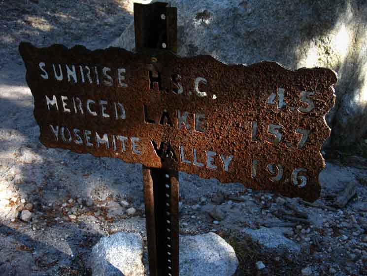
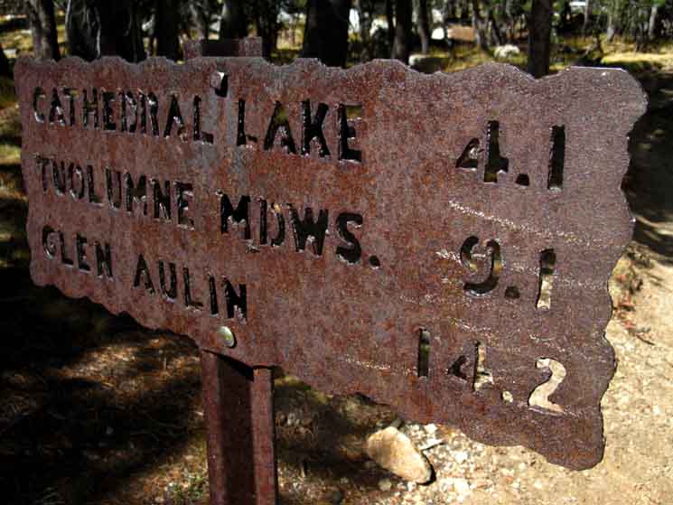
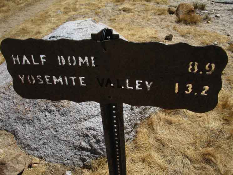
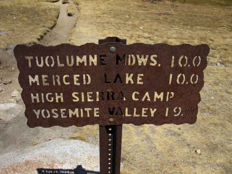
Yosemite miles sign cites 5.5 miles as the distance from Tuolumne Meadows to the Lower Cathedral Lakes junction. I cite 4.05 miles from the Post Office in Tuolumne Meadows to this junction, while I am assuming that the Yosemite Trail Miles Sign above, and all of them referencing TM, are refering to the distance to Tuolumne Lodge, which is another mile and a half to the East beyond the location of the Post Office. That distance, from this trail junction to Tuolumne Lodge, is 5.51 miles by my measurements, hiking there along the routes described on this guide above, and depicted on the maps linked to below. We discussed these mileage issues above, as we crossed the Wilderness Boundary hiking here on the John Muir Trail. Miles and ElevationsInformation
Let's put this into context on the maps.
|
South JMT
Cathedral Lakes
to
Sunrise High Sierra Camp
(Continuing Down this Page)
 |
||
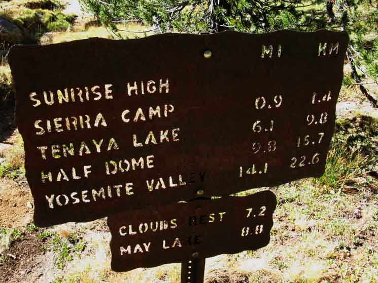
Steel Yosemite Miles Sign Tuolumne Meadows to Yosemite Valley We can skip from one Yosemite Trail Miles Sign to another leading down to Yosemite Valley on the This allows us to compare the miles cited on the Yosemite Trail Mileage Signs with those cited on the guide, and against other sources and in comparison with our own mapology.
|
To
Upper Cathedral Lake
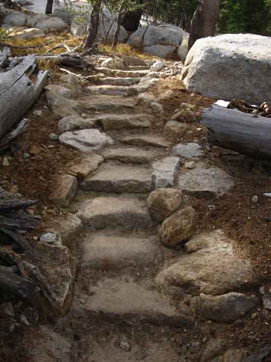 |
| Very Nice Staircase. Granite stairs climbing towards Upper Cathedral Lake from Lower, Yosemite above Tuolumne Meadows. |
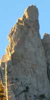
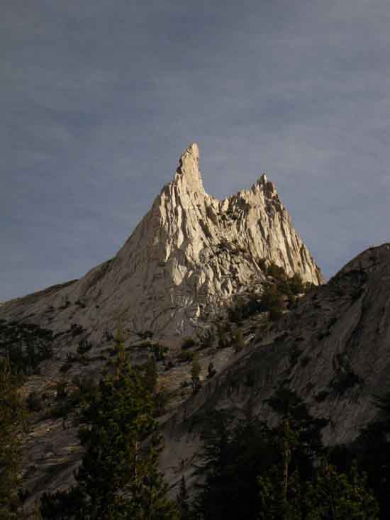
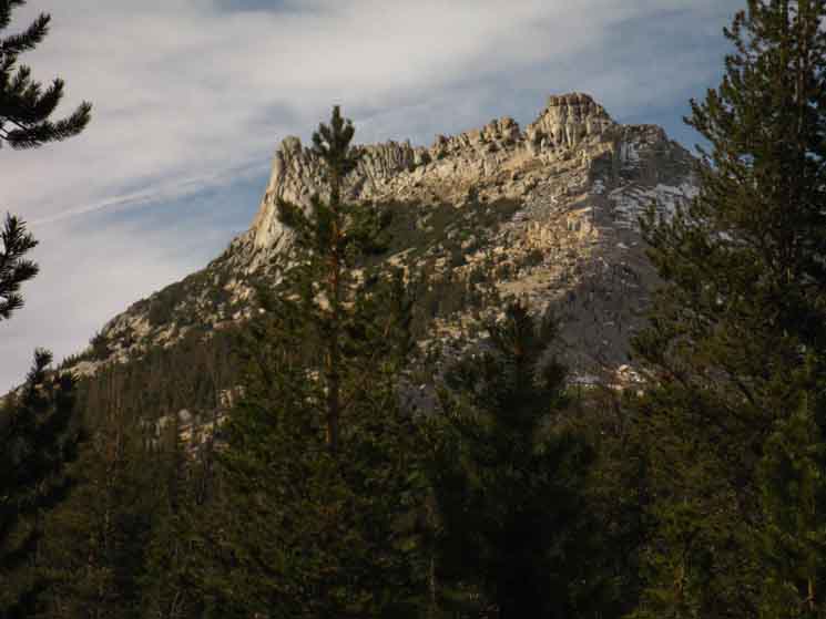
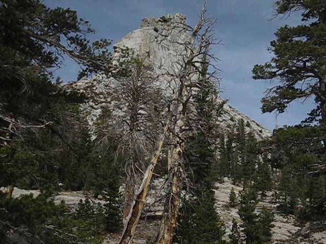
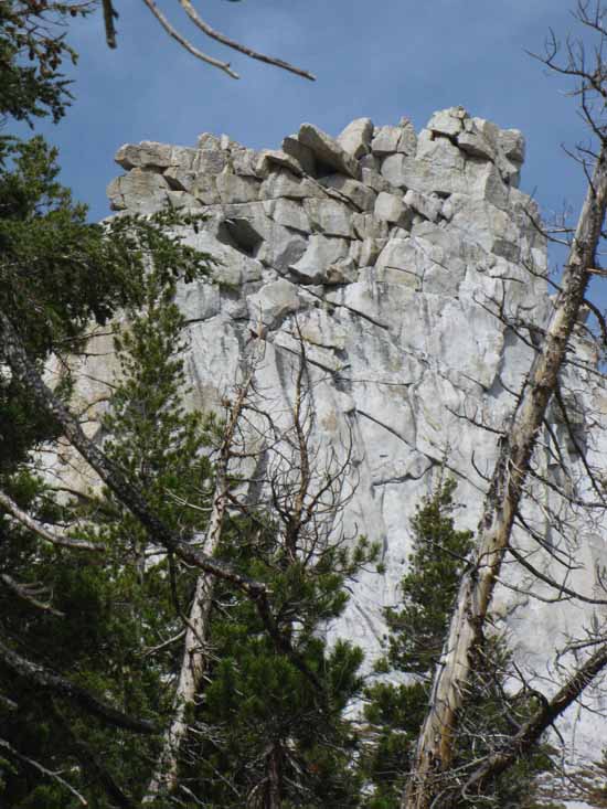
Cathedral Peak
 |
||
Another Aspect.
|
Climbing to Cathedral Pass
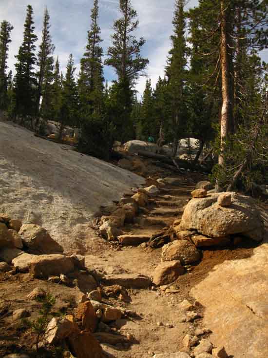 |
| More fine stairs, these crafted of stone bleeding out the rusty orange of oxides impregnating lines of local rock, on our way hiking up to Upper Cathedral Lake, Yosemite National Park. |
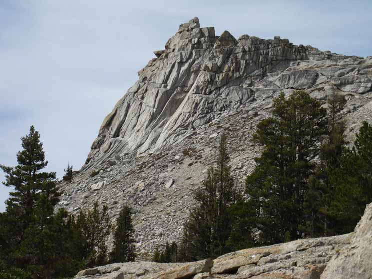
Tresidder Peak
 |
||
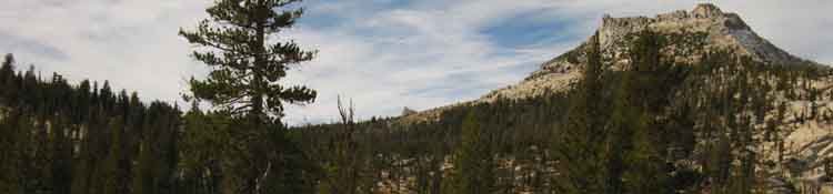
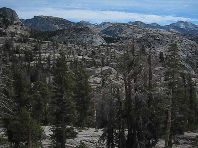
Tresidder Peak comes into view rising above the forest as we approach the upper flat, and our changing position begins to unmask the full view of the mountains ringing Cathedral Lakes.
|
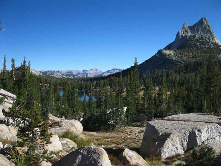
Upper Cathedral Lake Marker
9600 feet 4.59 miles South of Tuolumne Meadows 17.21 miles North of Yosemite Valley
The John Muir Trail
Maps and Miles
Miles & Elevations Tuolumne Meadows to Yosemite Valley
|
Tressider beyond Upper Cathedral lake
 |
Approaching Upper Cathedral Lake we find the expansive meadow wrapping its North Shore opens up nice views of Tresidder Peak beyond meadow and lake. The gentle slope of the upper basin up towards Cathedral Pass, being the lowest point below the Left flank of Tresidder Peak, gives us some indication of the moderate degree of difficulty of our upcoming hike through the pass. |
Trail approaches closest point to Northeast Shore of Upper Cathedral Lake
 |
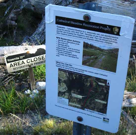
| Trail sign marking Upper Cathedral Lake location and restoration. |
Restoration Orders
 |
||
Cathedral Meadow Restoration Orders.
|
OLD & NEW
Routes
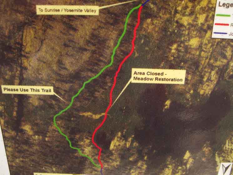 |
||
Upper Cathedral Lake meadow restoration notice. Translation
|
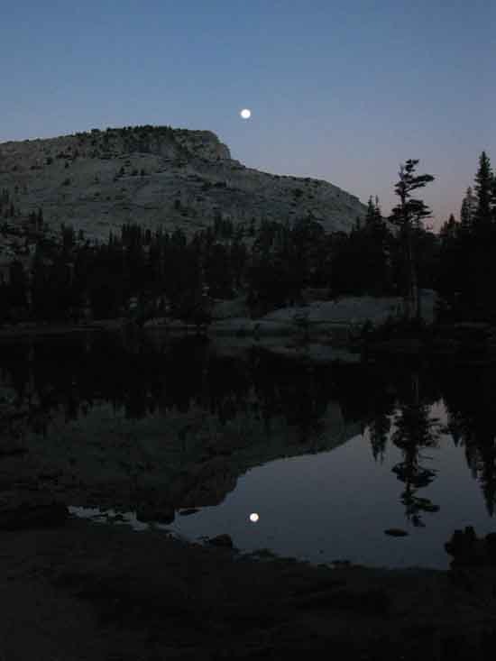
Time Moves
Approaching Morning Moonset
Air & Water
STILLNESS
 |
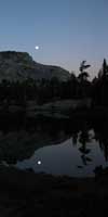
||
Full Moon approaches set as the Sun behind us approaches rise. It's been a bright, almost full Moon night. We get up early on the trail, and are up earlier the longer we stay on the trail. Arriving into the heart of Yosemite indicates we've been on the trail for awhile now along the hike down from Lake Tahoe. We are getting up quite early, as it suites our plans. Our plan now is to set-up so we hike into Yosemite Valley in the morning, at the beginning of a day, rather than hiking in at the end of the day. We are going to push to camp in Little Yosemite tonight, then make an early hike into The Valley the next day. Oh, and the stillness. The very early morning has some of the most still moments of the day. Be chill, Observe the Still.
|
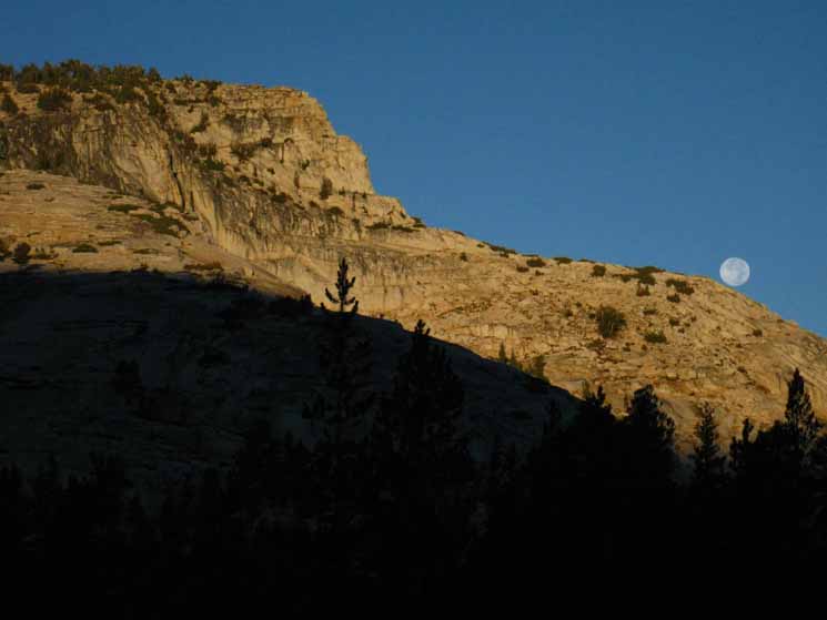
Post-Sunrise
Moonset
Over Upper Cathedral Lake
 |
||||
As the image above shows the Sun rose before the Moon set we know that the Moon is a bit past "Full." A full Moon happens when Moon set and Sun rise happen at exactly the same time. This represents the time the Sun, the Earth, and the Moon are all on exactly the same line at exactly the same time. That alingment defines the actual moment constituting a full Moon. Sometimes "fullness" lines up with our observed Sunrises and sets, other times it does not. It is a full Moon when the Sun rises at the moment of Moon set. (Morning) The position of the Moon above indicates that we are past full Moon. The reason is the Moon is orbiting the Earth counter-clockwise, relatively moving towards the Sun when transitioning through its phases. In the image above the Moon has already "orbited" closer to the Sun past, or above the position of full alignment in the morning. This evening the Sun will set before this just past-full Moon rises.
|
Upper Cathedral Lake
View to Northwest
 |
Upper Cathedral Lake, with Mendlicott Dome rising in the background. Yosemite. Climbing Mendlicott Dome |
View North-Northeast
 |
||
Aspects of Cathedral Peak Note the line running from the collar of forest around Polly Dome cleanly up to the pointy crest of Cathedral Peak. Check out how this terrain looks when we get views of Cathedral and Tresidder Peaks as we descend from the end of Cold Canyon to Glen Aulin along the combined routes of the Tahoe to Yosemite and Pacific Crest Trails through the North Yosemite Backcountry. The line formed by the ramp of terrain from the back of Mendilcott Dome East up the crest of Cathedral Peak create a distinctive line looking from the North, as well as our view from the South above. It's quite a view.
|
North Yosemite Backcountry beyond Upper Cathedral Lake
 |
The Sierra Crest wrapping around the North Yosemite Backcountry in the furthest distance beyond Cathedral Peak and Upper Cathedral Lake. The two images above highlight how different season's light changes how everything is, and how it looks. |
Detail of North Yosemite Backcountry
 |
||
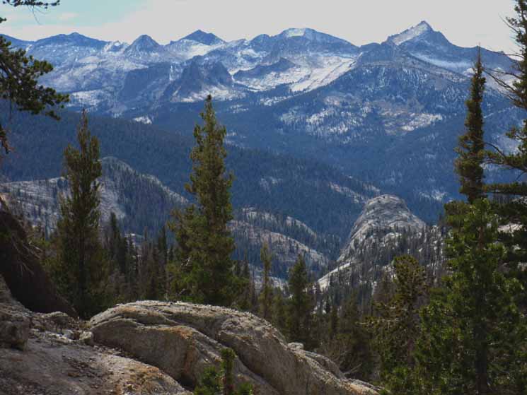
North Yosemite backcountry from above Upper Cathedral Lake. See the brightly-lit wall in the lower Right hand corner of the distant granite range above? North Yosemite Backpacking Map Spiller Creek runs down the canyon on the far distant Right below Whorl Mountain and Matterhorn Peaks, which rise above Spiller Creek's Canyon as the highest points along the Sierra Crestline. Well, Matterhorn Peak is along the Sierra Crest, with Whorl Mountain being a bit down on the Western Face ridgline separating Spiller Creek in its canyon on the Right from Matterhorn Creek in Matterhorn Canyon on its Left. To the Left of Matterhorn Peak sits the iconic two major teeth of the Sawtooth Range segment of the Sierra Crestline. Matterhorn Canyon winds its convoluted way down the West Flank below the Sawtooths. Further left along the Crestline, at the end of our most-distant view of the Sierra Crestline sits the tilted-top pyramidal shape of Quarry Peak. Most of the peaks on the far Left of the image are below the actual Sierra Crestline.
|
Another Detailed View North
Whorl Mountain and Matterhorn Peak in the North Yosemite Backcountry
 |
We're hiking South up beyond Upper Cathedral Lake approaching Cathedral Pass looking back to our North at the North Yosemite Backcountry, specifically the ridgeline descending West off the Sierra Crest at Matterhorn Peak dividing the Matterhorn drainage on the Left from that of Spiller Creek on the Right. The route of the PCT-TYT runs across both canyons just at our level of visibility across the treetops. |
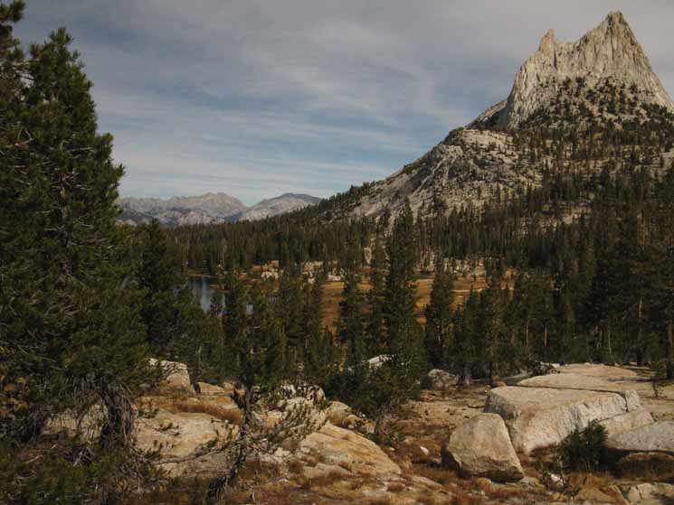
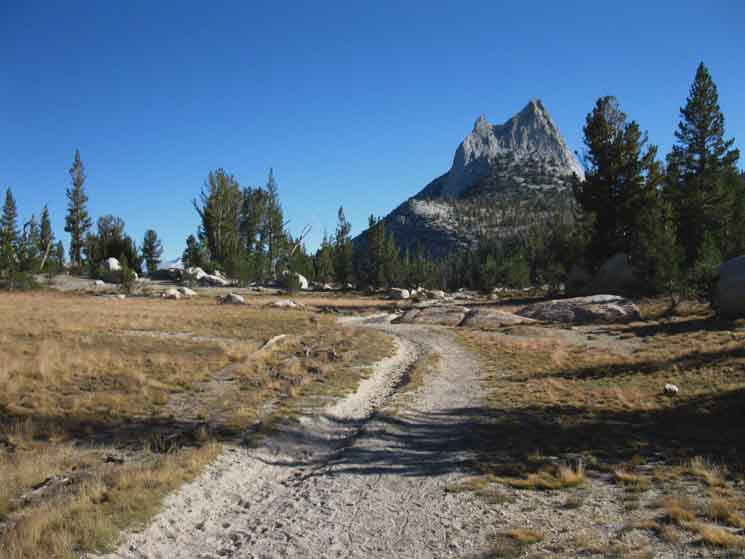
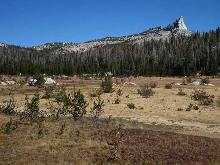
| Cathedral Pass along the John Muir Trail 9720 feet 5.09 miles South of Tuolumne Meadows 16.71 miles North of Yosemite Valley
The John Muir Trail
Maps and Miles
Tuolumne Meadows to Yosemite Valley
|
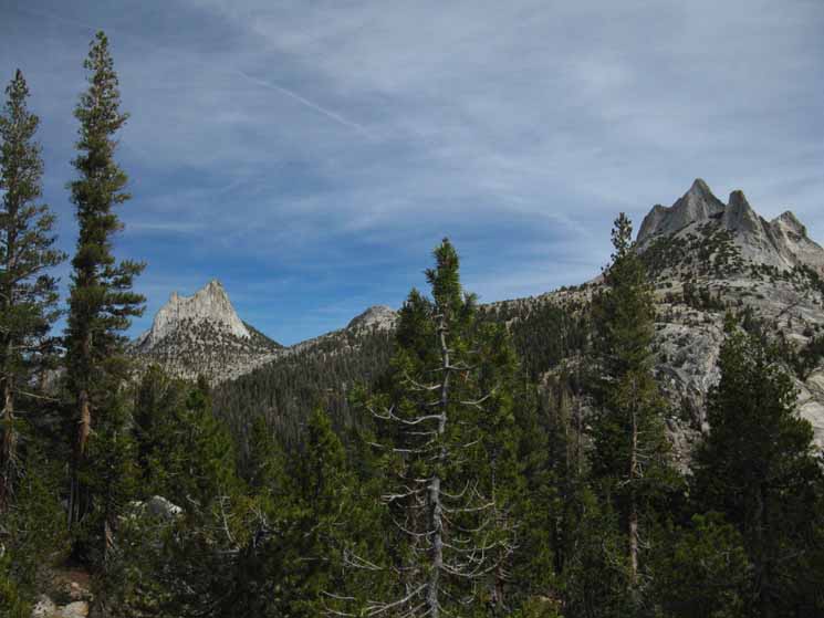
Cathedral Peak
Rises beyond the low line of Cathedral Pass
 |
||
Looking North at Cathedral Peak beyond the low saddle of Cathedral Pass.
|
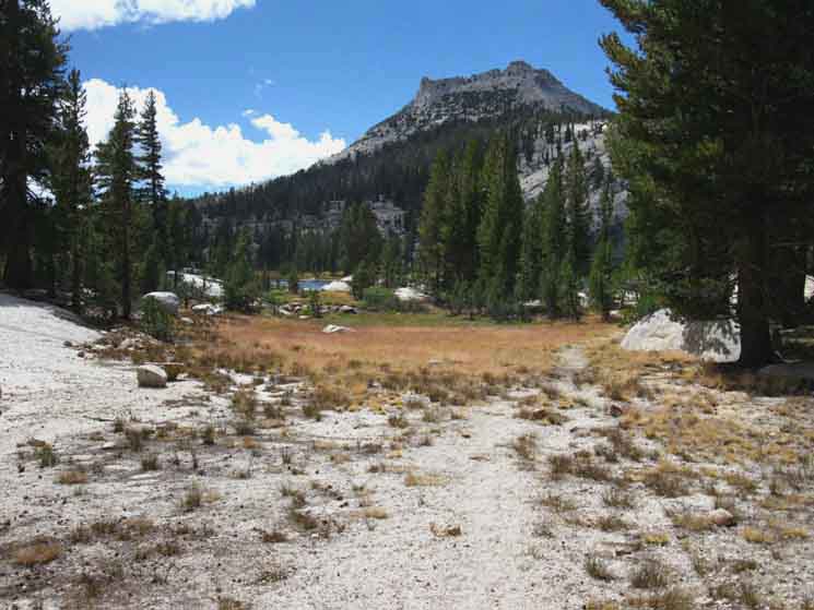
Western Meadow below Cathedral Pass
 |
Looking South down the meadow running South from Cathedral Pass. We take note of how this little high meadow reminds us of the much longer run of the great meadow down Cold Canyon. |
High Life
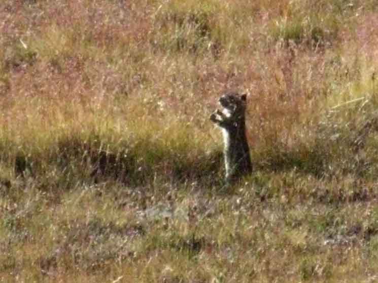 |
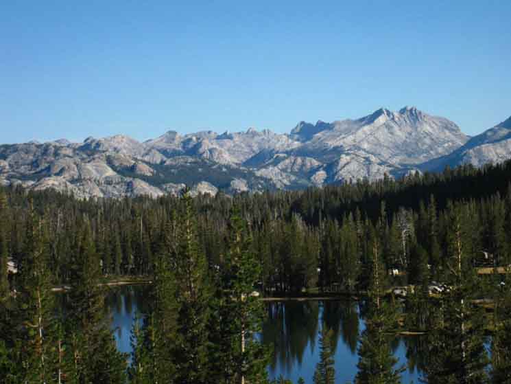
Meadow Dogs, otherwise known as Belding Ground Squirrels did not seem as common up here as in Cold Canyon. Looking North and South across Tuolumne Meadows as we hike across the North Yosemite Backcountry into the Central Yosemite Wilderness gives us three wonderful perspectives on each from the other. One perspective looking at the terrain we approach, the another as we hike through, and finally looking back as we depart. My head is spinning as if on a swivel. |
View East-Southeast
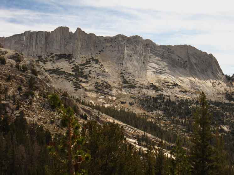
Matthes Crest running South below Echo Peaks
 |
||
Looking down Matthes Crest after crossing Cathedral Pass on the John Muir Trail. View of Matthes Crest from Sunrise HSC trail junction. Our trail moves West to begin a gentle traverse along the ridgline bringing us up under the end of
|
Echo Peaks
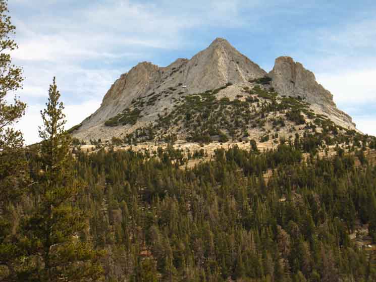 |
Echo Peaks to our East. The alingment of Cathedral Peak with Echo Peaks creates the outline of an amalgamation of their peaks when viewed from certain perspectives as we descend towards Glen Aulin on the PCT-TYT. |
Matthes Crest
 |
||
Matthes Crest running South from Echo Peaks.
|
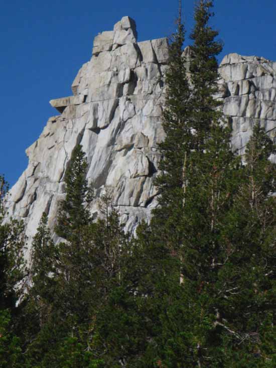
Moving into Forest trail Traversing along ridge ending in Colombia's Finger
 |
| Trail climbing moderately to our South to Colombia Finger from Cathedral Pass. |
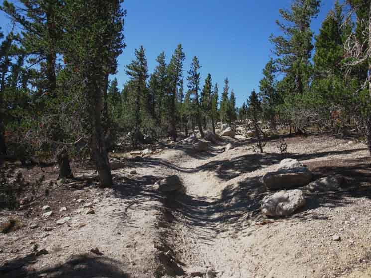
Yosemite Pavement
 |
||
Almost paved trail traversing up to pass under and around Colombia's Finger.
|
A Hard Climbing Trip
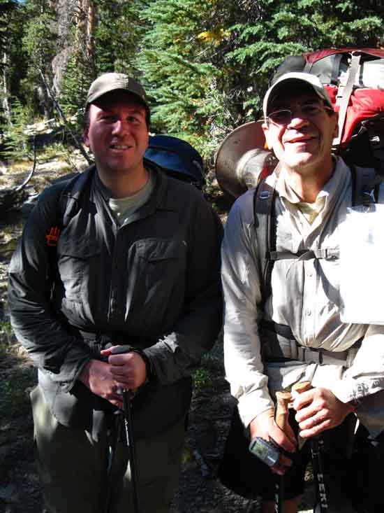 |
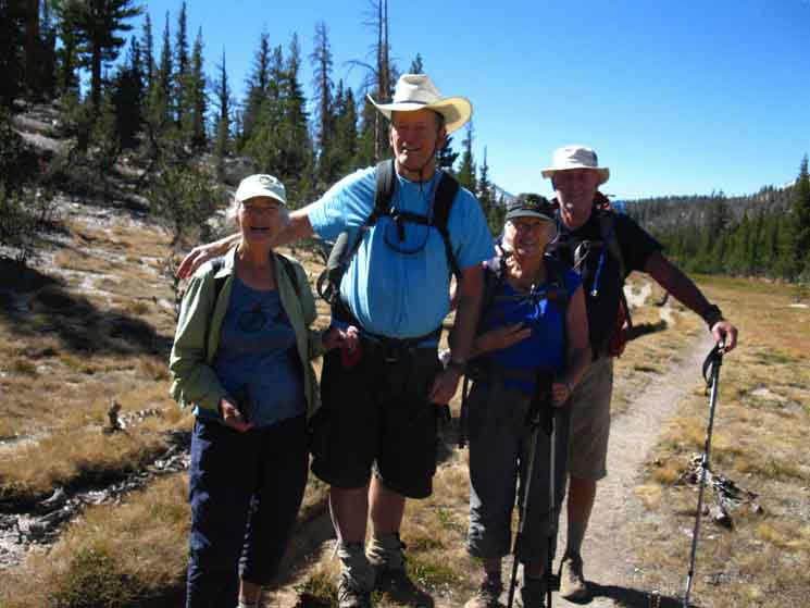
| Miller Bros, Matt and Rick hiking from The Valley to Tuolumne Meadows. |
Hiking South by the Compass
Trail into Open Terrain above thinning Forests
 |
||
Hiking South getting under the East Flank of Colombia's Finger, which rises above us to our West, our Southbound Right.
|
View Northeast
 |
||
Looking back at Echo Peaks and Cathedral Peaks along their shared crestline. I really like how these peaks look from the bottom of Cold Canyon, and again the unique views we get as we descend towards Glen Aulin High Sierra Camp. Now we are getting views North, at the North Yosemite Backcountry back through the "gunsight" at the North Yosemite Backcountry, above, just as we got some good looks from from up there in Cold Canyon at this West end of the Cathedral Range.
|
Sooty Grouse? Mountain Chickens!
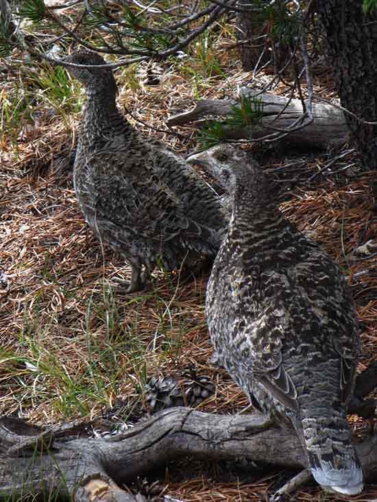 |
||
Sooty Grouse couple and I surprise each other, but nobody freaks out.
|
Matthes Crest as we approach end of Colombia Finger
 |
Looking at Matthes Crest from Colombia Finger. Cathedral Pass to Yosemite Valley Things are taking a turn towards awesome. |
East Flank of Colombia Finger
 |
||
Above us to the West rises the East Flank of Colombia Finger.
|
Detail East Flank Colombia Finger
 |
||
Second, closer look at the East Flank of Colombia's Finger. Sweet crackage.
|
Under Colombia Finger
 |
| View of Colombia Finger from under the nose. |
Detail East Flank Colombia Finger
 |
||
Our last look at the East Flank crest of Colombia's Finger.
|
Local Explorers
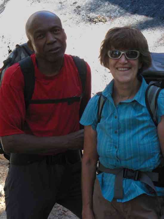 |
Leroy and Margot. Leroy was Climbing local walls and exploring the vertical as Margot was hiking about exploring the horizontal. |
Overview Under
Colombia Finger
 |
||
Nice break spot with great views under Colombia Finger, though with no water nearby. That's Clarks Peak of the Clarks Range almost directly to our South. Central & South Yosemite Hiking Map
|
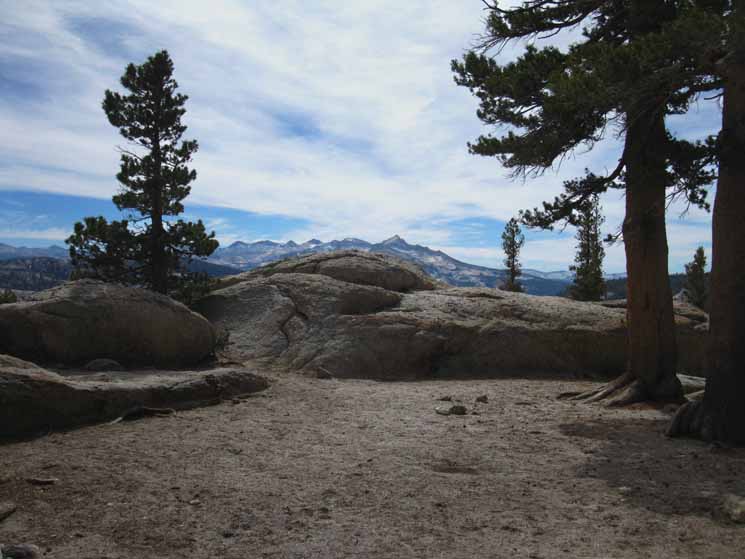
| Transitions
Unveiling We've been pointed almost directly South since passing the Upper and Lower Cathedral Lakes hiking up to and over the gentle rise of Cathedral Pass's 9680 feet of elevation. Hiking South from Cathedral Pass our views are limited to the sweet meadow descending gently in elevation to our South, and the stunning canyon walls bracketing the meadow. To our East, our Southbound Left, we have a fascinating view of the amazing shape and structures of Matthes Crest's sheer cliffs, buttes, and gaps along its quite complex and convoluted ridge line opening to our view as we hike South. It's shapes and structures are well-accented by an amazing range of textures and subtle graduations of color and contrasts across its many distinct surfaces under changing light conditions. Behind us, turning to look North-Northeast, we see the distinctive line-up of Cathedral Peak and Echo Peaks along their shared ridgeline. To our West the crestline dropping off Tresidder is running up to the pointed spire of Colombia Finger, most of which is masked from view during our traverse by the terrain itself, until we hike up to the end of the ridge. After hiking South through Cathedral Pass our trail bends gently to our Right, to the West, to begin a gentle climbing traverse along the moderately-forested ridgearm of the Western wall of the canyon surrounding this high meadow. As I mentioned, the Western wall is the spur of ridge running South from Tresidder Peak who's end is capped by the distinctive Colombia Finger. As our hike to the South end of the Colombia Finger ridgearm progresses we get far enough South to put us beyond the South end of Matthes Crest. Our changing position begins to open up amazing views, first to our East looking past and around the South end of Matthes Crest opening up grand views of the Southern end of the Cathedral Range. Wow. An angry ocean of great granite whitecaps opens up to our East, then of the Clarks Range in the South Yosemite Wilderness as we get to the end of Colombias Finger. As we get closer to the end of the ridgline terminating under Colombia's Finger we begin to emerge from forest cover and views obscured by terrain we get our first sweeping views South of the whole darn Central Yosemite Wilderness. Central & South Yosemite Hiking Map All of the Central Yosemite Wildeness is visible from here. Except the lower elevation areas masked by the terrain. Though we can see the massive gash of the Merced River Canyon, its rim is masked by the terrain. The Central Yosemite Wilderness bounded by the Cathedral and Clarks Ranges rising above the shores of the Merced River is always reminiscent of classic Hokusai scenes to me, but executed in granite by ice, rather than in water by winds. I believe the link I see between Hokusai and the Sierra is centered in their shared expression of the overwhelming power and beauty of Nature, the smallness of man, and the timeless consistency of great forces interacting on scales beyond the gratifications of men. Merced Canyon From our position under Colombia's Finger our view is not centered on Yosemite Valley, but our eyes are naturally drawn to the grand granite gash of the Merced River cutting the Central Yosemite Wilderness into two distinct parts, with an angry looking sea of mountain peaks rising far above both of the banks of the hidden depths of its deep granite channel. Again, wow! Cathedral Range Rises above the North Bank Clarks Range Rises above the South Bank We're going to stand here, maybe even stop for a while and take off the pack, while we are overwhelmed by the grand scale of natural beauty before us for awhile, before continuing on our trail around the base Colombia's Finger to lose this remarkable view dropping into the top of Long Meadow. Western Flank Wonderland The actual line of the Sierra Crest South of Tioga Pass is represented by the Kuna Crest rising above the East side of Lyell Canyon, which turns even further East to the South of Yosemite, bisecting Mammoth Mountain before running South along the Mammoth Crest. |
View
East-Southeast
Beyond
South End
of
Matthes Crest
Looking Left from under Colombia's Finger
 |
|||||
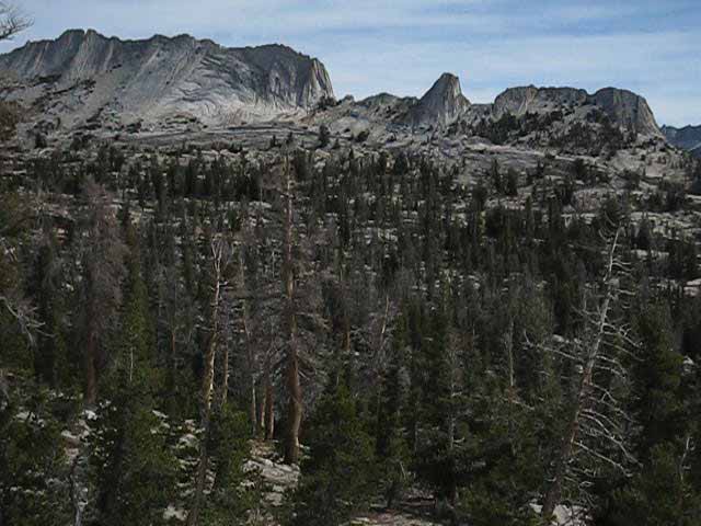
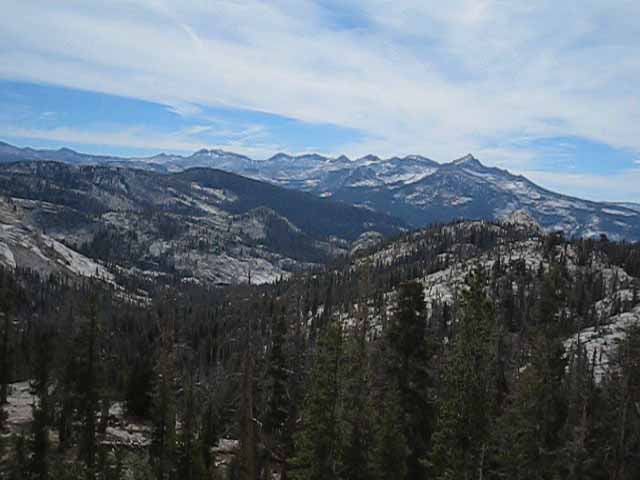
A unique view of Cathedral Range, Yosemite. We are gazing East by Southeast from under the Eastern flank of Colombia's Finger. The rising dome in the upper-Left corner of the image is the second to last structure on the end of Matthes Crest, the low dome to its Right being the last. On the far-Right edge of the crestline we have the majestic bulk of Mount Florence, to its Left the pointy peak of the ridge directly North of Mount Florence, Peak 11981. To the Left of that we can see Vogelsang Peak, with a triangular streak of white/light terrain just Right of its rounded crest. Can you see the faint white, slightly triangular vertical streak down the face of Vogelsang? The pointy peak rising from behind Vogelsang Peak's Left shoulder is either Simmons Peak or the the peak immediately to the South of Simmons Peak. I can't tell from here, with the way the relative positions of this sea of peaks one-to-another rotates with our position. Getting context on this ocean of mountain peaks is an amazing navigational-overview orientation challenge. We a looking out across a vast amount of complex space, route lines, time, and finally; effort. Tuolumne Meadows Hiking Map
|
View
Looking a Bit East of South
The Clarks Range
View South from under Colombia's Finger
 |
||
The Clarks Range Our view above is looking almost directly South, just a bit East of South, from our position under Colombia's Finger. We are located at the very Southwestern end of the Cathedral Range looking across this part of the Merced River watershed rising above the South rim of Merced Canyon. That watershed is reaching up through the forests rising above the far South rim of the Merced Canyon into the sheer granite peaks topping the Clarks Range. We see the Clarks Range is stashed way-back in the Central Yosemite Wilderness. Mount Clark is the highest peak on the Right side of the distant crestline.
The highest peak on the far Right is Mount Clark, the next peak to its Left along the Crestline is Gray Peak. Can you see the three granite slabs on the otherwise uniformly forested low ridge in the middle-distance? We can see them more clearly on the upper image, right above the granite horn. Merced Lake lays at the base of the far side of the position of those slabs on that ridge. Though we cannot see it from this angle, the bottom of the Merced Canyon is carved through pure, dense, close-grained granite of the most magnificent composition. I am comparing Yosemite/Merced granite against all the granite compositions up and down the Sierra Crest. (It changes dramatically) This stuff here is the cadillac of High Sierra granites in terms of density, uniform composition, grain, and color. It is also especially amazing in terms of its extent, its depth, and its wide distribution. This is the only place I say this: "It gets better as the lower we go." Our position under Colombia's Finger gives us a stunning perspective on the Clarks Range Mountains rising above the South bank of Lake Merced, really rising above the South Bank of the whole length of the Upper Merced River, albeit as seen through the bad images above.
In the image above the Sun was rising, reflecting off all the sheer granite surfaces, washing everything out for the camera. But not the eye! It was a sweet view under the harsh rising Sun. It makes them stand out. Central & South Yosemite Hiking Map
|
West
down into Upper Long Meadow
 |
| Moving Southwest under the bottom of Colombia Finger into the top of Long Meadow. |
Into the Top of Long Meadow
 |
||
Hiking thought thinly forested slope descending from Colombia Finger to enter the top of Long Meadow. Cathedral Pass to Yosemite Valley
|
COLOMBIA GIVING YOU THE FINGER:
GREAT WORK AMERICA...
 |
Colombia Finger across upper Long Meadow. Our John Muir Trail route came around the base of Colombia Finger before dropping into the top of Long Meadow. |
Sunrise Day Hikers
 |
| Campers from Sunrise High Sierra Camp day hiking up to the top of Long Meadow. |
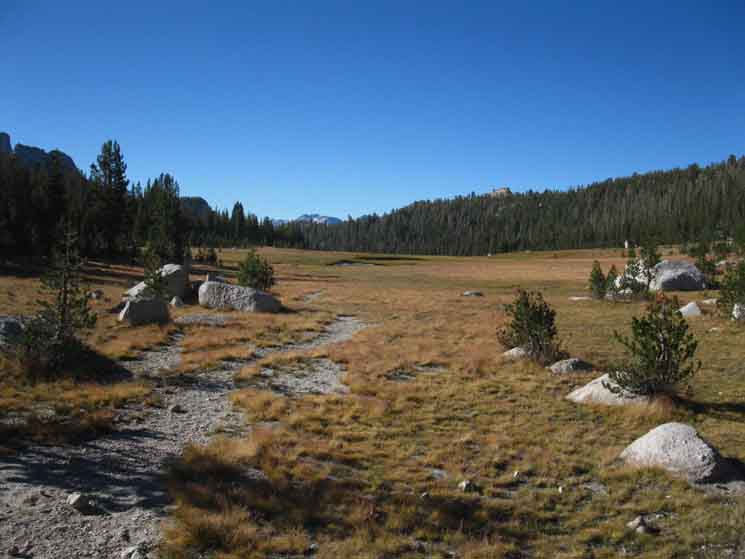
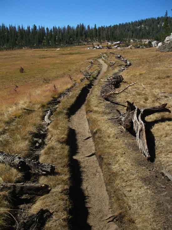
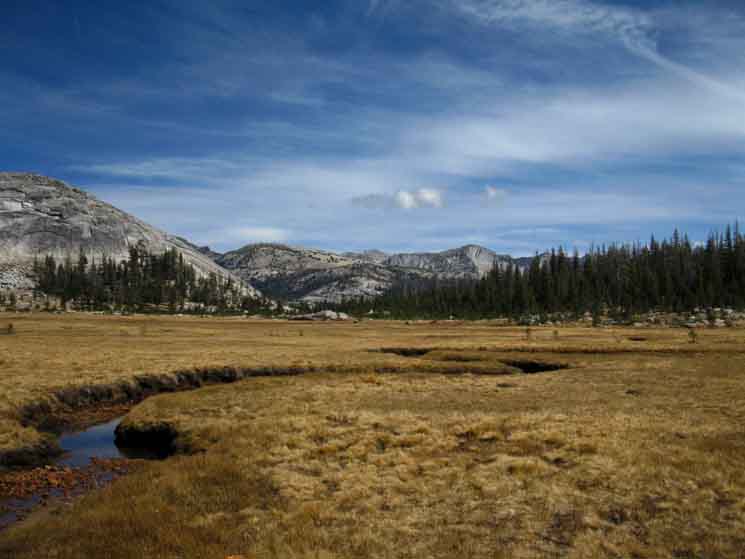
Long Bending Meadow
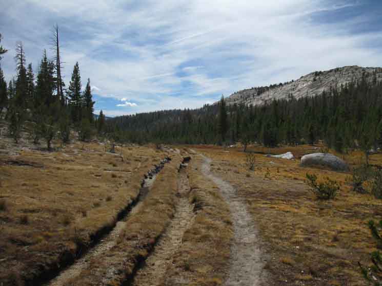 |
Triple lane trail worn into Upper Long Meadow. Long Meadow bending as we approach the upper reaches of this branch of the Cathedral Fork of Echo Creek. |
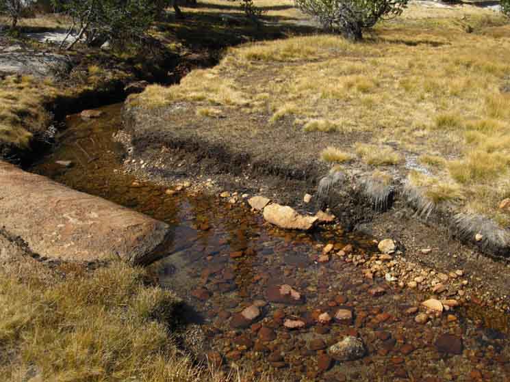
Cathedral Fork is Dry up Here
 |
Ford point of Cathedral Fork of Echo Creek in Long Meadow. Cathedral Fork drying out very early in the Summer during drought and dry times. |
Still Water, But not for Long
 |
| Cathedral Fork still holding a little barely-running water. We can's depend on water up high during dry times, such as those between 2013-2015. |
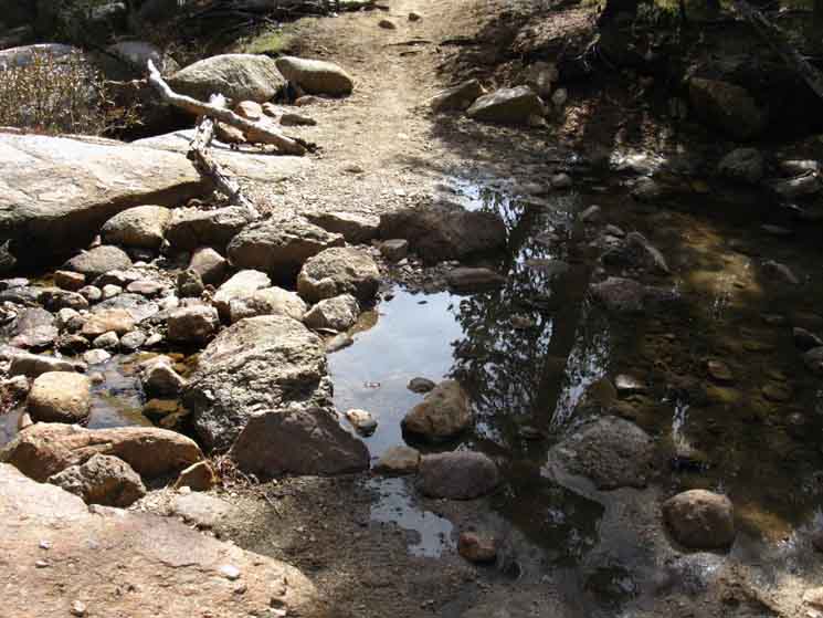
| Upper Long Meadow Trail Junction along the John Muir Trail 9520 feet 7.63 miles South of Tuolumne Meadows 14.17 miles North of Yosemite Valley
The John Muir Trail
Maps and Miles
Miles & Elevations Tuolumne Meadows to Yosemite Valley
The trail tracking East off our John Muir Trail route out of this junction shorty drops into the canyon to our East to follow the Cathedral Fork of Echo Creek all the way down to the floor of the Merced River Canyon just a short ways below Merced Lake. This trail opens up nice loop routes around the North-Central Yosemite Wilderness, or longer alternative routes to the length of standard route of the John Muir Trail linking Tuolumne Meadows to Yosemite Valley by swinging through Merced Lake before following the river down to Little Yosemite Valley to rejoin the JMT route. The 15 minute Cathedral Pass to Yosemite Valley map covers this optional route |
Trail Junction
in
Long Meadow
NORTHEAST TO TUOLUMNE MEADOWS AND HIGHWAY 120, THE TIOGA ROAD
 |
|||||
Back the way we came, out of the Northeast, back to Cathedral Lakes and Tuolumne Meadows. Tuolumne Meadows to Yosemite Valley
|
Down and Out
SOUTHWEST TO YOSEMITE VALLEY
 |
Down the Mountain on the John Muir Trail. We draw near Sunrise High Sierra Camp. Hiking Southwest on the JMT in Long Meadow opens up a wide range of classic Yosemite trails to amazing features along many interesting loop and trailhead to trailhead trips. The sign above is now referencing the trail climbing West from Sunrise High Sierra Camp to Tenaya Lake, located to the West of Tuolumne Meadows on Highway 120. The trail to Tenaya Lake also intersects with the North end of the trail to Clouds Rest. The plot thickens. Central Yosemite Hiking Map
|
Long Way to Yosemite Valley
EAST, then SOUTH
 |
||
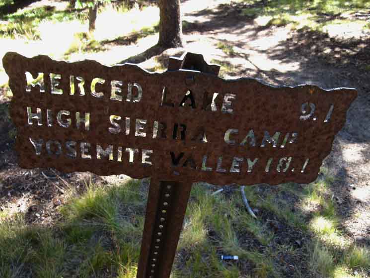
East, down to the Cathedral Fork of Echo Creek then South to Echo Creek all the way down to Echo Valley on the floor of the Merced Canyon located a short distance below Merced Lake. The sign above indicates 9 mile descents, first from here to Merced Lake HSC on the North end of the lake, then another nine from there down to Yosemite Valley. Nine point one to Merced Lake & Nine to The Valley. Call that the long way down to Yosemite Valley from here, with our JMT route being the most direct. Our next option for hiking up to Echo Valley and Merced Lake will open up when we arrive at the Merced-Washburn Lakes trail junction. This junction is located a bit further to our South along our John Muir Trail route between the upcoming Forsyth and Clouds Rest trail junctions.
|
Peak 9701 at the end of Long Meadow
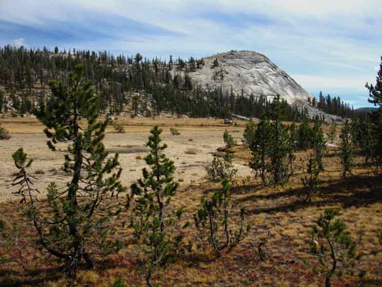 |
This peak always catches my eye and attention on the way through Long Meadow. I just like the "cut of its rock," its color and texture. I like the way it looks and feels in its role as the guardian of the bottom of Long Meadow. Looking South down Long Meadow at Peak 9701. |
Detail
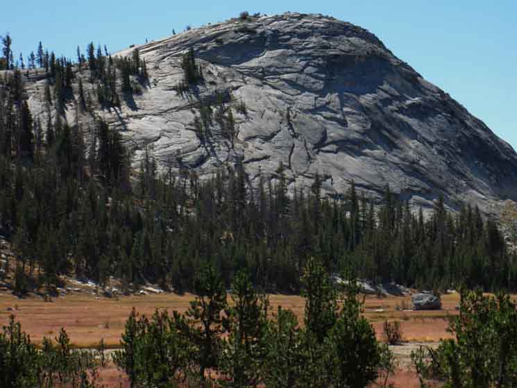
PEAK 9701
 |
||
Detail of Peak 9701 in Long Meadow, Yosemite, located at the end of the meadow beyond Sunrise High Sierra Camp.
|
Into Lower Long Meadow
 |
| Entering meadow around Sunrise's elevated position. |
Lower Long Meadow
 |
||
Yosemite Triple Trail Peak 9701 is off to our Left, our East.
|
| Sunrise High Sierra Camp along the John Muir Trail
9520 feet 8.44 miles South of Tuolumne Meadows 17.21 miles North of Yosemite Valley
The John Muir Trail
Maps and Miles
Miles & Elevations Tuolumne Meadows to Yosemite Valley
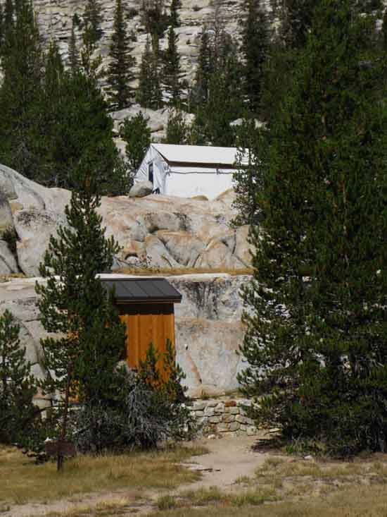
"Mary Curry Tresidder, president of the Curry Company, established the Sunrise High Sierra camp in 1961 and also equipped it with a canvas dining tent and stone kitchen structure. It overlooks Long Meadow on the John Muir Trail a few miles from Cathedral Pass." Yosemite High Sierra Camps I always visit the High Sierra Camps on my routes. I figure I will see what happens, say hello to the staff, and see if there are any cool folks hanging about. That would be friendy, and willing to share experiences. So I ask what is happening there, what has happened, and what I should look for in the area. Some of the staff-folks are "too cool for school," kind of like a poorer version of their snobby clients. Others of the staff and campers are nice folks. My point is that there is a mixture of characters naturally drawn to the High Sierra Camp environment, on both the staff and camper sides of the equation. Though I'm not a great fan of the "idea" of camps in our National Parks for rich folks, I always stop by to check out the weirdness of the High Sierra Camp system, and see if there's anyone interesting to chat with, and pick up any interesting bits of news that may be running up and down the trails between the HSC camps. |
Sunrise
High Sierra Camp
 |
|||
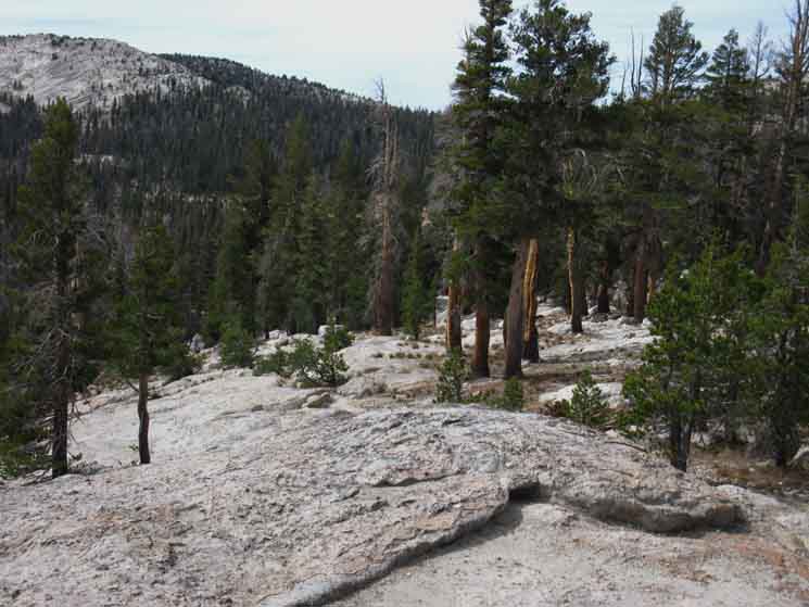
Foot trail to Sunrise High Sierra Camp from Lower Long Meadow. Hiking through the narrowing neck of meadow pinched between encroaching forests dividing the upper length of Long Meadow from the lower reveals the last run of Long Meadow bends to our Southeast, off to our Southbound Left, making its last run down the mountain as a meadow before ending at the base of Peak 9701. To our right we notice the Western edge of the bottom of Long Meadow is wrapped by a low granite wall, atop which is located Sunrise High Sierra Camp. A short trail from the sign above leads up to Sunrise High Sierra Camp.
|
Sunrise High Sierra Camp
on its
Perch
 |
||
Sunrise High Sierra Camp up on its rock perch above the Western edge of Lower Long Meadow.
|
Stairway to Sunrise
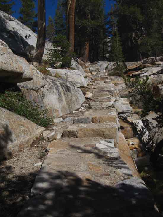 |
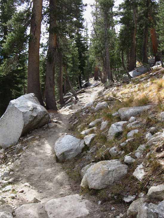
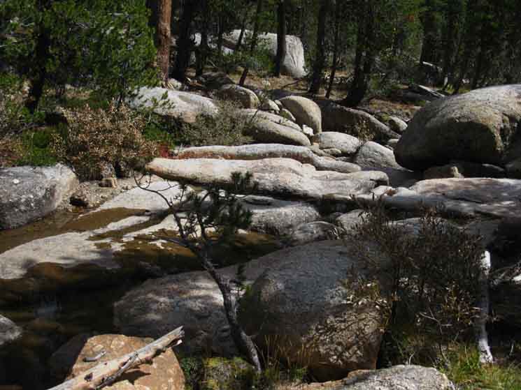
A very well crafted stairway to Sunrise. We've been hiking South in Yosemite for about sixty miles since entering the North Yosemite Backcountry, from where we've observed many examples of fine hard rock trail construction. Yosemite has spent considerable time, resources, and the labor of generations of trail workers maintaining its status as the crown jewel of the National Park System. As we are now approaching the heart of that jewel we are going to observe some of the oldest and finest trail work in Yosemite. In fact, we are going to be able to physically trace out previous "administrative" approaches to trails and public access by observing carefully. For example, we are going to encounter remnants of the previous asphalt-surfaced trail from Happy Isles up to at least as far as Nevada Falls, and I suspect paved trail once snaked its way up to the base of Half Dome. Different generations of Park Honchos represent different approaches to administering wilderness and access to it. |
Tahoe Billy
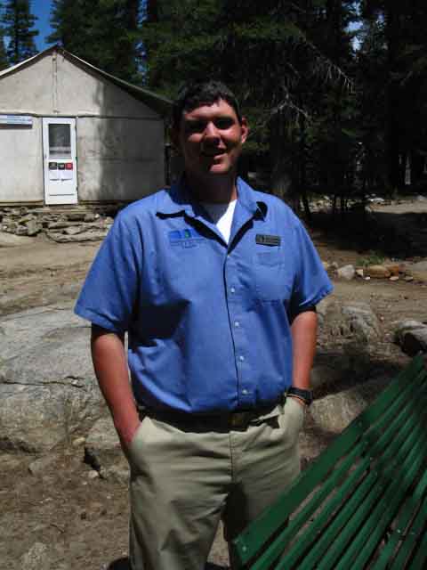 |
||
Tahoe Billy manages High Sierra Camps. I met him at Sunrise in 2012 after talking to him at Glen Aulin during 2009. Glen Aulin pictured above.
|
Sunrise High Sierra Camp
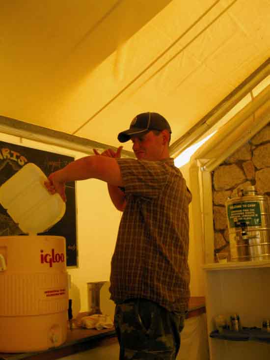 |
Tahoe Billy working the critical water scene at Sunrise High Sierra Camp during the great water shortage of 2012. High Sierra Camp folks are fairly unique. I mean the folks who work there. Many of the "guests" are quite trying. Rich Jerks. At least the ones who expect "luxury" and servants as they show how superior they are, by being in the wilderness. I find them very petty. I have come to see folks don't properly value things in the mountains if they don't carry them there themselves. It is a "character" thing. Other "guests" are in the High Sierra Camps because its the only way they can get access to the Splendors of Nature. Some folks can't carry a pack in, mostly due to age, infirmity, or disability. Yet they still want to engage Nature, and the High Sierra Camps offer them a way to maintain access. I find those "guests" offer much more rewarding encounters than the pampered snobs. The HSC staffs are generally cooler the further away that each camp is located from the crowds of snobs, and according to the ratio of snobs to "engagers" the staff has to deal with. |
| Back to the JMT
Crossing Departing Sunrise High Sierra Camp and eturning to our downward-hike on the John Muir Trail we note a seasonal stream and shade between the path to Sunrise HSC and our next trail junction shorty beyond the stream, at the South end of Long Meadow. We're going to stop, water up, eat a snack, relax and take in these nice views before resuming our descent past a whole series of classic Yosemite backpacker, and even destinations for fit and aggressive day hikers out of Yosemite Valley. |
Break with a View
 |
||
Rare creek running during Fall into bottom of Long Meadow. Water feeds the trees providing us a shady spot to water-up, cook-up some coffee and lunch, and relax while observing the wonderful terrain near and far.
|
SWEET VIEW FROM THE JMT
Long Views East
across the
Heart of the Central Yosemite Wilderness
 |
View East-Southeast from just below, and a few feet South of Sunrise High Sierra Camp. Vogelsang Peak highest on the Right, Parsons Peak in furthest, faint distant Center. Peak 10702 in middle distant middle Left. It is on the Rafferty Peak ridgeline. Closest Left is Peak 9701 guarding the end of Long Meadow. I am kicking back enjoying some coffee in shade with lots of water. |
Northeast View
Matthes Crest
 |
||
The bottom end of Matthes Crest visible from the bottom end of Long Meadow. The bottom of Matthes Crest visible over the ridge to our Northwest from the bottom of Long Meadow Is this not delightful? Time to hike on. Let's review the signs at the junction in the bottom of Long Meadow
|
| Sunrise High Sierra Camp along the John Muir Trail 9520 feet 8.44 miles South of Tuolumne Meadows 17.21 miles North of Yosemite Valley
The John Muir Trail
Maps and Miles
Miles & Elevations Tuolumne Meadows to Yosemite Valley |
Sunrise
High Sierra Camp
Trail Junction
Down the JMT to Yosemite Valley
SOUTH
 |
|||||
John Muir Trail from Sunrise High Sierra Camp to Yosemite Valley via Half Dome. Tuolumne Meadows to Yosemite Valley
|
Up the JMT
to
Tuolumne Meadows
NORTH
 |
This sign also indicates the route hiking up to the trail junction in Upper Long Meadow where a trail tracks East then South to the Merced River and Merced Lake. That would be the long way back to Yosemite Valley, or the second half of a nice loop out of and back to Yosemite Valley. |
Sunrise Lakes to the West
 |
||
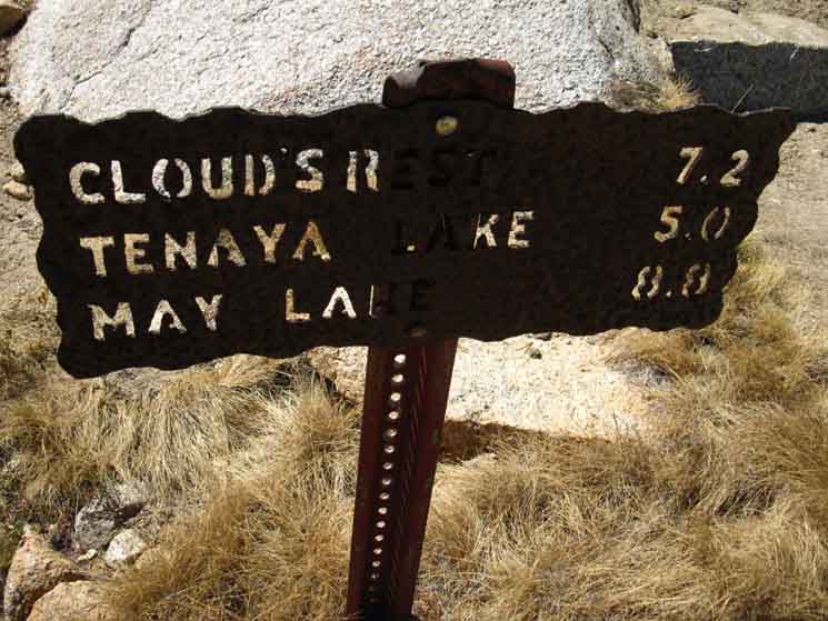
This trail to Tenaya Lake climbs to our West until it bends around past Sunrise Lakes before it tees-out. One wing of the trail tracks to the Northwest for Tenaya Lake and May Lake beyond, the other to the Southwest for Clouds Rest.
|
| Next
Crossing Down!
WE |
North: Tuolumne Meadows to Cathedral Lakes South: Sunrise to Little Yosemite Valley
Backpacking |
The Golden Triangle Yosemite is a large National Park that I break down into North, Central, and South regions for the convenience of the Long Distance Backpacker. We hike into the most Northwestern region of Yosemite through Bond or Dorothy Lake Passes on the Tahoe to Yosemite and Pacific Crest Trails, respectively. To our East-Northeast are the Hoover Wilderness Trailheads, to our South-Southwest lays the Grand Canyon of the Tuolumne River. We arrive at roughly the center of the Sierra Nevada arriving at Tuolumne Meadows. Here the end of the Tahoe to Yosemite Trail is supplanted by the John Muir Trail heading South along the Sierra Crest from Tuolumne Meadows. Since I consider everything South of Tuolumne Meadow to be the South Sierra, our explorations of the center of Yosemite will be quite limited. Unless we take an alternative route that will run us down to Yosemite Valley and back up to the JMT 5.6 miles South of Tuolumne Meadows in Lyell Canyon.
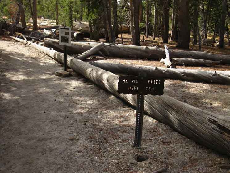
THIS PAGE IS UNDER CONSTRUCTION: STAY TUNED FOR MUCH MORE! COME ON BACK NOW, 'YA HEAR?
7.5 Map:
30 min Map
|
Backpacking Trail Guide PCT-TYT North Tuolumne Meadows |
 |
Backpacking Trail Guide JMT South |
Backpacker ForumsHave a great trip or story to relate about Yosemite or in the Sierra Nevada? Post it on Above we come to the Front Page of the High Backpacking Trails and Topics Forums. Below we break the forums down into categories:
The Trails Forum acts as your place to put up input, comments, relate your experiences, or ask questions about each segment and spot along the length of our combined TYT-PCT-JMT trails. The Forum is your place to supplement the trail guide. Anyone can post text comments in the existing forums, but only members can post up new topics, along with images, maps, and formatting. If you have experiences, comments, questions, or pictures and videos of the Pacific Crest Trail between Sonora Pass and Tuolumne Meadows, post up here as an unknown hiker or as a member: Forum Section
|
Trailhead
Contact
Alex Wierbinski

Backpacking Lake Tahoe to Mount Whitney
Your Guide to the High Sierra Crest, including the Tahoe to Yosemite, Pacific Crest, and John Muir Trails
