
The Trails
Guide
Maps
Miles/Ele
Permits
Resupply
Forum
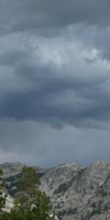
Current Weather Conditions
Weather Notes
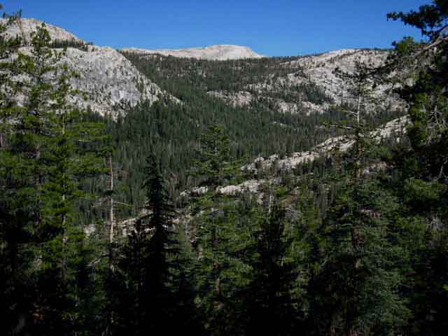
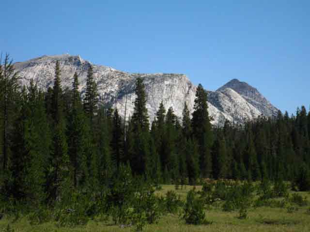
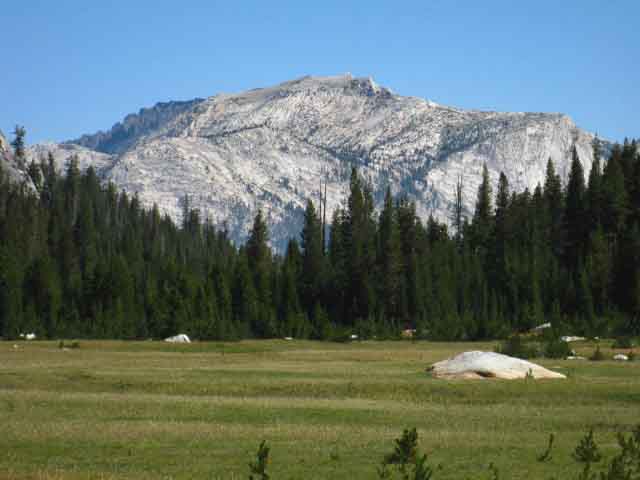
Northern High Sierras
Central High Sierras
Southern High Sierras
Gear
Gear List
Gettin Started
Layering
Discussion
Testing yourself and your gear
Gear Reviews
Hiking
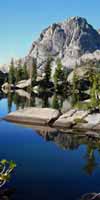
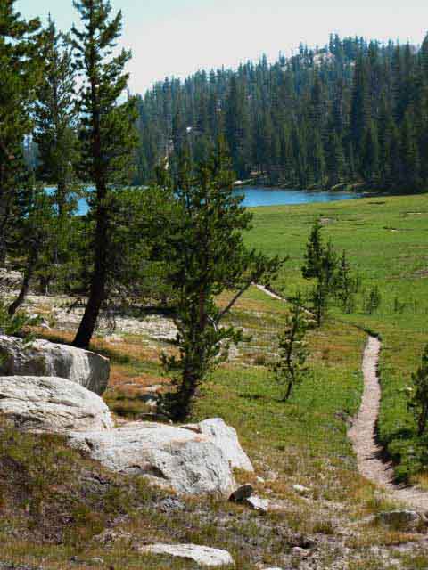
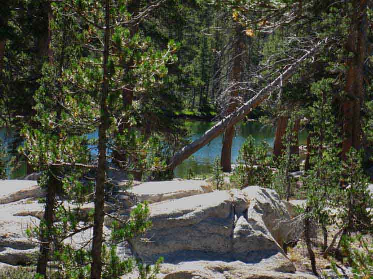
Miller Lake
to
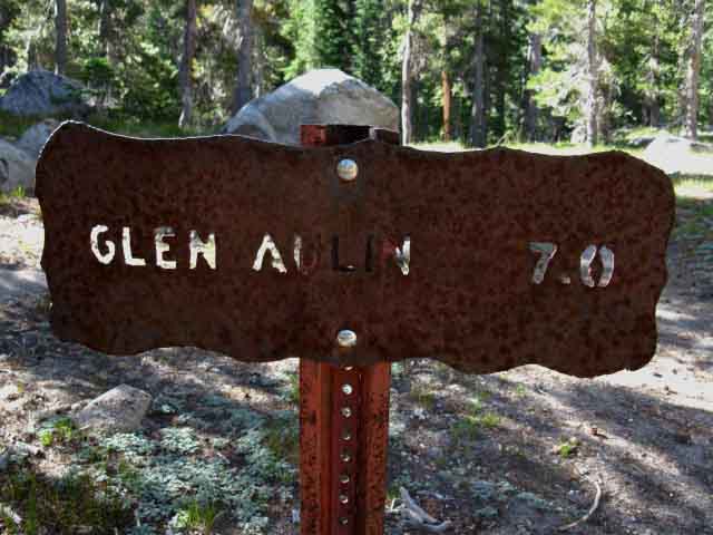
Glen Aulin
Backpacking
North Yosemite Backcountry
Hiking
The Pacific Crest Trail and Tahoe to Yosemite Trail routes from Sonora Pass to Tuolumne Meadows
Languages
Languages
Trail Arts
The art of walking
Physical Preperation
Trail Skills
The trail
Off the trail
Scrambling
Maps
Navigation
Camp skills
Food
Resupply
Food
Other
Photo Catagories
Trail Stories
Trail Culture
News and Science
Links
Groups
Books
Terms and Conditions of Use
| Trail Guide INDEX Highway 108 to Highway 120 |
North PCT-TYT Smedberg Lake to Miller Lake |
South PCT-TYT Glen Aulin to Tuolumne Meadows |
7.5 min Map Miller Lake to McCabe Lake Trail |
30 min Map Cold Canyon to Tuolumne Meadows |
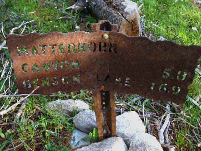
30 min Map Bensen Lake to Virginia Canyon |
Sonora Pass to Tuolumne Meadows MILES AND ELEVATIONS |
TOPO MAP INDEX SONORA PASS |
Resupply North Kennedy Meadows. South Tuolumne Meadows |
National Forest-Park PERMITS Yosemite NP & Toiyabe NF (Hoover) & Stanislaus NF (Emigrant) |
all maps index |
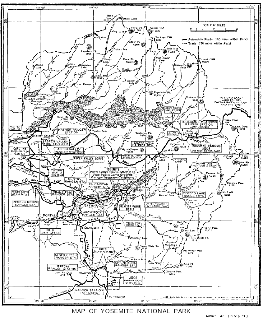
Yosemite National Park
<draft trail guide page>
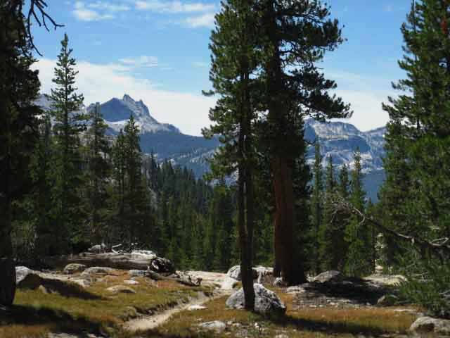
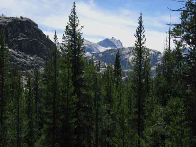
Miller Lake to Glen Aulin Approaching Tuolumne Meadows Resupply Arriving at Tuolumne Meadows is a big milestone along out hike South from Lake Tahoe to Mount Whitney, whichever way hiked down here, and whatever route we will choose to continue South. It's a substantial hike getting down here on either the PCT or TYT, or a custom combination of the two. Arriving at Tuolumne Meadows roughly marks the halfway point of our Tahoe to Whitney backpacking trip. As we had many route options hiking South from Tahoe to Tuolumne Meadows, we've got significant route options to choose from continuing South from Tuolumne Meadows. TYT and PCTroutes Lake Tahoe to Tuolumne Meadows
Compare and Contrast
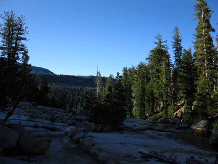
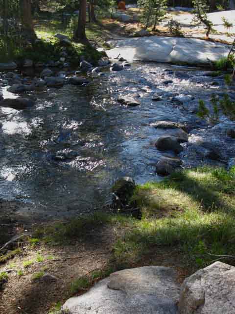
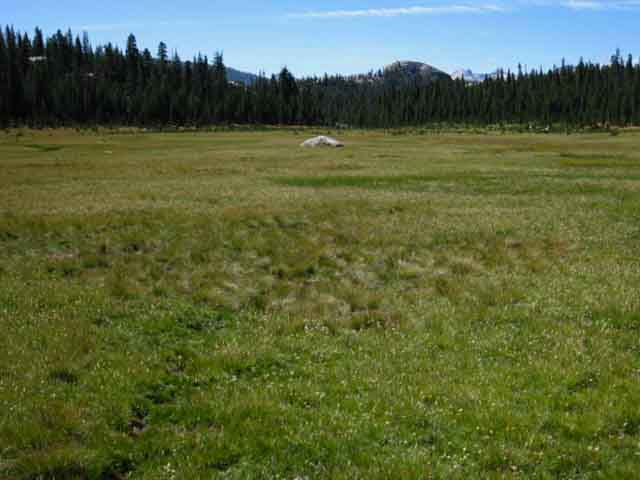
Our Options South After a nice visit touring Yosemite Valley we're going to return to the Sierra Crest and the Southbound John Muir Trail. We start out of Yosemite Valley following the the classic route of the JMT climbing back out of the Valley to Little Yosemite Valley. From Little Yosemite Valley we break off the JMT to follow the Merced River up to Merced Lake instead of the JMT to Tuolumne Meadows. Just beyond Merced Lake we'll hike over Voglesang Pass to rejoin the John Muir Trail in Lyell Canyon just a little bit South of Tuolumne Meadows. I call this route from the end of the Southbound Tahoe to Yosemite Trail down to Yosemite Valley via the John Muir Trail and back to the JMT in Lyell Canyon via Voglesang the "Golden Triangle." It's really is a stunning optional section of trail detouring off the Sierra Crest adding lots of miles and thousands of feet of elevation to our Tahoe to Whitney hike, but it's well worth the extra time and effort. The golden triangle is a classic route through the heart of Yosemite. Especially when we consider our hike came across the whole North Yosemite Backcountry to break off the Sierra Crest through Yosemite Valley to climb back onto the Sierra Crest for the hike out Yosemite's Southern border on the JMT through Donohue Pass. Tuolumne Meadows Resupply Good rest, good food, and good people. Tuolumne Meadows has all of the physical and cultural elements necessary to put together the perfect resupply stop. We are also approaching what I consider to be the rough center of the High Sierra Mountain Range, Tuolumne Meadows in Yosemite National Park. The Sierra runs North and South from this central position. I consider myself hiking into the North Sierra when I hike North out of TM, and into the South Sierra when venturing South. A Busy Place The daily population of Tuolumne Meadows rises and falls like breathing creature. The activity in Tuolumne Meadows is only a thin shadow of the urban-level of bustle and traffic that rises and falls each Summer day down in Yosemite Valley. Deciding to hike down to Yosemite Valley is like descending into the belly of the backpacking beast. The character and type of backpackers we will meet changes dramatically from those we've met in remote locations along the Sierra Crest hiking South from the Lake Tahoe Basin. A Very Busy Place I encourage the backpackers I meet around Yosemite Valley, the ones who are ready, to push their trips up to and out along the Sierra Crest and into the more remote wilderness areas where they would encounter less folks and choose their own campsites. Personally, I found the whole scene on the trails into and out of Yosemite Valley quite entertaining and heartening. I find a great bunch of backpackers there. There's a few jerks. More than we would ever meet in more isolated areas. Jeeze, there's not many backpacking folks I've met on the trails that I haven't enjoyed. There's been a few, but you can count them on a three-fingered hand and have a couple of fingers left over. Nonetheless, the density of backpackers, rangers, and idiots increases as we approach and draw closer to the "high population centers" of both Tuolumne Meadows and Yosemite Valley. Hiking South from Miller Lake From this fording-camp site along Return Creek we begin a mile-long H3 climb up to the McCabe Lake trail junction which is close to where we slip Southeast into the top of the long sets of descending meadows chained together through the wide and low expanse of Cold Canyon. From the McCabe Lake trail junction we have seven miles of almost all downhill hiking across all grades of steepness to Glen Aulin. Trail Segment Information
|
||||||||||||||||||||||||||||||||||||||||||||||||||||
Miller Lake Traversing Ridge 114 feet |
Second Gap Descending -1000 feet |
|
Return Creek Climbing 560 feet |
McCabe Lake Trail Junction Great Descent -1200 feet |
Miller Lake
9446 feet
High point at Second Gap on trail along flank of ridge South of Miller Lake
9560 feet
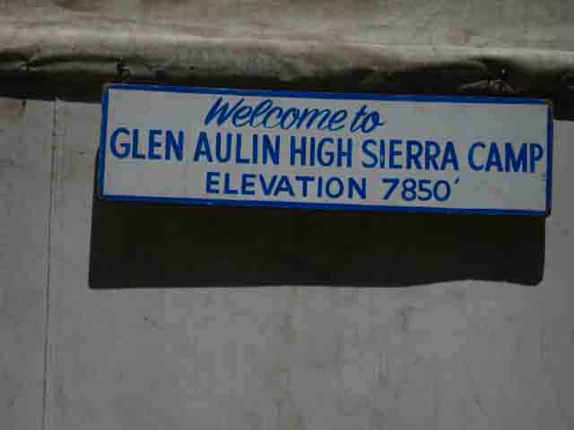
Glen Aulin High Sierra Camp
7920 feet
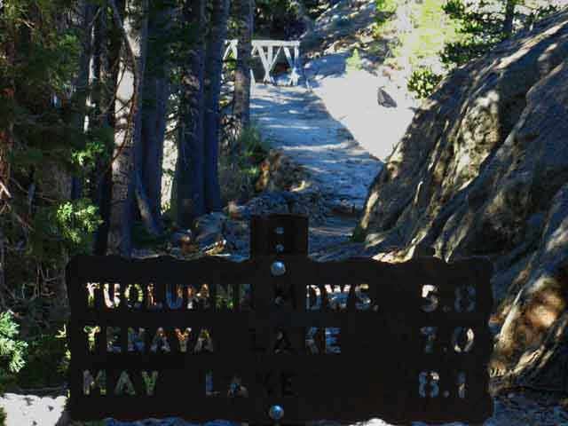
Totals Miller Lake to Glen Aulin 674 feet ascending 2200 feet descending Almost four to one feet down-mountain! |
Backpacker's Index
| Miller Lake to McCabe Lake 15 min Topo Backpacking Map |
Cold Canyon 15 min Topo Backpacking Map |
| Bensen Lake to Virginia Canyon N Yosemite 30 minute Backpacking Map |
North Yosemite Miles and Elevations |
Backpacker Resources
and
Hiker Information
| Backpacking Trails and Topics Forums |
Backpacking Trail Information Miller Lake to Glen Aulin Index |
||||||||||||||||||||||
Video
Miller Lake West Shore Campsites
First Gap South of Miller Lake
Second Gap South of Miller Lake
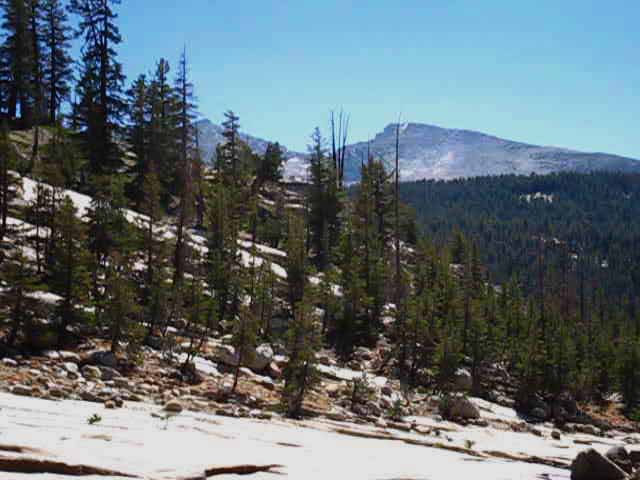
Matterhorn Peak and Whorl Mountain
Spiller Creek Ford and Campsite
Lower Spiller Creek looking into Virginia Canyon
Sheep Peak beyond Virginia Canyon
|
North Weather Below find the closest Ground Stations, Point and Regional Forecasts between Miller Lake and Glen Aulin High Sierra Camp. Satellite and Radar Imagery Real-Time Ground Reporting Stations
All |
Video Virginia Canyon Trail Junction
Virginia Canyon and Spiller Creek from Above
Climb South of McCabe Lake trail junction
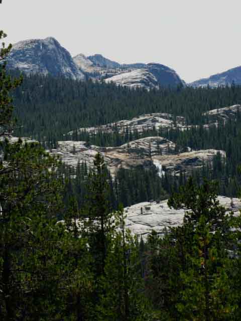
Cathedral Range from bottom of Cold Canyon Upper Meadow
Climb out of upper Cold Canyon Meadow
Into Lower Cold Canyon: Cathedral and Tresidder
Lower Cold Canyon Vista: Mendicott Dome, Pywiack Dome, Peaks 10450 and Tenaya
Yosemite Trail Crew hiking out to set up camp at Smedberg Lake
Northern Glen Aulin Trail Junction
|
||||||||||||||||||||
| > Forum < | ||||||||||||||||||||||
POST UP!
All backpackers can post text comments, questions, or add information and share their experiences on this segment of trail from Miller Lake to Glen Aulin through the comments links on this page.
Every comment link on every trail guide page goes into the forum for that segment of trail.
Your experiences become part of the guide.
Registered Members can post text, images, maps and videos on their own pages in the Trails Forum to supplement this section of the Trail Guide.
Check out the Tahoe to Whitney .org Backpacking Trails and Topics forums.
The Trails Forums cover the main High Sierra Trails from Lake Tahoe to Mount Whitney paralleling trail guide construction.
The Backpacking Topics Forum covers about every topical issue any long distance backpacker would face in high elevation mountains. The Topics Forum is also being constructed in conjunction with the trail guide.
As I slowly move South completing the trail guide so too the Trails and Topics Forums evolve. I hope to complete all three simultaneously. Make sure to post up your bits of wisdom and experience in this compendium of High Sierra Backpacker information, knowledge and experiences.
Joy, Pain, Wisdom and informative experiences emanate from experts and rookies alike. Your experiences across this terrain, as well as you questions, are part of its great tapestry of experience.
Video
Miller Lake to Virginia Canyon
Miller Lake South to Virginia Canyon via Spiller Creek.
|
Southbound to Miller Lake
 |
||
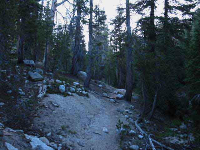
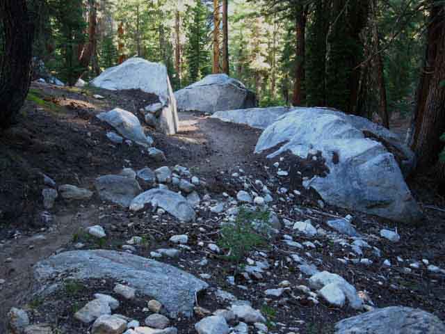
The grooved-in trail down to Miller Lake needs some rock blocks to divert Spring flows.
|
Trail to West Shore Campsites Miller Lake
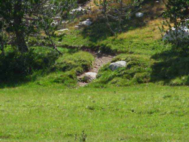 |
Across the Southwest side of the meadow on the North shore of Miller Lake we can see where the trail to the West shore campsites becomes visible. Let's hike over there and check it out. |
View North-Northeast
across
Miller Lake from the West Shore Campsites
 |
||||
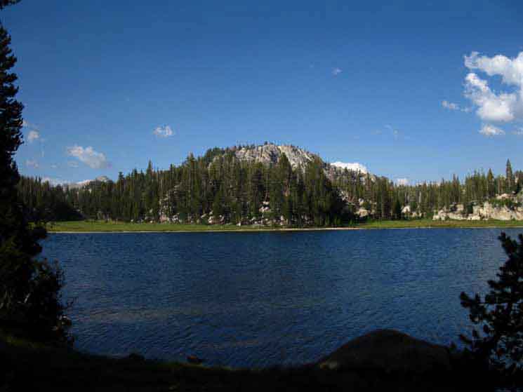
View North across Miller Lake from the West Shore Campsites. Looking at the route of the Tahoe to Yosemite and Pacific Crest Trails. Our Southbound trail moves to our Right to cross the narrow strip of land between the bottom of the low granite mountaintop and Miller Lake to pass through the low gap on the Right side of the granite mound. That's the route of the PCT-TYT by Miller Lake. Our point of observation is from the campsites on the West shore of Miller Lake. There are more sites on the low granite formations we can see the end of, sticking out from where they wrap around the Northeast shore of Miller Lake, on the far Right edge of the image above. Check the maps
|
View across South end of Miller Lake
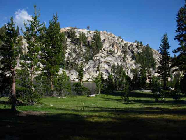 |
View East-Southeast across Miller Lake from the West Shore campsites. Note the tree topping the granite ridge across Miller Lake. See that tree on the highest point of the rock feature rising off the far shore of Miller Lake? It is a sweet solitary observer of this magnificent terrain. |
Fine Wind Swept Tree
atop
Rock above the East Shore of Miller Lake
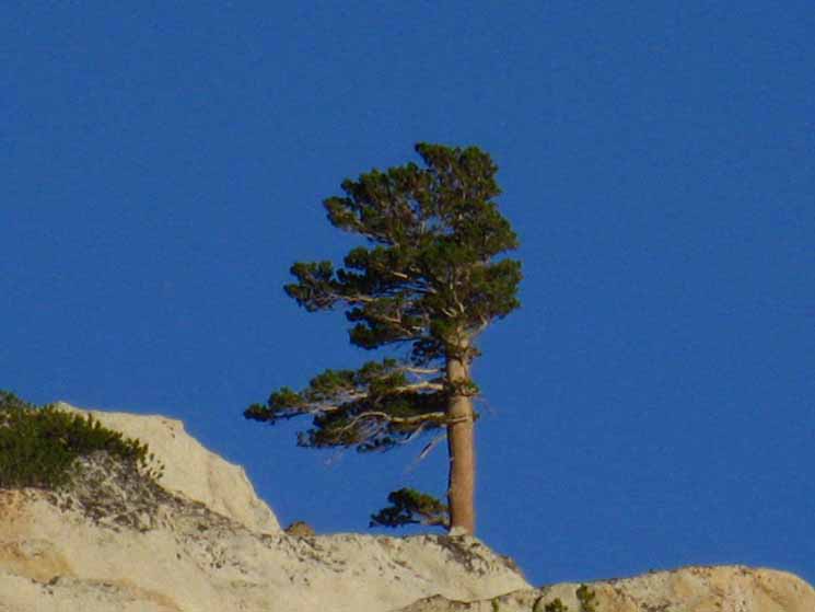 |
It is a massive Lodgpole strengthened and sculpted by the prevailing wind. |
Miller Lake
West Shore Campsite
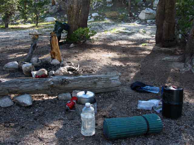 |
Nicely appointed campsite on the West Shore of Miller Lake. My position would be leaning up against the log with my feet elevated on bedroll. Stove cooking food at my side, water, hot beverage, and splendid view all at hand. Very relaxing after a long, hard, and beautiful day on the trail. |
Mosquito Protection
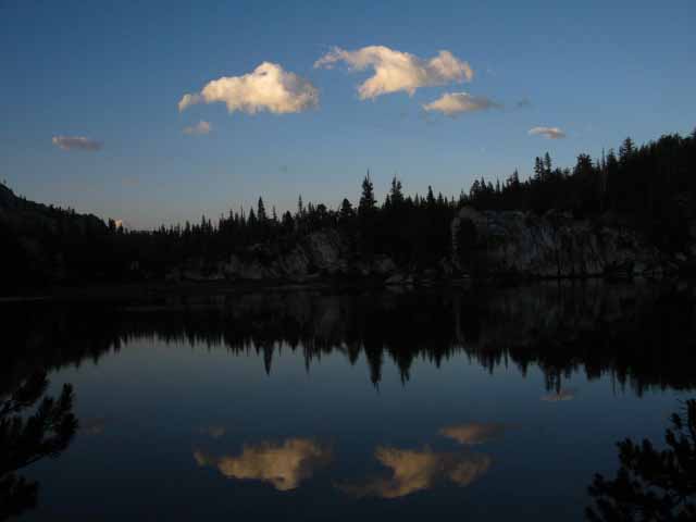
Miller Lake Twilight
 |
||||
Cotton Candy Cloud Puffs Floating in Miller Lake's Sunset Skies above and below. The Southbound Tahoe to Yosemite passes over the low point in the ridgeline on the Left of the image. We're looking at the low granite features around the Northeast shore disappearing in the deepening darkness growing from the East shore of Miller Lake.
|
Miller Lake First Light
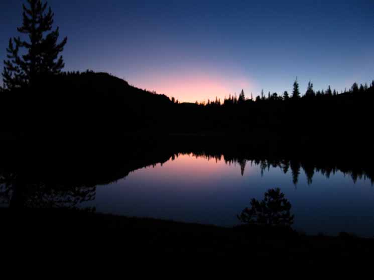 |
First light intensifying towards sunrise well framed by season and perspective. I liked watching this, this memory relaxes me. Here Comes the Sun! |
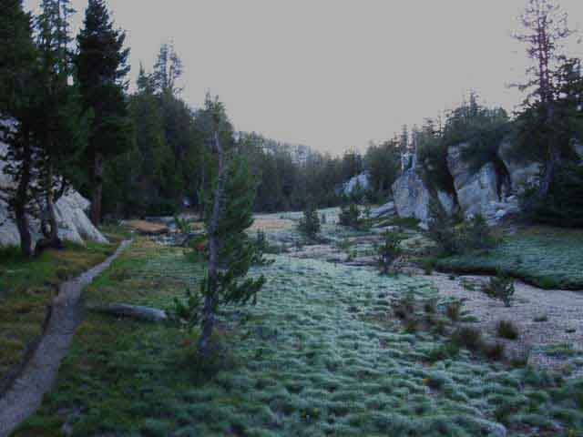
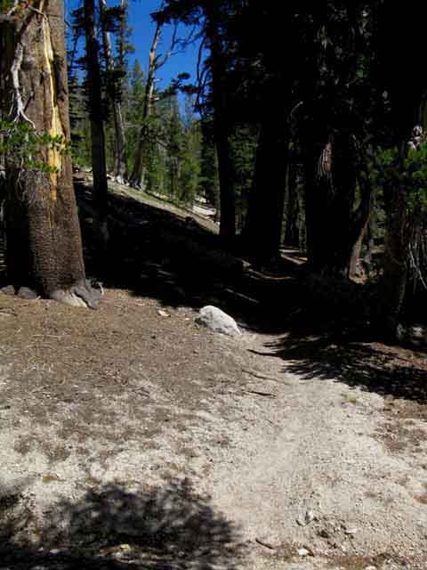
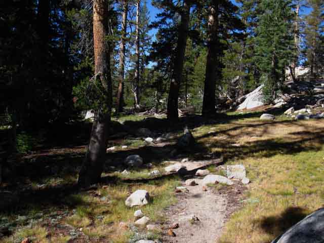
Hiking South from Miller Lake
 |
||
Hiking South from Miller Lake (Northeast by the compass) the trail is aside an understated but uniquely beautiful narrow dry meadow wedged between the granite mountaintop and Miller Lake's East shore formations. We are hiking a half mile up to the low gap to the Right of the low granite peak as we traverse along the top of this massive ridge dividing Matterhorn from Virginia Canyons. We are actually hiking to our Northeast, as we described in the text below this image. The seasonal wash splitting the meadow within this narrow granite channel ahead and to our Right is prettier than any Jap rock garden. To our Right, a few feet to the South across this narrow meadow there are granite formations and campsites, and a little pond and great granite sheets all nestled into and along the low granite features wrapping around the East shore of Miller Lake. Hiking South along the PCT-TYT from Miller Lake we are going to hike 1.4 miles basically traversing to the Northeast across the top of this vast ridge. This segment of trail is H3 or I1 difficulty. This traverse will take us across two low gaps before we begin the steep and deep descent to Spiller Creek, into the valley scooped out of the top of this vast ridgetop. The second gap beyond the first gap pictured above brings us to 9560 feet of elevation, the high point over this vast ridge dividing Matterhorn and Virginia Canyons. This is much lower that the Sierra Crestline here. We are still 6.6 miles to the Southwest down along the top of this massive ridge from the 12279 feet of Matterhorn Peak capping the top of this ridge on the Sierra Crestline. Bensen Lake to Virginia Canyon
|
Granite around the East Shore Miller Lake
 |
Looking to our Right, South across the narrow dry wash we see the fantastic granite formations that wrap around the East Shore of Miller Lake. |
Ponds along Trail South of Miller Lake
Early in the Season
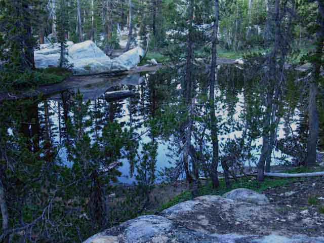 |
Black Pond |
Late in the Season
 |
||
Dead Pond
|
The
Lake
to the
South
of
Miller Lake
 |
||
The lake South of Miller Lake visible at a distance through the trees from the Tahoe to Yosemite Trail. The lake is situated to the South of the trail, to the Right of Southbound backpacker. There are campsites over there, judging by the tents I've noted over there a couple of times over the years.
|
The Unmarked Trail
to the
Lake East of Miller Lake
 |
A well-bedded trail leads South from an unmarked trail junction to the unnamed lake just about four-tenths of a mile South of Miller Lake. The trail branches out to the Southbound backpacker's Right. |
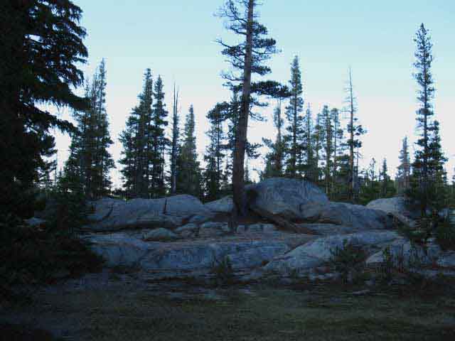
The First Gap South of Miller Lake
 |
||
First Gap South of Miller Lake Passing South over this low gap we'll drop down to traverse across a sandy flat under a fantastic granite wall above a rather expansive ridgetop meadow filling a low spot between glacial carved rock walls. That puts it at about 1.4 miles of fairly gentle climbing South from Miller Lake to the top of the Second Gap.
|
Over the First Gap
 |
Over the first gap South of Miller Lake. We begin a short drop down into a dry flat. |
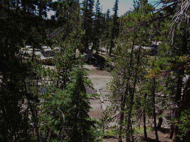
A Sandy Dry Flat
 |
||
The terrain turns sandy and descends more steeply.
|
Into the Dry Flat
 |
Dry flat between the two gaps between Miller Lake to our descent to Spiller Creek. Dropping into this flat is almost like dropping into another world. The strange colors, and drier terrain surrounded by a curtain of rock imparts a character that makes this yet another unique flat wedged into otherwise chaotic terrain. |
Rock Wall to our Left, to the Northwest
 |
Beautiful unique granite formations above the flat dry meadow South of Miller Lake. The top of the ridge here is around 9800 feet of elevation. |
Hiking South to the Second Gap South of Miller Lake
 |
Through the dry meadow and sandy flat hiking South of Miller Lake. |
Dry Flat Narrows into Base of Close-In Gully
 |
Trail enters narrow track up to second gap. Our trail tracks between two massive granite formations decorating the top of the ridge dividing Matterhorn and Virginia Canyons. Bensen Lake to Virginia Canyon |
Along the Narrow Channel below Second Gap
 |
| Nifty, intimate channel through close-in terrain. You can feel the closeness of the environment closing in through here. |
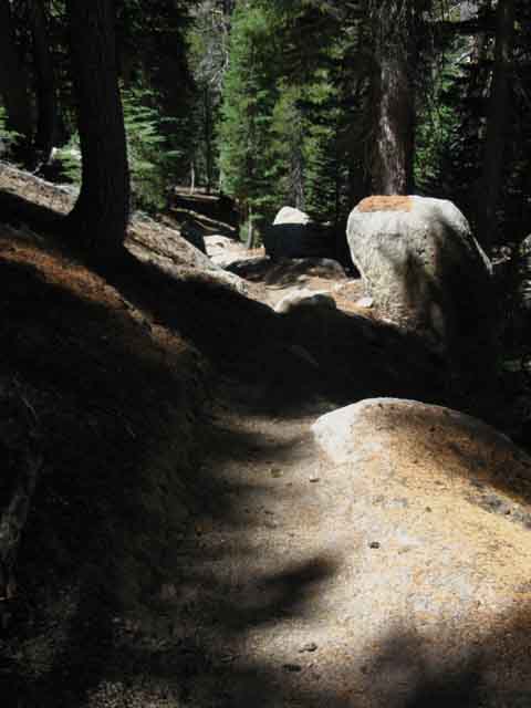
The Second Gap South of Miller Lake
 |
||
After climbing up a twisting bit of fishook-shaped bit of trail we approach the second gap South of Miller Lake. It's all downhill after we reach the top of this low rise.
|
High Point Above Spiller Creek
 |
The second gap South of Miller Lake. 9560 feet. A few more steps and we begin the descent to Spiller Creek on our way down into Virginia Canyon. |
Dropping Down to Spiller Creek
 |
||
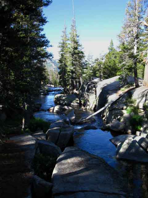
We are looking across Spiller Creek's valley at the 11520 foot massive South end of the chunk of granite dividing the Southeast end of the valley scooped out of the top of the ridge from Virginia Canyon below its far flank. Stanton Peak is at its North end, followed by Virginia Peak and finally Twin Peaks on the Sierra Crestline at the top of that arm of the wishbone shape of the top of this ridge around the high valley Spiller Creek drains. That mountain in distance rises above the far shore of Spiller Creek, it's Northeastern bank, which we will follow down into Virginia Canyon to our Right, the Southeast. But first our route will point itself up this amazing valley cut into the ridgetop, for a very short distance, to our Left, to find the switchbacks down to Spiller Creek.
|
Turning Up Spiller Creek
 |
As we hike up-valley to our Left for a short distance before descending down to follow Spiller Creek down and to the Right in the canyon below, we get a view of the exposed granite flank of the very South end of the ridge wrapping around the East side of Spiller Creek's high valley. The nose of that ridge runs down to make up the granite North bank of the lower end of Spiller Creek. Though obscured by the intervening trees, we can see that the whole glowing granite nose of the mountain in the middle distance is a rather huge slab of unjointed granite. That's the granite slab that makes hiking that section of Spiller Creek so unique. We're going to cross the bottom of that slab along Spiller Creek as we pass into Virginia Canyon. |
 |
A better look at the granite slab running down to Spiller Creek. We can see a bit more of the great granite mountain flank above North bank of lower Spiller Creek through the trees. We're going to cross the nose of that nifty slab following Spiller Creek down into Virginia Canyon. |
View North
up at the
Headwaters of Spiller Creek
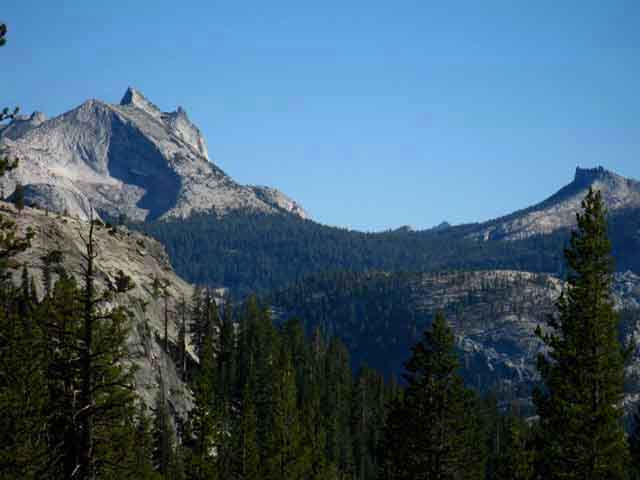
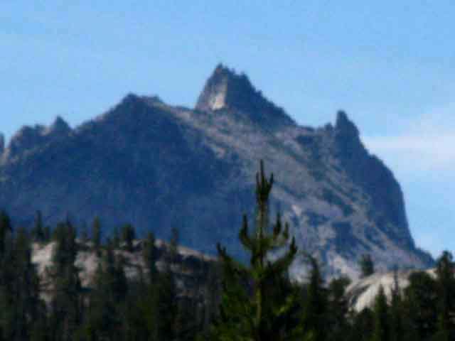
Matterhorn Peak and Whorl Mountain
 |
||
Matterhorn Peak and Whorl Mountain come into view at the top of the ridge dividing Matterhorn and the mountain top valley that Spiller Creek drains. Let's take a look at these peaks along the Sierra Crest from the other side, the West flank of this ridge where we were climbing South out of Matterhorn Canyon. We can see how Whorl Mountain divides Matterhorn Canyon to the West from the canyon holding Spiller Creek to the East on the 30 minute Yosemite hiking map.
|
Switchbacks Down to Spiller Creek
 |
Down through rock and forest approaching switchbacks down to Spiller Creek. We have fairly soft trails down, more soil and sand than rock. Here's another spot where we enjoy the ease of travel brought about by having trail crew and trail traffic remove loose granite from the trail. |
More Switchbacks
 |
Soft switchbacks down to Spiller Creek. |
Down to the Meadow above Spiller Creek
 |
Fine Meadow and Forest above Spiller Creek Campsites and Ford. Switchbacks bring us down into a fine meadow being filled with lodgepoles alongside Spiller Creek. We're hiking through the meadow above Spiller Creek during very early morning after Sunrise when the low angle of the Sun creates a deep tangle of shadow wrapping around brilliant islands of sunshine exploding out of the dew-dappled meadows. Soon the rising Sun will fully assert itself, the dew will evaporate, and the shade of the forest will be even more refreshing. |
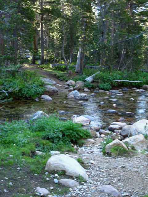
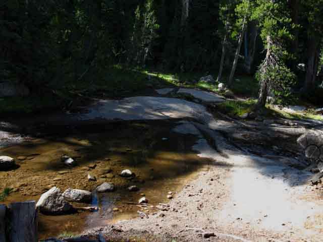
Spiller Creek Ford
 |
||
1.17 miles South of the second gap and a total of 2.6 miles South from Miller Lake we arrive at the Spiller Creek Ford and the campsites on the other side of the Creek.
|
Spiller Creek Ford 2009
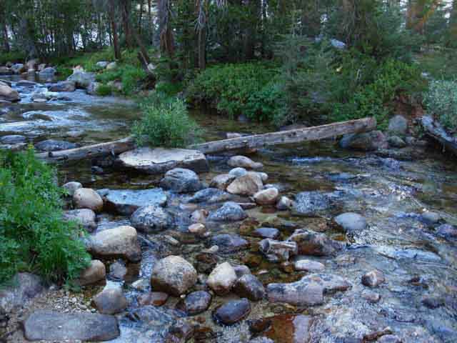 |
Logs ford Spiller Creek, 2009. Time is Slowing in the Sierra Nevada Mountains The trend of decreasing Winter snow during shorter Winters has significantly slowed down the erosive rate of change in the Sierra, as well as slowing down the growth rate of the trees. As water and tree growth are the major factors controlling the rate of physical change in the Sierra, the change to a drier climate will have the effect of "slowing down time" in the Sierra. Shorter periods of freezing temps in Winter will slow down the cracking of granite during freezes, and less snow will suppress the Spring Thaw, with each of these changes in the seasons working to slow the annual rate of physical change tied to the climate. The effects of this diminished water availability will "trickle down" to biology, the reduction in moisture slowing down the spread of forests, slowing the work of the trees invading frost-riven cracks in the granite, prying them slowly open through the mighty combined efforts of generations of tiny saplings, until a tree can finally exploit the expanding crack, and push it even further apart. All of these physical and biological processes are slowing with the rise of temps and the diminishment of Winter's length and moisture content. Time is slowing down in the Sierra. But first this drying trend that is slowing down time will radically speed-up the rate of forest succession and the rate of erosion. Increasing fires due to the changing seasons will quickly sweep away the forests supported by the old weather pattern, followed by huge amounts of erosion caused by the loss of forest cover. Then the pinions will grow where the jefferies grew, and the jefferies will supplant the lodgepoles, and the lodgepoles will supplant the whitebarks. Then the dry Winters will virtually freeze the mountains in place, slowing the rate of growth and erosion into a kind of suspended animation. This is our future if we continue the policies and practices of the past. The "Solution?" JUST UNDO IT Virtue and Balance must replace Greed and Irresponsible Growth. |
Spiller Creek Ford, 2009
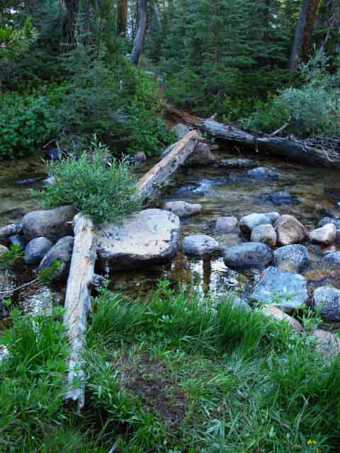 |
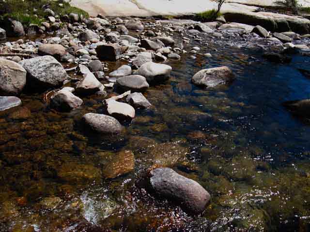
Dry Fords Powerful Spring Thaws will roll boulders down the creek bottom like a kid playing marbles in the gutter. Each year the fords are different, and the trajectory and timing of when dangerous Spring Thaw conditions moderates into passable fords, and finally relaxes into gentle flows differs every year, with the specific characters of the progression of seasons. So too the progression of folks building dry fords, such as the one above, differs each year, but there's a general pattern to their appearance. Once the trail crews get established in the backcountry and establish their camping and work sites we find quality fords quickly appear between camps and worksites. I'm just brainstorming now, but my observations also indicate that the first Wilderness and Trails Rangers who ride the trails to evaluate them early in the season also set up a few fords. Then the trail crews come out and set up a few more. As the season progresses we see evidence that backpackers have contributed to establishing dry fords. There is no assurance of passable fords in the backcountry. In fact, there's no assurance of safe fording conditions in the Wilderness. Especially early in Spring. Unless our knees and feet are hurting, in which case we're going to strip off the boots and socks anyway for a very-very nice soak in some seriously ice cold High Sierra stream water. Deep cold fords can be therapeutic! Giving the knees and feet a good cold soaking in a frigid pool can relieve inflammation. |
Spiller Creek Ford Campsite
 |
Forest between campsite and Spiller Creek, which is running past us off to our Left. In the distance we can see the splotch of red of my MSR fuel bottle sitting by the downed tree. I was sitting there having a break with coffee and a bowl of ramen noodles until I got up to wander about and look around. |
Campsite and Great Granite Slab
at
Spiller Creek Ford
 |
||
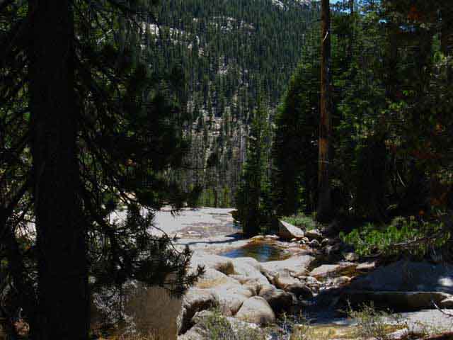
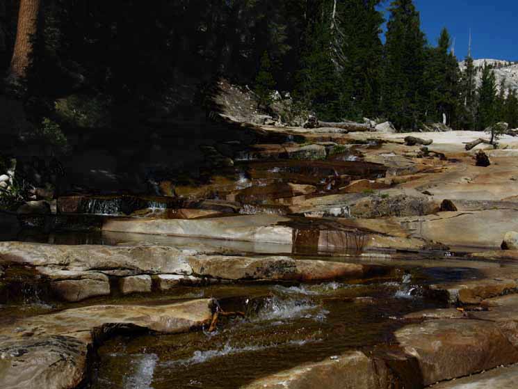
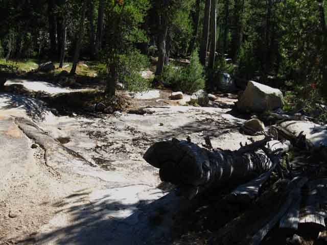
Campsite on the South bank of Spiller Creek Ford. Note the great sheet of low, smooth granite running North up the flank behind the campsite. As we were descending to Spiller Creek we saw that the vast extent of this granite slab, the bottom edge of which we see above, runs up and tapers off into the peak guarding the Northern gap in the top of the ridgeline dividing the Spiller Creek watershed from Virginia Canyon. The Spiller Creek campsite above marks where Spiller Creek and our trail South both turn Southeast onto the Western edge of this vast slab for our run Southeast down across this remarkable granite-floored segment of this amazing hanging canyon into the West wall of Virginia Canyon. This great granite slab composes the North bank and much of the bed of Spiller Creek as we too descend with Spiller Creek through this hanging canyon to emerge out onto the West wall of Virginia Canyon. The campsite above marks the edge of the forest along the top of this great granite slab, a perfect location to take a break or camp on the interface between meadow, forest, and rock slab. We find forest and meadow above the Spiller Creek ford and campsite, and the solar reflector-oven of heat and light of this great granite slab below. Spiller Creek's mountain top valley draining into Virginia Canyon is quite beautiful, especially here where Spiller Creek turns to flow across this amazing granite slab. The next half-mile or so hiking down along Spiller Creek, until we turn onto the long traverse down to the floor of Virginia Canyon, is a pretty amazing stretch of trail. Pretty and amazing.
This is another segment of trail we should walk through slowly. Very Slowly. And we should hike around a bit to get the best perspectives of Spiller Creek across the granite, and out the mouth of the hanging canyon looking into and across Virginia Canyon to our East. |
Down Spiller Creek
into
Virginia Canyon
 |
||
First Rays of Sunshine Probing the Forest The slab extends North (to our Left out of the image) and sharpens into the peak overlooking this granite gap allowing Spiller Creek into Virginia Canyon.
|
Great Granite Flat
Three Images of the Same Location
 |
Granite slab overlooking Virginia Canyon. Past the edge of granite in the distance we are looking across Virginia Canyon at its Eastern wall. |
Closer Look
at
Spiller Creek's Granite Bed
 |
Looking Southeast into Virginia Canyon down Spiller Creek. An afternoon view late in the Summer hiking season. |
And Closest
Look at
Spiller Creek down the Slab
 |
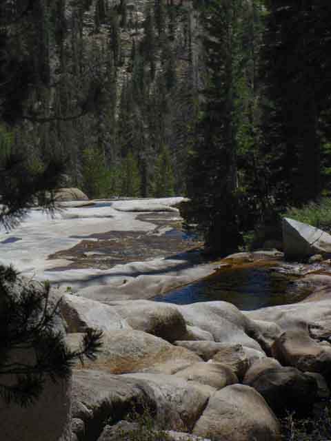
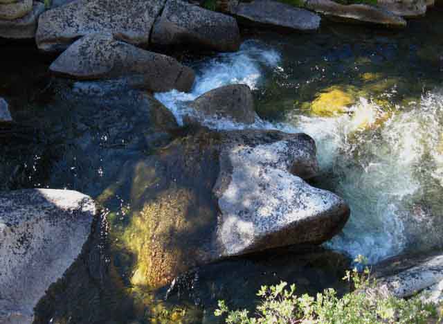
What a fine Slab of Granite this is. This is the bottom, the nose of the great granite slab we observed while dropping into Spiller Creek's drainage. It is splendid up-close. A morning view earlier in the Summer hiking season with a bit more water. Notice that this is virtually unjointed granite, smooth as a baby's butt. Notice this is exactly the same location in the second picture above, but we focused on the lower section of the slab in this lower image. |
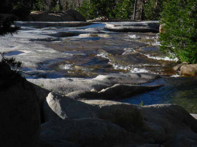
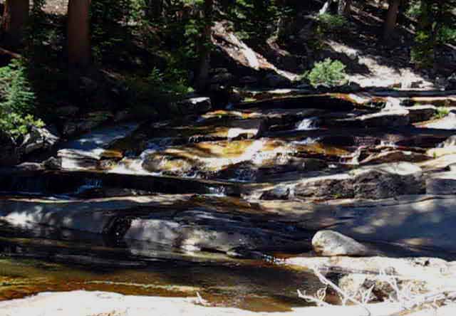
Red Granite Cascade
 |
Red granite cascade down Spiller Creek. |
Spiller Creek North Yosemite
 |
Spiller Creek Red Granite Cascade. This place always gets my heart beating fast. I hope you can see how the route of Spiller Creek is across a vast wide unjointed slab of ice cut granite that has been carefully polished by tens of thousands of years of Spring thaw flows. The images above and below do not do the special beauty of this place justice. |
 |
The sights and sounds of water, along with a mass of cool air moving down the canyon with the creek. Very nice. |
Long View Southeast
across
Lower Spiller Creek and Virginia Canyon
at
Southwestern Crest of Sheep Peak
 |
Virginia Canyon at our Feet Spiller Creek turning down for its steep flow into Return Creek. This image shows our slope down to Virginia Canyon as well as the ridge on its far side we climb up to the McCabe Lake trail junction. From the McCabe Lake junction we'll slip over that ridgeline into the very top of Cold Canyon to begin the final segment of our day's hike down to Glen Aulin. In the distance we can see the Southwestern crest of Sheep Peak, just within the Yosemite Boundary with the Hoover Wilderness. This side drains Westward, the other flank drains East. |
East:
Sheep Peak
 |
Sheep Peak rising on the Left of the two peak to our East-Southeast. Here we can see the main crest of Sheep Peak to the Northeast, to the Left of its lower, subordinate Southwestern point, peeking through the trees and across Virginia Canyon. Mount Conness is hidden behind Sheep Peak. The Yosemite Boundary with the Hoover Wilderness administering the East flank of the Yosemite Boundary runs across along the crestline topped by Mount Conness. Sheep Peak is fully within Yosemite, it's crest extending a mile West of the Sierra Crestline. Once we cross Virginia Canyon and get into the top of Cold Canyon we will hike far enough South down Cold Canyon to clear Sheep Peak to get a clear view to our East at the massive bulk of the Conness Massif. Virginia Canyon to Tuolumne Meadows Ahead of us in the foreground of the image above we can see where we will bend around to our Left, to the Northeast off of this vast granite slab alongside Spiller Creek turning us up-canyon as we emerge from Spiller Creek's hanging canyon into Virginia Canyon high up on its Western canyon wall. Once we turn the corner above we'll be on a very long fairly straight traverse up-canyon running down to the trail junction and ford point of Return Creek on floor of Virginia canyon. Crossing Return Creek we find nice campsites along with our route South along Return Creek for a short distance until we begin the short climb out of Virginia Canyon up to the McCabe Lake trail junction and just past it into the top of Cold Canyon. We'll stay in Cold Canyon for the remainder of our hike down to Glen Aulin. |
Virginia Canyon Trail Junction
Video
Virginia Canyon to Glen Aulin
Dropping down into Virginia Canyon brings us to the trail junction pictured below. Return Creek Ford and Campsites Campsites lay on the East side of the ford, otherwise we have a short hike down along Return Creek to the McCabe Creek ford before we begin the mile long climb up to the McCabe Lakes trail junction. The map does not depict the current route from the Return Creek ford to McCabe Creek and on up to the McCabe Lakes trail junction. The trail has been significantly rerouted. Miller Lake to McCabe Lake Trail Changes Climb to McCabe Lakes junction You can see I split our hike down Cold Canyon into two parts. The upper section is a fast downhill segment down a gently graded wide meadow with triple-tread Yosemite trails. The lower section is steeper, mostly a single-track trail into a narrower and narrowing granite gorge, but also crossing a few sweet shelves of meadow and forest wedged into the mountainside, but the lower segment of trail is mostly descending across moderately steep granite terrain. The meadow segment of trail in upper Cold Canyon and the lower steeper granite segments through the bottom of Cold Canyon are both downhill across hard surfaces. This type of extended impact descending across hard terrain, pretty much since we began hiking South from Miller Lake, produces a tremendous amount of shock-stress on the feet, knees, hips, back, and shoulders. The Internal Compass Swings The compass point of our strains and pains have shifted from massive calorie burning to impact mitigation, and so to should our gait, pacing, and breathing shift with this shift in terrain. Our next three days hiking South will be much different than our last three! Our experiences getting to this half-way point should inform the second half of our hike from Tuolumne Meadows to Mount Whitney. Our errors are now our assets, transformed by experience. Inside the Terrain To our East the series of huge 12,000 foot mountains making up the Sierra Crestline comes into view as we hike South down upper Cold Canyon, capped by Mount Conness. The Sierra Crestline to our East divides the administration of Yosemite National Park over this Western flank of the Sierra from that of the Toiyabe National Forest's Hoover Wilderness over the Eastern flank. We Got Bent Exiting the Five Canyons Though the levels of beauty and wonder remains constant approaching Tuolumne Meadows, even increasing, the number and ratio of people trying to enjoy them increases dramatically. The numbers of folks surrounding Tuolumne Meadows will be dwarfed as we climb over the Cathedral Range to drop into the Merced Drainage on our way down into the terrain surrounding Yosemite Valley. We enter a small city when we pass through the Happy Isles Trailhead onto the floor of Yosemite Valley, and we may well have to hike through a "traffic jam" of day hikers if we approach on Summer Holiday Weekends. Hiking into and out of Yosemite Valley makes an interesting and informative part of our hike that will be as influenced and informed by humans as nature.
|
Virginia Canyon Trail Junction
NORTH
PCT TYT
 |
||
Long View North NORTH Sonora Pass via the PCT
|
Virginia Canyon Trail Junction
SOUTH
PCT TYT
 |
||
South on the Pacific Crest Trail--- South on the Tahoe to Yosemite Trail Continuing South to Tuolumne Meadow Resupply. I have the distance from the Return Creek ford to Tuolumne Meadows Store and Post Office at 13.51 miles. The Yosemite signs measure the distance to the Tuolumne Meadows Visitor Center.
Bensen Lake to Virginia Canyon |
Virginia Canyon Trail Junction:
NORTH BY COMPASS
up Virginia Canyon
 |
||
Northeast up Virginia Canyon Green Creek access from Willow Springs on Hwy 395 and Virginia Creek access from Conway Summit on Hwy 395.
|
Return Creek Ford Points
 |
Where the Trail meets Return Creek. The Return Creek ford in Virginia Canyon along the Pacific Crest Trail. |
 |
To the South a hairy boulder ford is possible. Not a great option. |
Downstream from the Fording Point
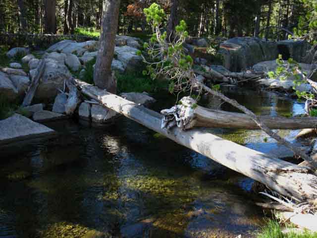 |
Further South an obstructed log crossing. You should have seen me going over the "perp to" log during a heavy Spring flow! I was holding on for dear life! |
Standard Fording Point
 |
Hopping across the rocks at the main ford during low flow of late August. |
Return Creek below Fording Point
 |
Hiking downstream along the South shore after fording Return Creek in Virginia Canyon we come to a unique stretch of Return Creek. The trail is about twenty yards off to our Left, to our East. We noticed this interesting bit of terrain and hiked over to check it out. There's a great pool off to our Right below the great cracked slab that's generally sporting a few trout. |
Great Cracked Slab
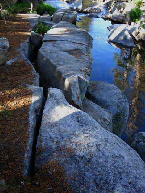 |
Noteworthy Cracked Slab along Return Creek in Virginia Canyon along Pacific Crest Trail. Pool with trout I visit pretty much at least once a year sits below and Right of the cracked rock. |
McCabe Creek Ford
 |
||
Though the 30 and 15 minute USGS maps depicts the trail differently, the trail fords McCabe Creek just above where it joins Return Creek. That's Return Creek running off to our Right, and we are facing South by the compass looking at McCabe Creek.
|
Climbing to McCabe Lake Trail Junction
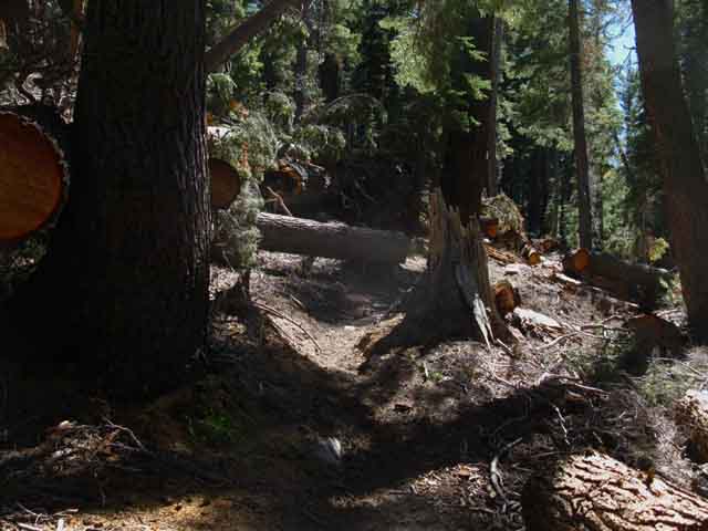 |
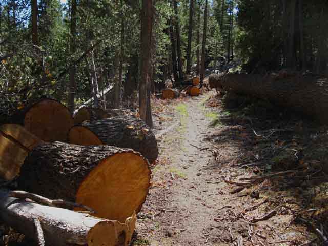
Downed trees South out of Virginia Canyon, Yosemite. Great wind damage done during gusts of Fall 2011. November 20, to be exact. I found this great article about this windstorm. It underplays the scope of the winds, which blew as far North as the North Yosemite Backcountry. Here's a forum article putting together information about this great blowdown. |
Looking Northwest up Canyon holding Spiller Creek
 |
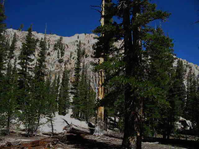
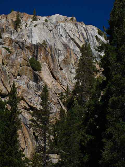
This is the canyon holding Spiller Creek seen through a gap in the forest cover hiking South out of Virginia Canyon up to the McCabe Lake trail junction. The PCT-TYT route turns Left through the line up trees up to Miller Lake. The vast white mass of granite we are seeing in the distance is the top of the ridge dividing upper Matterhorn Canyon from the valley Spiller Creek emerges from, capped by Whorl and Matterhorn Peaks along the Sierra Crest. |
Huge Amount of Fresh Fallen Forest
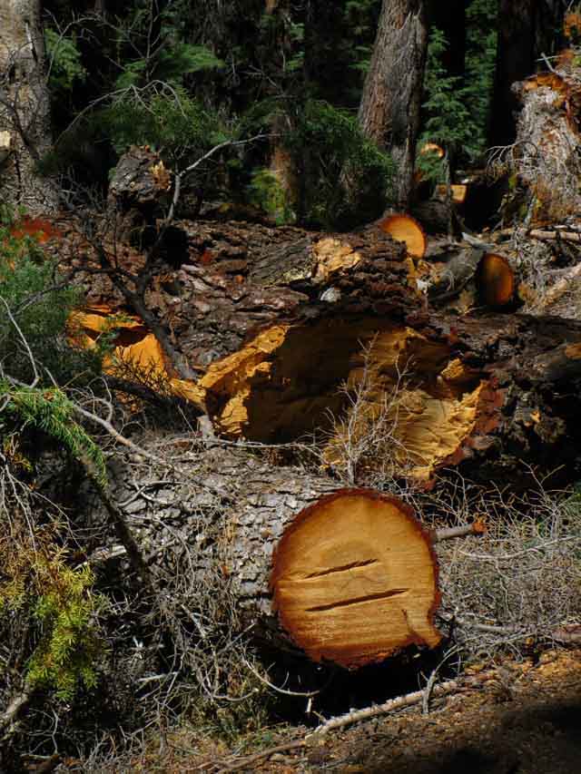 |
Downed trees from High Sierra Wind of 2011.We've seen damage from this to our North and will continue to encounter extensive damage as we hike South. |
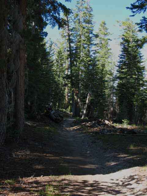 |
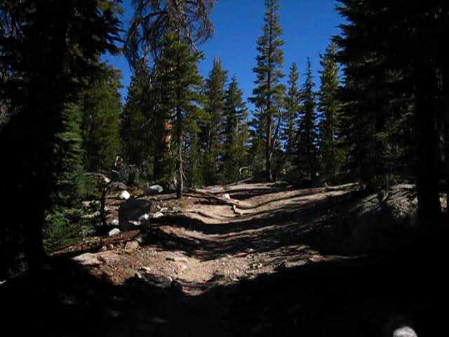
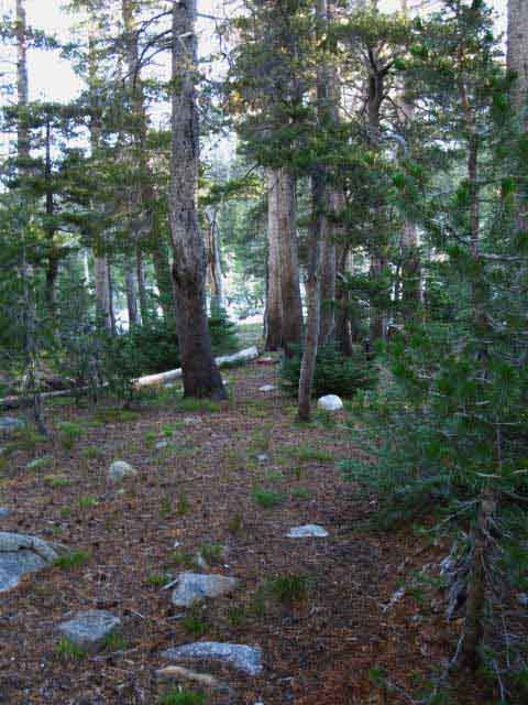
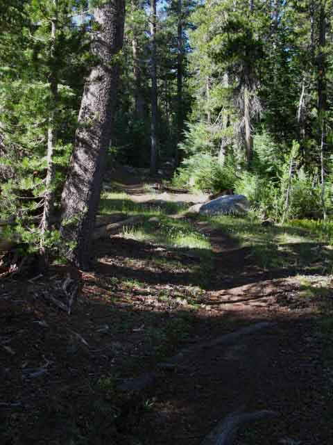
South through forest approaching McCabe Lake trail junction. The junction is just ahead in the stand of trees. |
McCabe Lake Trail Junction
 |
||||
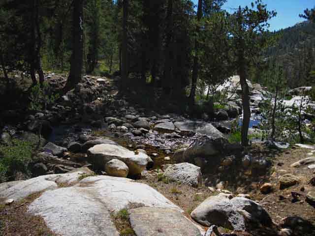
We have 120 feet more of gentle climbing to the South before we reach the top of Cold Canyon. From that point it is almost all down mountain to Glen Aulin.
|
 |
North, back the way we came to the campsites and ford of Return Creek in Virginia Canyon. One Mile North to campsites and ford in Virginia Canyon. |
 |
||||
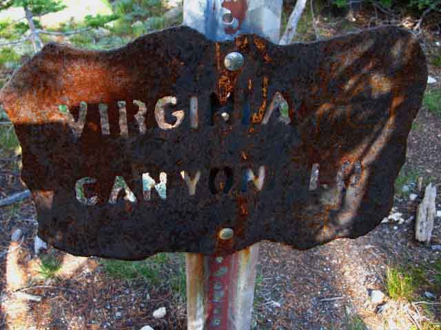
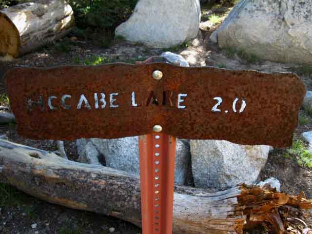
Trail East-Northeast up to McCabe Lake. There are a series of McCabe Lakes wrapping around the North flank of Sheep Peak. The 30 minute map below shows their proximity to our trail, Sheep Peak, and Mount Conness. The two miles called out by the sign above appears to remain correct. Though the route up to this junction from Virginia Canyon was modified, the McCabe Lakes trail junction remains in the same location.
The trail branches Southeast to follow a branch of McCabe Creek up to the Westernmost of the three McCabe Lakes. Above this lake another lake is nestled under the North flank of Sheep Peak. If we had followed the branch of McCabe Creek up the ravine where the trail turns out for the Westernmost lake we would climb an untrailed route to Upper McCabe Lake wedged in under the Western flank of the Sierra Crest just under the Northeastern flank of Sheep Peak. |
 |
||
| We can see the extent of the wind damage from the Fall of 2011.
By my observations the damage spanned from Bensen Lake in Yosemite to the Silver Divide. The remnants of this windstorm will decorate the trails for centuries. It is now part of the complexion of the Sierra.
|
Bear Sign
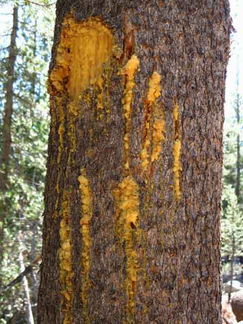 |
Bear slashed lodge pole South of McCabe Lake trail junction. |
Gentle Climb South
of the
McCabe Lake Trail Junction
 |
||
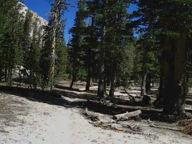
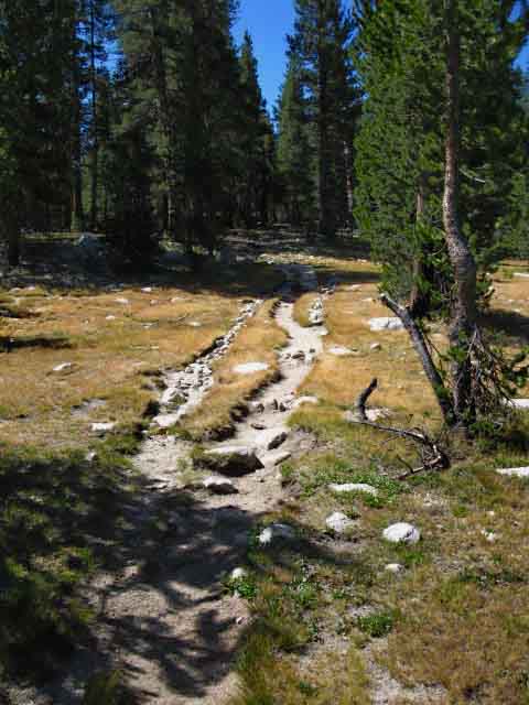
A low climb of 120 feet of elevation gain continues for .52 of a mile South of the McCabe Lake trail junction until we climb up into the top of Cold Canyon. Along the way we hike up through a moist forested fold in the terrain, what I would call an intimate length of trail.
|
Seasonal Stream flowing West into Virginia Canyon
 |
||
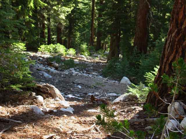
After cresting the low rise hiking South from the McCabe Lake trail junction we begin a gentle descent which brings us across this seasonal creek which has scoured off all the topsoil from this vast section of almost unjointed granite. This all flows down into Return Creek in Virginia Canyon until we get into the top of Cold Canyon. Above this seasonal creek a marshy area has reached the end of its Summer wetness with no flow of water by the time I came through on, Aug 27 2012. But this may not be true, the pattern may change, as I constantly emphasize. The huge snowfalls into the Spring of 2011 kept the high trails lined with snow through the Summer of 2011.
|
 |
The same seasonal stream & marshy area with a tiny bit of water still flowing through on August 3 of 2009. Seasonal Timing "Normal" weather is now happening every three or four years, if we are lucky. Our new scenario begins the seasonal progression with long Indian Summers that almost stretch into Winter, meaning we now have very dry Falls. This is followed by a weak and short Winter warming into a short and early Spring Thaw. This new pattern shows no signs of reversing itself, or even slowing down its development. The basis of the seasonal changes are too deeply rooted to be short term issues. The basic pattern of wind and heat circulation across the whole North Pacific Ocean have changed. That is, these storms are deflected during the rare times the old pattern even forms up. I have put together a suite of tools to follow these seasonal weather patterns: |
Last Bit of Sweet Forest above Meadows of Upper Cold Canyon
 |
Gentle downhill on the East side of the ridge marks the top of Cold Canyon. |
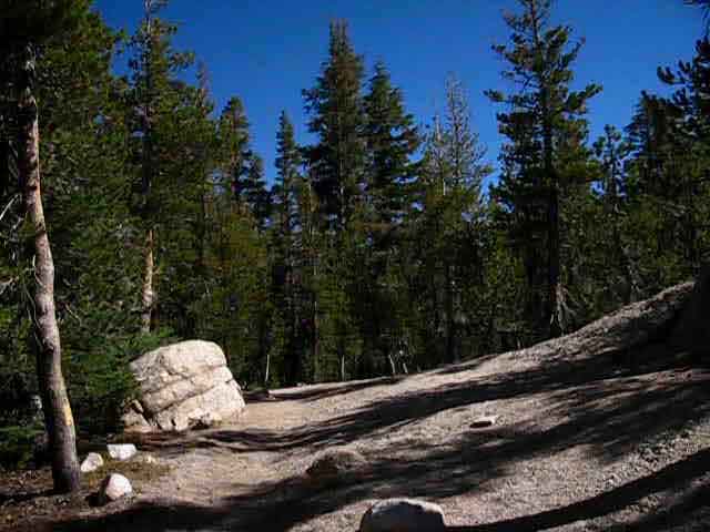
Into the Top of Cold Canyon
 |
||
A marshy area to our Left pushes the trail up onto this low mound as we approach Cold Canyon.
|
Peeking into the Meadows in the top of Cold Canyon
 |
Hiking gently downhill into the top of Cold Canyon in North Yosemite Back country. It's almost all down to Glen Aulin now. |
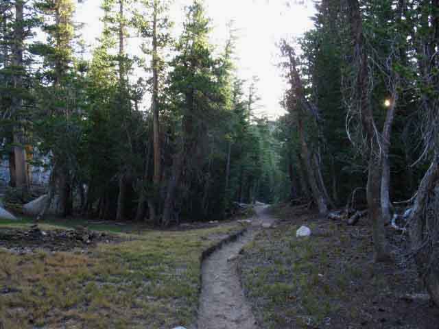
Upper Meadow in Cold Canyon
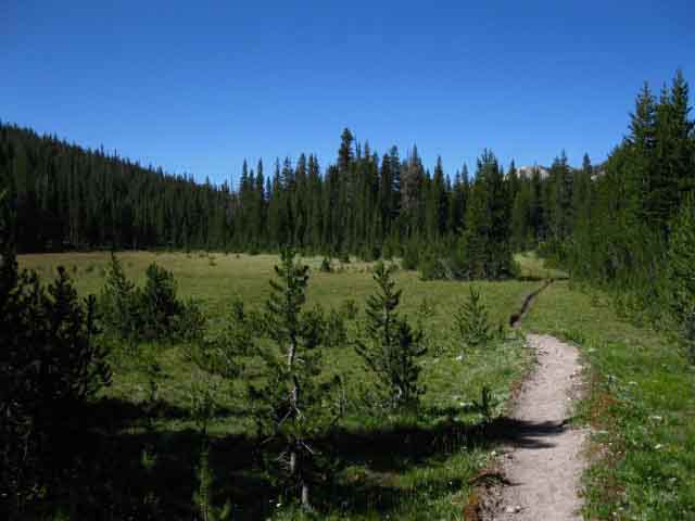 |
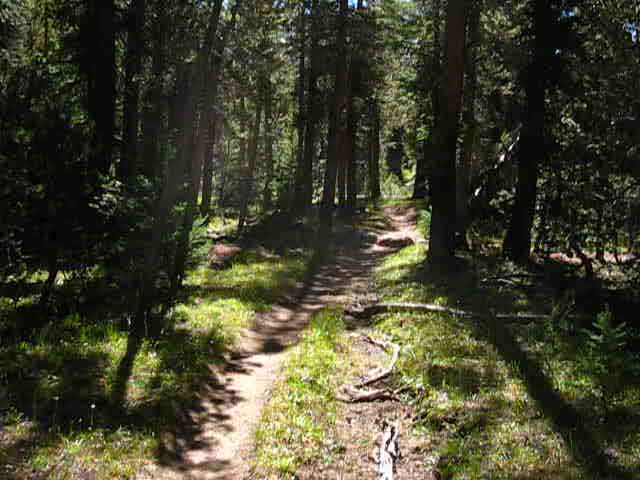
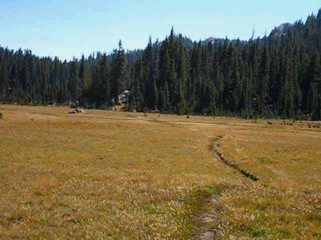
Upper Cold Canyon widens out into a set of expansive meadow running down to where we get a clear view of Mount Conness to our East. Though this is a plush wet meadow early in Spring it quickly dries out with the advent of Summer. Get a fresh layer of suntan lotion on the exposed parts. We're not getting much cover until we hike down to the bottom of this series of meadows where we cut over a forested climb to get into the steeper lower section of Cold Canyon. We've still to cross through the bit of forest ahead before we begin about three miles of hiking down the expansive meadows of upper Cold Canyon. Expansive exposed meadows... |
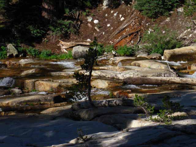
About 3 Miles Down the Great Meadow in Cold Canyon
 |
Hiking down through miles of meadow to the point where the meadow tapers down and turns to the East, our Left, as the creek begins to execute the S turn making its transition from the upper meadow section of Cold Canyon to the steeper, narrower, and deeper lower part of the canyon. Here our trail cuts over a ridgearm dividing the upper and lower segments of Cold Canyon. We'll cut up and over the ridge arm descending from the West, from the Left, to follow the creek down to Glen Aulin along the West wall of the lower part of Cold Canyon. Peak 11168 of the Cathedral Range is visible on the far distant Left above low ridgeline sitting in the middle distance. Peak 11168 sits on the ridge between Cockscomb and Cathedral Peaks. If you look real close you can likely see the tip(s) of Cathedral Peak to the Right of Peak 11168 mixed in with the treetops. |
Long View South down beyond the End of the Cold Canyon Meadow
 |
The Cathedral Range appears in the distance. The bottom of Cold Canyon meadow looking South at Cathedral Range. Note Unicorn and Cockscomb Peaks of the Cathedral Range on the far distant Right, partially obscured by the intervening high trees. |
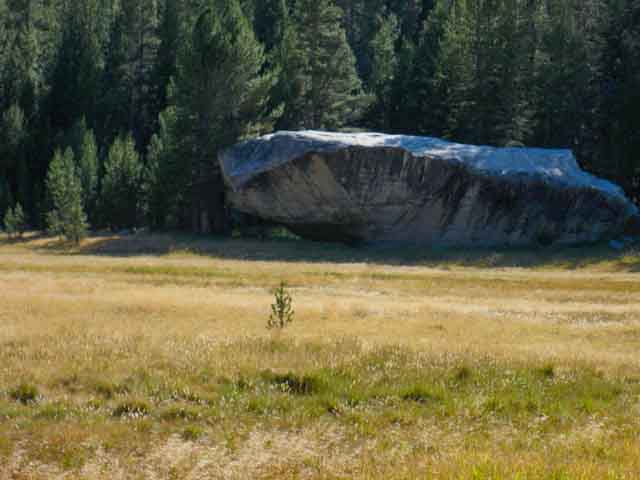
Cold Canyon Rock
 |
||
To our immediate Right we spot the massive Cold Canyon Rock, a local landmark. I've seen folks camping under the overhang. This is not a great idea. We are subject to heavy afternoon thunderstorm activity here, making this a potentially dangerous rock to be hanging around or camping under. Yes, it is lower than the trees and the ridge rising behind it. On the other hand it is significantly taller than the meadow fronting it. I'd camp there under clear skies. I would not take shelter there in a thunderstorm.
Virginia Canyon to Tuolumne Meadows |
We Get Long Views South at Cathedral Range above Tuolumne Meadows, if Observant
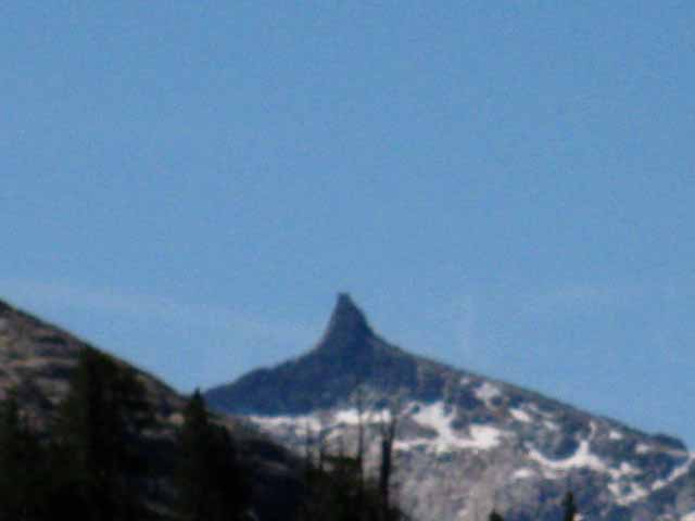 |
Cockscomb Peak in the Cathedral Range to our South. |
Cathedral Range
 |
Glimpse of Cathedral Range to the South over Cold Canyon. From Left to Right: Unicorn Peak, Cockscomb Peak, Peak 11168, Echo Peaks, Cathedral Peak. |
Approaching the Heart of Yosemite
View South
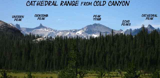 |
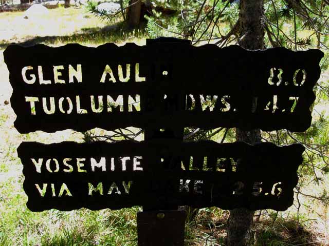
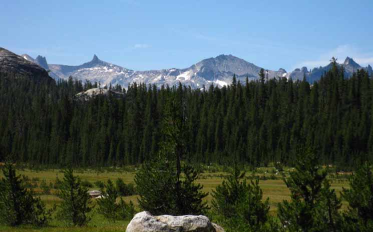
I'd say that getting sight of the Cathedral Range rising above Tuolumne Meadows in Yosemite heralds the end of our Southbound hike across the North Sierra. Tuolumne Meadows itself marks the end of our 181 mile on the Tahoe to Yosemite Trail, and a few less miles if we hiked down along the Pacific Crest Trail. Those of us who mixed up the TYT and PCT routes across the Carson Iceberg and Emigrant Wilderness can be approaching 200 miles on the trail at this point. Northbound hikers on the Pacific Crest Trail are approaching 925 miles of hiking from the Mexican Border to Tuolumne Meadows. South from Tuolumne Meadows If we hike from Tuolumne Meadows down to Yosemite Valley we will figure out how to return to the Southbound John Muir Trail by a substantially different route than the backwards JMT route we hiked down to the Valley. Hiking back out of Yosemite Valley to return to the Southbound John Muir Trail we'll continue hiking up the Merced River past Little Yosemite to turn over Voglesang Pass from the top of Merced Lake. From Volglesang High Sierra Camp we'll hike by Evelyn Lake to rejoin the JMT in Lyell Canyon about 6 miles South of Tuolumne Meadows Store and Grill. The trail sign at the junction calls it 5.6 miles to the Southbound JMT trailhead in Tuolumne Meadows. I call this route the "golden triangle." The Tuolumne Meadows Hiking Map lays out the position of the Cathedral Range in relation to Glen Aulin and Tuolumne Meadows. |
If Quiet and Observant the Locals Come out
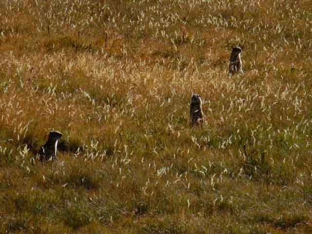 |
Well, not really. They are out watching everything if we are quiet or loud. We should be observant in any case. What I call "meadow dogs" (ie, the mountain-meadow version of prairie dogs) were everywhere, though officially called Belding Ground Squirrels. They use the same systems as prairie dogs for defense and evasion of predators. These unique squirrels have developed an upright posture to watch everything intensely. They share their observations with the group through verbal communications, and maintain a network of underground dens with multiple entrances to provide shelter and escape. They were all over the lower meadows when I shot these images on Thursday August 27th 2012. There were den entrances along the trail they were running in and out of as I approached, monitoring my progress from near and far. Check out the Belding Ground Squirrel/Prairie Dog |
Belding Ground Squirrel
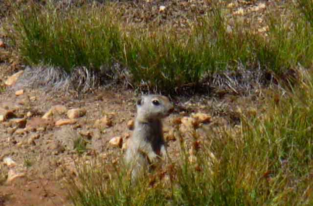 |
Quite a little society out here in the high meadows. Each individual appears to be a part of an early warning defense network, in communication with all the others. I'd swear this little sucker looks like he's grinning at us, if you look really close. |
Belding Ground Squirrel
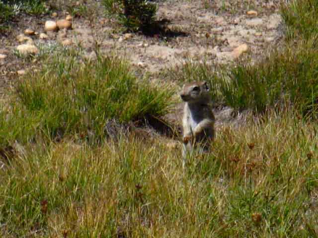 |
These guys appear tuned to threats from land and sky. |
View East
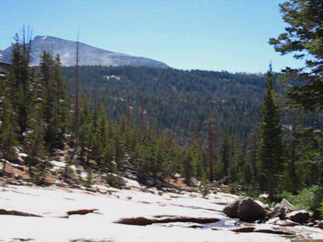
Mount Conness
From the Bottom of Upper Cold Canyon's Expansive Meadow
 |
South end of Mount Conness Massif Hiking down to the bottom of the meadow our view East opens up where the Cold Canyon Creek and meadow turn East. This Eastward bend is how the creek turns around the contours of the terrain, while our trail South stops following the creek, departing the meadow by climbing over a low ridge arm to our Right to intercept the creek further down in its steeper and deeper gorge below the bend. Virginia Canyon to Tuolumne Meadows |
View East
Mount Conness
 |
As we reach the bottom of the upper meadows in Cold Canyon a clear view of Mount Conness to our East opens up. The Eastern Boundary between Yosemite and the Hoover Wilderness runs along its crestline. Virginia Canyon to Tuolumne Meadows Check out our view of Mount Conness from the South, before we arrive at Lower Cathedral Lake on our way over Cathedral Pass on the John Muir Trail into Yosemite Valley. |
Looking South
Exiting the Upper Meadow
 |
||
We have a nice little climb over this upcoming ascending ridge arm before we rejoin Cold Creek to parallel it down the much steeper and deeper lower section of Cold Canyon to Glen Aulin. We can see the cut in the forest ahead where our trail climbs out of upper Cold Canyon.
|
Out of Upper Cold Canyon's Meadows
 |
A moderate short climb out of the bottom of Cold Canyon's meadow. I have it at 3.5 miles from this point to Glen Aulin. |
After the Climb we drop back into Cold Canyon
 |
||
Over the top, now descending back to parallel Cold Creek down to Glen Aulin. Dropping into the lower, steeper section of Cold Canyon after climbing over this ridge arm from the upper meadowed section of Cold Canyon. We can see our upcoming descent resuming ahead. Great views of Cathedral and Tresidder Peaks open up. I think I'll walk down there and set up the tripod.
|
Our View South
Cathedral and Tresidder Peak
 |
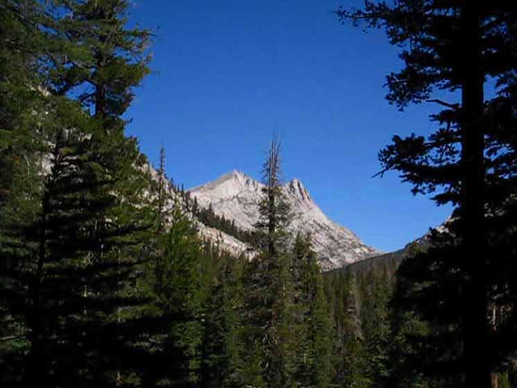
Cathedral and Tresidder Peaks. In the middle far Left of the image we can see the top of Fairview Dome poking out over intervening ridge in the foreground above Cold Canyon. The John Muir Trail runs across the center of the image above. Check the view through that same "gunsight" above, but looking North at the North Yosemite Backcountry, rather than our Southern view above. If we decide to hike the John Muir Trail from Tuolumne Meadows down to Yosemite Valley we will hike up to and across that arc of forest between Cathedral and Tresidder Peaks. |
Cathedral Peak
over
Wild Granite Waves rising above an Ocean of Green
 |
Our last glimpse of Cathedral Peak as we descend below forest cover and into the lower section of Cold Canyon. |
Cathedral Peak
 |
Our actual last look at the star-shapped crown of Cathedral Peak tearing at the sky as we submerge into the granite gorge of lower Cold Canyon. |
Levels of Perspective Open Before Us
View almost Directly South
 |
Mendicott Dome and Tuolumne Falls Peak 10450 shares its crestline with Tresidder Peak. The John Muir Trail makes a moderate climb South from Tuolumne Meadows to pass under the Eastern flanks of that crestline, their Left sides from our perspective. The small white wedge of a dome below and to the Right of Mendicott Dome is Dome 8906, which is perfectly blocking our view of the larger dome behind it, Peak 9205. Peak 9205 is a significant, but smaller massive dome sitting below Mendicott Dome. Beyond and to the Right of Dome 8906 we can see the profile of the legendary climbing face of Mendicott Dome in deep shadow. Climbing Mendicott Dome Though the sheer faces on the West face of Mendicott Dome are quite impressive, the route of the John Muir below its Eastern side offer much easier access to the tops of Mendicott and Fairview Domes. To the Right of Peak 8906 we can see the flank of Polly Dome rising out of the Right edge of the image. Tenaya Lake lays on the far South end of Polly Dome. Check Out: |
Dropping Lower the Terrain Rises Higher
Above Us
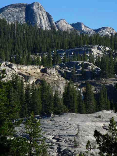 |
Mendicott Dome and Surrounding Terrain The cross-country route South from Glen Aulin goes around the backside of the granite feature to the Left of Tuolumne Falls before resuming a shoreline route South up to the double bridge. The granite ridgetop in the foreground divides Cold Creek on the near side from Alkali and Conness Creeks on the far. Just a bit lower on our way South to Glen Aulin and we will be in a much deeper canyon situation. We are dropping down and will soon be on the Western of the steep granite walls containing Cold Creek above where it merges into Conness Creek. Alkali Creek merges into Conness Creek above the point where our route along Cold Creek flows into Conness Creek for its remaining short flow past Glen Aulin into the Tuolumne River. In the meantime, we've got a short window where we're getting incredible views to our South across the top of the ocean of treetops climbing upt to Tuolumne Meadows, featuring granite whitecaps rolling across its surface, with Mendicott Dome and the peaks decorating the West end of the Cathedral Range rising above us, before we plunge into the lower canyon and lose this unique perspective of this unique terrain. Towering above Tuolumne Falls in the picture above is the high point of the uber-massive Mendicott Dome. Mendicott Dome is longer than tall. To the Right of Mendicott Dome along the crestline is the subordinate peak along the top of Mendicott Dome, and to the Right of that is Peak 10450. Tuolumne Meadows Hiking Map The view of the two images above are on roughly the same line of perspective, but from different elevations as we descend. We're about 4.5 miles from Mendicott Dome as the Crow Flys. Waves of Granite frozen above a slowly shifting sea of forest. Climbing Mendicott Dome |
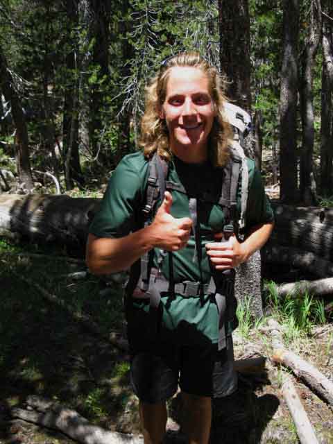
Monday August 3 2009 Ran into Nick Ross' trail crew hiking North above Glen Aulin on their way to set up their Trail Crew Camp at Smedberg Lake. I caught the kids climbing up the steep trail between Glen Aulin and the big meadow in upper Cold Canyon as I was descending. |
 |
||
The first member of the crew I ran into was Dan Schweitzer. I observed that Dan was moving as quickly up the mountain as I was down. As I observed Dan first, I watched him climbing. I knew I had run into trail crew. They have a certain way about them, an attitude sitting atop their confidence and ease of movement in the backcountry. Cold Canyon Know now that trail crew are the fittest folk on the trail. SAR may be fitter overall, but the SAR job description is quite different than trail crew. I'd say the top 10% of trail crew are far beyond SAR standards. These folks are strong.
How to begin a career in Trail Crew Yosemite Trail Crew |
Yosemite Trail Crew
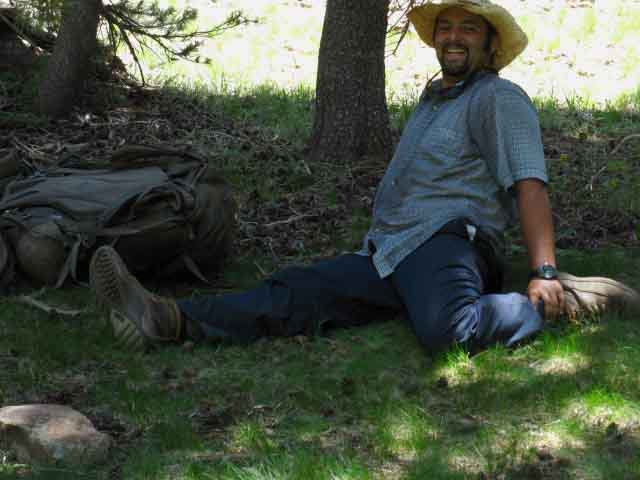 |
Kirk stretching it out during a break climbing Cold Canyon. Getting ready for a season of hard work at high elevation. The basic activity level of trail crew brings a superior level of fitness. |
Yosemite Trail Crew
 |
Jermaine and Rob hiking to Smedberg Lake Trail Crew Camp, 2009. |
Yosemite Trail Crew
 |
The main body of trail crew comes up the gorge. Abel, Jason, Chris, and Duffy. |
Yosemite Trail Crew
 |
2009 Backcountry Trail Crew Leadership Nick Ross is the Trail Crew Leader. Climbing rapidly South from Glen Aulin behind the trail crew, making sure no one is left behind. |
Down Down Down
 |
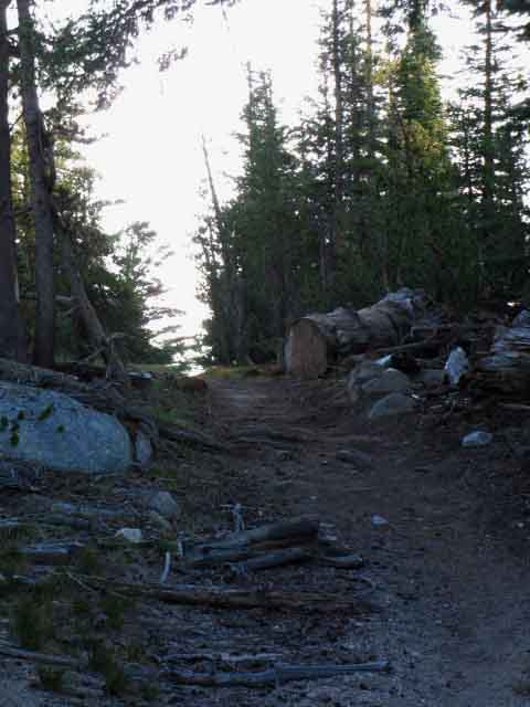
The last bit of trail down to Glen Aulin. We drop down a rocky channel to bend around a seasonal wet spot preceeding the Glen Aulin trail junction at the first bridge. |
Making our Way the last few steps
South
to
Glen Aulin High Sierra Camp
 |
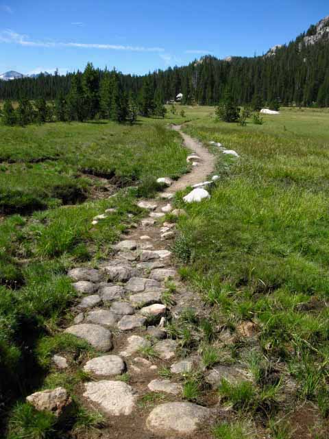
Final steps to Glen Aulin. Sweet slab of granite. |
West
Down the Tuolumne River
 |
||
West
|
North
Up Cold Canyon
 |
||||
North PCT-TYT Northbound trail junction on North side of Glen Aulin. South to Tuolumne Meadows:
Maps North
|
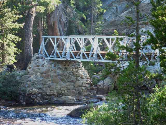
Glen Aulin Bridge
Bridge over Lower Conness Creek to Glen Aulin High Sierra Camp
 |
First Bridge Southbound, over Conness Creek Our Cold Canyon Creek merges with the combined flow of Alkali and Conness Creeks just above where it flows under the bridge to Glen Aulin. This combined flow of waters composing Conness Creek feeds the Tuolumne River a few yards below the bridge to Glen Aulin, just above where the second bridge at Glen Aulin crosses the Tuolumne River. |
SOUTH
Hiking Trail South
beyond
The Glen Aulin junction/bridge
 |
||
The Second Bridge at Glen Aulin The bridge in the distance carries our unified Tahoe to Yosemite and Pacific Crest Trail route South over the Tuolumne River to begin our final miles hiking the Tahoe to Yosemite Trail along the Tuolumne River to Tuolumne Meadows. One can also continue South to Tenaya Lake via May Lake. Glen Aulin Overlook Last Segment of the Tahoe to Yosemite Trail Those of us continuing South down the John Muir Trail to the Whitney Portal will celebrate arriving at Tuolumne Meadows as the rough halfway point of our Tahoe to Whitney backpacking trip. But, we'll turn Left here to cross the bridge over to Glen Aulin to spend a night there before hiking into Tuolumne Meadows early tomorrow morning.
|
Over the Bridge into Glen Aulin High Sierra Camp
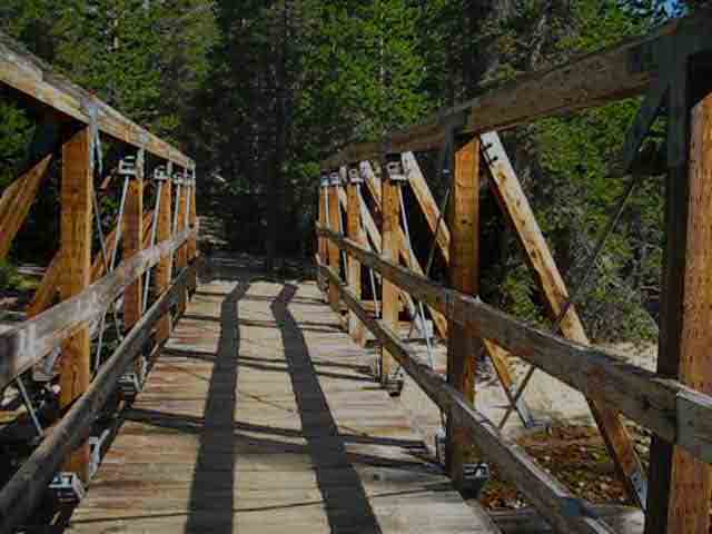 |
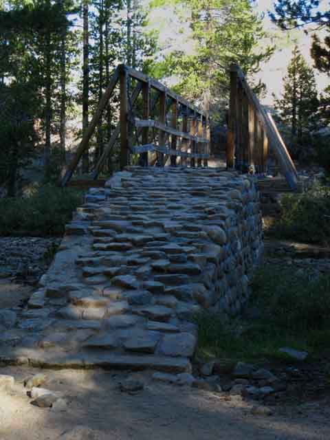
Hiking the bridge over Conness Creek backpacking into Glen Aulin High Sierra Camp. Humm. This is the first bridge hikers on the Tahoe to Yosemite Trail have crossed since the steel bridge over Relief Creek above Kennedy Meadows Pack Station. For Pacific Crest Trail hikers the last bridge we crossed to our North was the West West Walker River Bridge way up in the Toiyabe National Forest. This is the first of four bridges we will see or use hiking the next 5.8 miles South to Tuolumne Meadows. We don't have to stop at Glen Aulin, so this bridge is not a hiking aid. |
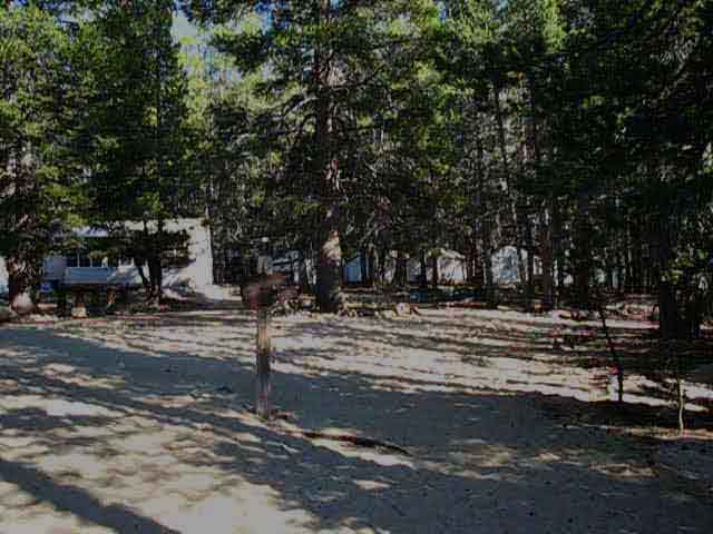
Glen Aulin High Sierra Camp
High Sierra Camps Established 1924 Glen Aulin moved in 1927 to current location beside the White Cascade Waterfall and pool due to the over abundance of mosquitoes down in Glen Aulin proper. From Green, Yosemite. 1987. The term "Glen" is Scottish, roughly meaning a glacially cut U shaped valley, a description which perfectly suites the original site of Glen Aulin, which marked the top of the Grand Canyon of the Tuolumne River. The original site sits in proximity to extensive soggy meadows. The current location of Glen Aulin High Sierra Camp was relocated just above the mouth of the canyon to a nice sandy flat under rich forest beside the upper pool below the upper of the two waterfalls leading down into Glen Aulin proper. |
 |
||
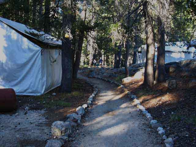
Entering Glen Aulin High Sierra Camp The showers (for "guests" only) are on the far side of the kitchen-dining room tent. Turning Left around the far side of the dining room and shower tents we will find the path to the backpacker's camp, past the three employee's tent cabins and the septic pump. The manager had a tent cabin more distant and private from the camp proper, a little upstream from the bridge. I'm not sure if they still run the manager's tent cabin out there. It is shown on the 1975 map below. The line of tents in the distance to the Right of the Kitchen-dining room are the guest tents. Between the two sets of tents is a rather large elevated (now) fire ring. To our Right, out of the image, is the great pool the Glen Aulin Waterfall, the White Cascade, pours into. This is a very scenic location. DNC DNC Past the Kitchen/store/dining room tent we will find a rock lined path the brings us to our Left between the guest-only showers and the employee tent cabins to the Glen Aulin Backpacker's Camp, which lay just beyond the tents to our Left. Marking the center of the backpackers camp there are a bank of bear proof food containers, one of those two-story Yosemite solar-electric shit converters (IE, the Malibu Condo version of an outhouse!), and pure water taps. All the luxuries of home! There's also a common fire ring in the backpacker's camp as in the High Sierra Camp. I don't make fires, which is good, because the decades of High Sierra Camp, backpacker, and horsecamper fires at Glen Aulin long ago stripped the terrain of firewood. Now-a-days the drier seasons, the drought, and the resulting crazy fire dangers will soon outlaw fires anywhere along the Sierra Crest and its flanks.
|
Glen Aulin High Sierra Camp Map
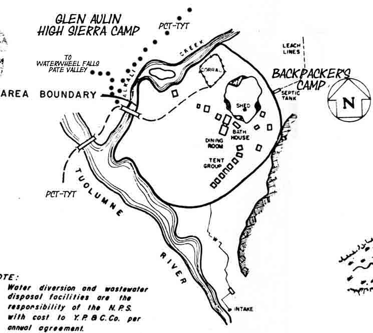 |
National Park Service Diagram of Glen Aulin from 1975 Not much has changed since then. The pump for the septic system has been moved. The tent marked "dining room" sits on a stone floor, and the kitchen structure behind the dining room tent is a stone building. The staff fires up the septic pump in the late afternoon every day guests are crapping at Glen Aulin. The Southbound PCT-TYT moves up along the Tuolumne River after crossing the second bridge. Tuolumne Meadows Hiking Map See Green, Yosemite, (1987) Chapter VI, p.906 for maps of the other Yosemite High Sierra Camps. I especially like the 1931 map of Yosemite National Park on that page. This map shows us that our TYT and JMT routes across Yosemite, including the "golden triangle" from Tuolumne Meadows into Lyell Canyon via Yosemite Valley, are essentially unchanged since 1931. One difference is that in 1931 we only had one route South from Jack Main Canyon, the current TYT route around Tilden Lake. The PCT route around Wilmer Lake was added sometime after 1931. We're going to visit all the High Sierra Camps, including Sunrise, Merced Lake, and Vogelsang High Sierra Camps if we hike the "golden triangle" down to Yosemite Valley and back to the John Muir Trail via Merced Lake and Voglesang Pass. The only High Sierra Camp we miss on our extended Tahoe to Whitney Hike across Yosemite is the May Lake High Sierra Camp. |
Glen Aulin Waterfall
The White Cascade
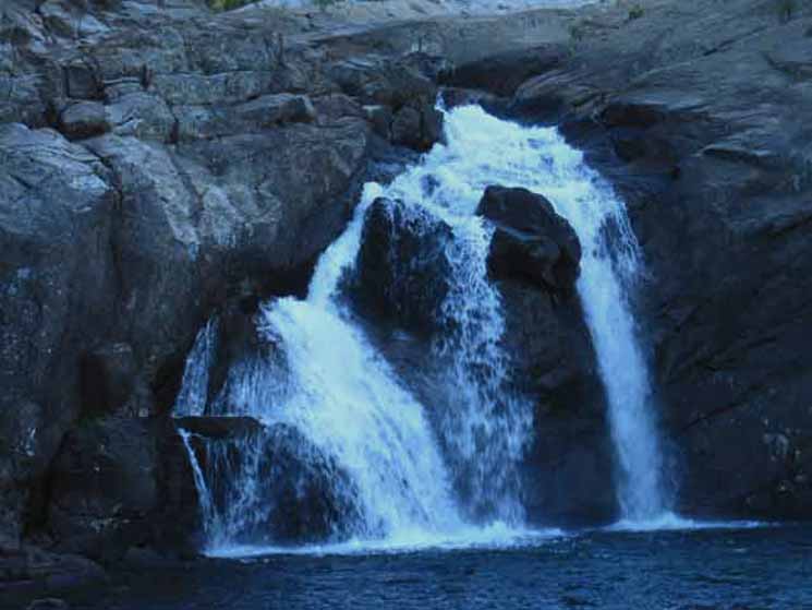 |
The White Cascade, the Glen Aulin Waterfall. |
Rock
Peak 8886 rises to the West
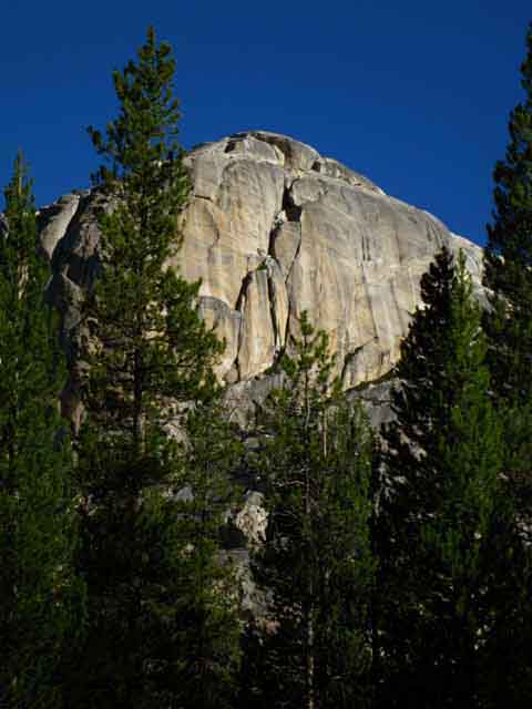 |
Peak 8886 towers above the Western side of Glen Aulin. Portal marking the entrance into the Grand Canyon of the Tuolumne River. Tuolumne River flows West down along the base of its South flank, at the bottom of its Left side, from our perspective above. This is one of the formations along the Tuolumne River South of Glen Aulin inviting us down into the Grand Canyon of the Tuolumne River. |
Glen Aulin Kitchen, Dining Room, and Store
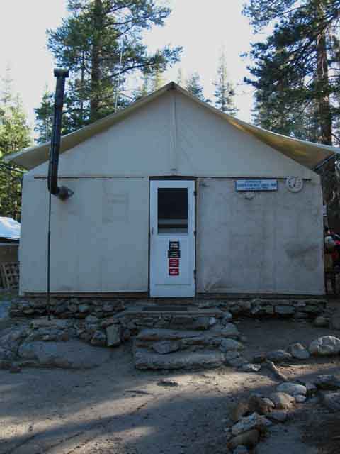 |
All wrapped up in one tent cabin. The Kitchen, Dining Room, Office and Store. Note the stone floor. The stone floor extends to the kitchen, which is actually a stone structure attached to the backside of this tent cabin. This tent cabin only has three walls. The back wall is the stone wall and door into the small stone building making up the kitchen. |
Make it Official
 |
||
Glen Aulin High Sierra Camp.
Does DNC now "own" the names of the High Sierra Camps as well? Should backpackers pay them for uttering Yosemite Place Names? DNC mostly has great folks working in the front-line trenches of their evil corporation, but that's much more due to folks wanting to live and work in Yosemite National Park than anything DNC does. In fact, employee-folks will put up with a lot of shit from employers to work and live in Yosemite. |
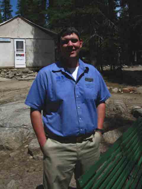
Bill
 |
||
Bill, the 2009 manager of Glen Aulin High Sierra Camp. I later saw Bill managing the Sunrise High Sierra Camp during 2012, when I dropped off the Sierra Crest to hike through Yosemite Valley on the way South to Mount Whitney. It was nice to meet Bill in 2009 at Glen Aulin and see him again at Sunrise during 2012. We looked at each other and said, "have I seen you before?" The High Sierra Camps are operated by Delaware North Corporation, which runs all the fundamental concessions in Yosemite National Park. DNC is the modern corporate version of the Curry Company interbred with the Devil Himself. This is the official I never use it. For information about permits and resupplying while hiking across Yosemite I've created the following resources:
The above pages direct you to the National Park permit information and resources you will need. This is about the Spirit and Goals of DNC. DNC and the Backpacker I'm not necessarily a great fan of DNC, but they sure as hell have a fantastic regular crew of folks working up there. They pick up some idiots each year, and at the end of the year as "temp" employees, but for the most part the regular employees are great folks. During 2012 they hired "gang bangers" out of Fresno to "top off" the employees at the end of the Summer season. I was hanging out with cool employees in Yosemite Valley and saw the crap these "folks" pulled in the employee housing. Wow. DNC is evil. Some prices are too high to pay for cheap labor. So be nice to the folks working up there. They don't make a great deal of money working for DNC, and they work hard to provide passing backpackers with what we need, and they have to put up with tons of shit from DNC and their illegal or semi-legal hires... Gang-bangers from "Fresno" in Yosemite Valley! Nothing Surprises Me Anymore. |
Glen Aulin High Sierra Campers
 |
Guests at Glen Aulin High Sierra Camp. The guests' tent cabins are lined up under a wall of granite and dense forest. The shower and kitchen tents are set perpendicular to the top of the line of guest cabins forming an "L" shape, with all the cabin doors facing the central fire ring wrapped with park benches pictured above. This old schematic diagram of Glen Aulin still represents the "L" shape layout of the tent cabins. |
To the Backpacking Camp
 |
To the Backpacker's Camp. Trail to the Northeast from fire ring to Backpacker's Camp. We point ourselves to the Right of the dining room tent and kitchen from the fire ring. These are the employee tent cabins between the shower tent and the backpacker's camp. |
Glen Aulin
Backpacker's Camp
 |
||
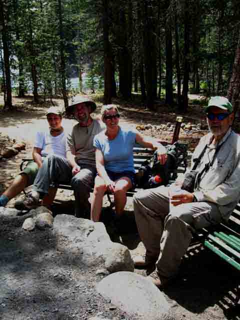
Glen Alpine Backpacker's Camp. This place is packed during the middle of the Summer, especially around holiday weekends. I've only hiked South into Glen Aulin and camped here every time I've walked South across Yosemite, so I've never been required to pull a permit from Yosemite to camp here. I'd imagine that it has no reservations available for campsites by the time the middle of the high backpacking season rolls around. I've seen long lines at the Tuolumne Permit Station during mid-Summer. If you want reliable backpacking dates in Yosemite National Park we'd be well served by making reservations for our dates when they become available.
|
Glen Aulin Backpackers
 |
||
Glen Aulin Backpackers at the communal fire ring. Lot's of cool family backpackers. This is a great place to bring the kids backpacking.
|
Glen Aulin Trail Crew
 |
Erin Anders trail crew at Glen Aulin 2010. 2010 Tuolumne Meadows Trail Crew Charlie, 11 years on trail crew, starting in Nez Perce, Idaho. Scott Johnson, Yosemite 2007 to 2010, CCC 04 to '07. Tony, two years on Yosemite Trail Crews. Becky, 3rd year in Yosemite Backcountry. Becky was cooking, Billy, 3rd year in Yosemite, started with Montana CC, 2007 in Yellowstone. Dave, fourth year in Yosemite. Started in Rocky Mountains. Larissa, Second Year in Yosemite. Little Rock-Palmdale. Crew Chief |
|
A Yosemite Backcountry Trail Crew Camp is a self-contained independent unit supporting up to 20 (?) crew members with all the fundamentals of life deep in the backcountry. Trail Crew camps are supplied by regular mule trains with supplies out of Tuolumne Meadows. They have a nice kitchen, supply tent, and professional cook. A couple of large yellow tarps are stretched out over a common area and kitchen, a circle of chairs surrounds the fire pit. They maintain a regular supply of firewood which provides heat and hot water via the fire pit during the mornings and evenings. |
Glen Aulin Ready for Winter
Stone Kitched Building
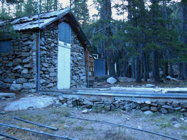 |
Glen Aulin stripped down and closed for the Winter Season Snows. This is the stone kitchen bullding. The dining room, store/office is a tent cabin attached to the front of the kitchen unit. |
Departing
Glen Aulin High Sierra Camp
 |
Hiking to the bridge out of Glen Aulin. |
Our Next Bridge South
over the
Tuolumne River
 |
We can see the bridge over the Tuolumne River at Glen Aulin High Sierra Camp while crossing the bridge over Conness Creek departing Glen Aulin. That's our second bridge of the two near Glen Aulin we use hiking South to Tuolumne Meadows. |
North: Smedberg Lake to Miller Lake South: Glen Aulin to Tuolumne Meadows
Two Ways South In addition to the standard PCT-TYT trail route South to Tuolumne Meadows from Glen Aulin there is a second route, an unmarked cross-country route on the North side of the Tuolumne River. Rather than hiking South out of the Glen Aulin site across the bridges one hikes South (East by the compass) by hiking up the trail leading East from the center of the Glen Aulin Backpacker's Camp. From that point there are two routes East. One off to our Left, and the other forward, closer to the river, then to our Left. Each of these routes finds its way over and around the top of remaining climbing up to the top of the granite feature rising above the East side of Glen Aulin. The key part is from here, departing the trail above Glen Aulin, to where we cross around the fantastic granite feature rising on the North side of Tuolumne Falls. This is a very delightful scramble. But, I don't suggest it unless you are a good route-finder and pay close attention to the terrain. Getting around this rock guarding the North side of Tuolumne Falls puts us above and around the steep fall of the river. Once we get around the rock we hike back to the Tuolumne River where it flows across and through a set of delightful granite flats divided by sections of enchanting granite terrain that with very pleasant river sights and sounds. A divine terrain. I'm thinking I'll put segments of video from the cross country route on the Glen Aulin to Tuolumne Meadows Trail Guide Video. For more and current information on this route contact the kids who work at Glen Aulin High Sierra Camp. They will tell you all about it. It's the route that folks who work there take when hiking in from Tuolumne Meadows. In fact, those kids are aware of what's happening in the backcountry. Where the Rangers went in, and where they may be going. The location of horsepackers resupplying trail crew and High Sierra Camps. The location of any science camps in the backcountry. They have all sorts of good information, if you can get them to talk. Lots of times they are busy providing "guest" services, other times they are enjoying the seclusion of the mountains. |
Hiking |
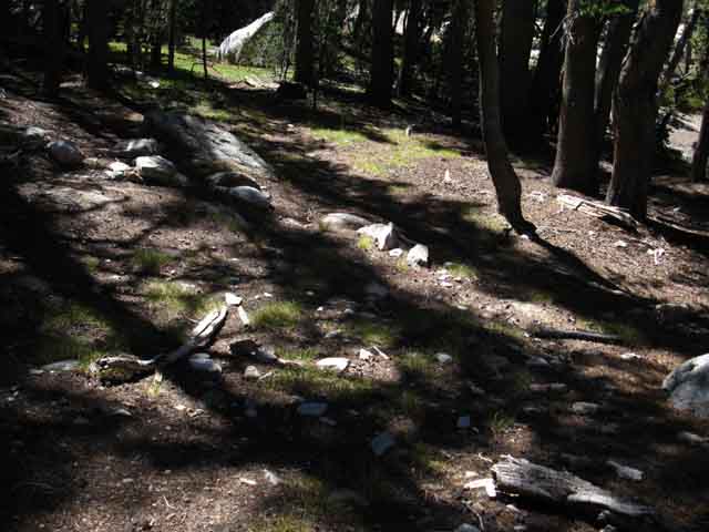
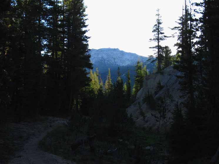
Miller Lake marks the end of our Major Southbound Climbs. South of Miller Lake we begin what is essentially a long descent down to Glen Aulin High Sierra Camp. Crossing Return Creek at the bottom of the great descent South from Miller Lake brings a short one mile climb up to the McCabe Lake trail junction. 7.5 Map 7.5 Map 7.5 Map 30 min Map |
Backpacking Trail Guide PCT & TYT North |
 |
Backpacking Trail Guide PCT & JMT South |
Backpacker ForumsHave a great Sierra Nevada trip or story to relate? A fine piece of gear? Or gear that failed?Post it on Above we come to the top of the High Backpacking Trails and Topics Forums. Below we break the forums down into categories:
Anyone can post text comments in the existing forums, but only members can post up new topics, along with images, maps, and formatting. If you have experiences, comments, questions, or pictures and videos about this part of the Pacific Crest Trail between Sonora Pass and Tuolumne Meadows, post up here as an unknown hiker or as a member: Forum Section
|
Trailhead
Contact
Alex Wierbinski

Backpacking Lake Tahoe to Mount Whitney
Your Guide to the High Sierra Crest, including the Tahoe to Yosemite, Pacific Crest, and John Muir Trails
